
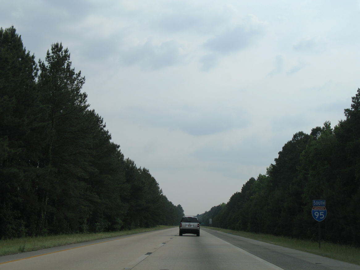
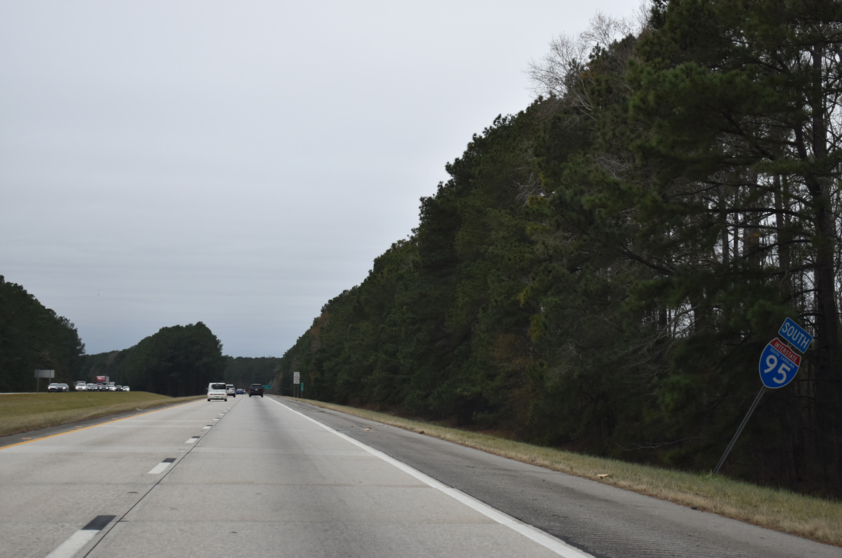
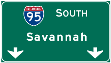
Interstate 95 South - Timmonsville to Manning
 South
South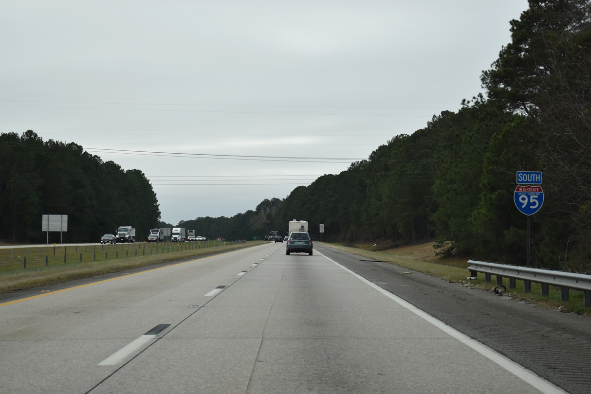
2015 traffic counts reduce from 48,000 vpd to 31,900 vpd on Interstate 95 leading south from I-20 to U.S. 76.
12/30/20
Interstate 95 straddles western reaches of the Florence city limits to the parclo A2 interchange (Exit 157) with U.S. 76 (Palmetto Street). Savannah, Georgia lies 171 miles to the southwest.
12/30/20
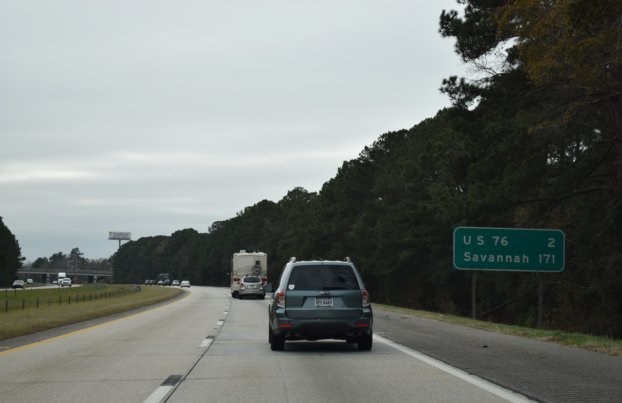
U.S. 76 branches southwest from Business Loop I-20 along a five lane boulevard through suburban areas to meet Interstate 95 in one mile. U.S. 76 connects Florence with Sumter.
12/30/20
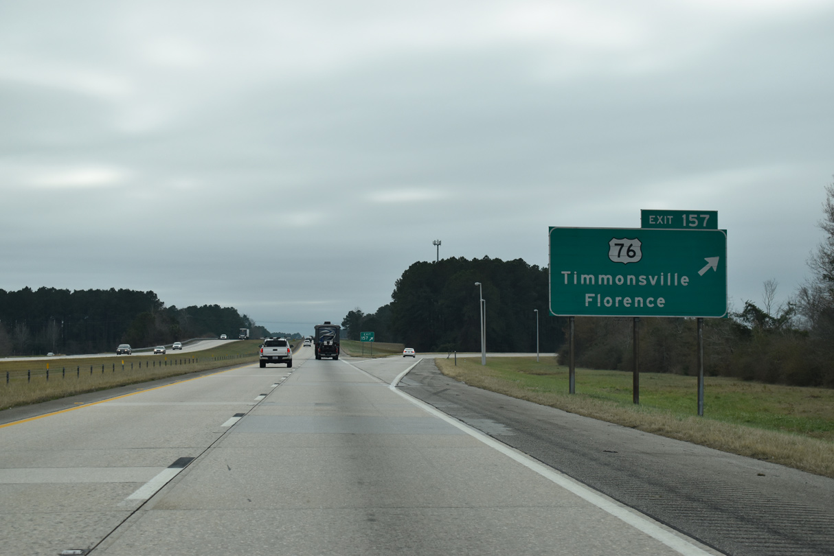
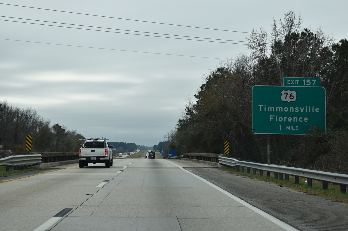
West from Exit 157, U.S. 76 travels four miles to the town of Timmonsville. The Florence County Forward Project included widening of U.S. 76 west to Timmonsville. Funded by a penny tax approved by voters in 2006, the expansion was completed in Fall 2016.1
12/30/20
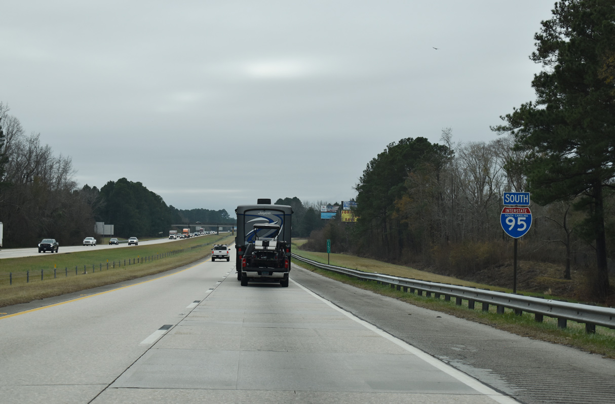
With Florence behind, Interstate 95 resumes across rural areas for the remainder of the drive through South Carolina. The ensuing stretch passes west of Morris Bay.
12/30/20
Passing below Alligator Road, this distance sign predates construction of the diamond interchange with Honda Way north and Center Road south at Exit 153. Savannah is another 168 miles to the south via I-95 and connecting routes.
12/30/20
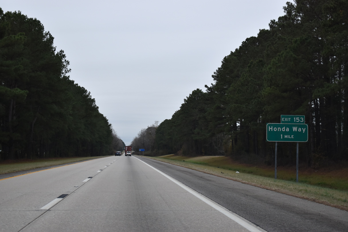
Exit 153 connects Interstate 95 with the adjacent Honda of South Carolina manufacturing plant.
12/30/20
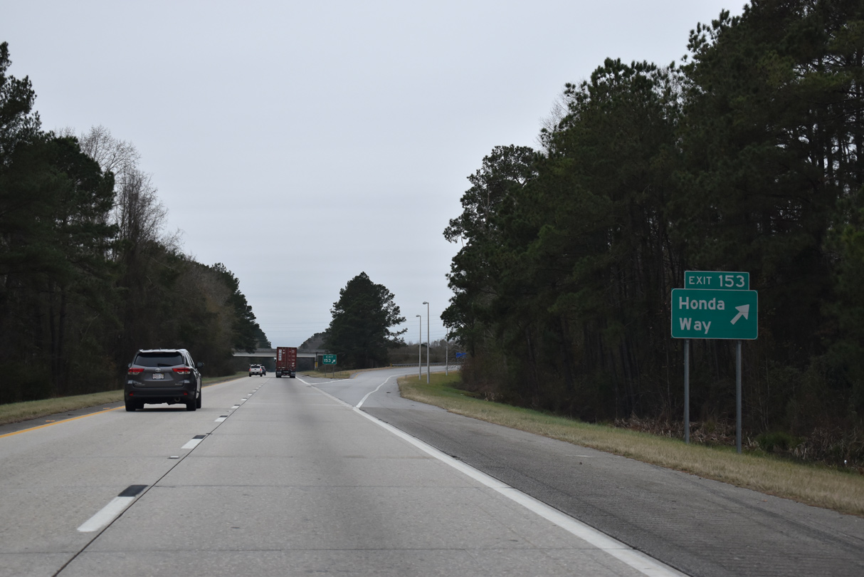
Honda Way leads north from Exit 153 to U.S. 76 (Smith Street) in Timmonsville. Center Road extends the road south to Hollman Crossroads.
12/30/20
The confirming marker posted of the entrance ramp from Center Road was removed after 2008.
05/28/07
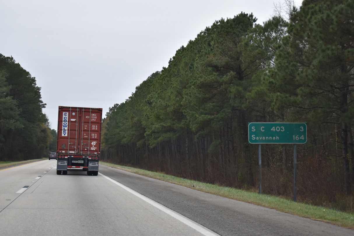
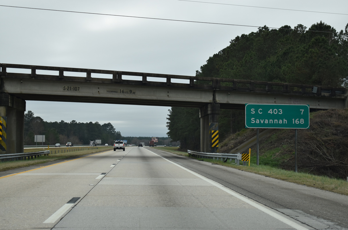
Curving southwest, Interstate 95 crosses Sparrow Swamp over the succeeding three miles to S.C. 403. Savannah is 164 miles away.
12/30/20
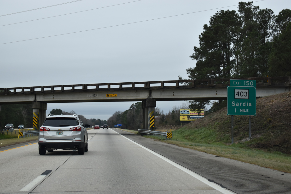
One mile ahead of the diamond interchange (Exit 150) with S.C. 403 at the Hill Street overpass.
12/30/20
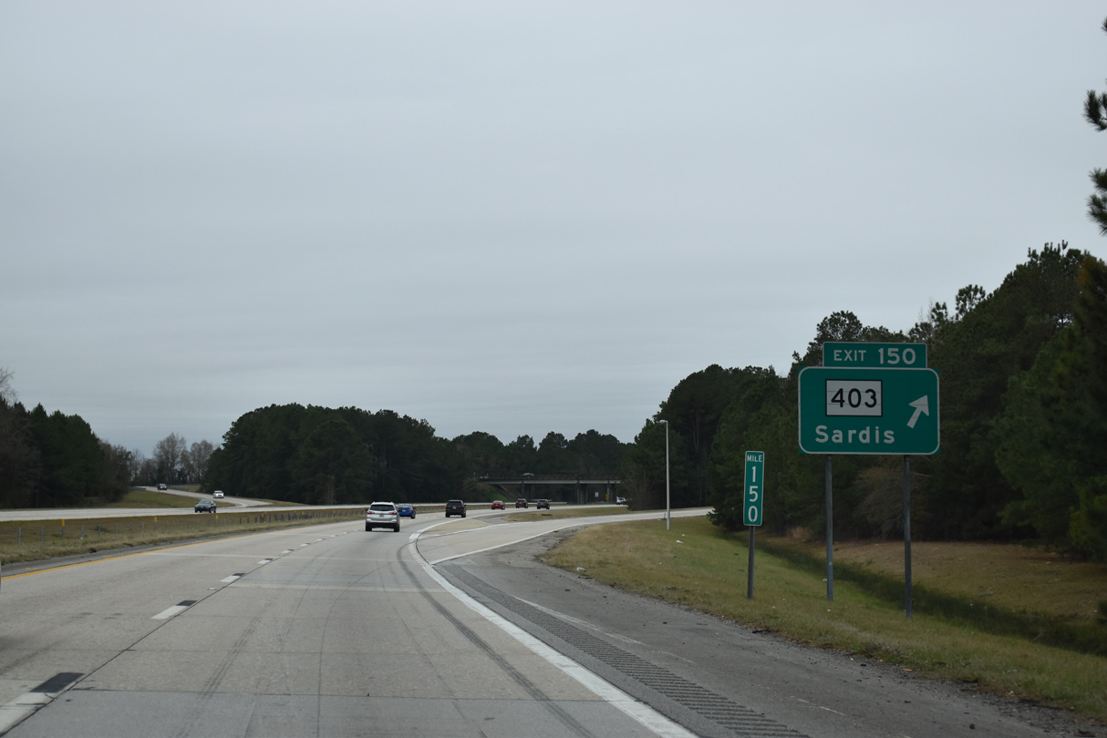
S.C. 403 (Cale Yarlborough Highway) leads north back to Timmonsville and south to the community of Sardis. A rural highway, S.C. 403 travels 48.77 miles overall from S.C. 341 at Camp Branch to U.S. 15/S.C. 34 at Lees Crossroads.
12/30/20
Progressing southward, Interstate 95 passes through a mixture of forest and agricultural land ahead of the Lynches River.
12/30/20
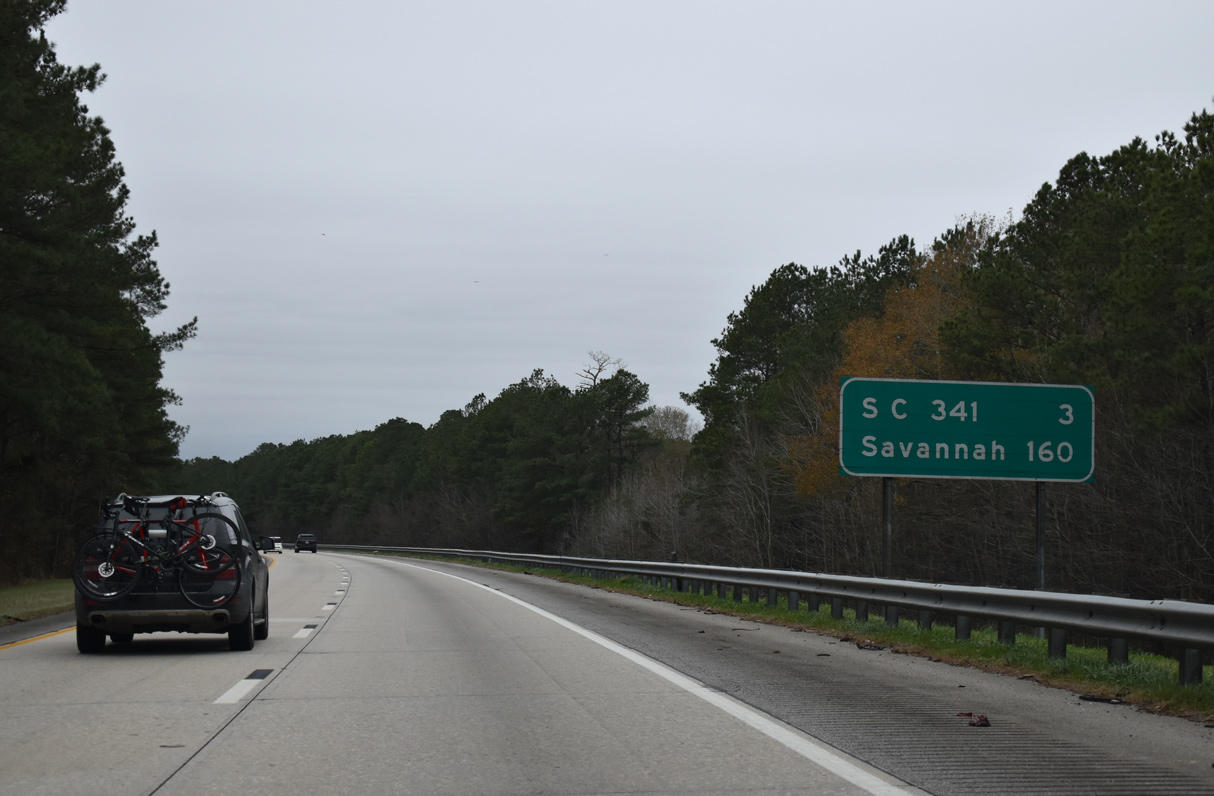
160 miles from Savannah, the next exit along I-95 south is three miles ahead with S.C. 341.
12/30/20
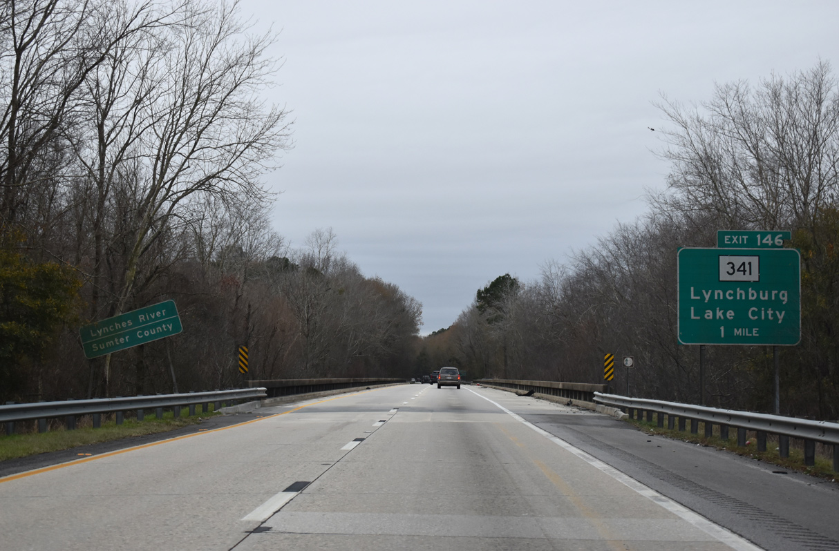
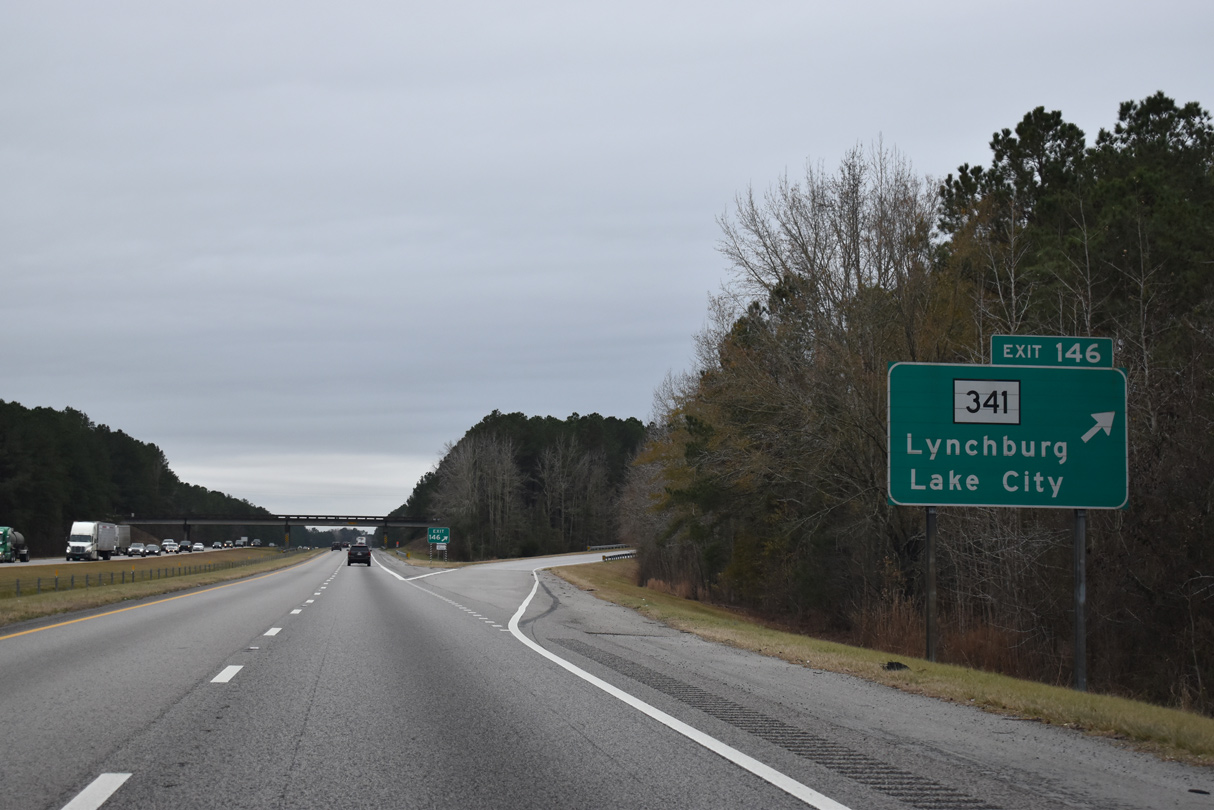
Interstate 95 enters Sumter County over the Lynches River across the bridges built in 1967. A diamond interchange joins the freeway with S.C. 341 one mile to the south.
12/30/20
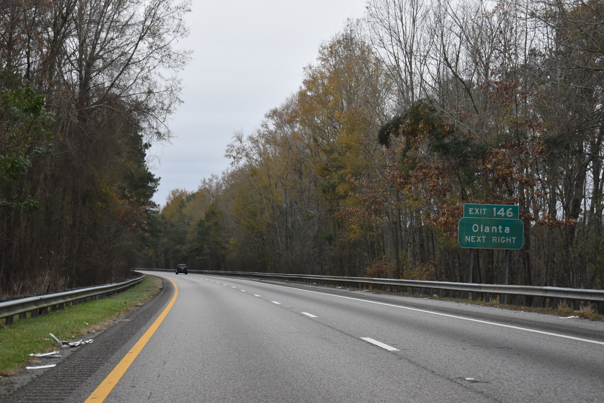
S.C. 341 runs north from Exit 146 to Lynchburg and south to Olanta and Lake City. A 93.87 mile long highway, S.C. 341 concludes to the northwest at Kershaw (U.S. 521-601 Business) and to the east at Johnsonville (S.C. 41/51).
12/30/20
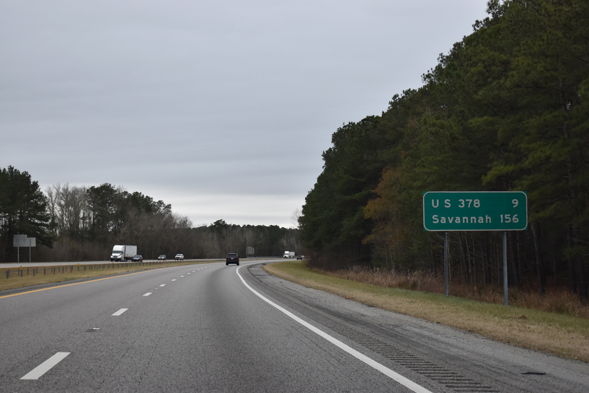
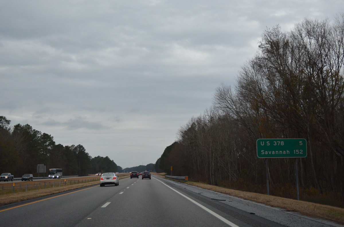
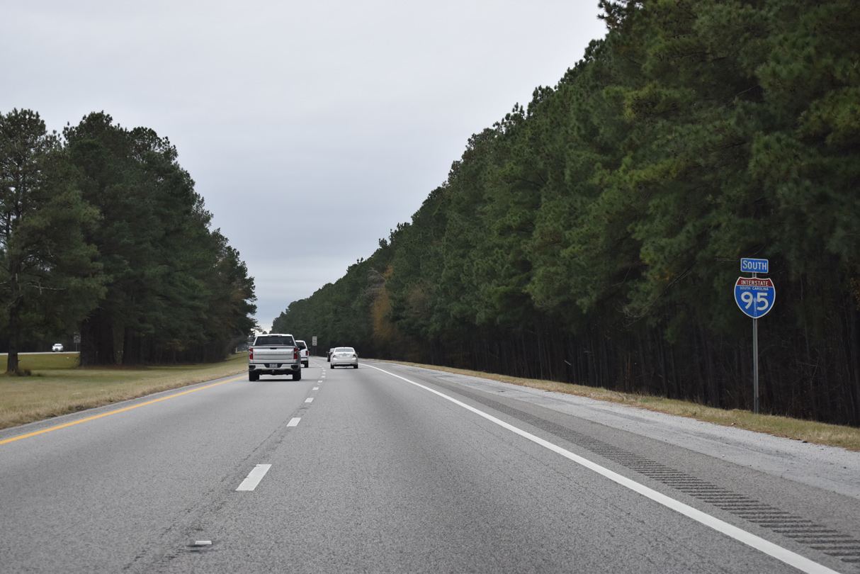
The third and final Sumter County interchange lies nine miles ahead with U.S. 378. Savannah is another 147 miles beyond the LowCountry in South Carolina.
12/30/20
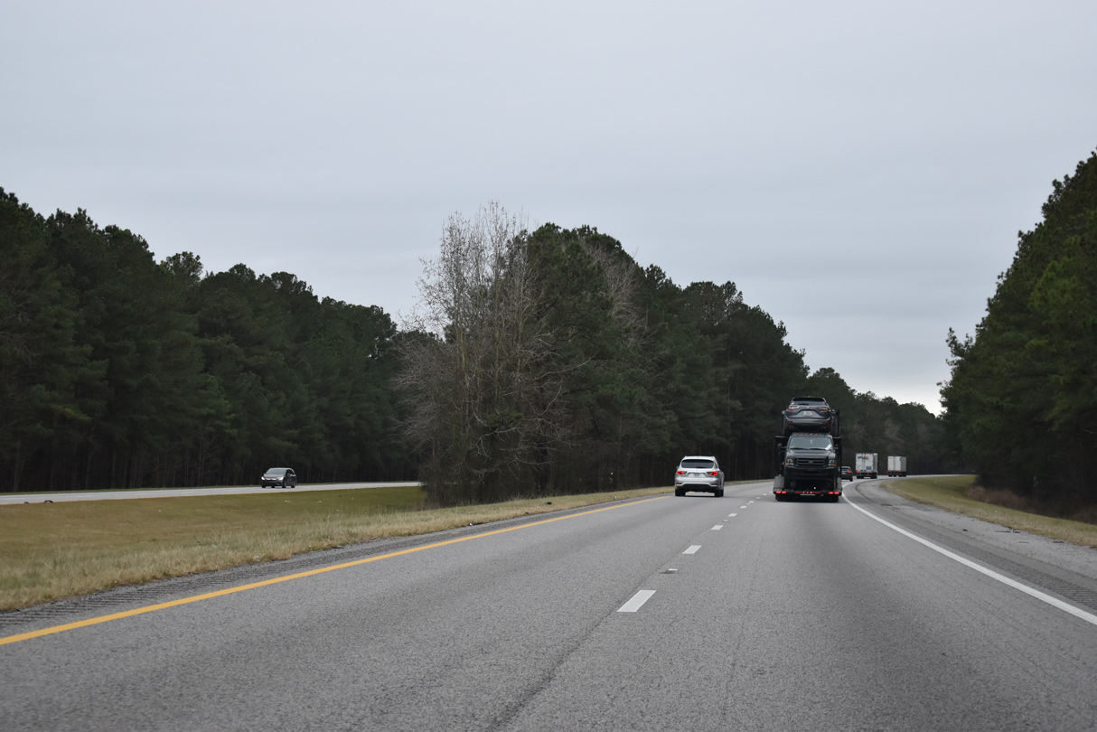
A forested median separates the roadways along I-95 west of Douglas Swamp and east of Pleasant Grove.
12/30/20
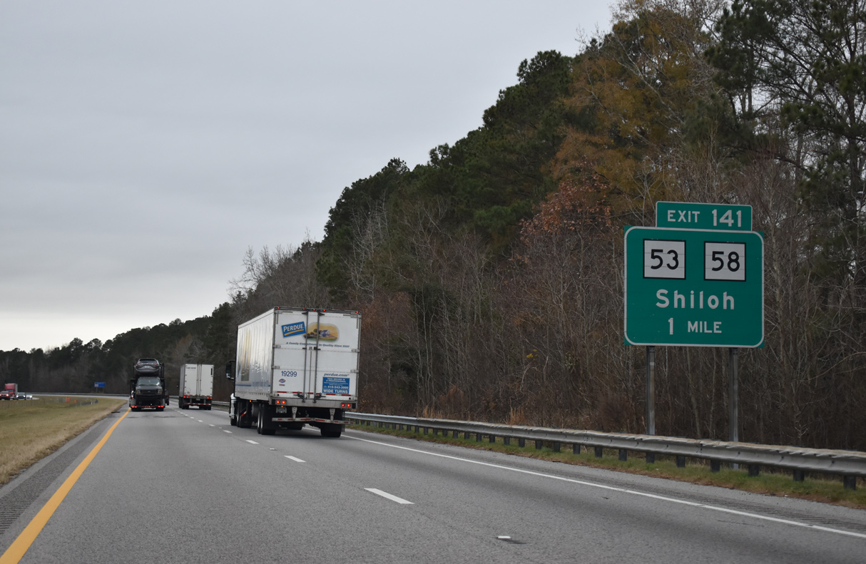
S.C. 53 and S.C. 58 combine 0.43 miles through a diamond interchange (Exit 141) with I-95 along Narrow Paved Road. Shiloh is a small community 2.5 miles to the south along S.C. 58 (Pudding Swamp Road).
12/30/20
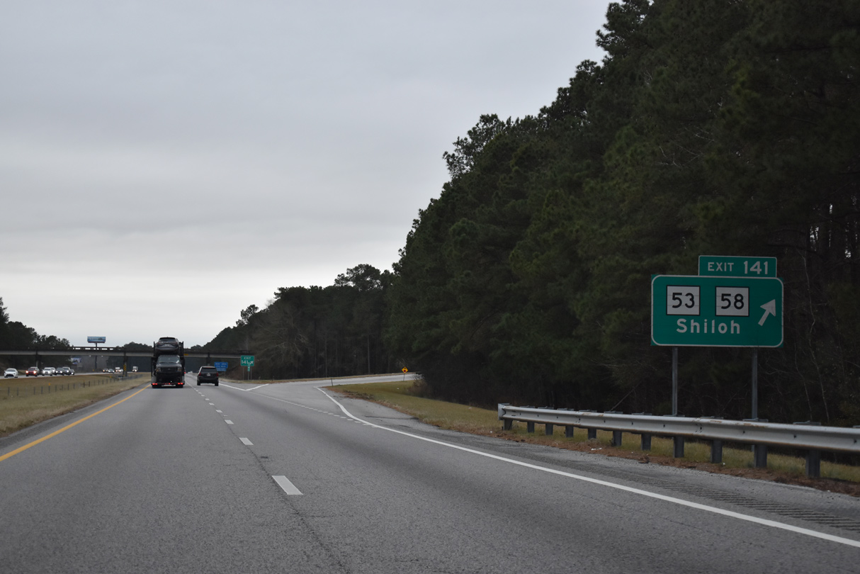
Exit 141 parts ways with Interstate 95 south for S.C. 53/58 (Narrow Paved Road). S.C. 53 and S.C. 58 crisscross through rural areas between U.S. 378 to the south and S.C. 341 to the north.
12/30/20
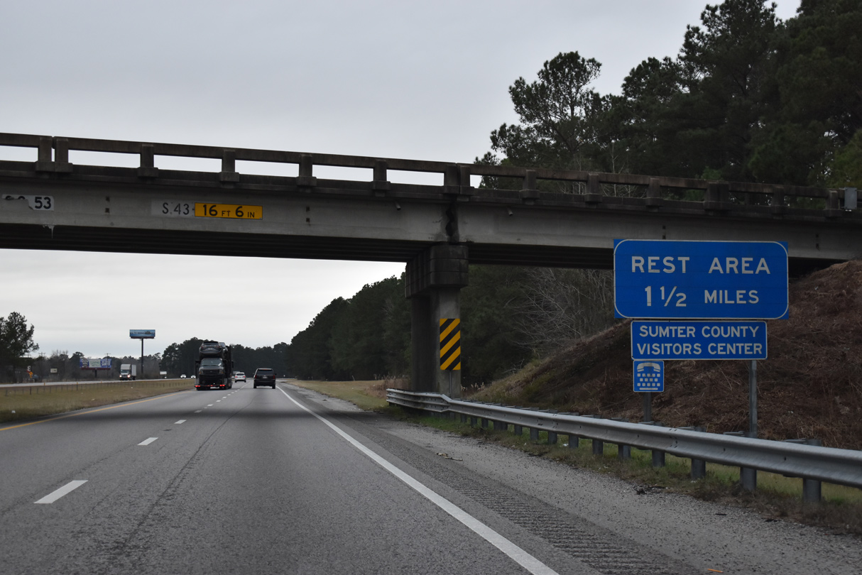
The first active rest area along I-95 southbound since Dillon is located west of Shiloh by the Mt. Sinai Church Road overpass.
12/30/20
Southbound I-95 reassurance marker posted ahead of Pudding Swamp.
12/30/20
Distance sign posted 152 miles from Savannah. U.S. 378 crosses paths with I-95 in five miles along five lane arterial. This sign was knocked over in 2020.
01/01/17

Rest areas operate in both directions of Interstate 95 at mile marker 139.
12/30/20
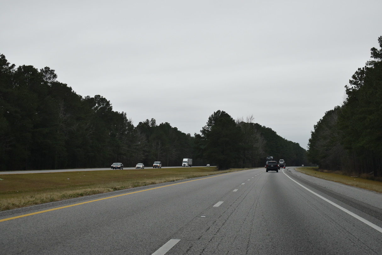
Advancing south from Hope Swamp, a forested median separates the freeway roadways over the next two miles.
12/30/20
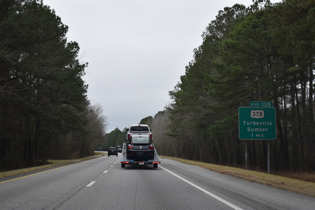
U.S. 378 runs 4.60 miles east to U.S. 301 at Turbeville from the diamond interchange with I-95 at Exit 135. A two state route, U.S. 378 extends east to Conway, 14 miles north of Myrtle Beach.
12/30/20
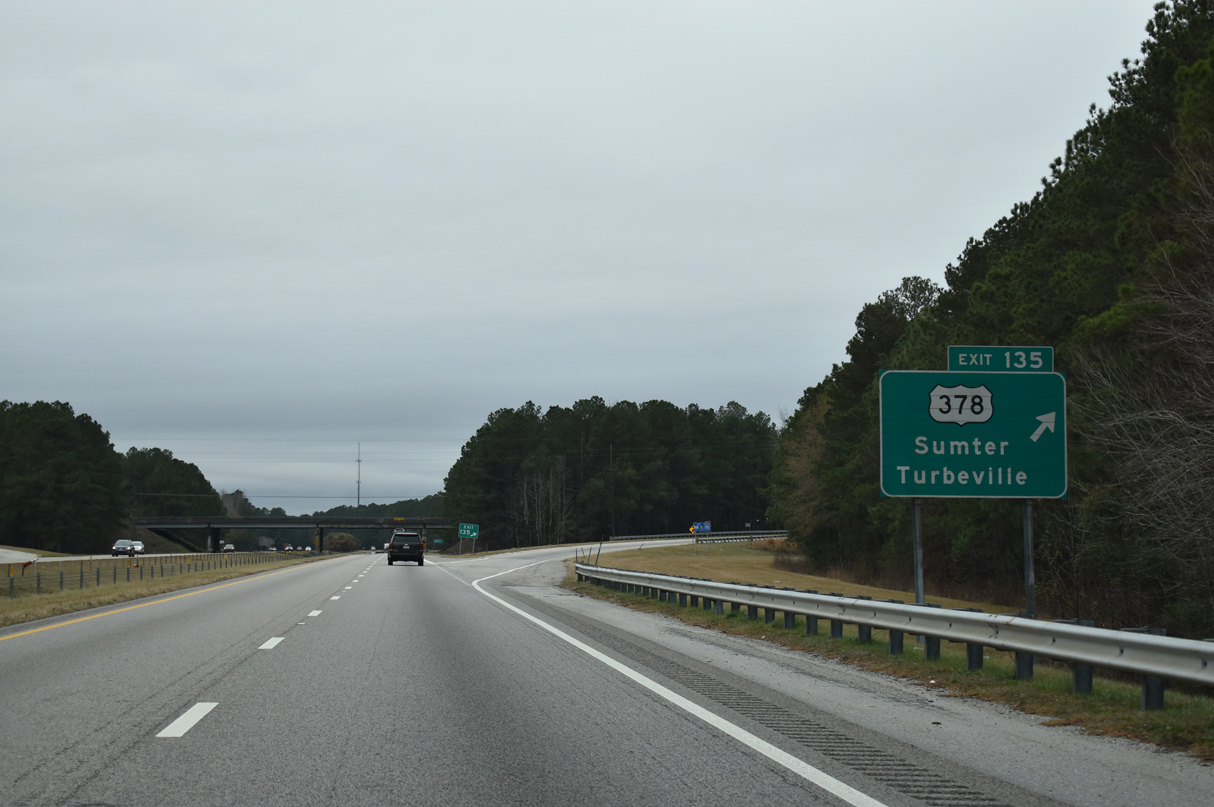
U.S. 378 provides the most direct route to the city of Sumter from Interstate 95 at Exit 135. U.S. 378 west combines with U.S. 78 along a freeway bypass to the north of the Sumter County seat in 13.3 miles. U.S. 76/378 overlap from there to Columbia.
12/30/20
Interstate 95 passes through forest land over the ensuing stretch to Exit 132.
12/30/20
Savannah is just over a two hour drive from U.S. 378 during optimum driving conditions. I-95 however is periodically congested in the LowCountry due to the advent of traffic from I-26.
12/30/20
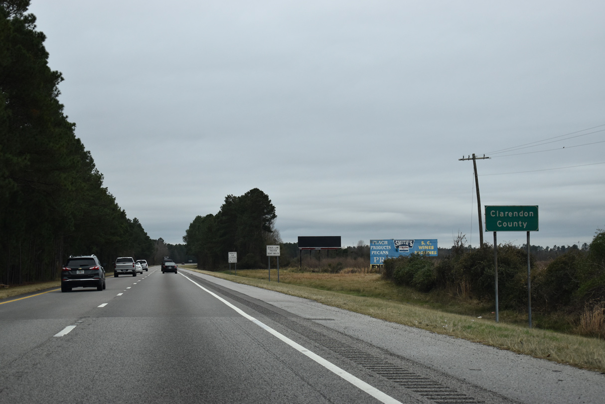
Interstate 95 southbound enters northern reaches of Clarendon County beyond the Skinner Road overpass.
12/30/20
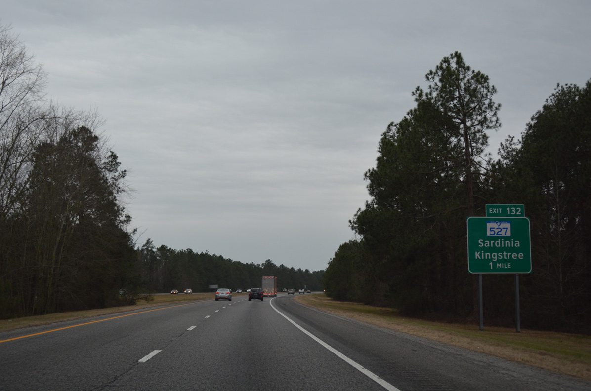
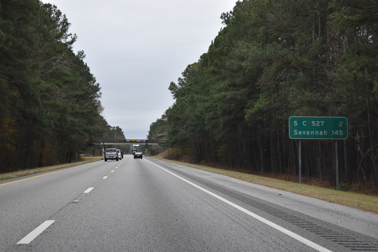
65.94 miles in length, S.C. 527 extends south from S.C. 341 at Wisacky to S.C. 41 near Andrews. S.C. 527 (Black River Road) meets I-95 at a diamond interchange (Exit 132) in one mile.
01/01/17
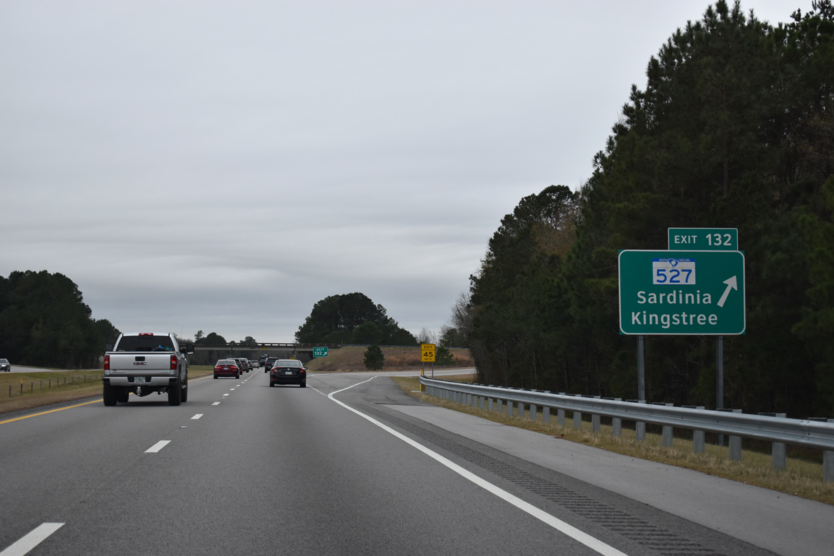
S.C. 527 (Black River Road) heads 2.6 miles south from Exit 132 to U.S. 301 near the settlement of Sardinia. The Williamsburg County seat of Kingstree is a 22 mile drive to the southeast.
12/30/20
Interstate 95 plies across Black River Swamp just west of S.C. 527.
12/30/20
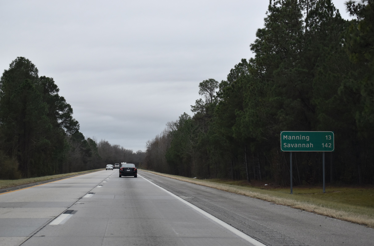
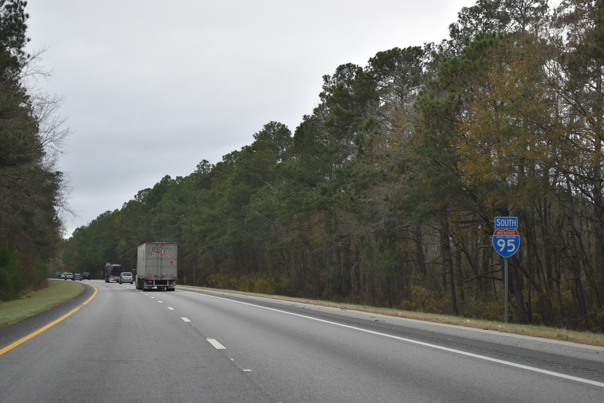
The Clarendon County seat of Manning represents the next destination along I-95 south in 13 miles. Savannah follows in 142 miles.
12/30/20
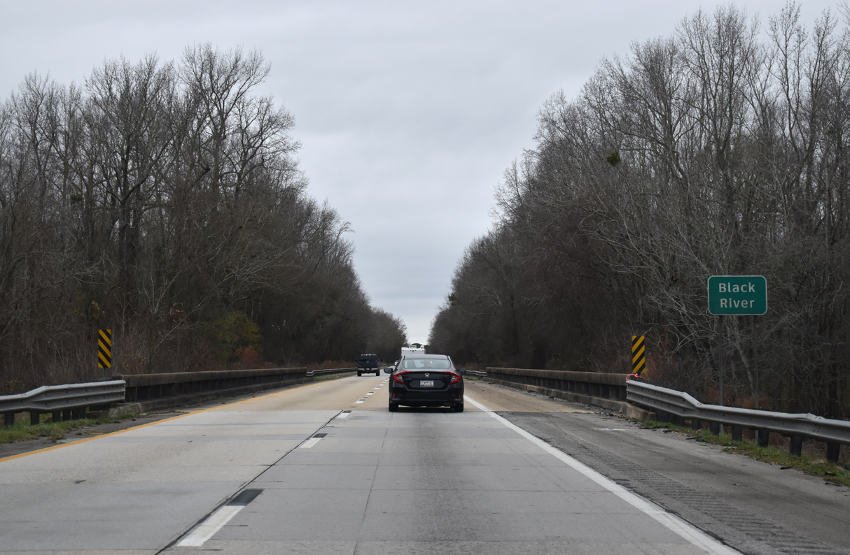
Interstate 95 spans a series of five bridges built in 1968 across Black River Swamp.
12/30/20
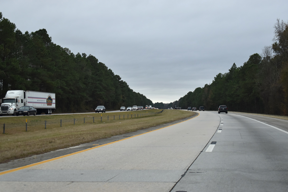
Curving southward after Tearcoat Branch, I-95 passes by agricultural areas over the succeeding five and a half miles.
12/30/20
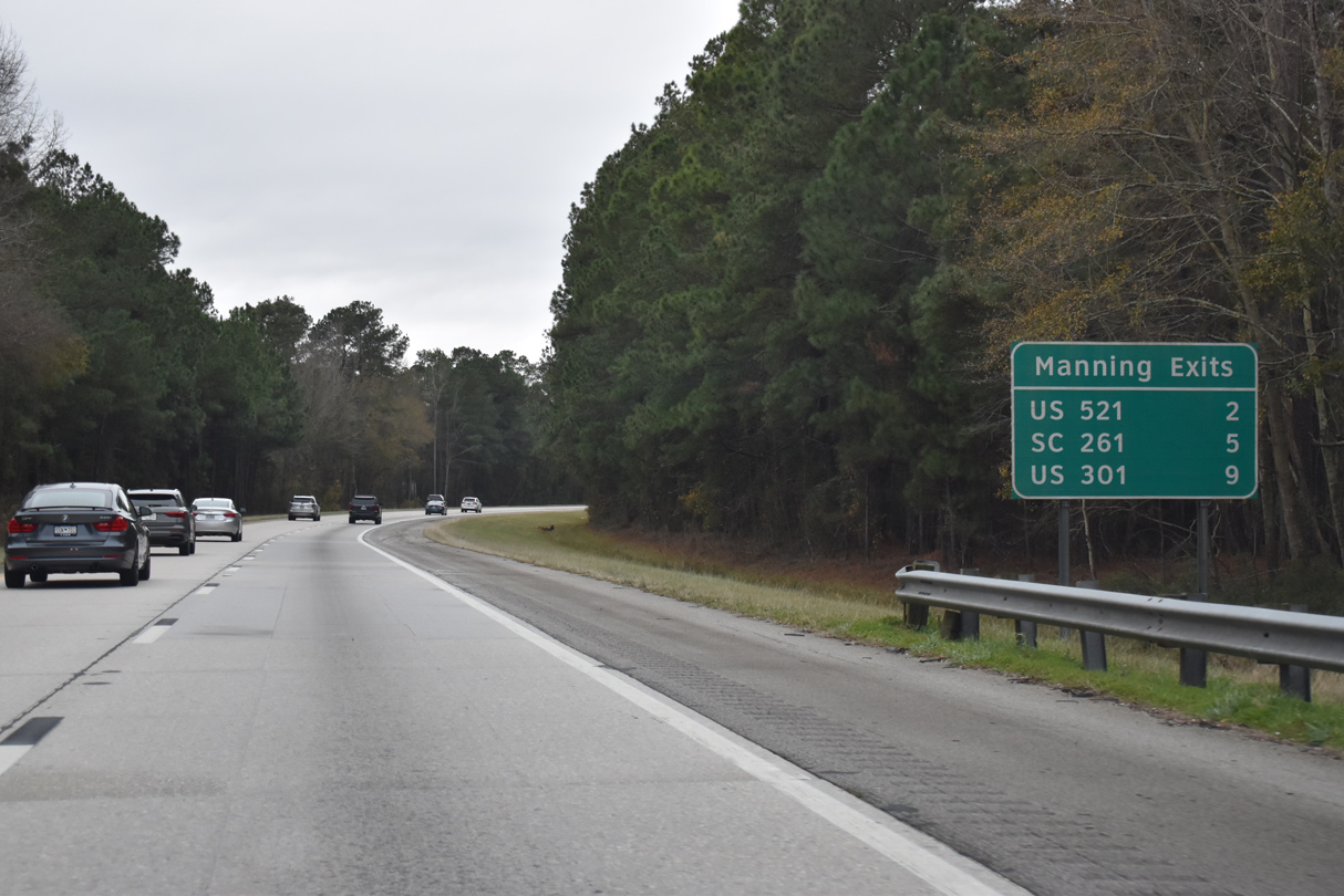
A community interchanges identification sign outlines the three exits for Manning. Manning lies at the crossroads of U.S. 301 and U.S. 521, two miles east of Interstate 95.
12/30/20
U.S. 521 (Sumter Highway) parallels a CSX Railroad line through the forthcoming folded diamond interchange (Exit 122) with Interstate 95 at Alcolu.
12/30/20
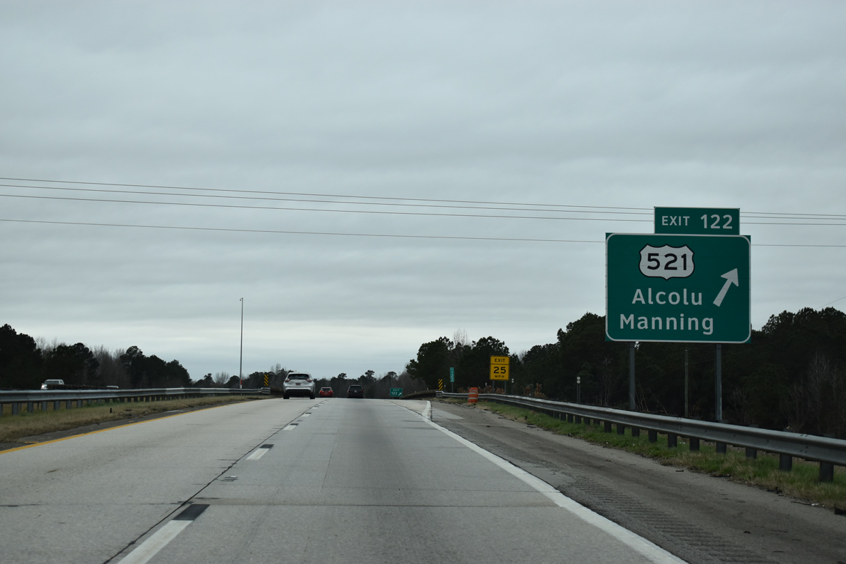
U.S. 521 travels 177 miles overall from U.S. 17 in Georgetown north to Manning, Sumter, Camden, Lancaster and Interstate 485 in south Charlotte, North Carolina.
12/30/20
Continuing south, Interstate 95 crosses the first of three bridges over wetland areas of Pocotaligo River. These spans were built in 1967.
12/30/20
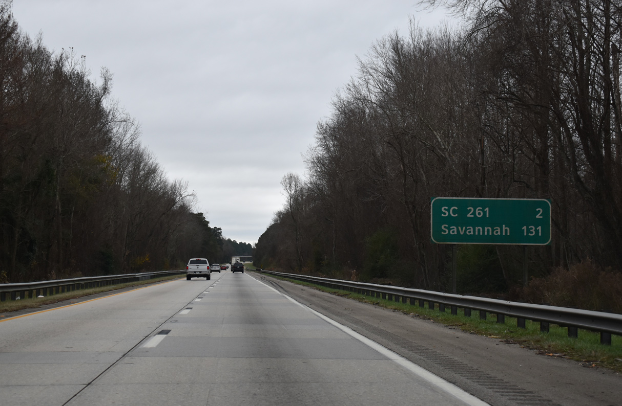
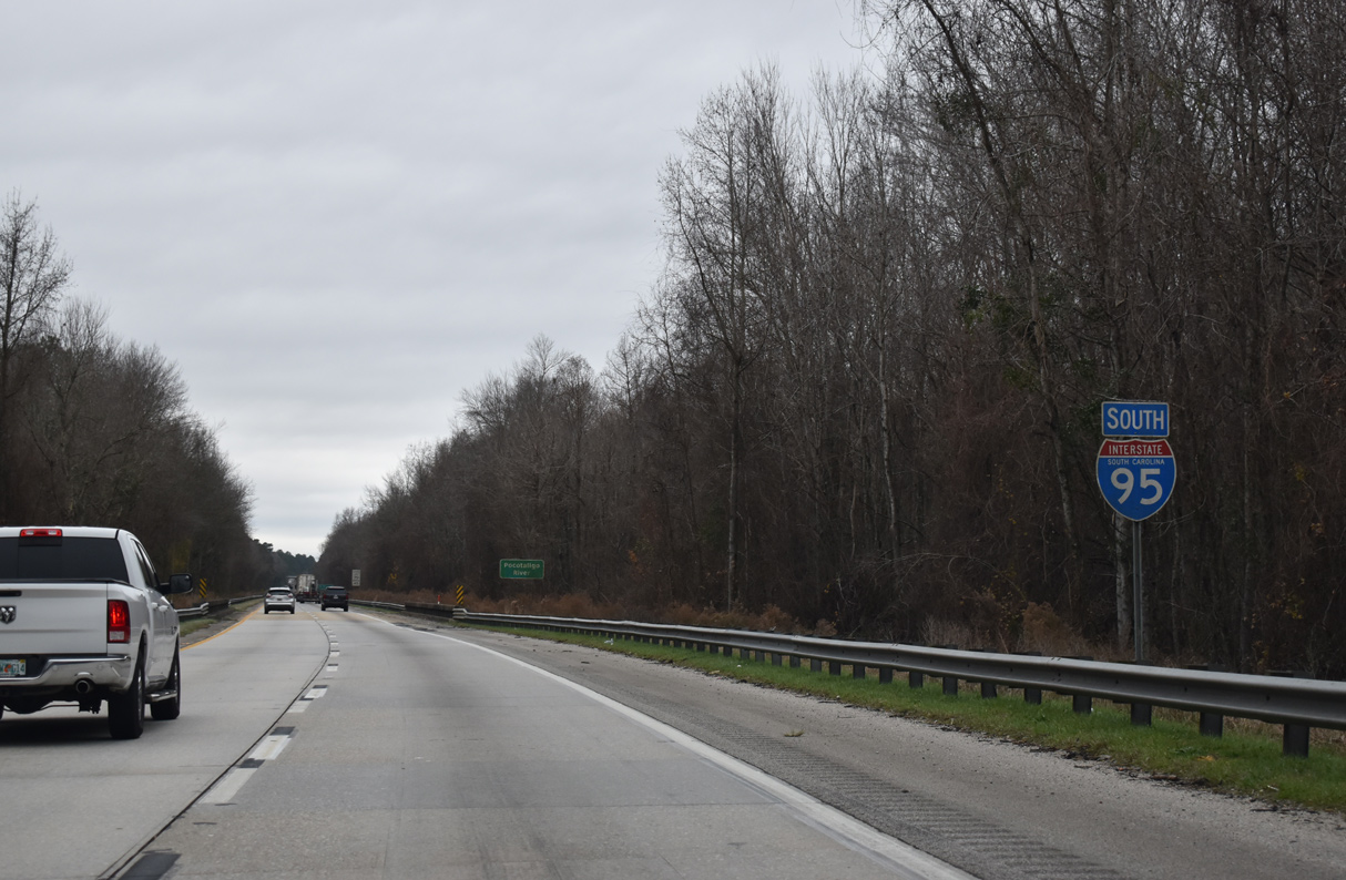
S.C. 261 (Paxville Highway) crosses paths with I-95 in two miles. Travelers reach Savannah in 131 miles.
12/30/20
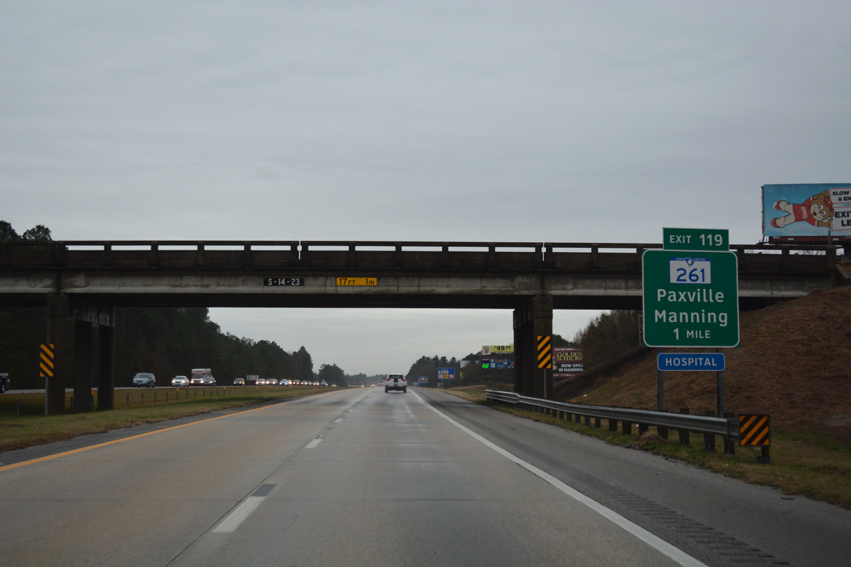
Old Georgetown Road spans I-95 one mile north of the diamond interchange (Exit 119) with S.C. 261 (Paxville Highway). S.C. 261 travels east to Kingstree and U.S. 701 at Yuhannah as part of a 117 mile long route.
01/01/17
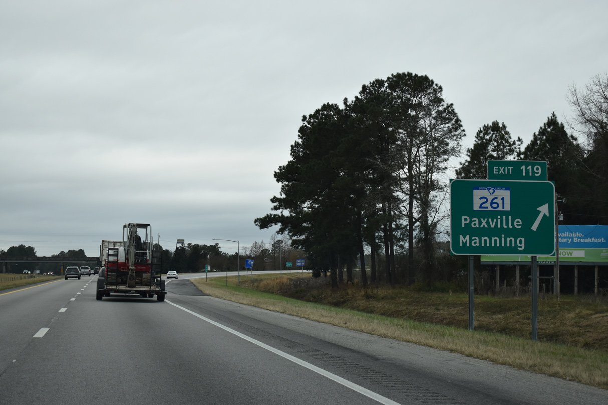
S.C. 261 (Paxville Highway) leads two miles east to Boyce Street through Downtown Manning. S.C. 261 extends west seven miles to U.S. 15 at the town of Paxville.
12/30/20
Interstate 95 advances southwest from Manning across large tracts of pine forest.
12/30/20
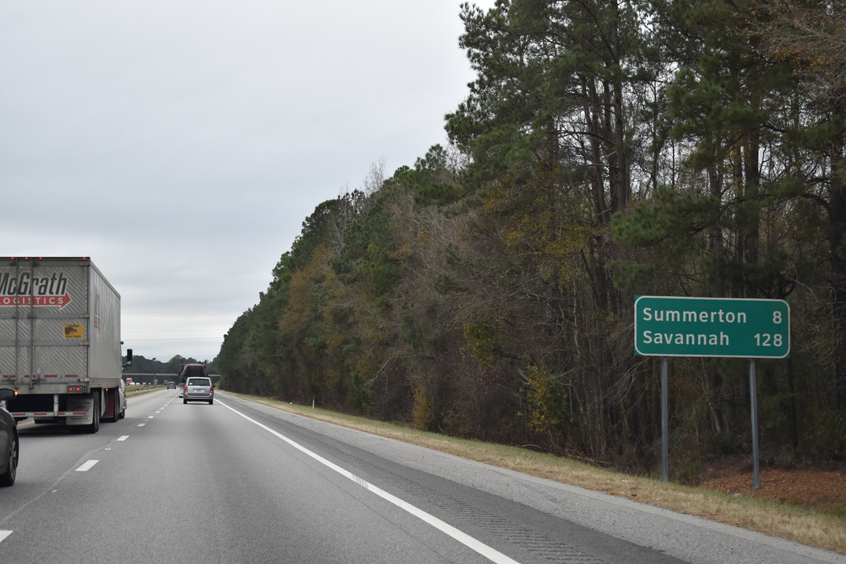
Eight miles away, the town of Summerton lies just west of Interstate 95 where U.S. 301 converges with U.S. 15.
12/30/20
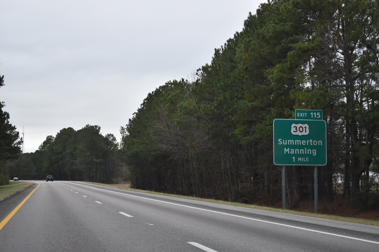
U.S. 301 splits with U.S. 521 in Downtown Manning along Sunset Drive southwest to the city line. U.S. 301 bee lines another 3.7 miles to meet I-95 for the first time since the North Carolina state line.
12/30/20
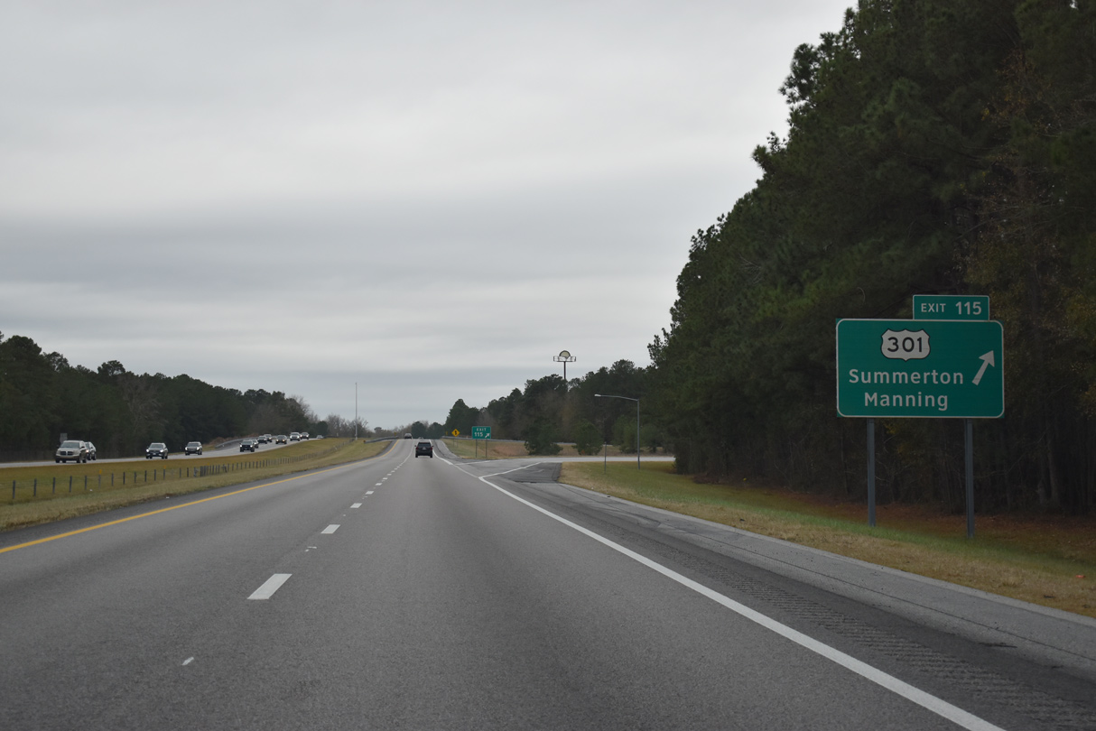
Beyond Exit 115, U.S. 301 (Alex Harvin Highway) switches sides with Interstate 95 and continues another 4.7 miles to Main Street through Summerton.
12/30/20
References:
- "Businesses feel effects of Florence County widening projects." WMBF (Myrtle Beach, SC), February 13, 2015.
Photo Credits:
- Alex Nitzman: 01/01/17, 12/30/20
- Andy Field: 05/28/07
Connect with:
Page Updated Tuesday June 08, 2021.