
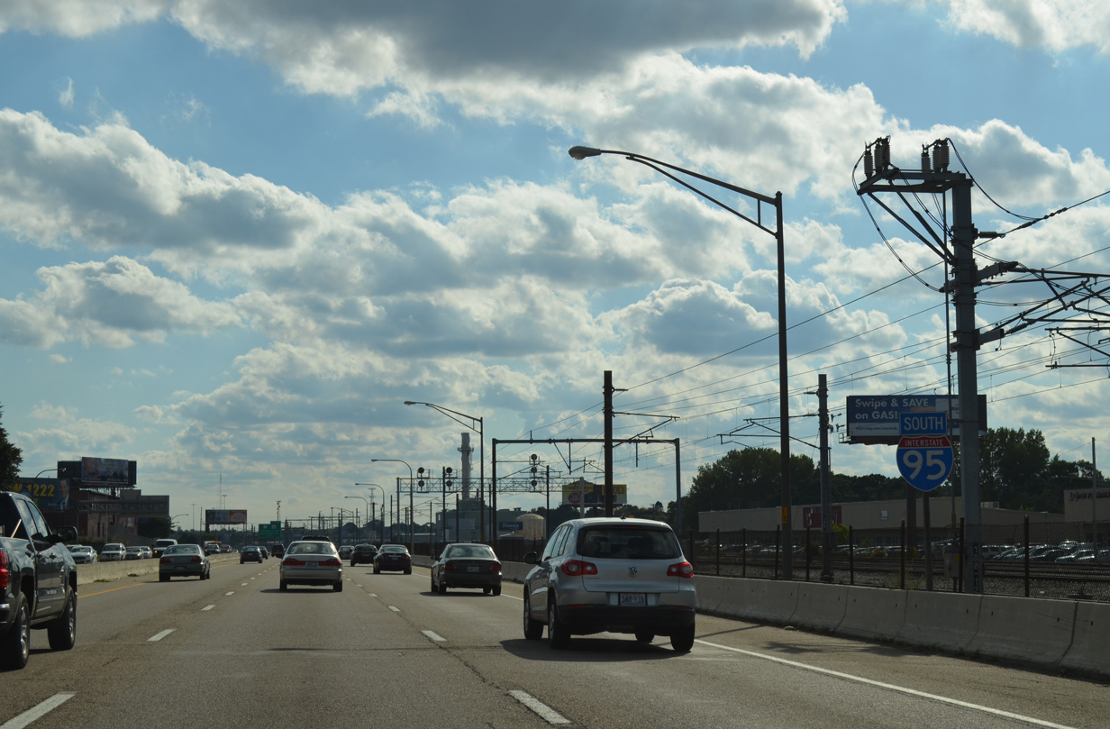
Interstate 95 South - Massachusetts to Downtown Providence
 South
South
Interstate 95 spans AMTRAK at the Massachusetts state line and quickly enters a diamond interchange with East Street. Exit 30 joins Roosevelt Avenue southbound, which in conjunction with Middle Street forms a southbound side frontage road. East Street ties in with parallel U.S. 1 (Broadway) to the east while Roosevelt Avenue branches southwest across the Blackstone River to Central Falls.
07/28/07
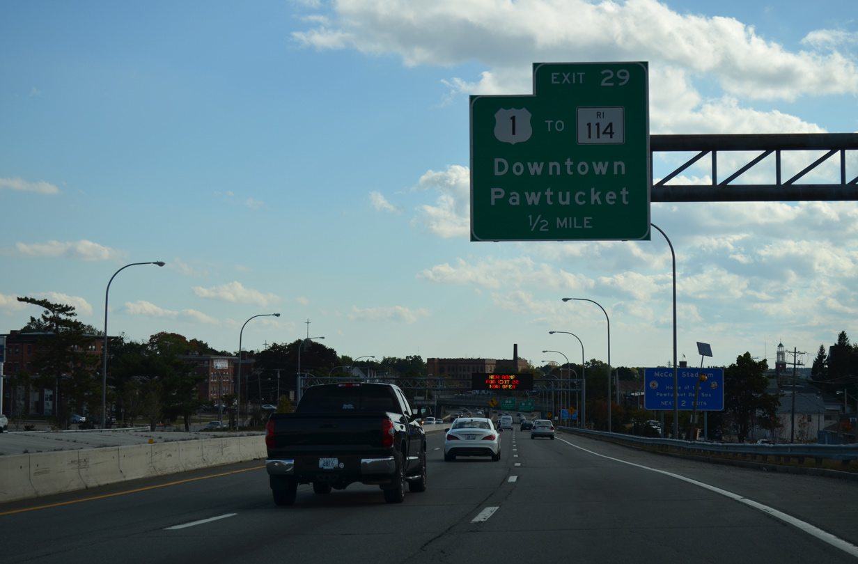
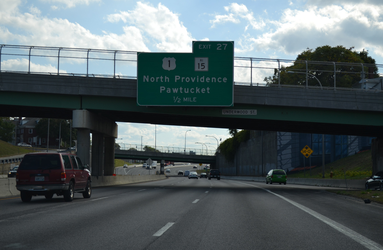
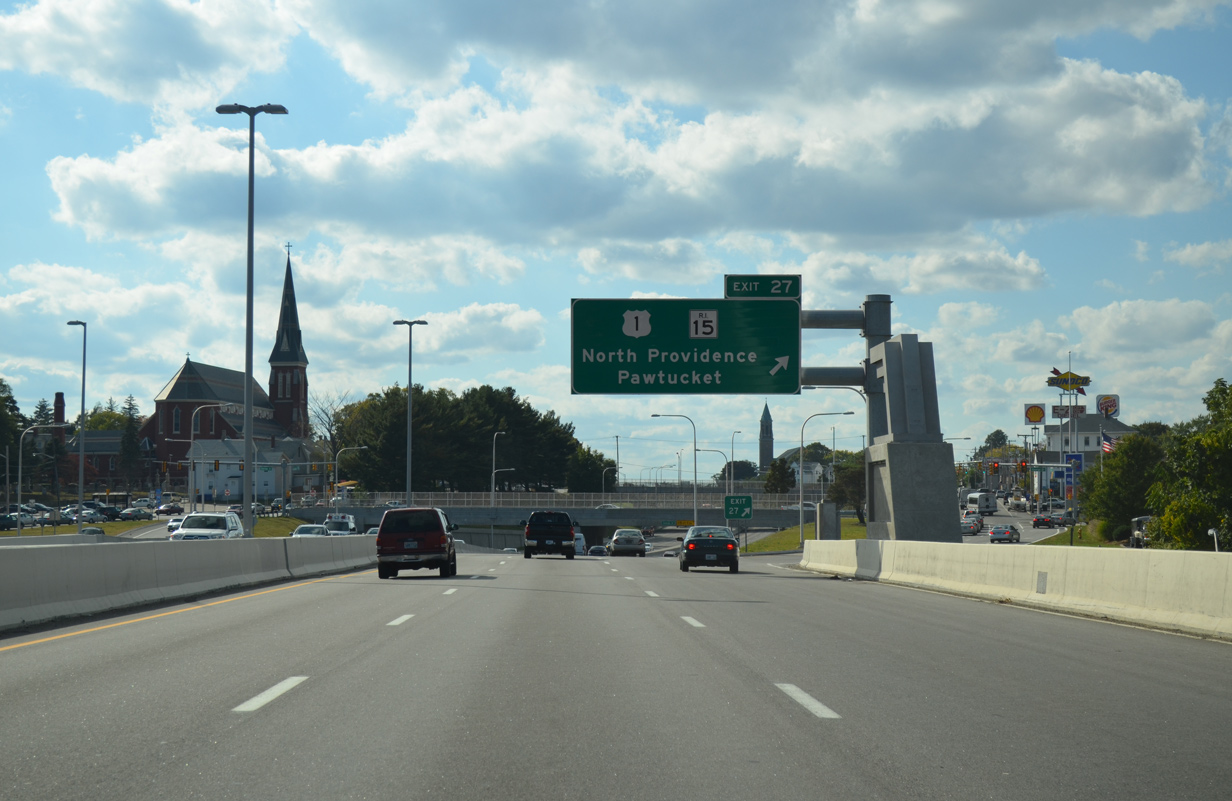
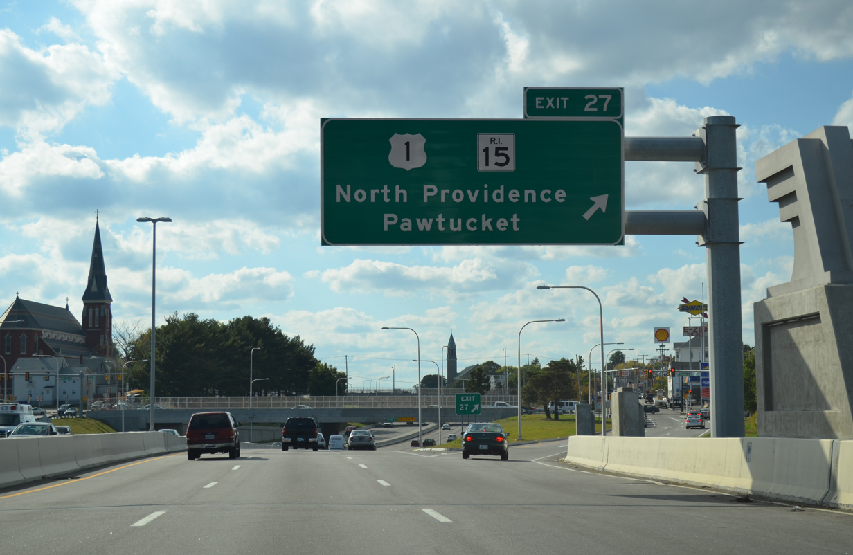
U.S. 1 and Interstate 95 cross paths for the first time within Rhode Island at Exit 29 outside Downtown Pawtucket. The US highway follows Broadway from the state line to Exchange Street, where it meets Route 15 and 114.
10/06/14
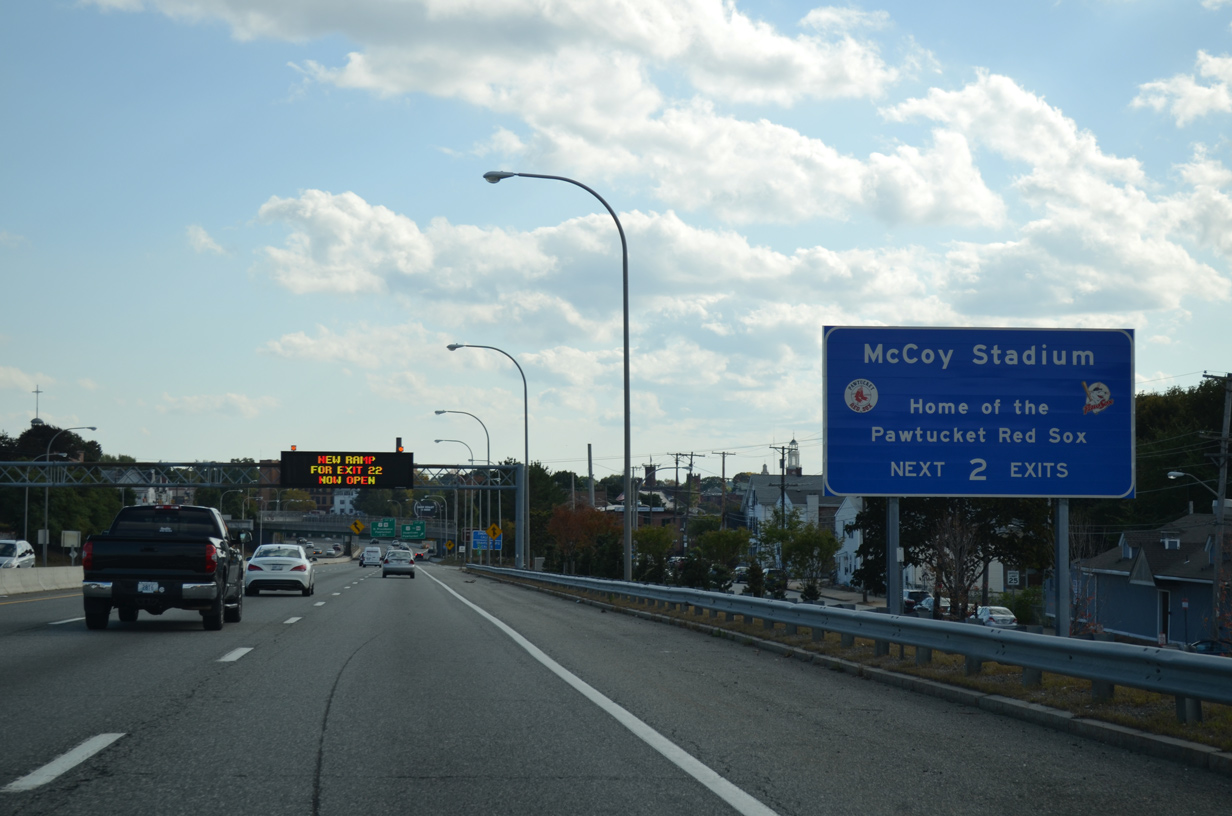
This sign directs motorists to take either of the next two exits for McCoy Stadium, home of the AAA Baseball Pawtucket Red Sox. The panel replaced a welcome sign, which was taken down by 2014.
McCoy Stadium, a 10,000 plus seat stadium constructed between 1940-42, resides at the corner of Division and Bend Streets southeast of Downtown. The stadium hosts the Pawtucket Red Sox until the 2017 season, when the International League team relocates south to a new venue in Downtown Providence.
10/06/14
An on-ramp adds traffic from adjacent Middle Street onto Interstate 95 south to add a short auxiliary lane.
10/06/14
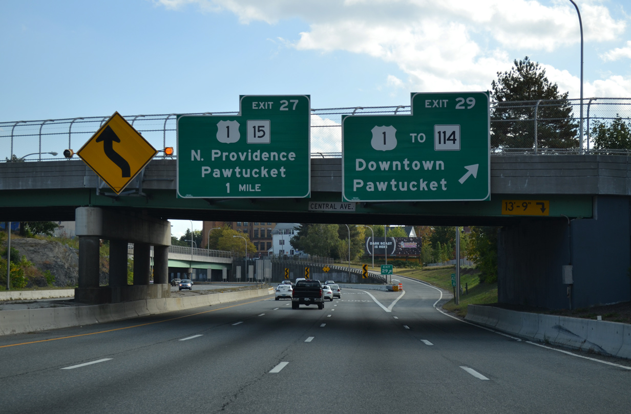
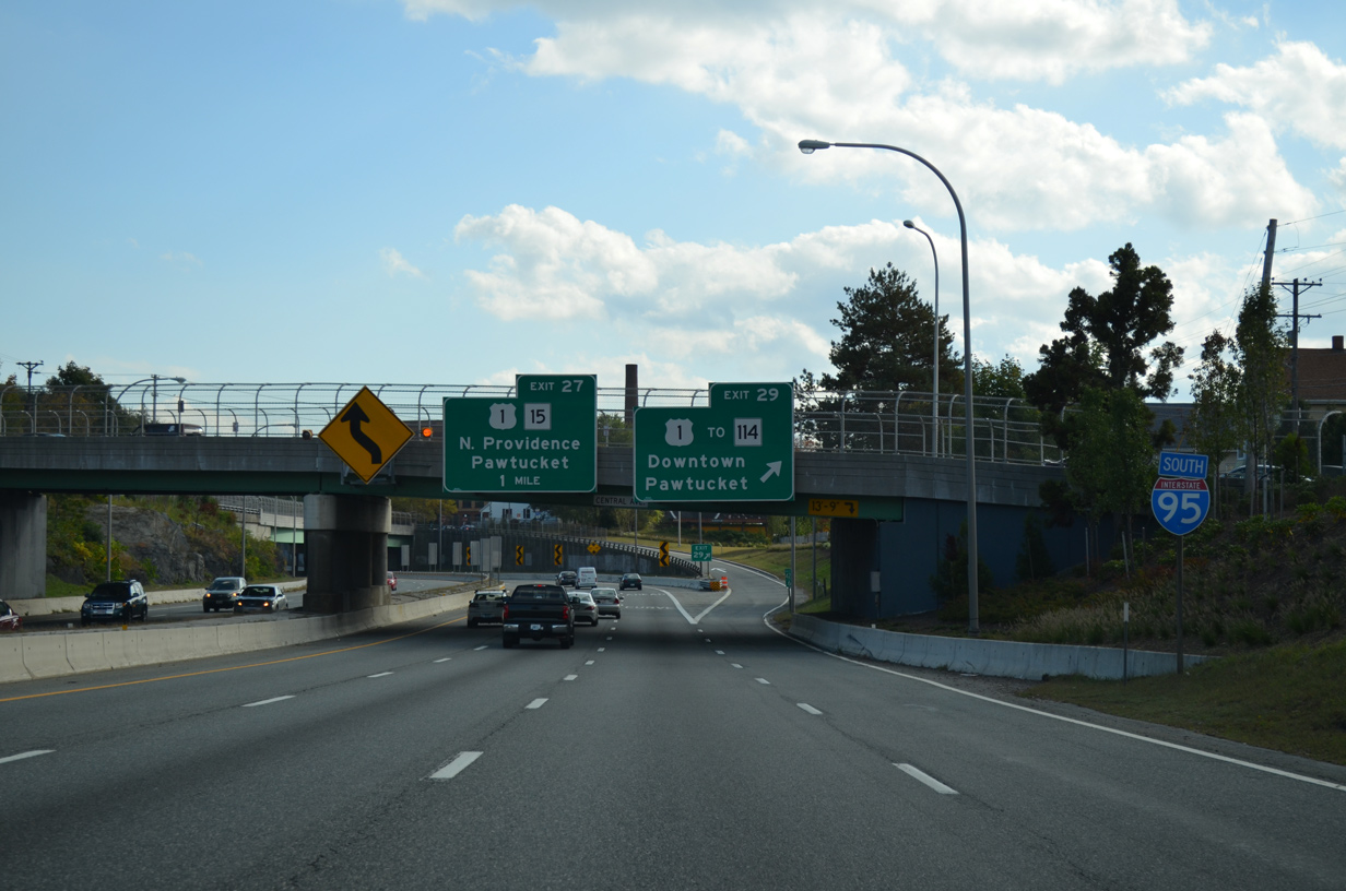
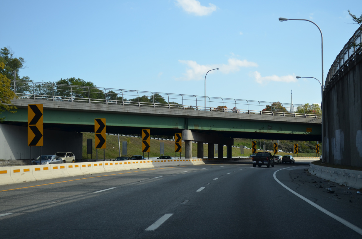
Exit 29 leaves Interstate 95 south at the Central Avenue overpass to Fountain Street and Broadway (U.S. 1). U.S. 1 south joins Interstate 95 across the Pawtucket River to Exit 27. Route 114 meanwhile meanders around Downtown Pawtucket with R.I. 15 along Exchange Street to Broad Street north to Central Falls. Southward the state route joins School Street as part of a route to Phillipsdale and East Providence.
10/06/14
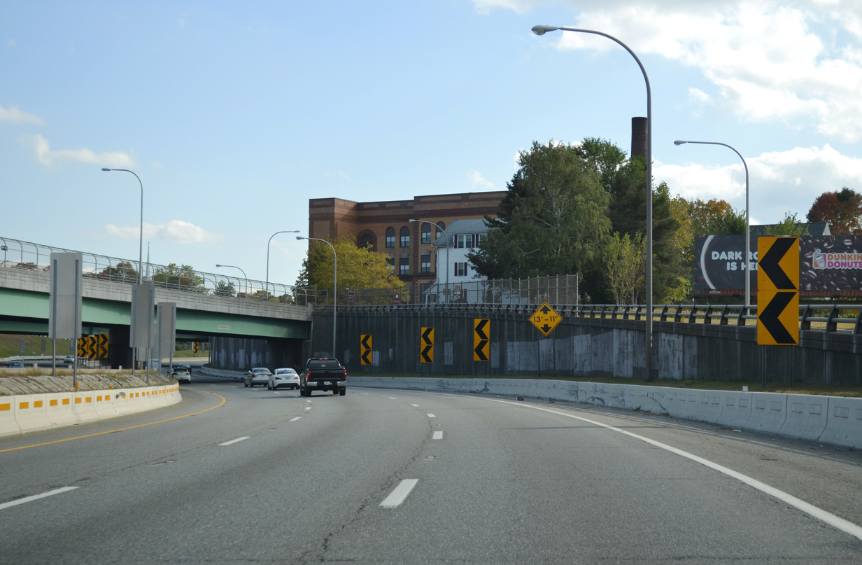
An S-curve winds Interstate 95 traffic under Fountain Street and Broadway just east of the Seekonk River.
10/06/14

New welcome signage for Interstate 95 south installed by 2014 stands at the Exchange Street overpass. Interstate 95 travels 42.36 miles through the Ocean State.
10/06/14
Passing below Underwood Street, U.S. 1 merges onto Interstate 95 south for a half mile overlap west to George Street. The forthcoming split diamond interchange serves Downtown via George Street north to Park Place.
10/06/14
 South
South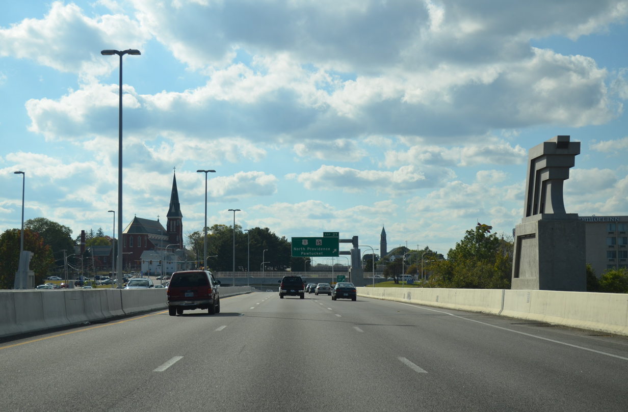
I-95/U.S. 1 south curve westward across the Pawtucket River Bridge.
An $81 million project started in November 2010 replaced the original bridges across the Seekonk River. The former spans deteriorated to a point to where a weight limit was implemented, forcing trucks onto a major detour. Rather than rehabilitating the 1958-built spans, RIDOT opted to replace the crossing with new spans. Work was completed in September 2013.1,2
10/06/14
Exit 27 departs from the west end of the Pawtucket River Bridge onto Cedar Street, a westbound frontage road. U.S. 1 follows George Street south to Pawtucket Avenue through south Pawtucket. Route 15 travels Main Street and Mineral Spring Avenue three blocks to the north, leading west from Downtown to North Providence.
10/06/14
South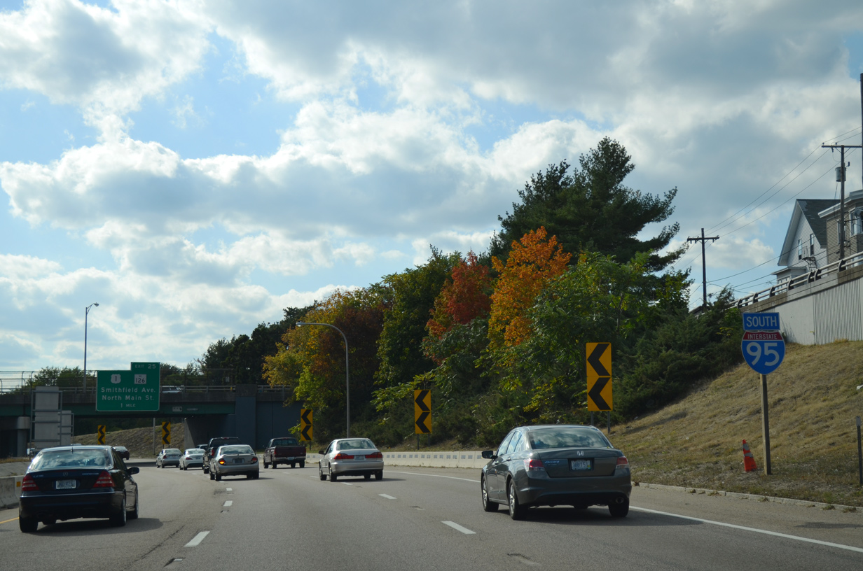
Cedar Street leads west from Exit 27 to Main Street. An on-ramp joins Interstate 95 south from Cedar at Garden Street, which precedes this reassurance marker.
10/06/14
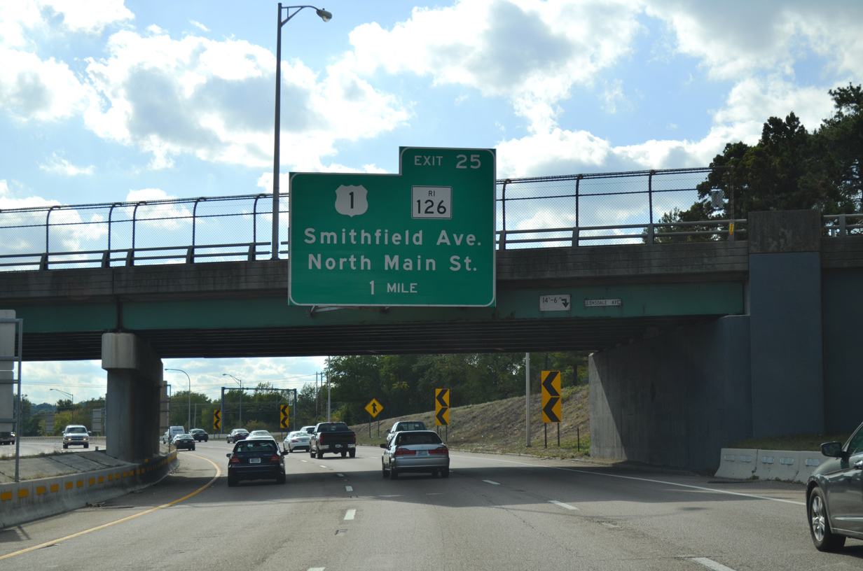
Lonsdale Avenue (Route 122) passes above Interstate 95 south as the freeway veers southwest by the Woodlawn community of Pawtucket toward Providence. Route 126 (Smithfield Avenue) meets the freeway at a parclo interchange (Exit 25) in one mile.
10/06/14
Another on-ramp merges onto Interstate 95 south to bring traffic from Route 122 onto the freeway. I-95 parallels AMTRAK to Exit 24.
10/06/14

One half mile north of the off-ramp (Exit 25) to Route 126 (Smithfield Avenue). The 14.3 mile state route ends at U.S. 1 (North Main Street) nearby and runs northward to Lincoln, Cumberland and Woonsocket where the route becomes Massachusetts 126 at Blackstone.
10/06/14
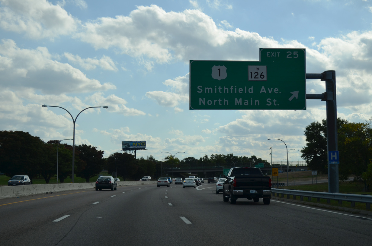
Southbound drivers bound for Smithfield Avenue or North Main Street part ways with Interstate 95 south at Exit 25. U.S. 1 continues parallel to I-95 to the State Capitol complex and Downtown Providence.
10/06/14
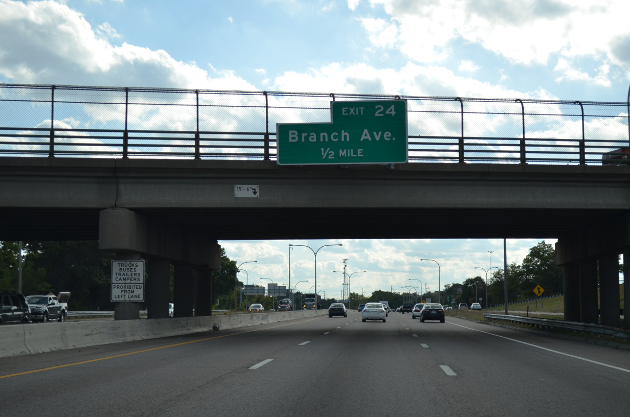
Interstate 95 continues one half mile to a parclo interchange (Exit 24) with Branch Avenue.
10/06/14
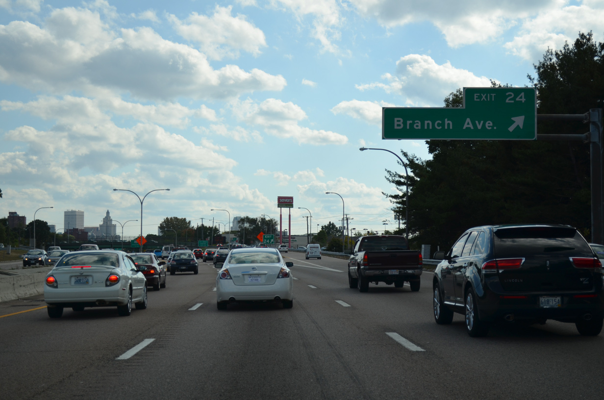
Branch Avenue ventures northwest from U.S. 1 (North Main Street) to meet Route 146 and Route 7 (Douglas Avenue) in northern Providence.
10/06/14
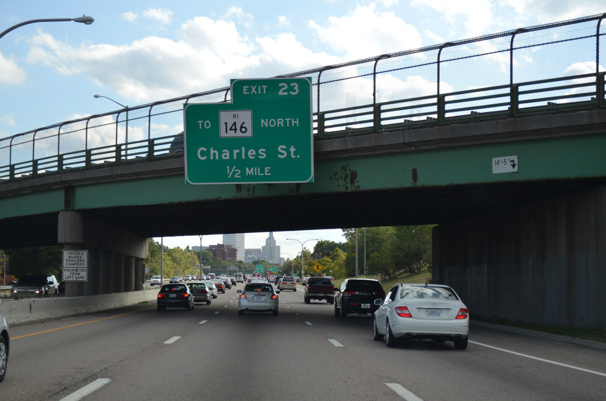
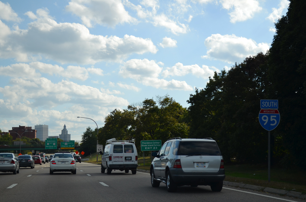
There is no direct access between Interstate 95 south and the Route 146 freeway leading north to Woonsocket. Instead motorists must use the half diamond interchange (Exit 23) with Charles Street (Route 246) to its on-ramp for R.I. 146 north.
10/06/14
Interstate 95 lines an industrial area to the west and the Moshassuck River to the east to Exit 23 with RI 246 (Charles and Ashburton Streets).
10/06/14
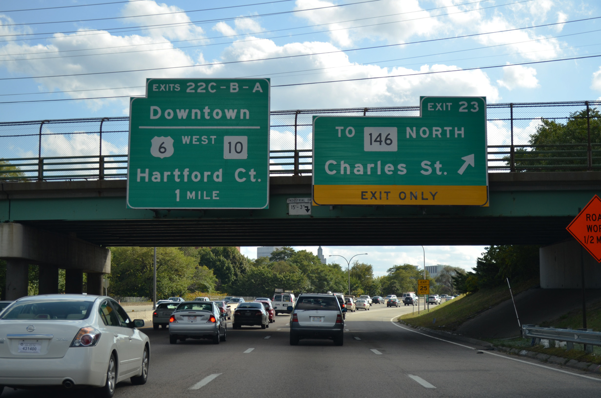
Exit 23 leaves Interstate 95 south for Charles Street. Route 246 follows Charles Street south to Route 7 (Orms Street) and U.S. 1 and north through North Providence to Old Louisquisset Pike through Lincoln. The state route represents the former alignment of Route 146.3
10/06/14
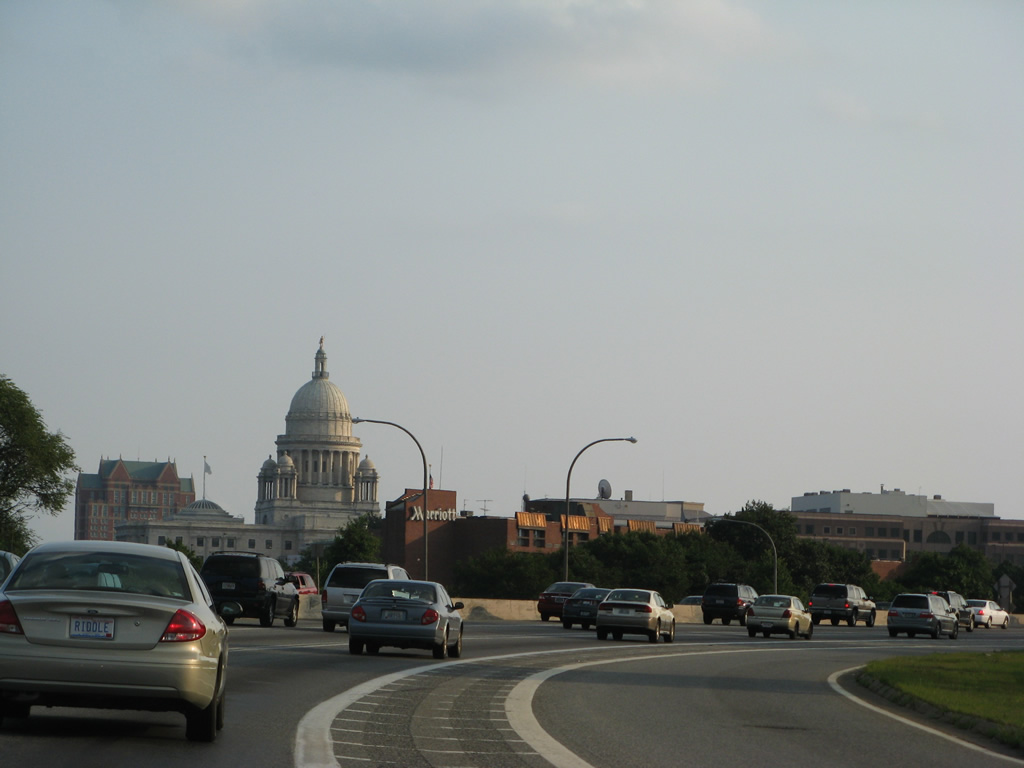
The Rhode Island State House comes into view as Interstate 95 kinks southwest to pass over Charles Street and AMTRAK.
07/28/07
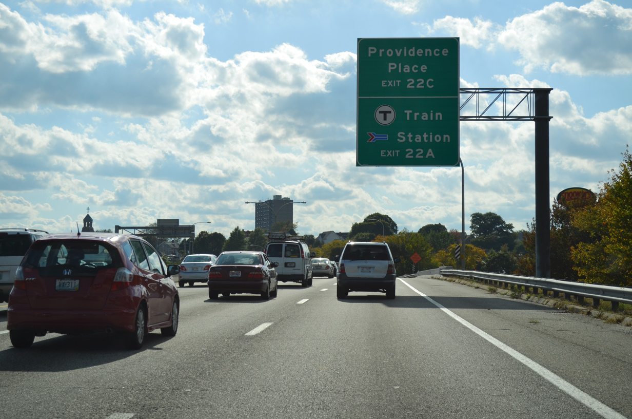
Next in line for southbound drivers is the turbine interchange with U.S. 6 west & Route 10 (Huntington Expressway) south and Memorial Boulevard east by Providence Place Mall.
10/06/14
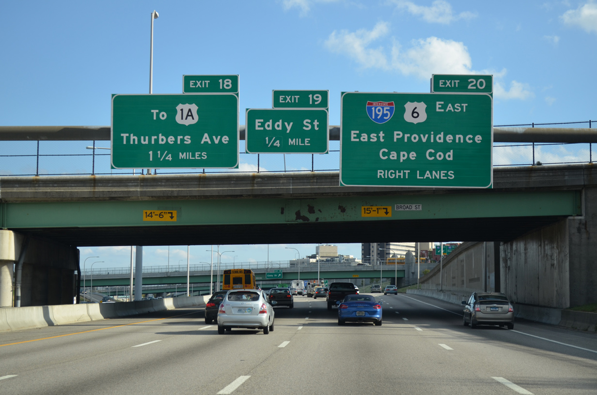
Traffic joins Interstate 95 south from the ending Route 146, one half mile north of the three-pronged ramp of Exit 22. The first sign for the west end of Interstate 195 appears as well.
U.S. 6 east will join I-95 south between the Huntington Expressway (Exit 22B) and Exit 20.
10/06/14
Orms Street (R.I. 7) passes overhead as Interstate 95 south expands to five overall lanes leading to Exit 22. R.I. 10 (Huntington Expressway) begins at upcoming Exit 22 and overlaps with U.S. 6 west for 1.2 miles.
10/06/14
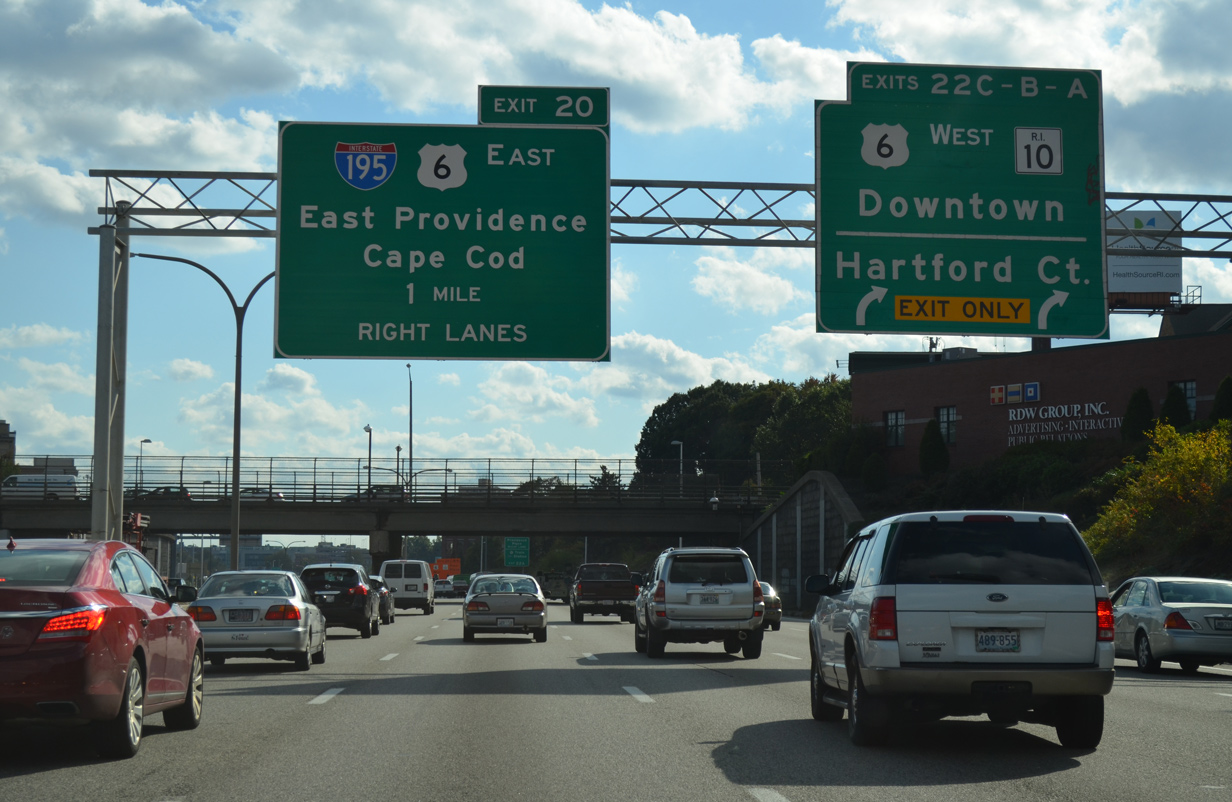
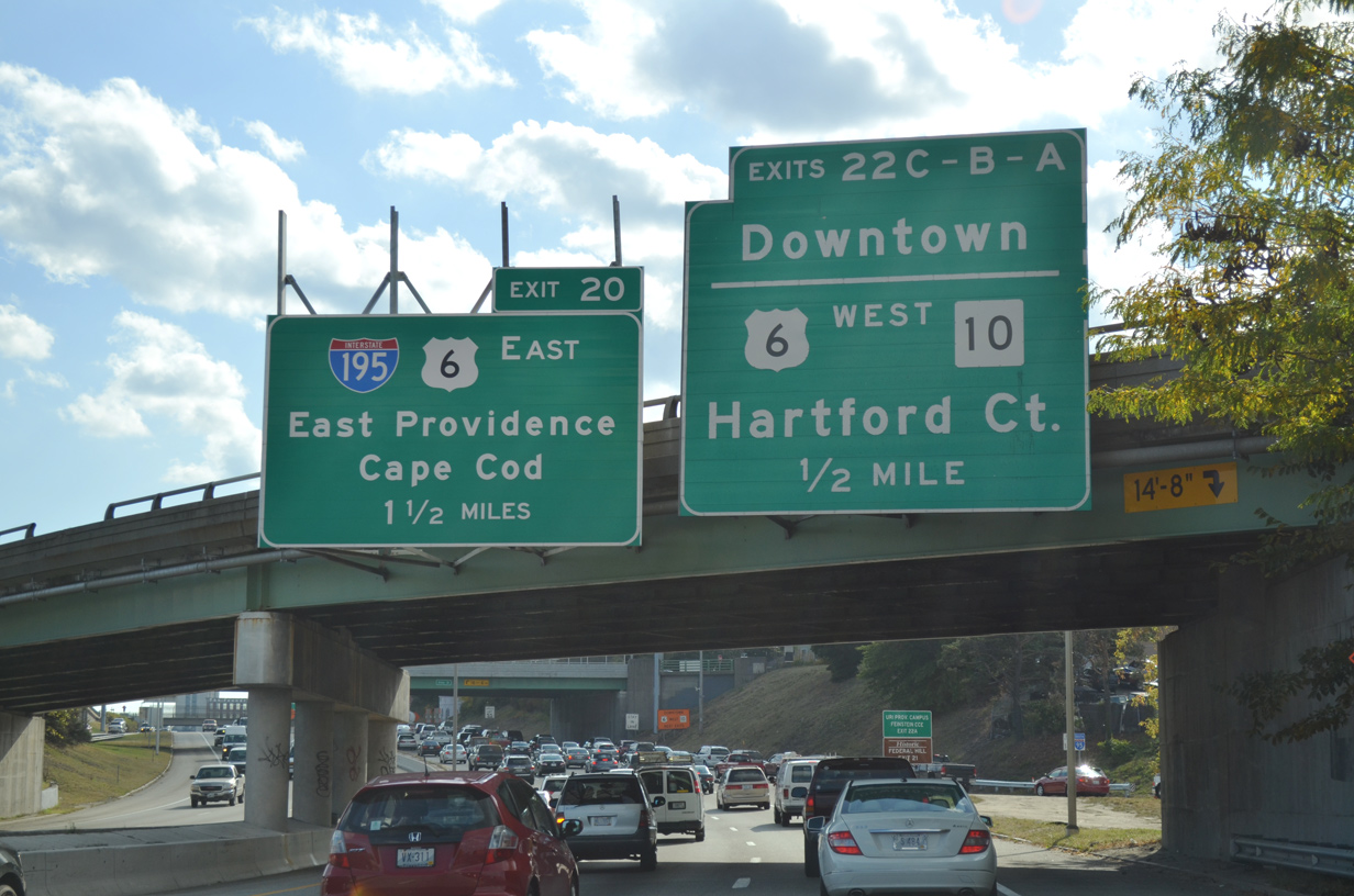
Nearing the Smith Street over crossing of U.S. 44, Exit 22 signage advises of the ramps to Memorial Boulevard east to the central business district and the 73 mile drive along U.S. 6 west to Hartford, Connecticut.
Motorists bound for I-195 and the continuation of U.S. 6 east across the IWay bridge toward Seekonk, Massachusetts are advised to use the right lanes, reflecting the 2009 shift from the previous left side ramp.
10/06/14
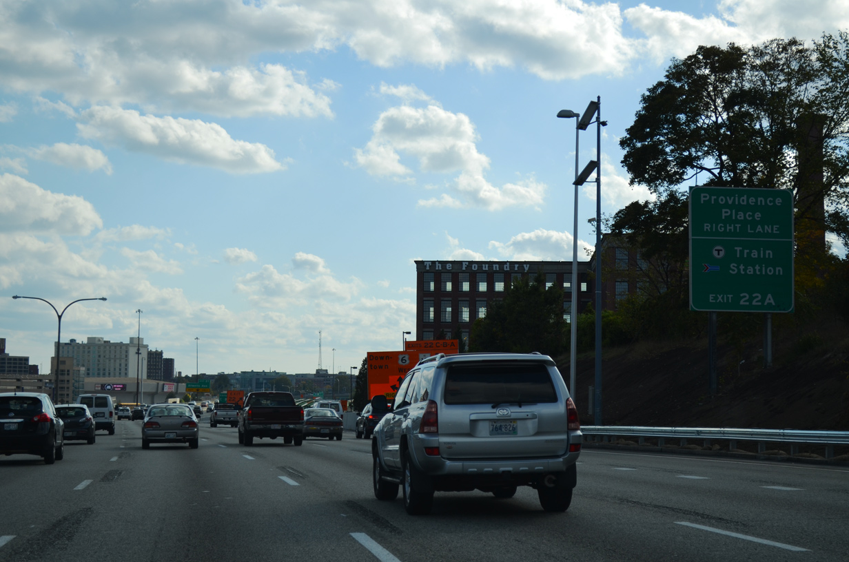
Providence Place lines the south banks of the Woonasquatucket River below Interstate 95 to Park Street at Providence Place Mall. Exit 22C loops directly to the street.
10/06/14
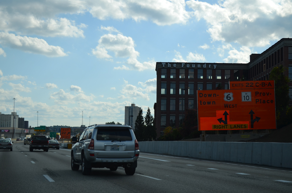
A two lane ramp carries motorists to Providence Place (Exit 22C), U.S. 6 west & Route 10 (Exit 22B) and Memorial Boulevard east (Exit 22A). Route 10 will meet Interstate 95 again at Exit 16 in Cranston.
Construction as part of the Providence Viaduct Replacement Project kicked off in June 2013 along Interstate 95 south between Exits 23 and 21. The project effects 1,290 feet of the freeway and replaced a viaduct constructed in 1964. $66.8 million in work in the southbound direction runs through fall 2016.
10/06/14
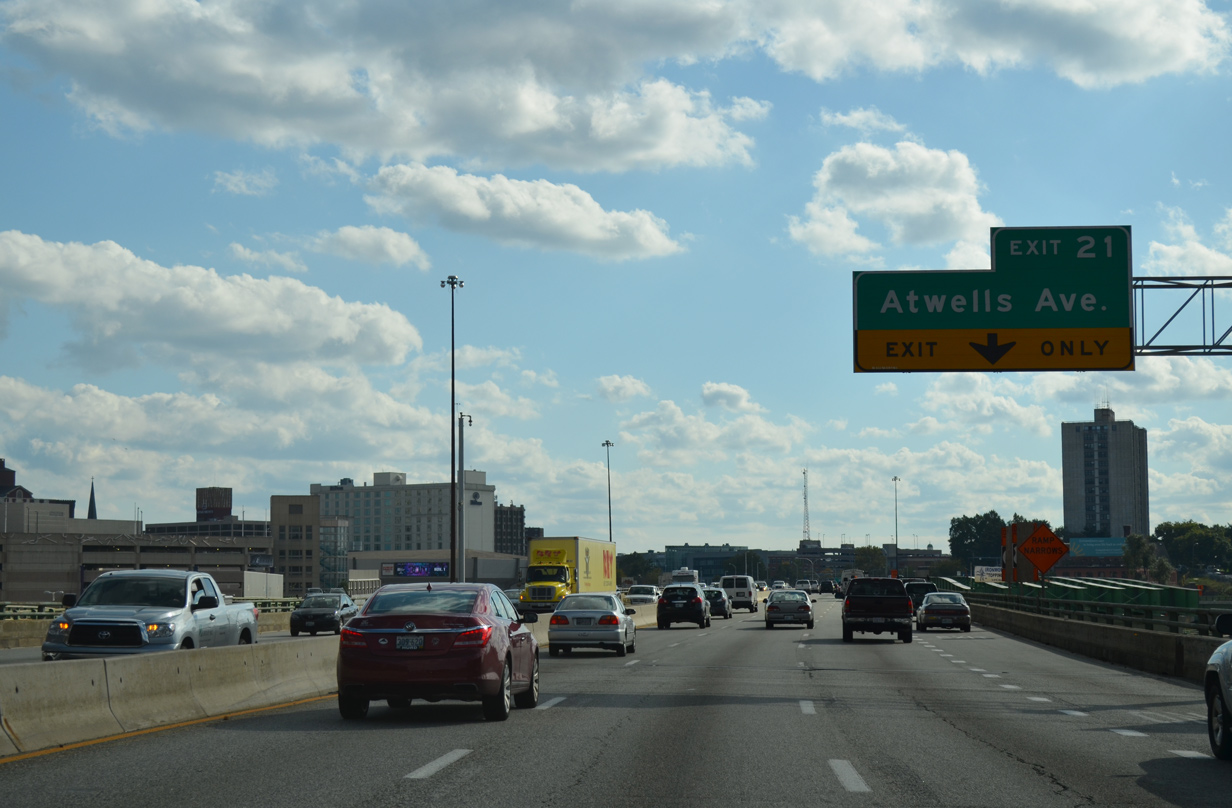
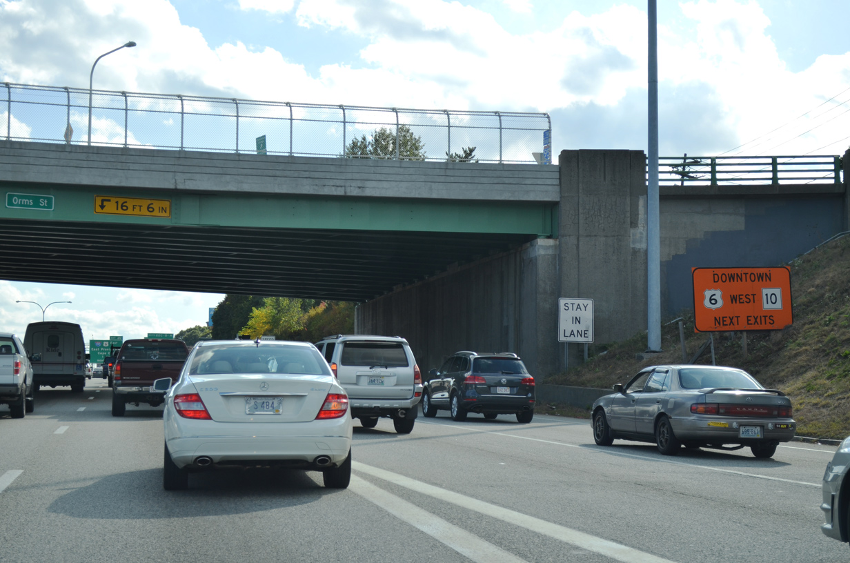
Almost immediately after the Exit 22 gore point is the half diamond interchange (Exit 21) with Atwells Avenue. Exit 21 serves the adjacent Rhode Island Convention Center via U.S. 1 (Fountain Street north / Sabin Street south).
10/06/14
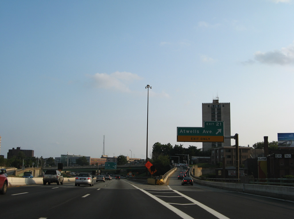
The ramp of Exit 21 forms the southbound side frontage road (Franklin Street), which carries U.S. 1 south from Broadway to Broad Street. U.S. 1 north utilizes the northbound Franklin Street frontage road between the same cross streets.
07/28/07
South  East
East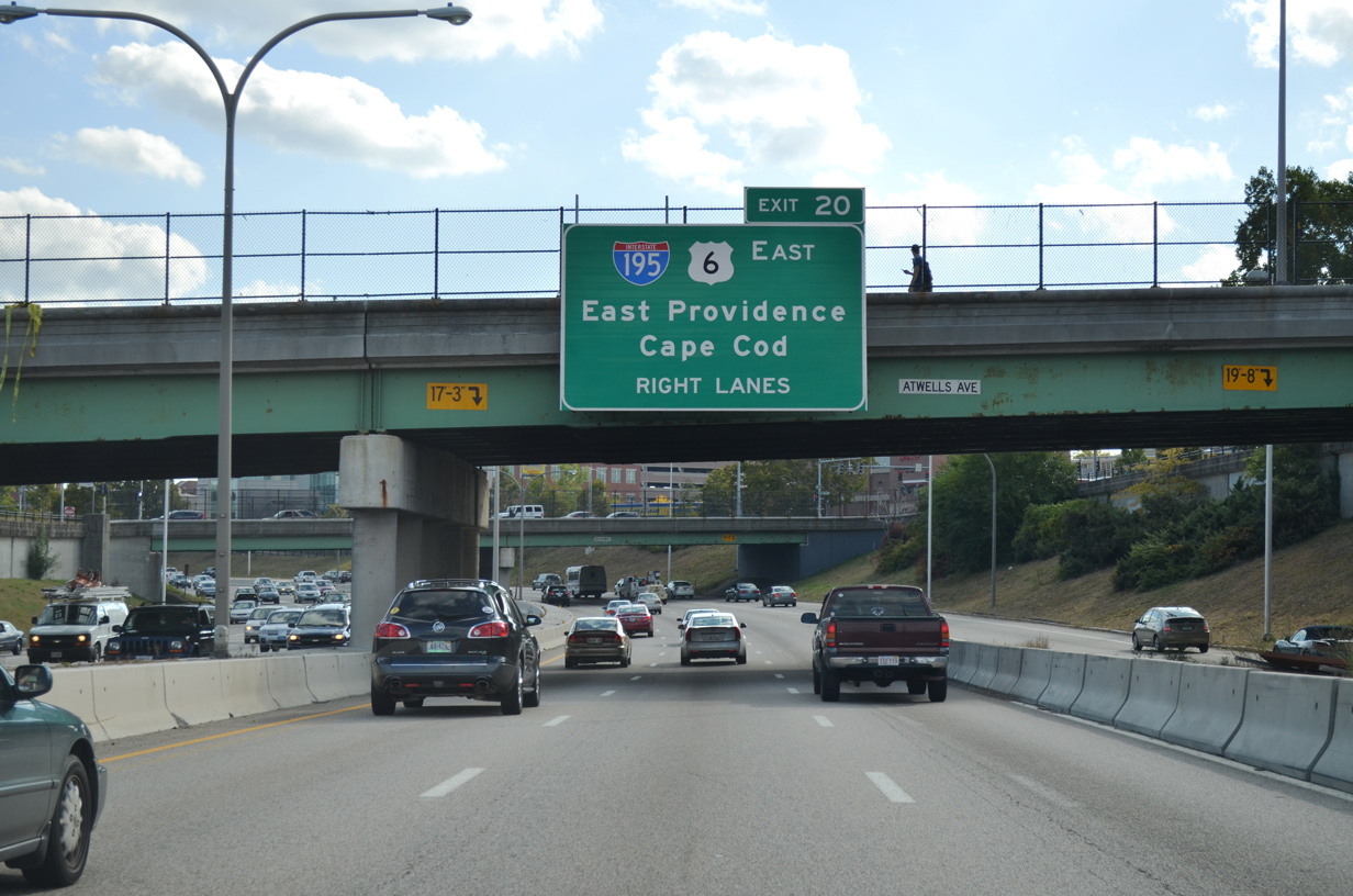
Travelers next meet the new alignment for Interstate 195 & U.S. 6 east across the Iway bridge to India Point and East Providence. The $610 million Iway project realigned I-195 southward onto a new signature bridge across the Providence River, from just west of the Washington Bridge (Seekonk River), to a new three-wye interchange with I-95. The work removed a stretch of 1960s freeway between Downtown and the Jewelry District, allowing for redevelopment of that land and improved connectivity.
10/06/14
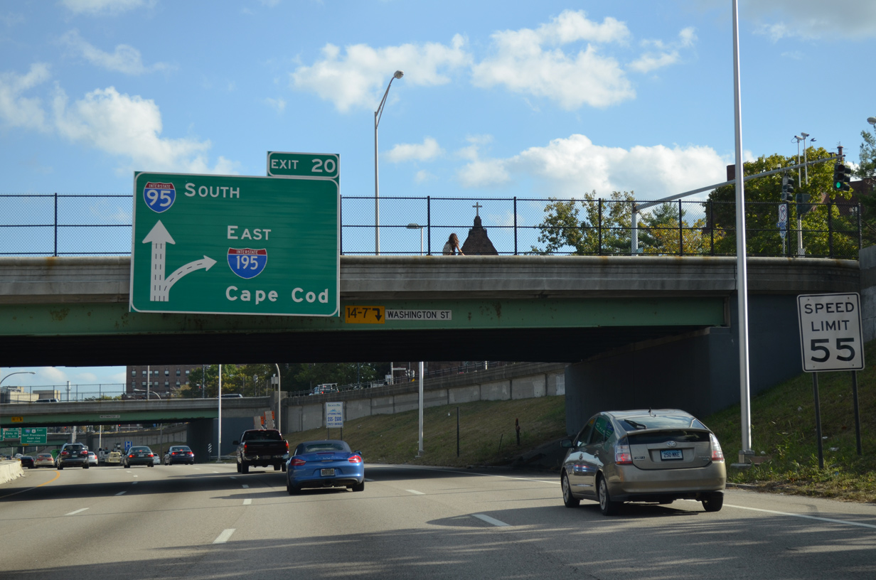
Another improvement of the Iway project was the relocation of Exit 20 from a left side departure of I-95 south to the right. U.S. 6 otherwise joins Interstate 195 east to Exit 8 (Warren Avenue) and parallels the freeway through Fall River, New Bedford and Wareham, Massachusetts.
10/06/14
U.S. 1 (Broad Street) passes overhead as Exit 20 separates from Interstate 95 south for the continuation of U.S. 6 east onto Interstate 195.
Additional work during the IWay project involved construction of a new Friendship Street overpass ahead and the slight relocation of adjacent Franklin Street south to accommodate the new sweeping Exit 20. Additional work relocated the Eddy Street off-ramp (Exit 19) to the north with new access to Borden Street at Rhode Island Hospital.
10/06/14
References:
- Pawtucket 550 Bridge, Turino Group.
- "Rhode Island DOT Wins Award for Bridge Design." TSP2 Bridge PreservationTSP2 Bridge Preservation (AASHTO), January 10, 2014.
- Rhode Island Route 246. Wikipedia.org.
Photo Credits:
- AARoads: 07/28/07
- ABRoads: 10/06/14
Connect with:
Page Updated Tuesday February 24, 2015.