
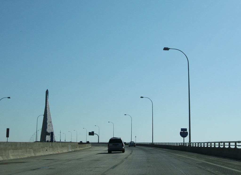
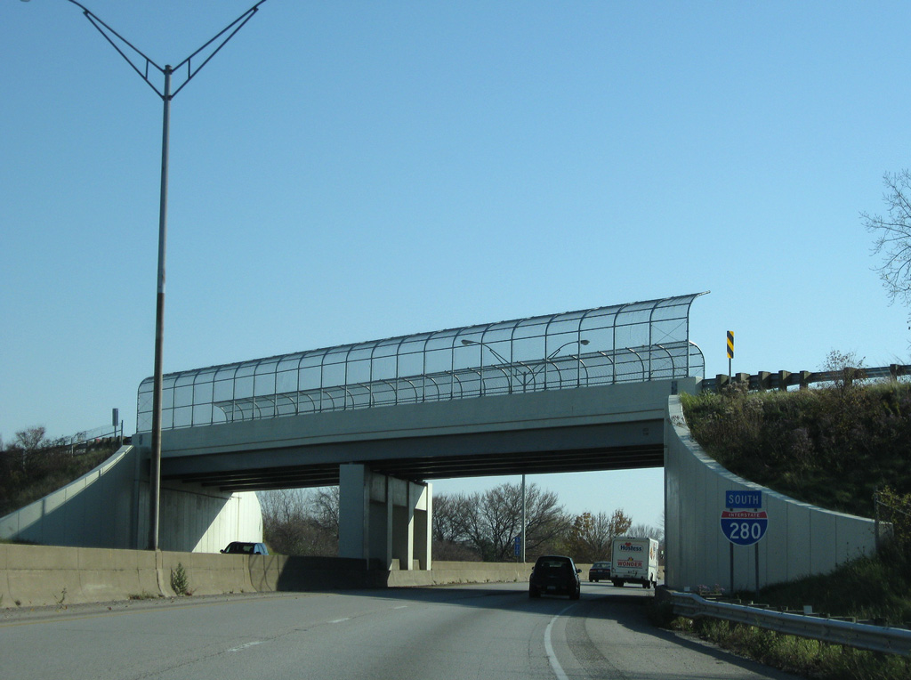
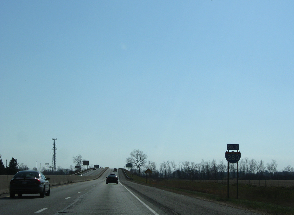
Interstate 280 South

 South
South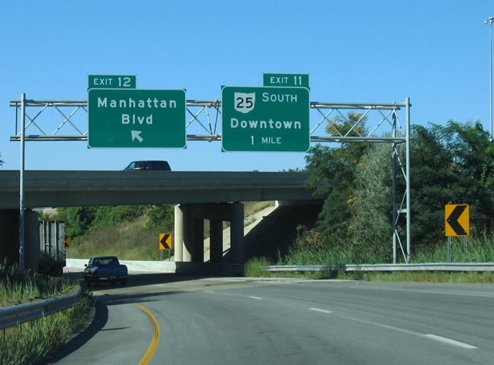
The exit from I-75 south to I-280 includes a ramp to Manhattan Boulevard. The exchange joining I-75/280 was reconfigured as part of the Veterans's Glass City Skyway bridge project.
09/02/05
09/02/05
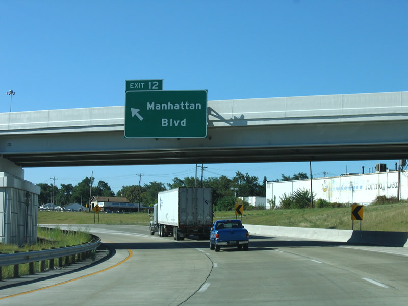
Left Exit 12 departs for Manhattan Boulevard. Manhattan Boulevard parallels I-75 along a 3.6 mile long course from Cherry Street near U.S. 24 to Summit Street at Detwiler Park.
09/02/05
09/02/05
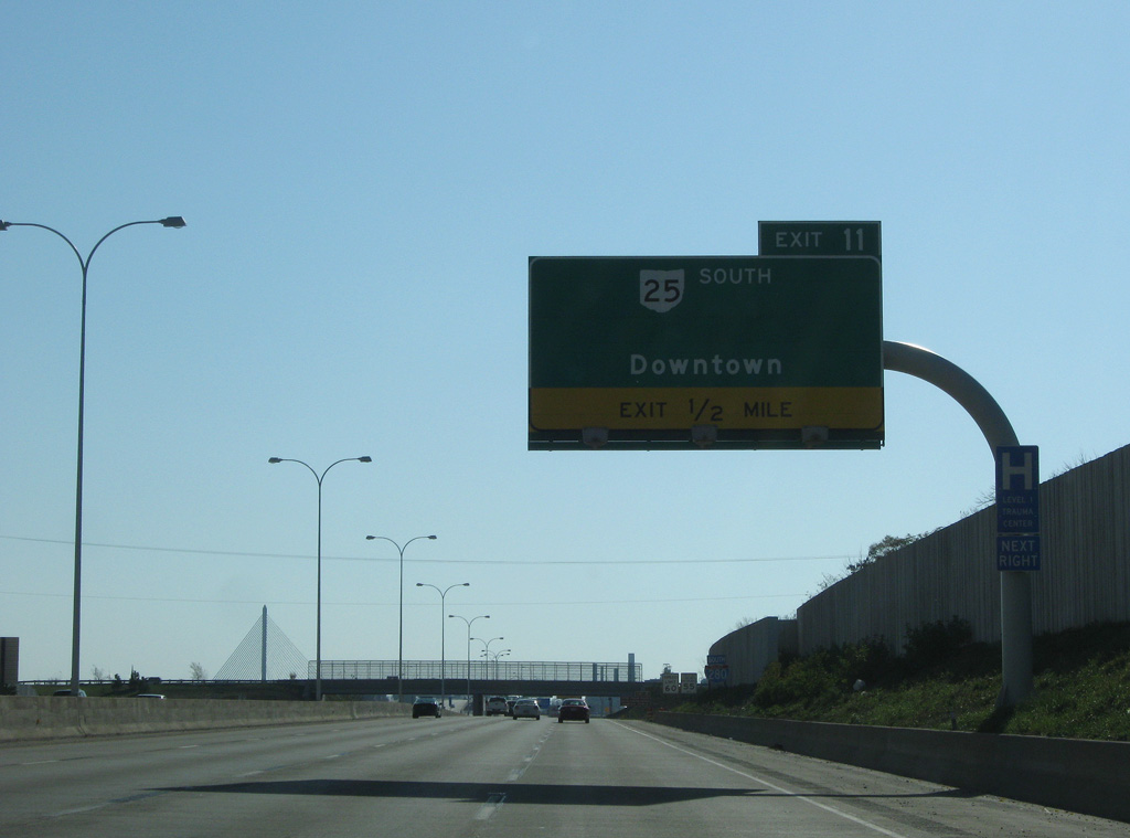
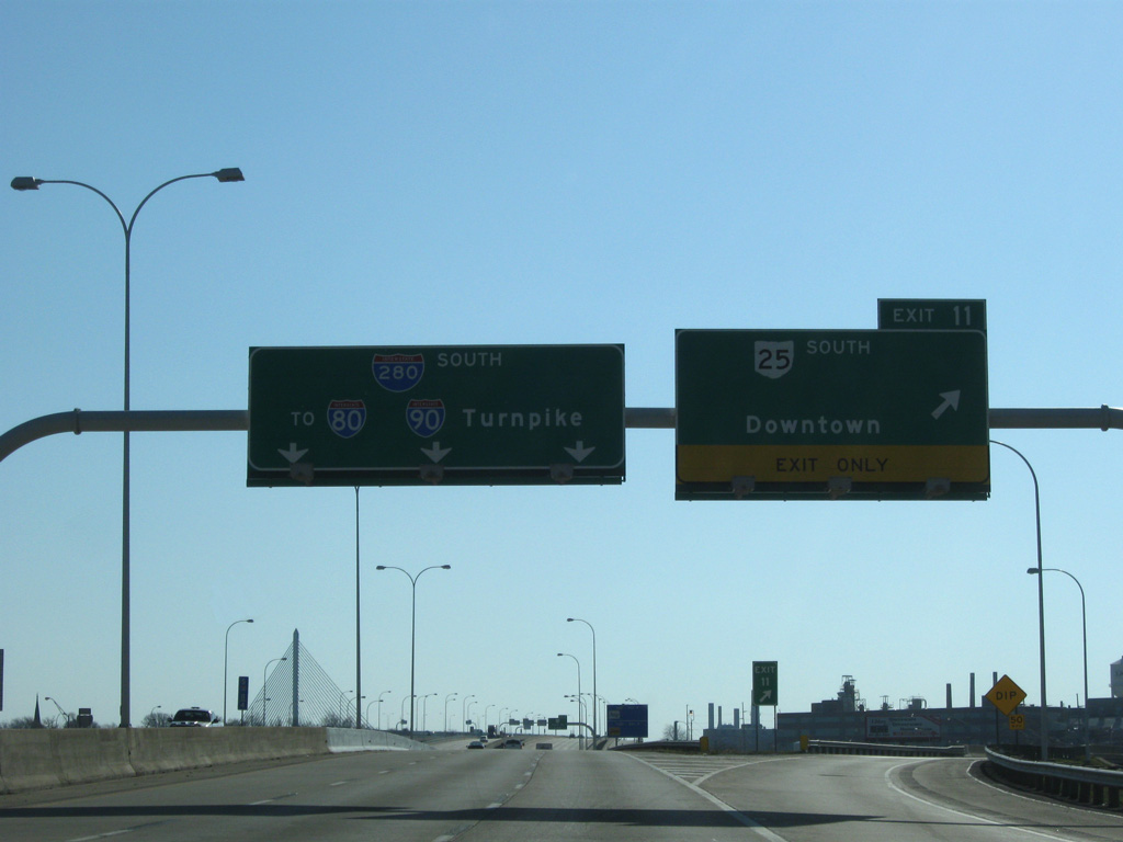
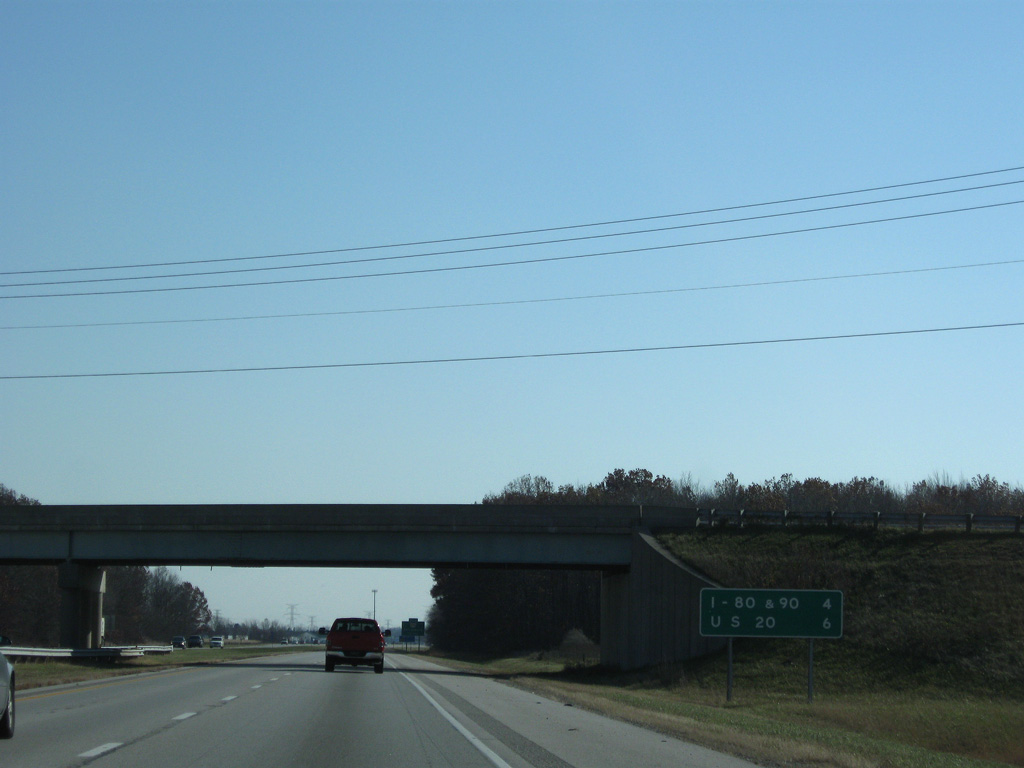
The ramps from I-75 combine a half mile ahead of the parclo interchange (Exit 11) with SR 25 (Greenbelt Parkway) south.
11/07/09
11/07/09
A diamond interchange originally connected Interstate 280 with Central Avenue beyond where the first shield is posted.
11/07/09
11/07/09
Greenbelt Parkway leads SR 25 southwest 1.44 miles to SR 120 (Cherry Street) outside Downtown Toledo. The controlled access route was completed in 1999.
11/07/09
11/07/09
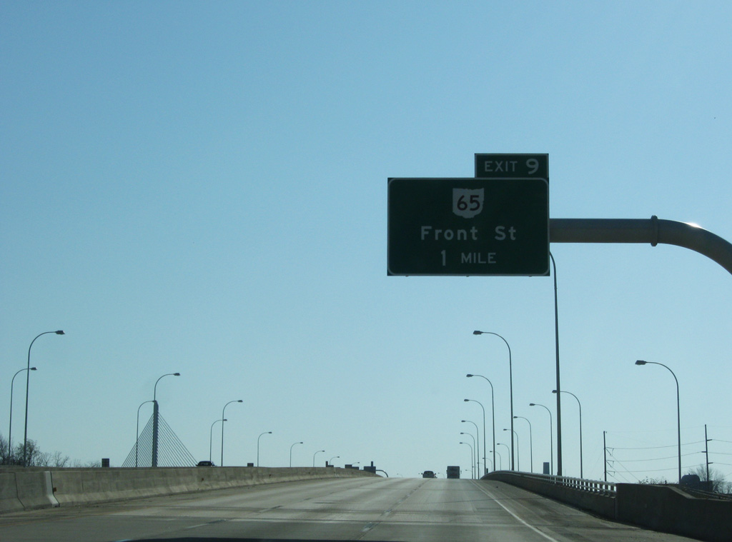
Prior to the completion of the Veterans' Glass City Skyway, Interstate 280 continued south onto the Craig Memorial Bridge. The drawbridge is part of SR 65 between Summit and Front Streets.
11/07/09
11/07/09
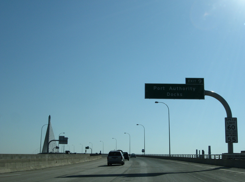
Front Street follows the south banks of the Maumee River between the Toledo Lucas County Port Authority docks area to 1st Street and International Park.
11/07/09
11/07/09
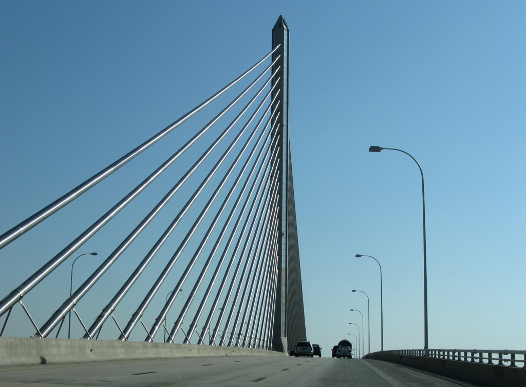
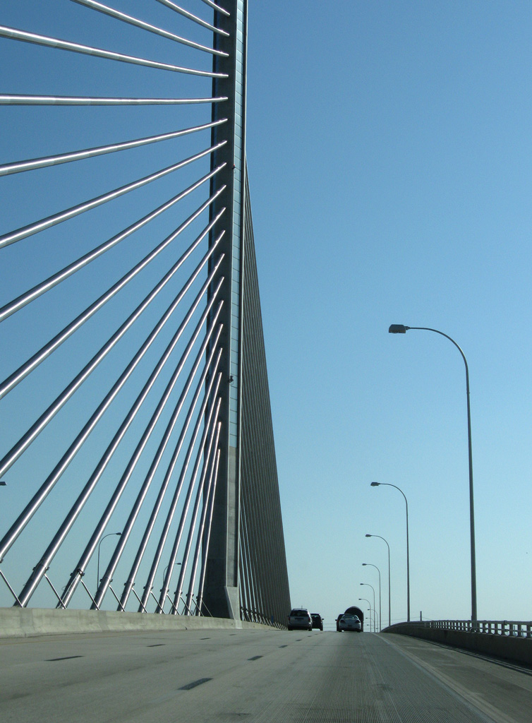
The cable-stayed bridge spanning the Maumee River was constructed at a cost of $237 million from 2002 to 2007. The span opened to traffic on June 24.
11/07/09
11/07/09
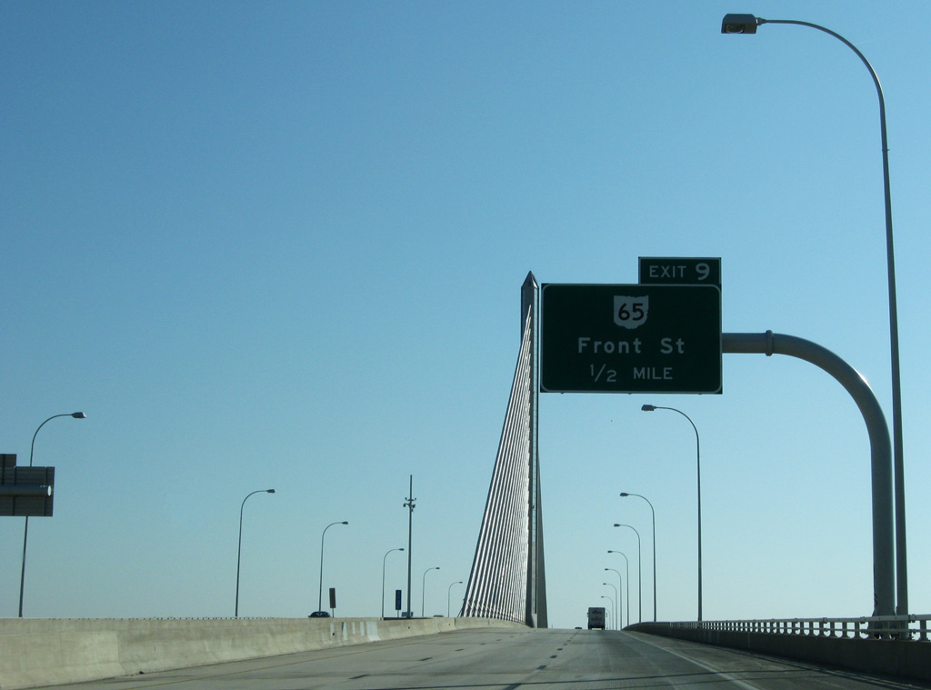
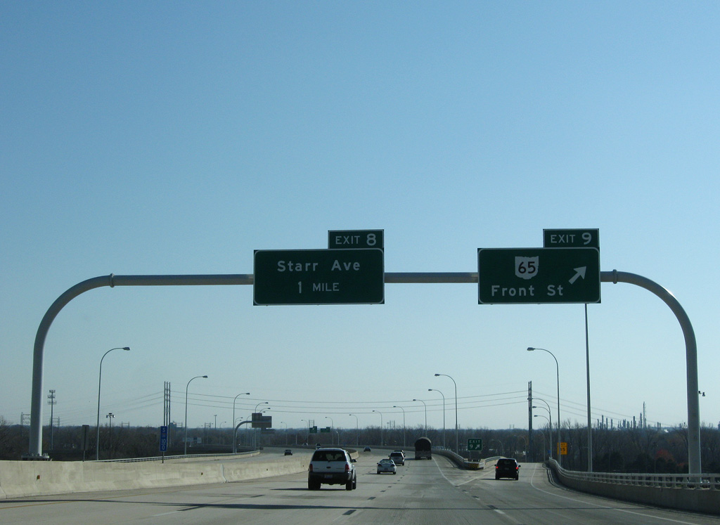
SR 65 commences southbound along the loop ramp (Exit 9) to Front Street.
11/07/09
11/07/09
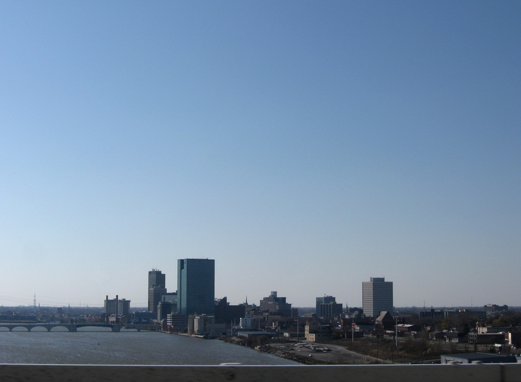
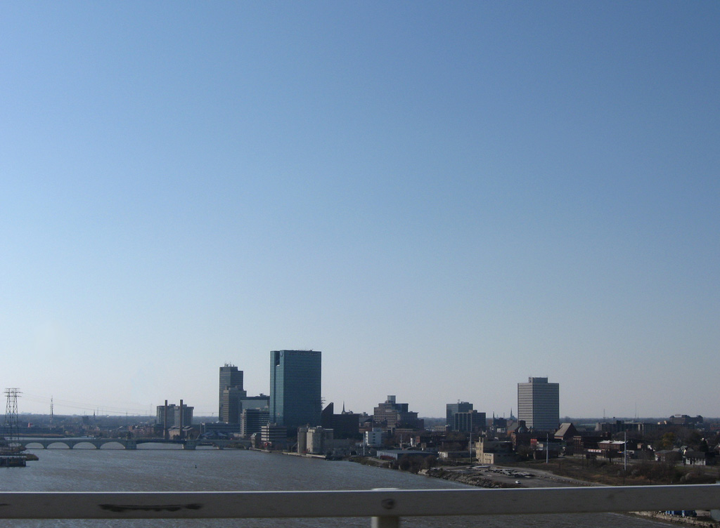
Downtown Toledo to the southwest of I-280.
11/07/09
11/07/09
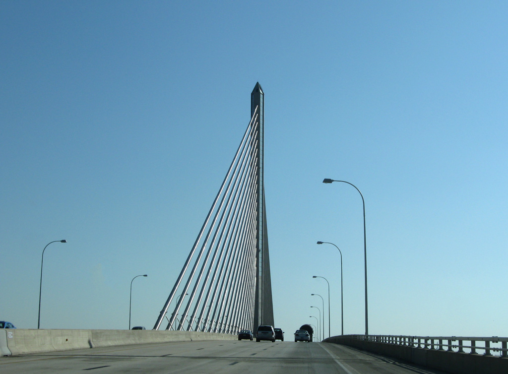
The tower supporting the Veterans' Glass City Skyway is 403 feet high.
11/07/09
11/07/09
11/07/09
11/07/09
11/07/09
SR 65 lines Summit Street southwest from the Craig Memorial Bridge to Downtown Toledo. The state route crosses the Maumee River again to East Toledo on the Anthony Wayne Bridge with SR 2/51.
11/07/09
11/07/09
Continuing south from the Veterans' Glass City Skyway, I-280 advances to a half diamond interchange (Exit 8) with Starr Avenue.
11/07/09
11/07/09
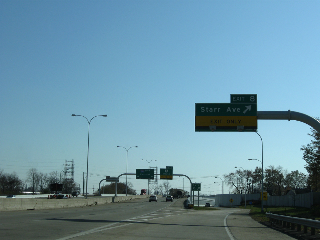
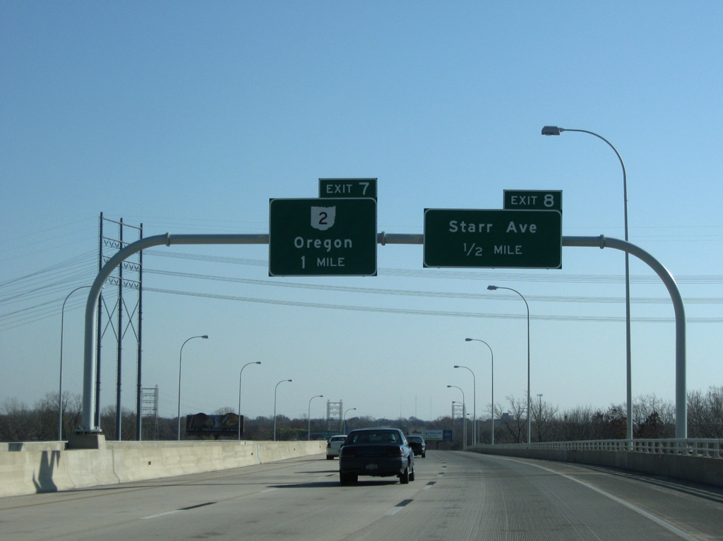
Starr Avenue heads 1.4 miles west from Exit 8 to Oak Street in East Toledo. East from I-280, Starr Avenue continue 3.6 miles through Oregon to Wynn Road at Pearson Metropark.
11/07/09
11/07/09
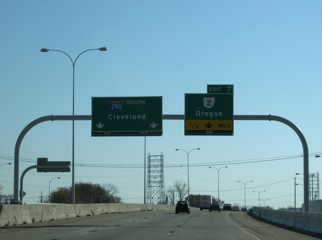
SR 2 (Navarre Avenue) branches east from SR 51 (Woodville Road) 1.4 miles to Interstate 280 at Exit 7.
11/07/09
11/07/09
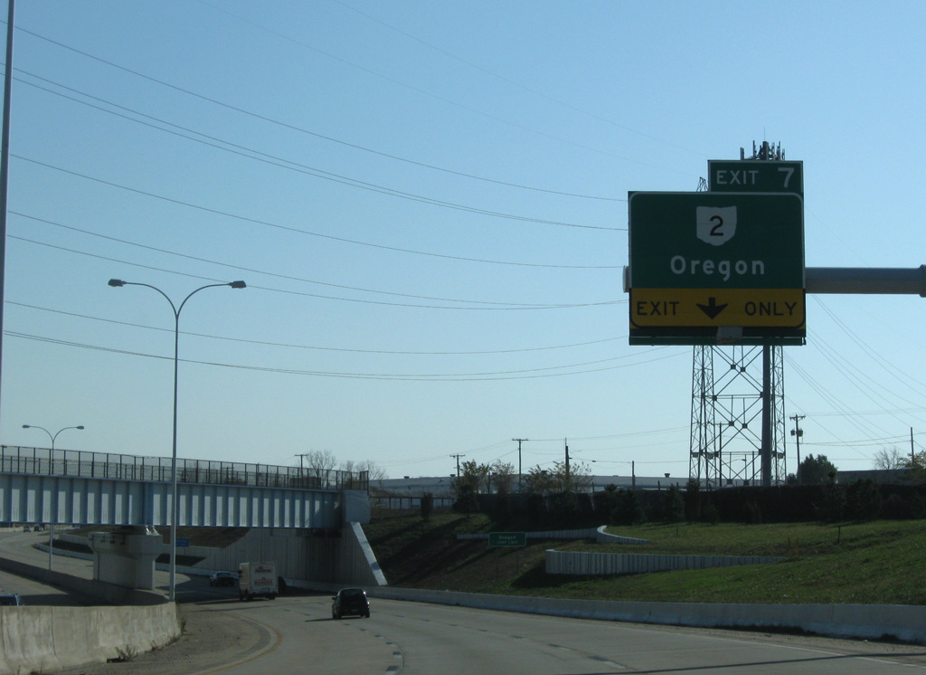
I-280 navigates through an S-curve below a CSX Railroad line into the split diamond interchange (Exit 7) with SR 2 (Navarre Avenue) and Wheeling Street.
11/07/09
11/07/09
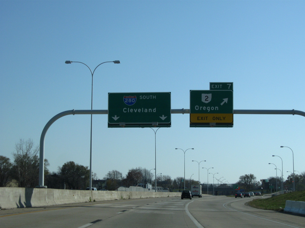
SR 2 (Navarre Avenue) heads west with SR 51 (Woodville Road) across the Maumee River to the Middle Grounds in Toledo. SR 2 east joins Oregon with Bono and Port Clinton on Lake Erie.
11/07/09
11/07/09

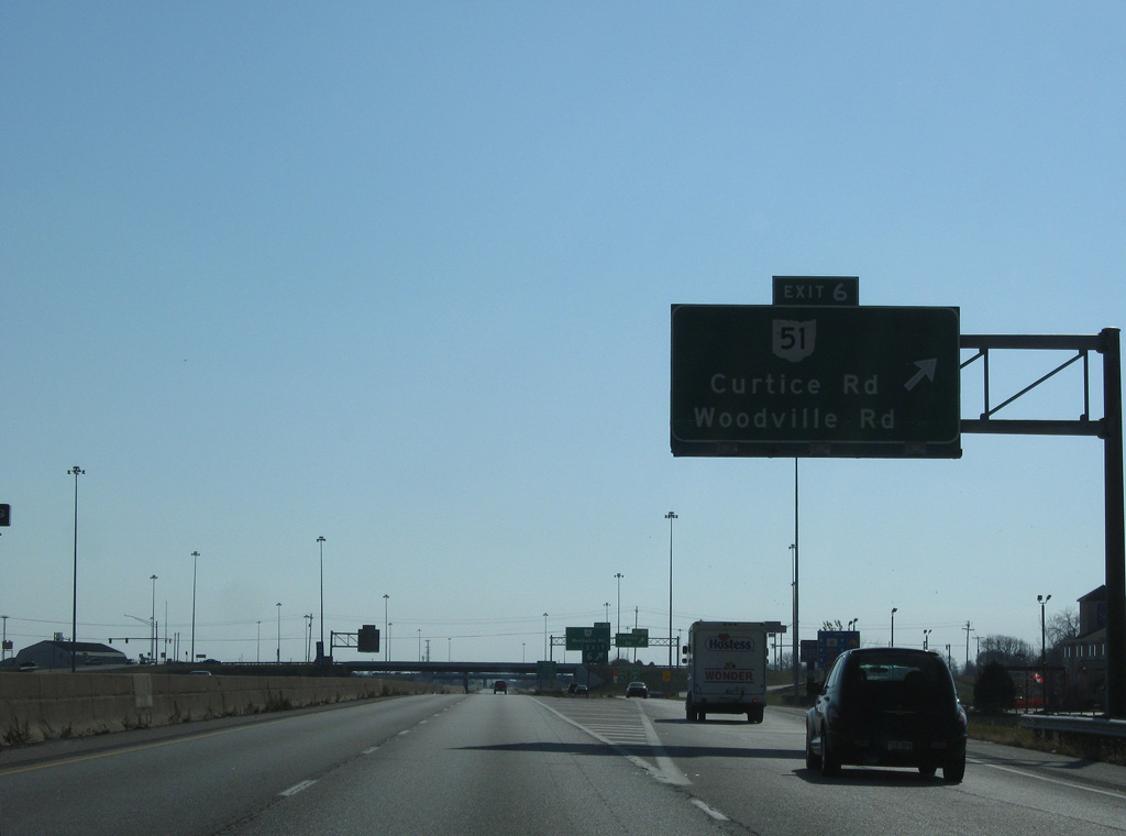
SR 51 (Woodville Road) angles 2.8 miles southeast from SR 2 (Navarre Avenue) to Interstate 280 at Exit 6.
11/07/09
11/07/09
Southbound Interstate 280 reassurance marker posted at the Pickle Road overpass.
11/07/09
11/07/09
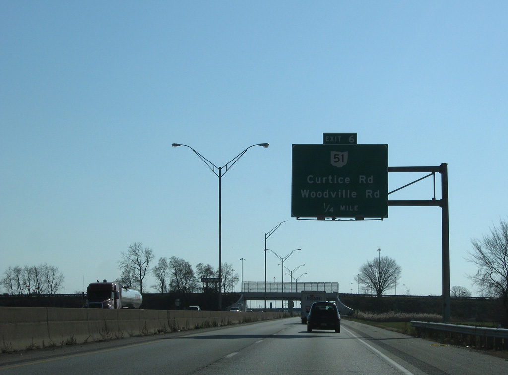
Exit 6 serves both SR 51 (Woodville Road) and nearby Curtice Road in north Norwood. Distributor roadways join the two exchanges.
11/07/09
11/07/09
11/07/09

Curtice Road stems east from Wheeling Street six miles to the community of Curtice.
11/07/09
11/07/09
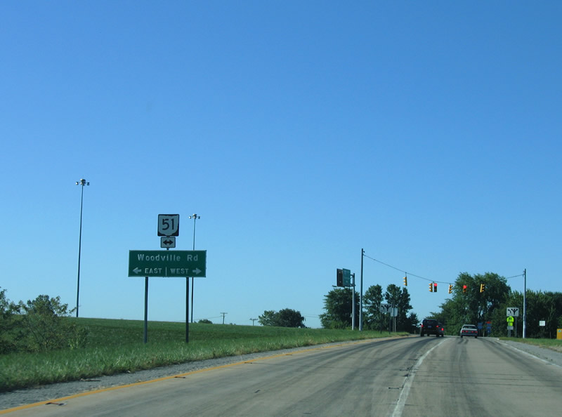
SR 51 travels northwest from Norwood and Oregon to Downtown Toledo and Sylvania. Southeast from I-280, SR 51 heads to Genoa, Elmore and the Ohio Turnpike at Exit 81.
09/02/05
09/02/05
11/07/09
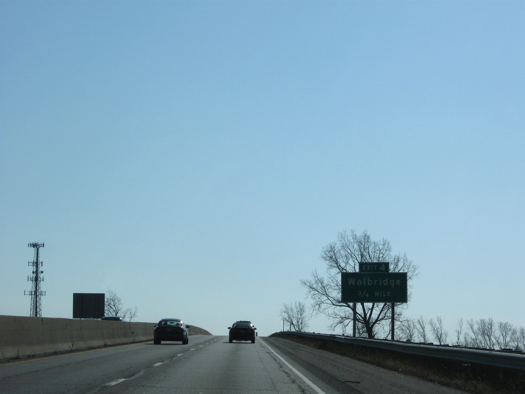
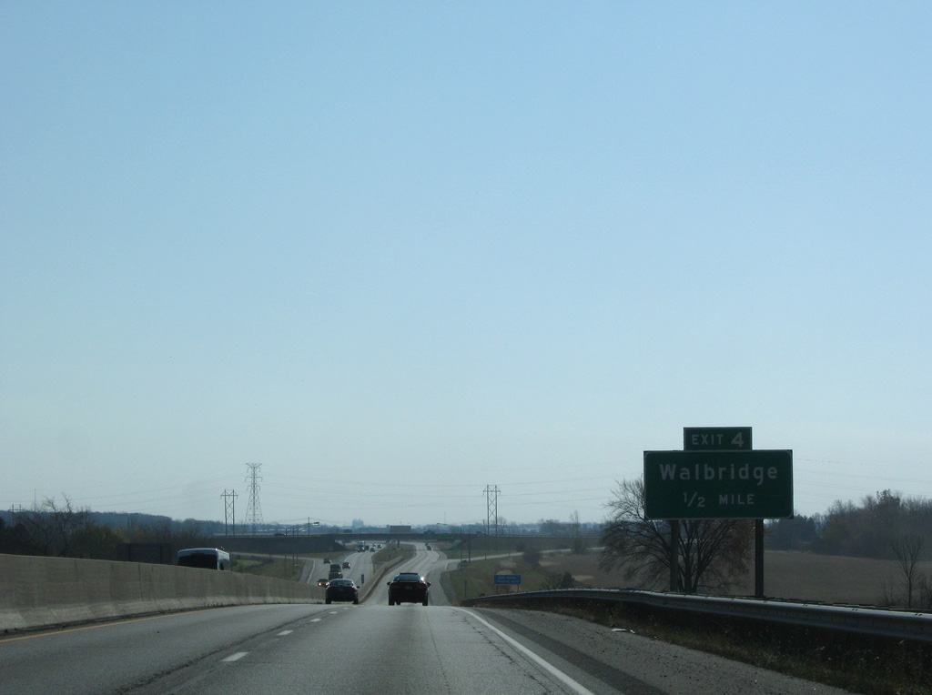
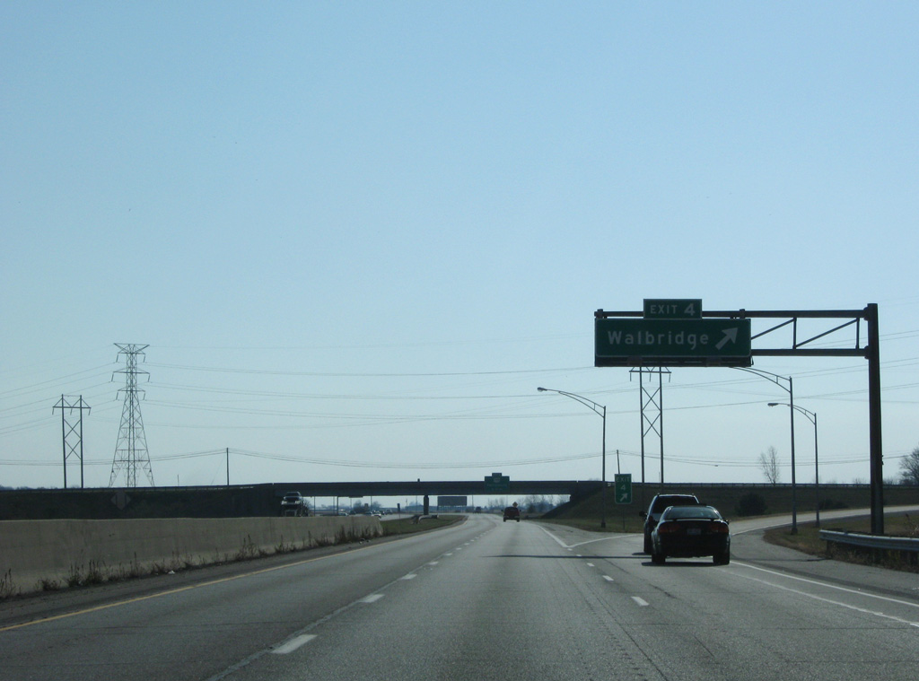
I-280 progresses south from the city of Norwood to the village of Walbridge at Exit 4.
11/07/09
11/07/09
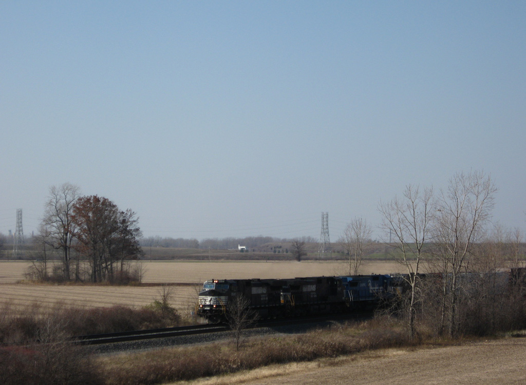
Interstate 280 spans a Norfolk Southern Railroad line a half mile north of the diamond interchange at Exit 4.
11/07/09
11/07/09
The Norfolk Southern Railroad line leads northwest into Toledo and southeast to Millbury.
11/07/09
11/07/09
Exit 4 links I-280 with Union Street west into Walbridge and Walbridge Road east to Fostoria Road through Lake Township.
11/07/09
11/07/09
11/07/09
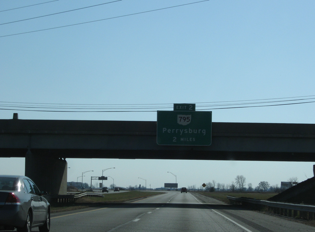
Interstate 280 curves eastward two miles from Walbridge to Exit 2 for SR 795 (Moline-Martin Road).
11/07/09
11/07/09
11/07/09
11/07/09
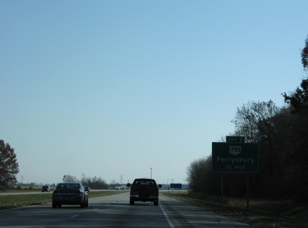
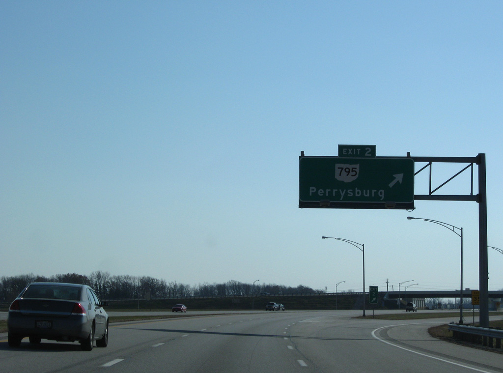
SR 795 runs 6.7 miles west to I-75 (Exit 195) and 9.05 miles to U.S. 20 (Sandusky Street) and SR 199 (Louisiana Avenue) in Perrysburg.
11/07/09
11/07/09
SR 795 concludes 3.15 miles to the east of I-280 at SR 51 beyond the village of Millbury.
11/07/09
11/07/09
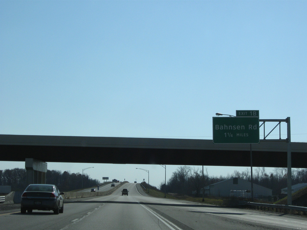
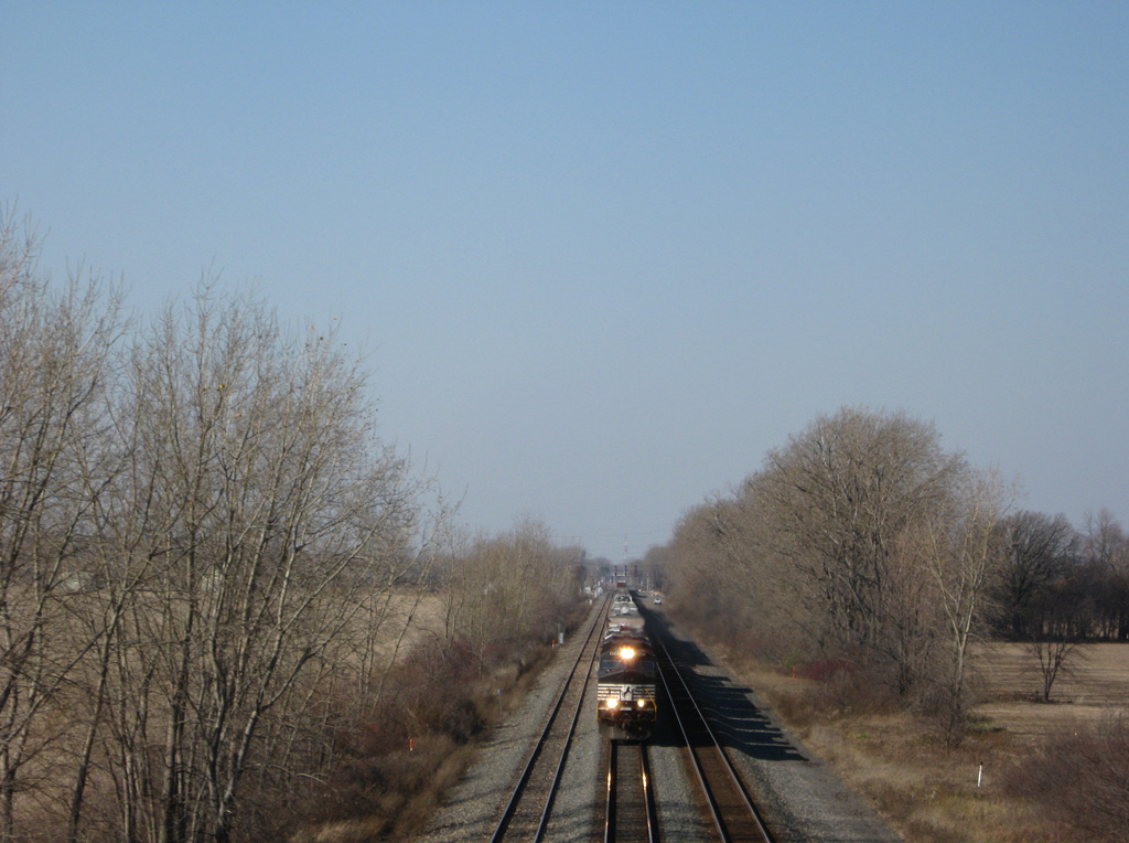
Interstate 280 elevates across a CSX Railroad line south of SR 795 and ahead of the diamond interchange (Exit 1B) with Bahnsen Road.
11/07/09
11/07/09
The expressway along SR 420 extends south from I-280 to U.S. 20/23 in four miles.
11/07/09
11/07/09
Bahnsen Road links I-280 with parallel Baker Drive and Warns Road to Lacha and Hanley Roads, both of which were severed by construction of the Toledo Expressway.
11/07/09
11/07/09

11/07/09

11/07/09
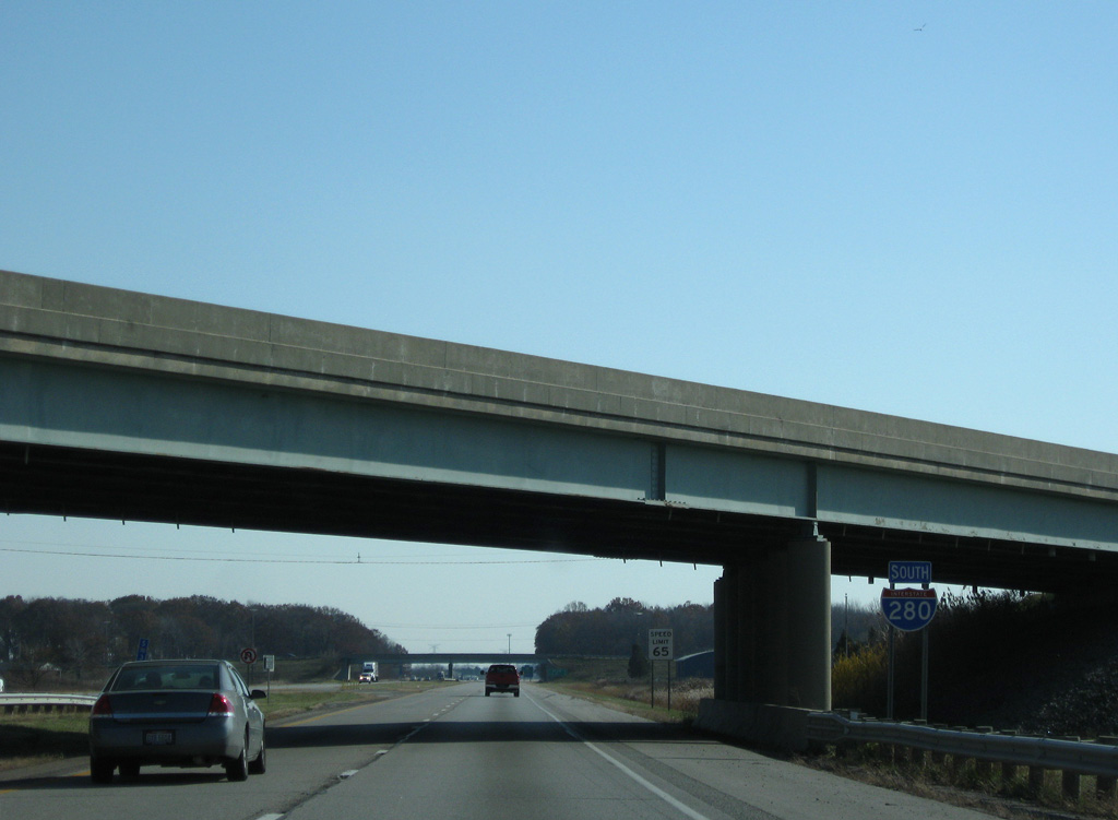
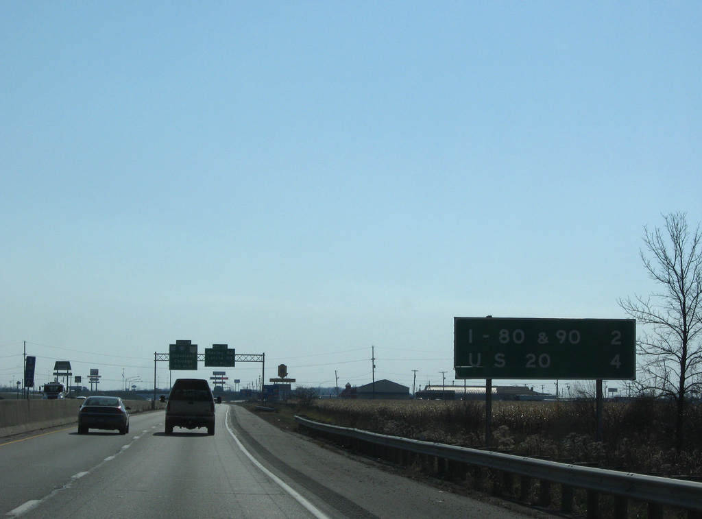
Interstate 280 south ends at Exit 71 along the Ohio Turnpike.
11/07/09
11/07/09

The Ohio Turnpike in conjunction with the Indiana Toll Road and Chicago Skyway lead Interstate 90 west to the city of Chicago.
11/07/09
11/07/09
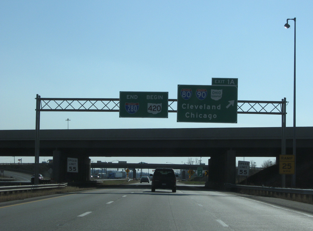
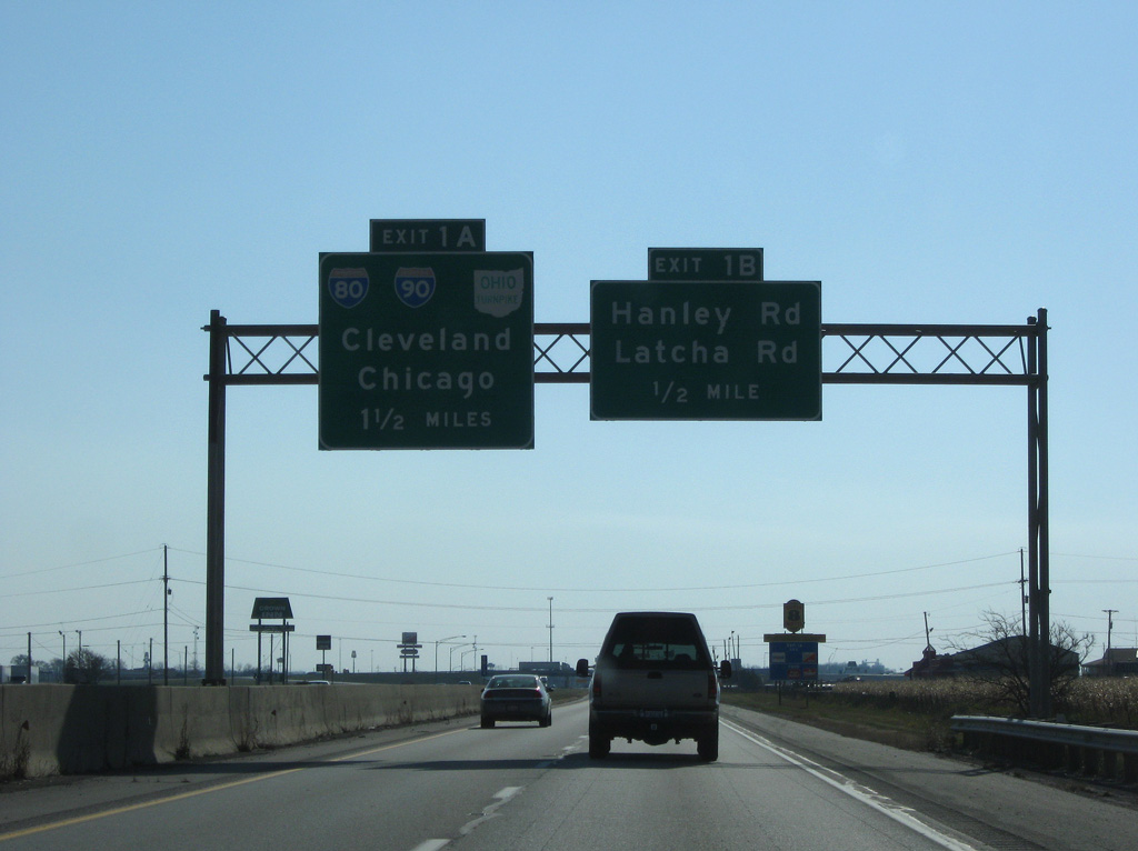
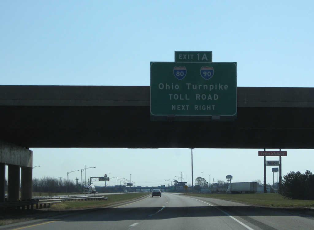
SR 420 travels 2.34 miles south from I-280 and trumpet interchange (Exit 1A) with the Ohio Turnpike access road to U.S. 20/23 at the unincorporated community of Lemoyne.
11/07/09
11/07/09
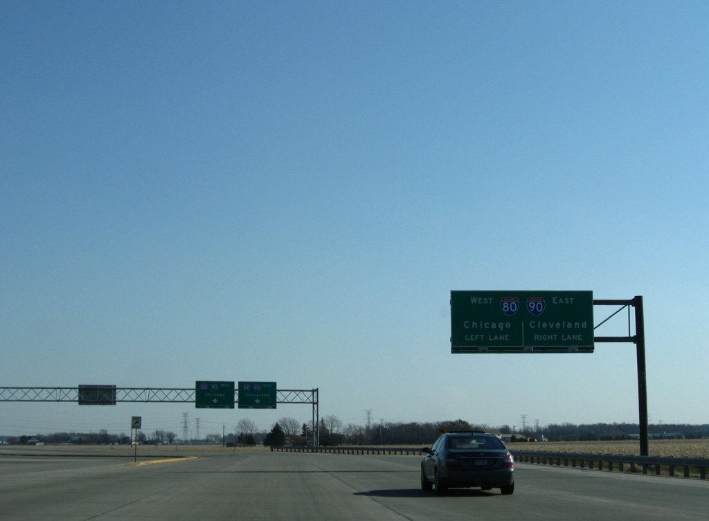
East from I-280, the Ohio Turnpike heads toward Cleveland, with Interstate 90 and several other freeways directly serving the city.
11/07/09
11/07/09

I-80/90 overlap west 208 miles to Lake Station, Indiana and 70 miles east to Elyria.
11/07/09
11/07/09
Photo Credits:
- AARoads: 09/02/05
- ABRoads: 11/07/09
Connect with:
Page Updated Saturday August 07, 2021.