
Interstate 435 Inner - Missouri River to Claycomo
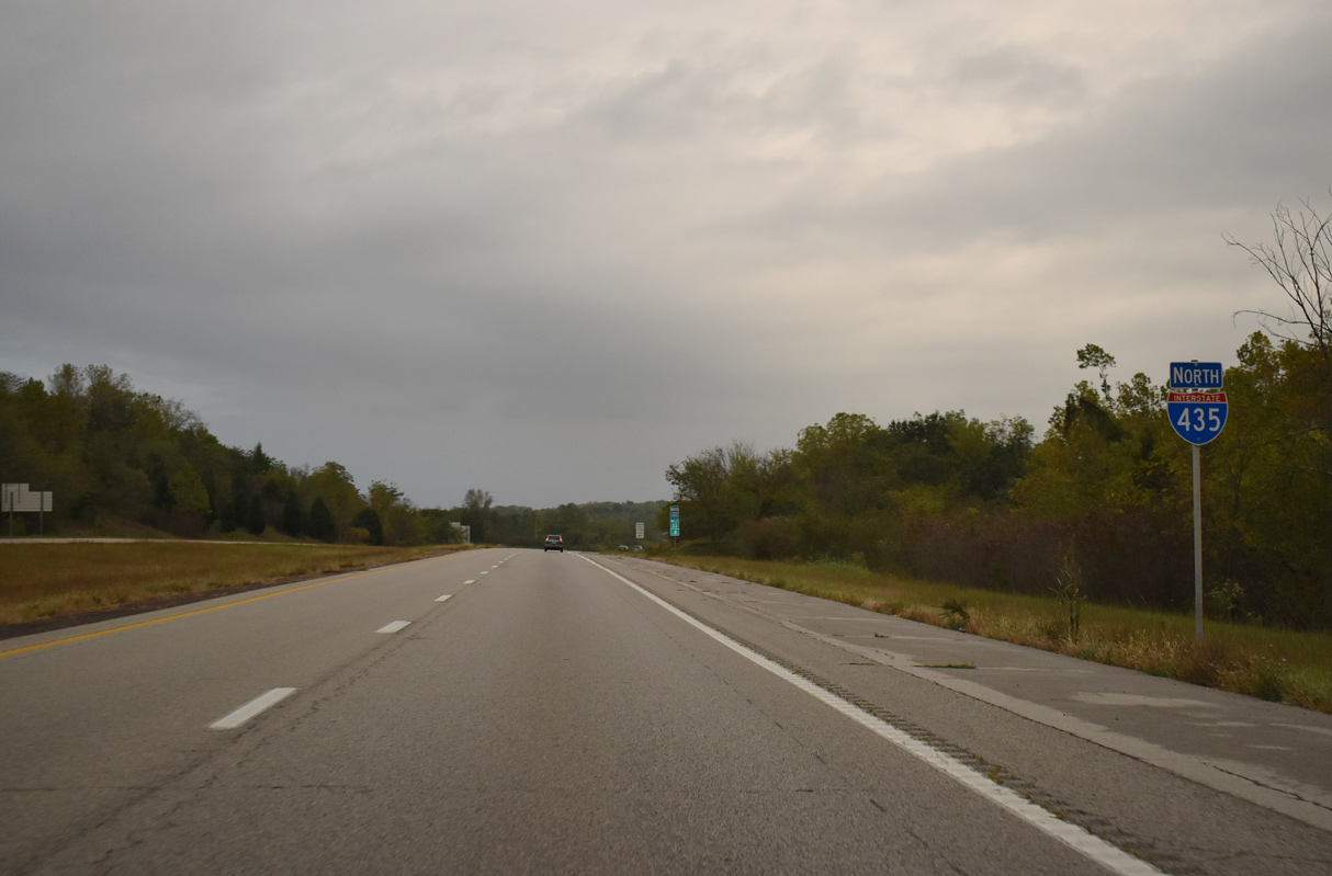
 North
North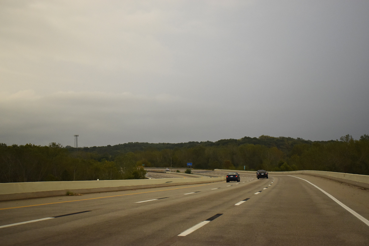
Interstate 435 hooks northward from the Missouri River flood plain to the bluff line by Brush Creek.
10/06/21
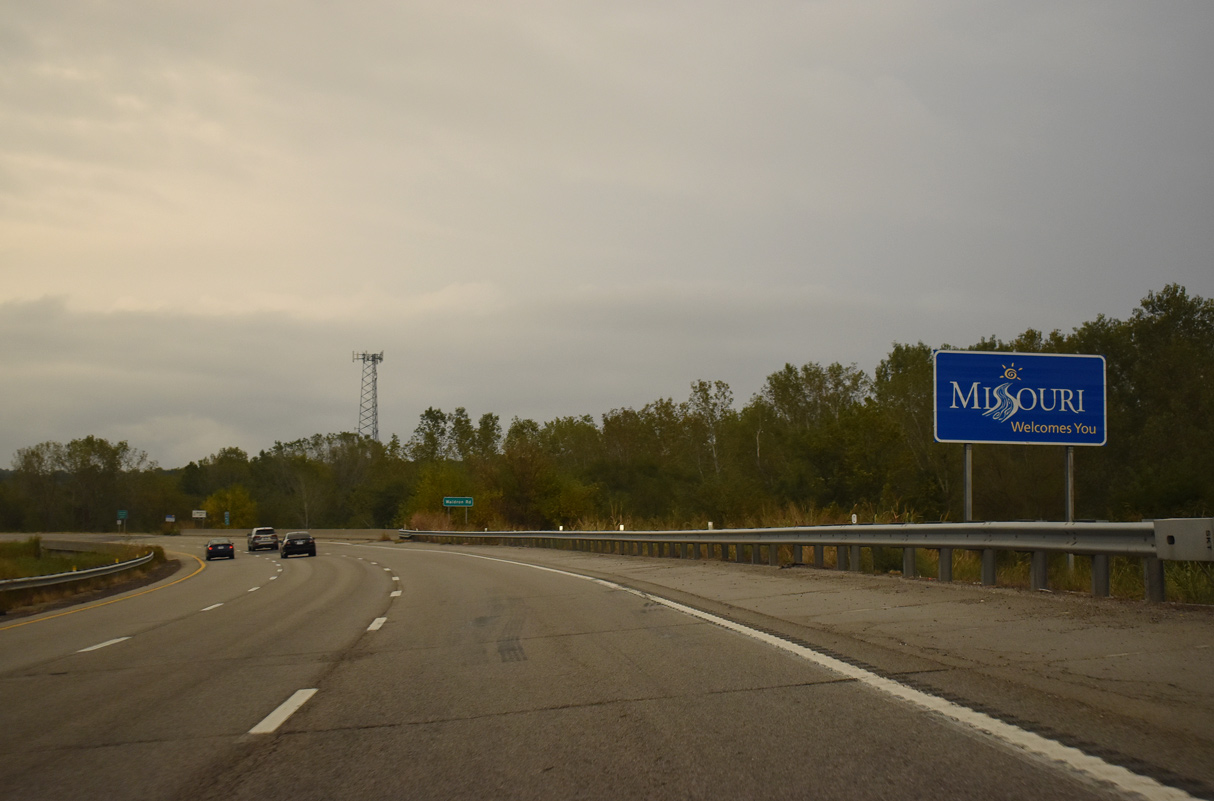
The Missouri welcome sign stands ahead of the Waldron Road and Burlington Northern Railroad underpass.
10/06/21
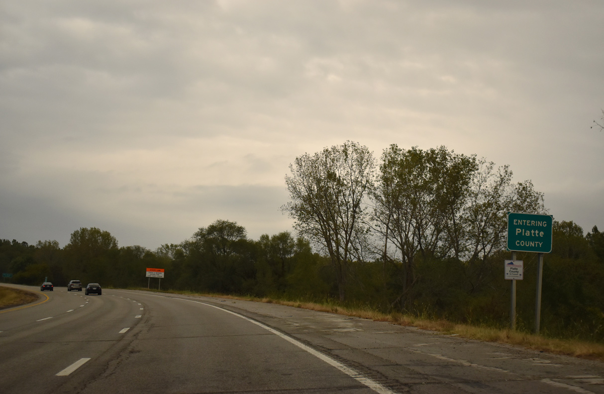
Interstate 435 leads north along Brush Creek through a mixture of rural and suburban areas of Platte County.
10/06/21
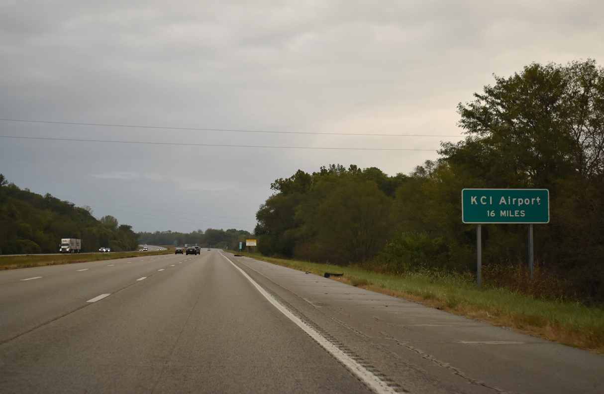
The passenger terminal at Kansas City International Airport (MCI) is 16 miles via I-435 north and I-29 south to Exit 13. Route 152 east to I-29 north is two miles less.
10/06/21
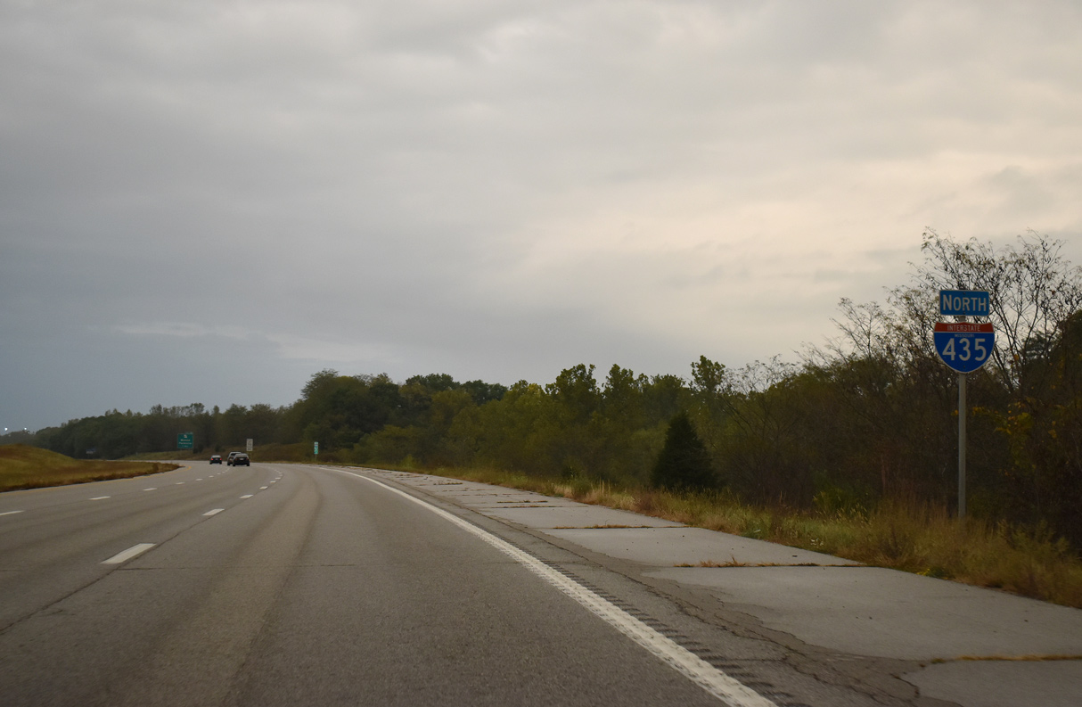
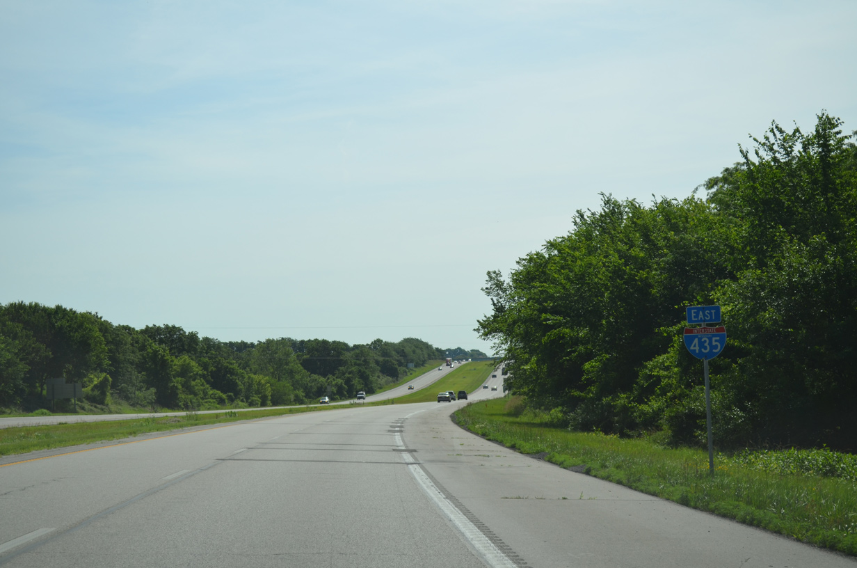
I-435 is signed with north cardinal directions to the overlap with Interstate 29 south.
10/06/21
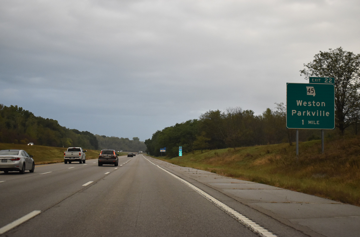
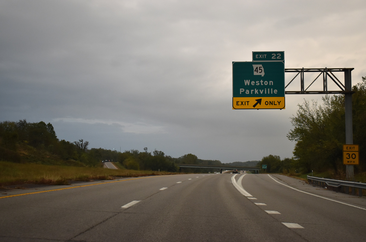
Missouri Route 45 crosses paths with the Kansas City beltway at a diamond interchange (Exit 22) in the city of Parkville.
10/06/21
Traveling 36.93 miles overall, Route 45 originates at Interstate 29 (Exit 5) in Kansas City to the east of Parkville. The state highway takes a rural course northwest to Farley, Weston and U.S. 59 by Lewis and Clark Village.
10/06/21
Progressing north, Interstate 435 remains parallel to Brush Creek through north Parkville.
10/06/21
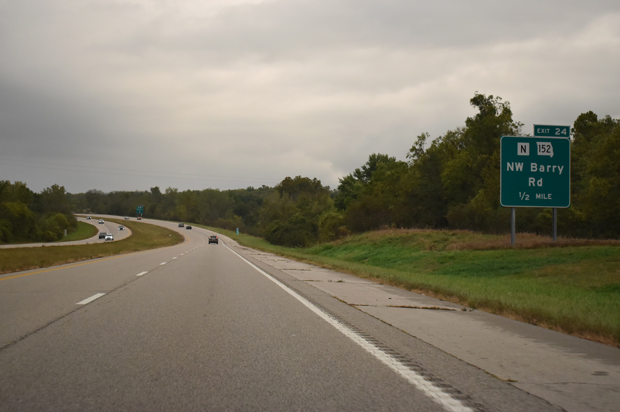
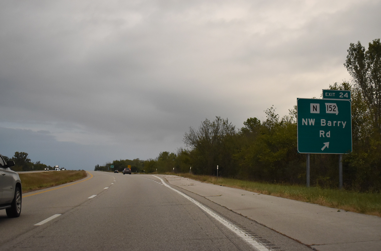
Route 152 west and Highway N south come together at a parclo interchange (Exit 24) with I-435 in one mile.
10/06/21
Beginning at Exit 24, Route 152 extends east as a freeway to meet Interstate 435 again at the Shoal Creek area of Kansas City. The alignment replaced Barry Road, which parallels the state highway to the south as an arterial route.
10/06/21
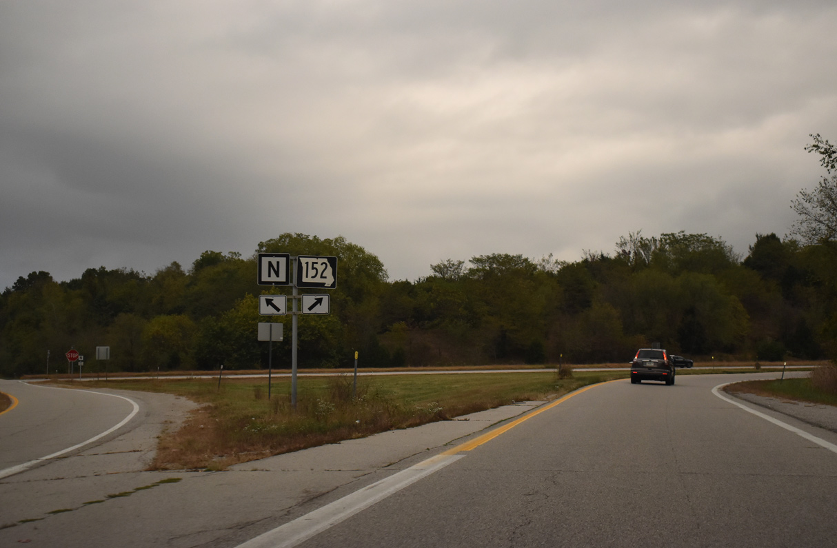
Highway N parallels the beltway north for 5.45 miles to Highway D. Highway N formerly extended southeast along Naylor Road and NW 76th Street before construction of I-435 severed the route.
10/06/21

Interstate 435 bends northwesterly across Naylor Creek before shifting eastward ahead of Sand Branch.
06/19/15
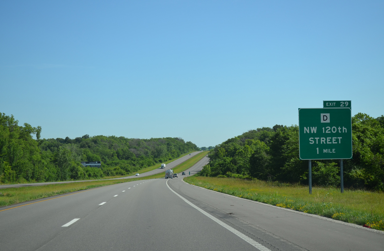
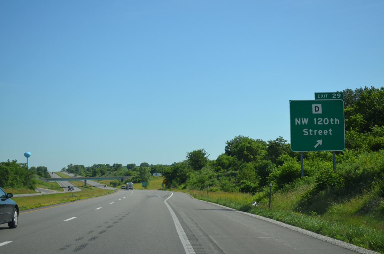
The northbound freeway straddles the Kansas City line to the forthcoming diamond interchange (Exit 29) with Highway D west and 120th Street.
06/19/15
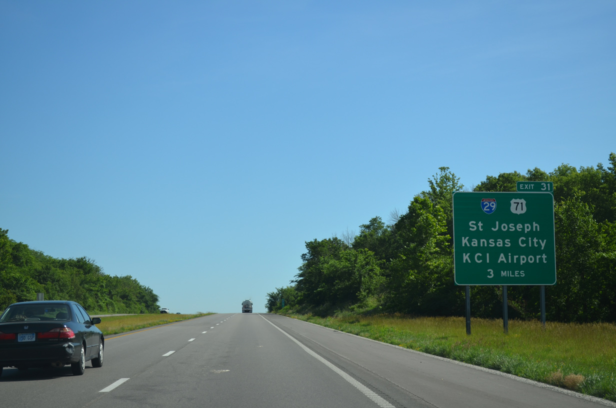
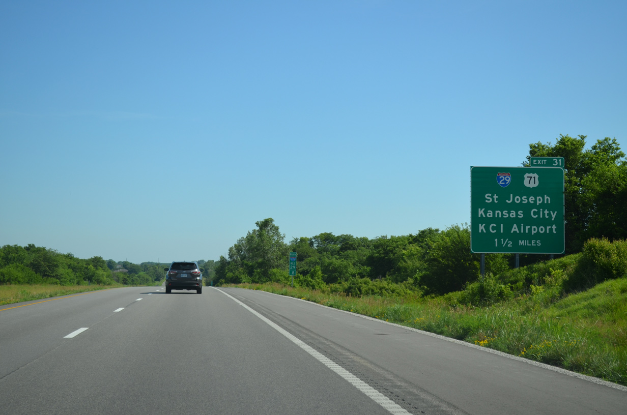
Interstate 435 continues beyond Highway D to combine with I-29/U.S. 71 south to Kansas City International Airport (MCI) at Platte City and Exit 31.
06/19/15
The western segment of Highway D travels just 1.93 miles between Highway N and the adjacent intersection of NW 120th Street and Brightwell Road. The eastern segment lies due east of Kansas City International Airport (MCI).
06/19/15
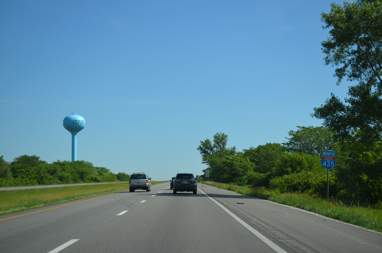
Interstate 435 remains along the Kansas City line north to NW 136th Street.
06/19/15
A number of subdivisions lie just west of the freeway along Running Horse Road as Interstate 435 approaches the semi directional T interchange (Exit 31) with I-29/U.S. 71.
06/19/15
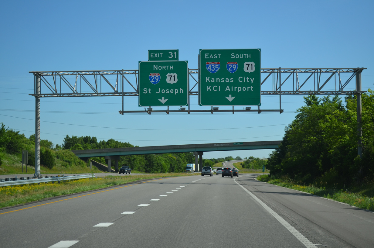
Interstate 29 enters the Kansas City area from St. Joseph, 30 miles to the north. U.S. 71 accompanies the route northward to Savannah, while I-29 parallels the Missouri River to Council Bluffs, Iowa.
06/19/15
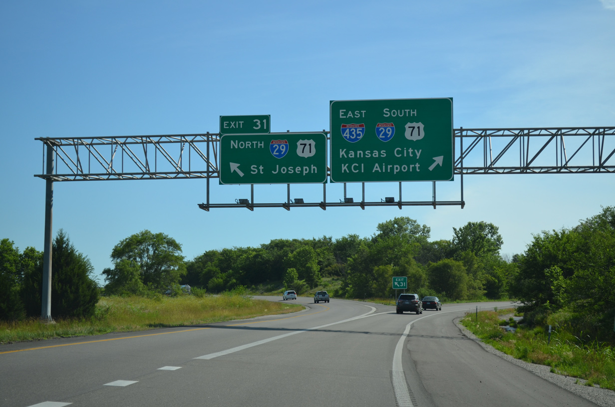
Single lane ramps split for Exit 31 to St. Joseph, Omaha and Sioux Falls, South Dakota and I-29 south / I-435 east to MCI Airport and Kansas City.
06/19/15

 South East
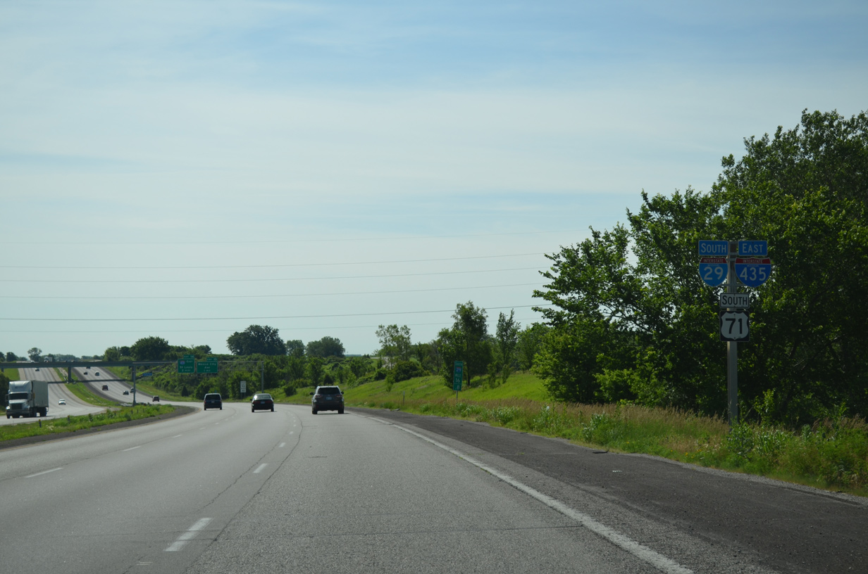
Confirming markers posted for I-29/435-U.S. 71 as the beltway enters the Kansas City limits.
06/19/15
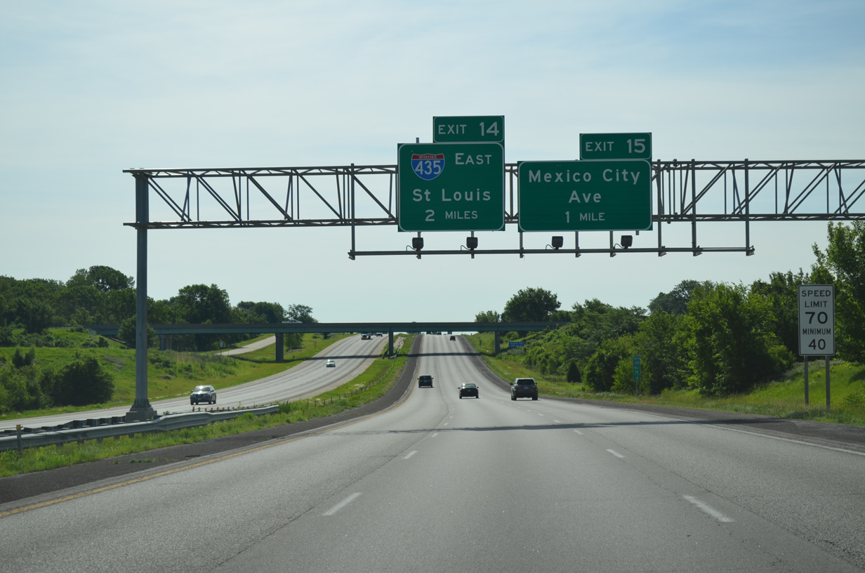
I-29/435 overlap for 2.386 miles headed inbound. The two partition just east of a folded diamond interchange (Exit 15) with Mexico City Avenue.
06/19/15
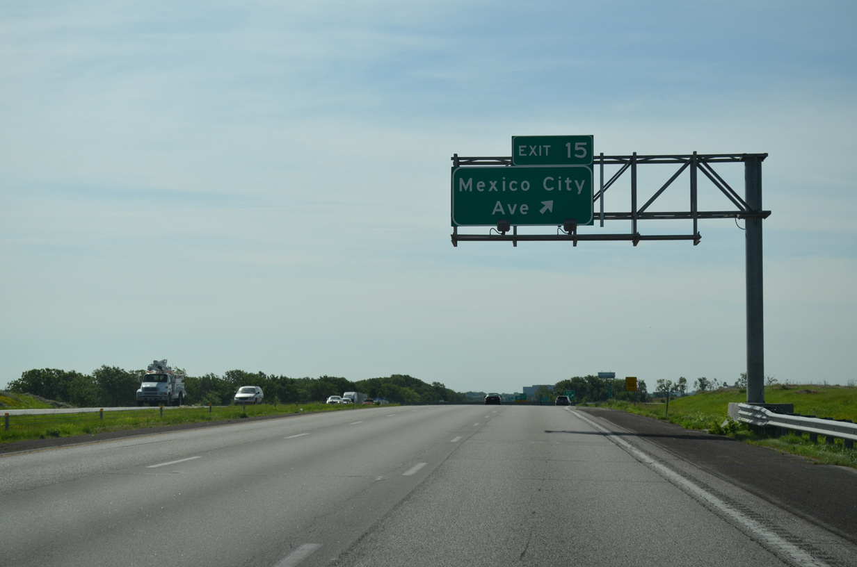
Mexico City Avenue spurs north from Exit 15 to 132nd Avenue and south to the air cargo area of Kansas City International Airport (MCI).
06/19/15
The entrance ramp from Mexico City Avenue adds a fourth southbound lane to the I-29/435 split. I-29 leads south through the Northland of Kansas City to Platte Woods and Riverside.
06/19/15
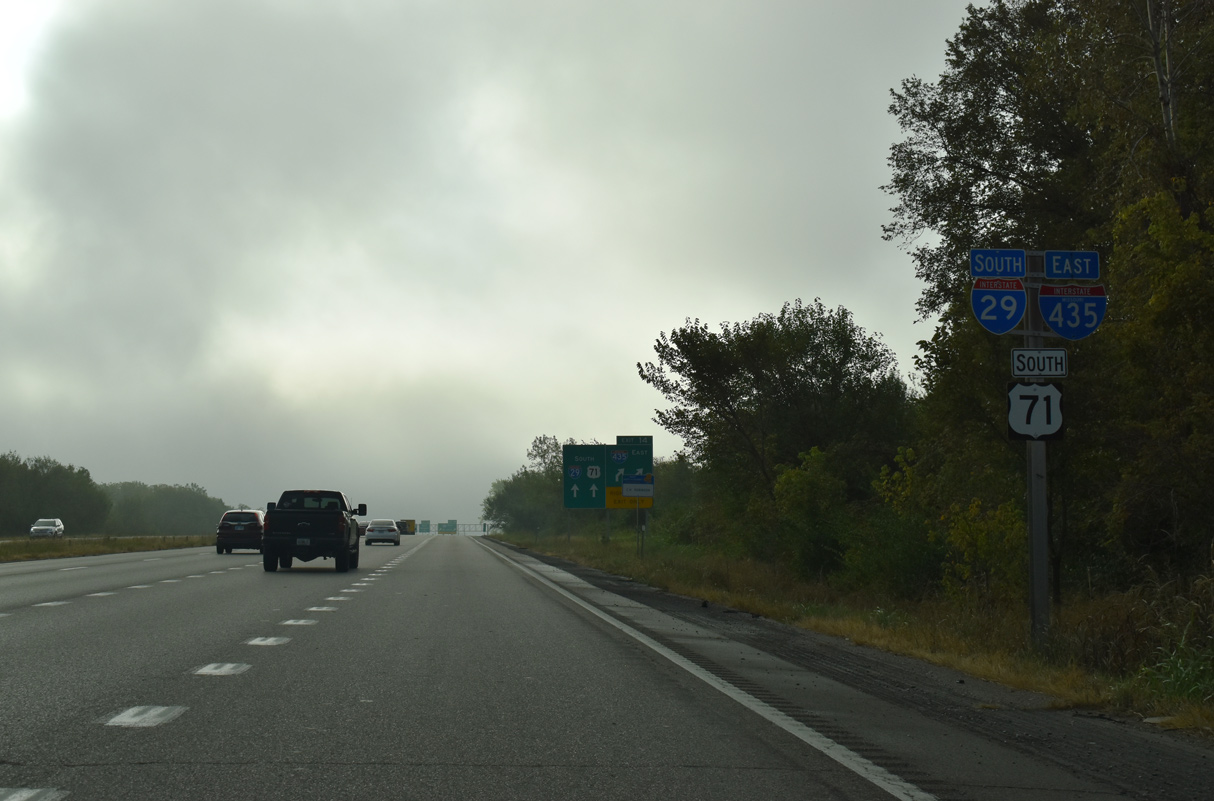
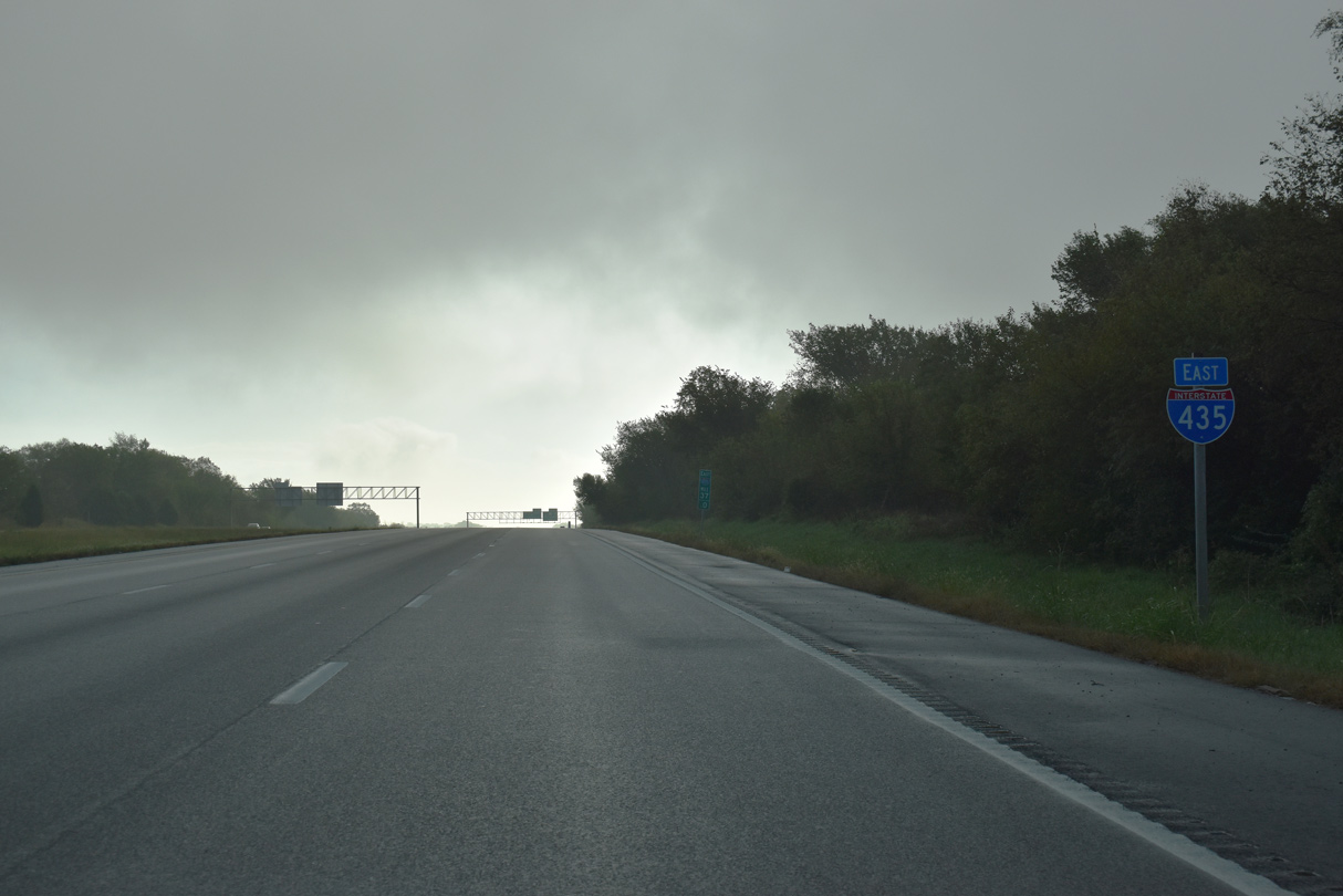
I-29/U.S. 71 remain paired to North Kansas City and Interstate 35. I-435 meets I-35 at Claycomo.
10/07/21
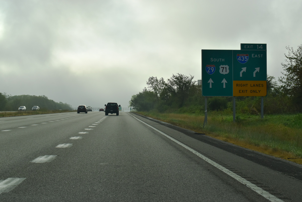
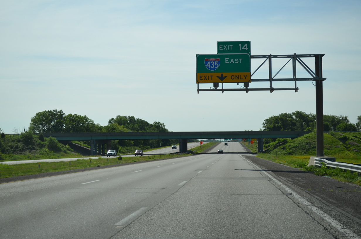
I-29/U.S. 71 turn southeast to the passenger terminal of MCI Airport as I-435 travels east toward Nashua in north Kansas City. Both freeways reduce to four overall lanes beyond their split at Exit 14.
10/07/21
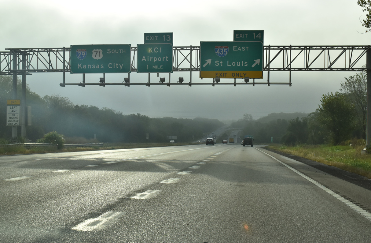
Traffic partitions at a wye interchange (Exit 14) for I-435 east to I-70 for St. Louis and I-29/U.S. 71 south to Downtown Kansas City.
10/07/21
East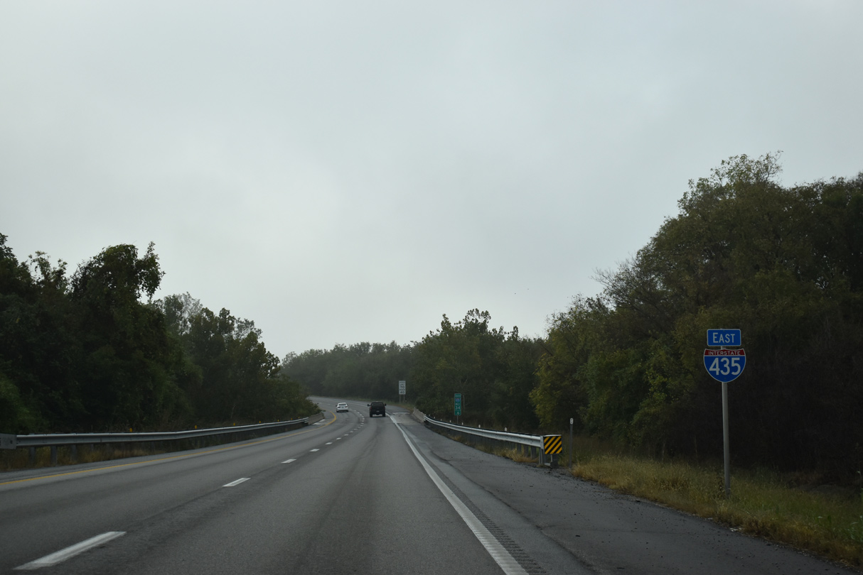
A confirming marker for I-435 east stands ahead of Todd Creek and the Interstate 29 mainline underpass.
10/07/21
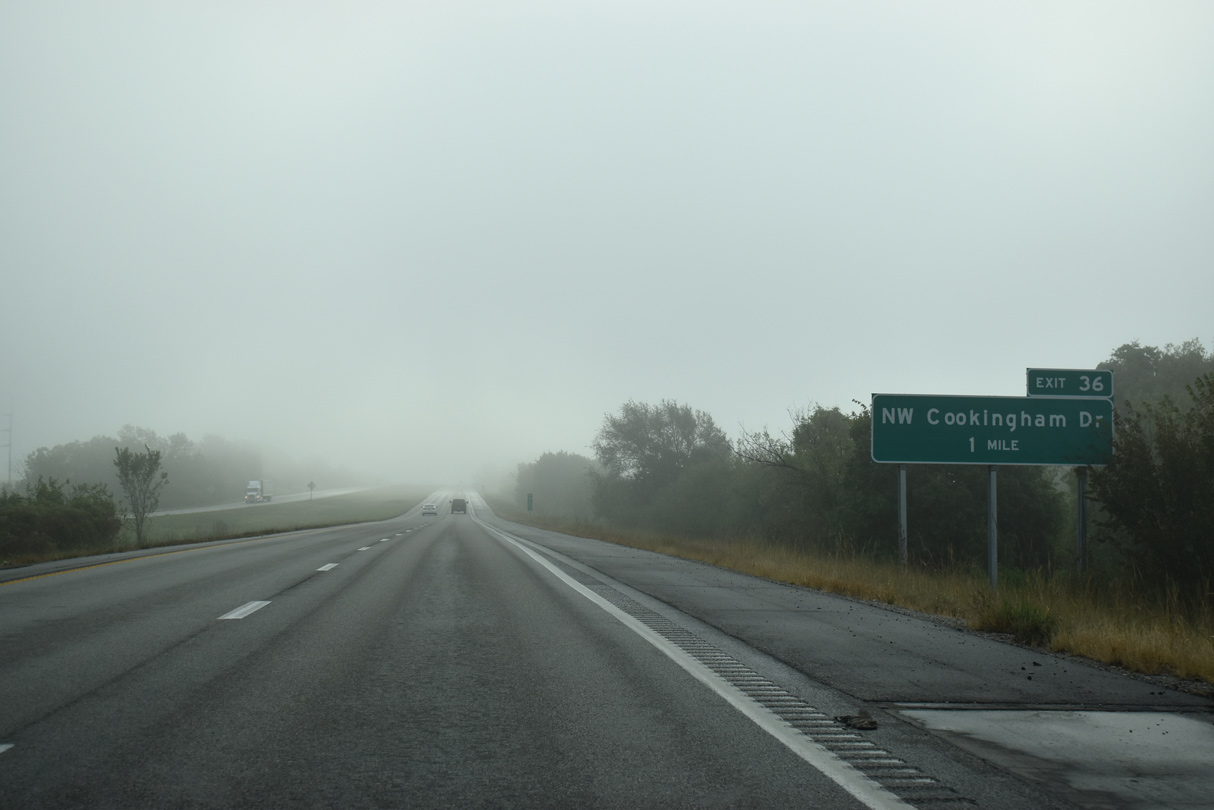
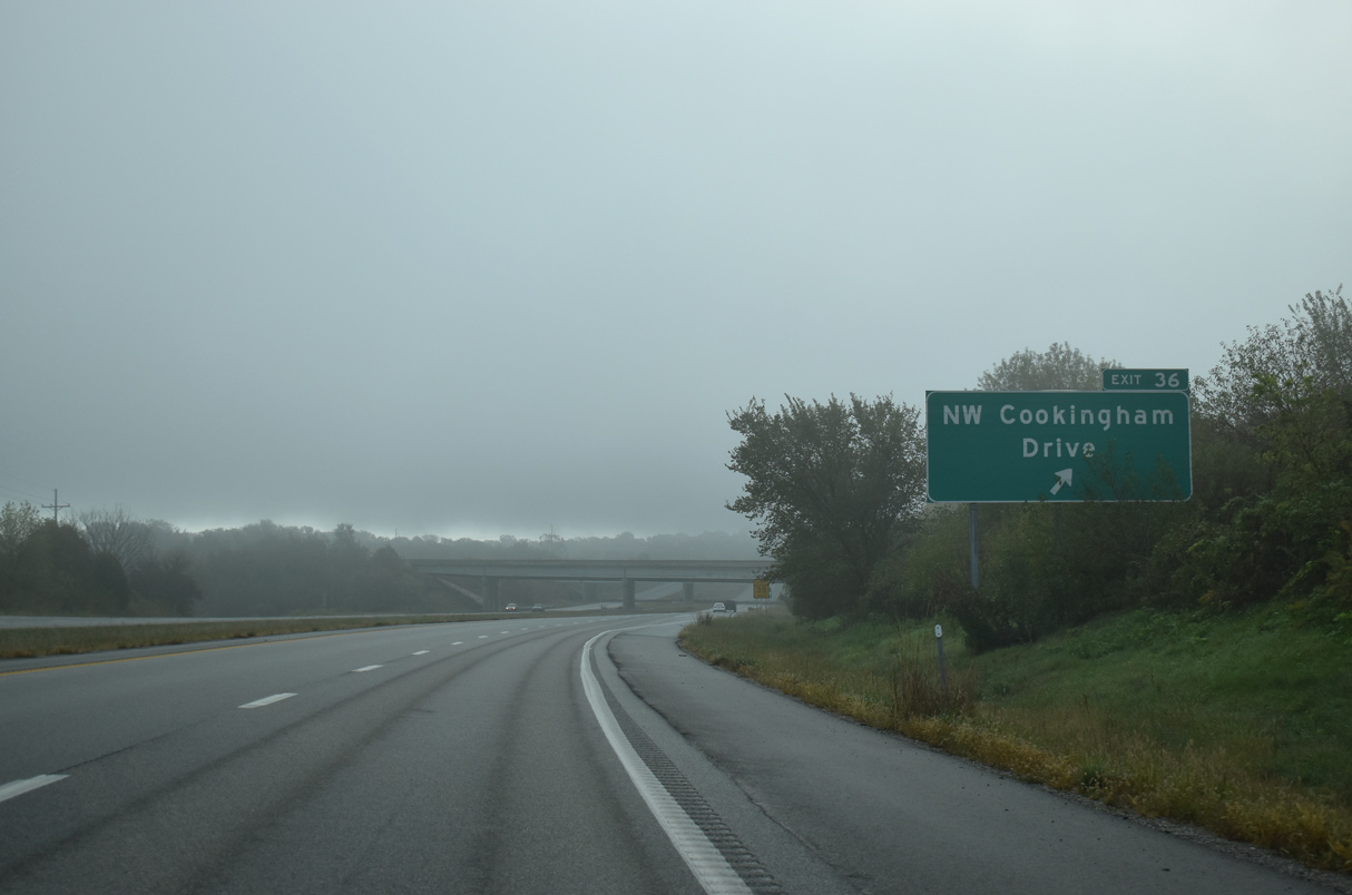
NW Cookingham Drive represents the east branch of Highway D from the access freeway to Kansas City International Airport (MCI) to Exit 36.
10/07/21
Exit 36 leads motorists west to a number of hotels and the KCI Expo Center and east to the nearby village of Ferrelview.
10/07/21
Turning east, Interstate 435 parallels Cookingham Drive to a diamond interchange (Exit 37) with NW Skyview Avenue.
10/07/21
Skyview Avenue leads south to a cluster of Northland subdivisions to Tiffany Springs Parkway. Highway C follows the avenue north to the city line along a stair stepped route 4.99 miles to Missouri Route 92.
10/07/21
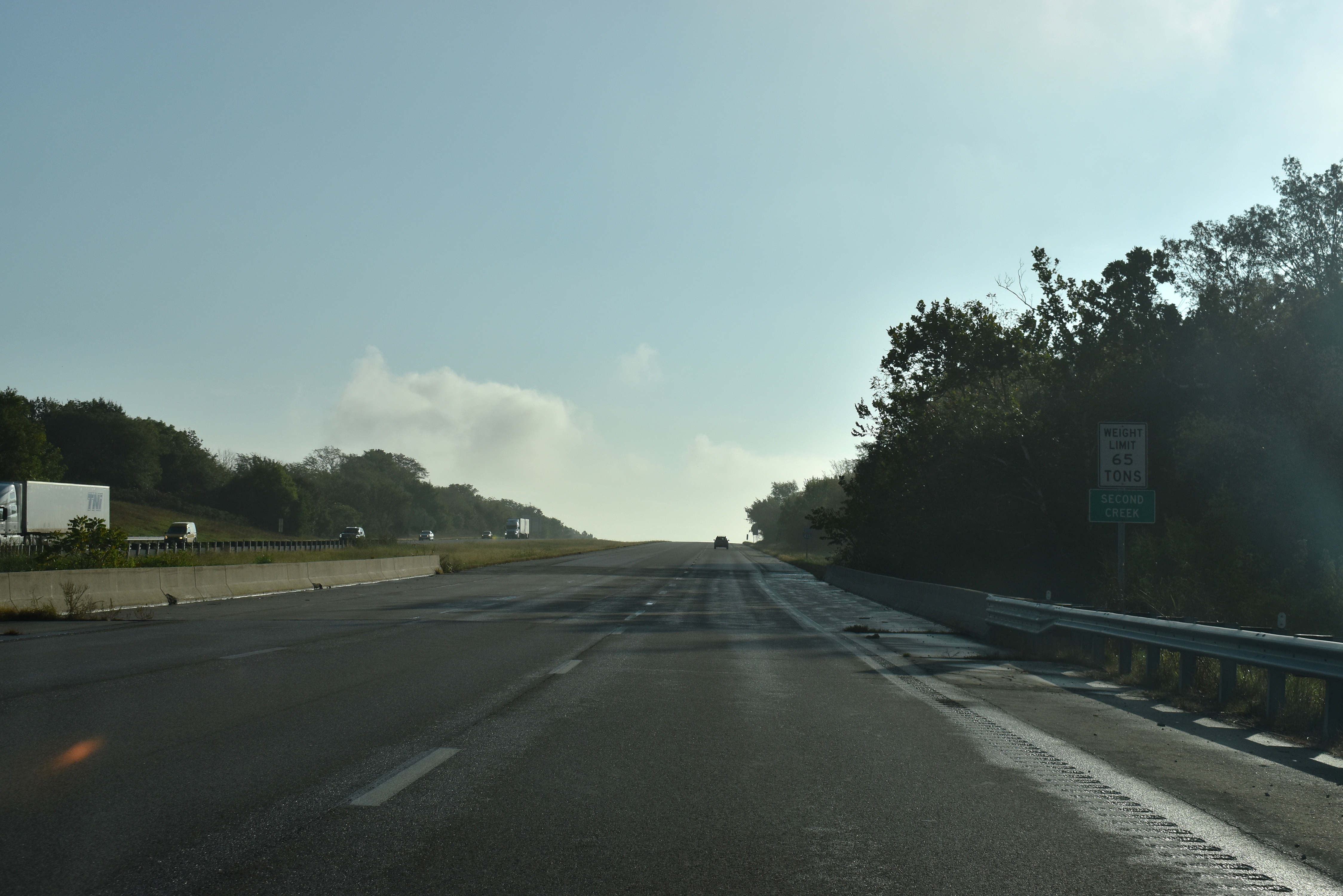
I-435 advances eastward across Second Creek toward Nashua in rural north Kansas City.
10/07/21
2015 traffic counts along the northern leg of I-435 varied between 12,774 vehicles per day (vpd) and 19,629 vpd.
10/07/21
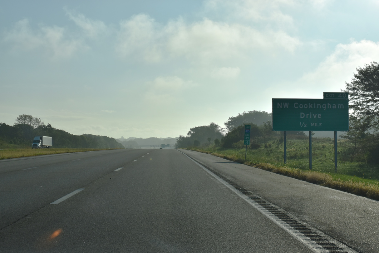
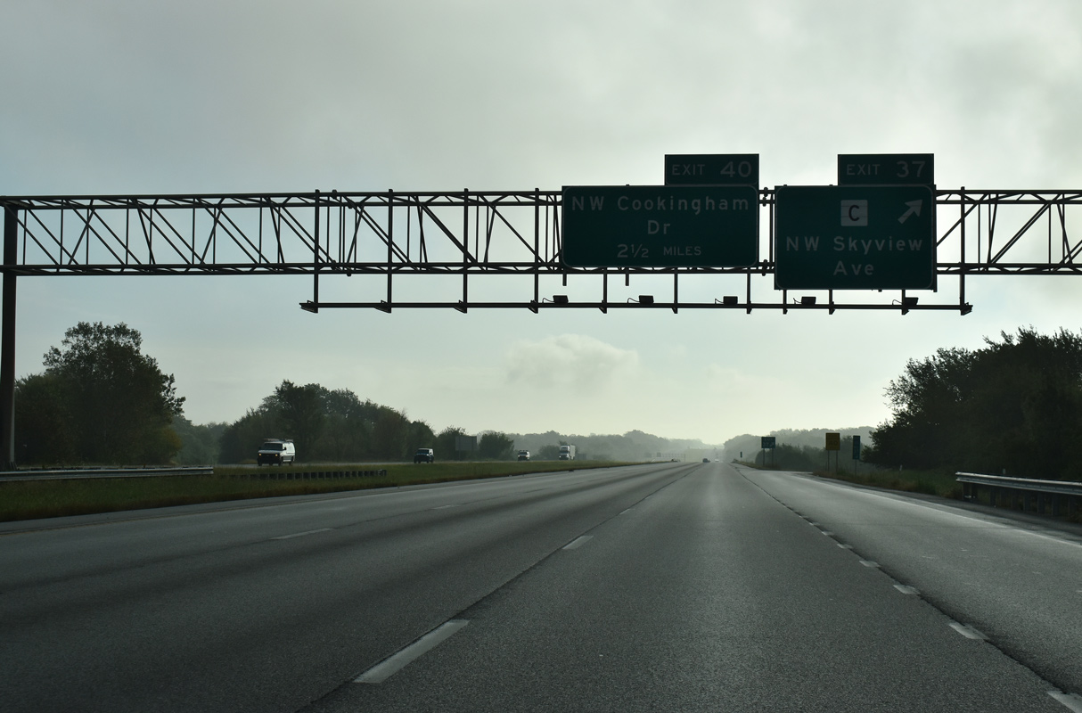
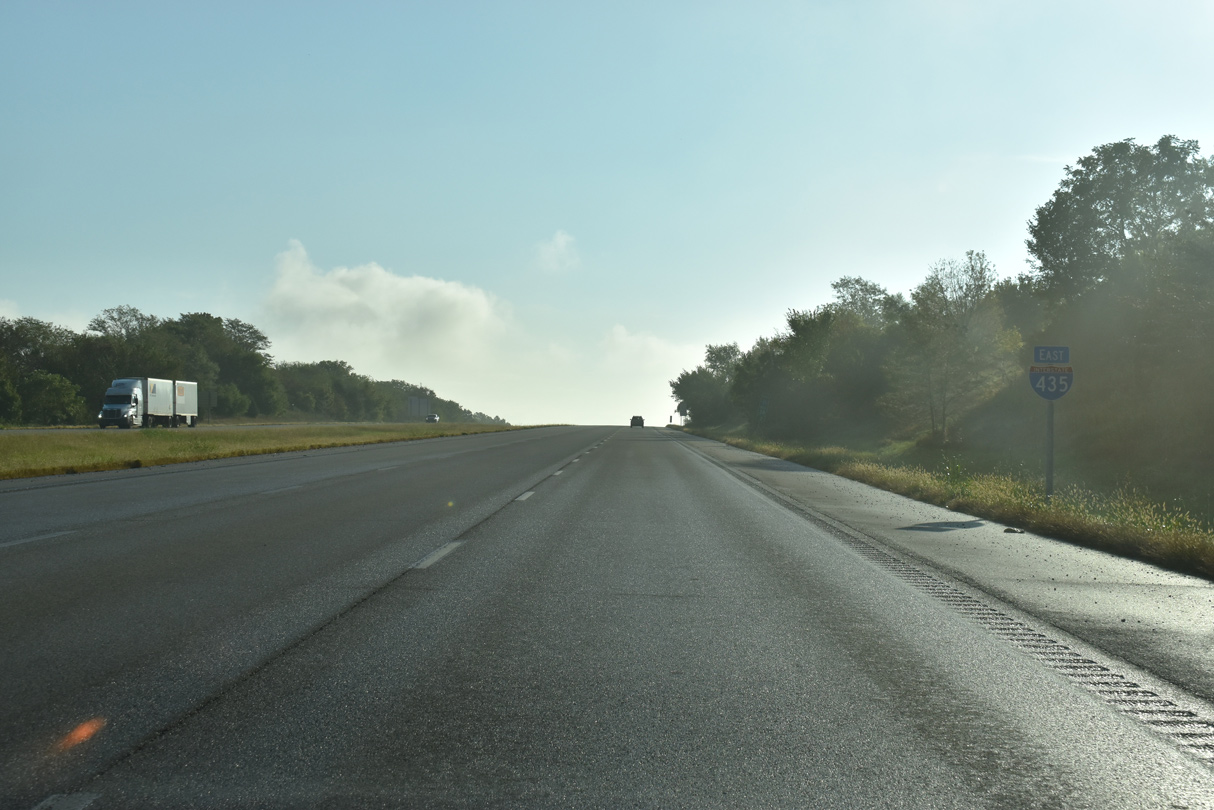
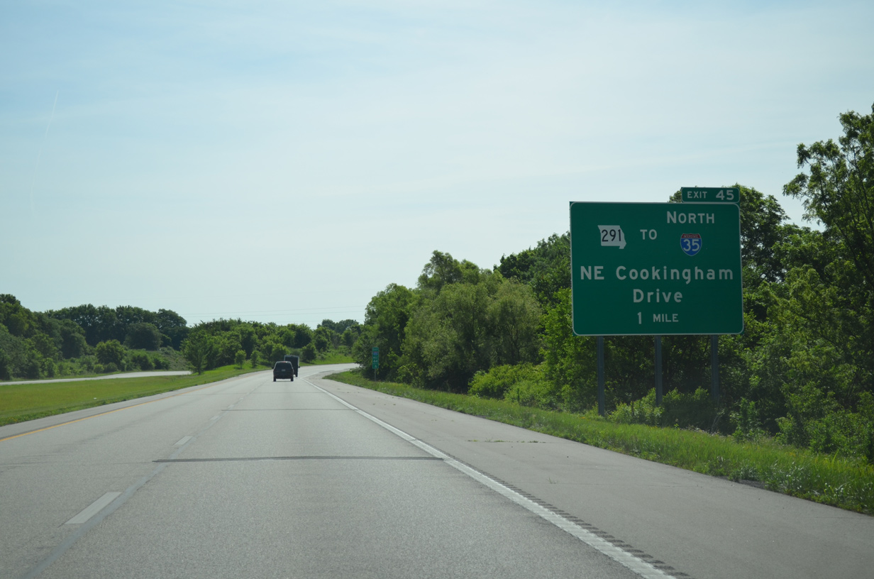
NW Cookingham Drive angles southeast to run south of Interstate 435 from upcoming Exit 40 east to Exit 45.
10/07/21
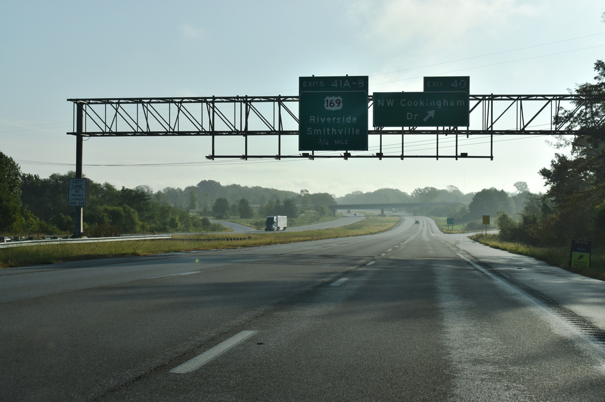
Cookingham Drive was formerly a part of Route 291 east from I-435 at Exit 40 through Nashua. The minor arterial meets the U.S. 169 freeway just south of a cloverleaf interchange (Exits 41A/B) with the Kansas City beltway.
10/07/21
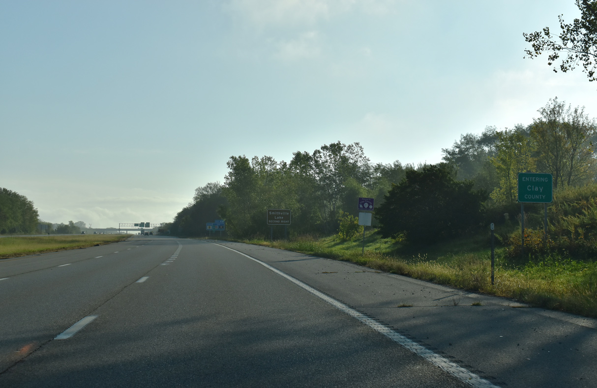
Interstate 435 east enters Clay County within the diamond interchange at Exit 40.
10/07/21
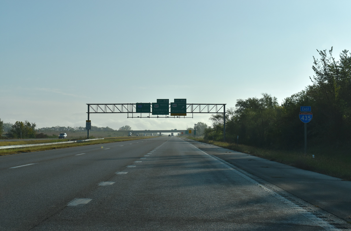
A lane drop occurs at forthcoming Exit 41A for the freeway along U.S. 169 south by Nashua.
10/07/21
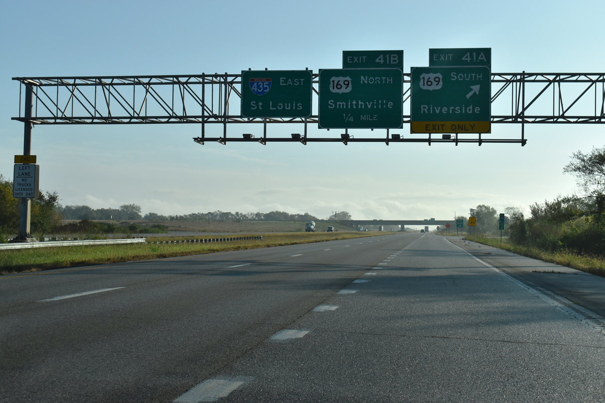
U.S. 169 comprises a suburban freeway south from I-435 to the site of Metro North Mall, Gladstone and U.S. 69 near Riverside. U.S. 169 spans the Kansas River on the Broadway Bridge from North Kansas City to combine with I-70/U.S. 24-40 west outside Downtown.
10/07/21
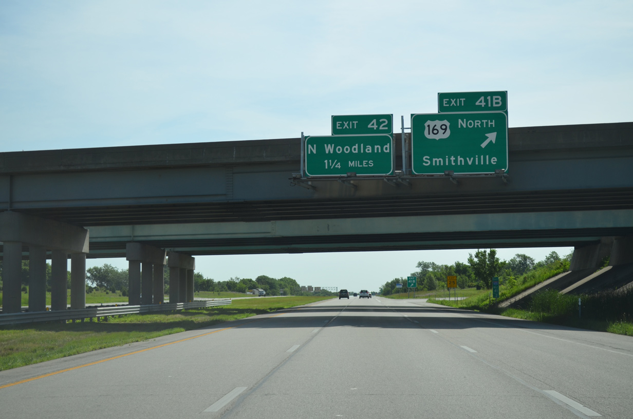
Leading north from Exit 41B, U.S. 169 transitions into a four lane divided highway to the city of Smithville. Beyond there, U.S. 169 extends to Gower and St. Joseph.
06/19/15
Interstate 435 runs just north of the Fairfield subdivision to the diamond interchange (Exit 42) with Woodland Avenue.
06/19/15

Woodland Avenue leads south from Exit 42 to Nashua and Anne Garney Park. Northward, Woodland Avenue becomes 126th Street and Virginia Avenue en route to Smithville.
06/19/15
Eastbound confirming marker for Interstate 435 posted ahead of the Agnes Avenue overpass and Northland Mobile Home Community.
06/19/15
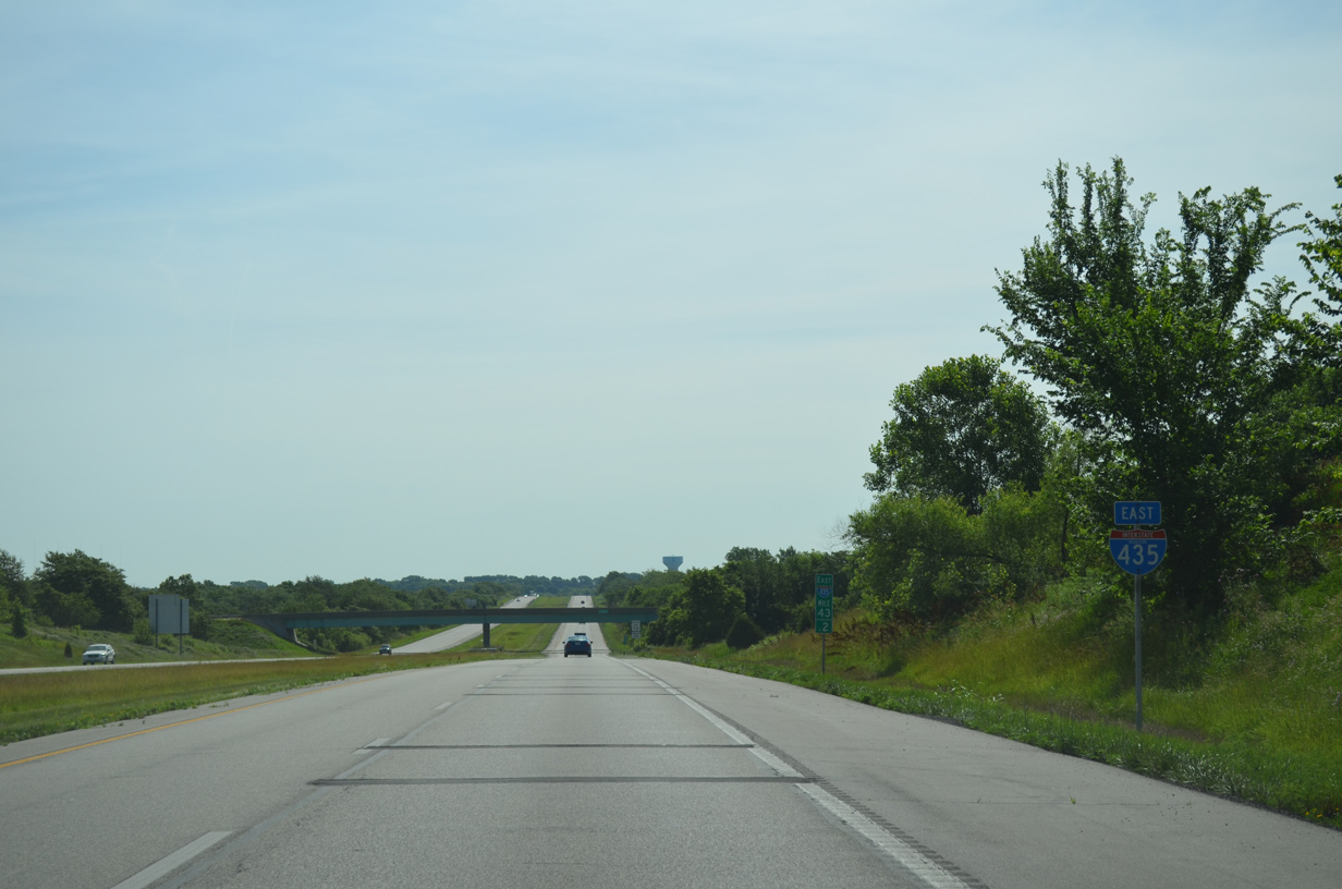
The beltway turns southward one mile to Exit 45 with Route 291 south and Cookingham Drive. The state highway provides a direct route to Interstate 35 leading north to Cameron from I-435 east.
06/19/15
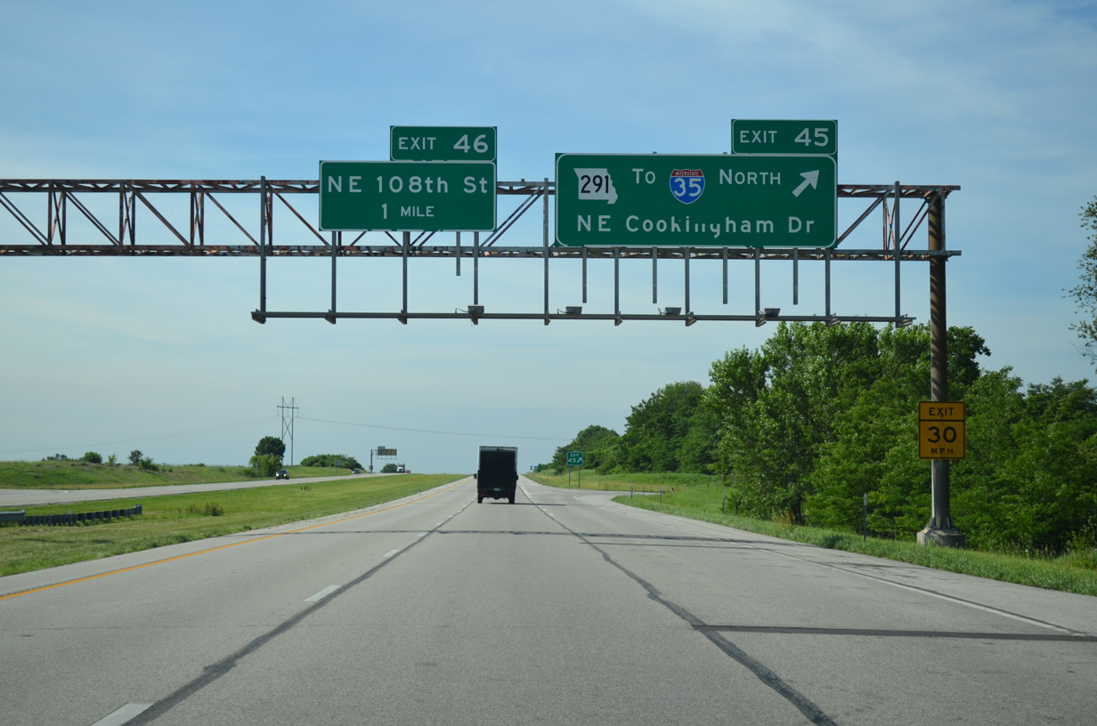
Missouri Route 291 (Cookingham Drive) commences a 49.43 mile course southeast to Liberty, River Bend and Independence at the folded diamond interchange (Exit 45) with Interstate 435. The route concludes at I-49/U.S. 71 in Harrisonville.
06/19/15
South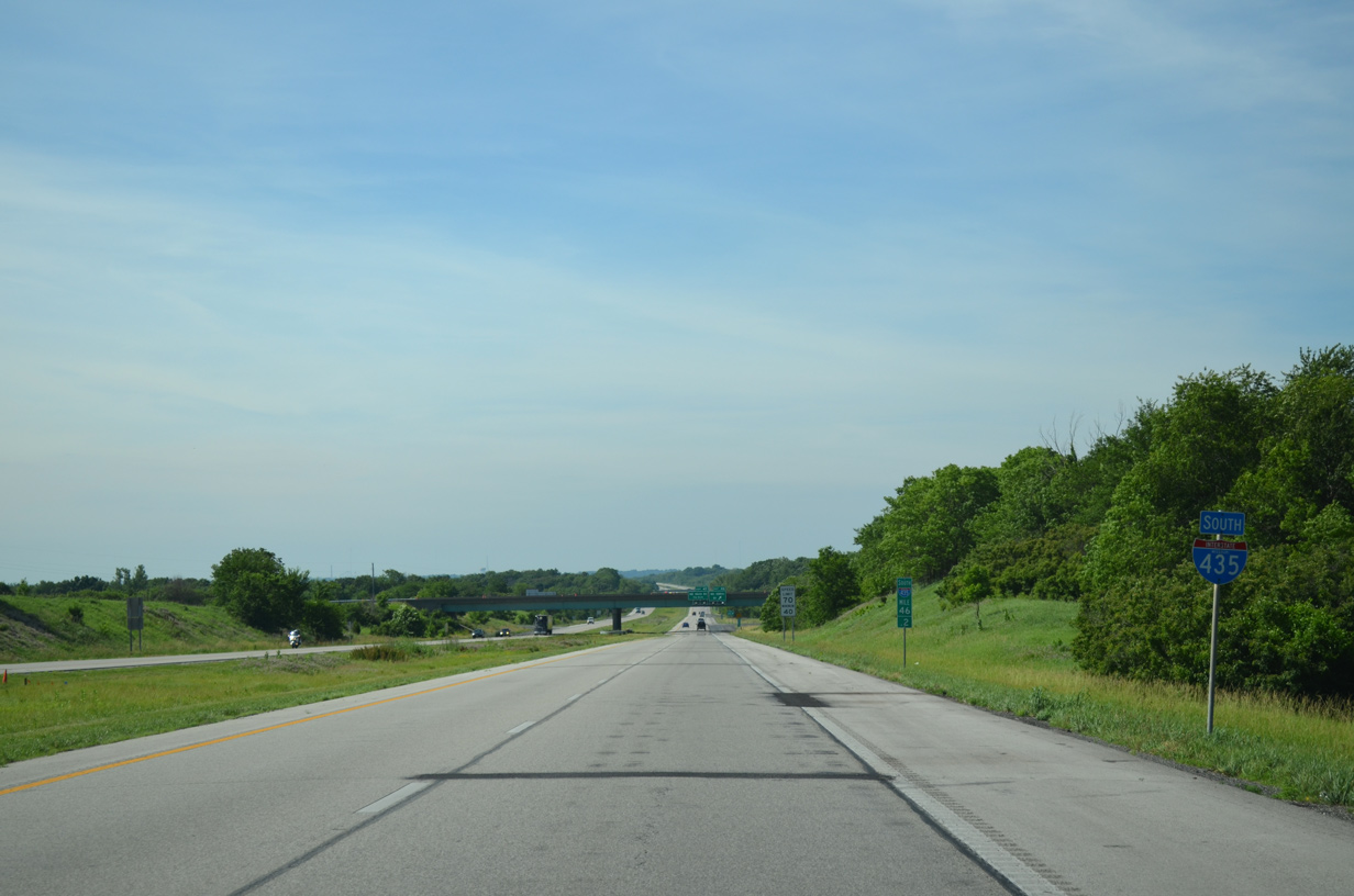
Cardinal direction banners for Interstate 435 switch to south from Route 291 to I-49 and I-470.
06/19/15
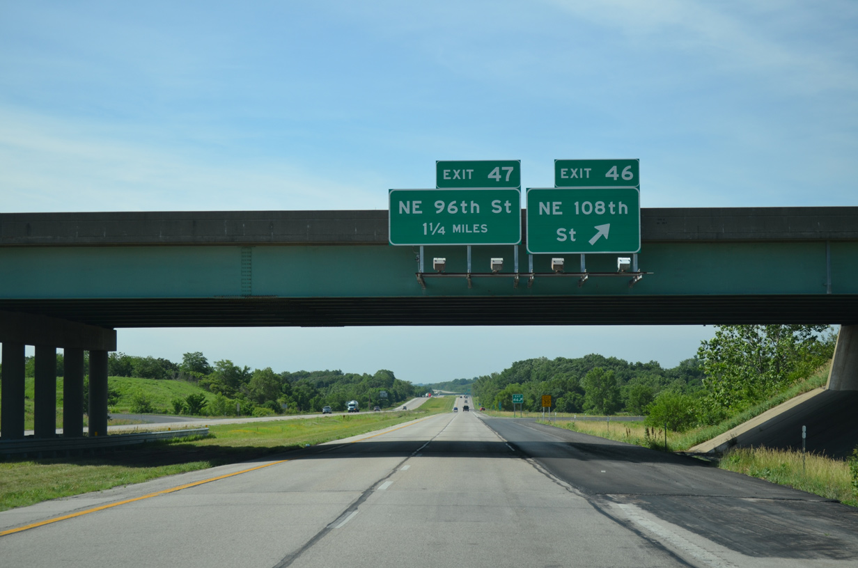
Another folded diamond interchange (Exit 46) joins the beltway with NE 108th Street in a rural area of Shoal Creek in northeast Kansas City.
06/19/15
Continuing south, Interstate 435 bee lines to Exit 47 with Shoal Creek Parkway and Hodge Park.
06/19/15
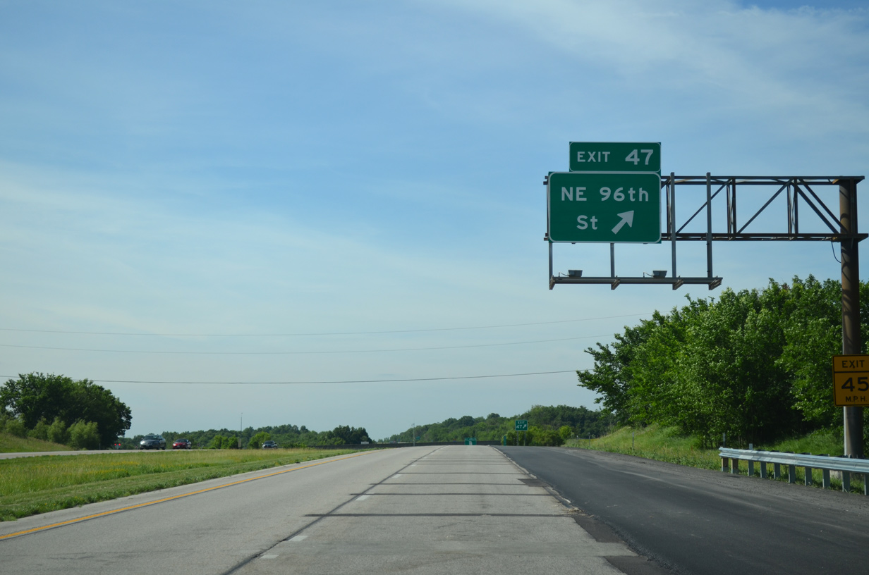
NE 96th Street stems west from the diamond interchange (Exit 47) with I-435 to Staley Avenue and the Pine Grove Meadows subdivision. Shoal Creek Parkway arcs southeast to the Shoal Creek Golf Course and Route 152 before returning to I-435 at Exit 51.
06/19/15
Missouri Route 152 crosses paths with Interstate 435 next as it runs east from Shoal Creek in Kansas City to NE Barry Road at the Liberty city line.
06/19/15
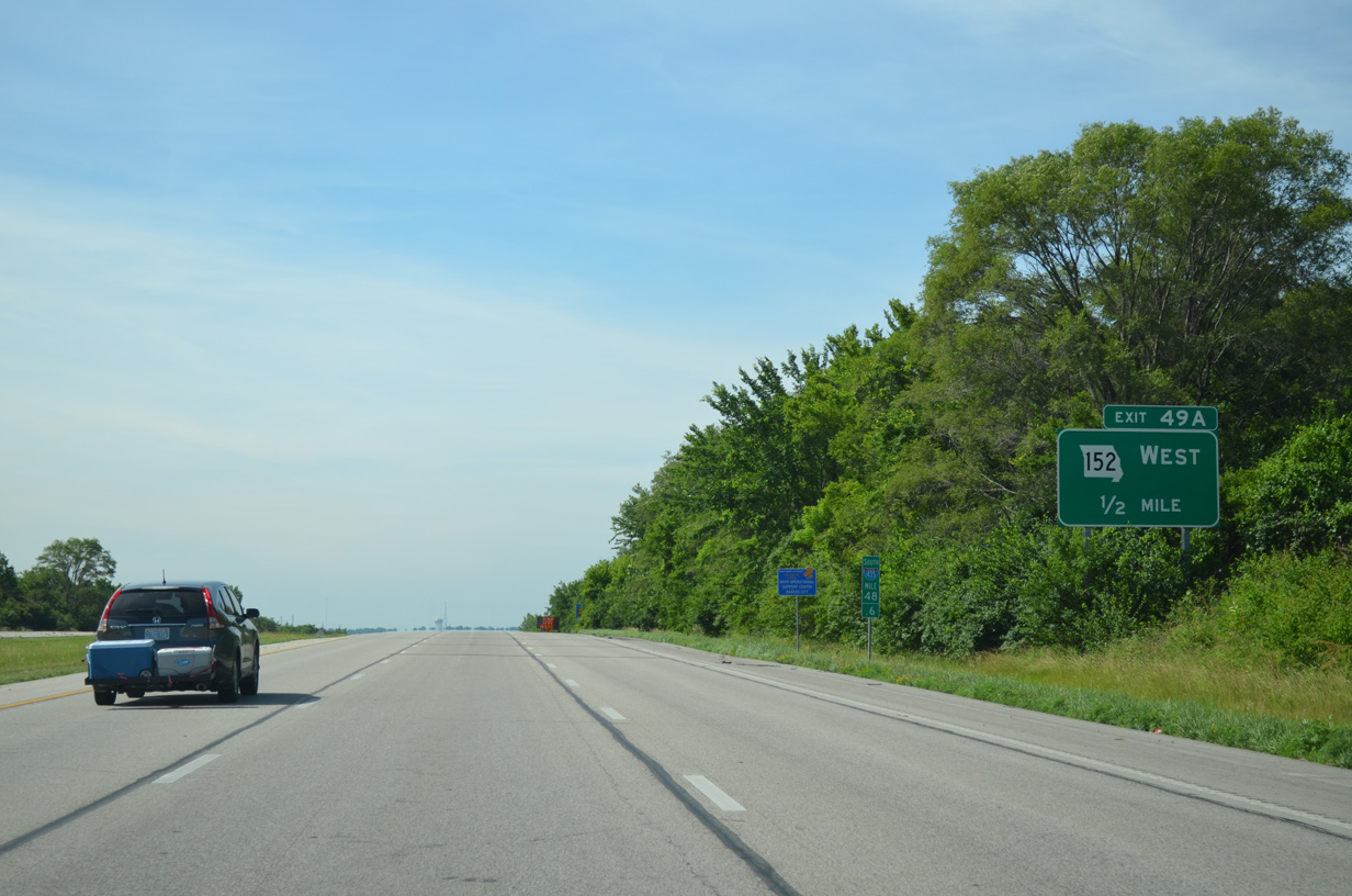
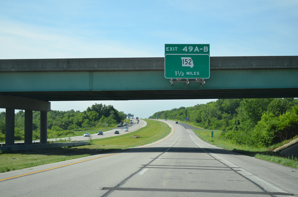
Exit 49A departs I-435 south in a half mile for the Route 152 freeway west. The suburban route travels through the Coves North and Prairie Point-Wildberry communities while meeting Interstate 29 at a commercialized junction.
06/19/15
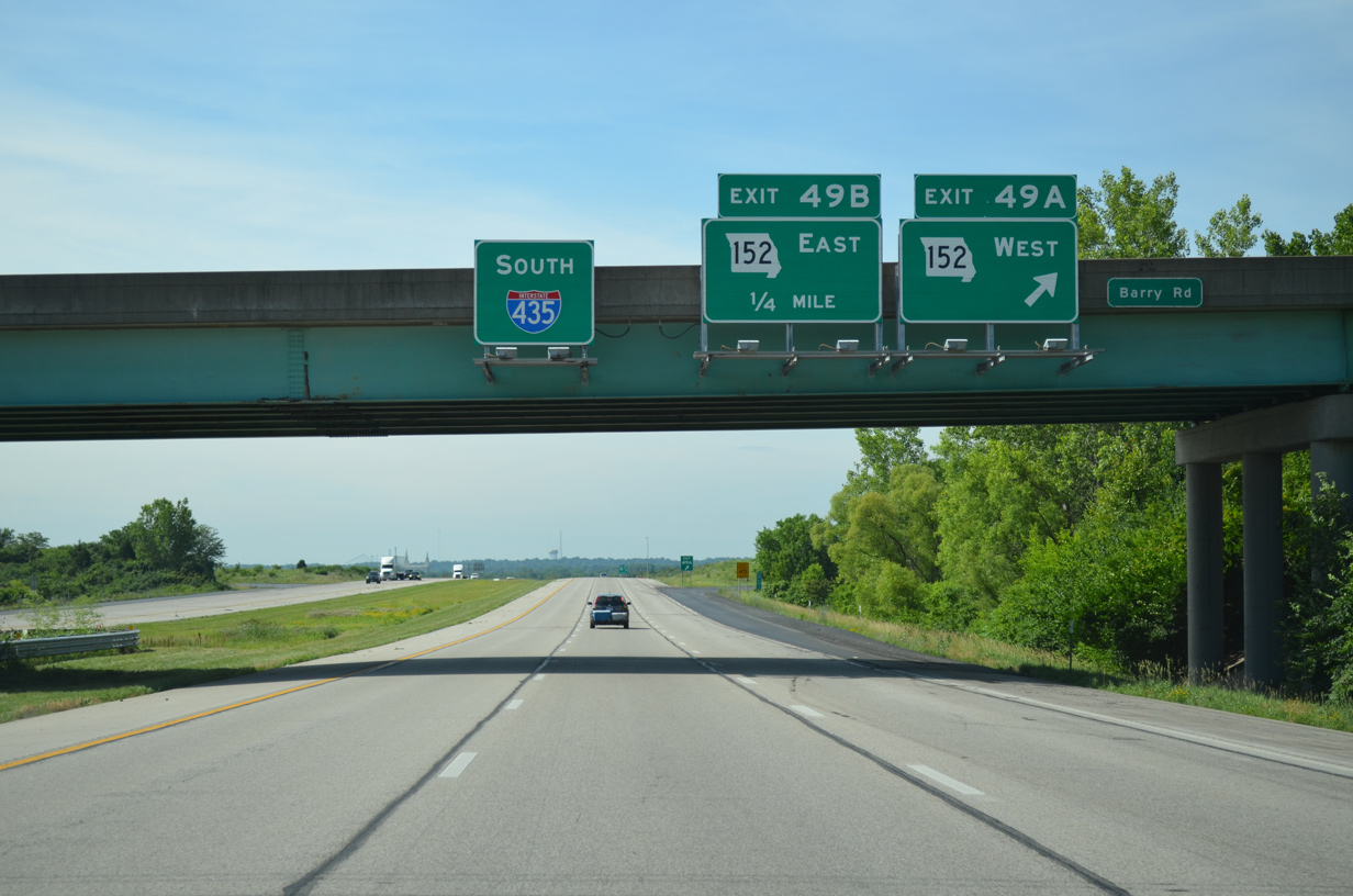
Entering the cloverleaf interchange (Exits 49A/B) with Route 152 on I-435 south. The Route 152 freeway opened in stages from 1992 to 1999 to replace Barry Road as the new alignment.
06/19/15
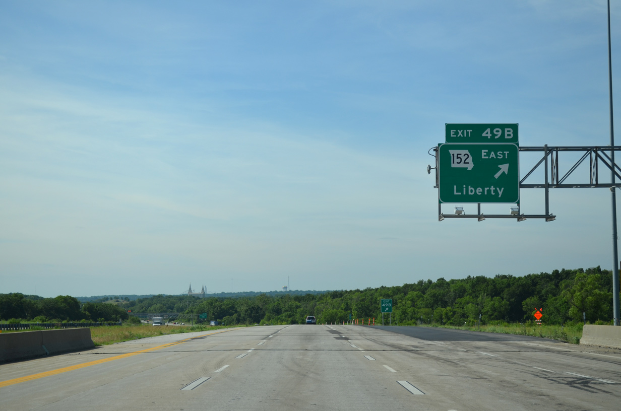
Route 152 transitions into a controlled access arterial east from Exit 49B. The 16.88 mile route concludes at I-35/Route 110 (CKC) and Kansas Street in Liberty.
06/19/15
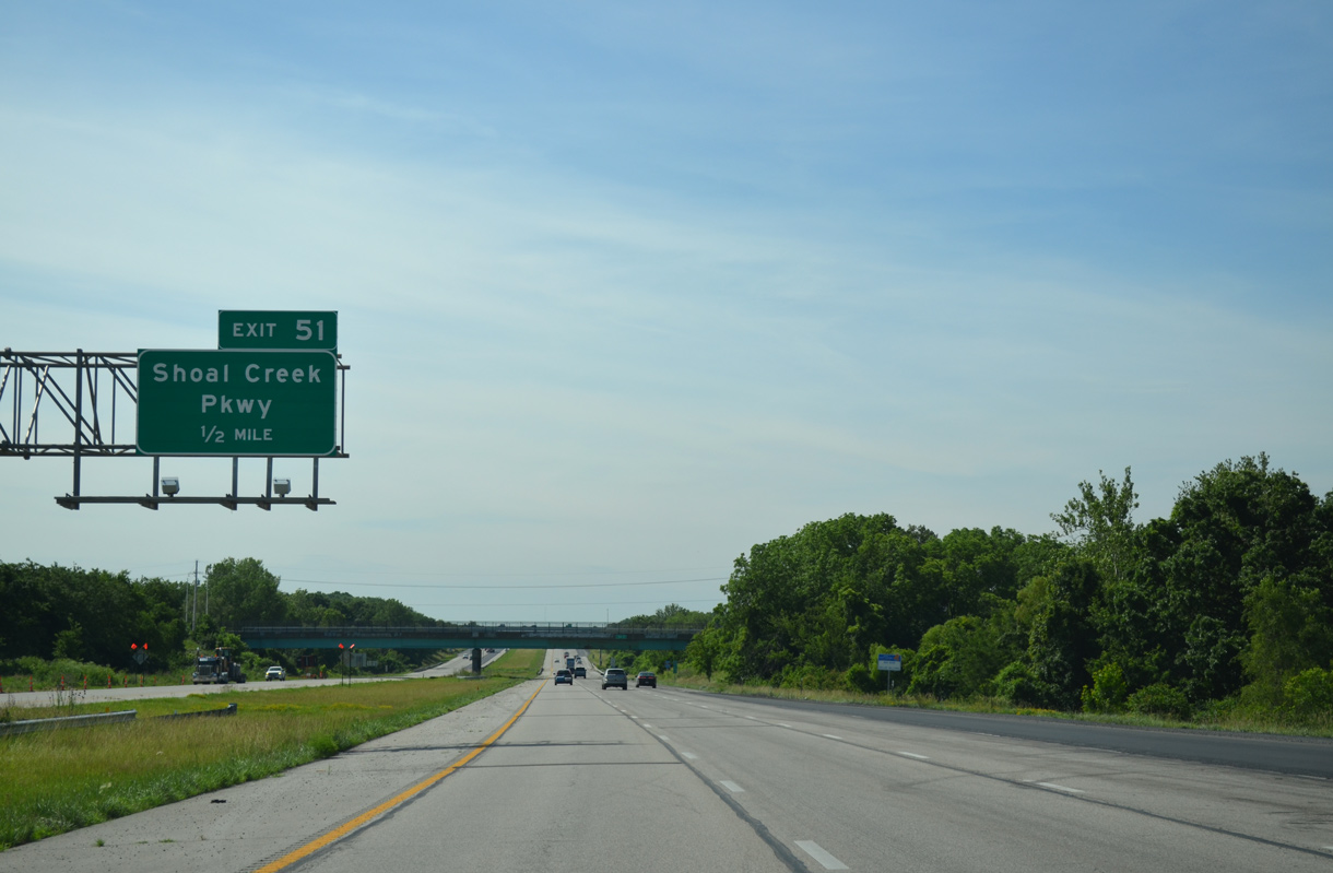
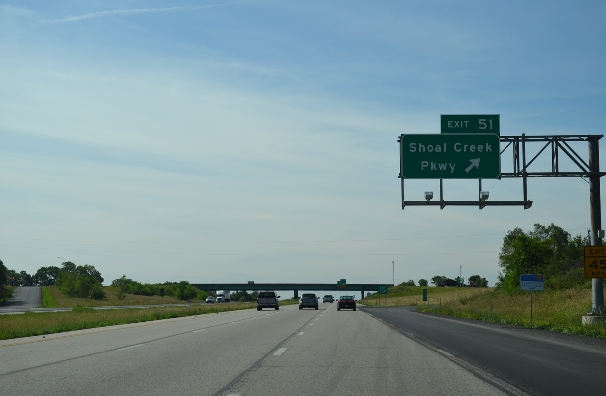
The six lane beltway and Shoal Creek Parkway converge at a diamond interchange (Exit 51) west of the Northbrook and Highridge Manor subdivisions.
06/19/15

Soccer Drive spans Interstate 435 beyond this reassurance marker. The freeway crosses the East Fork of Shoal Creek afterwards.
06/19/15
Shoal Creek Parkway ends just west of Exit 51 at a roundabout with Searcy Creek Parkway south and Maple Woods Parkway north. Both parkways await future expansion beyond their dead ends.
06/19/15
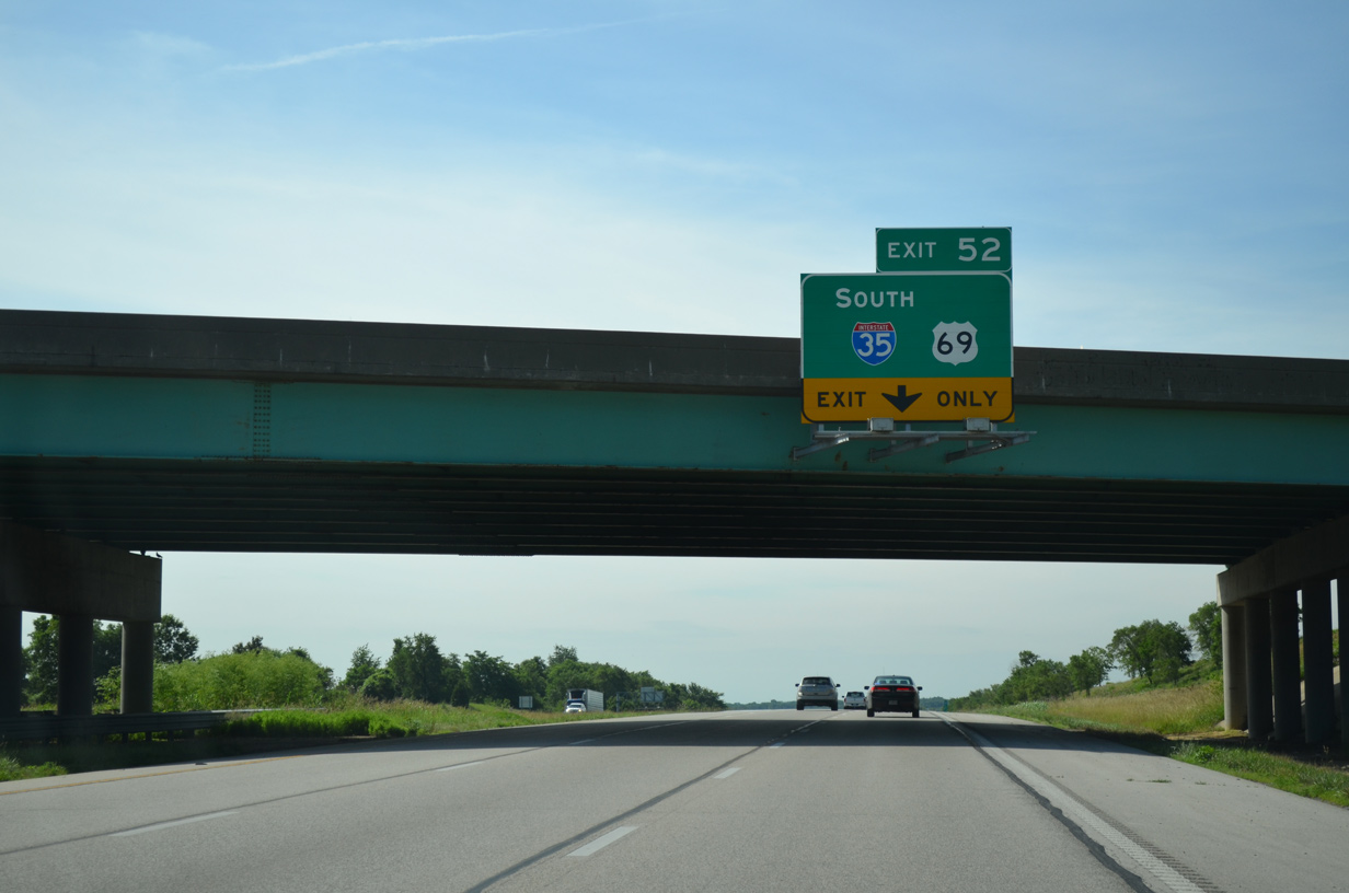
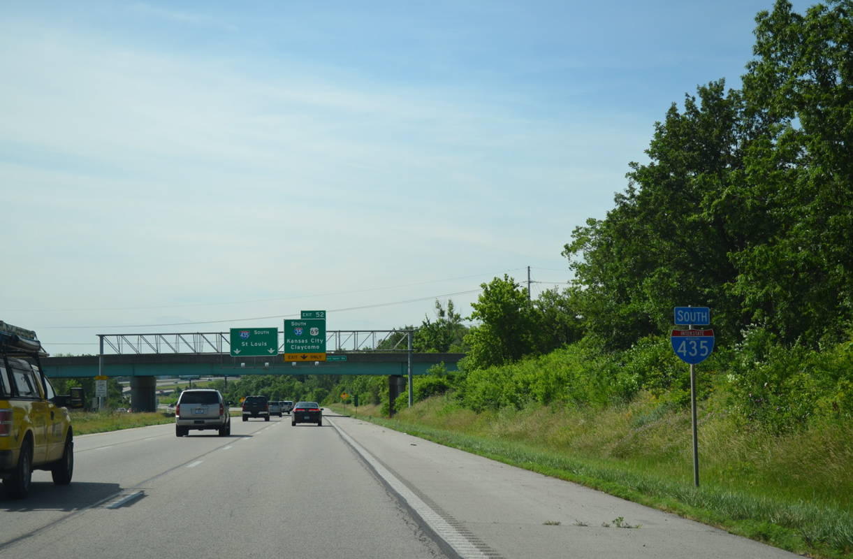
I-35/Route 110 (CKC) angle southwest through the cities of Liberty and Pleasant Valley to cross paths with Interstate 435 at a combination wye and semi directional T interchange (Exit 52).
06/19/15
Confirming marker for I-435 south posted ahead of the Pleasant Valley Road overpass. The beltway passes just east of the 32,000 square foot LDS Temple completed in May 2012.1
06/19/15
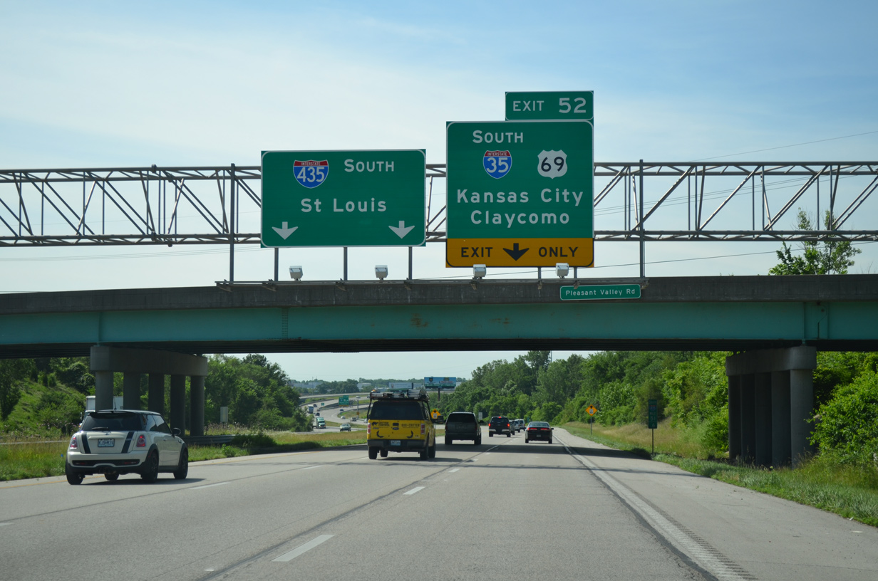
The I-435 mainline reduces to two through lanes to Randolph and Independence as Exit 52 departs for Interstate 35 south to North Kansas City and Downtown.
06/19/15
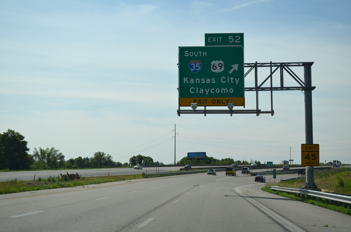
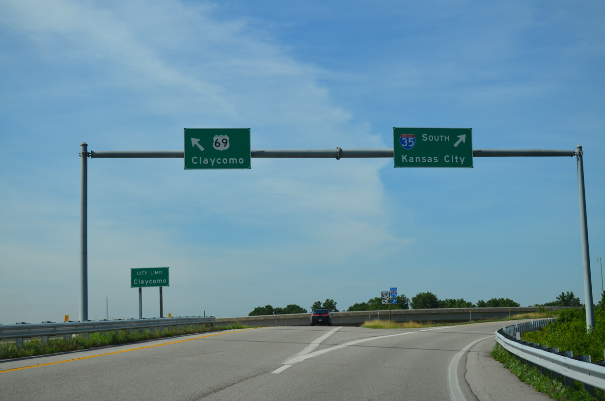
A diamond interchange (Exit 52) with U.S. 69 overlays the exchange between I-35 and I-435. The US route provides access to I-35 north from I-435 south and from I-35 south to the beltway north.
06/19/15
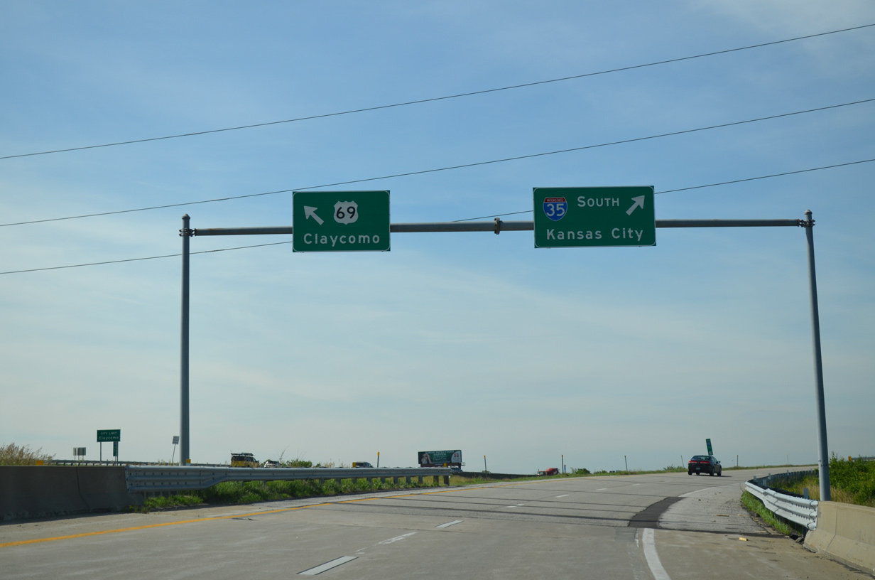
Exit 52 separates from I-435 at Shoal Creek to partition into ramps for I-35 south to Glenhaven and Winnwood in Kansas City and U.S. 69 through the city of Claycomo.
06/19/15
U.S. 69 serves local traffic through Claycomo as it parallels Interstate 35 to the south to Maple Park West. The surface arterial also connects the freeway network with the Ford Kansas City Assembly Plant to the east.
06/19/15

U.S. 69 follows the I-35 corridor northward to Albert Lea, Minnesota and south to Overland Park, Kansas.
06/19/15


References:
- Kansas City Missouri Temple. Wikipedia.
Photo Credits:
- ABRoads: 06/19/15, 10/06/21, 10/07/21
Connect with:
Page Updated Monday October 18, 2021.