
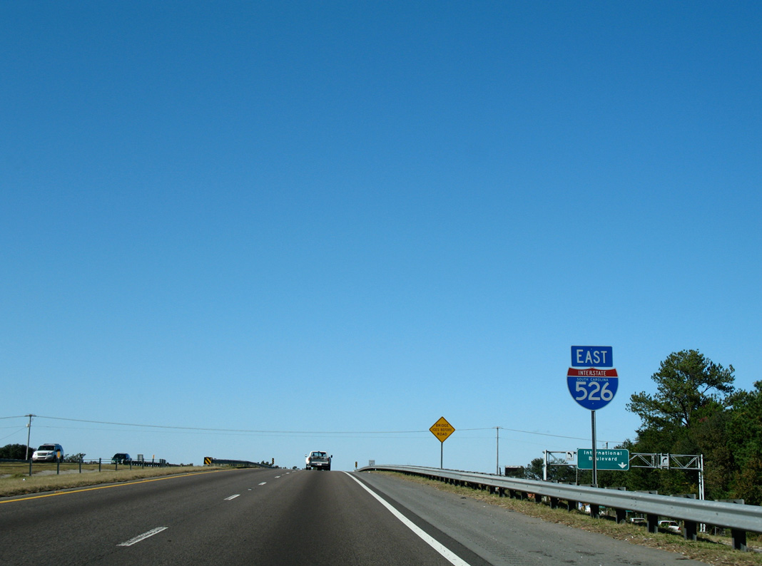
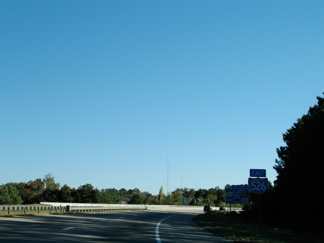
Interstate 526 East
 East
East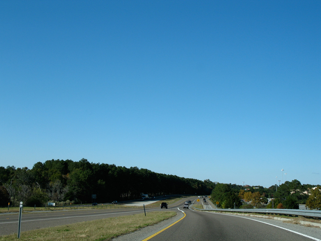
Ramps from both directions of U.S. 17 and S.C. 7 (Sam Rittenberg Boulevard) converge along Interstate 526 eastbound.
11/12/06
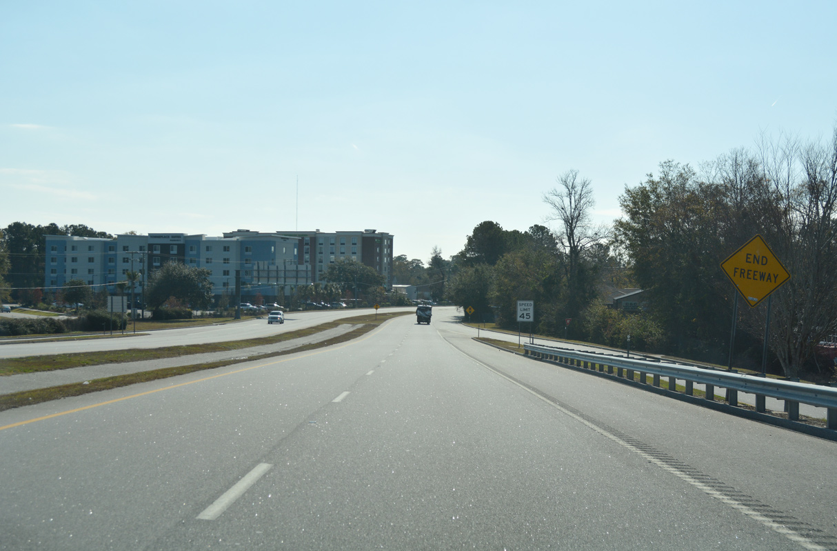
The westbound lanes end prematurely ahead of S.C. 7 (Sam Rittenburg Boulevard).
11/12/06
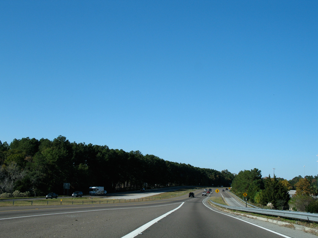
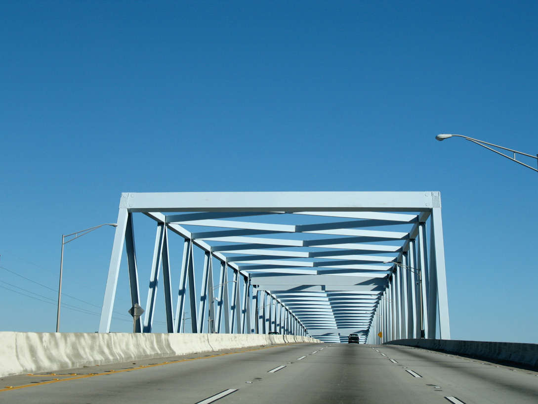
Advancing north by Citadel Mall, I-526 approaches S.C. 461 (Glenn McConnell Parkway / Paul Cantrell Boulevard).
11/12/06
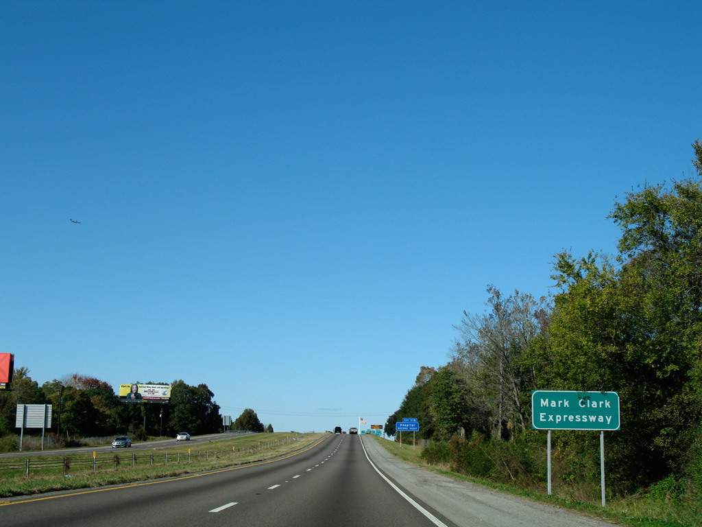
All of I-526 is named the Mark Clark Expressway.
11/12/06
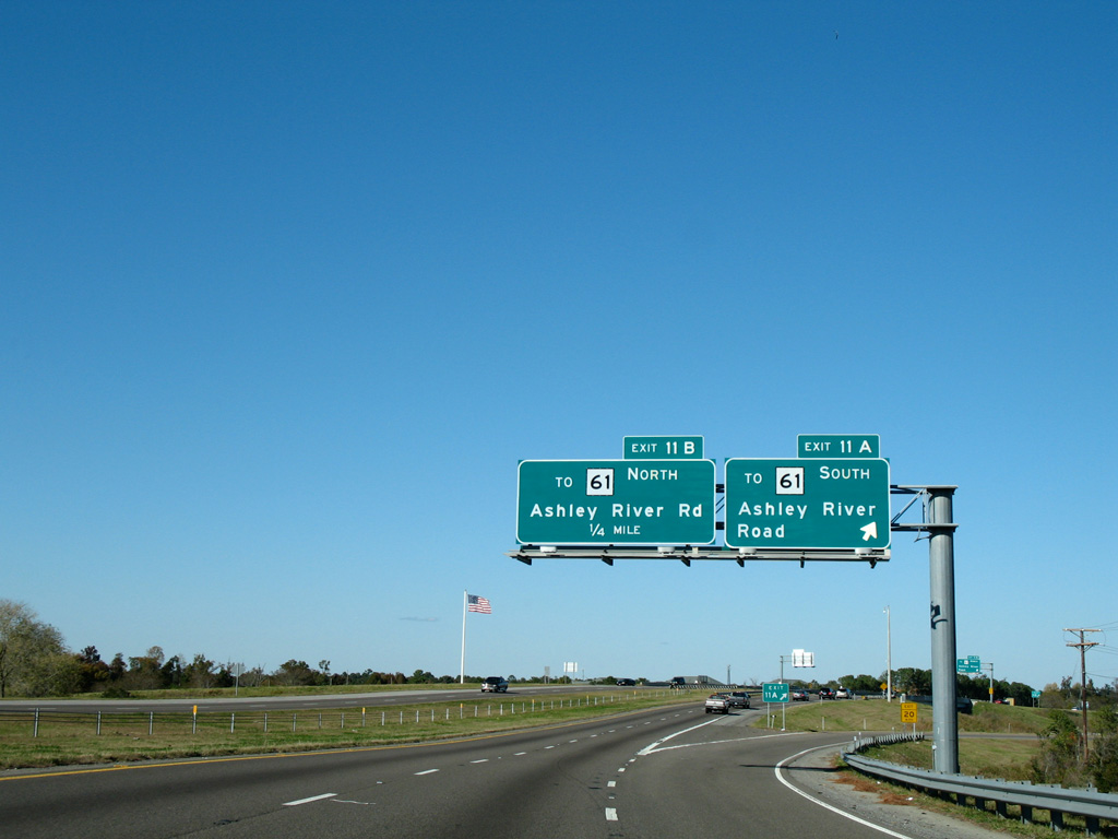
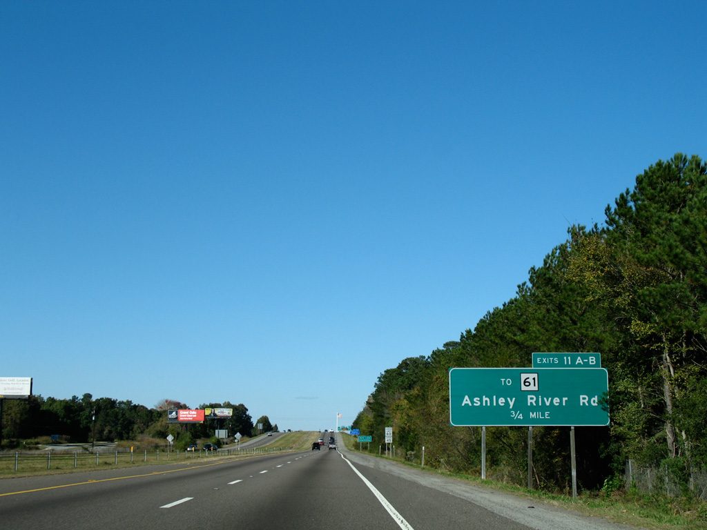
Eventual sign changes at Exits 11A/B reflect the upgrade of Paul Cantrell Boulevard east to S.C. 61 (Ashley River Road) as S.C. 461. S.C. 461 extends west along Glenn McConnell Parkway to Bees Ferry Road.
11/12/06
The 3.71 mile route of S.C. 461 is a four lane arterial branching west from S.C. 61 (Ashley River Road) to Ashley Circle and Bees Ferry Road in the West Ashley area of Charleston. Future road work will both widen the state highway to six lanes and extend Glenn McConnell Parkway to the Long Savannah development.
11/12/06

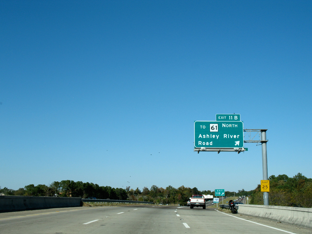
An array of apartments line both sides of Interstate 526 as the freeway progresses north across S.C. 61 (Ashley River Road) and Bulls Creek.
11/12/06
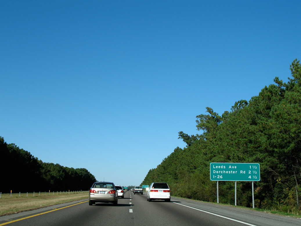
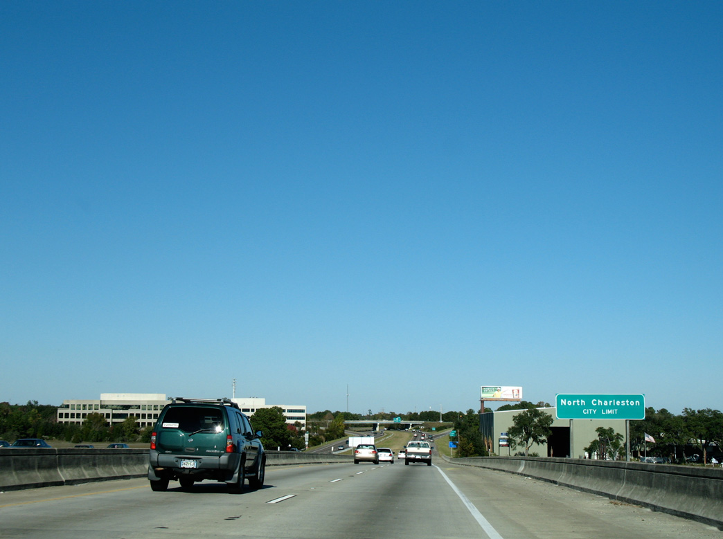
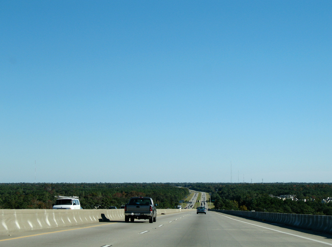
The succeeding seven interchanges fall within the city of North Charleston. I-526 converges with I-26 in 4.5 miles.
11/12/06
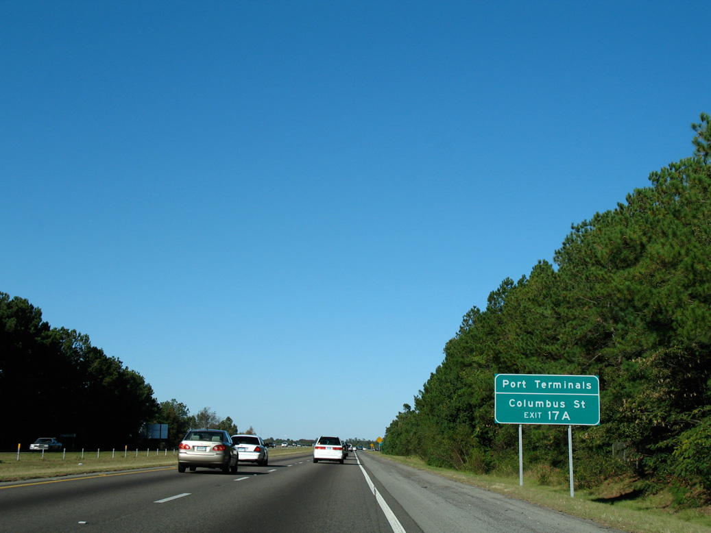
Trucks bound for the Port of Charleston - Columbus Street terminal are directed to take I-26 east from Exit 17A. The North Charleston terminal lies further east along I-526 via Exit 20.
11/12/06
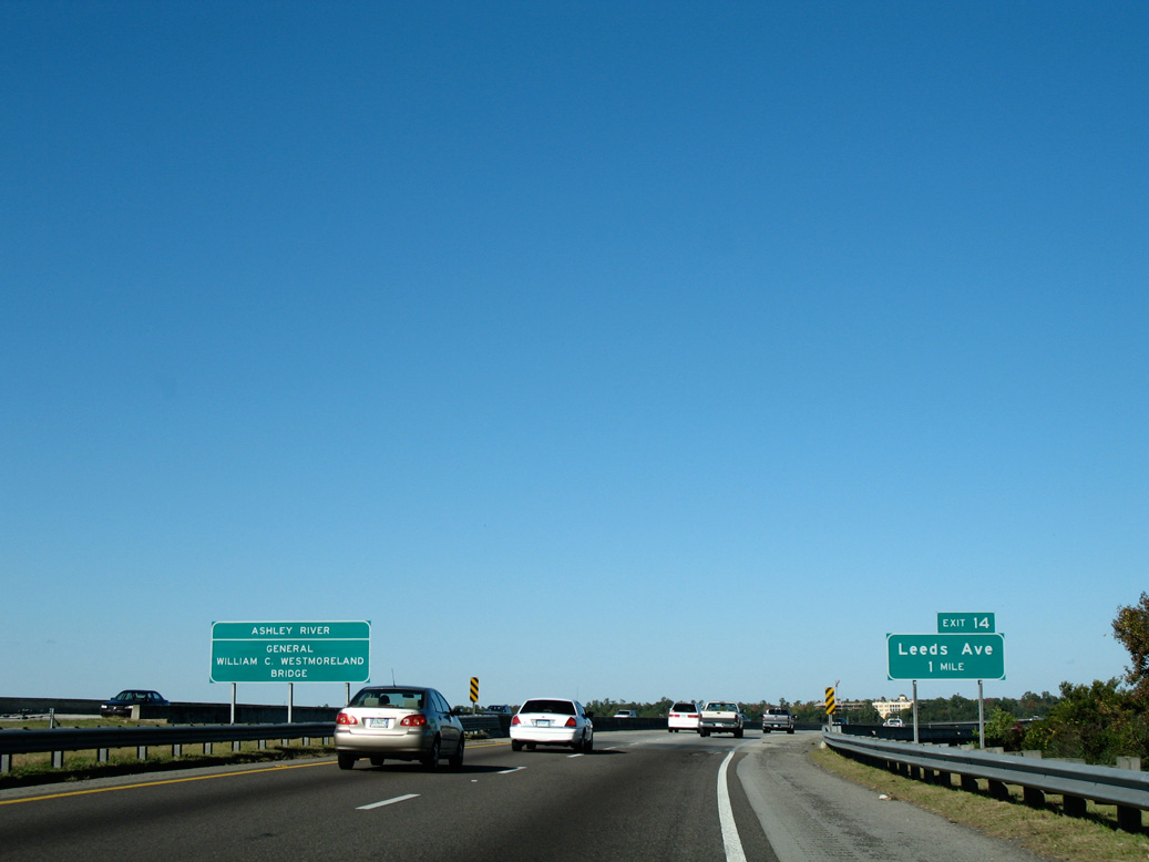
Interstate 526 transitions onto the General William C. Westmoreland Bridge over marshland preceding the Ashley River. A diamond interchange (Exit 14) with Leeds Avenue lies just beyond the span.
11/12/06
The General Westmoreland Bridge extends 3,908 feet northeast into the North Charleston city limits. Completed in 1980, the concrete span rises to 35.1 feet above the Ashley River.1
11/12/06
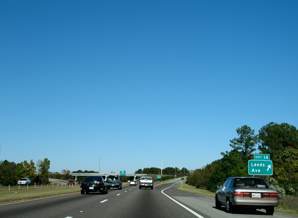
Exit 14 leaves I-526 eastbound for Leeds Road west to LeedsPark International commerce center. and north to Charleston County government offices and S.C. 642 (Dorchester Road).
11/12/06

Interstate 526 arcs northwestward a half mile from Lees Avenue to a split diamond interchange (Exit 15) with Paramount Drive and S.C. 642 (Dorchester Road).
11/12/06
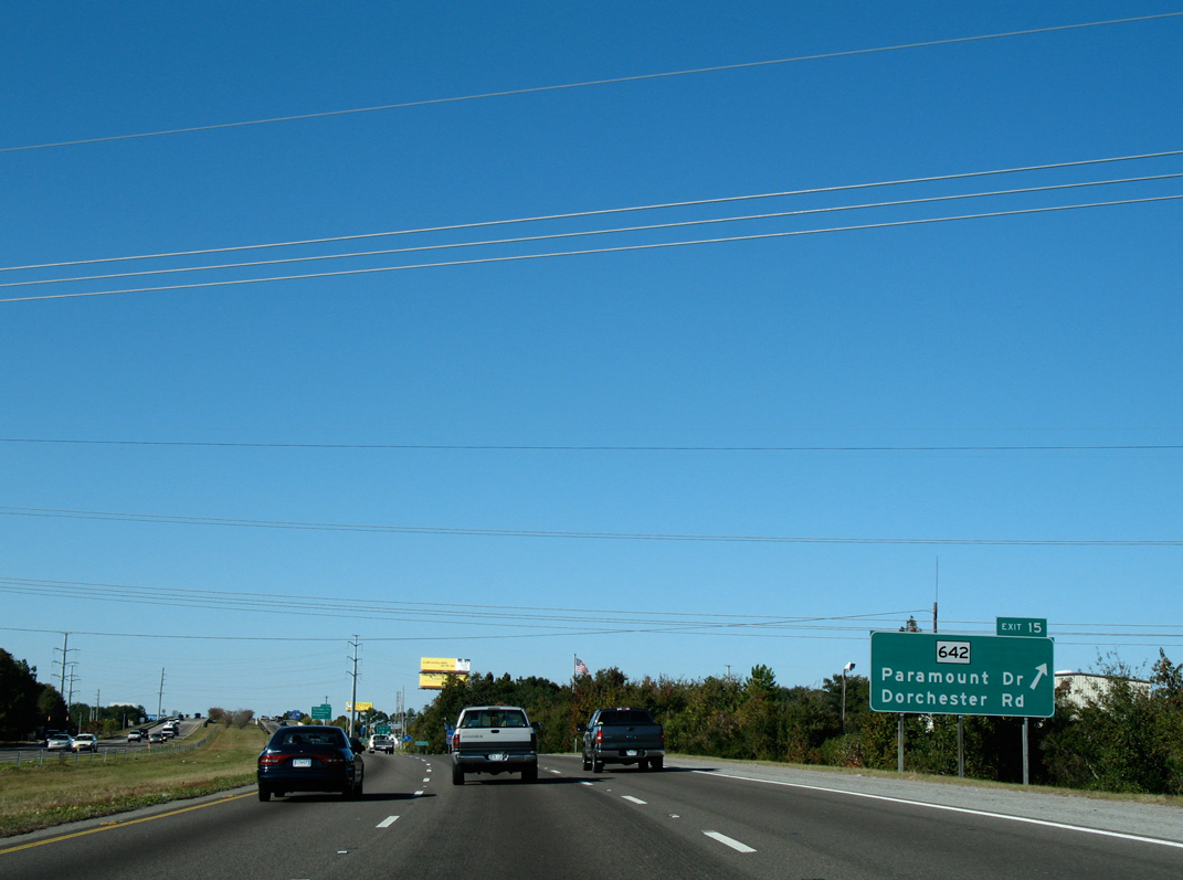
Paramount Drive branches southwest from S.C. 642 (Dorchester Road) to the Wando Woods community. Dorchester Road constitutes a commercial arterial across North Charleston while S.C. 642 is a 19.29 mile highway paralleling the Ashley River northwest to U.S. 17 Alternate near Summerville.
11/12/06
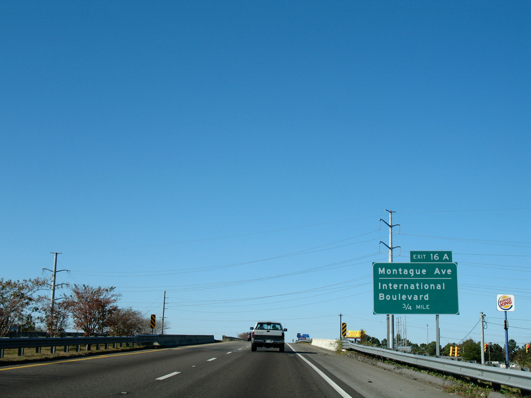
Spanning Paramount Drive, I-526 advances north 0.75 miles to a half diamond interchange (Exit 16A) with Montague Avenue.
11/12/06
Confirming marker posted at the S.C. 642 (Dorchester Road) underpass. I-526 passes over a CSX Railroad line next.
11/12/06
Montague Avenue winds northeast from S.C. 642 to Park Circle in North Charleston. Exit 16A connects with the five lane boulevard by North Charleston Coliseum and the Charleston Area Convention Center.
11/12/06
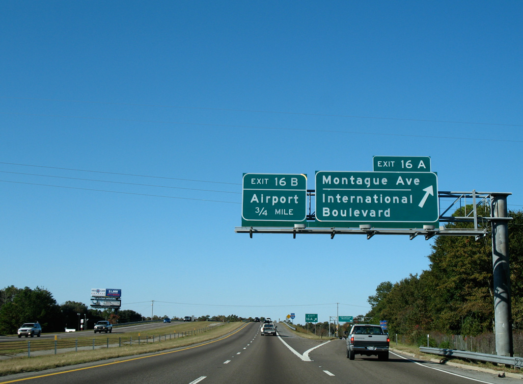
An east side service road links Exit 16A and Montague Avenue with forthcoming International Boulevard.
11/12/06
Exit 16B provides direct access to International Boulevard west to Charleston International Airport (CHS) from Interstate 526 eastbound. The arterial originates from a retail area along Montague Avenue to the east.
11/12/06
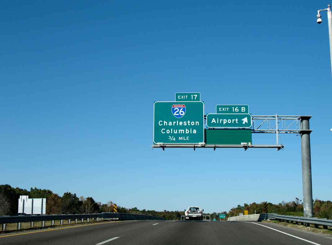
An auxiliary lane opens northeast from International Boulevard to the directional cloverleaf interchange (Exit 17) with Interstate 26.
11/12/06
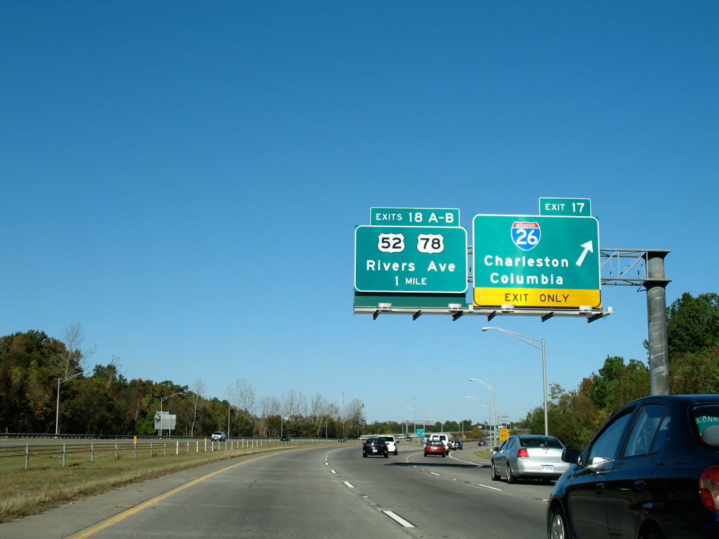
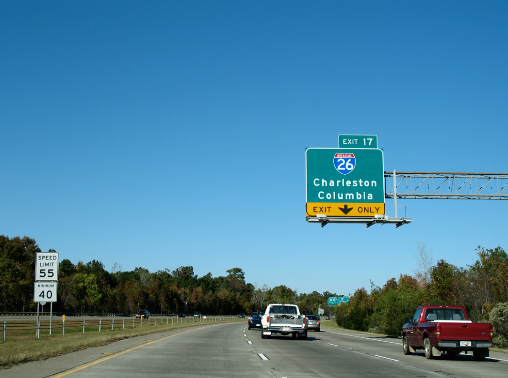
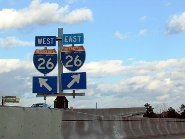
Two lanes depart from I-526 east for Interstate 26 leading south to Charleston and northwest to Columbia. U.S. 52/78 (Rivers Avenue) parallels the freeway just to the east through North Charleston.
11/12/06
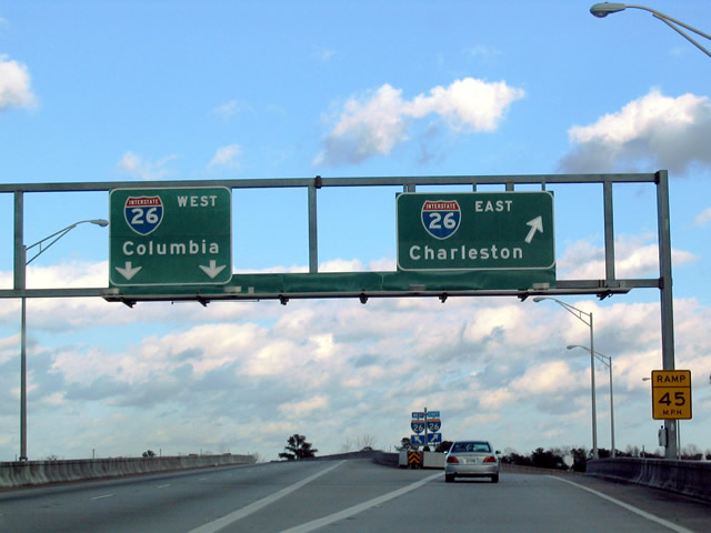
Exit 17 partitions into a flyover for I-26 west to Summerville, Orangeburg and the capital city. A single lane ramp joins the final eight miles of Interstate 26 south to U.S. 17 (Septima Clark Parkway) ahead of Downtown Charleston.
01/18/04
Interstate 26 travels 43 miles northwest to I-95 and 104 miles to Columbia.
01/18/04
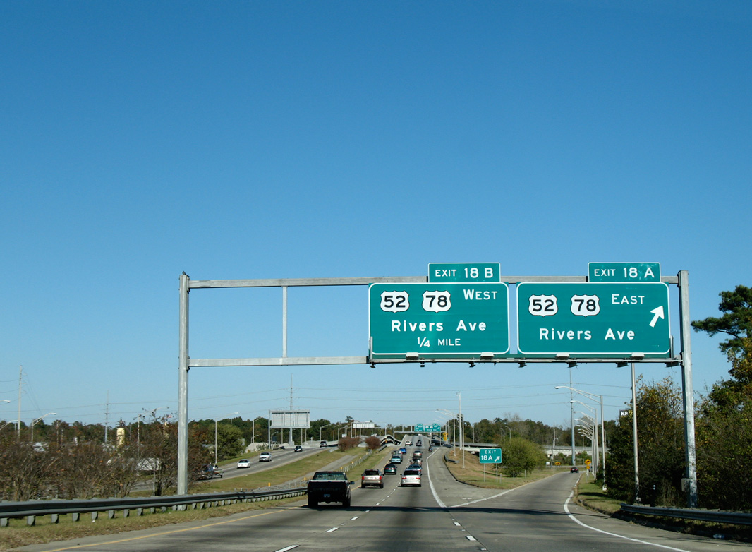
A six-ramp parclo interchange provides separate egress points for U.S. 52/78 (Rivers Avenue) south to North Charleston and north toward Hanahan.
11/12/06
U.S. 52/78 (Rivers Avenue) west combine for 9.4 miles from Charleston Heights in North Charleston along a commercialized corridor to Goose Creek. Both routes originate in Charleston.
11/12/06

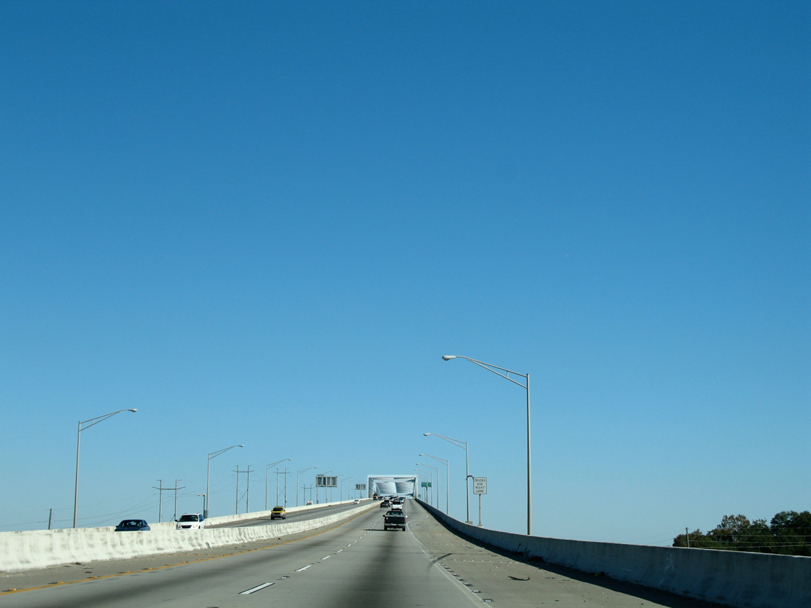
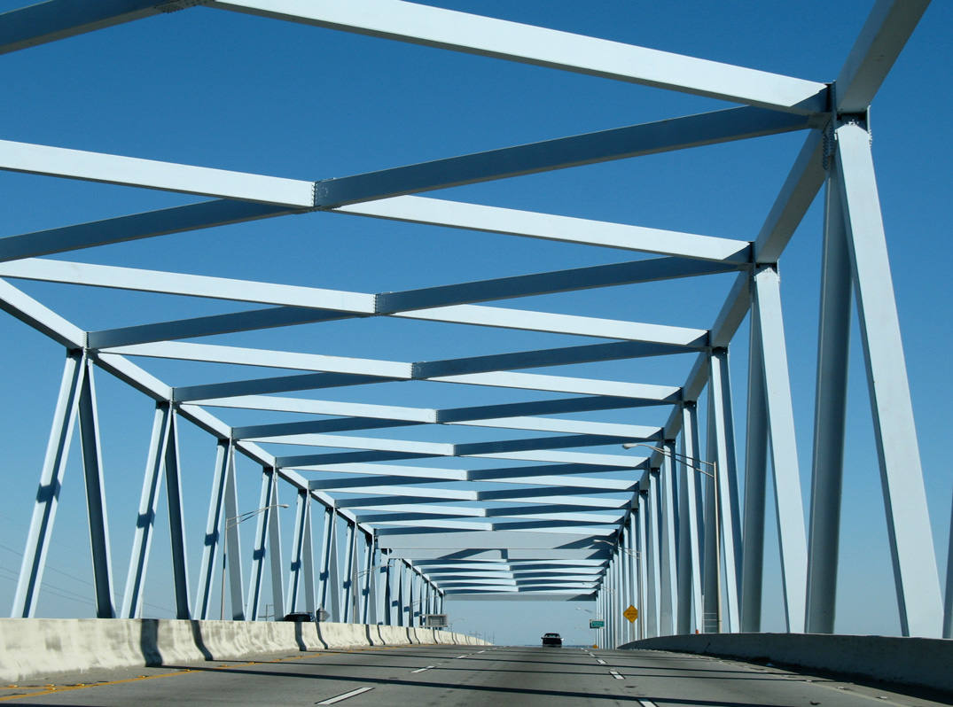
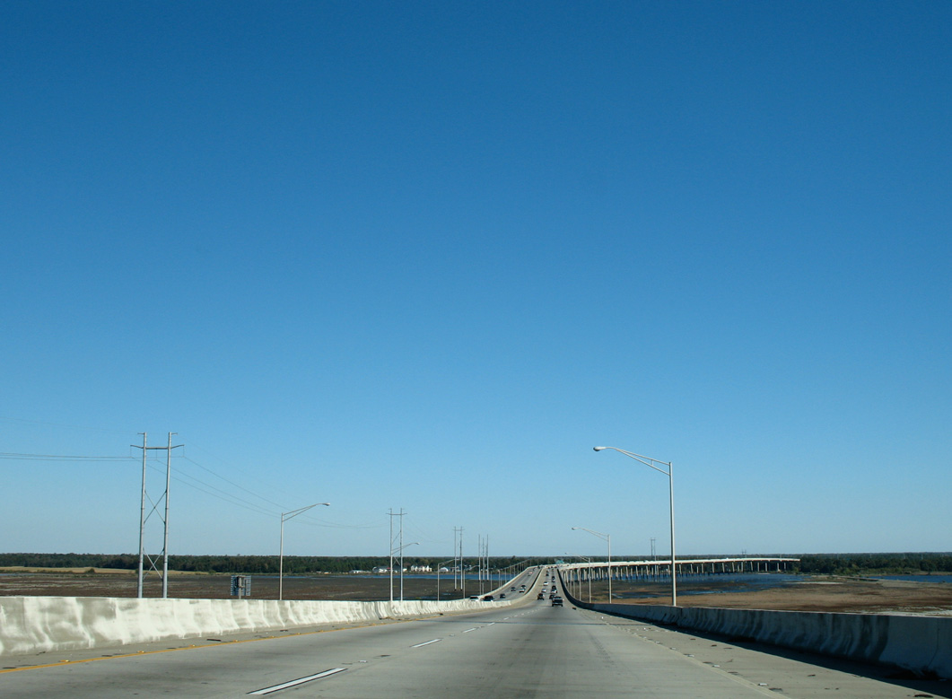
Interstate 526 (Mark Clark Expressway) elevates onto a system of viaducts and high rise bridges over the ensuing 5.1 miles from Rivers Avenue.
11/12/06
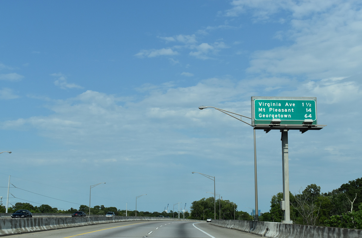
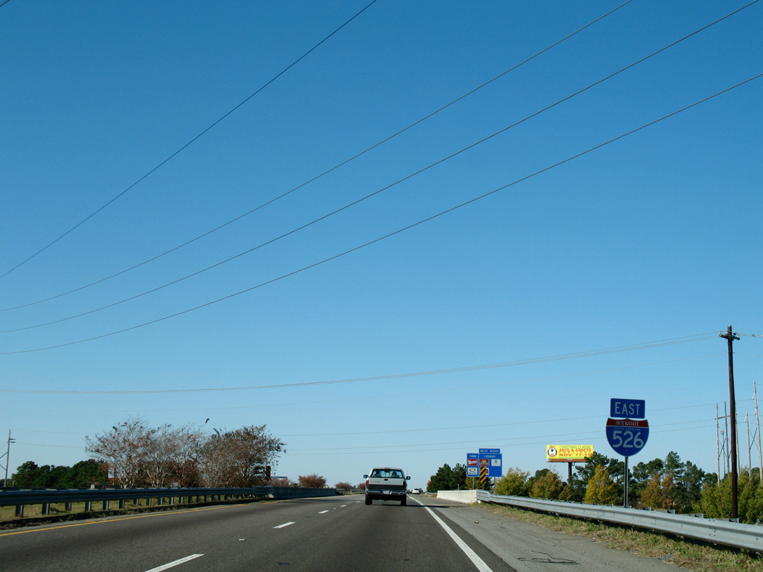
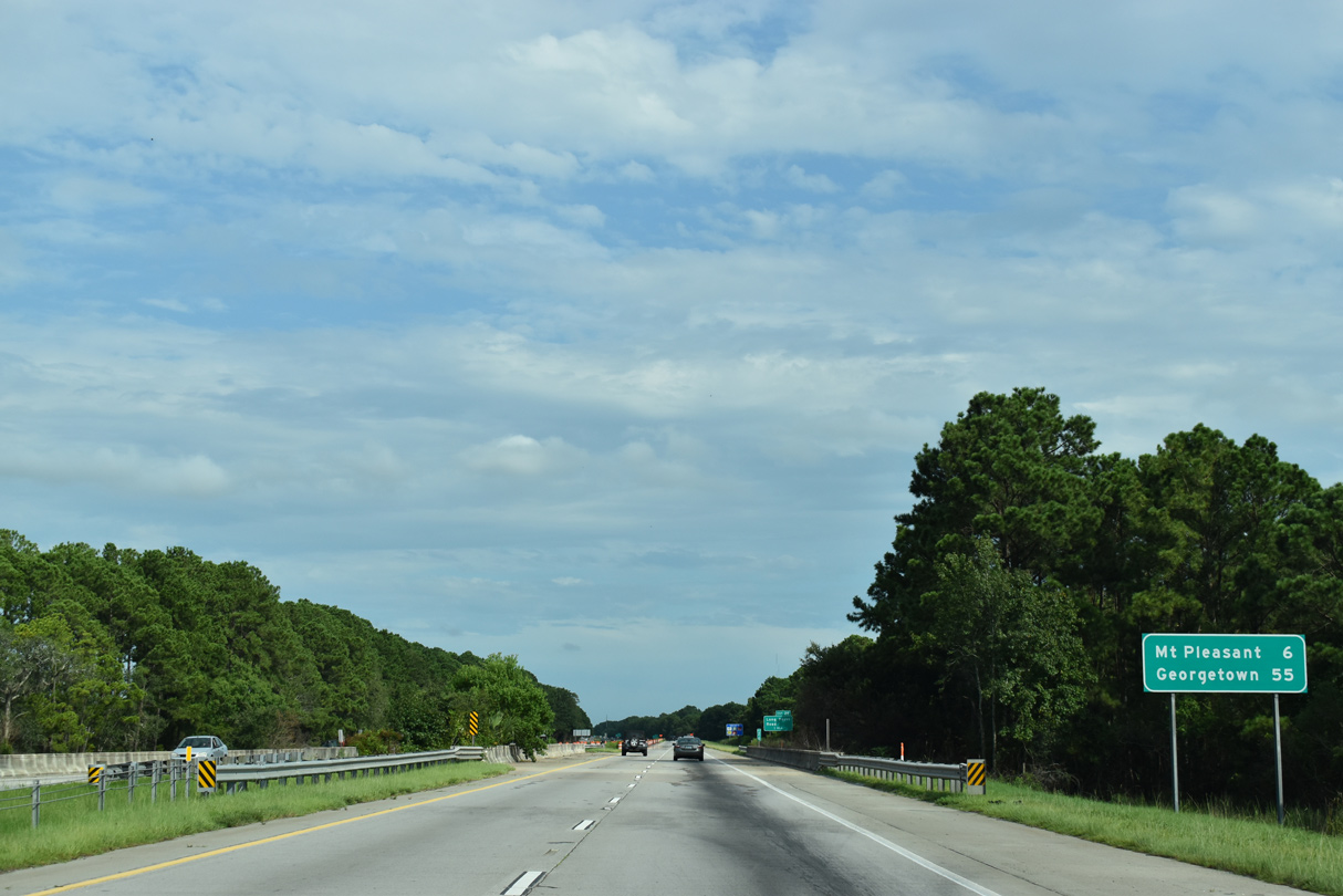
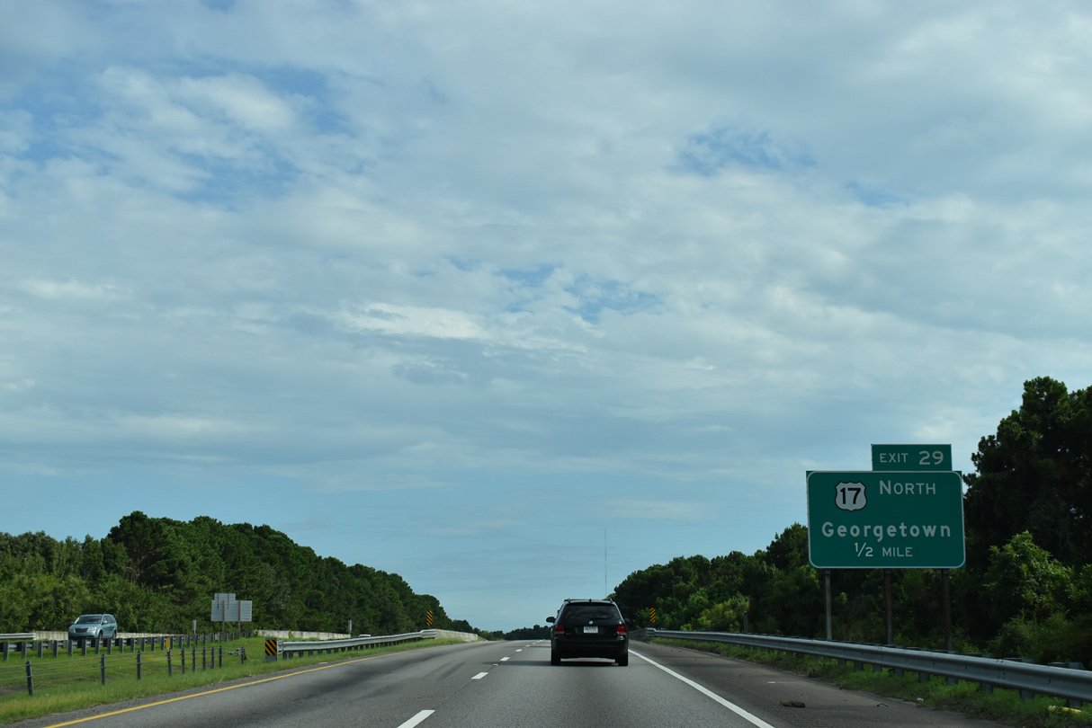
Mt. Pleasant lies 14 miles ahead beyond the east end of Interstate 526. Georgetown is 50 miles further along U.S. 17 northbound.
08/18/19
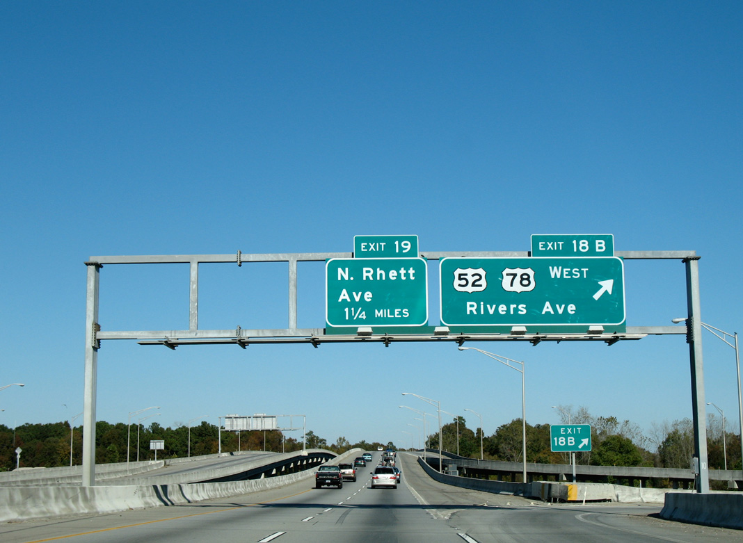
Traveling over Filbin Creek, I-526 enters a folded diamond interchange (Exit 19) with North Rhett Avenue. Rhett Avenue heads south to Park Circle and north to the city of Hanahan.
08/18/19
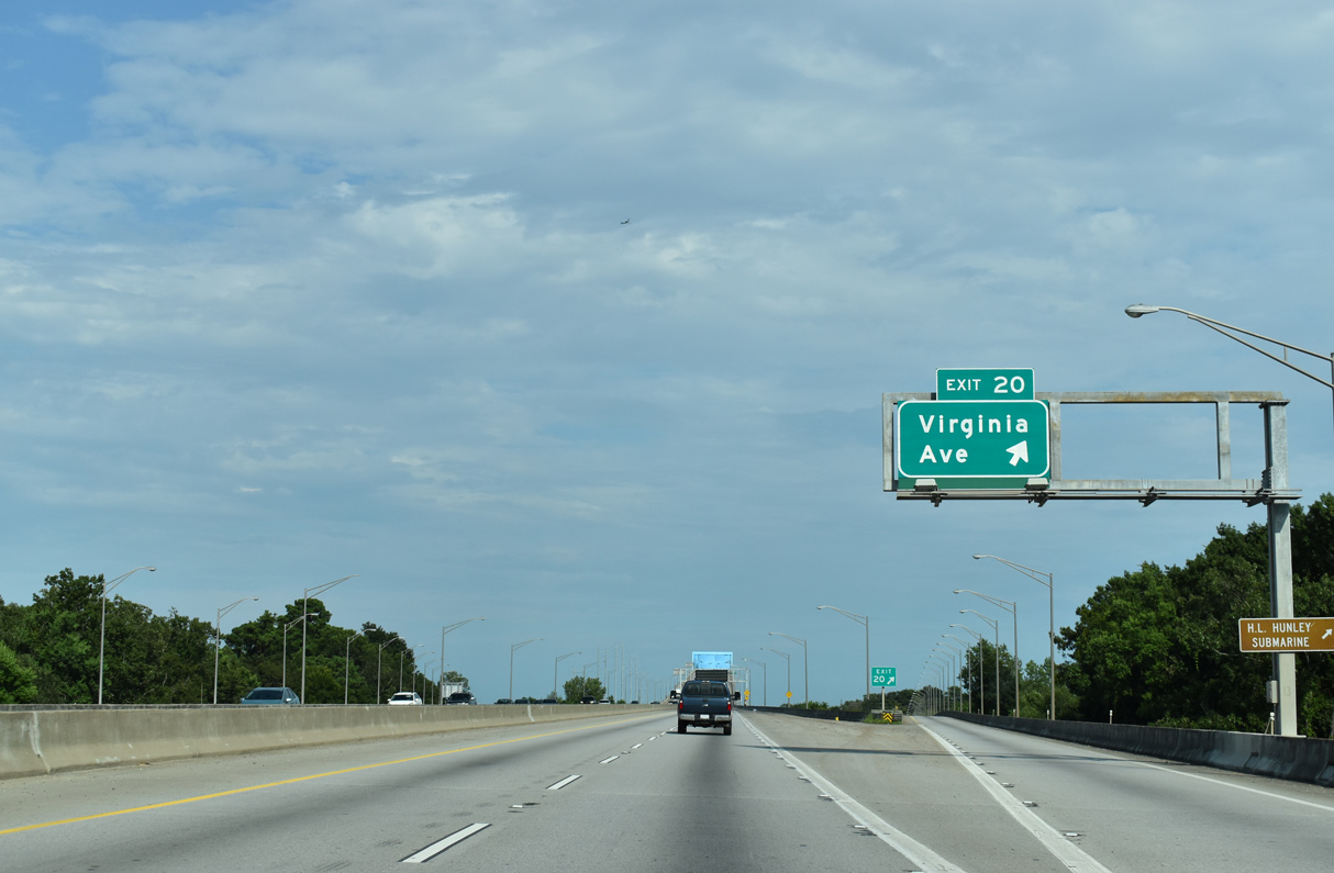
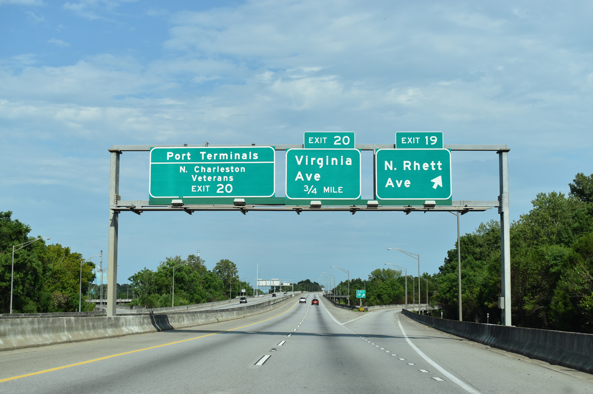
Exit 20 lowers from I-526 eastbound to Virginia Avenue. Virginia Avenue runs along industrial areas on the west side of the Cooper River.
08/18/19
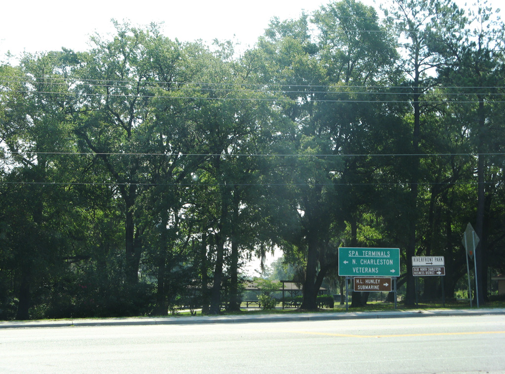
Virginia Avenue connects I-526 with the North Charleston Terminal of the South Carolina Port Authority (SPA) and the Veterans Terminal via Noisette Boulevard south.
05/30/07
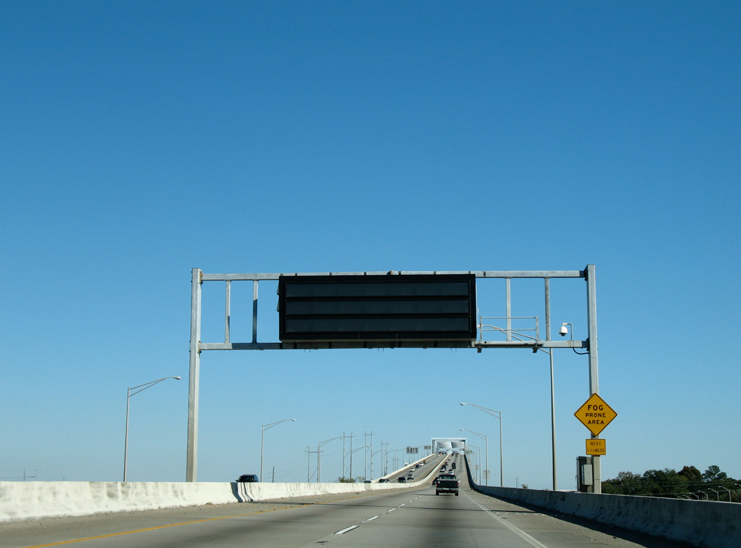
Traversing marshland areas along the Cooper and Wando Rivers, the next seven miles along Interstate 526 heading southeast are prone to foggy conditions during the winter months.
11/12/06
Interstate 526 climbs onto the Cooper River Bridge over Filbin Creek. The span stretches 10,900 feet.2
11/12/06
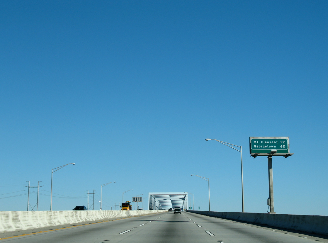
Distance sign posted 12 miles from Mount Pleasant and 62 miles southwest of Georgetown.
11/12/06
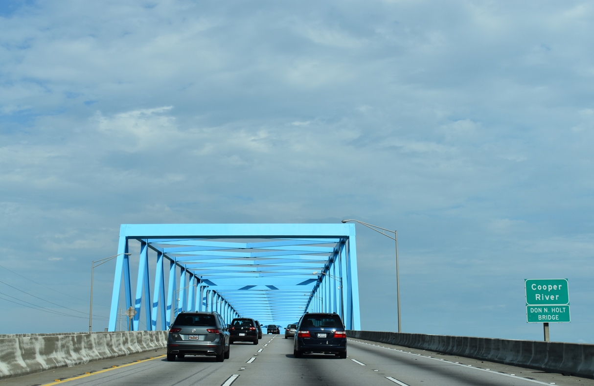
The Cooper River Bridge honors Drawdy Norton "Don" Holt, Jr. (1922-1995), a Charleston County legislator who served in the state House of Representatives from 1975 to 1995. The S.C. General Assembly passed a resolution naming the span after Holt on April 15, 1992.3
08/18/19
The Cooper River span is a continuous Warren box truss bridge peaking at 155 feet above sea level.2 Truck climbing lanes open along both sides of I-526 to the bridge apex.
11/12/06
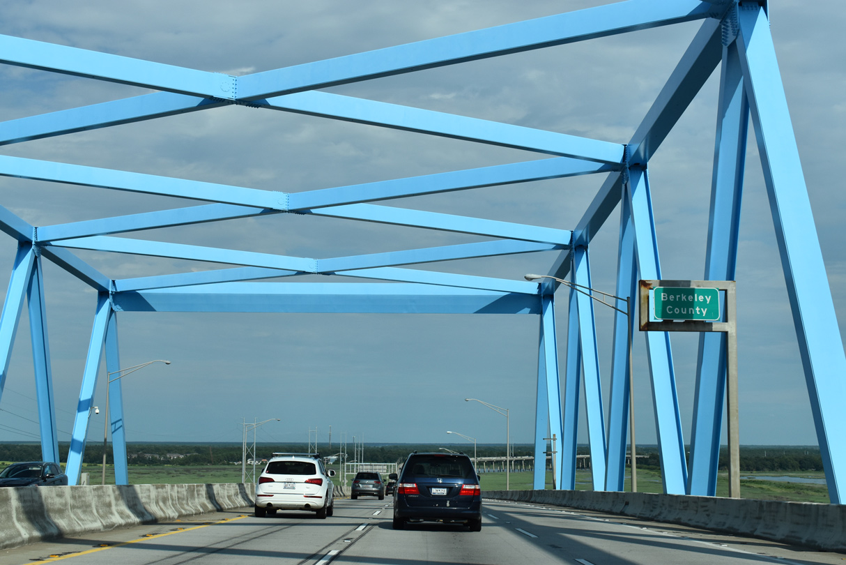
I-526 enters Berkeley County at mid-span across the Cooper River. The Mark Clark Expressway reenters Charleston County in 4.59 miles.
08/18/19
The Don N. Holt Bridge crosses over wetlands and areas of Naval Weapons Station Charleston between the Cooper River and Clouter Creek as I-526 turns southward toward Thomas Island.
11/12/06
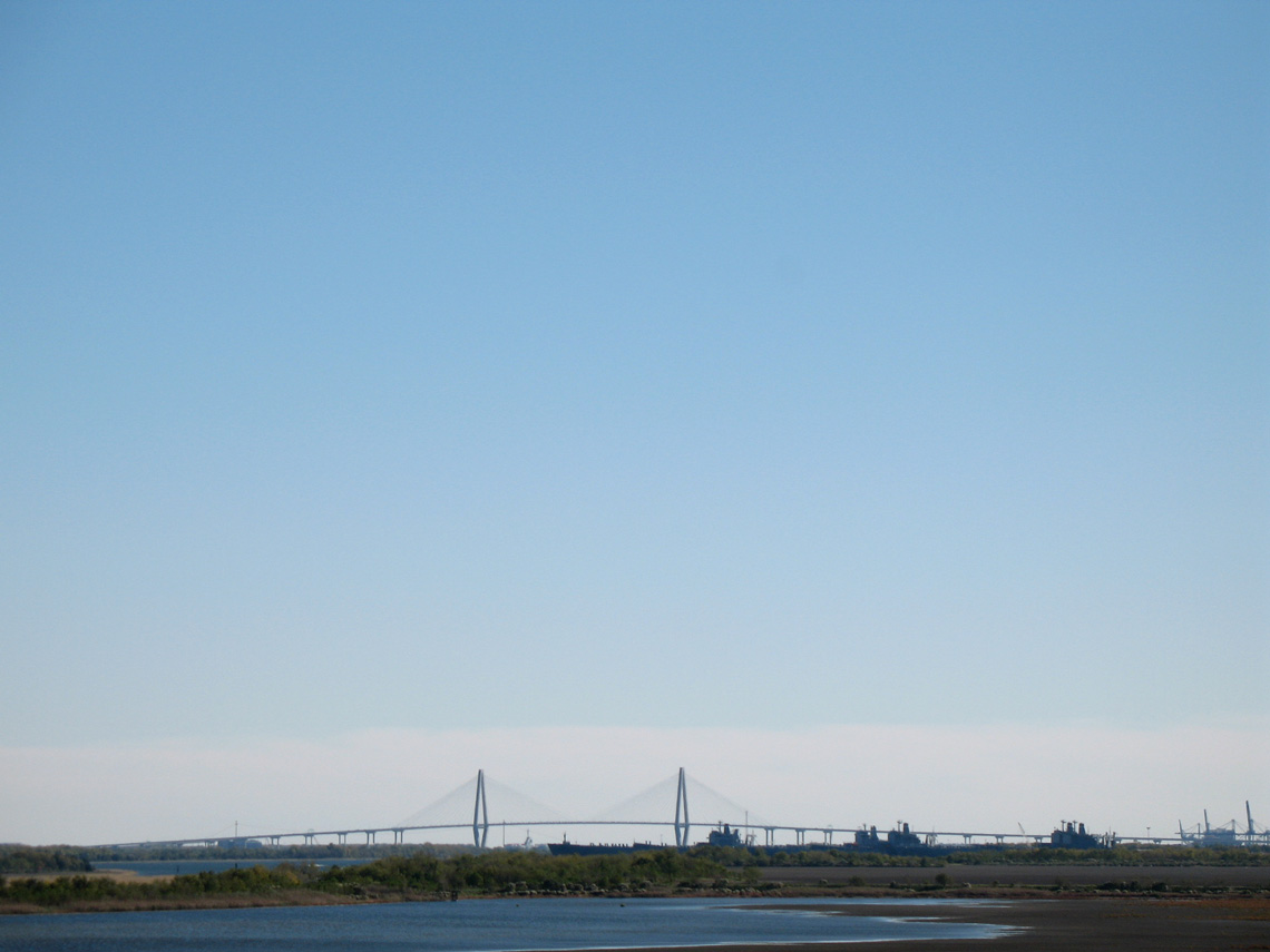
Looking south over Cloutier Creek toward the Arthur Ravenel, Jr. Bridge carrying U.S. 17 between Charleston and Mt. Pleasant.
11/12/06
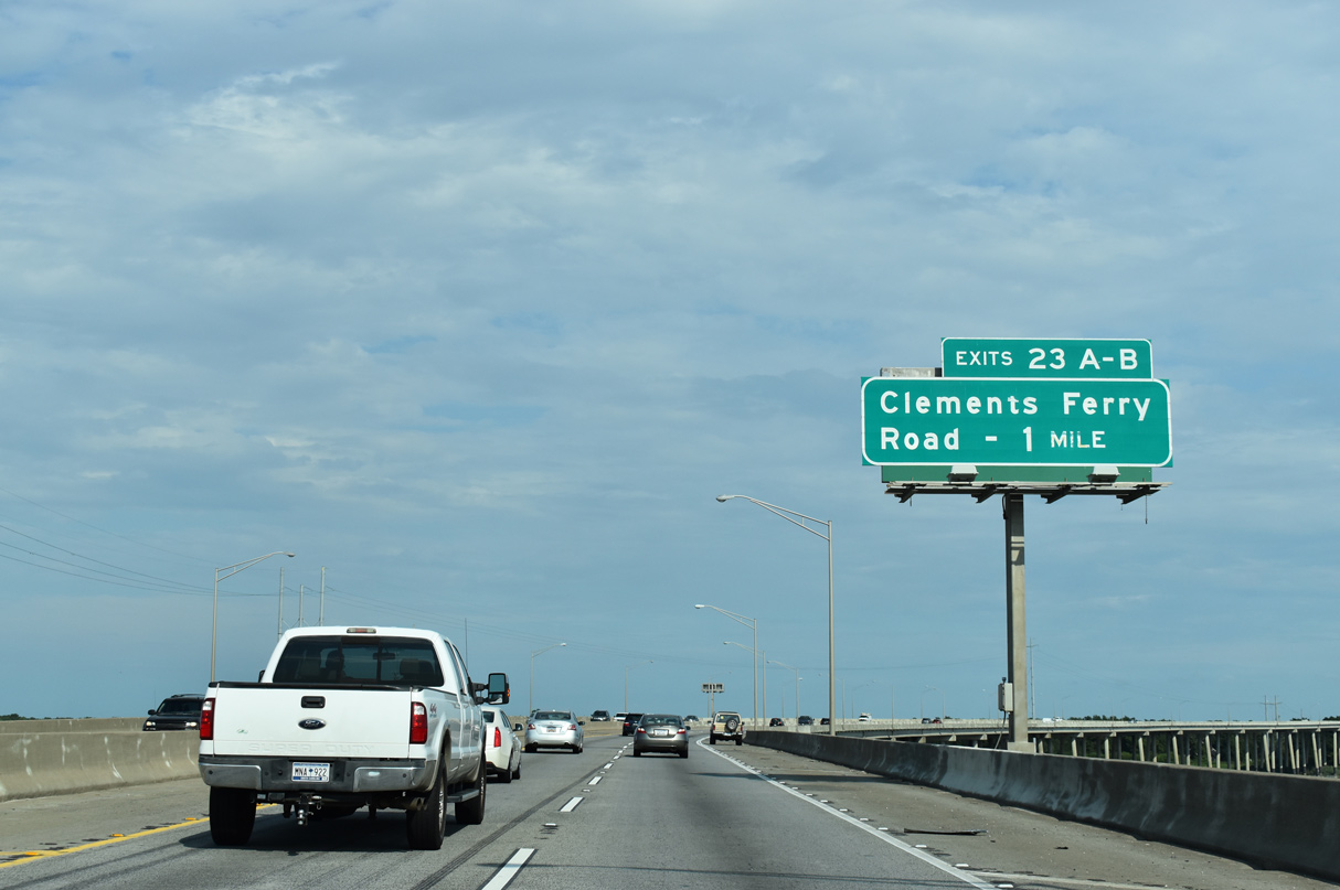
The first of two exits connecting I-526 with Daniel Island is Exit 23A for Clements Ferry Road.
08/18/19

The Cooper River Bridge opened on June 20, 1992 as the final section of Interstate 526.
11/12/06
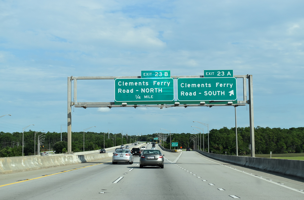
Exit 23A departs I-526 east for Clements Ferry Road south to St. Thomas Island Drive and Daniel Island.
08/18/19
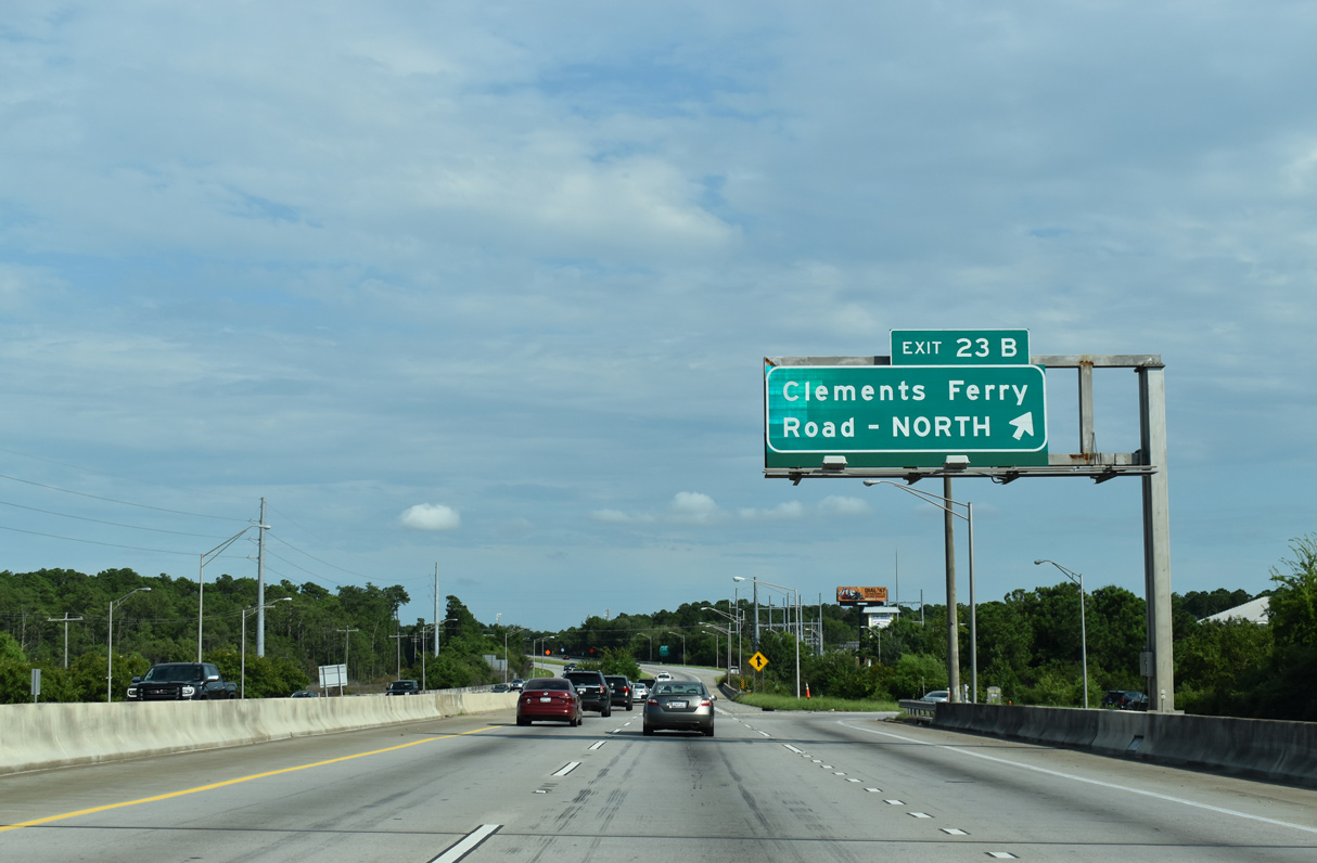
Clements Ferry Road (Road 33) arcs northeast from Exit 23B and Thomas Island to Wando and S.C. 41.
08/18/19
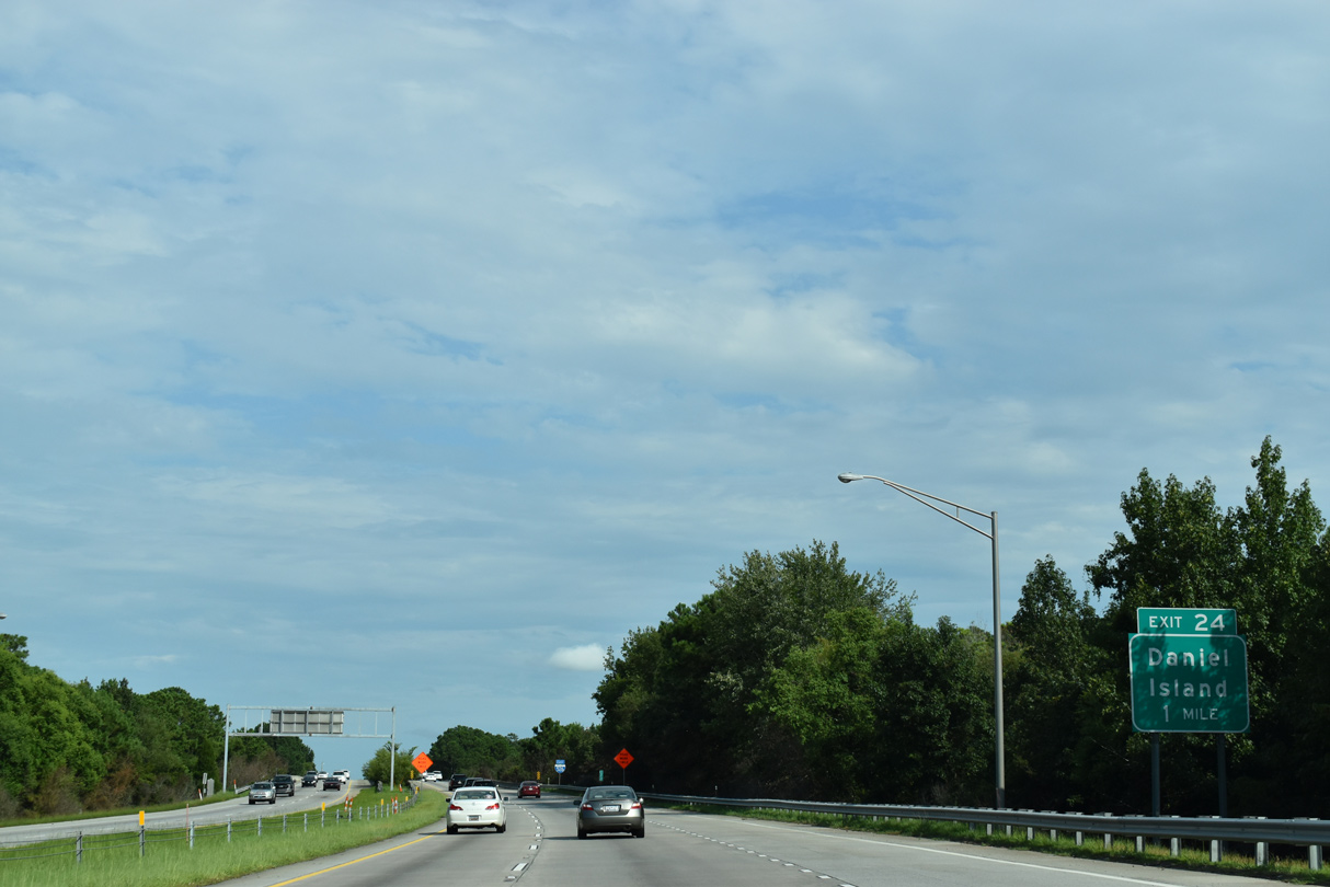
A folded diamond interchange (Exit 24) follows one mile south of Clements Ferry Road on Daniel Island.
08/18/19

Spanning Nowell Creek, Interstate 526 crosses onto Daniel Island ahead of the the site for MUSC Health Stadium. Opened in 1999 and demolished in 2021, the 5,100 seat venue was home of the Charleston Battery, a United Soccer League franchise.4
08/18/19
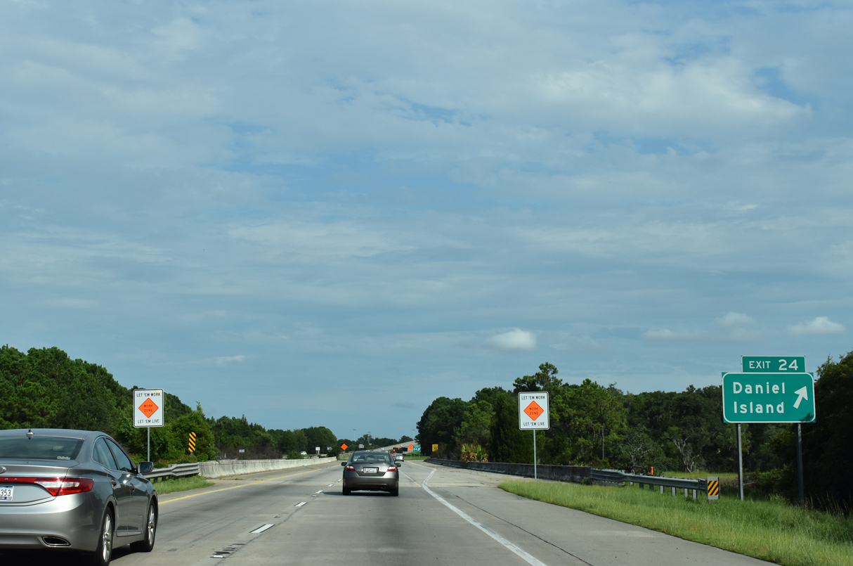
Exit 24 ties into the intersection of River Landing Drive at Fairchild Street within the business district of Daniel Island.
08/18/19
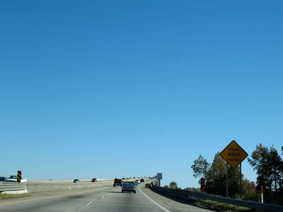
Interstate 526 climbs again onto the James B. Edwards Bridge across the Wando River. Subject to strong crosswinds, the 1989-built span tops out at 138 feet.5
11/12/06

Prolonged leaking of rainwater into the hollow interior of the Wando River bridge damaged some of the eight primary cables linking the concrete bridge segments. Corrosion on one of the cables discovered in 2016 ultimately led to it failing in May 2018. The span closed for three weeks for repairs, reopening on June 2, 2018.6
08/18/19
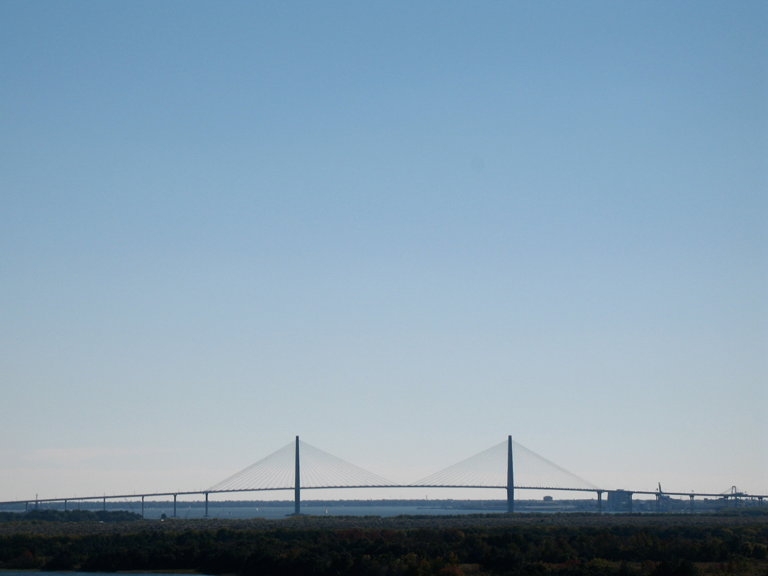
U.S. 17 crosses the Cooper River across the Arthur Ravenel, Jr. Bridge, a cable-stayed span opened to traffic on July 15, 2005.
11/12/06
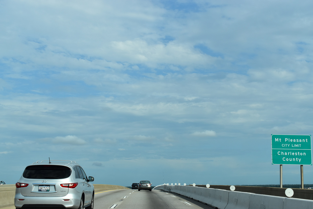
Interstate 526 enters both the town of Mt. Pleasant and Charleston County midway across the Wando River.
08/18/19
The 7,900 foot long4James B. Edwards Bridge lowers onto a peninsula between the Wando River and Rathall Creek. Townhomes and apartments line both sides of the freeway at the bridge end.
11/12/06
The town center of Mount Pleasant is located six miles to the east via Long Point Road and U.S. 17 south. The city of Georgetown is 55 miles to the northeast.
08/18/19
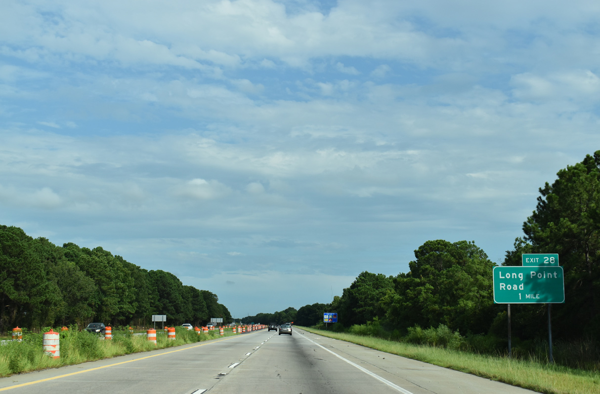
Long Point Road (Road 97) originates 0.63 miles to the east from upcoming Exit 28 at the South Carolina Port Authority Wando terminal.
08/18/19
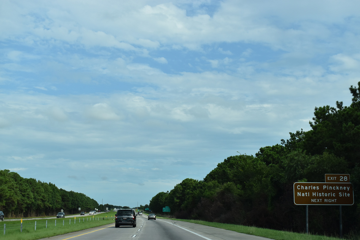
Long Point Road (Road 97) continues 2.6 miles east from Exit 28 to the Charles Pinckney National Historic Site.
08/18/19

A six-ramp parclo interchange (Exit 28) joins I-526 with Long Point Road in Mount Pleasant. Long Point Road (Road 97) provides a cutoff 3.18 miles east to U.S. 17 north through the Snowden community.
08/18/19
The last reassurance marker for Interstate 526 stands ahead of Hobcaw Creek along the Mark Clark Expressway eastbound.
11/12/06
Interstate 526 crosses over Wakendaw Road a half mile ahead of the split into branches for U.S. 17.
08/18/19
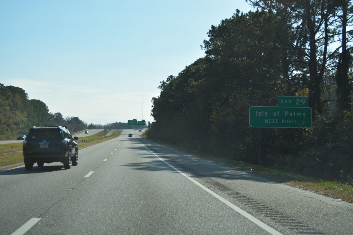
The eastern prong of I-526 links with U.S. 17 at a single point interchange opposite Hungry Neck Road east to S.C. 517 (Isle of Palms Connector). The SPUI at Hungry Neck Road was constructed during a $123.7 million, 10 mile widening project along U.S. 17 completed in January 2013.7
12/31/17
Exit 29 separates from I-526 eastbound at a wye interchange for U.S. 17 at Hungryneck Boulevard. U.S. 17 comprises a suburban arterial with six lanes east to Darrell Creek Trail. The highway joins Charleston with Georgetown and Myrtle Beach to the northeast.
08/18/19
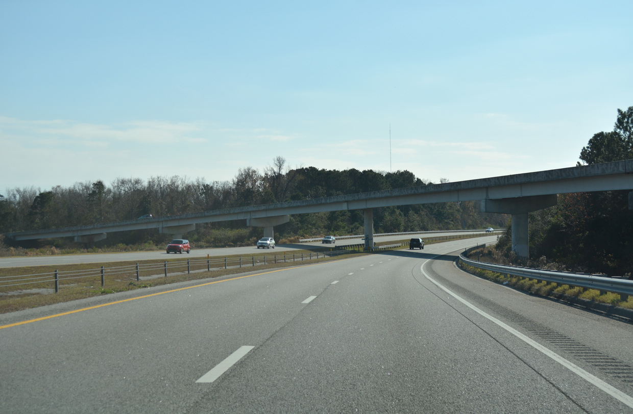
A flyover takes traffic southeast to U.S. 17 at Hungry Neck Boulevard. The I-526 mainline shifts westward across Shem Creek to Business Spur I-526 (Chuck Dawley Boulevard).
12/31/17
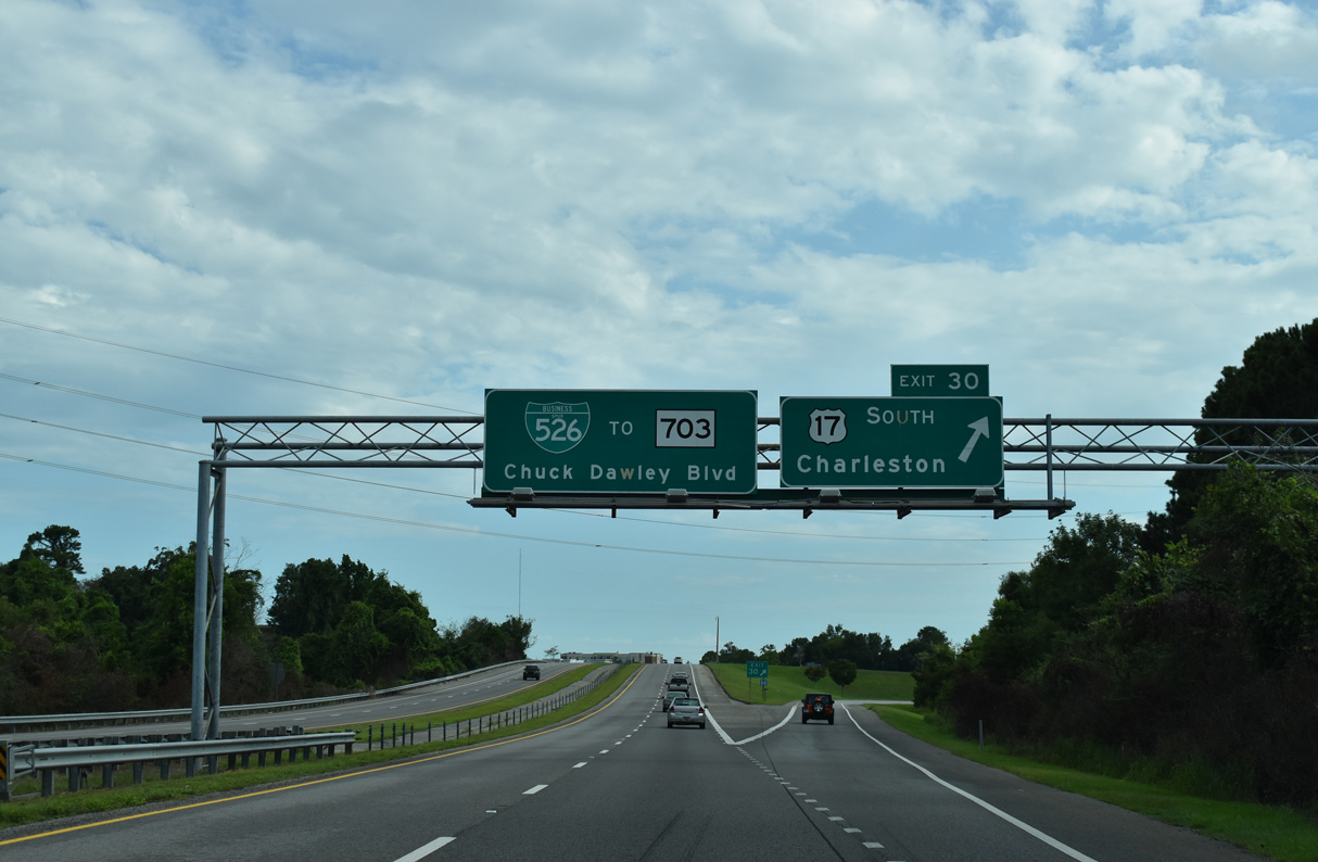
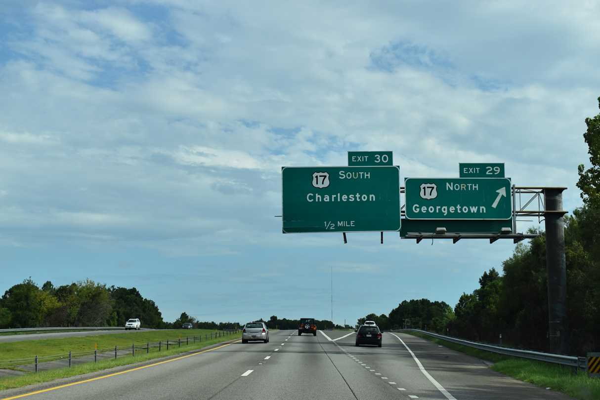
Exit 30 departs next for U.S. 17 (Johnnie Dodds Boulevard) south to the Arthur Ravenel, Jr. Bridge into Charleston. Business Spur I-526 takes over at the U.S. 17 underpass, linking the freeway southwest with S.C. 703 (Coleman Boulevard).
08/18/19
Business Spur I-526 transitions into an at-grade arterial just south of the parclo interchange (Exit 30) with U.S. 17, intersecting Bowman Road ahead. The spur extends 1.57 miles to S.C. 703.
12/31/17
References:
- I-526 EBL over ASHLEY RIVER, Charleston County, South Carolina. http://bridgereports.com/1481696 BridgeReports.com
- Don Holt Bridge. http://bridgehunter.com/sc/berkeley/cooper-river/ Bridgehunter.com
- 1991-92 Bill 3448: Don H. Holt Bridge named - South Carolina Legislature Online. South Carolina General Assembly, 109th Session, 1991-1992.
- I-526 EB over WANDO RIVER, Charleston County, South Carolina. http://bridgereports.com/1481713 BridgeReports.com
- MUSC Health Stadium. Wikipedia.
- "South Carolina officials: Wando River bridge back open and ‘absolutely safe’." Post and Courier, The (Charleston, SC), June 2, 2018.
- "'Just Like Legos' U.S. 17 in Mt. P. to close 5 nights for I-526 overpass installation." Post and Courier, The (Charleston, SC), May 15, 2012.
Photo Credits:
- Alex Nitzman, Justin Cozart: 11/12/06
- aan.wcb: 01/18/04
- Brent Ivy: 08/18/19
- Andy Field: 05/30/07
- Alex Nitzman: 12/31/17
Connect with:
Page Updated Monday September 27, 2021.