
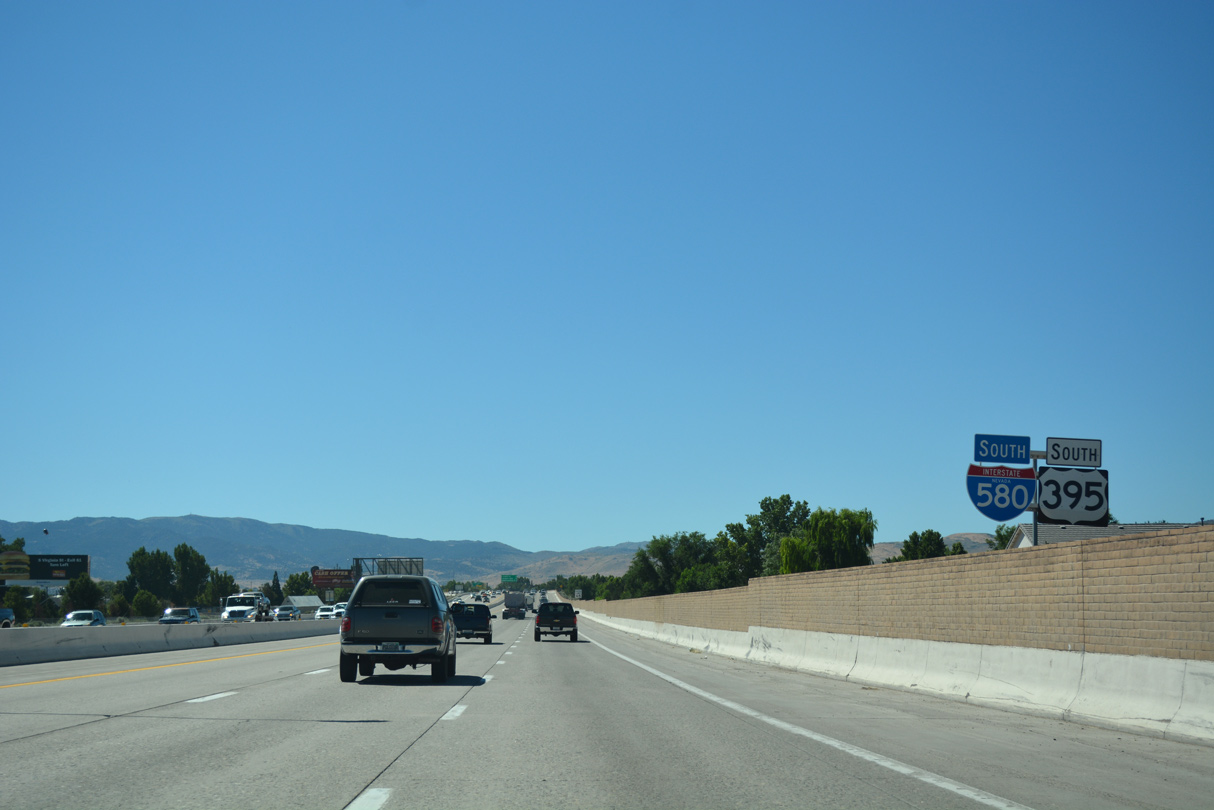
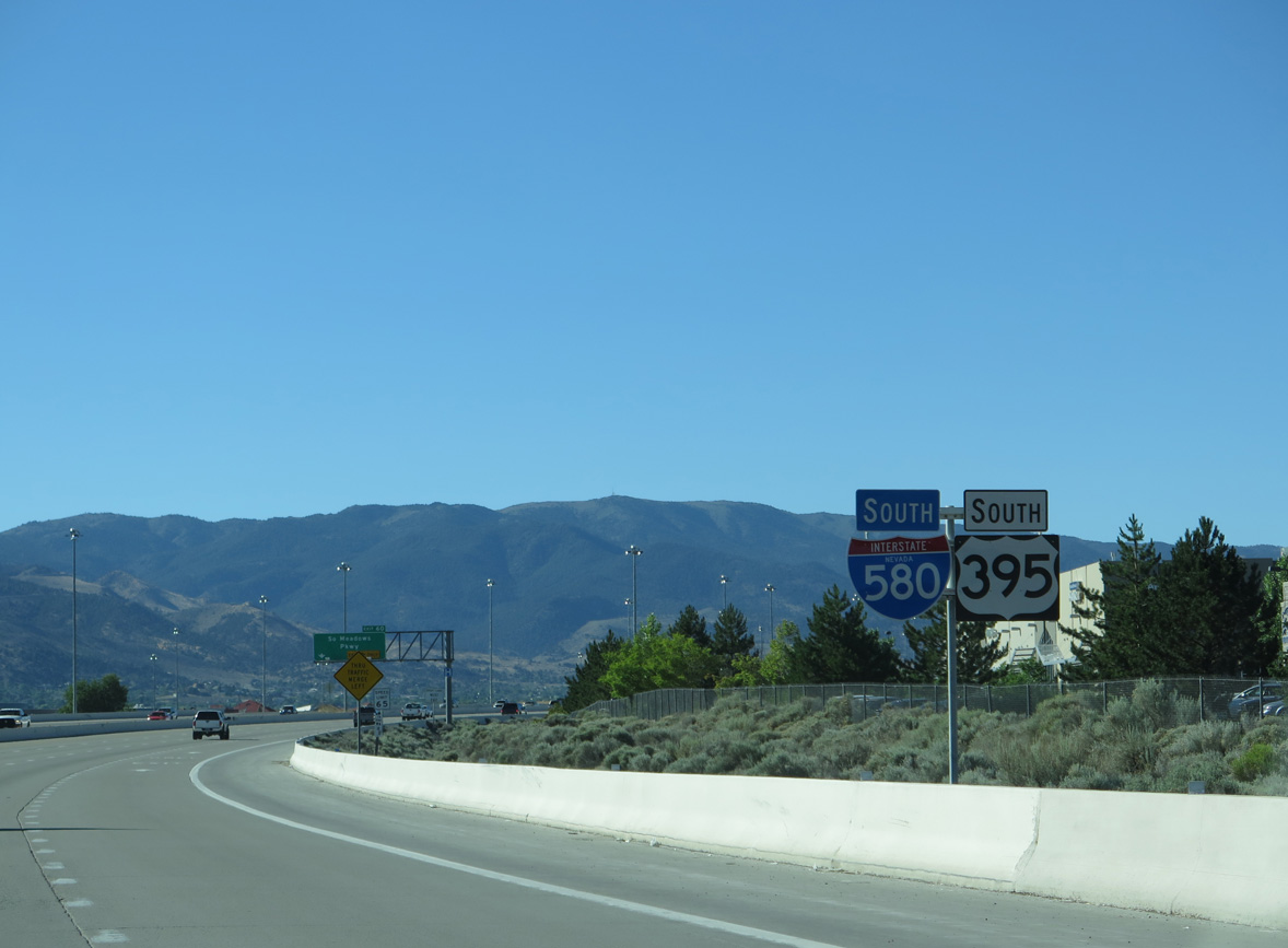
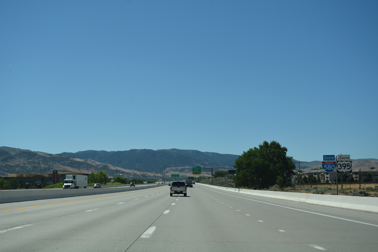
I-580/U.S. 395 South - Reno

 South
South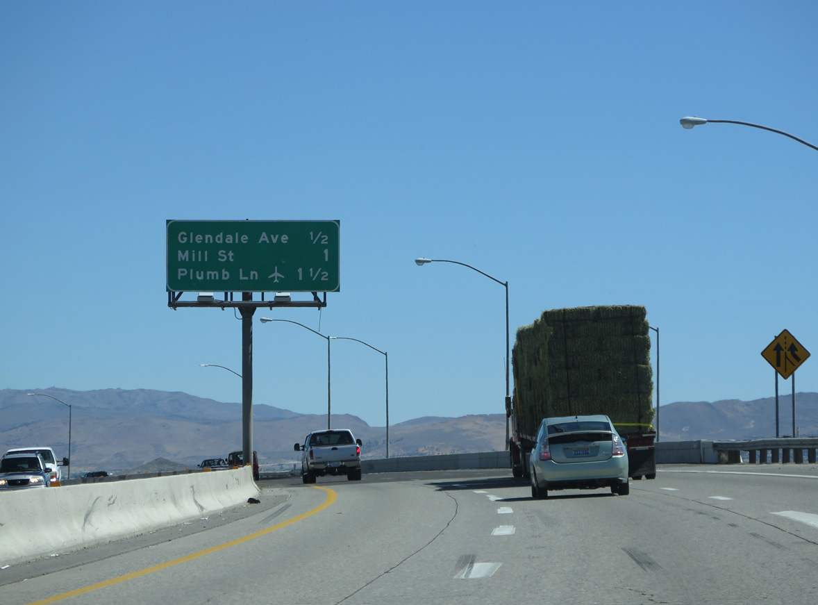
Interstate 580 & U.S. 395 (Martin Luther King, Jr. Memorial Highway) navigate through an S-curve across the Truckee River to Exit 67 with Glendale Avenue (SR 648).
06/28/14
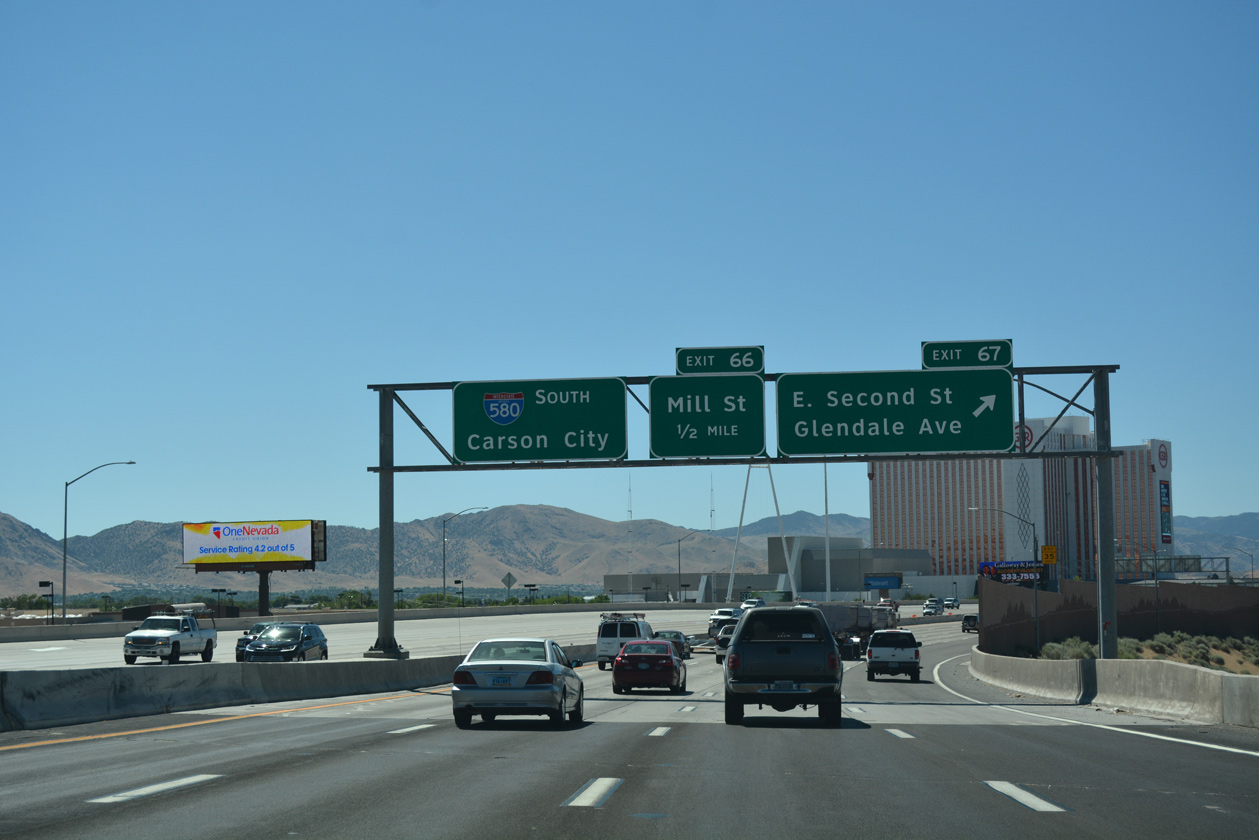
Omitted from guide signs in both directions, East 2nd Street west to Kietzke Lane (SR 667) and Glendale Avenue east from the Truckee River to McCarran Boulevard (SR 659) in Sparks is SR 648. The 2.65 mile state route proivdes part of a route west from I-580 to Downtown Reno.
07/17/17
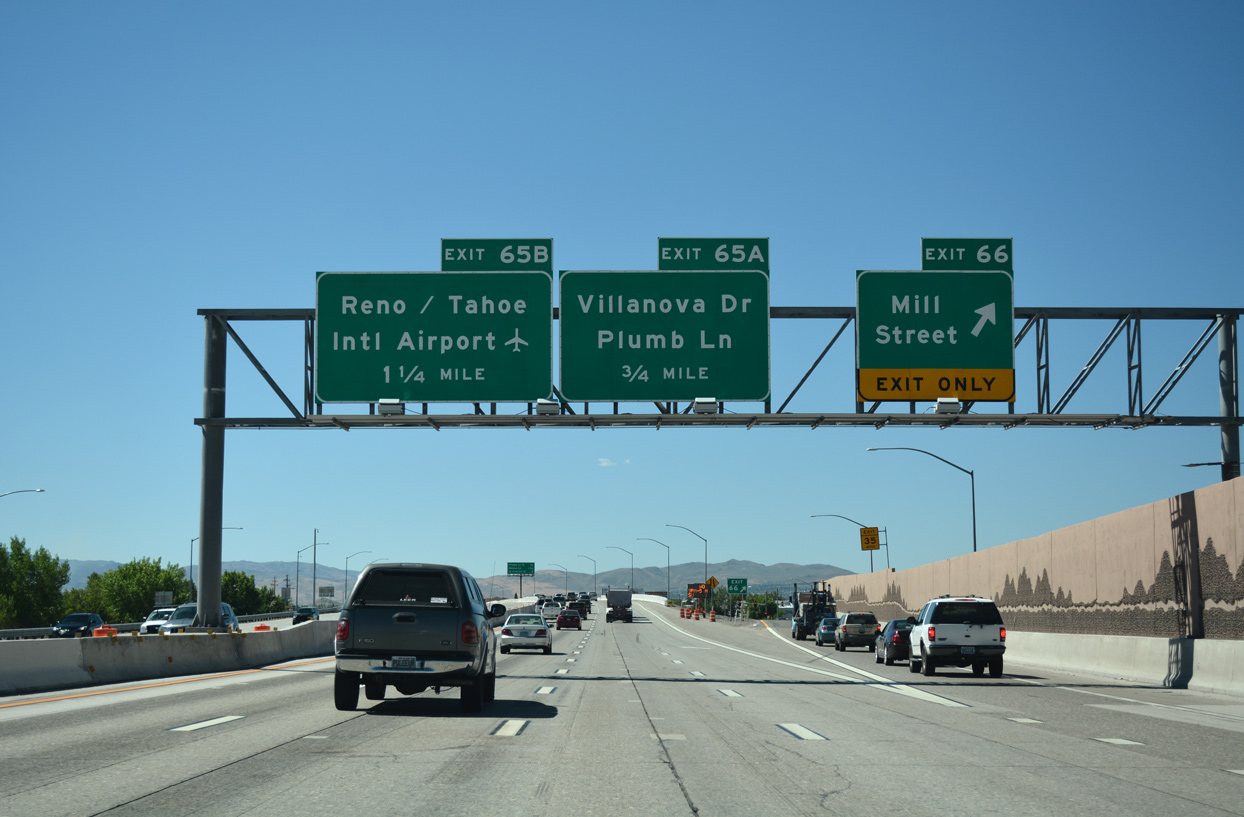
The second in a series of parclo interchanges along I-580 & U.S. 395 south joins the freeway with Mill Street at Exit 66. Mill Street angles southeast from central Reno to Grand Sierra Resort and Casino and industrial and business parks on the northeast side of Reno-Tahoe International Airport (RNO).
07/17/17
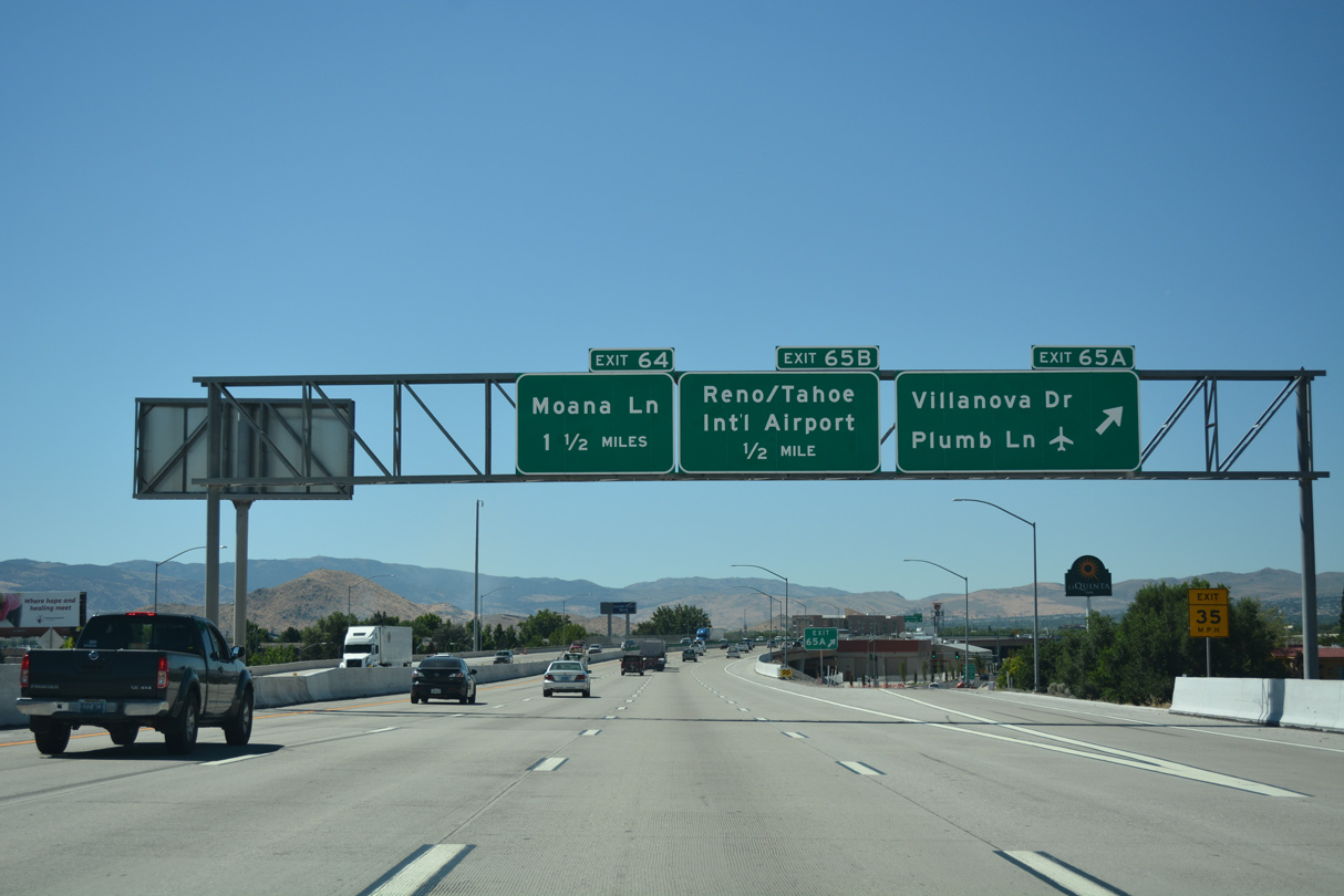
The next interchange sequence sign omits Exit 65B for Reno-Lake Tahoe International Airport (RNO). Exit 65A also serves RNO Airport, but along an at-grade arterial via Plumb Lane east to Terminal Way.
07/17/17
A split diamond interchange (Exit 65A) joins Interstate 580 and U.S. 395 with Villanova Drive and Plumb Lane (SR 653). Villanova Drive is a local collector between Harvard Way and Terminal Way. Plumb Lane is state-maintained west 0.588 miles from Terminal Way to Kietzke Lane (SR 667). The boulevard extends west to Virginia Street (U.S. 395 Business) and West McCarran Boulevard (SR 659).
07/17/17
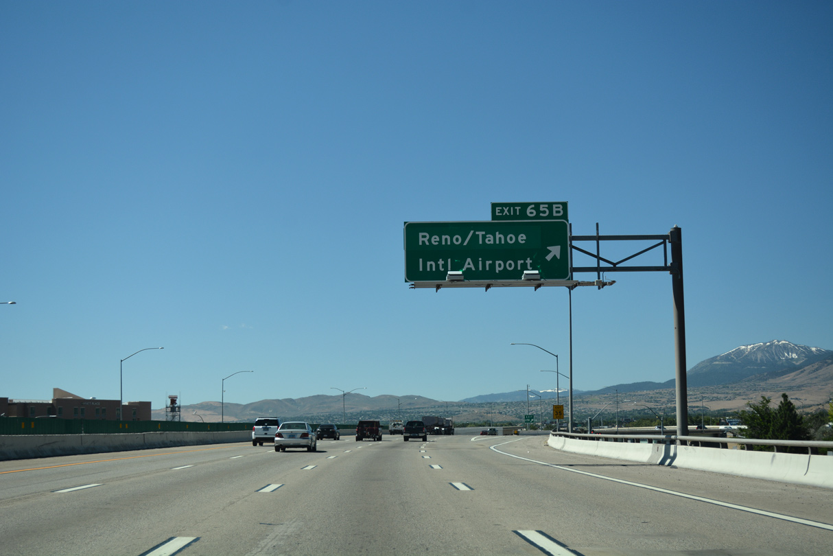
I-580 & U.S. 395 elevate onto a viaduct between Eat Wooster High School and businesses along parallel Terminal Way to the departure of Exit 65B to the passenger terminal of Reno-Tahoe International Airport (RNO).
07/17/17
Flyovers at the wye interchange (Exit 65B) to the RNO passenger terminal from I-580 were completed in 1988.
07/17/17
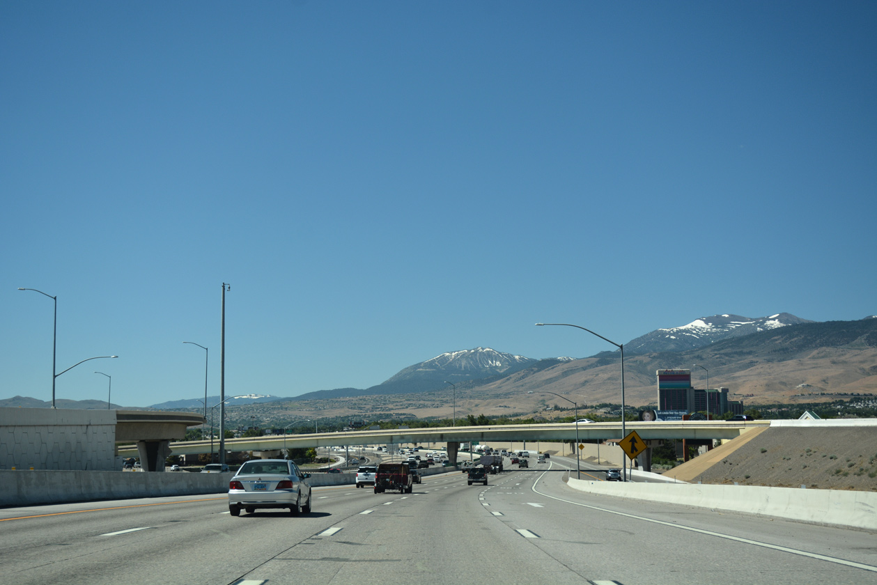
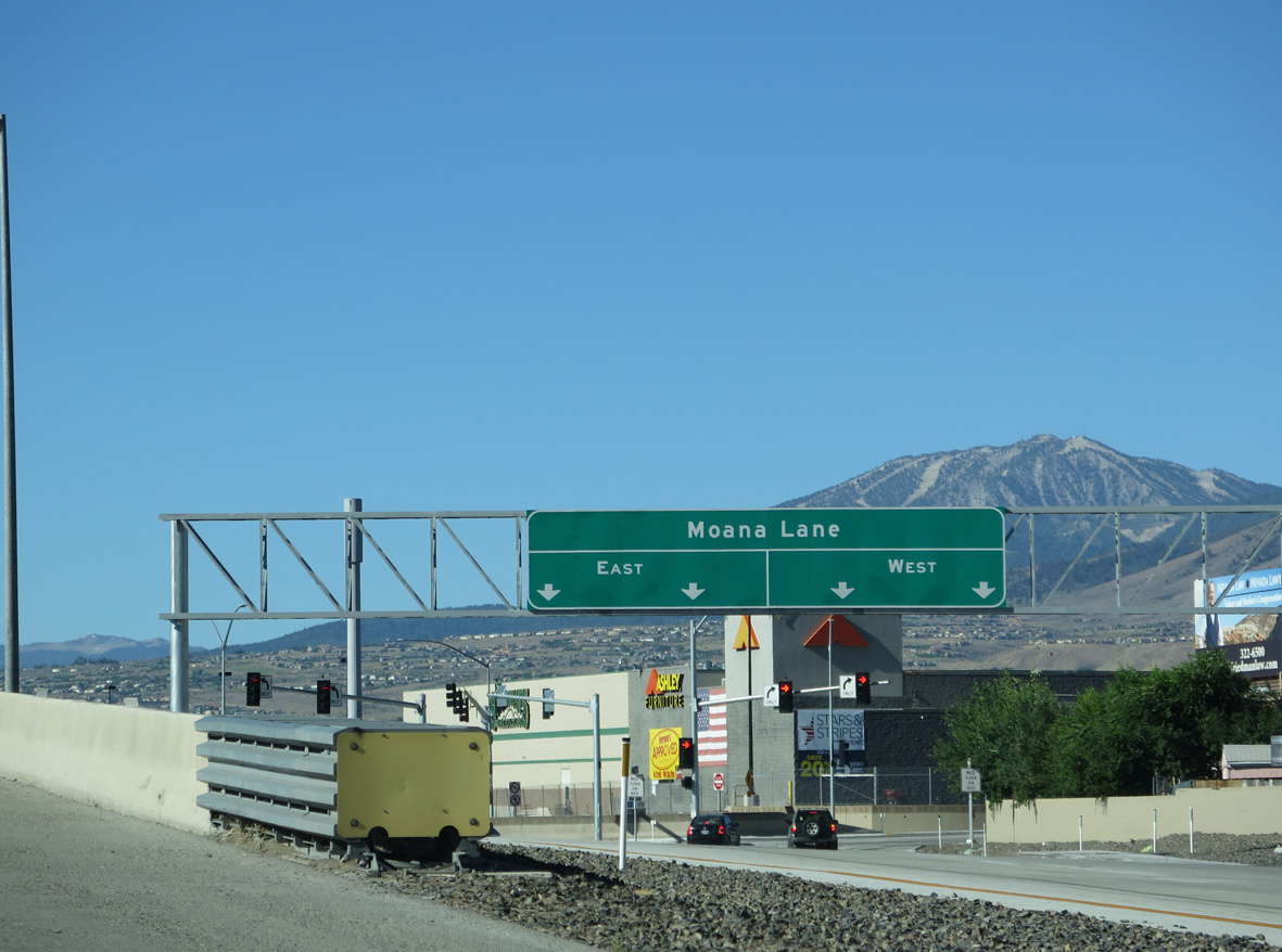
I-580 & U.S. 395 run just west of the RNO runways on the approach to the single point urban interchange (SPUI) with Moana Lane.
07/17/17
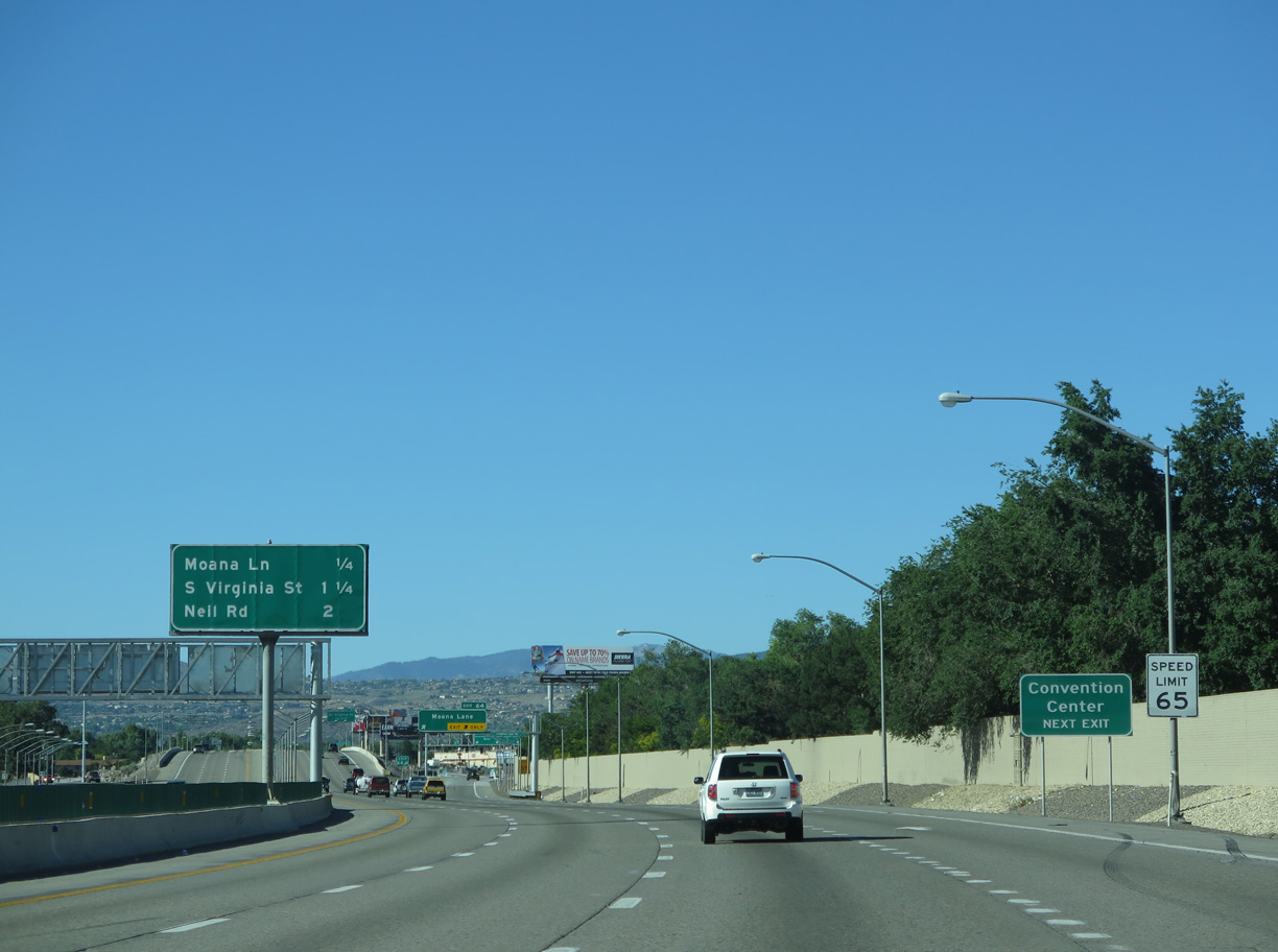
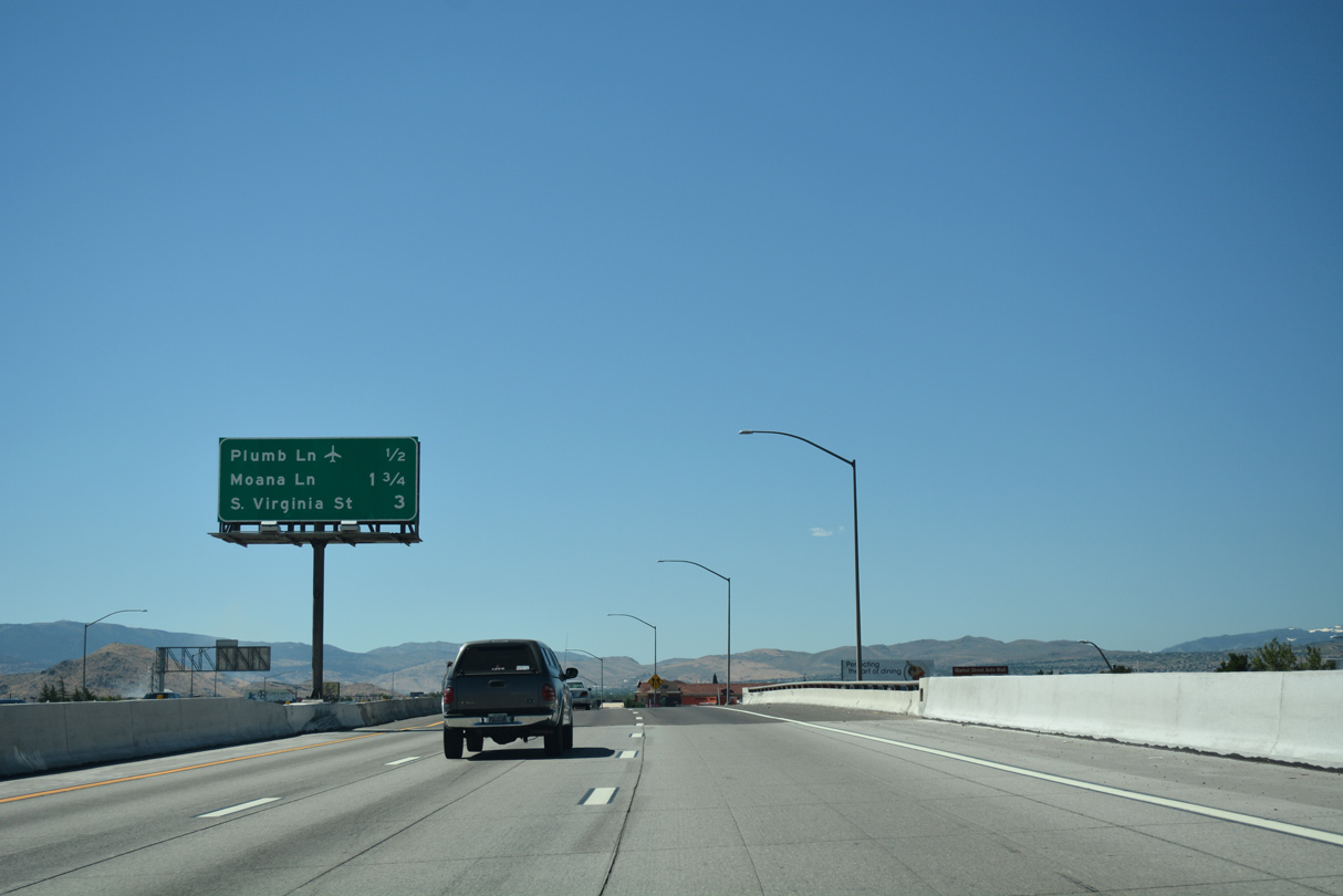
Moana Lane comprises a six lane arterial linking I-580 & U.S. 395 with U.S. 395 Business (Virginia Street) north of Atlantis Casino resort and the Reno-Sparks Convention Center. U.S. 395 Business and Martin Luther King, Jr. Memorial Highway come together directly in 1.25 miles.
06/29/14
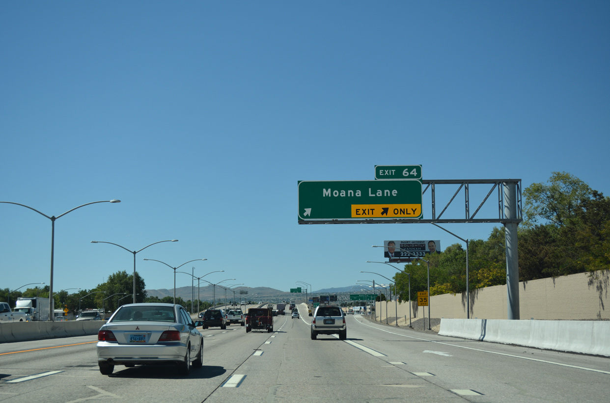
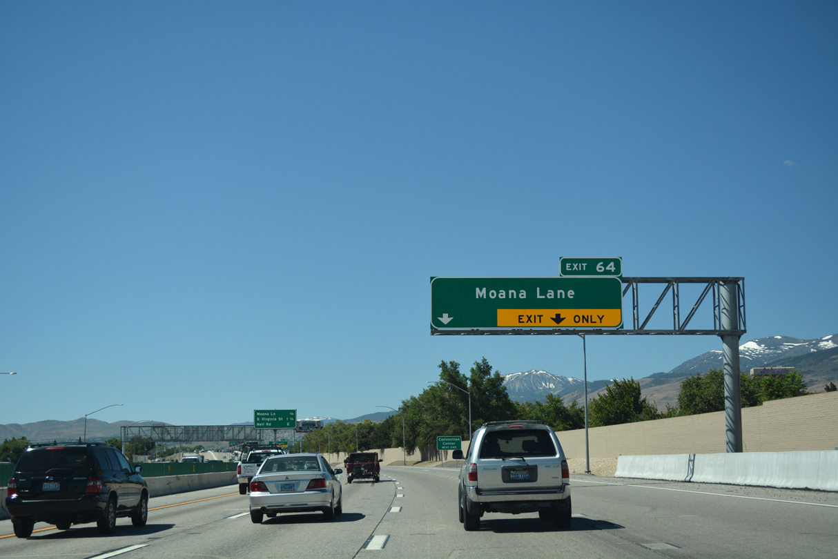
A lane drop occurs along I-580 & U.S. 395 southbound at Exit 64. The freeway continues south with six overall lanes.
07/17/17
Exit 64 partitions into dual turn lanes for Moana Lane west to the Country Club Estates and Rancho Manor neighborhoods and east to Airway Drive leading south along RNO Airport to SR 659 (McCarran Boulevard).
06/29/14
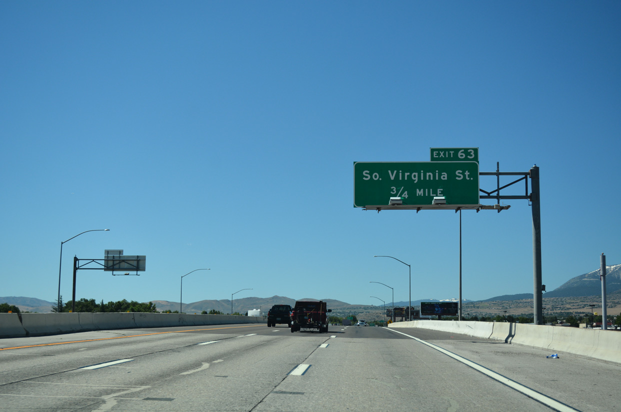
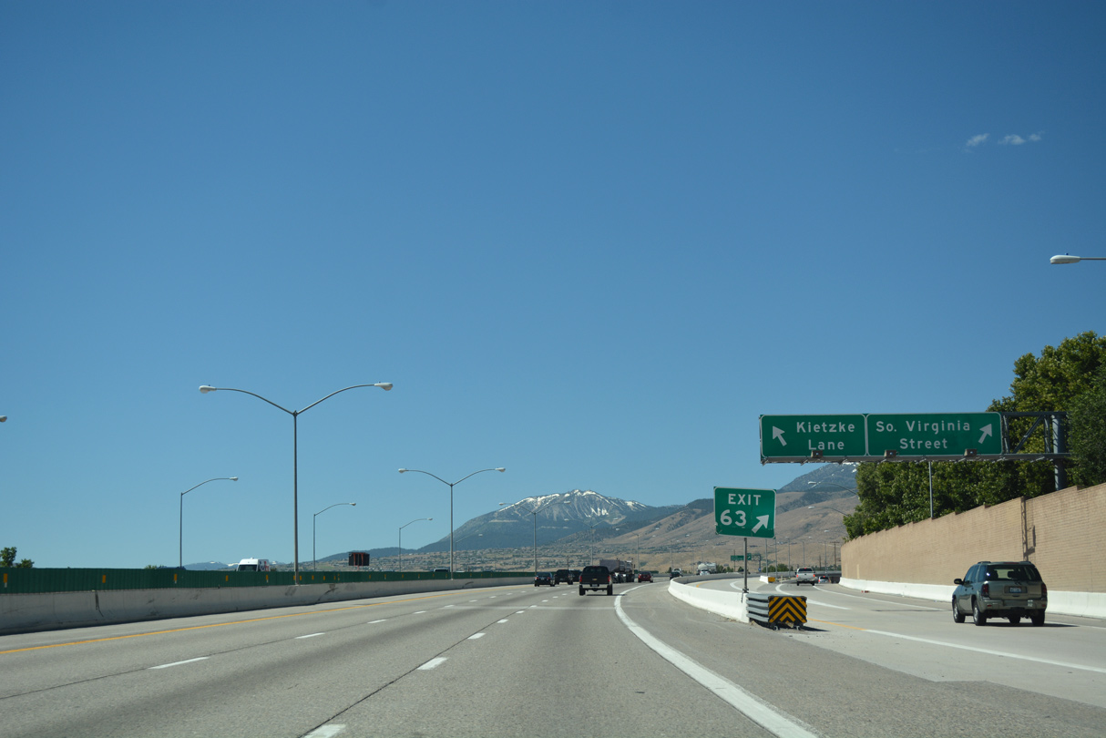
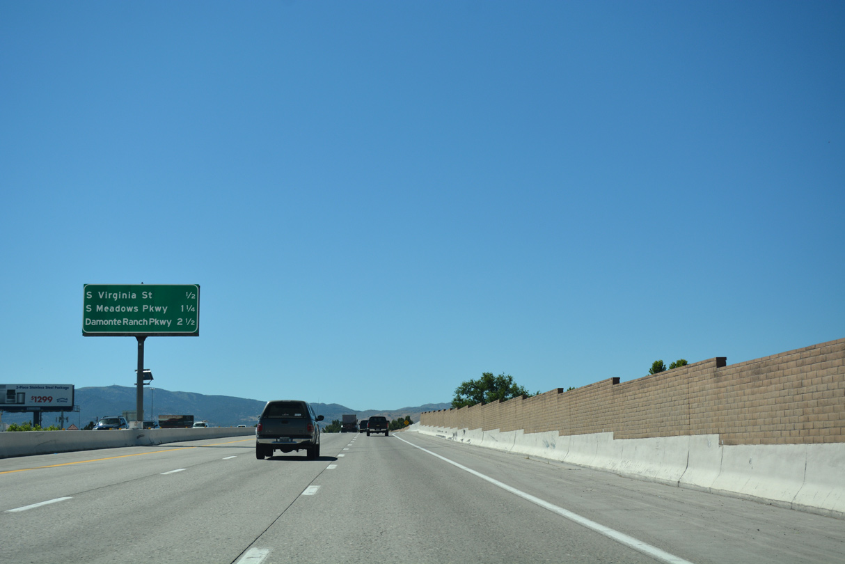
A half diamond interchange (Exit 63) joins I-580 & U.S. 395 south with South Virginia Street (U.S. 395 Business) in 0.75 miles.
07/17/17
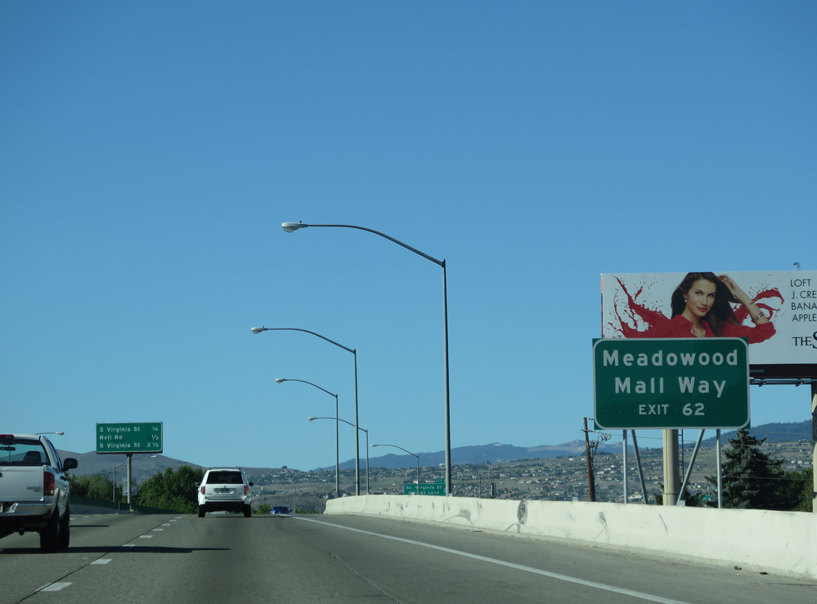
The subsequent off-ramp (Exit 62) from I-580 & U.S. 395 lowers from the approaching viaduct to Meadowood Mall Way. Construction from June 2010 to November 2012 built the east-west link between Kietzke Lane and South Virginia Street in conjunction with a new frontage road system north from the ramps at Neil Road.
06/29/14
Virginia Street is locally maintained south from North McCarran Boulevard (SR 659) to I-580 at Exit 61. Signed sporadically as U.S. 395 Business, the parallel route shifts to the east side of U.S. 395 southward from Exit 63.
07/17/17
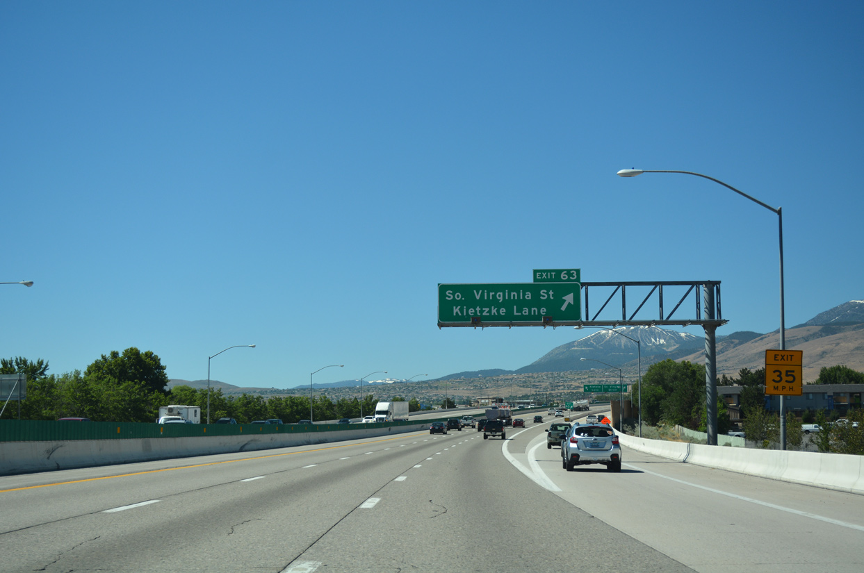
Exit 63 was expanded in 1997 with the addition of a second ramp connecting I-580 & U.S. 395 south with Redfield Parkway west at Kietzke Lane.
07/17/17
Kietzke Lane links the ramp end with U.S. 395 Business (Virginia Street) and SR 667 to the north and SR 659 (McCarran Boulevard) to the south. SR 659 encircles central Reno and Sparks as part of a 23 mile long belt route. The state route previously met U.S. 395 at Exit 70A.
07/17/17
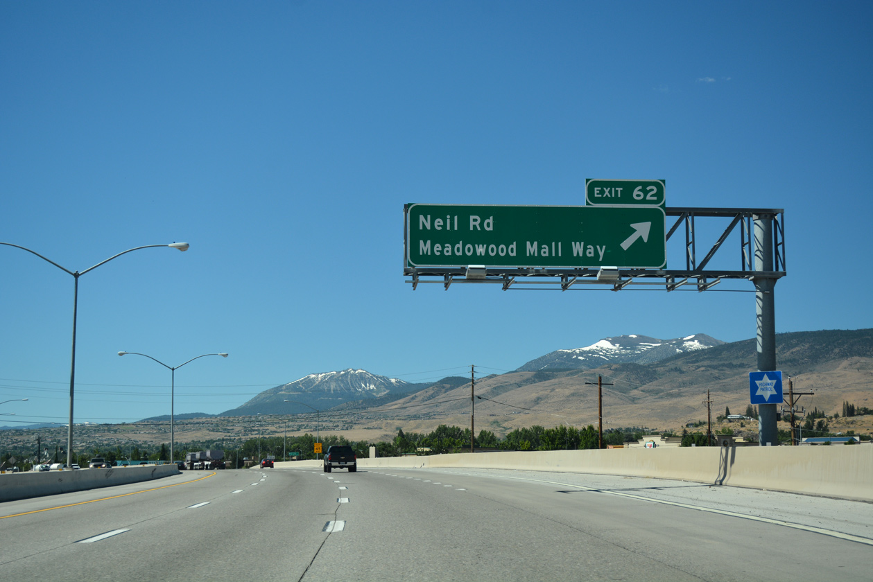
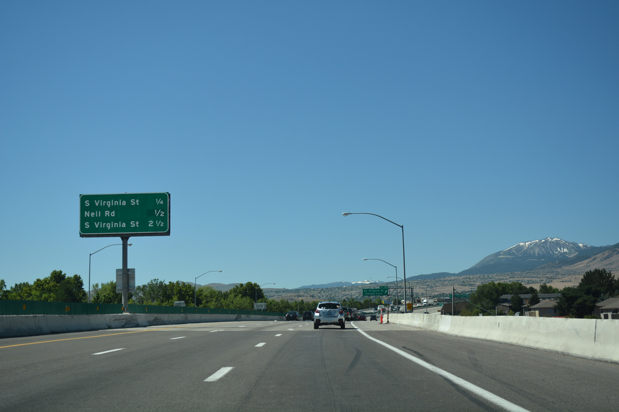
Exit 62 constitutes a split diamond interchange with Meadowood Mall Way east to Meadowood Mall and Neil Road to the south. Neil Road east to South Virginia Street, and parallel Keitzke Lane to the west were formerly a part of the 5.65 mile route of SR 667 leading north to Sparks.
07/17/17
Washoe County postmile 21.00 for Interstate 580 stands at the Neil Road underpass. The original extent of I-580 concluded here.
06/29/14
The first confirming marker for Interstate 580 finally appears southbound after the entrance ramp from Neil Road.
07/17/17
Sound walls separate the Crystal Lake and Country Estates subdivisions from I-580 & U.S. 395 as the freeway advances south to cross paths with South Virginia Street again at Exit 61.
07/17/17
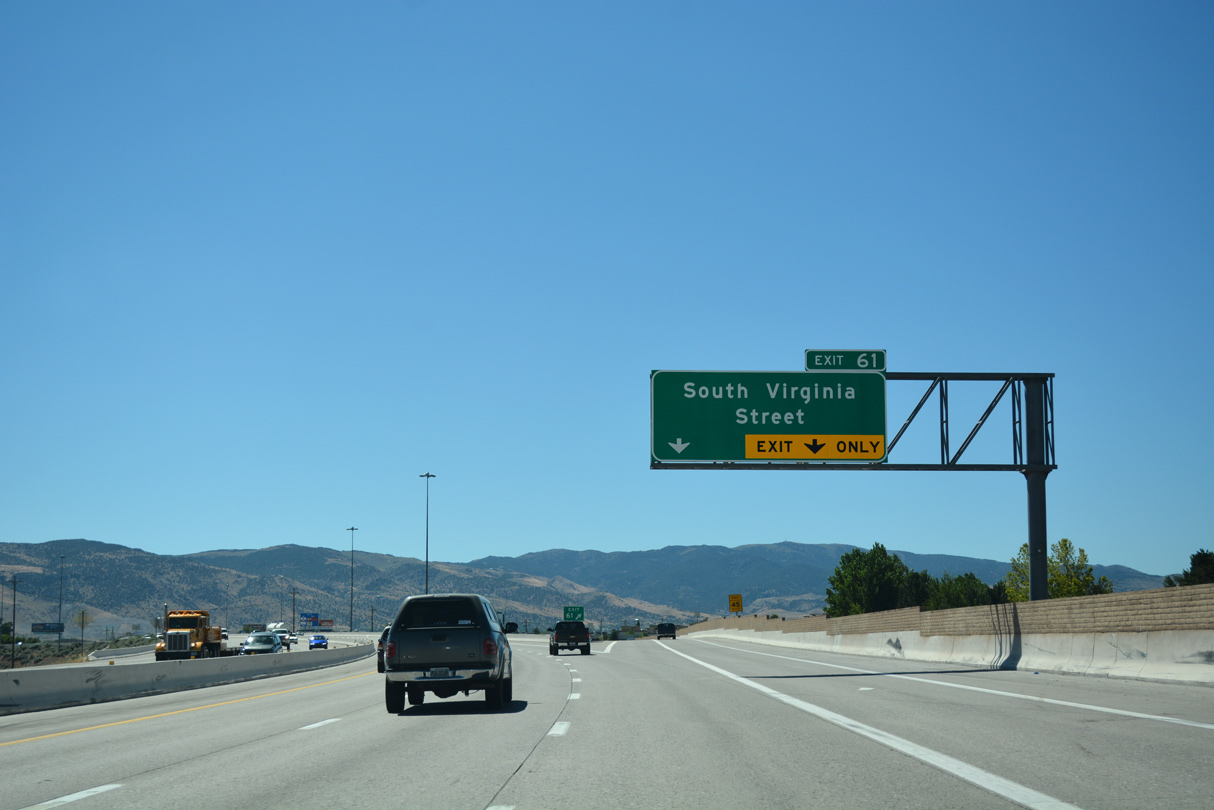
Entering the parclo interchange (Exit 61) with South Virginia Street on I-580 & U.S. 395 south. Although unmarked on freeway guide signs, the parallel commercial arterial becomes U.S. 395 Alternate south from this exchange.
07/17/17
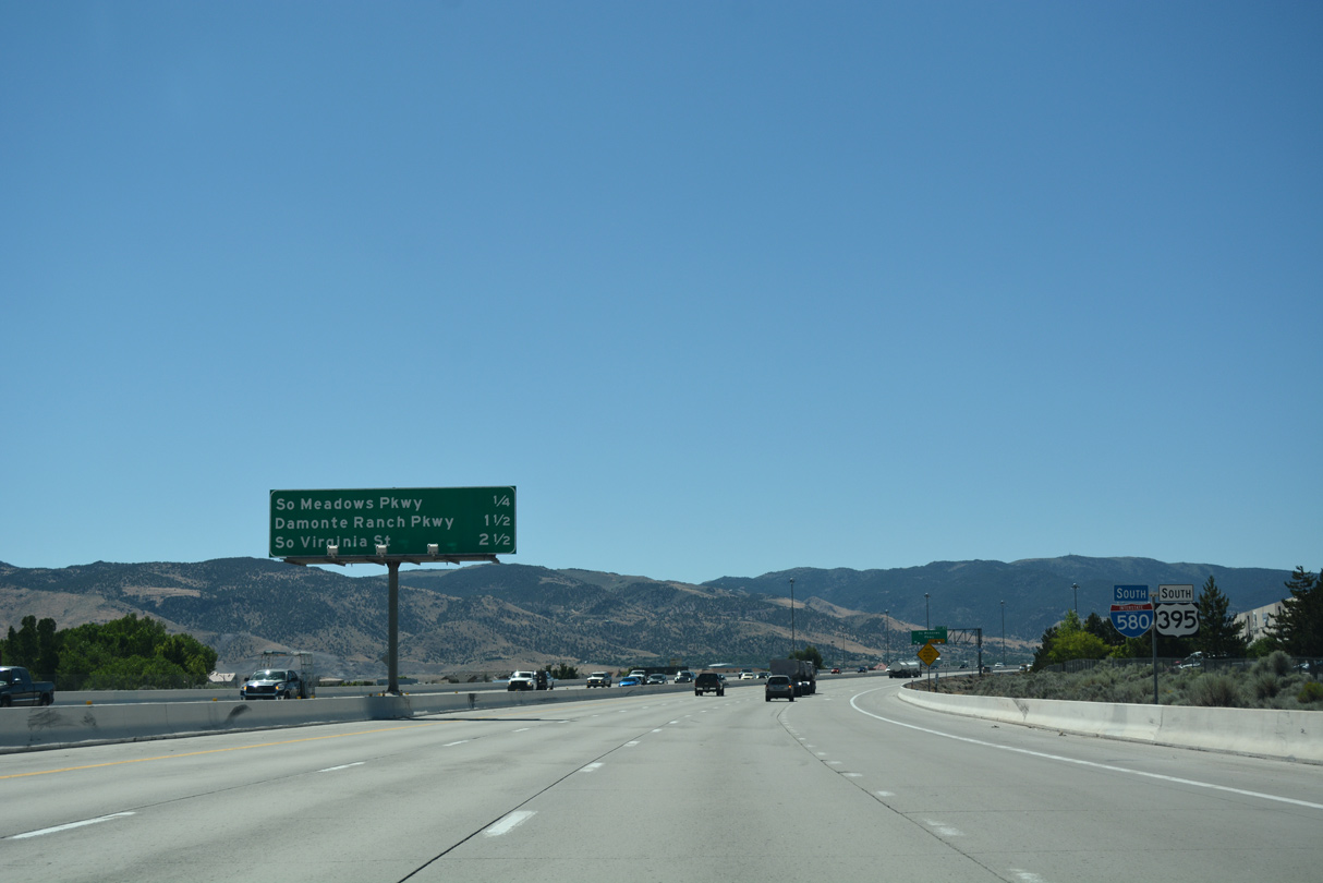
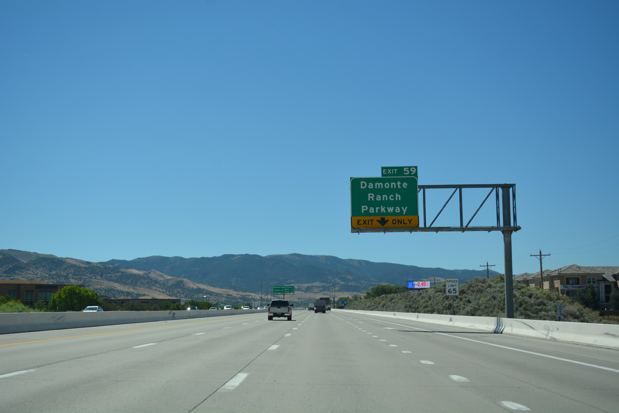
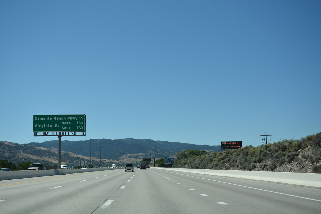
The next three exits serve the southern reaches of the Reno city limits. South Meadows Parkway and Damonte Ranch Parkway constitutes arterials leading east to newer suburban development including Double Diamond Ranch Village and Bella Vista Ranch Village.
07/17/17
Auxiliary lanes expand I-580 between Exits 61 and 60 to eight overall lanes.
06/29/14
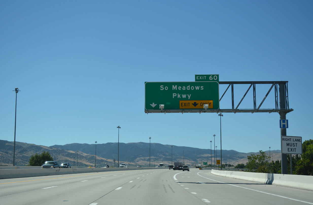
Southbound at the diamond interchange (Exit 60) with South Meadows Parkway. The 0.361 mile link between I-580 and U.S. 395 Alternate is unsigned SR 426. South Meadows Parkway otherwise extends 2.4 miles east to Veterans Parkway and the July 6, 2018-opened SouthEast Connector leading north to Sparks.
07/17/17
Auxiliary lanes again accompany I-580 & U.S. 395 between Exits 60 and 59. The freeway runs between several apartment complexes and business parks just west of the Double Diamond Ranch Village community.
07/17/17
Forthcoming Damonte Ranch Parkway arcs east from U.S. 395 Alternate (South Virginia Street) and Arrow Creek Parkway to Steamboat Parkway east and a dead end by Steamboat Creek.
07/17/17
This interchange sequence sign outlines the final three exits for the city of Reno along I-580 & U.S. 395 south.
07/17/17
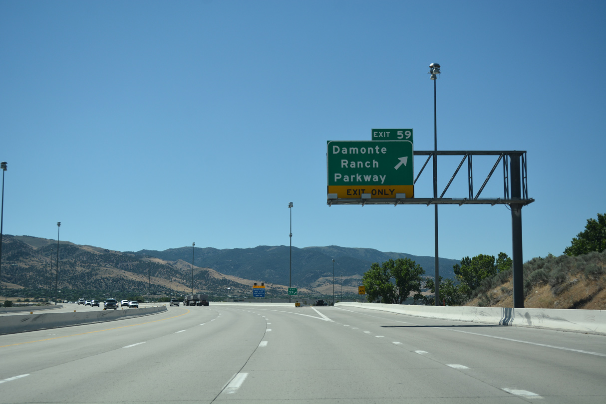
Entering the diamond interchange (Exit 59) with Damonte Ranch Parkway on I-580 & U.S. 395 south. Arrowcreek Parkway extends the arterial southwest to the Mountaingate neighborhood and west to the Arrowcreek Village golf course community.
07/17/17

Interstate 580 & U.S. 395 curve southwest to meet South Virginia Street (U.S. 395 Alternate) again in a half mile.
07/17/17
During periods of high winds, semi trucks, RV's and other high profile vehicles are directed off I-580 onto U.S. 395 Alternate south through Pleasant Valley and Washoe Valley.
07/17/17
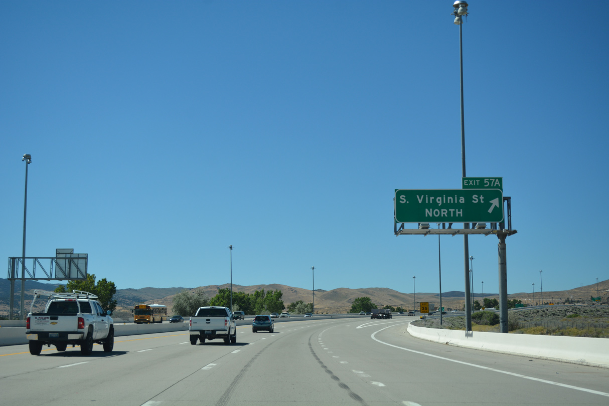
Exit 57A departs next for U.S. 395 Alternate (Virginia Street) north back into Reno.
07/17/17
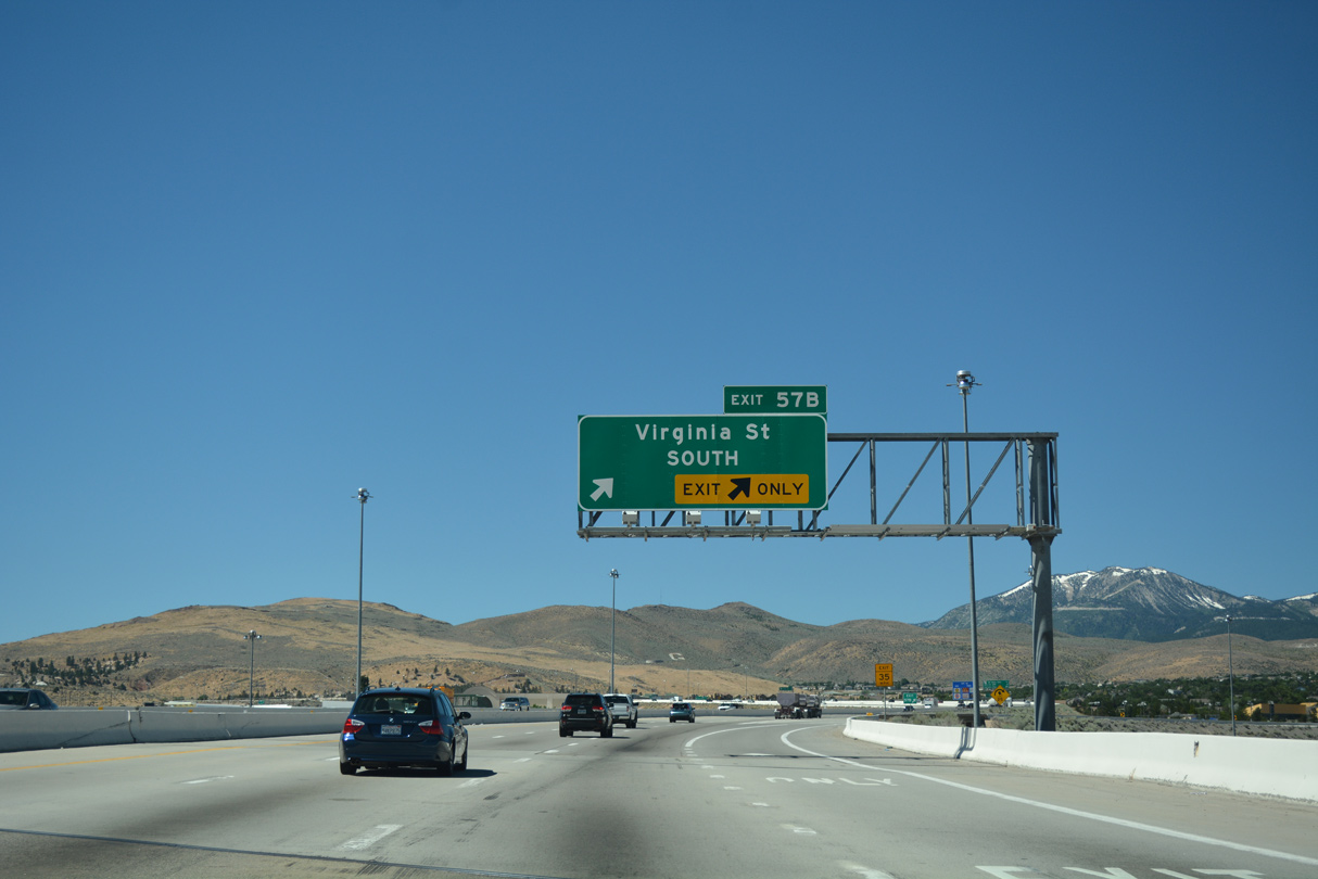
A loop ramp (Exit 57B) follows from I-580 & U.S. 395 south for U.S. 395 Alternate (Virginia Street) south to SR 341 (Geiger Grade Road) and Pleasant Valley.
07/17/17
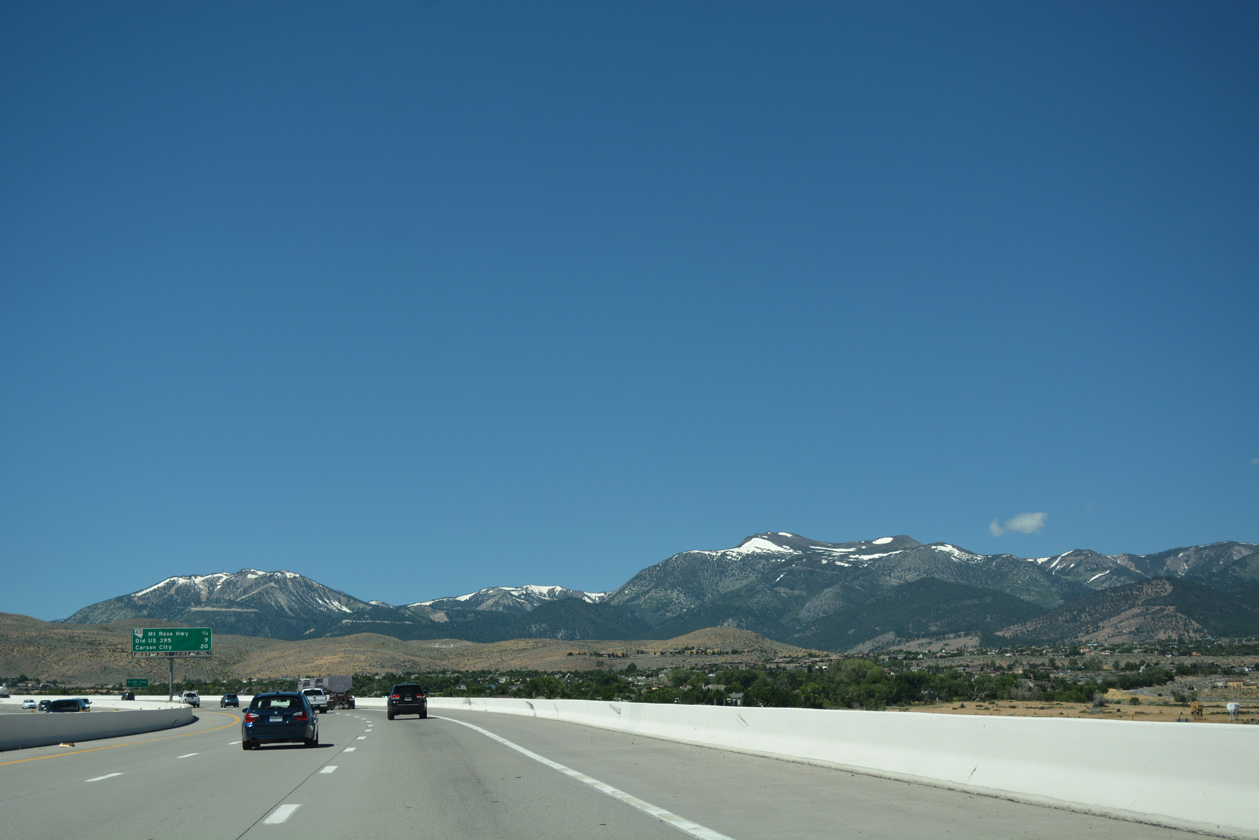
Mount Rose (el. 10,778 ft) and Slide Mountain (el. 9,698 feet) anchor the Carson Range to the southwest of Truckee Meadows.
07/17/17
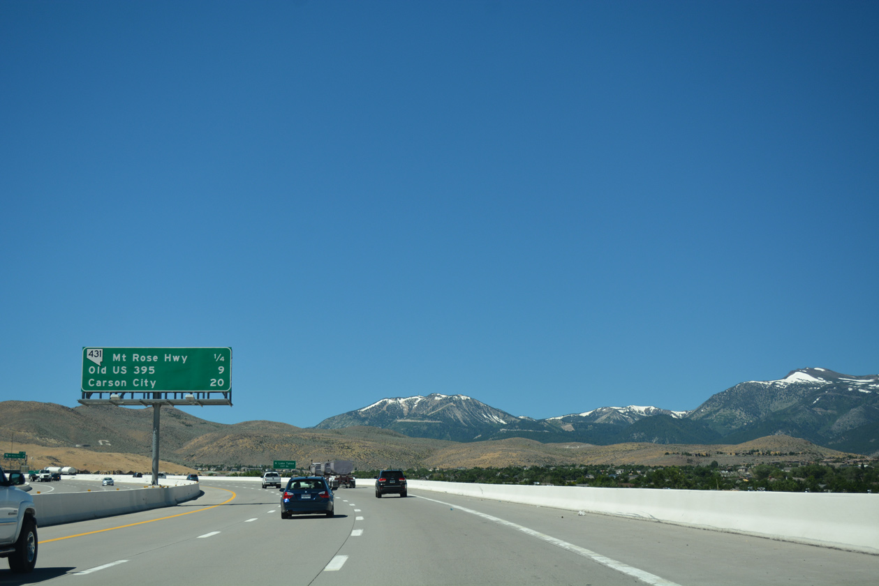
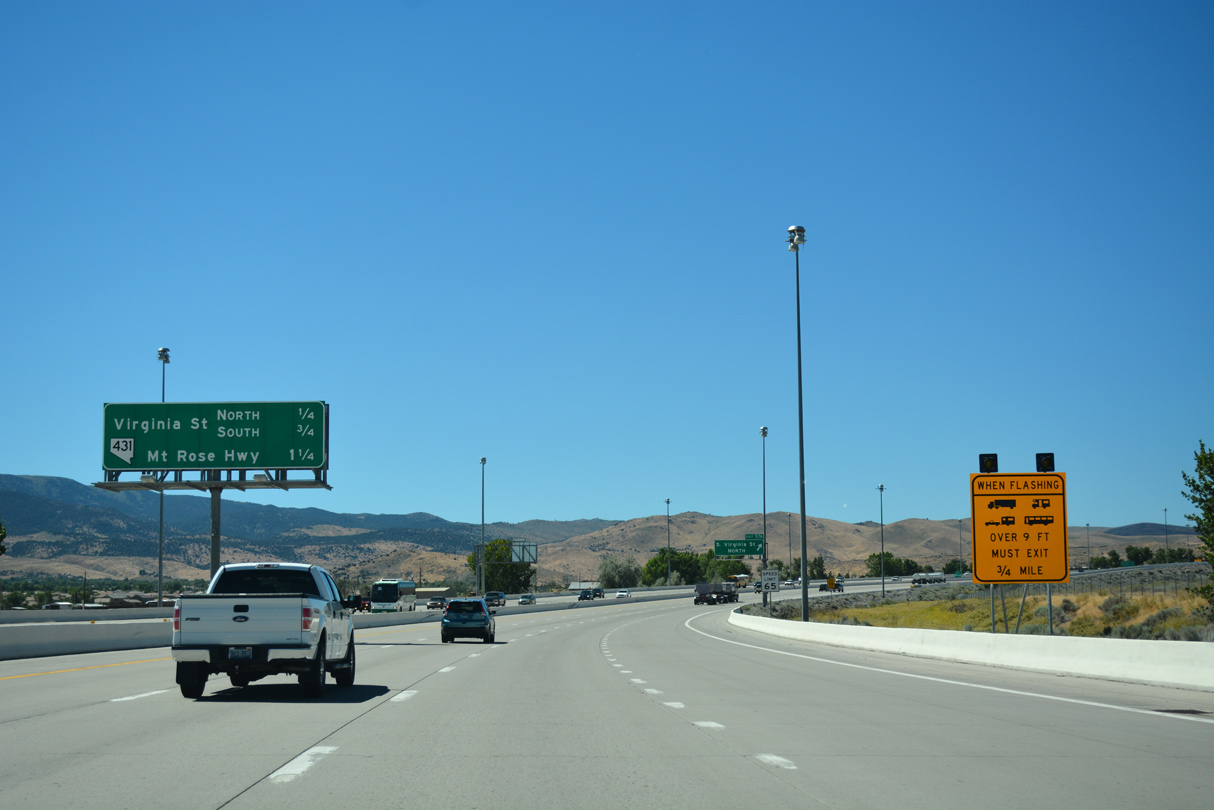
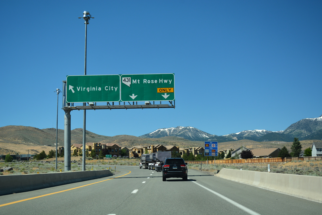
SR 431 branches southwest from U.S. 395 Alternate and SR 341 (Geiger Grade Road) to cross paths with I-580 & U.S. 395 at the ensuing exit. The I-580 Freeway Extension continues from there south around the Steamboat Hills to Washoe Valley.
07/17/17
SR 431 comprises a 24.47 mile route from U.S. 395 Alternate in south Reno to SR 28 at Incline Village on the north side of Lake Tahoe.
06/29/14
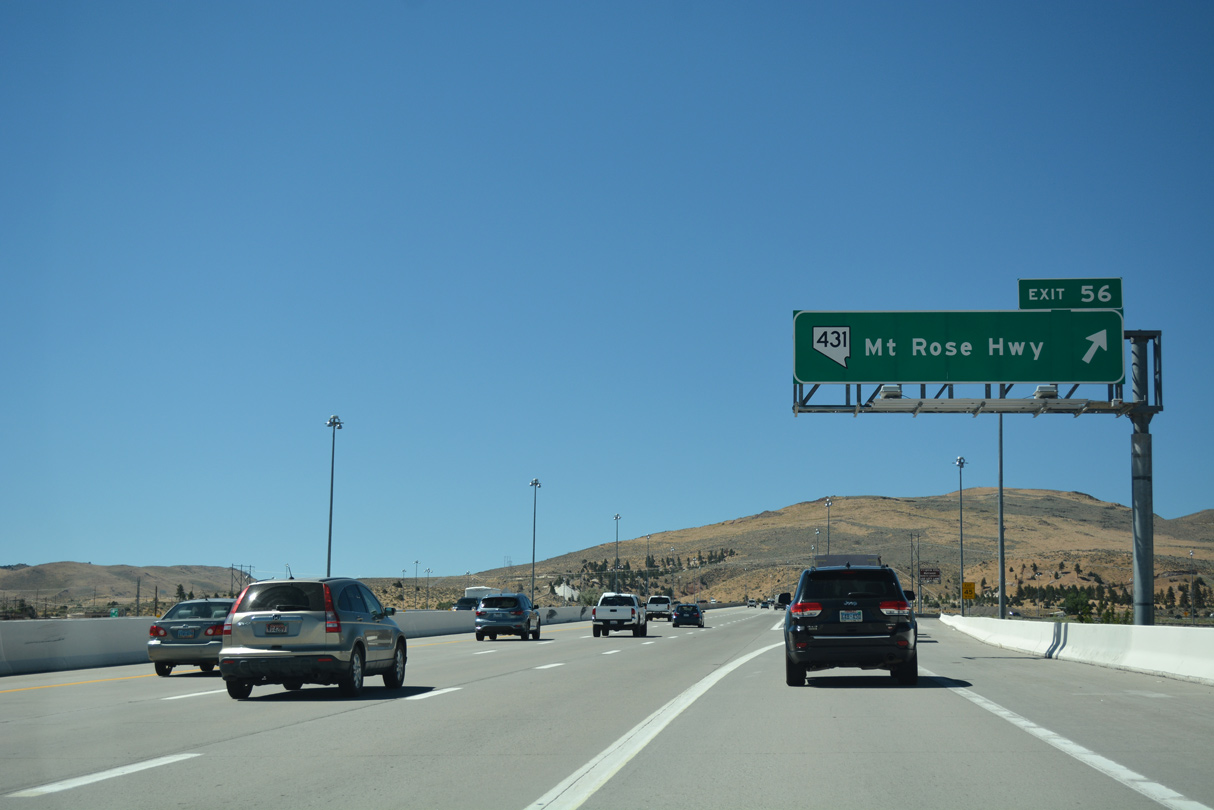
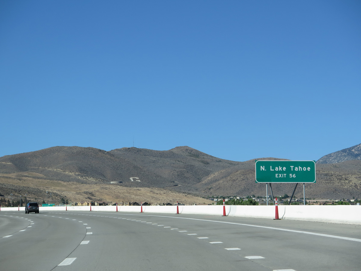
The U.S. 395 freeway ended at the parclo interchange (Exit 56) with SR 431 (Mt. Rose Highway) until August 2012, when the I-580 Freeway Extension opened southward to the Washoe Freeway.
07/17/17
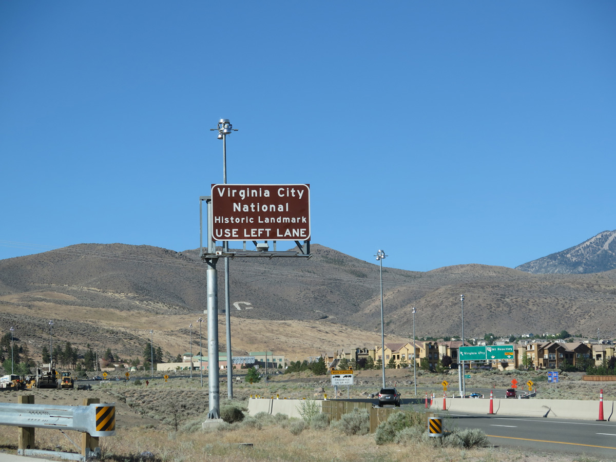
SR 341 begins 0.75 miles east from Exit 56 at U.S. 395 Alternate and SR 431 (Mt. Rose Highway). The state route and travels 13 miles southeast across the Virginia Range to Virginia City National Historic Landmark.
06/29/14
Traffic separates along the off-ramp to SR 431 (Mt. Rose Highway) southwest to the Montreux golf course community and for SR 431 north to SR 341 south by the Summit Reno retail complex. SR 431 traverses Humboldt-Toiyabe National Forest and the Carson Range through a number of switchbacks and hairpin turns, topping out at 8,900 feet in elevation across Mt. Rose Summit.
07/17/17
Photo Credits:
- Andy Field: 06/28/14, 06/29/14
- Brent Ivy: 07/17/17
Connect with:
Page Updated Thursday July 05, 2018.