
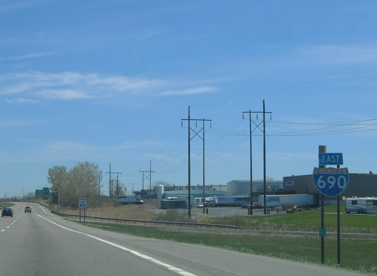
Interstate 690 East
 East
East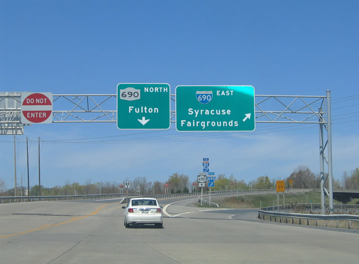
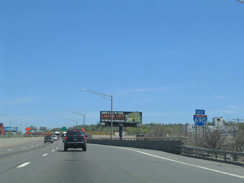
The Thruway access road from Exit 39 partitions into ramps for NY 690 north to Baldwinsville and I-690 east to Solvay and Syracuse beyond the toll collection point.
05/09/05
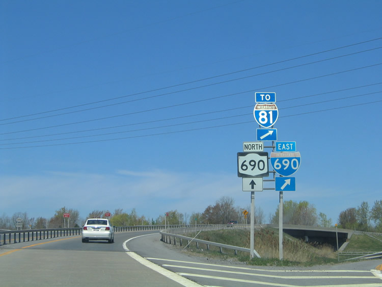
An I-81 trailblazer references the truck route from Interstate 90 east for Cortland and Binghamton via I-690.
05/09/05
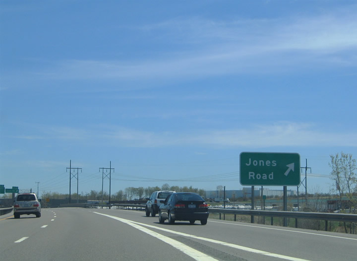
A parclo interchange joins I-690 with Jones Road to the immediate east of the trumpet interchange with the Thruway access road.
05/09/05
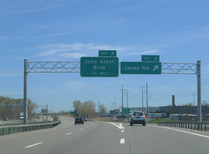
Jones Road connects I-690 with NY 48 (State Fair Boulevard) to the north. South from Exit 2, Jones Road serves the Interstate Island Road commerce park ahead of Van Buren and Brickyard Roads in the town of Van Buren.
05/09/05
The first confirming marker for Interstate 690 stands within the exchange at Exit 2.
05/09/05
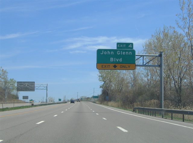
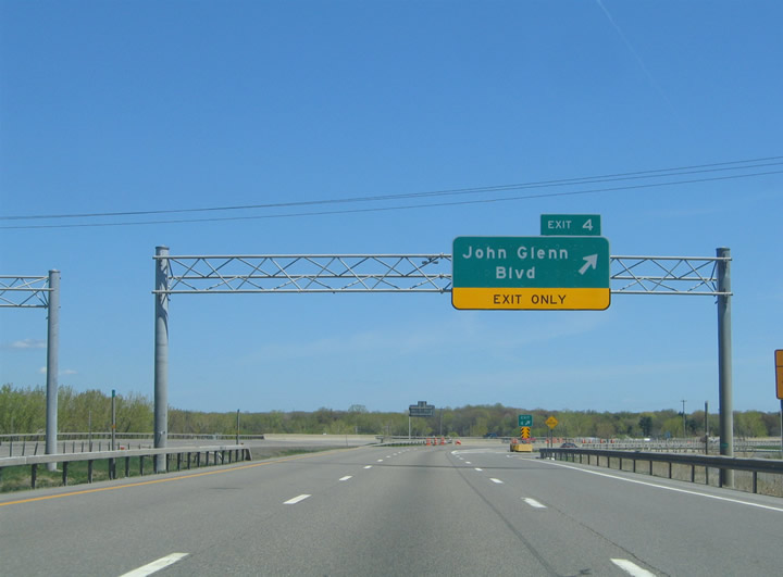
An auxiliary lane opens along I-690 east to John Glenn Boulevard (Exit 4). John Glenn Boulevard constitutes a controlled access parkway east to Buckley Road and Woodard.
05/09/05
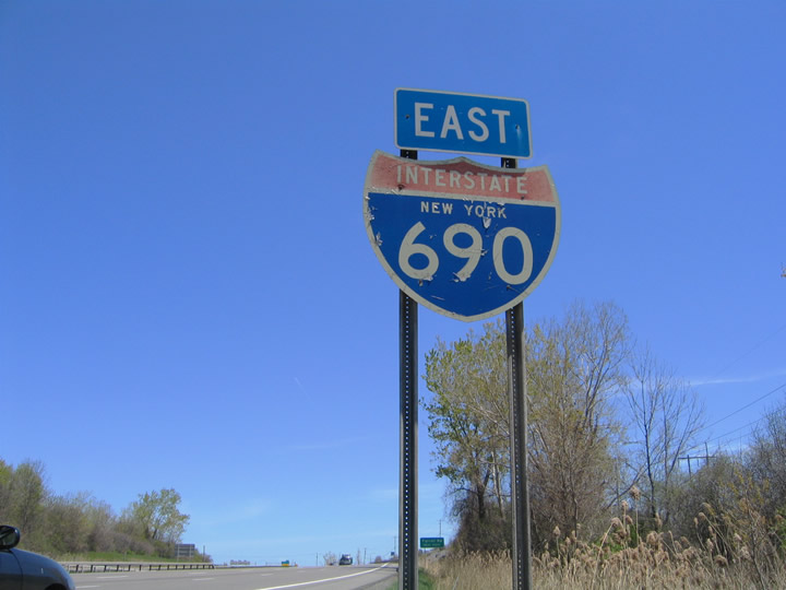
The last remaining state named shield for Interstate 690 preceded Exit 4. It was replaced in Summer 2009.
05/09/05
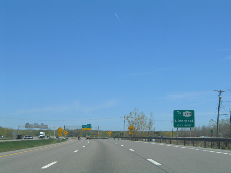
John Glenn Boulevard connects I-690 with the Farrell Road industrial area and NY 370 (Cold Springs Road) to Liverpool.
05/09/05
Interstate 690 eastbound at the two wye interchange (Exit 4) with John Glenn Boulevard. The south end of NY 48 ties into the exchange from Farrell Road to the northwest.
05/09/05
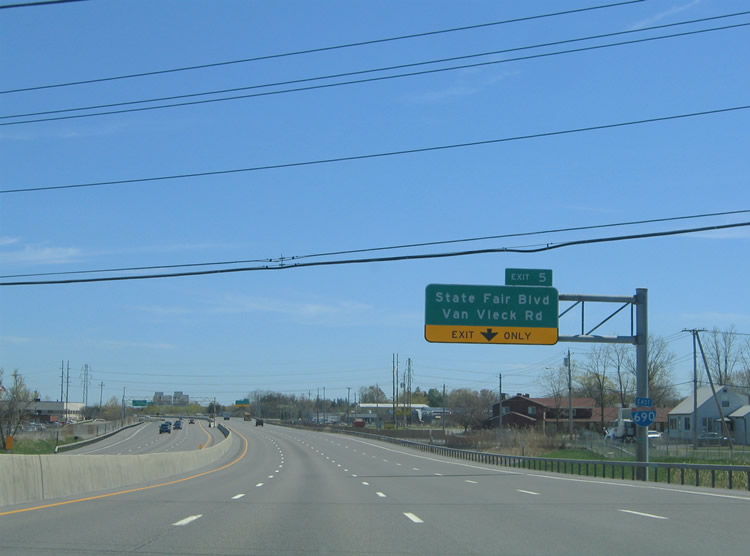
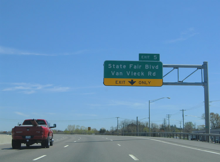
Interstate 690 crosses over the New York Thruway ahead of a parclo interchange (Exit 5) with Van Neck Road and State Fair Boulevard.
05/09/05
Van Vleck Road serves an industrial area in the wedge between I-90 (New York Thruway), I-690 and Onondaga Lake Park.
05/09/05
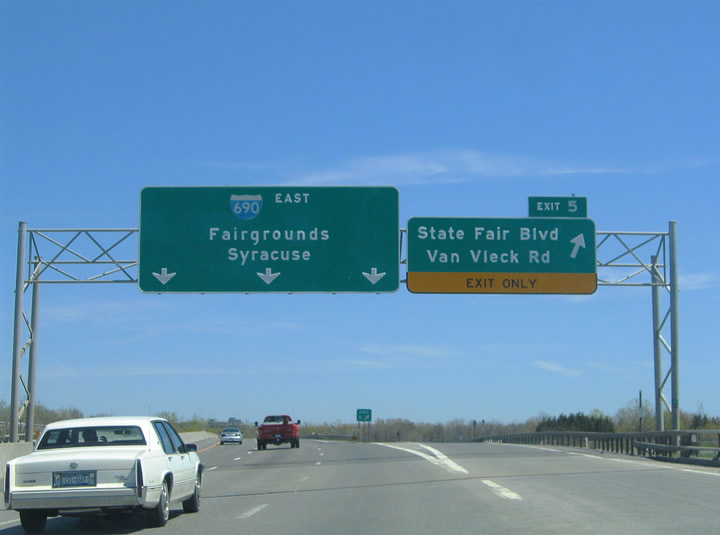
State Fair Boulevard heads southeast from Exit 5 to Lakeland and the New York State Fairgrounds. I-690 serves the fairgrounds directly beyond NY 695.
05/09/05
Forthcoming NY 695 is a 2.40 mile long freeway linking Interstate 690 with NY 5 west of Solvay.
05/09/05
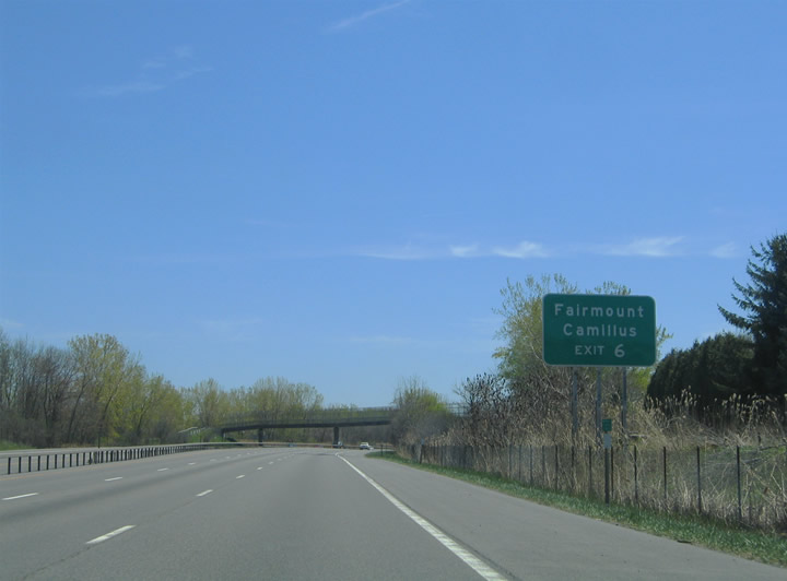
NY 5 bypasses Fairmount and Camillus along a freeway. Genesee Street (old NY 5) runs through the communities.
05/09/05
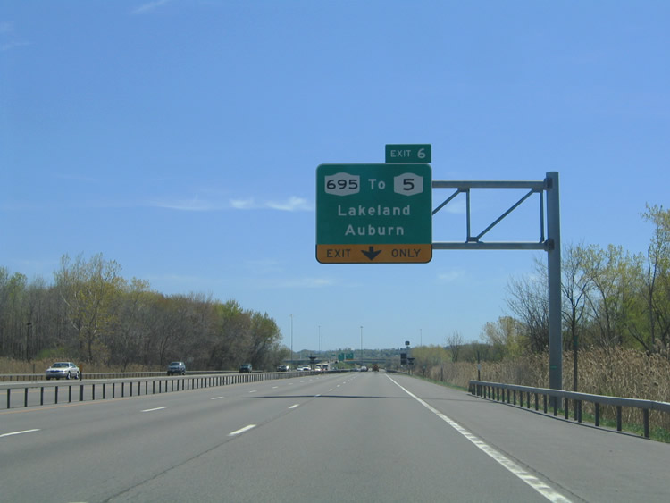
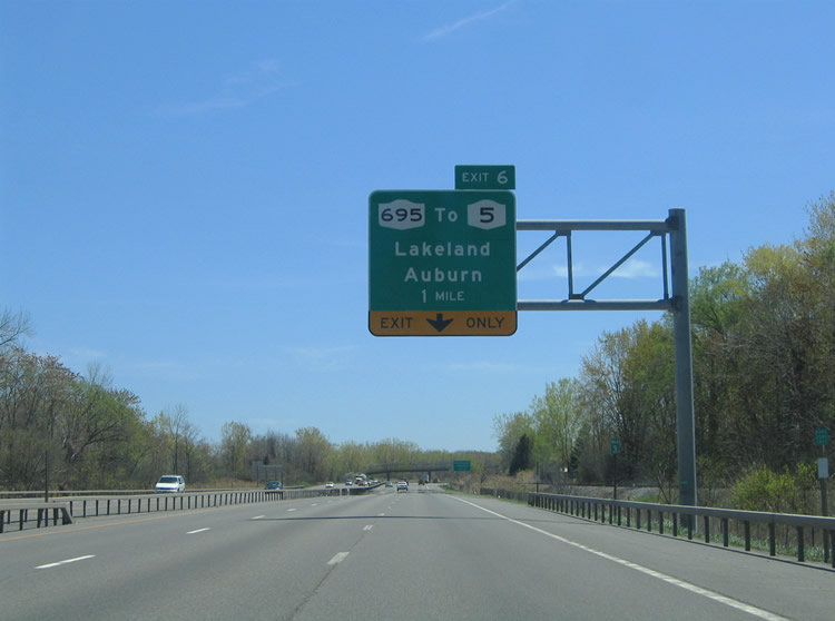
The directional T interchange (Exit 6) joining I-690 with NY 695 includes an off-ramp for Pumphouse Road to State Fair Boulevard and Lakeland.
05/09/05

Exit 4 departs I-690 east for NY 695 south to NY 5. NY 5 leaves the Syracuse area west for Auburn in the Finger Lakes Region.
05/09/05

Interstate 690 crosses Ninemile Creek beyond the gore point at Exit 6.
05/09/05
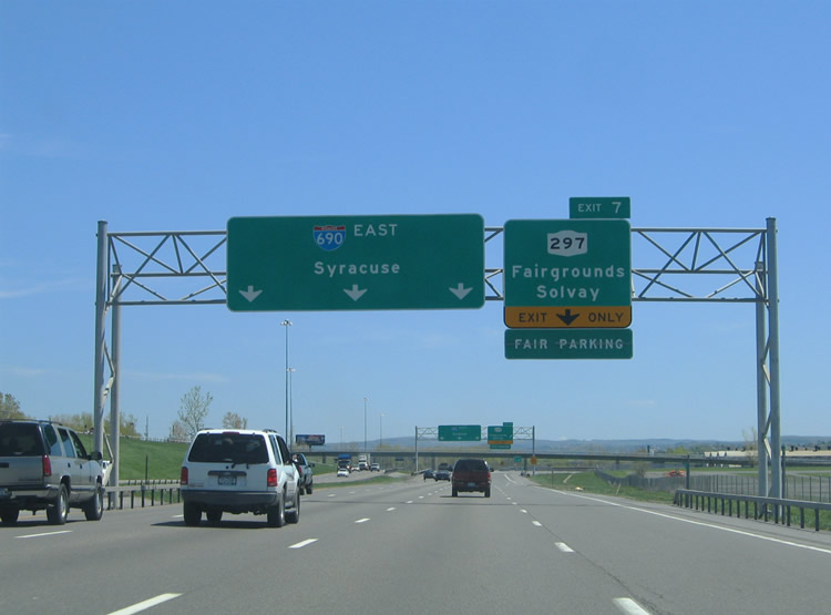
Exit 7 joins I-690 eastbound with NY 297 (Bridge Street) south at State Fair Boulevard and the New York State Fairgrounds parking lots.
05/09/05
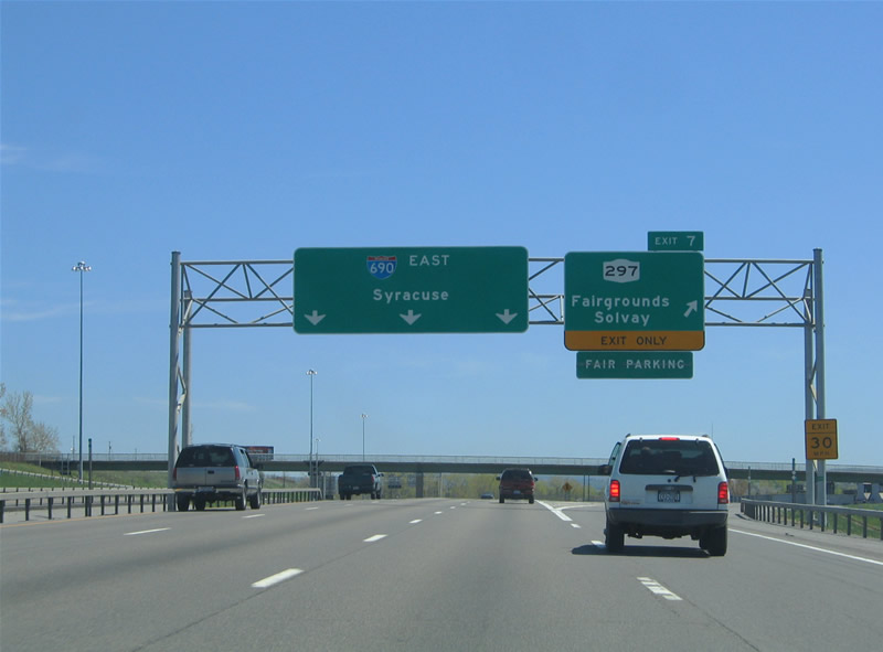
NY 297 meanders 2.33 miles southwest from Interstate 690 to Solvay and NY 173 (Warners Road) at Fairmont.
05/09/05
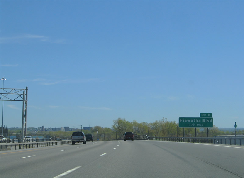
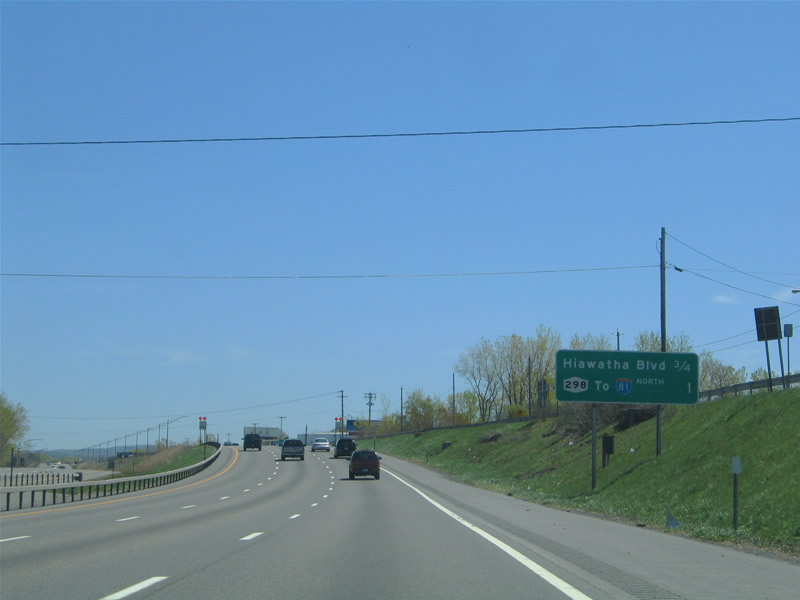
Advancing 1.5 miles southeast, I-690 next meets Hiawatha Boulevard at a half diamond interchange (Exit 8).
05/09/05
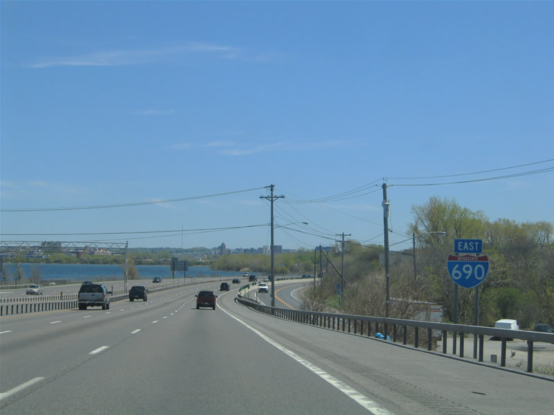
Onondaga Lake comes into view along the east side of Interstate 690.
05/09/05
Interstate 690 enters the city of Syracuse just ahead of Hiawatha Boulevard.
05/09/05
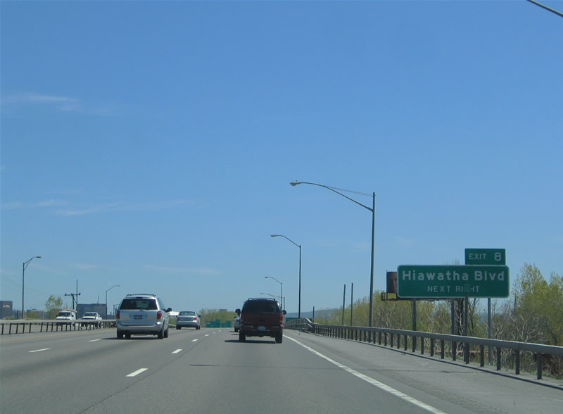
Hiawatha Boulevard is a commercial boulevard northeast from Erie Boulevard to Destiny USA mall and I-81 at Salina Street.
05/09/05
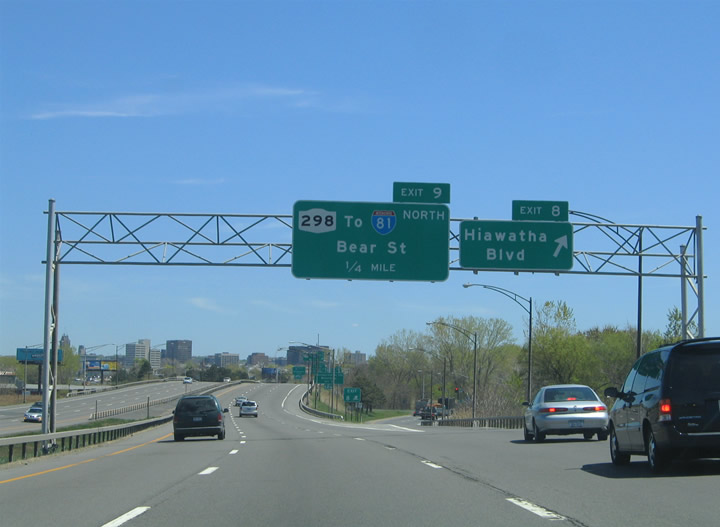
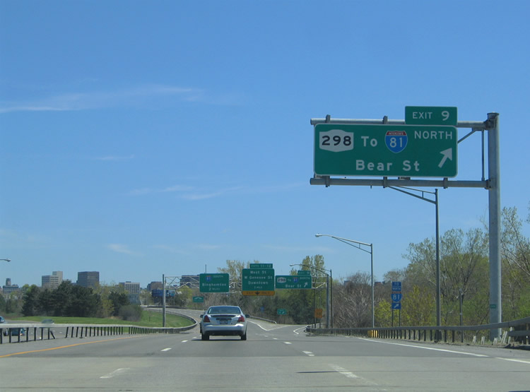
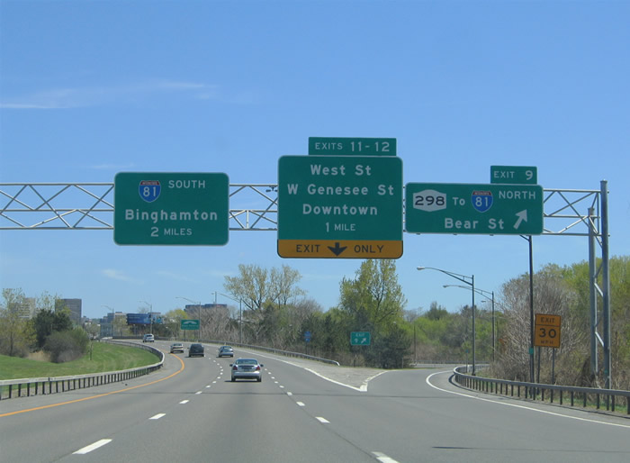
Exit 8 departs Interstate 690 eastbound for Hiawatha Boulevard, one quarter mile ahead of the wye interchange (Exit 9) with NY 298 (Bear Street) north.
05/09/05
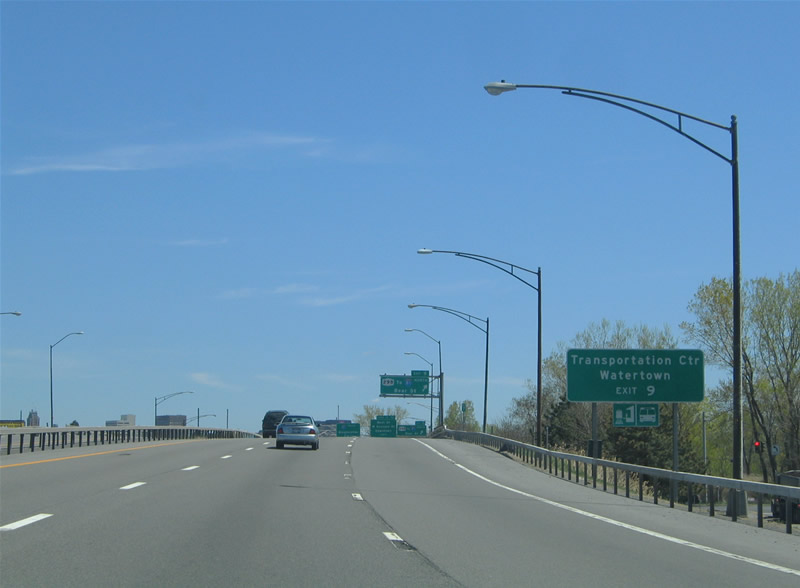
Since there is no direct access from I-690 east to I-81 north, travelers are directed along NY 298 (W Bear Street) north to the Sunset Avenue entrance ramp. Watertown lies 68 miles to the north in Jefferson County.
05/09/05
NY 298 travels 15 miles northeast from Syracuse to NY 31 at Bridgeport near Oneida Lake.
05/09/05
Bear Street leads NY 298, 0.81 miles northeast to I-81, where the state route dog legs east to Court Street through north Syracuse.
05/09/05
The Carrier Dome, home of Syracuse University Football and other entertainment events, lies east of Interstate 81 at the corner of Sims Drive and Irving Avenue.
05/09/05

The OnCenter Civic Center Theaters and War Memorial Arena is located in Downtown Syracuse along U.S. 11 (S State Street).
05/09/05
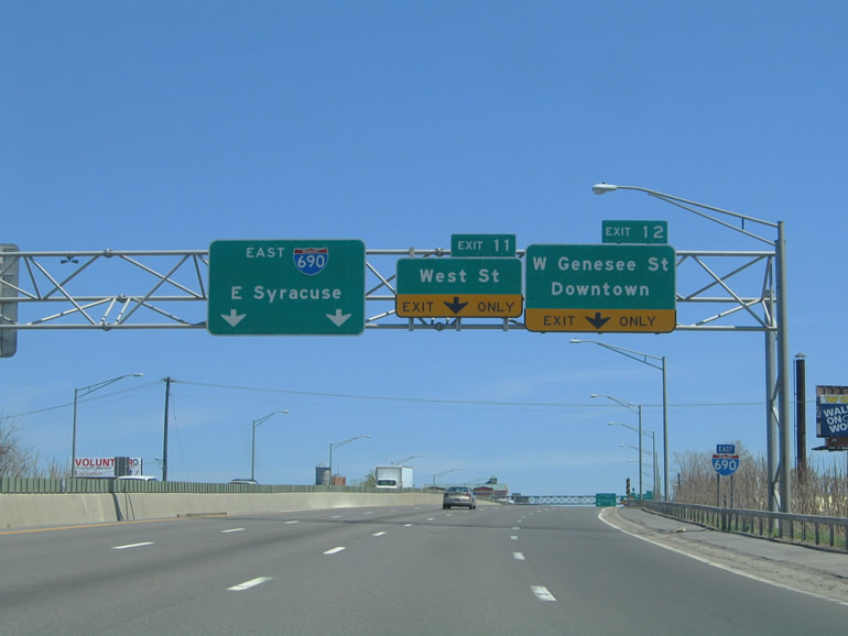
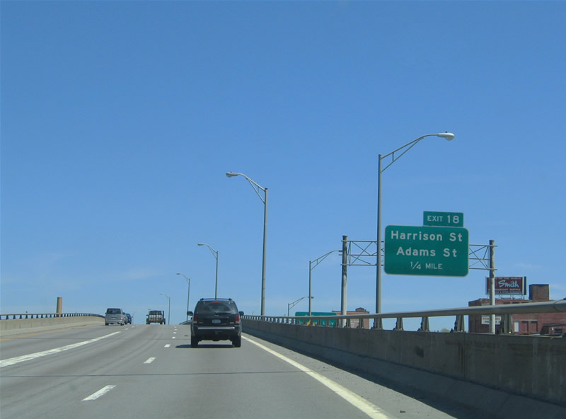
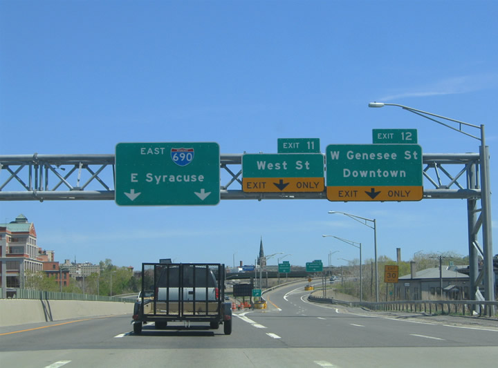
Exits 11 and 12 depart I-690 in unison for West Street at parallel NY 5 (Genesee Street) west of Downtown Syracuse. West Street constitutes a freeway spur (Route 930B) south to Erie Boulevard and Fayette Street.
05/09/05
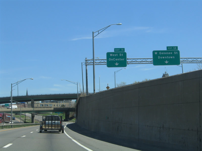
Exits 11 and 12 separate for West Street south toward the OnCenter and W Genesee Street (NY 5) to the Syracuse Central Business District.
05/09/05
Progressing east through the directional T interchange (Exit 11) with West Street.
05/09/05
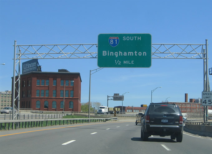
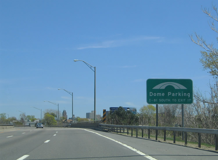
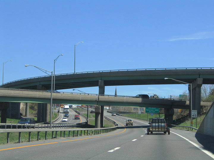
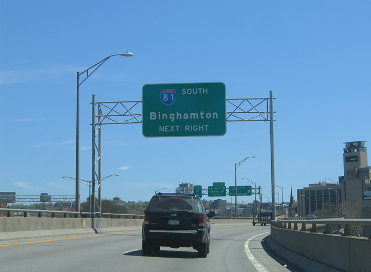
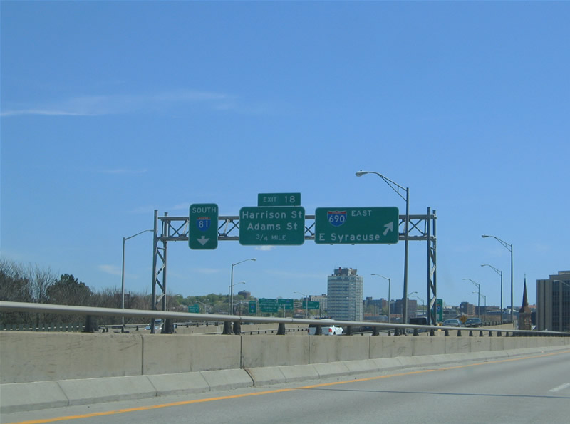
Interstate 690 converges with I-81 along an elevated section north of Downtown Syracuse. Exit 13 connects with I-81 south to Cortland and Binghamton in a half mile.
05/09/05
I-81 and I-690 run side by side over the Syracuse street grid for 0.4 miles. Elevated slip ramps join I-81 south with I-690 east from the left and to I-81 south from Exit 13 to the right.
05/09/05

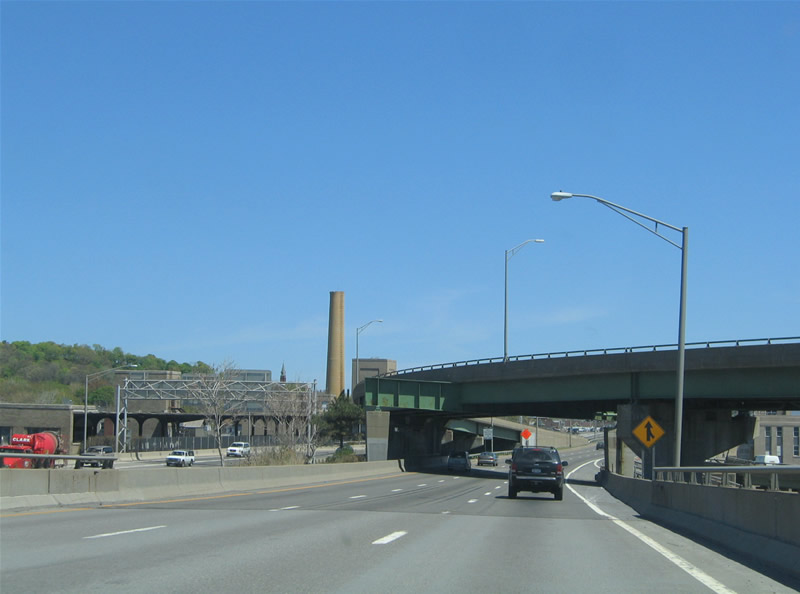
Constructed in 1928, State Tower rises just south of the I-690 viaduct adjacent to Syracuse City Hall.
05/09/05
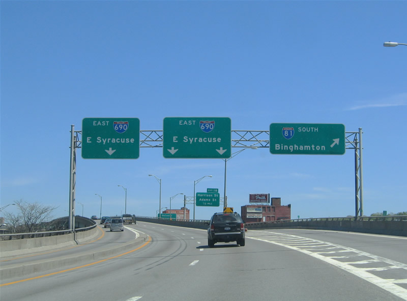
Interstate 81 curves southward from I-690 toward the Skytop neighborhood in south Syracuse. Cortland is 32 miles south of Exit 13, followed by Binghamton in 72 miles.
05/09/05
NYSDOT proposes demolishing the elevated section of I-81 south of I-690 and replacing it with an at-grade boulevard.
05/09/05
I-690 resumes an eastward heading through the directional T interchange with Interstate 81 south.
05/09/05
Crossing over Lodi Street on Interstate 690 eastbound.
05/09/05
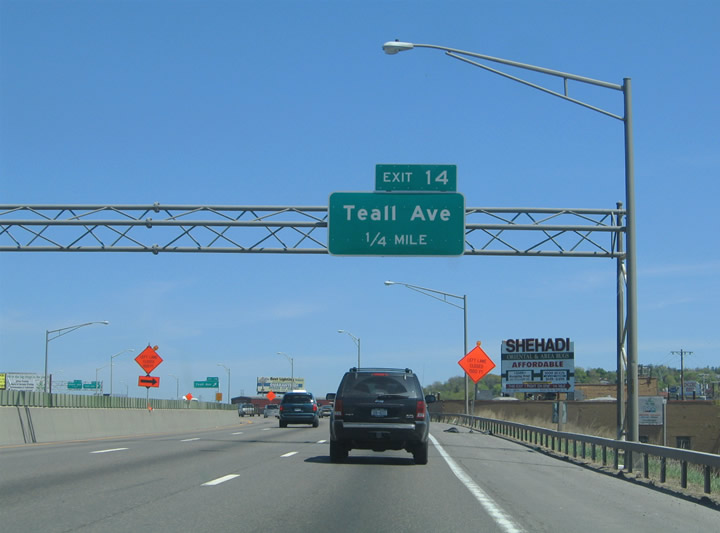
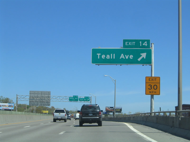
Interstate 690 shifts northward along a viaduct over Beech Street to a diamond interchange (Exit 14) with Teal Avenue.
05/09/05

Teal Avenue extends north from Columbus Avenue at NY 5 (Erie Boulevard) to NY 298 (Court Street) in east Syracuse.
05/09/05
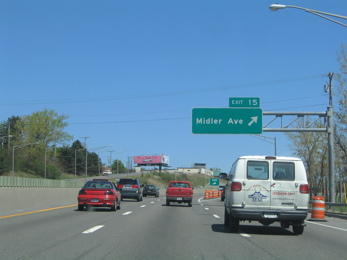
The succeeding exit joins Interstate 690 with Midler Avenue at the Eastwood neighborhood in Syracuse. Unmarked at Exit 15, Midler Avenue is a part of NY 598 north from NY 5 at Seeley Road to New Court Avenue.
05/09/05

Entering the parclo interchange (Exit 15) with NY 598 (Midler Avenue). NY 598 constitutes a 2.29 mile long route north to NY 298 (Court Street).
05/09/05
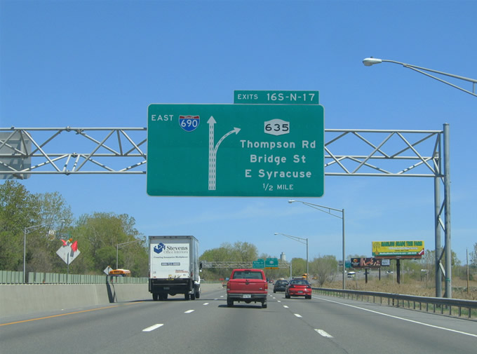
A collector distributor roadway separates from I-690 in a half mile for NY 635 (Thompson Road) at Exit 16.
05/09/05
NY 635 heads north from nearby NY 5 (Erie Boulevard) 2.29 miles to NY 298 (Carrier Parkway).
05/09/05
Spanning a CSX Railroad line, I-690 enters the cloverleaf interchange (Exits 16S/N) with NY 635 (Thompson Road).
05/09/05
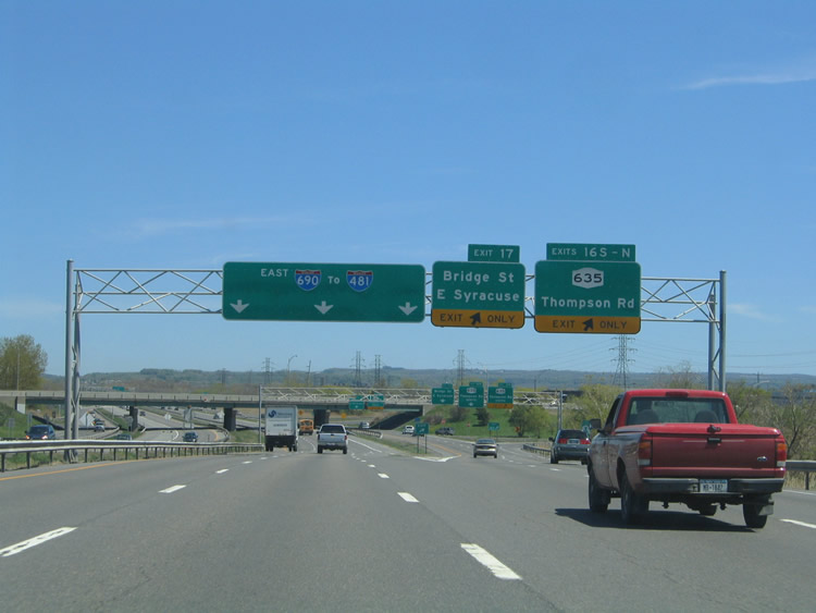
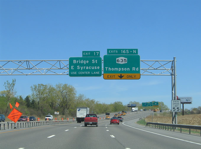
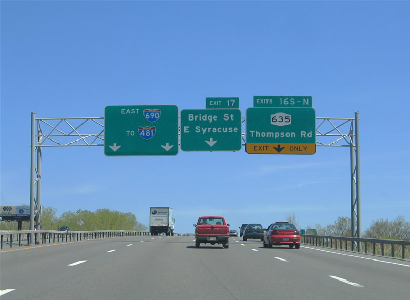
The c/d roadway for NY 635 extends east to Exit 17 for Bridge Street (Route 930P). NY 635 and Bridge Street north both lead to the village of East Syracuse.
05/09/05
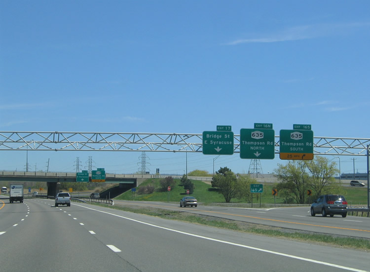
Exit 16S parts ways for NY 635 (Thompson Road) south to NY 5 (Erie Boulevard) and Lemoyne College.
05/09/05
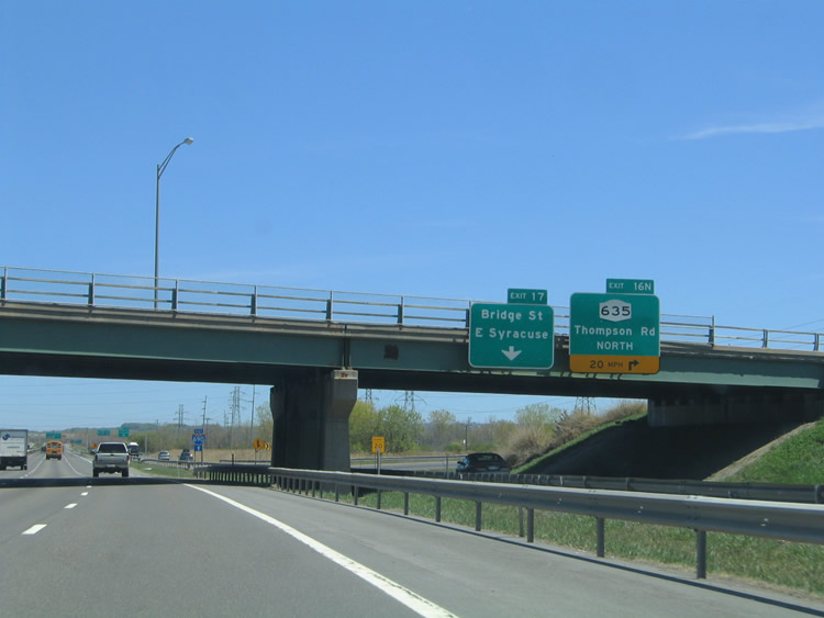
Exit 16N loops onto NY 635 north to DeWitt.
05/09/05
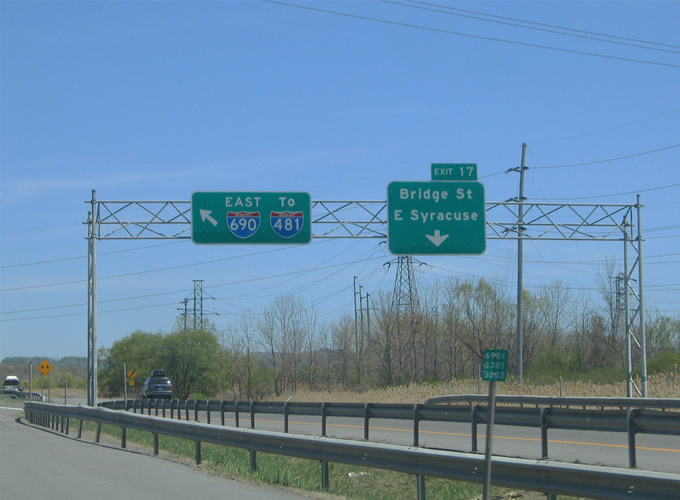
Bridge Street (Route 930P) is an arterial route connecting NY 5 (Erie Boulevard) north of ShoppingTown Mall with NY 290 (Manlius Center Road) in East Syracuse.
05/09/05
Interstate 690 spans Bridge Street with four lanes eastbound leading into the Butternut Interchange with I-481.
05/09/05
The last shield for Interstate 690 east.
05/09/05
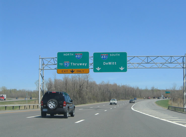
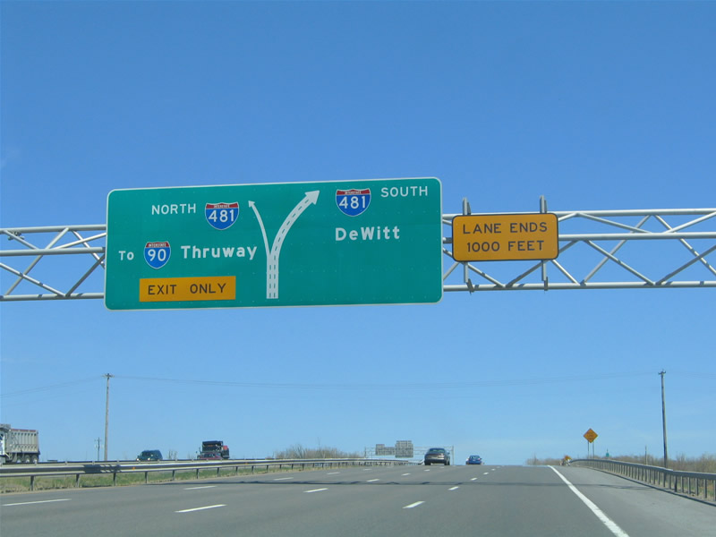
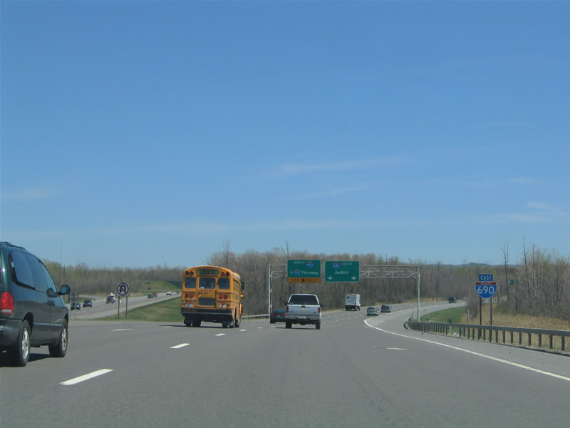
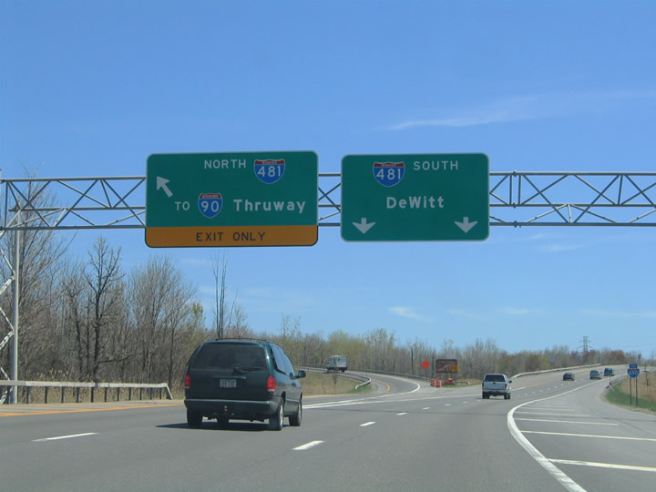
The I-690 eastbound mainline defaults onto I-481 south to DeWitt and south Syracuse. The left lane connects with I-481 north, three miles ahead of the New York Thruway.
05/09/05
Interstate 481 constitutes an eastern bypass of Syracuse between southern reaches of the city near Nedrow and the city of North Syracuse.
05/09/05
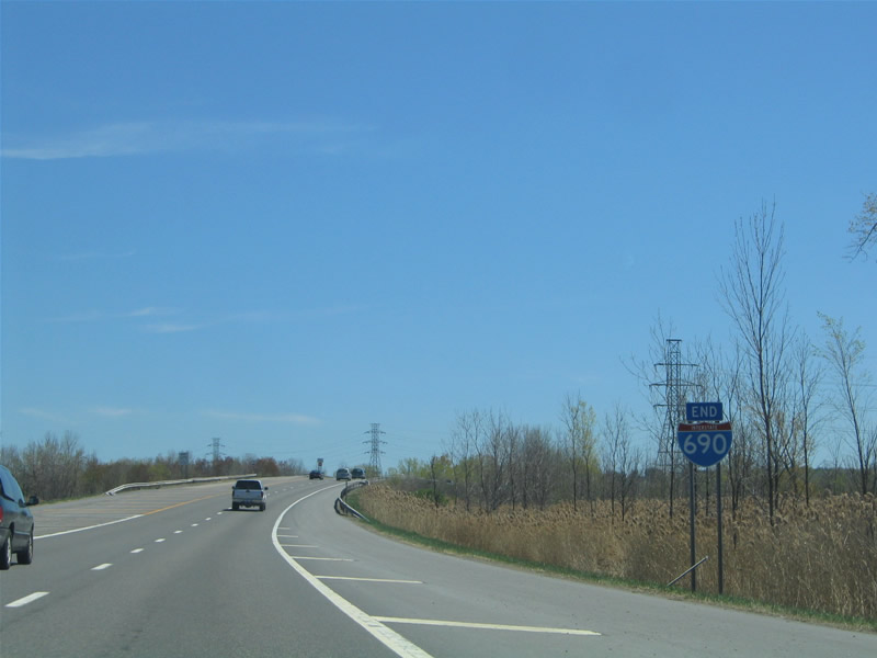
The east end shield for Interstate 690 stands beside the gore point for I-481 north.
05/09/05
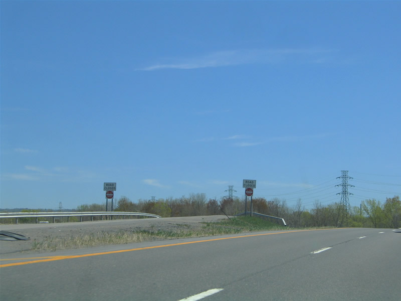
One of several unused ramps at the Butternut Interchange separates from I-690 east from the roadway to I-481 south. These ramps were constructed for the cancelled bypass taking NY 5 around Fayetteville.
05/09/05
Photo Credits:
- Alex Nitzman: 05/09/05
Connect with:
Page Updated Tuesday March 10, 2020.