
Route 84 South - Jo Davies County
 South
South
The first shield for IL 84 south appears just beyond the state line.
12/21/09

IL 84 winds through open farm land in this scene ahead of Jo Davies County 1 (Council Hill Road).
12/21/09

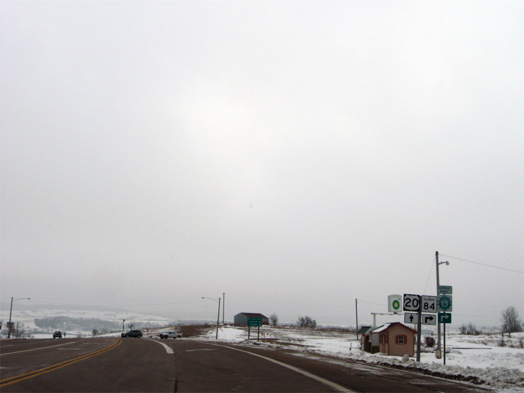
Six miles south of Hazel Green, Wisconsin, IL 84 converges with U.S. 20 in a rural area ten miles east of East Dubuque.
12/21/09

U.S. 20 is part of the National Great River Road Route, which IL 84 joins and continues south to Savanna and the Quad Cities. U.S. 20 carries the route west to Dubuque, Iowa.
12/21/09

IL 84 merges with U.S. 20 east at the end of its four lane alignment from East Dubuque. Here U.S. 20 turns southward on the approach to Galena with IL 84. The two share 15.2 miles of roadway.
12/21/09
 East
East 
A traffic light operates along U.S. 20/IL 84 at Industrial Drive west and Oldenburg Lane east just south of the city line.
12/21/09
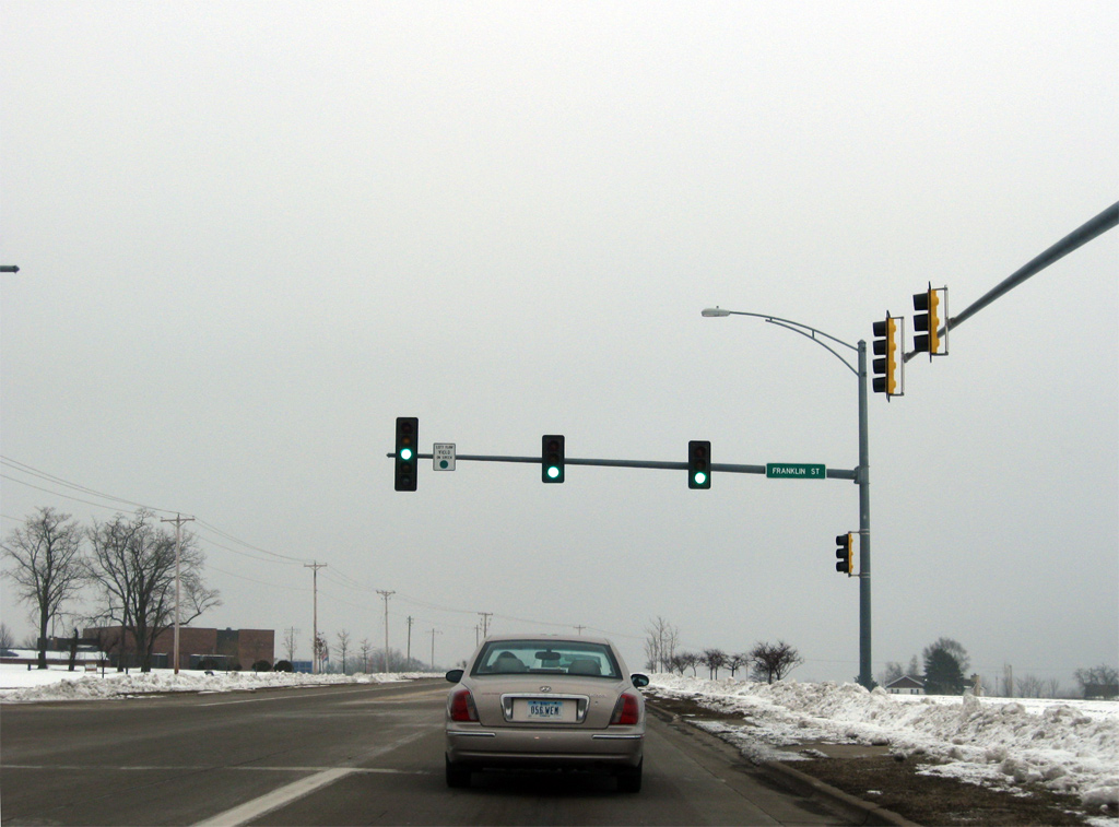
Franklin Street branches eastward from U.S. 20/IL 84 to lead directly into downtown Galena.
12/21/09
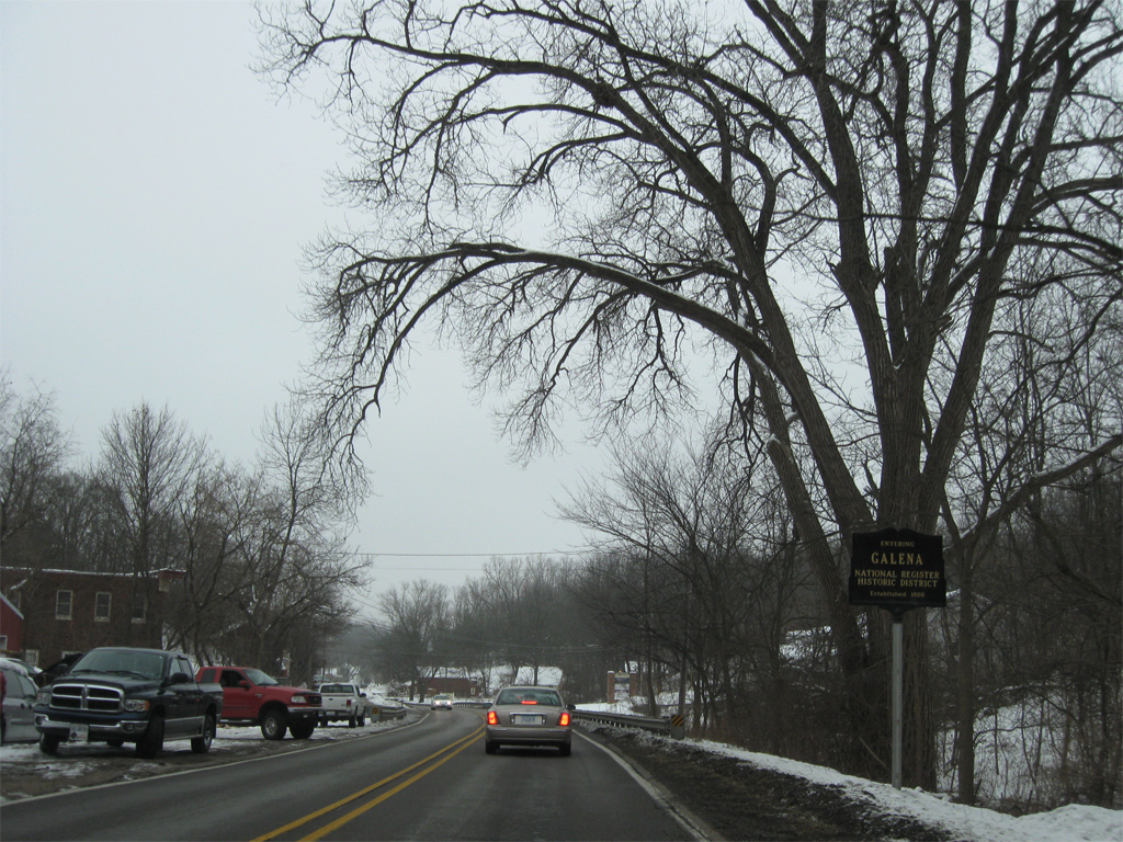
U.S. 20/IL 84 enter the Galena National Historic District ahead of Summit Street. Galena is home to over 1,000 buildings constructed before 1900, including the Ulysses S. Grant Home, where the 18th President of the U.S. lived preceding the Civil War.
12/21/09
U.S. 20/IL 84 (Decatur Street) ascend through a rock cut between 4th Street and Bouthillier Street
12/21/09
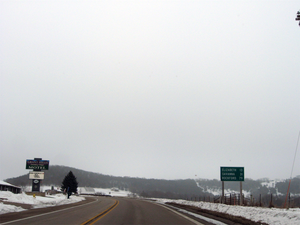
Distance sign posted 13 miles northwest of Elizabeth on U.S. 20/IL 84. Rockford is 79 miles to the east of Galena via U.S. 20 while Savanna is a 31 mile drive south along IL 84 and the Great River Road. U.S. 20/IL 84 round Horseshoe Mound just east of this distance sign and Powder Hill Road.
12/21/09
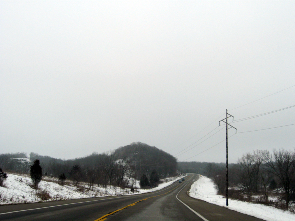
U.S. 20 east / IL 84 south after Devils Ladder Road.
12/21/09
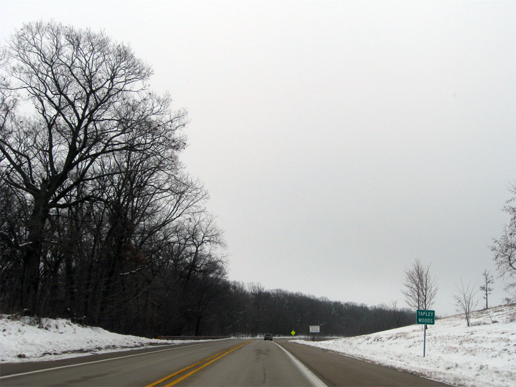
Entering the Tapley Woods Conservation Area on U.S. 20 east / IL 84 south.
12/21/09
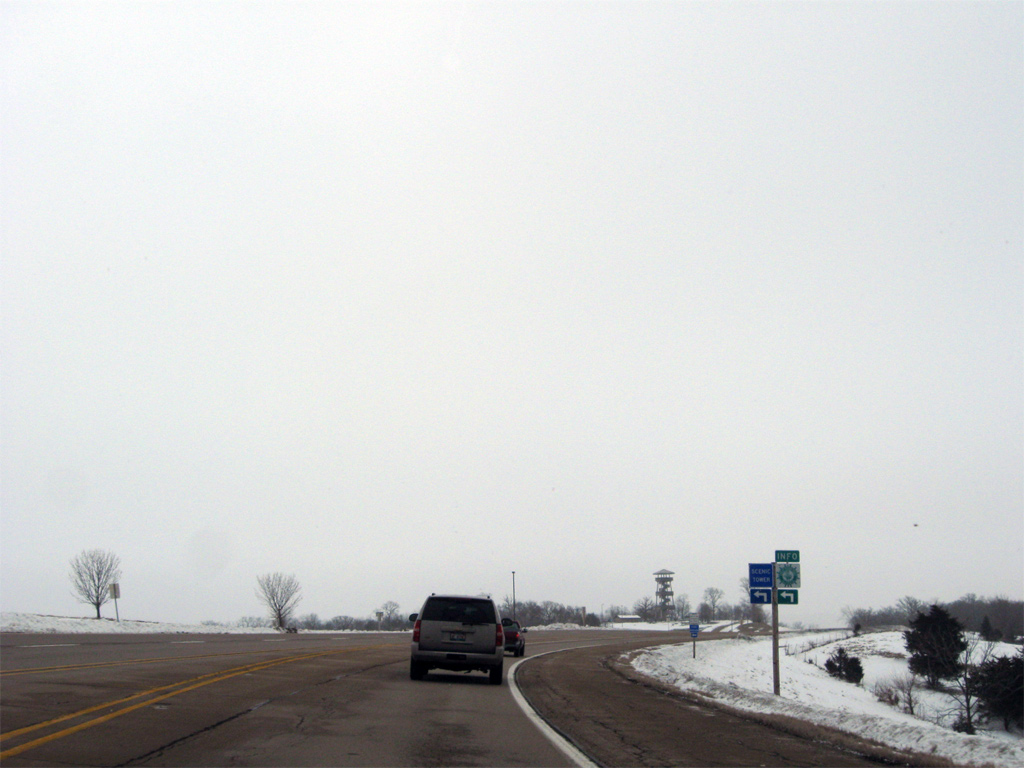
The Long Hollow Scenic Overlook lines the north side of U.S. 20/IL 84 near their eastbound separation. The tower stands at 100 feet tall and is part of the Great River Road parks system.
12/21/09
U.S. 20 continues east 15 miles to Stockton as IL 84 drops south five miles to Hanover and 19 miles to Savanna.
12/21/09
South
Reassurance shield and distance sign posted south of U.S. 20 on IL 84. Savanna, where U.S. 52 and IL 64 join IL 84 for a 2.1 mile overlap, is 19 miles away.
12/21/09

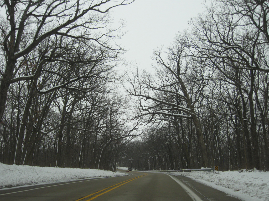
IL 84 traverses low rolling hills south to Hanover. Trees occasionally separate the route from adjacent farm land on the otherwise uninterrupted stretch.
12/21/09

IL 84 traverses low rolling hills on the approach to Hanover. Trees occasionally separate the route from adjacent farm land on the otherwise uninterrupted stretch.
12/21/09

Crossing Duke Creek, motorists along IL 84 enter the village of Hanover. The state route follows Washington Street through northern reaches of town.
12/21/09

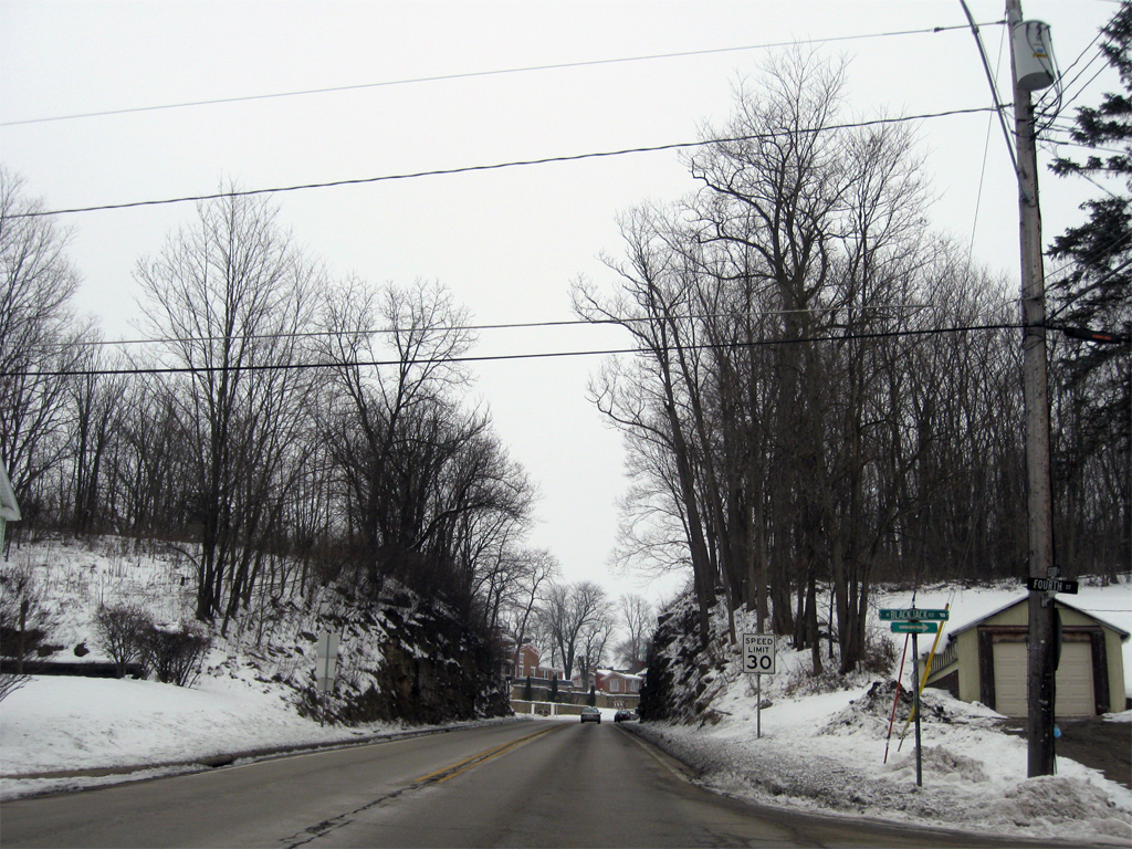
Jo Davies County Route 8 (Black Jack Road) ties into IL 84 (Washington Street) from Rice and Galena to the northwest ahead of this shield assembly.
12/21/09

IL 84 heads two blocks south to the Apple River, a 55 mile tributary of the Mississippi River flowing south from Lafayette County, Wisconsin.
12/21/09

IL 84 turns east onto Jefferson Street in the heart of Hanover.
12/21/09

Washington Street curves east onto Fillmore Street, one block south of the IL 84 turn onto Jefferson Street.
12/21/09

IL 84 follows Jefferson Street east for 0.4 miles before shifting southward to exit Hanover.
12/21/09

Jefferson Street continues east from IL 84 to become Hanover Road and County Route 17 en route to Derinda Center.
12/21/09

A Great River Road reassurance marker follows the intersection with Fillmore Street in Hanover.
12/21/09

Savanna is 14 miles further south along IL 84. East Moline in the Quad Cities area is 63 miles away.
12/21/09

IL 84 hugs a series of hills just east of the winding Apple River to the Carroll County line. This scene looks at the intersection with Whitton Road.
12/21/09

Rush Road stems east from IL 84 toward the Rall Woods State Natural Area.
12/21/09

Crossing into Carroll County along IL 84 south near Cheek Slough.
12/21/09
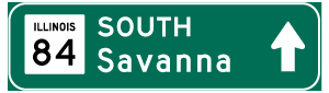

Photo Credits:
- Alex Nitzman: 12/21/09
Connect with:
Page Updated Saturday March 16, 2013.