
State Route 11

SR 11 runs 99.69 miles north from the Jennings Randolph Bridge crossing the Ohio River at East Liverpool to SR 531 in the Lake Erie city of Ashtabula. Historically the Lake Erie to Ohio River Highway, all of SR 11 is a limited access highway.
SR 11 overlaps with U.S. 30 northwest 10.73 miles from the West Virginia state line to Madison Township. The freeway passes east of the Columbiana County seat of Libson en route to Leetonia and Columbiana by the Mahoning County line.
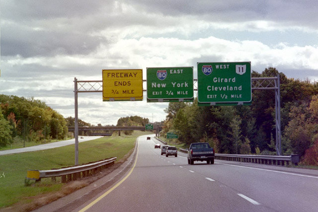
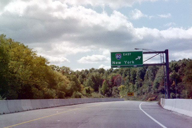
Continuing north past Youngstown, SR 11 connects with U.S. 224 at Canfield and overlaps with I-80 east for 3.83 miles to SR 711 at Girard. SR 11 resumes a northward heading east of Niles, Warren and Cortland in Trumbull County. The state route passes east of the Ashtabula County seat of Jefferson ahead of Interstate 90, U.S. 20 and the city of Ashtabula.
The Lake Erie to Ohio River Highway was completed by July 1972. All but 23 miles of the freeway were open to traffic as of July 1971. SR 11 north from SR 344 at Leetonia to SR 14/46, opened after September 1, 1971 and from there to U.S. 224 east of Canfield by November 1, 1971. Work on SR 11 from SR 88 to Jefferson in Ashtabula County was finished by November 30, 1971. Construction continued on the remaining two sections of SR 11 from Interstate 680 to SR 88 to June and July 1972.1
 North
North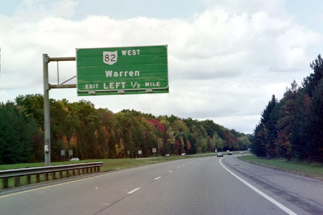
SR 11 heads north by Lake Girard to a directional cloverleaf interchange (Exit 51) with SR 82 in Vienna Township.
10/08/01
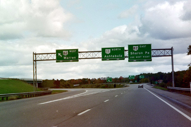
West from SR 11, SR 82 comprises an expressway bypass of Howland Center to the south and a freeway encircling the city of Warren to the north.
10/08/01
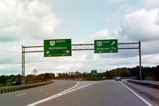
The remaining 9.74 miles of SR 82 east to U.S. 62 at Masury near the Pennsylvania state line and Sharon is a controlled access expressway.
10/08/01
South
Confirming marker posted south of the exchange with SR 82 at Exit 51.
10/08/01
SR 11 runs south between the city of Girard and Churchill to Interstate 80 at Exit 46 and SR 711 (Youngstown Connector).
10/08/01
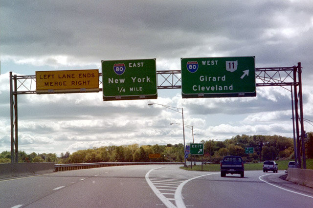
Bypassing Youngstown, SR 11 south combines with I-80 west for 3.83 miles. I-80 travels west to Cleveland along the Ohio Turnpike.
10/08/01
Exit 46A loops onto I-80 east toward Hubbard and Sharon, Pennsylvania. SR 711, a limited access route south from I-80/SR 11 to I-680 in Youngstown, was constructed from 2002 to 2005.
10/08/01
scenes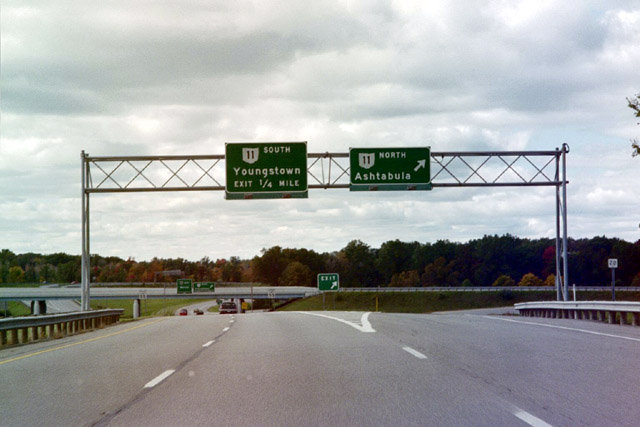
SR 82 heads west from SR 193 near Youngstown-Warren Regional Airport (YNG) to meet SR 11 near Howland Corners.
10/08/01
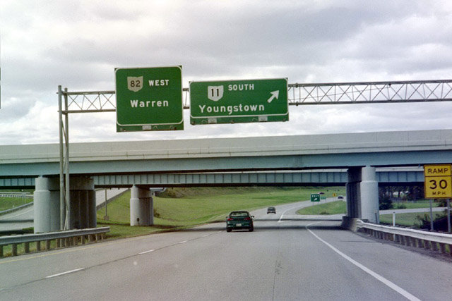
SR 82 continues west along an expressway toward Warren while SR 11 travels south to I-80/SR 711 at Girard.
10/08/01
References:
- "July 4, 1972, Opening is Seen for Lake-to-River Highway." The Salem News (OH), July 28, 1971.
Photo Credits:
- AARoads: 10/08/01
Connect with:
Page Updated Wednesday August 04, 2021.