South Carolina Highway 6 travels 116.01 miles southeast from Irmo in the central part of the state to Moncks Corner in the LowCountry. The south end of S.C. 6 is at Main Street and U.S. 52. S.C. 6 (Dreher Shoals Road) concludes at U.S. 76 (Dutch Fork Road) and Ballentine just outside the Irmo city limits.
The northern section of S.C. 6 serves western reaches of the Columbia metropolitan area from Lake Murray south into Lexington, where the state highway overlaps with U.S. 378 for 0.29 miles. Turning east from a 1.60 mile long overlap with S.C. 302 (Edmund Highway) at Edmund, heads to Swansea. S.C. 6 shares a one block concurrency with U.S. 321 along Church Street in the town.
Continuing east into Calhoun County, S.C. 6 converges with U.S. 21 (Columbia Road) for a 1.57 mile long overlap to S.C. 172 near Staley Crossroads. Following Caw Caw Highway for 4.78 miles, S.C. 6 branches east from U.S. 21 to a parclo B2 interchange with I-26 and a 0.76 mile long concurrency with U.S. 178 (Old State Road).
Beyond U.S. 176, S.C. 6 leads east along Bridge Street into the town of St. Matthews. The state highway shifts southward into Orangeburg County, connecting Elloree, Santee and Vance. S.C. 6/45 combine south of Lake Marion, from the town of Eutawville east 11.04 miles into Berkeley County. S.C. 45 encircles Lake Moultrie to the north while S.C. 6 runs along the western periphery of the lake south to Moncks Corner.
| S.C. 6 begins south along Dreher Shoals Road from U.S. 76 (Dutch Fork Road) at Ballentine. 01/02/14 |
| An Irmo town limits sign was formerly posted along S.C. 6 at Farming Creek Road. This intersection was expanded and signalized in 2015-16. 01/02/14 |
| Irmo Drive (Road 175) stems 2.28 miles east from S.C. 6 (Lake Drive) to S.C. 60 (Lake Murray Boulevard) in Irmo. 01/02/14 |
| River Road (Road 38) spurs 1.75 miles west from S.C. 6 to Lake Murray. 01/02/14 |
| S.C. 6 (Lake Drive) converges with the west end of S.C. 60 (Lake Murray Boulevard) and Bush River Road beside Lake Murray. 01/02/14 |
| S.C. 60 constitutes an arterial route leading 1.85 miles east to Irmo and U.S. 176 (Broad River Road). 01/02/14 |
| Bush River Road (Road 107) extends 3.76 miles southeast from S.C. 6/160 to St. Andrews Road (Road 36) at Seven Oaks. 01/02/14 |
| S.C. 6 (Caw Caw Highway) branches 1.26 miles east from U.S. 21 (Columbia Road) to a parclo B2 interchange (Exit 136) with Interstate 26. 11/21/21 |
| Construction slated to begin in late 2023 widening I-26 from mile marker 125 to mile marker 136 includes reconfiguring the exchange at S.C. 6 into a diamond interchange. 11/21/21 |
| S.C. 6 (Caw Caw Highway) proceeds east from I-26 across Mack Branch and Crim Creek. 11/21/21 |
| The Calhoun County seat of St. Matthews lies seven miles east of Interstate 26 along S.C. 6 at U.S. 601. 11/21/21 |
| S.C. 6 combines with U.S. 176 east 3.29 miles from Interstate 26. 11/21/21 |
| Wye intersections at both ends of the 0.76 mile long overlap with U.S. 176 were reconfigured in 2016 so that S.C. 6 meets U.S. 176 at a right angle. 11/21/21 |
| Paralleling the I-26 corridor, U.S. 176 travels southeast toward Charleston. S.C. 6 shifts east to St. Mathews and Santee en route to the LowCountry. 10/13/14 |
| A 0.12 mile long section of S.C. 6's old alignment at the east split with U.S. 176 was retained as a local road (Road 482) linking Bridge Street with Edgewood Drive north. 10/13/14 |
| S.C. 6 (Bridge Street) leads 3.28 miles east to U.S. 601 (Harry C. Raysor Drive) in the St. Matthews business district. U.S. 176 stays to the south of St. Matthews, meeting U.S. 601 at Wertz Crossroads in 3.46 miles. 10/13/14 |
| S.C. 6 east intersects U.S. 15 Connector (Bass Drive) in the town of Santee. U.S. 15 Connector parallels I-95 south along old U.S. 15/301 to U.S. 15/301 at Five Chop Road. 09/25/22 |
| S.C. 6 (Old Number Six Highway) proceeds southeast from Bass Drive (U.S. 15 Connector) to a diamond interchange (Exit 98) with Interstate 95 in Santee. 08/14/21 |
| I-95 travels southwest from Santee to Walterboro, Hardeeville and Savannah. 08/14/21 |
| U.S. 15/301 overlap with I-95 south to the succeeding exit at Five Chop Road and S.C. 6 Connector. 08/14/21 |
| Savannah, Georgia is 108 miles south of S.C. 6 at Santee via Interstate 95 and U.S. 17. 08/14/21 |
| S.C. 6 between Bass Drive (U.S. 15 Connector) and the northbound entrance ramp for I-95 was formerly part of U.S. 15/301. 08/14/21 |
| U.S. 15/301 were realigned onto I-95 when their bridge across Lake Marion permanently closed. 08/14/21 |
| Florence lies 67 miles to the northeast along Interstate 95 by the east end of I-20. 08/14/21 |
| S.C. 6 (Old Number Six Highway) continues southeast along a commercial strip by I-95/U.S. 15-301 in Santee. 05/30/07 |

West
S.C. 6 (Old Number Six Highway) north at the town of Santee.
09/25/22
S.C. 6 widens to a three lane commercial boulevard leading northwest to the exchange with Interstate 95 in Santee.
09/25/22
I-95/U.S. 15-301 span Lake Marion northward en route to Summerton.
09/25/22
Sign replacements made along S.C. 6 westbound at Interstate 95 omitted U.S. 15/301.
05/30/07
Interstate 95 travels northeast from Santee to Manning, Florence and Dillon in South Carolina.
09/25/22
09/25/22
U.S. 15/301 part ways with Interstate 95 south at the succeeding exit for Five Chop Road and S.C. 6 Connector.
09/25/22
S.C. 6 continues north from I-95 to U.S. 15 Connector (Bass Drive) by an array of traveler services.
09/25/22
U.S. 15 Connector lines old U.S. 15/301 along Bass Drive 2.14 miles southwest to U.S. 15/301 at Five Chop Road.
09/25/22
S.C. 6 (Caw Caw Highway) heads 3.29 miles west from U.S. 176 to a parclo B2 interchange (Exit 136) with Interstate 26.
09/16/21
Southeast from S.C. 6, Interstate 26 travels to Orangeburg and Charleston.
09/16/21
09/20/21
09/16/21
S.C. 172 (Bull Swamp Road) branches west from S.C. 6 (Caw Caw Highway) just ahead of U.S. 21 (Columbia Road).
09/20/21
S.C. 172 (Bull Swamp Road) runs 9.00 miles west to Staley Crossroads and U.S. 178 near the town of North.
09/20/21
09/16/21
S.C. 6 combines with U.S. 21 (Columbia Road) north for 1.57 miles en route to Swansea.
09/16/21
S.C. 6 (Lake Drive) heads north from Red Bank to a parclo interchange (Exit 55) with Interstate 20 outside the city of Lexington.
09/20/21
Interstate 20 runs west from Columbia and Lexington to Augusta and Atlanta, Georgia.
09/20/21
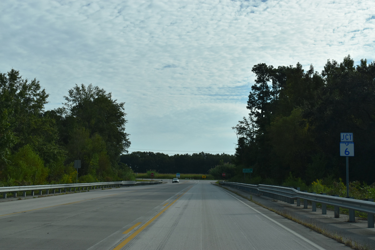
| S.C. 6 Connector along Five Chop Road near Santee is a 0.76 mile arterial extending east from the exchange joining U.S. 301 with I-95 to S.C. 6 (Old Number Six Highway). 09/25/22 |
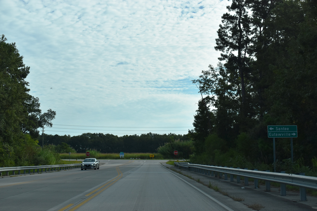
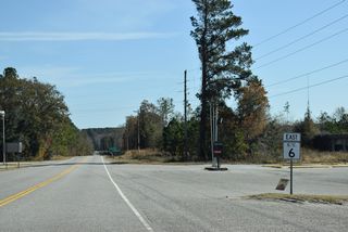
| Five Chop Road ties into S.C. 6 south of Santee and north of Vance. 09/25/22 |
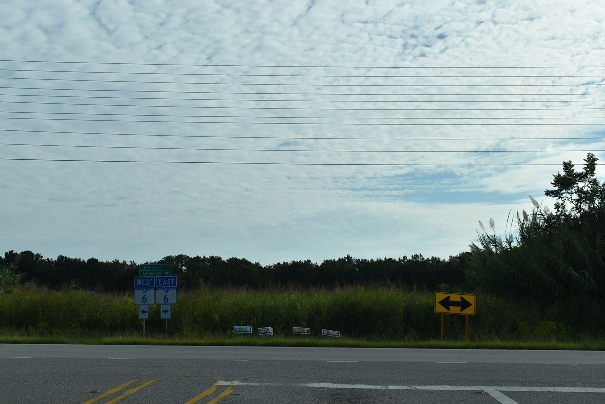
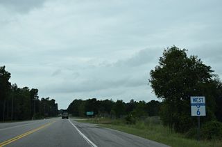
| Eutawville lies 8.48 miles southeast along S.C. 6 at S.C. 45 (Porcher Avenue). 09/25/22 |
| Confirming marker posted north of S.C. 6 Connector (Five Chop Road) west to I-95/U.S. 301. 09/25/22 |
|
Photo Credits:
09/25/22 by AARoadsConnect with:
Interstate 20
Interstate 26
Interstate 95
U.S. 1
U.S. 15
U.S. 21
U.S. 25
U.S. 76
U.S. 176
U.S. 178
U.S. 301
U.S. 321
U.S. 601
Highway 302
Page Updated 12-02-2022.
Page load link
|