
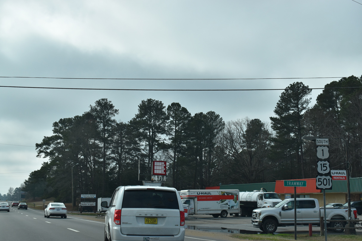
U.S. 1 South - Chatham / Lee Counties

 South
South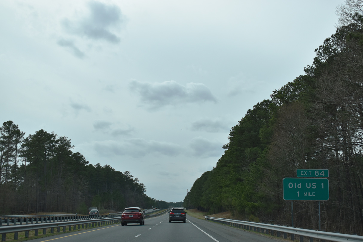
Old US 1 parallels U.S. 1 to the north from S Salem Street in Apex to a folded diamond interchange (Exit 84) at Merry Oaks.
02/15/19
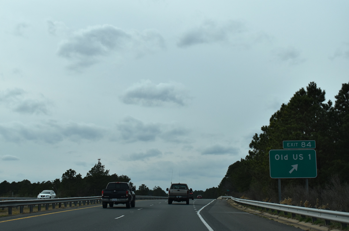
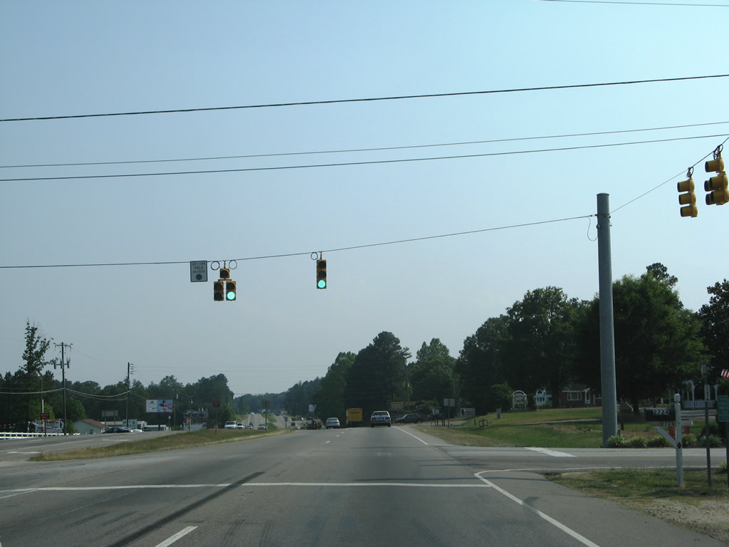
Old U.S. 1 arcs southward from U.S. 1 at Merry Oaks to Haywood and Moncure before crossing U.S. 1 again at Blacknel (Exit 78).
02/15/19
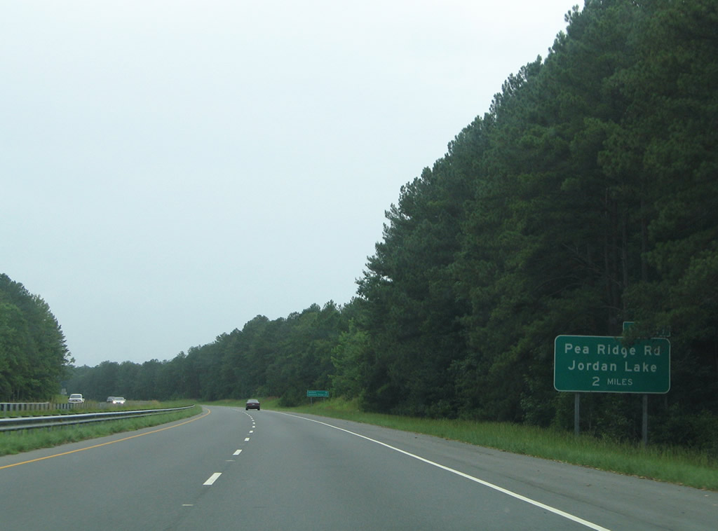
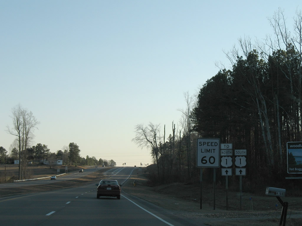
U.S. 1 south next meets Pea Ridge Road (SR 1972) at a diamond interchange (Exit 81) in two miles.
07/12/05
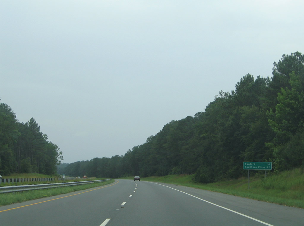
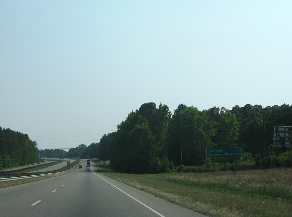
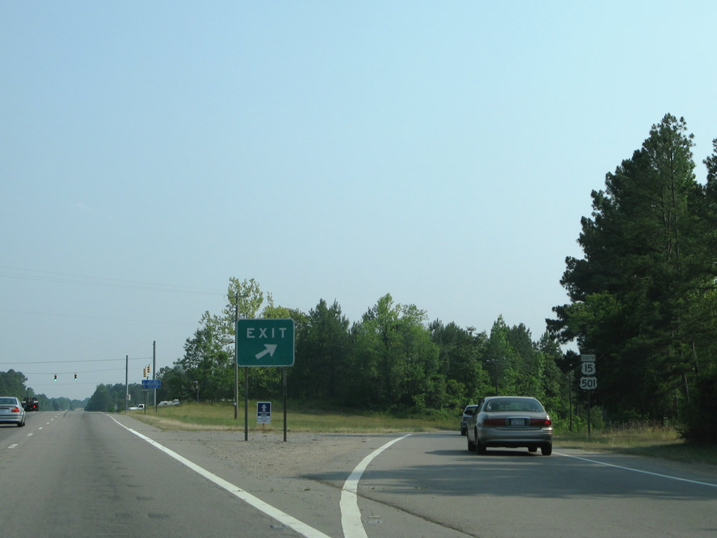
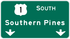
Sanford is 18 miles to the southwest, followed by Southern Pines in 42 miles.
07/12/05
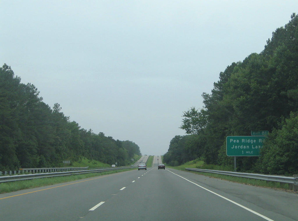
Pea Ridge Road provides another link between the U.S. 1 freeway and B. Everett Jordan Lake to the north.
07/12/05
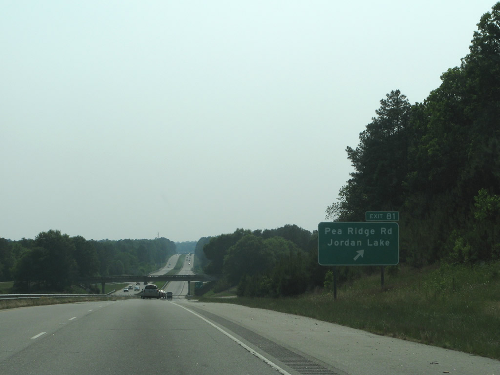
Pea Ridge Road extends 1.31 miles south from Exit 81 to Old US 1 (SR 1011) near Haywood. Corinth Road (SR 1916) stems south from Old U.S. 1 nearby to Brickhaven, and NC 42 near Corinth.
05/30/07
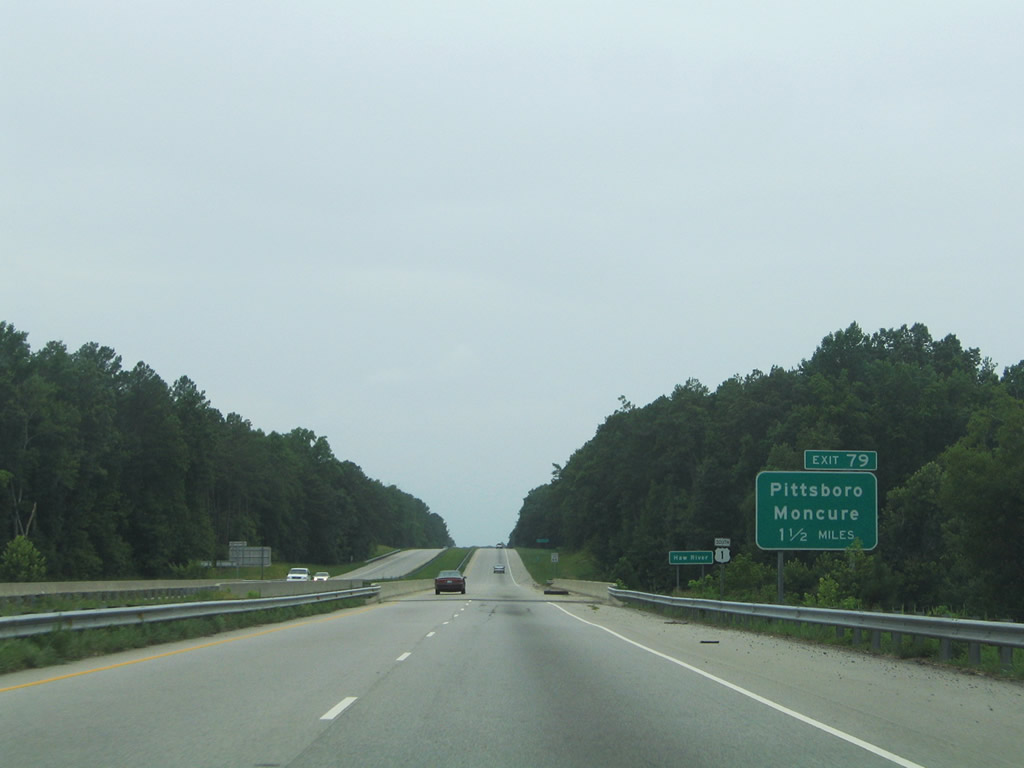
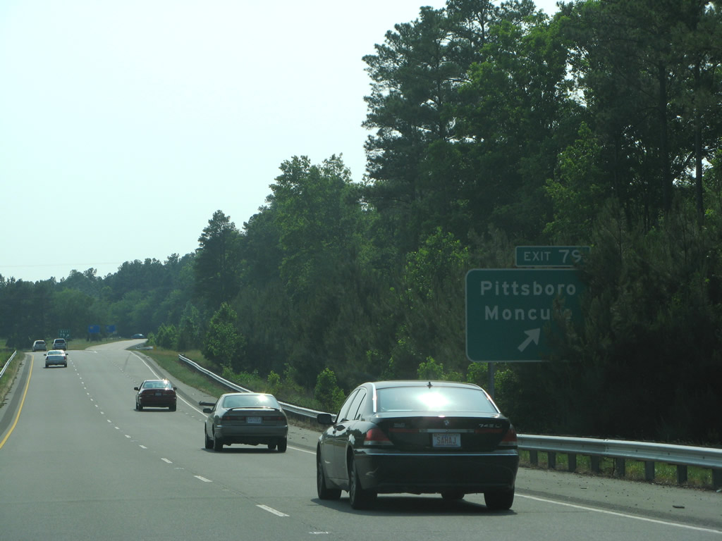
U.S. 1 spans the Haw River 1.5 miles east of Exit 79 with Moncure-Pittsboro Road (SR 1012).
07/12/05
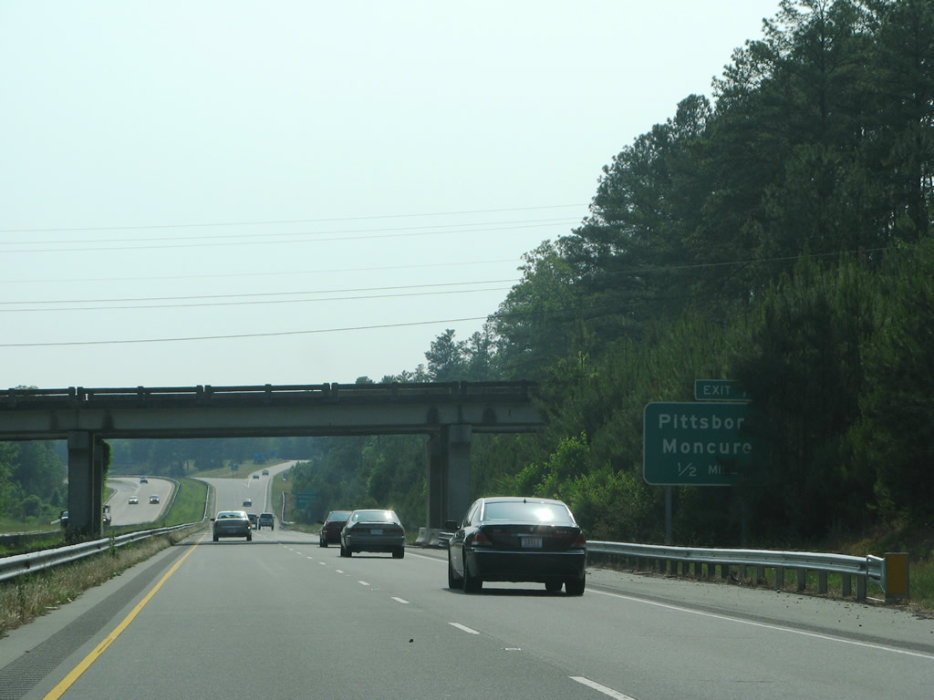
Moncure School Road (SR 1931) passes over U.S. 1 east of the diamond interchange at Exit 79. Moncure-Pittsboro Road runs north from Old US 1 and Moncure to Jordan Dam Road (SR 1970) for B. Everett Jordan Dam.
05/30/07
Moncure-Pittsboro Road (SR 1012) travels 8.29 miles northwest from Moncure to U.S. 15/501 at NC 87 in the Chatham County seat of Pittsboro.
05/30/07
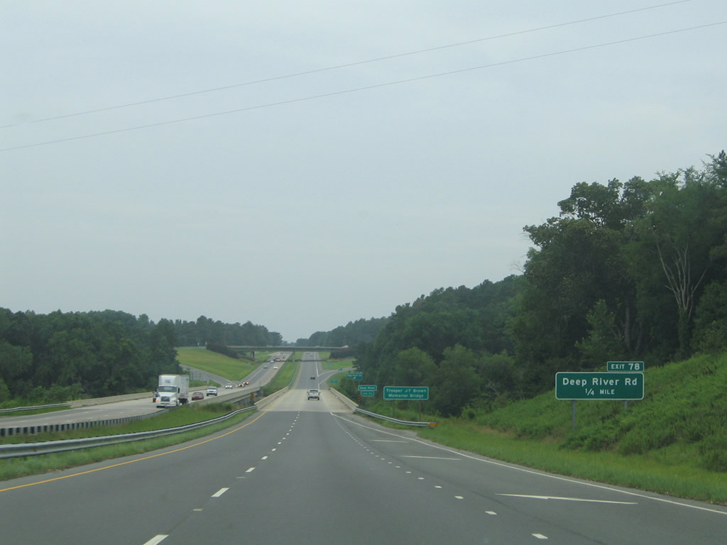
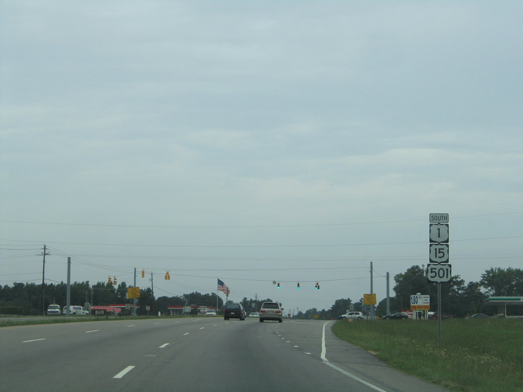
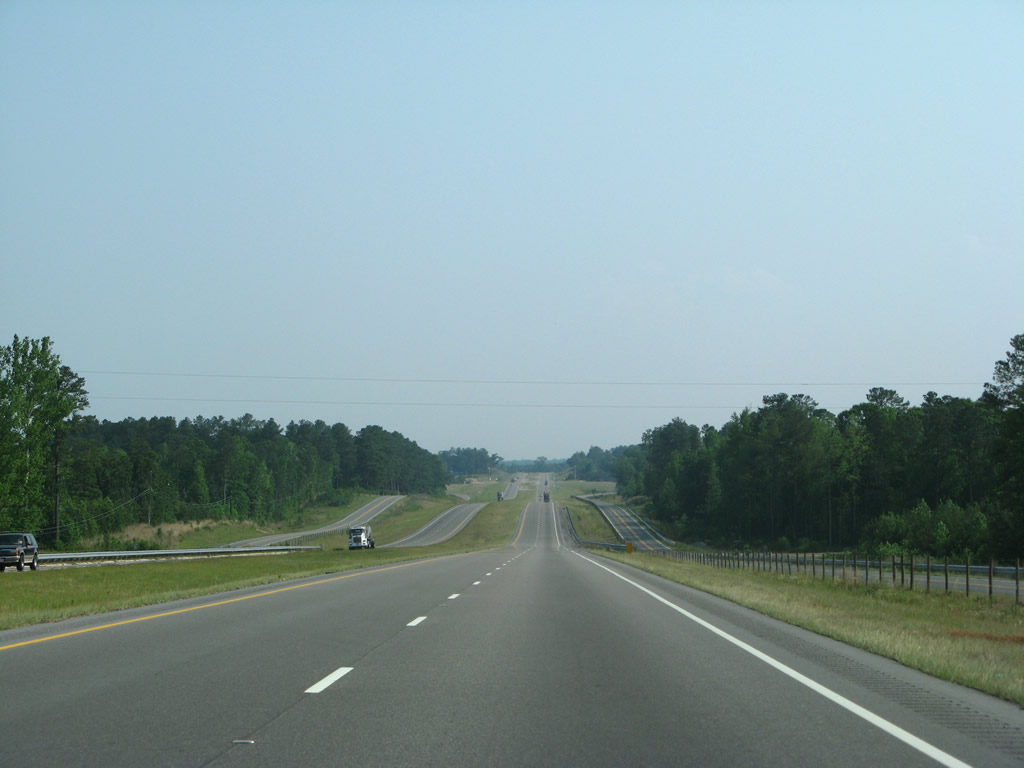
U.S. 1 and Old U.S. 1 converge southwest of the Deep River at a diamond interchange (Exit 78).
07/12/05
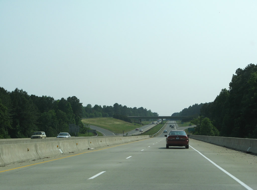
Entering Lee County, U.S. 1 crosses the Deep River over the Trooper J.T. Brown Memorial Bridge.
05/30/07
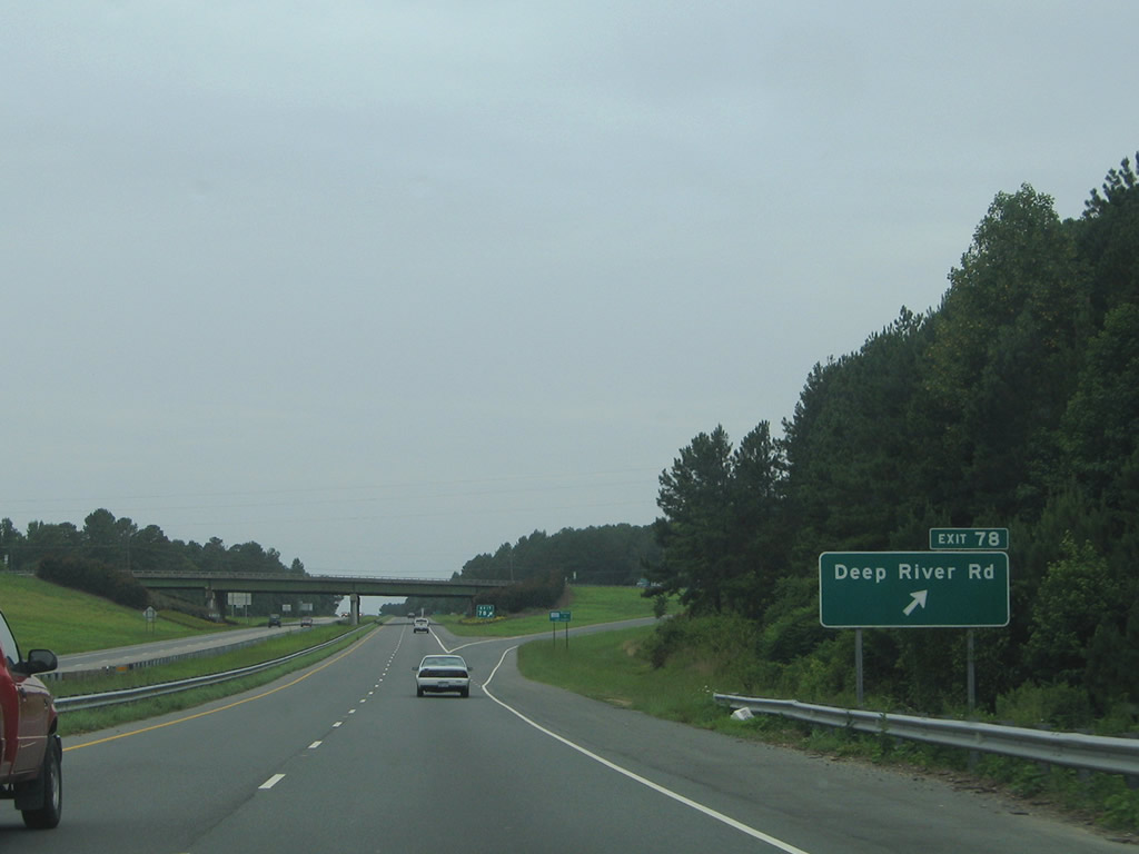
Deep River Road (SR 1466) extends west from Exit 78 along the original U.S. 1 alignment to U.S. 15/501 and NC 87 (Hawkins Avenue) outside Sanford.
07/12/05
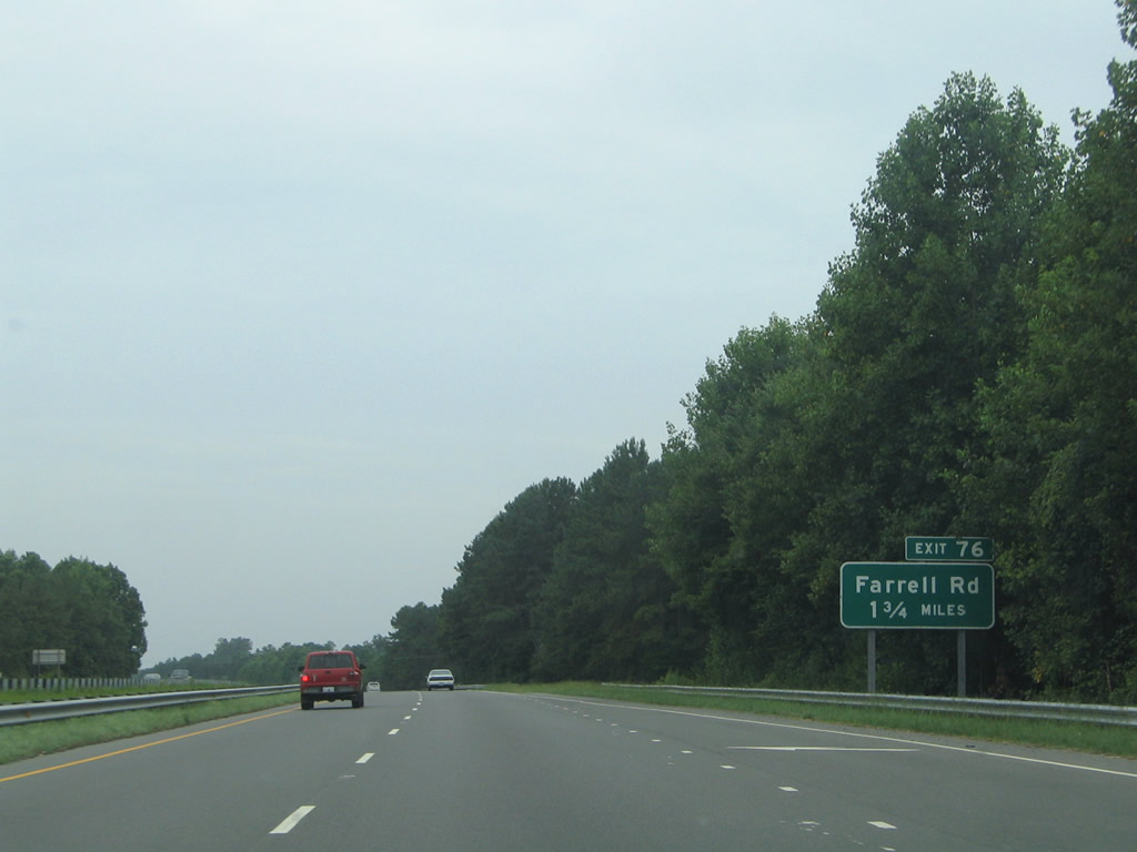
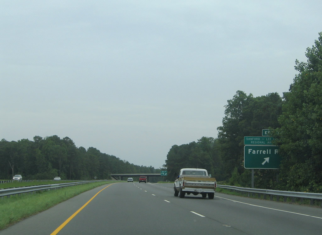
The succeeding exit on U.S. 1 south connects with Farrell Road (SR 1423) near Raleigh Executive Jetport (TTA).
07/12/05
U.S. 1 confirming marker posted ahead of Wombles Creek.
07/12/05
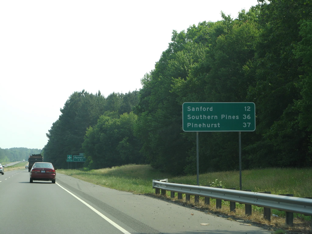
Located south of Sanford along U.S. 1, Pinehurst and Southern Pines are neighboring cities in southern Moore County, west of Fort Bragg.
05/30/07
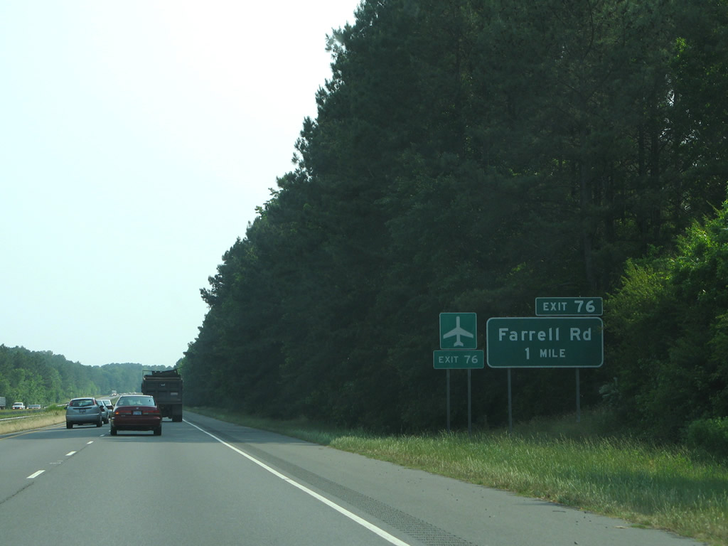
Farrell Road (SR 1423) heads north from the diamond interchange at Exit 76 to Deep River Road.
05/30/07
Farrell Road continues south from Exit 76 to Lower Moncure Road (SR 1002) near Osgood. Lower Moncure Road provides a back route into eastern Sanford.
07/12/05

Zion Church Road (SR 1426) passes over the U.S. 1 freeway nine miles north of the Lee County seat of Sanford.
07/12/05
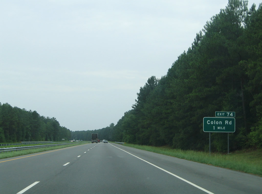
Colon Road (SR 1415) stems 0.91 miles east from Deep River Road (SR 1466) to a rural diamond interchange (Exit 74) with U.S. 1.
07/12/05
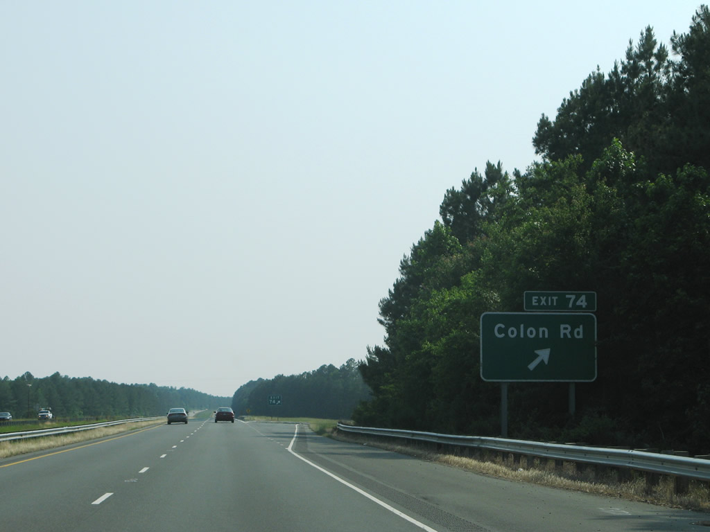
Colon Road arcs southward to Colon en route to 7th Street in the city of Sanford.
05/30/07

U.S. 15-501/NC 87 overlap southward through industrial areas north of Sanford to combine with U.S. 1 at a dumbbell interchange (Exit 71) opposite U.S. 1 Business (Hawkins Avenue) north.
05/30/07
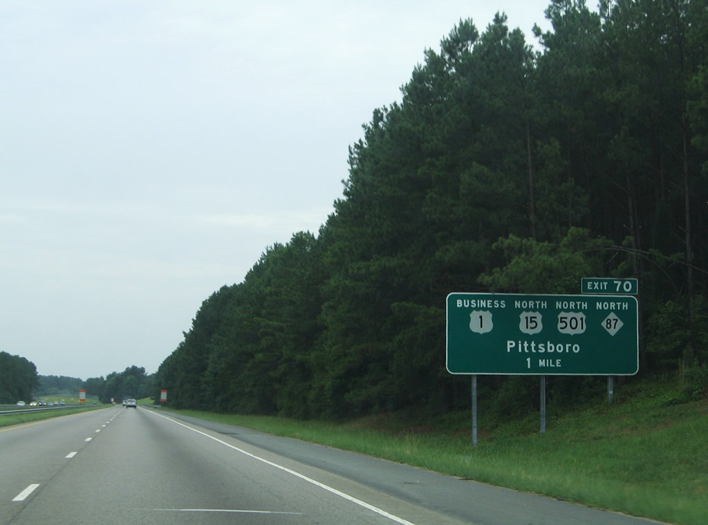
U.S. 15-501/NC 87 join Sanford with Pittsboro. U.S. 1 Business (Hawkins Avenue) provides a direct route south into Downtown Sanford, the historic district, and to area potteries.
05/30/07

U.S. 1 Business loops 4.8 miles south from Exit 71 to Charlotte Avenue in Downtown and west along side NC 42 to U.S. 1-15/501 at Exit 66.
05/30/07


 South
South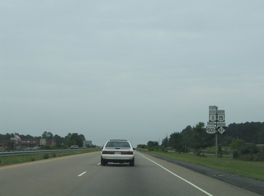
U.S. 1-15-501 bypass Sanford to the west. NC 87 accompanies the three routes south to U.S. 421 Business (Horner Boulevard) at Exit 69A.
07/12/05
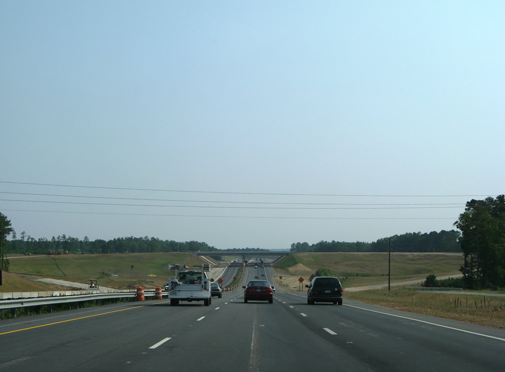
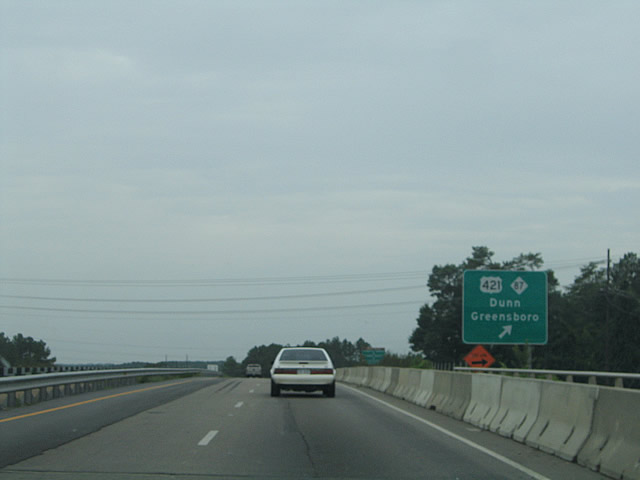
A cloverleaf interchange (Exit 70) joins U.S. 1-15-501/NC 87 with U.S. 421?NC 87 Bypass. U.S. 421 circumvents Sanford along a 12 mile long freeway.
05/30/07
Construction of the exchange with the Sanford Bypass along U.S. 421 directly replaced a diamond interchange with McNeill Road. McNeill Road was redirected southward as frontage roads for U.S. 1-15-501 to Burns Drive.
05/30/07
The U.S. 421 Sanford Bypass opened to traffic east from Exit 70A by February 2008. US. 421 heads east to Lillington while NC 87 runs south to Spring Lake and Fayetteville.
05/30/07
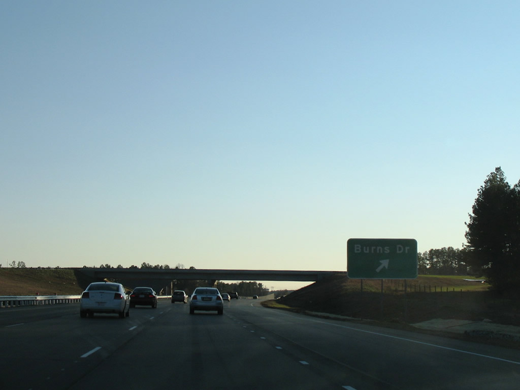
Burns Drive (SR 1406) links U.S. 1-15-501/NC 87 with parallel U.S. 1 Business (Hawkins Avenue) to the east and a residential area west of McNeill Road and Exit 69B.
01/02/08
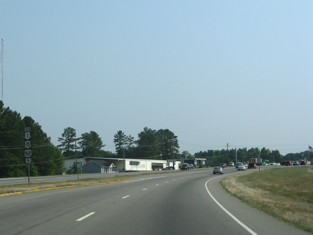
NC 87 splits with U.S. 1-15-501 at a folded diamond interchange (Exit 69A) with U.S. 421 Business (N Horner Boulevard). U.S. 421 Business/NC 87 overlap 3.60 miles southeast across the city of Sanford.
07/12/05
South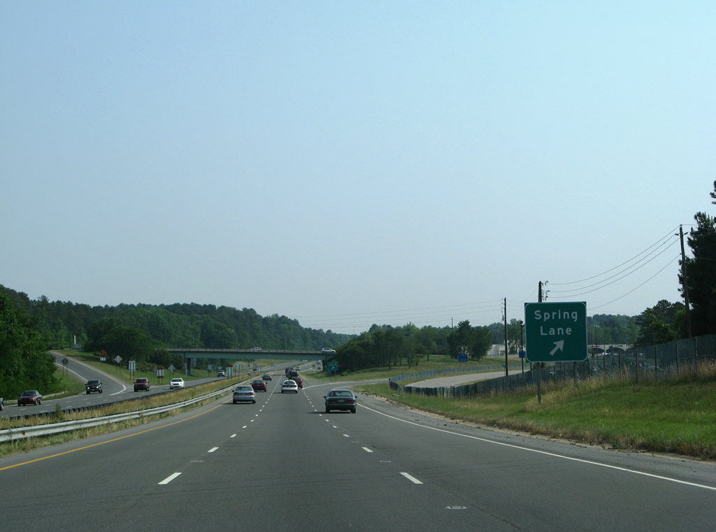
A commercialized diamond interchange with Spring Lane (SR 1100) follows along U.S. 1-15-501 at Exit 68. SR 1100 travels west to Cool Springs Road and east to Gulf and Weatherspoon Streets.
05/30/07
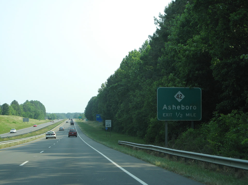
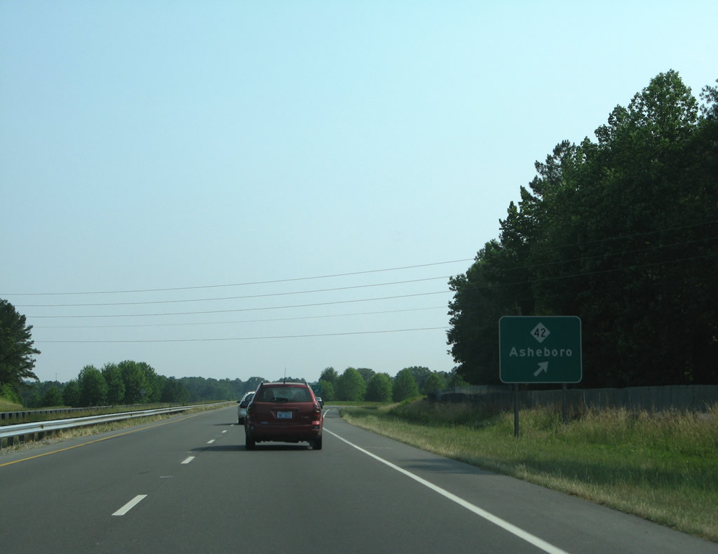
One mile north of the diamond interchange (Exit 66) with NC 42 (Wicker Street) and U.S. 1 Business north in Sanford. Leading 45 miles west to Asheboro, NC 42 departs the city of Sanford at Cool Springs.
05/30/07
NC 42 east/U.S. 1 Business north follow Wicker Street east to Carthage Street and Downtown Sanford.
05/30/07
Westover Drive (SR 1333) parallels U.S. 1-15-501 southbound from NC 42 to Pendergrass Road (SR 1334)
07/12/05
U.S. 15/501 part ways for Carthage ahead of Cameron, but return to U.S. 1 at Southern Pines.
05/30/07
U.S. 1-15-501 transition into an at-grade arterial ahead of the merge with Carthage Street (SR 1237) south of Sanford. Carthage Street represents the original route of U.S. 1-15-501, and U.S. 1-15-501 Alternate when the freeway opened by 1958.1
05/30/07
Pendergrass Road (SR 1334) heads 2.47 miles northwest from U.S. 1-15-501 (Jefferson Davis Highway) to Steel Bridge Road (SR 1318) near NC 42 west of Sanford.
07/12/05
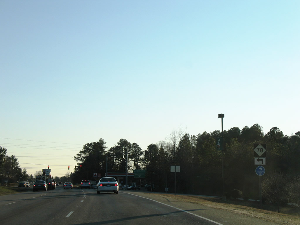
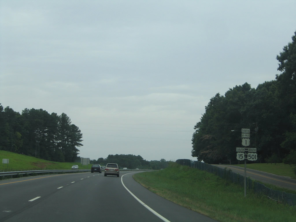
U.S. 1-15-501 south at the west end of NC 78 (Tramway Road). NC 78 constitutes a 4.57 mile long route from Tramway to Jonesboro Heights and U.S. 421 Business/NC 42-87 (Horner Boulevard).
01/02/08

Center Church Road (SR 13030) ties into the intersection with NC 78 at Tramway from Plank Road (SR 1007) to the southwest. NC 78 was designated in 1940 between U.S. 1-15-501 and Lee Avenue (old U.S. 421) in Jonesboro Heights.2
05/30/07
U.S. 1-15-501 confirming markers posted south of NC 78 and Center Church Road. Tramway is a community in south Sanford.
01/18/19
Hickory House Road (SR 1157) leads 2.69 miles east from U.S. 1-15-501 to NC 78 (Tramway Road) at Southern Lee High School.
05/30/07
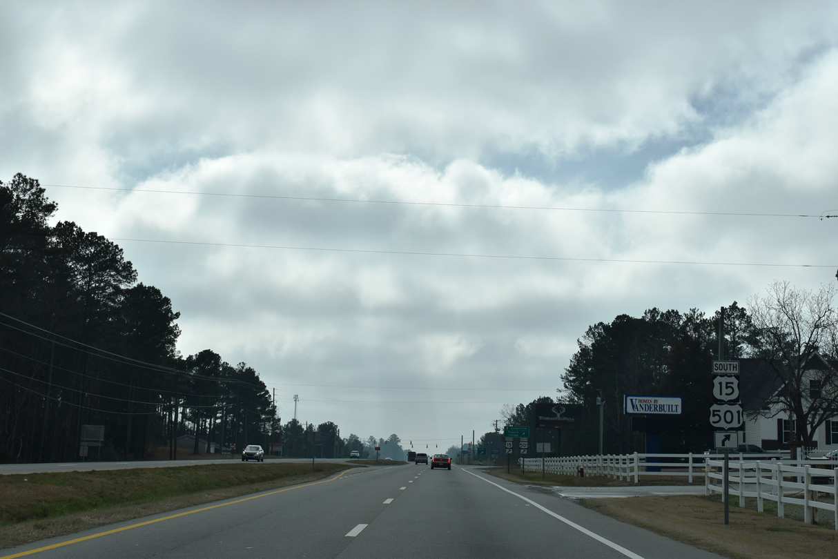
U.S. 15/501 part ways with U.S. 1 southwest 10.7 miles to Carthage. U.S. 1 remains southward toward Cameron and Vass.
01/18/19
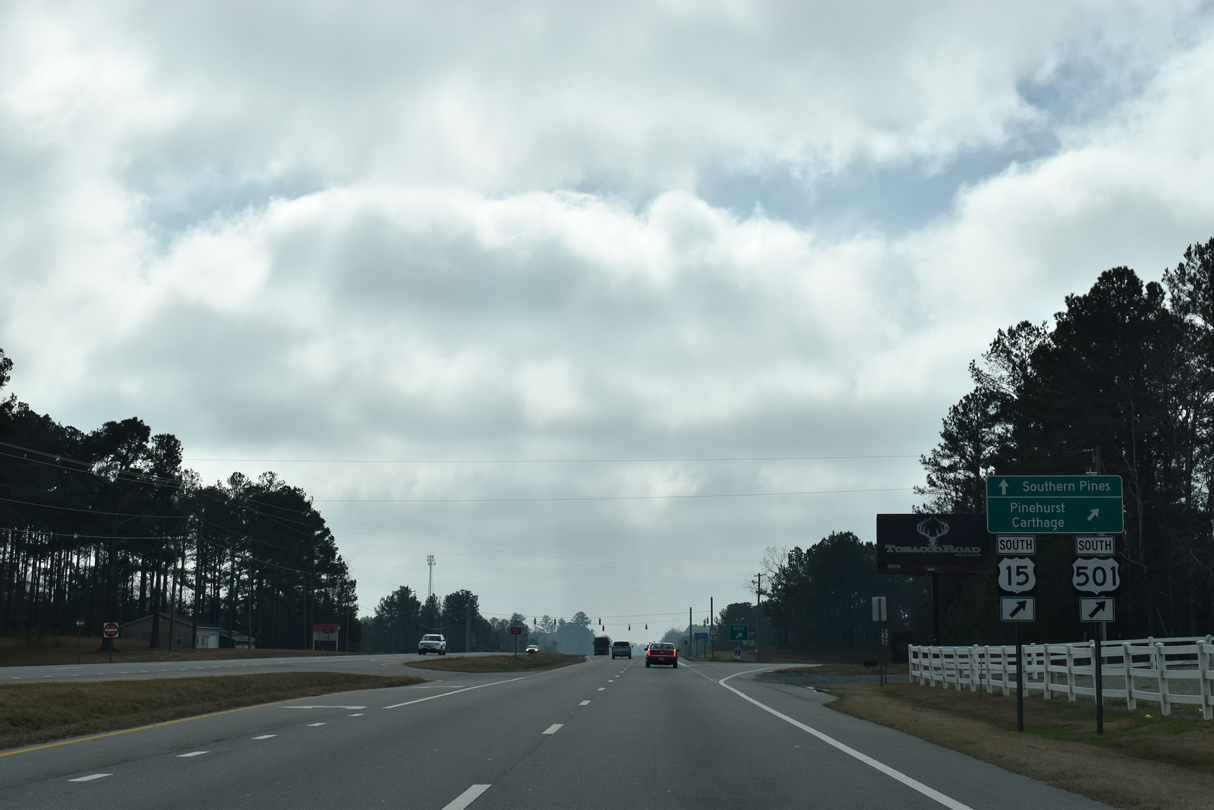
U.S. 15/501 are signed as the most direct route to Pinehurst while U.S. 1 varies between arterial and expressway to Southern Pines east of Pinehurst. U.S. 1-15-501 combine again between Southern Pines and Aberdeen after 25.1 miles.
01/18/19
Rocky Fork Church Road (SR 1179) loops southeast from the intersection with U.S. 15/501 (White Hill Road) along the pre-1933 alignment of U.S. 1.1
05/30/07
South
Continuing south from U.S. 15/501 by the Quail Ridge Golf Course on U.S. 1.
05/30/07
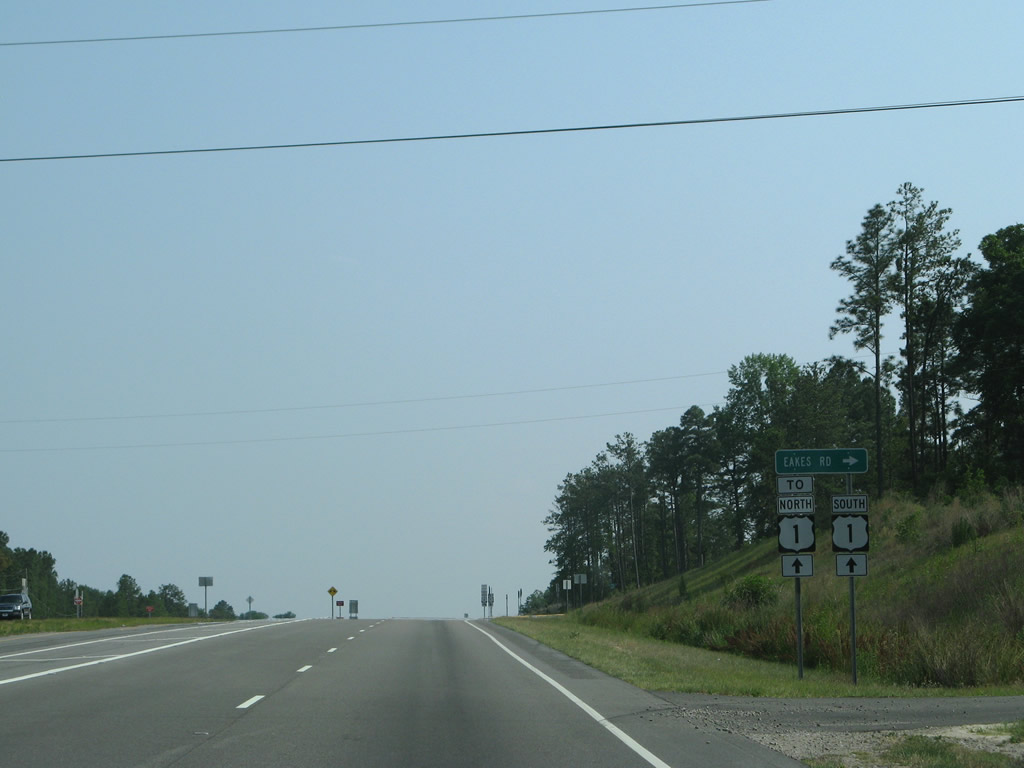
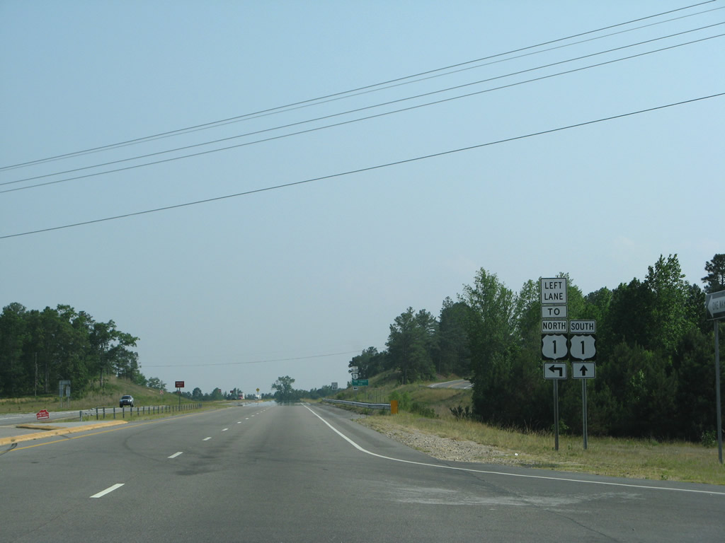
U.S. 1 south at the J-turn intersection with Eakes Road (SR 1181).
01/02/08
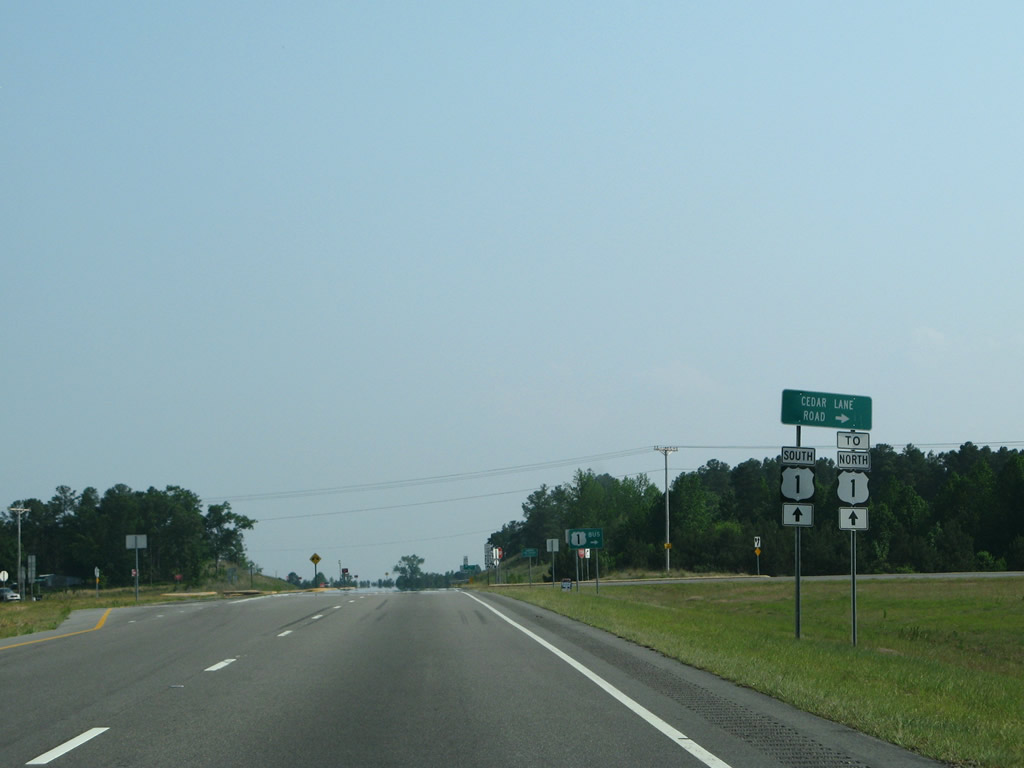
Eakes Road links U.S. 1 with Cedar Lane Road (SR 1182) west of the Quail Ridge Golf Course.
05/30/07
A U-turn lane follows to provide access to U.S. 1 north from Eakes Road eastbound.
05/30/07
Frontage roads line U.S. 1 beyond Eakes Road. The east side road (SR 1754) represents the original alignment of U.S. 1 before the highway was four laned in the 2000s.
05/30/07

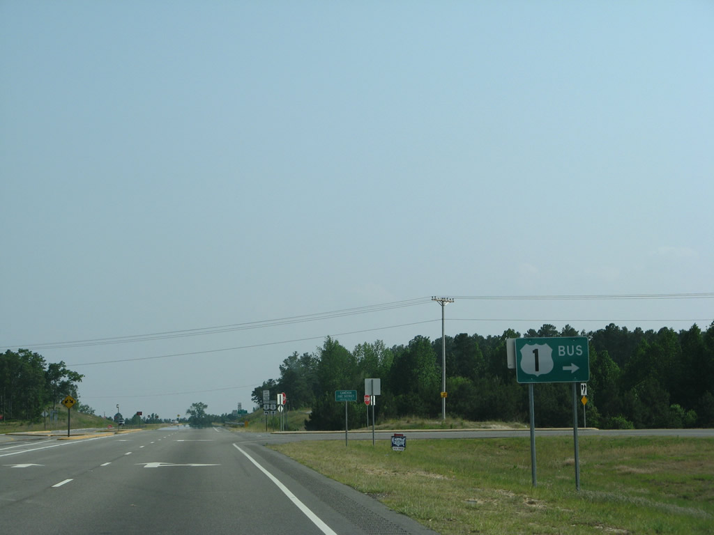
U.S. 1 Business (Old Jefferson Davis Highway) into Cameron branches southwest from U.S. 1 at Cedar Lane Road.
05/30/07
Cedar Lane Road east and Pine Forest Road (SR 1173) west meet U.S. 1 at a J-turn intersection.
05/30/07
U.S. 1 Business follows the former U.S. 1 alignment before the Cameron and Vass freeway bypass opened in June 2005.
05/30/07
The J-turn intersection at Cedar Lane and Pine Forest Roads was constructed after 2005.
05/30/07
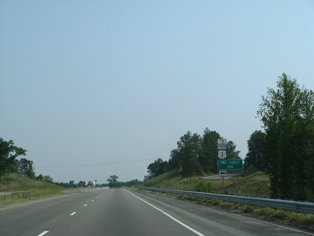
Pine Forest Road (SR 1173) angles 2.34 miles southeast to Nicholson Road (SR 1166).
05/30/07
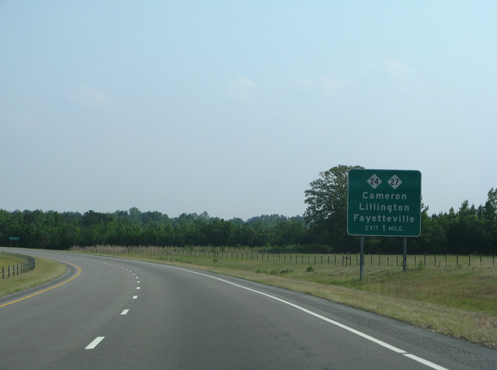
The expressway along U.S. 1 meets NC 24/27 next at a diamond interchange east of Carthage Street in Cameron.
05/30/07
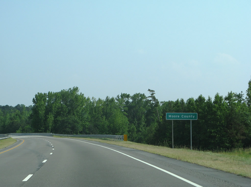
U.S. 1 concludes a 22.1 mile stretch through Lee County at the Lee County line just ahead of a CSX Railroad underpass.
05/30/07

References:
Photo Credits:
- Brent Ivy: 01/18/19, 02/15/19
- Alex Nitzman: 07/12/05, 01/02/08
- Andy Field: 05/30/07
Connect with:
Page Updated Friday July 17, 2020.