
U.S. 2
U.S. 2 stretches 665.42 miles across northern Montana. Following the Kootenai River, U.S. 2 enters Lincoln County, Montana by the settlement of Leonia. U.S. 2 parallels the Kootenai southeast to Troy and east to Libby. Turning south ahead of White Haven, the highway continues to Sediak Park around Kenelty Mountain.
East - Browning to Cut Bank - 55 photos

Ethridge to Shelby - 26 photos
Resuming eastward, U.S. 2 heads to Loon Lake, the first in a series of lakes along the south side of the highway to the Flathead County line. U.S. 2 straddles the north side of McGregor Lake and enters Smith Valley ahead of Kalispell. Expanding to a four lane boulevard, the route crosses the city north of Downtown.
U.S. 2 turns northward at MT 35 and the community of Evergreen. Staying west of the Flathead River, U.S. 2 continues north to MT 40, where shifts east into Columbia Falls. U.S. 2 travels north of the Swain and Flathead Ranges to West Glacier and Going to the Sun Road into Glacier National Park.
Passing south of Glacier National Park through Theodore Roosevelt Pass, U.S. 2 leaves the high mountains beyond East Glacier Park. Northeast to Browning, U.S. 2 combines with U.S. 89 for 3.90 miles. Beyond their separation, U.S. 89 travels southeast to Great Falls while U.S. 2 generally follows a BNSF Railroad line eastward to Cut Bank and Shelby.
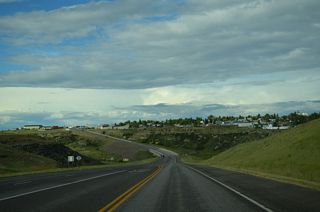
U.S. 2 meets Interstate 15 at the city of Shelby and overlaps with Business Loop I-15, 0.99 miles to Downtown. U.S. 2 connects Shelby with the Liberty County seat of Chester and the Hill County seat of Havre. Through eastern Montana, U.S. 2 continues to U.S. 191 at Malta, Glasgow and Culberson.
Connect with:
Page Updated Sunday February 08, 2026.