
U.S. 6 East - California to Coaldale
U.S. 6 travels across northern Esmeralda County from near Basalt to Tonopah. With a population of just 729 as of the 2020 Census, down from 971 at the 2000 Census, this county has a large area, encompassing 3,589 square miles. Esmeralda County was formed in 1861, prior to the inclusion of the state of Nevada into the United States of America in 1864. Gold and silver mining was part of the original growth of the county in the 19th century, along with other parts of Nevada. However, with the decline of mining activities through the 20th century, Esmeralda County today is very rural with only a few settlements within its expanse.
U.S. 6 leaves the Golden State of California and enters the Silver State of Nevada and Mineral County.
11/11/08

The Nevada welcome sign stands adjacent to the cattle guard and zero milepost marking the state boundary.
11/11/08
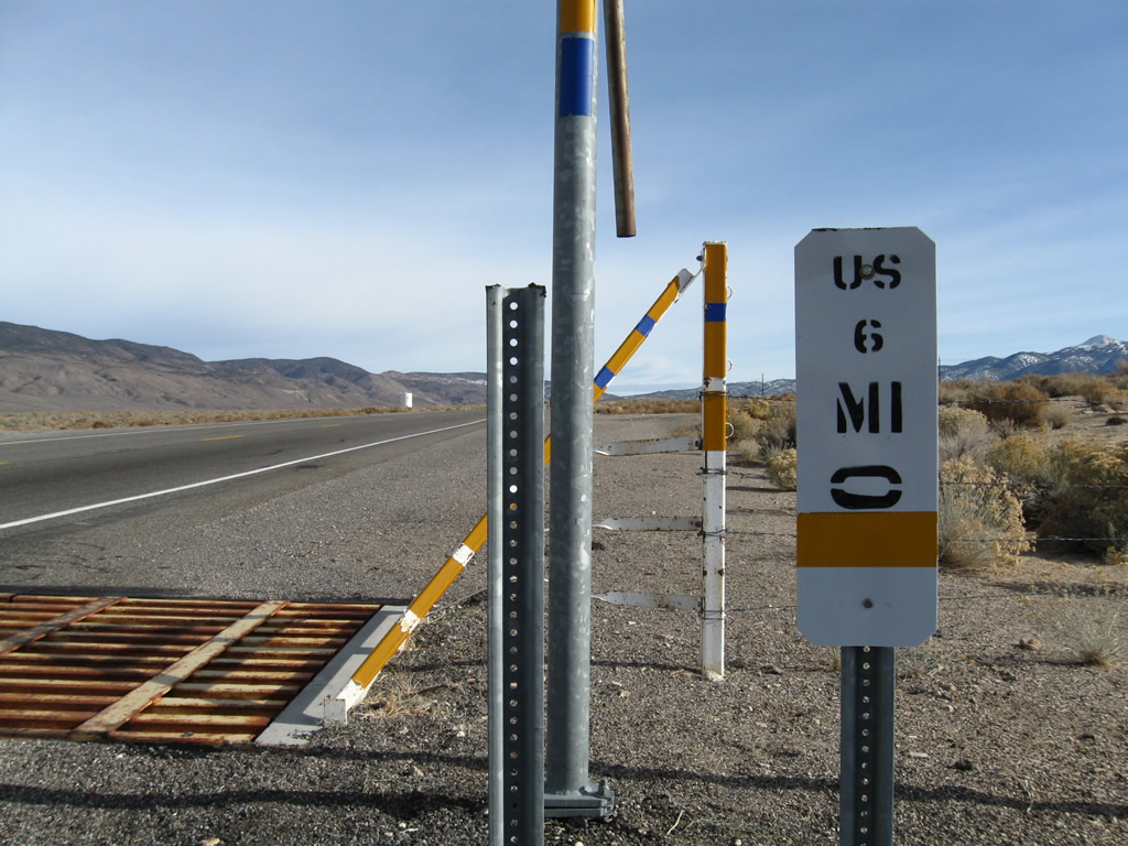
The Nevada Department of Transportation (NDOT) uses white mile markers as references along the state route system. While similar to those found in California, newer mileposts include a graphic of the corresponding route above a two letter county code.
11/11/08

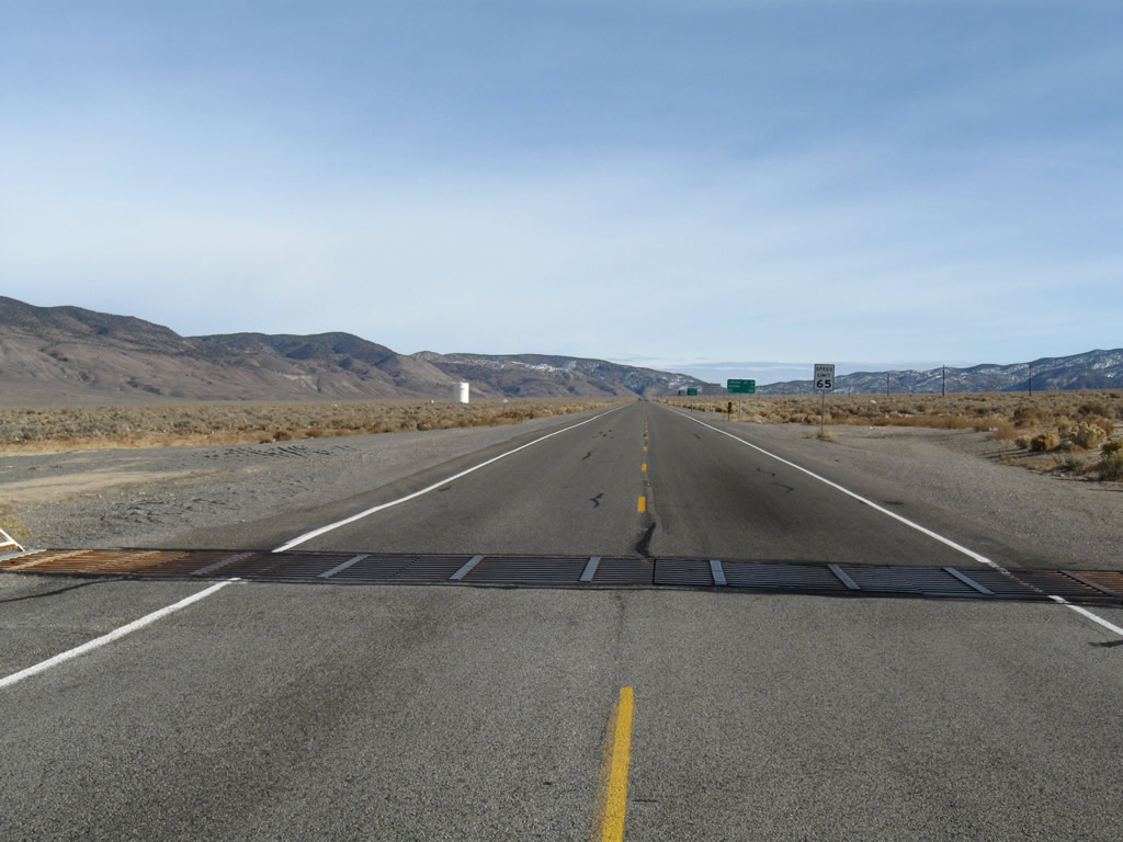
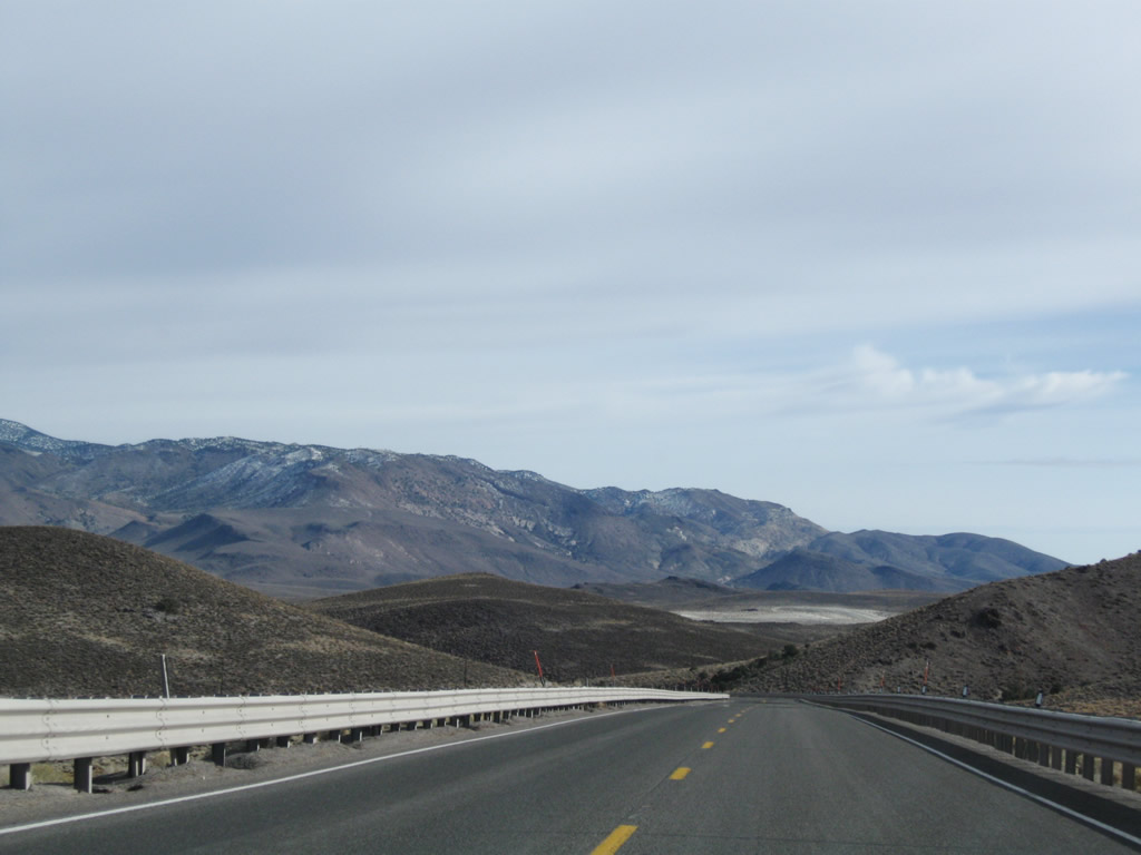
U.S. 6 traverses sparsely populated areas 75 miles east from the California state line to Tonopah.
11/11/08

U.S. 6 is designated as the Grand Army of the Republic Highway. Originating in California, shields for the route are posted along SR 14, U.S. 395, and U.S. 6. The designation follows all of U.S. 6 east to Cape Cod, Massachusetts.
11/11/08

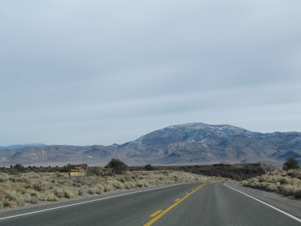
A tourist sign "Welcome to Pioneer Territory" refers to the division of the Silver State into multiple touring regions. Much of Central Nevada falls within Pioneer Territory.
11/11/08
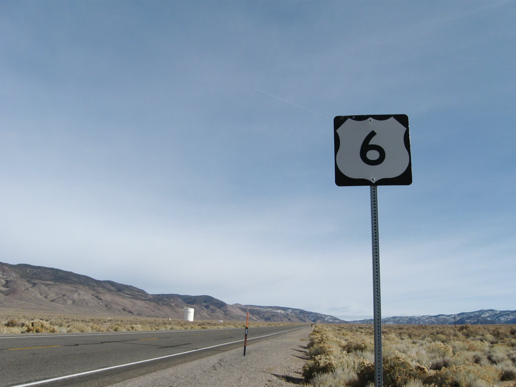
The first confirming marker for U.S. 6 east in Nevada.
11/11/08

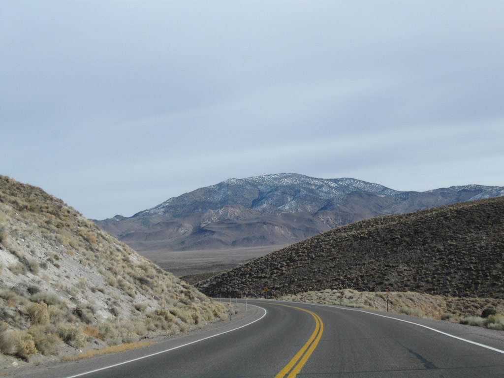
U.S. 6 (Grand Army of the Republic Highway) extends northeast across Queen Valley toward Montgomery Pass. Sagebrush populates the arid landscape.
11/11/08
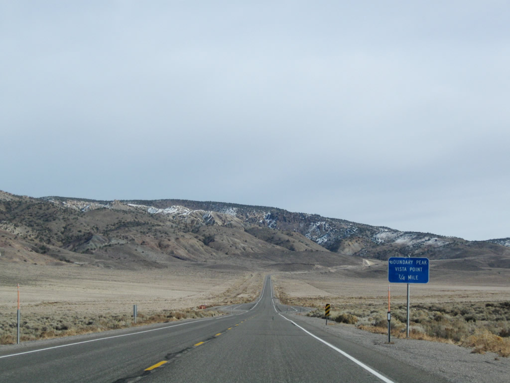
Located 3.7 miles from the state line, the Boundary Peak vista point constitutes pull offs along both directions of U.S. 6. This area was expanded during road work in 2022.
11/11/08
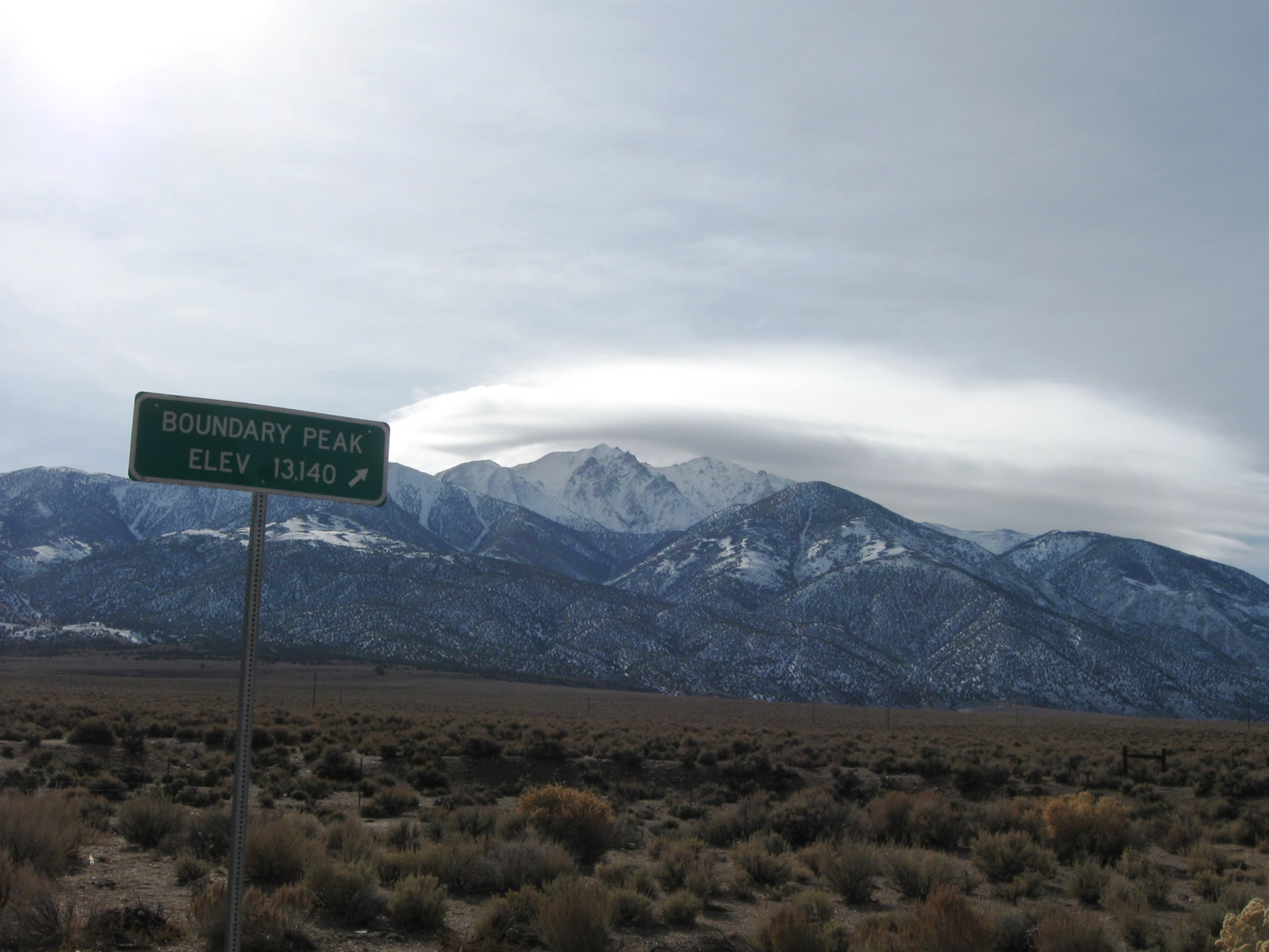
Boundary Peak rises to the south across from Montgomery Peak in California. With an elevation of 13,140 feet above sea level, Boundary Peak is the Nevada high point.
11/11/08

The straight away along U.S. 6 east concludes beyond Mineral County milepost 5 at the first of several curves along the ascent to Montgomery Pass.
11/11/08

U.S. 6 east climbs to 7,000 feet in elevation beyond Mineral County milepost 7.
11/11/08
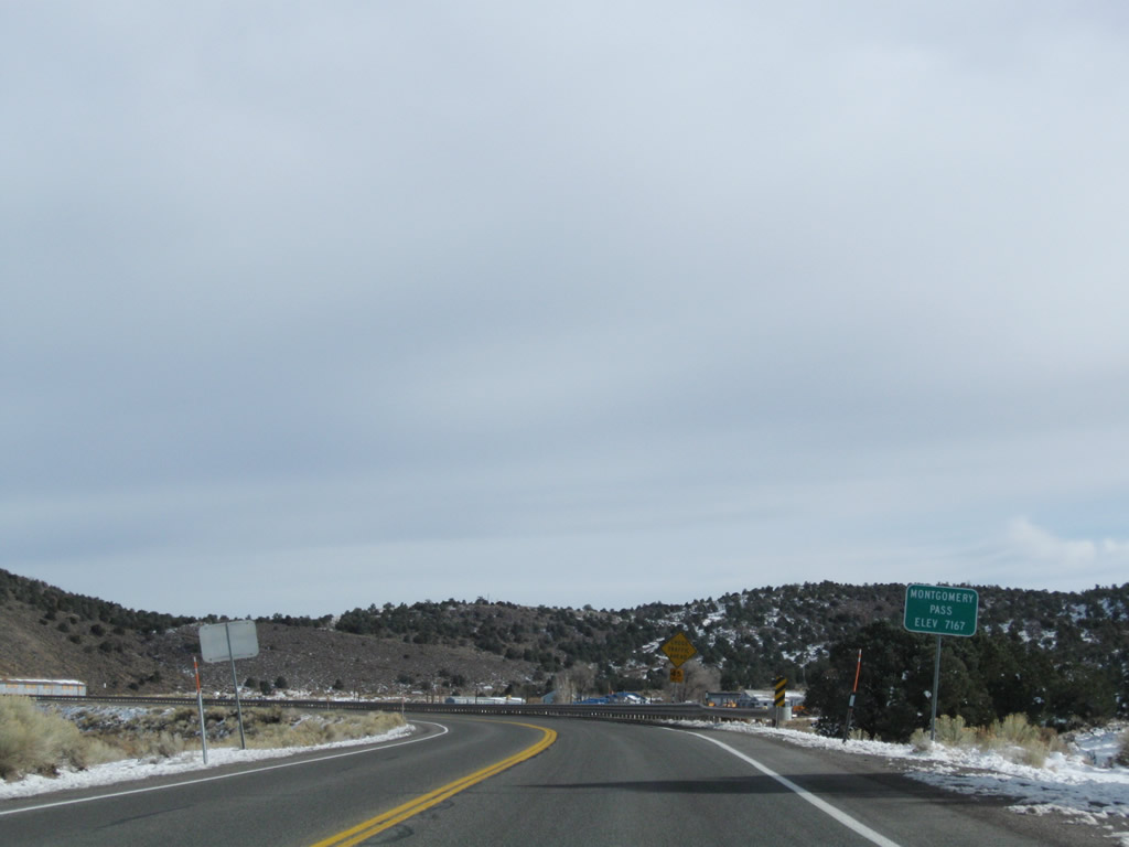
Eastbound U.S. 6 reaches Montgomery Pass, elevation 7,167 feet above sea level.
11/11/08
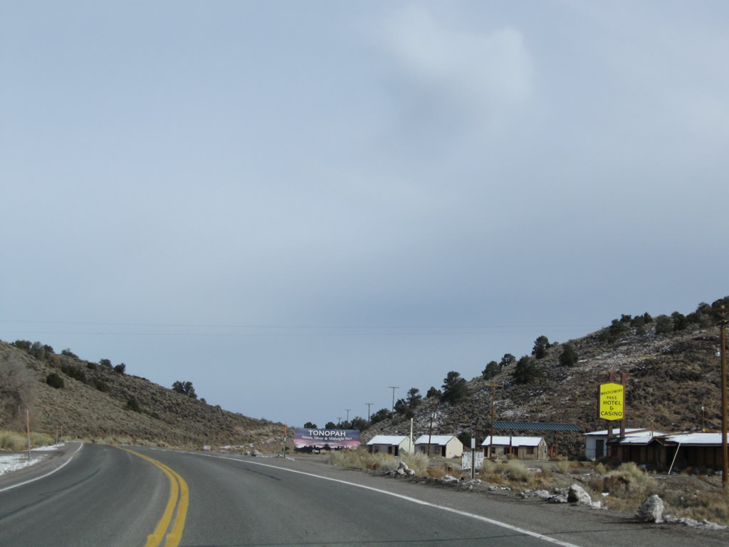
The settlement of Mount Montgomery lies just beyond Montgomery Pass along U.S. 6. The site was once the location of the Montgomery Pass Hotel & Casino.
11/11/08

U.S. 6 lowers at a 6% grade from Mount Montgomery, dropping 800 feet in elevation between Montgomery Pass and SR 360 near Basalt.
11/11/08
U.S. 6 leaves Inyo National Forest east ahead of Mineral milepost 10.
11/11/08
Miller Mountain appears to the far northeast from U.S. 6 along the descent from Montgomery Pass.
11/11/08

Angling northeast, U.S. 6 advances to meet SR 360 (Mina/Basalt Cutoff Road) at the site of Basalt.
11/11/08
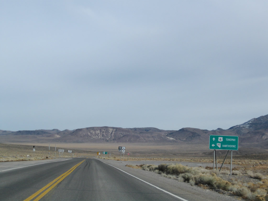
SR 360 provides a cut off from U.S. 6 east to U.S. 95 north for Mina, Hawthorne, Walker Lake and Fallon.
11/11/08
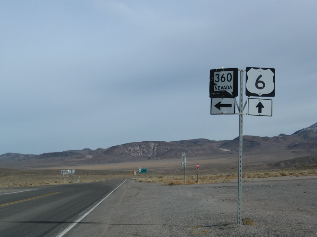
SR 360 travels 23.23 miles northeast from U.S. 6 to U.S. 95 (Veterans Memorial Highway).
11/11/08

This confirming marker for U.S. 6 east after SR 360 stands at Mineral County milepost 12.
11/11/08
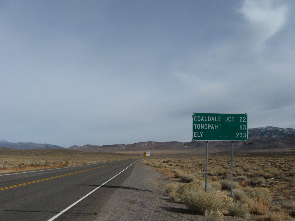
U.S. 6 converges with U.S. 95 south at Coaldale Junction 22 miles east of SR 360.
11/11/08
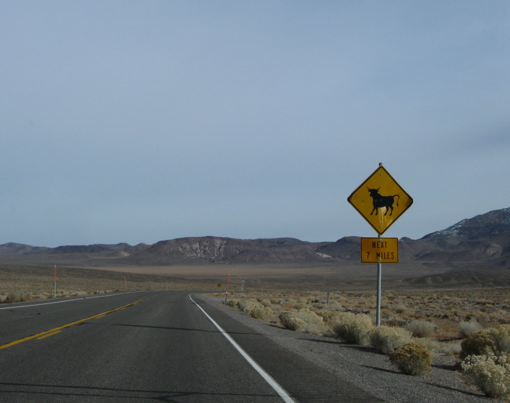
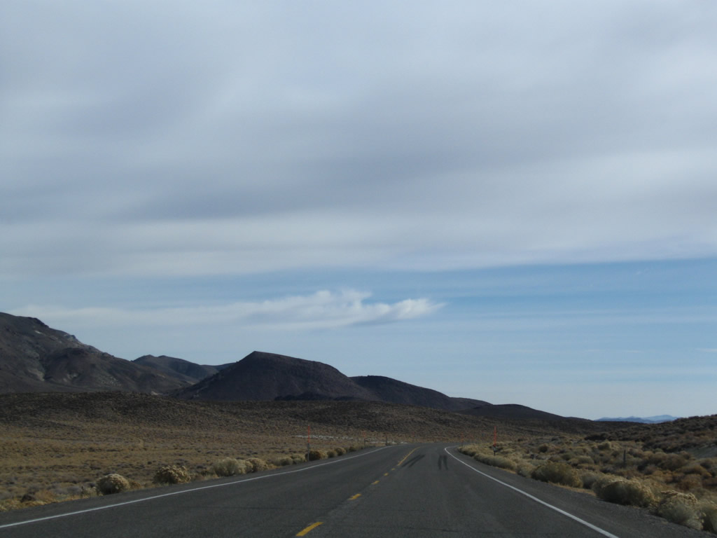
There are no fences on either side of U.S. 6 to restrain loose range stock for the ensuing seven miles east from SR 360.
11/11/08

U.S. 6 (Grand Army of the Republic Highway) navigates through a series of S-curves to the southwest of Miller Mountain (elevation 8,729 feet above sea level).
11/11/08
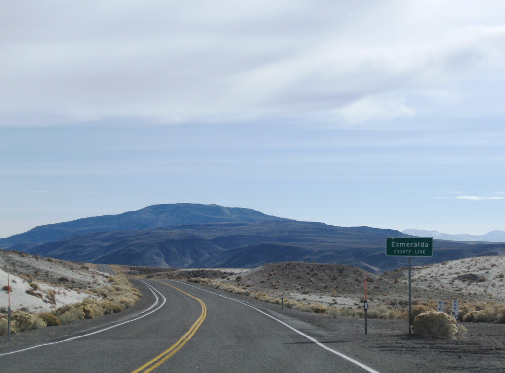
U.S. 6 travels 15.20 miles across Mineral County to the Esmeralda County line.
11/11/08
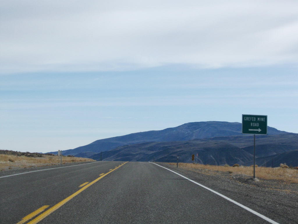
Grefco Mine Road stems south from U.S. 6 to an open pit mine.
11/11/08
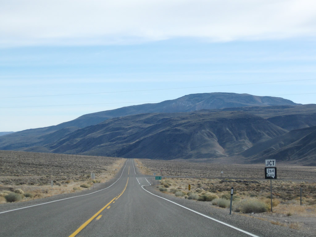
SR 264 (Dicalite Cutoff) travels southeast from U.S. 6 across the Volcanic Hills to SR 773, overtaking Fish Lake Valley Road south to Dyer.
11/11/08

Southeast of Dyer, SR 264 crosses into California, becoming SR 266 en route to SR 168 in Oasis. SR 266 continues east from there as a multi state route to Lida, Nevada and U.S. 95 south of Goldfield.
11/11/08

SR 264 (Dicalite Cutoff / Fish Lake Valley Road) measures 33.65 miles in length from U.S. 6 south to the California state line.
11/11/08
U.S. 6 parallels Pinchot Creek to the north across a valley separating the Volanic Hills from Miller Mountain.
11/11/08
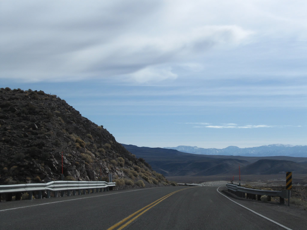
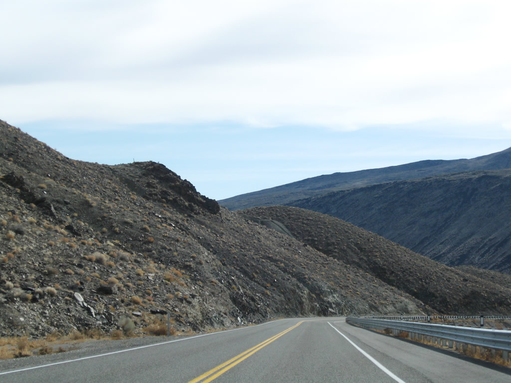
Curving southward through an S-curve, U.S. 6 traverses northern reaches of the Volcanic Hills.
11/11/08
Making another S-curve, U.S. 6 east emerges from the Volcanic Hills.
11/11/08

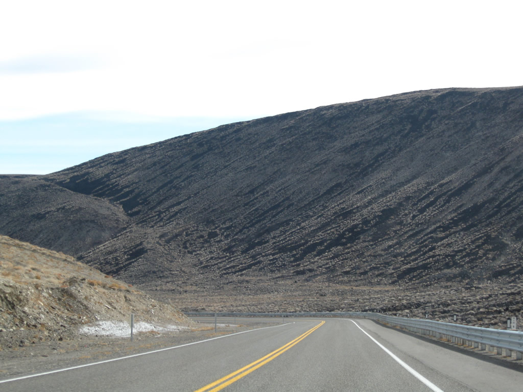
The Columbus Salt Marsh appears far to the east from where U.S. 6 lowers from the Volcanic Hills.
11/11/08
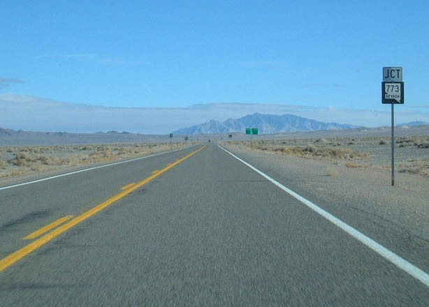
U.S. 6 drops nearly 900 feet in elevation from the Volcanic Hills to the north end of SR 773 (Fish Valley Road).
01/20/02

SR 773 replaced the SR 264 along the northeastern extent of Fish Valley Road from U.S. 6 to SR 264 along Dicalite Cutoff. The state route connects Dyer and Oasis, California with U.S. 6 east to Coaldale.
01/20/02
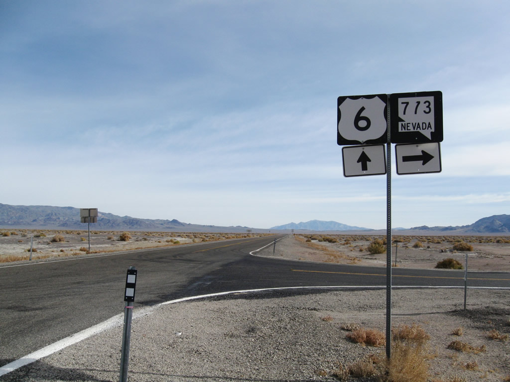
Bypassing the Volcanic Hills to the southeast, SR 773 (Fish Lake Valley Road) is 10.49 miles in length.
11/11/08
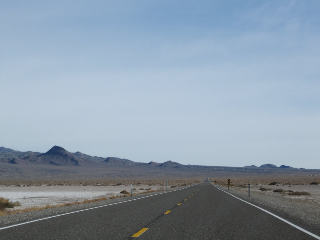
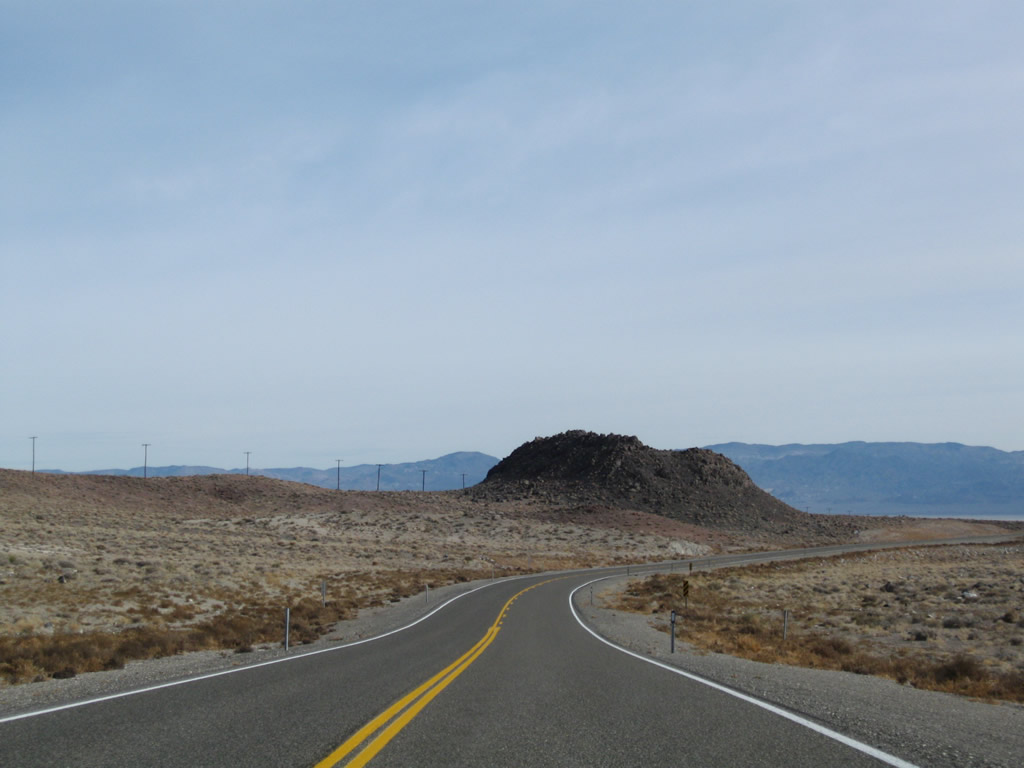
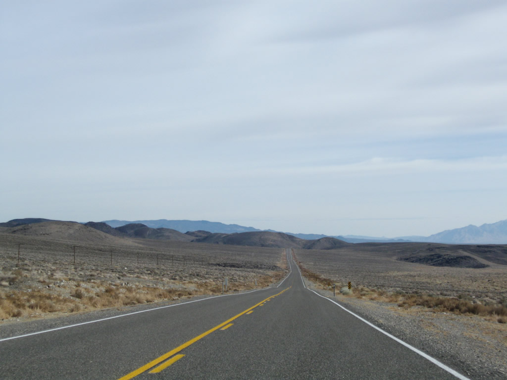
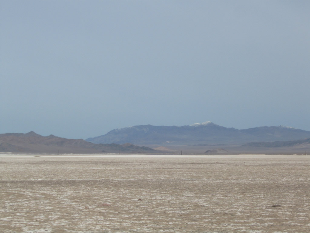
Long, flat stretches of highway between mountain passes are common along U.S. 6 across Nevada, including dry lakebeds such as the Columbus Salt Marsh.
11/11/08
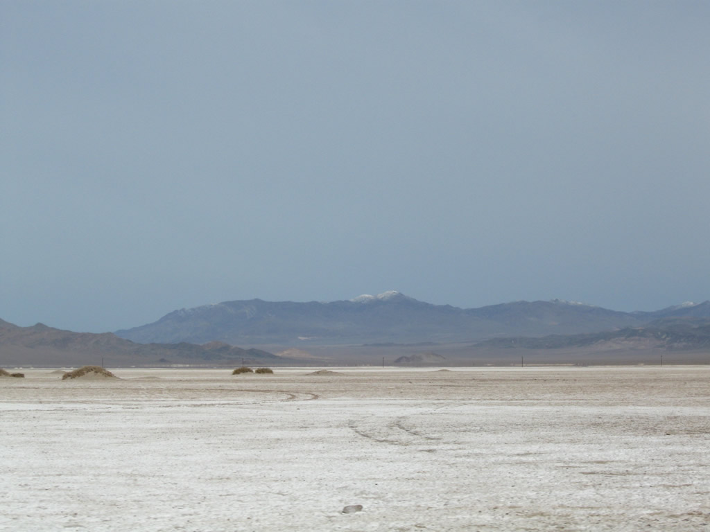
Columbus Salt Marsh spreads north of U.S. 6 and west of U.S. 95. Within the Great Basin, rivers do not escape to the ocean; instead, they drain to the lowest point and either feed wetlands or lakes or dry out before reaching a lake.
11/11/08
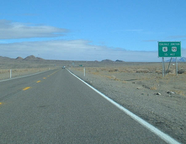
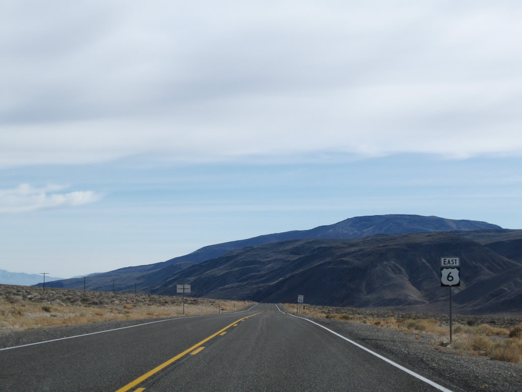
U.S. 6 (Grand Army of the Republic Highway) east combines with U.S. 95 (Veterans Memorial Highway) south at Coaldale Junction.
01/20/02

U.S. 95 heads north from Coaldale to Mina, Hawthorne and Fallon east of Reno.
01/20/02
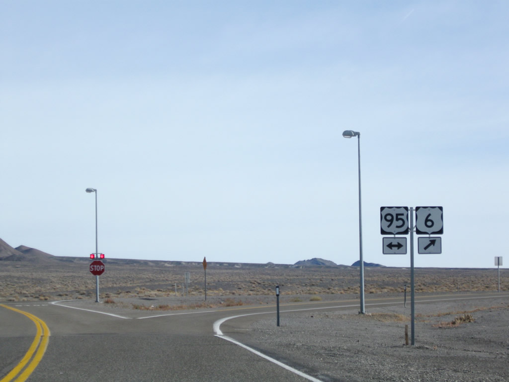
Historically U.S. 6 east met U.S. 95 at a three-wye intersection. The abandoned settlement of Coaldale is nearby to the east.
11/11/08
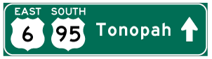
Photo Credits:
- AARoads: 11/11/08
- Andy Field: 01/20/02
Connect with:
Page Updated Friday September 02, 2011.