
U.S. 29 North - High Point to Greensboro


Business Loop I-85/U.S. 29 north of the Baker Road (SR 1193) overpass in southeast High Point, North Carolina. - 08/18/2021

 North
North  East
East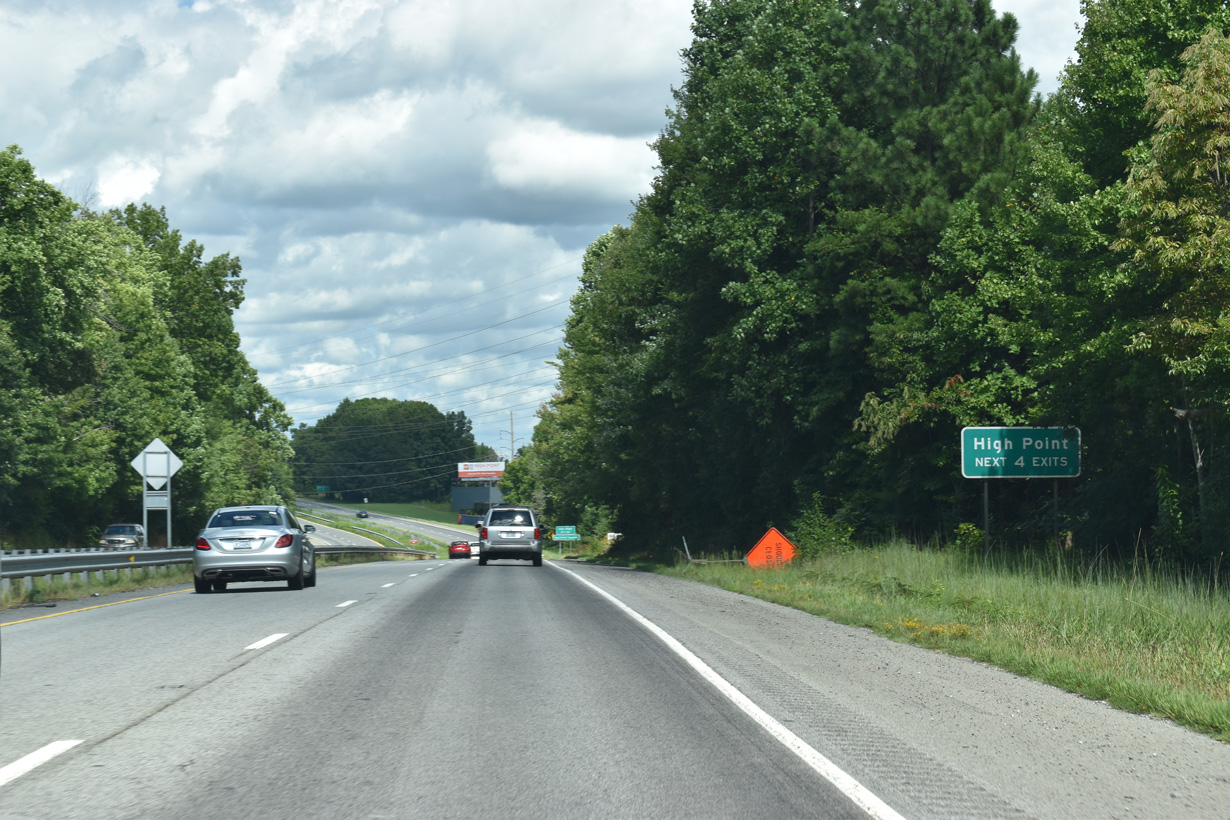
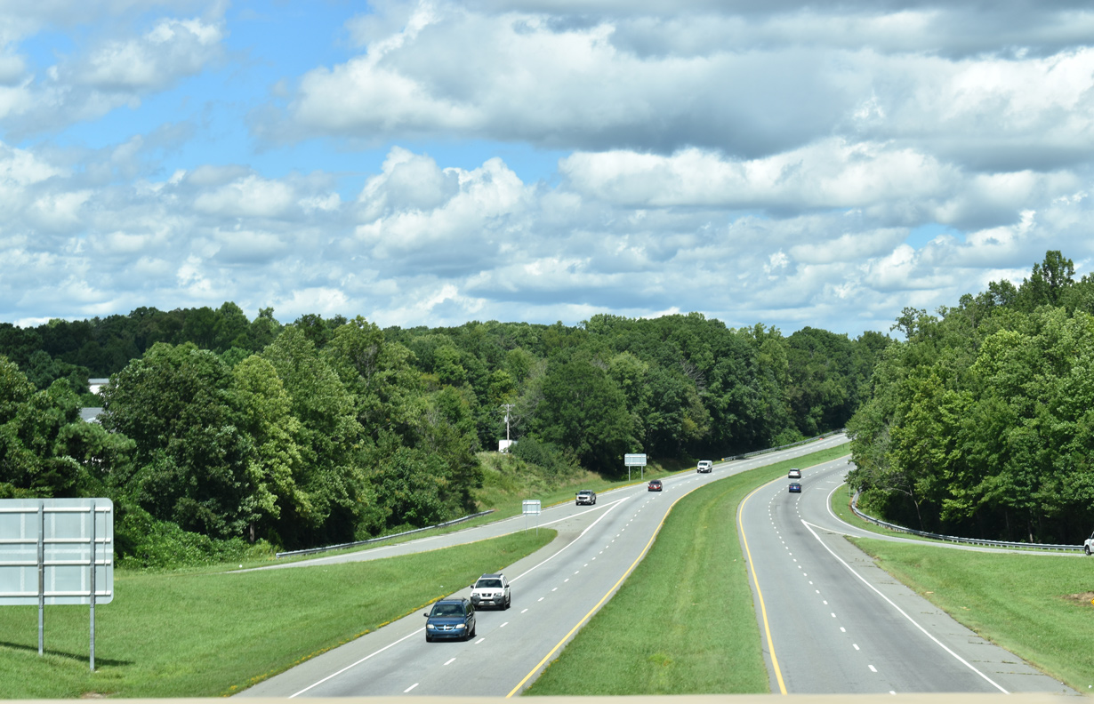
The exchange with W Green Drive / W Fairfield Road (SR 1300) is the first of four exits from Business Loop I-85/U.S. 29 north in the city of High Point.
08/18/21
08/18/21
08/18/21
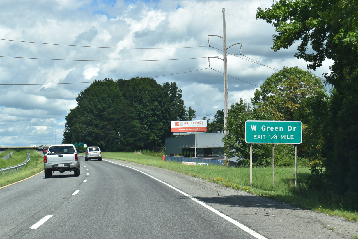
W Green Drive and W Fairfield Road serve the industrial south side of High Point.
08/18/21
08/18/21
08/18/21
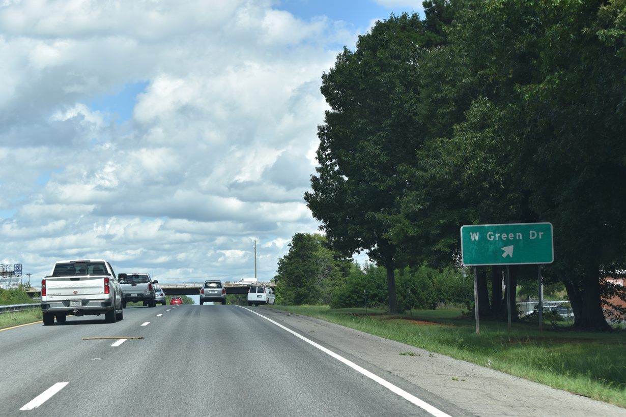
Confirming markers posted beyond the diamond interchange with W Green Drive / W Fairfield Road (SR 1300).
08/18/21
08/18/21
08/18/21

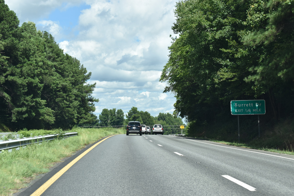
The folded diamond interchange joining U.S. 29 with Surrett Drive (SR 4053) lies west of a Norfolk Southern Railroad line.
08/18/21
08/18/21
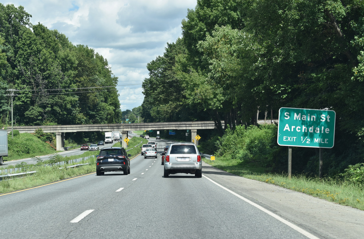
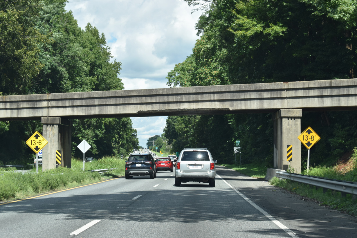
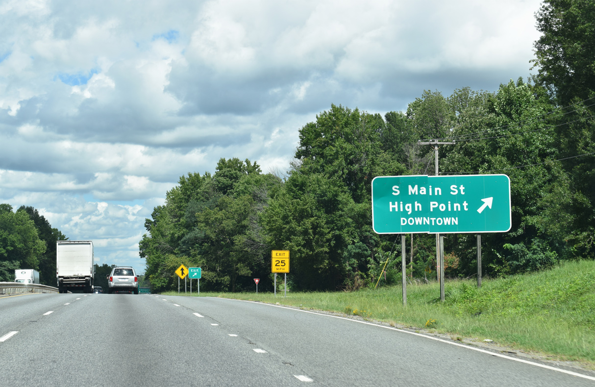
A cloverleaf interchange follows the Norfolk Southern Railroad overpass at S Main Street (SR 1009).
08/18/21
08/18/21
08/18/21
08/18/21
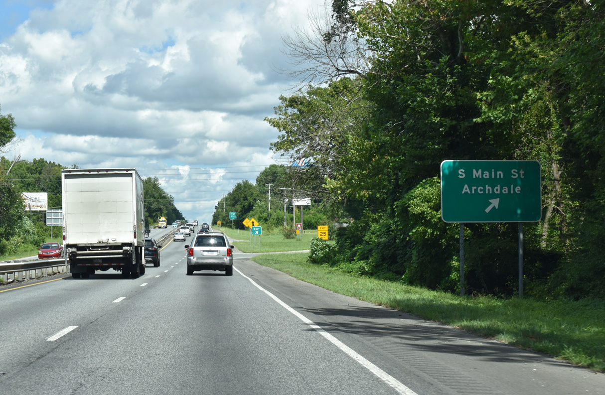
S Main Street was formerly part of U.S. 311 south into Archdale and north to Downtown High Point.
08/18/21
08/18/21
08/18/21
08/18/21
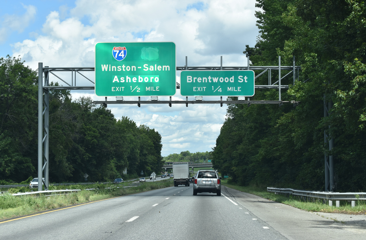
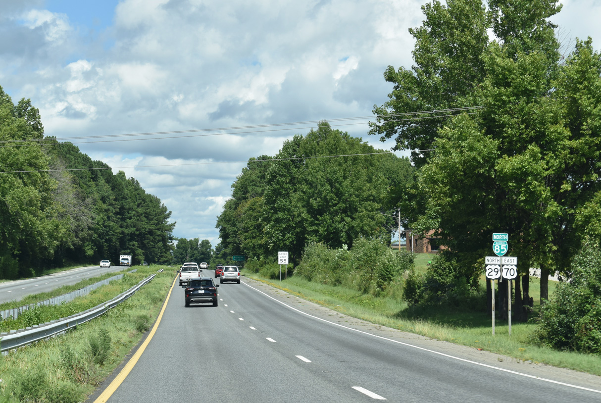
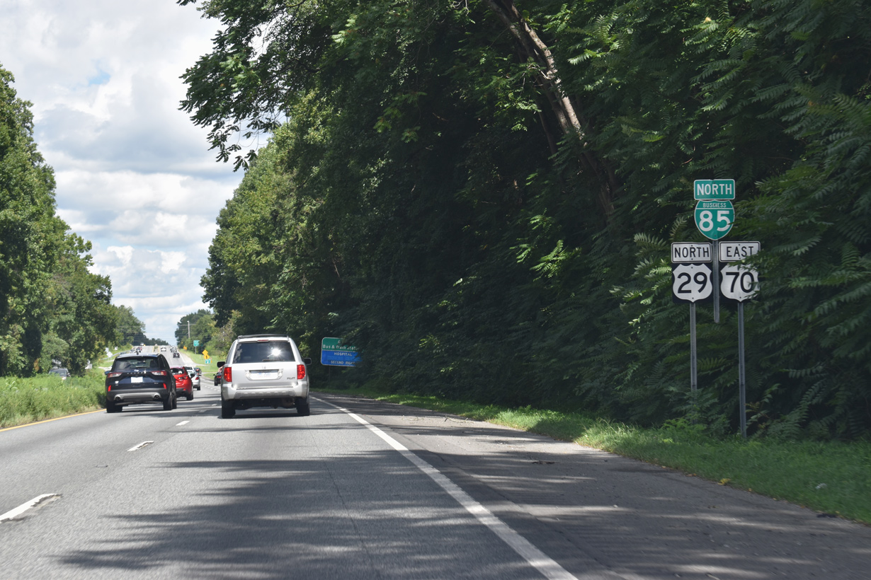
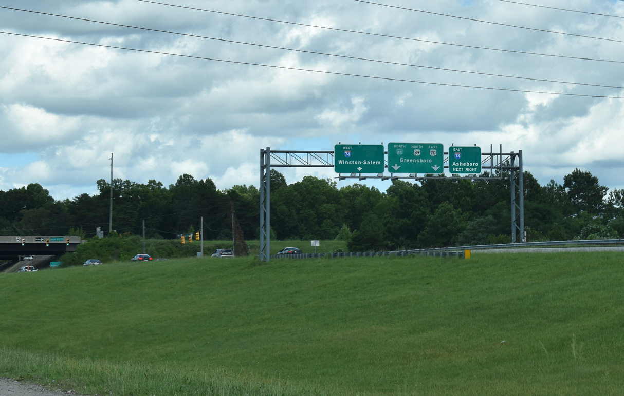
A three level interchange joins U.S. 29 with Interstate 74 east to Randleman and west to Winston-Salem.
08/18/21
08/18/21
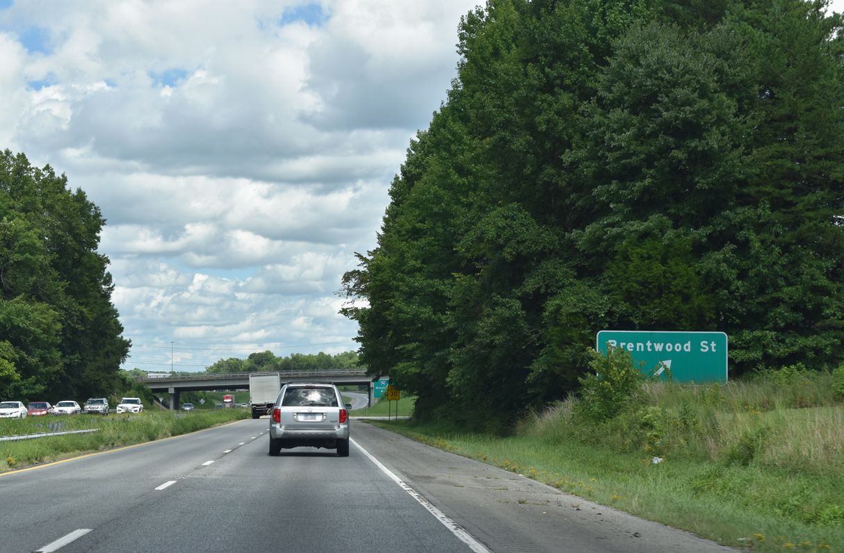
Ramps for the diamond interchange with Brentwood Street tie into the adjacent exchange with Interstate 74.
08/18/21
08/18/21
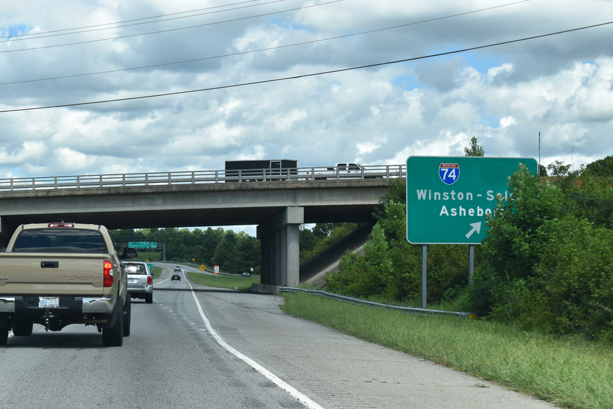
Interstate 74 replaced U.S. 311 along the freeway southeast to I-73/U.S. 220 at Randleman and northwest to I-40 at Winston-Salem.
08/18/21
08/18/21
08/18/21
08/18/21
08/18/21
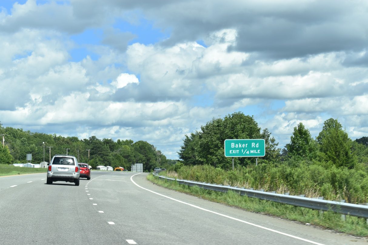
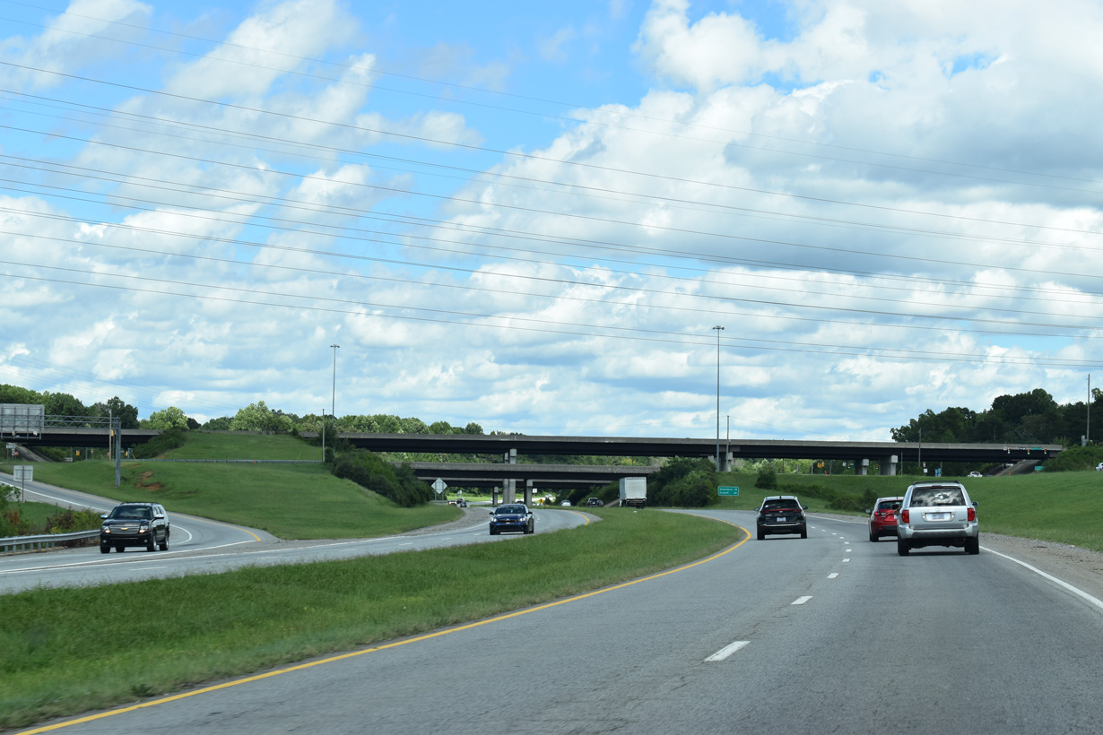
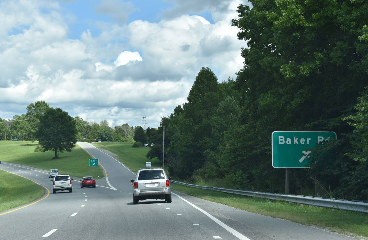
Advancing east from I-74 through an S-curve, U.S. 29 next meets Baker Road (SR 1193) at a diamond interchange.
08/18/21
08/18/21
08/18/21
08/18/21
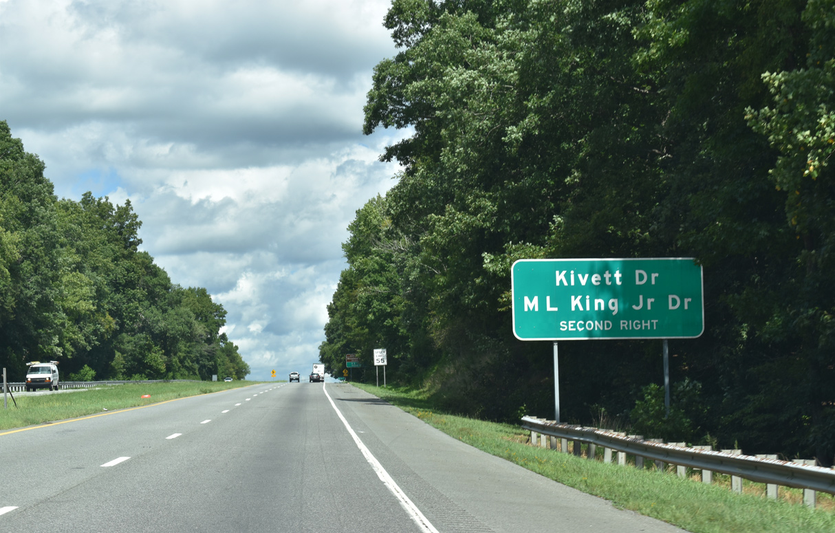
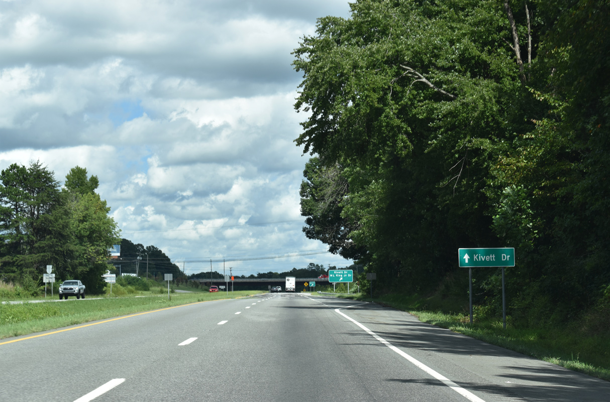
Martin Luther King, Jr. Drive east and Kivett Drive (SR 1113) west come together at a parclo interchange with Business Loop I-85/U.S. 29 along the High Point city line.
08/18/21
08/18/21
08/18/21

08/18/21
08/18/21
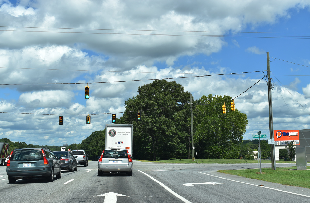
Traffic lights operate along U.S. 29 at Riverdale Drive (SR 1145).
08/18/21
08/18/21
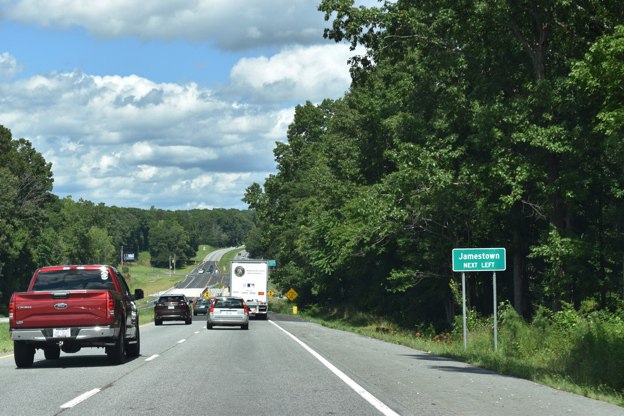
River Road (SR 1144) runs 0.68 miles north from U.S. 29 to Oakdale Road (SR 1352) and Harvey Road (SR 1355) at the Jamestown municipal limits.
08/18/21
08/18/21
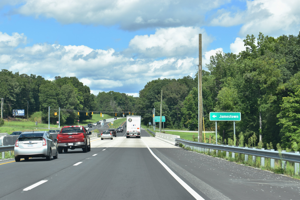
U.S. 29 north spans the Deep River ahead of the signalized intersection with River Road (SR 1144).
08/18/21
08/18/21
Business Loop I-85/U.S. 29 upgrade to a freeway northeast between River Road and the diamond interchange with Vickrey Chapel Road (SR 1546).
08/18/21
08/18/21
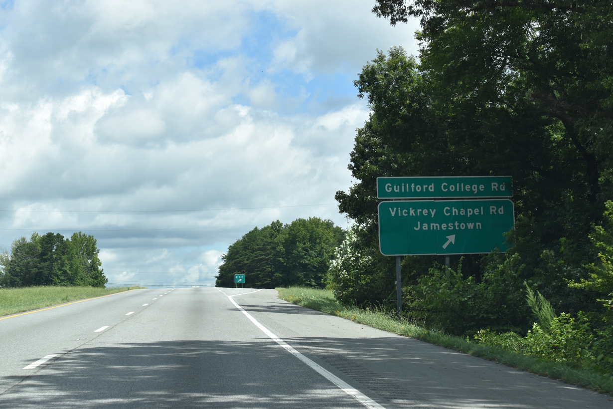
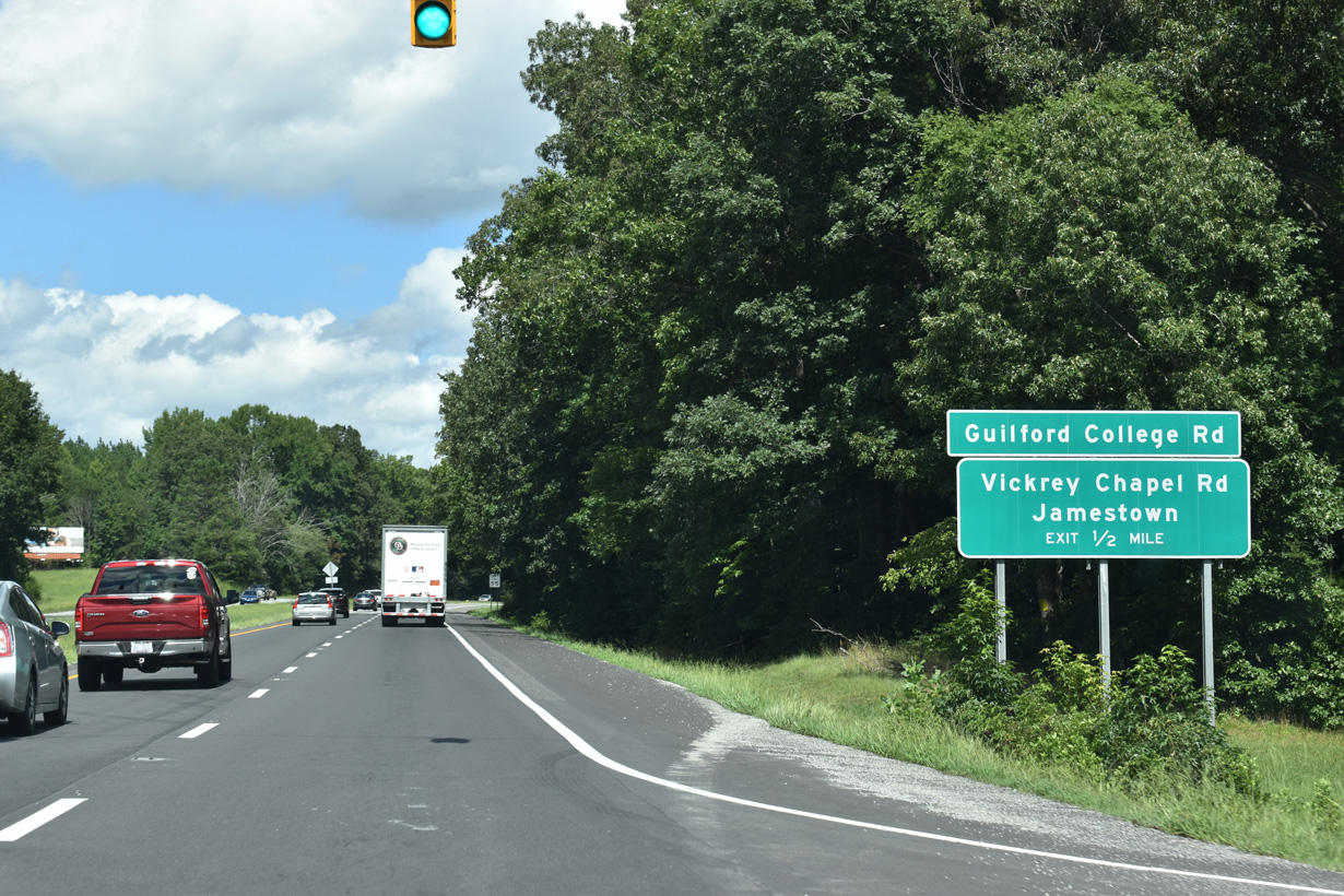
Guilford College Road (SR 1546) extends Vickrey Chapel Road north from U.S. 29 into Jamestown.
08/18/21
08/18/21
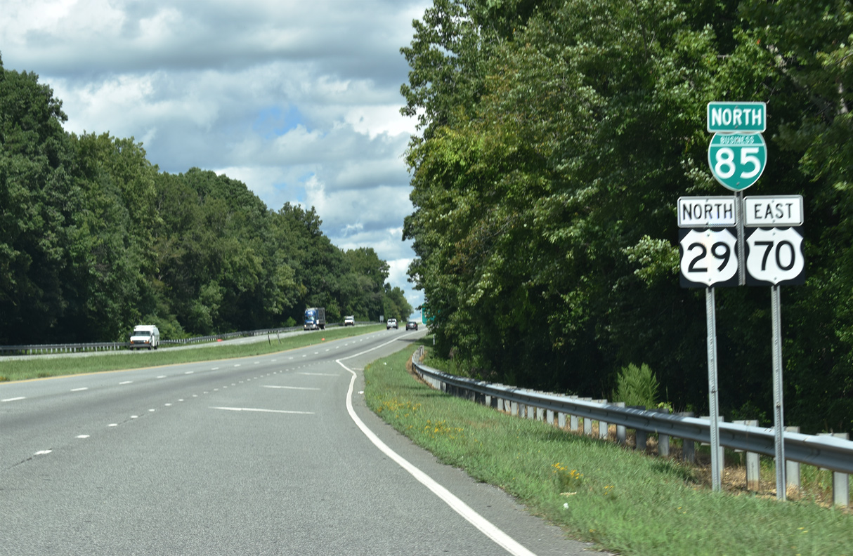
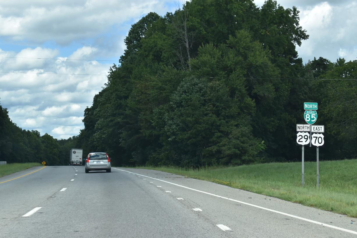
Business Loop I-85/U.S. 29-70 continue 1.70 miles east from the Vickory Chapel Road (SR 1546) overpass onto Interstate 85 north.
08/18/21
08/18/21
Business Loop I-85/U.S. 29 north tie into Interstate 85 at a trumpet interchange.
08/18/21
08/18/21
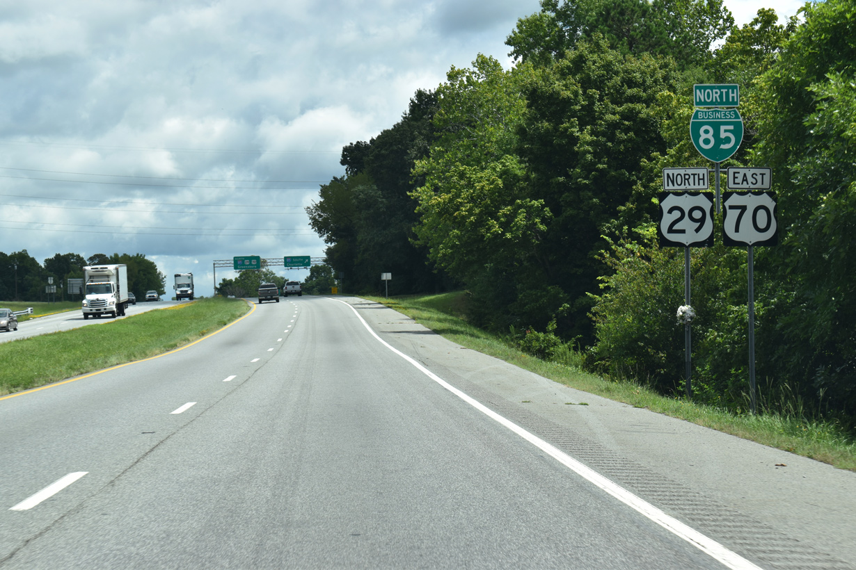
Confirming markers posted ahead of the exchange with Interstate 85 by southwest Greensboro.
08/18/21
08/18/21
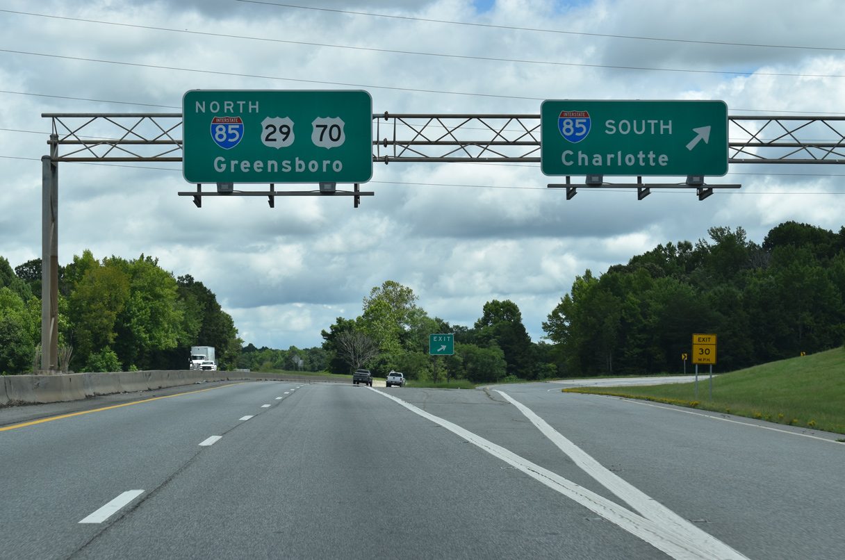
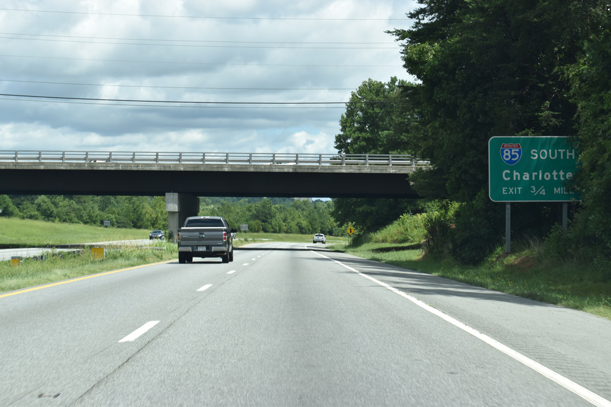
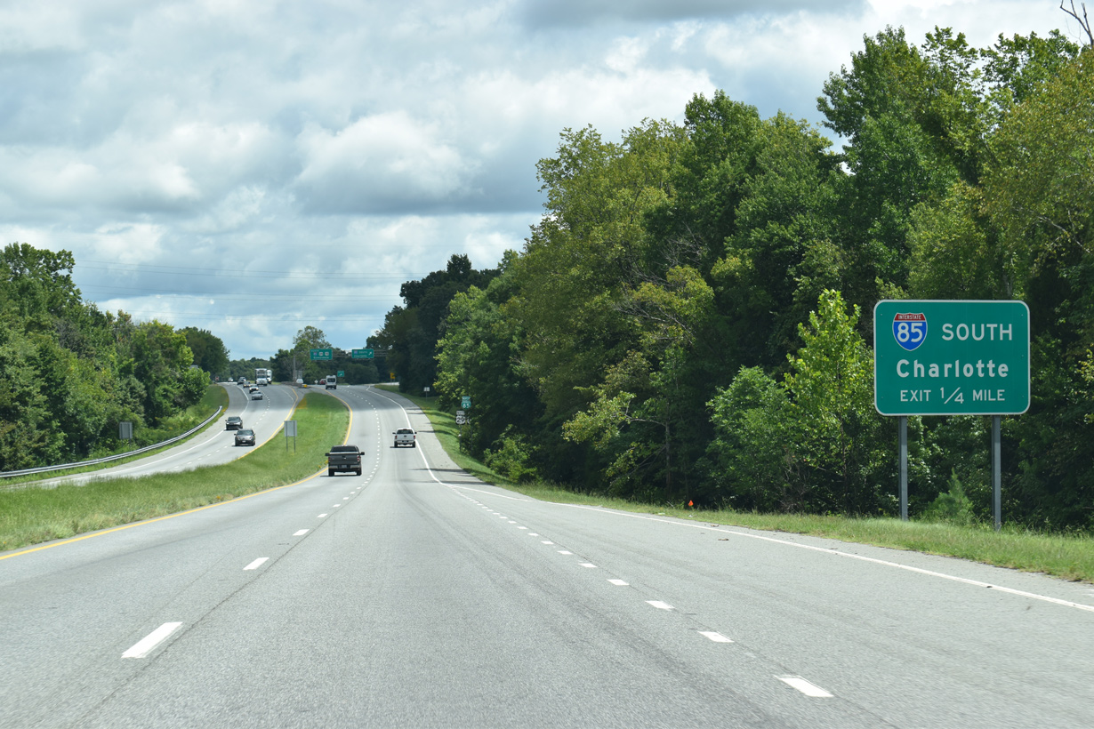
Interstate 85 south bypasses High Point through Archdale en route to Charlotte.
08/18/21
08/18/21
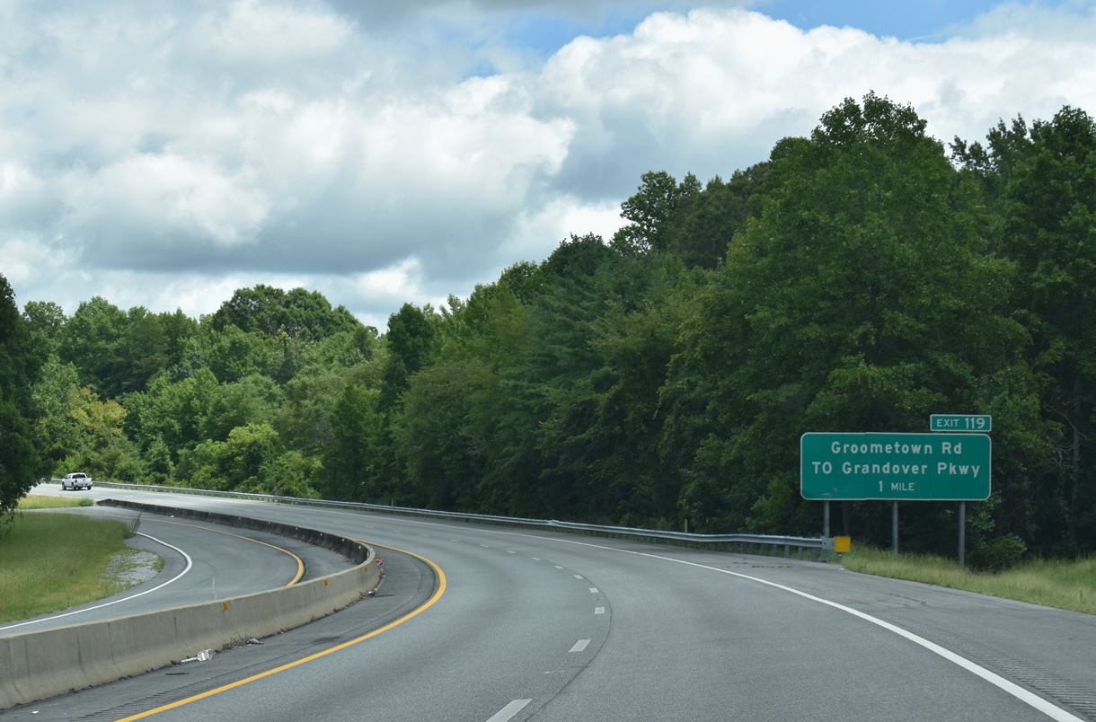
Business Loop I-85/U.S. 29 north join Interstate 85 north ahead of Exit 119 to Groometown Road.
08/18/21
08/18/21
 North East
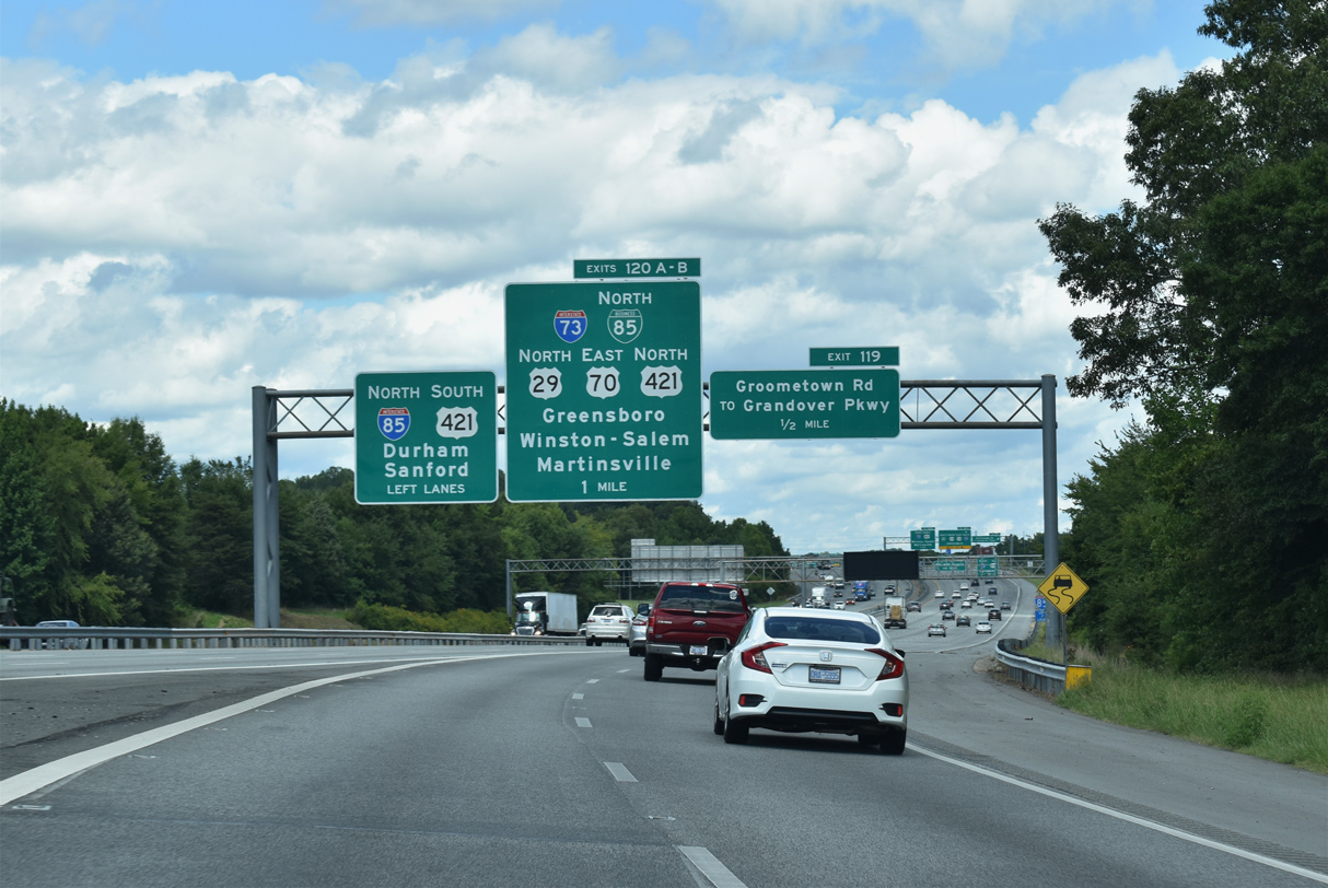
An implied overlap with Interstate 85 takes Business Loop I-85 north alongside U.S. 29, 0.94 miles to Exit 120 A.
08/18/21
08/18/21
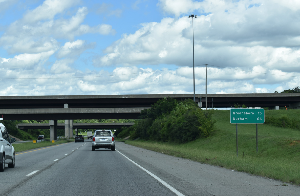
Business Loop I-85/U.S. 29 follow the former route of Interstate 85 into Greensboro. I-85 was relocated onto the Greensboro Urban Loop in 2004.
08/18/21
08/18/21
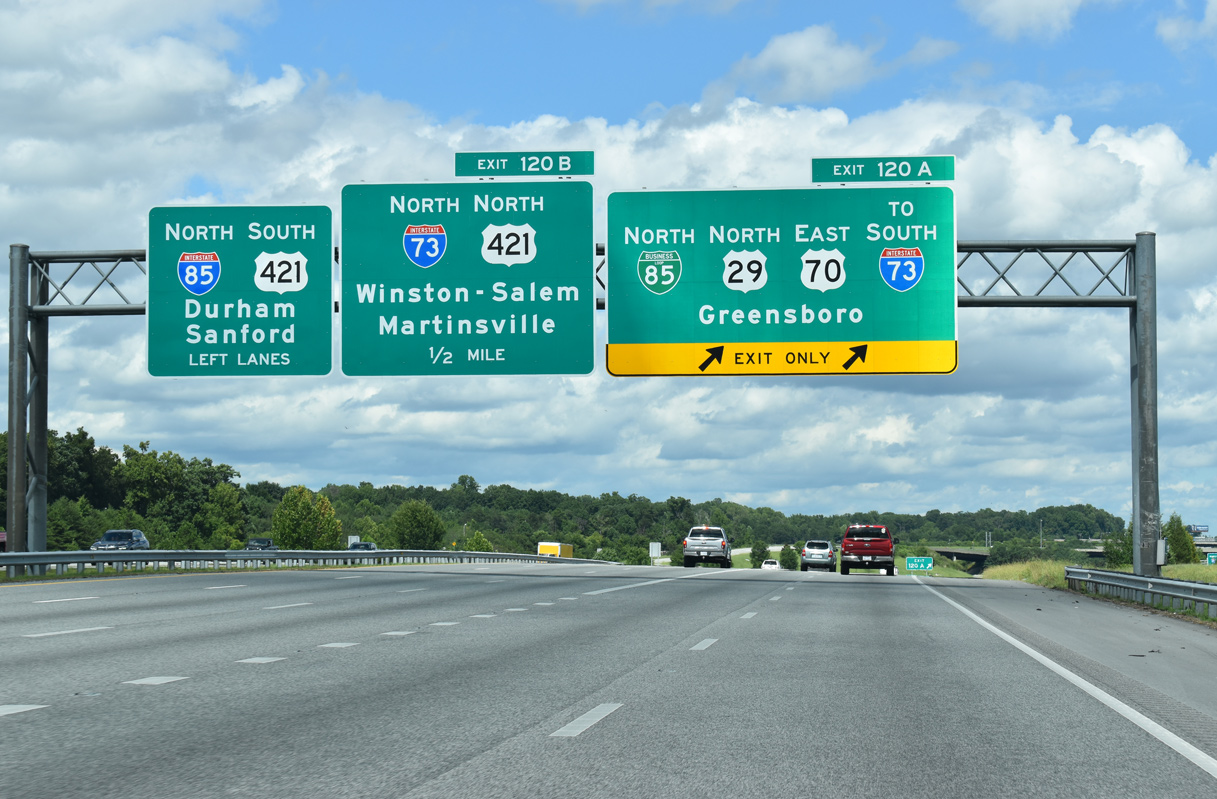
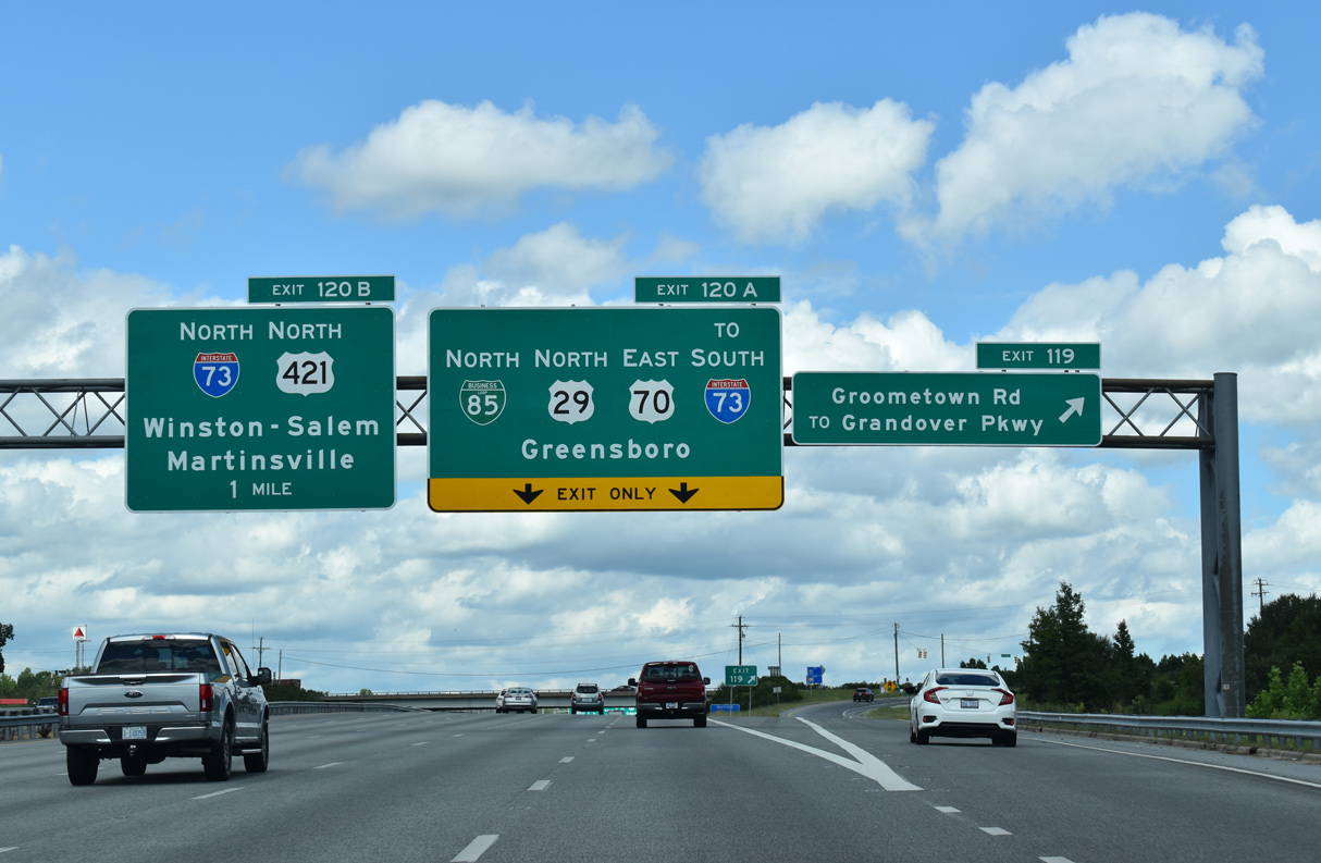
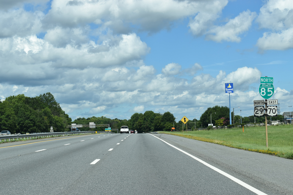
Interstate 73 and U.S. 421 tie into the systems interchange where Business Loop I-85/U.S. 29 north separate with I-85. I-73 runs northwest to PTI Airport and south to Asheboro.
08/18/21
08/18/21
North East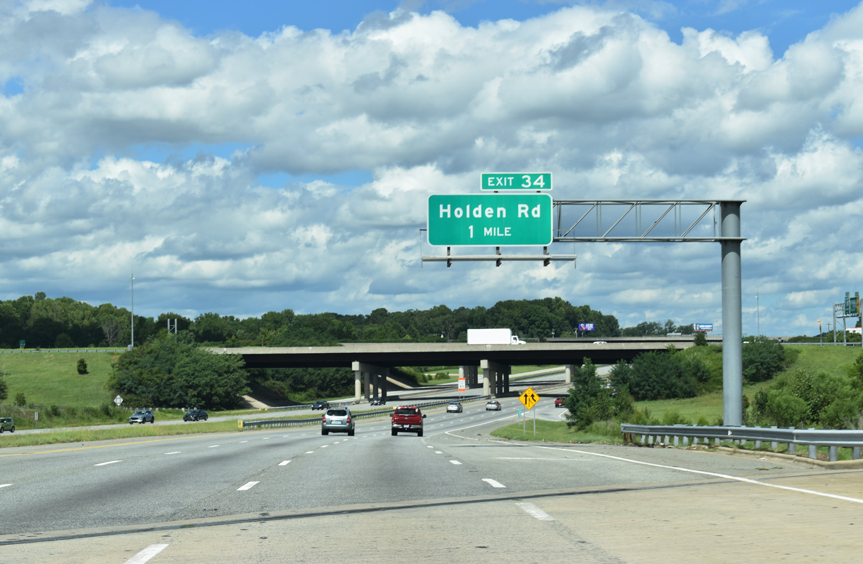
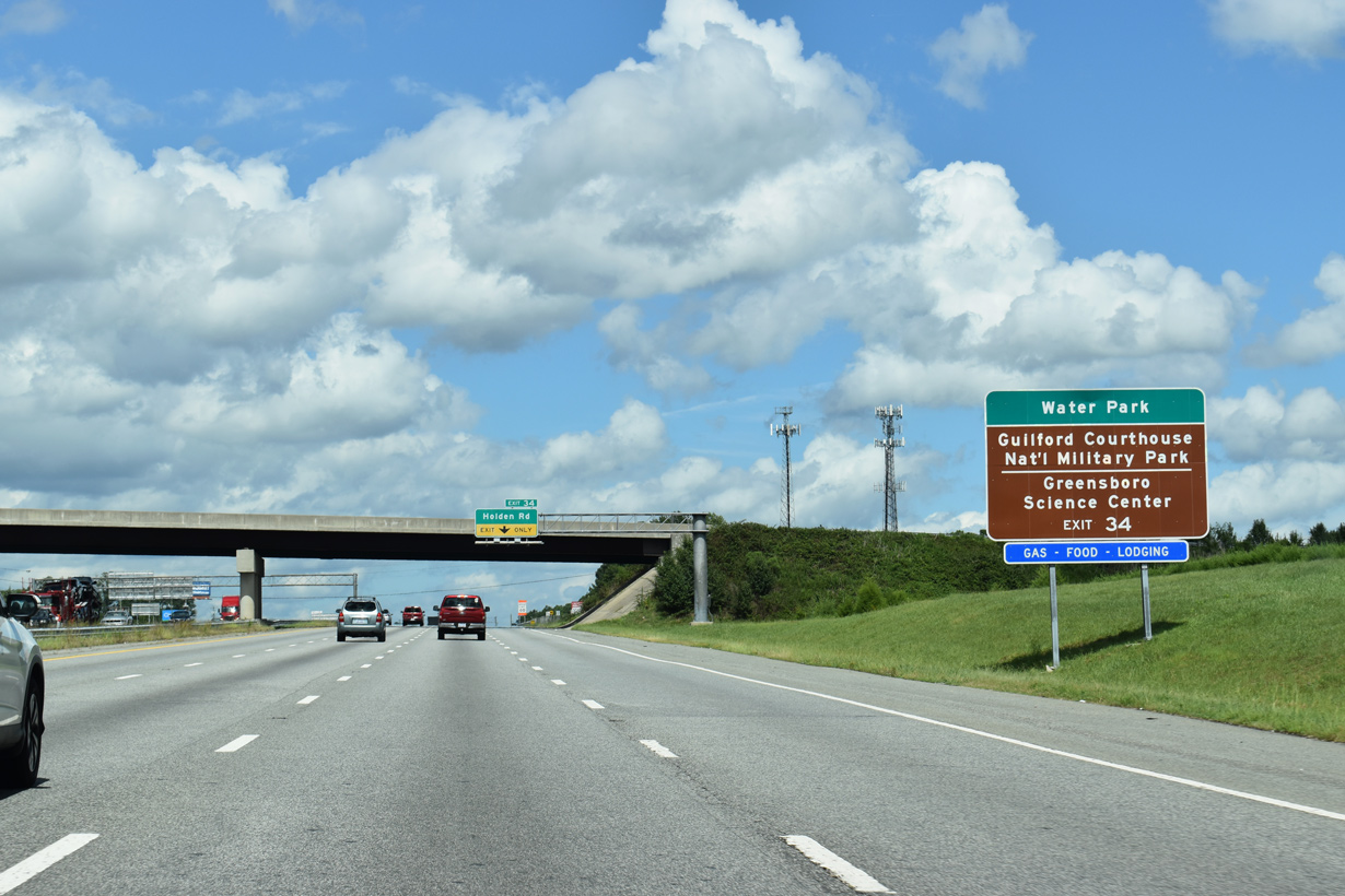
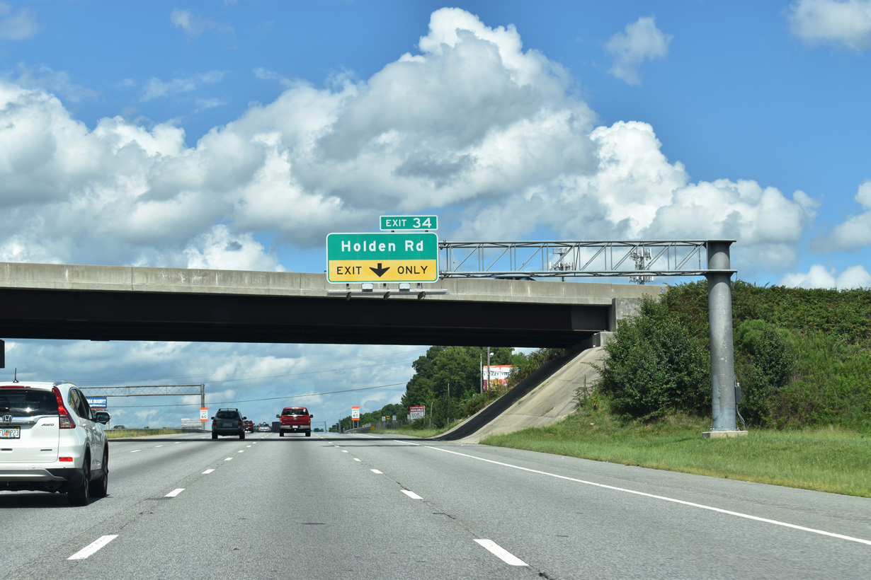
The ensuing exit along U.S. 29 north is with Holden Road (SR 1117) to the Pinecroft neighborhood in Greensboro.
08/18/21
08/18/21
08/18/21
08/18/21
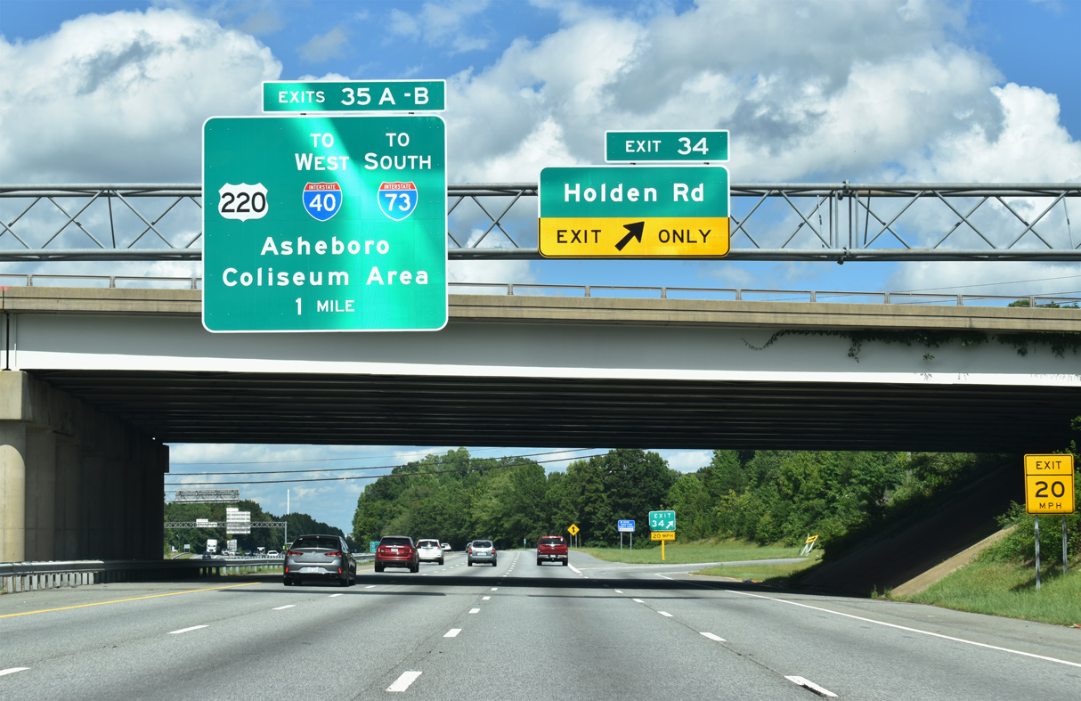
A folded diamond interchange joins Business Loop I-85/U.S. 29 with Holden Road at Exit 34. Holden Road runs 2.2 miles north to Gate City Boulevard through the Latham Town and Starmount Forest neighborhoods.
08/18/21
08/18/21
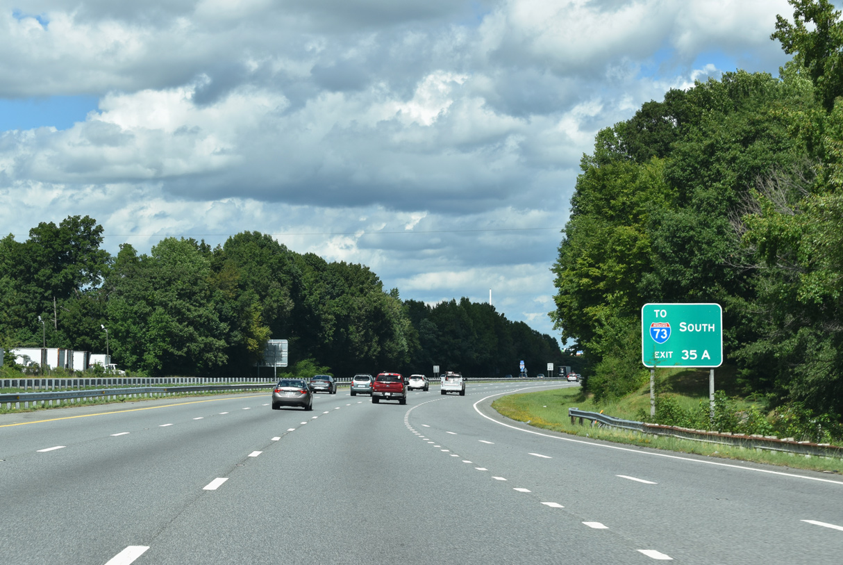
U.S. 220 heads south from forthcoming Exit 35 A to become a part of I-73 at I-85/U.S. 421 en route to Asheboro.
08/18/21
08/18/21
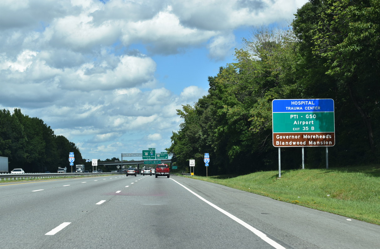
U.S. 220 north continues 1.25 miles to Interstate 40 at Freeman Mill Road. I-40 travels west to Piedmont Triad International Airport (PTI) and Winston-Salem.
08/18/21
08/18/21
08/18/21
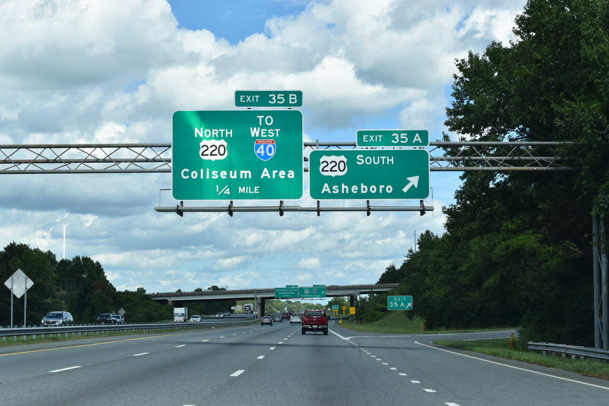
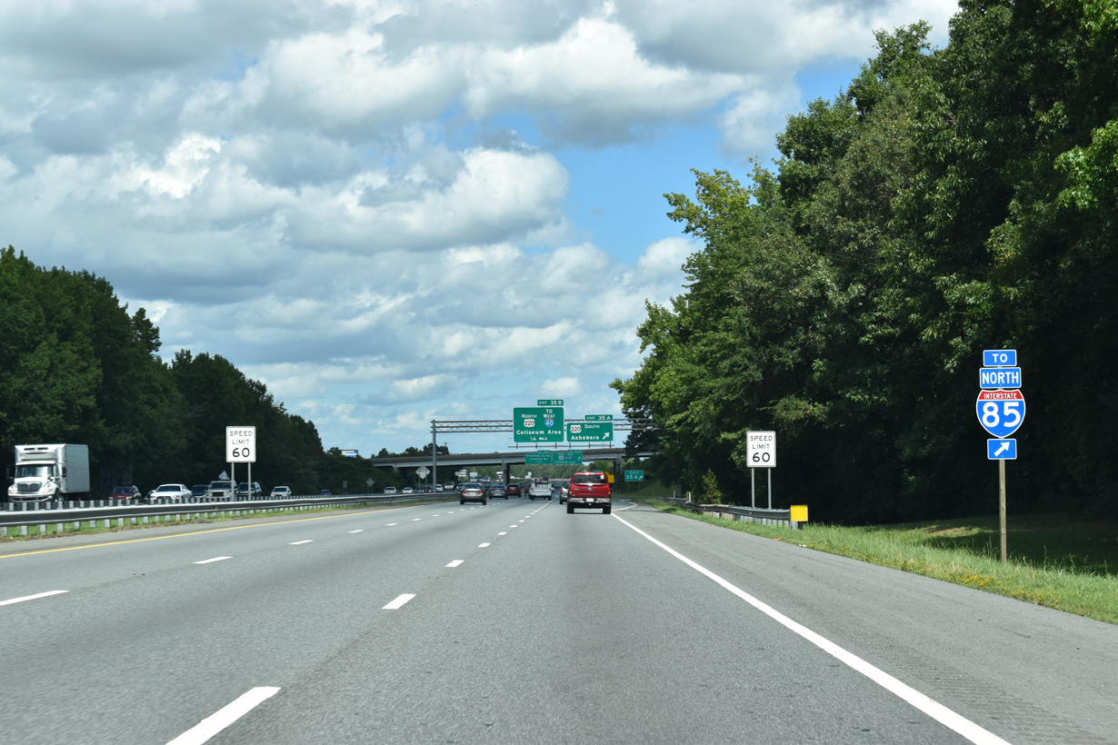
A three quarter cloverleaf interchange joins U.S. 29 with U.S. 220 at Exit 35.
08/18/21
08/18/21
U.S. 220 north connects U.S. 29 with I-40 west and Freeman Mill Road north to Spring Valley and Downtown Greensboro. U.S. 29 converges with U.S. 220 again alongside I-40.
08/18/21
08/18/21
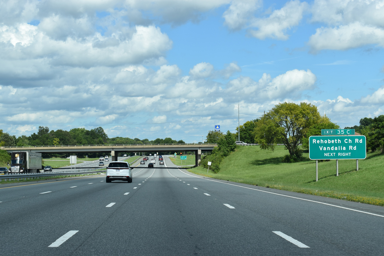
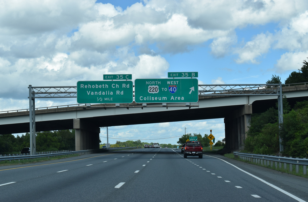
A folded diamond interchange joins U.S. 29 northbound next with Rehobeth Church Road (SR 1115). Rehobeth Church Road heads north to Dellwood Park and south to Vandalia Road and Shannon Hills Park. Vandalia Road runs east to The Pines and Woodlea Lakes through south Greensboro.
08/18/21
08/18/21
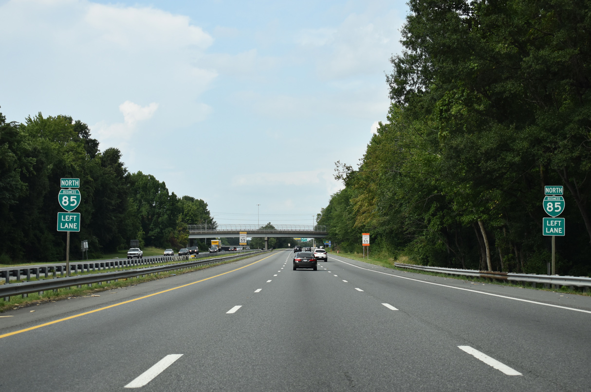
Business Loop I-85/U.S. 29-70 reassurance markers posted beyond Exit 35 C.
08/18/21
08/18/21

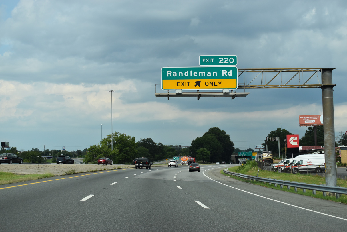
U.S. 29 angles northeast to the exchange (Exit 220) joining I-40/U.S. 220 with Randleman Road (SR 1007).
08/14/21
08/14/21
U.S. 29 combines with I-40/U.S. 220 east at a wye interchange. A lane drop occurs at Exit 220 for Randleman Road.
08/14/21
08/14/21

There is no direct access to I-40 west from U.S. 29 northbound.
08/18/21
08/18/21
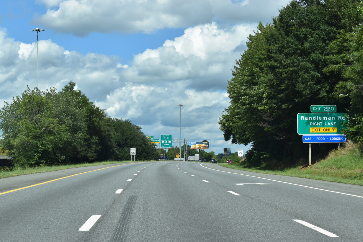
Exit 220 departs from U.S. 29 north just ahead of I-40/U.S. 220. Randleman Road heads 1.9 miles north through Oak Grove to Freeman Mill Road in Downtown Greensboro.
08/18/21
08/18/21
U.S. 29 joins I-40/U.S. 220 east for 1.78 miles to O' Henry Boulevard north. Randleman Road heads south 1.2 miles through the Rocky Knoll section of Greensboro to Vandalia Road.
08/14/21
08/14/21
Photo Credits:
- Andy Field: 08/18/21
- Alex Nitzman: 08/14/21
Connect with:
Page Updated Monday January 30, 2023.