
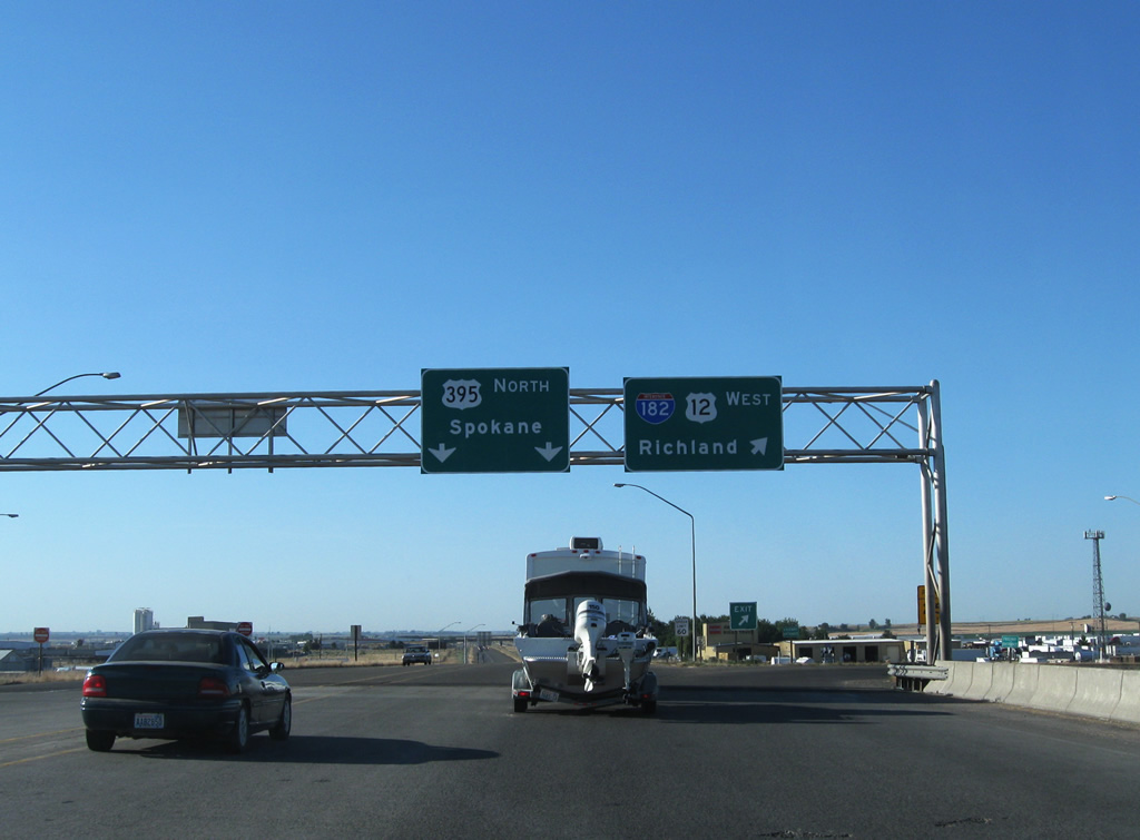
U.S. 395 North - Tri-Cities

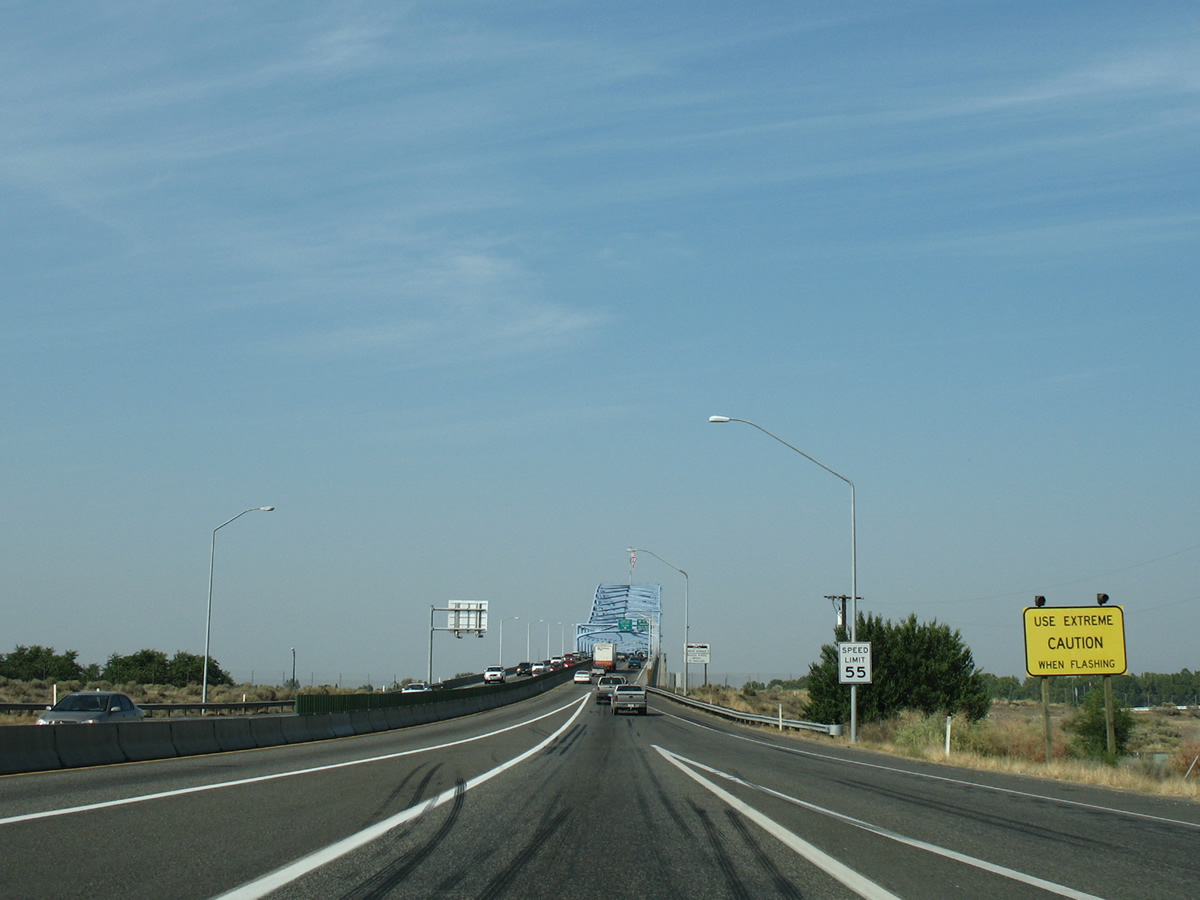
U.S. 395 veers northeast from Interstate 82 and lowers toward the Columbia River. Speed limits are posted at 55 miles per hour along the four lane divided highway ahead of the Kennewick street grid.
08/03/11
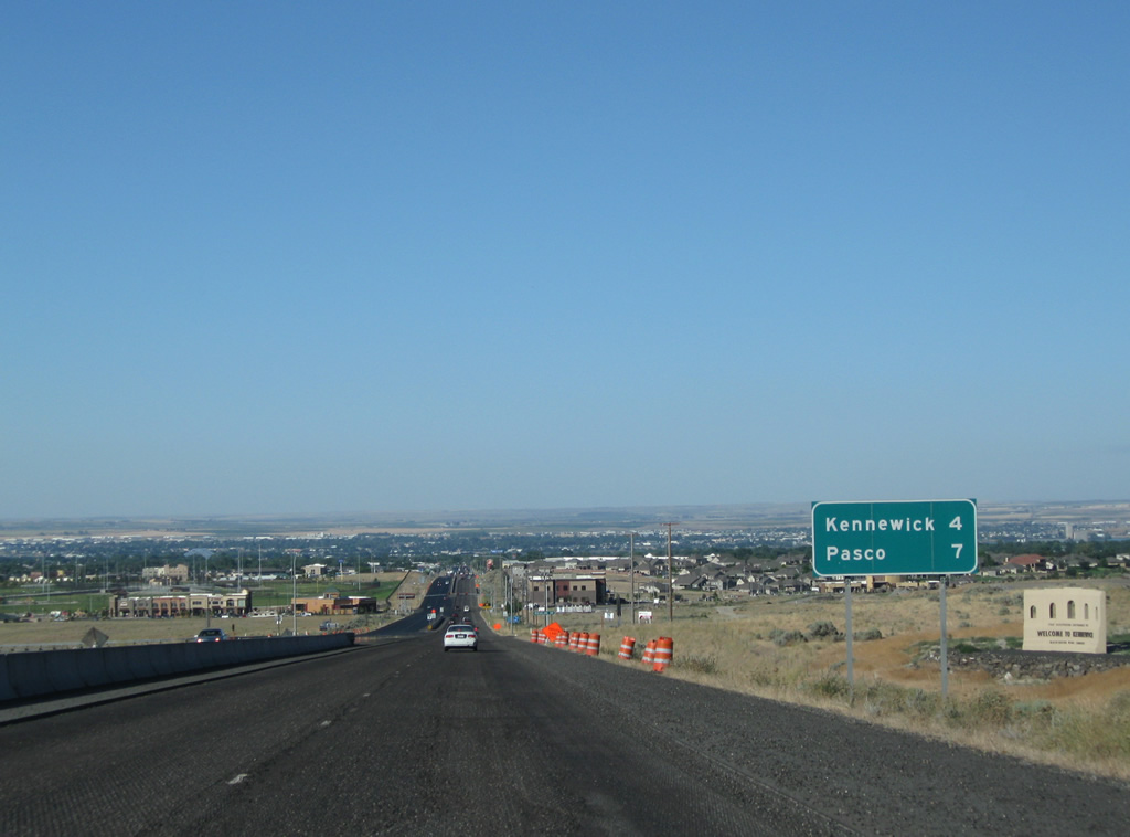
Distance sign posted four miles southwest of the Kennewick city center and seven miles from Pasco. The Kennewick city limits extend to Interstate 82.
08/03/11
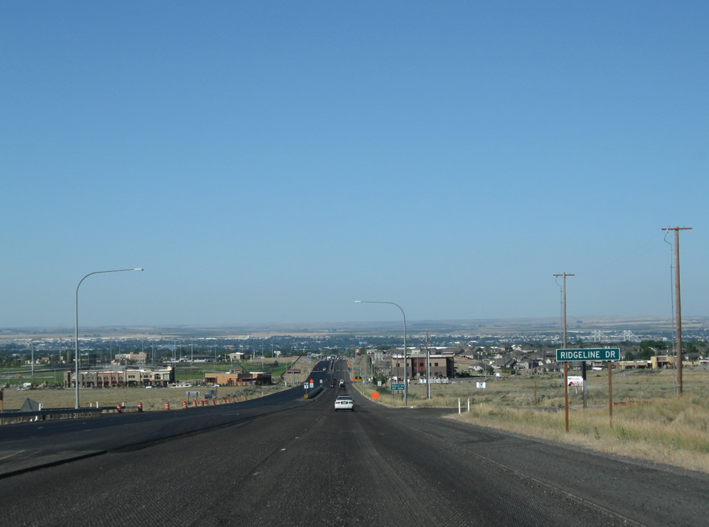
Ridgeline Drive connects U.S. 395 with Bofer Canyon Road to the east and Southridge Boulevard (former SR 12) to the west. Right of away appears to accommodate a diamond interchange at this intersection should traffic counts warrant such an upgrade.
08/03/11
Frontage immediately changes from open grass land into a montage of suburban sprawl with adjacent residential and retail development at Hildebrand Boulevard.
08/03/11
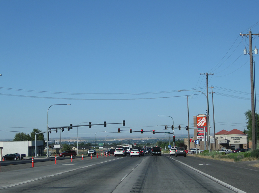
Big box retail surrounds the signalized intersection of U.S. 395 and West 27th Avenue. West 27th Avenue heads east to the South Highlands community of Kennewick and west to a roundabout with Creekstone Drive, Southridge Boulevard and Union Street.
08/03/11
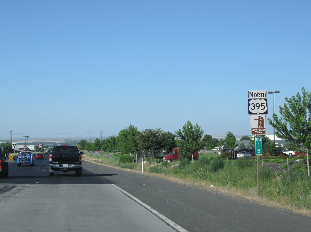
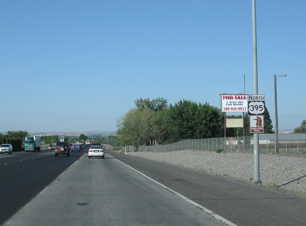
Reassurance shield assembly touting U.S. 395 also as the Lewis and Clark Trail.
08/03/11
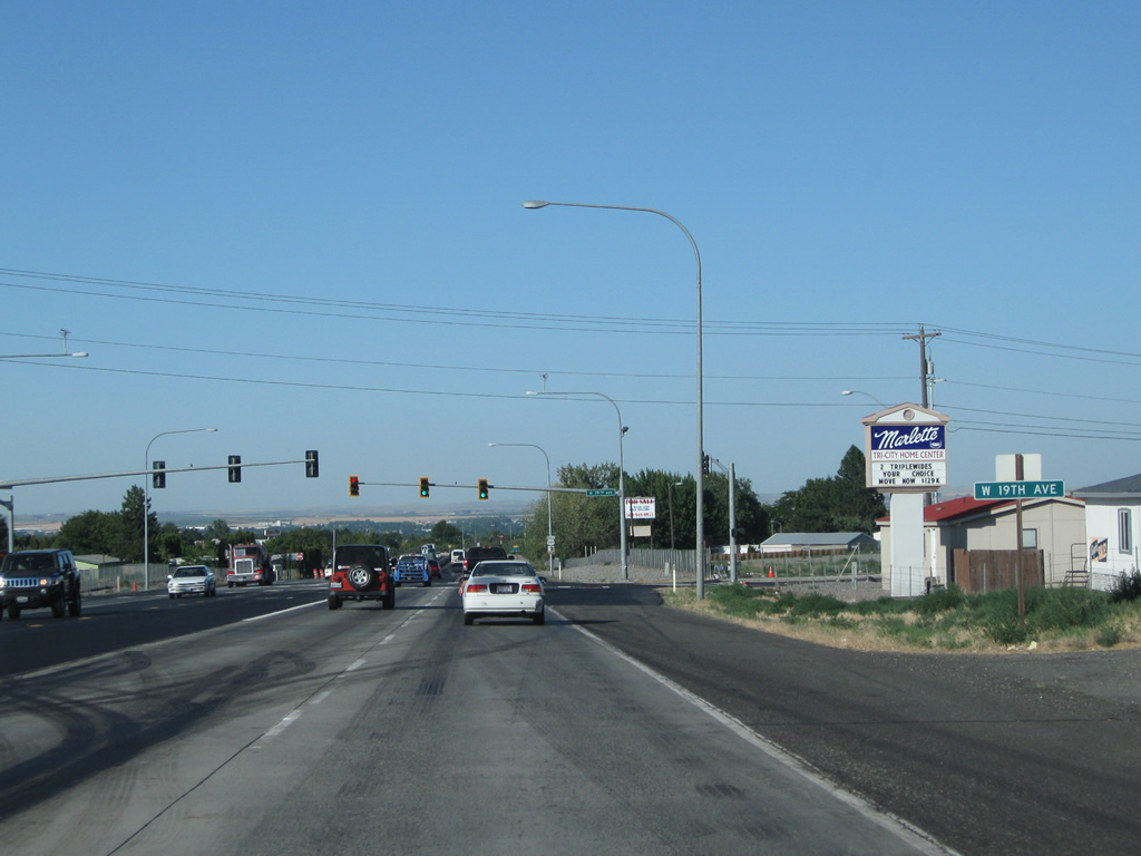
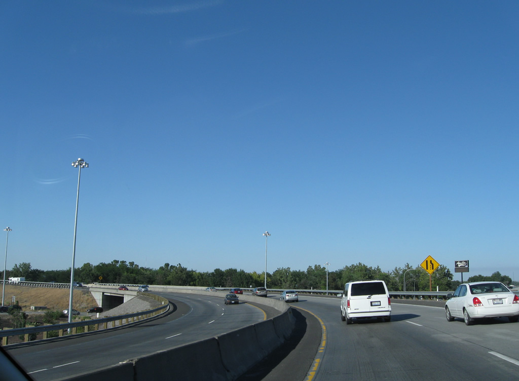
West 19th Avenue joins U.S. 395 with suburban areas to the west. Eastward the road ends at Ely Street and resumes east of Zintel Canyon.
08/03/11
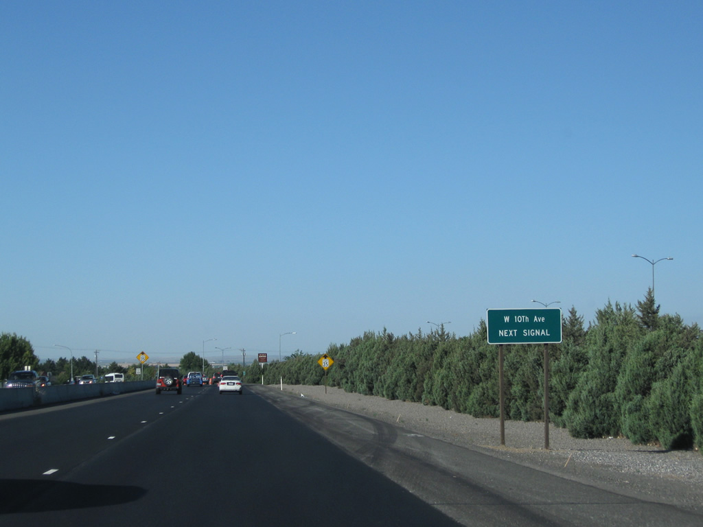
Continuing northeast along U.S. 395, the road remains a controlled-access highway to West 10th Avenue.
08/03/11
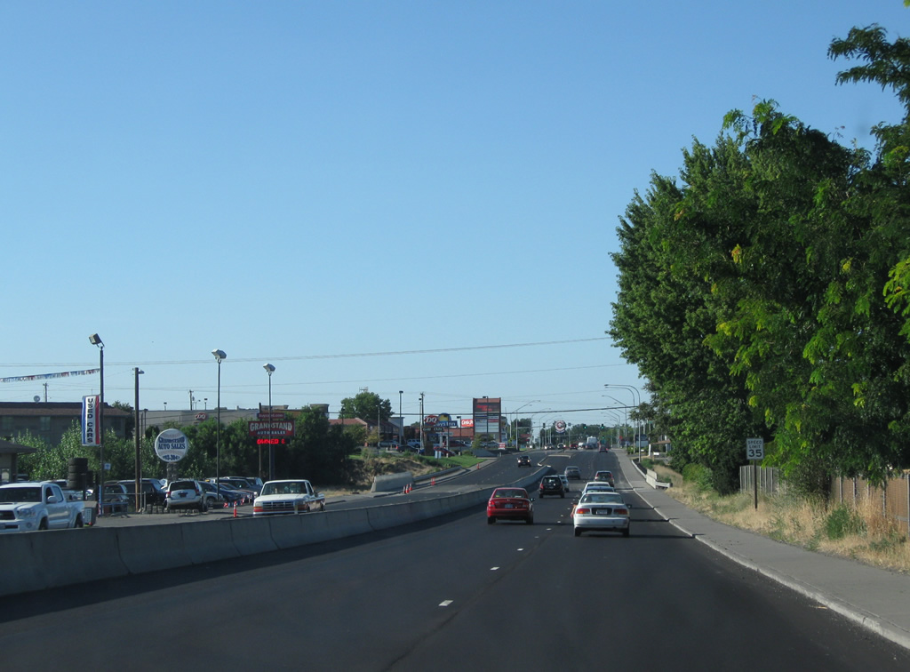
U.S. 395 overtakes Ely Street in name from West 10th Avenue northward to the Blue Bridge. The road transitions into a commercial arterial with 35 mph speed limits.
08/03/11
An underpass carries West 4th Avenue below U.S. 395 along an otherwise solid retail-lined stretch. Kennewick Avenue meets the arterial at the next signalized intersection.
08/03/11
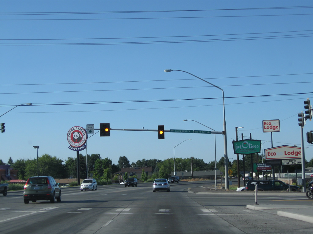
Vista Way angles northwest from Kennewick Avenue to form the westbound beginning of Clearwater Avenue at U.S. 395. Clearwater Avenue extends westward to the folded diamond interchange of Interstate 82 with Badger Road on the outskirts of the city.
08/03/11
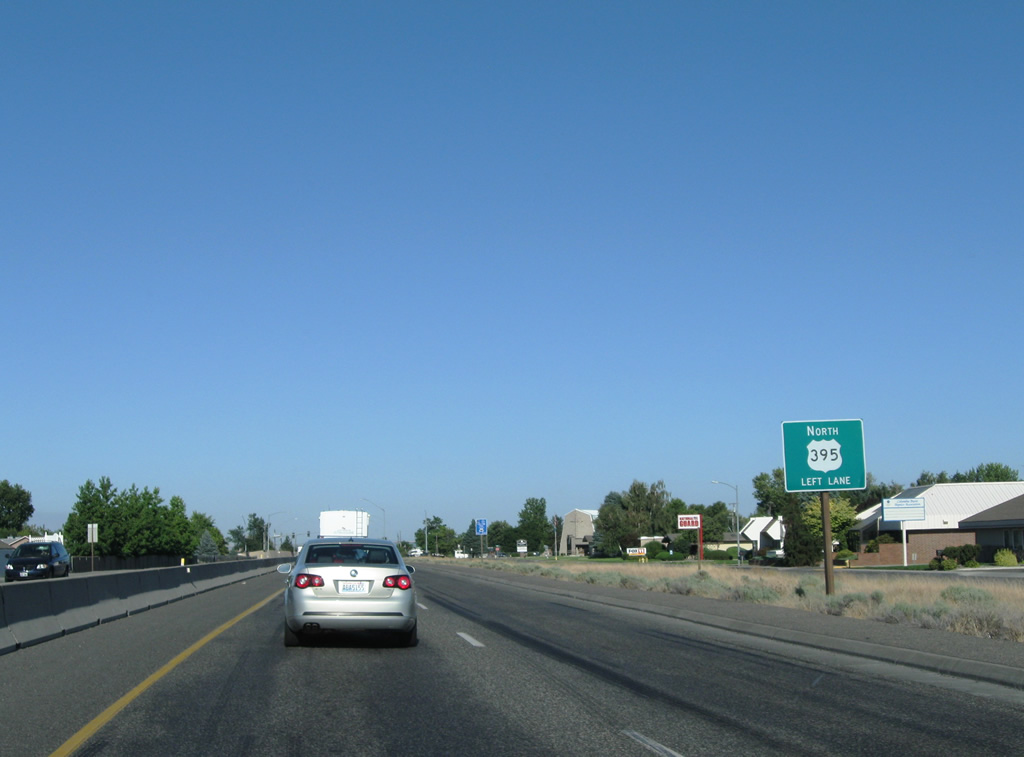
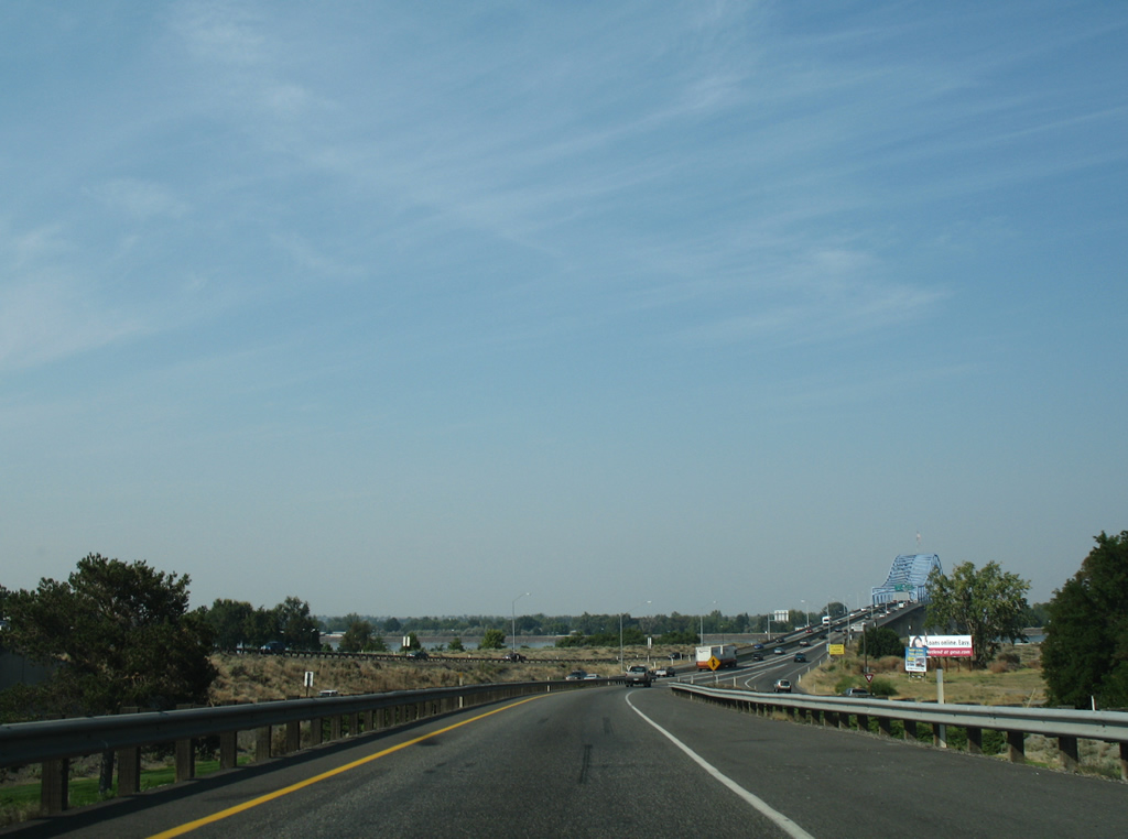
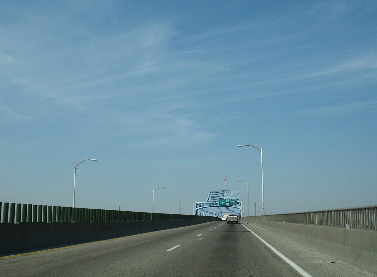
U.S. 395 turns northeast and parts ways with Ely Street for a four lane expressway dropping toward the Columbia River. Motorists are advised to keep left ahead of the Yelm Street intersection for eventual approach to the Blue Bridge.
08/03/11
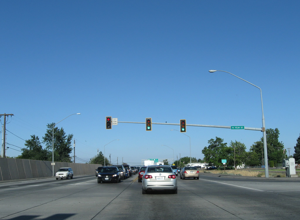
Yelm Street provides neighborhood access to U.S. 395 from adjacent residential areas between Canal Drive and Kennewick Avenue.
08/03/11
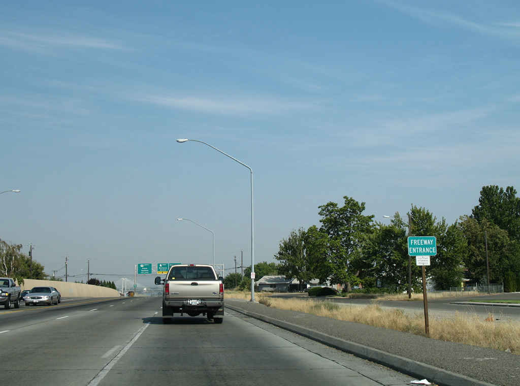
Freeway entrance sign posted beyond the traffic light with Yelm Street on U.S. 395 north.
08/28/06
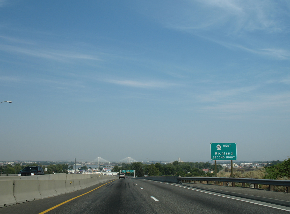
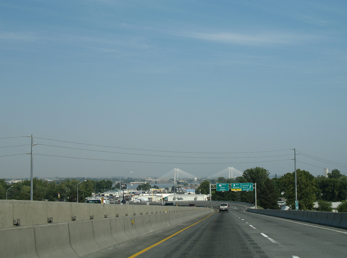
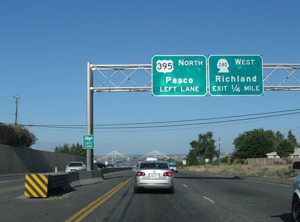
SR 240 follows a freeway southeast from Richland to end at Columbia Drive and U.S. 395 near the Kennewick city center. Originally a three-quarter cloverleaf interchange joined the two roadways, but changes completed in October 2009 reconfigured the interchange to eliminate weaving traffic concerns created by the three loop ramps. Now a diamond interchange with roundabouts handles movements.
08/28/06
08/03/11
A loop ramp used to link U.S. 395 north with SR 240 west. Now that movement is handled by a roundabout.
08/28/06
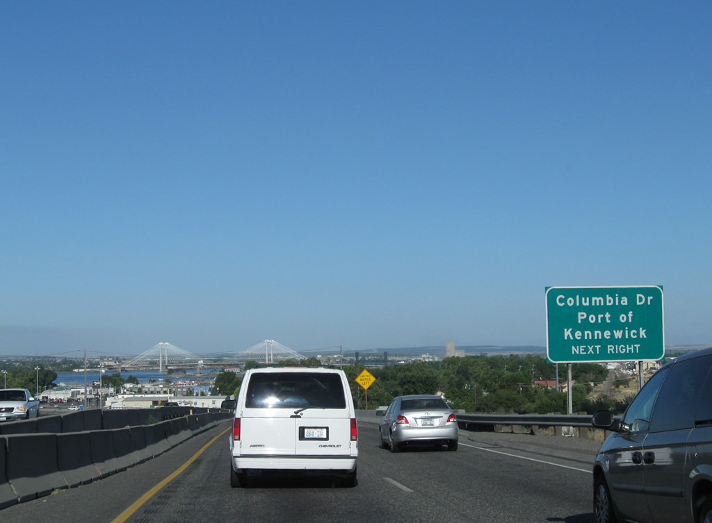
Motorists bound for Columbia Drive east to the Port of Kennewick are provided with a separate ramp that bypasses the roundabout.
08/03/11
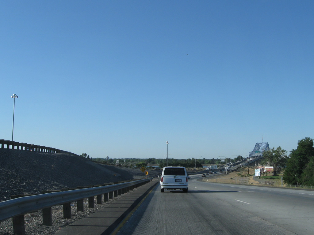
Towers from the Cable Bridge rise above the tree line as U.S. 395 lowers to cross the Columbia River. The Cable Bridge carries SR 397 between Pasco and Kennewick. It replaced the Green Bridge, the original U.S. 410 and U.S. 12 crossing of the river.
08/28/06
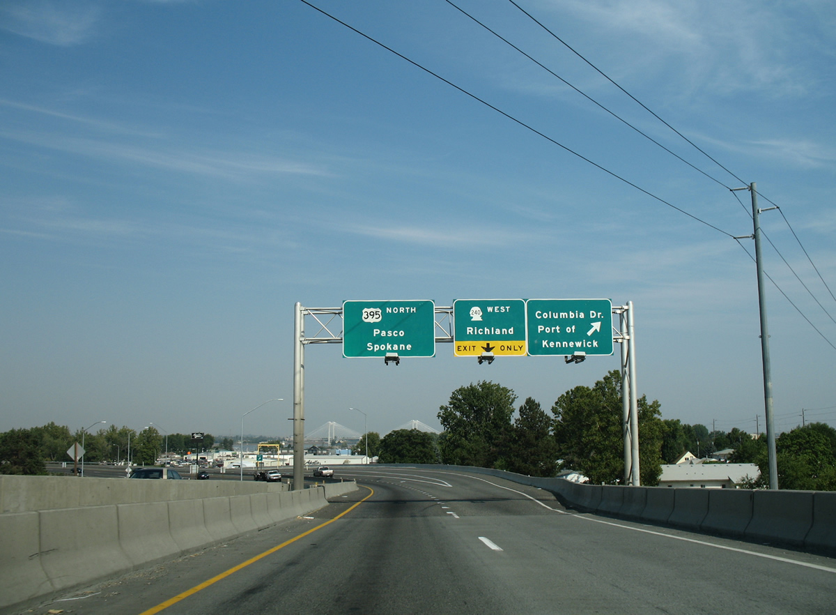
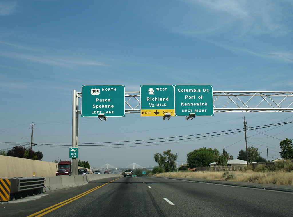
All traffic bound for either SR 240 west to Richland or Columbia Drive east to the Kennewick City Center departs U.S. 395 in unison. SR 240 constitutes a 41.31 mile route from Kennewick to SR 24 at West Hanford Gate. The freeway to Interstate 182 was originally signed as U.S. 410.
08/28/06
08/03/11
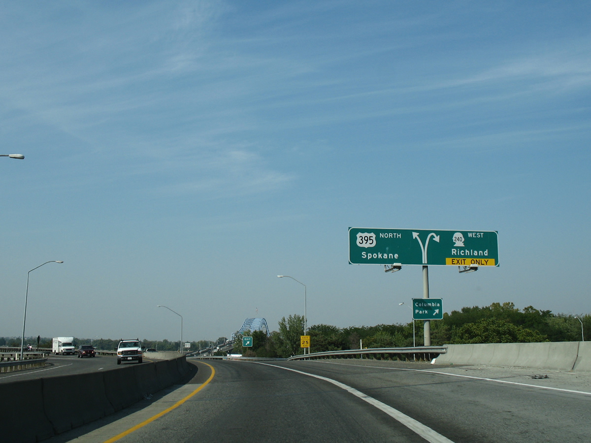
A look at changes made to U.S. 395 northbound as the freeway passes over SR 240. The original loop ramp claimed the right lane for the SR 240 freeway to Richland. Now that lane simply merges in anticipation of the wye interchange with the SR 240 eastbound lanes.
08/28/06
08/03/11
A key element in the U.S. 395 and SR 240 interchange rebuild was the addition of a second through lane for U.S. 395 south through the junction. The original configuration favored the movement from the Blue Bridge onto SR 240 west, but the majority of westbound traffic now uses Interstate 182. Therefore a new wider overpass was built to accommodate U.S. 395 drivers toward southwest Kennewick.
08/28/06
08/03/11
Traffic merges onto U.S. 395 north from SR 240 east from the left side on the Blue Bridge approach. Signs used to advise motorists to use caution during strong wind events. These were removed by 2011.
08/28/06
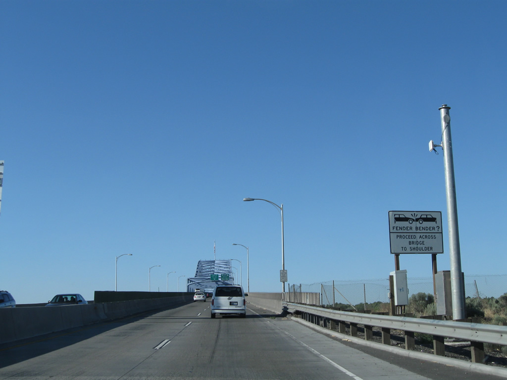
The lack of shoulders necessitates vehicles involved in minor collisions to proceed to the north end of the Blue Bridge.
08/03/11
08/28/06
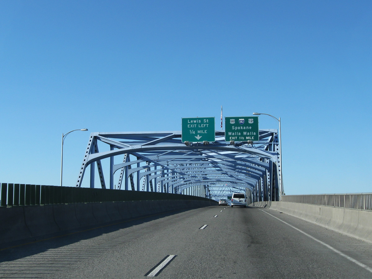
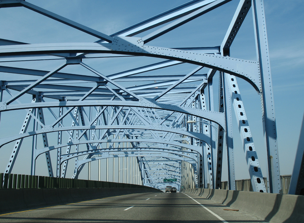
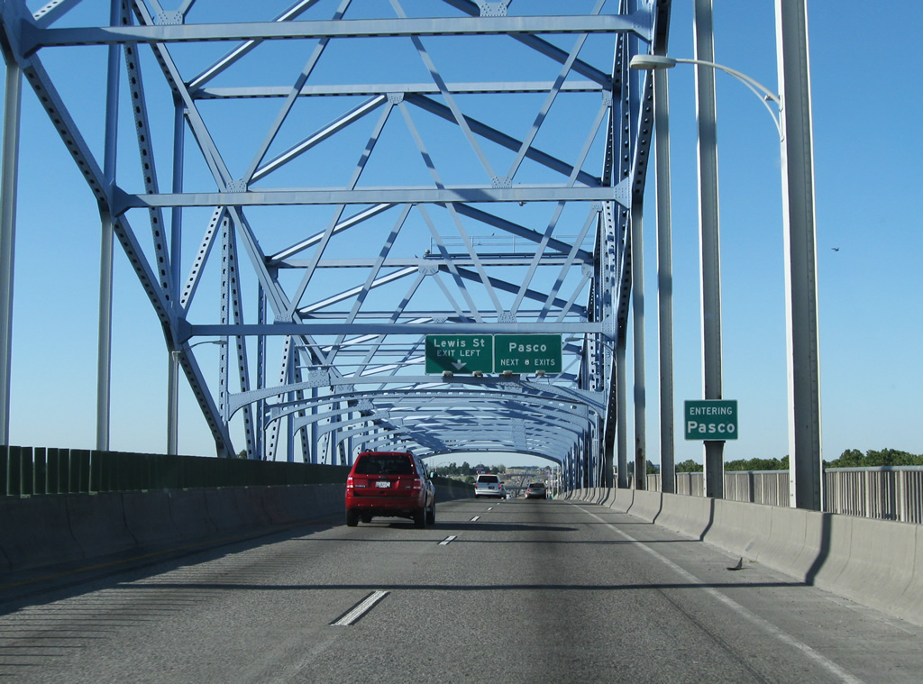
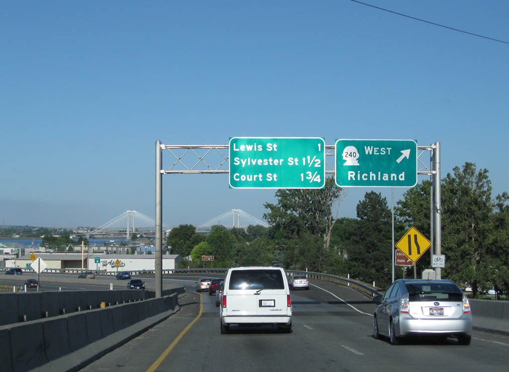
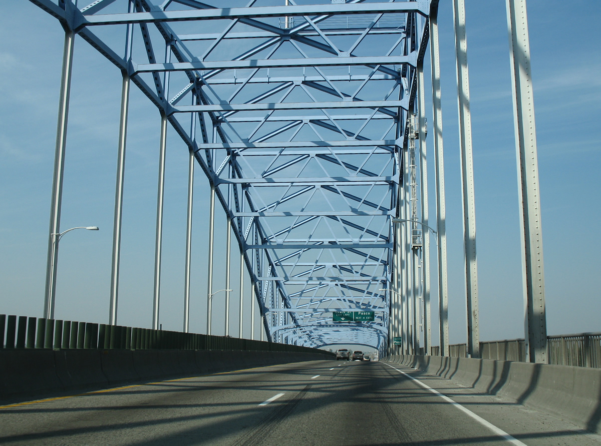
The next three exits serve the city of Pasco street grid, beginning with the wye interchange with Lewis Street (former U.S. 410 and U.S. 12). Interstate 182 lies 1.50 miles to the north.
08/03/11
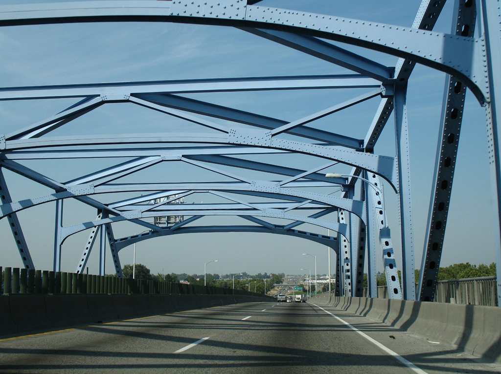
The Blue Bridge was dedicated on July 30, 1954 and constructed at a cost of $6.5 million as a new crossing for U.S. 410 between Pasco and Kennewick.
08/28/06
U.S. 395 crosses into Franklin County and the city of Pasco north of the midway point across the Columbia River.
08/03/11
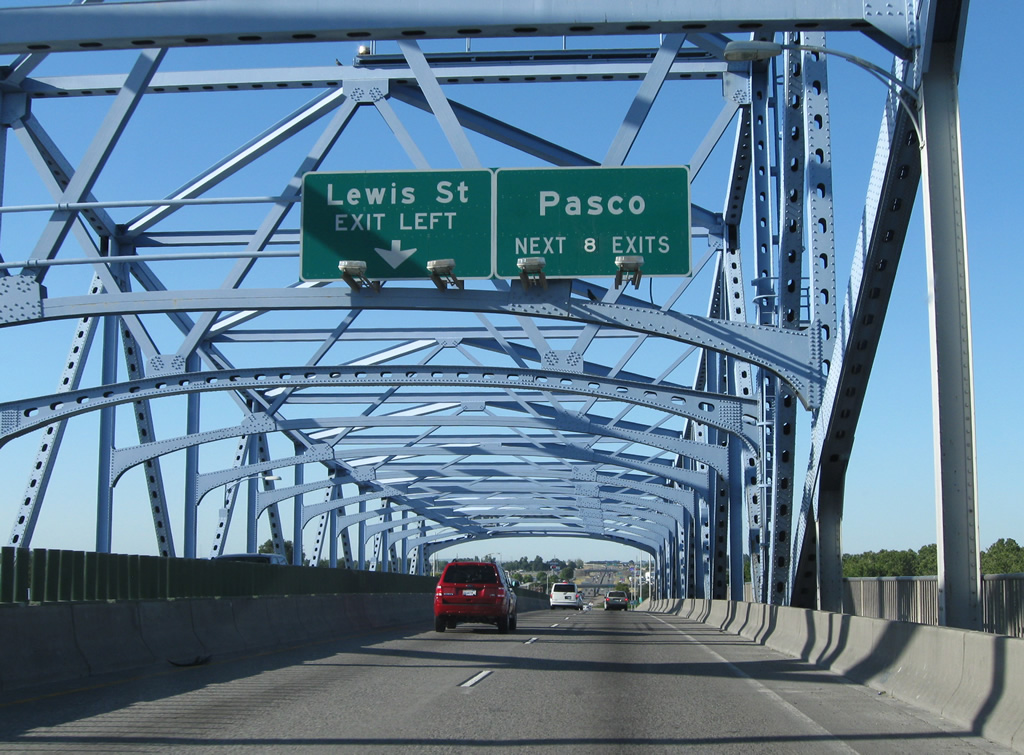
The Lewis Street off-ramp departs immediately after the Blue Bridge from U.S. 395 northbound. Lewis Street bends southeastward toward the Pasco city center and eventually meets the end of the U.S. 12 freeway at Pasco-Kahlotus Road.
The Pasco exits sign was revised from four to eight between 2006 and 2011 to reflect the U.S. 395 continuation along Interstate 182 and north to Kartchner Street.
08/03/11
08/28/06
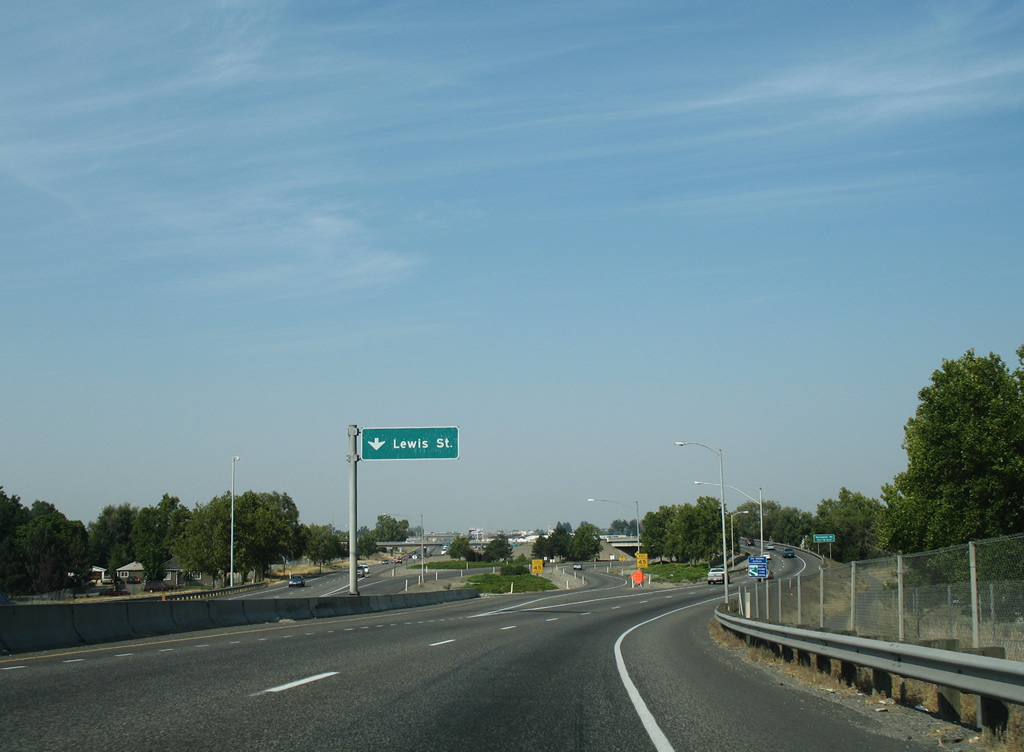
Motorists bound for Lewis Street east depart U.S. 395 northbound.
08/28/06
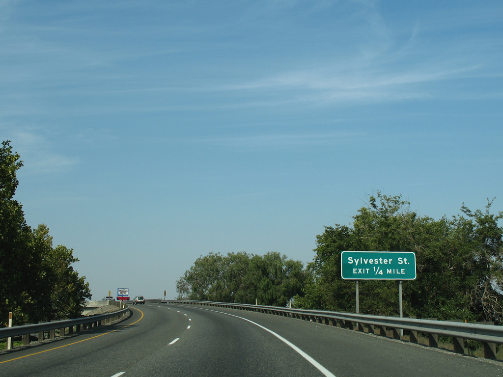
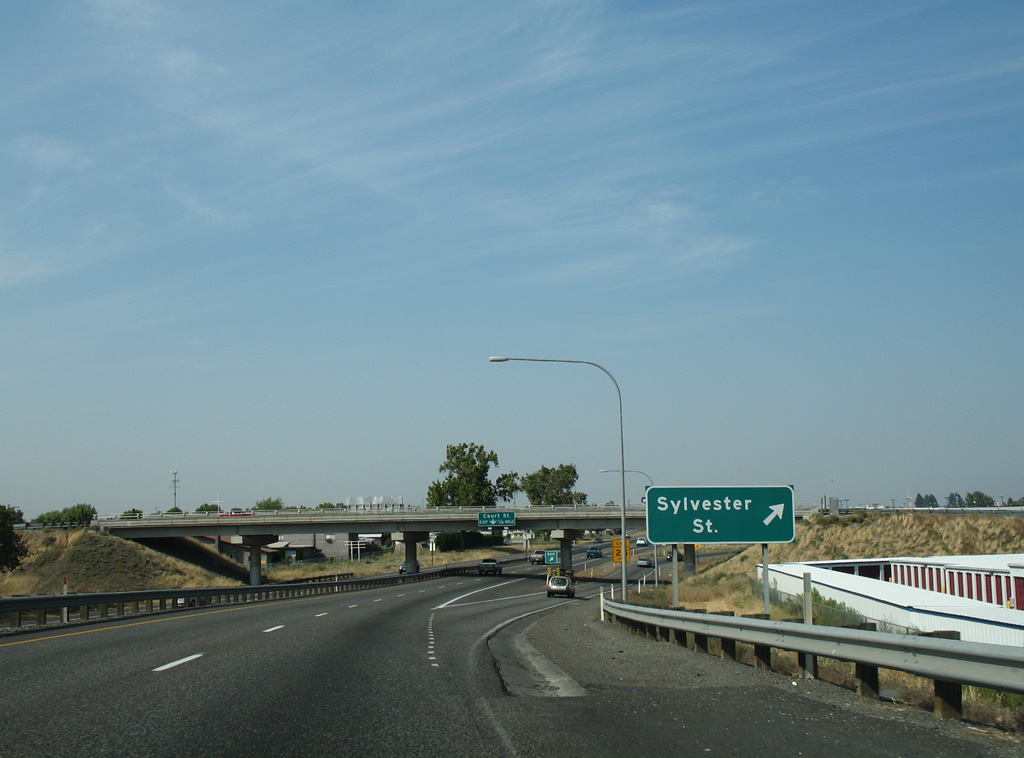
A loop ramp leaves U.S. 395 northbound in one half mile for Sylvester Street.
08/28/06
Sylvester Street joins the residential street grid west of U.S. 395 with the city center area to the east.
08/28/06
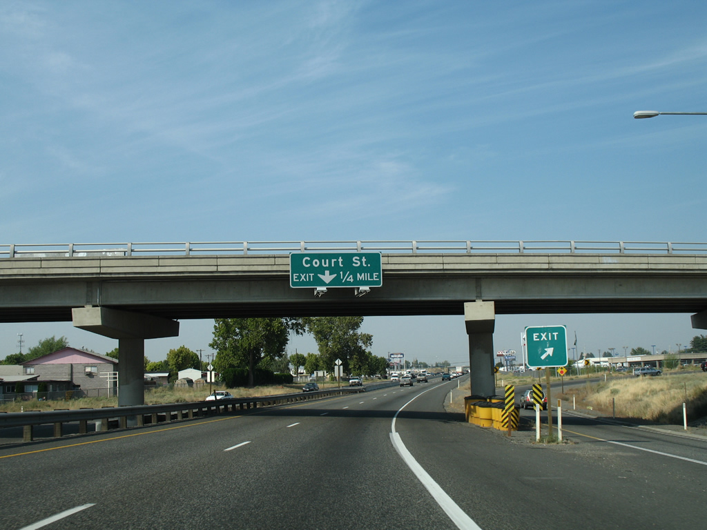
A parclo interchange with Court Street follows in one quarter mile.
08/28/06
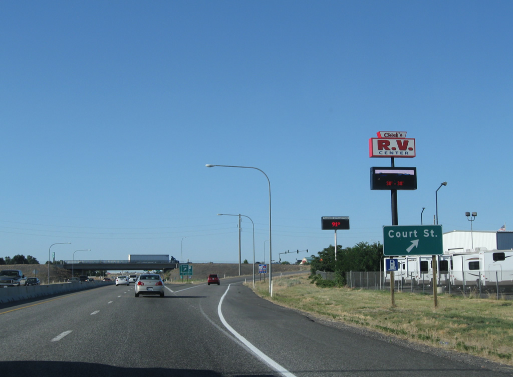
U.S. 395 northbound at the Court Street off-ramp. Court Street comprises a commercial boulevard east to North 4th Avenue and west to the Pasco city line nearby.
08/03/11
U.S. 395 north merges with I-182/U.S. 12 east in one quarter mile at a trumpet interchange.
08/03/11

Interstate 182 meets 20th Avenue adjacent to the merge with U.S. 395. Drivers bound for the north-south arterial and nearby Columbia Basin Community College should use the eastbound on-ramp.
08/03/11
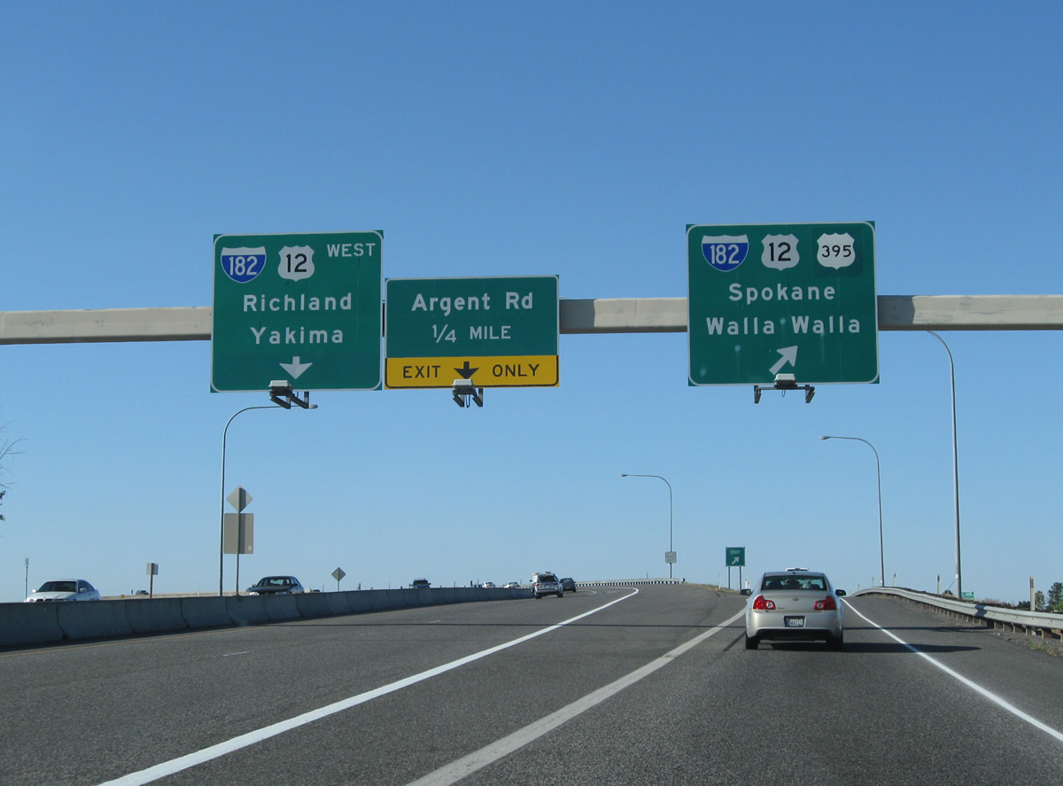
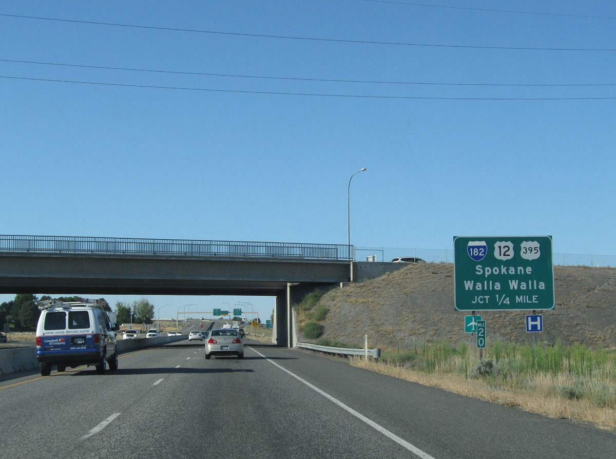
Traffic partitions into ramps for Interstate 182-U.S. 12 east & U.S. 395 north to Walla Walla and Ritzville and I-182/U.S. 12 west to Richland and Yakima.
08/03/11
An additional ramp connects the westbound I-182 ramp with parallel Argent Road by Tri-Cities Airport.
08/28/06
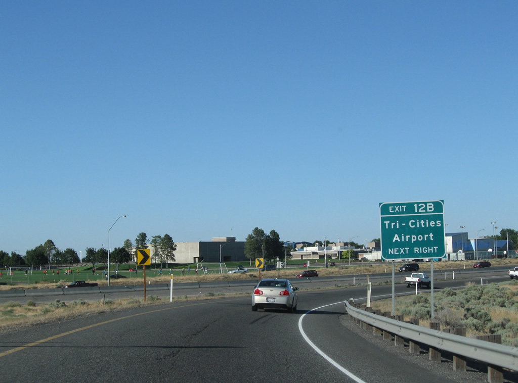
Travelers destined for the Tri-Cities Airport passenger terminal are directed onto 20th Avenue north from Interstate 182 (Exit 12B).
08/03/11
SR 397 transitions directly into the U.S. 395 freeway leading north from I-182/U.S. 12. A loop ramp carries motorists onto the westbound freeway to Richland.
08/03/11
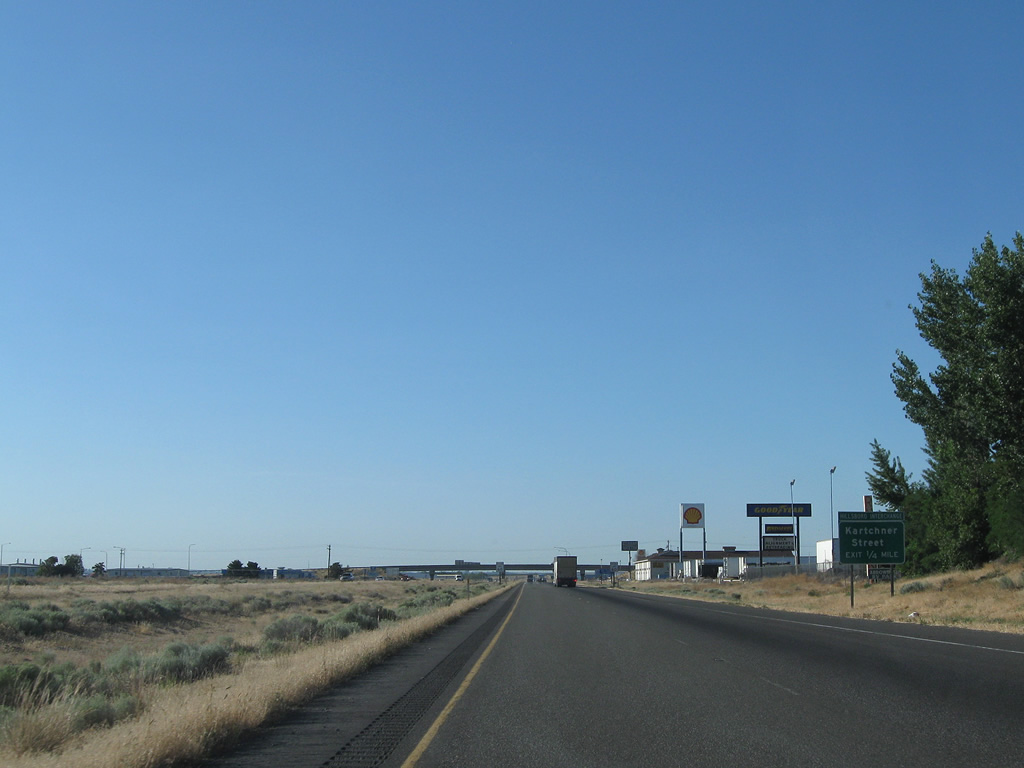
Next in line for northbound U.S. 395 travelers is the folded diamond interchange with Kartchner Street.
08/03/11
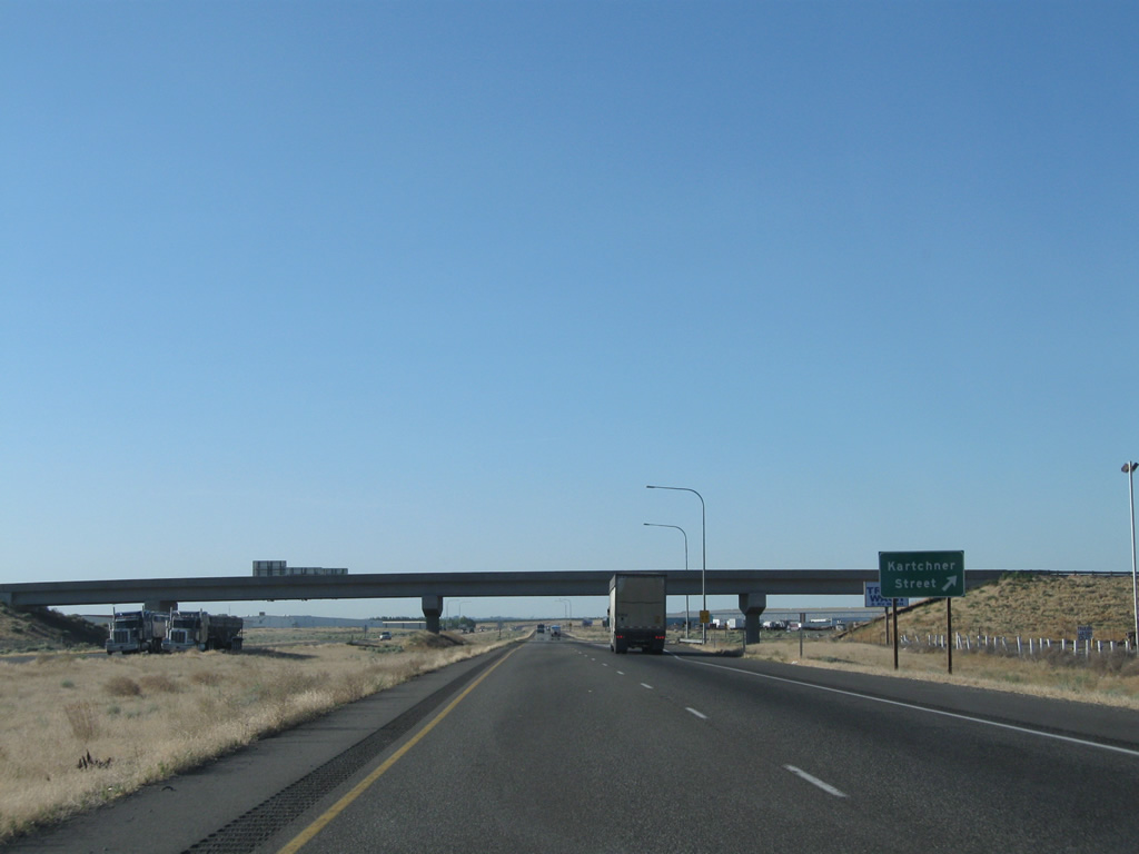
Kartchner Street connects the freeway with Railroad Avenue to the west and Capitol Avenue to the east, serving a large industrial park on either side of U.S. 395.
08/03/11
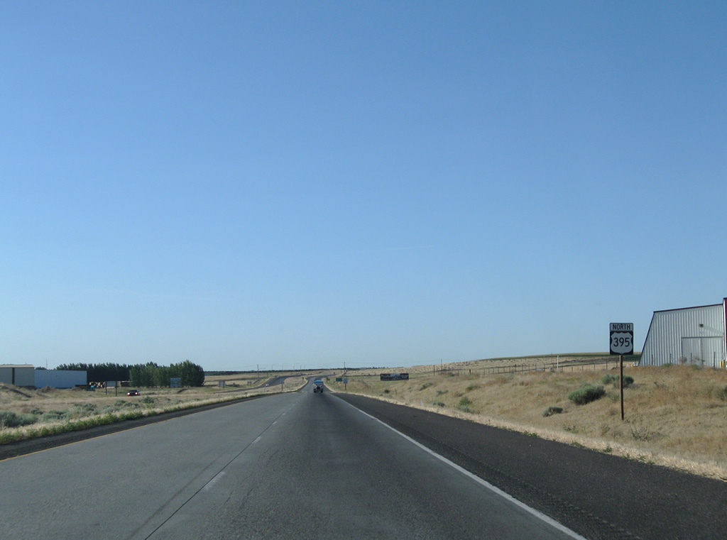
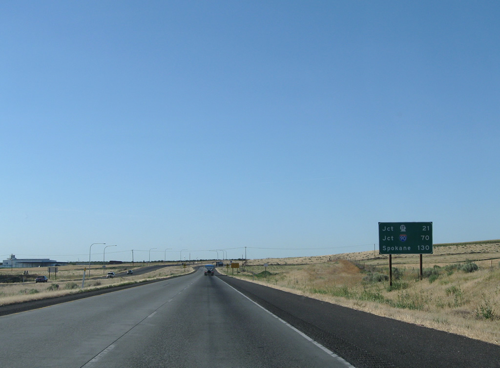
U.S. 395 reassurance shield and mileage assembly posted north of the Kartchner Street on-ramp. The merge with Interstate 90 lies 70 miles ahead at Ritzville.
08/03/11
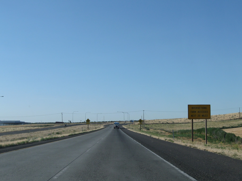
The U.S. 395 freeway comes to an end at the at-grade intersection with Foster Wells Road. Intersections and farm access ties into the expressway over the next 20 miles to beyond Eltopia.
08/03/11
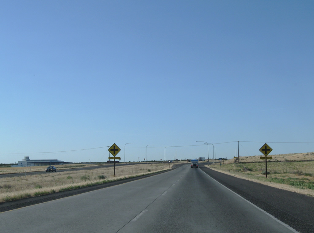
Foster Wells Road mirrors Kartchner Street through an industrial park area east from Railroad Avenue. East of U.S. 395, the road heads through agricultural areas.
08/03/11
Photo Credits:
- Andy Field: 08/03/11
- AARoads: 08/28/06
Connect with:
Page Updated Thursday October 13, 2011.