
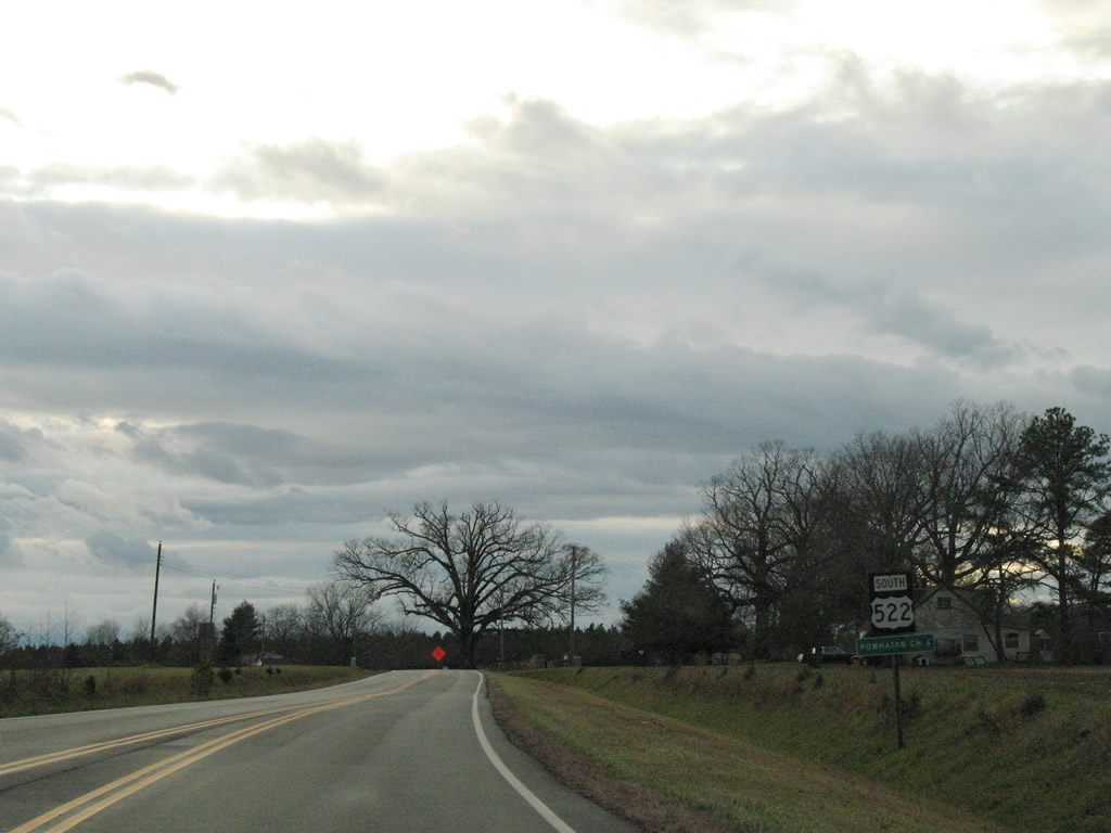
U.S. 522 South

 South
South  West
West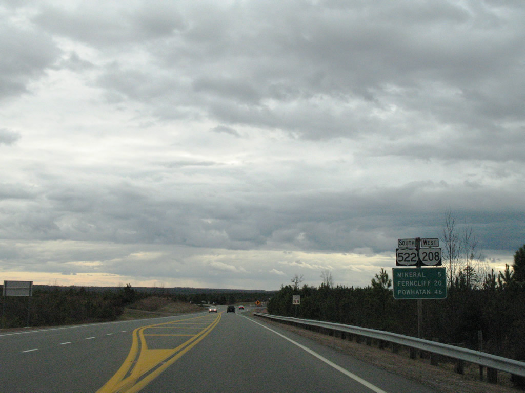
U.S. 522/SR 208 (Zachary Taylor Highway) combine 5.43 miles south from Wares Crossroads to the town of Mineral.
12/26/06
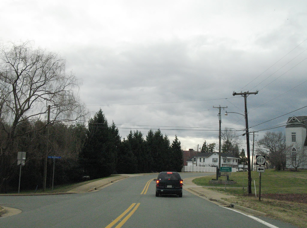
SR 667 (Old Tolersville Road) provides a cutoff from U.S. 522/SR 208 Louisa Avenue) to SR 618 (Fredericks Hall Road) east to Fredericks Hall and Bumpass.
12/26/06
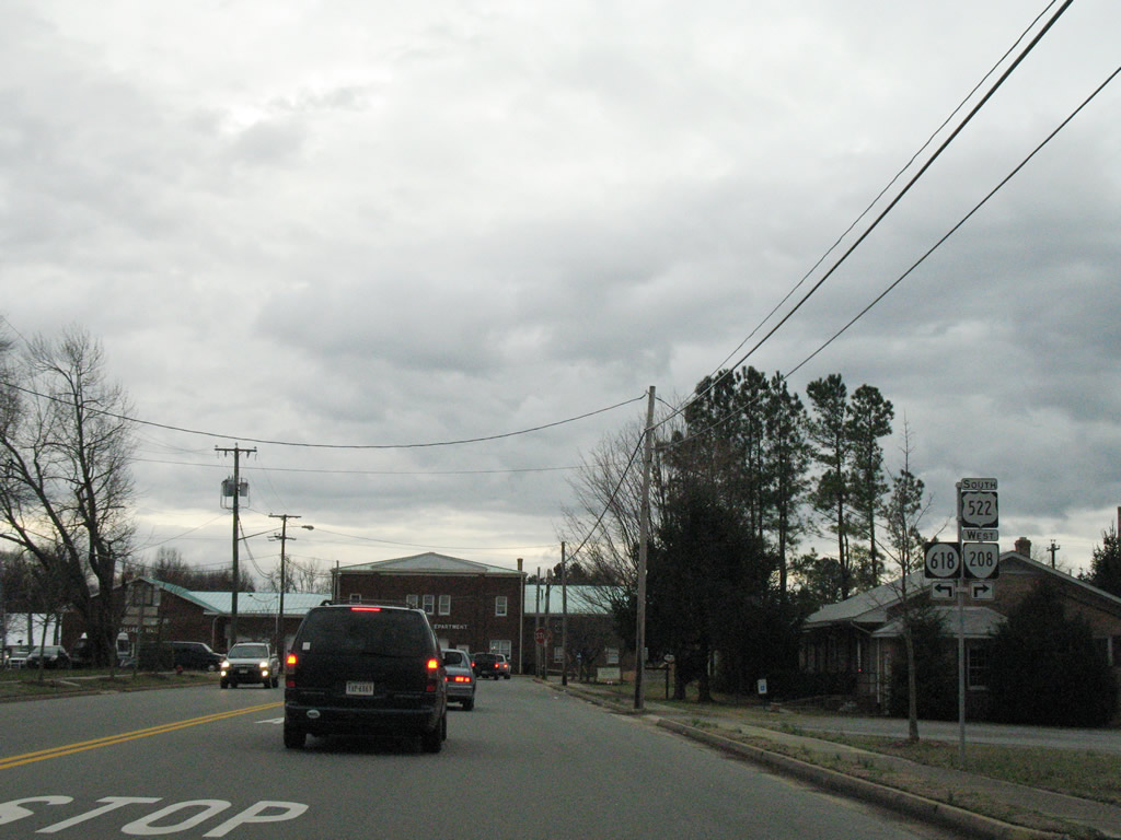
U.S. 522/SR 208 follow Louisa Avenue south from the Mineral corporate limits to 1st Street west at SR 608.
12/26/06
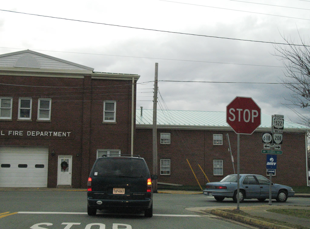
SR 618 runs 11.97 miles from 1st Street in Mineral to 1st Street east to Fredericks Hall Road and SR 680 (Woodson Mill Road) in Hanover County.
12/26/06
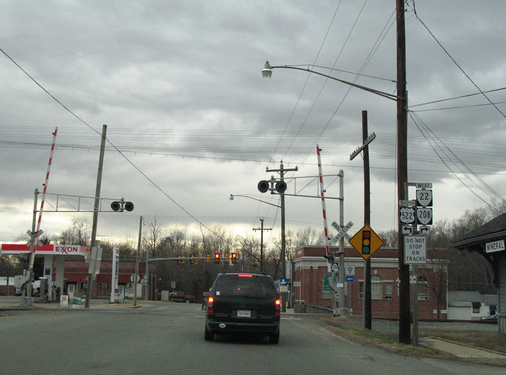
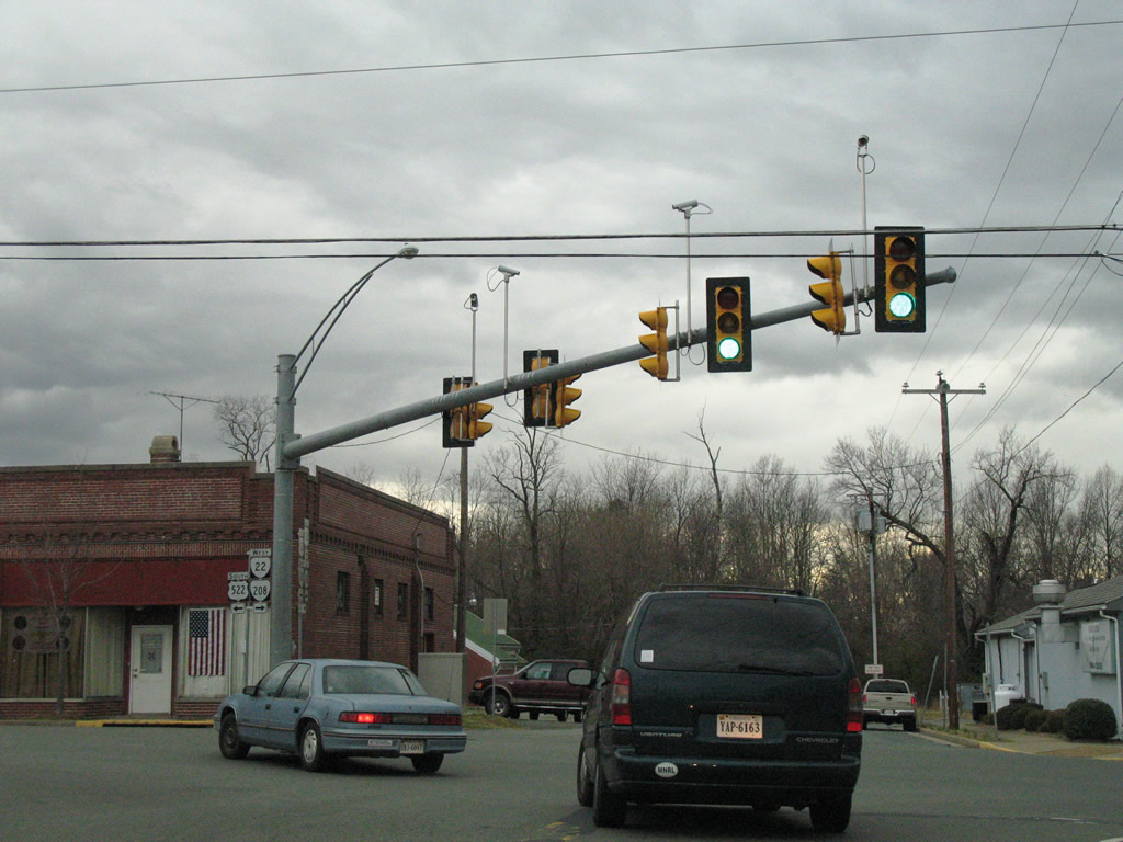
U.S. 522/SR 208 turn onto 1st Street from Louisa Avenue 0.07 miles west to SR 22 and Mineral Avenue. SR 22 accompanies SR 208 west five miles to Louisa, the county seat.
12/26/06
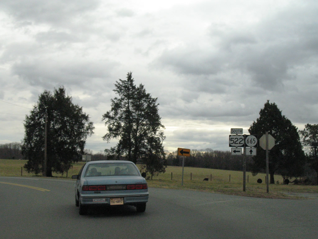
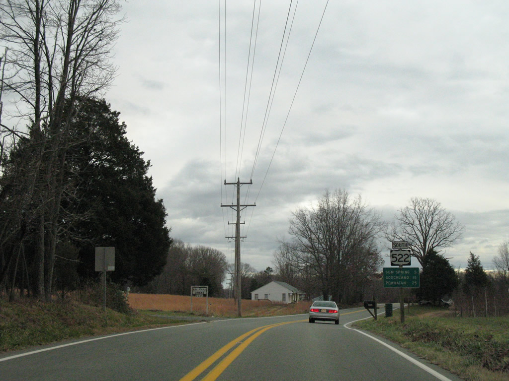
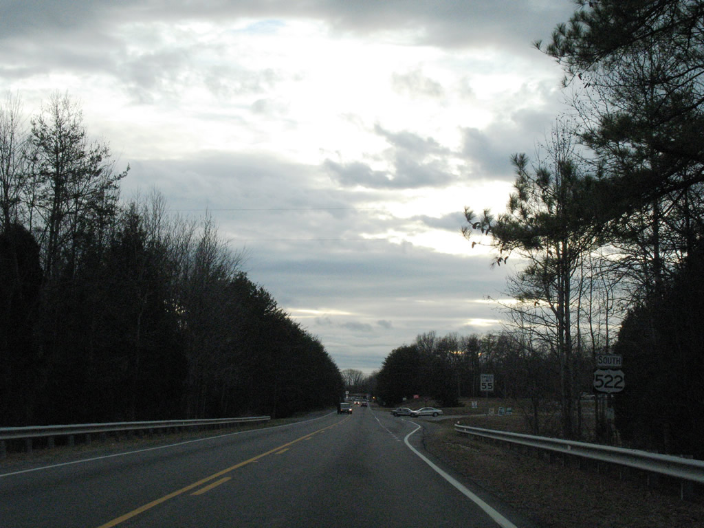
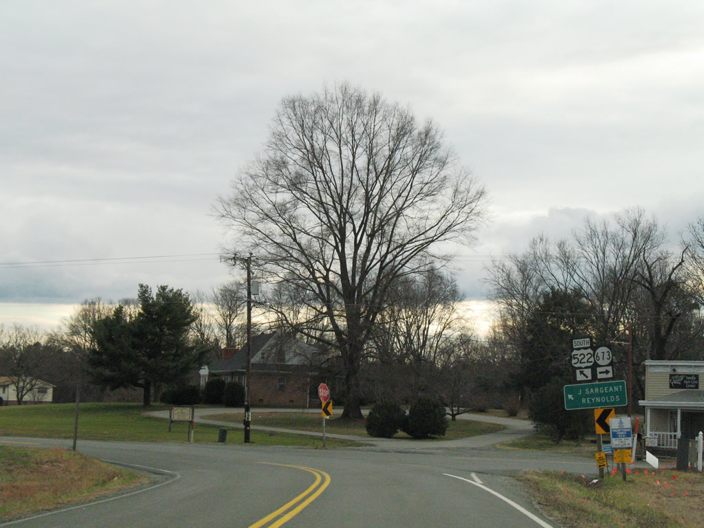
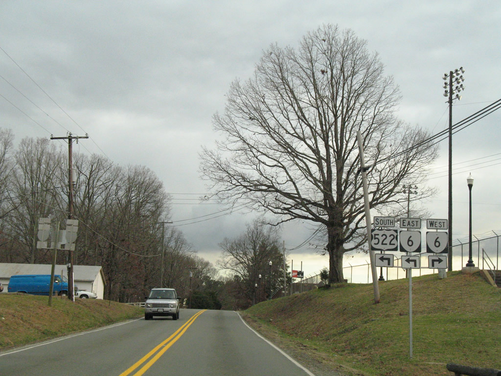
U.S. 522 lines Mineral Avenue south from SR 22/208 west at 1st Street. U.S. 522 continues from Mineral to Cuckoo.
12/26/06
South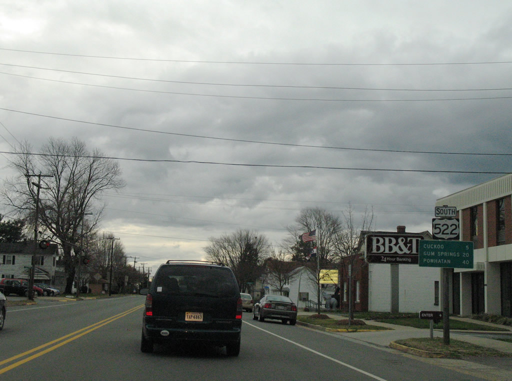
Continuing south from Mineral, U.S. 522 travels six miles to Cuckoo, 20 miles to Gum Springs and 40 miles to its south end.
12/26/06
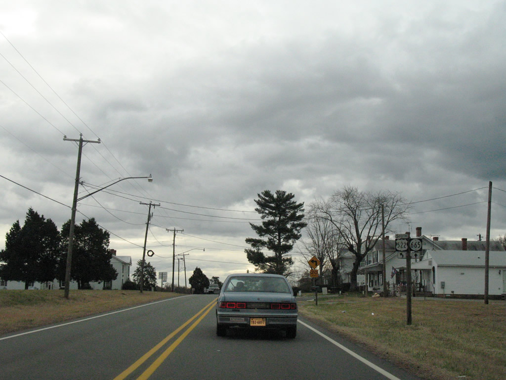
SR 655 stems southwest from U.S. 522 (Mineral Avenue) along W 9th Street to Kennon Road. SR 655 meanders south between Mineral and U.S. 33 (Jefferson Highway) east of Northeast Creek Reservoir.
12/26/06
U.S. 522 curves southeast from SR 655 (W 9th Street) onto Pendleton Road to SR 700 (Mica Road).
12/26/06
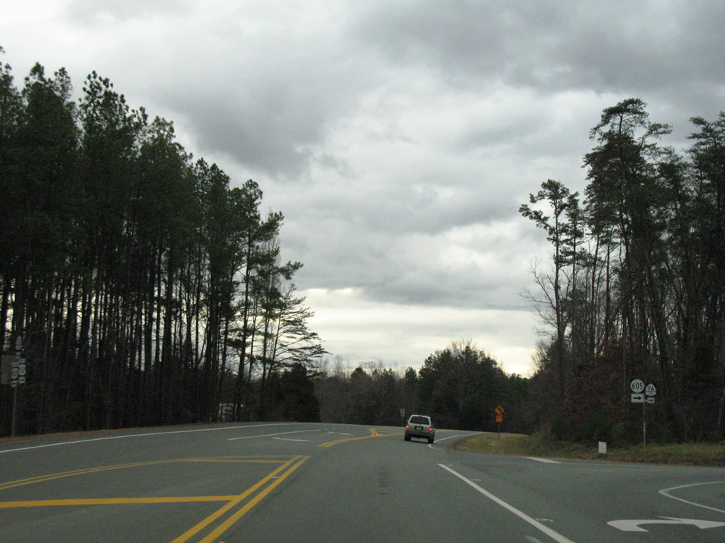
Willis Proffitt Road (SR 605) connects U.S. 522 (Pendleton Road) with U.S. 33 (Jefferson Highway) at Shannon Mill Road.
12/26/06
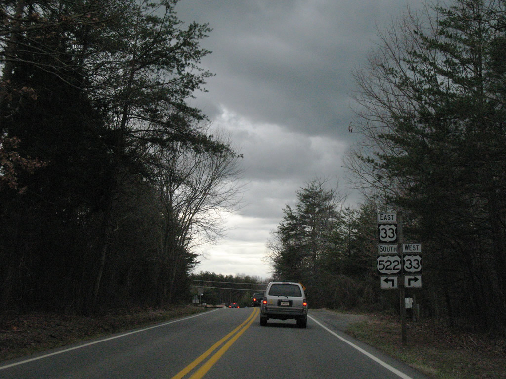
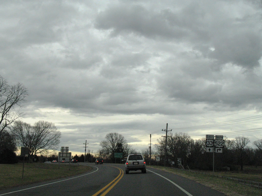
U.S. 33/522 combine between Pendleton Road and Cuckoo for 0.66 miles. U.S. 33 travels seven miles northwest to Louisa.
12/26/06
U.S. 33 travels 135.7 miles in Virginia between the West Virginia state line near Rawley Springs to Richmond. Overall the highway runs 709 miles northwest to Elkhart, Indiana.
12/26/06
 East South
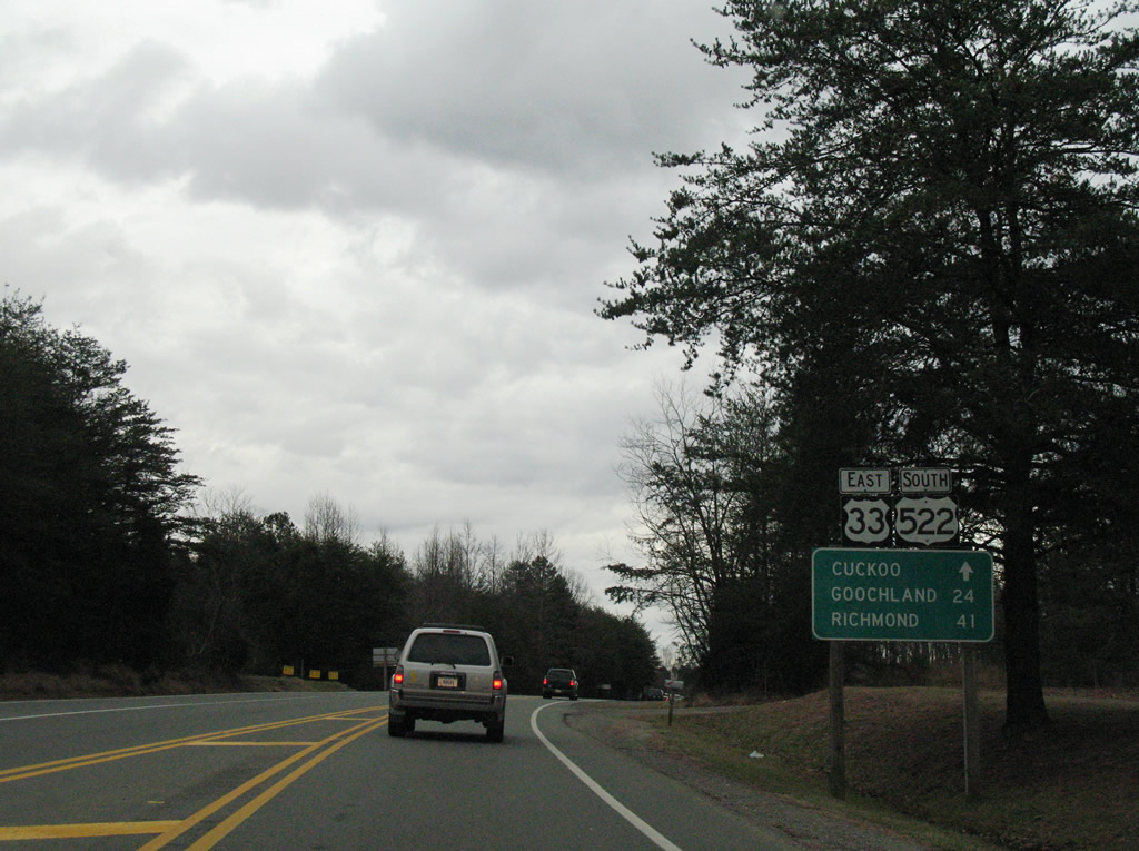
U.S. 33/522 overlap 0.66 miles south from Pendleton Road to Cuckoo.
12/26/06
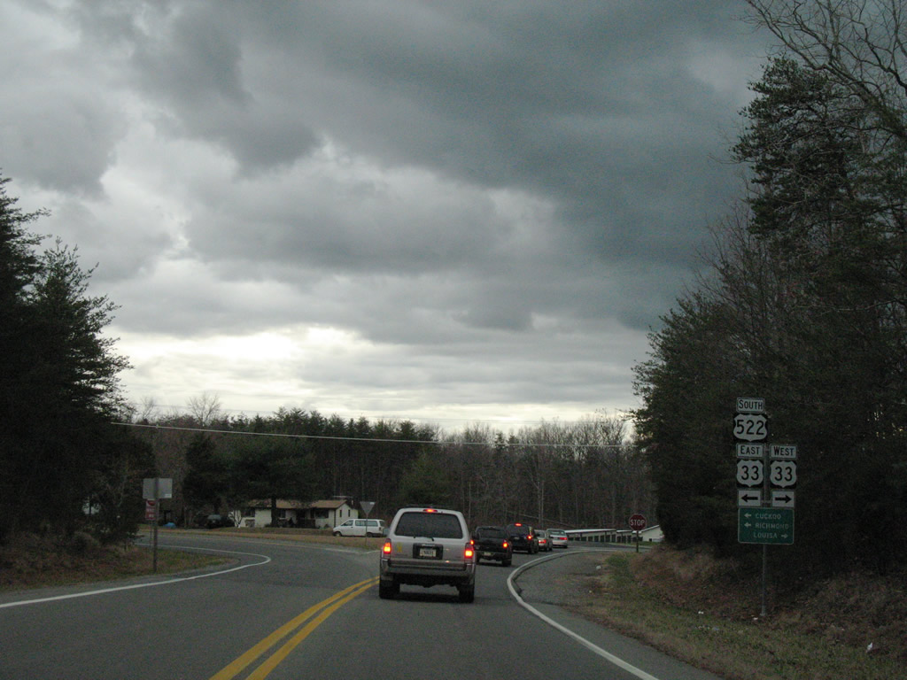
U.S. 33 continues east 16 miles to Montpelier and 40 miles to Richmond. U.S. 522 resumes its southward course to Gum Spring, Goochland and Powhatan.
12/26/06
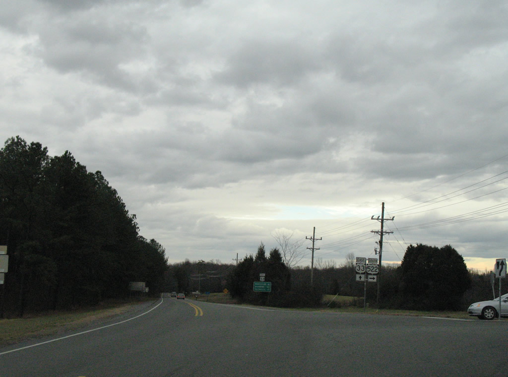
U.S. 33/522 partition at Cuckoo. U.S. 522 crosses paths with I-64 near Gum Spring in 14 miles. U.S. 33 meets SR 54 at Lone Oak in 18 miles.
12/26/06
South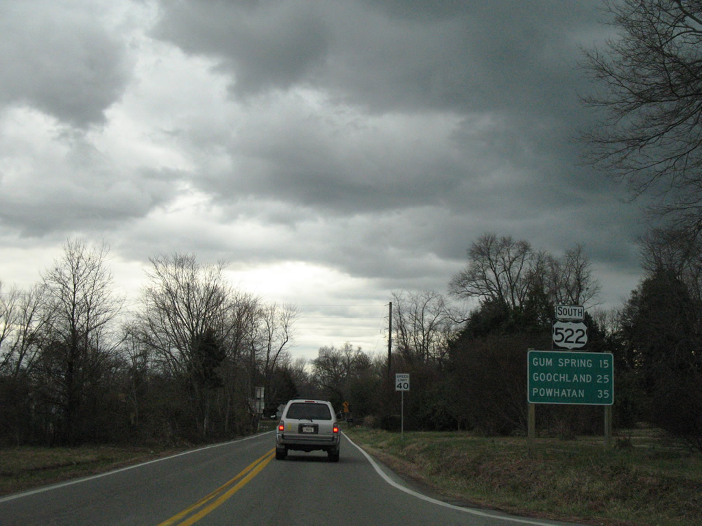
Leaving U.S. 33 (Jefferson Highway), U.S. 522 continues along Cross County Road 15 miles to Gum Spring.
12/26/06
SR 601 (Paynes Mill Road north / Orchid Road south) crosses U.S. 522 (Cross County Road) at Orchid, five miles north of Gum Spring.
12/26/06
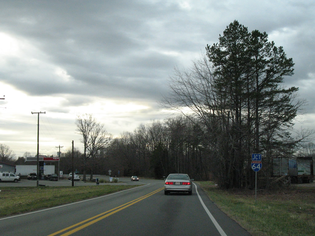
Turning southwest, U.S. 522 meets Interstate 64 at a diamond interchange (Exit 159) just north of Gum Spring.
12/26/06
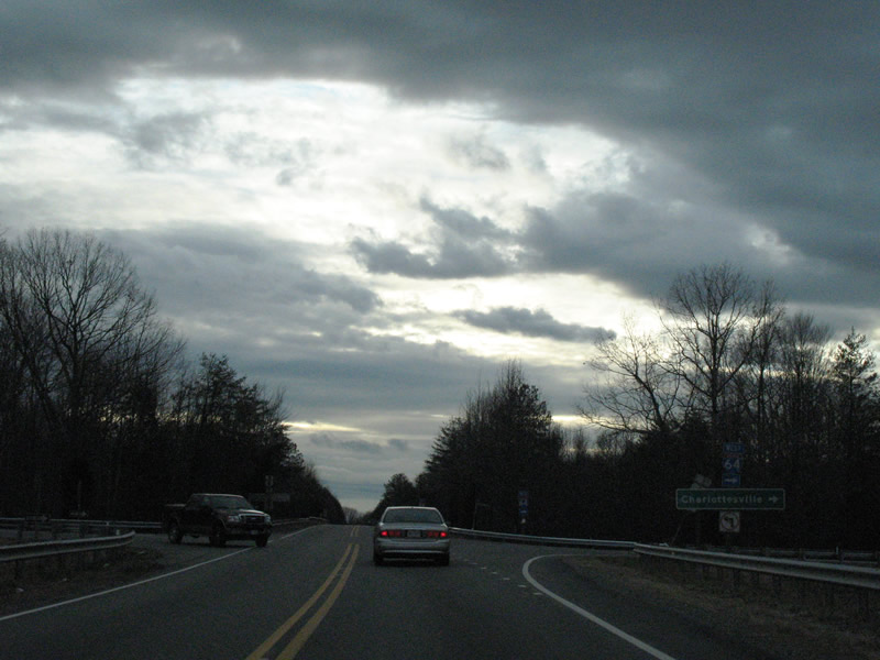
Interstate 64 travels west from Gum Spring to Charlottesville, Waynesboro and I-81 near Staunton.
12/26/06
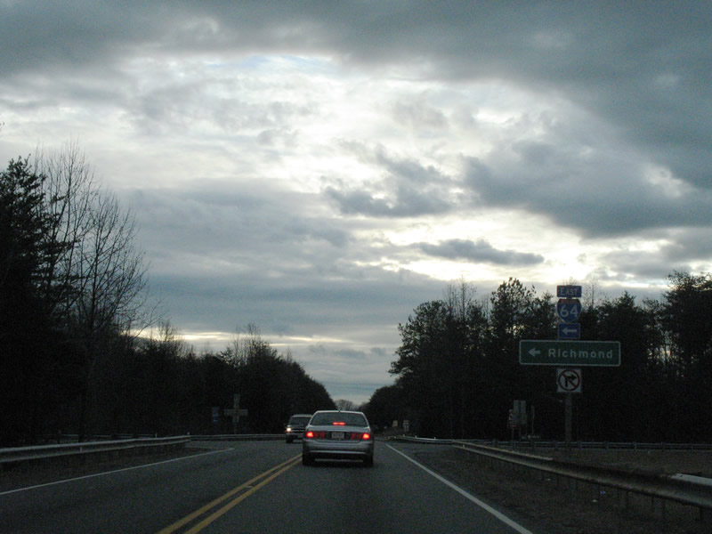
East from U.S. 522, I-64 heads 18 miles to Interstate 295 at Short Pump en route to Richmond.
12/26/06
Departing from Interstate 64, U.S. 522 (Cross County Road) continues to Gum Spring.
12/26/06
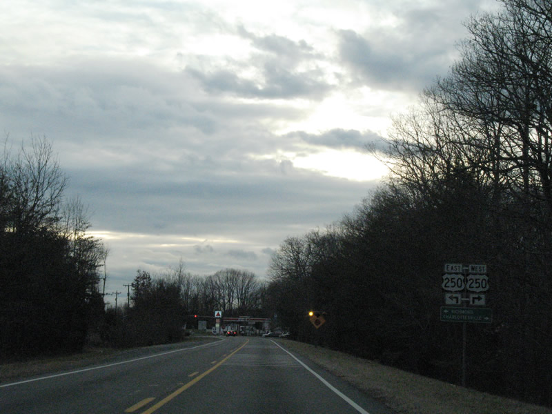
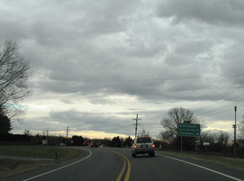
U.S. 250 is the counterpart to Interstate 64 from Richmond west to Charlottesville, Waynesboro, and Staunton. The highway intersects U.S. 522 along Broad Street Road at Gum Spring.
12/26/06
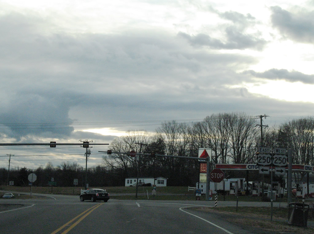
U.S. 522 (Cross County Road) south at U.S. 250 (Broad Street Road) in Gum Spring. U.S. 250 continues seven miles northwest toward Hadensville and eight miles southeast to Oilville.
12/26/06
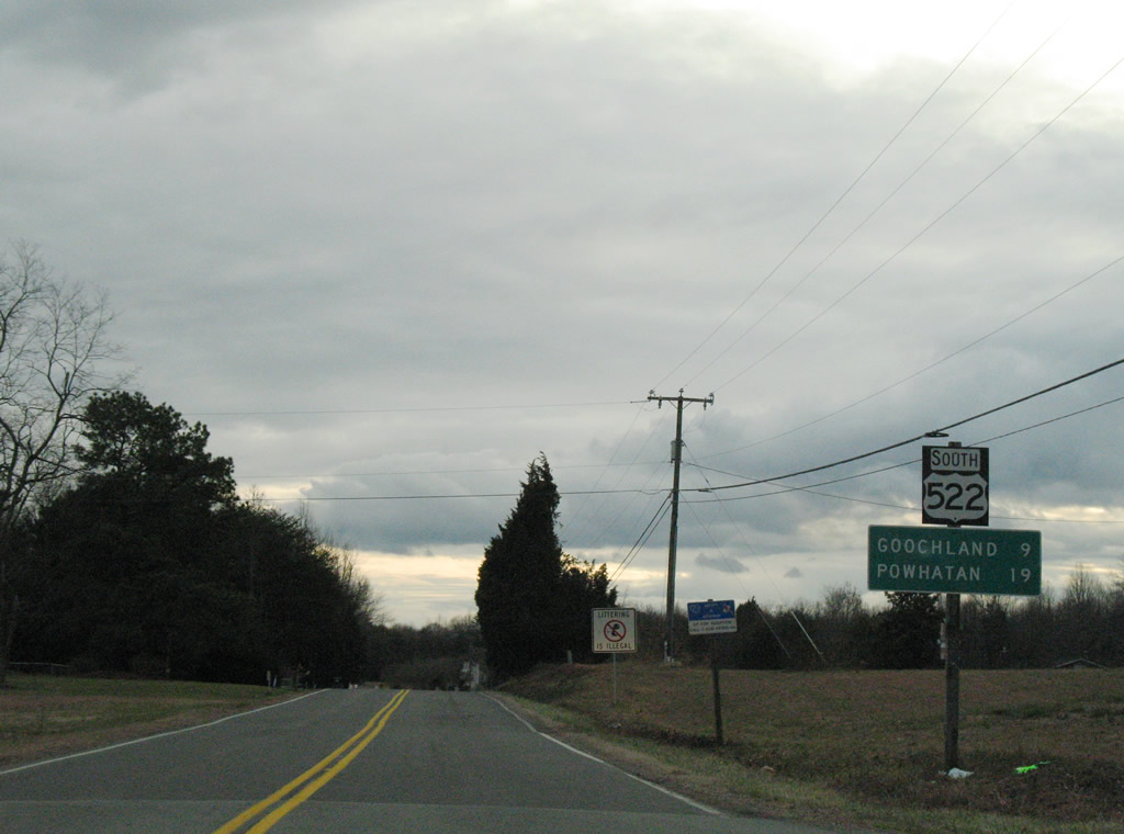
U.S. 522 winds southeast from Gum Spring (Cross County Road) into Goochland County (Sandy Hook Road).
12/26/06
Meeting U.S. 522 (Sandy Hook Road) at Sandy Hook is SR 673 (Whitehall Road). SR 673 stems west from the US route to Othma and SR 606 north of Bula.
12/26/06
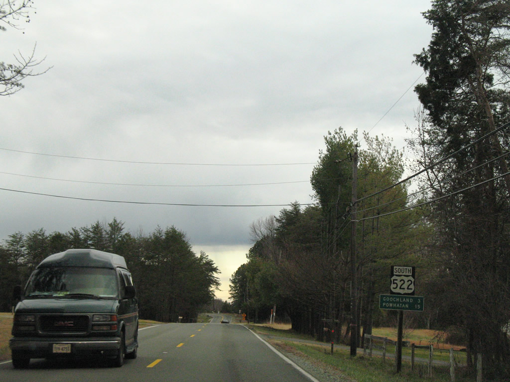
Three miles north of the Goochland County seat of Goochland on U.S. 522 (Sandy Hook Road) south in Sandy Hook.
12/26/06
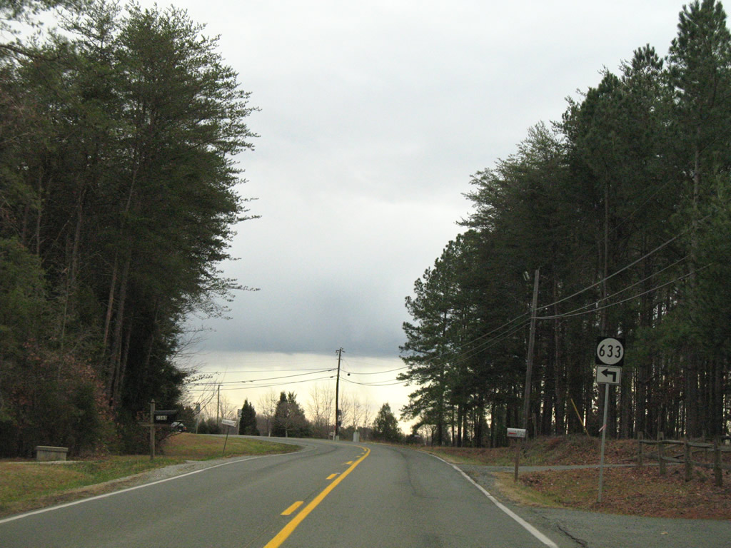
SR 633 follows Poorhouse Road east from U.S. 522 (Sandy Hook Road) to SR 634 (Maidens Road).
12/26/06
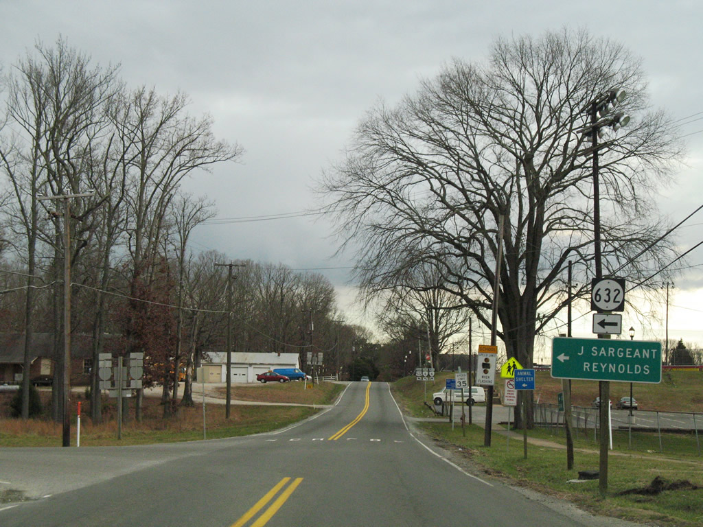
SR 632 (Fairground Road) heads five miles from U.S. 522 to U.S. 250 near Oilville.
12/26/06
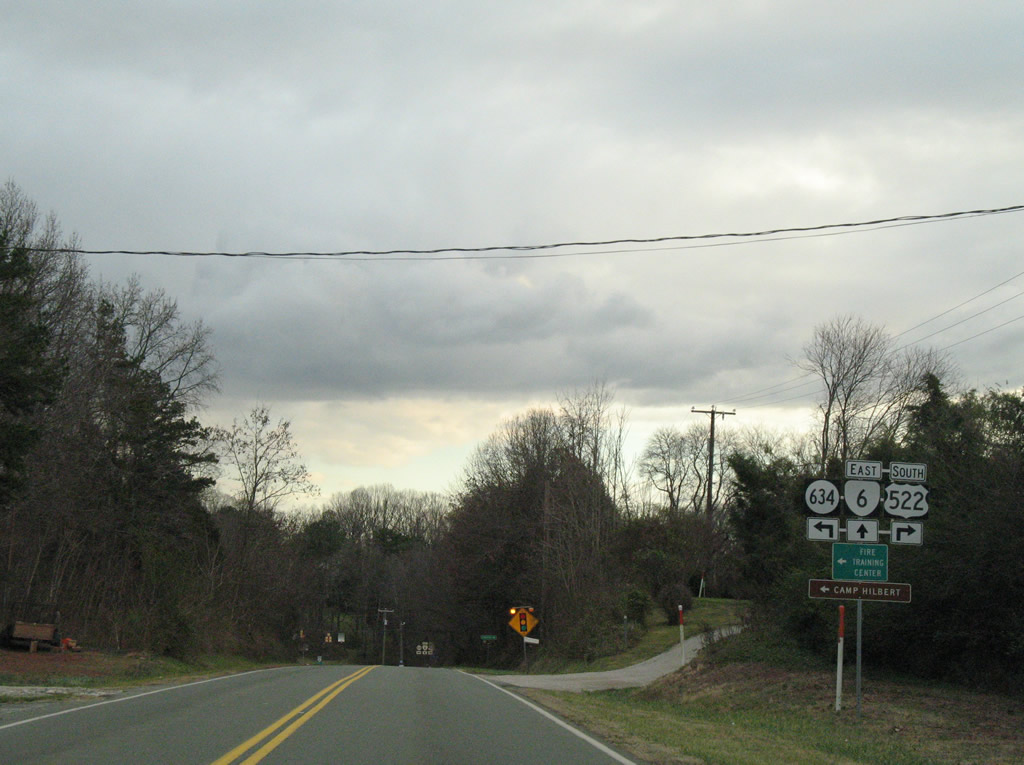
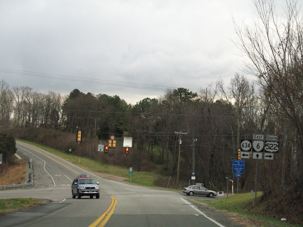
SR 6 enters the Goochland area from Georges Tavern nine miles to the west and 39 miles from Scottsville.
12/26/06

U.S. 522/SR 6 (River Road W) combine 1.5 miles southward. SR 6 constitutes a 102 mile long highway between U.S. 250 at Afton Mountain and SR 161 in the city of Richmond.
12/26/06
South  East
East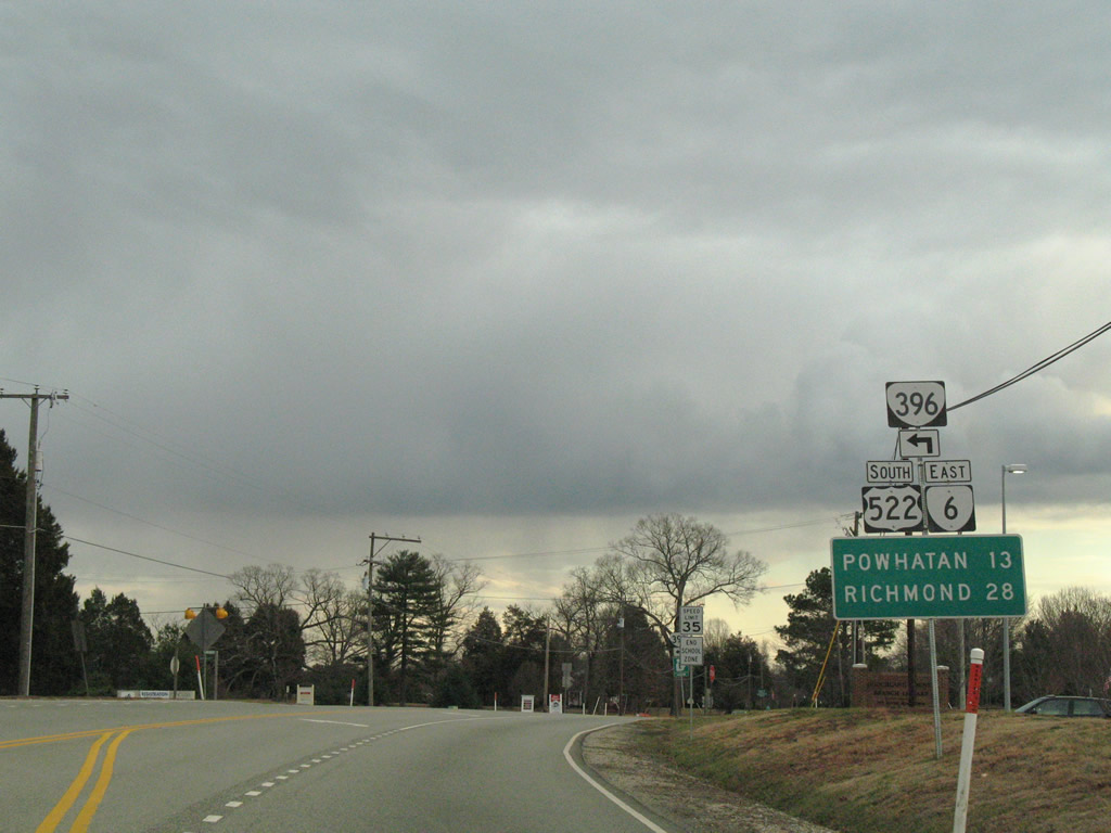
SR 396 (Dickinson Road) arcs northeast between U.S. 522/SR 6 (River Road W) to SR 608 (Fairground Road). SR 396 serves the Western Campus of J. Sargeant Reynolds Community College.
12/26/06
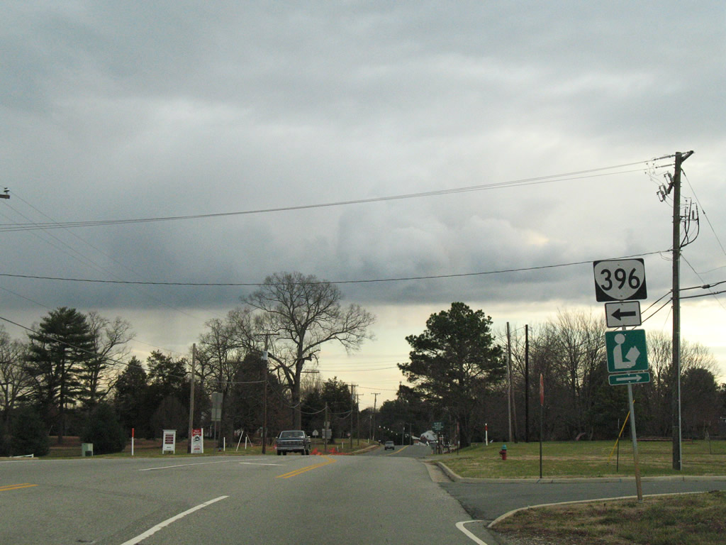
Southbound U.S. 522/SR 6 (River Road W) south at SR 396 (Dickinson Road) north.
12/26/06
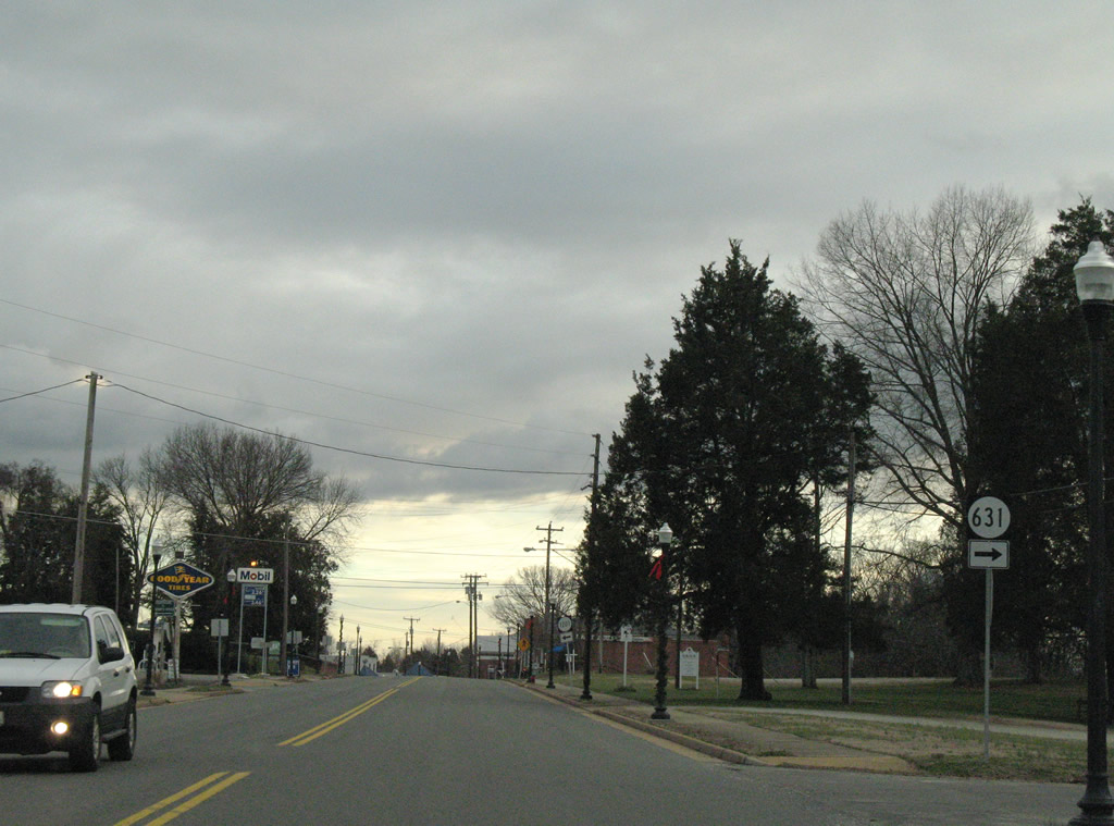
Scott Road (SR 631) spurs west from U.S. 522/SR 6 (River Road W) in Goochland.
12/26/06
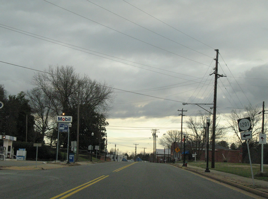
SR 1201 follows Courthouse Circle east from U.S. 522/SR 6 (River Road W) within Goochland.
12/26/06
South of Goochland at Maidens, U.S. 522 and SR 6 part ways at SR 634 (Maidens Road) north. U.S. 522 follows Maidens Road southwest to the Michaux Bridge; SR 6 straddles the James River valley eastward to Crozier and Richmond. SR 634 leads northeast to SR 632 (Fairground Road) and U.S. 250.
12/26/06
SR 6 (River Road W) east reaches Crozier in five miles. U.S. 522 (Maidens Road) continues southwest nine miles to U.S. 60 outside Powhatan.
12/26/06
South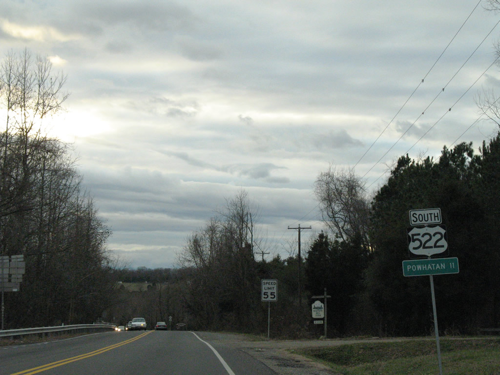
Powhatan, the county seat of Powhatan County, lies 11 miles to the south via U.S. 522 and U.S. 60 east.
12/26/06
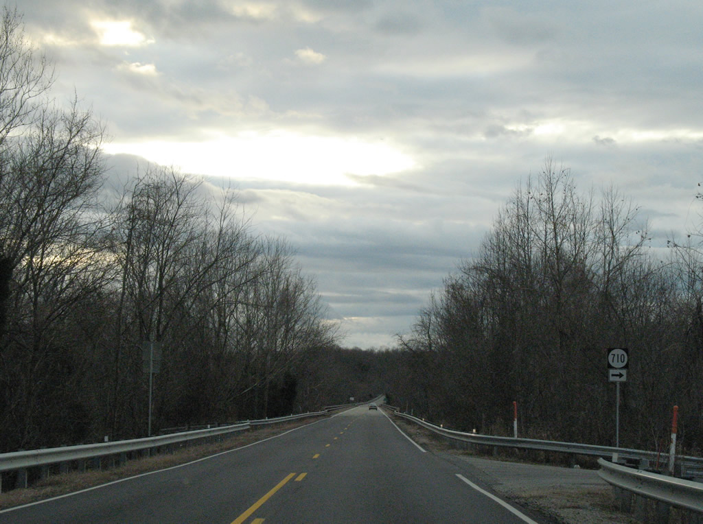
SR 710 follows Maidens Loop west of U.S. 522 to an at-grade railroad crossing that Maidens Road passes above.
12/26/06
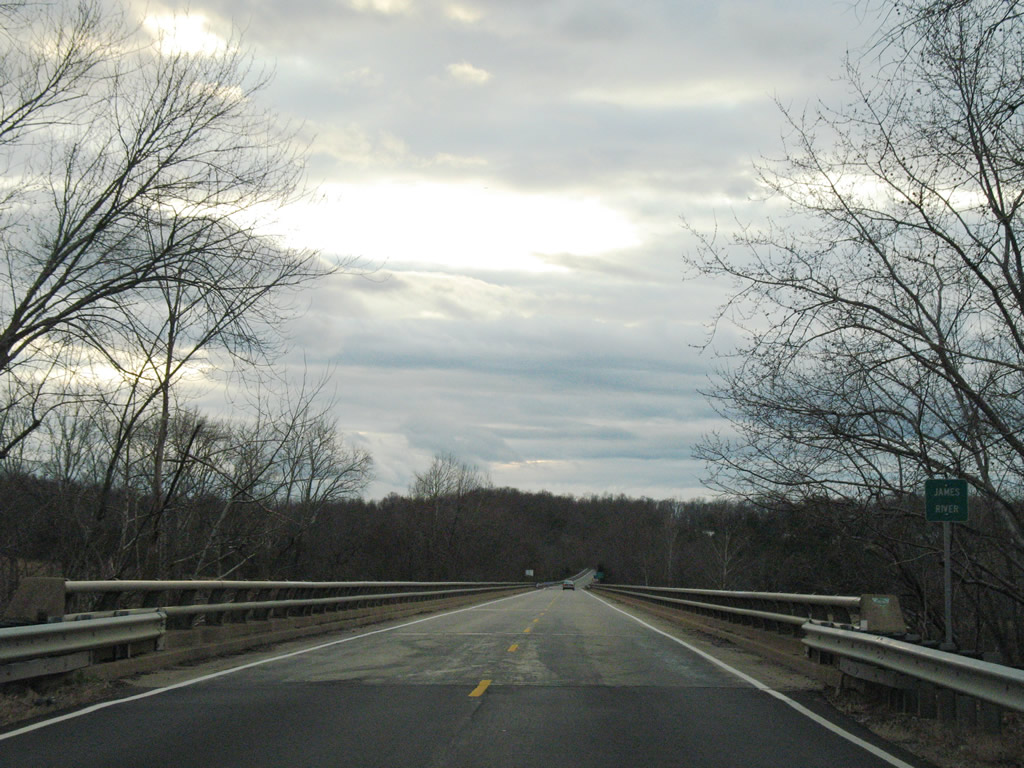
U.S. 522 crosses the James River south over the Michaux Bridge into Powhatan County. This span dates to 1972.
12/26/06
U.S. 522 (Maidens Road) continues another four miles south from SR 711 (Huguenot Trail) east at Jefferson.
12/26/06
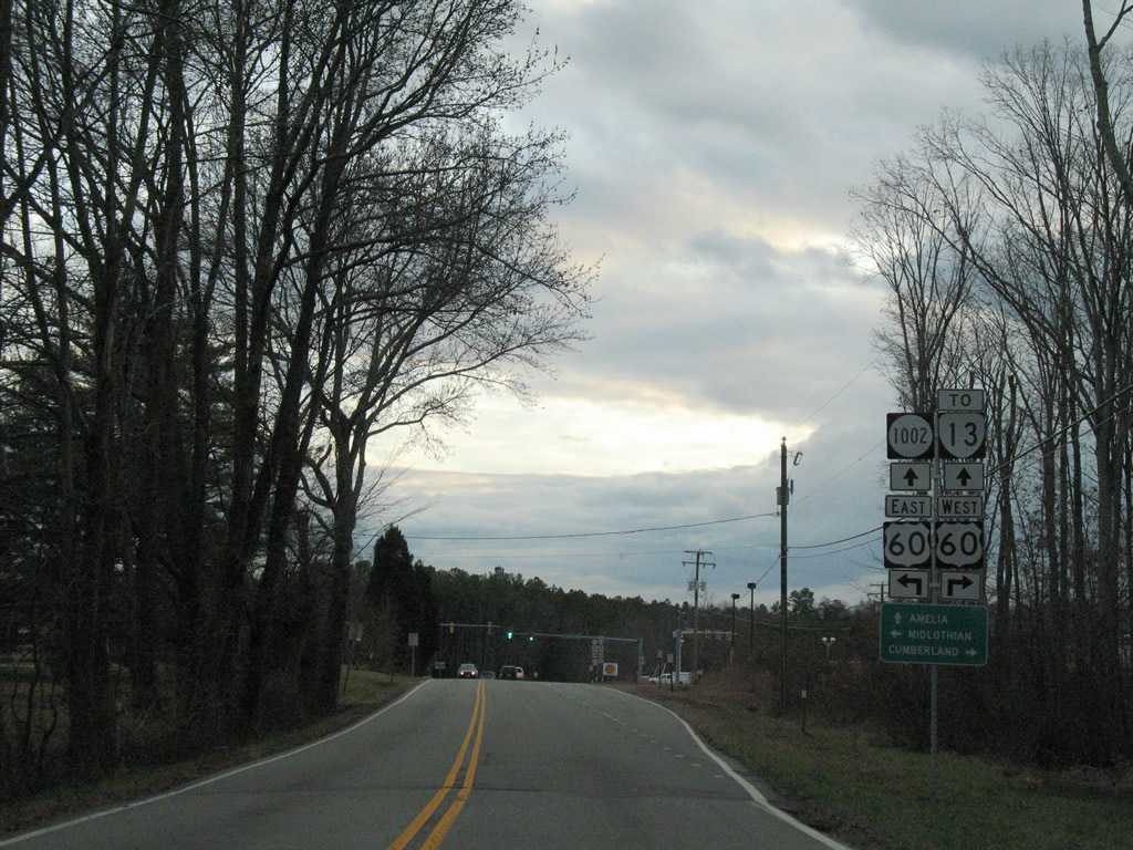
Two miles outside Powhatan, U.S. 522 ends at U.S. 60 (Anderson Highway) across from Emmanual Church Road (SR 1002)
12/26/06
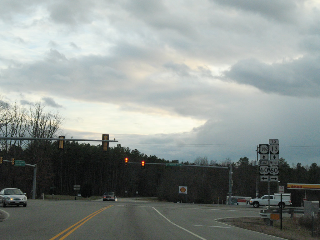
U.S. 60 (Anderson Highway) bypasses Powhatan between Cumberland and Midlothian. SR 1002 extends south from U.S. 522 (Maidens Road) to SR 13 (Old Buckingham Road). A 24.08 mile long route, SR 13 runs from the Cumberland area east to U.S. 60 at Plain View beyond Powhatan.
12/26/06
Photo Credits:
- Alex Nitzman: 12/26/06
Connect with:
Page Updated Sunday October 04, 2009.