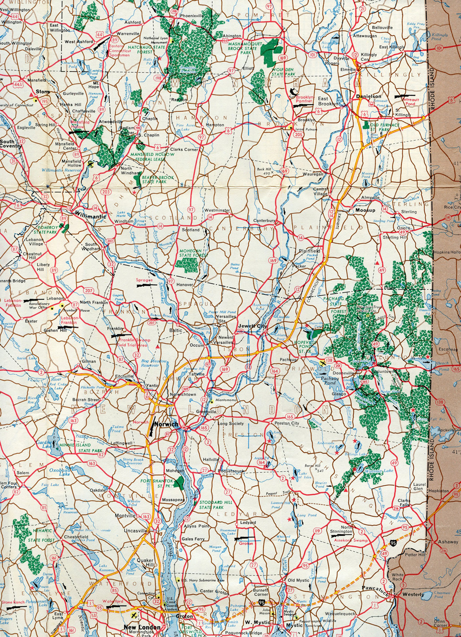
The Connecticut Turnpike extending north from I-95 at East Lyme to U.S. 6 at South Killingly on the 1962 Connecticut Official Highway Map.
Interstate 86 Eastern – added two photos of the temporary end at South Waverly, PA and replaced three photos at the future east end.
Interstate 88 New York – replaced four photos of the east end at Rotterdam and three photos at the west end near Binghamton.
Interstate 90 – replaced 2005 and 2007 photos covering the east end of I-90 (Mass Pike) in Boston, Massachusetts.
Interstate 93 – added photos of the south end from I-95 south and replaced three photos from I-93 south.
Interstate 99 – the future I-80/99 interchange is delayed again and is expected to go to bid in Fall 2023. Replaced seven photos and added two more for the northern section of I-99.
Interstate 190 Massachusetts – replaced coverage of both ends not previously covered in 2021 and added two historical map scans. Did some additional research on the history of the freeway and earlier proposals envisioned extending the route northward to Nashua, New Hampshire.
Interstate 290 Massachusetts – replaced photos from I-290 west at I-90/Mass Pike and I-395 north at I-290/90 in Auburn. Added a map scan from 1969.
Interstate 291 Connecticut – added map scans from 1976 and 1994 and replaced one photo from I-84 westbound.
Interstate 293 New Hampshire – replaced four photos and added another from 08/21/21 covering the south end from I-93 northbound.
Interstate 295 Massachusetts / Rhode Island – updated photos of both ends showing new mile based exit numbers.
Interstate 390 New York – posted complete coverage of the north end and replaced 2005 photos at the south end.
Interstate 395 Connecticut / Massachusetts – replaced photos both at the north end in Auburn and at the south end in East Lyme. Added maps from 1952 and 1968.
Interstate 481 New York – drove the bypass of Syracuse again before the eventual renumbering to I-81. Replaced photos both ends.
Interstate 490 New York – replaced two photos at the west end and added/replaced five photos at the east end.
Interstate 590 New York – updated entire coverage of both ends and added a map scan from 1968.
Interstate 684 Connecticut / New York – replaced photos covering the south end from Hutchinson River Parkway and added a map scan from 1969.
Interstate 690 New York – updated coverage of both ends and added two map scans.
Interstate 790 New York – replaced two photos and added another of the west end in Utica. Added a map scan from 1965.
Interstate 890 New York – replaced four photos at the east end and eight photos at the west end. Added a map scan from 1965.
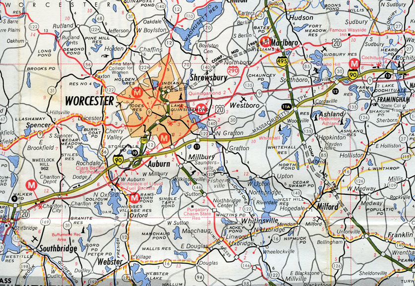
Interstate 290 partially complete from the Mass Pike north to Worcester in 1969.