

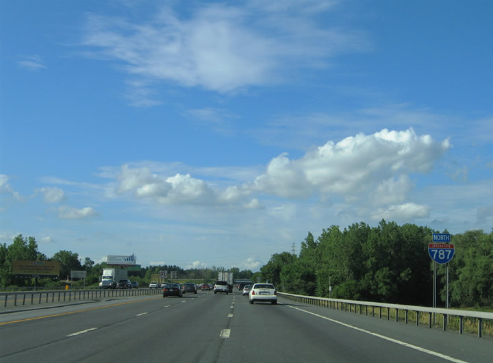
Interstate 787 Northbound
06/28/05 photos taken by Alex Nitzman & Carter Buchanan. 08/04/07 photos taken by AARoads. Special thanks goes to Jack Thomas for help with photo captions.
| Interstate 787 North | |
|---|---|
 |
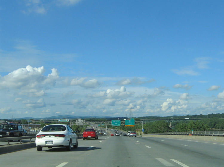
Interstate 787 northbound begins as two freeway prongs. The first prong departs Exit 23 of the New York Thruway mainline (Interstate 87). The second prong directly ties into U.S. 9W (Southern Boulevard) in south Albany. Pictured here is the first northbound reassurance marker posted on the freeway connection with U.S. 9W. Ahead is a wye interchange with the New York Thruway connector. Photo taken 06/28/05. |
 |
Curving eastbound on the U.S. 9W connector, Interstate 787 passes underneath Southern Boulevard (U.S. 9W). A three-quarter diamond-interchange joins U.S. 9W with the Interstate 787 connector to Interstate 87 (New York Thruway). Photo taken 06/28/05. |
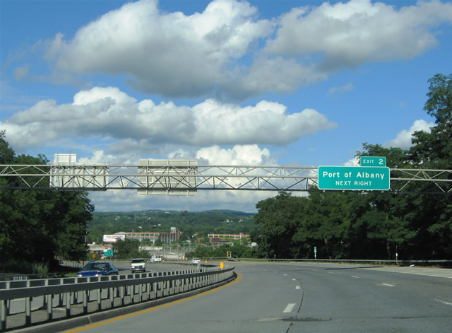 |
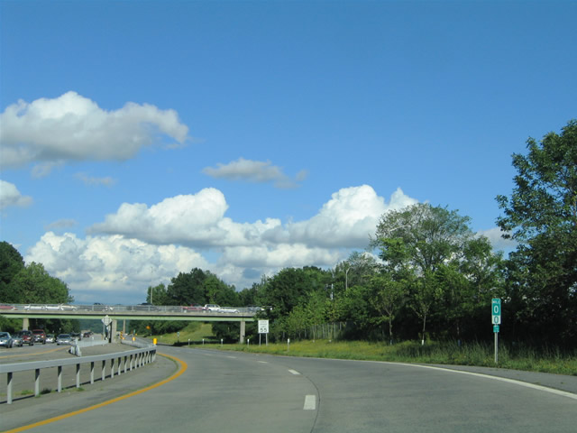
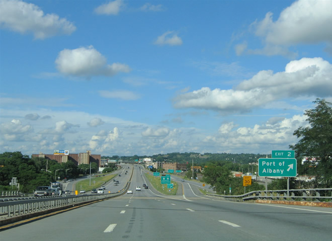
Three lanes of Interstate 787 northbound descend toward the Port of Albany (Exit 2). A set of slip ramps join Interstate 787 with the parallel New York 32 frontage roads between Pearl and Green Streets at the Port itself. Photo taken 06/28/05. |
 |
Turning Northeast, travelers get a grand view of downtown to the left, and the Kenwood Railroad Yards to the right. Exit 2 departs Interstate 787 northbound onto the adjacent New York 32 northbound. New York 32 intersects Green Street and Broadway near the entrance to the Port of Albany. Photo taken 06/28/05. |
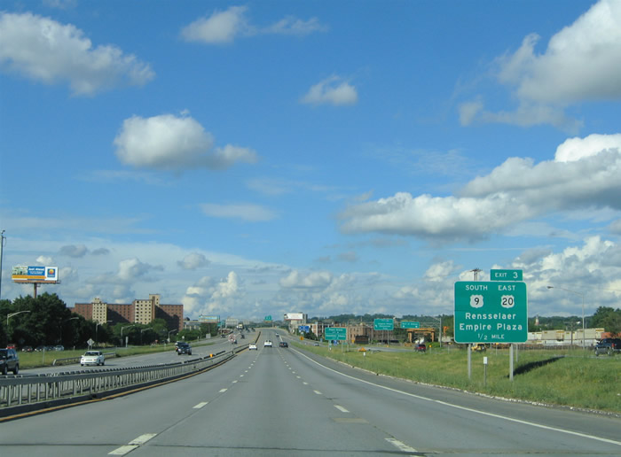 |
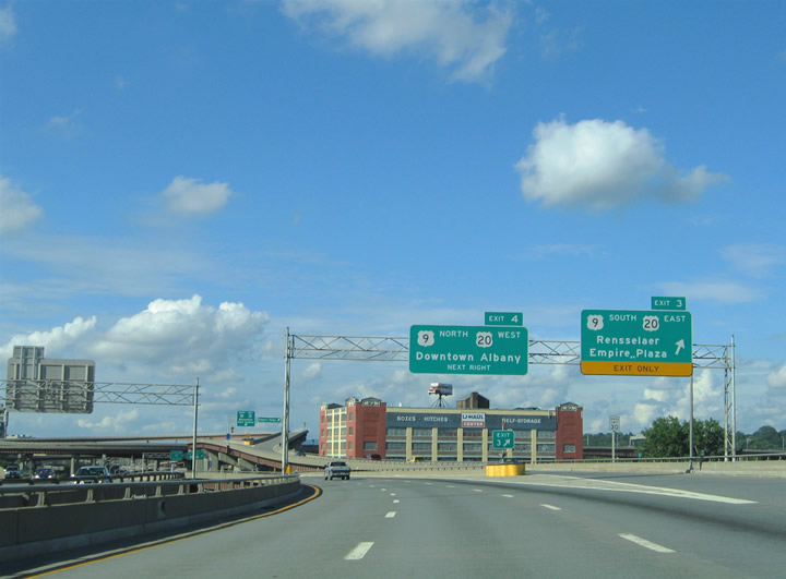
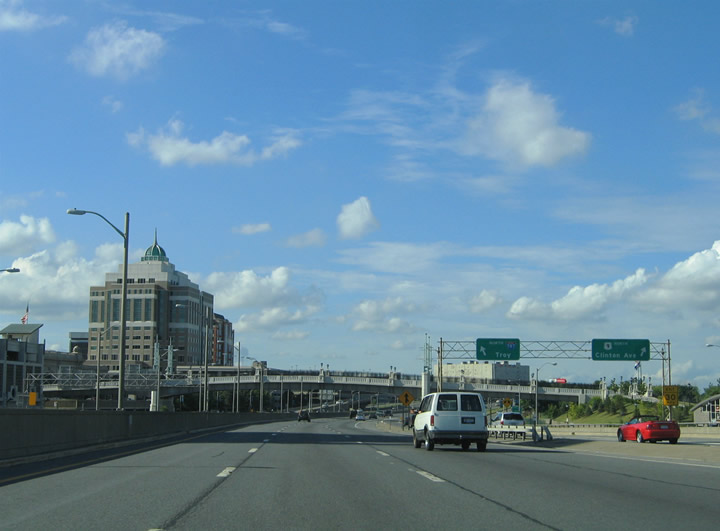
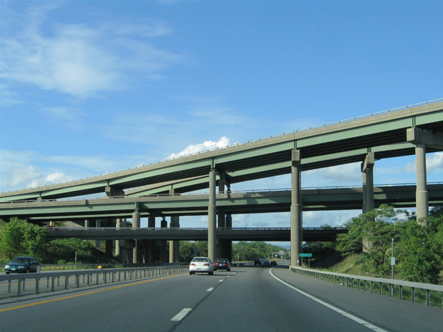
Next in line for Interstate 787 northbound motorists is the circle stack interchange with U.S. 9 & 20 for the Empire State Plaza and Rensselaer. Photo taken 06/28/05. |
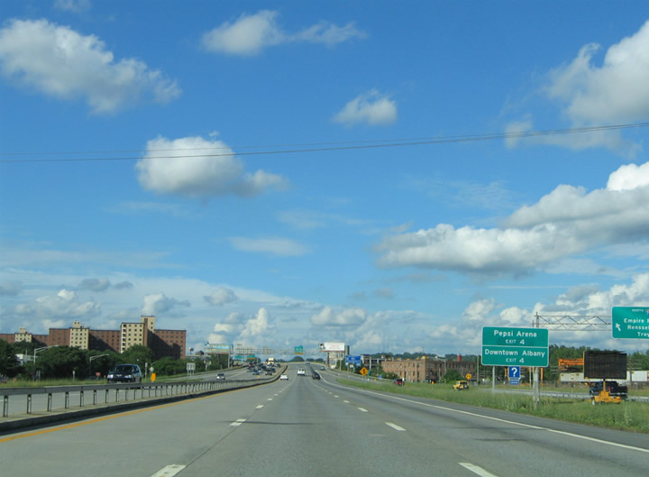 |
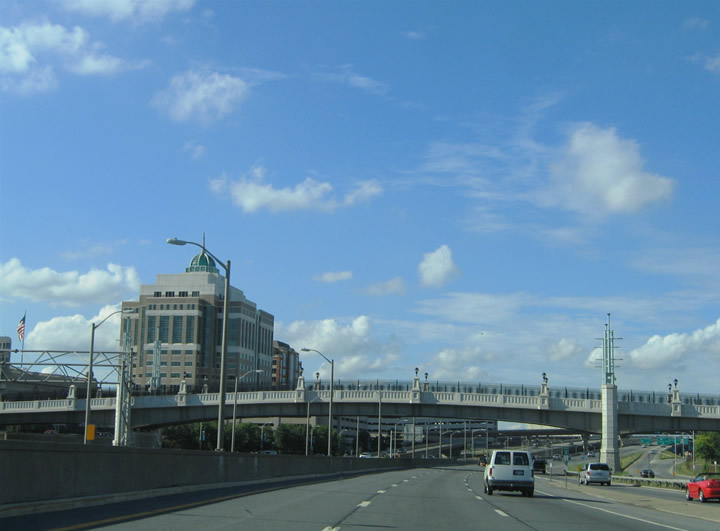
Exit 3A provides a direct connection to downtown Albany via U.S. 9 north & U.S. 20 westbound. Situated within the central business district is Pepsi Arena, a sports and entertainment facility for the Capital District. The Pepsi Arena was originally named the Knickerbocker Arena. Photo taken 06/28/05. |
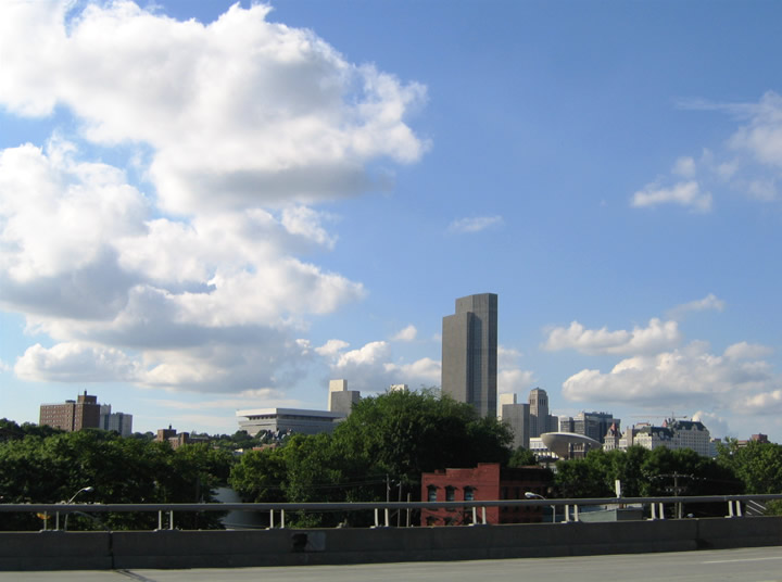 |
A view of the Empire State Plaza, a vast office complex for the New York State government that was built from 1963 to 1978. The tallest building in the complex, the Corning Tower, is the tallest building in the state outside of New York City. Photo taken 06/28/05. |
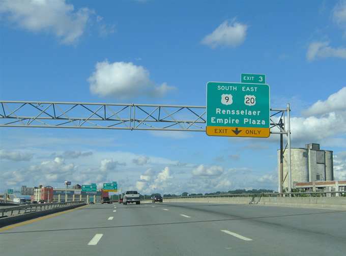 |
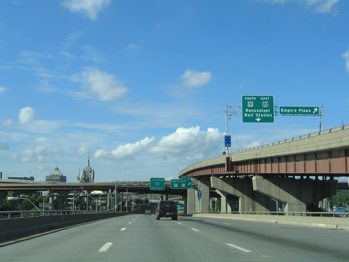
Interstate 787 elevates over the Delaware and Hudson Railway and New York 32 (Green Street). The right-hand lane defaults into the circle stack for U.S. 9 south & 20 east to Rensselaer. The two routes share eight miles of pavement between downtown Albany and Schodack Center. Photo taken 06/28/05. |
 |
Exit 3 departs Interstate 787 northbound for U.S. 9 south & U.S. 20 east across the Dunn Memorial Bridge to Rensselaer. The exit splits with a westbound ramp to the Empire State Plaza. The Empire State Plaza ramp partially collapsed due to structural failure in July of 2005 and has since been repaired. Photo taken 06/28/05. |
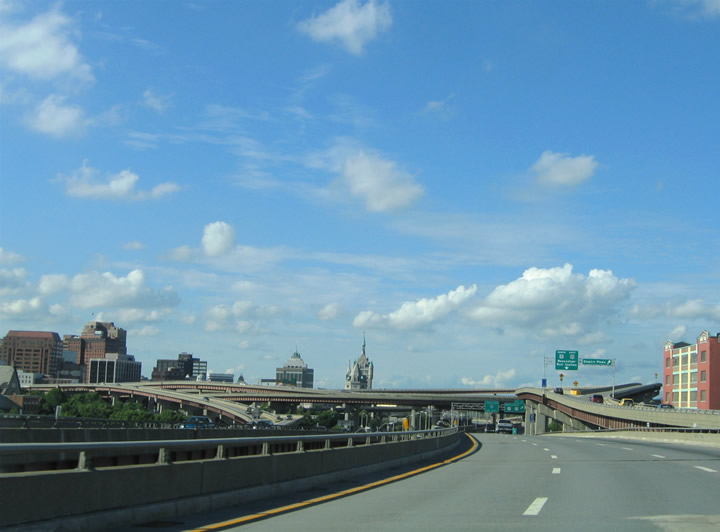 |
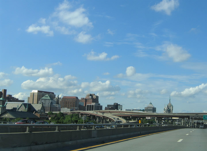
Northbound views of Downtown Albany in the distance as well as the upcoming circle stack interchange for Interstate 787 and the South Mall Expressway (Exit 3). The Northbound and Southbound lanes are separated here due to the D&H Railroad tracks running in the median of the interstate. Photos taken 06/28/05. |
 |
|
 |
A view of the upcoming circle stack interchange as well as the aforementioned ramp that partially collapsed in July 2005, a little over a week after these pictures were taken. Photo taken 06/28/05. |
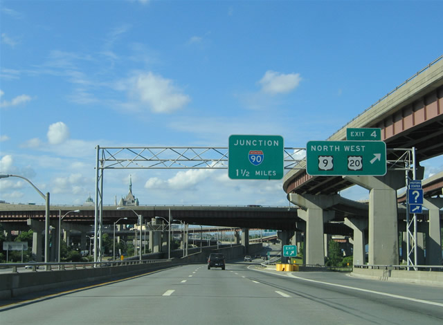 |
Exit 4 departs Interstate 787 northbound for U.S. 9 north (Clinton Avenue) to U.S. 20 (Madison Avenue) west. The South Mall Expressway off-ramp from Exit 3 does not provide access to the U.S. 20 westbound turn-off onto South Pearl Street for Madison Street. U.S. 20 follows Western Avenue to Westmere from Albany. U.S. 9 follows Loudonville Road northward from Albany to Menands. Photo taken 06/28/05. |
 |
Here we pass under the brunt of the circle stack interchange, the only one like it in New York State. Photo taken 06/28/05. |
 |
Passing underneath the South Mall Expressway, the arterial that Exit 3 serves. This highway had much greater plans than what we have today. It was supposed to connect to Interstate 90 at present-day Exit 8 (That's the reason traffic is "forced off" the Dunn Memorial Bridge (SM Expressway)). At its western end, it would've ended at another now defunct highway project, the Mid - Crosstown Arterial, running from the NY Thruway to Interstate 90 Exit 6. That is the reason why only the two outer portals of the four portal tunnel under the Empire State Plaza are used, and why the arterial mainline curves back toward Interstate 787 from underneath the Empire State Plaza complex. Photo taken 06/28/05. |
 |
Ascending from the South Mall Expressway (Exit 3) interchange on Interstate 787 northbound. Pictured above is the Exit 4 split between ramps to U.S. 9 (Clinton Avenue) north, return access to Interstate 787 north (for traffic emanating from the Dunn Memorial Bridge), and adjacent Erastus Corning Riverfront Park. Photo taken 06/28/05. |
 |
Interstate 787 northbound adjacent to Erastus Corning Riverfront Park and the Exit 3 split between U.S. 9 (Clinton Avenue) northbound and the Dunn Memorial Bridge on-ramp. Photo taken 06/28/05. |
 |
A view of the Hudson River Way Pedestrian Bridge, completed in 2002, that connects downtown to the Corning Preserve. The New York State Department of Environmental Protection headquarters is in the background. Photo taken 06/28/05. |
 |
The D&H tracks still serve as a median for Interstate 787, while the north and southbound lanes of U.S. 9 serve as collector/distributor roadways for the freeway. A second on-ramp carries motorists onto the roadway from the nearby Erastus Corning Riverfront Park. Photo taken 06/28/05. |
 |
Continuing northbound at the U.S. 9 (Clinton Avenue) southbound flyover to Interstate 787. Exit 4B of Interstate 787 southbound directly serves Clinton Avenue west. Otherwise Interstate 787 meets Interstate 90 (Exit 5) within one half mile. Photo taken 06/28/05. |
 |
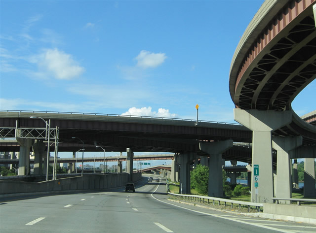
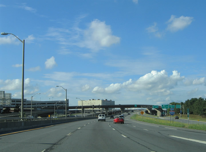
The D&H tracks veer westward from the freeway mainline as Interstate 787 descends toward Interstate 90 (Exit 5). In the background is the Patroon Island Bridge of Interstate 90 over the Hudson River. Photo taken 06/28/05. |
 |
A two-lane off-ramp claims one of the three northbound lanes of Interstate 787 for Exit 5 (Interstate 90). Interstate 90 loops north of Albany between the New York Thruway mainline (Interstate 87) at Colonie and the Berkshire Section of the New York Thruway near Nassau. Photo taken 06/28/05. |
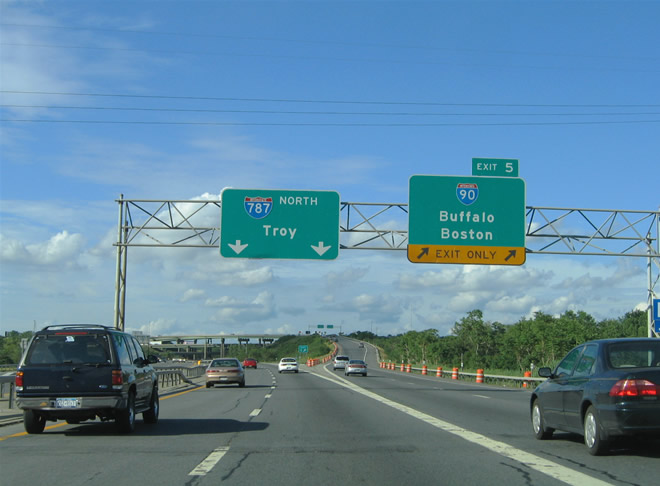 |
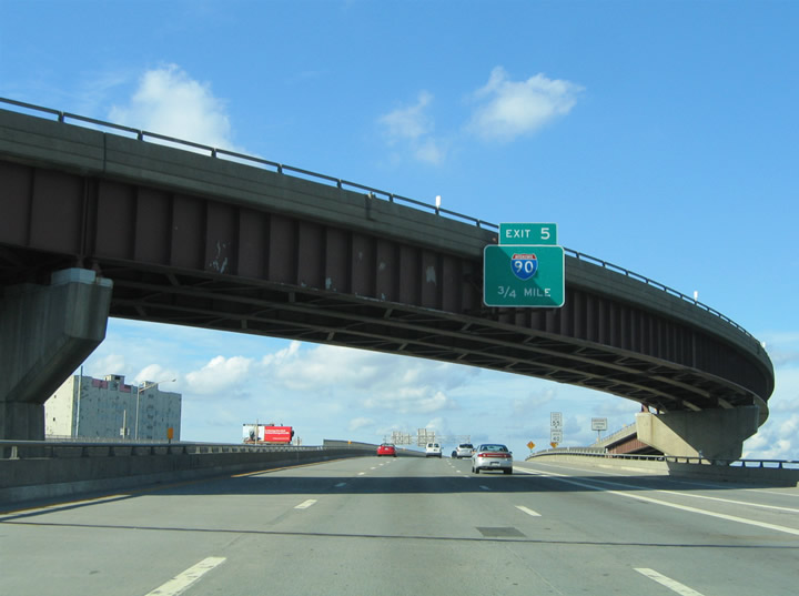
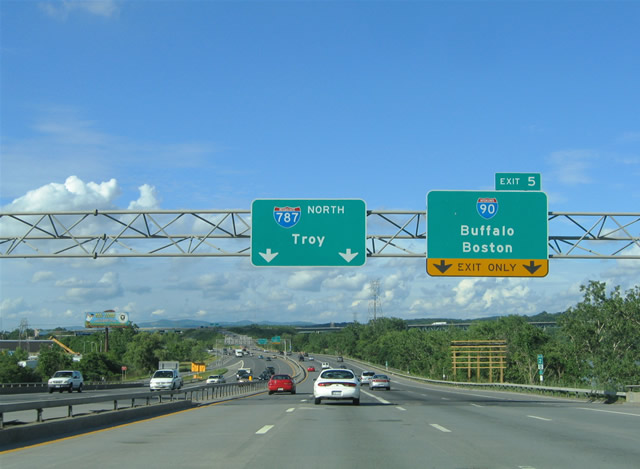
Exit 5 departs Interstate 787 northbound to both directions of Interstate 90. Interstate 90 follows the New York Thruway mainline west from Albany to Schenectady, Utica, Syracuse, Rochester, and Buffalo. Travelers headed south join the Berkshire Section of the New York Thruway in 14 miles. From there Interstate 90 heads east into Massachusetts where it becomes the Mass Pike mainline en route to Springfield, Worcester, and Boston. Photo taken 06/28/05. |
 |
 |
 |
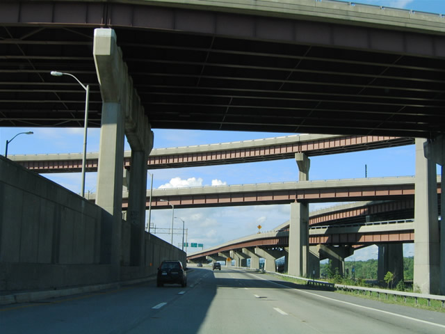
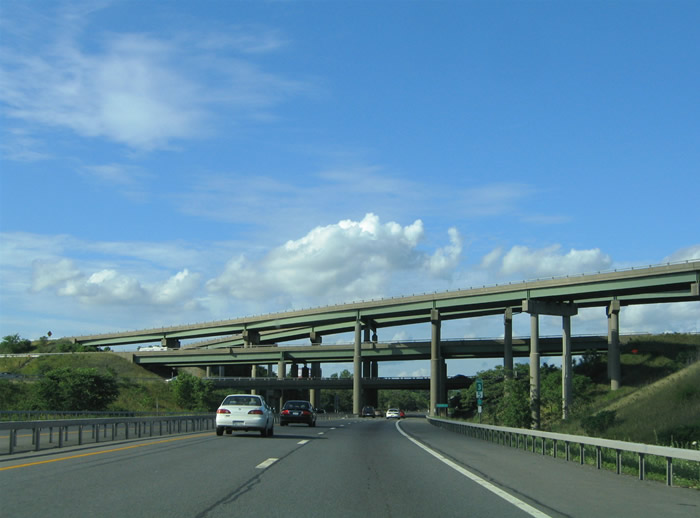
A four level stack interchange facilitates the movements between Interstates 787 and 90 in north Albany. This is one of three such interchanges within New York State. There is one just to the west on Interstate 90 at Exit 6, and one on Interstate 295 at the Grand Central Parkway in Queens. Photos taken 06/28/05. |
 |
Continuing northward along Interstate 787 toward the Exit 6 trumpet interchange with New York 32 (Broadway) near Menands. New York 32 travels north-south parallel to Interstate 787 to the west. Menands resides along U.S. 9 (Loudon Road) and New York 377 (Van Rensselaer Boulevard) west of Broadway. Photo taken 06/28/05. |
 |
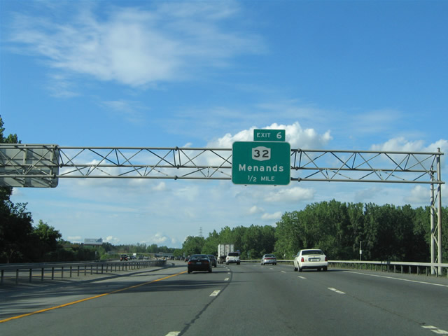
Northbound reassurance marker posted ahead of the Exit 6 off-ramp to New York 32 (Broadway). The freeway resumes with six lanes through to Exits 9E/W (New York 7). Photo taken 06/28/05. |
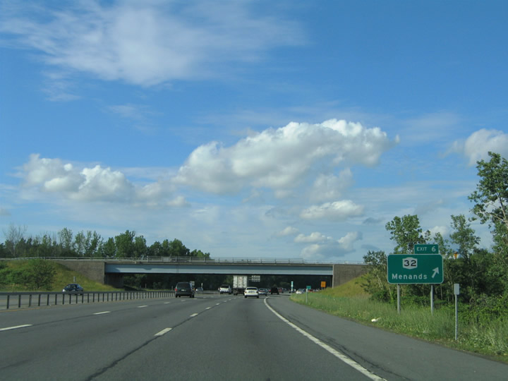 |
Exit 6 leaves Interstate 787 northbound for New York 32 (Broadway). The trumpet interchange joins the freeway with an access road to Broadway near its intersection with Wards Lane. Use Wards Lanes west to New York 377 (Van Rensselaer Boulevard). Photo taken 06/28/05. |
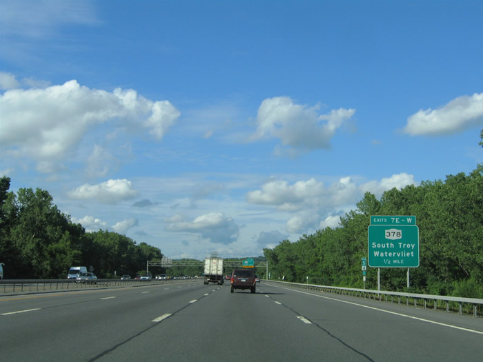 |
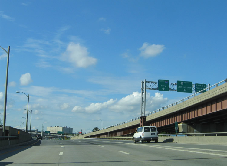
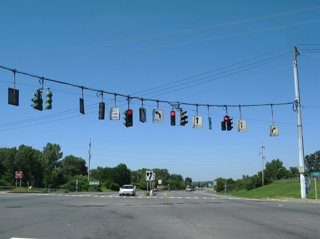
Advance signage for Exit 7E-W for Route 378 for South Troy and Menands. Northbound signage is newer than the southbound signage, as it is from a 2003 reconstruction project. Photo taken 06/28/05. |
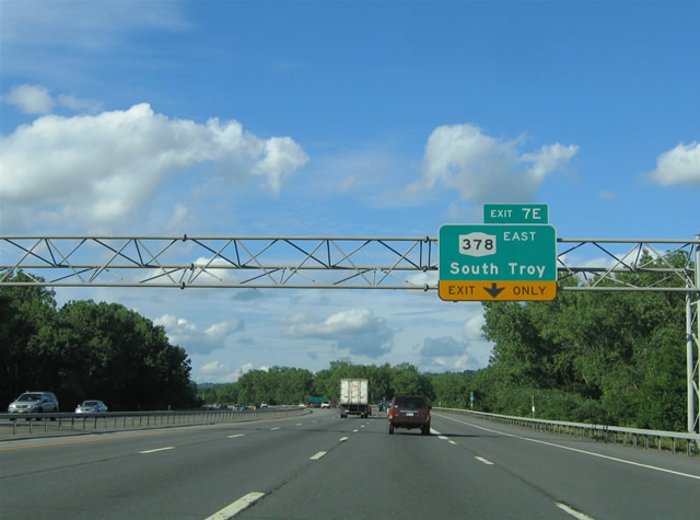 |
Motorists merging onto Interstate 787 northbound from Exit 6 form the exit-only lane for Exit 7E (New York 378 east). New York 378 travels along Menands Road between U.S. 9 (Loudon Road) and U.S. 4 (Mill Street) in south Troy. Photo taken 06/28/05. |
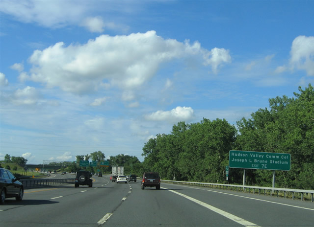 |
Exit 7E provides direct access to the Hudson Valley Community College and Joseph L. Bruno Stadium via U.S. 4 South. Bruno Stadium, named after Senator Joseph Bruno, the politician responsibile with securing funds for the 4,500-seat stadium, is home to the Tri-City Valley Cats. The Valley Cats are a minor league franchise in the New York-Penn League. Photo taken 06/28/05. |
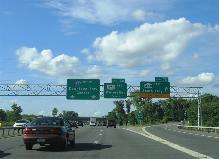 |
Interstate 787 northbound at the Exit 7E off-ramp to New York 378 (Menands Road) eastbound. New York 378 ends one mile to the east at the High Street intersection with U.S. 4 (Mill Street / Burden Avenue). Pull-through signs posted at Exits 7E/W reflect Downtown Troy and Cohoes for Interstate 787 north. It is ironic that Interstate 787 has Downtown Troy for a control point, seeing as how all signage (except on New York 7 westbound) that points to I-787 traveling across the Hudson River on New York 7 at Exit 9 has been removed. Photo taken 06/28/05. |
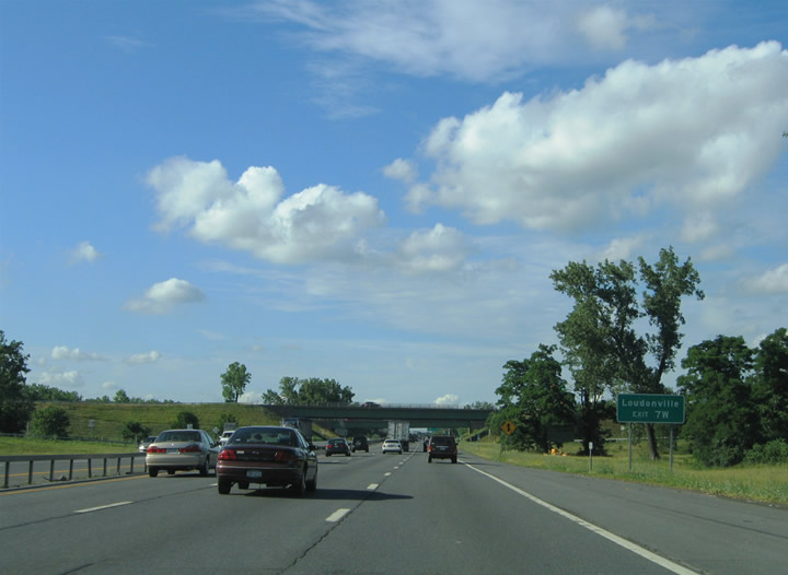 |
Access to the Albany suburb of Loudonville is provided by Exit 7W (New York 378 west to U.S. 9). Photo taken 06/28/05. |
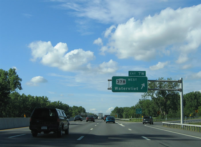 |
Northbound at the Exit 7W loop ramp to New York 378 (Menands Road) westbound. New York 378 interchanges with New York 32 (Broadway) nearby on the 2.75-mile drive to U.S. 9 (Loudon Road) and New York 152 (Old Niskayuna Road). Photo taken 06/28/05. |
 |
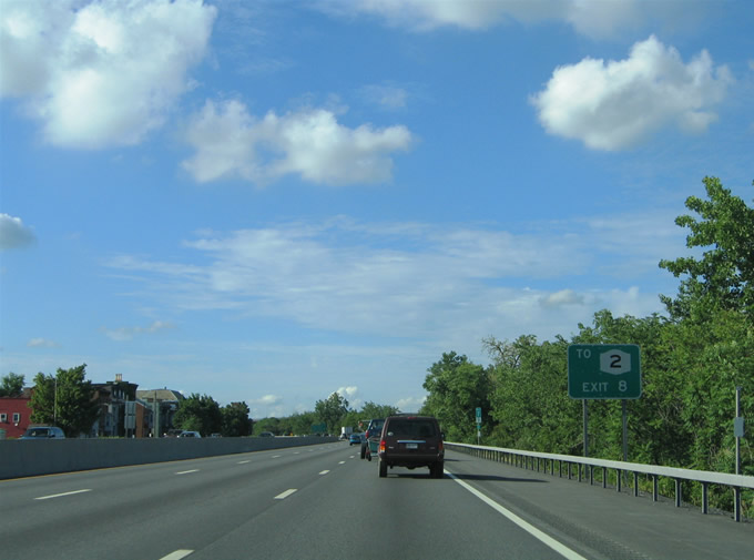
Exit 8 is for Watervaliet and Green Island, two suburb cities of Albany. Troy itself is a suburb city of Albany, being part of the Capital District. Schenectady and Saratoga Springs also fall under that category. Photo taken 06/28/05. |
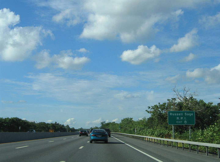 |
Direct access to Downtown Troy, Russell Sage College, and Rensselaer Polytechnic Institute (RPI) is provided by Exit 8 via New York 2 (Ferry Street) eastbound. Photo taken 06/28/05. |
 |
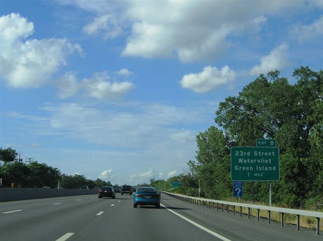
Exit 8 joins Interstate 787 with 23rd Street at Watervliet near New York 2 (19th Street / Troy-Watervliet Bridge). New York 2 spans the Hudson River between downtowns of both Troy and Watervliet. The state route is accessible from Exit 8 via New York 32 (2nd Avenue). Photo taken 06/28/05. |
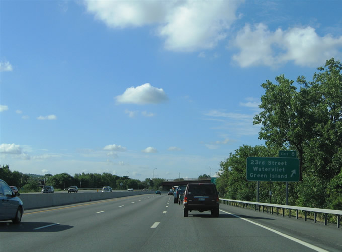 |
A diamond interchange joins Interstate 787 with 23rd Street in Watervliet. 23rd Street (Exit 8) links the freeway with Lower Hudson Avenue to the east and Broadway, New York 32 (2nd Avenue), and 5th Avenue to the west. Use Lower Hudson Avenue north for the Troy-Green Island Bridge. Green Island lies within Hudson River. Photo taken 06/28/05. |
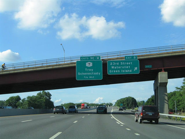 |
New York 2 (Troy-Watervliet Bridge) passes over Interstate 787 ahead of the Exit 8 off-ramp to 23rd Street. Attached to the overpass is the 0.75-mile guide sign for New York 7 (Exits 9E/W). Exit 9E provides access to Troy and Bennington, Vermont, while Exit 9W provides access to Interstate 87, Latham, and Schenectady. Photo taken 06/28/05. |
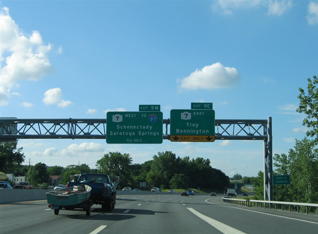 |
The right-hand lanes of Interstate 787 northbound default onto New York 7 (Exit 9E) eastbound north of 23rd Street (Exit 8). The New York 7 freeway between Interstate 87 and Troy was originally planned to be included in an extension of Interstate 88 from Schenectady to Portsmouth, New Hampshire. However, those plans were cancelled, and this portion of highway as well as the Crosstown Connection in Schenectady are the only results of those original plans still evident in the area. Other portions of the planned highway exist in Bennington, Vermont, and in Manchester to Portsmouth, New Hampshire along Route 101 and Interstate 293. Photo taken 06/28/05. |
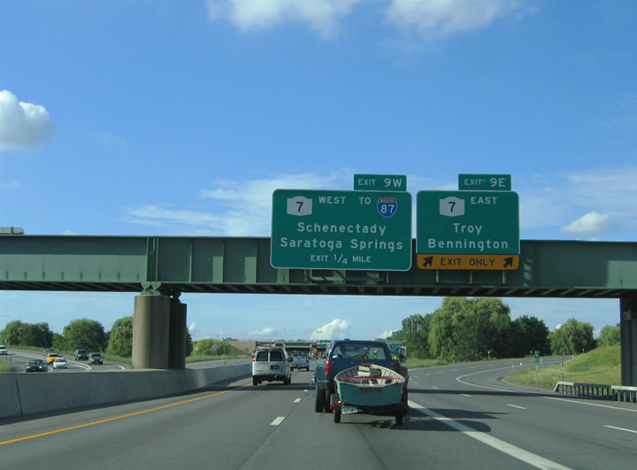 |
Traffic to New York 7 (Collar City Bridge) eastbound departs Interstate 787 northbound via Exit 9E. A directional-cloverleaf interchange handles the movements between the two freeways. Signage posted here originally directed the Interstate 787 mainline across the Hudson River along New York 7 Eastbound. All vestiages of this signing however were removed. Photo taken 06/28/05. |
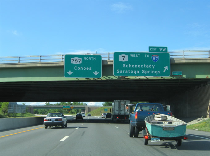 |
Interstate 787 ends and New York 787 begins at the Exit 9W loop ramp to New York 7 west. New York 7 provides a direct connection to Interstate 87 (Adirondack Northway) 3.5 miles to the west. There are no other off-ramps along the freeway between Interstates 787 and 87. Photo taken 06/28/05. |
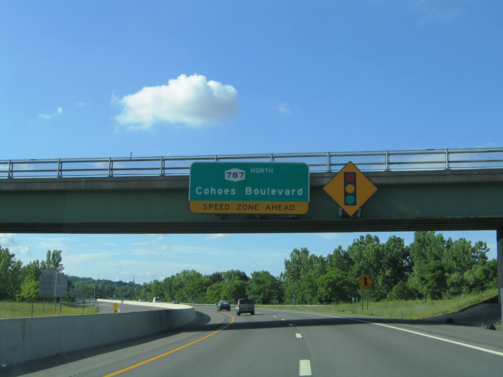 |
New York 787 northbound at the directional ramp from New York 7 west to Interstate 787 south. New York 787 is shown as Cohoes Boulevard on the pull-through panel. However Jack Thomas reports that the designation is rather obscure otherwise. Photo taken 06/28/05. |
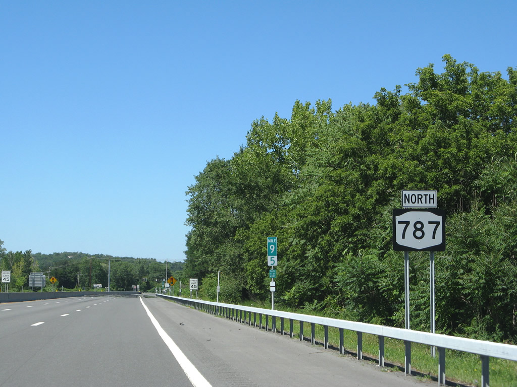 |
New York 787 northbound reassurance marker posted at the merge of the New York 7 westbound on-ramp. New York 787 (Cohoes Boulevard) constitutes a four-lane divided highway between Interstate 787 & New York 7 and downtown Cohoes. Photo taken 08/04/07. |
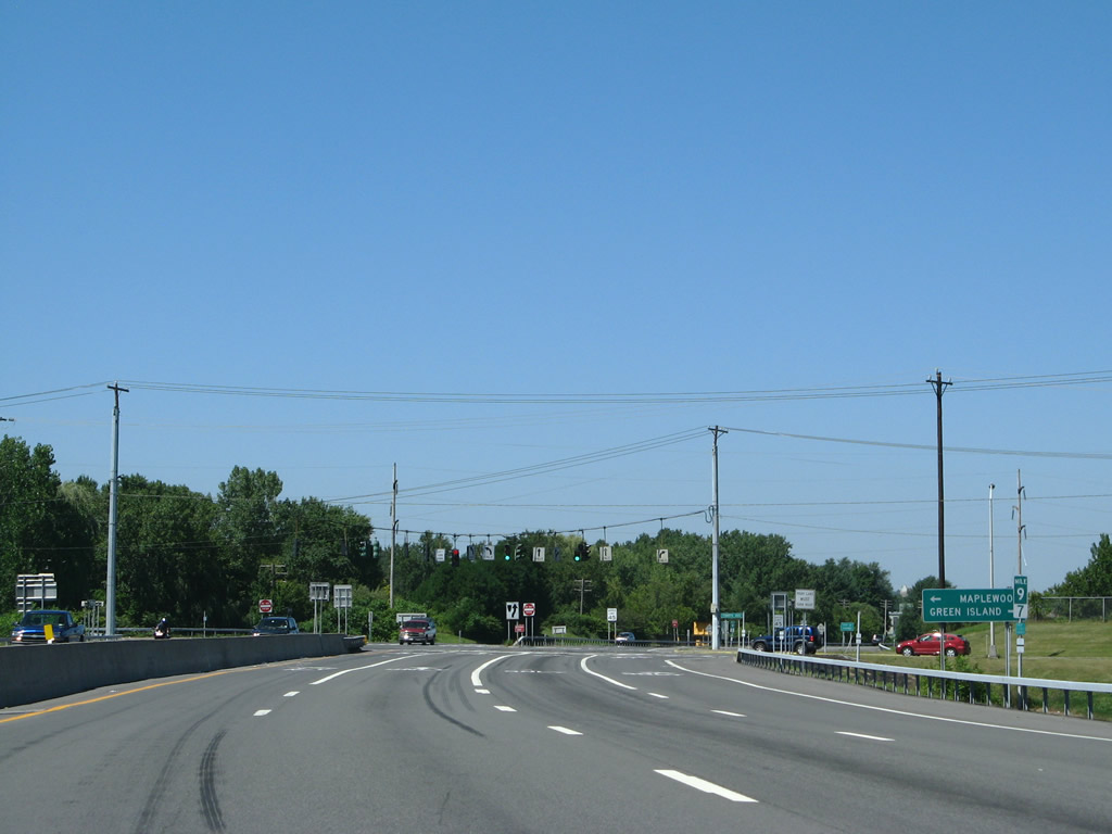 |
New York 787 intersects Tibbetts Avenue at a signalized intersection one half mile north of New York 7. Tibetts Avenue travels east-west between New York 32 (Cohoes Road) and Delaware Avenue in north Watervliet. Photo taken 08/04/07. |
 |
Tibbetts Avenue connects New York 787 with the Green Island community to the east and with Maplewood to the west. Photo taken 08/04/07. |
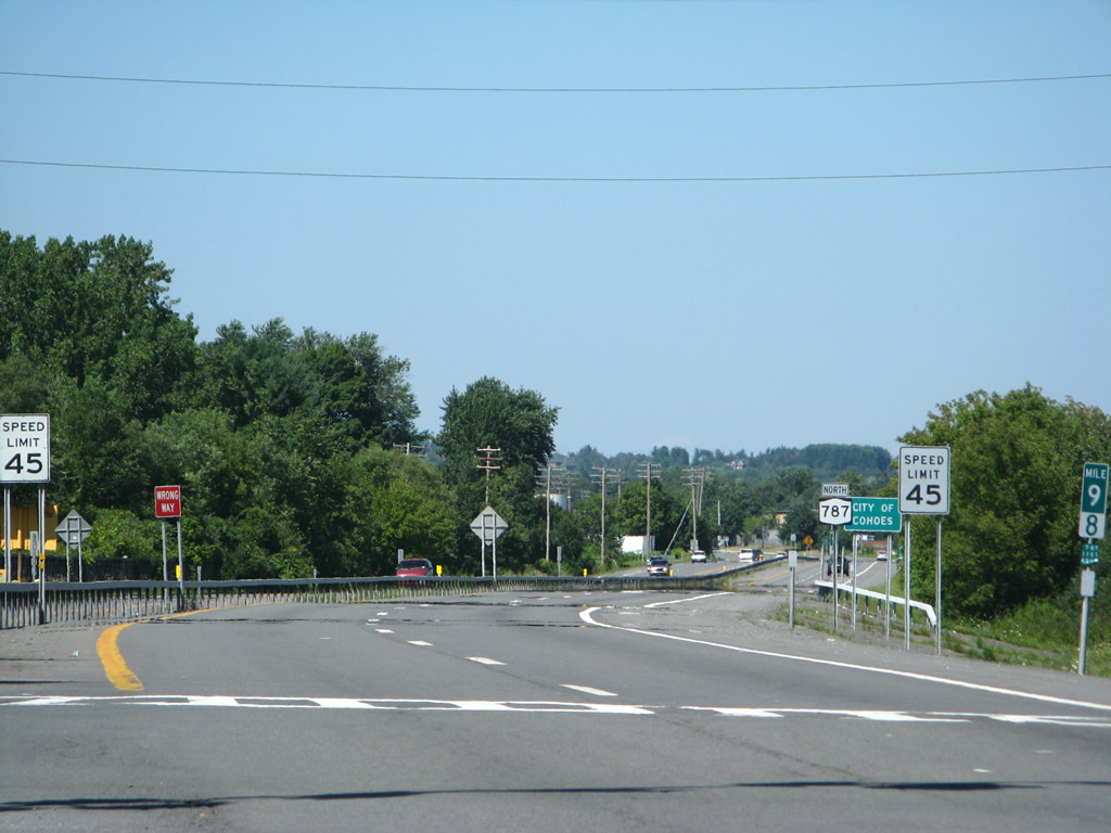 |
New York 787 continues north from Tibbetts Avenue as a controlled-access expressway into the city of Cohoes. The state route ends at New York 32 (Saratoga Street) ahead of its crossing of the Mohawk River. Downtown Cohoes lies 1.5 miles ahead. Photo taken 08/04/07. |
Page Updated September 1, 2009.
|
About Contact Glossary |
In The News Interstate Guide |
Social Media:
 |
|
© 2000-25 AARoads.com | All Rights Reserved | Privacy Policy / Terms of Use
|
||