05/09/05 photos taken by Alex Nitzman. 08/04/07 photos taken by AARoads.
| New York 5 East |
|
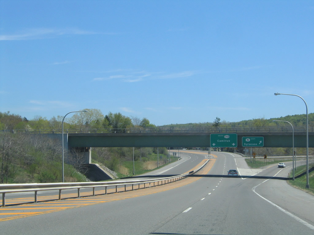
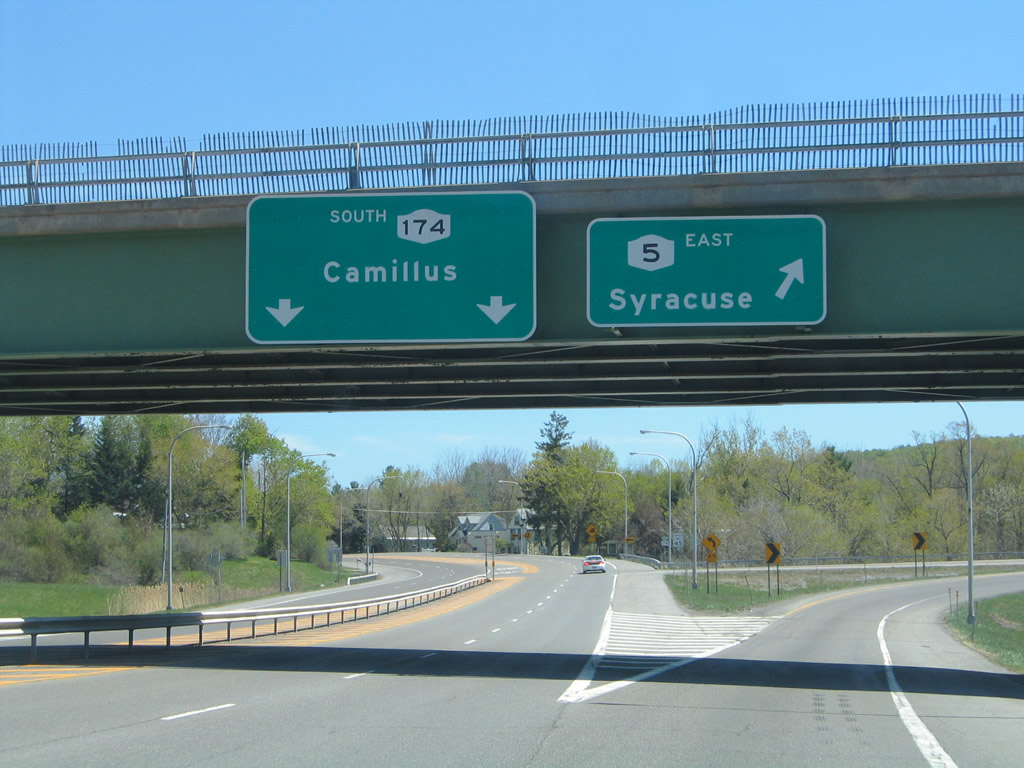
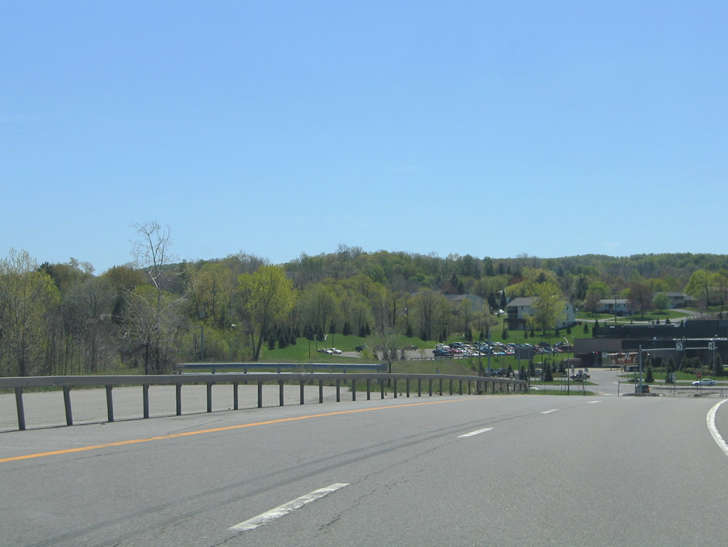
Entering the junction with New York 5's freeway bypass of Camillus. Intended as a parclo interchange, only the westbound off-ramp and eastbound loop ramp were constructed. Photo taken 05/09/05. |
|
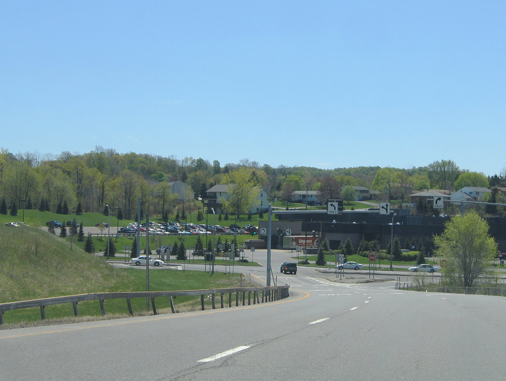
New York 5 turns north onto a freeway to bypass both Camillus and Fairmount. New York 174 begins and follows old New York 5 (Main Street) to its southward turn onto Elm Street in Camillus. The state route travels south from there to Marcellus. Photo taken 05/09/05. |
|
The loop ramp forms the eastbound freeway mainline at a roadway stub; a grassy area remains to the left for the unconstructed westbound carriageway. Photo taken 05/09/05. |
|
Eastbound reassurance shield posted for New York 5 as the freeway leaves New York 174. A roadway stub remains in the opposite direction. Photo taken 05/09/05. |
|
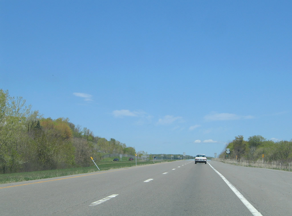
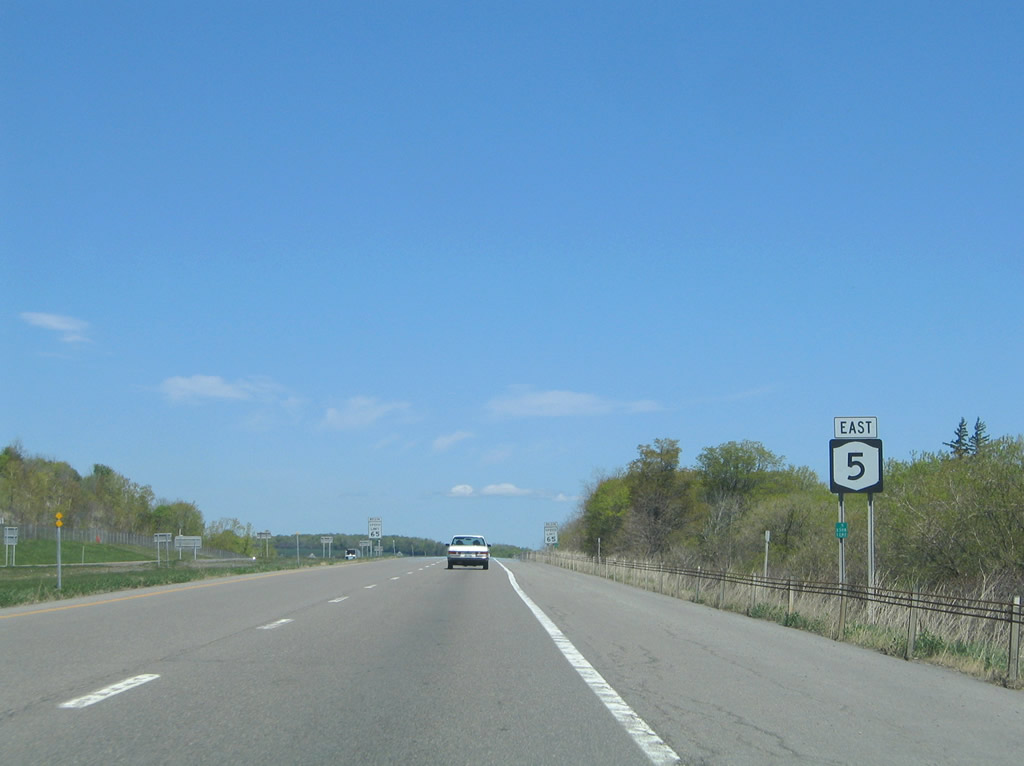
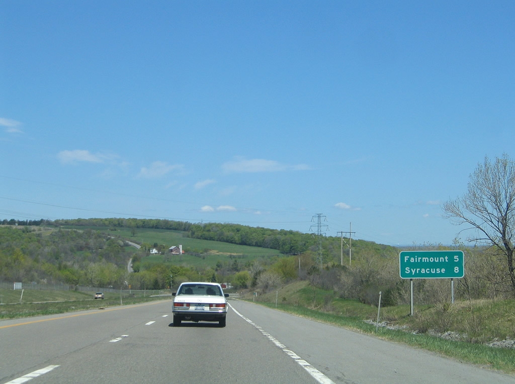
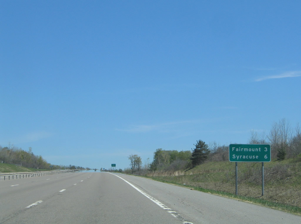
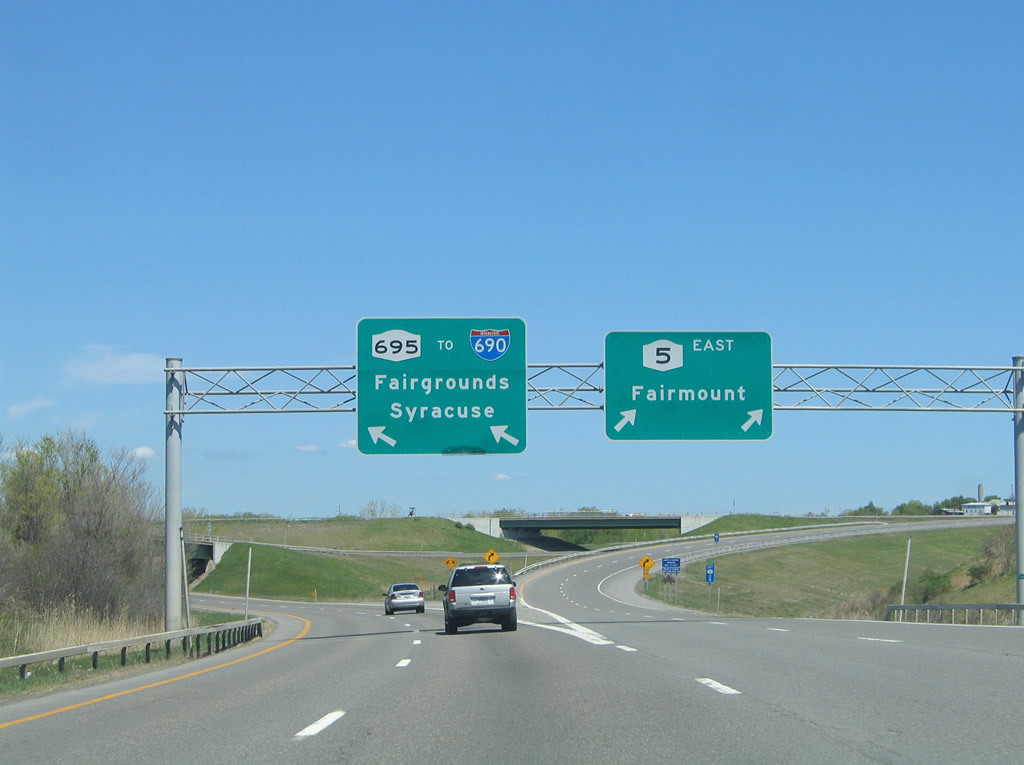
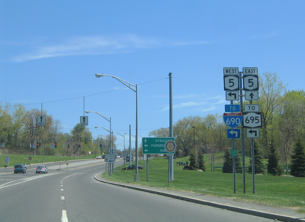
New York 5 continues five miles east on the freeway to Fairmount; Syracuse is an eight mile drive via New York 695 north to Interstate 690 east. Photo taken 05/09/05. |
|
The freeway expands to six overall lanes from the Newport Road half-diamond interchange eastward. Photo taken 05/09/05. |
|
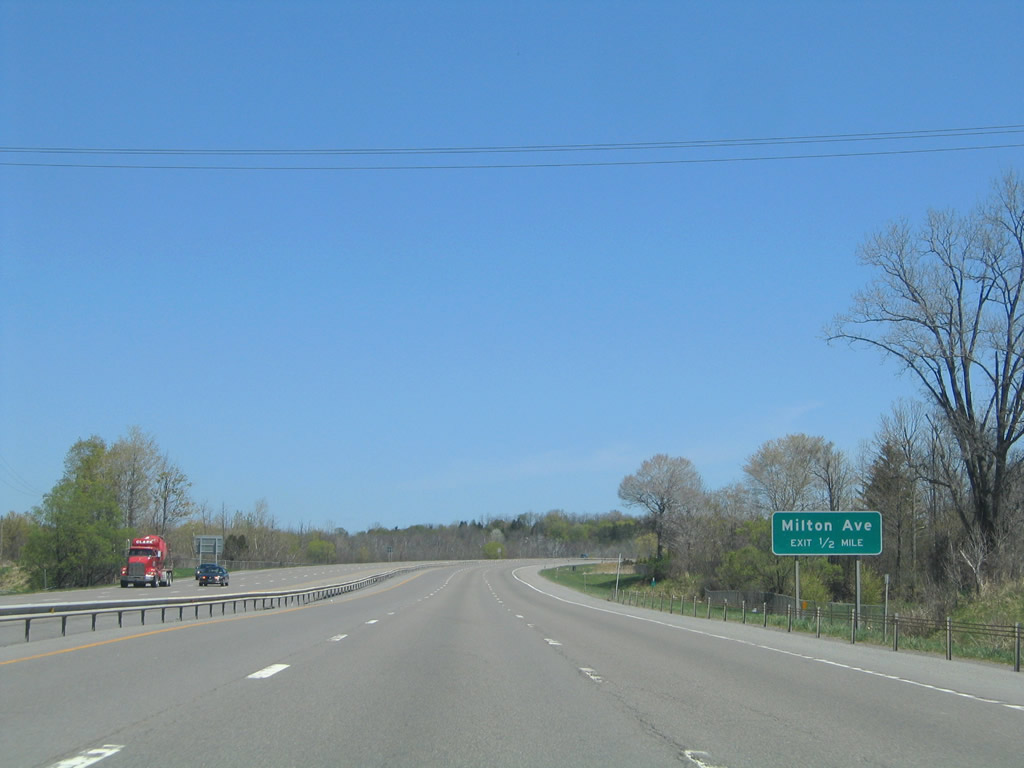
One half mile west of the half-diamond interchange with Milton Avenue and Bennett Road. Photo taken 05/09/05. |
|
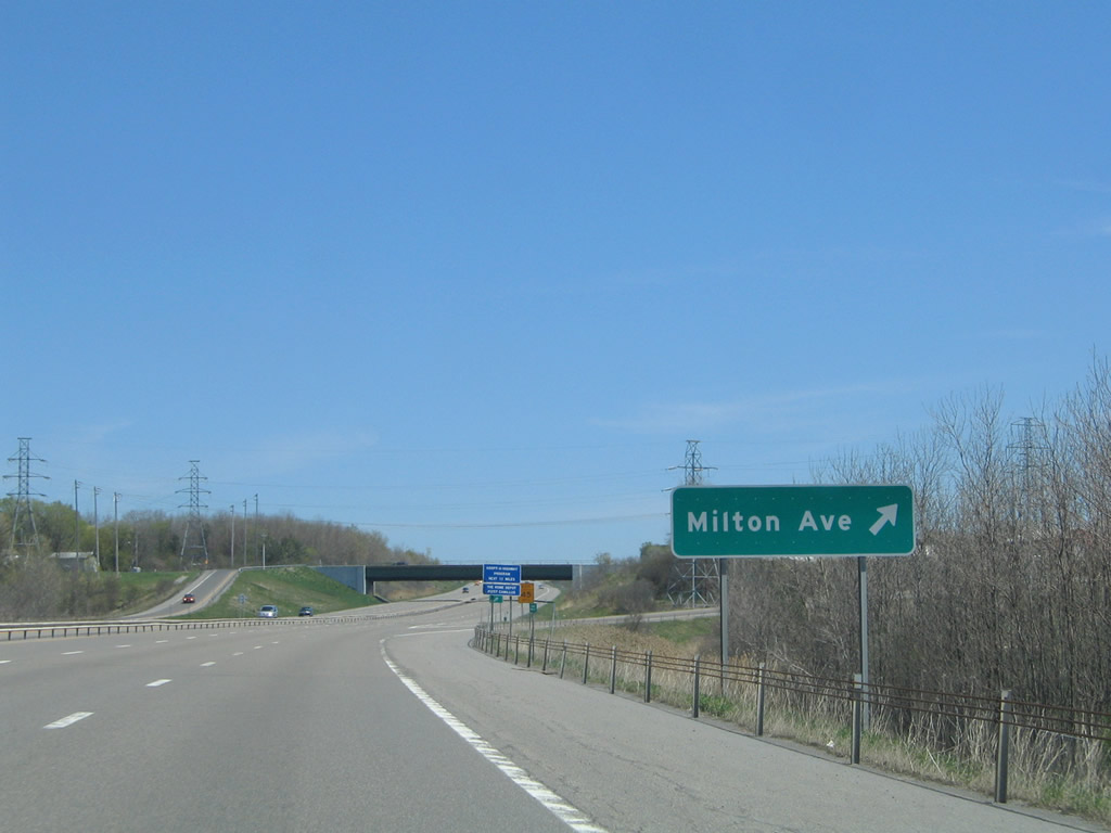
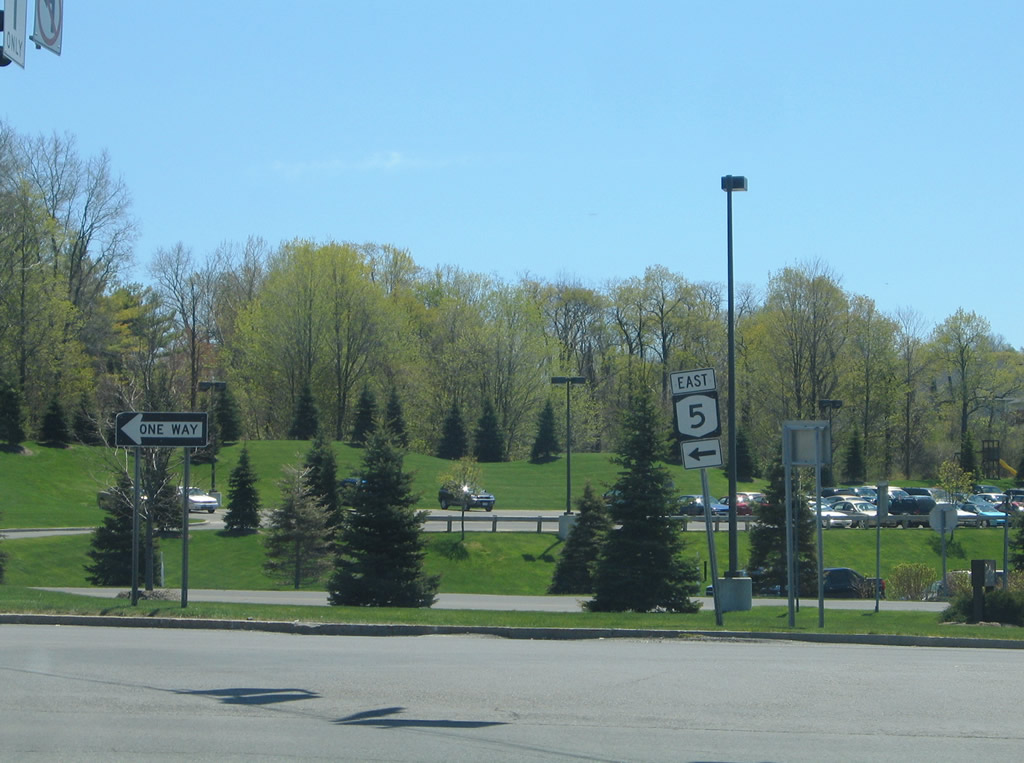
Milton Avenue stems eastward from old New York 5 (Main Street) in Camillus to an alignment along side the freeway east to Fairmount. Bennett Road travels north from Milton Avenue and Knowell Road to New York 173 (Warners Road). Photo taken 05/09/05. |
|
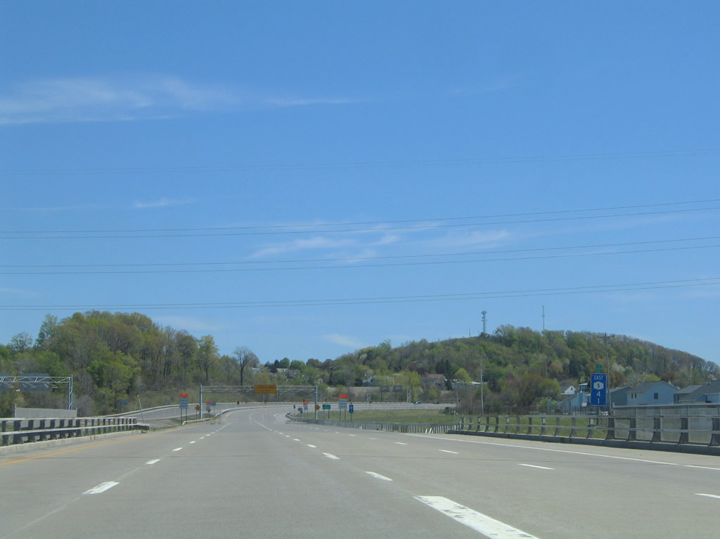
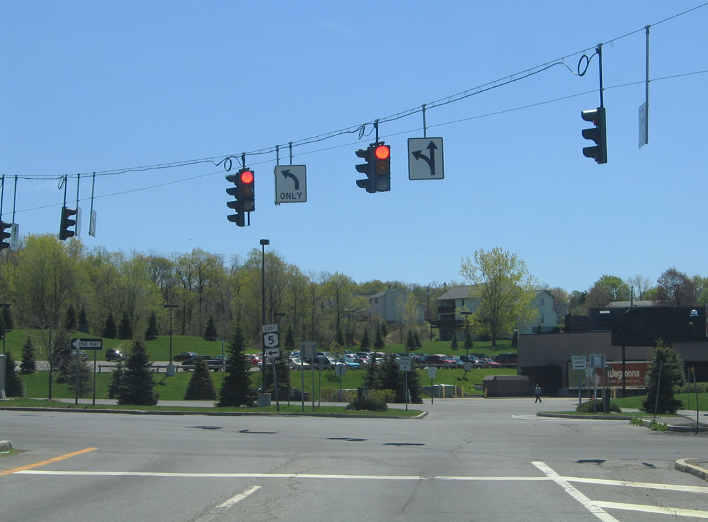
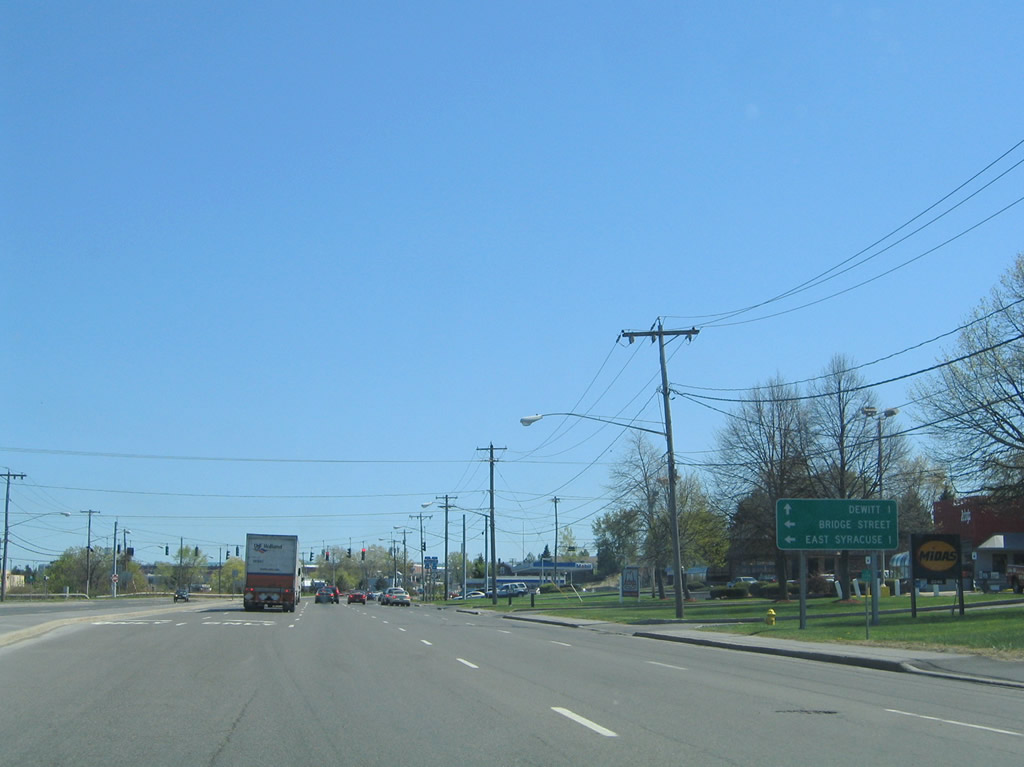
Eastbound mileage sign for Fairmount (the east end of the freeway) and Syracuse (via Interstate 690 east) posted after the Bennett Road overpass. New York 5's freeway is a part of the Purple Heart Highway. Photo taken 05/09/05. |
|
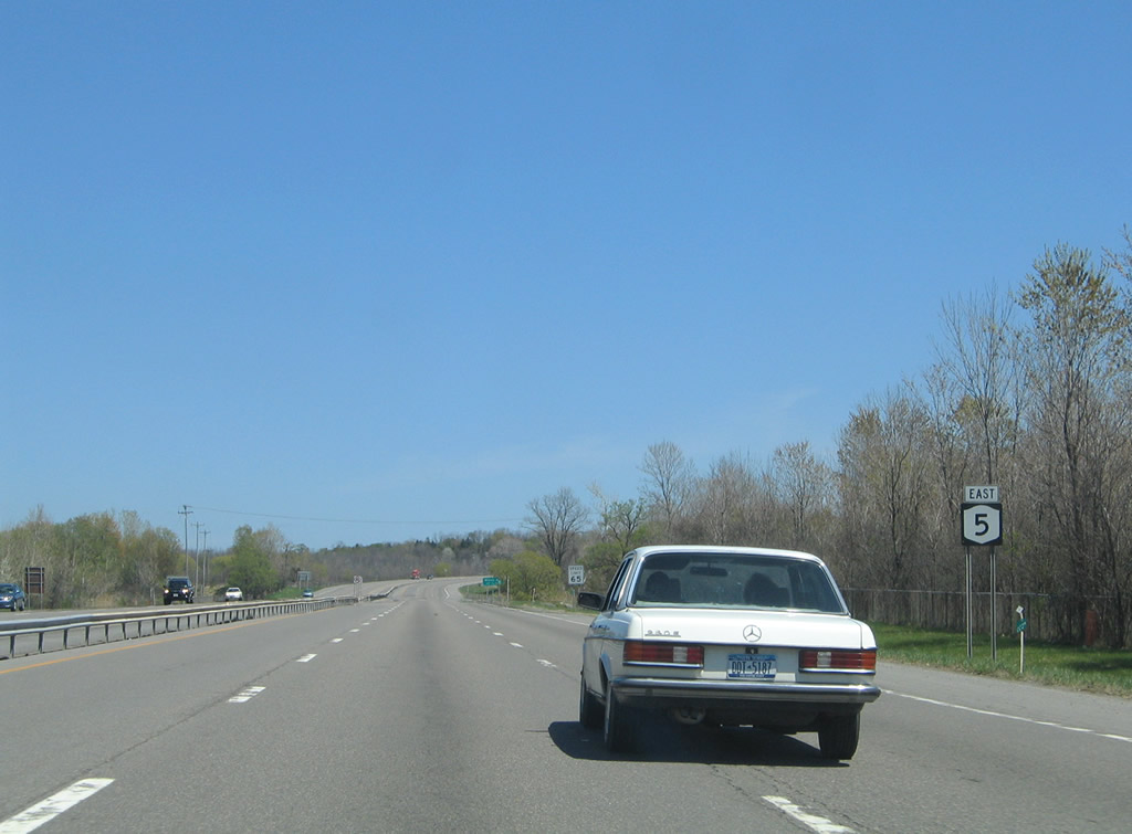
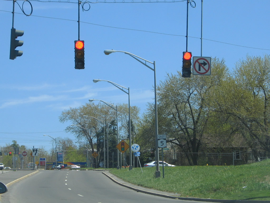
Another reassurance shield for New York 5 east resides after the Hinsdale Road half-diamond interchange. Photo taken 05/09/05. |
|
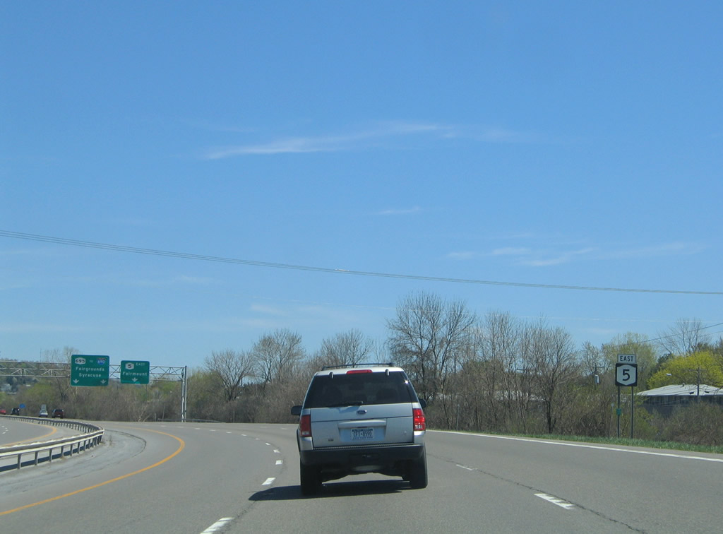
Nearing the northbound beginning of NY 695 north on New York 5 east. New York 695 travels 2.30 miles north to Interstate 690 at the New York State Fairgrounds. Photo taken 05/09/05. |
|
The New York 5 mainline defaults onto New York 695 north as the freeway curves southeast to its end at Fairmount. Photo taken 05/09/05. |
|
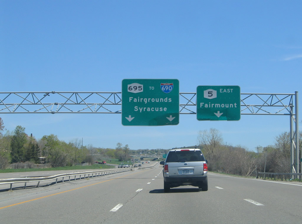
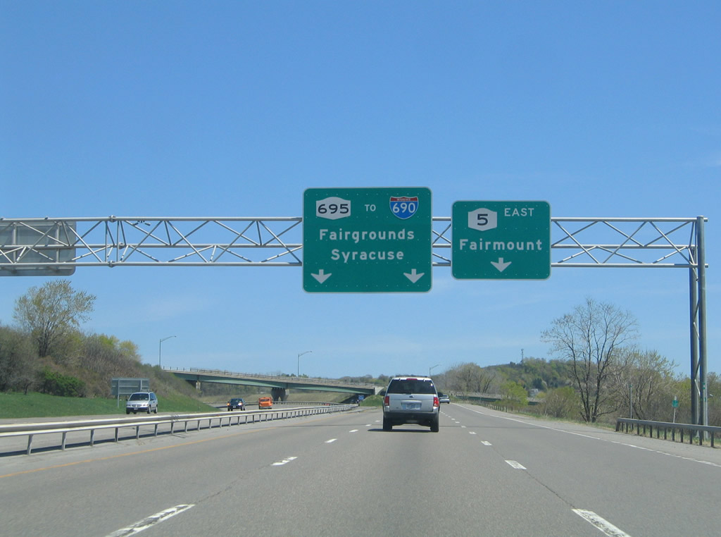
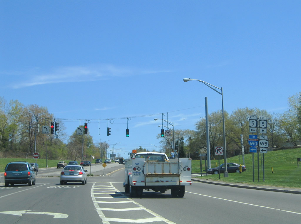
Eastbound at the split with New York 695 north on New York 5 east. I-690 travels east from New York 695's end directly into downtown Syracuse and Interstate 81. Photo taken 05/09/05. |
|
Leaving the interchange with New York 695, New York 5 east briefly carries four lanes as it crosses New York 297 (Milton Avenue. Photo taken 05/09/05. |
|
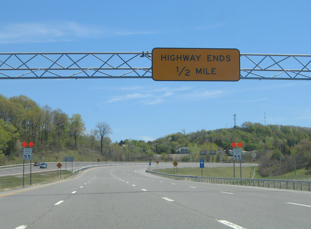
New York 5 enters the town of Geddes on its southward turn to Genesee Street. The freeway ends with the state route rejoining its surface street alignment. Photo taken 05/09/05. |
|
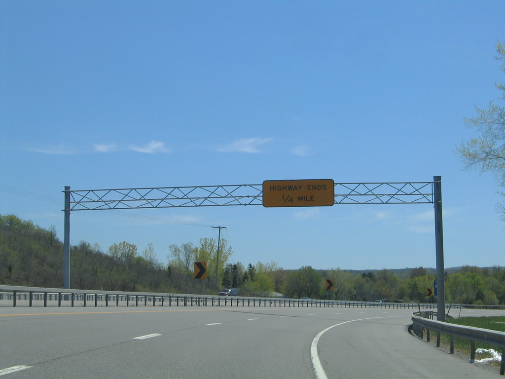
Facing south on the one-quarter mile approach to Genesee Street on New York 5 east. Photo taken 05/09/05. |
|
|
A freeway stub lies within the middle of the half-diamond interchange of New York 5 with Genesee Street (Onondaga County 98 west). Photos taken 05/09/05. |
|
|
New York 5 turns east onto Genesee Street at the signalized end of the freeway. Genesee Street carries the state route to south Solvay and into the city of Syracuse. Photos taken 05/09/05. |
|
Traveling east by the stub end of the New York 5 freeway, Genesee Street intersects the northbound beginning of the limited access highway. Fairmount interests to Interstate 690 via New York 695 north are directed onto New York 5 west. Photo taken 05/09/05. |
|
The New York 5 freeway between Camillus and Geddes was constructed as part of an overall plan to link Syracuse and Auburn with a limited access highway in the 1950s.1 Only the section here was constructed however. Photo taken 05/09/05. |
|
New York 5 continues east to a signalized intersection with Terry Road (Onondaga County 75). Photo taken 05/09/05. |
|
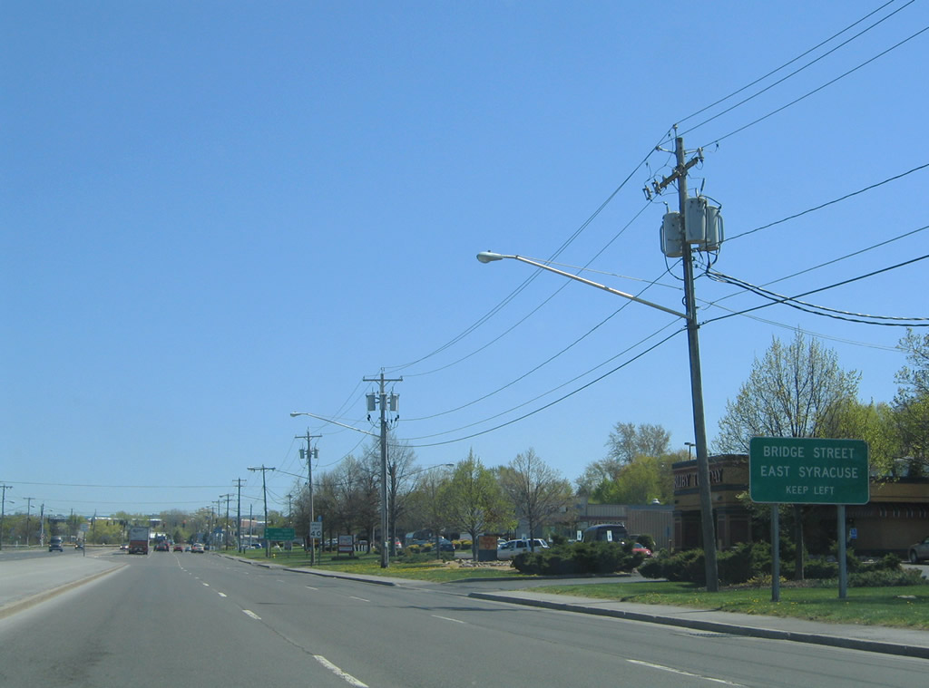
Traveling east along New York 5 (Erie Boulevard) ahead of the intersection with Bridge Street. Bridge Street leads northeast from Erie Boulevard to New York 290 at East Syracuse. Photo taken 05/09/05. |
|
Eastbound Bridge Street connects New York 5 (Erie Boulevard) with Exit 17 of Interstate 690. Photo taken 05/09/05. |
|
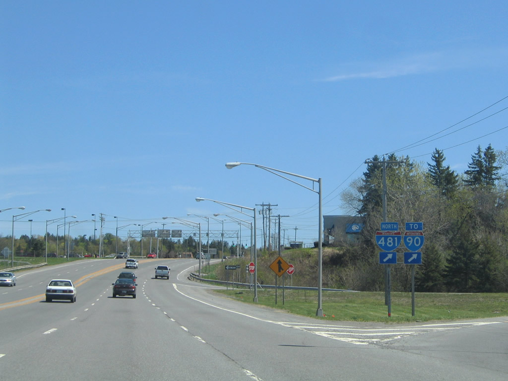
Now within the town of Dewitt, New York 5 (Genesee Street) merges with New York 92 from Erie Boulevard and meets Interstate 481 at a full-cloverleaf interchange. Photo taken 05/09/05. |
|
New York 5 & 92 (Genesee Street) leave Interstate 481 and intersect Maple Drive south. Maple Drive connects Genesee Street with residential areas south to Woodchuck Hill Road. Photo taken 05/09/05. |
|
Continuing east from Maple Drive on New York 5 & 92 (Genesee Street). A signal lies ahead with an adjacent shopping center. Photo taken 05/09/05. |
|
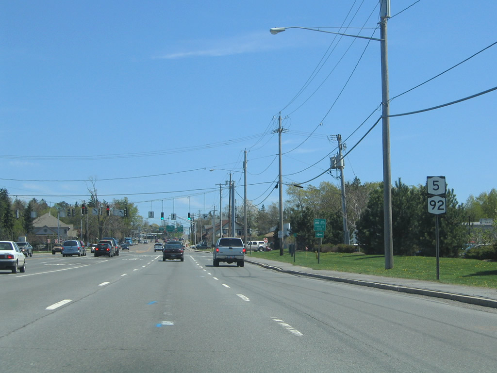
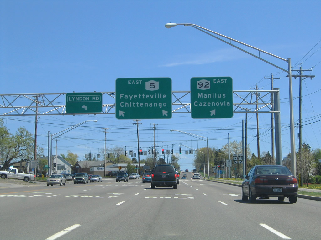
1.13 miles after their merge, New York 5 & 92 split at Lyndon Road. New York 5 continues Genesee Street east while New York 92 follows Highbridge Road southeast. Photo taken 05/09/05. |
|
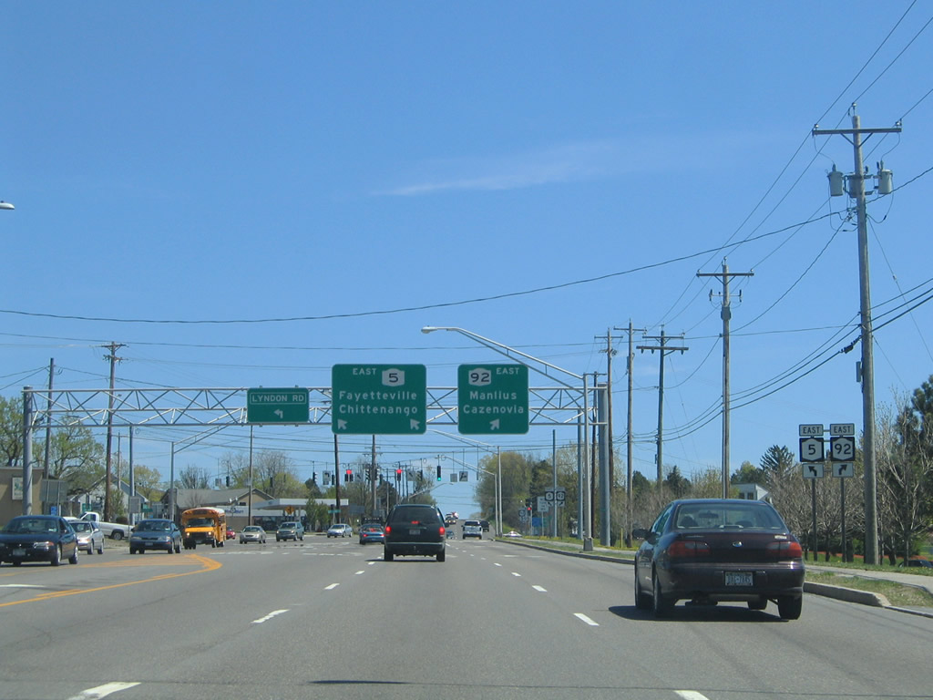
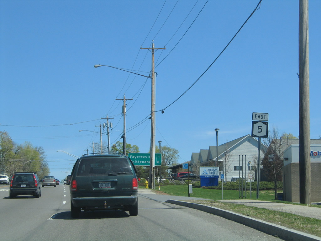
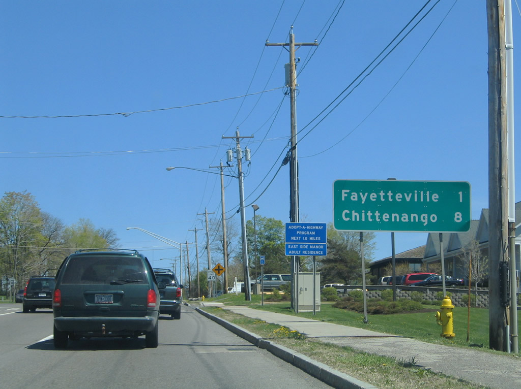
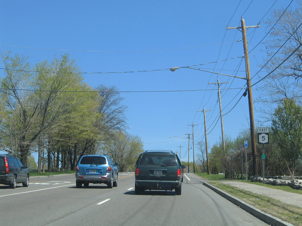
New York 5 joins DeWitt with Fayetteville and Chittenango; New York 92 continues southeast into Manlius and Cazenovia. Lyndon Road stems north to Cedar Bay Road at Old Canal State Park. Photo taken 05/09/05. |
|
|
Genesee Street constitutes a four-lane arterial east into downtown Fayetteville and New York 257. Photos taken 05/09/05. |
|
Another eastbound New York 5 shield posted after the Genesee Street with Lynacres Boulevard. Photo taken 05/09/05. |
|
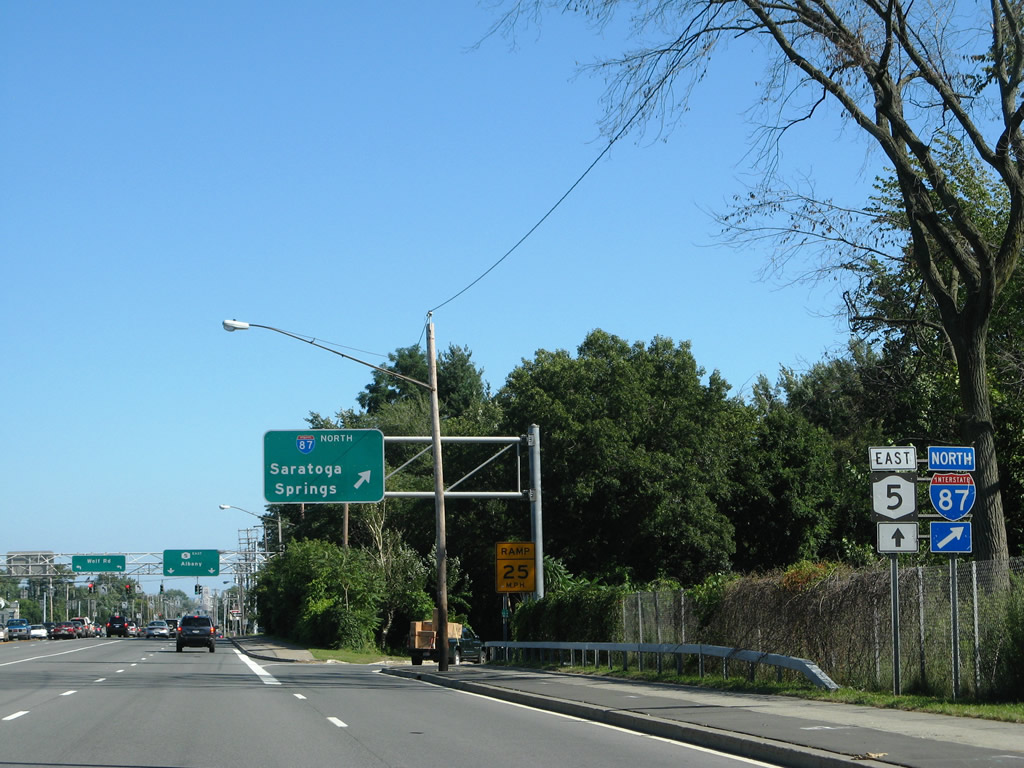
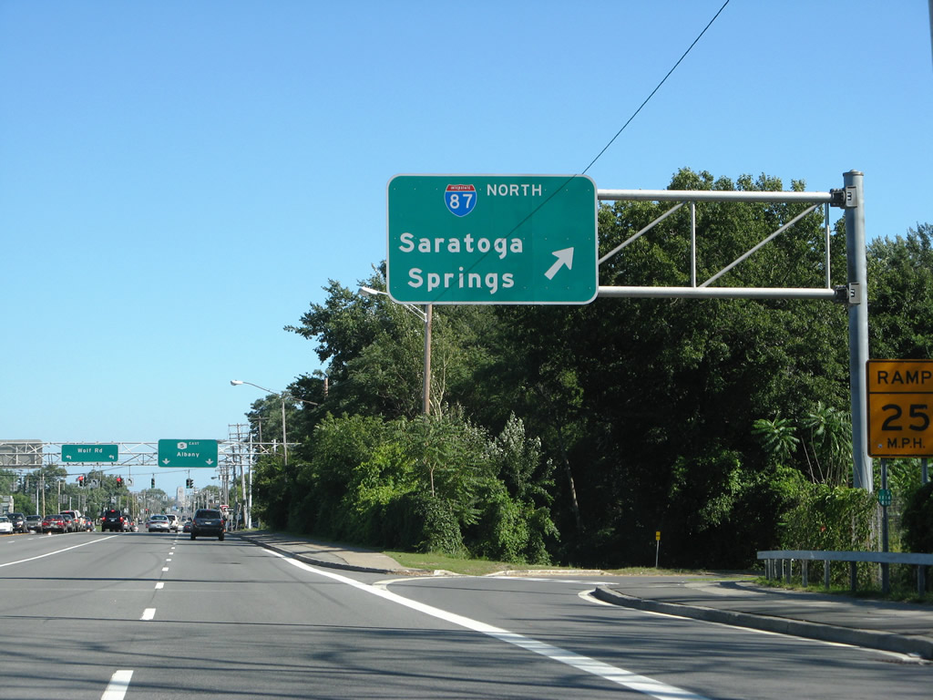
Shifting east to Colonie, New York 5 meets Interstate 87 at a full-cloverleaf interchange ahead of its intersection with Wolf Road. Photo taken 08/04/07. |
|
|
Interstate 87 heads north from Colonie to Saratoga Springs, Glens Falls, Plattsburgh, and Rouses Point. Photos taken 08/04/07. |
|
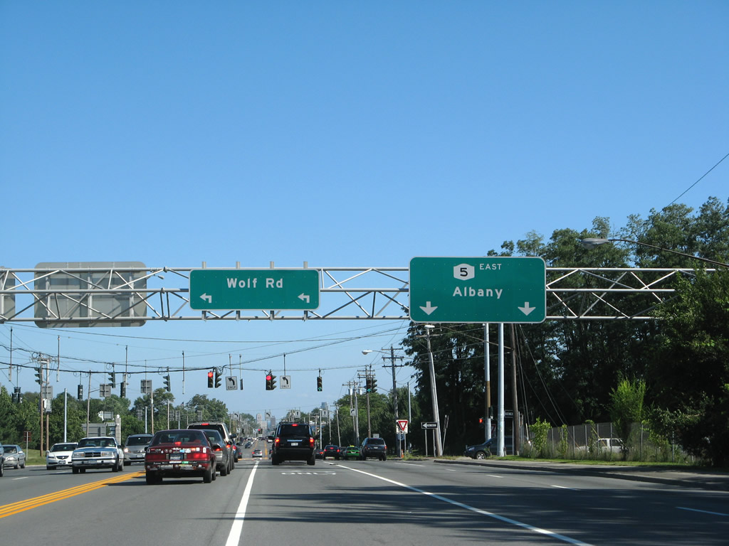
Wolf Road spurs north from the Interstate 87 (Exit 2E) northbound off-ramp to New york 5 (Central Avenue) to Colonie Center mall and a bevy of other commercial businesses. Photo taken 08/04/07. |
|
New York 5 continues east along Central Avenue with its own entrance to Colonie Center mall opposite the Northway shopping center. Photo taken 08/04/07. |
Page Updated August 20, 2009.