05/09/05 photos taken by Alex Nitzman. 08/04/07 photos taken by AARoads.
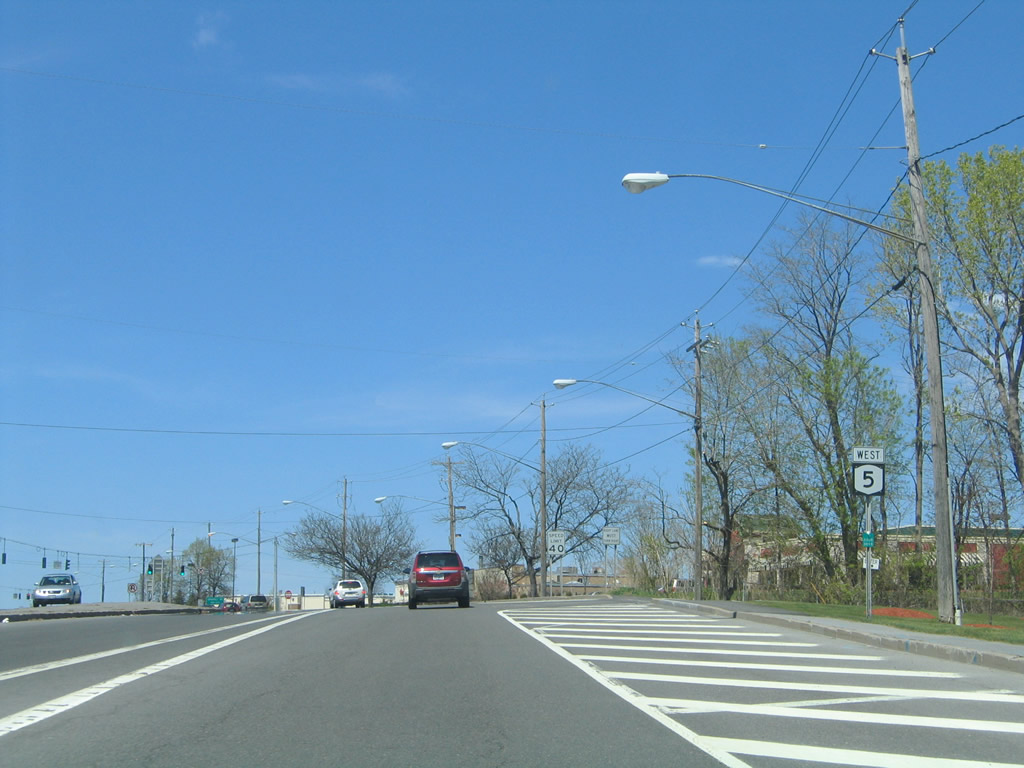
| New York 5 West |
|
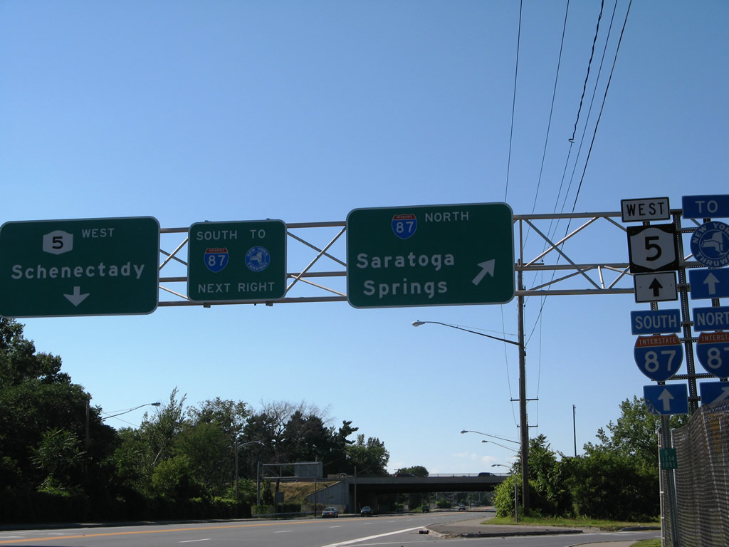
New York 5 (Central Avenue) enters a full-cloverleaf interchange with Interstate 87 (Exit 2) at Colonie. Interstate 87 north continues to Saratoga Springs and Glen Falls. Photo taken 08/04/07. |
|
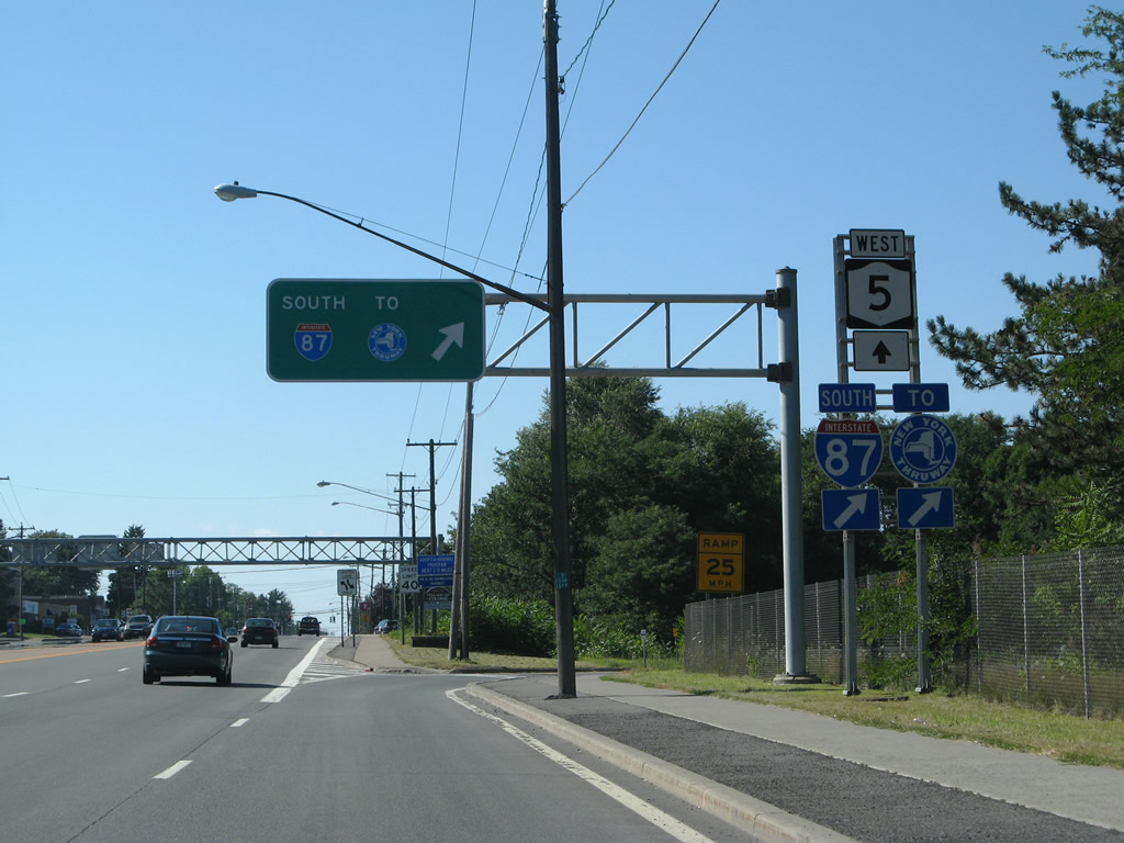
Interstate 87 continues south from New York 5 (Central Avenue) onto the New York Thruway at Interstate 90. Interstate 87 follows the Thruway south to New York; Interstate 90 travels the toll road west to Syracuse. Photos taken 08/04/07. |
|
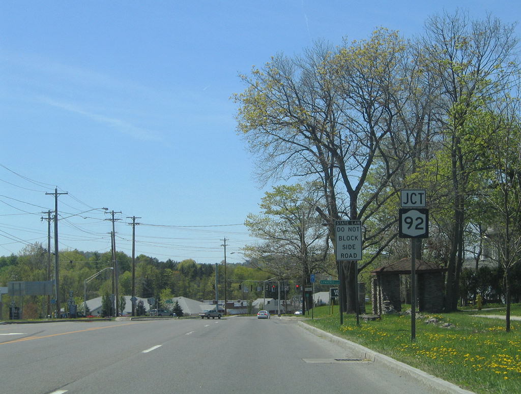
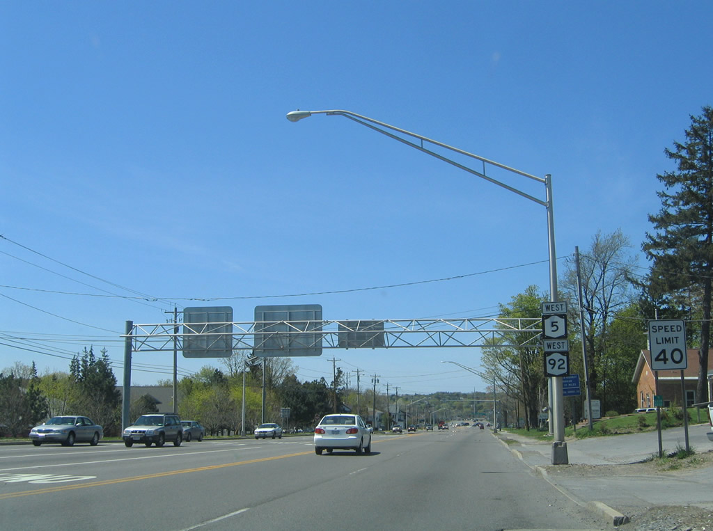
Approaching New York 92 (Highbridge Road) on New York 5 (Genesee Street) west in DeWitt. Photo taken 05/09/05. |
|
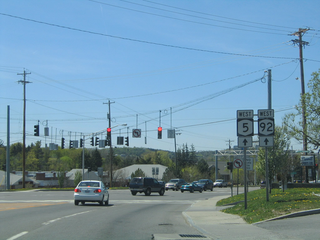
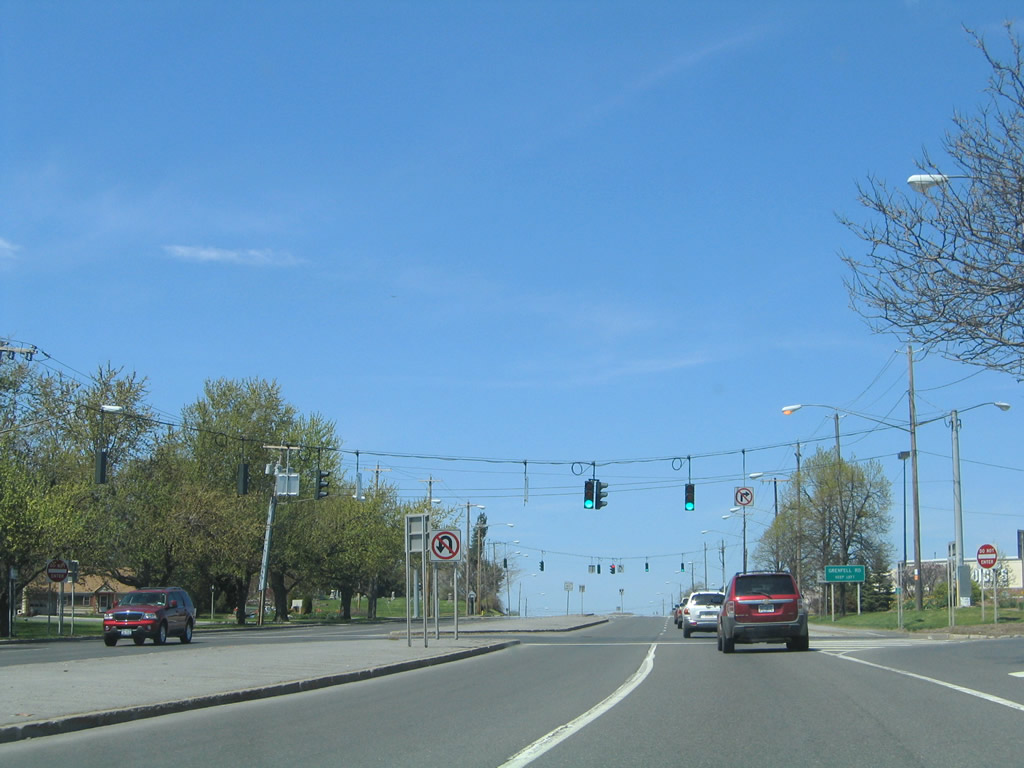
New York 5 & 92 join for 1.13 miles along Genesee Street through DeWitt. New York 92 enters the area from Manlius. Photo taken 05/09/05. |
|
A commercialized arterial carries New York 5 & 92 northwest toward Interstate 481 and central DeWitt. Photo taken 05/09/05. |
|
Continuing beyond a signalized intersection for an adjacent shopping center entrance, New York 5 & 92 (Genesee Street) near Interstate 481. Photo taken 05/09/05. |
|
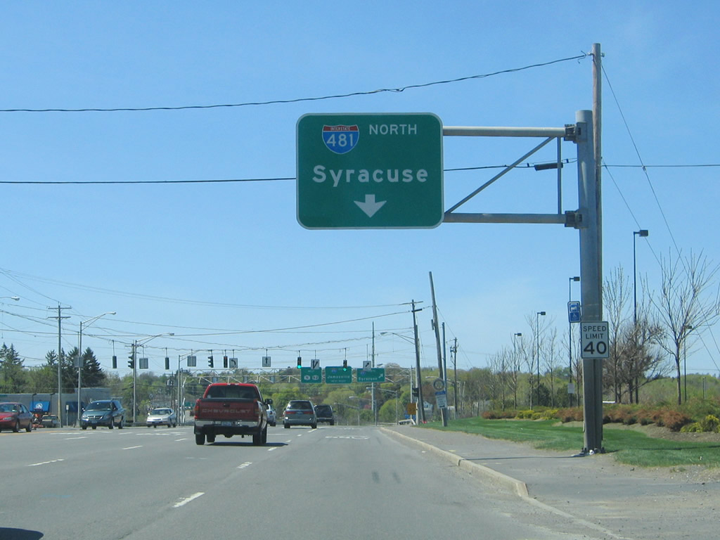
The right-hand lane defaults onto Interstate 481 north to I-690 west for Syracuse. Maple Drive stems south from a traffic light nearby to Woodchuck Hill Road. Photo taken 05/09/05. |
|
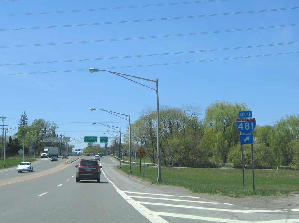
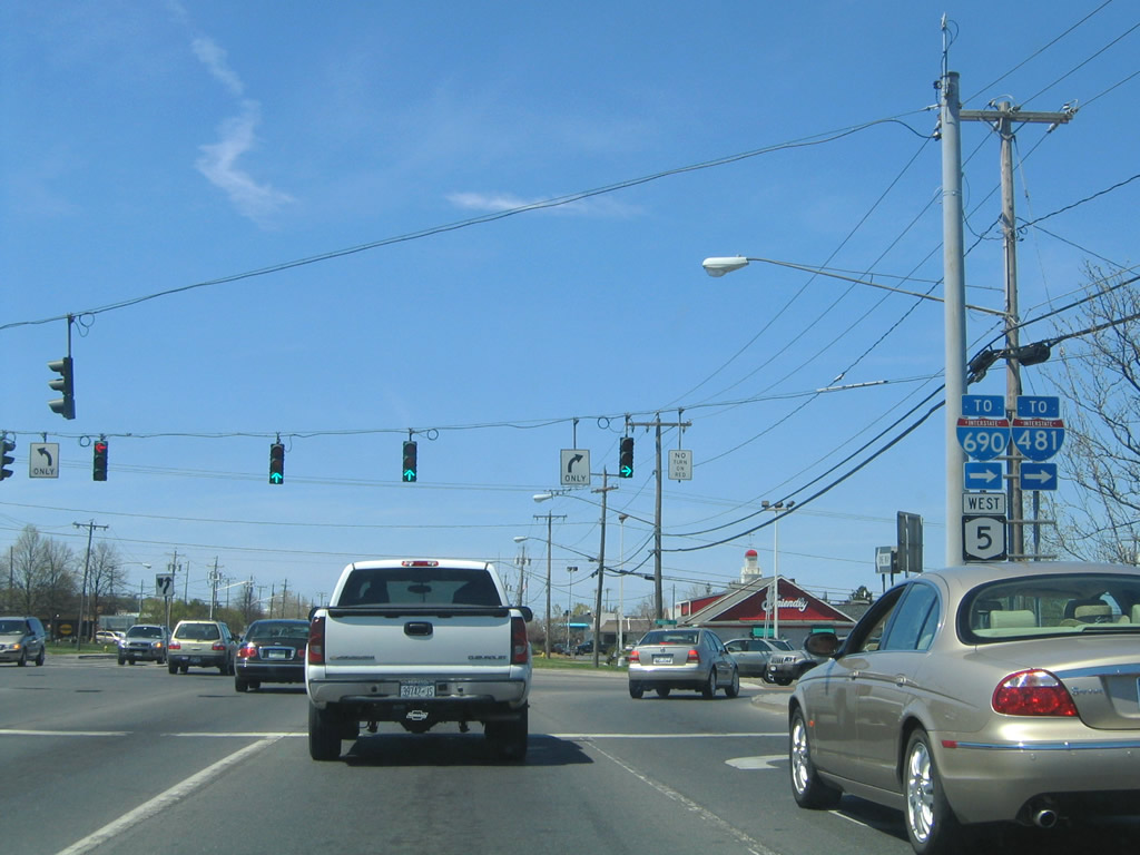
Westbound New York 5 & 92 at the northbound on-ramp to Interstate 481. Interstate 481 meets the westbound beginning of Interstate 690 nearby and I-90 in north DeWitt. Photo taken 05/09/05. |
|
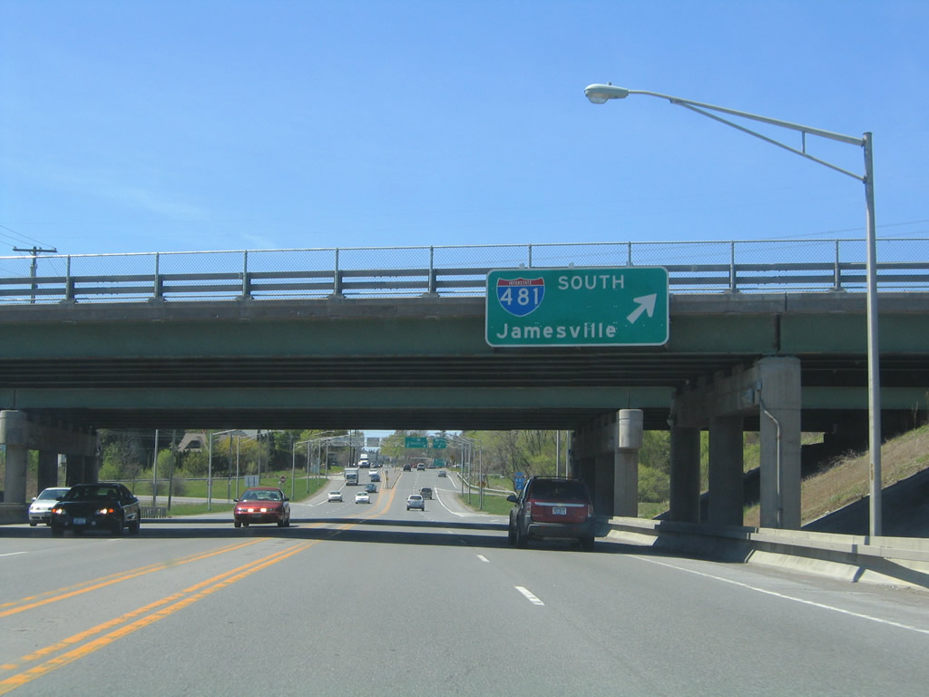
A full-cloverleaf interchange joins New York 5 & 92 (Genesee Street) with Interstate 481. Photo taken 05/09/05. |
|
|
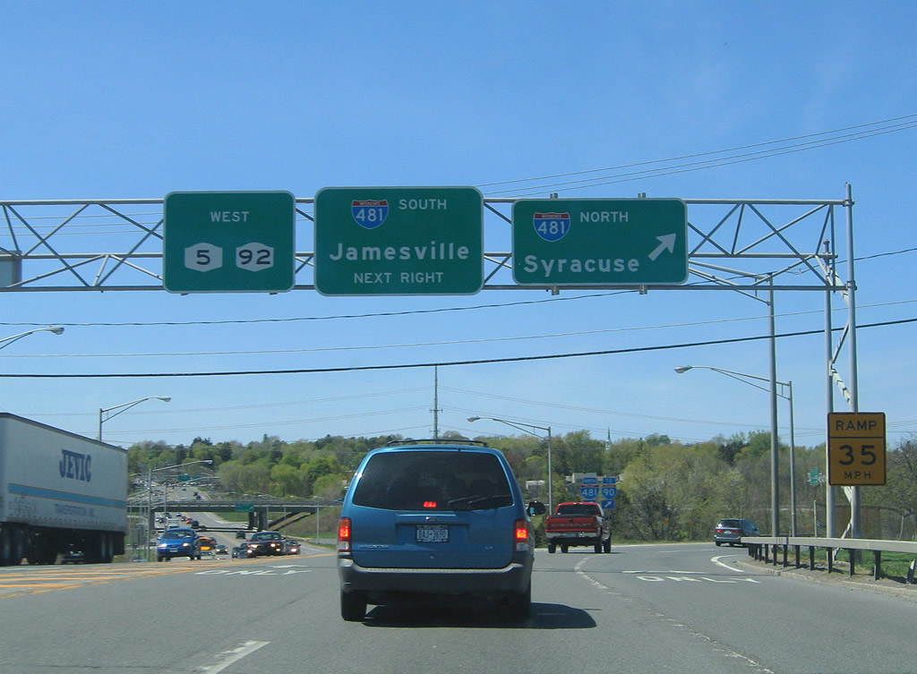
Interstate 481 continues south from Genesee Street to Jamesville (via Exit 2) and Interstate 81 in south Syracuse. Photos taken 05/09/05. |
|
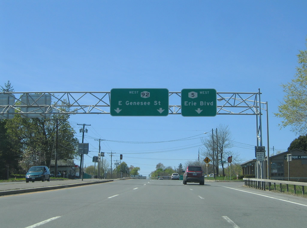
Just west of Interstate 481 is the split of New York 5 west (Erie Boulevard) and New York 92 west (East Genesee Street). Photo taken 05/09/05. |
|
New York 5 arcs northwest along Erie Boulevard to Shoppingtown Mall and New York 635 (Thompson Road). New York 92 continues along East Genesee Street toward Syracuse University and downtown Syracuse. Photo taken 05/09/05. |
|
Erie Boulevard consists of a heavily commercialized, four-lane divided arterial through to downtown Syracuse. Pictured here is a westbound shield after New York 92. Photo taken 05/09/05. |
|
|
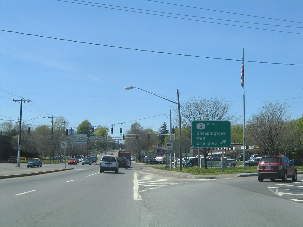
A pair of signalized intersections lie along New York 5 (Erie Boulevard) west at Shoppingtown Mall. The second intersection also connects with Grenfell Road and an adjacent residential area. Photos taken 05/09/05. |
|
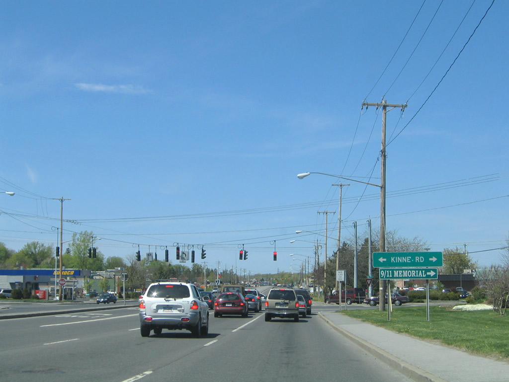
Kinne Road intersects New York 5 (Erie Boulevard) at the next traffic light. The east-west road begins at Thompson Road nearby and ends at Lyndon Road near Old Erie Canal State Park. Photo taken 05/09/05. |
|
Bridge Street leads north from New York 5 (Erie Boulevard) at Orrick Road to Exit 17 of Interstate 690 at East Syracuse. Photo taken 05/09/05. |
|
New York 5 turns north onto a freeway bypass of Fairmount and Camillus within the Town of Geddes. Genesee Street (Onondaga County 98) travels the original alignment. Pictured here is the northbound on-ramp transitioning into the freeway mainline. Roadway stubs lie within the middle of the half-diamond interchange alluding to the unconstructed extension east to Syracuse. Photo taken 05/09/05. |
|
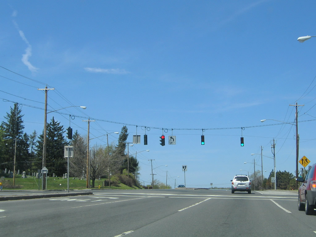
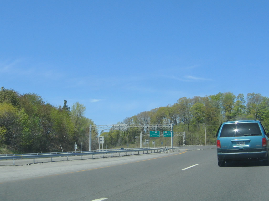
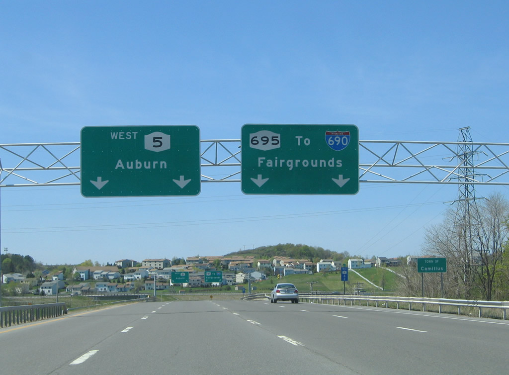
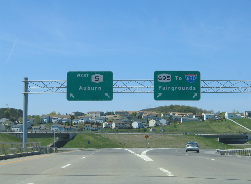
New York 5 westbound expands to four lanes westbound in anticipation of the three-wye directional interchange with New York 695 north. New York 695 provides a connection to Interstate 690. Photo taken 05/09/05. |
|
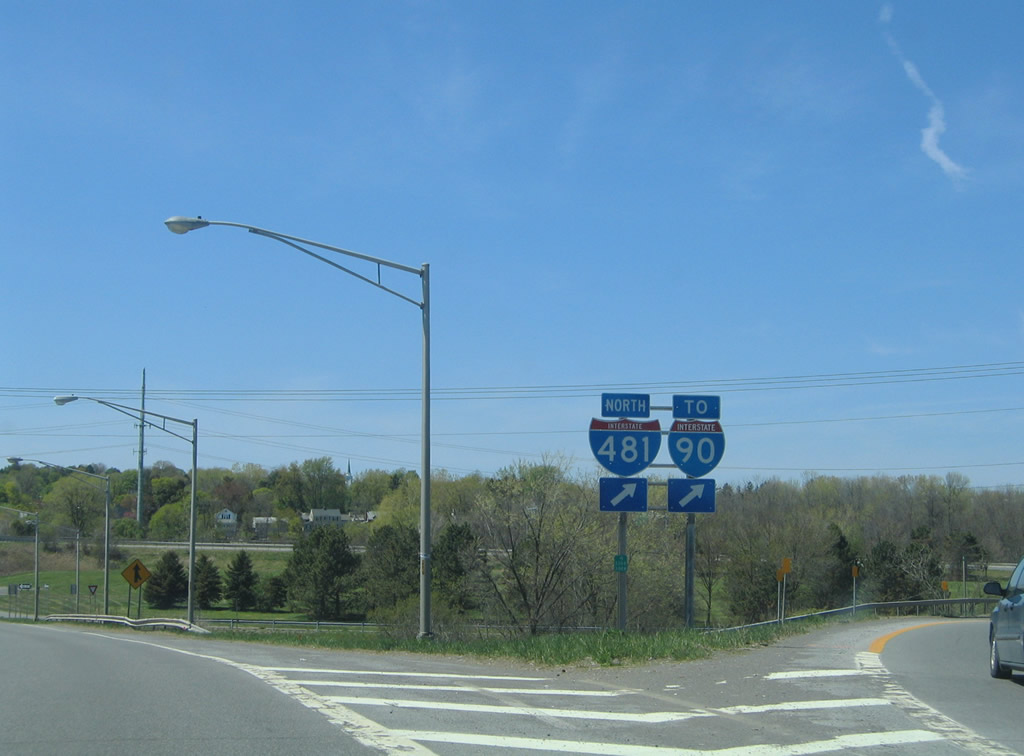
Westbound motorists enter the Town of Camillus on the approach to New York 695 north. NY 695 meets Interstate 690 at the New York State Fairgrounds and Onondaga Lake Park. Photo taken 05/09/05. |
|
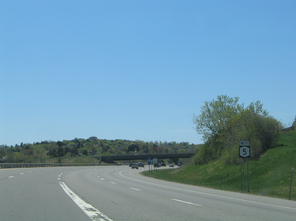
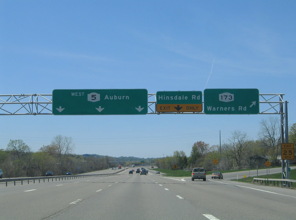
Passing over New York 297 (Milton Avenue), New York 5 splits with the northbound on-ramp to New York 695. New York 695 north to Interstate 690 west leads travelers to Interstate 90 (New York Thruway) and New York 690 west to Baldwinsville. Photo taken 05/09/05. |
|
Continuing west along New York 5 ahead of the New York 173 (Warners Road) overpass. Photo taken 05/09/05. |
|
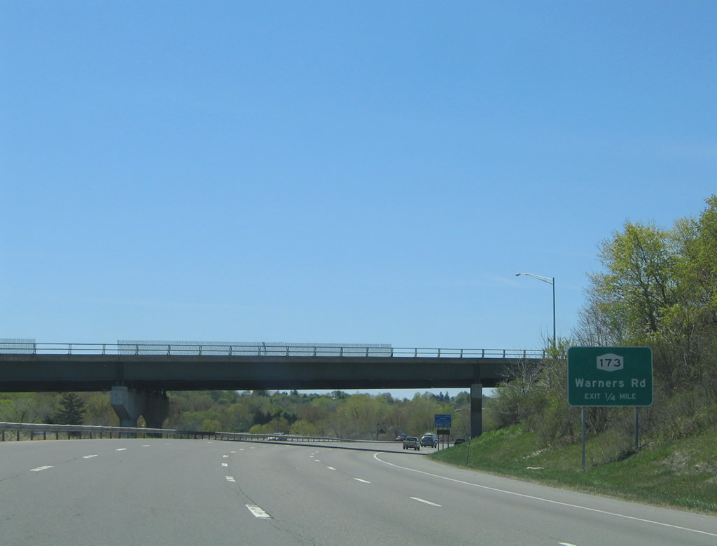
A westbound off-ramp connects New York 5 with adjacent New York 173 (Warners Road) in one quarter mile. Photo taken 05/09/05. |
|
New York 173 follows Warners Road northwest from Onondaga Road in Fairmount to its end at New York 31. The state route travels 30.59 miles overall between Ionia and Chittenango. Photo taken 05/09/05. |
|
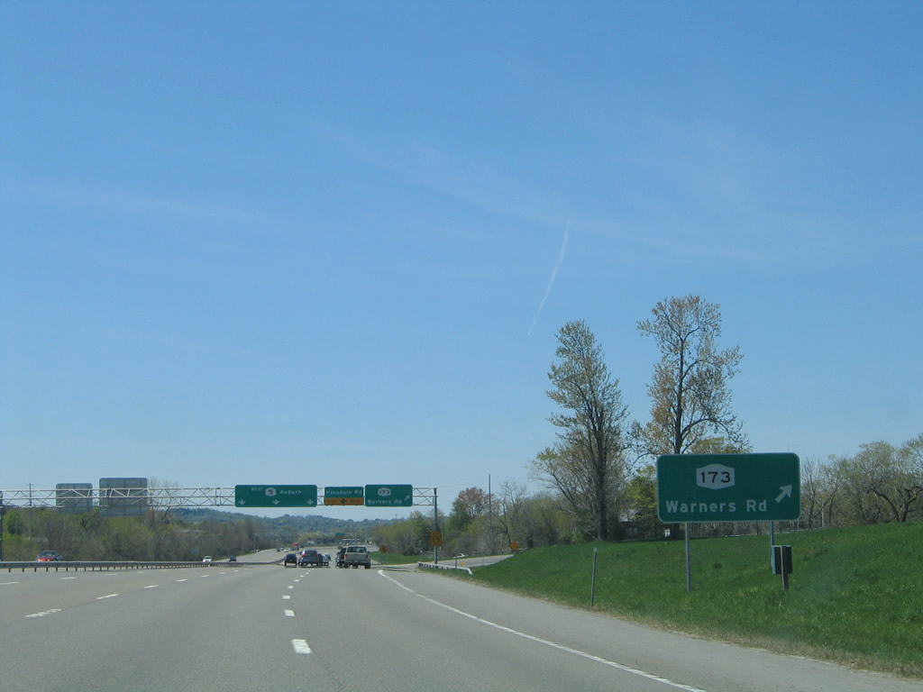
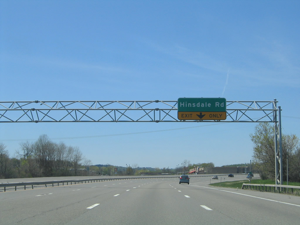
A half diamond interchange with Hinsdale Road follows the New York 173 (Warners Road) westbound off-ramp. Photo taken 05/09/05. |
|
Hinsdale Road heads south from New York 173 (Warners Road) nearby to Genesee Street (Onondaga County 98). Photo taken 05/09/05. |
|
|
Westbound at the Hinsdale Road off-ramp on New York 5. Milton Avenue travels parallel to the freeway and provides a connection between Hinsdale Road and the half-diamond interchange at Bennett Road. Photos taken 05/09/05. |
|
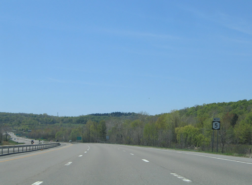
New York 5 continues three miles to the village of Camillus and 19 miles to the city of Auburn. The freeway of New York 5 is a part of the Purple Heart Highway. Photo taken 05/09/05. |
|
Bending southwest along New York 5 after the Bennett Road on-ramp. Photo taken 05/09/05. |
|
The next westbound exit joins New York 5 with Newport Road north and Camillus-Warners Road south. Photo taken 05/09/05. |
|
Nearing the half diamond interchange with Camillus-Warners and Newport Roads on New York 5 west. The village of Camillus lies just south of the interchange. Newport Road (Onondaga County 36) ventures northwest to Newport and Warners (New York 173). Photo taken 05/09/05. |
|
New York 5 west at the Camillus Warners off-ramp. Interests to Marcellus are directed southward from Camillus via New York 173 (Elm Street). Photo taken 05/09/05. |
|
Entering the final half mile of New York 5's freeway outside Camillus. Photo taken 05/09/05. |
|
|
Like the east end of the freeway, a roadway stub also exists at the west end of the bypass. This remnant also alludes to the planned extension of New York 5's freeway to Auburn. Photos taken 05/09/05. |
|
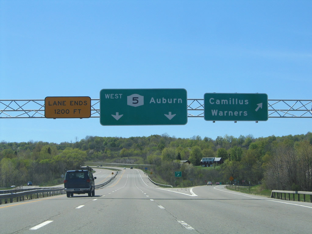
Traffic descends toward New York 174 (Main Street) east to Camillus. The off-ramp is part of a planned parclo interchange. Photo taken 05/09/05. |
|
New York 174 begins at the New York 5 interchange and travels Main Street east to Elm Street south in Camillus. The state route used to end in Camillus but was extended west once New York 5 relocated to its freeway. Photo taken 05/09/05. |
|
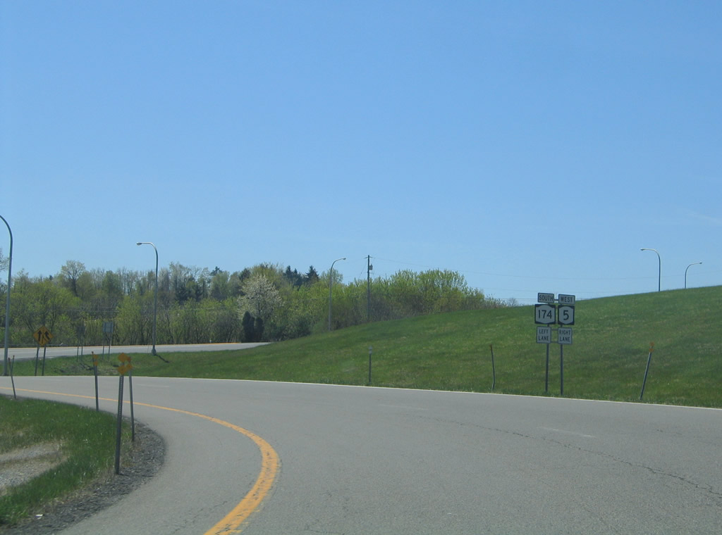
New York 5 rejoins its original alignment on the six-mile drive to Elbridge and 15-mile drive to Auburn (U.S. 20). New York 174 meanwhile begins its 16.70-mile alignment to New York 41 at Borodino. Photo taken 05/09/05. |
Page Updated August 20, 2009.