

U.S. Highway 82 East - Mabelle to Wichita Falls

U.S. 82 between Lubbock and Wichita Falls, Texas.
| U.S. 82 East | |
|---|---|
 |
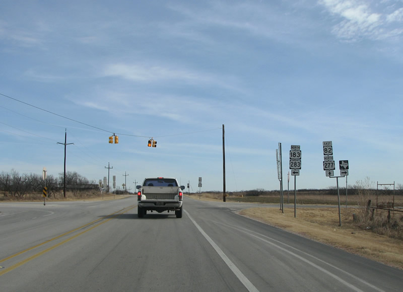
After going under the bypass, the US highways continue northbound and eastbound through cattle and oil country. Photo taken 01/27/08. |
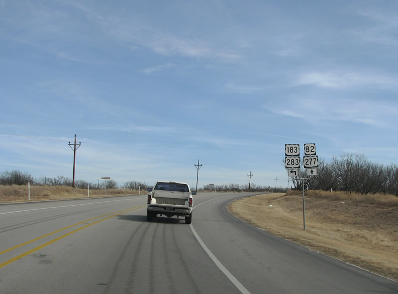 |
The 4-way overlap ends as US 183/283 peel off to head north to Vernon and Lake Kemp. Photo taken 01/27/08. |
 |
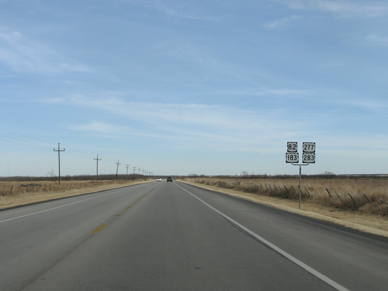
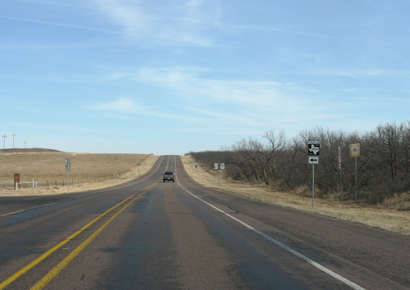
This view looks east as US 183/283 turn off at the community of Mabelle. Photo taken 01/27/08. |
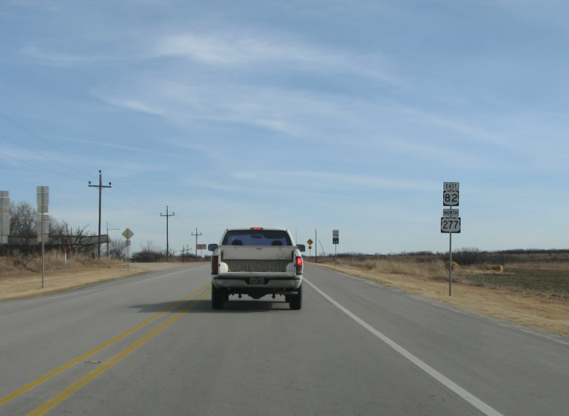 |
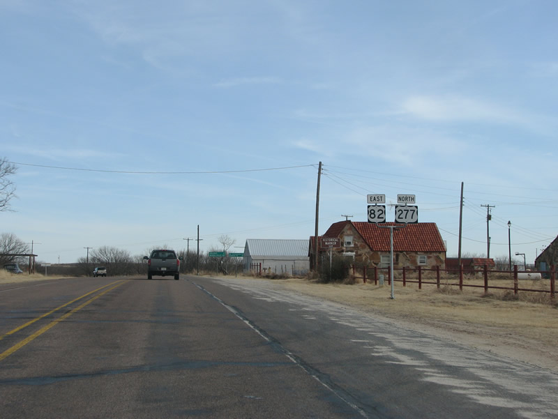
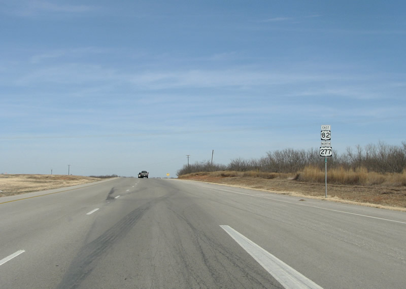
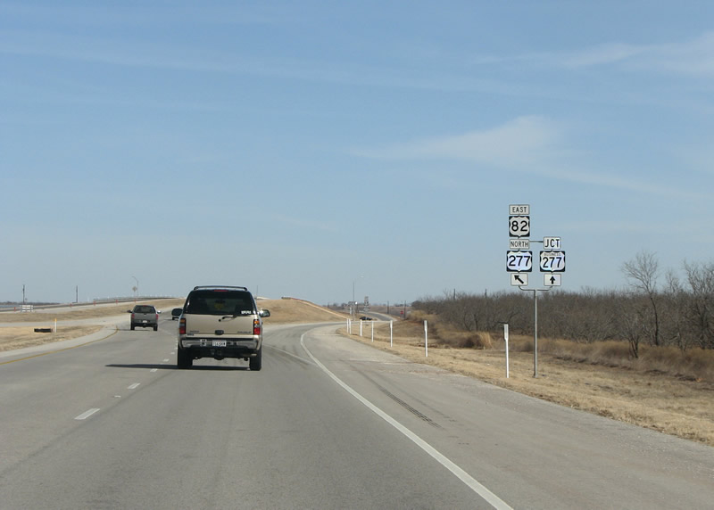
A US 82 eastbound reassurance marker and US 277 northbound marker east of Mabelle. The Wichita Falls district is good about signing directional banners on US routes, unlike many other areas of Texas. Photo taken 01/27/08. |
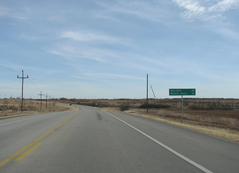 |
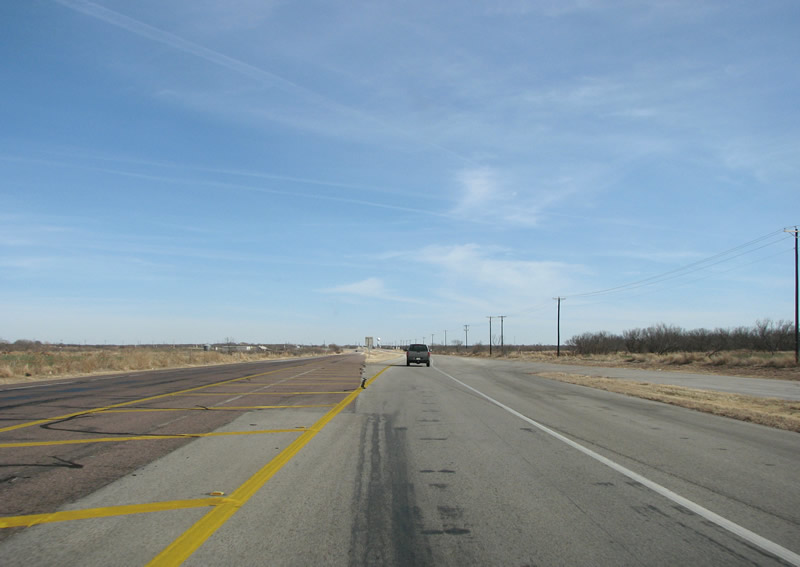
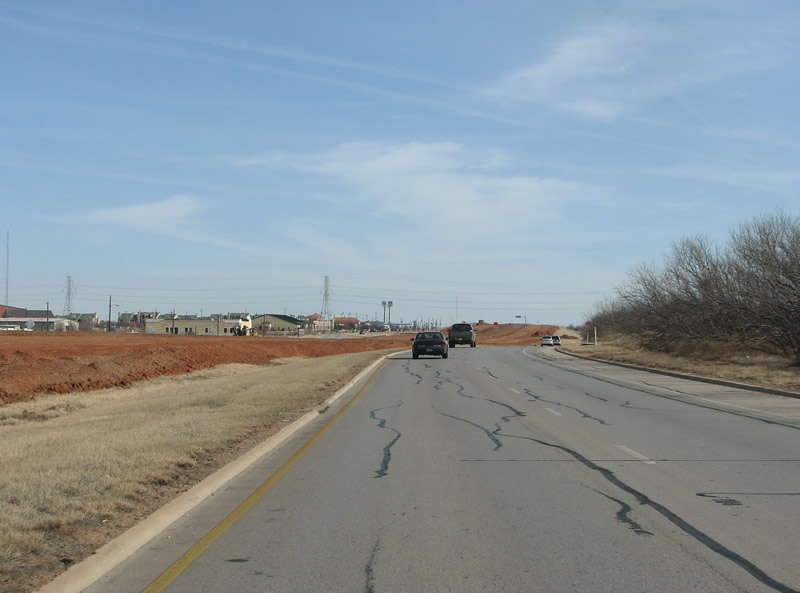
The US highways travel through rather dull countryside in northeastern Baylor County. The next town is a distant 28 miles away. Photo taken 01/27/08. |
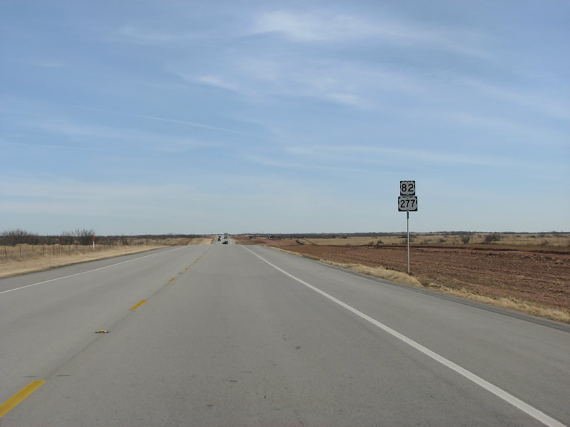 |
US 277 is an important route in Texas, and connects two of the regional centers of Wichita Falls and Abilene. It continues south of Abilene to San Angelo. Because of its importance as a NAFTA trade route, the US highway is being upgraded to an expressway for most of its length in Texas. This view looks east in Baylor County at grading work being done on the route. Along with the Seymour Bypass, other bypasses are being built around every populated place. Photo taken 01/27/08. |
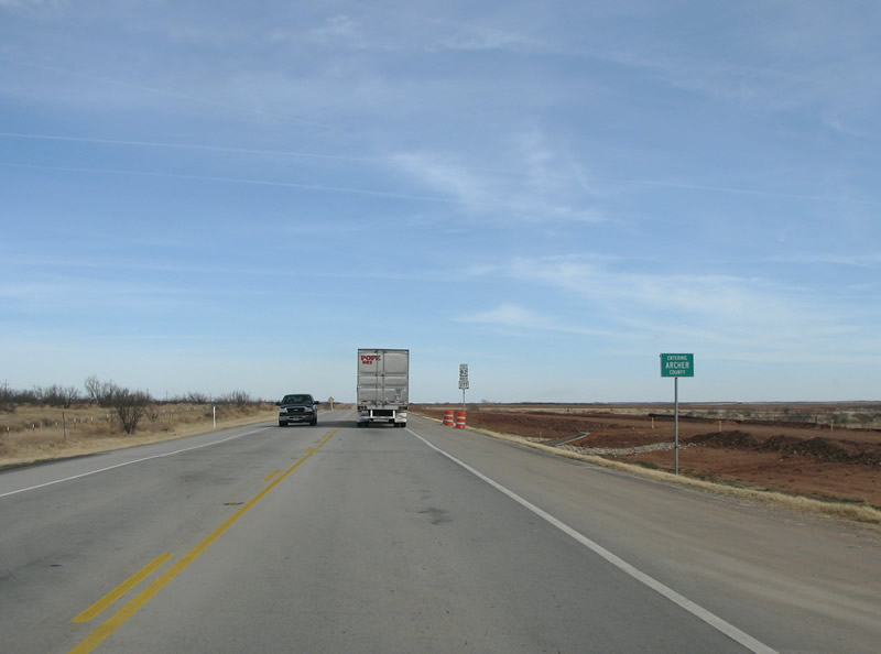 |
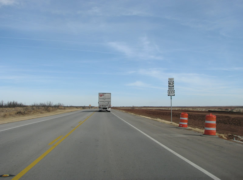
US 82/277 briefly enters Archer County. Archer County was created in 1858 but not open to settlers for about two decades while the army "cleared out" the local Indians. Photo taken 01/27/08. |
 |
A reassurance marker in Archer County. This area was the site of some fierce battles between the local Comanche and Kiowa indians and Texas cavalrymen. This photo looks at the area near where, in 1870, US cavalrymen led by Curwen B. McClellan were defeated by a band of Kiowas led by Kicking Bird. Photo taken 01/27/08. |
 |
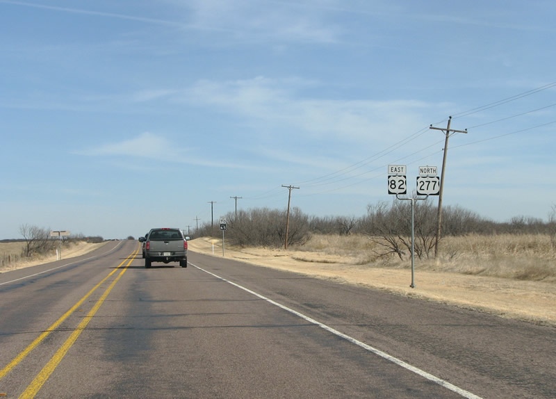
US 82/277 eastbound at FM 2846. This FM road runs north past oil wells to Lake Diversion, a water impoundment reservoir and recreational opportunity. Photo taken 01/27/08. |
 |
More reassurance markers in northwestern Archer County, each with their own directional banner. Photo taken 01/27/08. |
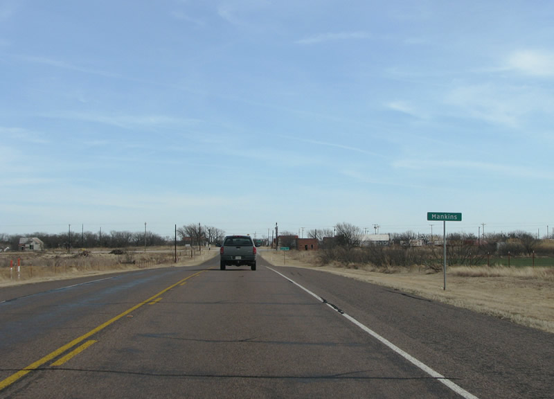 |
The first community encountered in Archer County is Mankins, although there is not much to it. That was not always the case, however, as oil discoveries in this area in the 1920s brought many people. A tornado in 1938 devastated the community and it never fully recovered. Photo taken 01/27/08. |
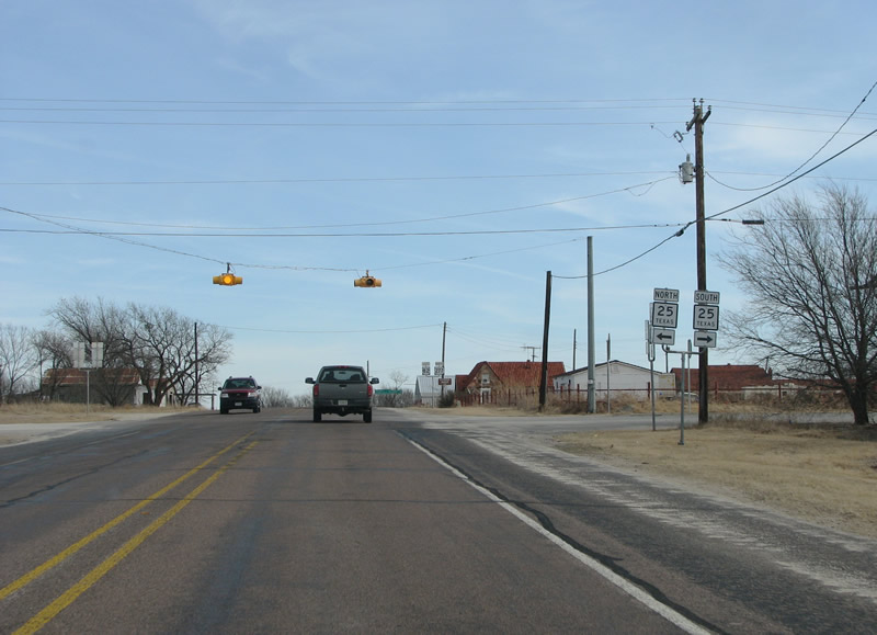 |
US 82/277 eastbound at SH 25 in Mankins. SH 25 runs 60 miles from Electra southward to Windthorst and US 281. Photo taken 01/27/08. |
 |
After SH 25, these reassurance markers continue the theme of separate directional banners. Photo taken 01/27/08. |
 |
As US 82/277 nears Holliday, it widens out to a 4 lane divided highway. Pavement extends on the right hand side of this picture to provide for an easy extension when the road is upgraded. Photo taken 01/27/08. |
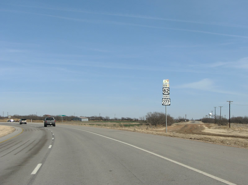 |
The old route of US 82/277 through town has become a business route for US 277. The US 82 business routing is technically a mistake, as only US 277 has been retained along the old route. For some reason, in Texas, many times business routes of 3-digit US highways have "Business" in the shield as well as on an affixed banner, while 2-digit US highway business routes only have the banner. This sign assembly is no exception. Photo taken 01/27/08. |
 |
The beginning of the Holliday bypass. The $13 million bypass opened in the summer of 2006 and bypasses the town's famous 30 mph speed limit. Photo taken 01/27/08. |
 |
This view looks east along the new 4 lane section of US 82/277 near Holliday. The bypass is part of the larger US 277 upgrading through the state. Photo taken 01/27/08. |
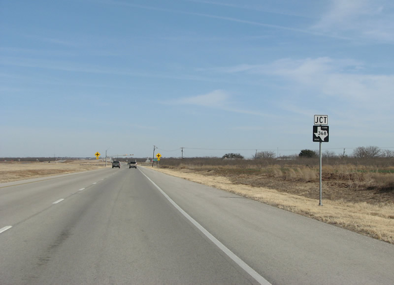 |
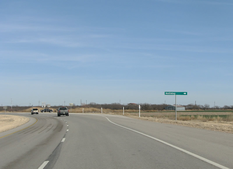
At Holliday, the US highways encounter FM 368 - a right turn here will take motorists into downtown. Photo taken 01/27/08. |
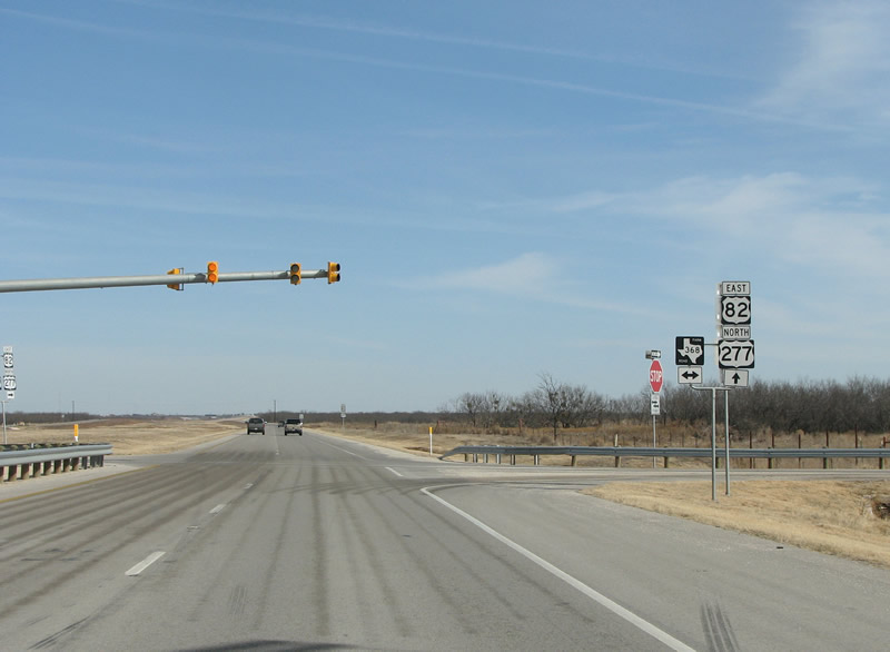 |
US 82/277 eastbound at FM 368 at Holliday. A flashing yellow light here tells of the intersection, and the median is wide enough to accommodate future freeway lanes. Photo taken 01/27/08. |
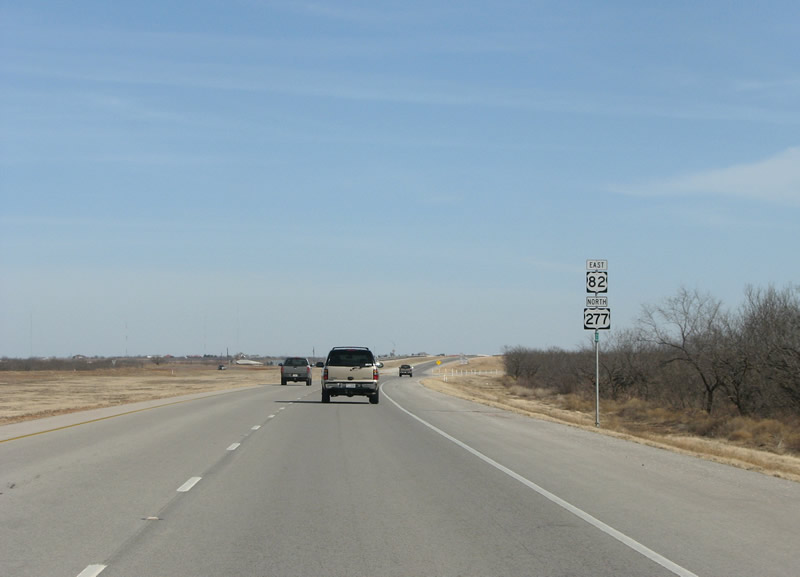 |
US 82/277 reassurance markers on the north side of Holliday. Photo taken 01/27/08. |
 |
On the eastern side of the bypass, a grade separation takes motorists over the old route. This time, the US 82 nonexistent business route is correctly omitted. Photo taken 01/27/08. |
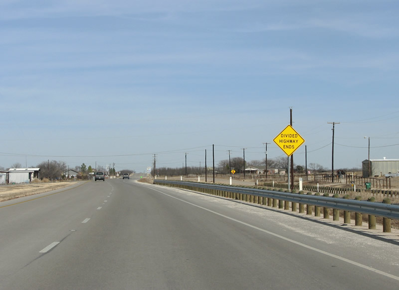 |
As the US highways leave Holliday and enter the Wichita Falls area, the divided highway ends and the road takes on a suburban-rural arterial feel to it. Also, US 82/277 enter Wichita County here. For US 277, this is the last county in Texas. Photo taken 01/27/08. |
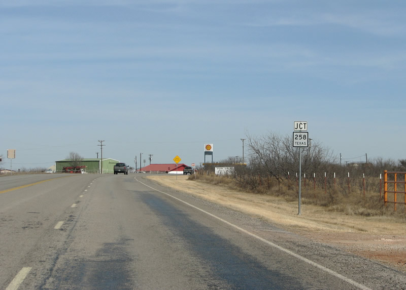 |
The first state highway encountered in the Wichita Falls area is SH 258. This view looks northward towards the junction. Photo taken 01/27/08. |
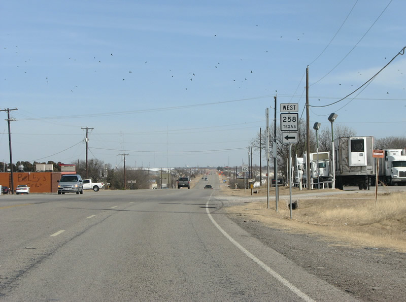 |
US 82/277 northbound at SH 258's eastern end. SH 258 is a short state road that connects to the community of Kamay and SH 25. Photo taken 01/27/08. |
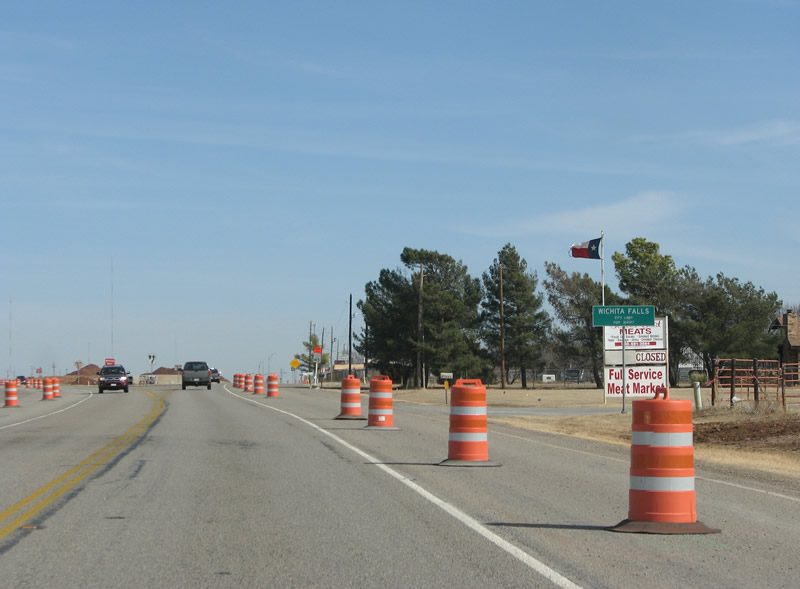 |
Construction barrels are the order of the day as US 82/277 enters the city limits of Wichita Falls. Wichita Falls claims natives Mia Hamm, Tommy Tune, and the band Bowling for Soup. Photo taken 01/27/08. |
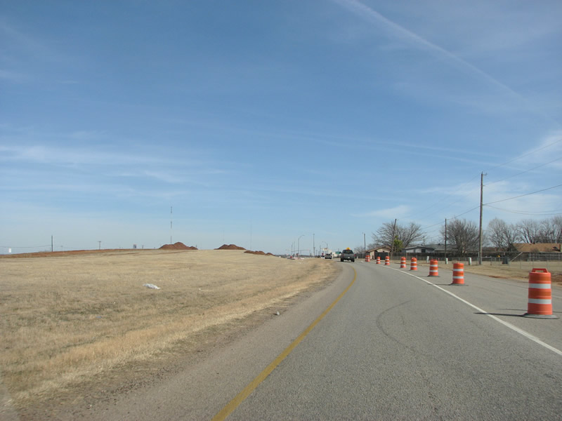 |
Piles of earth are visible in this construction area as US 82/277 widen to form frontage roads for a freeway. Photo taken 01/27/08. |
 |
The first suburban street encountered in Wichita Falls is FM 369 (Southwest Parkway). The FM road provides an arterial bypass of the city to the south and southwest. This also marks the future beginning of the Kell Freeway. Phase 4 of the freeway project will begin here with an overpass at FM 369. Construction was underway when this photo was taken. Photo taken 01/27/08. |
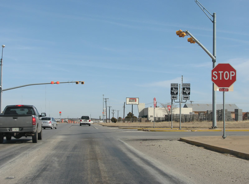 |
US82/277 (Kell Boulevard) eastbound at Southwest Parkway in Wichita Falls. This is the first stop along the road since Seymour, 50 miles to the southwest. Photo taken 01/27/08. |
 |
US 82/277 reassurance markers along the Kell Freeway frontage roads in Wichita Falls. This area is one of the city's industrial districts, with many factories and manufacturing areas. Photo taken 01/27/08. |
 |
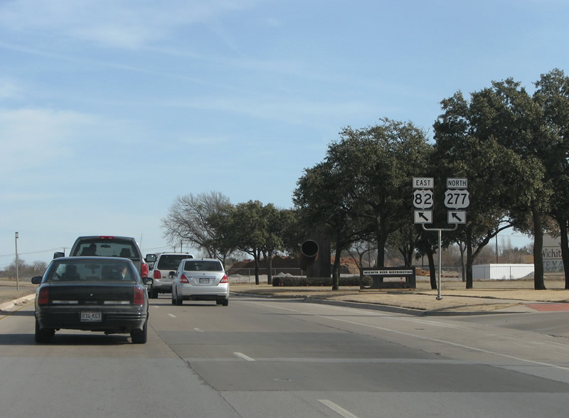
Advance signage appears for the junction of US 277 business. Like other 3-digit US highway routes in Texas, this one says "Business" twice. US 277 Business runs northeastward into downtown Wichita Falls. Photo taken 01/27/08. |
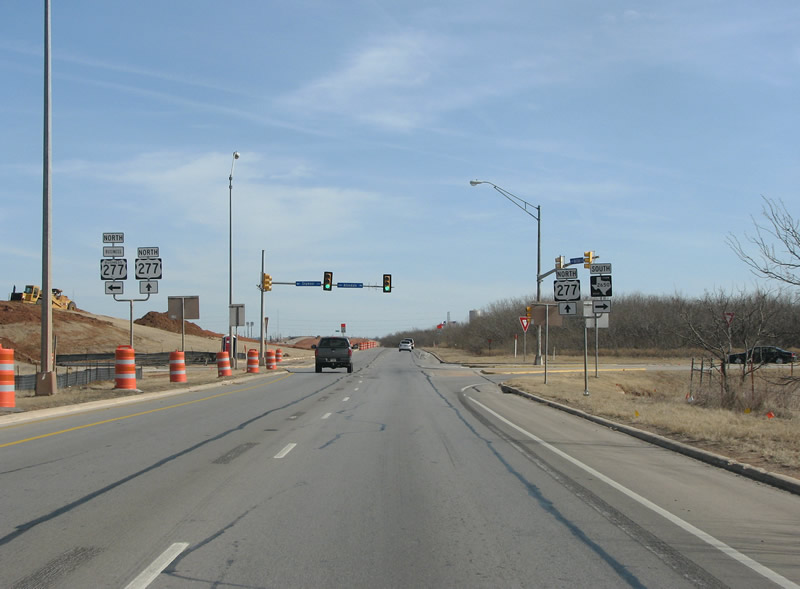 |
US 277 continues northeastward here, along with the (not signed here) US 82. The US highway was recently routed with US 82 along the new freeway alignment. Photo taken 01/27/08. |
 |
This view looks northeastward at Kell Freeway construction on the extreme southwest side of Wichita Falls. This section, phase 4 of the project, is 3.5 miles long and will include 3 overpasses. Photo taken 01/27/08. |
 |
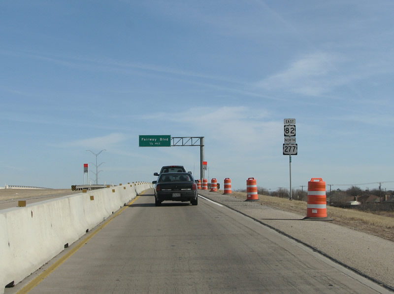
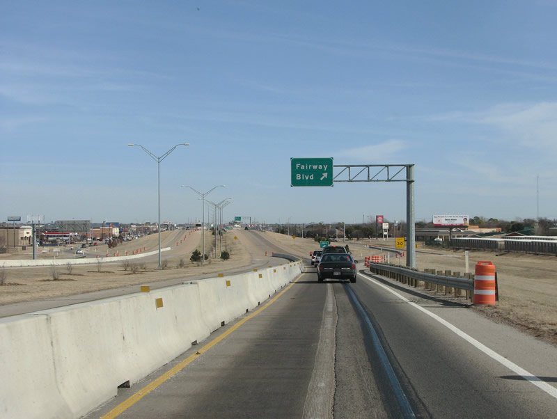
The freeway's mainlanes begin just west of Fairway Boulevard. Traffic in the left lane of the frontage roads must enter the freeway. Photo taken 01/27/08. |
 |
The Kell Freeway's western beginning is marked with more reassurance signs for motorists. This section of the freeway, phase 3, was opened in March, 2003. Photo taken 01/27/08. |
 |
The first exit along the route is at Fairway Boulevard, which is a suburban arterial on Wichita Falls' west side. Photo taken 01/27/08. |
 |
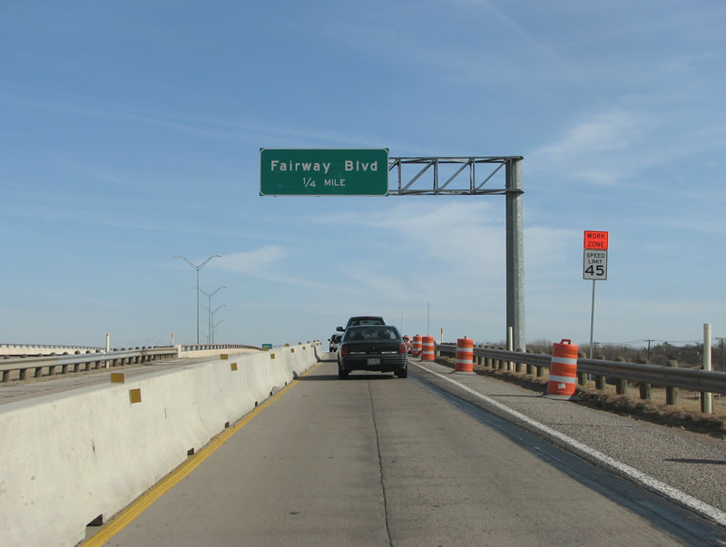
Traffic is restricted in the construction zone until the Fairway exit. Note the lack of exit numbers along this US highway freeway. Photo taken 01/27/08. |
 |
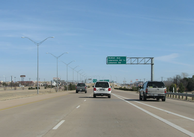
Clearview signs mark the next several exits along the Kell Freeway. Here on its west side, it is 4 lanes of concrete. Photo taken 01/27/08. |
 |
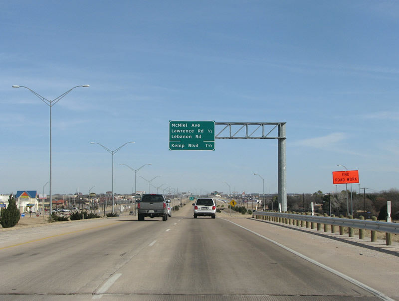
Another advance exit sign is here, before the McNiel exit. The industrial areas have turned into rows of shopping centers and big box stores. Photo taken 01/27/08. |
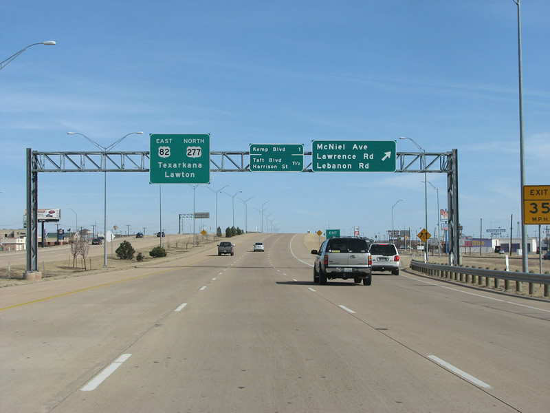 |
This view looks east along the Kell Freeway at the McNiel exit. Much of Wichita Falls' large retail sits at this exit. Note the much smaller font size on the center sign, possibly a contractor's mistake. Texarkana is listed as a control point for US 82, and Lawton, OK for US 277. Also, the freeway has widened to 6 lanes. Photo taken 01/27/08. |
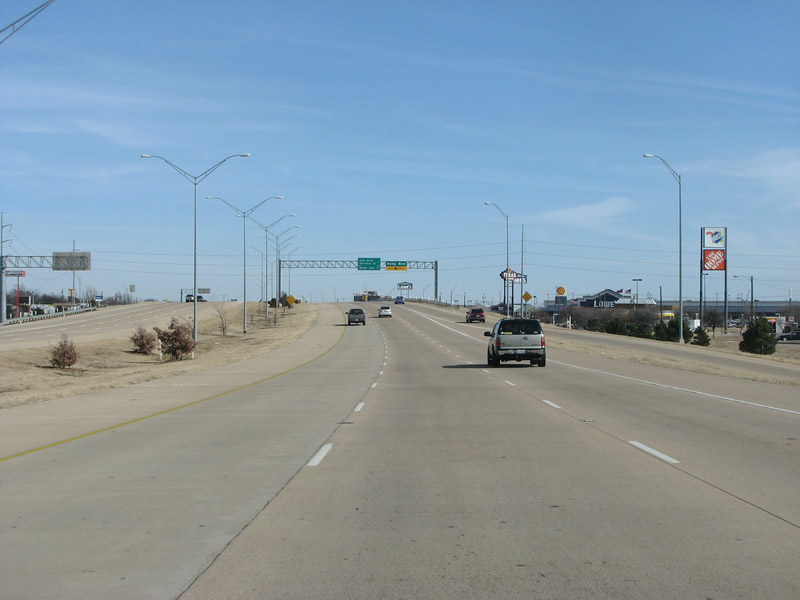 |
A view of the Kell Freeway eastbound past McNiel. The next exit, at Kemp, marks the eastern end of the $17.5 million 2003 section of freeway. Photo taken 01/27/08. |
 |
Advance signage before Kemp. The road is named for Joseph Kemp, an early civic leader and oilman here. Tons of things here in Wichita Falls (a library, roads, schools, a lake) are named after him. Photo taken 01/27/08. |
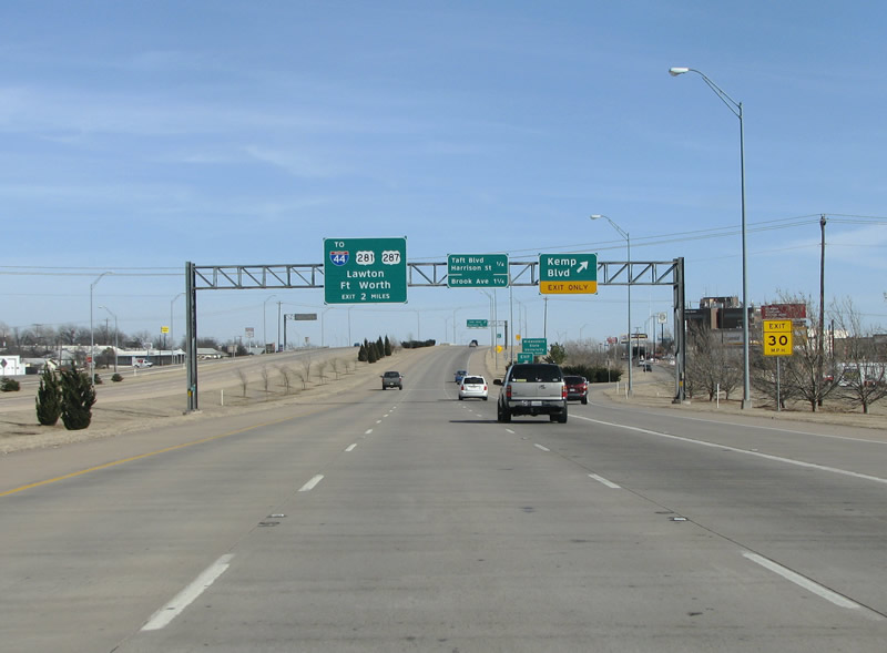 |
This view looks northeast along the Kell Freeway at Kemp Boulevard. A collector/distributor lane connects this exit with the previous onramp. IH 44 is mentioned here for the first time along with its US highway twins. Until IH 44 was extended to Wichita Falls in 1987, it was the largest city in the United States without an interstate highway. Photo taken 01/27/08. |
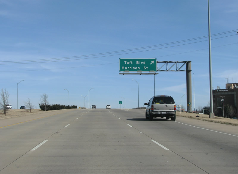 |
The Kell Freeway eastbound at Taft/Harrison. This marks the site of Phase 1 of the freeway's construction, from the Kemp onramp to the Taft/Harrison exit. This very short section of freeway opened in 1988. Photo taken 01/27/08. |
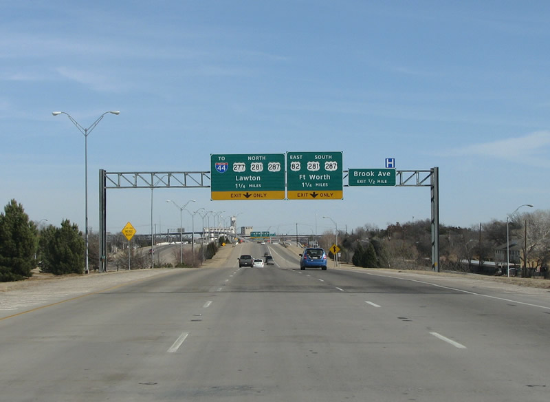 |
The end of the freeway is visible here after Taft, this also marks the beginning of the section of freeway that opened in July 1990. Lawton and Fort Worth are control points here, Texas omits state abbreviations from control points that are beyond its borders (thus, no "OK" on the Lawton sign). Photo taken 01/27/08. |
 |
The left lane ends as the Kell Freeway prepares to enter the stack interchange at its eastern end. The freeway was named after Kell Boulevard, which was in turn named for Frank Kell. He was an industrialist who ran the Wichita Mill and grain Elevator Company, which brought thousands of jobs to Wichita Falls in the early 20th century. Photo taken 01/27/08. |
 |
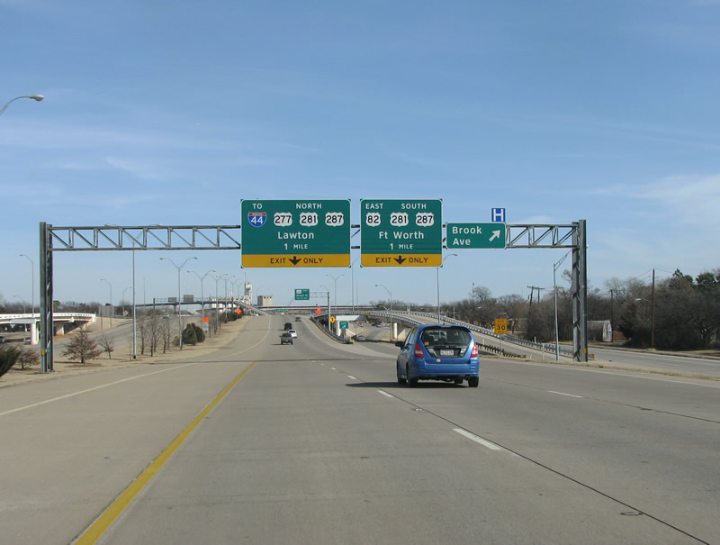
The freeway goes down to 2 lanes and has threaded ramps at Brook Avenue here. There is a very wide median which is well landscaped, and the small skyline of Wichita Falls is visible on the horizon to the left. Spur 447 is the next exit, and traffic can use it to enter downtown. Photo taken 01/27/08. |
 |
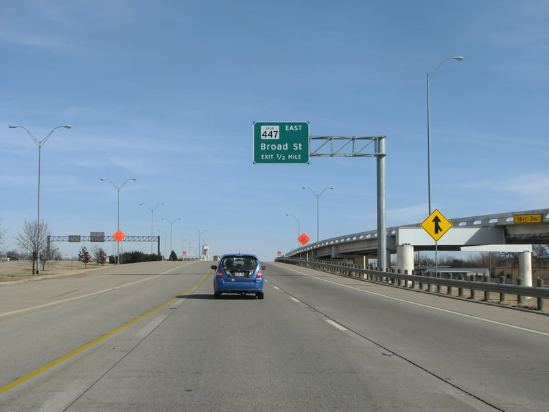
The freeway ends here at the stack with US 287/281. There is no more signage for the Spur 447, other than a small exit sign on the right. Until very recently, from 1990 until 2007, all traffic was forced to exit here Spur 447 and endure several traffic lights to get on US 281/287/IH 44. Photo taken 01/27/08. |
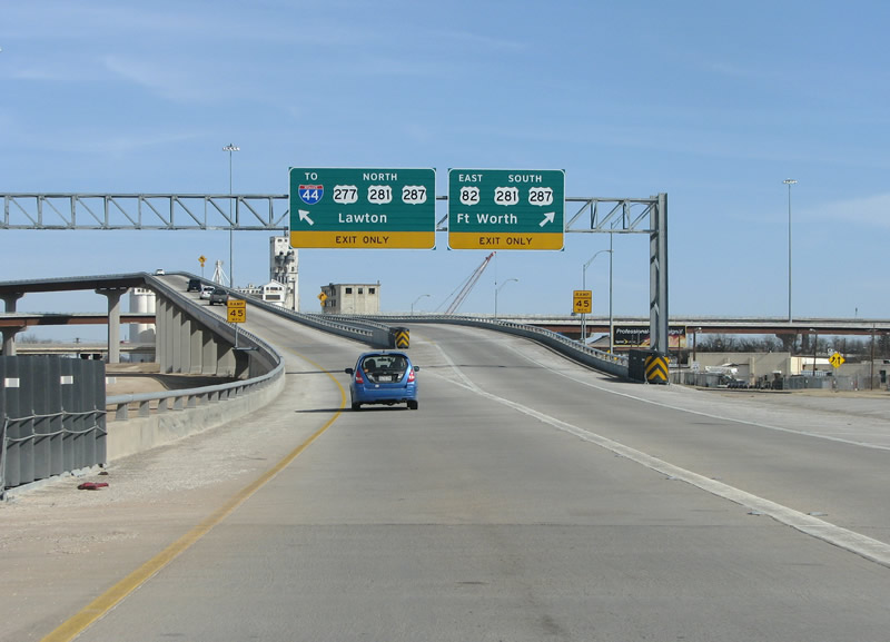 |
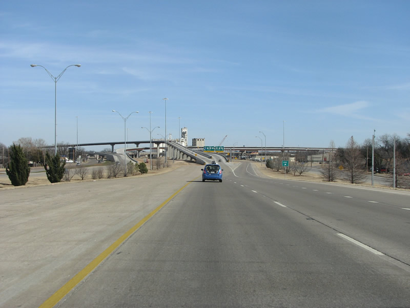
US 82 begins its eastward journey to Texarkana here as the Kell Freeway ends. Finished in late 2007, this stack is locally known as the "Falls flyover" (after a local contest in the summer of 2005). Taking the left lane here, traffic follows one of two flyovers past downtown Wichita Falls and onto IH 44, as indicated on the overhead sign here. Photo taken 01/27/08. |
Page Updated February 1, 2008.
|
About Contact FAQ |
Spotlights Interstate Guide |
Social Media:
 |
|
© 2000-25 AARoads.com | All Rights Reserved | Privacy Policy / Terms of Use
|
||