
Interstate 80 West - Carbon County
| Interstate 80 West | |
|---|---|
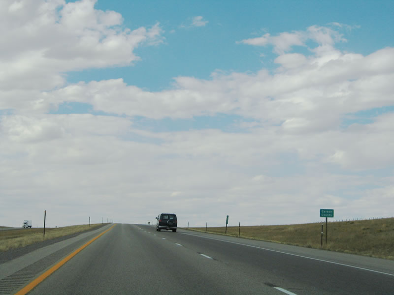 |
Now leaving the Laramie Basin, Interstate 80 leaves Albany County and enters Carbon County. The freeway prepares to skirt the northern fringe of the Snowy Range (Medicine Bow Mountains). During most months, the grassy areas are dormant, but look for vibrant flowers along both sides of the freeway during the springtime. Photo taken 09/06/05. |
 |
The first exit along westbound Interstate 80 in Carbon County is Exit 279, Junction Carbon County Route 15, Cooper Cove Road. Photo taken 09/06/05. | ||||||||||||||||||||||||||||||||||||||||||||||||||||||||||||||||||||||||||||||||||||||||||||||
 |
At the base of the offramp to Exit 279, Junction Carbon County Route 15, Cooper Cove Road, is this sign. Turn left to Cooper Cove and right to Diamond Lake. Photo taken 09/06/05. | ||||||||||||||||||||||||||||||||||||||||||||||||||||||||||||||||||||||||||||||||||||||||||||||
 |
After Exit 279, this mileage sign provides the distance to Rawlins and Rock Springs. Photo taken 09/06/05. | ||||||||||||||||||||||||||||||||||||||||||||||||||||||||||||||||||||||||||||||||||||||||||||||
 |
Legions of wind turbines line the mesa above Arlington. Power generated here is distributed throughout the Intermountain West. Photo taken 09/06/05. | ||||||||||||||||||||||||||||||||||||||||||||||||||||||||||||||||||||||||||||||||||||||||||||||
 |
The next exit along westbound Interstate 80 is Exit 272, Wyoming 13 to Arlington and Rock River. Photo taken 09/06/05. | ||||||||||||||||||||||||||||||||||||||||||||||||||||||||||||||||||||||||||||||||||||||||||||||
 |
Due to winter storms, winds, and ice, Interstate 80 through Arlington is among the most frequently closed sections of Interstate 80. Photo taken 09/06/05. | ||||||||||||||||||||||||||||||||||||||||||||||||||||||||||||||||||||||||||||||||||||||||||||||
 |
A full array of services (food, gas, phone) are available here. While there is no lodging available, to the north is a private campground (open to the public) that lies alongside the Rock Creek. Photo taken 09/06/05. | ||||||||||||||||||||||||||||||||||||||||||||||||||||||||||||||||||||||||||||||||||||||||||||||
 |
The wind turbines come into view on the cliff above the Rock Creek. Photo taken 09/06/05. | ||||||||||||||||||||||||||||||||||||||||||||||||||||||||||||||||||||||||||||||||||||||||||||||
 |
Westbound Interstate 80 reaches Exit 272, Wyoming 13. Follow Wyoming 13 northeast to Rock River, where the state highway meets U.S. 30-287, the Lincoln Highway. Photo taken 09/06/05. | ||||||||||||||||||||||||||||||||||||||||||||||||||||||||||||||||||||||||||||||||||||||||||||||
 |
A New York-style neutered Interstate 80 shield is posted after the Wyoming 13 interchange. At the top of this slope, Elk Mountain comes into view for the first time on westbound. Photo taken 09/06/05. | ||||||||||||||||||||||||||||||||||||||||||||||||||||||||||||||||||||||||||||||||||||||||||||||
 |
Between Laramie and Elk Mountain, Interstate 80 follows the Overland Trail. The Overland Trail was a route used in the 1800s by pioneers to cross the frontier region en route to the West Coast; it is memorialized in markers along Interstate 80, including one at Exit 272 (Arlington). Photo taken 09/06/05. | ||||||||||||||||||||||||||||||||||||||||||||||||||||||||||||||||||||||||||||||||||||||||||||||
 |
Looking to the northeast, we see one final view of the wind turbines that line the bluff above Arlington. Photo taken 09/06/05. | ||||||||||||||||||||||||||||||||||||||||||||||||||||||||||||||||||||||||||||||||||||||||||||||
 |
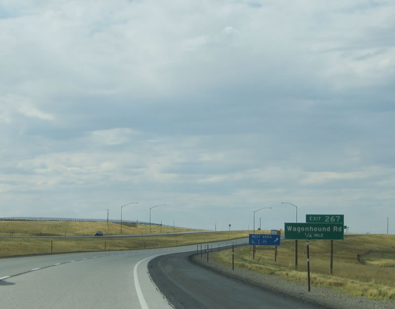
The next exit along westbound Interstate 80 is Exit 267, Junction Carbon County Route 402, Wagonhound Road/Rest Area. The rest area serves both directions of the freeway and is located on the south side of Interstate 80. Photo taken 09/06/05. | ||||||||||||||||||||||||||||||||||||||||||||||||||||||||||||||||||||||||||||||||||||||||||||||
 |
Wagonhound Road is part of Carbon County Route 402, which parallels Interstate 80 between Arlington and Elk Mountain. Carbon County Route 402 again interchanges with Interstate 80 at Exit 260 (Junction Carbon County Route 3 and 402). Photo taken 09/06/05. | ||||||||||||||||||||||||||||||||||||||||||||||||||||||||||||||||||||||||||||||||||||||||||||||
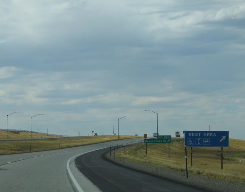 |
The Wagonhound Rest Area provides restroom facilities, running water, telephone, and picnic area. The wind is almost always blowing through this rest stop. Photo taken 09/06/05. | ||||||||||||||||||||||||||||||||||||||||||||||||||||||||||||||||||||||||||||||||||||||||||||||
 |
Westbound reaches Exit 267, Junction Carbon County Route 402, Wagonhound Road/Rest Area. Photo taken 09/06/05. | ||||||||||||||||||||||||||||||||||||||||||||||||||||||||||||||||||||||||||||||||||||||||||||||
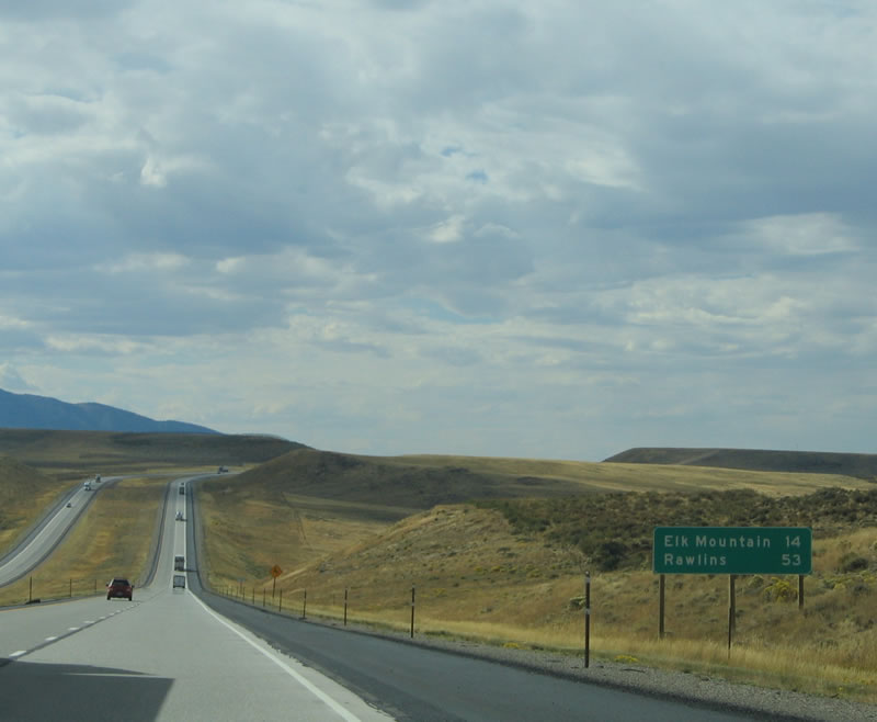 |
This mileage sign provides the distance to Elk Mountain and Rawlins via Interstate 80. Elk Mountain is a small community nestled near the foot of the mountain of the same name. Use Exit 260 or Exit 255 to enter Elk Mountain. Photo taken 09/06/05. | ||||||||||||||||||||||||||||||||||||||||||||||||||||||||||||||||||||||||||||||||||||||||||||||
 |
Lines of snow fences carve their way through the landscape to help alleviate problems related to blowing snow. Prior to the installation of these snow fences, keeping Interstate 80 open during winter was much more of a challenge. Snow fences effectively pile up blowing snow and allow the wind to cross the highway unabated, thus pushing snow off the highway pavement. Large piles of snow adjacent to snow fences is common during the winter and even well into the spring. Photo taken 09/06/05. | ||||||||||||||||||||||||||||||||||||||||||||||||||||||||||||||||||||||||||||||||||||||||||||||
 |
A truck parking area is located after the Wagonhound Rest Area and prior to the Carbon County Route 402 interchange. Photo taken 09/06/05. | ||||||||||||||||||||||||||||||||||||||||||||||||||||||||||||||||||||||||||||||||||||||||||||||
 |
A herd of cattle rests on a grassy slope in the mid-afternoon. Ranching is a very common activity in Wyoming, and agriculture is much less common. The soil here is not as good for farming, and water sources are scarce. Photo taken 09/06/05. | ||||||||||||||||||||||||||||||||||||||||||||||||||||||||||||||||||||||||||||||||||||||||||||||
 |
The next exit along westbound Interstate 80 is Exit 260, Junction Carbon County Route 3 (Elk Mountain-Medicine Bow Road) northeast to Medicine Bow and Junction Carbon County Route 402 (Elk Mountain-Arlington Road/Wagonhound Road) west to Elk Mountain. The highway guide sign is less than descriptive. Photo taken 09/06/05. | ||||||||||||||||||||||||||||||||||||||||||||||||||||||||||||||||||||||||||||||||||||||||||||||
 |
Westbound Interstate 80 reaches Exit 260, Junction Carbon County Route 402 near Elk Mountain. Approximately 192 people live here (2000 Census). One of the main attractions in Elk Mountain is Elk Mountain Ranch. All sorts of wildlife, including elk, mule deer, antelope, and bison (buffalo), graze on the private slopes of Elk Mountain. Photo taken 09/06/05. | ||||||||||||||||||||||||||||||||||||||||||||||||||||||||||||||||||||||||||||||||||||||||||||||
 |
Interstate 80 crosses over the Medicine Bow River, which is also part of the North Platte River drainage. The Medicine Bow River travels northeast to Medicine Bow, then angles northwest to join the North Platte River in the Seminoe Reservoir (northeast of Rawlins). Photo taken 09/06/05. | ||||||||||||||||||||||||||||||||||||||||||||||||||||||||||||||||||||||||||||||||||||||||||||||
 |
Just a short distance west of the previous photo, Interstate 80 crosses the main branch of the Medicine Bow River. Photo taken 09/06/05. | ||||||||||||||||||||||||||||||||||||||||||||||||||||||||||||||||||||||||||||||||||||||||||||||
 |
Elk Mountain defines the northwestern corner of the Snowy Range mountains. With significant sections privately owned, Elk Mountain is not easily accessible without paying for the privilege. At an elevation of 11,156 feet above sea level, Elk Mountain rises over 3,500 feet from its base (at around 7,500 feet). Photo taken 09/06/05. | ||||||||||||||||||||||||||||||||||||||||||||||||||||||||||||||||||||||||||||||||||||||||||||||
 |
The next exit along westbound Interstate 80 is Exit 255, Wyoming 72. Traveling north, Wyoming 72 crosses no fewer than four separate alignments of the Lincoln Highway before reaching the town of Hanna, including the current route along U.S. 30-287. "Old Lincoln Highway" is signed through Hanna and follows the Union Pacific Railroad tracks along Carbon County Route 316W. Photo taken 09/06/05. | ||||||||||||||||||||||||||||||||||||||||||||||||||||||||||||||||||||||||||||||||||||||||||||||
 |
Westbound Interstate 80 reaches Exit 255, Wyoming 72 north to Hanna and south to Elk Mountain. Unlike most state routes in Wyoming, Wyoming 72 does not start or end at an Interstate, U.S., or state highway. Instead, Wyoming 72 begins in Elk Mountain at Carbon County 402 and ends in Hanna. The Wyoming 72 overpass is the only overpass on Interstate 80 between the Curtis Street interchange in Laramie and Walcott Junction. To Carbon County Route 400 (Rattlesnake Road), follow Wyoming 72 and make the first westbound turn. Rattlesnake Road connects with Wyoming 130 south of Walcott Junction. Photo taken 09/06/05. | ||||||||||||||||||||||||||||||||||||||||||||||||||||||||||||||||||||||||||||||||||||||||||||||
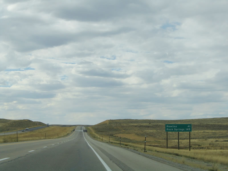 |
After the Wyoming 72 interchange, the next mileage sign along westbound Interstate 80 provides the distance to Rawlins and Rock Springs. Photo taken 09/06/05. | ||||||||||||||||||||||||||||||||||||||||||||||||||||||||||||||||||||||||||||||||||||||||||||||
 |
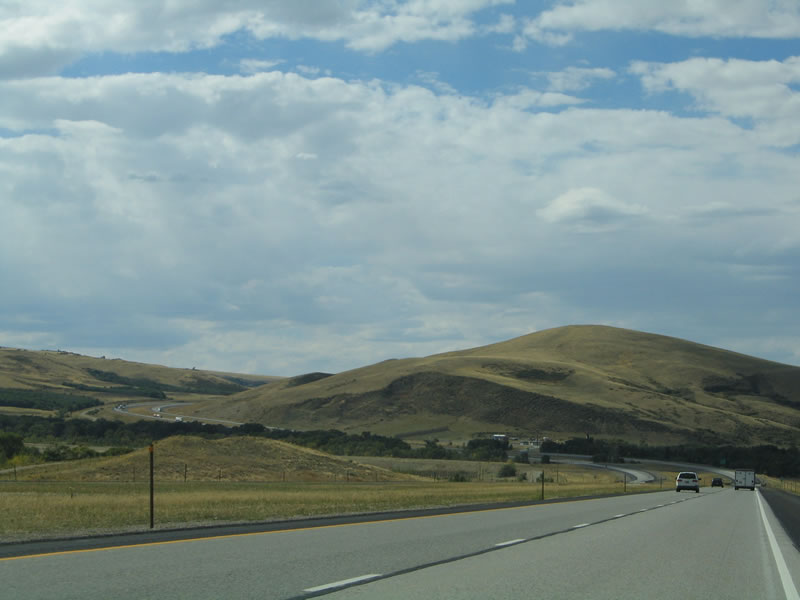
Four-lane Interstate 80 continues through the high altitude desert, but with a significant change: the prairie grasses that dominated the Laramie Basin and north edge of the Snowy Range now give way to more sagebrush and less grasses. Photo taken 09/06/05. | ||||||||||||||||||||||||||||||||||||||||||||||||||||||||||||||||||||||||||||||||||||||||||||||
 |
The endless horizon along this stretch of Interstate 80 allows drivers moments to reflect in between negotiating around trucks and staying within the speed limit. Wildlife crossings and fences allow antelope, deer, and elk to pass under Interstate 80 rather than passing onto the fast-paced freeway. Photo taken 09/06/05. | ||||||||||||||||||||||||||||||||||||||||||||||||||||||||||||||||||||||||||||||||||||||||||||||
 |
More snow fences line the top of the ridge on the southwest edge of Interstate 80. Seventeen miles separate Exit 255 (Wyoming 72) and Exit 235 (Peterson Road). Photo taken 09/06/05. | ||||||||||||||||||||||||||||||||||||||||||||||||||||||||||||||||||||||||||||||||||||||||||||||
 |
The next exit along westbound Interstate 80 is Exit 235, Peterson Road. There are no services available at this interchange. Photo taken 09/06/05. | ||||||||||||||||||||||||||||||||||||||||||||||||||||||||||||||||||||||||||||||||||||||||||||||
 |
Continuing west, Interstate 80 next approaches Exit 235, U.S. 30 East, U.S. 287 South, and Wyoming 130 South. West of here, U.S. 30-287 merge onto Interstate 80 toward Sinclair and Rawlins. Services are available at this interchange (Walcott Junction). To the south is Saratoga, a major town in the North Platte River Valley. Saratoga is home to the Hobo Hot Springs (while free to the public, the springs are hot with temperatures above 115 degrees). Photo taken 09/06/05. | ||||||||||||||||||||||||||||||||||||||||||||||||||||||||||||||||||||||||||||||||||||||||||||||
 |
Wyoming 130 heads south to Saratoga along an alignment roughly parallel to the Wyoming-Colorado Railroad. Southeast of Saratoga, Wyoming 130 turns east over the Snowy Range (via Ryan Park and Libby Flats) to Centennial and Laramie. While closed during the winter, the section of Wyoming 130 over the Snowy Range is a national forest scenic byway and part of a state scenic loop route. With elevations between 8,100 and 10,847 feet, the scenic route passes through high altitude plains, forests, and treeless alpine tundra zones. The high point of the Snowy Range is found in such an alpine tundra zone. Photo taken 09/06/05. | ||||||||||||||||||||||||||||||||||||||||||||||||||||||||||||||||||||||||||||||||||||||||||||||
 |
U.S. 30-287 east follows the old Lincoln Highway to Hanna, Elk Mountain, Rock River, and Laramie alongside the Union Pacific Railroad. Wyoming 130 travels south to Saratoga, then splits with Wyoming 230. Wyoming 130 travels east toward Laramie via the Snowy Range Pass, while Wyoming 230 continues the route south toward Riverside, Encampment, Three Way, and Walden, Colorado. Photo taken 09/06/05. | ||||||||||||||||||||||||||||||||||||||||||||||||||||||||||||||||||||||||||||||||||||||||||||||
| Interstate 80 and U.S. 30 Westbound, U.S. 287 Northbound | |||||||||||||||||||||||||||||||||||||||||||||||||||||||||||||||||||||||||||||||||||||||||||||||
|---|---|---|---|---|---|---|---|---|---|---|---|---|---|---|---|---|---|---|---|---|---|---|---|---|---|---|---|---|---|---|---|---|---|---|---|---|---|---|---|---|---|---|---|---|---|---|---|---|---|---|---|---|---|---|---|---|---|---|---|---|---|---|---|---|---|---|---|---|---|---|---|---|---|---|---|---|---|---|---|---|---|---|---|---|---|---|---|---|---|---|---|---|---|---|---|
 |
This mileage sign along westbound Interstate 80 and U.S. 30-287 provides the distance to Sinclair and Rawlins. On the day this picture was taken, highway crews were repaving the highway in preparation for the winter season. Photo taken 09/06/05. | ||||||||||||||||||||||||||||||||||||||||||||||||||||||||||||||||||||||||||||||||||||||||||||||
 |
The next exit along westbound is Exit 228, Fort Steele/Rest Area. Like the Wagonhound Rest Area, the Fort Steele Rest Area serves both direction of travel. The rest area sits on the north side of the freeway near a old Lincoln Highway truss bridge over the North Platte River. To the north of the rest area, the Fort Fred Steele State Historic Site is located near the Union Pacific Railroad. Photo taken 09/06/05. | ||||||||||||||||||||||||||||||||||||||||||||||||||||||||||||||||||||||||||||||||||||||||||||||
 |
Fort Fred Steele was established in 1868 at the point where the Union Pacific Railroad meets the North Platte River. The base was used during the various skirmishes with Indians during the latter part of the 19th century. When those skirmishes settled down, the fort was decommissioned and abandoned in 1886, only 18 years after its inception. Photo taken 09/06/05.
 This steel truss bridge over the North Platte River was constructed in 1931 as part of transcontinental U.S. 30. The bridge still stands today, but it is no longer in use as a major thoroughfare. It is readily visible from motorists along westbound Interstate 80. Photo taken 09/06/05.
|  Westbound Interstate 80 and U.S. 30-287 reach Exit 228, Fort Steele/Rest Area. Photo taken 09/06/05.
| 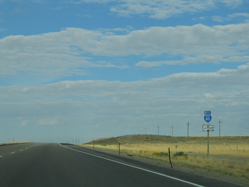 A reassurance shield assembly is posted for Interstate 80, U.S. 30, and U.S. 287 after the Fort Fred Steele interchange. U.S. 287 remains signed along with Interstate 80 until Rawlins; U.S. 30 remains with Interstate 80 until just west of Little America. Photo taken 09/06/05.
|  An oil town, Sinclair is only seven miles west of here, while Rawlins (the seat of Carbon County) is another six miles west of Sinclair. Photo taken 09/06/05.
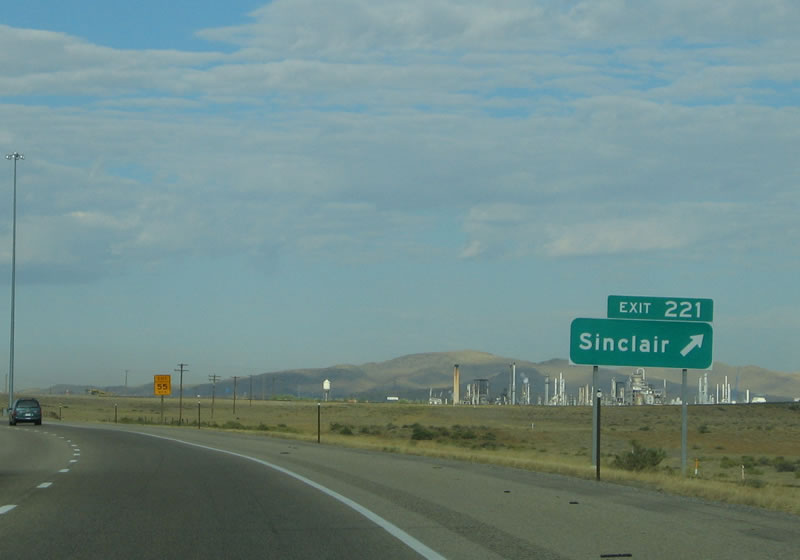
|  The next exit along westbound is Exit 221, Wyoming 76, Lincoln Avenue. Wyoming 76 follows the old alignment of U.S. 30-287 through Sinclair. A large oil refinery dominates the skyline of Sinclair. To the north, follow Carbon County Route 351 (North Tenth Street) to the Seminoe Reservoir. Photo taken 09/06/05.
|  The town of Sinclair is home to 423 residents as of the 2000 Census. Established in 1922 as a company town for the oil refinery, Sinclair was originally known as Parco, for the Producers and Refiners Corporation. When Sinclair Oil bought Parco in 1934, the name of the "Wonder Town of Wyoming" was changed to reflect the new ownership: Sinclair. The Parco Inn, located in the center of town, is a Spanish Colonial style building that is currently rented but has been closed recently. Photo taken 09/06/05.
|  The spires of the oil refinery come into view as westbound Interstate 80 approaches Exit 221, Wyoming 76, Sinclair. While Wyoming 76 through Sinclair would make a logical business loop, we have not seen any signs that provide evidence of such a designation. Photo taken 09/06/05.
|  Downtown Sinclair (formerly Parco) is a national historic district due to its history as a master planned community surrounding the refinery. The entire town was owned by the oil company until 1967, when Sinclair Oil began to sell its buildings and homes to private property owners. Photo taken 09/06/05.
|  Westbound Interstate 80 and U.S. 30-287 reaches Exit 221, Wyoming 76/Lincoln Avenue west to Sinclair. Use this exit to follow Carbon County Route 351 north to Seminoe Reservoir. Photo taken 09/06/05.
|  Another full set of reassurance shields for Interstate 80 and U.S. 30-287 is posted after the first Wyoming 76 interchange. Photo taken 09/06/05.
|  The Sinclair Oil Refinery comes into view to the north of Interstate 80. Photo taken 09/06/05.
| 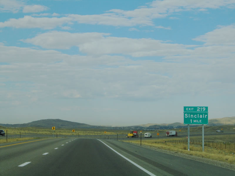 The next exit along westbound Interstate 80 is Wyoming 76/Lincoln Avenue to Sinclair. To the west, Wyoming 76 continues along the frontage road to the south of Interstate 80, connecting directly with Business Loop I-80 in Rawlins (Exit 215). Photo taken 09/06/05.
| 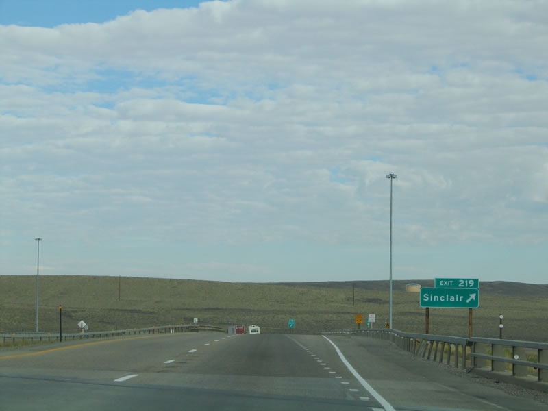 Westbound Interstate 80 and U.S. 30-287 reach Exit 219, Wyoming 76/Lincoln Avenue to downtown Sinclair and to the old alignment of the Lincoln Highway. Photo taken 09/06/05.
|  Continuing west from Sinclair, Interstate 80 and U.S. 30-287 ascends a brief rise with the freeway passing through a cut in the butte. The city of Rawlins lies on the other side of the butte. The old alignment of U.S. 30-287 (Lincoln Highway) bypasses the butte to the south via Wyoming 76. Photo taken 09/06/05.
|  Interstate 80 and U.S. 30-287 are co-signed again after traffic from Wyoming 76 merges onto westbound. The next exit is a major splitting of the routes: U.S. 287 continues its journey northwest toward northwest Wyoming, while Interstate 80 continues west toward western Wyoming. Photo taken 09/06/05.
|  Rawlins is six miles ahead, and it is the last city on Interstate 80 until reaching Rock Springs, which is 113 miles west of here. Photo taken 09/06/05.
|  Chief Washakie was head of the Cheyenne tribe of Indians. During the 1800s, Chief Washakie assisted and befriended white settlers who came to Wyoming during the frontier days. In honor of his memory, U.S. 287 is also signed as "Chief Washakie Trail" between Rawlins and Fort Washakie in the Wind River Indian Reservation northwest of Lander in Fremont County. Photo taken 09/06/05.
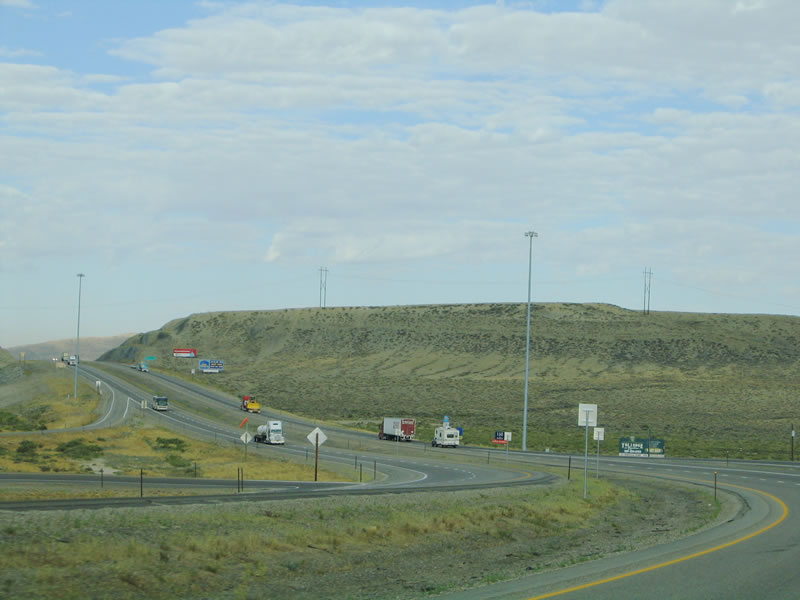
|  The next three exits (Exit 215, Junction Business Loop I-80/Cedar Street; Exit 214, Wyoming 78, Higley Boulevard; and Exit 211, Junction Business Loop I-80/Spruce Street) all serve the city of Rawlins, which is the seat of Carbon County. Named after General John A. Rawlins, the city was incorporated in 1886. At an elevation of 6,755 feet, Rawlins is semi-arid, with only 10.9 inches of precipitation (of which 41 inches are snowfall) on average. This being southern Wyoming, wind is always a factor, and the average wind speed is 11.9 miles per hour. A little more than half of Carbon County's population calls Rawlins home; 8,538 people live in the city as of the 2000 Census, and Carbon County has 15,639 people as of the same time period. Photo taken 09/06/05.
| 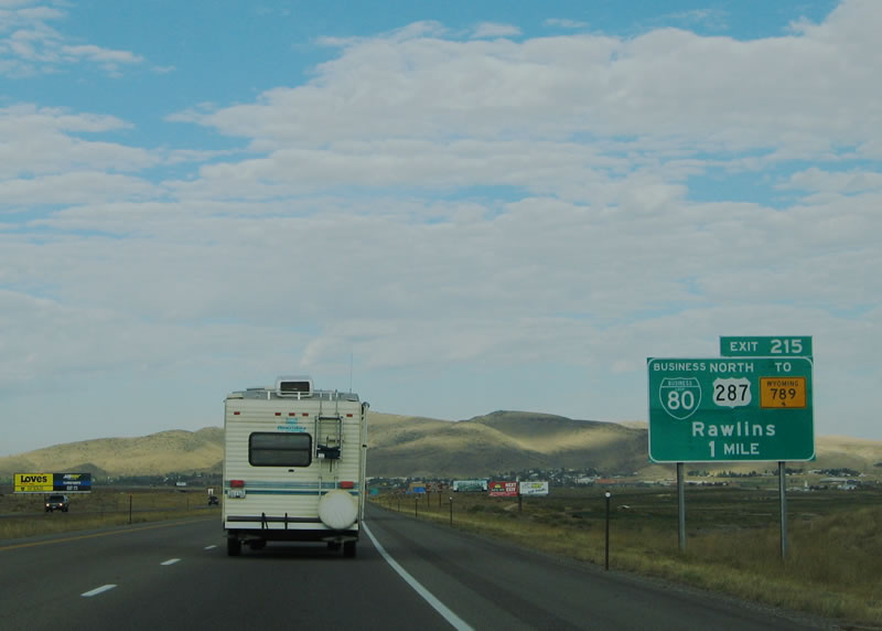 The next exit along westbound Interstate 80 is Exit 215, Junction Business Loop I-80, U.S. 287, and Business U.S. 30 to Wyoming 789 and Wyoming 76. The business loop follows Cedar Street into town, turns north briefly on Third Street, then turns west again via Spruce Street. This entire route through town was part of the Lincoln Highway except that the old road followed Fifth Street instead of Third Street to connect from Cedar to Spruce Street. Photo taken 09/06/05.
|  Points of interest for Exit 215 innclude the Wyoming Peace Officers Museum, which is located within the former Wyoming Frontier Prison. The Frontier Prison was in operation from 1901 to 1981; the newer Wyoming State Penitentiary is located off Higley Boulevard (Wyoming 78) via Exit 214. Photo taken 09/06/05.
|  The aforementioned Wyoming Peace Officers Museum is located within the frontier prison. The frontier prison is located at Fifth and Walnut, while the Carbon County Museum is located at Ninth and Walnut. Photo taken 09/06/05.
|  Cedar Street and Spruce Street are signed as Business Loop I-80 and Business U.S. 30. Mainline U.S. 30 remains on Interstate 80 to bypass downtown Rawlins. Business U.S. 30 is occasionally signed without a business banner. Photo taken 09/06/05.
| 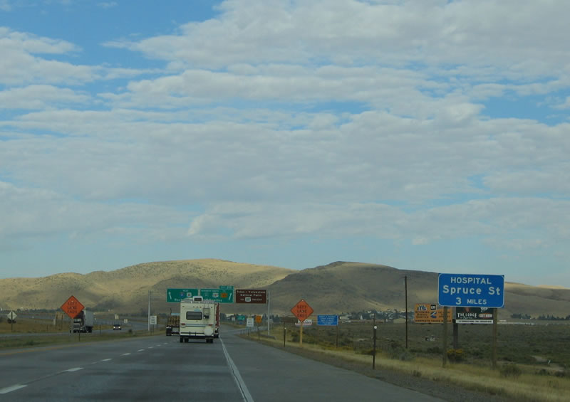 For the Rawlins Memorial Hospital, stay on Interstate 80 westbound until Exit 211, Junction Business Loop I-80, Business U.S. 30, and Wyoming 789 north (Spruce Street). Photo taken 09/06/05.
|  This is the point where Interstate 80 and U.S. 287 part ways permanently. The two routes have been roughly parallel to each other between Laramie and Rawlins, a distance of over 100 miles. U.S. 287 travels northwest from Rawlins toward Grand Teton and Yellowstone National Parks in Northwest Wyoming. Between Rawlins and Lander, U.S. 287 travels with Wyoming 789, which is part of the old Canada Mexico Highway (once planned as U.S. 287). U.S. 287 and Wyoming 789 pass through Muddy Gap (Wyoming 220) and Jeffrey City. While Wyoming 789 turns north toward Riverton, U.S. 287 continues northwest through Fort Washakie before joining with U.S. 26 en route to Crowheart, Dubois, and Grand Teton National Park. Once in the park, U.S. 287 turns north to follow U.S. 89-191 into Yellowstone. U.S. 287 reemerges as an extant route north of West Yellowstone, Montana, after separating from U.S. 20 and U.S. 191. Photo taken 09/06/05.
| Interstate 80 and U.S. 30 Westbound
| 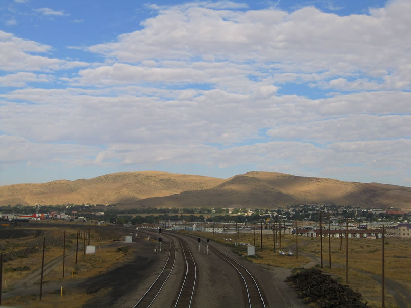 The Union Pacific Railroad passes under Interstate 80 and U.S. 30 as it travels toward the Rawlins depot. Photo taken 09/06/05.
|  A neutered Interstate 80 shield, sans a companion U.S. 30 shield, is posted after the Union Pacific Railroad undercrossing. Photo taken 09/06/05.
|  The next exit along westbound Interstate 80 and U.S. 30 is Exit 214, Wyoming 78, Higley Boulevard. Wyoming 78 is a short state highway that begins in downtown Rawlins at the intersection of Washington Street and Cedar Street (Business Loop I-80) and travels south over the Washington Street viaduct, turns east on State Street, then turns south on Higley Boulevard. Higley Boulevard then travels south past Interstate 80 before ending at the Rawlins State Penitentiary. Photo taken 09/06/05.
|  Higley Boulevard is a name that appears on two different roadways in the Rawlins area. One is this stretch of Wyoming 78, and another is the U.S. 287 bypass between Cedar Street and North Third Street. There is currently no connection between these two Higley Boulevards, but a connection might be contemplated in the future. Photo taken 09/06/05.
|  This view of downtown Rawlins shows the skyline, with the Wyoming 71/Jackson Street bridge crossing the Union Pacific Railroad. Unlike many other Wyoming cities, there is no creek, river, or other significant body of water that passes through Rawlins. Photo taken 09/06/05.
|  The next exit along westbound Interstate 80 and U.S. 30 is Exit 211, Junction Business Loop I-80, Business U.S. 30, and Wyoming 789 (Spruce Street). Wyoming 789 will join with westbound Interstate 80 and U.S. 30 between Exit 211 and Creston Junction (Exit 187) in Sweetwater County. Photo taken 09/06/05.
|  Westbound Interstate 80 and U.S. 30 reaches Exit 211, Junction Business Loop I-80 East, Business U.S. 30 East, and Wyoming 789 North (Spruce Street). A full array of services is available at this interchange. To Sage Creek Road (Wyoming 71) south to Medicine Bow-Routt National Forest (Sierra Madre Unit), follow Spruce Street east to Jackson Street, then follow Jackson Street south to Davis Street. Photo taken 09/06/05.
| Interstate 80 and U.S. 30 Westbound and Wyoming 789 Southbound
|  After the Spruce Street interchange, this shield assembly offers the only instance in Wyoming where an Interstate highway, U.S. highway, and state route share the same pavement and are fully signed. The three routes will remain merged until Exit 187. Wyoming 789 was commissioned in 1954 as part of a "Canada-to-Mexico Highway" that would extend from Nogales, Arizona, north to Sweet Grass, Montana. 789 may have even been contemplated as a potential U.S. highway, but there is no evidence that it was approved by AASHTO, which provides for such designations. Since much of the 789 route shared alignment with existing U.S. highways in the states it passed through, the route appeared superfluous on most maps. Nevertheless, the states of Arizona, New Mexico, Colorado, Wyoming, and Montana all agreed to sign the route for nearly 40 years. Only two extant sections (not shared with another U.S. or state highway) of 789 existed, and both were in Wyoming. Due to the seemingly continuous overlay of 789 on other routes, state unity for keeping this route signed waned in the early 1980s, and by 1984, the route was decommissioned in every state except Wyoming. Here in 2005, Wyoming 789 is still a well-signed, north-south route that bisects the state from Baggs north to Frannie (near Lovell). Photo taken 09/06/05.
|  The next exit along westbound Interstate 80 is Exit 209, Johnson Road. Prior to the emergence of truck stop chains in Wyoming, the Johnson Road interchange was perhaps best known for "Gay Johnson's," a truck stop and automobile repair service. Today the facility is a Flying J. Photo taken 09/06/05.
|  Continuing west, the next town of significance is Wamsutter in the Great Divide Basin in Sweetwater County. Wamsutter is located after Creston Junction, which is where Wyoming 789 turns south toward Baggs. After Wamsutter, Interstate 80 continues across the Red Desert, culminating at Rock Springs, the largest town in southwestern Wyoming. Photo taken 09/06/05.
|  Westbound Interstate 80/U.S. 30 and southbound Wyoming 789 reach Exit 209, Johnson Road. This is the last service along Interstate 80 until Wamsutter at Exit 173, a distance of 36 miles. Photo taken 09/06/05.
| 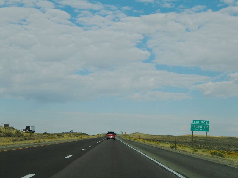 The next exit along westbound is Exit 206, Hadsell Road. Hadsell Road provides local ranch and railroad access. For the entire distance between Rawlins and Rock Springs, the mainline of the Union Pacific Railroad lies south of Interstate 80, with several spurs connecting the mainline to places such as Point of Rocks (near the Jim Bridger Power Plant). Photo taken 09/06/05.
|  The entrance/exit ramp from Interstate 80 to Hadsell Road is nearly a 90-degree turn from the freeway onto the connecting road. The deceleration and acceleration lanes are very limited, and the turn onto the county road is sharp. This kind of interchange design becomes increasingly common west of Rawlins on Interstate 80 within Wyoming; however, several interchanges that used to have this configuration (such as Harriman Road in Laramie County) have been converted into a more traditional diamond format to enhance safety. Photo taken 09/06/05.
| 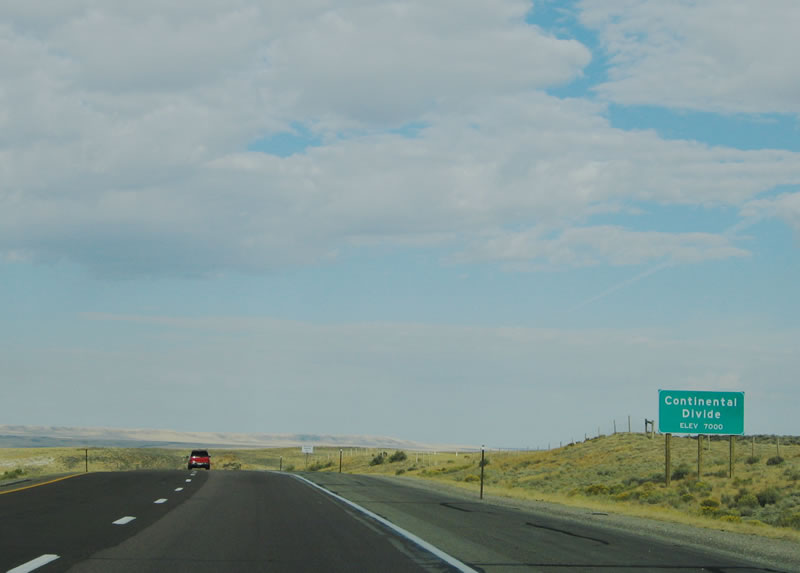 Culminating a long journey from the Eastern Continental Divide near Exit 111 in Pennsylvania, Interstate 80 reaches the first crossing of the Western Continental Divide. The Western Continental Divide splits into two branches in western Carbon County and merge back together near South Pass in southwestern Fremont County. Unlike other western Interstates, Interstate 80 crosses the Continental Divide twice, once here at Milepost 206 and again at Milepost 158. The area between the two divides is known as the Great Divide Basin. In this basin, all precipitation that lands within the basin stays within the basin. East of the Continental Divide, all precipitation runoff drains toward the Atlantic Ocean. West of Continental Divide, all precipitation runoff flows toward the Pacific Ocean. Photo taken 09/06/05.
| | .
 And so, here is a magnificent view of the beauty of the Great Divide Basin. With over 2.5 million acres, the Great Divide Basin consists of sagebrush prairies, sand dunes, salt flats, and buttes. Although there are washes that carry water within the basin, none of the washes or creeks flow toward either ocean. Interstate 80 now enters the Red Desert, which includes part of the Great Divide Basin. The Red Desert is the picturesque area that is one of the most pristine high altitude deserts in the United States. Much of the land here is federally owned and is administered by the Bureau of Land Management (BLM). Photo taken 09/06/05.
|  The next exit along westbound Interstate 80, U.S. 30, and Wyoming 789 is Exit 204, Knobs Road. This is another local access exit that provides access to BLM land and the railroad as well as ranch access. Conservation efforts for the region sometimes do not mix well with the continuing effort to extract coal, oil, and gas reserves from the energy-rich ground. In fact, a large development for the additional mining of energy resources around Wamsutter in October 2005 promise to make that small town much larger as workers arrive to extract the minerals. Some have called for the energy exploitation of the land to stop, and others have proposed a national monument or wilderness area to cease such developmental pressures. However, the jobs generated by such new developments along with the country's growing thirst for more energy often trump the environmental concerns. Photo taken 09/06/05.
|  The Knobs Road interchange features another 90-degree offramp configuration, just like the Hadsell Road interchange. This road provides local access. Photo taken 09/06/05.
|  The Great Divide Basin flattens out after Interstate 80, U.S. 30, and Wyoming 789 pass by Knobs Road. This is truly the "open road." With only a limited annual precipitation and a high altitude, the Great Divide Basin has a fast evaporation rate (due to an elevation of around 6,000 feet above sea level) that makes it harder for vegetation to survive here. However, several varieties of animals live or forage here, including pronghorn antelope, mule deer, wild horses, and elk. To the north of the Great Divide Basin is the Green Mountains and to the northeast are the Ferris Mountains. Mountain ranges do not form the southern and western boundaries of the Great Divide Basin. Photo taken 09/06/05.
|  The next exit along westbound Interstate 80, U.S. 30, and Wyoming 789 is Exit 201, Daley Road. Again, there are no services at this interchange, and the freeway continues west toward Wamsutter. Photo taken 09/06/05.
|  Unlike the previous two interchanges, Exit 201 features a diamond interchange rather than a 90-degree offramp. Some Bureau of Land Management areas are accessible via Daley Road. Photo taken 09/06/05.
|  Interstate 80 and U.S. 30 continue west along the Lincoln Highway (which is also known as the Dwight D. Eisenhower Highway across southern Wyoming) into Sweetwater County, leaving Carbon County. Interstate 80 spends more time in Sweetwater County than in any other county in the Equality State. Photo taken 09/06/05.
| | ||||||||||||||||||||||||||||||||||||||||||||||
 |
 |
Page Updated October 20, 2005.
|
About Contact FAQ |
Spotlights Testimonials Interstate Guide |
Social Media:
 |
|
© 2000-23 AARoads.com | All Rights Reserved | Privacy Policy / Terms of Use
|
||