
Interstate 80 West - Sweetwater County (#1)
| I-80/U.S. 30 West WYO 789 South | |
|---|---|
 |
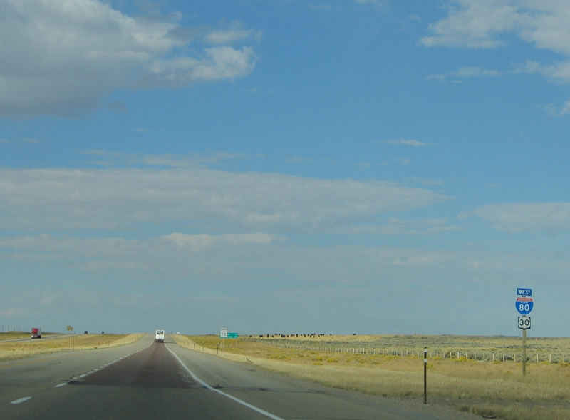
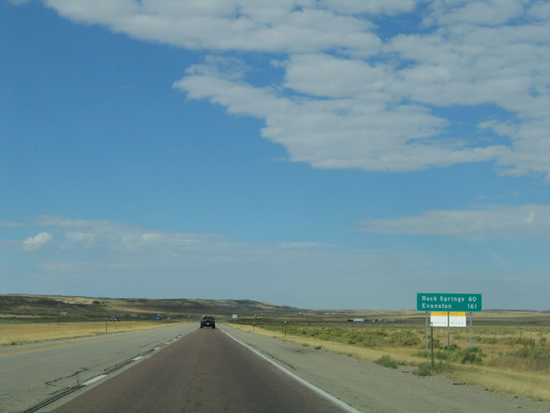
Interstate 80 and U.S. 30 continue west along the Lincoln Highway (which is also known as the Dwight D. Eisenhower Highway across southern Wyoming) into Sweetwater County, leaving Carbon County. Interstate 80 spends more time in Sweetwater County than in any other county in the Equality State. Photo taken 09/07/05. |
 |
The next exit along westbound Interstate 80, U.S. 30, and Wyoming 789 is Exit 196, Riner Road. Interstate 80 continues to travel through the extensive Great Divide Basin, where all precipitation and runoff that falls on this land is either evaporated or absorbed into the ground; no rivers or creeks carry water out of the Great Divide Basin to any river system or to either ocean. Photo taken 09/07/05. |
 |
Westbound Interstate 80/U.S. 30 and Wyoming 789 reach Exit 196, Riner Road. The Red Desert and Great Divide Basin spread out to the north of Interstate 80, while the southern edge of the basin is only ten or so miles south of the freeway. Interstate 80 essentially skirts the southern edge of the Great Divide Basin; the majority of the basin lies to the north, between Interstate 80 and the Green Mountains and Antelope Hills. Most of this land is unpopulated; instead the majority of the basin population resides in Wamsutter and Red Desert (Exits 173 and 165, respectively). Photo taken 09/07/05. |
 |
Another set of shields for Interstate 80, U.S. 30, and Wyoming 789 are posted after the Riner Road interchange. This is the last shield assembly for all three routes; Wyoming 789 will split from the east-west freeway at the next exit, Exit 187 at Creston Junction. Photo taken 09/07/05. |
 |
A parking area is located one mile ahead. There had been plans by the Wyoming Department of Transportation to construct a rest area to serve motorists in the Red Desert area, but to date it has not been constructed. It would likely be installed at Exit 187, Wyoming 789/Baggs Road. The Red Desert is a large area, much bigger than the Great Divide Basin. According to a map of the area available at the Friends of the Red Desert webpage,1 the Red Desert extends from Rock Springs east to Rawlins, and it covers the entire Great Divide Basin from the Green Mountains south to the state line with Colorado. The Red Desert continues south past the state line toward Craig. Oil and gas development plans in an area known as the Jack Morrow Hills (northwestern Red Desert) have resulted in controversy between economic and environmental interests. Some are hoping to establish a conservancy area to ensure development in the Red Desert does not become like the rapid development of the Powder River Basin near Gillette. Photo taken 09/07/05. |
 |
The next exit along westbound Interstate 80 and U.S. 30 and southbound Wyoming 789 is Exit 187, Wyoming 789 south to Creston Junction, Baggs, and Craig, Colorado. Wyoming 789 leads south to the town of Baggs, and it turns into Colorado 13 upon entering Colorado. The segment of Wyoming 789 south between Creston Junction and Baggs has had several designations over the years, including Wyoming 87 and Wyoming 330. In addition, Wyoming 789 was considered for inclusion in the U.S. Highway System, once as part of proposed but never-signed U.S. 789 and again as a proposed southerly extension of former U.S. 187. Photo taken 09/07/05. |
 |
The routes divide as Wyoming 789 departs from Interstate 80 at Exit 187. Prior to 1954, Wyoming 789 south of Creston Junction was known as Wyoming 330. Today, Wyoming 330 is a secondary route in Sheridan County, but prior to 1954, Wyoming 330 was the third state route to branch from U.S. 30 (the other branches existed prior to 1954 and still remain in place today: Wyoming 130 over the Snowy Range and through Saratoga; Wyoming 230 from Laramie to Encampment via Three Way in Colorado; Wyoming 430 south of Rock Springs toward Hiawatha Camp; and Wyoming 530 along the western edge of the Flaming Gorge Reservoir.) Photo taken 09/07/05. |
| I-80/U.S. 30 West | |
|---|---|
 |
After the Wyoming 789 interchange, Interstate 80 and U.S. 30 are again signed together without any other companion routes. This remains the case from here west to Exit 104, U.S. 191/Elk Street in Rock Springs. Photo taken 09/07/05. |
 |
This mileage sign provides the distance to Wamsutter (13 miles) and Rock Springs (81 miles). No evidence of any oil or gas exploration appears on the horizon of the Red Desert. Photo taken 09/07/05. |
 |
The next exit along westbound Interstate 80 is Exit 184, Continental Divide Road. Despite the name, Continental Divide Road does not indicate the western edge of the Great Divide Basin; instead, Continental Divide Road travels southeast to the sites of Continental Divide and Creston. However, the actual Continental Divide is still five miles south of Interstate 80, parallel to the freeway. The Henry Joy Bourne (Lincoln Highway) Monument used to be located on the south side of Interstate 80 at Exit 184, but it was moved to the Summit Rest Area (Exit 323, Happy Jack Road) east of Laramie in 2001. Photo taken 09/07/05. |
 |
Shadows and light dominate the horizon as westbound Interstate 80 and U.S. 30 continue toward Wamsutter. Photo taken 09/07/05. |
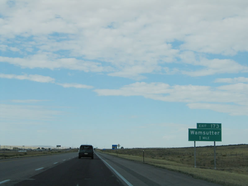 |
The next exit along westbound Interstate 80 is Exit 173, Junction Sweetwater County Route 23, Wamsutter Crooks Gap Road. Wamsutter was originally known as Washakie, but it was renamed to avoid confusion with Fort Washakie in the Wind River Indian Reservation in Fremont County. The name Wamsutter was from a bridge builder who worked for the Union Pacific Railroad. Much of Old Lincoln Highway is either directly below Interstate 80 or near the Union Pacific Railroad through this region; remnants of the old road can be seen from Interstate 80 on the south side of the freeway from time to time. Photo taken 09/07/05. |
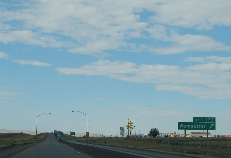 |
Westbound Interstate 80 and U.S. 30 reach Exit 173, Junction Sweetwater County Route 23, Wamsutter Crooks Gap Road south to Wamsutter. Although there is no grocery store here, most motorist services, including lodging, gas, convenience store, restaurants, and other amenities are available here. Most of the services are located south of the freeway interchange along McCormick Street. This is certainly a small town; the 2000 Census lists 261 people who live in Wamsutter, but that number is certain to grow considering BP's investment in the town. The Love's truck stop on the north side of this interchange is a relatively newcomer to Wamsutter. To the north, Sweetwater County Route 23/Wamsutter-Crooks Gap Road travels north through the Great Divide Basin into Fremont County, where the route changes into Fremont County Route 318, Crooks Gap Road. The county route ends in Jeffrey City where Crooks Gap Road meets U.S. 287 and Wyoming 789. Photo taken 09/07/05. |
 |
Another neutered Interstate 80 shield is posted with U.S. 30 as the freeway leaves Wamsutter and continues west through the Red Desert and Great Divide Basin. At this crest in the road, several more miles come into view. Photo taken 09/07/05. |
 |
This mileage sign provides the distance to Rock Springs, which is 67 miles west of Wamsutter. Notably, both are in the same county. Evanston, which anchors Interstate 80 at the western end of the route in Wyoming, is 169 miles west of here. Photo taken 09/07/05. |
 |
The next exit along westbound Interstate 80 is Exit 170, Rasmussen Road. Rasmussen Road provides access to the Union Pacific Railroad and Old Lincoln Highway to the south and to BLM areas to the north. Photo taken 09/07/05. |
 |
Westbound Interstate 80 and U.S. 30 reach Exit 170, Rasmussen Road. Photo taken 09/07/05. |
 |
The next exit along westbound is Exit 168, Frewen Road. This exit again provides local access to ranches, public land, and the railroad. Photo taken 09/07/05. |
 |
Westbound Interstate 80 and U.S. 30 reach Exit 168, Frewen Road. The dry lakebed of Frewen Lake is located south of Interstate 80 near the Union Pacific Railroad, and the site of Frewen is adjacent to the dry lake. Photo taken 09/07/05. |
 |
The next exit along westbound is Exit 166, Booster Road. Like Frewen Road and Rasmussen Road before it, Booster Road provides local access to ranches, public land, drilling stations, and the railroad. Photo taken 09/07/05. |
 |
Westbound Interstate 80 and U.S. 30 reach Exit 166, Booster Road. Photo taken 09/07/05. |
 |
The next exit along westbound Interstate 80 and U.S. 30 is Exit 165, Red Desert. Named for the Red Desert of southern Wyoming, this town consists of a few buildings on either side of the freeway. To the northwest of the town of Red Desert lie the most famous and dramatic scenery of the Red Desert: Boars Tusk, Killpecker Sand Dunes, Alkali Flat, and Steamboat Mountain. Not visible from Interstate 80 and U.S. 30, these features lie in the path of the proposed Jack Morrow Hills development of energy facilities. Photo taken 09/07/05. |
 |
Westbound Interstate 80 and U.S. 30 reach Exit 165, Red Desert. Even here on the relatively flat Great Divide Basin, snow fences are occasionally positioned to reduce blowing snow on the highway. Photo taken 09/07/05. |
 |
Interstate 80 is again signed with a neutered shield. Looking at the date of installation, it appears that most, if not all, of the neutered shields in Wyoming appeared in 2001. Interstate shields installed before or after that year all contain the state name. The majority of Interstate shields in the state of Wyoming still retain the state name. Larger numerals, such as those found in this shield, are becoming more prevalent on both kinds of Interstate shields. Photo taken 09/07/05. |
 |
This mileage sign again provides the distance to Rock Springs and Evanston. Photo taken 09/07/05. |
 |
The next exit along westbound is Exit 158, Tipton Road. Like several other local access exits through the Red Desert, there are no services available here, but the road connects to the railroad, old highway, BLM land, ranches, and county roads. Hunters frequently use BLM land in the fall to hunt various game animals, such as antelope and elk. Photo taken 09/07/05. |
 |
Westbound Interstate 80 and U.S. 30 reach Exit 158, Junction Sweetwater County Route 67, Tipton Road. The Interstate 80 finally pulls out of the Great Divide Basin (after 48 miles since entering the basin), but it remains within the Red Desert for many miles to come. Photo taken 09/07/05. |
 |
Interstate 80 reaches the second Continental Divide crossing at the Tipton Road undercrossing at Exit 156. The highway ascends to an elevation of 6,930 feet, which enables the freeway to leave the Great Divide Basin and enter the Colorado River Watershed. The Continental Divide marks the location where streams lead to the Atlantic or Pacific Oceans. Most rivers in the United States drain toward the Atlantic Ocean, including all of those rivers that cross Interstate 80 from Milepost 206 eastward. All rivers to the west of Milepost 158 on Interstate 80 westbound flow toward the Pacific Ocean except for those rivers that flow into the Great Basin in Nevada and Utah. At Milepost 158 is the first crossing of the Continental Divide Basin headed eastbound; for westbound, this marks the second crossing of the Divide. Between Mileposts 158 and 206, Interstate 80 passes through the Great Divide Basin in the Red Desert. In this stretch, all rivers empty into the basin rather than flowing into river systems leading to the Pacific Ocean or to the Atlantic Ocean. It is almost like a smaller version of the much larger Great Basin in Utah and Nevada. Photo taken 09/07/05. |
 |
The next exit along westbound Interstate 80 and U.S. 30 is Exit 156, GL Road. This is another in a continuing series of local access roads that serve the railroad, energy interests, local ranches, BLM land, and the old highway. Photo taken 09/07/05. |
 |
Westbound Interstate 80 and U.S. 30 reach Exit 156, GL Road. Photo taken 09/07/05. |
 |
The next exit along westbound Interstate 80 and U.S. 30 is Exit 154, BLM Road. Photo taken 09/07/05. |
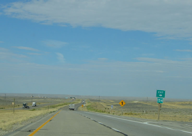 |
Westbound Interstate 80 and U.S. 30 reach Exit 154, BLM Road. Photo taken 09/07/05. |
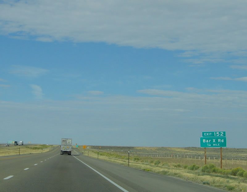 |
The next exit along westbound Interstate 80 and U.S. 30 is Exit 152, Junction Sweetwater County Route 21, Bar X Road. Photo taken 09/07/05. |
 |
Westbound Interstate 80 and U.S. 30 reach Exit 152, Junction Sweetwater County Route 21, Bar X Road. Follow Bar X Road (County Route 21) northwest to Alkali Basin, Killpecker Sand Dunes, Jack Morrow Hills, and ultimately Wyoming 28 northeast of Farson and southwest of South Pass. Most of the route is unpaved, so conditions may vary depending upon the weather. Photo taken 09/07/05. |
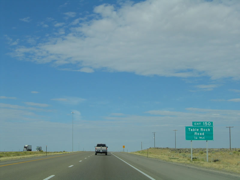 |
The next exit along westbound Interstate 80 and U.S. 30 is Exit 150, Table Rock Road. Just south of the freeway is the first settlement since Red Desert, a small company town clustered around a smokestack called Table Rock. The actual rock formation called Table Rock is located a bit further to the south, and it was called Pulpit Rock in the past. A swindle occurred in this area in the 1870s when two miners salted the mines at Diamond Mesa and Ruby Gulch with $25,000 worth of reject gems in order to sell their claim to the land. The two made off with over a half million dollars before the swindle was uncovered. Photo taken 09/07/05. |
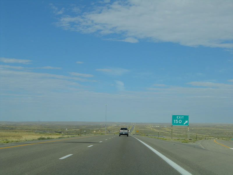 |
Westbound Interstate 80 and U.S. 30 reaches Exit 150, Table Rock Road. According to the 2000 Census, 82 people live in Table Rock. Photo taken 09/07/05. |
 |
The next exit along westbound Interstate 80 is Exit 146, Junction Sweetwater County Route 24, Patrick Draw Road. No services are available here, but the ramp provides ranch access and BLM access. Photo taken 09/07/05. |
 |
Westbound Interstate 80 and U.S. 30 reach Exit 146, Junction Sweetwater County Route 24, Patrick Draw Road. This is another 90-degree turnoff. Photo taken 09/07/05. |
 |
The Bitter Creek Rest Area is located near Milepost 144, the first rest area west of Rawlins (since the proposed rest area at Creston Junction/Wyoming 789 has not been constructed to date). When looking at Interstate 80 west, the rest area for eastbound traffic comes into view before the rest area for westbound traffic. Photo taken 09/07/05. |
 |
At the time this photo was taken, the Bitter Creek Rest Area was closed as a result of a lack of water. The underground water pumps were drawing mud rather than water, and the problem had existed at least as far back as June 2005 (per a Wyoming Department of Transportation press release, "Rest Area Closes for Lack of Water"). Photo taken 09/07/05. |
 |
A parking area is located immediately after the rest area, around Milepost 143. Photo taken 09/07/05. |
 |
The next exit along westbound Interstate 80 and U.S. 30 is Exit 142, Junction Sweetwater County Route 19/Bitter Creek Road. Photo taken 09/07/05. |
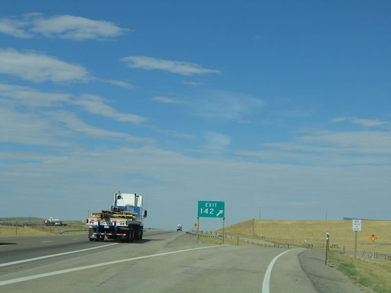 |
Westbound Interstate 80 and U.S. 30 reaches Exit 142, Junction Sweetwater County Route 19, Bitter Creek Road. An old alignment of U.S. 30 is still intact as a service road on the south side of Interstate 80, and it crosses to the north side of the freeway at Exit 136. The service road passes Point of Rocks (Wyoming 377) and follows the freeway again on the south side all the way to Wyoming 370 (Baxter Road). Photo taken 09/07/05. |
 |
At the bottom of the ramp, the guide sign points the way to Bitter Creek Road north and south. Turn south to the site of Bitter Creek, which is where Sweetwater County Route 19 meets the Union Pacific Railroad. South of the railroad, Bitter Creek Road follows the Bitter Creek to provide ranch and BLM access. Photo taken 09/07/05. |
 |
Another magnificent vista of westbound Interstate 80 and U.S. 30 in the Red Desert west of Bitter Creek Road. The freeway descends toward the Bitter Creek valley. Photo taken 09/07/05. |
 |
For the first time, the Sweetwater County seat of Green River appears on a mileage sign, 50 miles east of that city. Rock Springs remains as the primary destination city (35 miles). Only 15 miles separate these two large cities. (Well, they are large for Wyoming standards anyway.) Photo taken 09/07/05. |
 |
The next exit along westbound Interstate 80 is Exit 139, Red Hill Road. This unimproved road offers access to Tenmile Draw north of the freeway and connects with the service road to the south. Photo taken 09/07/05. |
 |
Continuing west, Interstate 80 and U.S. 30 next approach Exit 136, Black Butte Road. Black Butte Road travels south to the site of Black Buttes along the Union Pacific Railroad. The county route follows the Union Pacific Railroad southeast until it merges into Sweetwater County Route 24, Patrick Draw Road. Patrick Draw Road angles southwest to northeast between Wyoming 430 and Interstate 80 Exit 146. Photo taken 09/07/05. |
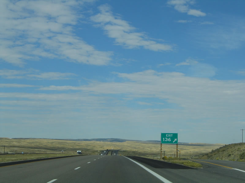 |
The interchange between westbound Interstate 80/U.S. 30 and Black Butte Road is a diamond interchange. There are no services available here. Photo taken 09/07/05. |
 |
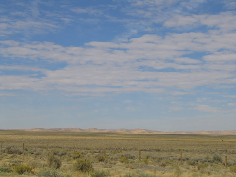
Another glorious vista of the Red Desert comes into view as Interstate 80 and U.S. 30 again crest over a rise. The freeway next approaches a parking area, which is visible in the distance in this picture. Photo taken 09/07/05. |
 |
The parking area is located near Milepost 132. The next exit is only two miles after the parking area. Photo taken 09/07/05. |
 |
As Interstate 80 and U.S. 30 approach the Point of Rocks area, the freeway swings due west to pass under a spur of the Union Pacific Railroad. The railroad spur travels north to serve the Jim Bridger Power Plant. This power plant comes into view at varying intervals from Interstate 80, but it is not very close to the freeway. With its tall smokestacks, it is said that the Jim Bridger Power Plant is the tallest structure in Wyoming, even taller than the dormitories at the University of Wyoming (White Hall and McIntyre Hall). Photo taken 09/07/05. |
 |
Westbound Interstate 80 and U.S. 30 pass under the Union Pacific Railroad spur bridge. This rail line enables coal and other supplies to be delivered to the power plant. Photo taken 09/07/05. |
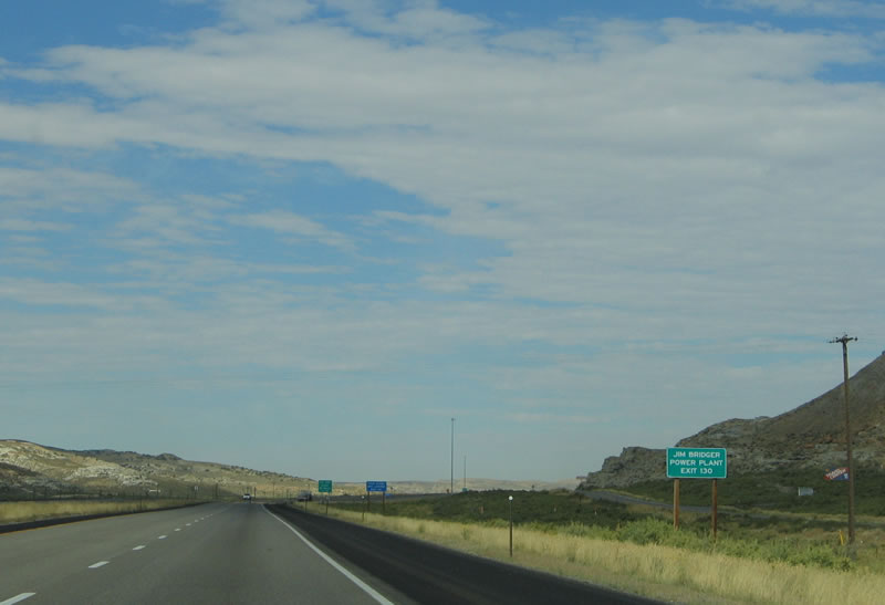 |
The Jim Bridger Power Plant is located north of the freeway, and the frontage road (Old U.S. 30) is visible to the north of the freeway. A massive coal fire plant, Jim Bridger Power Plant and adjacent Bridger Coal Mine (the largest surface coal mine in Sweetwater County) have been in existence since 1974 (construction started in 1969). Operated by PacifiCorp (which does business as Pacific Power and Light in parts of most counties in Wyoming), the power plant contains four, 2,110-megawatt electricity generation units. Proponents of the "Frontier Line" transmission system have proposed to make the Jim Bridger Power Plant a hub of the system that would convey electricity throughout the West, from Wyoming and Montana west through Idaho, Utah, and Nevada to California. One of the proposals (called the "The Bridger Expansion Project") from 2004 was to construct a 345 kilovolt line from Rawlins to the Jim Bridger Power Plant. Photo taken 09/07/05. |
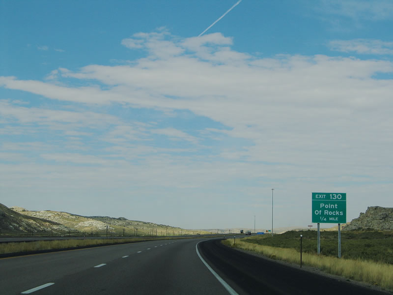 |
The next exit along westbound Interstate 80 and U.S. 30 is Exit 130, Wyoming 377 north to Point of Rocks. From the interchange, Wyoming 377 travels east along the frontage road, then turns north toward the Jim Bridger Power Plant. Available at the interchange are the first services since leaving Red Desert, including a solitary gas station. From the south, the Bitter Creek turns west to follow Interstate 80 toward Rock Springs. Photo taken 09/07/05. |
 |
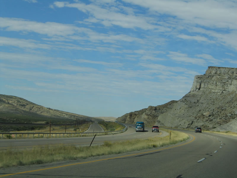
West of Point of Rocks, Interstate 80 and U.S. 30 follow the palisades as the freeway follows the Bitter Creek through the valley. To Salt Wells, use Exit 130, then follow the Service Road west to Salt Wells. At Salt Wells, Sweetwater County Route 48 travels south past the railroad to follow the Salt Wells Creek before merging with Wyoming 430 southeast of Rock Springs. Photo taken 09/07/05. |
 |
The Bitter Creek is the southernmost feature, and from left to right (north to south) the area has the railroad, Old U.S. 30/Lincoln Highway, Interstate 80, and the palisades. This area is still part of the Red Desert, but the palisades offer a welcome change in scenery. Photo taken 09/07/05. |
 |
Here is another view that shows the old and new highways in perspective to each other. Photo taken 09/07/05. |
 |
The next exit along westbound Interstate 80 and U.S. 30 is Exit 122, Wyoming 371 north to Superior. The interchange itself is located at the site of Thayer Junction, which features no services and no discernible buildings. From Thayer Junction, Wyoming 371 travels north through Horseshoe Canyon to serve the town of Superior. An abandoned rail line travels north to Superior, but it is not in operation. Photo taken 09/07/05. |
 |
Westbound Interstate 80 and U.S. 30 reach Exit 122, Wyoming 371 north to Superior. Superior, which is home to 244 people as of the 2000 Census, has a history steeped in mining. In fact, several abandoned mines are located north of Superior. Photo taken 09/07/05. |
 |
Immediately after the Point of Rocks interchange, check out this massive rock cut on the north side of Interstate 80 and U.S. 30. Photo taken 09/07/05. |
 |
Interstate 80 and U.S. 30 are again signed together on this reassurance shield assembly. Photo taken 09/07/05. |
 |
Both Rock Springs and Green River are posted on this mileage sign after the Point of Rocks interchange. Photo taken 09/07/05. |
 |
 |
 |
Here are some views of Interstate 80 and the surrounding Bitter Creek valley as the freeway lurches westward toward Rock Springs. Photos taken 09/07/05. |
 |
The next exit along westbound Interstate 80 and U.S. 30 is Exit 111, Wyoming 370/Baxter Road south to Rock Springs/Sweetwater County Municipal Airport. The airport is situated on a bluff to the south of the freeway, and Wyoming 370 acts as a spur route from the Bitter Creek valley to the top of the mesa (at an elevation of 6,752 feet). Photo taken 09/07/05. |
 |
Westbound Interstate 80 and U.S. 30 reach Exit 111, Wyoming 370, Baxter Road south to the airport. Commercial service by express carriers is available at this airport. In addition to the airport, follow Wyoming 370 south to Sweetwater County Route 45/Baxter Road south to Wyoming 430 south. Photo taken 09/07/05. |
 |
A large variable message sign is mounted onto this overhead sign bridge. The design of this sign is very similar to designs of VMS assemblies found in the Salt Lake Valley in Utah. Photo taken 09/07/05. |
 |
Finally, westbound Interstate 80 and U.S. 30 enters the Rock Springs urban area. Home to 18,708 people as of the 2000 Census, Rock Springs was founded in 1868 as a mining town and rests at an elevation of 6,271 feet above sea level. Underground mines criss-cross not only the area around Rock Springs but also below the city; some of the original tunnels have collapsed after years of abandonment, which in turn affected the city above the collapsed tunnel. Sweetwater Economic Development Association (SWEDA) is a council of governments for the Sweetwater County region. Photo taken 09/07/05. |
 |
A traffic advisory sign is placed after the freeway enters the city. The sign would be in use in times of traffic congestion, weather, or construction advisories. On average, 8.7 inches of precipitation falls in the Rock Springs-Green River area, of which 34.9 inches falls as snow. The average temperature in Sweetwater County in winter is 18 degrees and in summer is 68 degrees. The average wind speed, at least, is less than it was in Rawlins; it is "only" an average of 9 miles per hour in Rock Springs. Three hundred days have sun each year, which is vastly improved over many Eastern cities. Finally, Rock Springs is 18.4 square miles in size. Photo taken 09/07/05. |
 |
The next exit along westbound Interstate 80 and U.S. 30 is Exit 107, Junction Business Loop I-80, Business U.S. 30, and To Wyoming 430 south, Pilot Butte Avenue. In its early history, Rock Springs began as a mining area, due to its rich history in coal and gas extraction. While laborers of many nationalities came to Wyoming for work, the Chinese were the most prevalent non-whites to enter the area in the 1870s. Tensions between the Chinese and white coal miners rose to a zenith on September 2, 1885, when the white miners attacked the Chinese miners in what is known today as the The Rock Springs Massacre.2 To keep the peace, the government had to separate the two groups of miners. Today, Chinese form a significant portion of Rock Springs's population. Photo taken 09/07/05. |
 |
Rock Springs is steeped in history. The History Museum is located at 201 B Street in downtown Rock Springs, at the site of the original City Hall (which was built in 1892). Near the museum, mounted one block from the museum, is the famous "Home of Rock Springs Coal Welcome" arch. This arch was in place from 1928 until 1941, but it was removed when viewed as hopelessly out of date as diesel locomotives overtook coal-fire locomotives. However, the arch was restored to the downtown skyline as part of redevelopment in 1997. Butch Cassidy used to roam the streets of Rock Springs. Photo taken 09/07/05. |
 |
Westbound Interstate 80 and U.S. 30 reaches Exit 107, Junction Business Loop I-80, Business U.S. 30, and To Wyoming 430 south, Pilot Butte Avenue (trumpet interchange). The business route follows the original Lincoln Highway route into Rock Springs, the largest city in Southwestern Wyoming. The Interstate, meanwhile skirts the north edge of the city and completely avoids downtown. Photo taken 09/07/05. |
 |
 |
Sources:
- Citizs for the Rest Desert - Wyomings Heart of the West web page.
- The Rock Springs Massacre - Today in History - September 2. Library of Congress web site.
Page Updated October 21, 2005.
|
About Contact FAQ |
Spotlights Testimonials Interstate Guide |
Social Media:
 |
|
© 2000-23 AARoads.com | All Rights Reserved | Privacy Policy / Terms of Use
|
||