| U.S. 395 north |
|---|
|
Leaving downtown Minden, northbound U.S. 395 (Railroad Avenue) approaches the Carson Valley Inn Hotel-Casino-RV Resort on the right side of the highway. Photo taken 07/19/09. |
|
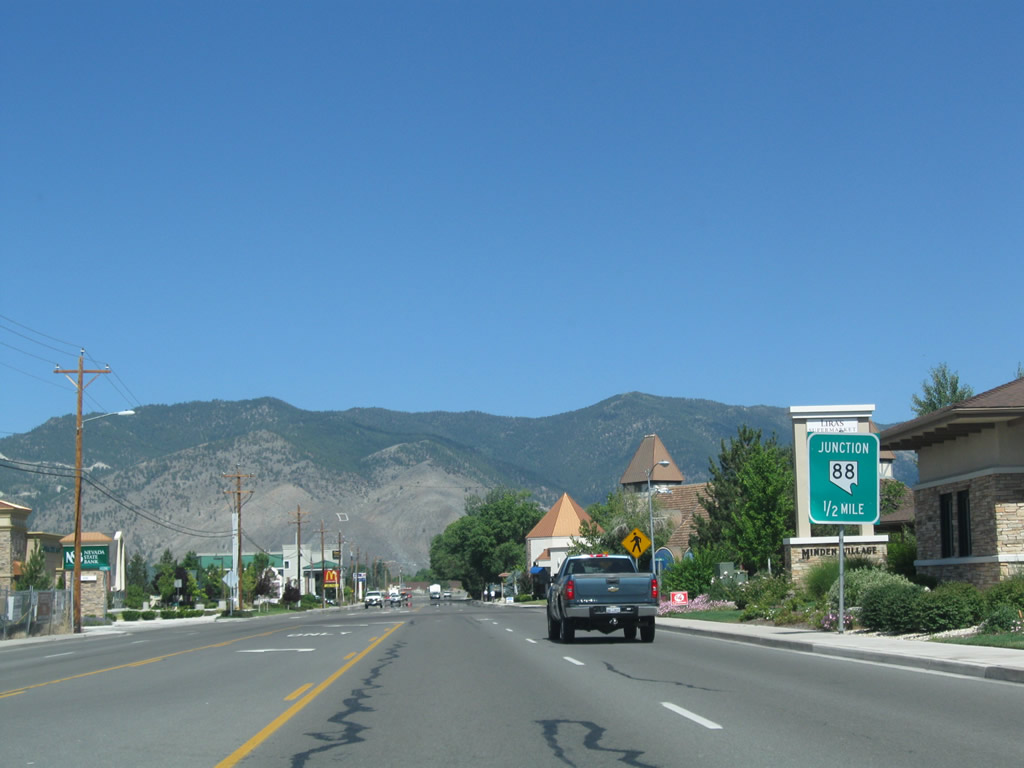
The next major intersection along U.S. 395 north is with Nevada 88, which travels from Minden south to Markleeville in California's Alpine County. Nevada 88 changes into California 88 upon reaching the state line, and California 88 travels over the Carson Pass in the Sierra Nevada, then descends into the Gold Country foothills east of Stockton. California 88, along with U.S. 50 and Interstate 80 are among the all-weather routes over the Sierra Nevada. Photo taken 07/19/09. |
|
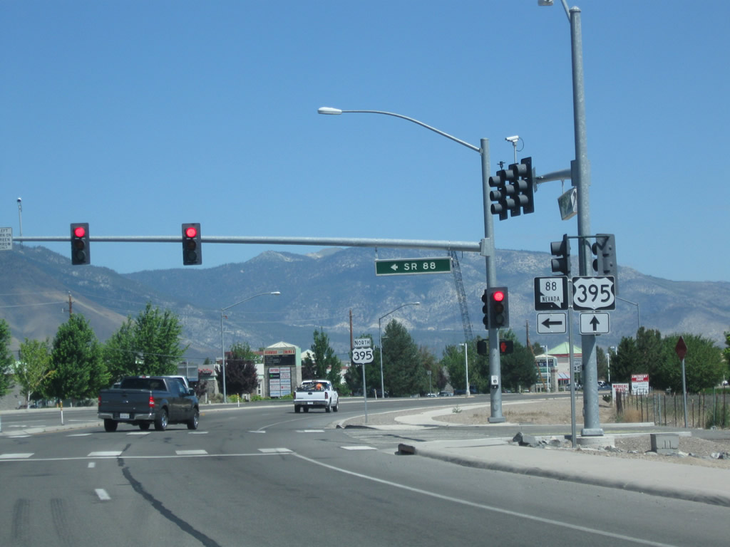
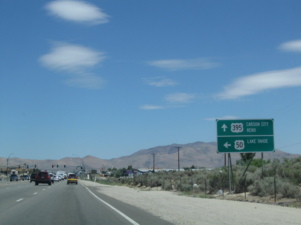
A traffic operates at Nevada 88 and U.S. 395. Turn left to follow Nevada 88 south to California 88 west over Carson Pass to Jackson, California 89 south to Markleeville, or California 4 west over Ebbetts Pass en route to Angels Camp. A U.S. 395 reassurance shield is posted afterwards. Photo taken 07/19/09. |
|
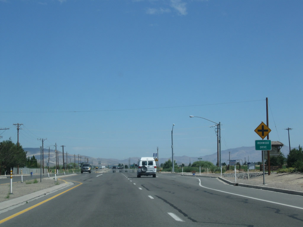
Now traveling due north, U.S. 395 approaches Ironwood Drive at this cross-traffic intersection. Photo taken 07/19/09. |
|
Leaving Minden, U.S. 395 widens to an expressway configuration with limited intersections and four lanes (two in each direction) with turn pockets. The next major intersection along U.S. 395 north is with Nevada 757 (Muller Lane) west to Genoa, Walleys Hot Springs, and Kingsbury Grade (via a brief connection on Nevada 206 / Foothill Road south). Photo taken 07/19/09. |
|
This view looks north on U.S. 395 at the Nevada 757 intersection. The next intersection along northbound is with Nevada 206 (Genoa Lane / former Nevada 758), which leads west to the town of Genoa and to Jacks Valley Road. Photo taken 07/19/09. |
|
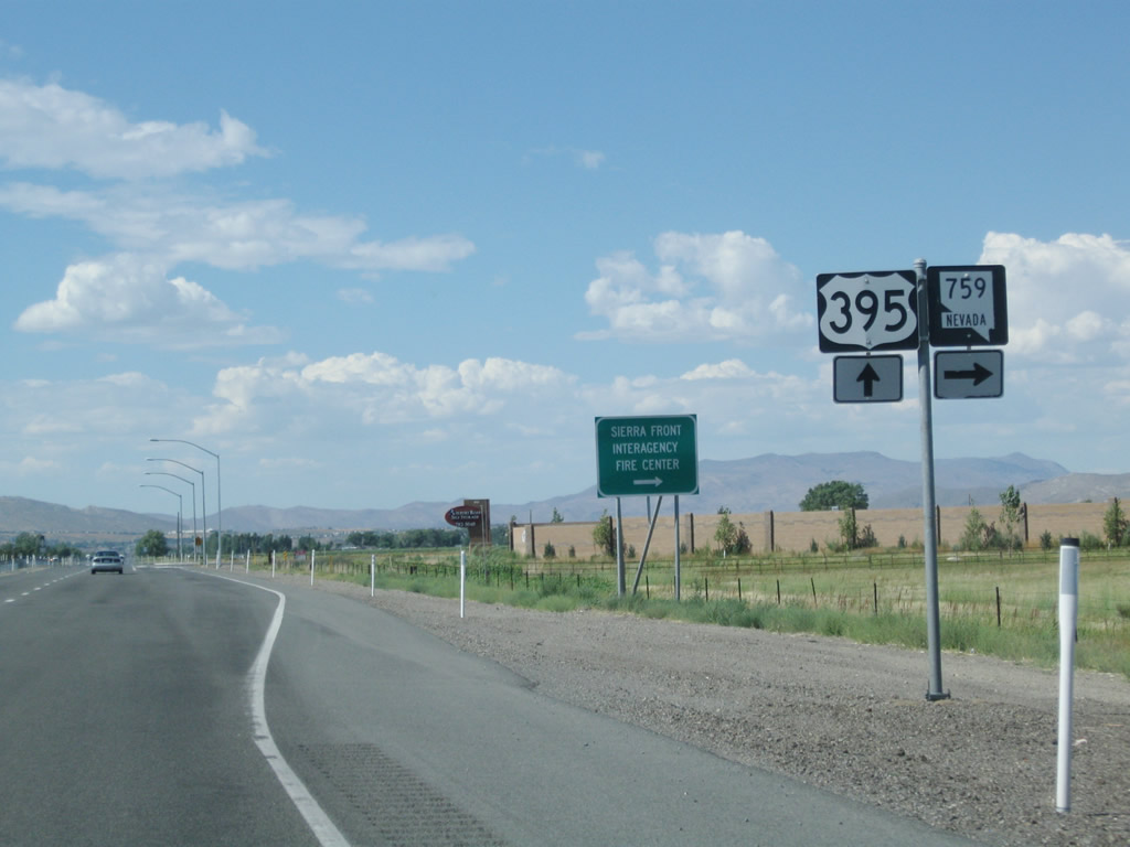
After passing by the Nevada 206 (Genoa Lane) intersection, northbound U.S. 395 immediately approaches the junction with Nevada 759 (Airport Road) east to Douglas County Airport. Photo taken 07/19/09. |
|
A pair of trailblazer route markers (for U.S. 395 and Nevada 759) is posted prior to the Airport Road intersection. Nevada 759 is a short spur state route that leads from U.S. 395 east to the county airport. Photo taken 07/19/09. |
|
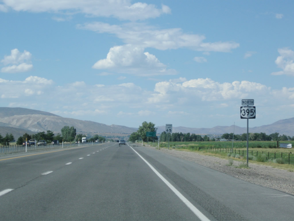
This U.S. 395 north reassurance shield is posted after the intersection with Nevada 759 (Airport Road). Photo taken 07/19/09. |
|
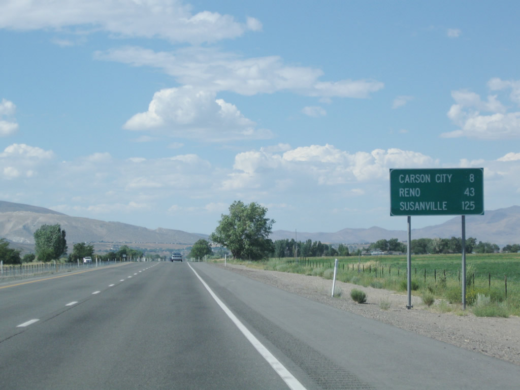
This mileage sign provides the distance to Carson City (eight miles), Reno (43 miles), and Susanville (125 miles). Photo taken 07/19/09. |
|
Northbound U.S. 395 meets Johnson Lane at this traffic signal. Photo taken 07/19/09. |
|
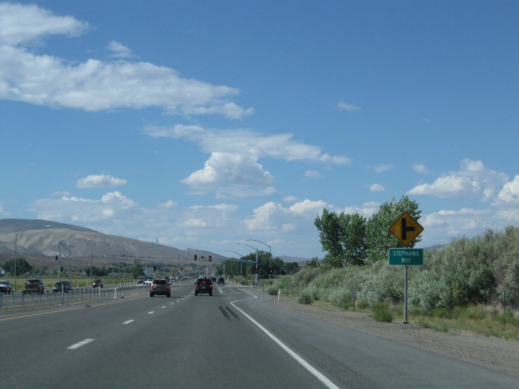
Northbound U.S. 395 approaches the traffic signal with Stephanie Way. Photo taken 07/19/09. |
|
U.S. 395 crosses the Carson River on this 1948 bridge. From here, the Carson River flows northeast toward Dayton, then follows the U.S. 50 corridor from Dayton east to Lahontan Reservoir near Silver Springs and then east to Fallon. At Fallon, the river flows northeast into the Carson Sink near Stillwater Marsh. Photo taken 07/19/09. |
|
After making that crossing, northbound U.S. 395 approaches and meets Plymouth Drive (left) and Sunridge Drive (right). Photo taken 07/19/09. |
|
This view looks north on U.S. 395 after the Plymouth Drive intersection. Photo taken 09/09/05. |
|
|
|
U.S. 395 northbound nears the signalized intersection with Mica Drive in northern Douglas County. The expansion of the Carson City metropolitan area involves the suburbanization of U.S. 395 between Minden and the Douglas-Carson City county line. Mica Drive serves residential areas east and west of the U.S. highway. Photos taken 09/09/05. |
|
A sign indicates that U.S. 395 is leaving the Carson Valley. Soon we will leave Douglas County and enter Nevada's capital, Carson City (former Ormsby County). Photo taken 07/19/09. |
|
Next in line for northbound travelers is the junction with Former Nevada 206 (Jacks Valley Road) and Sunridge Drive. Nevada 206 loops southwest 15.432 miles to Genoa. Sunridge Drive arcs east between U.S. 395 and Mica Drive through new suburbs. Photo taken 09/09/05. |
|
|
The next signalized intersection also features a "prepare to stop when flashing" overhead in advance. Crossing U.S. 395 here is Topsy Lane, the last suburban roadway encountered in Douglas County. Photos taken 09/09/05. |
|
|
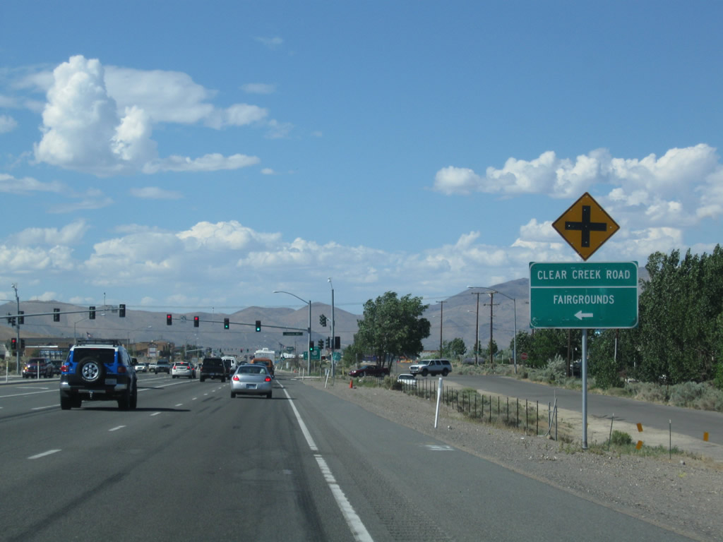
U.S. 395 enters Carson City, the Nevada state capital and leaves Douglas County. The next signalized intersection is with Nevada 705 (Clear Creek Road) west and Lupin Drive (frontage road) north. The non-standard welcome sign for Carson City was gone by 2009. Photos taken 09/09/05. |
|
|
Lupin Drive and Nevada 705 (Old Clear Creek Road) intersect U.S. 395 (Carson Street) one-half mile south of its merge with U.S. 50. Nevada 705 (Old Clear Creek Road) parallels U.S. 50 west into the mountains along an older alignment. Lupin Drive provides a northbound side frontage road to Carson Street between here and Snyder Avenue (Nevada 518). Photos taken 07/19/09 and 09/09/05. |
|
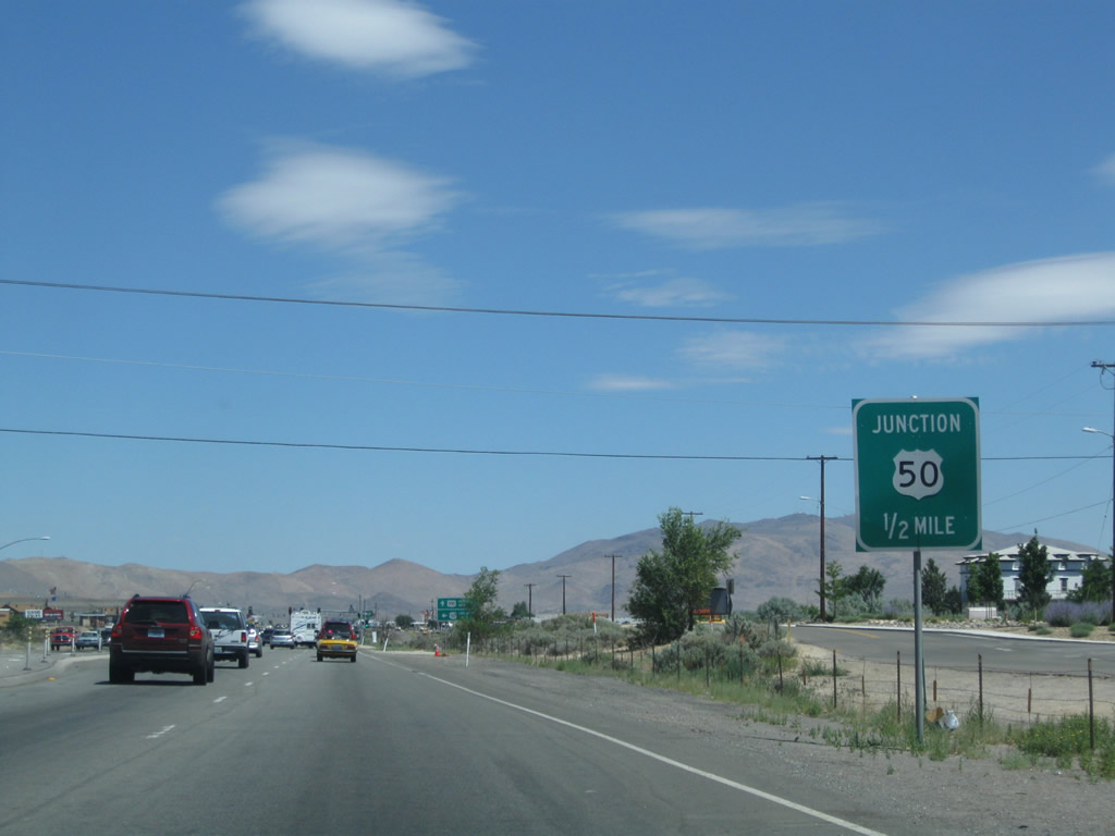
Northbound U.S. 395 approaches its junction with U.S. 50 in southern Carson City, one-half mile ahead. Technically speaking, this intersection was renumbered as the intersection between U.S. 395 north, U.S. 50 west, and Nevada 529 north. Since the U.S. routes are to be rerouted onto the Carson City Bypass (Future Interstate 580), U.S. 50-395 temporarily follow Carson Street into downtown Carson City. Photo taken 07/19/09. |
|
To the west, U.S. 50 travels up to Spooner Summit (elevation 7,146 feet above sea level) and connects to all destinations in the Lake Tahoe basin. Ahead, Temporary U.S. 50-395 and Nevada 529 (Future U.S. 50 Business-395 and Nevada 529) join for 3.5 miles between here and downtown Carson City. Photo taken 07/19/09. |
|
|
A set of mast-arm supported traffic lights govern the movements between U.S. 395 (Carson Street) and U.S. 50 in south Carson City. An undeveloped swath of land lies to the east of the junction awaiting construction of the Carson City Bypass (Interstate 580). By 2014, the Interstate 580 bypass will be complete and will carry U.S. 50 east and U.S. 395 north around downtown Carson City on a limited-access route. Business routes will follow the original alignments at that time. Note the subtle changes to the intersection between 2005 and 2009: new mast arm signage and a new reference marker with mileage. More significant changes will come with freeway construction by 2014. Photos taken 09/09/05 and 07/19/09. |
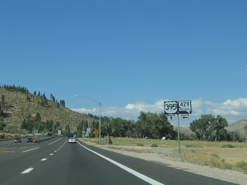
| Old Alignment: U.S. 395 north approaching Nevada 429 |
|---|
|
|
Back in 2005, the freeway used to end at the point where U.S. 395 and Nevada 429 reconnected. This is now where Interstate 580 and U.S. 395 Alternate cross each over near Bowers Mansion. South of here back in 2005, Old U.S. 395 used to shift from freeway to an expressway configuration. Photos taken 09/09/05. |
|
|
Before May 2012, the segment of U.S. 395 Alternate along Bowers Mansion Road was known as Nevada 429. From here, U.S. 395 Alternate and former Nevada 429 travel south to Bowers Mansion Regional Park and Davis Creek Park; these points of interest are within two miles of here. U.S. 395 Alternate and Nevada 429 continue south along the eastern base of Slide Mountain to Franktown. Photos taken 09/09/05. |
|
|
This U.S. 395 north and Nevada 429 south shield assembly used to be posted near Bowers Mansion and Washoe City. This of course has changed since the construction of the Interstate 580 freeway in 2012. Photo taken 09/09/05 and by Mike Ballard (08/12/99). |
Page Updated October 8, 2012.