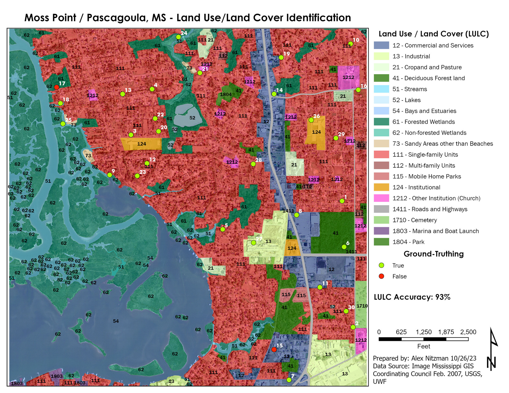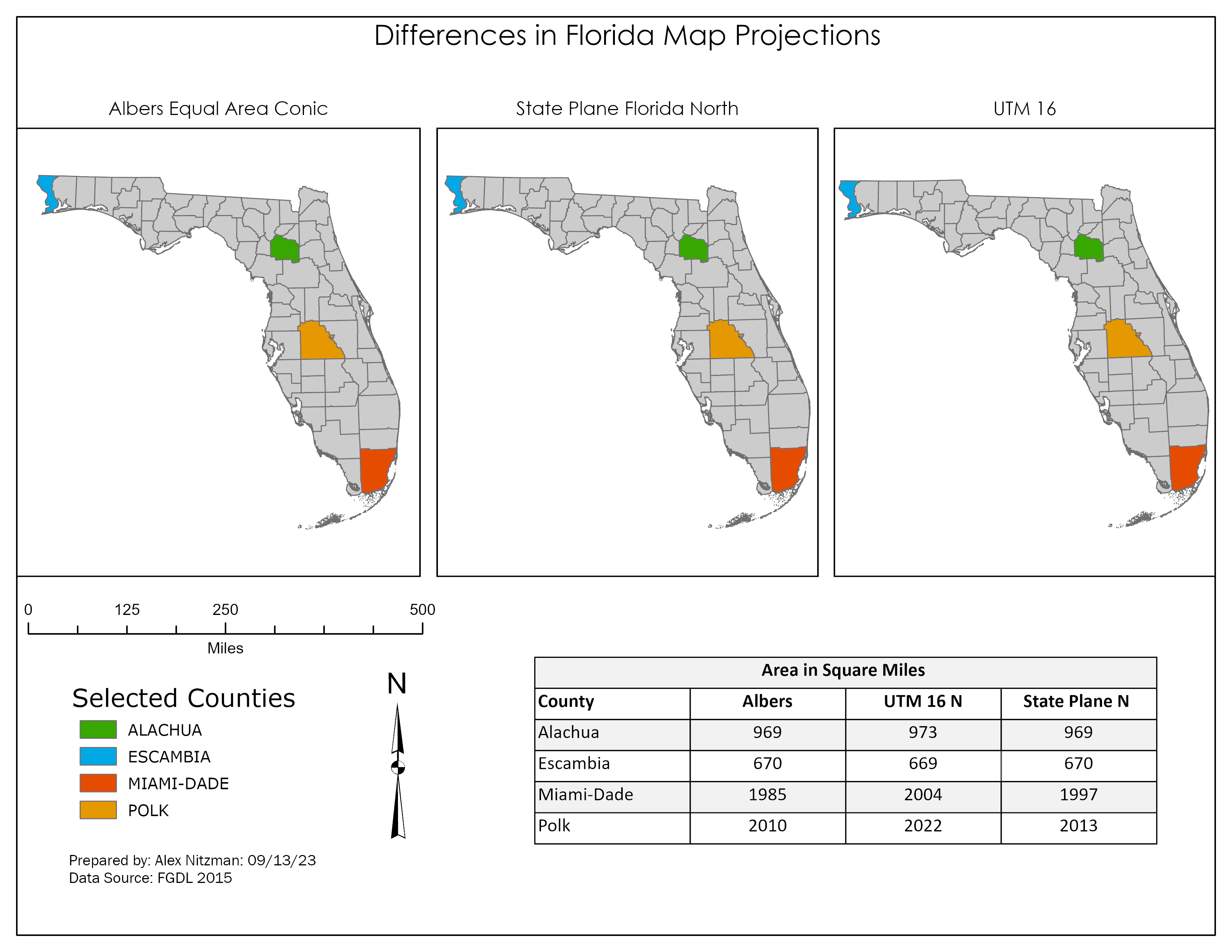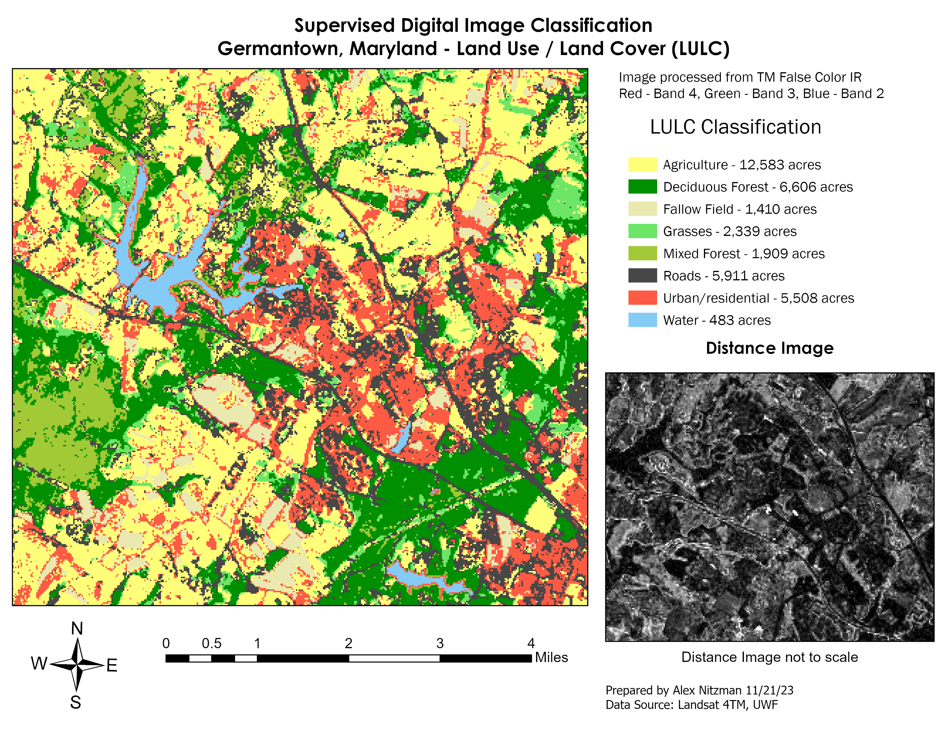
Supervised Image Classification – Germantown, Maryland
The fifth module for Remote Sensing and Photo Interpretation introduced Supervised and Unsupervised Digital Image Classification techniques. These are automated processes for converting a spectral class, a group or cluster of spectrally similar pixels, into an information class, i.e. land use/land cover class of interest. Using multi-spectral data and spectral pattern recognition techniques, the algorithm may take many spectral classes to describe a single information class. Similarly one spectral [...]