
This week’s lab project introduced me to Geocoding within ArcGIS Pro and some Excel spreadsheet tactics used to prepare the data for it. The focus of this project is to extract the geographic location for Manatee County Schools from the list posted on the Florida Department of Education web site.
Started the lab with a simple copy and paste of the schools list, which includes 84 entries ranging from Charter Schools to Colleges. Added these to an Excel spreadsheet and proceeded to format the data for processing by ArcGIS Pro. The end result were data columns including the school’s name, street address, city and zip code.
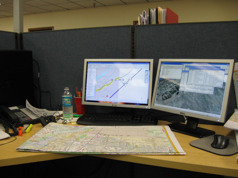
With the Excel spreadsheet saved as a .CSV file, proceeded into ArcGIS Pro with downloaded TIGER line shapefile data for Manatee County, Florida. The schools list data was then imported into a table.
Geocoding in ArcGIS Pro utilizes either an X/Y location using latitude/longitude, or in the case here, with an address location. First, we needed to compile an address locator file for Manatee County. Using the Create Locator tool, parameters on the TIGER line fields were set for the street name, zip codes right and left for the side of a street segment, and similarly left and right house number ranges. The process ran on the Manatee County line file, creating the Address Locator file needed for the Geocode Table tool.
The Geocode Table tool cross references the Schools input table with the Address Locator file. With our three columns of location data from the original Excel sheet, selected Address, City and Zip as the Data for the Locator Field within the tool. The process creates a geocoded point file of all school locations.
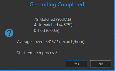 Of the 83 entries within the Schools table, all but four were matched. Those needed further analysis to be located.
One of the entries was located simply by abbreviating “Street” in the address field to “St”. Based upon Florida State Road addresses, the remaining three were manually placed by researching their location.
The data entry for Carlos E. Haile Middle School used Fl 64 as the address street name. A problem with this is that often numbered routes have formal names that are used for postal addressing. Furthermore, while FL 64 implies Florida State Road 64, FDOT and other government agencies often instead use “SR” on signing and for addressing.
Two of the schools were addressed as “State Route 70” or “SR 70”. The TIGER line data uses 53rd Avenue E in the FULLNAME field for the segment of SR 70 where the schools are actually located. So those schools are misplaced. Contrary to that, two of the original unmatched schools are located along SR 64 in Lakewood Ranch, which the TIGER line data references incorrectly as Manatee Avenue. Manatee Avenue is the formal name for SR 64 within Bradenton. East of there, State Road 64 is the formal name for SR 64 in unincorporated Manatee County.
Data quality is definitely a concern for when it comes to Geocoding. Whether it be an inaccurate address or missing data, these can result in potentially time consuming problems.
Published the final geoprocessed data, showing Manatee County populated with the various school locations, on the webmap at https://pns.maps.arcgis.com/home/item.html?id=c66a66146c024cec9064604c851b0f23. Edited the webmap on September 26 to show a second point layer including the geocoded school list with all locations corrected.


Leave A Comment