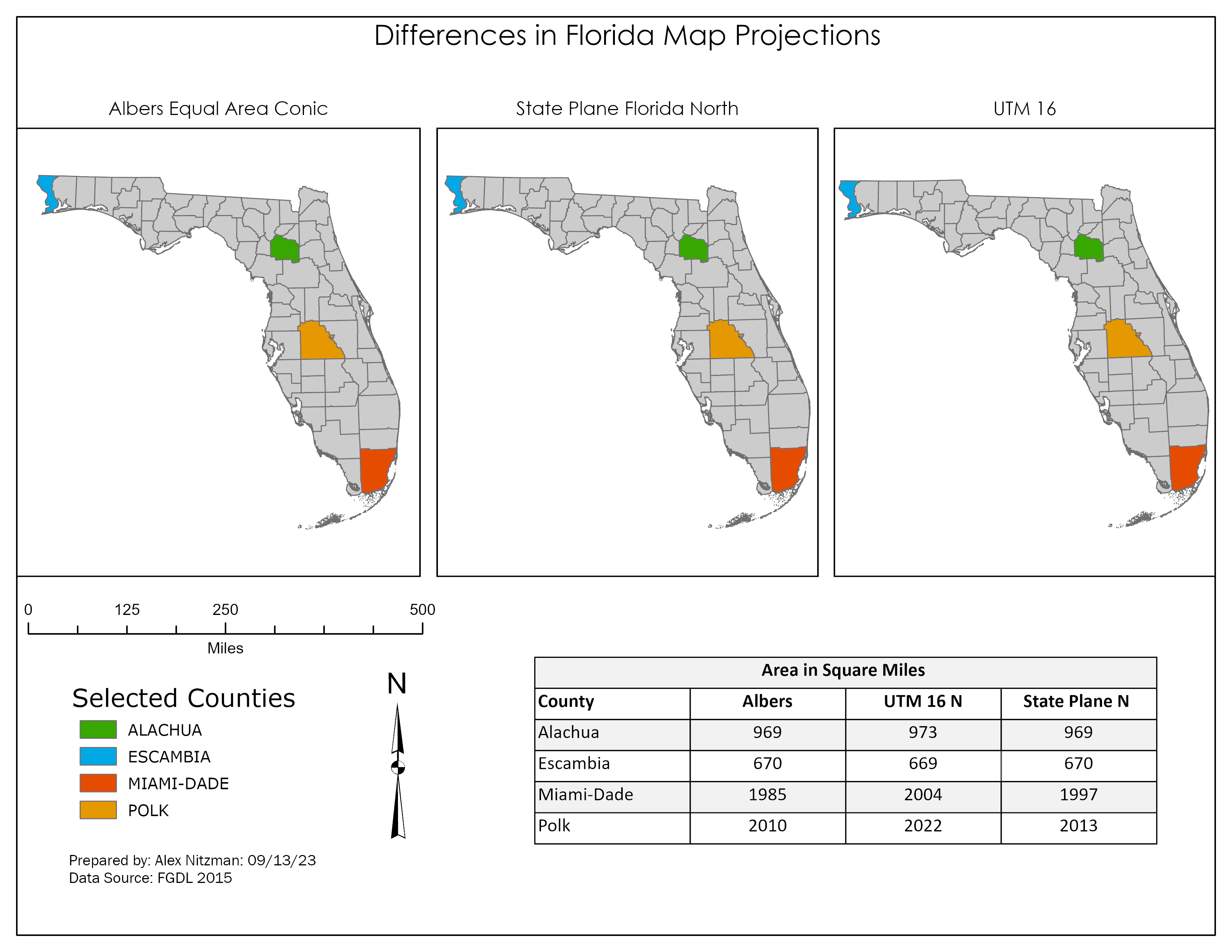
Geocoding Data – Manatee County Schools
This week's lab project introduced me to Geocoding within ArcGIS Pro and some Excel spreadsheet tactics used to prepare the data for it. The focus of this project is to extract the geographic location for Manatee County Schools from the list posted on the Florida Department of Education web site. Started the lab with a simple copy and paste of the schools list, which includes 84 entries ranging from [...]