
Spent our final full day in Vermont visiting Burlington and the University of Vermont.
As always with this trip, we took convoluted routes to see more of the area. Departing Interstate 89 south via Exit 16 (U.S. 2 & 7), we traveled through Winooski, an old mill town situated along the north banks of the Winooski River. Redevelopment of the downtown area is phenomenal when compared to previous visits in 2000 and 2005. Old industrial buildings were razed or renovated at the junction of U.S. 2 & 7 and Vermont 15 (Allen Street) and the intersection itself was replaced with a new roundabout. I was happy to see that McKee’s Irish Pub is still around too!
Crossing the 1926-built Winooski River Bridge between Burlington and Winooski on U.S. 2 west & 7 north. The bridge dumps traffic directly into the new roundabout with Vermont 15 (Allen Street). Pedestal signals are positioned within the roundabout for crosswalks, but otherwise the junction is unsignalized.
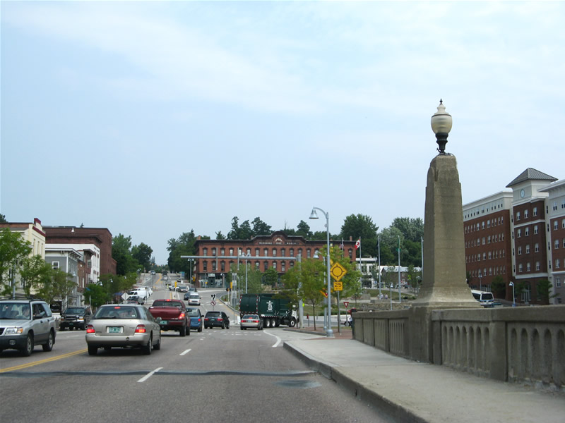
Following U.S. 2 east through Burlington, we headed along busy Williston Road to a local map store where we picked up a new Chittenden County map. After a discussion with Bob about Interstate 289 and Vermont mapping in general, we doubled back west to next visited the campus of the University of Vermont (UVM). UVM, spreading along the hills north of U.S. 2 (Main Street), is also undergoing renovation this summer. There we made our way to the University library where we discovered a gold mine of highway related information, including copies of the 1965 Greater Burlington Urban Area Highway Plan and the Outline History of Vermont State Highways – National Highway Week, Sept. 19-25, 1965. Because of this research, we discovered the background on the unopened highway west of Interstate 189
Rather than going into detail here on Burlington’s highway history, see the new Burlington, Vermont feature page where we cover the Belt Line, the Southern Connector/Champlain Parkway, and other unconstructed road projects.
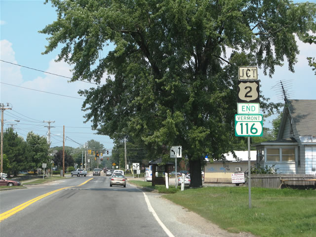
Some hand painted signs remain in use within the city of Burlington, such as this U.S. 2 shield assembly at Vermont 116’s north end.
It is more common to find hand painted signs within the town limits of rural communities throughout the state. VTrans maintains the roads and their signs outside such limits. This is why signs that display “State Highway Ends” and “Begins” signs are posted along Vermont U.S. and State Highways. They indicate the maintenance swap between the state and local municipalities.
Next on our agenda was a stop in downtown and the Church Street Mall, a three block section of roadway converted into a pedestrian street mall. The Church Street Mall bustled with visitors and locals alike, as it has in all of my Vermont trips since 1995. One can find a wide array of eateries, shops, book stores, etc. The scene at night is no different with several bars and restaurants from which to choose as well! After walking around the mall, picking up some lunch, and visiting the marina area, we opted for Vermont 127 north into north Burlington.
Vermont 127 follows Main Street west to Battery Street north and then the one-way street couplet of Park Street (south) and Champlain Street (north) before departing the central Burlington area for a swampy area known as The Intervale. The routing along Main Street is unsigned and signs along Battery and Park Street are almost nonexistent. Originally. the routing of Vermont 127 took the highway northwest along North Avenue to Plattsburgh Avenue. When the two-lane expressway opened between Manhattan Drive and Plattsburgh Avenue, Vermont 127 shifted to the east onto the controlled access route. This leaves North Avenue with no designation, but the route still remains busy as it serves North Beach and a number of residential areas between the Winooski River and Lake Champlain.
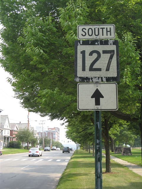
An older style Vermont 127 shield posted along Park Street at Battery Park. This is the final southbound shield even though the state highway turns east onto Main Street several blocks ahead. Further north, speed bumps reside along Park Street southbound between Manhattan Drive and North Avenue. What other state highway has speed bumps along its mainline?
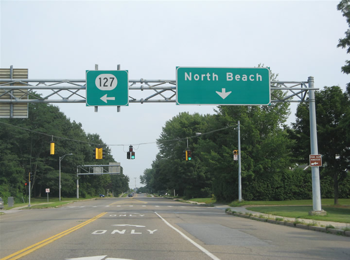
When Vermont 127 shifted to the expressway alignment through The Intervale, a connector roadway was built to join North Avenue with the new route via a trumpet interchange. A second connector route was to be built to the north, tying North Avenue with Vermont 127 by a diamond interchange as well. That connection was never built and instead Vermont 127 meets its old alignment (Plattsburgh Avenue) at a signalized intersection. Pictured here is North Avenue southbound at the Vermont 127 connector.
One final swing through downtown took us along St. Paul Street, which is signed once as U.S. 7 Alternate. It turns out that the City of Burlington posted that sign in an effort to remove motorists from Pine Street and other local streets that are bound for U.S. 7 and the south suburbs. This effort is token, but is all that will be done presently as the unconstructed Southern Connector/Champlain Parkway continues to labor with slow moving Environmental Impact Statements.


I think the I-189 must be extended to Kesseville,NY to reaching the I-87 Adirondack Northway between the 33 and 34 exits and building a toll bridge or bridge without toll over Lake Champlain to creating a faster highway link between Vermont and New York’s Lake Champlain shores.
And making easier the commercial exchanges between Plattsburgh and Burlington citizens by the Lake Champlain future expressway link.
What do you think?
Good Bye and see you soon.
Sylvain