
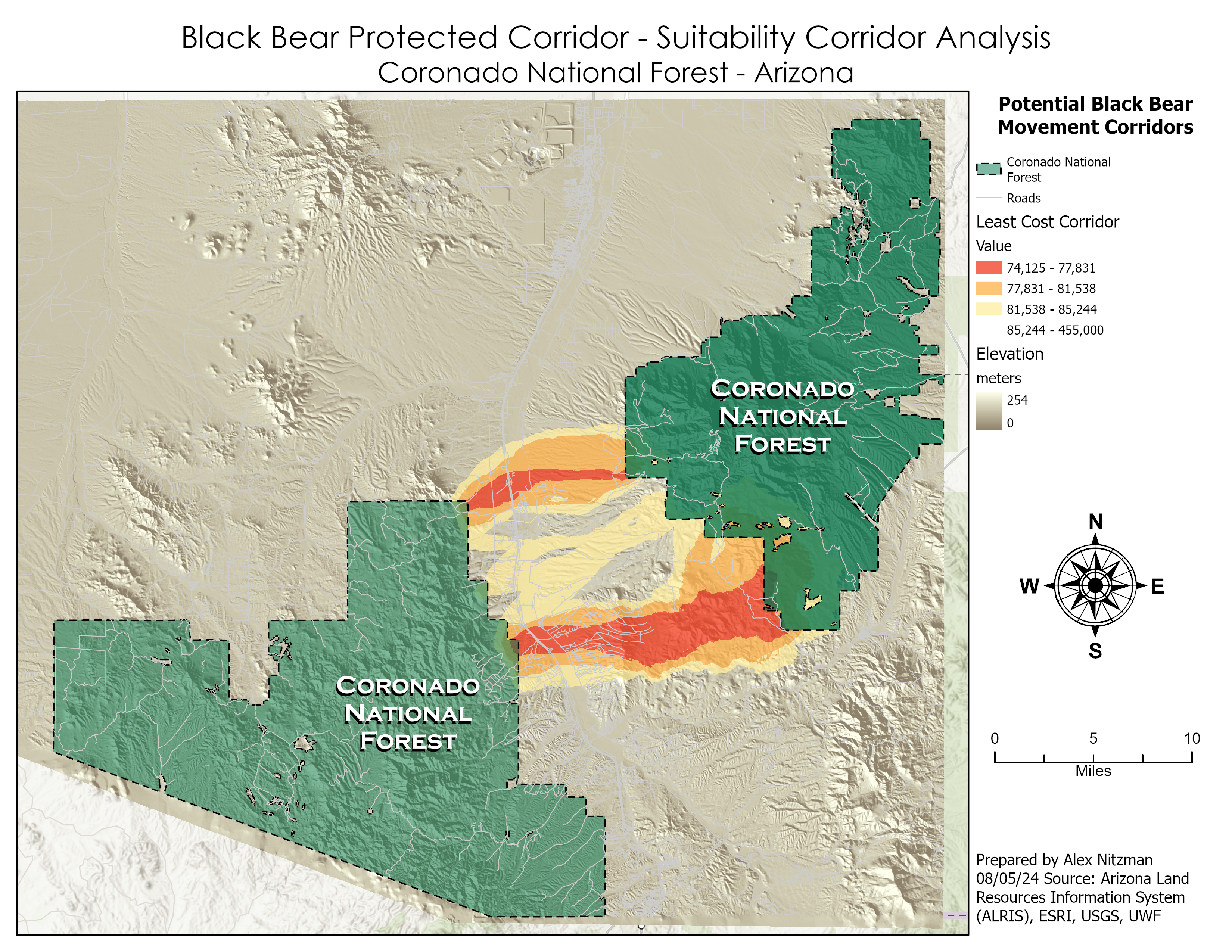
The final scenario for the lab of GIS Applications Module 6 is to determine a potential protected corridor linking two areas of black bear habitat in Arizona’s Coronado National Forest. Data provided included the extent of the two existing areas of known black bear habitat, a DEM, a raster of land cover and a feature class of roads in the study area. Parameters required for a protected corridor facilitating the safe transit of black bear included land use away from population and preferably with vegetation, mid level elevations and distances far from roadways.

Geoprocessing flow chart for Scenario 4

The suitability raster for the distance to roads derived from the raster output from the Euclidean Distance tool.

Weighted Overlay raster with the values of 1-10 where lighter colors represent lower suitability scores
Utilizing the Weighted Overlay raster, a cost surface raster is generated by using the Raster Calculator geoprocessing tool. The cost surface values were obtained by inverting the suitability model so that higher habitat suitability values translated into lower travel costs:

Cost Surface Raster Cost Surface raster where the darker colors represent higher costs
With the Cost Surface raster, the Corridor Suitability Analysis continues with the Cost Distance tool run on the two Coronado National Forest black bear habitat area feature classes. This outputs Cost Distance and Cost Distance Backlink Rasters.

The cost distance raster for the northeastern unit of Coronado N.F.

Coronado N.F. Destination Raster - 2nd feature class The cost distance raster for the southwestern unit of Coronado N.F.
Together the two cost distance rasters for Coronado National Forest are the parameters for the Corridor geoprocessing tool, which generates the Least-Path Corridor raster. The threshold value for determining the best corridors was subjective, so I went with percentages used in the previous scenario, where the minimum destination cost value multiplied by 1.05 represented the optimal corridor. Chose a color scheme based upon the ColorBrewer web site.


