
My first trip through New Orleans in 2006 occurred in early January on a cross-country voyage along Interstate 10. I was quite stunned with the devastation that took place in the Big Easy (it looked as bad as it was portrayed in TV), but had little sunlight to work with as far as road photography went. So I returned to Southeast Louisiana on June 10th to redocument the freeways for the website.
This is how the frontage along Interstate 10 eastbound in New Orleans East looked in January
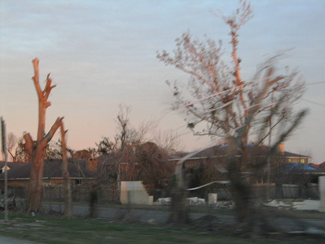
The areas of New Orleans East resembled a post-apocalyptic landscape and were vastly the same between January and June, meaning recovery is slow if at all there. From the abandoned Six Flags theme park to the gutted Sam’s Club and Walmarts and darkened street lights, the area remains very bleak almost 9 months removed from Hurricane Katrina’s August 29, 2005 landfall. The freeways meanwhile are all open to traffic at full capacity; even the I-10 twin spans carry two lanes in each direction. Some signs of the hurricane are visible in the form of damaged or missing signs, bent street lamps, and water line stains on the sound walls near the Jefferson Parish line.
Katrina’s wrath is still quite evident along Interstate 10 westbound through New Orleans East in June of 2006.
See the freeways for yourself at at http://www.southeastroads.com/louisiana.html


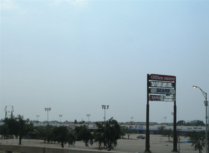
This shopping center on the lakeside of I-10 along with the Lake Forest Plaza (former mall) on the riverside of I-10 are both being torn down. They are across I-10 from each other on the west side of Read Blvd.
The mall will be replaced with a Lowe’s along with other outdoor-oriented shopping and restaurants like malls are being developed these days.
Both the mall and shopping center (as pictured above) took in 3 to 4 feet of water as the horizontal brown line indicative of the high water mark shows.
All good news with the demolitions.
-steven, 3-24-07