
Over the holiday weekend, I took a trip that concentrated heavily on US-50 from I-15 in Utah to Carson City. This batch barely gets us there, as we head up the US-91 corridor (approximately) from San Diego to Utah, and then turn west, stopping in Ely, Nevada for the night.
those that click on the large versions of the photos may notice… new camera! Larger pictures for your enjoyment. When my D50 died at 99872 exposures, I upgraded to the D5000. This trip served to field-test it in a variety of conditions.
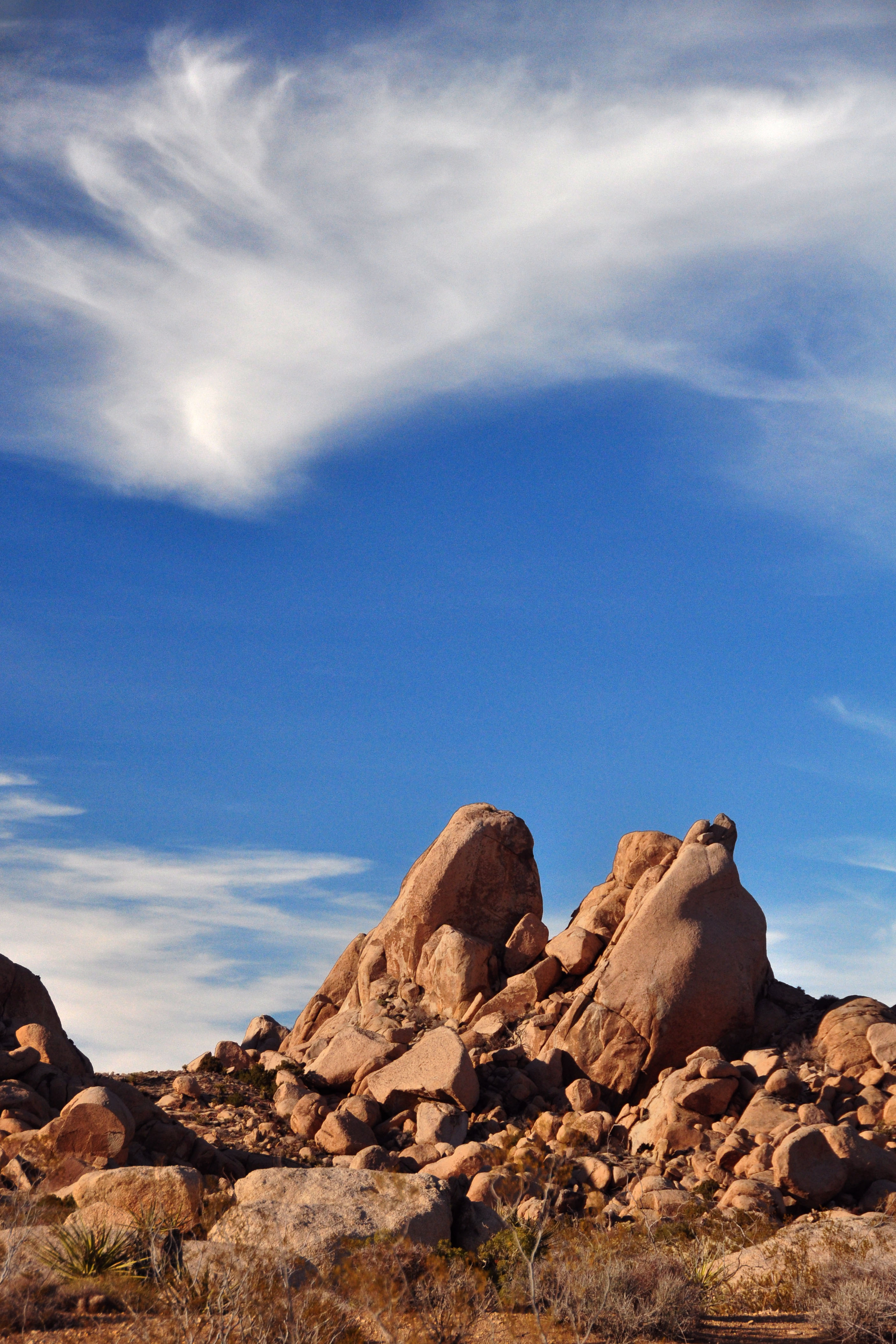
Pointy rocks and high clouds, by the side of the Kelso-Cima Road, which is a very old US-91 alignment. Before they built the road in the 30s that would be upgraded to I-15 in 1962, a somewhat more indirect highway followed the railroad between Cima and Kelso, and that was US-91.
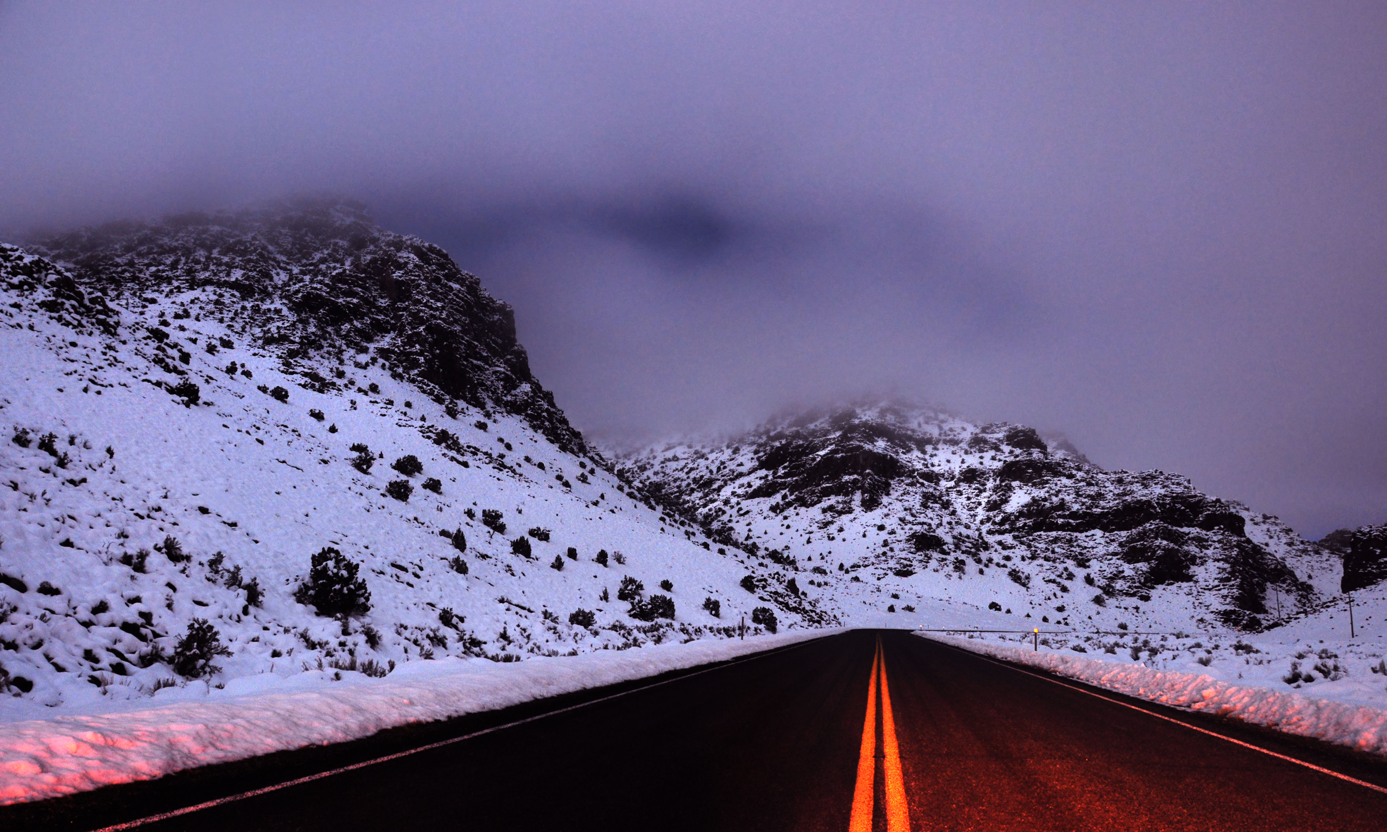
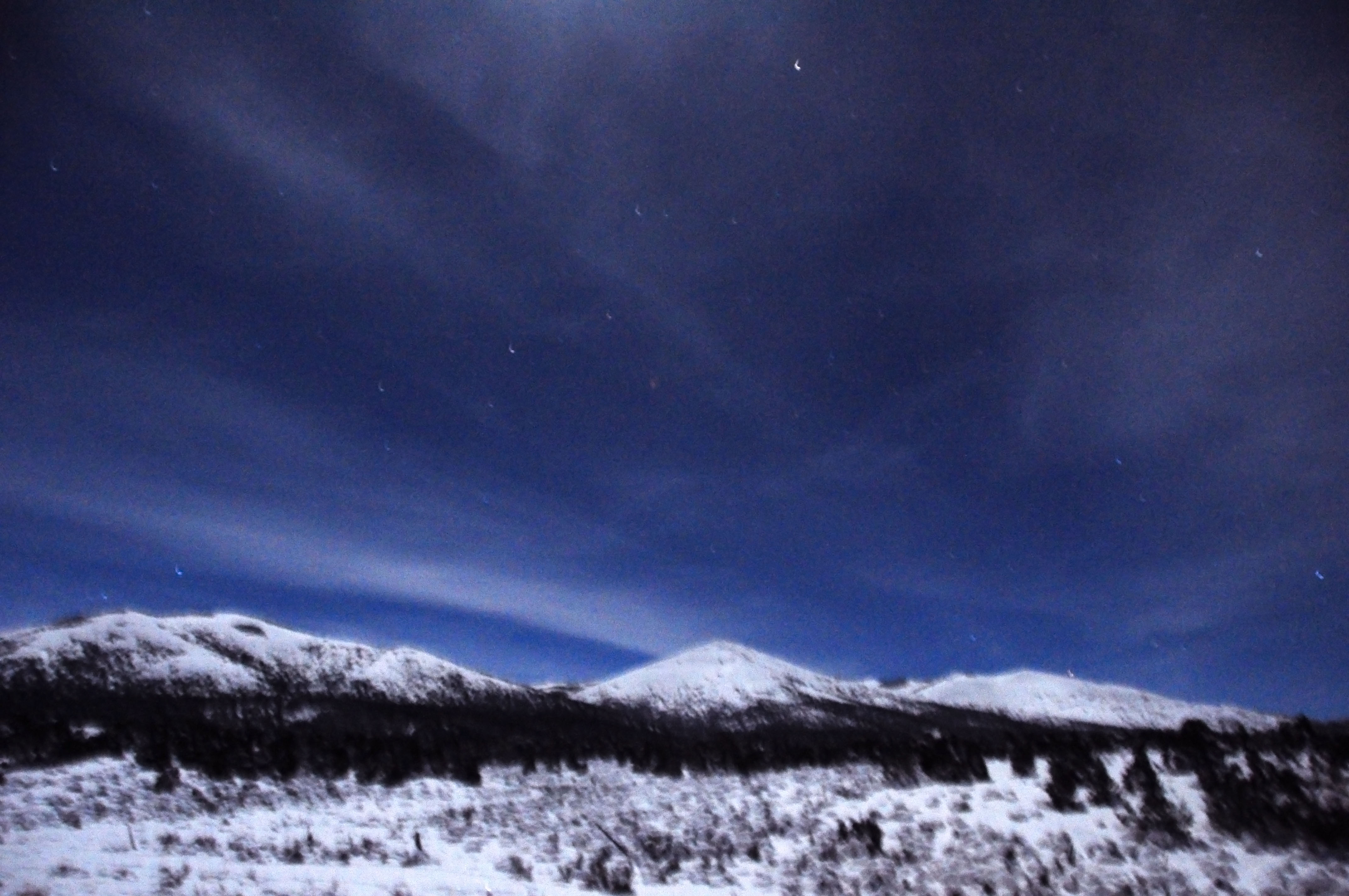
US-50 in western Utah. 1am on a foggy night. As there was no place to pull over, I stopped the car in the middle of the road and set up the tripod next to it. No cars came in the six or seven minutes I was stopped. Indeed, no other vehicles between Hinckley, Utah and Majors Junction, Nevada – over 100 miles!
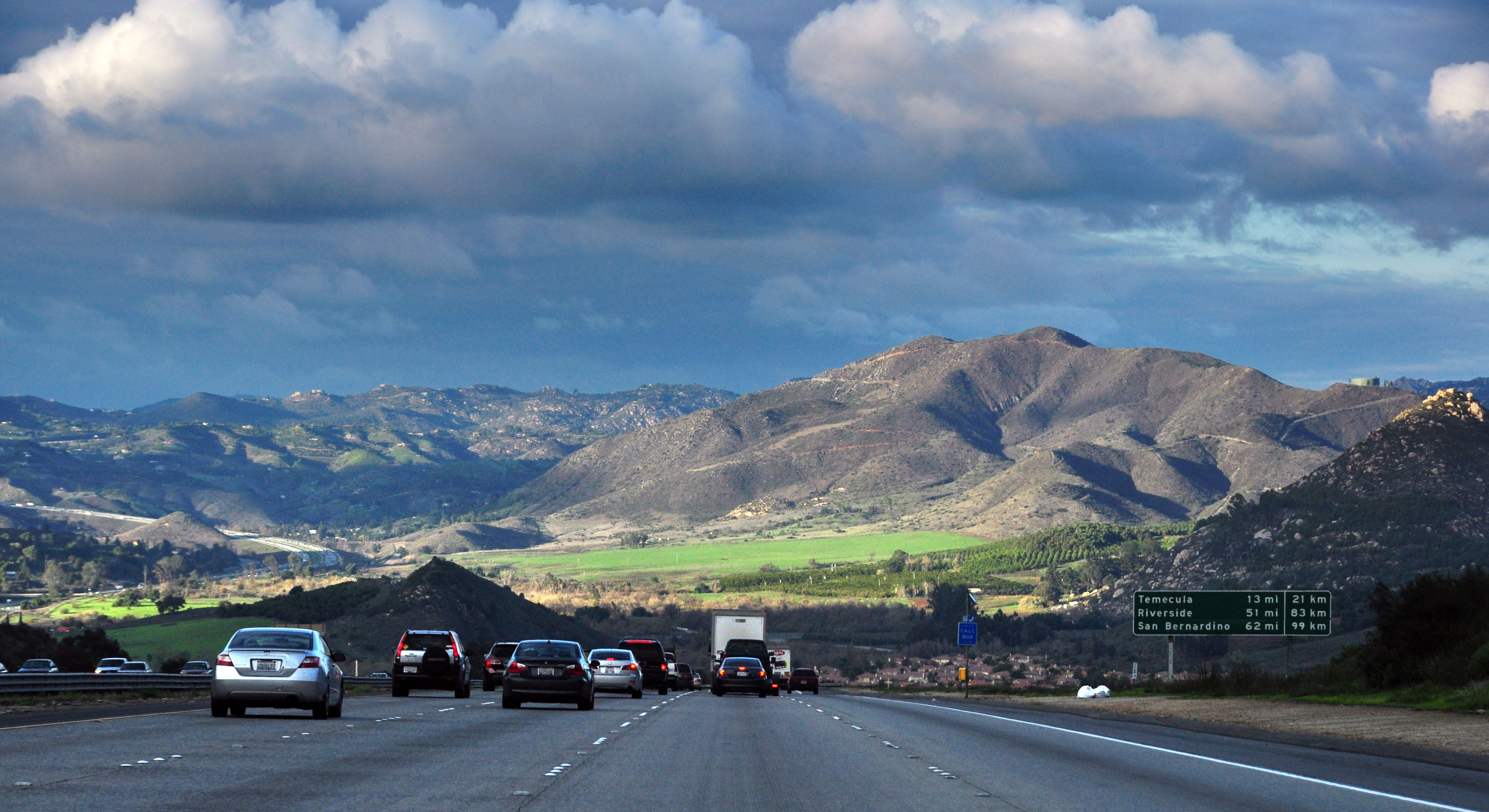
Altogether too much traffic on I-15 as we depart heading towards Riverside County.
Taking I-10 instead of I-15 or I-215 gets us off the main road with all the Los Angeles to Las Vegas traffic. While you wouldn’t think of putting Christmas and gambling in the same sentence… apparently, half of LA’s population did!
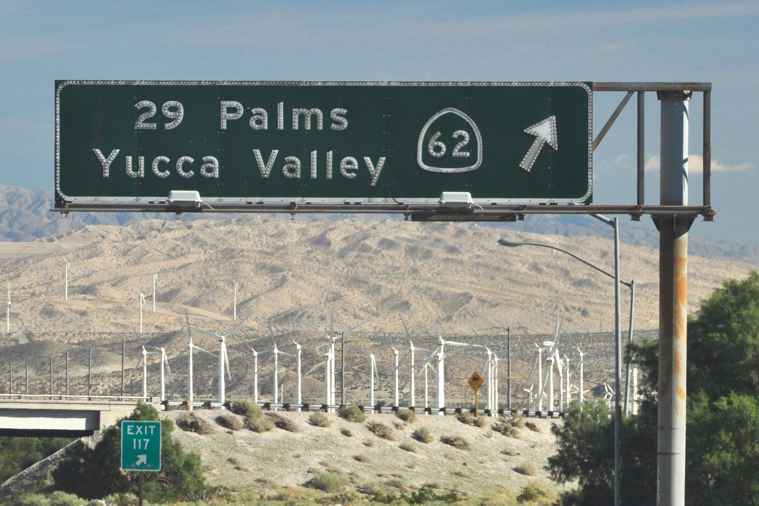
This sign dates to 1966, when 62 became a state highway.
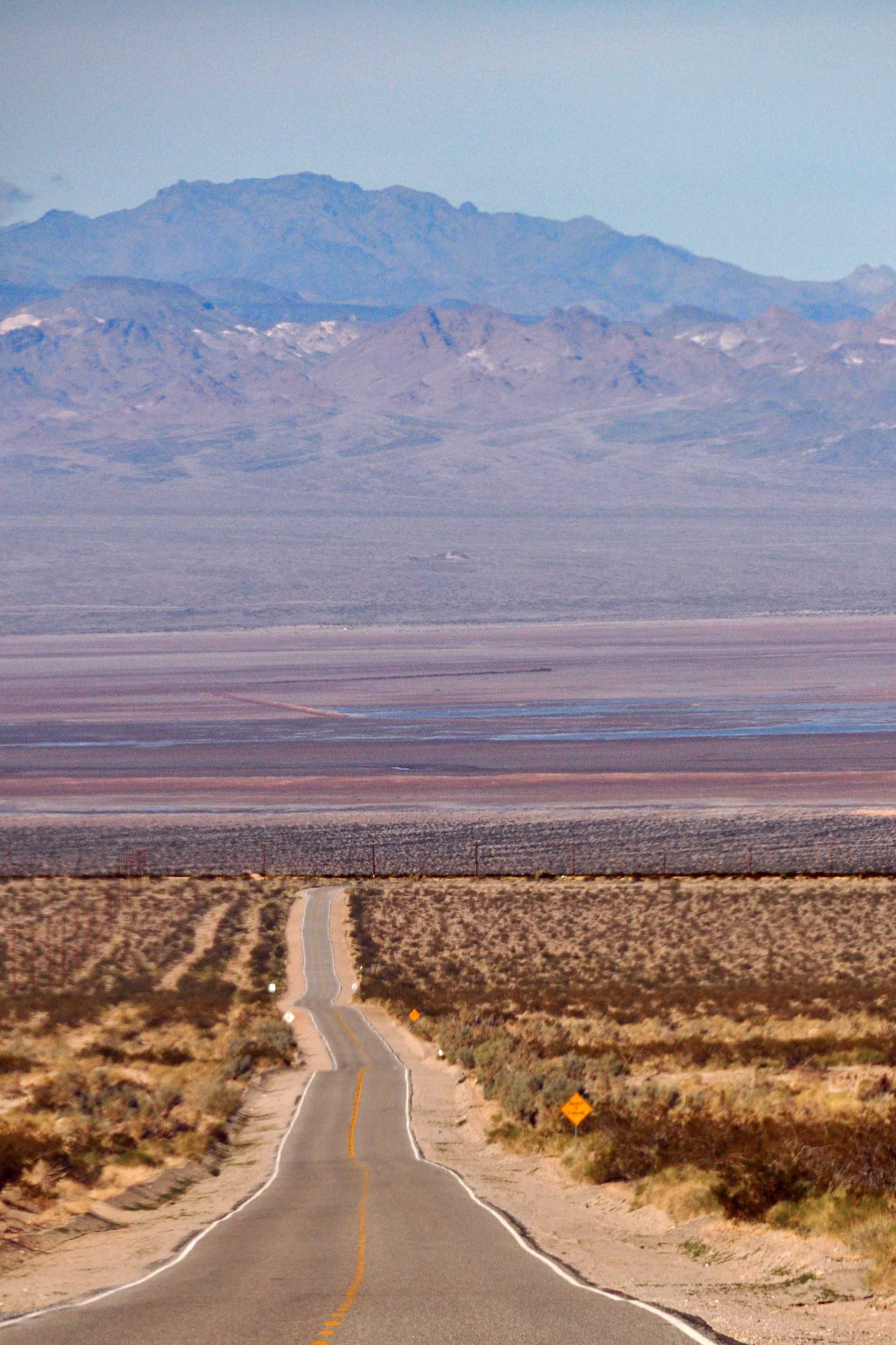
And now, the Amboy Road, which connects Twentynine Palms to Amboy. We’re taking a somewhat circuitous route, but at least the traffic levels are favorable.
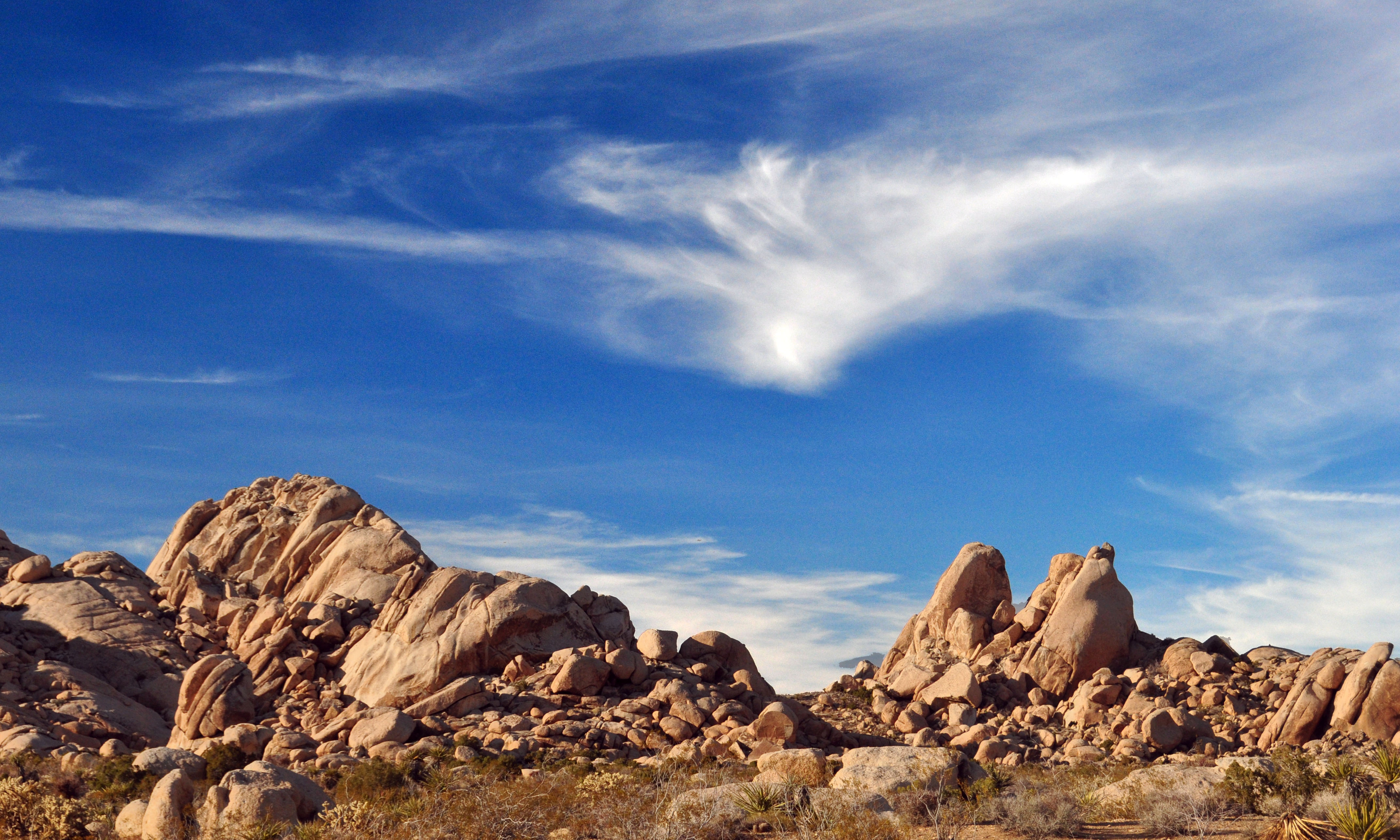
Kelso-Cima Road again, but this time with some more context.
I think San Bernardino County is responsible for this sign.
The sign that this replaced survives: it has “US 91/466” to the left, and is a 1950s porcelain Auto Club sign: white with black legend.
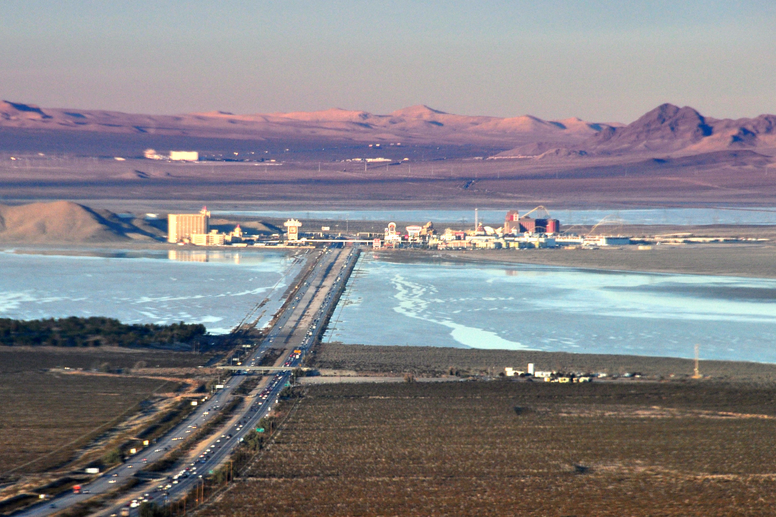
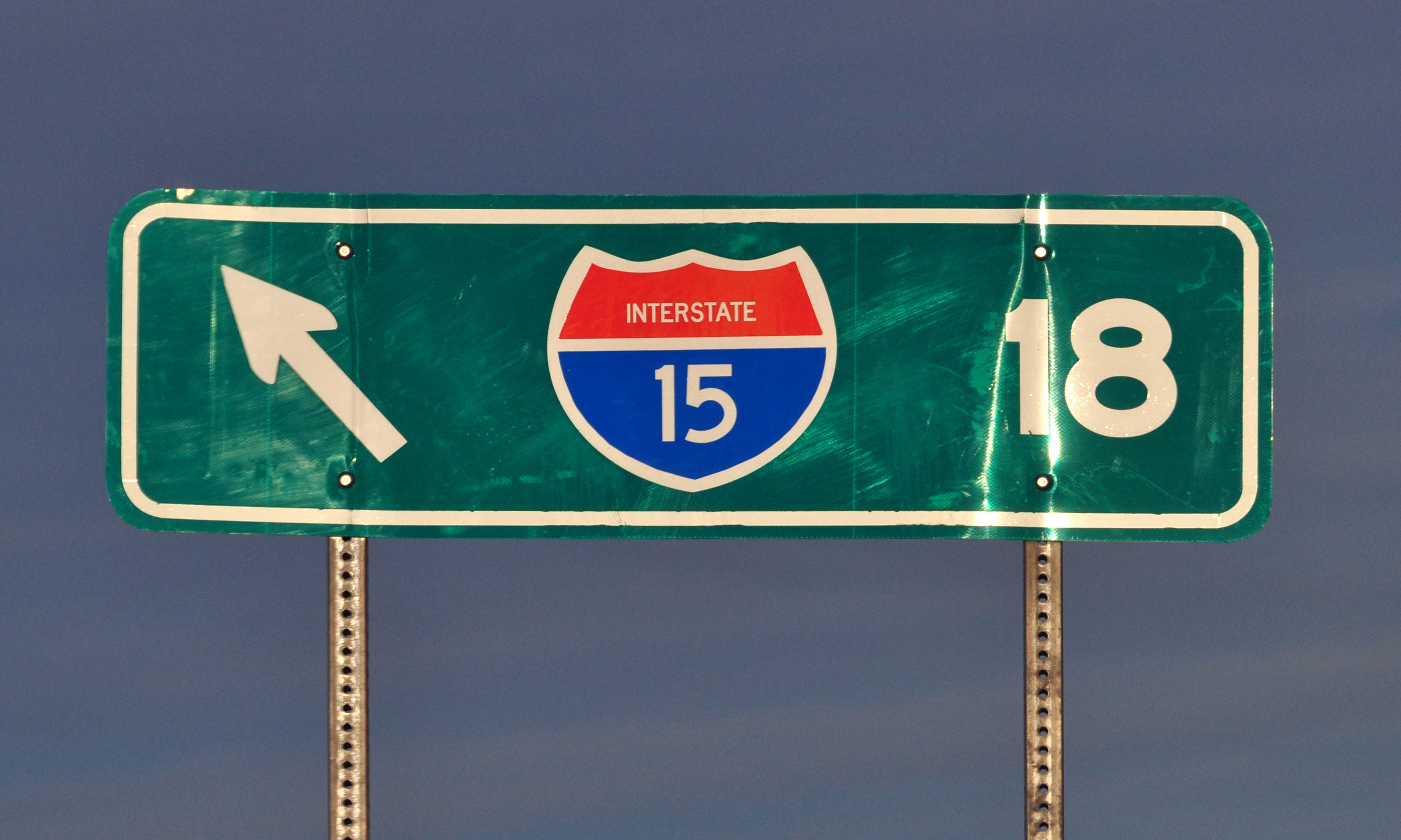
We’re back on I-15, as that is the only way into Nevada in the area. The town of Primm, formerly known as State Line, is in the distance.
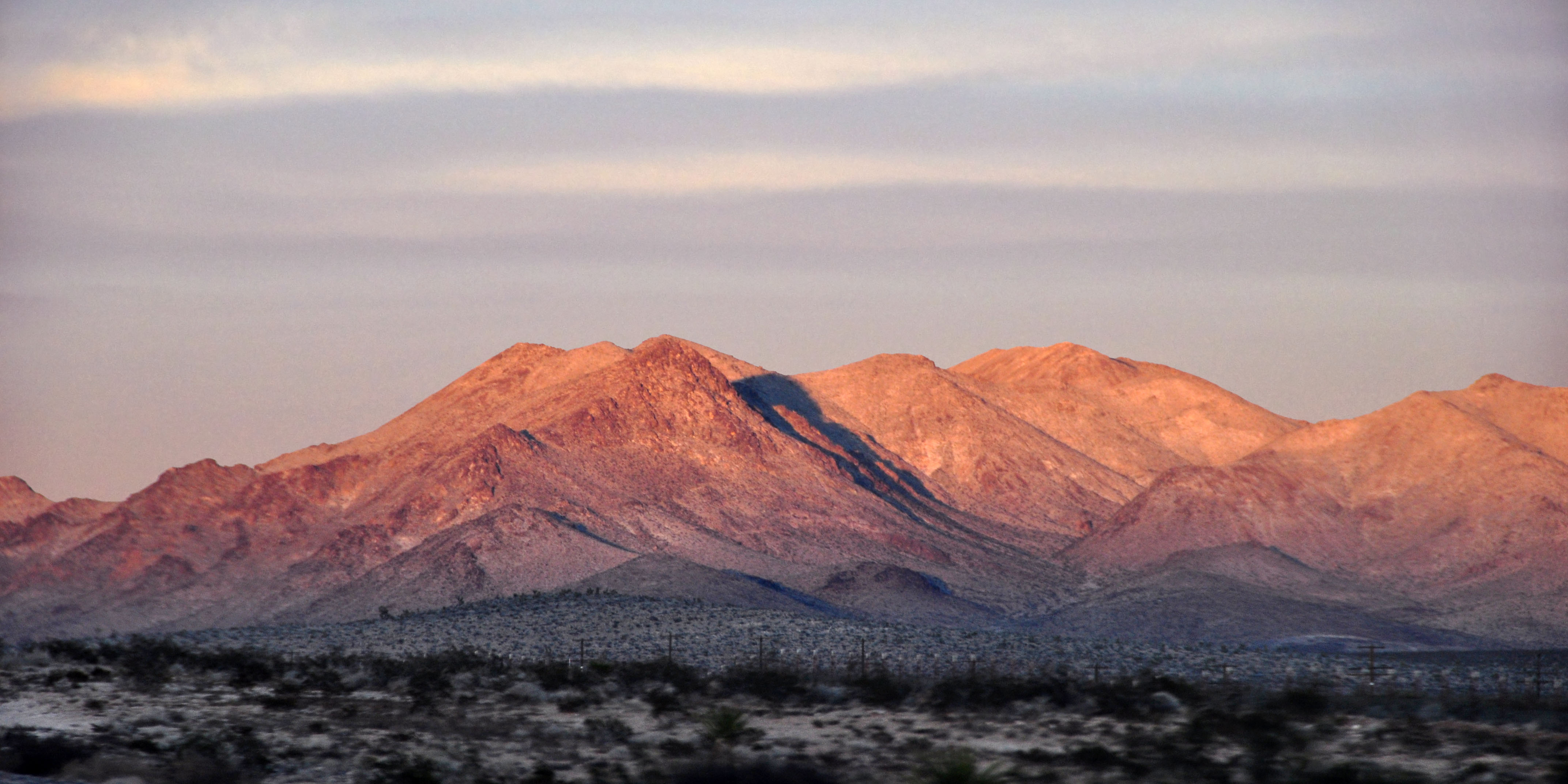
The mountains turn red.
A bit of poor planning gets us sunset at the worst of Vegas traffic. Oops.
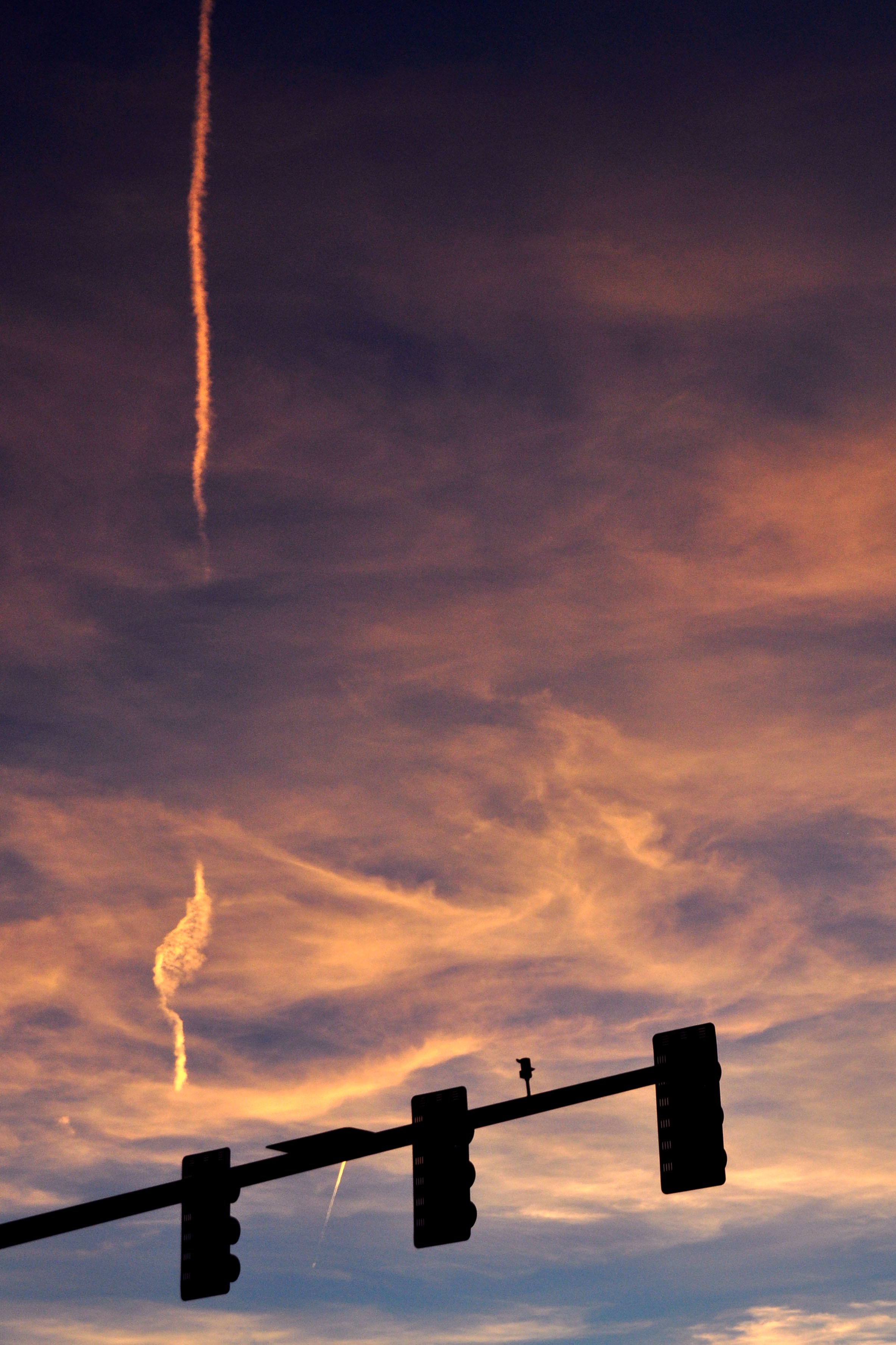
Red skies… and traffic lights.
I’ve taken more realistic photos of I-15 through the Virgin River Gorge on more than one occasion, but this one came out so over-the-top misexposed that I just had to keep it. About 80% of this photo’s pixels are railed to one maximum or another. Gotta love it.
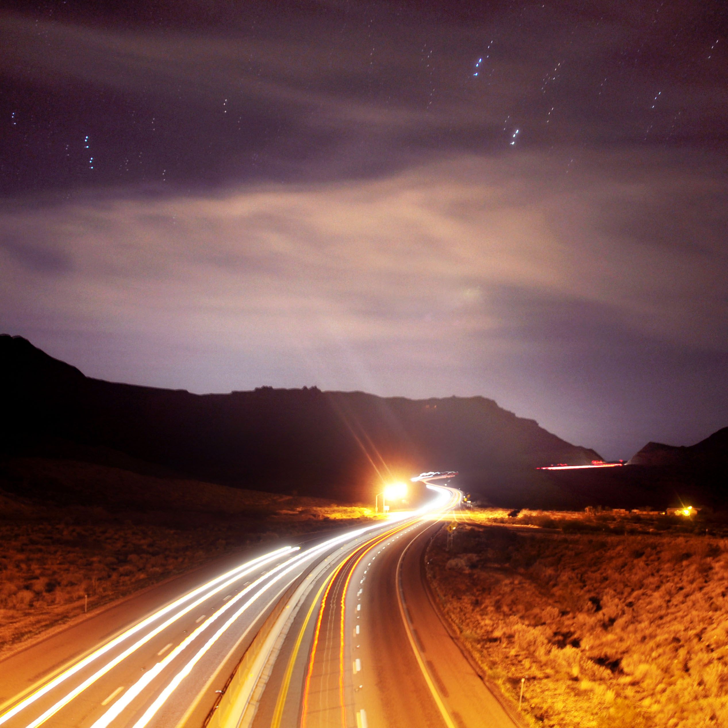
There we go – a much better exposure. Or, combination of exposures as the case may be. The very discontinuous star trails should give a good idea as to which photos of a series I selected to combine.
The I-15 routing through the gorge is one of the rare examples of an interstate that replaced an old two-lane road, making the trip more scenic in the process. I-70 vs US-50 between Green River and Salina, Utah is another example, as is I-68/US-40 at Sideling Hill in Maryland.
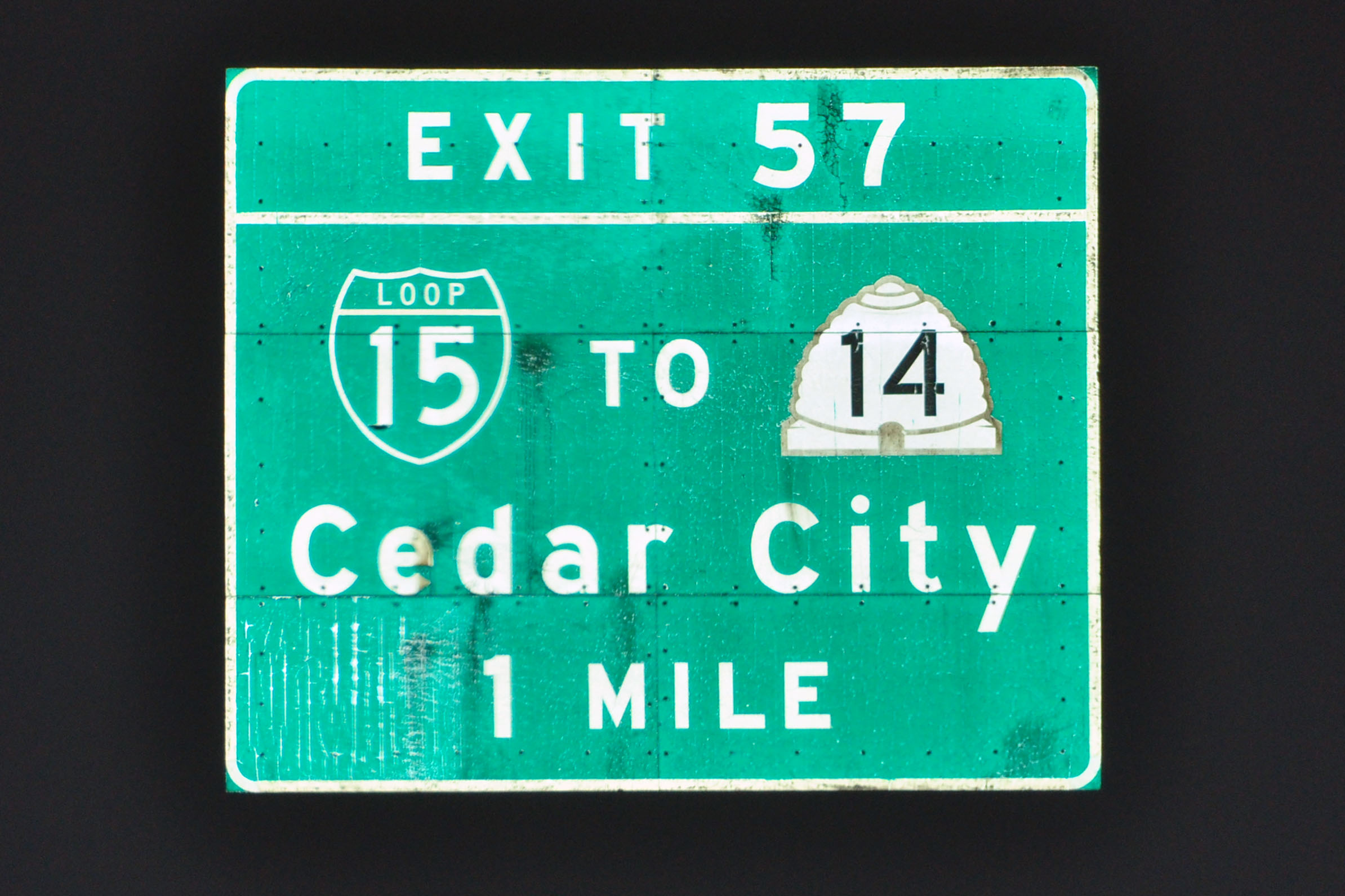
And we’ve made it to Utah. Don’t tell Enterprise, as they do not allow the car past Nevada and Arizona. Note the “loop 15” shield – this is a direct replacement of an older button copy sign, which did not have the resolution for a detailed Business Loop 15.
And some actual button copy. This, and a corresponding sign southbound, are – I believe – the only button copy signs left on I-15 in Utah.
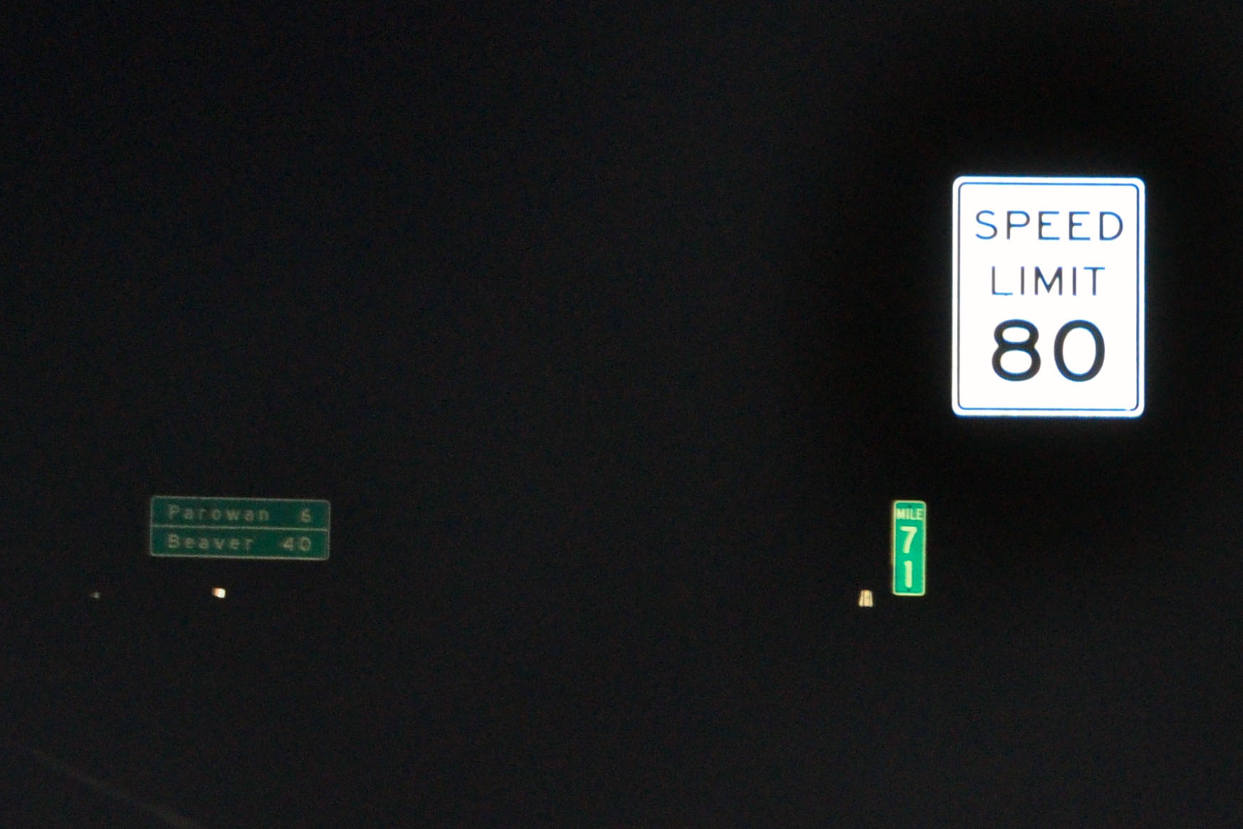
The highest posted speed limit in the country. Texas has it on I-10 and I-20 in the sticks out west, and Utah has three segments of it now on I-15. From milepost 65 to 85, then miles 116 to 133 (ending at I-70 at Cove Fort), and one more section from 144 to 164. There may be more north of US-50 as well that I did not notice.
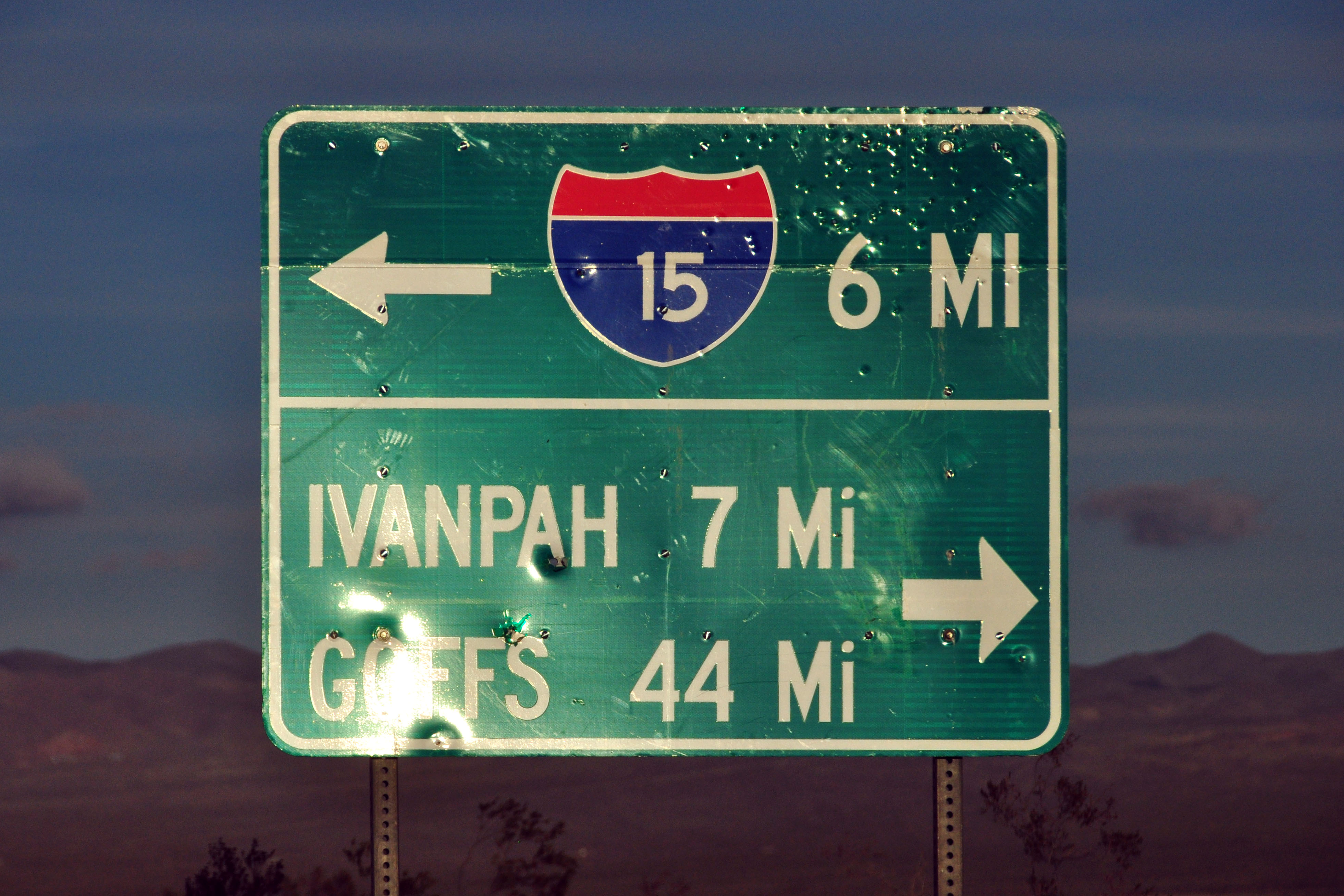
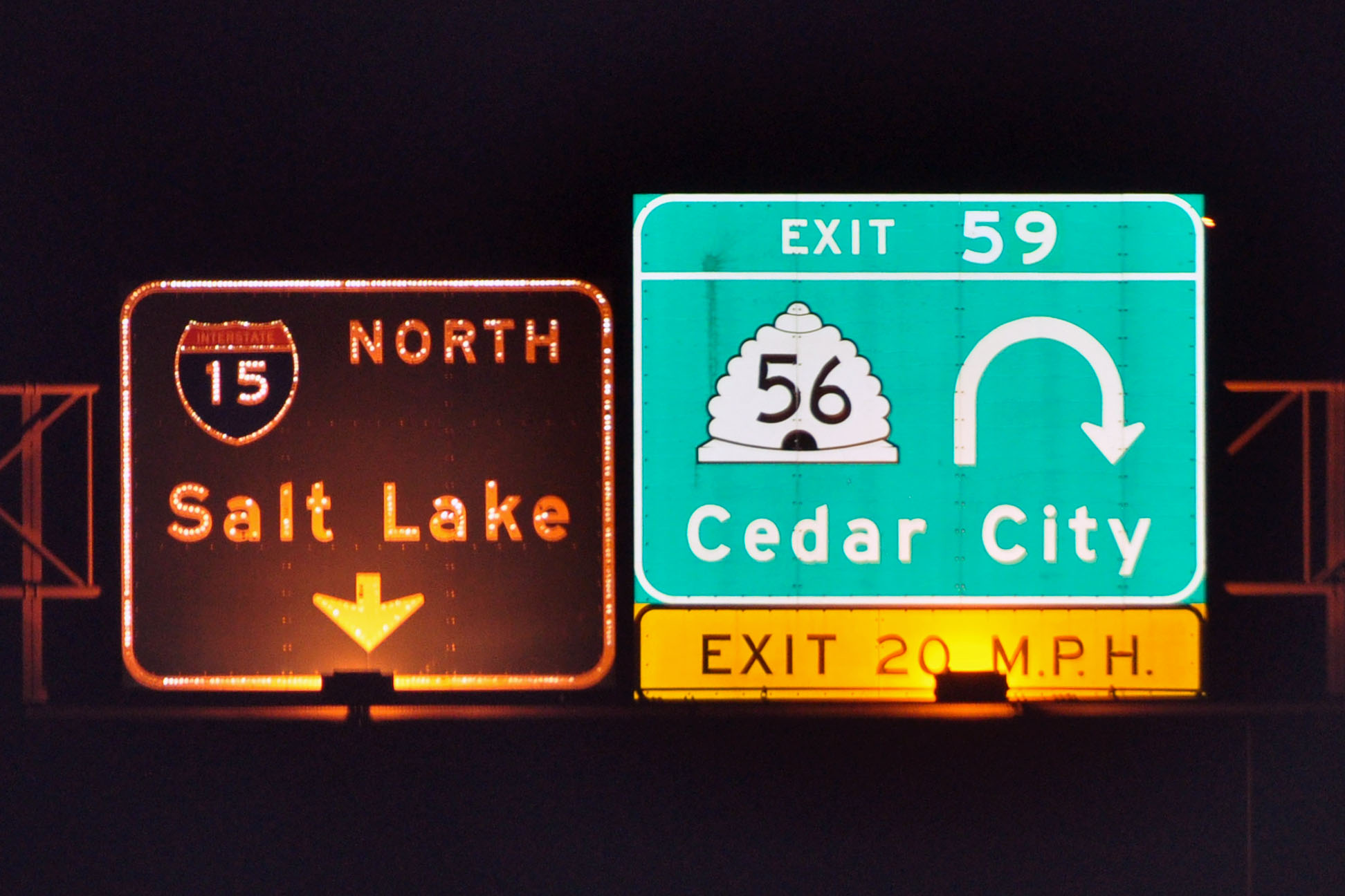
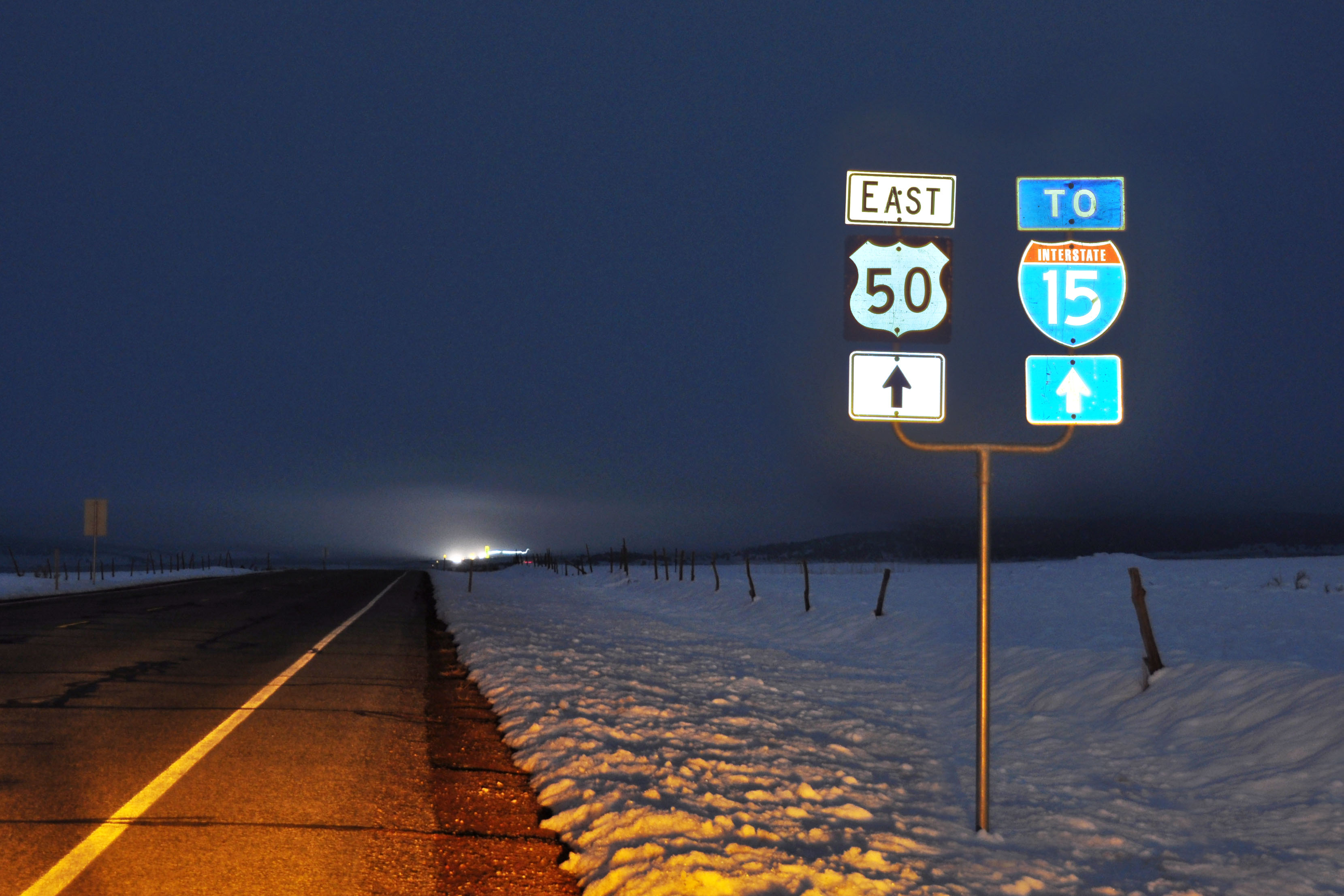
This is where we get off I-15 and head west on US-50 all the way to Carson City, Nevada.
What do we have here? An early 1960s US-50 shield, complete with the custom Utah font! Alas, the I-15 is much newer. The 50 was probably paired with a US-91 to begin its life.
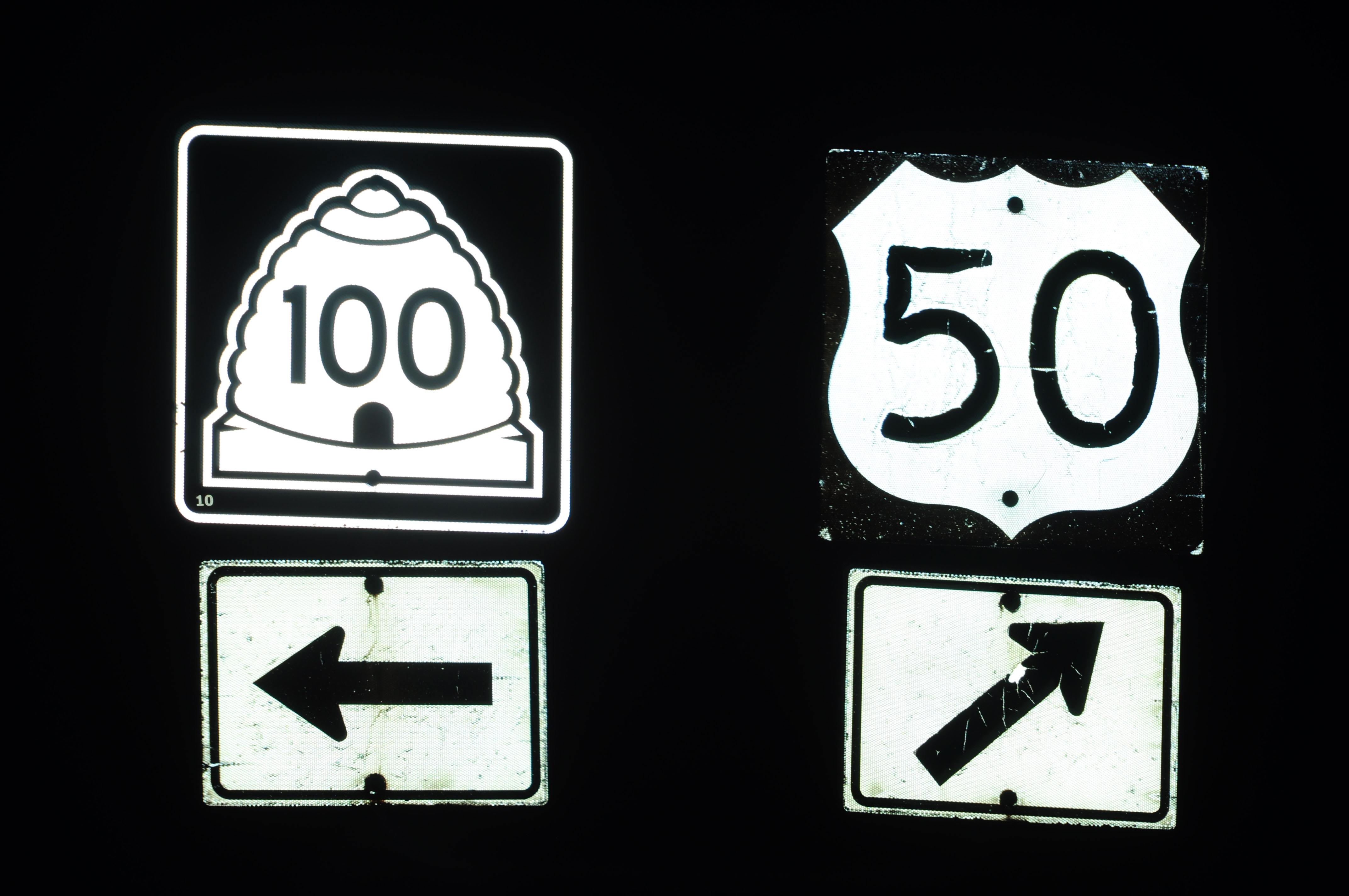
Brand new beehive 100 shield, with extra wide white margin.
Standard-font 1961 spec shields are not difficult to find in Utah.
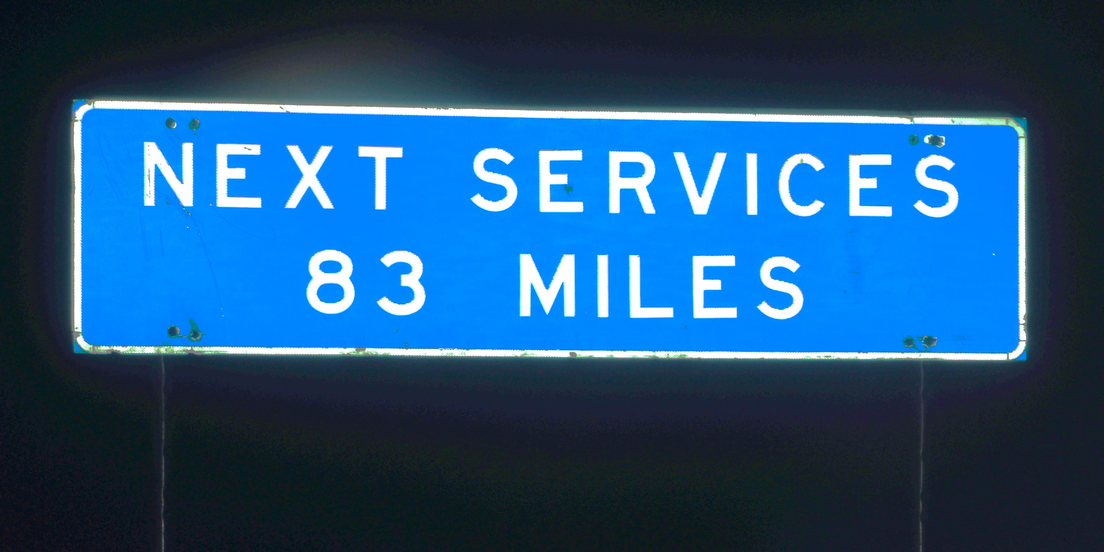
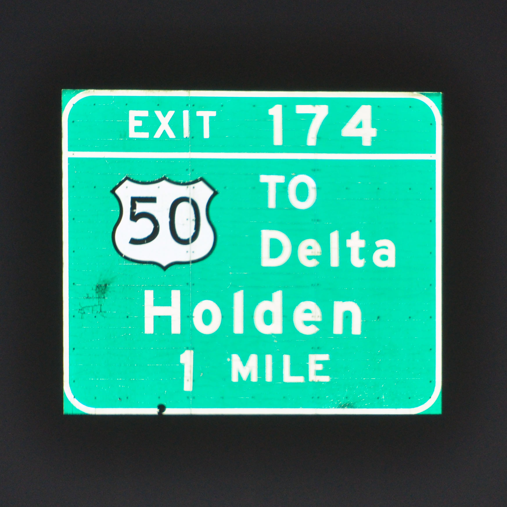
We leave Hinckley with an eye on the gas gauge. Past here, there is gas only at the state line (83 miles away), and then Ely, Austin, Middlegate Junction, and Fallon as we cross the most uninhabited portions of Nevada.
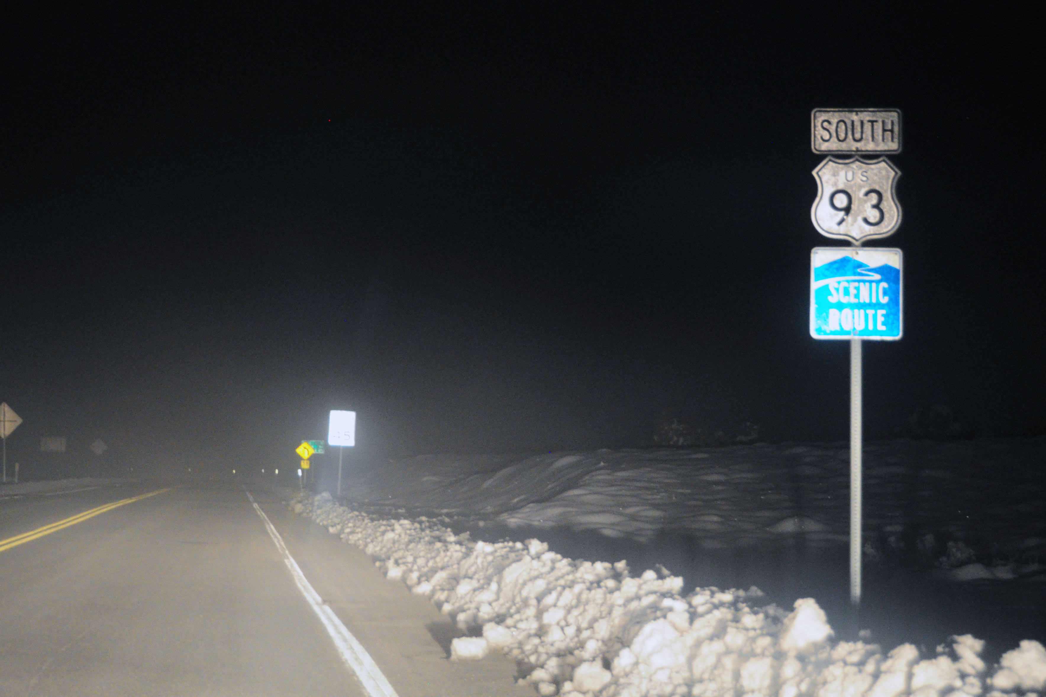
Yep, that’s a cutout US-93 marker in Nevada. It was put up quite recently (2005 or so) at Majors Junction. There were, at one point, US-6 and US-50 cutouts as well, but those are gone.
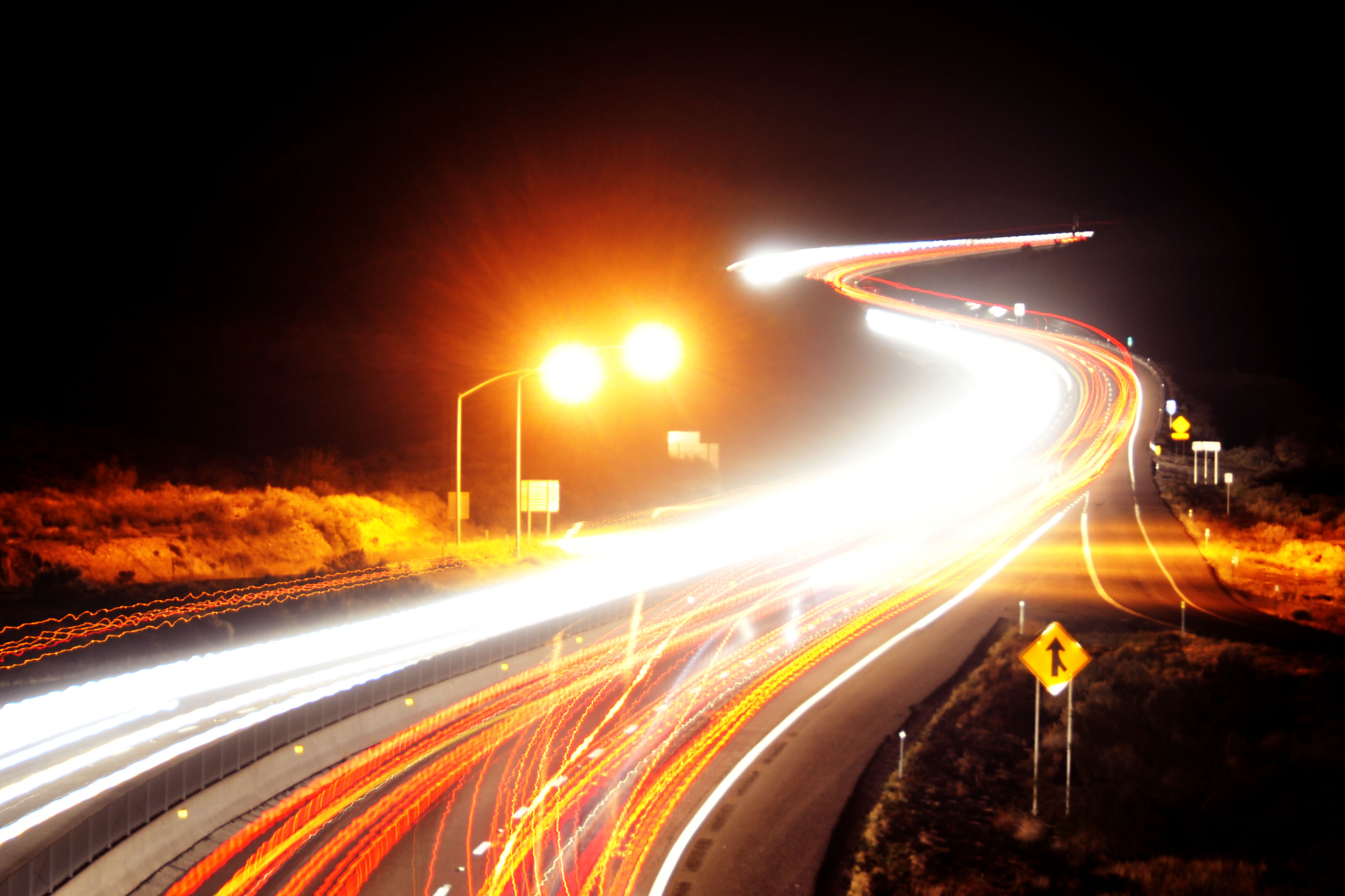
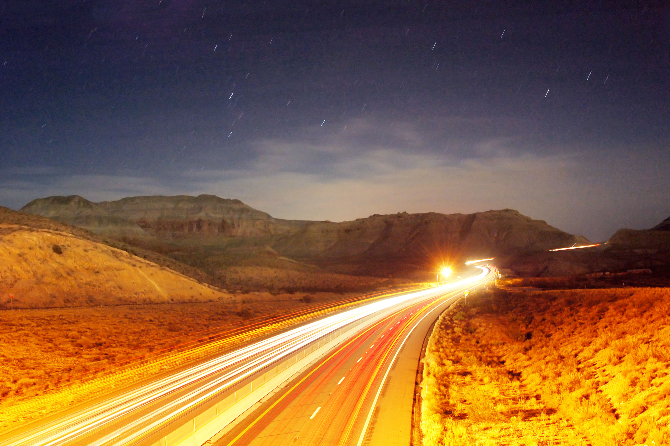
I should’ve stopped for this one, as opposed to shooting a hand-held 5 second exposure out the window. The view is from a sweeping curve along Connors Pass, and there was absolutely no place to pull over and visibility for stopping in the road… and surprisingly many vehicles at that time of the night, so I kept going.
At small size, it looks all right, but the full-size version is very blurry. It should actually be fairly easy to get rid of the motion blur: all the stars should be points, so taking a star track and inverting it should give us the appropriate deconvolution filter. Quick, where’s my knowledge of Fourier transforms?
And that does it for the first day of the trip. Next up: US-50 across Nevada.


Well, the 80 mph speed limits through Utah don’t change much – everyone goes 90+ regardless of whether the limit’s 75 or 80.
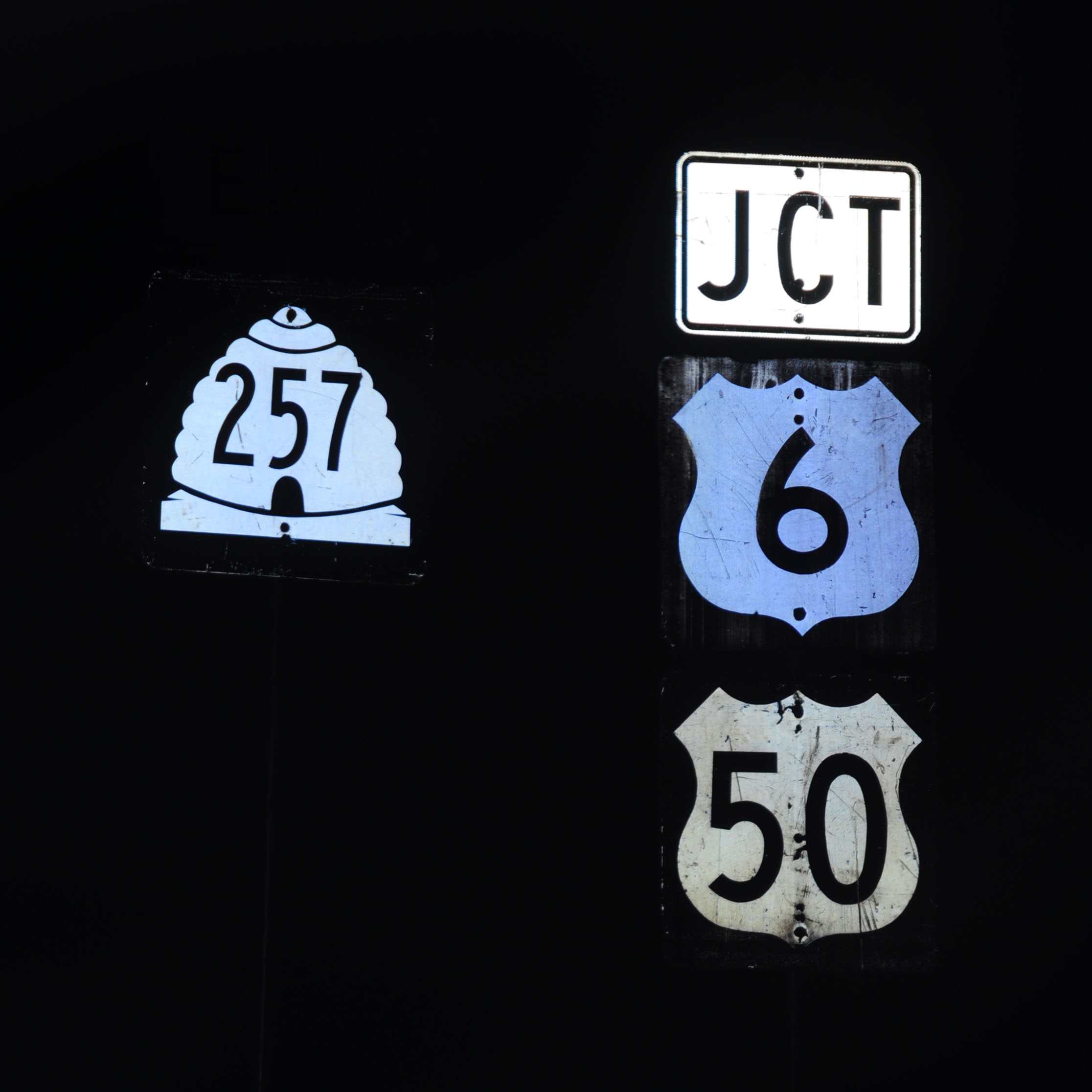
That SR-100 shield is one of several UDOT has been experimenting with. That example is one of the more tamer ones… for some reason, UDOT saw fit to abandon the old beehive shield (the one seen on your SR-257 photo) used since the ’60s for a plethora of substandard ones. Oh well.
the sad part is, it was really foggy so I was doing about 63 most of the way.
the 257 is a 1970 or so beehive. Here is a ’61.
http://shields.aaroads.com/show.php?image=UT19611931&view=3
note the almost complete ellipse of the doorway on the beehive.
I had the same fog problem heading south on I-15 through the same area area about a week ago… and yet, average travel speed was still 85 (granted it wasn’t nighttime). Go figure.
I keep forgetting about that early ’60s shield, but that ’70 spec Utah consistently used for thirty years before going to ten or so variations of that blank shield we talked about on the boards (I suspect lack of contractor oversight having in part to do with this). I’ll have to get some pictures -there are some really ghastly shields lying around.
When I check the pictures of the pointy rocks or the mountain pic at Amboy Road. I could imagine watching classic western movies from John Ford and Sergio Leone. ;)
CL – do you know when Utah changed from the ’61 to the ’70 spec of US shield? Hardly any ’61 spec state shields left (hell, I can’t remember a single one floating around) but US ones are very very easy to find, still.
that 50, and another like it just down the street, are the only two US shields I know of with custom Utah font, though. there are several examples on the shield gallery of cutout UTAH/US with custom font, but no black squares.
Stephane – yes, very Wild West for sure.
Good question. Really, I have no solid idea. I’ll offer you my deductive reasoning though – there are several old shields on State St (US-89 through Salt Lake) that are ’70 spec. They were most likely installed when US-91 and 50A were truncated (’74 and ’79 respectively). The numerals on the shield are series C however, as if they were meant to be on a ’61 spec shield. This might indicate that the switchover from ’61 to ’70 had barely occurred somewhere around the mid 1970s, but I don’t know. Maybe that’s a little bit of a stretch.
While we’re on the subject, is Utah the only state that pastes new signs over its old ones? There are dozens of button-copy signs on I-80 and I-215 that lie underneath newer installations.
Re your / picture. Keep in mind that U.S. 50 was concurrent with U.S. 6 through Spanish Fork between Green River and Delta (as it is west of there) until completion of the I-70 segment across the middle of Utah. After that, U.S. 50 continued to follow new I-70 west from Green River. And then from Salina to Delta it was established across what were formerly Utah state highways. So, it’s unlikely that the U.S. 50 marker you have there was vintage early 1960s – at least not at that location. Not sure of the date that U.S. 50 shifted onto I-70 in that stretch. I’m thinking late 1960s/early 1970s.
yep, that sign is just to the west of I-15.
I wonder how late Utah was still using Silver Scotchlite.
Great site…I love it…!
regards
ram51
>We leave Hinckley with an eye on the gas gauge. Past here, there is gas only at the state line (83 miles away), and then Ely, Austin
I was starting to think you were in Minnesota..all three of those are there