
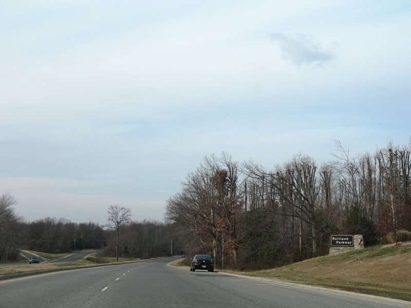
Suitland Parkway links southeast Washington, D.C. with Andrews Air Force Base at Maryland 4 (Pennsylvania Avenue) near Forestville. The highway carries four lanes overall along a 9.35-mile controlled-access route. Several interchanges and a handful of at-grade intersections lie along the route. Like the George Washington Memorial and Clara Barton Parkways, the Maryland section is maintained by the National Park Service.
Suitland Parkway begins at a signalized intersection with Maryland 4 (Pennsylvania Avenue) near its interchange with Interstate 95. Departing westward, the parkway first interchanges with Patrick Avenue at the north gate to Andrews Air Force Base. From there the route continues west underneath Interstates 95 & 495 (there is no direct access between the parkway and Capital Beltway).
Originally constructed during World War II by the Bureau of Public Roads (now the FHWA), Suitland Parkway was built to link the military facilities of Bolling Field Air Force base with Camp Springs (Andrews A.F.B.). Opened December 9, 1944 the parkway later became part of the National Capital Parks system, which preserves the forest and rural scenery along the route. This designation led to Suitland Parkway inclusion in the National Register of Historic Places on June 2, 1995.
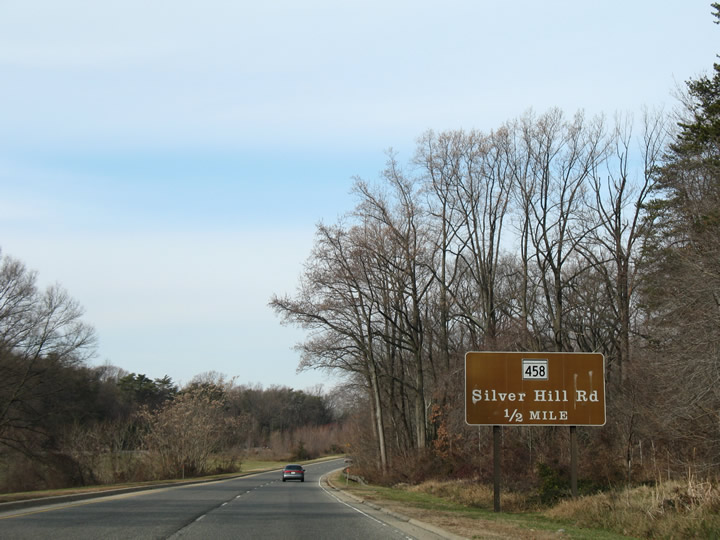
Suitland Parkway continues west and north to a three-quarter cloverleaf interchange with Maryland 458 (Silver Hill Road). National Park Service maintained sections of the road include brown signs with Clarendon font in most places. However replacement signs feature Arial font and some signs, such as those for the Maryland 5 interchange, are simply missing. Just before the Silver Hill Road interchange is an at-grade intersection for Meadowview Drive and the Meadowview subdivision. Meadowview is only accessible via the NPS-maintained Suitland Parkway.
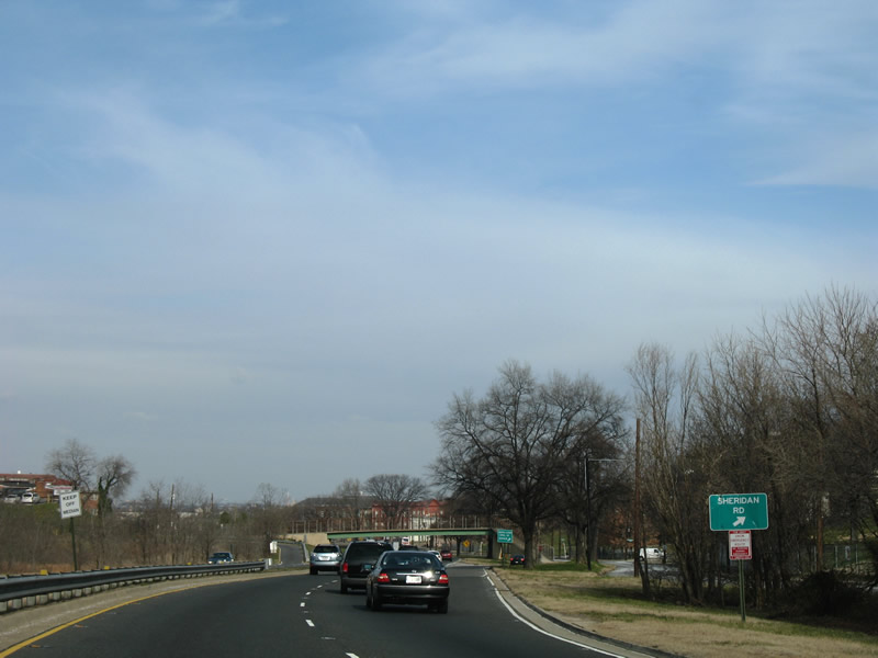
Suitland Parkway gains an urban feel upon crossing the District of Columbia line at the Southern Avenue overpass. Sign standards decrease within Washington, with substandard guide signs for the ramps to Alabama Avenue, Sheridan Road and Martin Luther King Jr. Avenue. Pictured here is the approach to the Sheridan Road slip ramp for MLK Jr. Avenue.
The roadway is used by commuters and visitors alike. Connections with South Capitol Street to the north provide a direct route into downtown Washington and the United States government center. Additionally drivers bound for the new Washington Nationals baseball park can use Suitland Parkway from the south, as the new stadium lies along South Capital Street north of the Frederick Douglass Memorial Bridge.
A modified cloverleaf interchange joins Suitland Parkway, South Capitol Street / Douglass Memorial Bridge, and Interstate 295 (Anacostia Freeway). Suitland Parkway merges with South Capitol Street ahead of the Douglass Memorial Bridge.
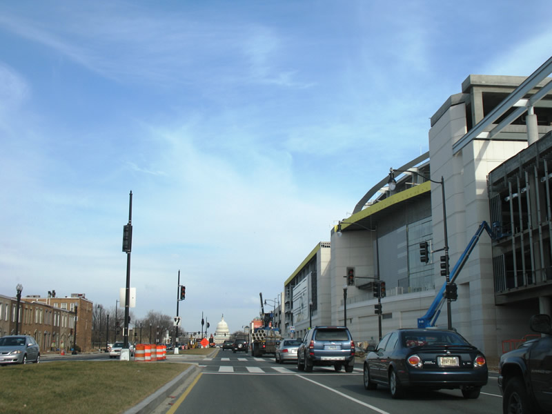
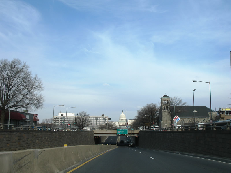
South Capitol Street travels north from the Interstate 295 interchange with Suitland Parkway at Anacostia Park. The route utilizes the Frederick Douglass Memorial Bridge across the Anacostia into south central Washington. Following a four-lane boulevard, South Capital Street first passes by the new Washington Nationals stadium site before diving below M Street. Four blocks north of the M Street overpass are ramps to the Southeast Freeway (Unsigned Interstate 695) directing motorists to Interstate 395 north and south.
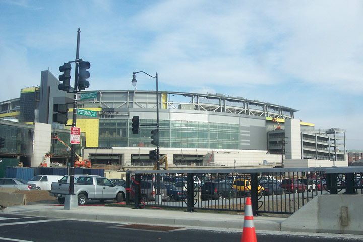
South Capitol Street touches down at a signalized intersection with Potomac Avenue at the north end of the Douglass Bridge. Construction is well underway at the Washington Nationals ball park, with opening day slated for March 30, 2008. The stadium will seat 41,000
Looking northward along South Capitol Street at P and O Streets, adjacent to the new Nationals baseball stadium. Two years ago this scene existed underneath the South Capitol Street viaduct.
$27 million construction involving the Frederick Douglass Memorial Bridge continues with an expected completion of April 2008. Work already completed includes the removal of a 400′ viaduct section (between Potomac Avenue and O Street) at the north end of the bridge and lowering of the north approach of the bridge to blend the span into the surrounding area. This work is part of an urban renewal project centered around the new Nationals ball park. An intersection with Potomac Avenue on the north side of the bridge begins the new urban boulevard leading north. Before this was completed, an industrial style viaduct carried motorists northward into a blighted area. The bridge carries an average of 77,000 vehicles per day.
A study is still underway on the overall replacement of the 1950-built Frederick Douglass Memorial Bridge with a new signature span. Design concepts include some elaborate draw and swing spans on cable-stayed and arch bridges. Details of the study are available at South Capitol Street Bridge Study http://www.southcapitolstreetbridgestudy.com/ and JD’s “Near Southeast” DC Redevelopment blog.
South Capitol Street sinks below M Street on the approach to Interstate 695 and the United States Capitol complex. Ramps ahead join Interstate 695 west at its interchange with Interstate 395.
For much more on the Nationals ball park, redevelopment of the South Capitol Street corridor, and the Douglass Bridge, please see JD’s “Near Southeast” DC Redevelopment.
Sources:
- Suitland Parkway.
http://www.nps.gov/archive/nace/suitlandparkway.htmNational Park Service. - “Douglass Bridge Closure Marks The Start of Construction Season.” Washington Post, January 25, 2007.
- “Near Southeast” DC Redevelopment


I checked the satellite pics at Google maps
http://maps.google.com/?ie=UTF8&ll=38.833022,-76.867476&spn=0.021997,0.053988&t=k&z=15&om=1
I wondered if it could be possible to build a interchange to link Suitland parkway with the Capitol Beltway as well as some upgrades of MD-4 east of the beltway?