
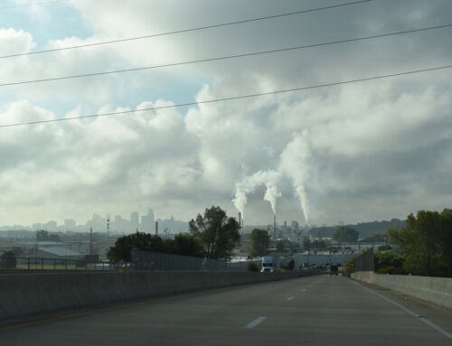
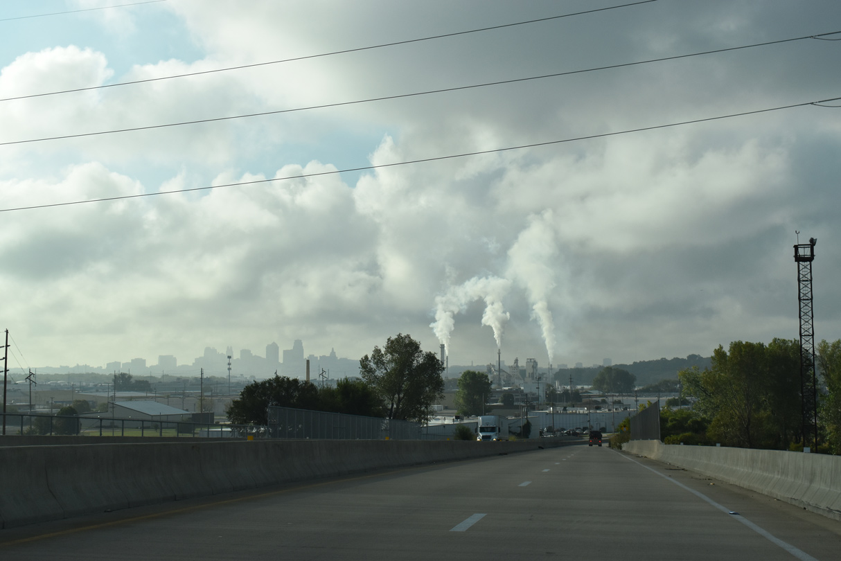
Interstate 435 spends 80 miles circling Kansas City, and is one of the busiest roads in the metro area. It happens to be the world’s fourth longest beltway with a single number (after Cincy, Berlin, and London). Recently, the busy southern portion of the route in Kansas was reconstructed, and parts of it are still being upgraded. Let’s take a quick look at how KDOT is doing. As always click on most photos for larger versions.
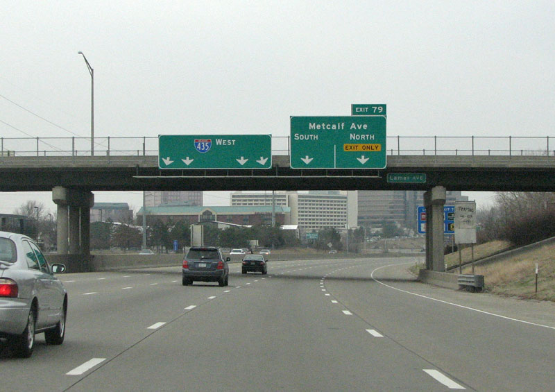
I-435 west at Metcalf Avenue (Exit 79).
435 is Kansas’ busiest roadway, and the state’s DOT is in the process of completely rebuilding the road. It is the largest project (in cost) ever undertaken by KDOT. The largest part of the project is widening from 6 to 8 lanes plus collector/distributor lanes. Work is complete from Missouri west to Antioch, with the section from Metcalf to Antioch completed in 2006. For now, 435 from Antioch to west of 69 is ongoing. Lets take a look at some of the disparate sections through Overland Park.
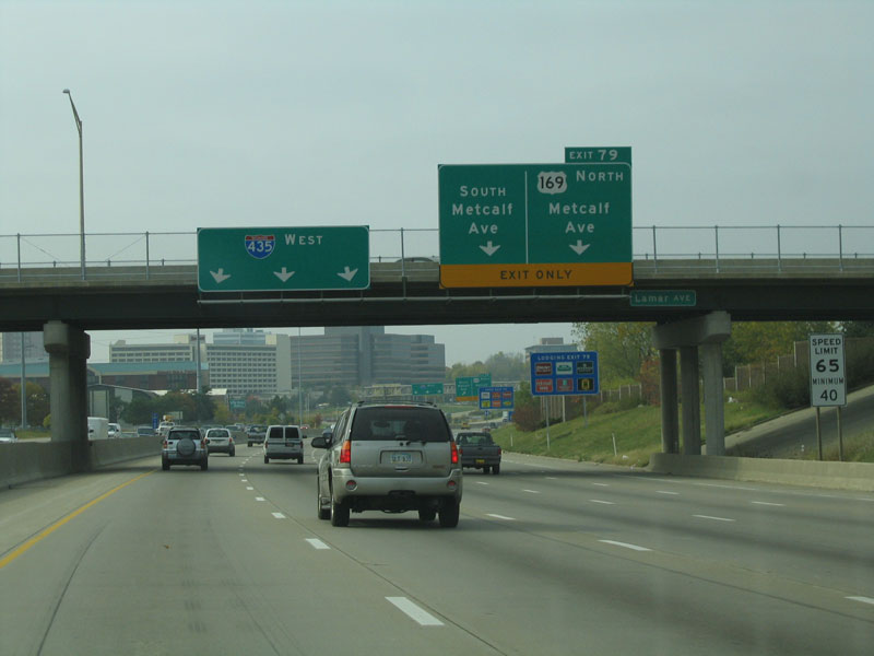
This view looks at 435 westbound at Metcalf in 2003. Note that the newer signs omit the US 169 designation.
The author is unsure, but he’s fairly certain that US 169 was not recently rerouted through Johnson County (was it?).
The Metcalf Avenue interchange was recently upgraded and has multiple lane exit ramps.
Metcalf, US 169, is the second busiest arterial road in Kansas (after Kellogg in Wichita). Along it sit the state’s largest office park and major employment centers. Metcalf Ave was named for a banker from Oklahoma, who was an early developer and purchased large tracts of land in the early days of Johnson County.
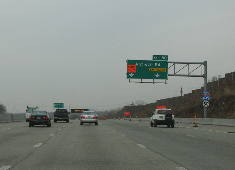
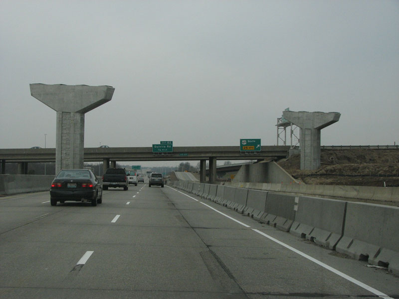
I-435 west approaching the new exit for Antioch Road.
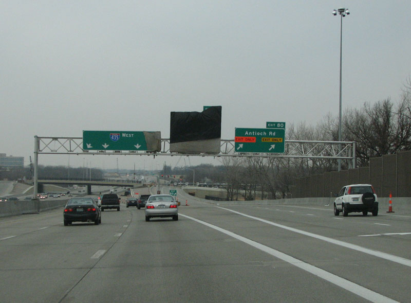
I-435 west at the Antioch Road off-ramp (Exit 80).
The Antioch Road interchange is new, and was designed to relieve pressure on nearby Metcalf Avenue, which is a “real bitch” at most hours, according to the author’s local friend.
This view looks westbound at the new Antioch interchange.
Currently it is a half diamond, with access available to the east. The buildings to the left are part of Overland Park’s Corporate Woods office park, which is Kansas’ largest and holds some of the area’s largest employers. Overland Park is the second largest city in Kansas, after Wichita. It is home to some of the tallest buildings in the state and is the corporate headquarters for such companies as Applebee’s, Embarq, and Sprint/Nextel.
Braided ramps, not yet complete, will allow traffic onto 435 westbound from Antioch, and onto US 69.
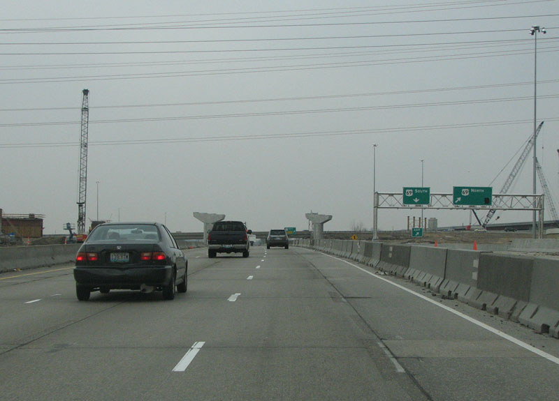
US 69 is a freeway from Fort Scott to the north. The cloverleaf at 435 is being reconfigured and a two lane flyover ramp from southbound US 69 to eastbound 435 will enhance traffic flow.
US 69 provides an important route from downtown Kansas City into Overland Park, its largest suburb.
This view looks west at the new US 69 stack under construction. It is due to be completed in early 2009.
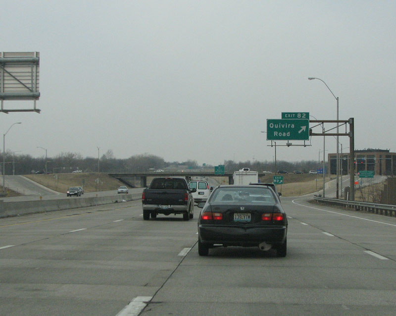
Quivira Road was named for the fabled land that the Spanish explorer Coronado sought. This section of 435 is the older portion, and will be reconstructed in upcoming years.
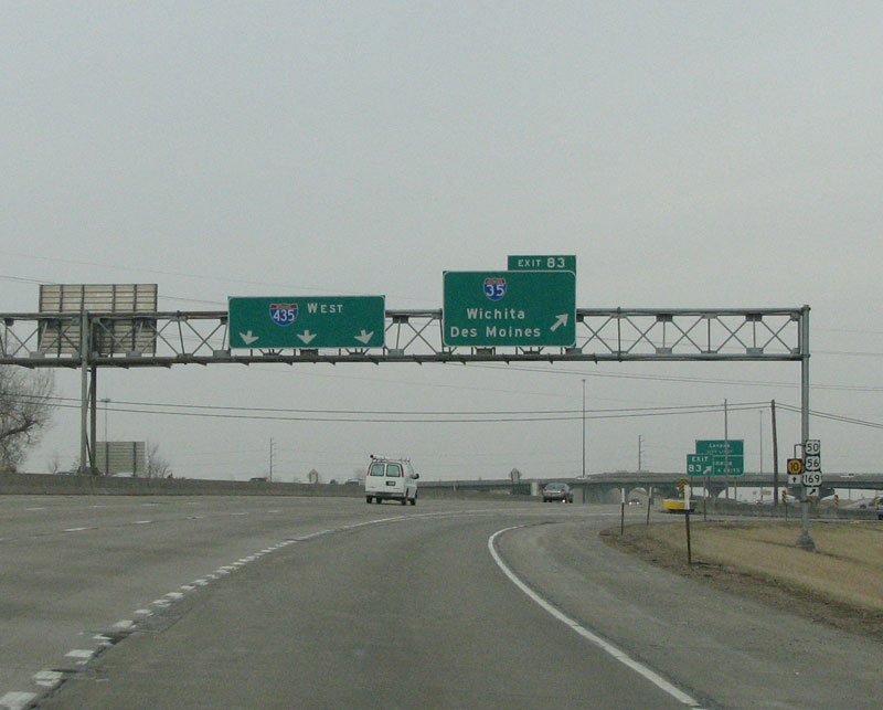
435 westbound at I-35, southwest of Kansas City. Kansas signs multiplexed US highways and state highways primarily off to the side, as is seen here.


The north end versus the south end of I-435 is like night and day. I recall the stretch shared with Interstate 29 with just four lanes and no adjoining development.
Finally, the KDOT is getting on board updating its interstates.These upgrades will now put this beltway in an upper class. These upgrades should be an example for others to follow.
One thing that annoys me about the south side of I-435… K-10 officially ends at I-435. But, there are reassurance shields/trailblazers for K-10 posted on the sideposts on westbound I-435, North and southbound I-35.
And for some reason, there’s K-10 on the overhead pullthrough sign bridge just past the final exit of K-10 (to northbound I-435).
Since 2008, I-435 has (finally) been completed on the south side. It has four through lanes on both the eastbound and westbound sides and become as wide as six on each side for short distances, depending on the exit or entrance configurations.
There are a couple of corrections that need to be made here. 1. The I-435 loop is 83.6 miles of continuously numbered loop around the Kansas City Area. In this case the fact that I-435 crosses the state lines of Kansas and Missouri twice does not cause the mile markers to start at 0.0 in each state. Instead the mile markers run the total 83.6 miles with the first and last mile marker at I-35 in the southwest corner of the loop.
Alex made the observation that in the northwest corner of the I-435 loop it shared highway with I-29. That stretch is roughly 2.5 to 3 miles and since Alex posted this in 2008 they have changed the signs and the interchange configuration to ease congestion and help motorists stay on the right road at the splitting points.
KDOT is now planning to completely rebuild the interchange at I-435, I-35, K-10 and Lackman Road. It needs updating very badly and it will be the next major highway nightmare for those of us who use that interchange daily.
The only other interesting thing I have to say is this: KDOT has started putting up new pull thru signs which now not only the route number and direction of travel but also have a control city on them too. Wichita and St Louis are the two big cities I have seen thus far.