
The final day in the Twin Cities involved a spin around the metropolitan area to clinch the remaining Interstates and a dip into Wisconsin. After a few hours at our friends’ apartment that afternoon, we braved peak hour traffic on the return drive to Omaha, Nebraska.
Some additional photos and commentary about Twin Cities area roads:
Interstate 335 was conceptualized as a connector between Interstates 94 and 35W north of downtown Minneapolis. The short freeway would complete a central loop system in conjunction with Interstates 35W and 94 along an alignment roughly parallel to Broadway Street. Early proposals involved an at-grade expressway in the 1940s and a full freeway by the 1960s. Right-of-way purchasing commenced in the 1970s with initial ramp construction of the eastern terminus. Rising opposition mounted from local residents, ultimately curtailing the freeway officially in 1978.1
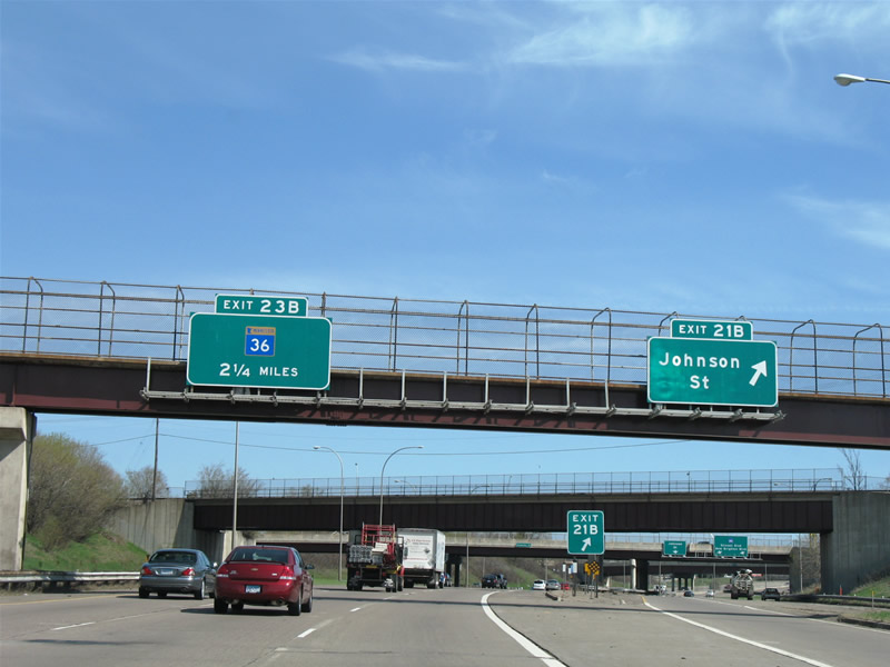
Interstate 35W northbound on its departure from downtown Minneapolis. Pictured here is the Johnson Street off-ramp of Exit 21B. Slightly visible beyond the gore point, Exit 21B converges with the Exit 21A off-ramp to Broadway Street. A small area of pavement, a ramp stub, exists between the two ramps as a remnant of the unconstructed Interstate 335 eastbound on-ramp to Interstate 35W north.
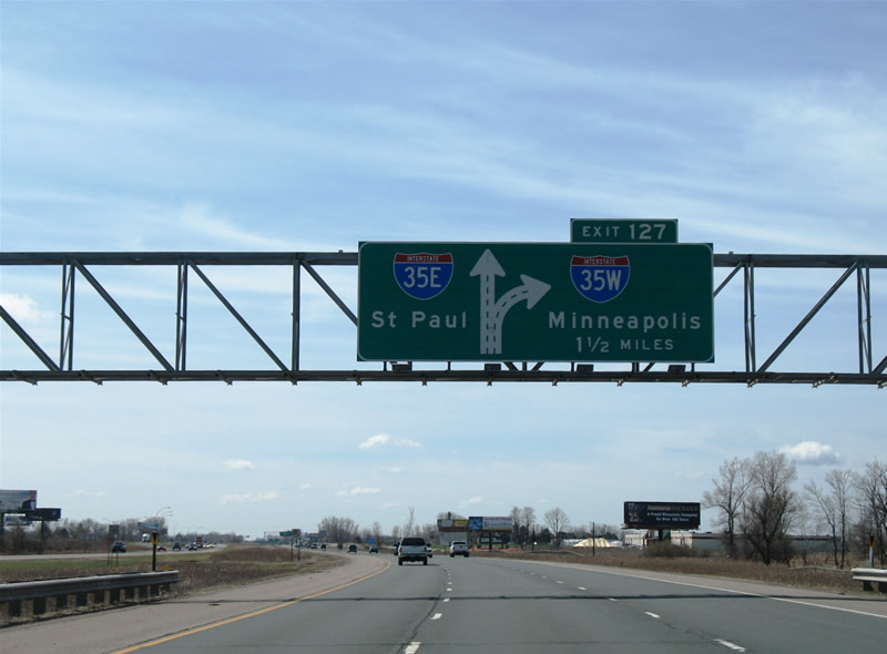
Southbound at the Interstate 35 split into Interstate 35W to Minneapolis and Interstate 35E into St. Paul. A wye interchange joins facilities the movement at the split, similar to the south merge/partition.

Interstate 35E southbound sees a brief confluence with Interstate 94 in downtown St. Paul.
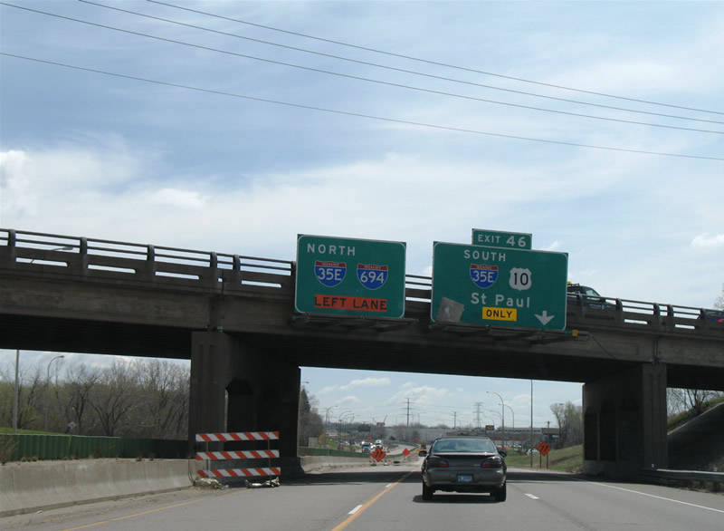
U.S. 10 joins Interstate 35E between Interstate 694 and Interstate 94. U.S. 52 emerges from its cover here, as it leaves Interstate 94 at the adjacent interchange to the east for a freeway of its own. Interstate 35E transitions into a parkway south of Interstate 94, therefore trucks over 9,000 lbs. must find an alternate route to the south suburbs from downtown St. Paul.
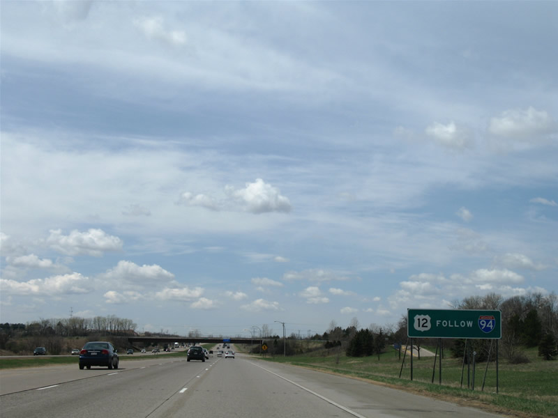
A small reassurance sign, similar to those used for U.S. highway overlaps with freeways in Indiana, directs motorists to remain on Interstate 94 west.
U.S. 12 joins Interstate 94 four miles from the Minnesota state line in western Wisconsin. Wisconsin cosigns it consistently for its short overlap with Interstate 94 but as soon as the freeway spans the St. Croix River, U.S. 12 disappears. U.S. 12 emerges from obscurity briefly at Interstate 394’s east end, but not wholly until west of the Interstate 394 and 494 junction.
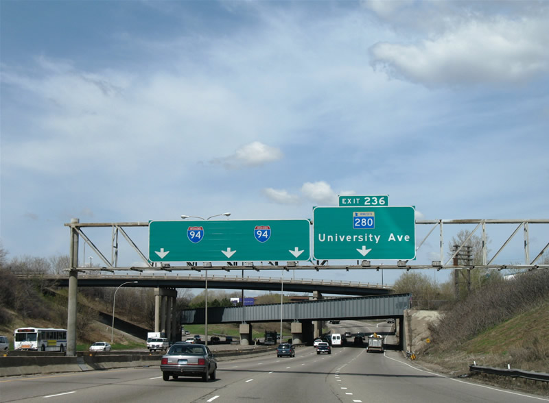
Interstate 94 westbound at the south end of the Minnesota 280 (University Avenue) freeway.
Minnesota 280 exists partially as a freeway and partially as a surface boulevard. Initially Minnesota 280 was a 1960s planned freeway in conjunction with the unconstructed 28th Street Expressway through south Minneapolis. Curving southwest from the Interstate 94 interchange, Minnesota 280 was to span the Mississippi River and travel along the railroad corridor parallel to 28th Street, ending at Minnesota 100 outside of the Minneapolis city limits.1 Most of that railroad line is now part of Midtown Greenway line of the Twin Cities trail system.
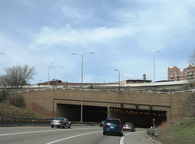
I-94 west at the Lowry Hill Tunnel.
Interstate 94’s Lowry Hill Tunnel opened to traffic in December of 1971.2 The cut and cover tunnel passes underneath the intersection of Lyndale and Hennepin Avenues southwest of the Minneapolis central business district. Hennepin Avenue joins downtown with the Uptown district and acts as a gateway between the two areas.
A major construction project presently underway in the Twin Cities are is the rebuilding of the Interstate 35E and 694 confluence at Little Canada. Entitled “Unweave the Weave”, work involves rebuilding Interstate 35E and 694 so that the two freeways no longer share a stretch of common pavement. At present a pair of interchanges join the two highways, requiring a mile long cosigned section with three lanes in each direction. This stretch results in numerous weaving traffic movements by motorists remaining both on the respective freeway mainlines and those making exchanges between Interstate 35E and 694. Project work will eliminate the shared freeway by separating both freeways onto their own carriageways and connecting the four roadways with in dependent ramps, similar to what will be done at the Interstate 35W and Crosstown interchange in Minneapolis. Work commenced in early 2005 and should be completed by late 2008. The project web site: http://www.dot.state.mn.us/metro/projects/i35e_694/.
Approaching the Interstate 35E merge on Interstate 694 eastbound at the Long Lake Road diamond interchange.
Work surrounding the “Unweave the Weave” project also involves rebuilding of aging bridges and the overall Interstate 694 freeway between Rice Street (Exit 45) and Minnesota 61 (Exit 48) and Interstate 35E freeway between Minnesota 36 (Exit 111) and County Road E (Exit 115).
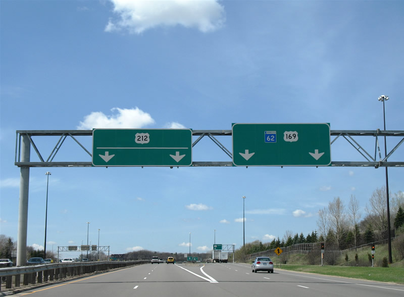
Crosstown westbound at the split with U.S. 212’s westbound beginning, ahead of the full-cloverleaf interchange with U.S. 169.
U.S. 169 constitutes a north-south freeway between Interstate 494 and Interstates 94 & 694, serving the western suburbs of Eden Prairie, Edina, St. Louis Park, Golden Valley, Plymouth, New Hope, Maple Grove, and Brooklyn Park in the process. U.S. 212 follows a freeway of its own initially from the Crosstown southwest through Eden Prairie.
Work continues on extending the U.S. 212 freeway southwest to an overall length of 11.8 miles through Chanhassen, Chaska, and Carver. The route provides a suburban commuter freeway for far reaching suburbs of the Twin Cities metropolitan area and the U.S. 212 corridor westward to South Dakota. The MnDot project is known as “The New 212”, a $232 million endeavor whose planning began in the 1960s.
Current segments of the new freeway carry the temporary designation of Minnesota 312. Freeway construction began in August 2005 and by late 2006 Minnesota 312 extended west to Eden Prairie Road (Hennepin County 4). By next month Minnesota 312 expands westward another mile to the Dell Road partial cloverleaf interchange. Opening of the freeway westward to Powers Boulevard (Carver County 17) follows by Fall 2007.
Final completion of the project is scheduled for Fall 2008, bringing U.S. 212 onto a full freeway between Carver County 147 west of Chaska and the Crosstown at Edina. Further west, other projects follow that include upgrades of U.S. 212 to expressway standards and other enhancements are planned as part of the 212 Interregional Corridor http://www.dot.state.mn.us/movingminnesota/ircstudies/212.html.
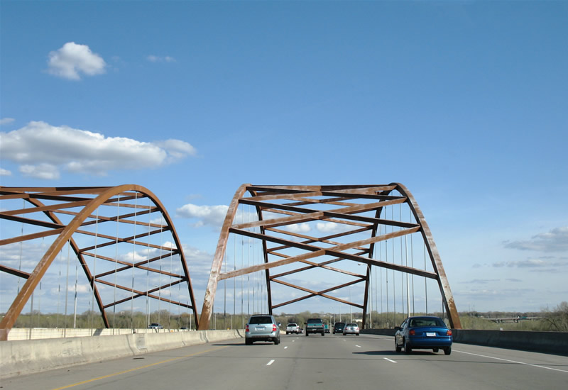
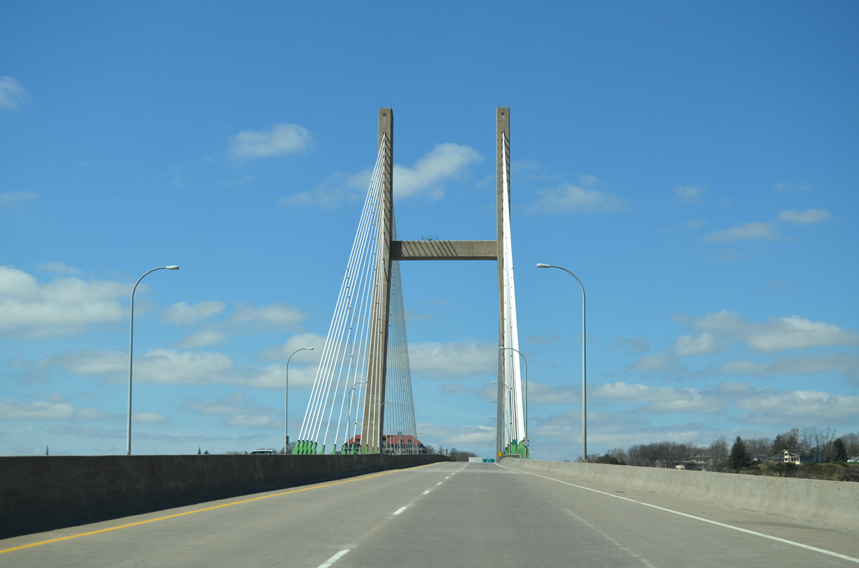
Minnesota 77 (Cedar Avenue) south at the tied-arch bridge over the Minnesota River.
Minnesota 77 constitutes a surface street (Cedar Avenue) in Minneapolis and a freeway through Richfield, Bloomington, and Eagan. The commuter route serves the Mall of America complex at Interstate 494 and suburbs southward to Apple Valley. Initially open between the Crosstown and Interstate 494 in the 1960s, Minnesota 77 continued south across the Mississippi via this tied-arch bridge by 1980.3
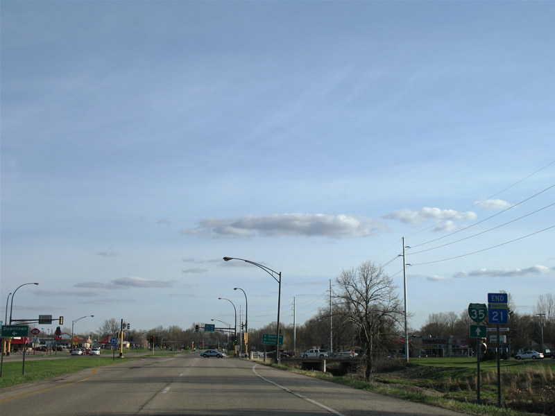
Business Loop Interstate 35 south at junction Minnesota 60 in Faribault. This business loop was only signed in 2006 and follows Minnesota 21 (Lyndale Avenue) south from Exit 59 to Minnesota 60 (4th Street) and Lyndale Avenue (without Minnesota 21) south to Exit 55. The alignment follows old U.S. 65.
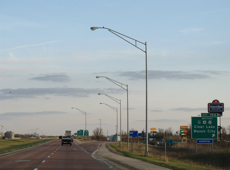
Interstate 35 south at the Clear Lake, Iowa Business Loop I-35.
Clear Lake’s Business Loop travels west with U.S. 18 from Exit 194 to Iowa 107 (8th Street) south and 4th Avenue South eastbound back to Interstate 35 (Exit 193). Iowa 27 overlaps with Interstate 35 southward from the Minnesota state line to the U.S. 18 freeway at Exit 190. Iowa 27 represents the Avenue of the Saints, High Priority Corridor 2.
Sources:
- Cancelled Highways – I-335 Minneapolis North Loop, Froehlig, Adam.
- A History of Minneapolis: Intercity Transit and Highways (Part II),
http://www.mpls.lib.mn.us/history/tr4.aspMinneapolis Public Library web site. - MN 77/CSAH 23 Cedar Ave, Froehlig, Adam.


Wow. You hit a lot of the Twin Cities that I’ve never seen before! And I usually visit them once a year! Looks like I’ll have to check out I-694 sometime soon!
One thing though…I believe the bridge on MN 77 crosses the Minnesota River and not the Mississippi…
I should also point out that a lot of bridge reconstruction has been done in the state of Minnesota (Patrick Lilya informed me of this), and the previously abundant tied-arch bridges have been replaced by simple bridges without structure. The MN 77 bridge and a bridge up in Duluth (can’t remember which one Patrick said), I believe, are the only two tied-arch bridges left in Minnesota.
The bridge on I-94/US 12 over the St. Croix used to be one as well. I remember crossing that (the first memory of leaving the state of Wisconsin) and being in awe. Now the sense of awe is very much diminished with the newer bridge…
The trend overall seems to be replacing bridges with superstructure with those that are simply functional. When crossing the St. Croix River, it dawned me on how high up we were, and the newness of the bridge did catch me off guard. A shame that I missed what was there previously.
There are some instances where bridges with superstructure are coming back. Take Interstate 490 in Rochester, New York for instance: Construction is ongoing to replace a standard concrete bridge over the Genesee River with a “signature” arch bridge. Simarly the Indian River Inlet Bridge along Delaware 1 may be replaced with an arch or cable-stayed bridge. Currently that span is just a standard steel and concrete bridge.
Several comments/corrections:
– I-35E and I-694 will still share common pavement upon completion of the Unweave the Weave project. However, that pavement will be 12 lanes wide (vice the existing 6) and will have additional ramps added so as to minimize weaving between the two Interstates.
– On your EB I-694 photo approaching I-35E, what you label the “Long Lake Rd” interchange is actually the Rice St interchange. Long Lake Rd is several miles to the west.
– The “New 212” has actually been in planning since the 1950s.
– MN 312 has existed out to Eden Prairie Rd since late 2001…that short spur from MN 5 was built when the segment of MN 5 that is part of the “New 212” was upgraded to freeway that year. West of Eden Prairie Rd is where the construction began in 2005. The extension to Dell Rd was completed and opened over this past winter (Monte Castleman made a post on MTR about it). I was on it last month when I was home briefly. Surprised you didn’t go on it.
– As Chris noted, MN 77 crosses the Minnesota River, not the Mississippi.
Mndot is irritating how they decommissioned US 65, should continue parallel along I 35 could go into Minneapolis on Lyndale Ave and US 69 should replace Minnesota 13 and US 65 could take over Minnesota 65 also US 61 should be reinstated to the Canadian border and US 52 should be reinstated to Fargo along it’s original route. Mndot waste a lot of money on light rail and bike trails with the majority of people use neither yet pay for them. Fix the roads and stop ripping off small towns.