| California 99 north |
|
|
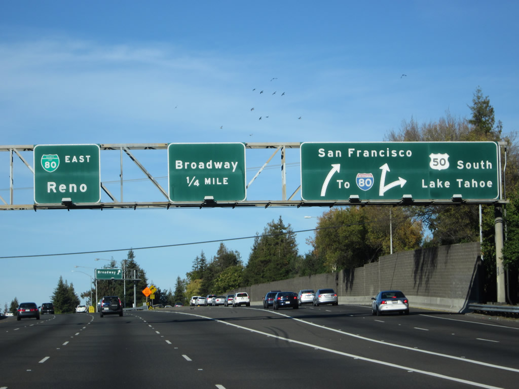
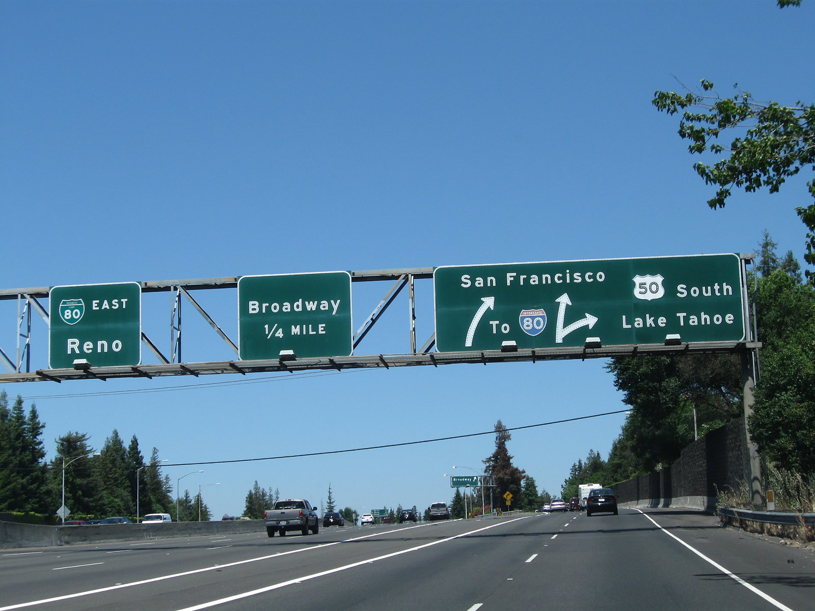
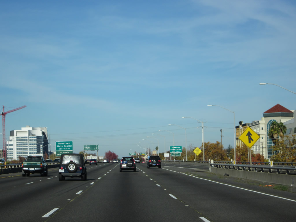
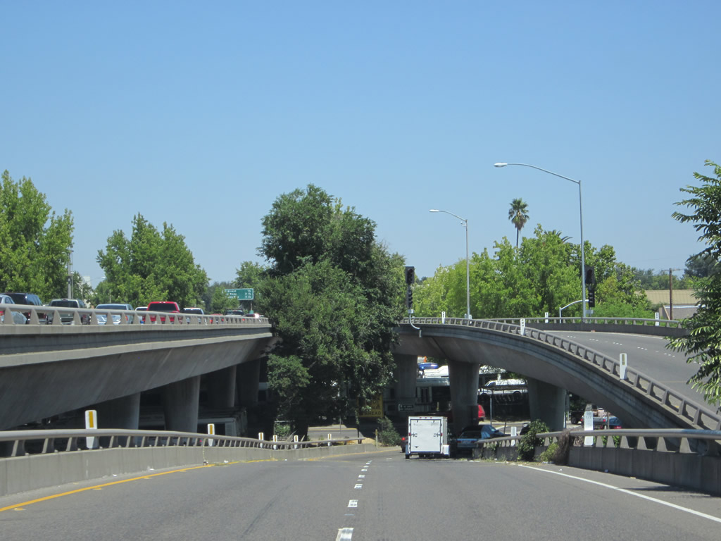
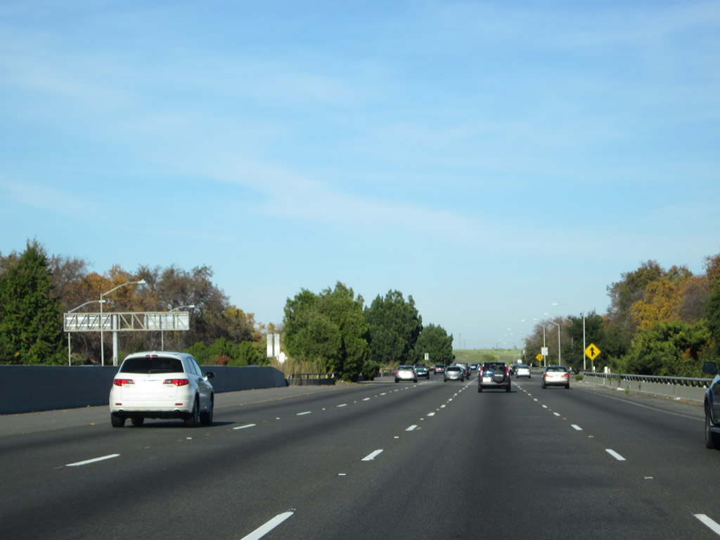
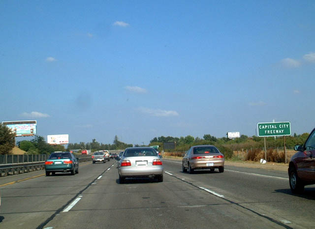
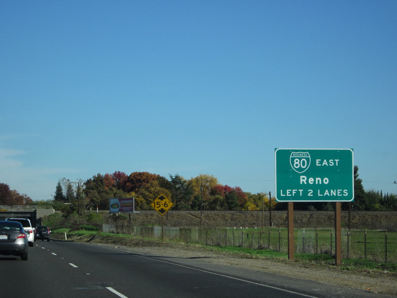
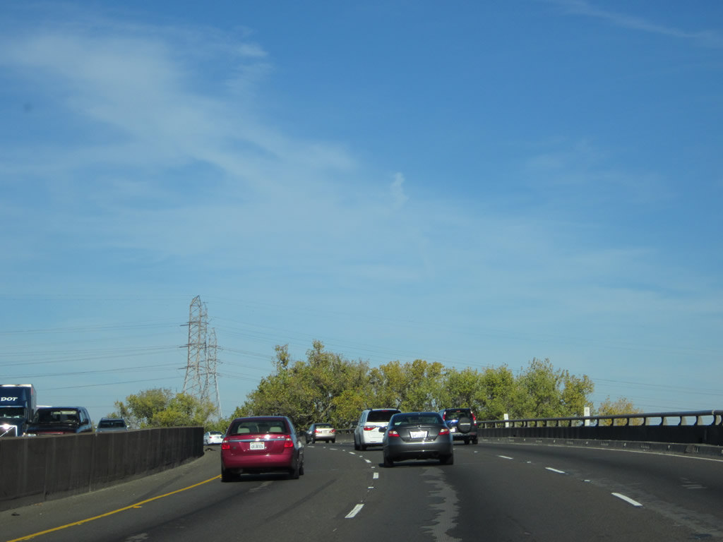
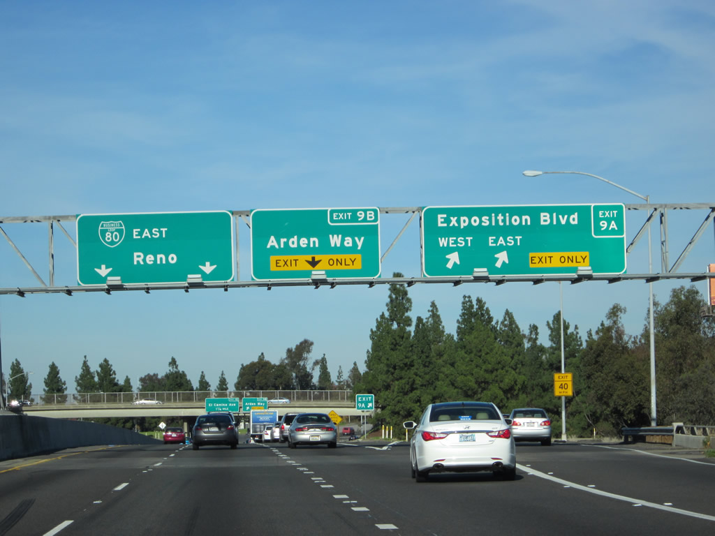
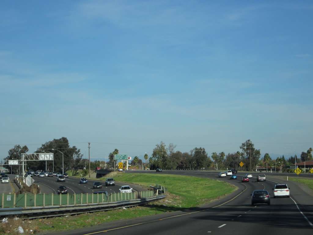
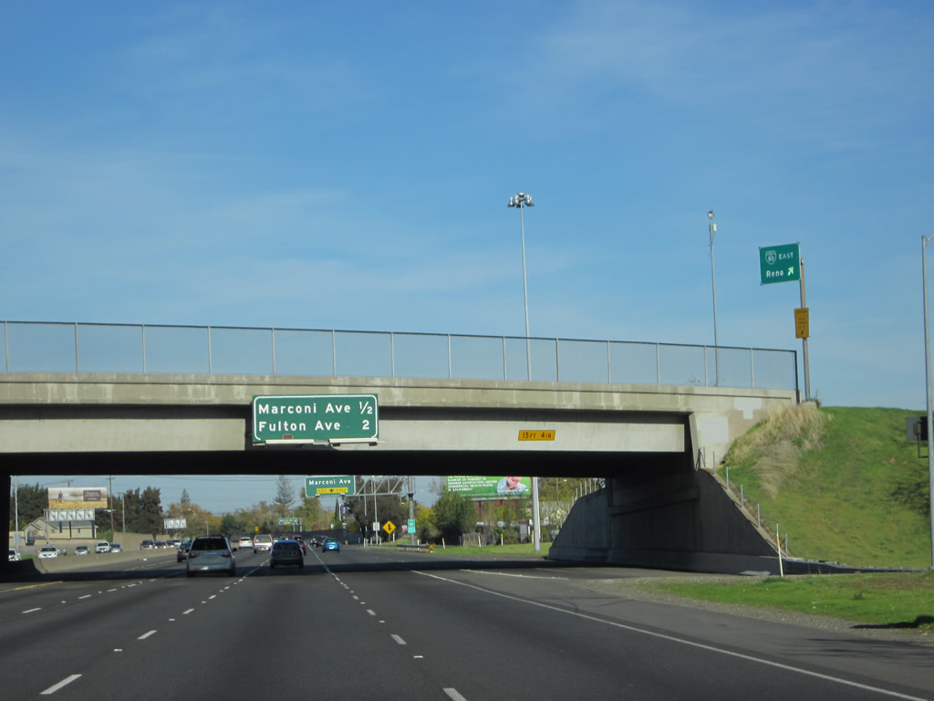
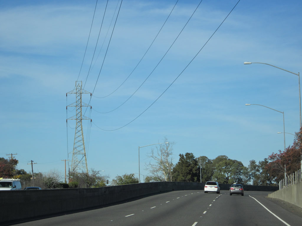
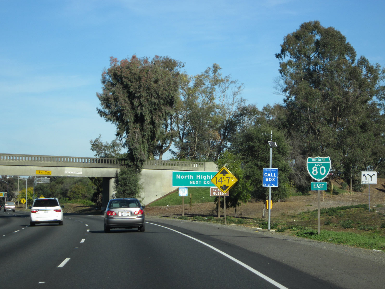
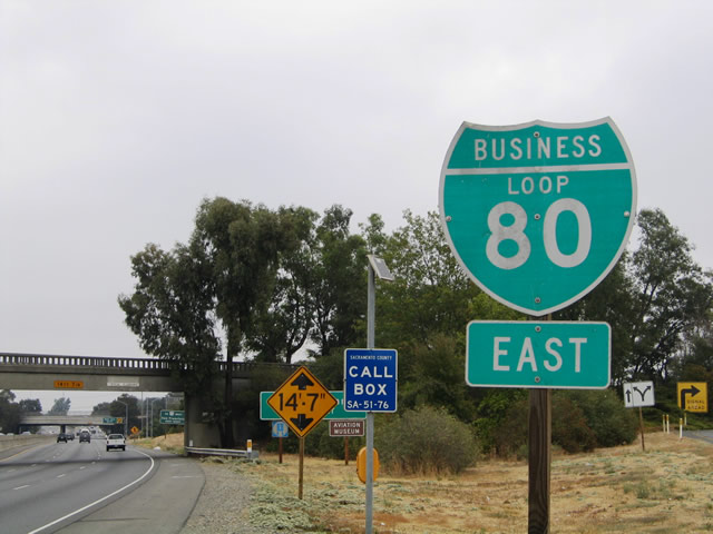
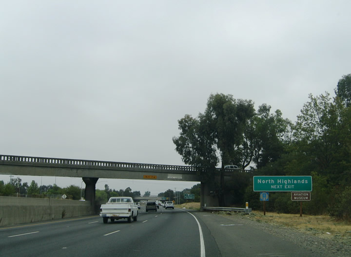
Northbound California 99 reaches Exit 298A, with the left four lanes connecting to Business Loop I-80 east and the right two lanes following California 99 north to Business Loop I-80 west. Use the left four lanes for Exit 298B (Broadway) and Exit 298C (Business Loop I-80 east and California 51 north). Photos taken 11/23/12 and 07/31/11. |
| California 51 north |
|
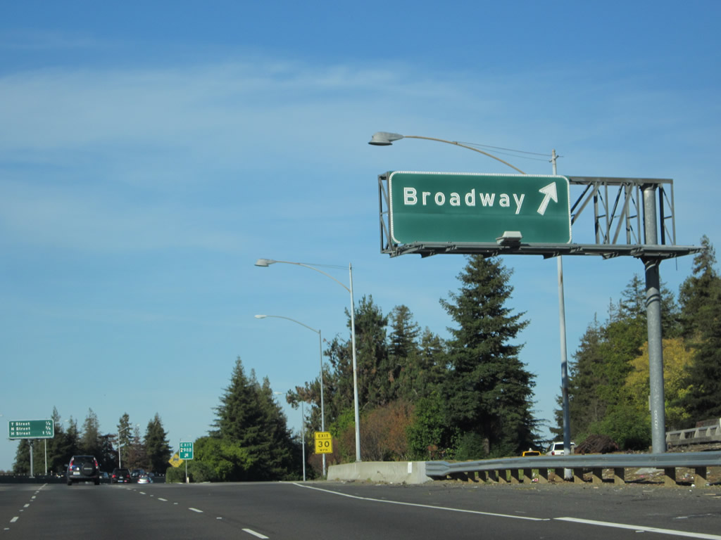
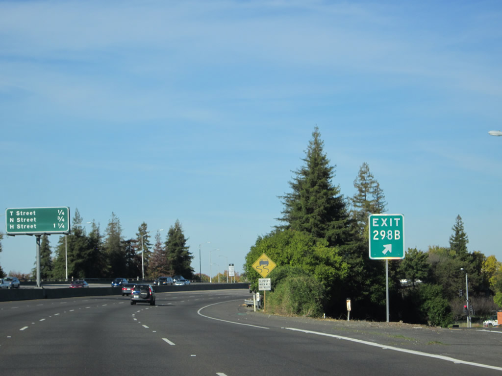
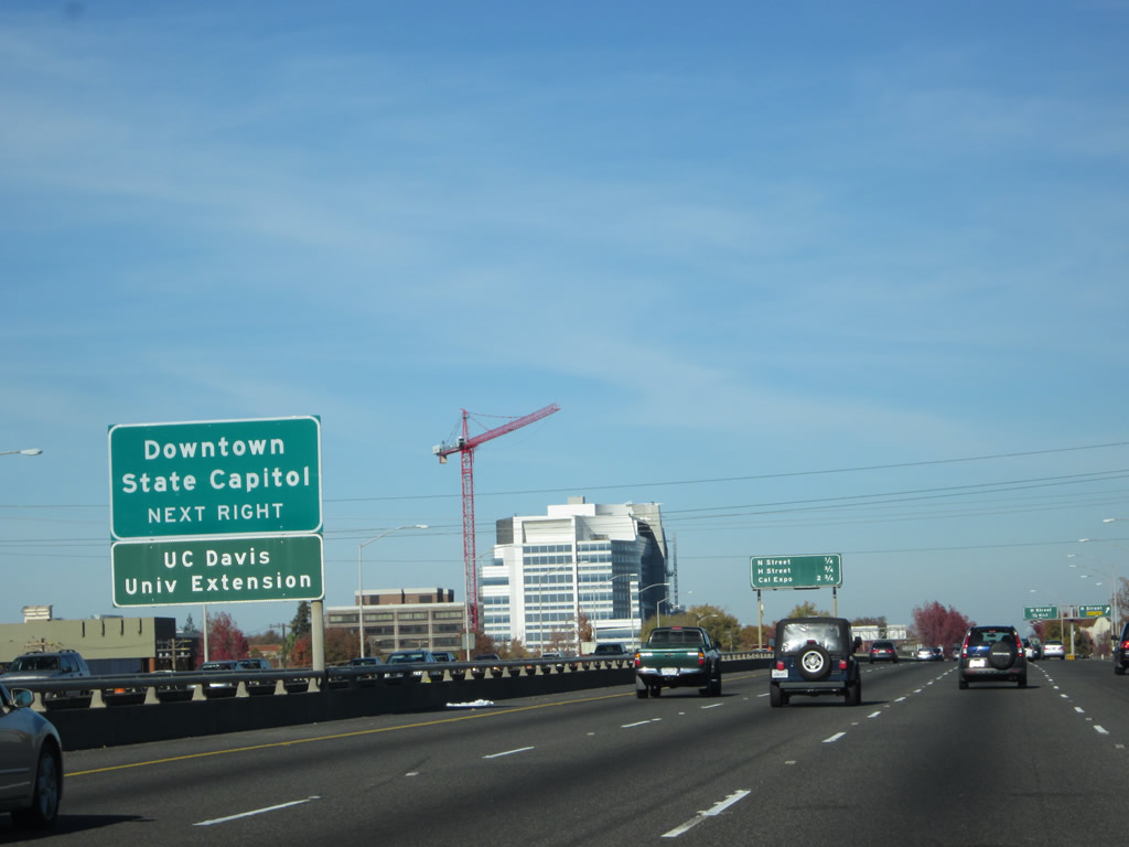
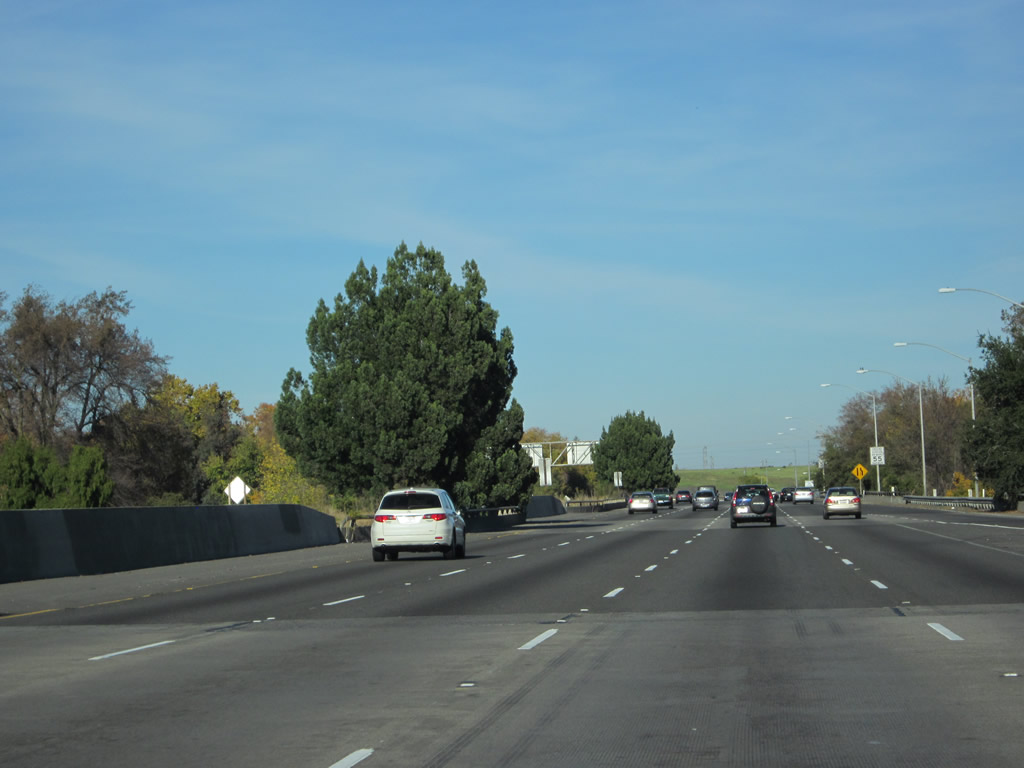
Northbound California 51 meets Exit 298B, Broadway (to Sacramento County J-8 south). J-8 travels west on Broadway to meet Franklin Boulevard, then follows Franklin Boulevard south. This interchange is the northern terminus of CR J-8. Photo taken 11/23/12. |
|
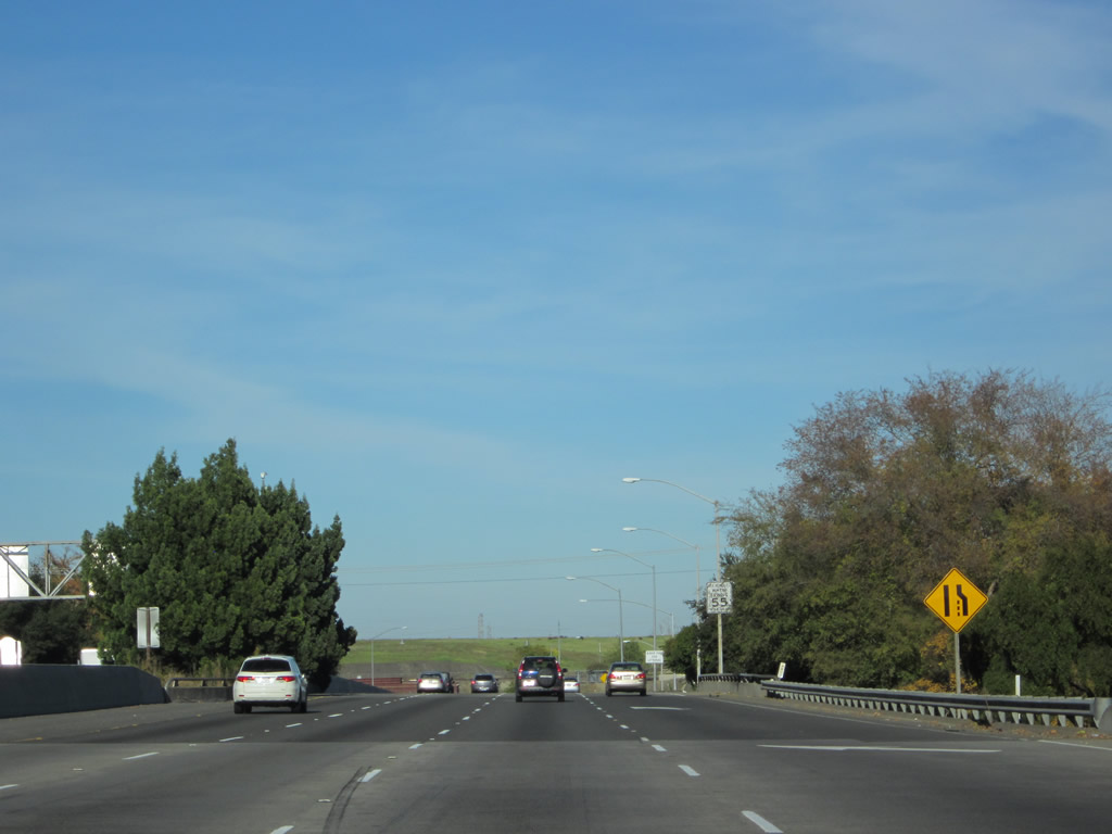
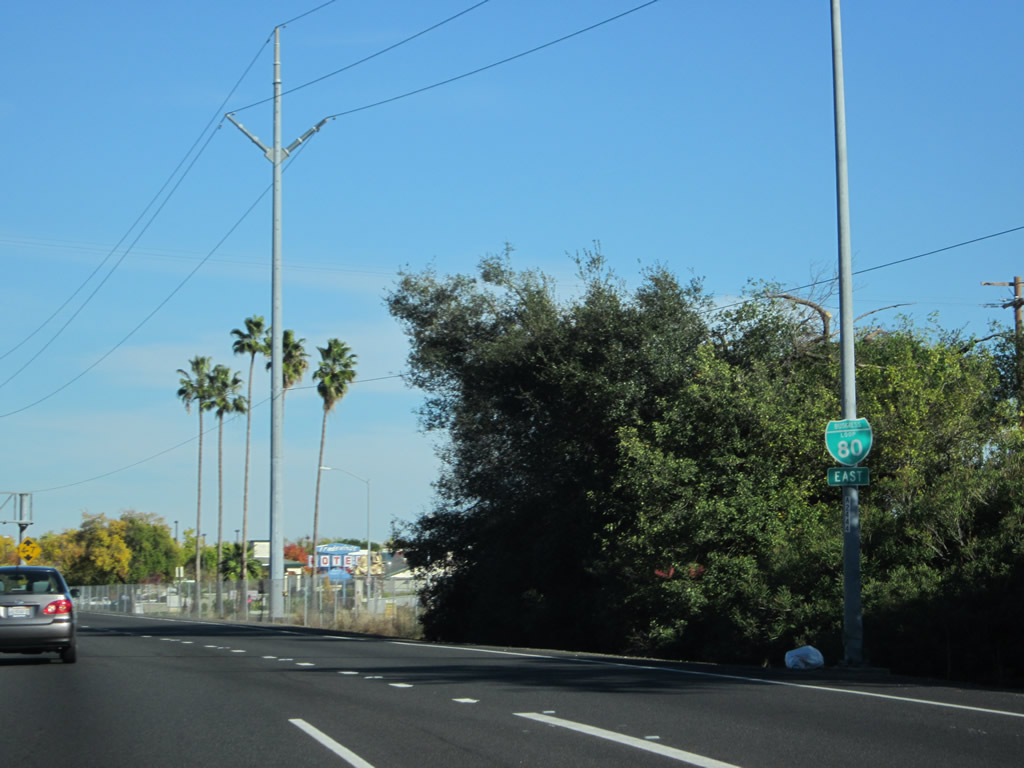
The gore point sign indicates the Broadway exit (to Sacramento County J-8) is California 99's Exit 298B. Based on Caltrans's methodology of declaring route number changes occur at the midpoint of the interchange, it is appropriate for this ramp to be numbered as if it were off California 99, even though 99 departed the freeway at the Business Loop I-80 and U.S. 50 off-ramp (Exit 298A). Ahead, California 51 begins (part of California 99's Exit 298A). Photo taken 11/23/12. |
|
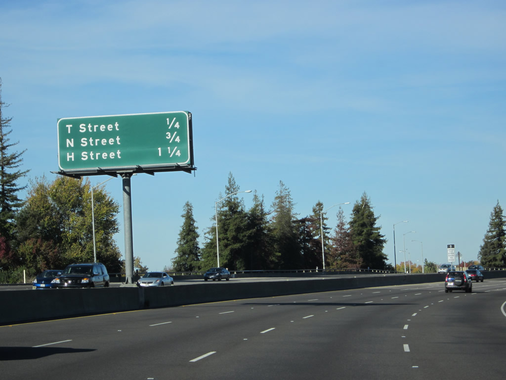
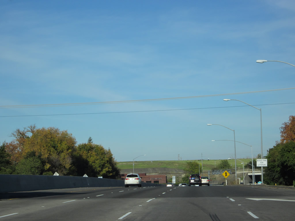
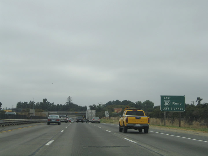
After California 99 traffic departs its mainline freeway at Exit 298A, the left four lanes will proceed northeast via Business Loop I-80 (Capital City Freeway) toward Reno. However, the four left lanes are part of the transition ramp (and unsigned California 51) between the Exit 298A off-ramp and the point where traffic from Business Loop I-80 east merge together; it is not part of mainline Business Loop I-80. This mileage sign provides the distance to the next three exits along eastbound Business 80 and northbound California 51: Exit 6C, T Street; Exit 7A, N Street; and Exit 7B, H Street. Exit 6C cannot be reached via mainline Business Loop I-80 but it can be reached via the transition ramp from California 99 north to Business 80 east. Photo taken 11/23/12. |
|
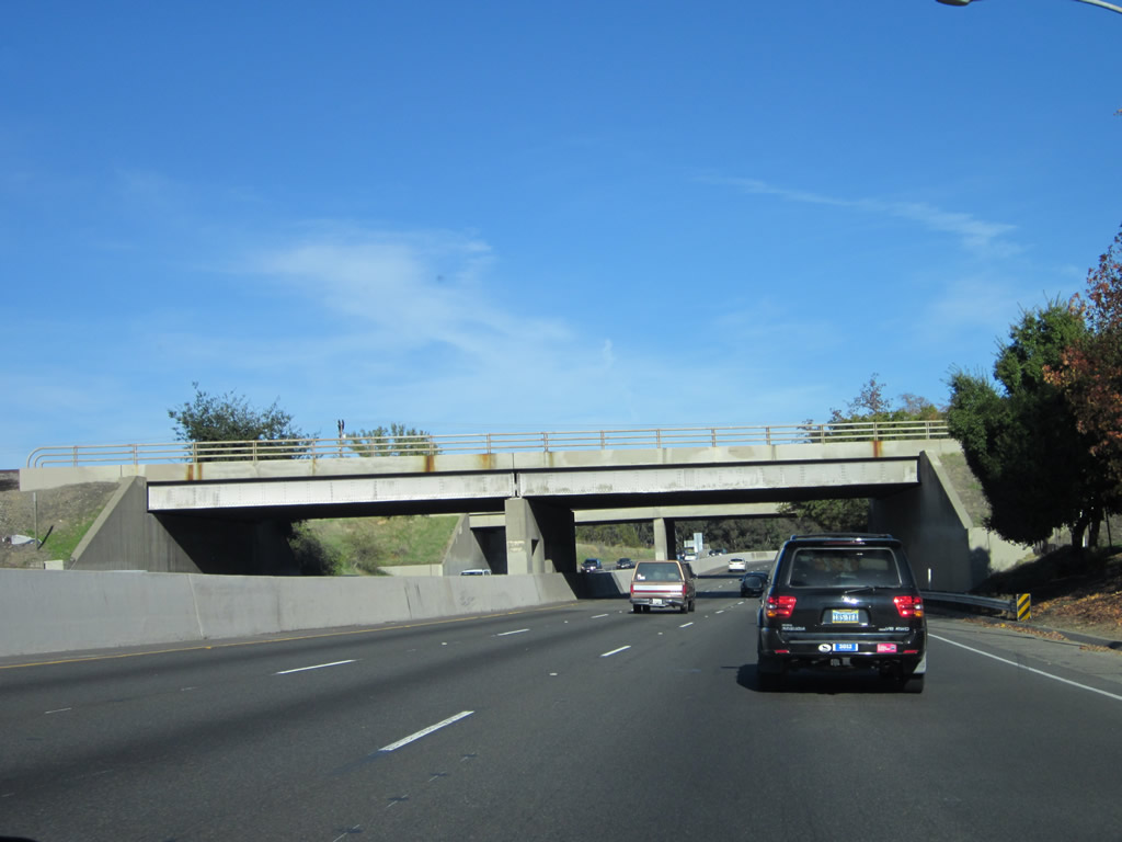
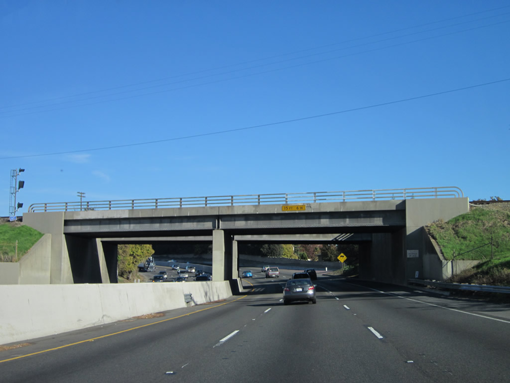
Four lanes of traffic continue north from California 99 to Business Loop I-80. Below this bridge is U.S. 50 (El Dorado Freeway) as well as a series of connecting ramps between the two busy freeways. Photo taken 11/23/12. |
|
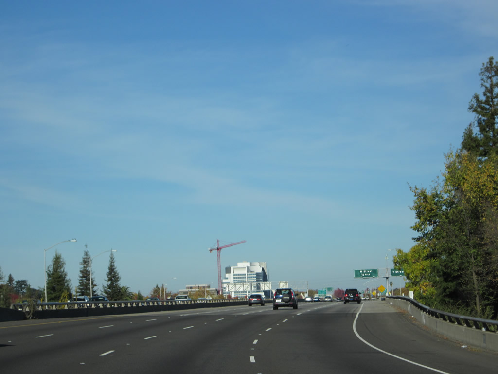
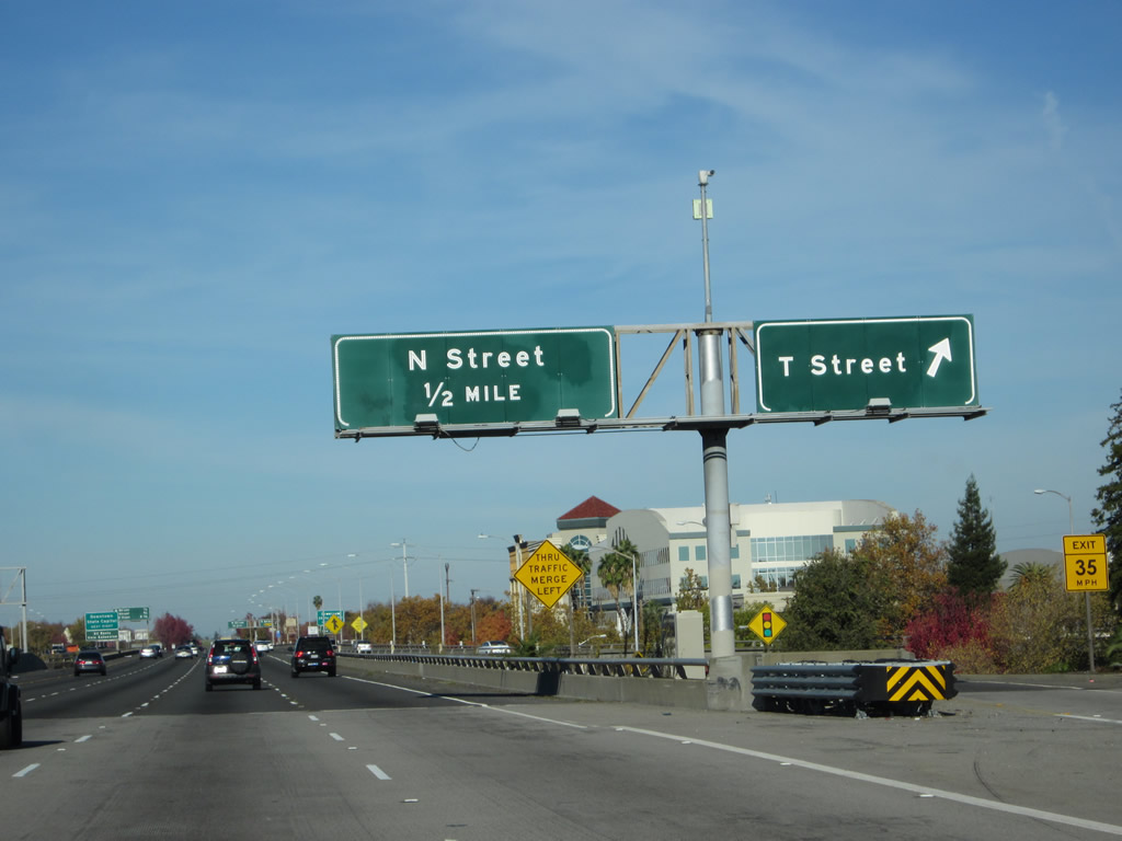
Northbound California 51 meets Exit 6C, T Street. Downtown Sacramento has a grid pattern, with numbered streets running north-south and lettered streets running east-west. T Street is the first of three lettered street exits along northbound California 51 and eastbound Business Loop I-80. Photo taken 11/23/12. |
|
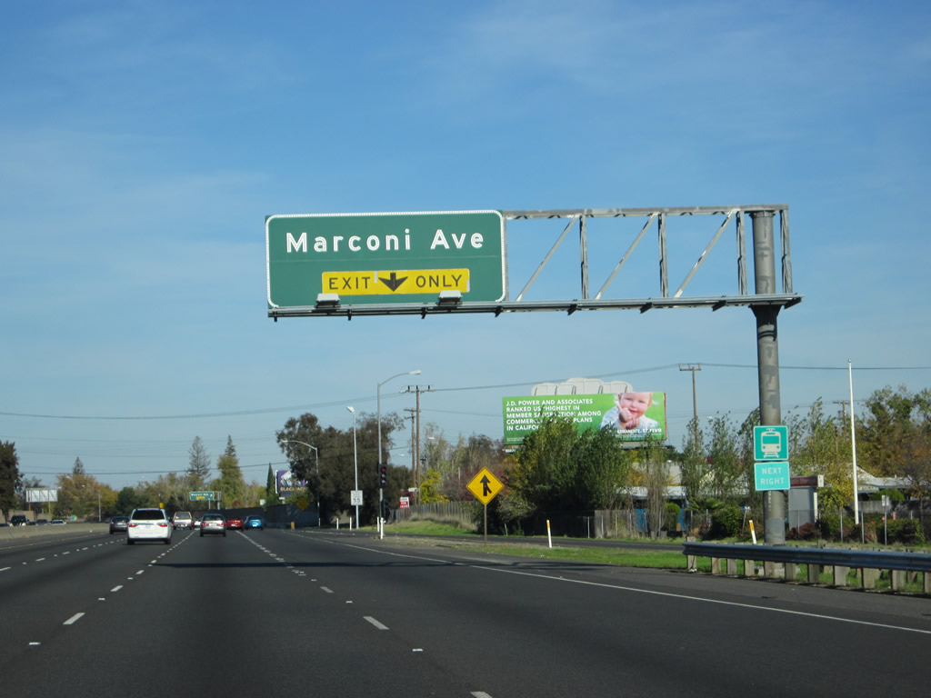
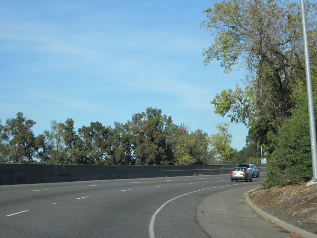
Traffic on California 51 north prepares to merge with traffic from Business Loop I-80 (Capital City Freeway) east. Ahead, California 51 is unsigned, and Business Loop I-80 (Capital City Freeway) is signed. Photo taken 11/23/12. |
| Business Loop I-80 (Interstate 305) east & California 51 north |
|
|
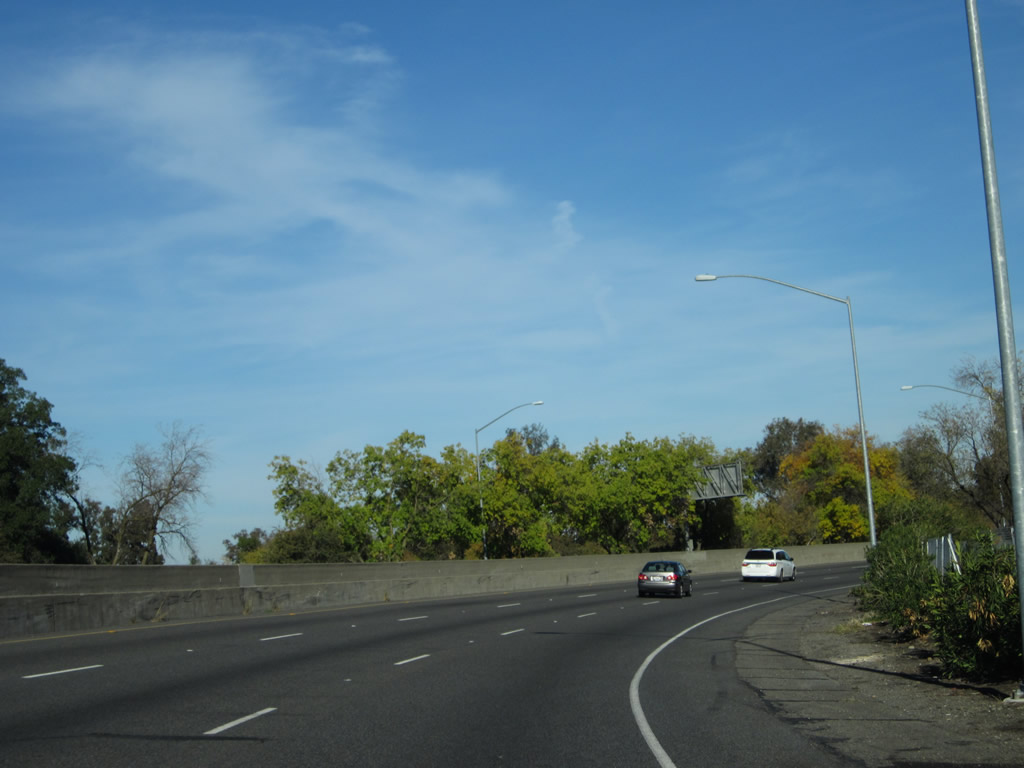
Heavy traffic ensues as Business Loop I-80 and California 51 merge together to form the 29th-30th Freeway segment of the Capital City Freeway. The next exit will be Exit 7A, N Street. Interstate 305, the hidden Federal Highway Administration designation for the portions of former Interstate 80 that remain in the Interstate Highway System, continues onto California 51 until crossing over C Street on the 29-30th Viaduct. Photos taken 11/23/12 and 07/27/12. |
|
As noted on this sign, the next exit leads to the best route from the east side of town to Downtown Sacramento, the California State Capitol, and related Sacramento attractions such as Old Town and a variety of state agencies which have their state headquarter offices in and around Sacramento. The route west into downtown Sacramento is achieved via L Street, a one-way street leading westbound toward downtown. Photo taken 07/27/12. |
|
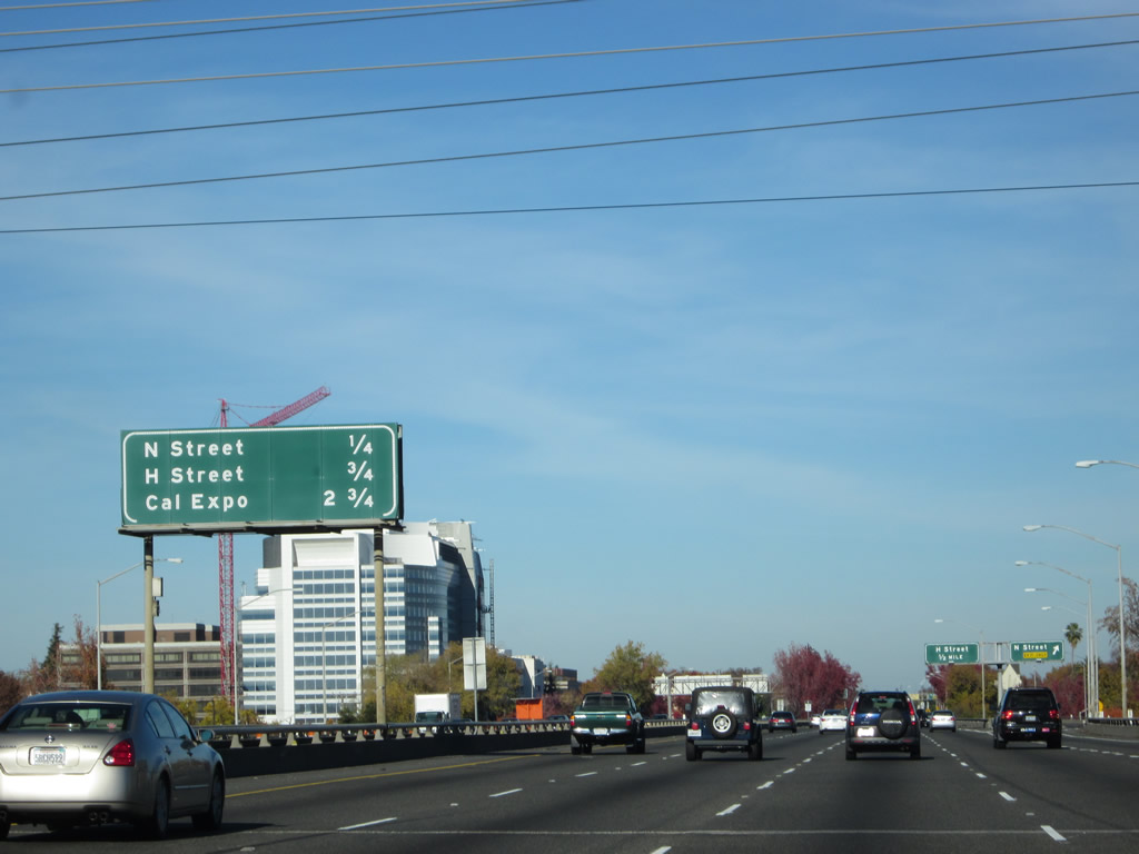
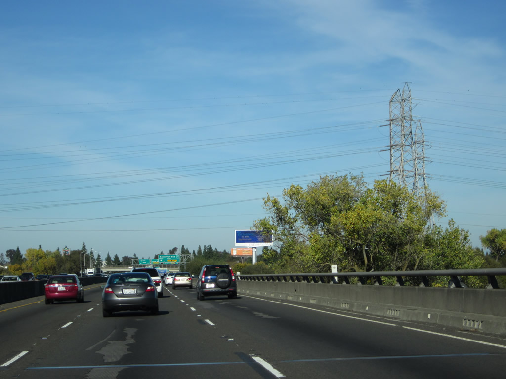
This mileage sign for eastbound Business 80 and Interstate 305 provides the distance to the next three off-ramps: Exit 7A, N Street; Exit 7B, H Street; and Exit 9A, Exposition Boulevard to Cal Expo. Photo taken 04/12/12. |
|
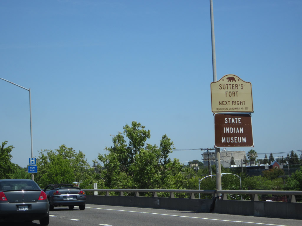
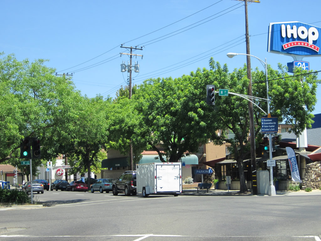
Use N Street to Sutter's Fort State Historic Park and the California State Indian Museum. Photo taken 04/12/12. |
|
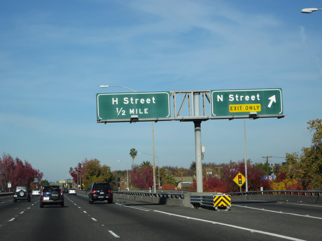
Eastbound Business Loop I-80 meets Exit 7A, N Street at this off-ramp while on the 29th-30th viaduct. N Street is a one-way street leading eastbound west of the business loop. East of the business loop, it connects to Folsom Boulevard, which was former U.S. 50 before it was routed onto its freeway, and Stockton Boulevard, which was former U.S. 99 (and former U.S. 50-99 Business after that). Photo taken 11/23/12. |
|
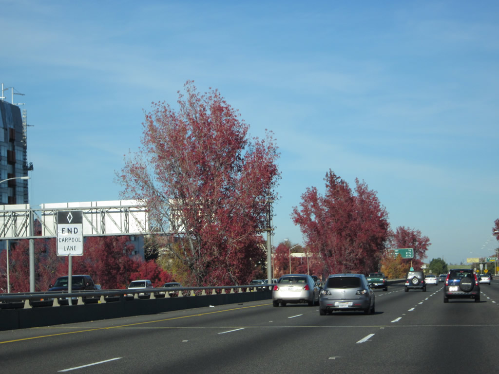
The carpool lane ends at about the same point as the N Street off-ramp. Photo taken 07/27/12. |
|
Looking at the off-ramp from Business 80 east to N Street, we see several ramps leading to and from the elevated freeway. Down below, this ramp will connect directly to 30th Street northbound. Photo taken 07/27/12. |
|
Soon thereafter, the Exit 7A off-ramp meets N Street at this traffic signal. Continue straight ahead for 30th Street north (frontage road). Photo taken 07/27/12. |
|
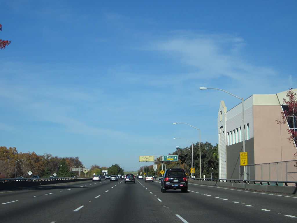
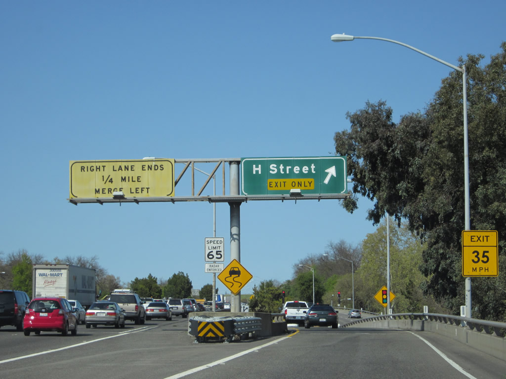
Back on the mainline, the next exit along eastbound Business Loop I-80 and northbound California 51 is Exit 7B, H Street. This far east of downtown, H Street carries two-way traffic, but it changes one-way eastbound west of 15th and 16th Streets (old California 160). G Street to the north is the best alternative route. Photo taken 11/23/12. |
|
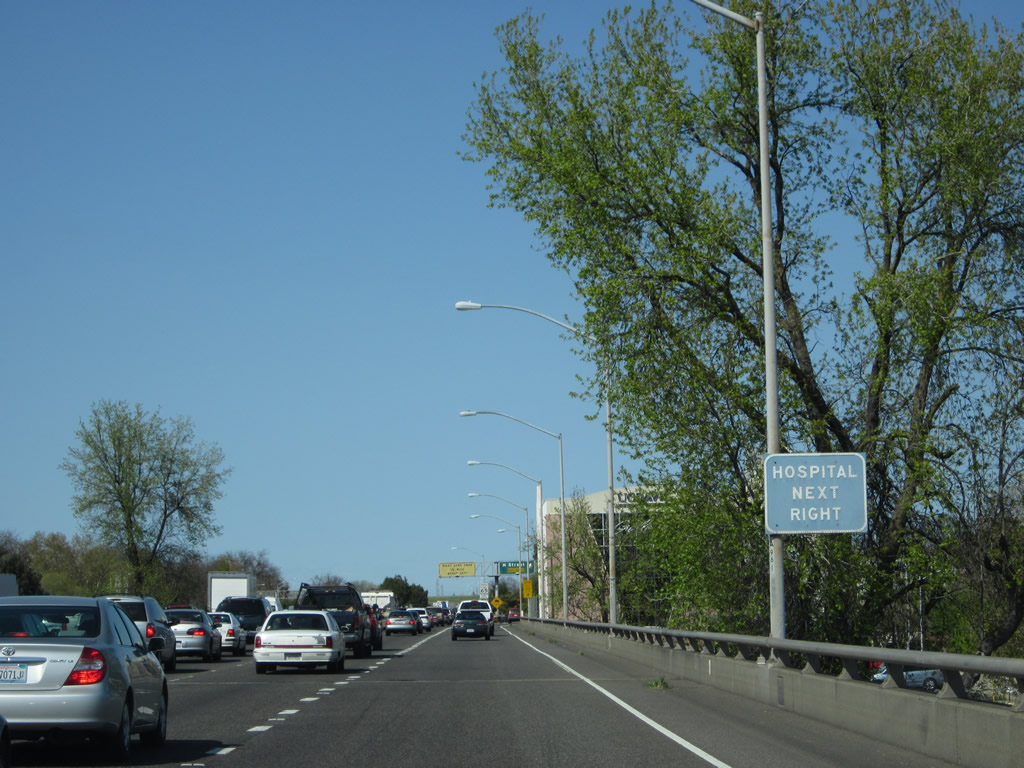
Use Exit 7B to the hospital. Photo taken 04/12/12. |
|
Business Loop I-80 continues east with four through lanes and one auxiliary lane. Photo taken 11/23/12. |
|
Eastbound Business Loop I-80 (Interstate 305) and northbound California 51 (Capital City Freeway) meet Exit 7B, H Street. Use this off-ramp to the intersection of H and 30th Streets. 29th Street and 30th Street continue to parallel the freeway below the elevated viaduct (between X Street and B Street). Photo taken 04/12/12. |
|
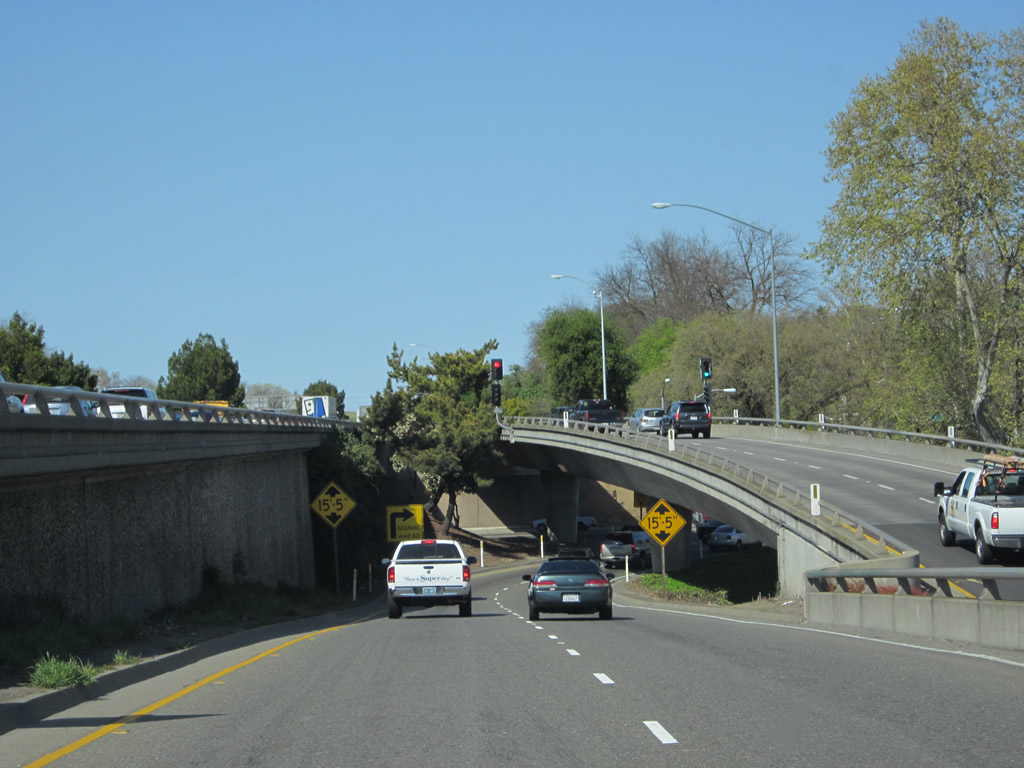
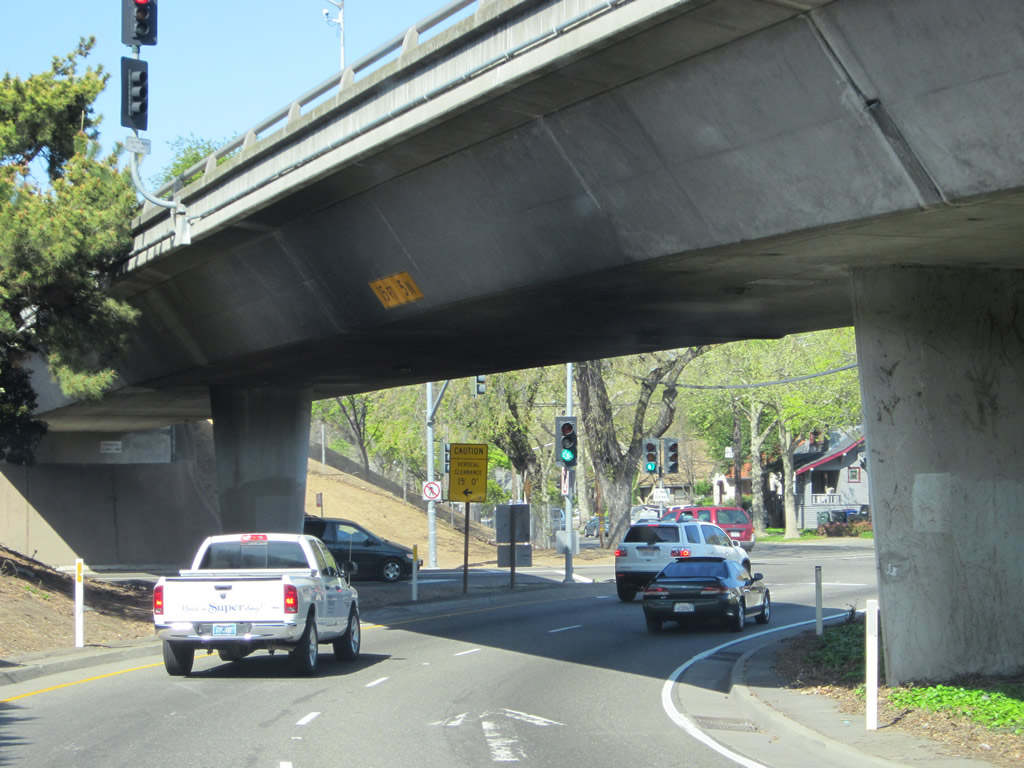
Again departing the business loop freeway, we see the off-ramp leaving the elevated viaduct and landing at H Street. Another on-ramp flies overhead at this point, creating this contrast of off and on-ramps. Photo taken 04/12/12. |
|
The Exit 7B off-ramp approaches the intersection with 30th Street and H Street while passing below the on-ramp that brings traffic from J Street onto Business 80 east. Photo taken 04/12/12. |
| Business Loop I-80 east & California 51 north |
|
|
|
|
|
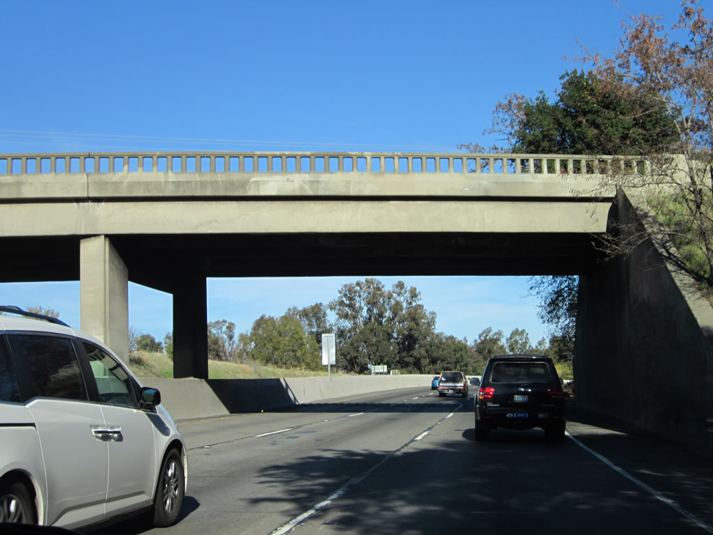
| This series of pictures follows Business Loop I-80 east and California 51 north as the Capital City Freeway proceeds from the 29th-30th viaduct section down to grade. Once the freeway reaches ground level, the right lane (#4 lane) ends. Unsigned Interstate 305 also ends here. Ahead, the upcoming section of freeway dates back to 1954 and was constructed originally as U.S. 40-99E/Elvas Freeway. That means the freeway was built to standards from that era, rather than modern Interstate highway standards. The highway curves a bit as it approaches a railroad overpass prior to entering Sutter's Landing Regional Park. Ahead, watch for rolling curves and limited sight distances (at least as compared to most California freeways). A proposal to construct a bypass of the Elvas Freeway was planned in the 1970s but was cancelled in 1980 when funds were reallocated toward light rail construction. The northern stub of this unconstructed freeway is now the Exit 94 Light Rail Station found off Interstate 80 west. Photos taken 11/23/12. |
|
Continuing northeast, Business Loop I-80 passes under a road bridge that appears to no longer be in use (or is at least constrained to official/authorized use only). The Capital City Freeway curves northeast through Sutter's Landing Regional Park. While most of the 29-30th Viaduct was built in 1966-1968, this old bridge was built in 1954 as part of U.S. 40 and U.S. 99E/Elvas Freeway. Photo taken 11/23/12. |
|
|
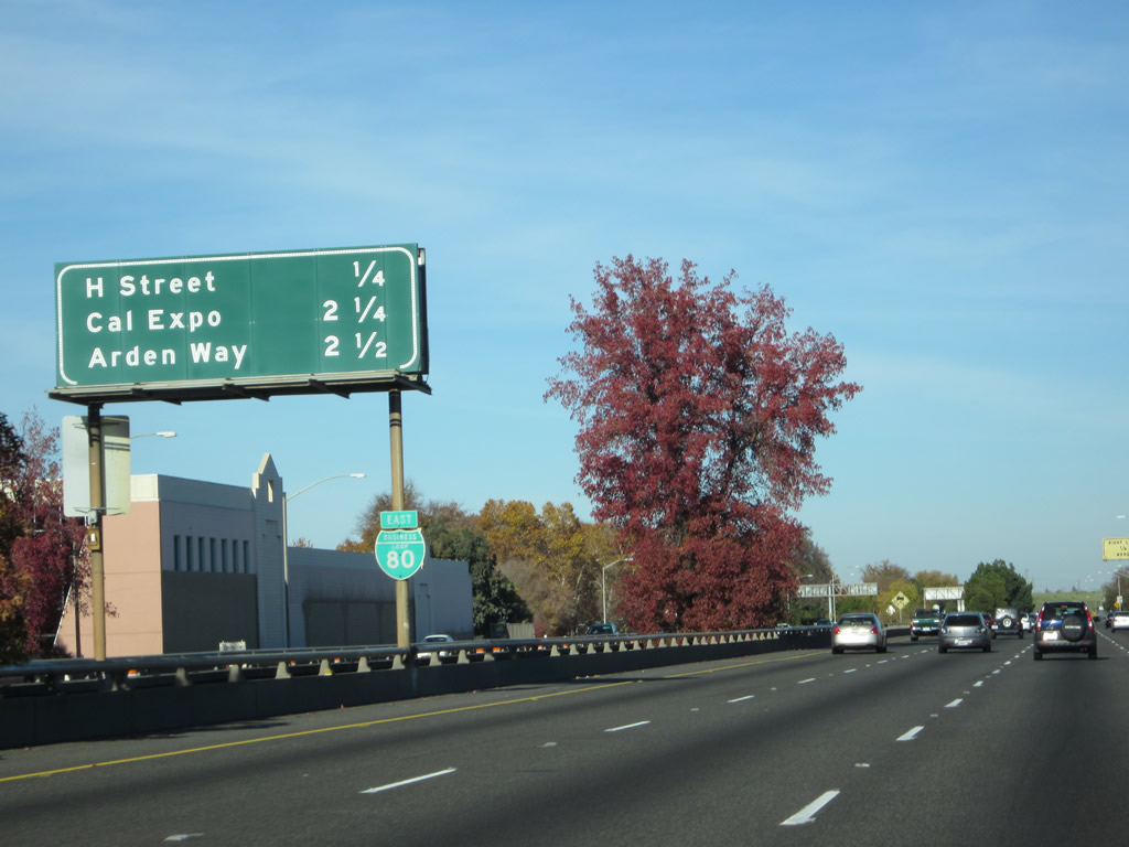
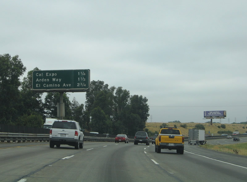
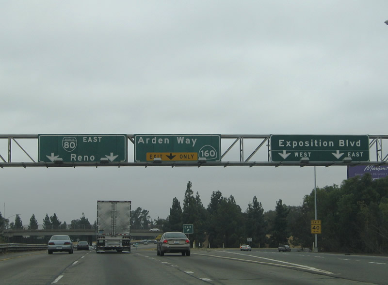
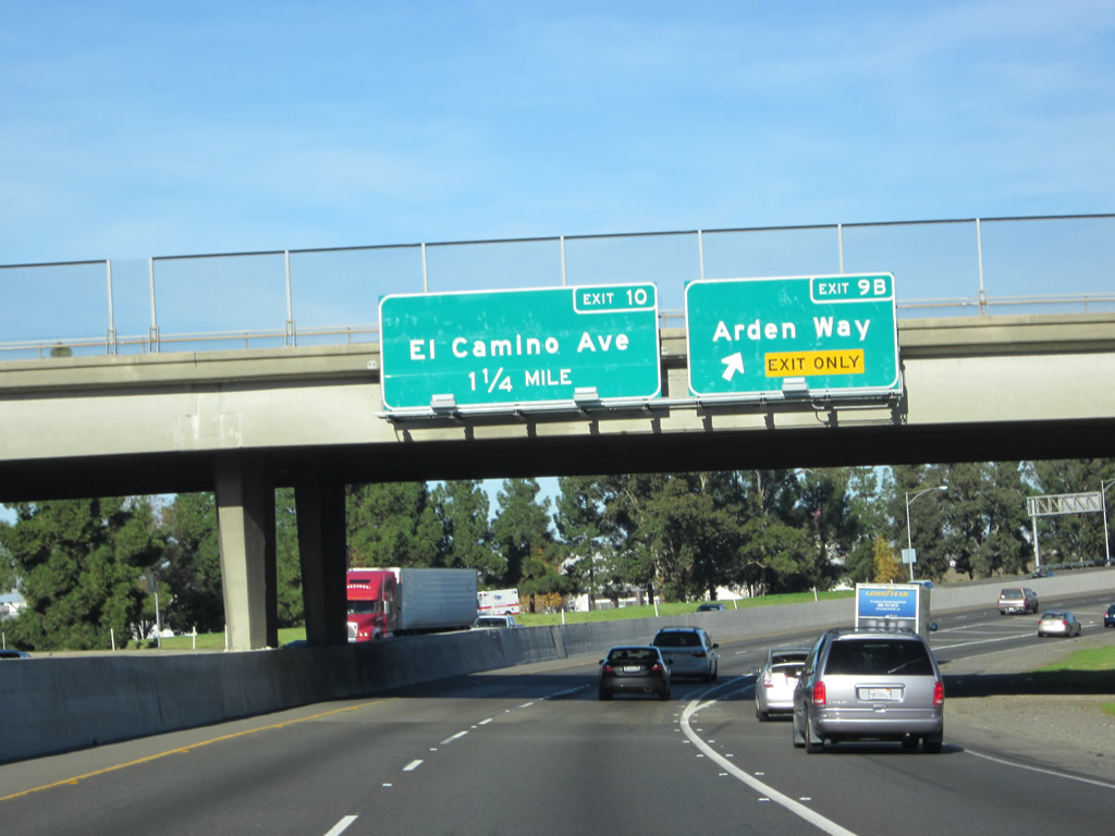
This mileage sign (replaced between 2005 and 2012) along eastbound Business 80 and northbound California 51 provides the distance to the next three exits: Exit 9A, Exposition Boulevard to Cal Expo; Exit 9B, Arden Way (to California 160 southwest); and Exit 10, El Camino Avenue. Photos taken 11/23/12 and 09/10/05. |
|
Business Loop I-80 is signed and known as the Capital City Freeway. Photo taken 08/23/03. |
|
|
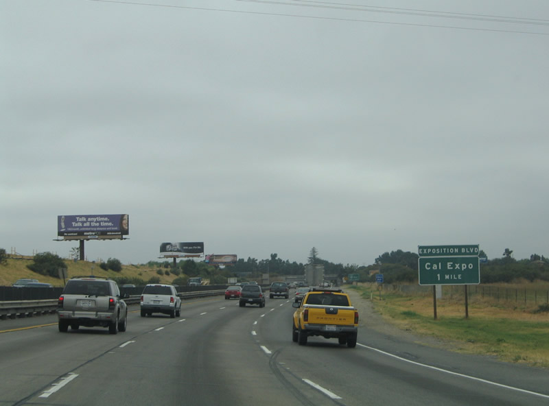
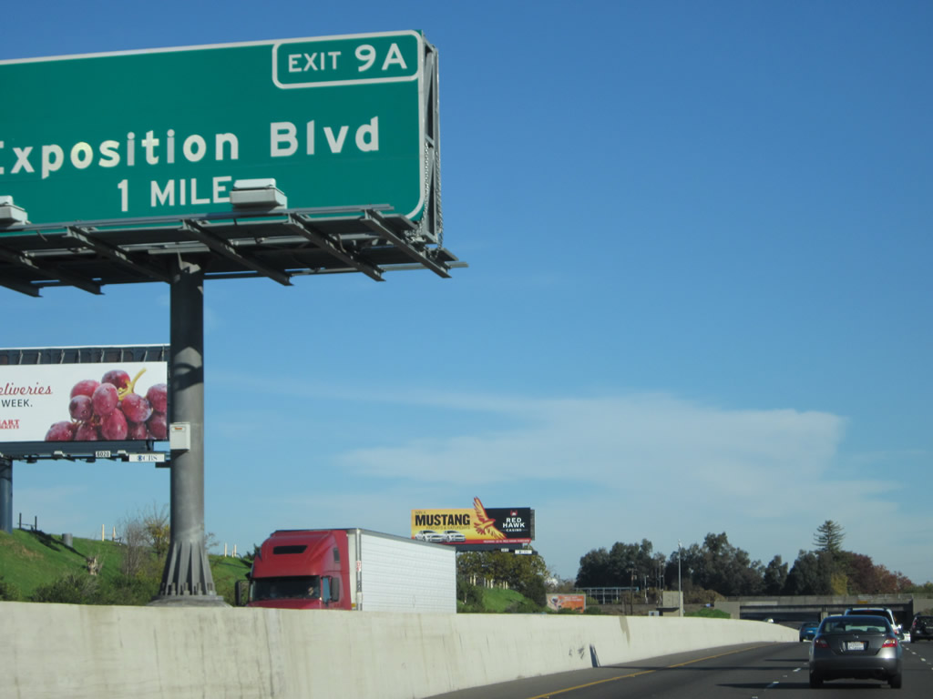
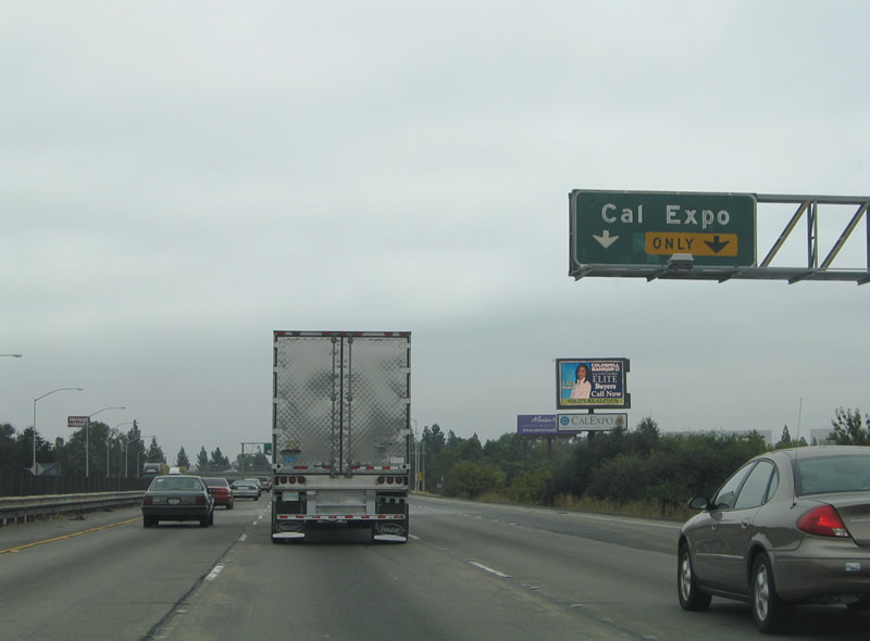
As the business loop passes through the undeveloped American River Parkway area, there are no exits until Exit 9A, Exposition Boulevard/Cal Expo. The signage for this exit is somewhat inconsistently signed between Exposition Boulevard and Cal Expo. Photos taken 11/23/12 and 09/10/05. |
|
A one-mile advance sign for Exit 9A, Exposition Boulevard to Cal Expo is now posted in the median. Photo taken 11/23/12. |
|
|
To mitigate a variety of substandard design features (such as the upcoming Marconi Curve, several short or non-existent acceleration/deceleration ramps and shoulders, and other similar features) along the business loop freeway between Exits 9A and 12C, this sign advises through traffic to remain in the left two lanes. Slow or stopped traffic occurs along this stretch during afternoon commuting hours. Photos taken 11/23/12 and 09/10/05. |
|
Business Loop I-80 and California 51 pass under another railroad track. Photo taken 11/23/12. |
|
Eastbound Business Loop I-80 and northbound California 51 curve to the north for the approach onto the American River bridge. Photo taken 11/23/12. |
|
|
Quickly thereafter, Business Loop I-80 and California 51 pass over the American River on this 1954 bridge, which was expanded/widened to 1966. There are no shoulders on this bridge, which complicates traffic whenever a car breaks down or has an accident on the bridge. Note the divoted curbing on the bridge, which is a hallmark from the 1954 construction. Photos taken 11/23/12. |
|
|
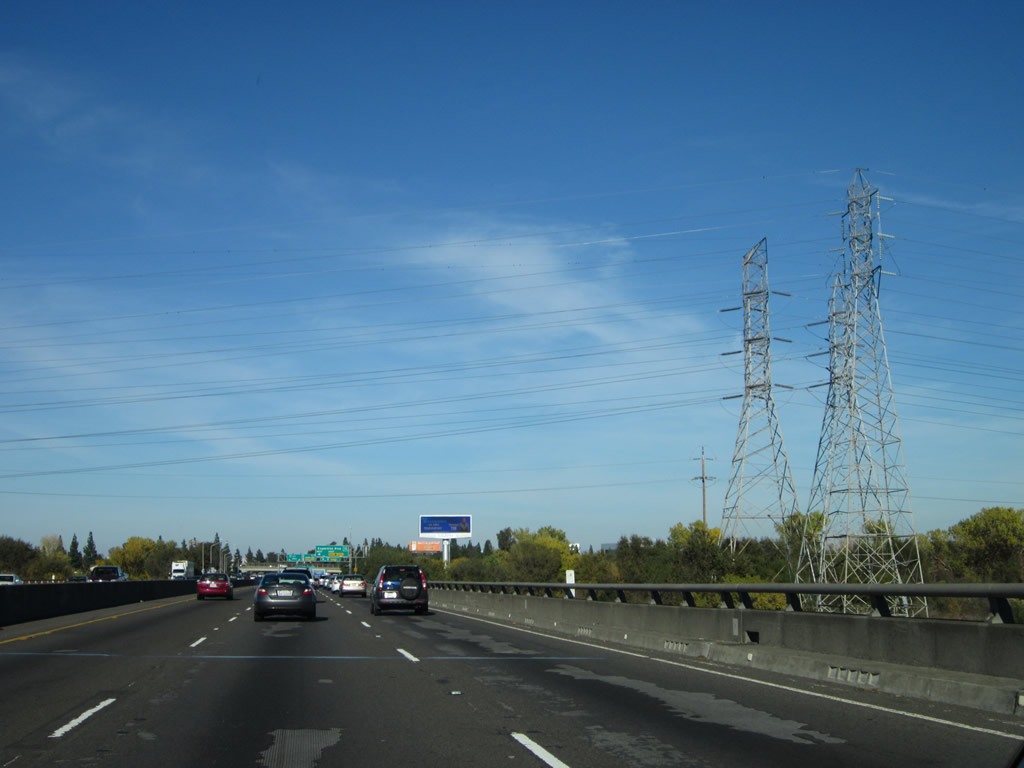
A set of Sacramento Municipal Utility District (SMUD) power lines crosses over Business Loop I-80 (Capital City Freeway) at the north bank of the American River. Photos taken 11/23/12. |
|
|
After the American River bridge, an auxiliary lane forms to carry traffic off of eastbound Business Loop I-80 to Exit 9A, Exposition Boulevard to Cal Expo. Photos taken 11/23/12 and 09/10/05. |
|
|
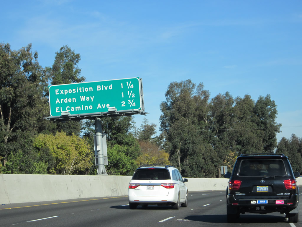
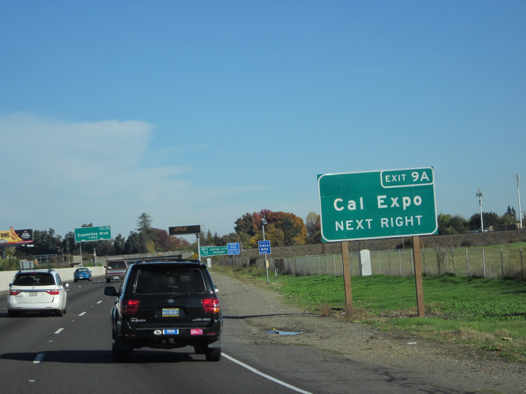
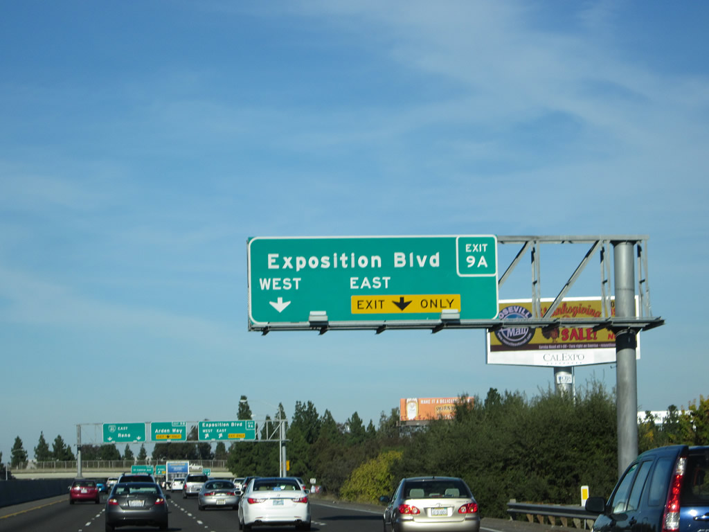
Eastbound Business Loop I-80 (Capital City Freeway) reaches Exit 9A, Exposition Boulevard and Cal Expo (state fairgrounds). The next exit is Exit 9B, Arden Way to California 160 (North Sacramento Freeway) south. Many of the overpasses along the freeway prevent expansion by another lane and some bridge heights do not meet current minimum height standards for Inter state routes. Photos taken 11/23/12 and 09/10/05. |
|
|
Immediately thereafter, Eastbound Business Loop I-80 meets Exit 9B, Arden Way. Use the Arden Way ramp system to link with California 160 (North Sacramento Freeway) west. California 160 is a short freeway spur from the business loop southwest toward downtown. The state route used to provide a consistent route through the city and then continue into the Delta; now it has a route break through the city limits of Sacramento. This means that the northern segment of California 160 only extends for a couple miles west of here, then ends at the point where the freeway empties onto the Sacramento street grid. The southern instance of California 160 begins near Freeport, south of Sacramento. Photos taken 11/23/12 and 09/10/05. |
|
|
Business Loop I-80 (former U.S. 40-99E / Elvas Freeway) narrows to two lanes after the Arden Way off-ramp. Watch for stopped or slow traffic through the Arden Interchange. Photos taken 11/23/12. |
|
|
A grassy median separates the two directions of traffic along Business Loop I-80 (Capital City Freeway) in the Arden Interchange. Traffic from California 160 east merges onto Business 80 east on the right side. Photos taken 11/23/12. |
|
|
Here's another view of eastbound Business Loop I-80 at the point where California 160 east merges onto the Capital City Freeway. Arden Way passes below the freeway ahead. Photos taken 11/23/12. |
|
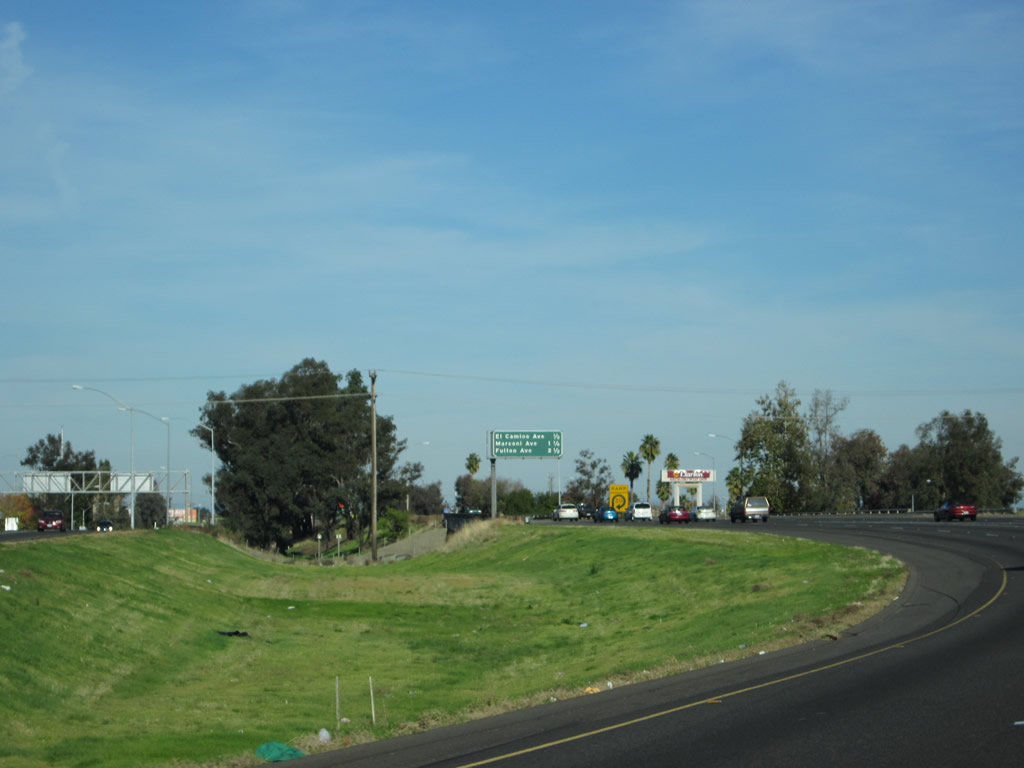
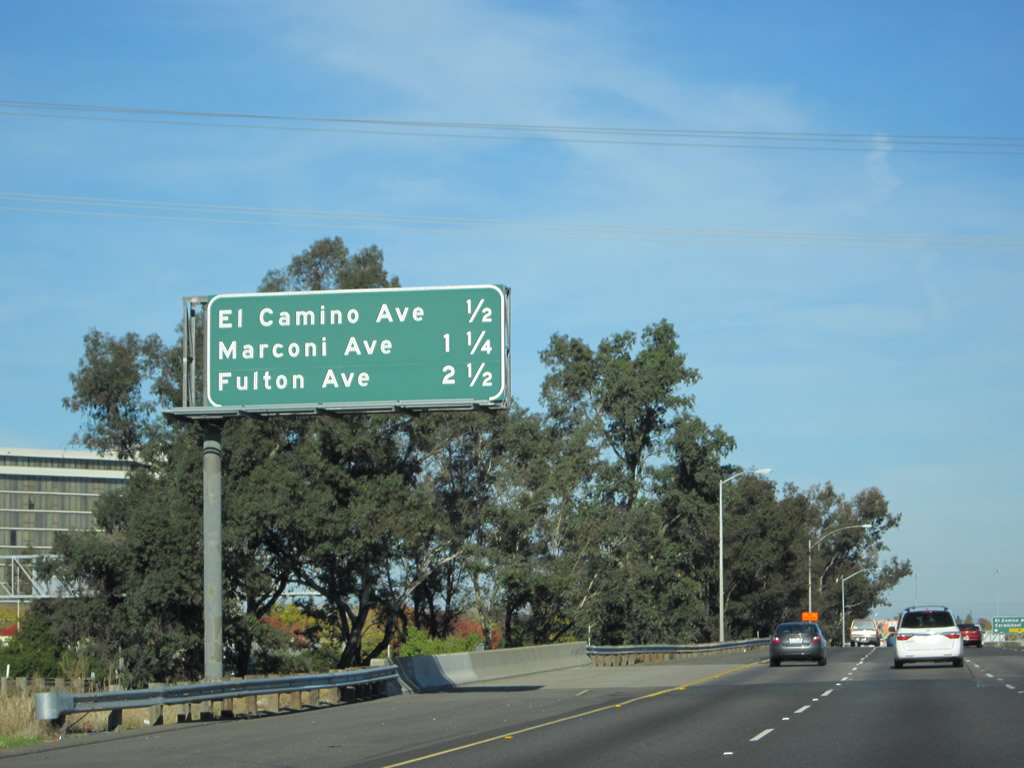
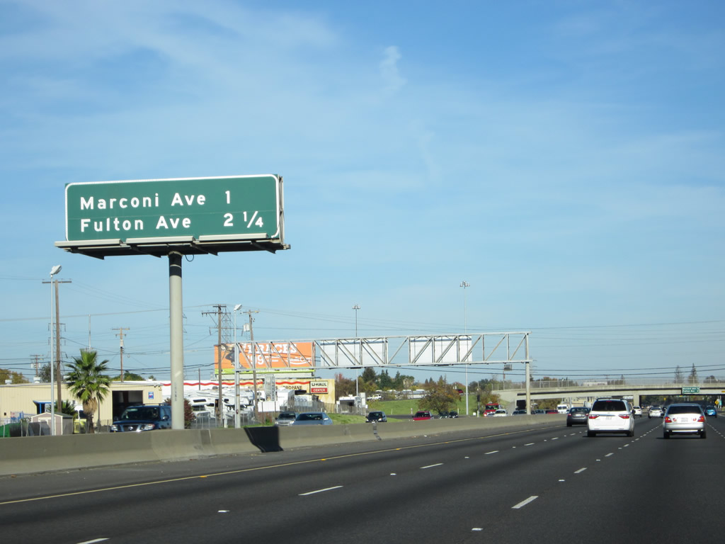
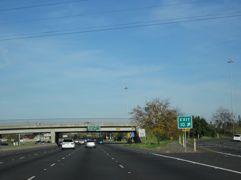
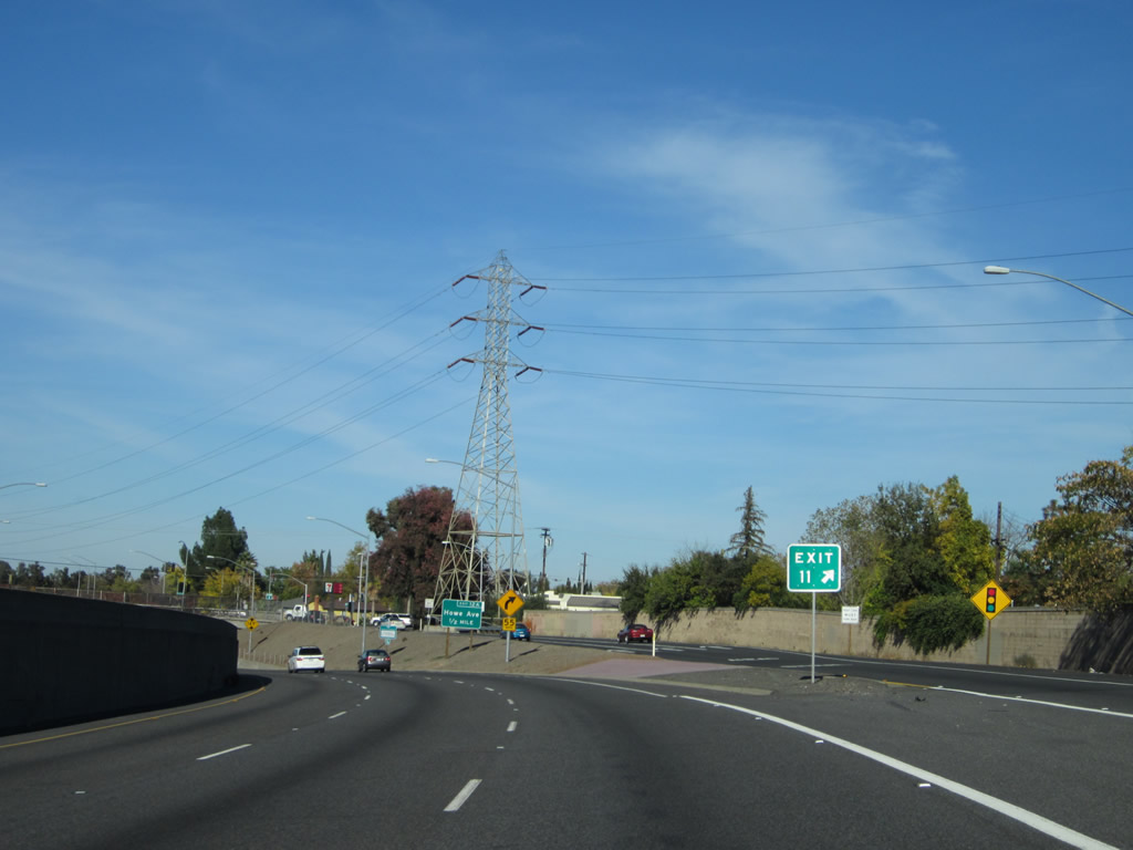
This mileage sign provides the distance to three of the next five exits along Business 80 east and California 51 north: Exit 10, El Camino Avenue; Exit 11, Marconi Avenue; and Exit 12C, Fulton Avenue. Exits 12A and 12B are omitted, but that is because they are not major exits (see below). Photo taken 11/23/12. |
|
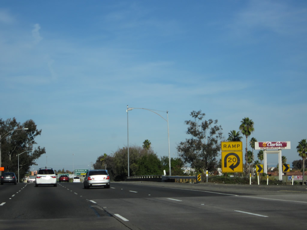
A large RAMP - 20 MPH sign is posted on the transition ramp from Business 80 east to Arden Way west. This yellow sign is visible from the main lanes of Business 80. Photo taken 11/23/12. |
|
As Business Loop I-80 approaches Exit 10/El Camino Avenue, enjoy the four lanes. They will constrict to three lanes of through traffic on the approach to the substandard Marconi Curve. Traffic during afternoon rush hours (often starting after 3 p.m.) can be quite heavy along this segment of the Capital City Freeway. Photo taken 11/23/12. |
|
This mileage sign provides the distance to the next several exits along eastbound Business 80: Exit 10, El Camino Avenue (next right - the exit is visible in the distance); Exit 11, Marconi Avenue (one mile); and Exits 12A-B-C, Howe Avenue, Bell Street, Fulton Avenue (2.25 miles). Photo taken 11/23/12. |
|
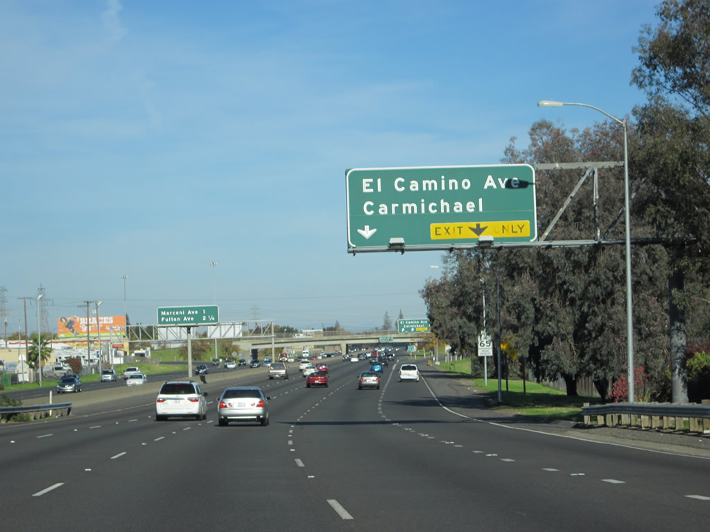
Eastbound Business Loop I-80 (Capital City Freeway) and northbound California 51 reach Exit 10, El Camino Avenue. Use El Camino Avenue east into the unincorporated community of Carmichael. Photo taken 11/23/12. |
|
The gore point for Exit 10 is signed with an exit number. Note that the exit number sign is held up by a metal breakaway post rather than the more typical wooden post. Several of these have started appearing in the Sacramento area recently. Photo taken 11/23/12. |
|
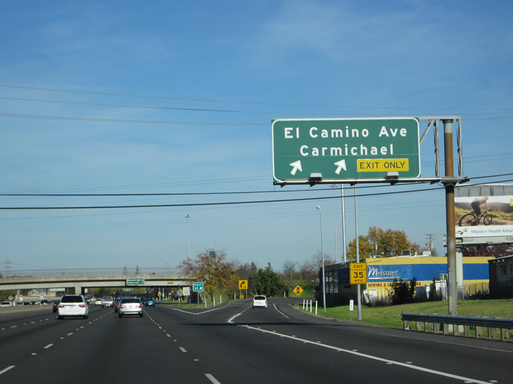
This photo presents a neat juxtaposition of the mileage sign hanging from the El Camino Avenue overpass along with the freeway entrance side for eastbound El Camino Avenue motorists. The next exit is Exit 11, Marconi Avenue. Photo taken 11/23/12. |
|
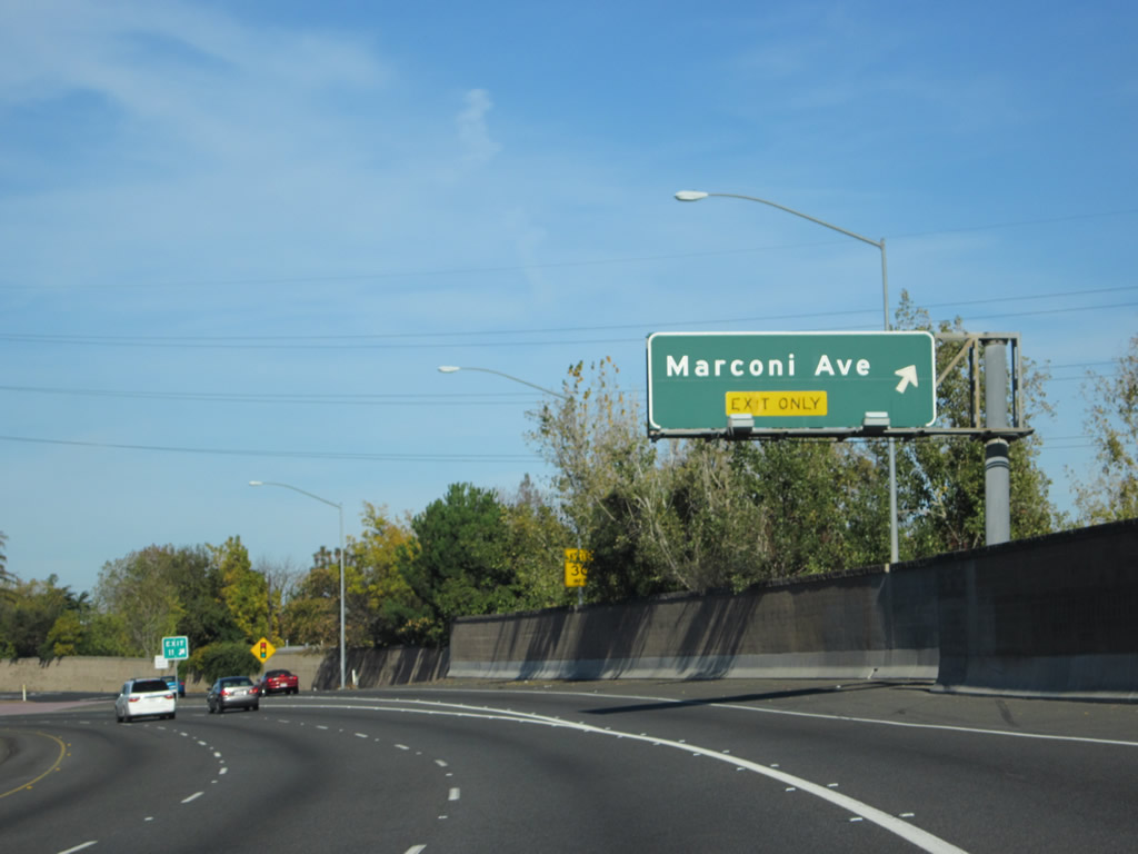
The right lane becomes exit only for Exit 11, Marconi Avenue. Ahead, Business 80 approaches one of its most infamous segments: the Marconi Curve, a well-known traffic bottleneck. Marconi Avenue, which parallels El Camino Avenue and also leads into Carmichael, is a semi-major street but probably better known regionally because of the curve the business loop freeway takes near the interchange. We'll see the curve just ahead along eastbound. Photo taken 11/23/12. |
|
But before we get to the Marconi Curve, Business Loop I-80 is deceptively straight and wide just north of El Camino Avenue. Photo taken 11/23/12. |
|
Eastbound Business Loop I-80 and northbound California 51 meet Exit 11, Marconi Avenue. The freeway will lower in elevation to pass under Marconi Avenue. The Marconi Curve can be considered to be the totality of the minor curve before the off-ramp to Exit 11, the elevation change at the interchange (limiting sight distance), and the major curve to the northeast after the Exit 11 interchange. Photo taken 11/23/12. |
|
Just like Exit 10 (El Camino Avenue), Exit 11 is signed with an exit number at the gore point. A Sacramento Municipal Utility District (SMUD) power line crosses high above the Marconi Avenue interchange. Photo taken 11/23/12. |
|
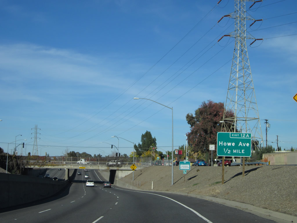
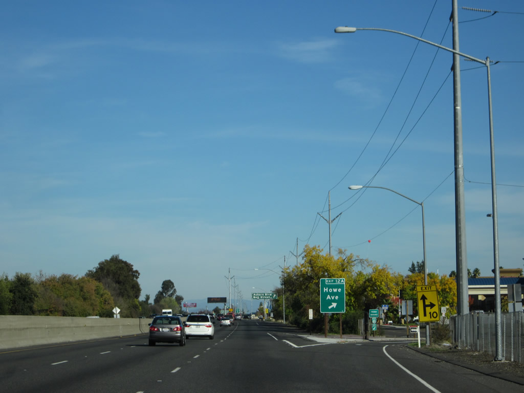
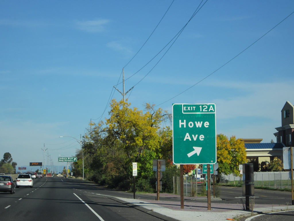
The next exit along Business 80 east is Exit 12A, Howe Avenue. The freeway dips to pass below Marconi Avenue. Photo taken 11/23/12. |
|
Business Loop I-80 east and California 51 north pass under Marconi Avenue. Photo taken 11/23/12. |
|
A Sacramento Municipal Utility District (SMUD) power line passes over the Capital City Freeway. Photo taken 11/23/12. |
|
|
|
Thereafter, Business 80 makes a sharp turn northeast. This is the beginning of the sharp Marconi Curve. Watch carefully; the exit to Howe Avenue (Exit 12A) comes immediately after this curve ends. Photos taken 11/23/12. |
|
|
Eastbound Business Loop I-80 (Capital City Freeway) reaches Exit 12A, Howe Avenue. This off-ramp is nearly a 90-degree right hand turn off the freeway, with a freeway entrance with a minimal acceleration lane present right after it. During the winter of 2003-2004, a reflective sign complete with exit number was placed at this interchange. Photos taken 11/23/12. |
|
Immediately thereafter, eastbound Business Loop I-80 (Capital City Freeway) and northbound California 51 meet Exit 12B, Bell Street. There is not much advance warning for this exit. Photo taken 11/23/12. |
|
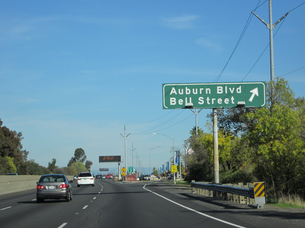
Upon departing the Capital City Freeway at Exit 12B, the off-ramp will connect to Historic U.S. 40-99E (Auburn Boulevard) northeast. Turn right to connect with Bell Street south. A U.S. 40 shield and Auburn Boulevard overhead sign are posted at the end of the off-ramp ... both are visible in this picture. Photo taken 11/23/12. |
|
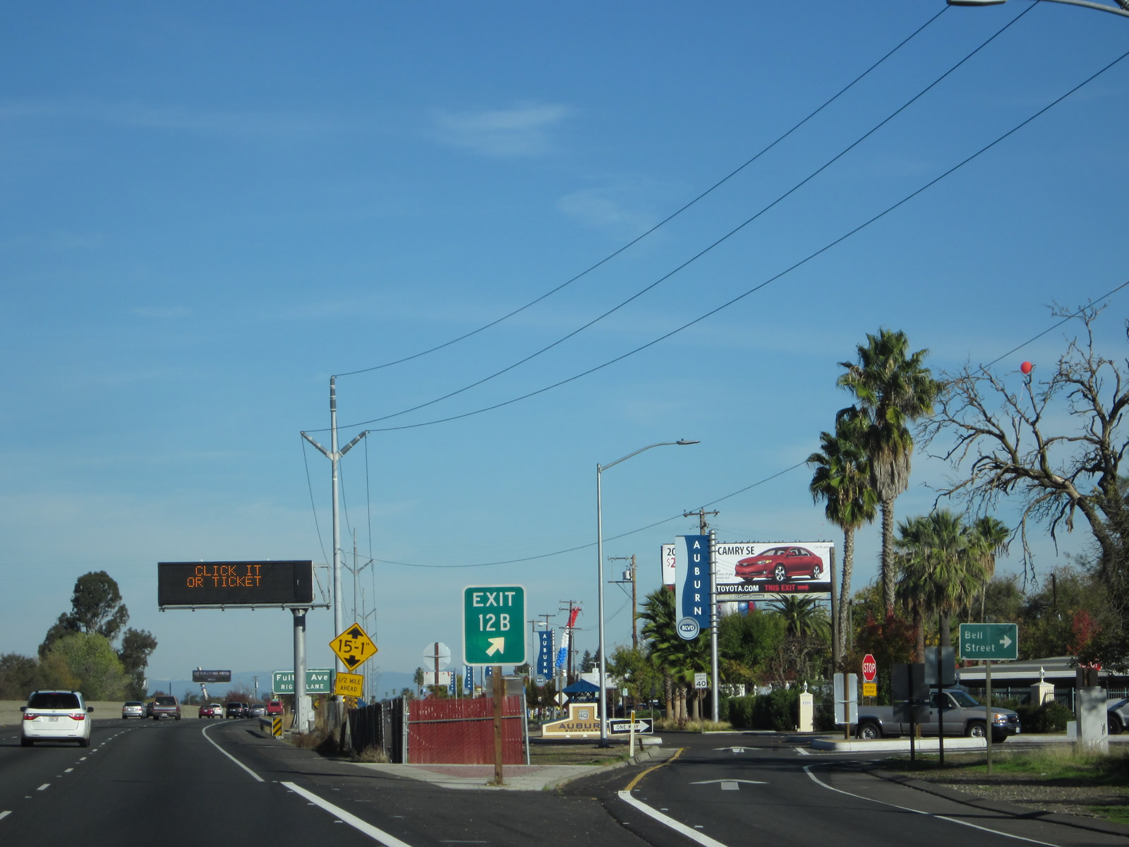
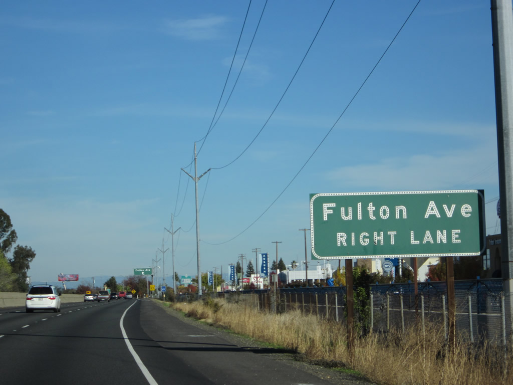
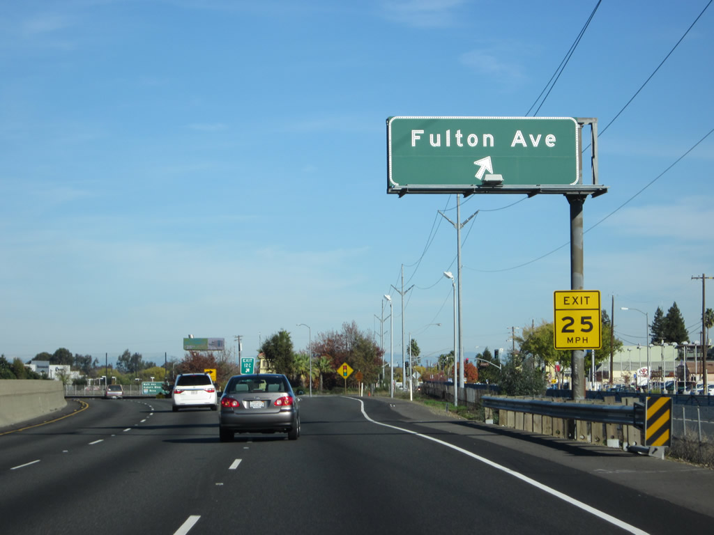
The next exit along Business Loop I-80 (Capital City Freeway) east is Exit 12C, Fulton Avenue. Photo taken 11/23/12. |
|
Eastbound Business Loop I-80 meets Exit 12C, Fulton Avenue. Use Fulton Avenue north to Haggin Oaks Municipal Golf Course and south into unincorporated Carmichael. Photo taken 11/23/12. |
|
The exit number for Exit 12C is posted at the gore point. Photo taken 11/23/12. |
|
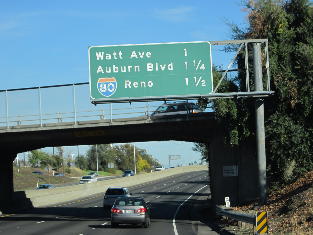
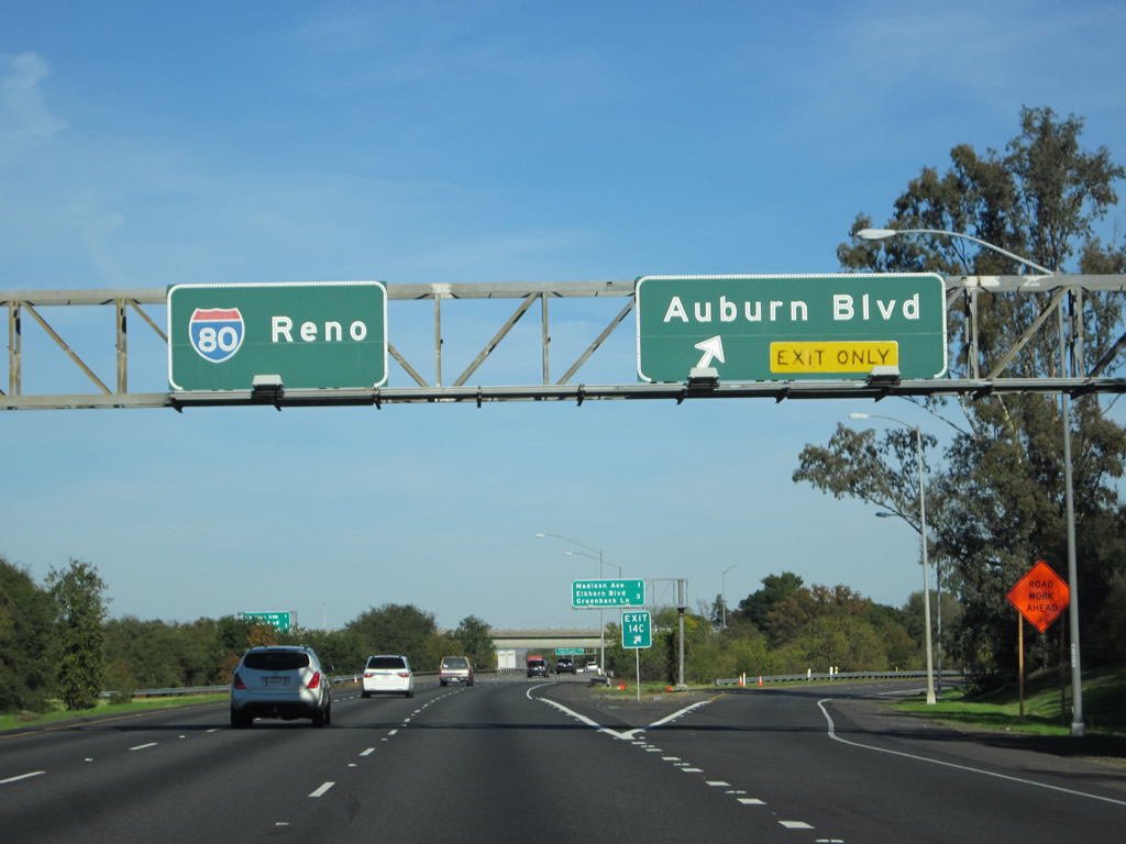
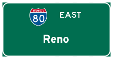
This mileage sign along eastbound Business Loop I-80 (Capital City Freeway) provides the distance to the next four exits: Exits 14A-B, Watt Avenue; Exit 14C, Auburn Boulevard; and Exit 14D, Interstate 80 east to Auburn, Truckee, and Reno. Photo taken 11/23/12. |
|
A Business Loop I-80 east reassurance shield is posted along the Capital City Freeway after the on-ramp from Fulton Avenue. Photo taken 11/23/12. |
|
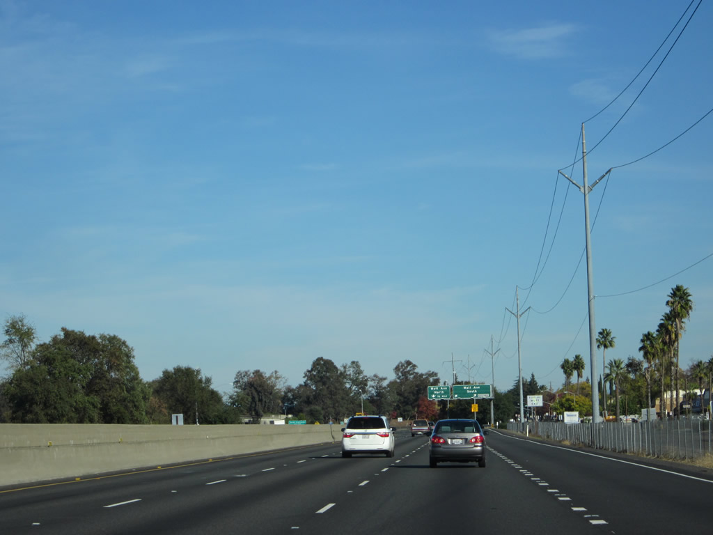
The next exits along eastbound Business Loop I-80 and northbound California 51/Capital City Freeway are Exit 14A, Watt Avenue south and Exit 14B, Watt Avenue north. Photo taken 11/23/12. |
|
A Sacramento Municipal Utility District power line parallels the business loop freeway. Photo taken 11/23/12. |
|
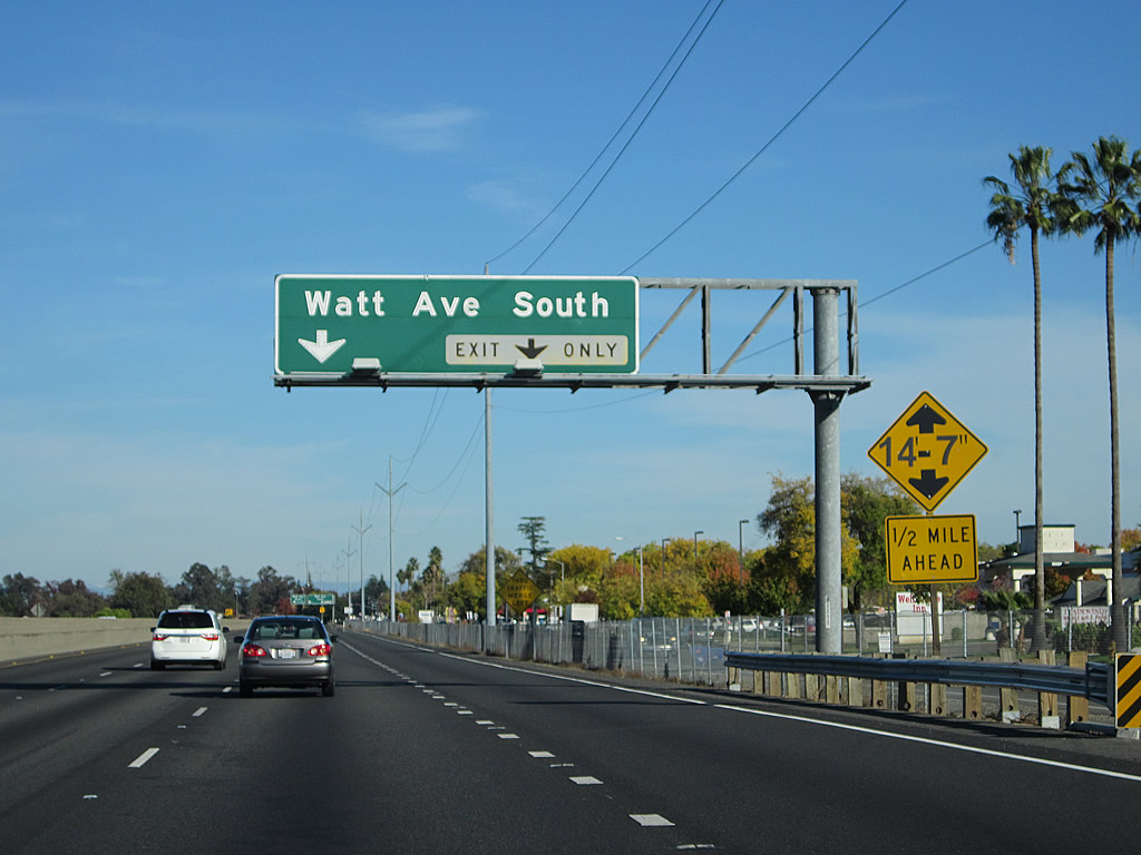
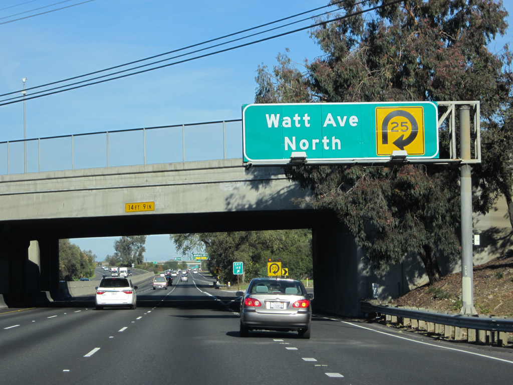
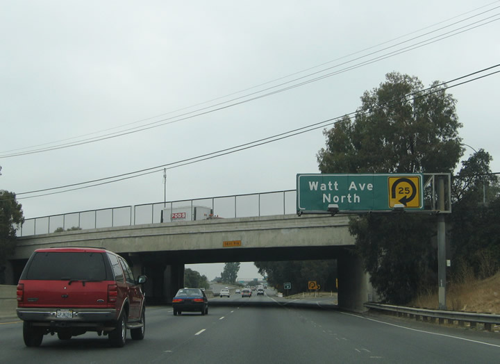
Shortly thereafter, eastbound Business Loop I-80 and northbound California 51 meet Exit 14A, Watt Avenue south, followed by Exit 14B, Watt Avenue north. Southbound Watt Avenue will travel south past the Del Paso Country Club, Arden Oaks, and Arden before connecting with U.S. 50 near the American River. Photo taken 09/10/05. |
|
|
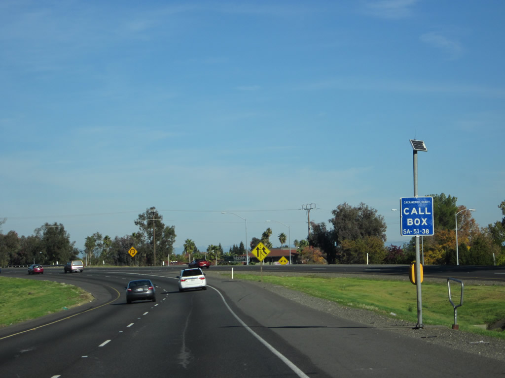
This is the last eastbound Business Loop I-80 reassurance shield along the mainline business loop freeway. Exits 14A-C constitute the final interchange. Note the blue call box, which contains the "secret" designation of Route 51 in its location code. Photos taken 11/23/12 and 09/10/05. |
|
Use northbound Watt Avenue (Exit 14B) to North Highlands. Photo taken 09/10/05. |
|
Since the main lanes merge directly onto eastbound Interstate 80, travelers looking to reach westbound Interstate 80 must exit northbound Watt Avenue and reconnect with Interstate 80 a mile or so north of here. There is no direct freeway-to-freeway connection from eastbound Business Loop I-80 to westbound Interstate 80. Photo taken 09/10/05. |
|
|
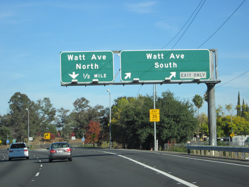
Eastbound Business Loop I-80 (Capital City Freeway) and northbound California 51 meet Exit 14B, Watt Avenue north. Use Watt Avenue north to Interstate 80 west en route to Interstate 5 and the Sacramento International Airport. Photos taken 11/23/12 and 09/10/05. |
|
A sharp loop ramp (Exit 14B) connects from Business 80 east to Watt Avenue north. Photo taken 11/23/12. |
|
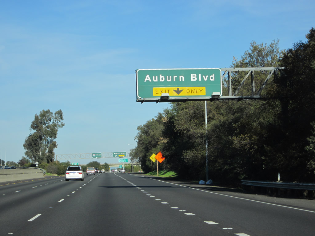
The final off-ramp from Business Loop I-80 is Exit 14C, California 244 east to Historic U.S. 40-99E (Auburn Boulevard). This exit serves northern end of unincorporated Carmichael. The freeway ramp for Exit 14C was originally intended to be much more than it is today. Exit 14C actually leads to unsigned California 244, which acts as a connector ramp from the business loop freeway to Auburn Boulevard. However, California 244 was to be part of a much larger freeway system that was proposed for eastern Sacramento County. Continuing east past Auburn Boulevard, California 244 was to provide an east-west freeway link, culminating at a junction with U.S. 50 after passing unconstructed California 65. The extension was eliminated in stages during the mid-1970s and mid-1990s due to local opposition. All that remains of this route is the stub section here. For more on California 244, see California State Route 244 (Daniel Faigin). Photo taken 11/23/12. |
|
Eastbound Business Loop I-80 meets Exit 14C, California 244 east to Historic U.S. 40-99E (Auburn Boulevard). California 244 is not signed. Photo taken 11/23/12. |
|
The Auburn Boulevard off-ramp is signed as Exit 14C. Photo taken 11/23/12. |
|
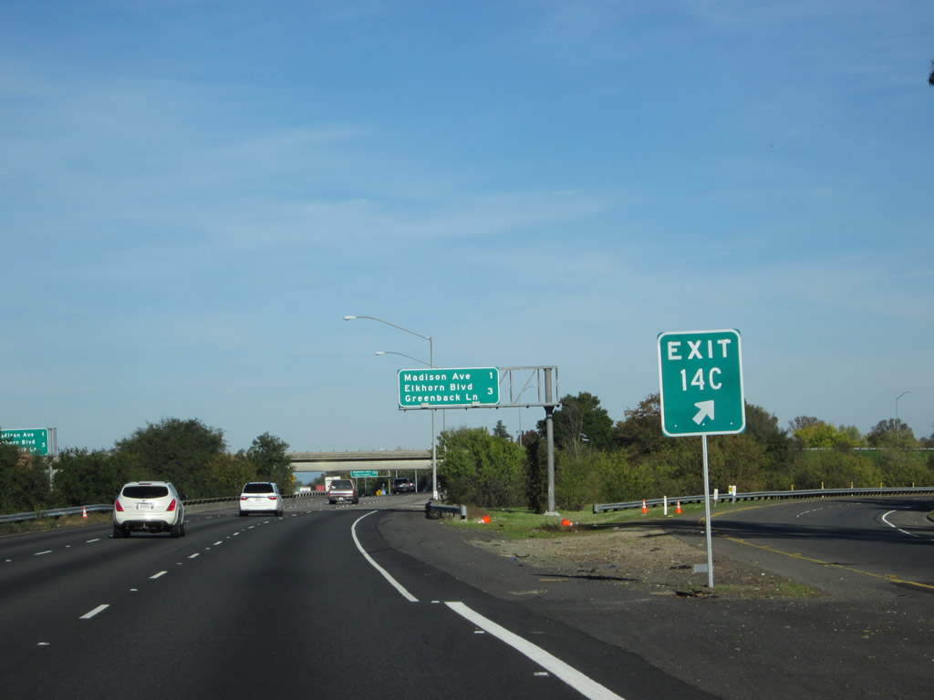
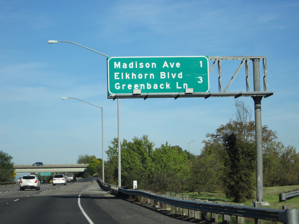
Immediately after the off-ramp to Exit 14C, this mileage sign (along Business Loop I-80 east) provides the distance for upcoming exits on Interstate 80 east: Exit 96, Madison Avenue and Exit 98, Sacramento County E-14 (Elkhorn Boulevard) and Greenback Lane. This mileage sign provides the distance to the next two exits from Interstate 80 east. Ahead, Business Loop I-80 and California 51 will merge onto Interstate 80. Someday the short California 244 freeway spur may connect to another freeway, but prior plans to connect California 244 to any other state highway at its eastern end have been thwarted due to local and community opposition. There are still long-range plans (per California Streets & Highways Code) to construct California 143, a north-south freeway that would bypass the downtown area to the east and end at California 99 south of Elk Grove. That freeway also has opposition, and no current plans are underway to construct it. For more on California 143, see State Route 143 (Daniel Faigin). Photo taken 11/23/12. |
|
|
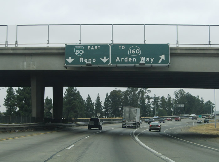
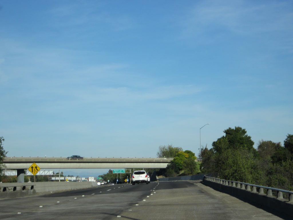
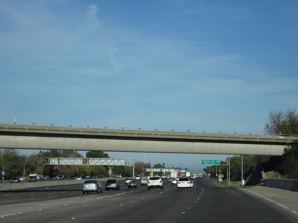
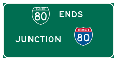
California 51 and Business Loop I-80 end as the Capital City Freeway merges back with Interstate 80. Main line Interstate 80 will merge with Business Loop I-80 from the left. Neither California 51 nor Business Loop I-80 are signed with end shields here. As traffic from Business 80 and Interstate 80 merge together, the right two lanes will end up exiting onto Exit 96, Madison Avenue. Traffic delays due to all of this merging can occur during afternoon commute hours. Photo taken 11/23/12. |
Page Updated July 14, 2013.