

Business Loop I-80 west & California 51 south
| Interstate 80 west | |
|---|---|
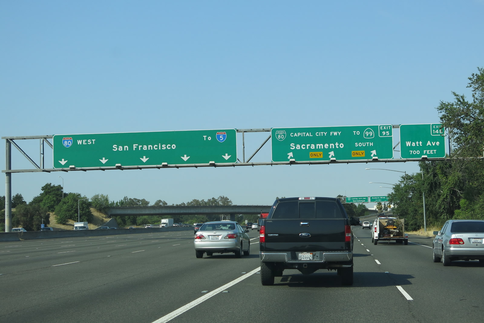 |
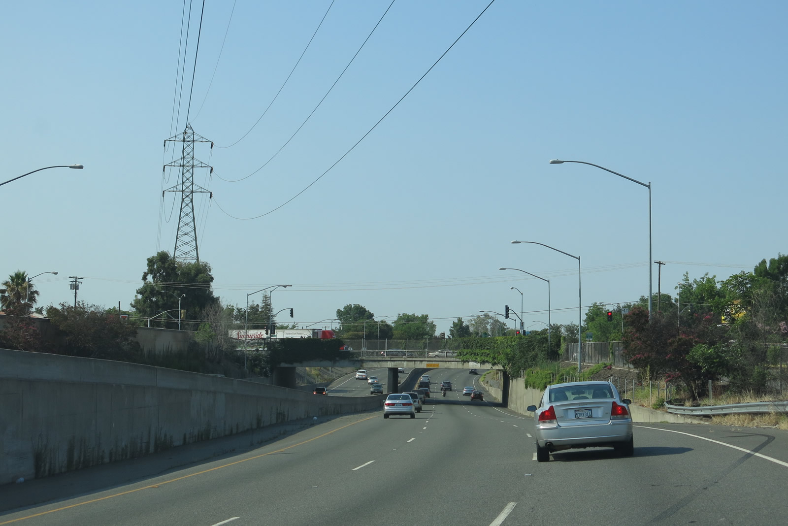
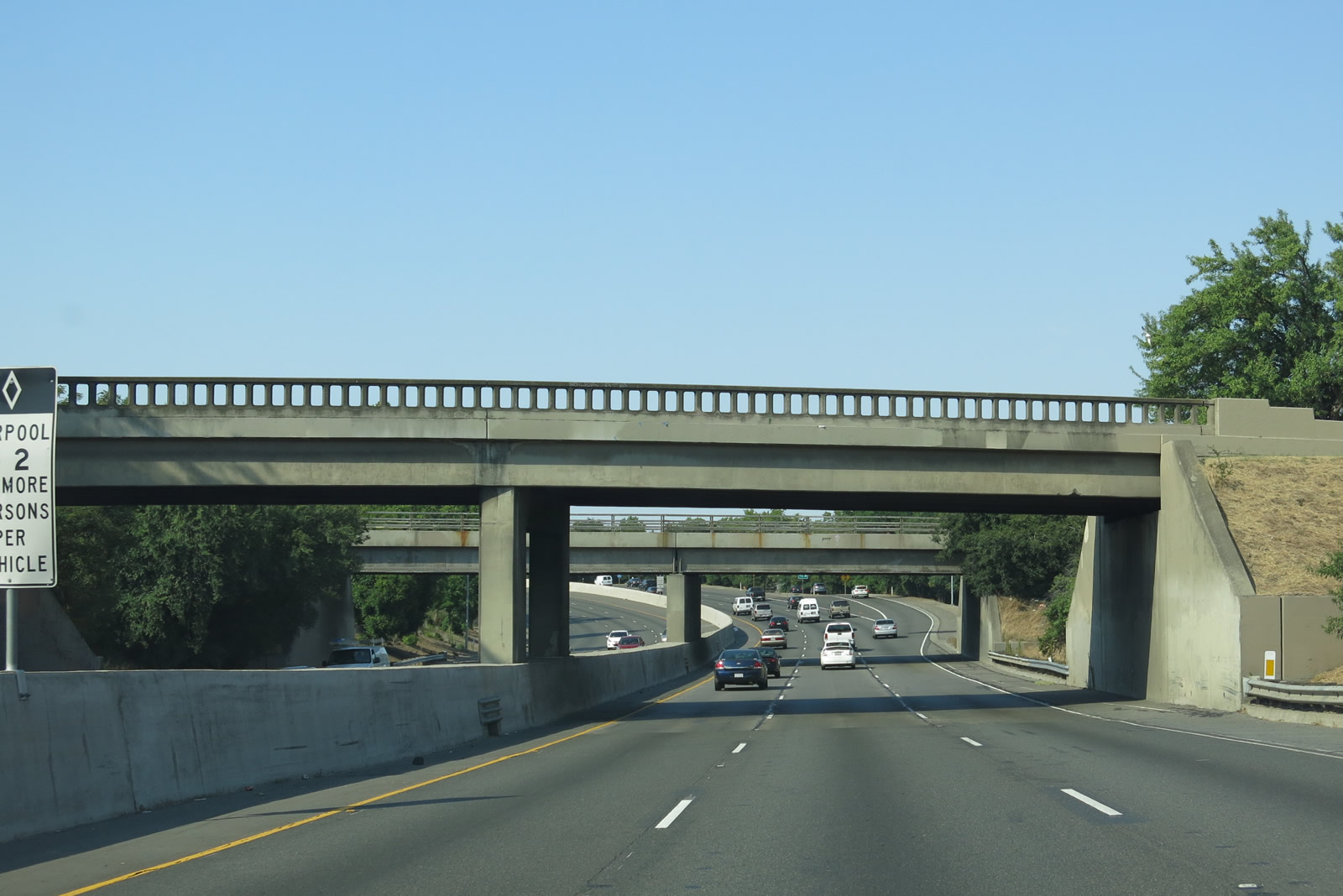
Three lanes transition from Interstate 80 west to Business Loop I-80 (Capital City Freeway) west. The first off-ramp from Business Loop I-80 connects to Exit 14B, Watt Avenue. Business Loop I-80 used to be Interstate 80 until 1980-1982, when a series of actions relocated Interstate 80 onto former Interstate 880 and removed the I-80 segment between Watt Avenue and the American River bridge from the Interstate Highway System. Photo taken 07/02/13. |
| Business Loop I-80 west & California 51 south | |
 |
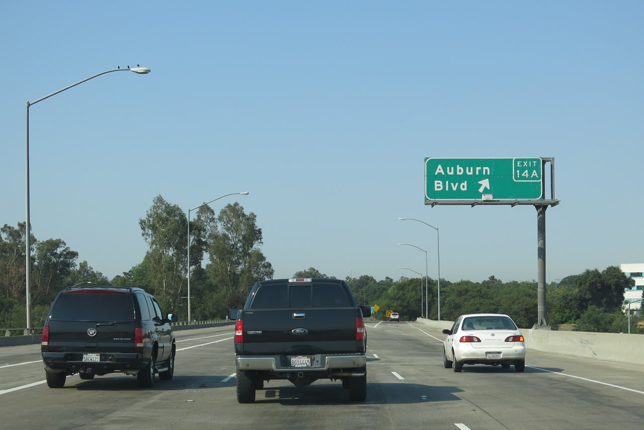
After exiting from westbound Interstate 80 onto westbound Business Loop I-80 (Capital City Freeway), Exit 14B (Watt Avenue) appears before the transition ramp from Interstate 80 crosses over the parent freeway. The next exit, Exit 14A, is unsigned California 244 east to Auburn Boulevard. Photo taken 07/0213. |
 |
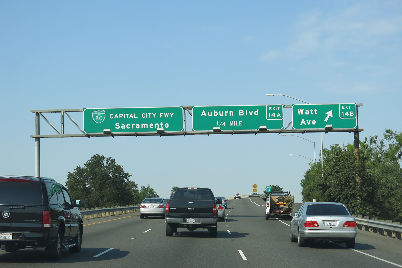
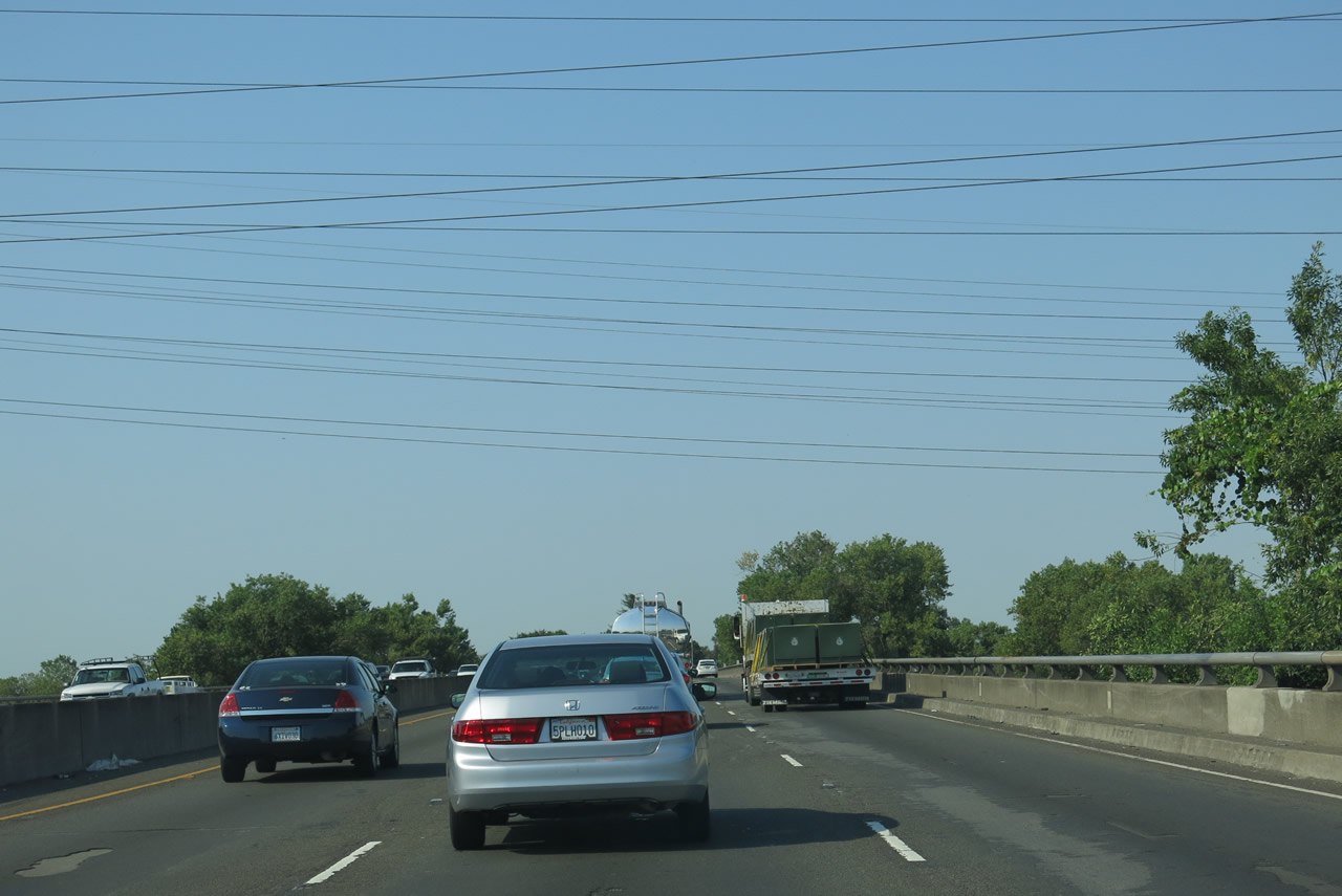
Westbound Business Loop I-80 (Capital City Freeway) and southbound California 51 meet Exit 14A, California 244 east to Historic U.S. 40-99E (Auburn Boulevard). Of note, this exit sign was the first overhead sign to feature an exit number (2002 series) in the state of California; it was placed in August 2002. Photo taken 07/02/13. |
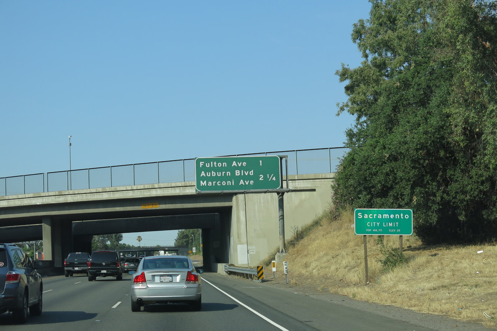 |
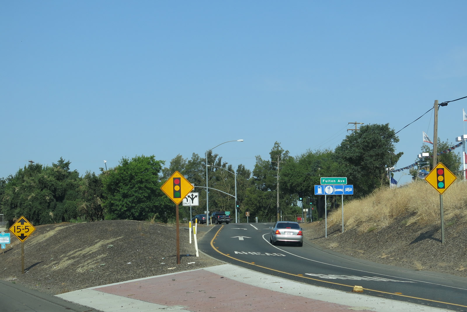
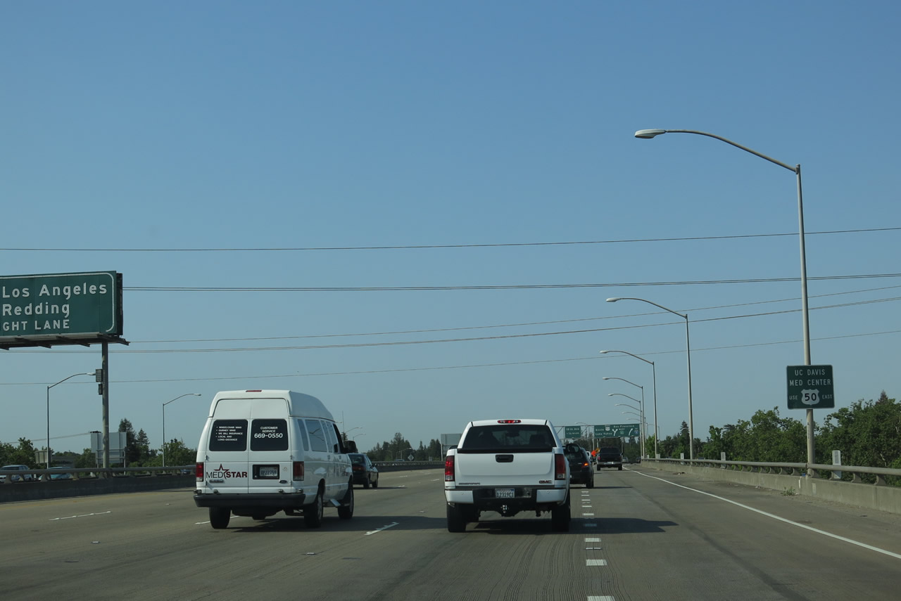
Business Loop I-80 enters the city of Sacramento (population 466,488 as of the 2010 Census, elevation 25 feet, and incorporated on February 27, 1850). Sacramento is the capital city of California and is the seat of Sacramento County. This mileage sign along westbound Business Loop I-80 provides the distance to Exit 12, Fulton Avenue and Exit 11, Auburn Boulevard and Marconi Avenue. Photo taken 07/02/13. |
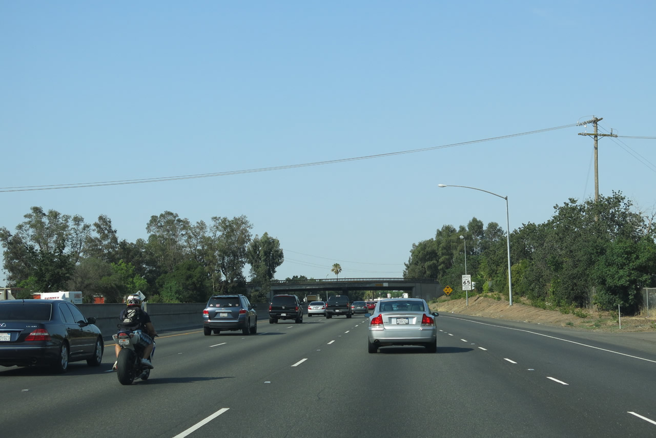 |
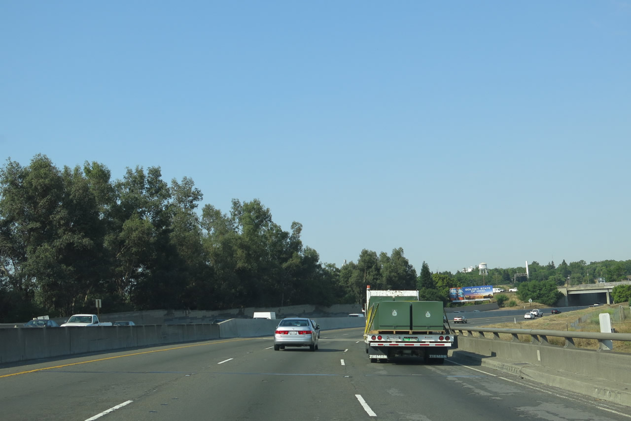
Four westbound lanes carry Business Loop I-80 briefly prior to the Fulton Avenue interchange (Exit 12). The number of lanes will vary between Interstate 80 and C Street. Photo taken 07/02/13. |
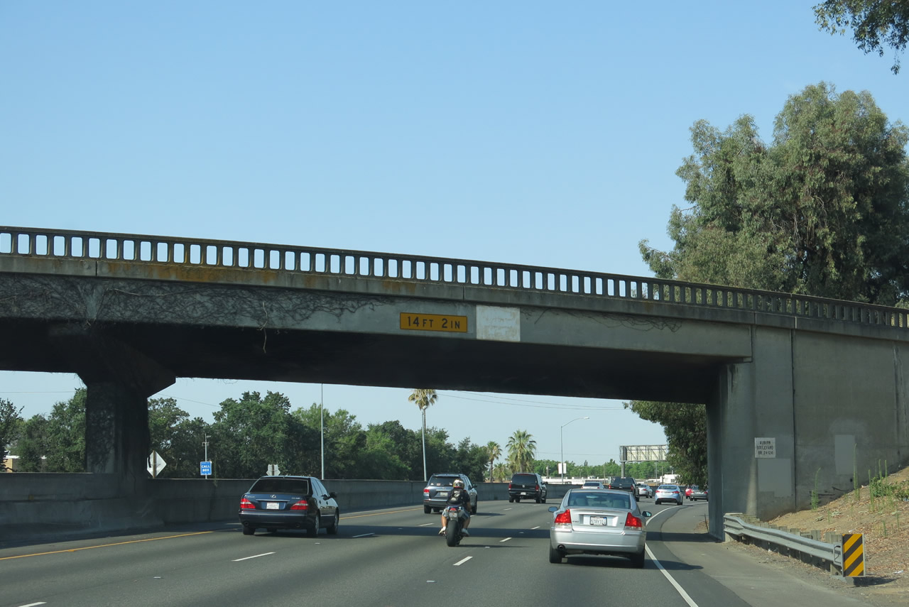 |
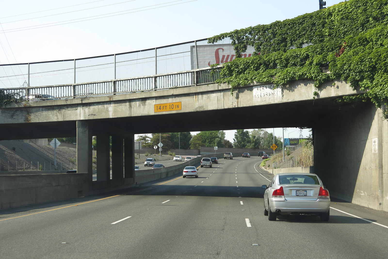
A ramp connecting Auburn Boulevard (Historic U.S. 40-99E) with Business Loop I-80 west flies overhead. The bridge height (a little more than 14 feet) does not meet Interstate standards. Photo taken 07/02/13. |
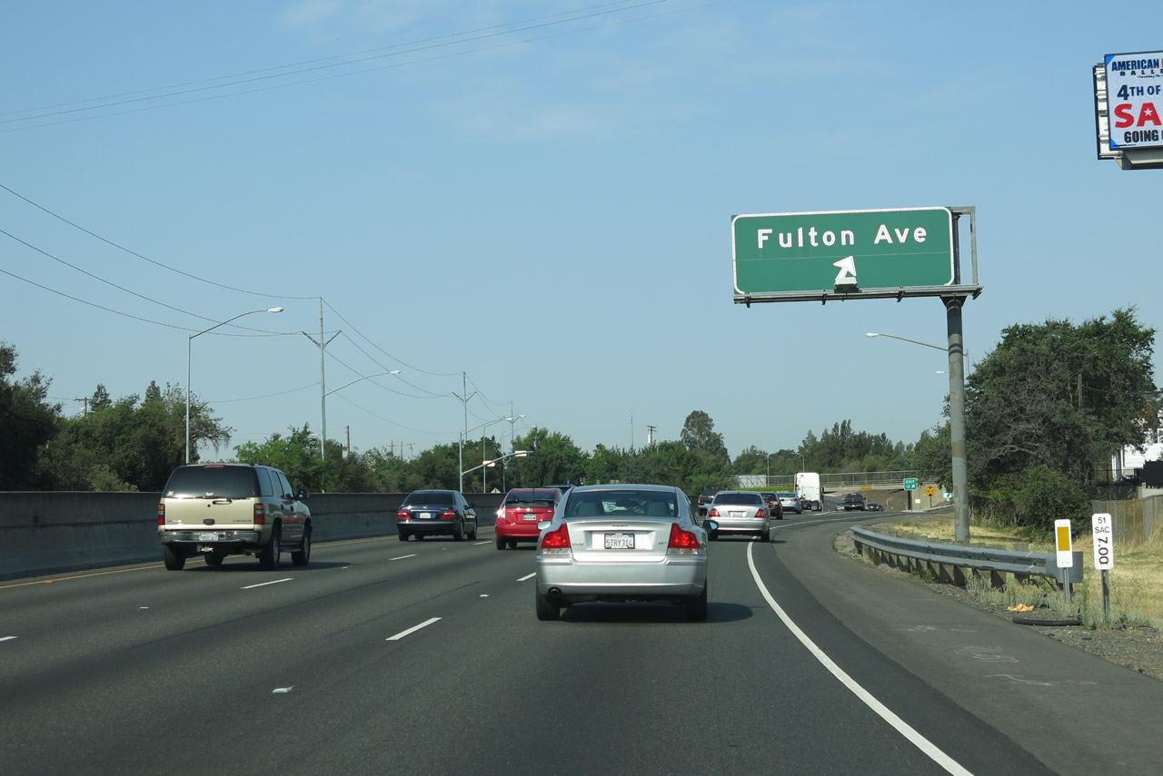 |
Westbound Business Loop I-80 and southbound California 51/Capital City Freeway meet Exit 12, Fulton Avenue. Business Loop I-80 is considered to be below Interstate standards for the stretch of freeway between Fulton and U.S. 50, with the Marconi curve and below standard shoulders. Plans call for construction of a high occupancy vehicle lane, which will require a reworking of the lanes through this relatively narrow stretch. Note the post mile marker shown in this image, which indicates the state route number of 51. Photo taken 07/02/13. |
 |
A single-lane off-ramp connects to Fulton Avenue from Business Loop I-80 (Capital City Freeway) west. Photo taken 07/02/13. |
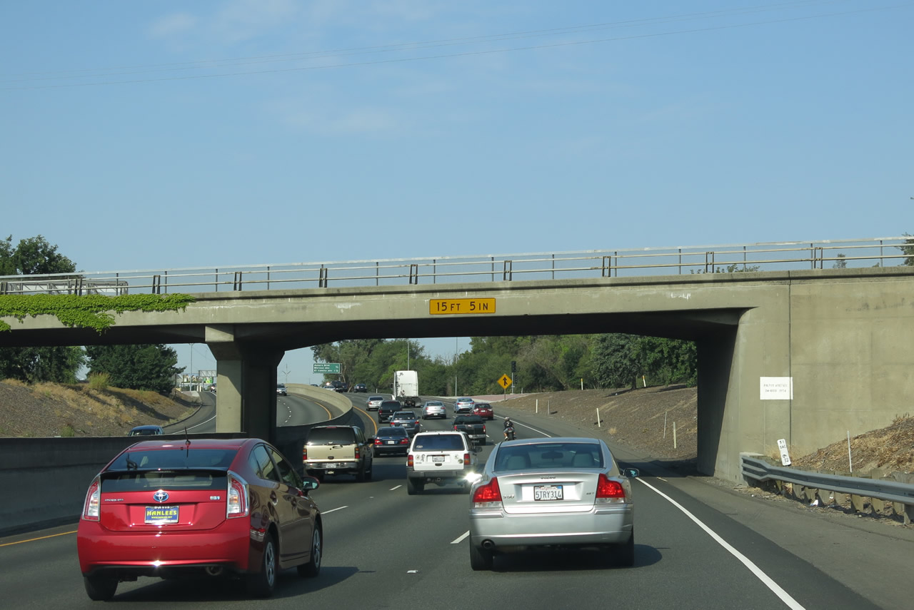 |
One of the substandard features of the six-mile segment of Business Loop I-80 (Capital City Freeway) between Interstate 80 and C Street is the low height of several bridges, such as this one that carries Fulton Avenue over the freeway. Interstate standards call for a 17-foot minimum bridge height; the Fulton Avenue overpass is only 15 feet 5 inches tall. Photo taken 07/02/13. |
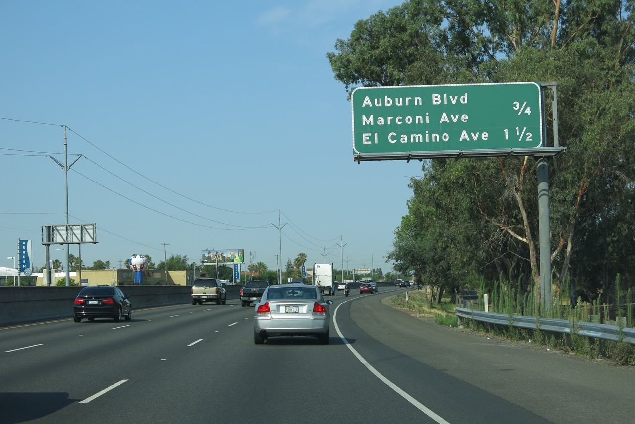 |
A mileage sign along Business Loop I-80 west provides the distance to the next two interchanges: Exit 11, Auburn Boulevard and Marconi Avenue and Exit 10B, El Camino Avenue. Photo taken 07/02/13. |
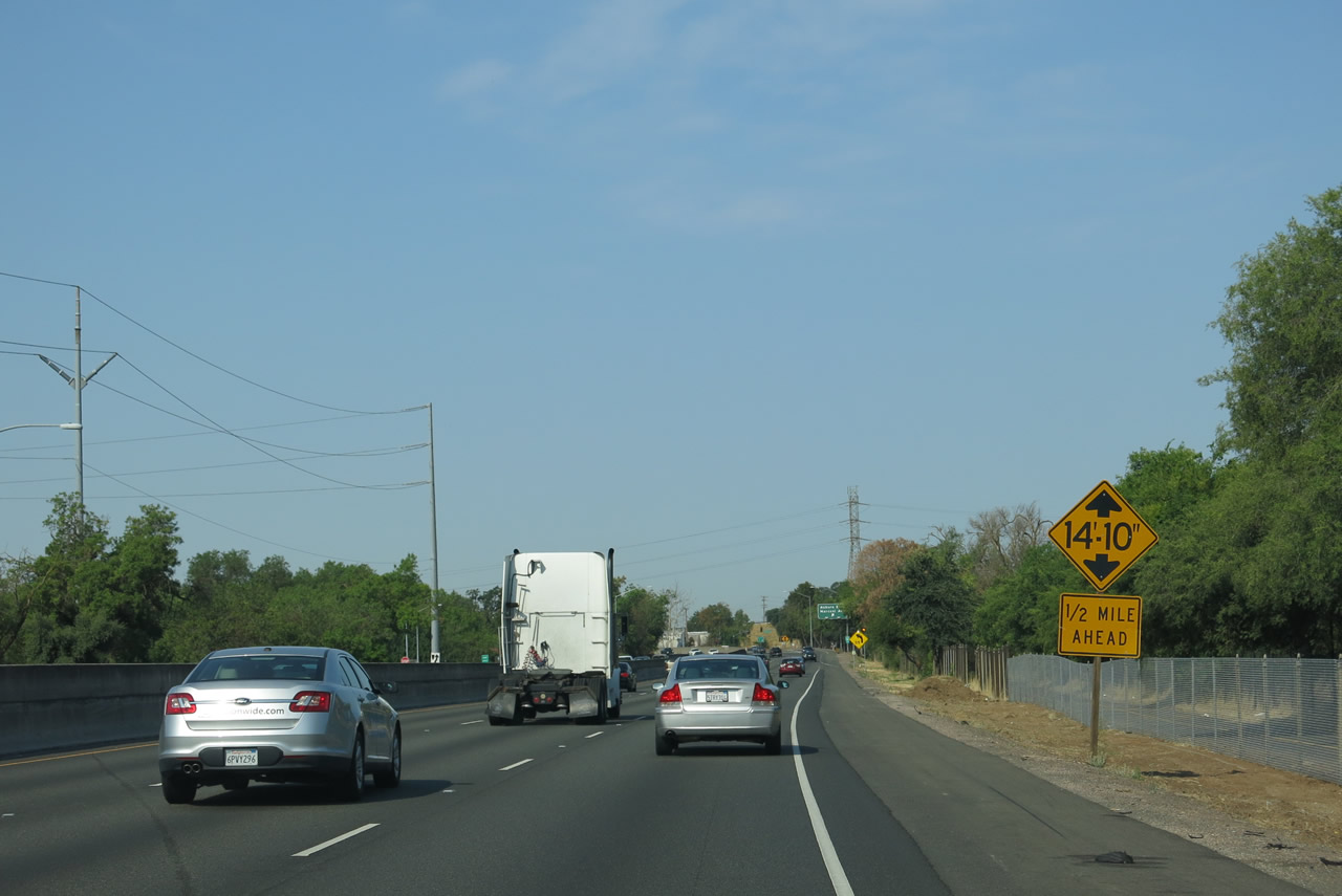 |
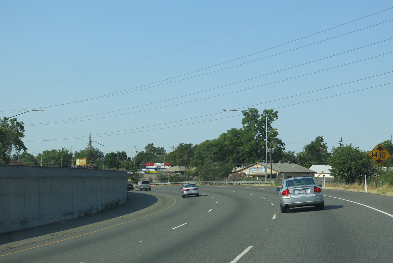
Another low-rise bridge (even shorter than the last one at 14 feet 5 inches tall) is one-half mile ahead at the Marconi Avenue overpass. Photo taken 07/02/13. |
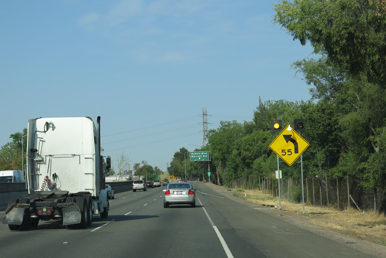 |
Traffic is advised to slow for the Marconi Curve, which sharply turns the freeway from a southwesterly trajectory to due south. The freeway will travel due south to pass under Marconi Avenue then curve again toward the southwest. Photo taken 07/02/13. |
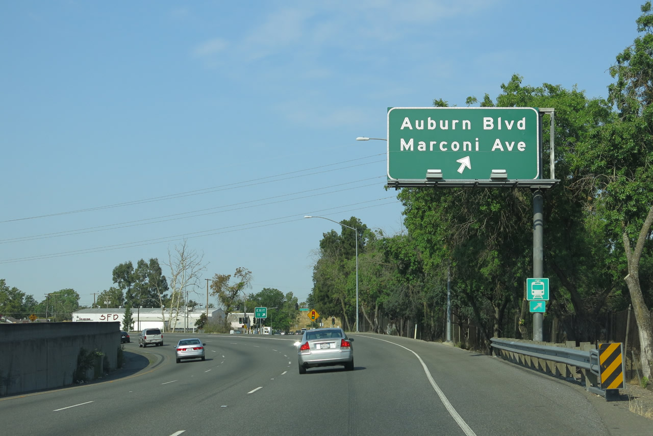 |
Westbound Business Loop I-80 (Capital City Freeway) meets Exit 11, Auburn Boulevard and Marconi Avenue. Upon exiting, the off-ramp directly connects with westbound Auburn Boulevard, which is disconnected from the longer stretch of Auburn Boulevard northeast of here by the Capital City Freeway. Auburn Boulevard overtakes Roseville Road and takes Historic U.S. 40-99E southwest into downtown Sacramento. Photo taken 07/02/13. |
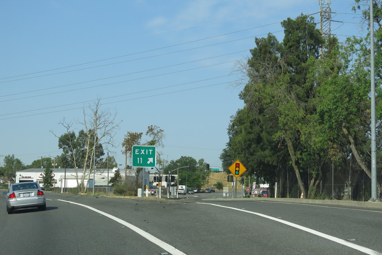 |
The gore point is the only indication that the Auburn Boulevard and Marconi Avenue off-ramp is Exit 11. Marconi Avenue travels east into Carmichael and connects to Arcade Boulevard toward the northwest of here, eventually traveling into a residential area to the west. Photo taken 07/02/13. |
 |
Business Loop I-80 (Capital City Freeway) enters the sharp Marconi Curve, which is frequently cited as a slowing point along the business loop freeway during commuting hours. This curve is another aspect of the sub-standard features of the freeway, which includes a limited sight distance and below-standard speed limit. Business Loop I-80 curves from southwest to south at this point. Photo taken 07/02/13. |
 |
Now briefly traveling due south, Business Loop I-80 (Capital City Freeway) passes under a Pacific Gas and Electric (PG&E) power line and descends to pass below Marconi Avenue. Photo taken 07/02/13. |
 |
Business Loop I-80 (Capital City Freeway) passes under Marconi Avenue with three westbound lanes. Photo taken 07/02/13. |
 |
Curving again toward the southwest, Business Loop I-80 (Capital City Freeway) again gains elevation after passing under Marconi Avenue. While there are three westbound lanes, the shoulder is fairly inadequate due to the limited real estate for the freeway. Photo taken 07/02/13. |
 |
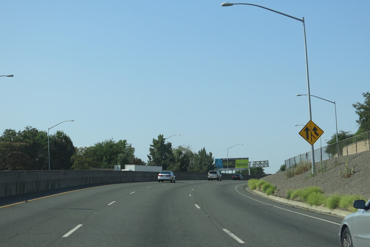
A fourth lane briefly joins Business Loop I-80 west. Normally there should be a reassurance shield for Business Loop I-80, but none is posted here. Photo taken 07/02/13. |
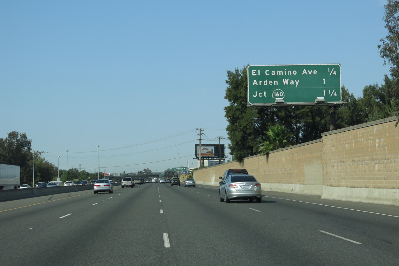 |
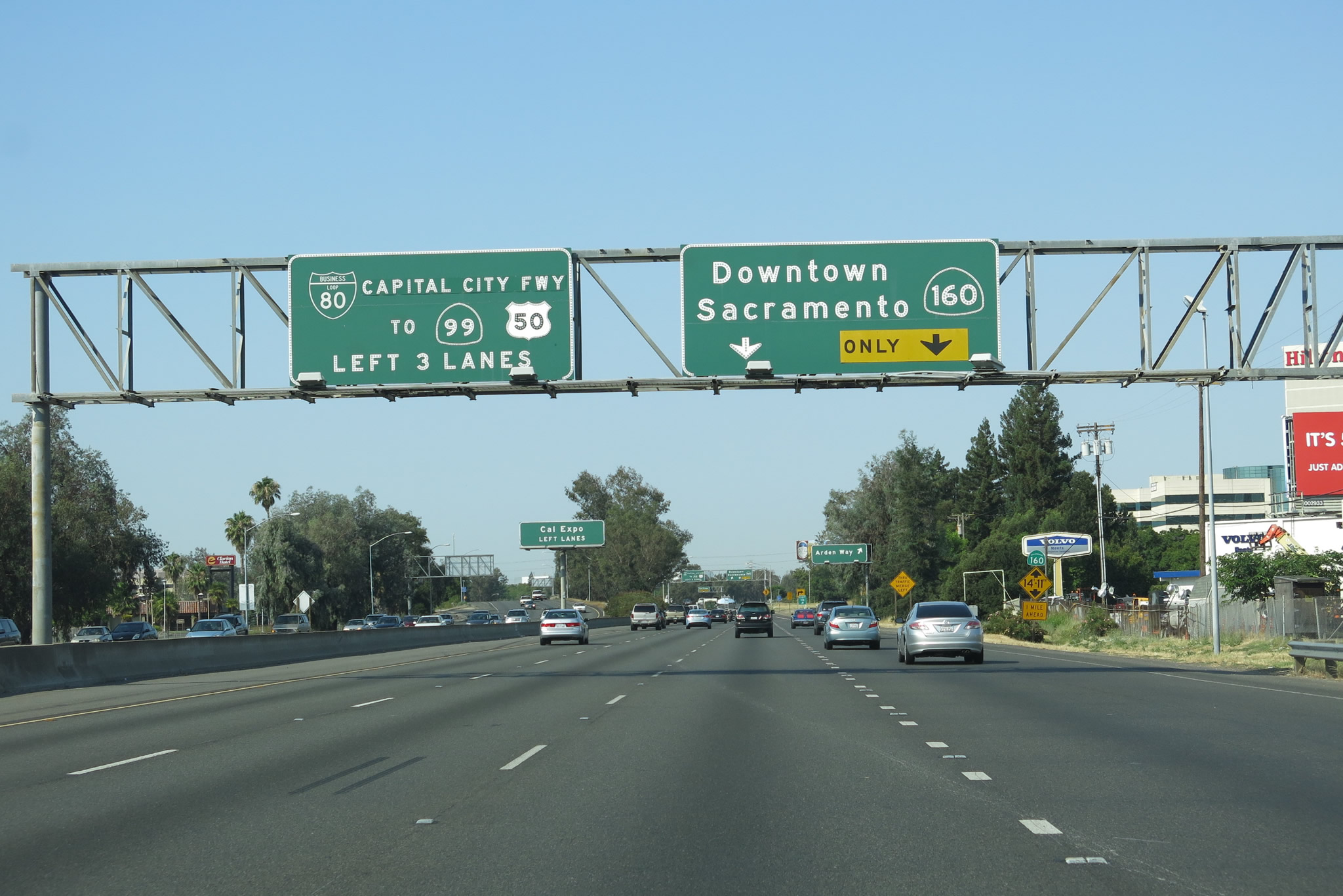
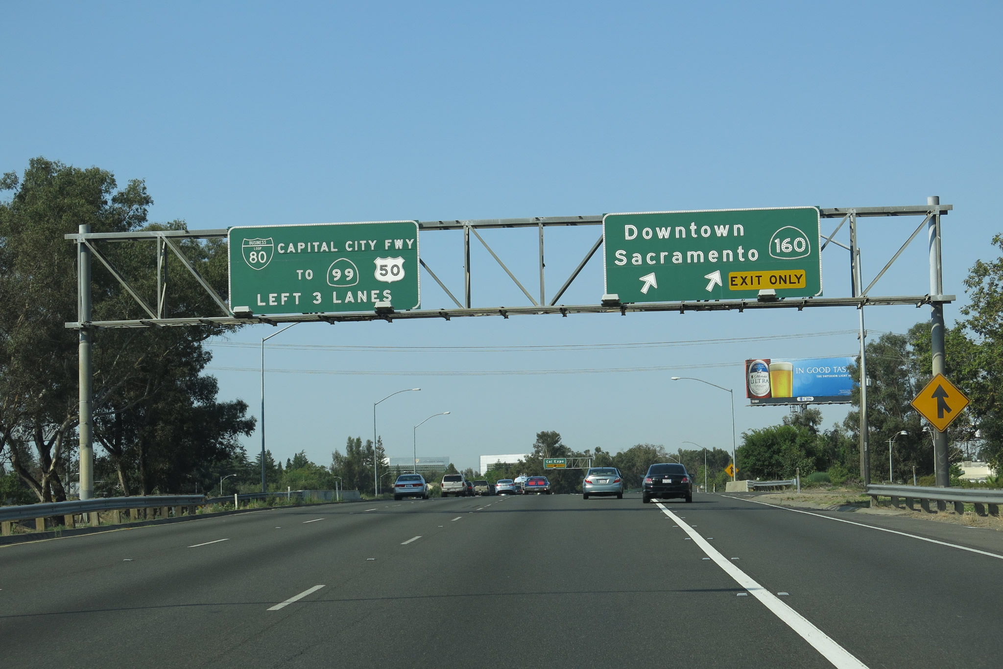
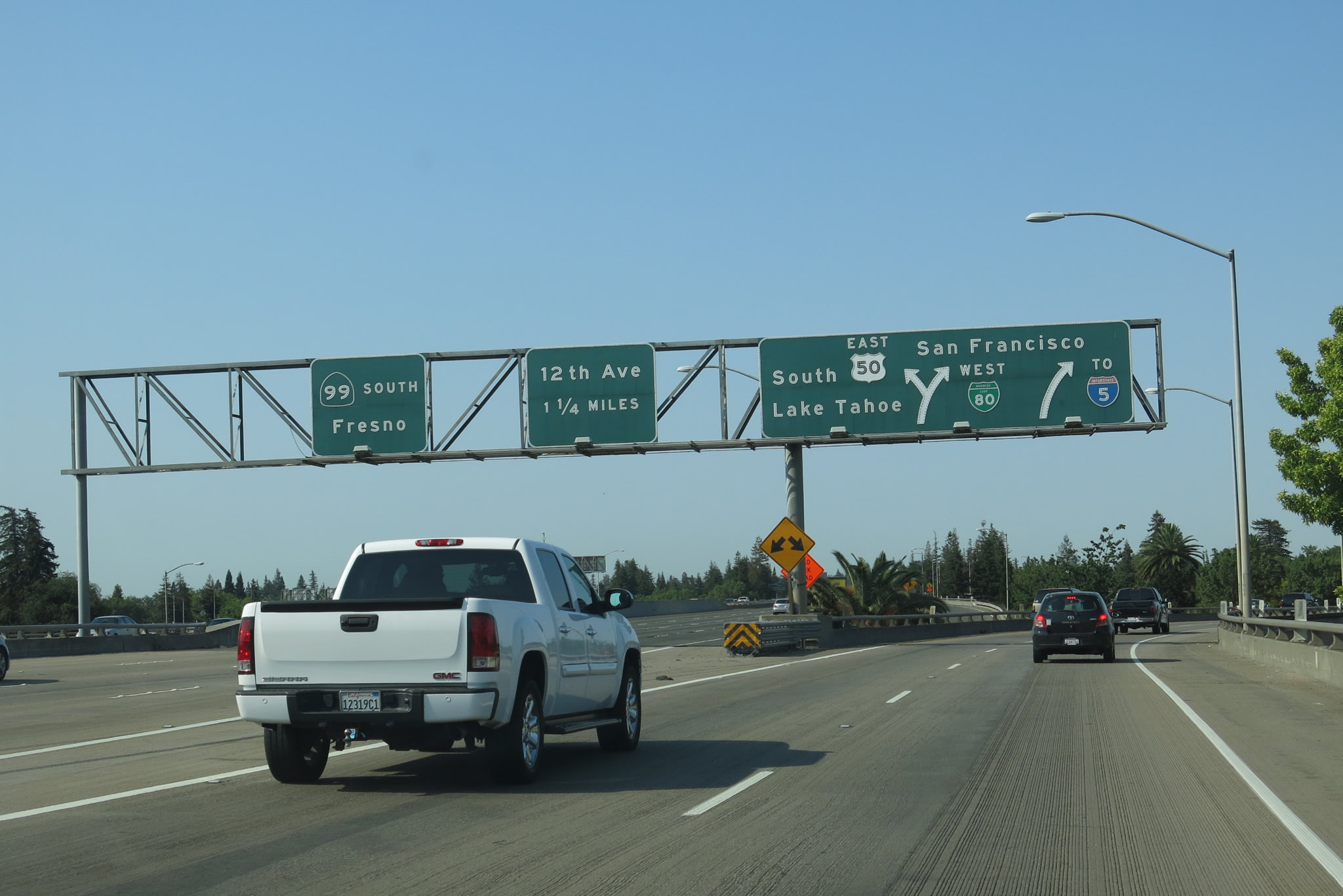
This mileage sign along Business Loop I-80 (Capital City Freeway) west and California 51 south provides the distance to the next three interchanges: Exit 10B, El Camino Avenue; Exit 10A, Arden Way; and Exit 9B, California 160 (North Sacramento Freeway) southwest to downtown Sacramento and the state capitol building via 12th Street south. California 160 is divided into two parts -- this short freeway segment and another, longer segment that travels into the Delta region. Twelfth Street, F Street, 15th Street, Broadway, and Freeport Boulevard were formerly part of a continuous southbound California 160 through downtown Sacramento, but that portion of California 160 was decommissioned in 2003. Today, a separate, southern segment of California 160 begins at Interstate 5 Exit 512 (Pocket Road) and continues south through the Sacramento-San Joaquin Delta to end at California 4 in Antioch. Photo taken 07/02/13. |
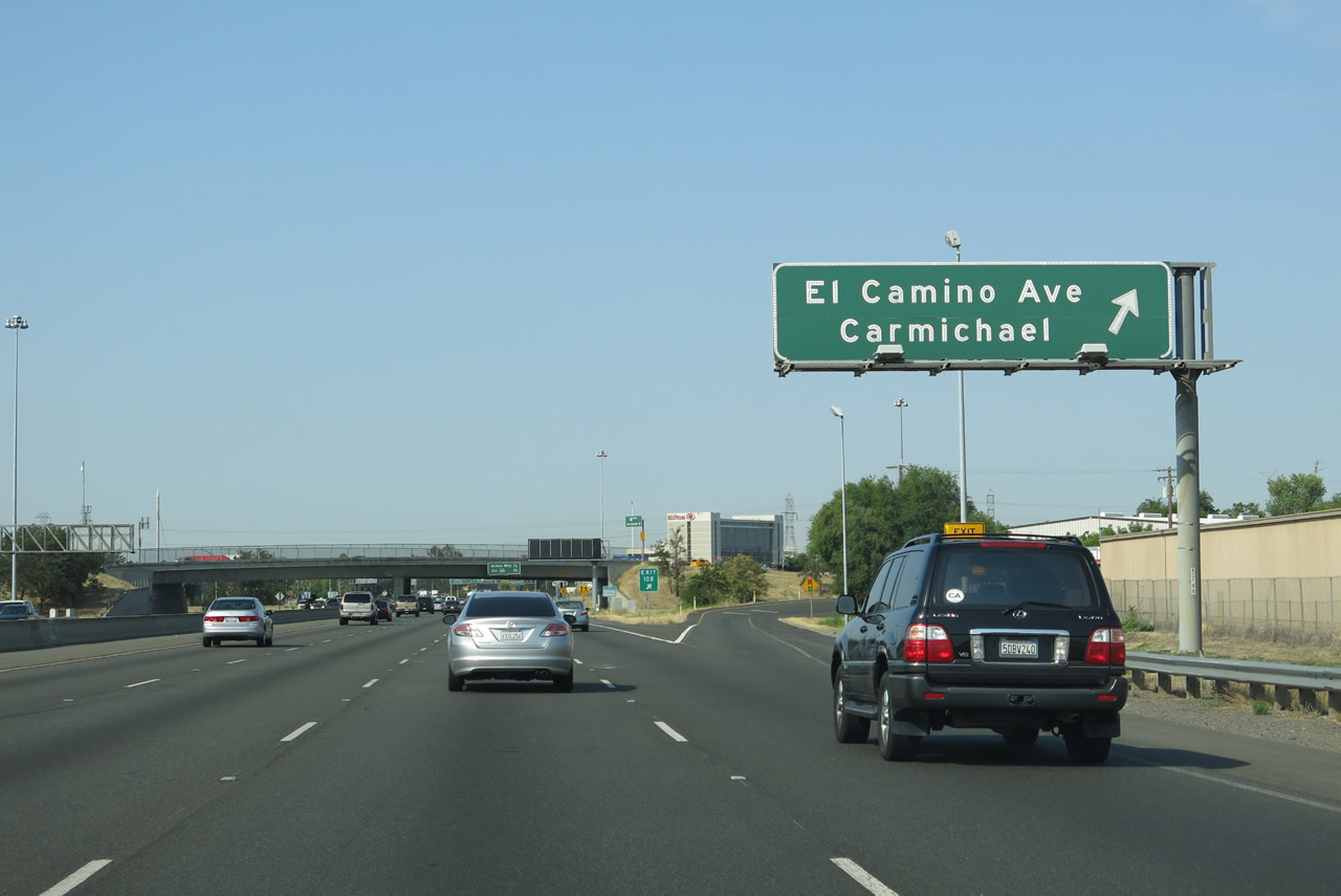 |
Westbound Business Loop I-80 (Capital City Freeway) Exit 10B, El Camino Avenue. Use El Camino Avenue east into Carmichael, an unincorporated community of Sacramento County. Carmichael is home to suburban development and contains most motorist services. To the west, El Camino Avenue leads to the Old North Sacramento, River Gardens, and Natomas communities of the city of Sacramento, connecting to both Interstate 5 and ultimately Interstate 80. Photo taken 07/02/13. |
 |
Business Loop I-80 passes under El Camino Avenue. An interchange sequence sign provides the distance to the next two interchanges: Exit 10A, Arden Way and Exit 9B, California 160 (North Sacramento Freeway) southwest. Notice the overhead sign on westbound El Camino Avenue for Business Loop I-80 and the control city of Sacramento, even though we are currently within Sacramento's city limits. Photo taken 07/02/13. |
 |
After passing under El Camino Avenue, Business Loop I-80 passes under some Sacramento Municipal Utility District (SMUD) overhead power lines. The freeway again widens to four westbound lanes. Photo taken 07/02/13. |
 |
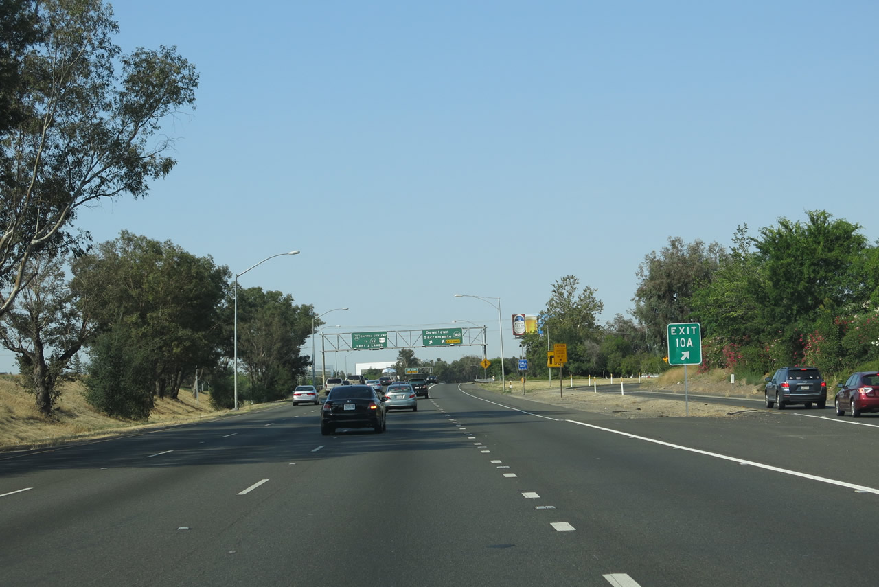
Westbound Business Loop I-80 next approaches Exit 10A, Arden Way, and Exit 9B, California 160 (North Sacramento Freeway) southwest. The left three lanes continue along Business Loop I-80 west and California 51 south. The right two lanes will connect to California 160 southwest. Photo taken 07/02/13. |
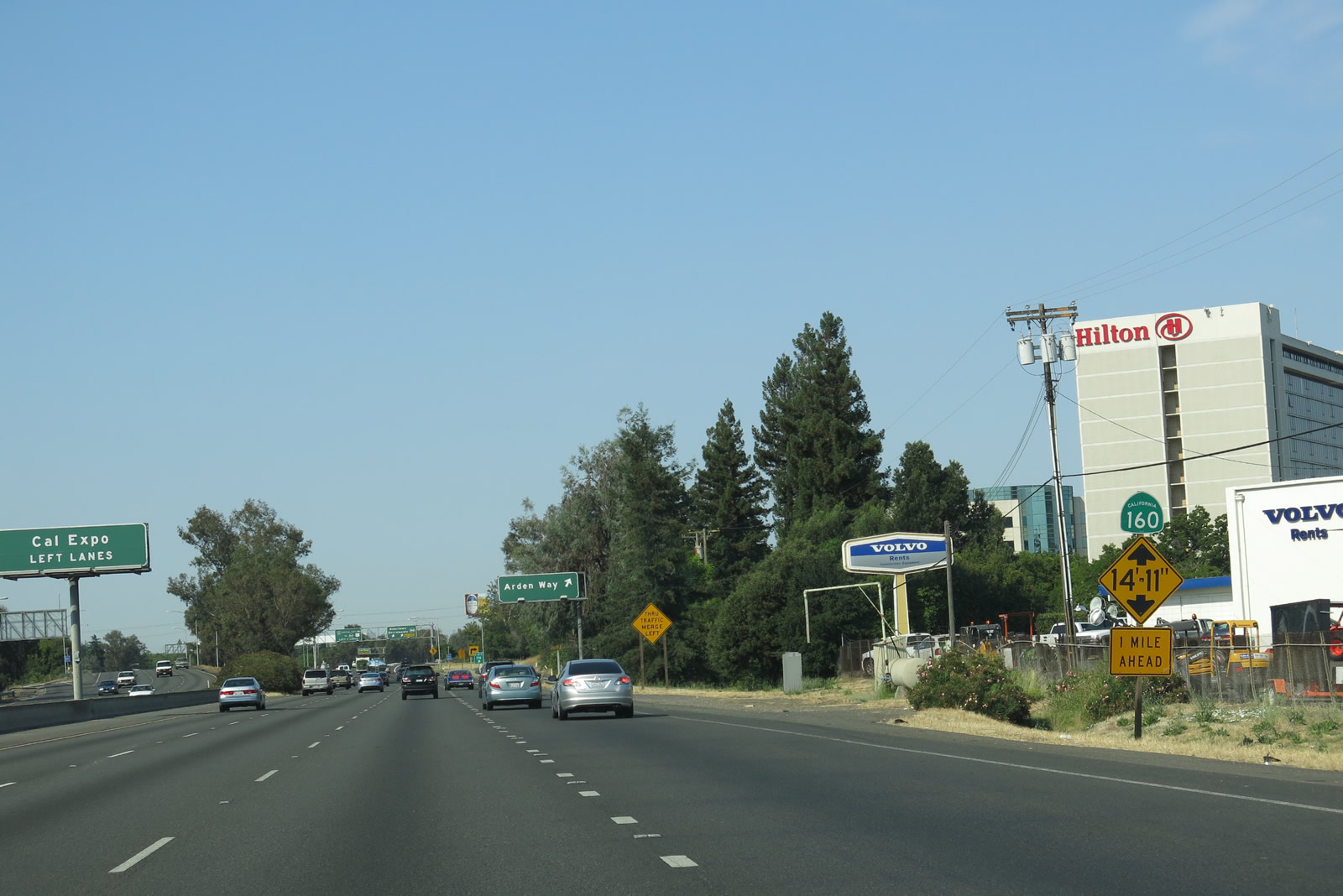 |
Traffic destined for California 160 southwest should note the low-height bridge clearance, while motorists en route to Cal Expo should continue along Business Loop I-80 west to Exit 9A, Exposition Boulevard (third right exit after Arden Way and California 160 southwest). Photo taken 07/02/13. |
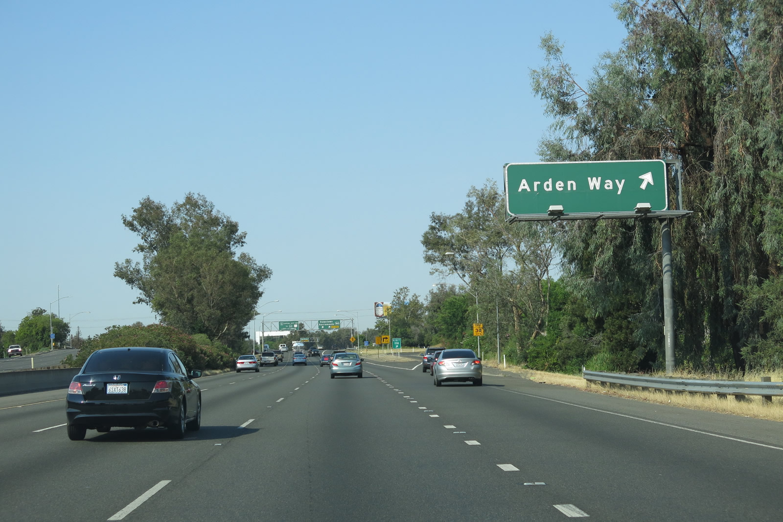 |
Westbound Business Loop I-80 meets Exit 10A, Arden Way. The second right connects to Exit 9B, California 160 (North Sacramento Freeway) southwest. Photo taken 07/02/13. |
 |
A single lane connects to Arden Way. Use Arden Way southeast to Arden Fair, a major regional shopping center with several ancillary strip malls and related shopping areas. From there, Arden Way leaves the city of Sacramento at Ethan Way and continues east into Arden-Arcade, an unincorporated community of Sacramento County. Arden-Arcade had a population of 92,186 as of the 2010 Census. A vote to incorporate Arden-Arcade as a city failed in 2010; it is possible that future efforts to incorporate may ensue. Photo taken 07/02/13. |
 |
Westbound Business Loop I-80 meets Exit 9B, California 160 (North Sacramento Freeway) southwest. The left three lanes carry Business Loop I-80 west, while the right two lanes depart onto California 160. The North Sacramento Freeway extends for about two miles, ending at the American River crossing where it meets the Richards Boulevard traffic signal. From that point, southbound traffic takes 12th Street, while northbound traffic uses 16th Street. Between Richards Boulevard and downtown Sacramento, southbound traffic must use 12th Street, L Street, and 15th Street while northbound traffic remains only on 16th Street. Photo taken 07/02/13. |
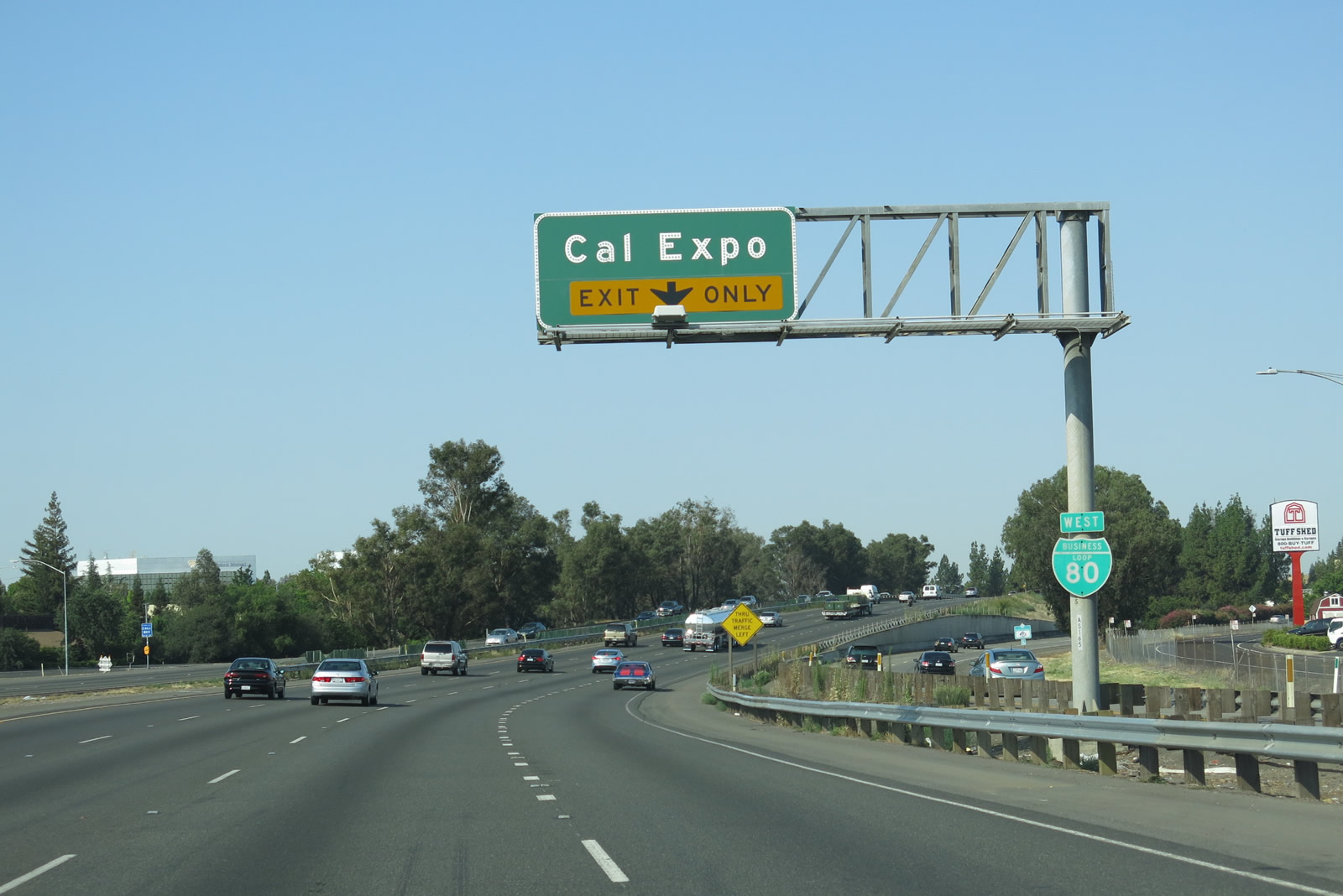 |
Leaving the California 160 split, westbound Business Loop I-80 next approaches Exit 9A, Exposition Boulevard to Cal Expo, home of the annual California State Fair. A business loop route marker is posted below the exit only guide sign for Exit 9A. Photo taken 07/02/13. |
 |
The right lane of westbound Business Loop I-80 becomes exit only for Exit 9A, Exposition Boulevard to Cal Expo. To the right in this picture, you can see a guide sign on California 160 for Exit 47B, Royal Oaks Drive. Photo taken 07/02/13. |
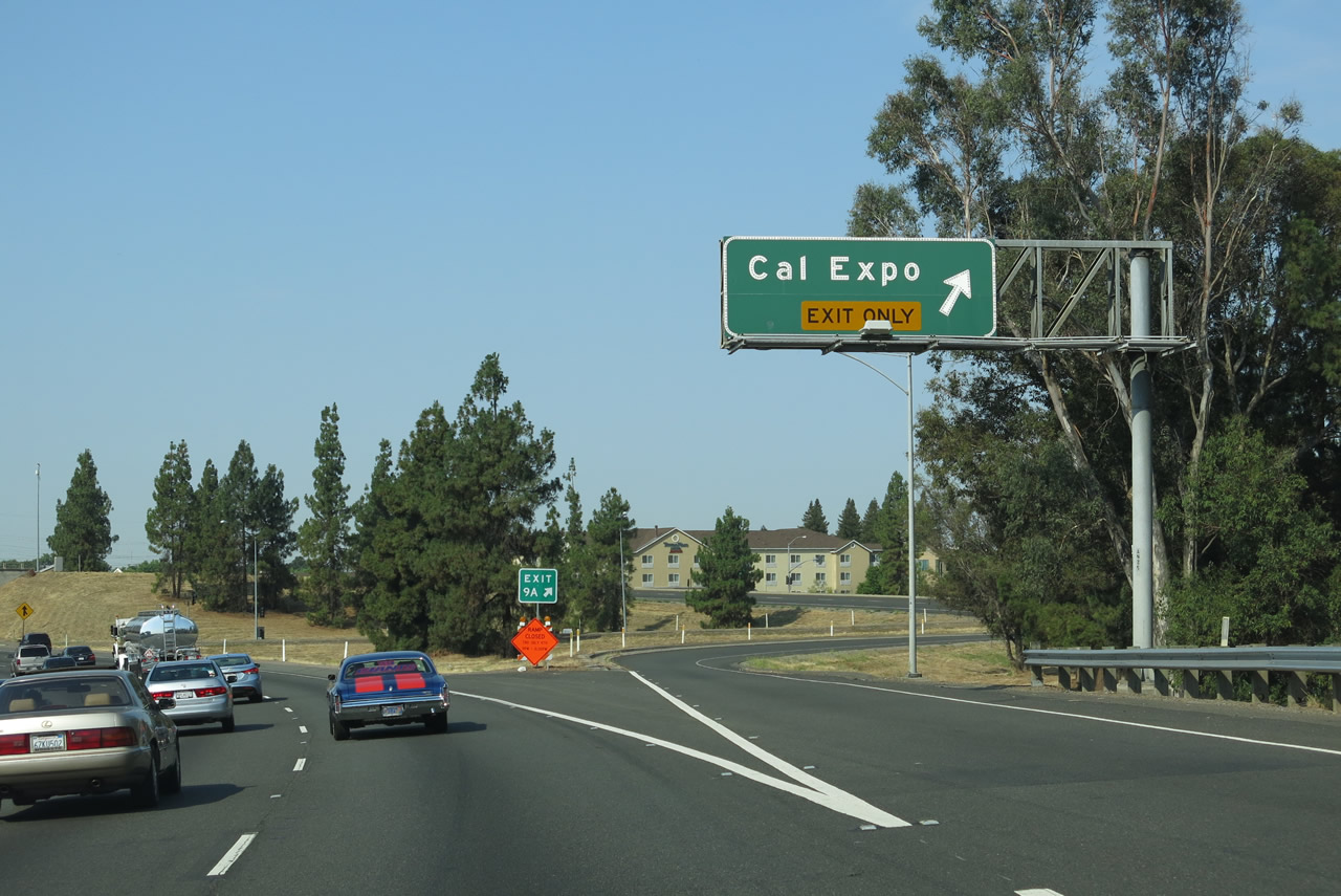 |
Westbound Business Loop I-80 meets Exit 9A, Exposition Boulevard to Cal Expo. Exposition Boulevard is an east-west arterial that travels east to Cal Expo and Arden-Arcade, ending at the confluence of Arden Way, Ethan Way, and Exposition Boulevard. To the west, Exposition Boulevard connects back to California 160 (North Sacramento Freeway). Photo taken 07/02/13. |
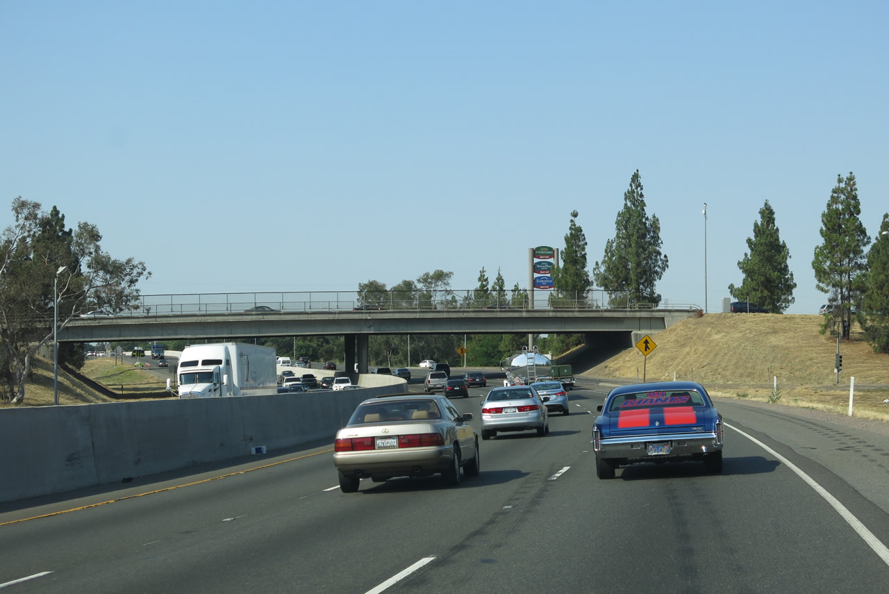 |
Busy traffic ensues as Business Loop I-80 west passes under Exposition Boulevard and onward toward the American River crossing. Photo taken 07/02/13. |
 |
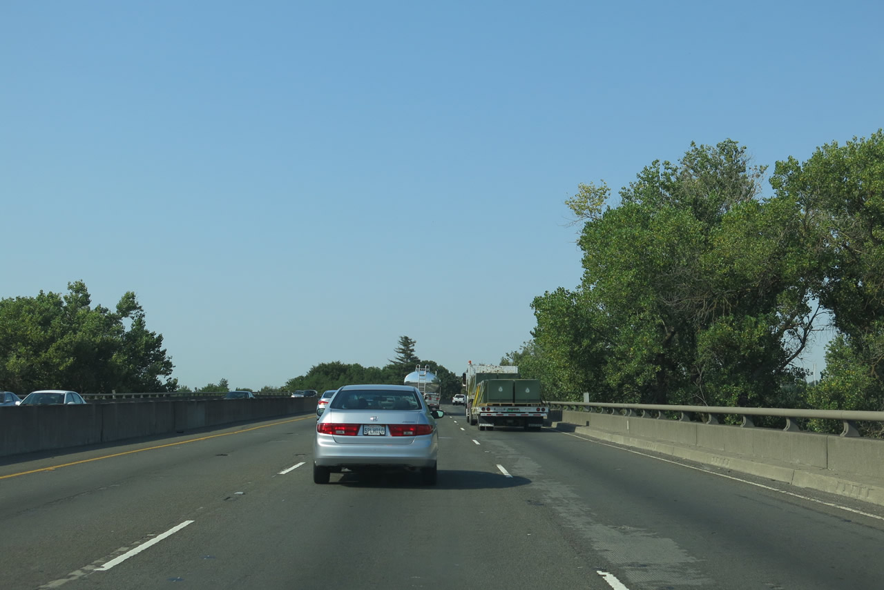
After the Exposition Boulevard interchange, a Business Loop I-80 west reassurance shield appears. The next off-ramp is not until Exit 7B, a bit more than a mile from here. Photo taken 07/02/13. |
 |
 |
 |
 |
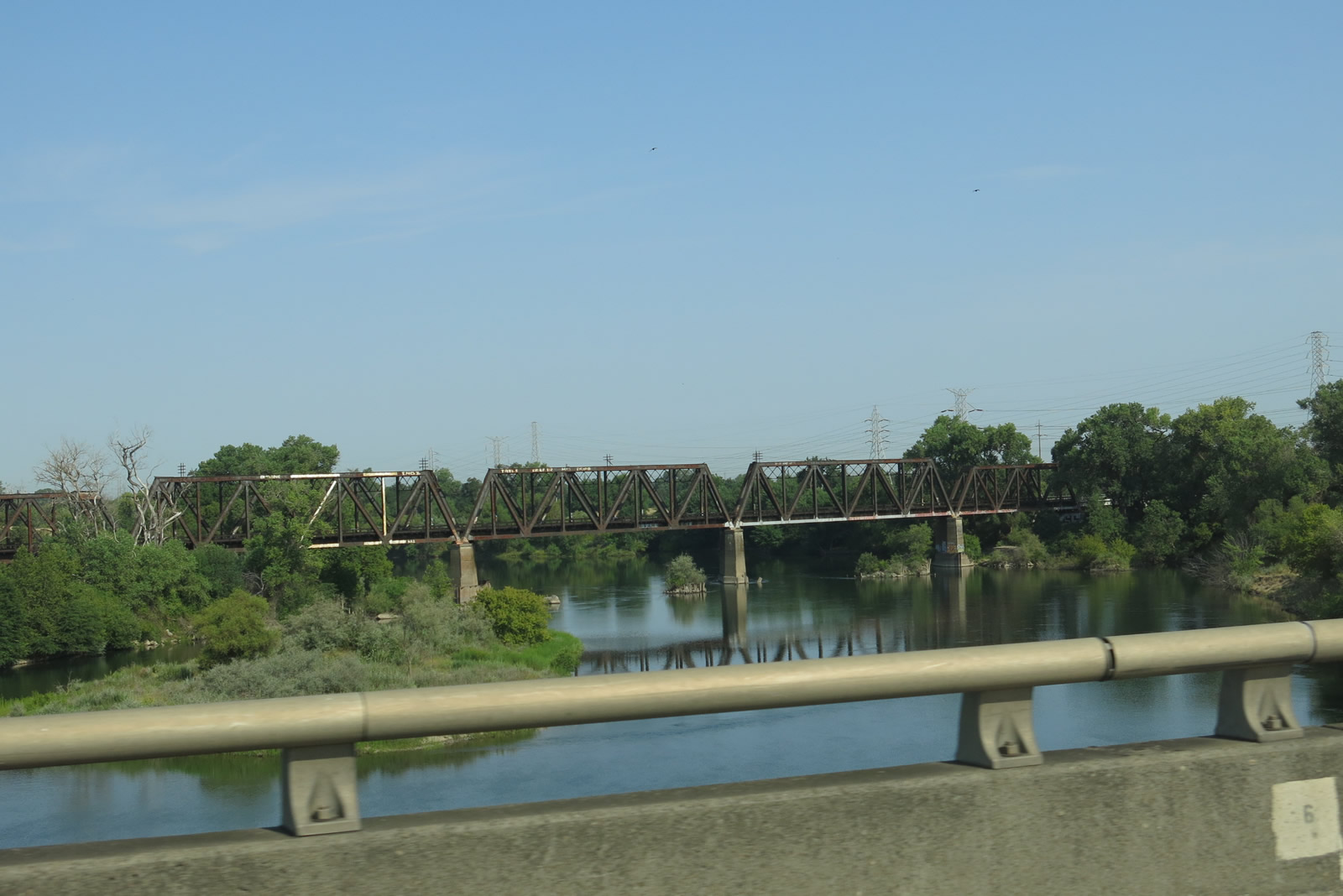 |
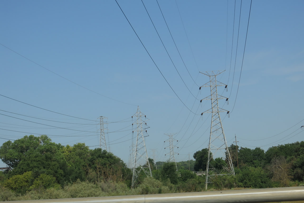
| Business Loop I-80 and California 51 cross the American River on a pair of bridges that were built in 1954 and 1966. The original expressway that was first built on this alignment was constructed in 1954 to bypass Auburn Boulevard as part of U.S. 40-99E. The bridge over American River was part of this initial construction, and widening of the bridge occurred thereafter, notably in 1966. Note the nonexistent shoulders and narrow placement of the three through traffic lanes. More Western Area Power Administration, Sacramento Municipal Utility District, and Pacific Gas and Electric power lines cross over the Capital City Freeway. A look to the west reveals a railroad truss bridge crossing seemingly placid waters. Photo taken 07/02/13. | ||||
 |
Business Loop I-80 and California 51 descend from the American River bridge and proceed into Sutter's Landing Regional Park, which is currently undeveloped (with plans for eventual park improvements). Photo taken 07/02/13. |
 |
A pair of railroad bridges cross over Business Loop I-80 (Capital City Freeway). Photo taken 07/02/13. |
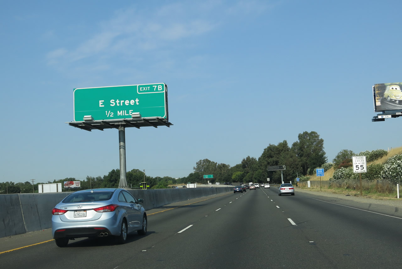 |
The next exit along Business Loop I-80 (Capital City Freeway) west and California 51 south is Exit 7B, E Street (0.50 mile). Photo taken 07/02/13. |
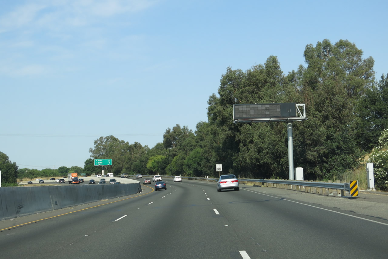 |
A dynamic message sign is posted shortly thereafter along Business Loop I-80 (Capital City Freeway). Photo taken 07/02/13. |
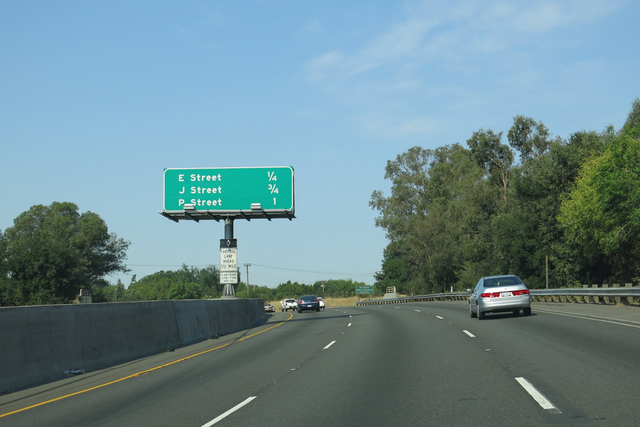 |
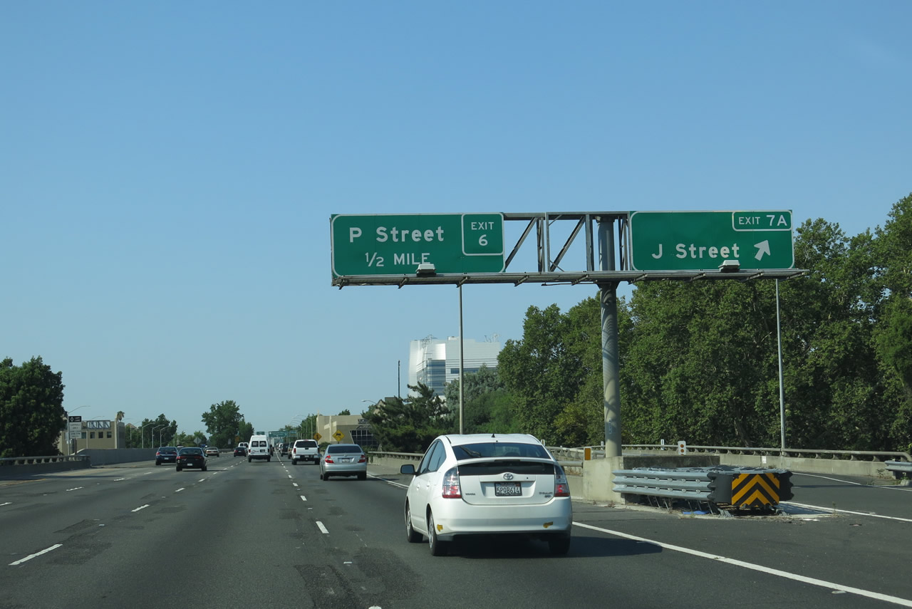
This interchange sequence sign along Business Loop I-80 (Capital City Freeway) west and California 51 south provides the distance to the next three off-ramps: Exit 7B, E Street; Exit 7A, J Street; and Exit 6C, P Street. Photo taken 07/02/13. |
 |
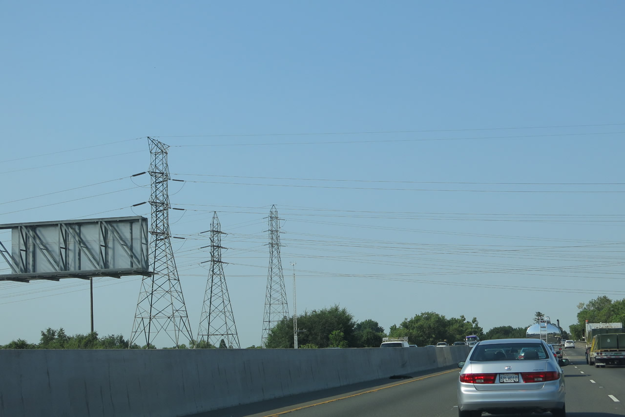
A high occupancy vehicle (carpool) lane begins just ahead. Business Loop I-80 (Capital City Freeway) west and California 51 south pass under a road bridge that appears to no longer be in use (or is at least constrained to official/authorized use only). The Capital City Freeway curves through the remainder of Sutter's Landing Regional Park. Ahead, Business 80 will ascend onto the 29th-30th Viaduct, which was built in 1966-1968 (unlike the 1954 U.S. 40 and U.S. 99E/Elvas Freeway). Photo taken 07/02/13. |
 |
The second bridge carries a railroad over the business loop freeway. Photo taken 07/02/13. |
 |
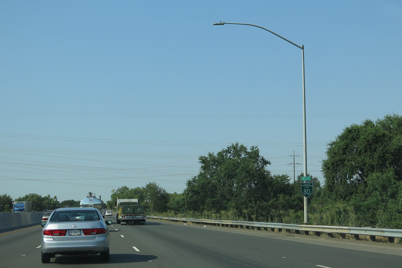
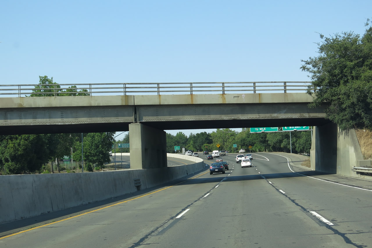
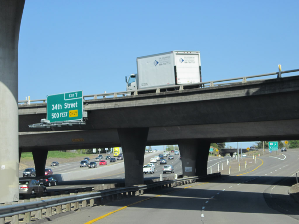
Westbound Business Loop I-80 meets Exit 7B, E Street. Shortly after this off-ramp, Business Loop I-80 will ascend onto the 29th-30th Street Freeway, which is initially above grade and eventually becomes a viaduct. The 29th-30th Freeway is named for the city streets that parallel the viaduct. Interstate 305, which was assigned in 1982 for all portions of Former Interstate 80 that met Interstate standards at that time, begins at the point where Business Loop I-80 crosses C Street. That point is right after the gore point for Exit 7B (even though C Street itself does not cross over nor interchange with the freeway). So it's fair to say that Interstate 305 begins at this point. Photo taken 07/02/13. |
| Business Loop I-80 (Interstate 305) west & California 51 south | |
|---|---|
 |
Use Exit 7A for 29th Street south to L Street west to the California State Capitol. Motorists would not use J Street, since it is one-way eastbound. L Street is one-way westbound, and it travels about 15 blocks west to the Capitol Park. The capitol building is located at the west end of Capitol Park, which is bounded by 10th Street, L Street, 15th Street, and N Street. West of Capitol Park and the state capitol building is Capitol Mall, which follows former California 275 from 10th Street to the Tower Bridge over the Sacramento River. Photo taken 07/02/13. |
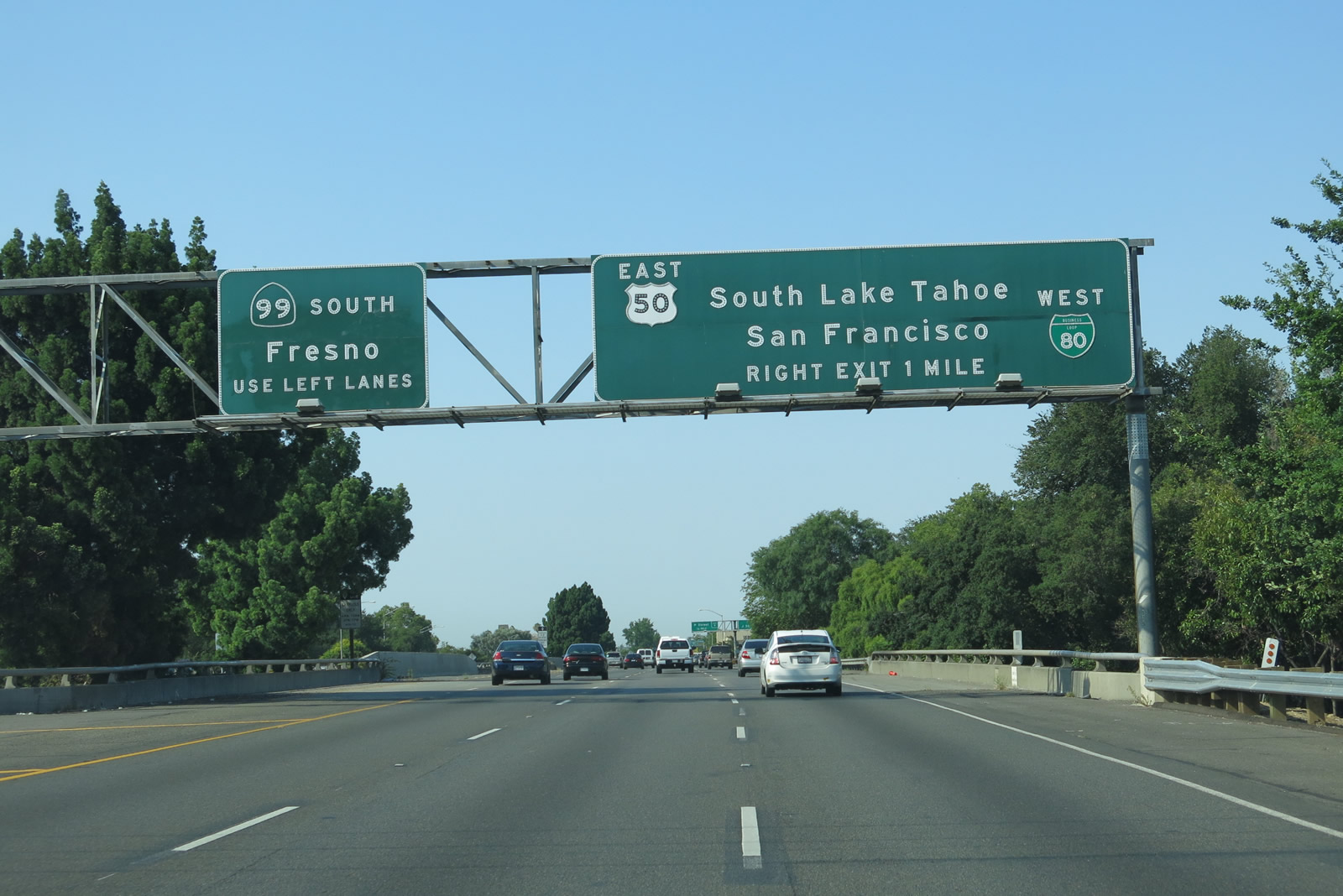 |
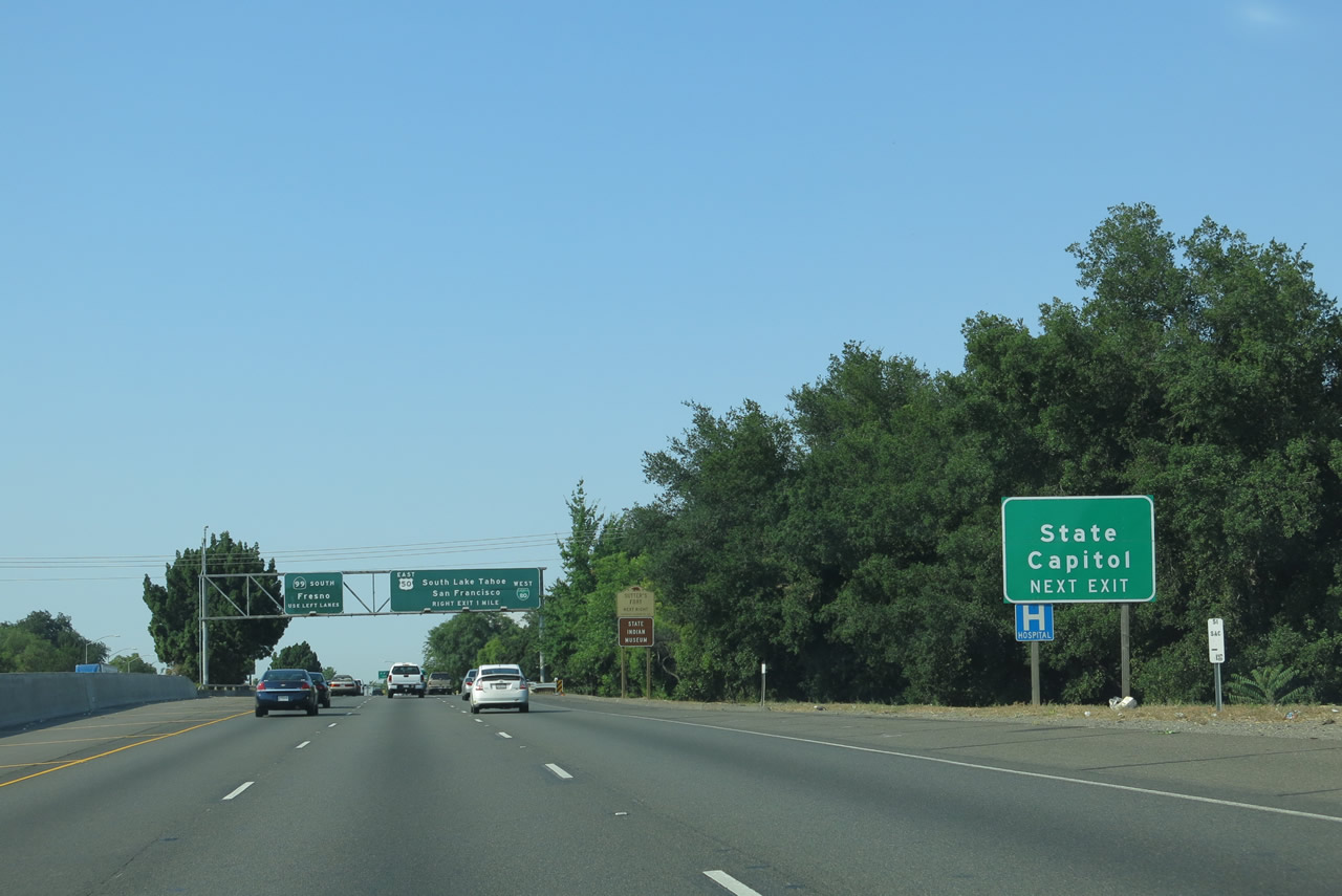
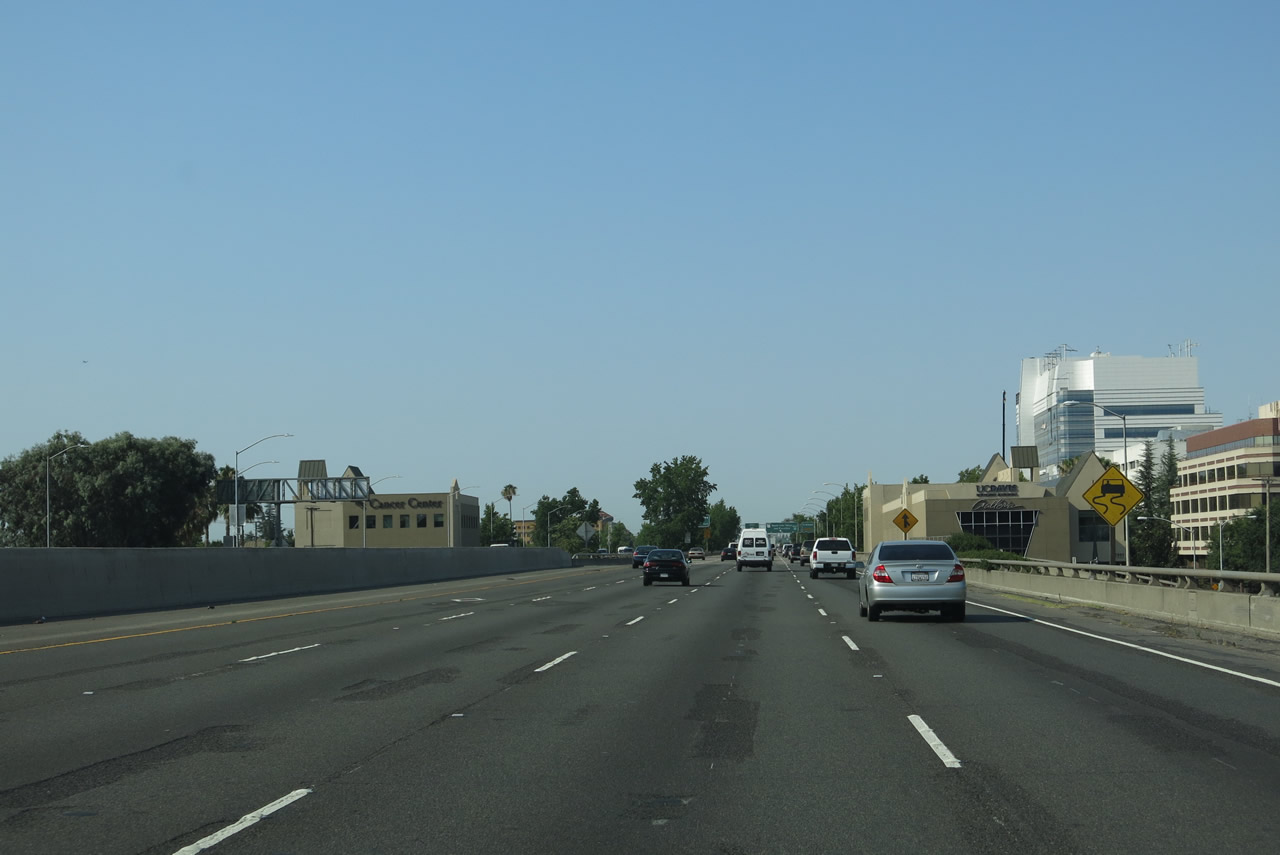
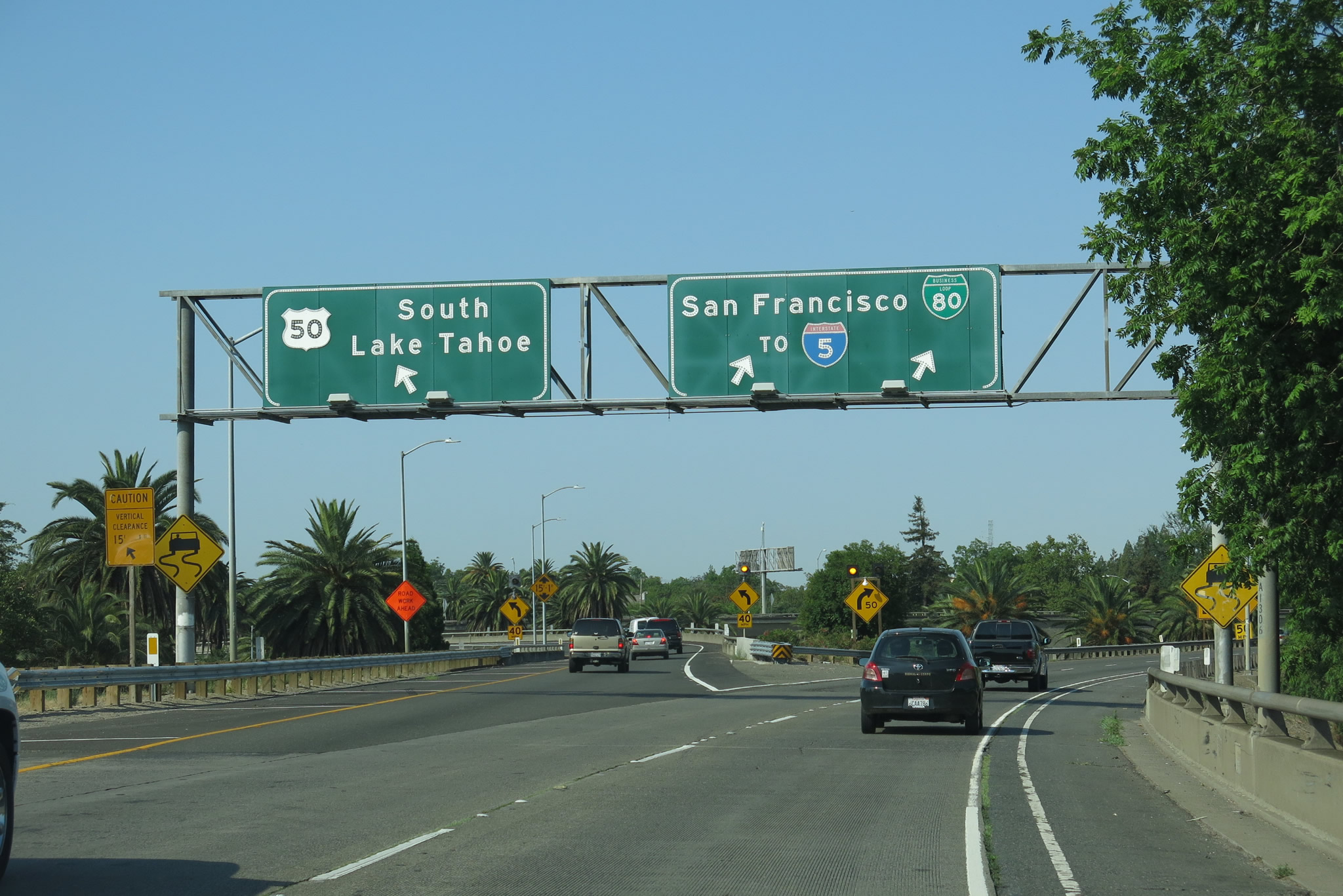
Looking ahead, Business Loop I-80 and Interstate 305 approach its confluence with U.S. 50 and California 99. For westbound travelers, the left lanes will connect to California 99 south to Stockton, Modesto, and Fresno. The right lanes will transition to both U.S. 50 east to South Lake Tahoe and Business Loop I-80 and U.S. 50 west to San Francisco. Photo taken 07/02/13. |
 |
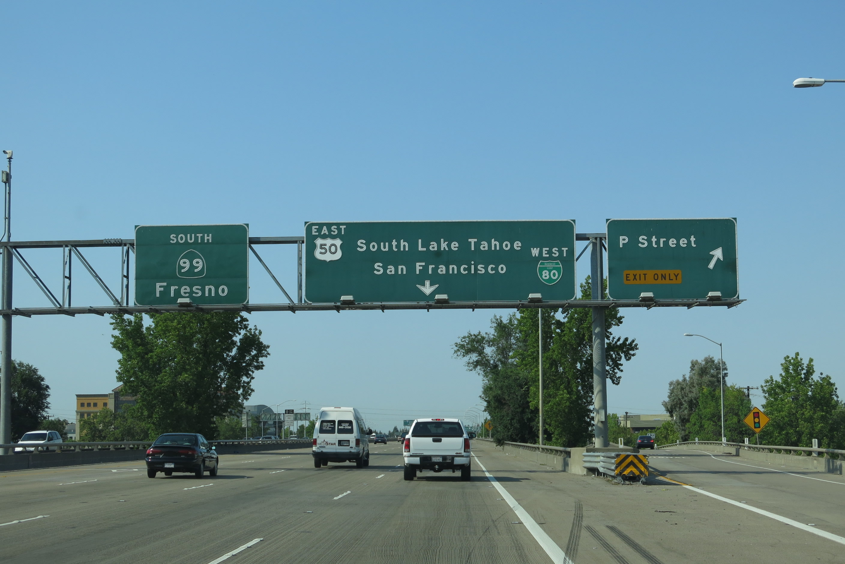
Westbound Business Loop I-80 meets Exit 7A, J Street. The following off-ramp will be Exit 6C, P Street. (Note the guide sign lists this off-ramp as "Exit 6," but Exits 6B-A are assigned to the California 99 and U.S. 50 connections, respectively. Photo taken 07/02/13. |
 |
Ascending onto the viaduct, Business Loop I-80 and Interstate 305 carry four westbound lanes including the high occupancy vehicle (carpool) lane. Photo taken 07/02/13. |
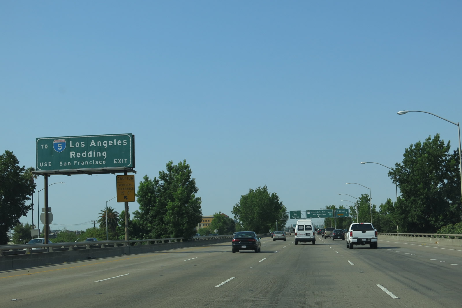 |
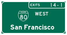
For Interstate 5 south to Los Angeles, follow Business Loop I-80 and U.S. 50 west (described on this sign as the "San Francisco exit"). Photo taken 07/02/13. |
 |
Still on the elevated viaduct, westbound Business Loop I-80 and Interstate 305 connect to Exit 6C, P Street. This off-ramp also links to 29th Street, which is the frontage road on the west side of the freeway. Photo taken 07/02/13. |
 |
Meanwhile, the Capital City Freeway is rapidly approaching the turbine interchange between the 29th-30th viaduct and the WX viaduct, where the business route will meet California 99 and U.S. 50. Although not signed on many of these approach signs, westbound Business Loop I-80 also carries westbound U.S. 50 and northbound California 99. Photo taken 07/02/13. |
 |
Westbound Business Loop I-80 (Capital City Freeway) splits with Exit 6B, California 99 south to Stockton, Modesto, Fresno, and Bakersfield. Business Loop I-80 westbound traffic must stay right to transition from the 29th-30th Freeway onto the WX Freeway/Camellia City Viaduct (and leaves behind California 51). Although not signed here, the Capital City Freeway follows westbound Business Loop I-80 onto this transition ramp. Exit 6B is the left exit for southbound California 99, which has more "exiting" lanes than the mainline! This marks the southern terminus of California 51. Photo taken 07/27/12. |
| Business Loop I-80 (Interstate 305) west | |
 |
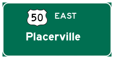
Immediately after splitting from California 51 and California 99, westbound Business Loop I-80 meets Exit 6A, U.S. 50 (El Dorado Freeway) east. U.S. 50 heads due east through the foothills, travels over the Sierra Nevada at Echo Pass, and leaves California as it skirts the south shore of sapphire Lake Tahoe. Although not signed here, Business Loop I-80 (and Interstate 305) west is also technically part of U.S. 50 west. Northbound California 99 slides onto the WX as well, but signage on the freeway has deemphasized this additional route. In a way, California 16 is also merged through here (along U.S. 50), but it is better to think of California 16 in two segments that are separated by Interstate 5 and U.S. 50 from Woodland to Sacramento. Photo taken 07/27/12. |
 |
 |
 |
 |
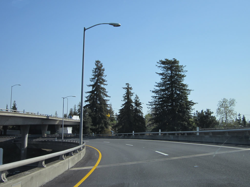
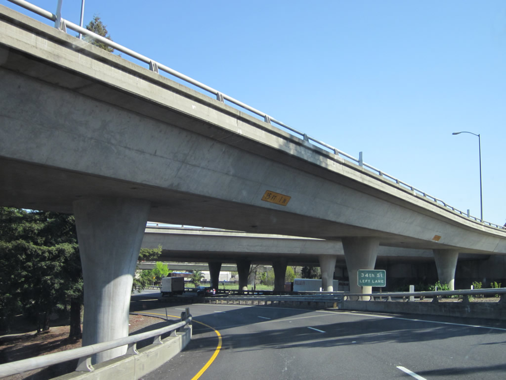
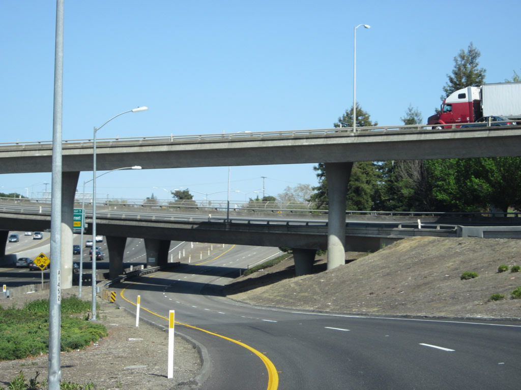
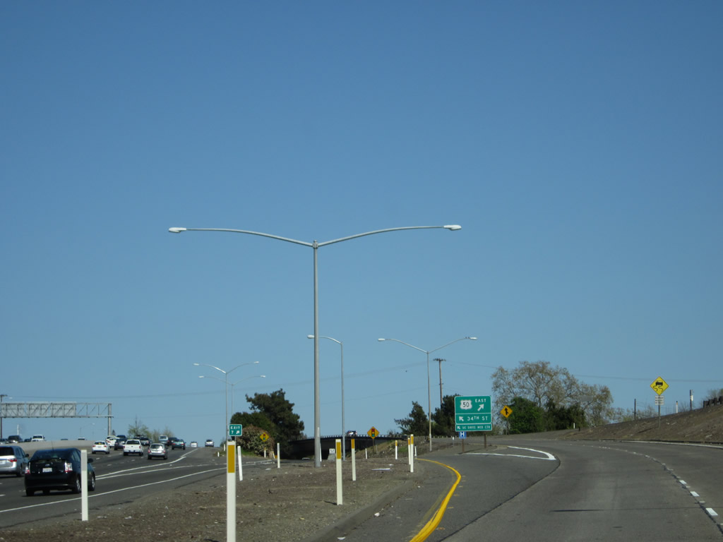
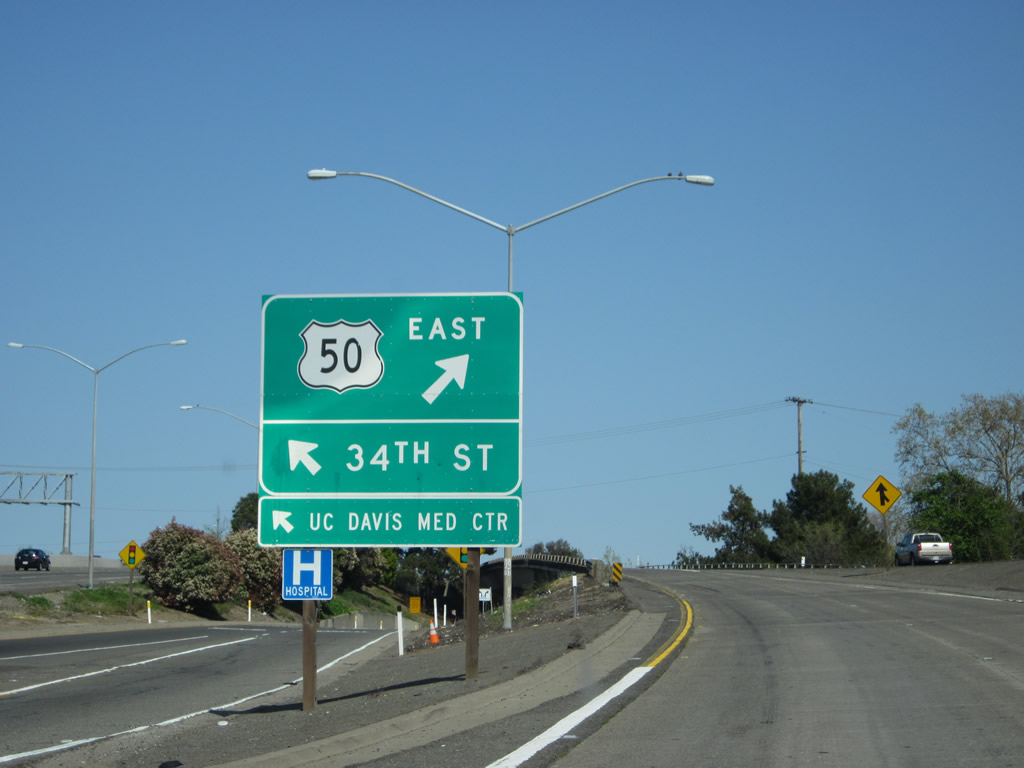
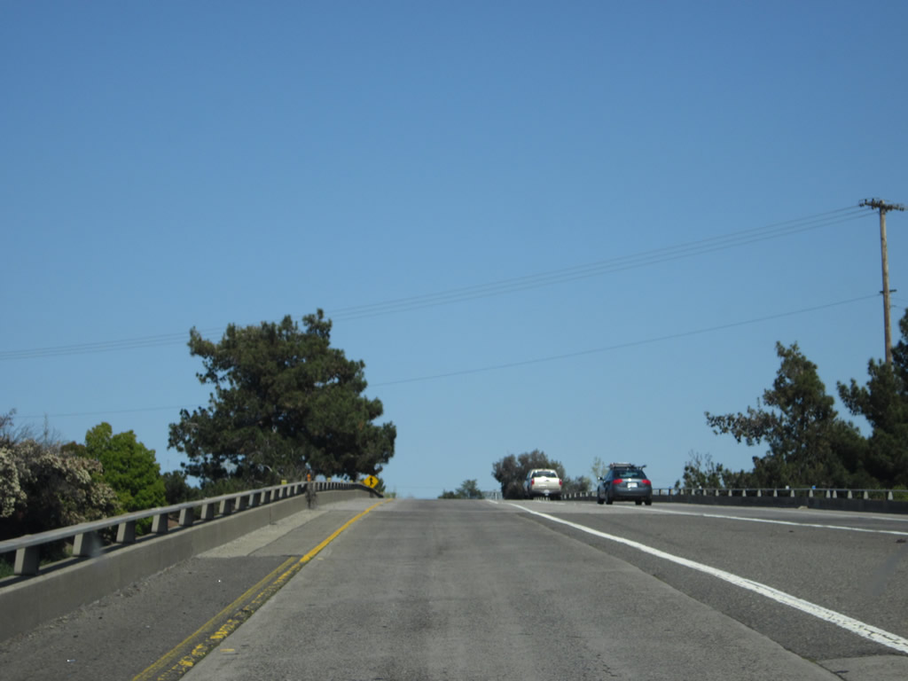
| This series of pictures follows the transition ramp from Business Loop I-80 (Capital City Freeway) west to Exit 6A, U.S. 50 (El Dorado Freeway) east to South Lake Tahoe. The connection is a bit convoluted due to its route through the massive turbine interchange. The two-lane ramp has a dedicated off-ramp to 34th Street as shown here. Photos taken 04/12/12. | |||
 |
 |
 |
|

Page Updated July 30, 2013.
|
About Contact Glossary |
In The News Interstate Guide |
Social Media:
 |
|
© 2000-25 AARoads.com | All Rights Reserved | Privacy Policy / Terms of Use
|
||