
California 1 North - Santa Cruz County
| California 1 north | |
|---|---|
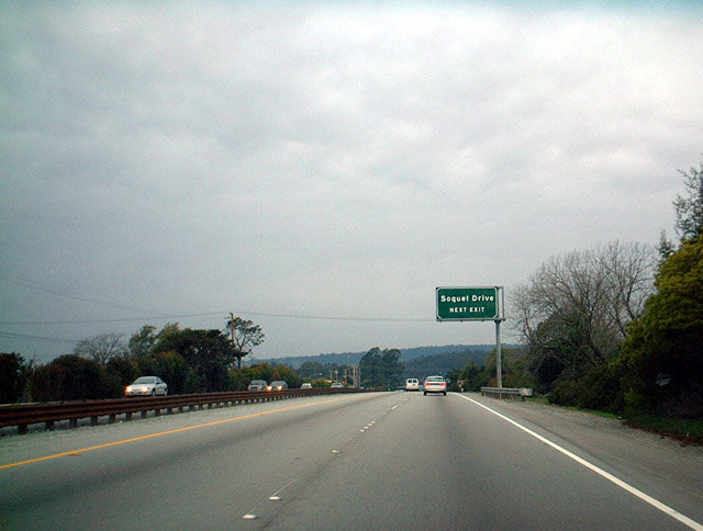 |
Now many miles north of the previous photograph, this picture shows northbound California 1 approaching Exit 420, Soquel Road, just southeast of Santa Cruz. The section of California 1 between California 152 and Santa Cruz is one of the longest stretches of continuous freeway for California 1 along its coastline journey. This highway primarily facilitates traffic between the Bay Area, Santa Cruz, and the Monterey Peninsula. Photo taken 12/27/01. |
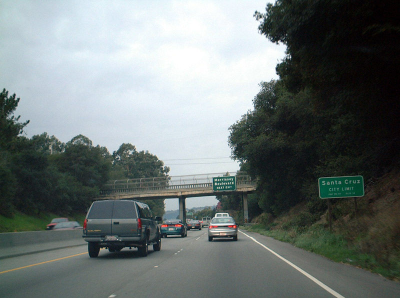 |
Northbound California 1 entering Santa Cruz, home of the University of California-Santa Cruz banana slugs. There is certainly nothing ethnically biased about that mascot! The next exit is Exit 421, Morrisey Boulevard. Photo taken 12/27/01. |
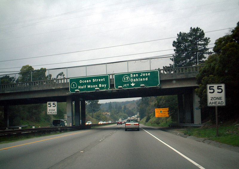 |
Northbound California 1 approaching Exit 422, California 17. California 17 is the main route from Santa Cruz north to San Jose and the Bay Area. It is a narrow, four-lane expressway, with freeway standards at its southern and northern ends. The mountainous portions of California 17 can be treacherous, especially in fog or rain. California 17 used to be a much longer route, continuing north as a freeway from San Jose to Oakland and San Rafael. This routing has been replaced by Interstate 880 and Interstate 580. Photo taken 12/27/01. |
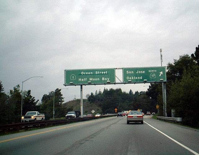 |
Northbound California 1 meets Exit 422, California 17. After this interchange, which was reconstructed in 2008, California 1 will quickly lose its freeway status; it is a divided highway by the time it reaches California 9. The control city changes to Half Moon Bay, a scenic hamlet on the Pacific coast 52 miles north of here via California 1. Half Moon Bay remains underdeveloped due to its relatively remote location in relation to the rest of the San Francisco Bay Area. Photo taken 12/27/01. |

Page Updated June 29, 2009.
|
About Contact Glossary |
In The News Interstate Guide |
Social Media:
 |
|
© 2000-25 AARoads.com | All Rights Reserved | Privacy Policy / Terms of Use
|
||