
California 1 South - Los Angeles County
| California 1 (Pacific Coast Highway) south | |
|---|---|
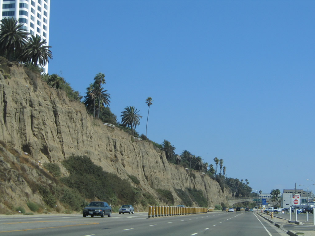 |
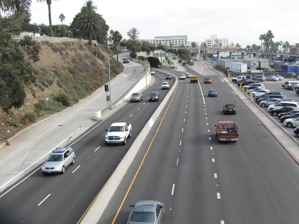
Traveling south on California 1 (Pacific Coast Highway), the Palisades rise to the east in the city of Santa Monica. Ahead, California 1 will connect to Interstate 10 after passing through the McClure Tunnel. Santa Monica had a population of 84,084 people as of the 2000 Census and was incorporated on November 30, 1886. The city is a well-known tourist destination with the famous Santa Monica Pier, Palisades Park on a coastal bluff, the west end of Historic U.S. 66 at the intersection of Lincoln Boulevard and Olympic Boulevard (near today's Interstate 10 and California 1 interchange), and shopping at the Third Street Promenade. Palisades Park, with its incredible evening views of the sunset, sits atop the cliffs seen on the east side of California 1 (Pacific Coast Highway). The highway travels alongside the beach, with parking lots located on the west side of the highway. Photo taken 08/24/04. |
 |
An exit along California 1 (Pacific Coast Highway) south connects to Coast Avenue in Santa Monica. The left two lanes will connect to Interstate 10 (Santa Monica Freeway) east and California 1 (Lincoln Boulevard) south to Venice and Marina del Rey. This is the first advance signage for Interstate 10 seen on California 1 south in Santa Monica. Photo taken 08/24/04. |
 |
The on-ramp from Ocean Avenue north to California 1 (Pacific Coast Highway) north in Santa Monica features old concrete paving. This view looks south from a pedestrian bridge toward the McClure Tunnel. Photo taken 11/11/09. |
 |
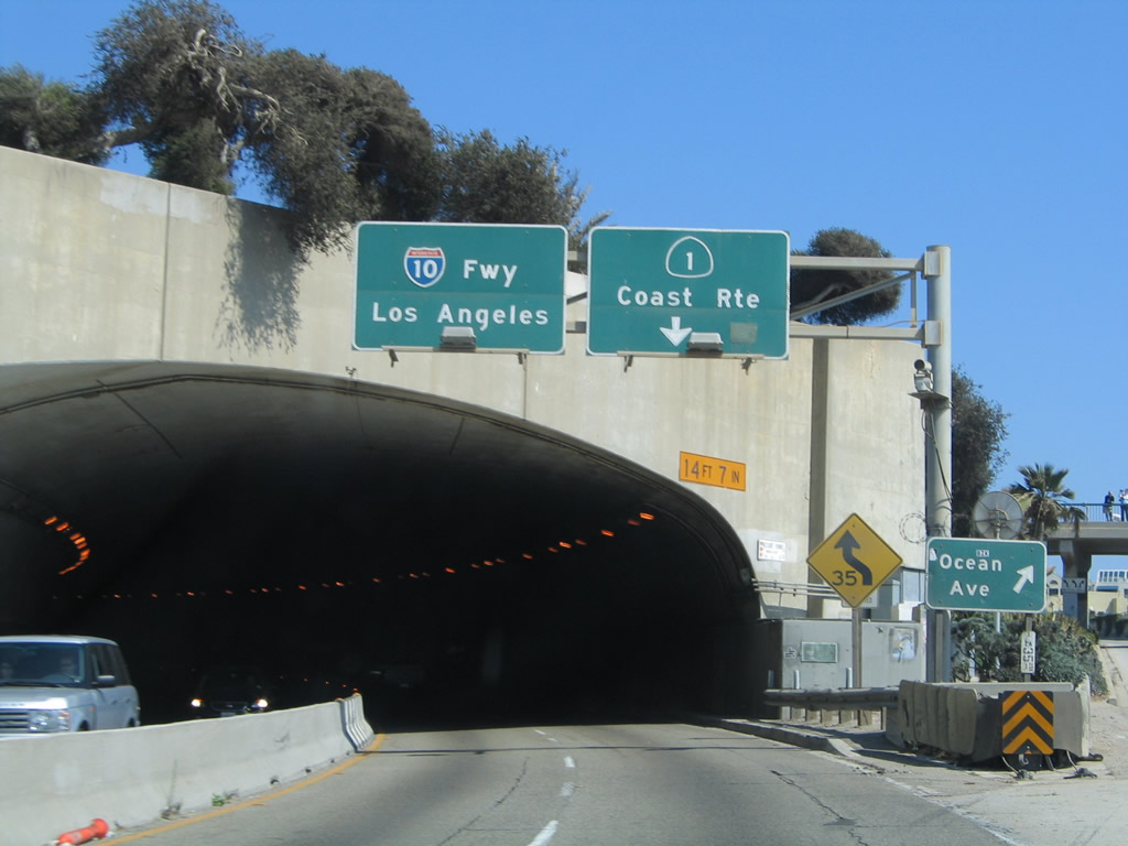
This view looks south on California 1 (Pacific Coast Highway) in Santa Monica prior to the Ocean Avenue off-ramp and the entrance to the McClure Tunnel, which connects California 1 to Interstate 10 (Santa Monica Freeway) east. Photo taken 11/11/09. |
 |
 |
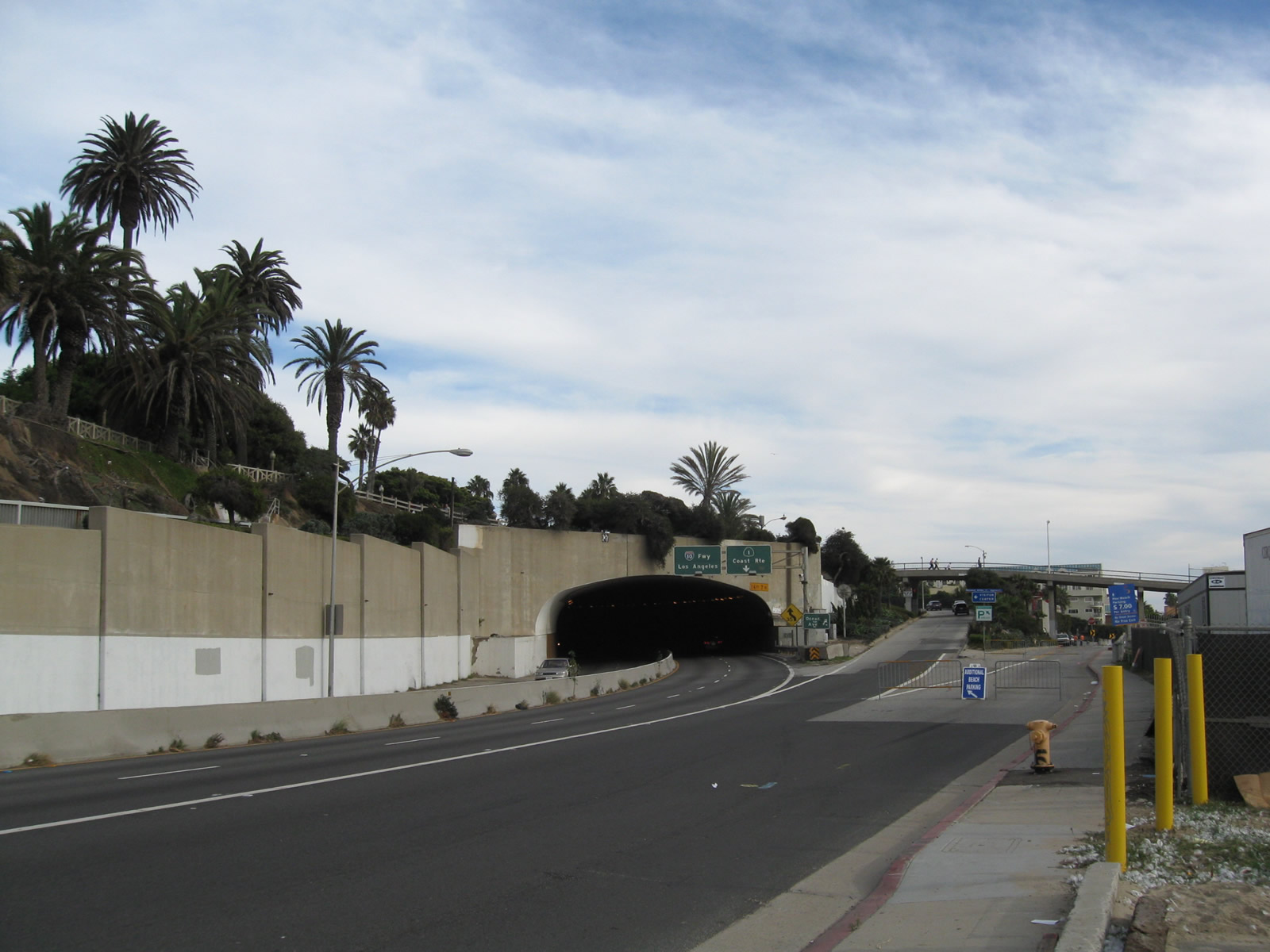
After following the Palisades in Santa Monica, California 1 turns inland at the McClure Tunnel to join the Santa Monica Freeway. Stay left here for Interstate 10 east, or stay right to follow California 1 (Lincoln Boulevard) south to Venice and Marina del Rey. An off-ramp connects to Ocean Avenue south. Photos taken 11/11/09. |
 |
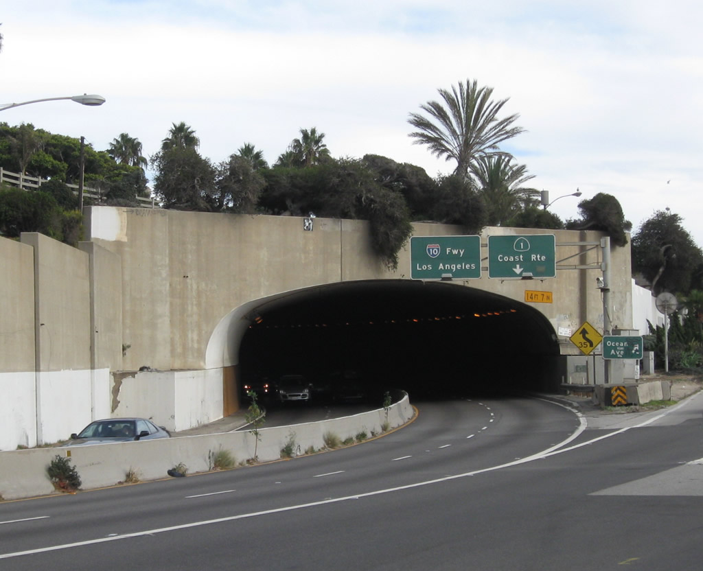
Southbound California 1 (Pacific Coast Highway) splits with Coast Avenue prior to entering the McClure Tunnel. This exit does not have an exit number. The right lane departs to Coast Avenue in Santa Monica, while the left two lanes connect to Interstate 10 (Santa Monica Freeway) east and California 1 (Lincoln Boulevard) south to Venice and Marina del Rey. Built between 1935 and 1939 as part of historic Alternate U.S. 101, the Robert E. McClure (Palisades) Tunnel is a historic resource in the greater Los Angeles transportation network. The tunnel is not wide enough to meet Interstate standards and thus is not a part of Interstate 10. However, it is part of a dramatic and fitting precursor to a long Interstate highway that crosses the country en route to Jacksonville, Florida. Photo taken 08/24/04. |
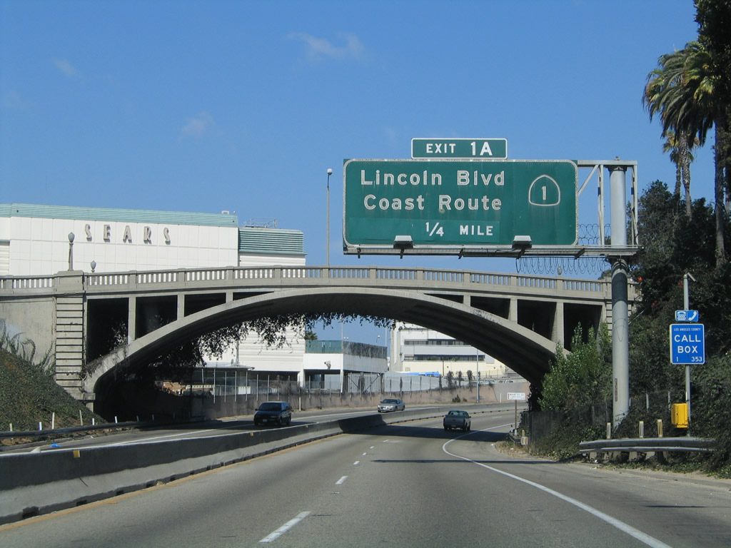 |
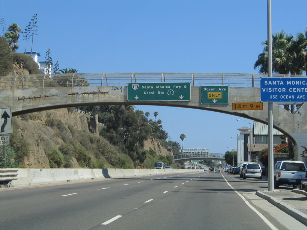
After clearing the McClure Tunnel, California 1 only carries two lanes in each direction with a single jersey barrier median as it travels below-grade almost due east. Main Street passes overhead on an old concrete arch bridge built in 1925 as an overpass to Olympic Boulevard (which preceded California 1 along this stretch). The next exit, which is signed as Exit 1A, carries California 1 south onto Lincoln Boulevard and also connects to Lincoln Boulevard north to California 2 and U.S. 66 east. Photo taken 08/24/04. |
 |
Southbound California 1 departs the freeway and connects to Exit 1A, Lincoln Boulevard south to Venice Beach, Marina del Rey, and Los Angeles International Airport (LAX) and Lincoln Boulevard north to U.S. 66 and California 2. U.S. 66 generally follows the path of California 2 east to U.S. 101, then follows its own path around the edge of downtown Los Angeles, then aims northeast toward Pasadena along the California 110 corridor. At Pasadena, U.S. 66 turns east to follow Interstate 210 (Foothill Freeway) toward Pasadena, then turns north along the Interstate 15 (and former U.S. 91-395) corridor toward Barstow. At Barstow, U.S. 66 follows Interstate 40 east toward Needles, Flagstaff, Albuquerque, Amarillo, and Oklahoma City before turning northeast toward its eastern terminus in Chicago. Interstate 10 officially begins at this point as California 1 departs on the off-ramp. (Note the begin freeway sign; there is no begin Interstate 10 shield.) Photo taken 08/24/04. |
| California 1 south and Olympic Boulevard east | |
|---|---|
 |
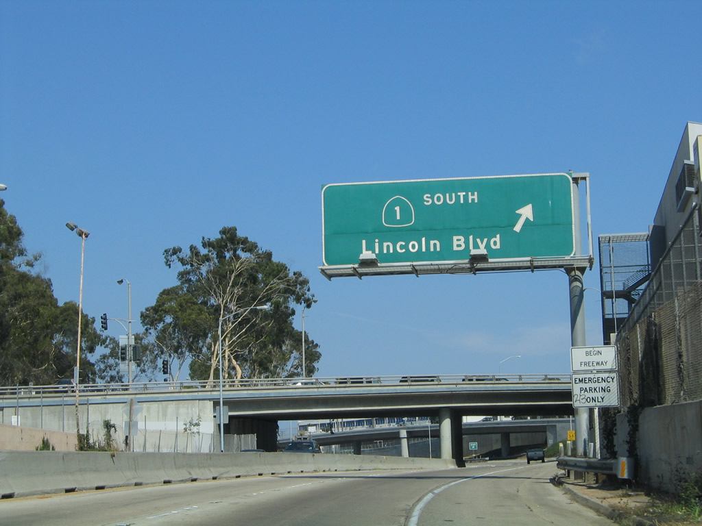
After splitting from Interstate 10 (Santa Monica Freeway), California 1 uses a slip ramp to join eastbound Olympic Boulevard. California 1 only follows Olympic Boulevard briefly, then will turn right (south) on Lincoln Boulevard. Turn left on Lincoln Boulevard to U.S. 66 and California 2 east and Lincoln Boulevard north. U.S. 66 and California 2 travel north four blocks from this point, then turn east on Santa Monica Boulevard toward Beverly Hills and Hollywood. Photo taken 10/30/05. |
| California 1 (Lincoln Boulevard) south | |
 |
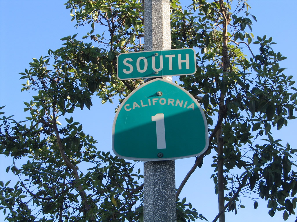 |
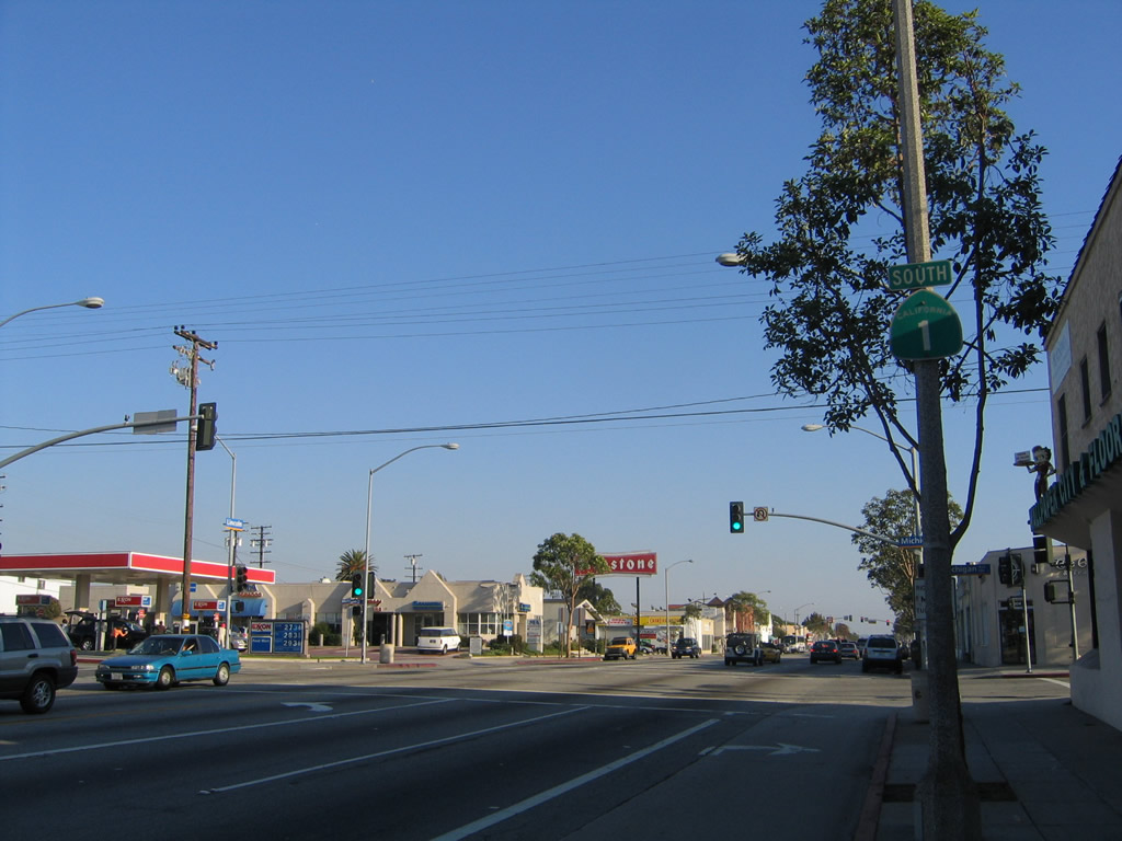
Shortly after the Lincoln Boulevard/Olympic Boulevard south intersection, a reassurance shield for California 1 is posted. The state route is generally well-signed through Santa Monica, Venice, Marina del Rey, and Playa del Rey as it proceeds south toward Los Angeles International Airport (LAX). Photos taken 10/30/05. |
| California 1 (Pacific Coast Highway) south | |
|---|---|
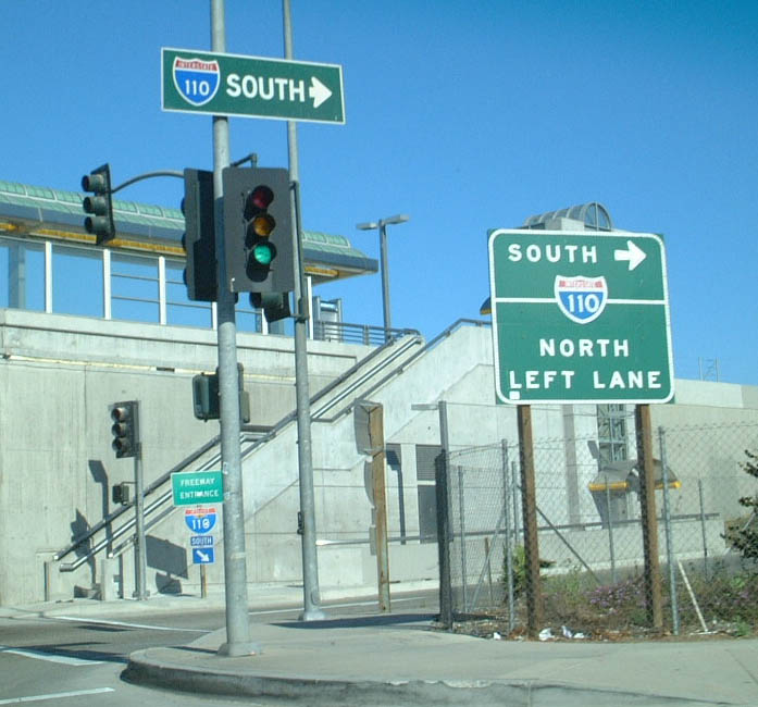 |
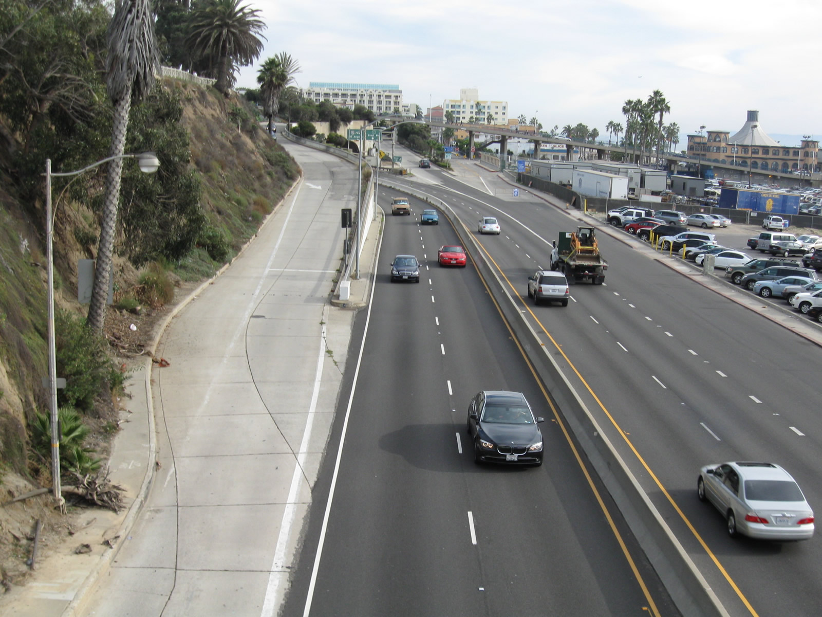
Southbound California 1 (Pacific Coast Highway) meets Interstate 110 (Harbor Freeway) in Los Angeles. California 1 is a four-to-six lane divided highway at this point, and it is headed due east when it intersects north-south Interstate 110. Taking southbound Interstate 110 at this interchange leads south to the Port of Los Angeles, the cruise ship terminal at San Pedro, and Long Beach via the Vincent Thomas Bridge (California 47). Photo taken 07/21/01. |
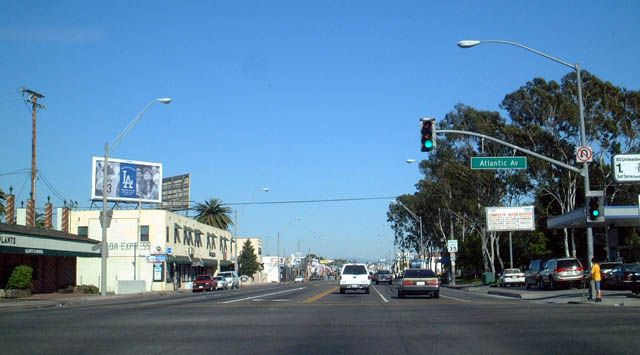 |
This modest intersection, located along southbound (eastbound) California 1 (PCH), carries a great deal of history. Although most maps are very ambiguous about the specific historic western terminus of U.S. 6 and historic southern terminus of U.S. 91, this intersection, at PCH and Atlantic Avenue, is where both U.S. 6 and U.S. 91 met their ends, at the junction with what then known as California 15, the precursor to Interstate 710 (Long Beach Freeway). U.S. 6 reached this intersection by following the Harbor Freeway (Interstate 110 / Former California 11) south to PCH (then known as Alternate U.S. 101, now part of California 1), then taking PCH south (actually east) to this intersection. U.S. 91 reached this intersection by following former California 18 via Lincoln Avenue, Carson Street, and Lakewood Boulevard to PCH, then PCH northbound (actually westbound). Photo taken 03/30/03. |
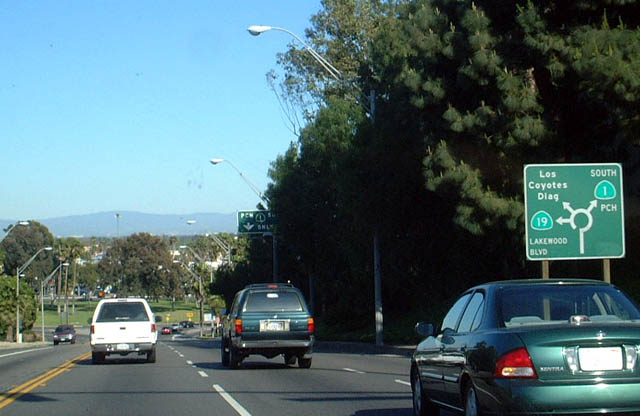 |
Southbound California 1 (PCH) approaches California 19 and Lakewood Traffic Circle in Long Beach. This unusual sign shows how traffic is routed through the circle to remain on southbound California 1, access the Los Coyotes Diagonal, or take northbound California 19 (Lakewood Boulevard). Photo taken 03/30/03. |
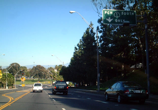 |
Los Alamitos Traffic Circle is a major intersection between California 1 (PCH) and California 19 (Lakewood Boulevard). A dedicated lane for through traffic along southbound is provided to the right. Photo taken 03/30/03. |
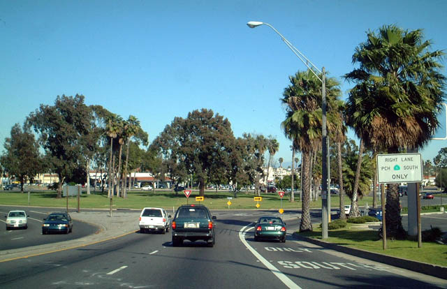 |
Southbound California 1 (PCH) at the Lakewood Traffic Circle in Long Beach. California 19 is a multi-lane, divided highway that leads north from this traffic circle under the Long Beach Airport and into Lakewood, Bellflower, and Downey. By the time California 19 reaches Interstate 5, the state highway transfers from Lakewood Boulevard to Rosemead Boulevard. Northbound California 19 (Rosemead Boulevard) continues north through Pico Rivera, Temple City, and Temple City before terminating in East Pasadena. The stretch of California 19 between Pico Rivera and East Pasadena is technically California 164. Since the California 164 connection between California 19 and Interstate 605 is unconstructed, the segment of California 164 north of Pico Rivera is signed as California 19 for route continuity. Photo taken 03/30/03. |
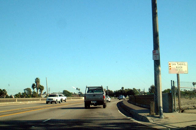 |
California 1 (Pacific Coast Highway) south crosses the San Gabriel River here. Photo taken 03/30/03. |

Page Updated March 13, 2011.
|
About Contact Glossary |
In The News Interstate Guide |
Social Media:
 |
|
© 2000-25 AARoads.com | All Rights Reserved | Privacy Policy / Terms of Use
|
||