
California 4 West - Contra Costa County
| California 4 west | |
|---|---|
 |
After transitioning from the California 160 interchange, the first exit along westbound California 4 is Exit 29, Hillcrest Avenue, one mile. Photo taken 01/18/03. |
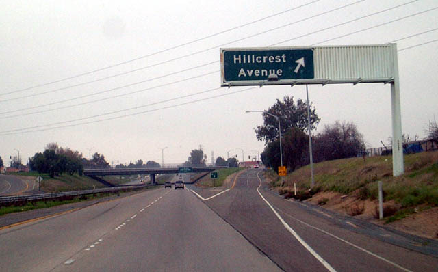 |
Westbound California 4 reaches Exit 29, Hillcrest Avenue in Antioch. Photo taken 01/18/03. |
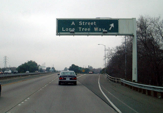 |
Westbound California 4 reaches Exit 28, A Street/Lone Tree Avenue in Antioch. Photo taken 01/18/03. |
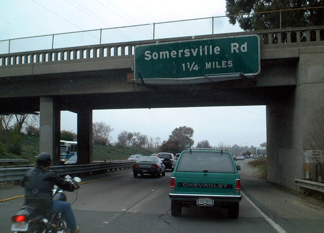 |
The vintage guardrail on the highway overpass will likely be removed when California 4 is widened to accommodate an increasing east-west traffic flow through the California Delta region. This bridge also supports the one and one-quarter mile advance sign for Exit 26, Somersville Road. Photo taken 01/18/03. |
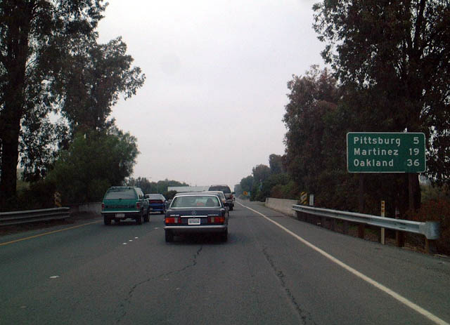 |
This mileage sign provides the distance to Pittsburg, Martinez, and Oakland along westbound California 4. The sign is located after Exit 28 and before Exit 26, Somersville Road. Photo taken 01/18/03. |
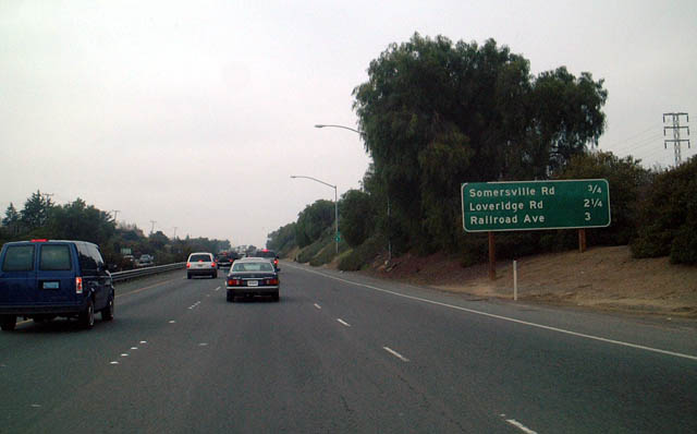 |
Another mileage sign is posted thereafter for next three exits along westbound California 4: Exit 26, Somersville Road; Exit 24, Loveridge Road; and Exit 23, Railroad Avenue/Harbor Street. Photo taken 01/18/03. |
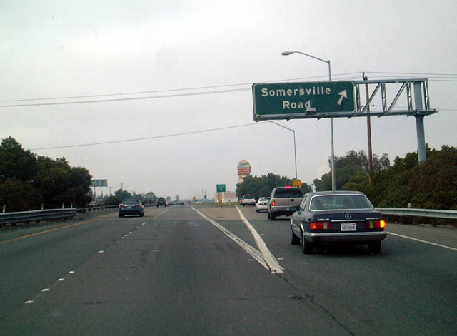 |
Westbound California 4 at Exit 26, Somersville Road. Photo taken 01/18/03. |
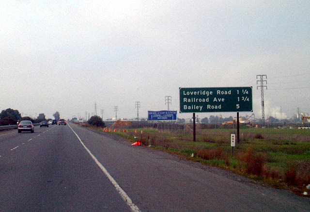 |
The next exit along westbound California 4 is Exit 24, Loveridge Road, one and one-quarter miles. The next exits after Loveridge Road are Railroad Avenue and Bailey Road. Photo taken 01/18/03. |
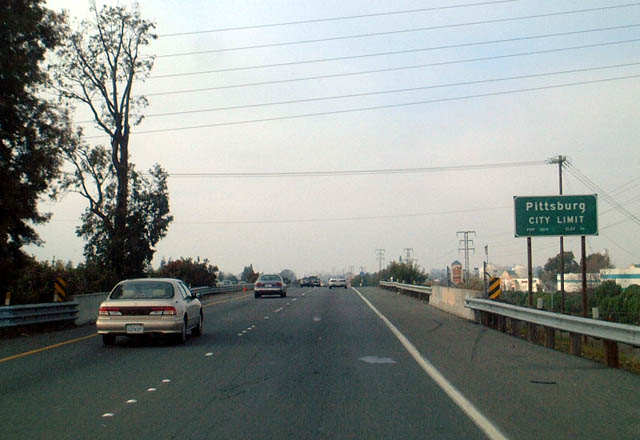 |
California 4 enters the city of Pittsburg. Photo taken 01/18/03. |
 |
Westbound California 4 reaches Exit 24, Loveridge Road. Note the lack of an exit sign at this exit; perhaps one used to be affixed to the overcrossing. Photo taken 01/18/03. |
 |
This California 4 west shield is found after Exit 24 and before Exit 23, Harbor Street/Railroad Avenue. Photo taken 01/18/03. |
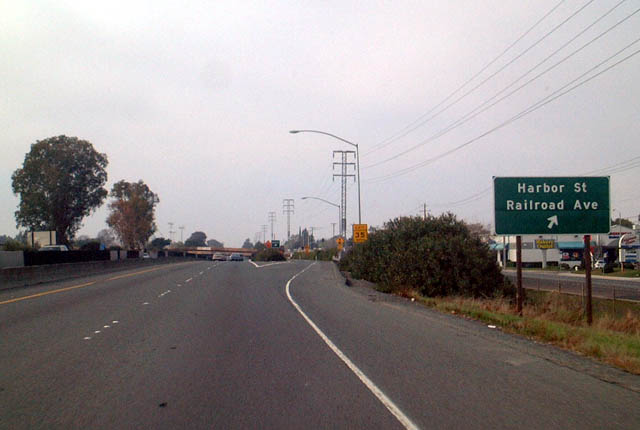 |
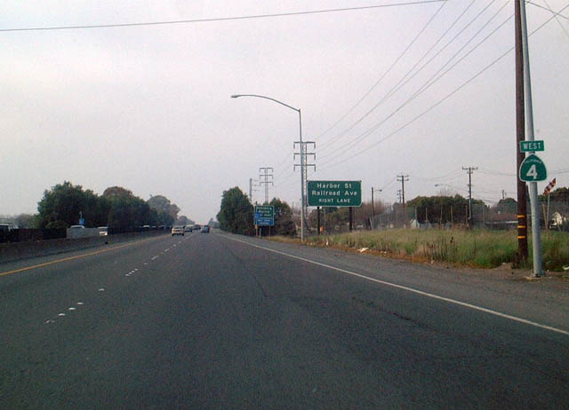
Westbound California 4 reaches Exit 23, Harbor Street/Railroad Avenue. Photo taken 01/18/03. |
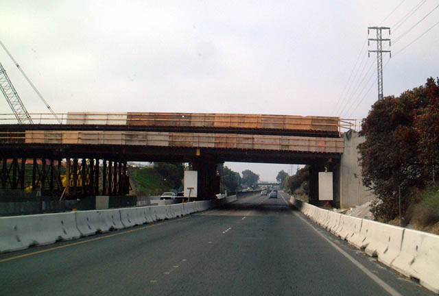 |
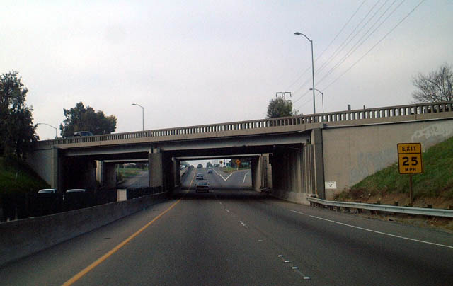
Westbound California 4 makes a startling transition from a four-lane to eight-lane freeway as it leaves Pittsburg. (However this area is under construction from freeway widening and extension as of 2007.) The remaining sections of four-lane freeway are inadequate to handle traffic volumes, so it is being widened, as evidenced by this bridge replacement. Photo taken 01/18/03. |
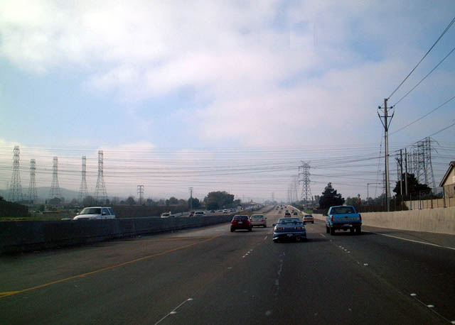 |
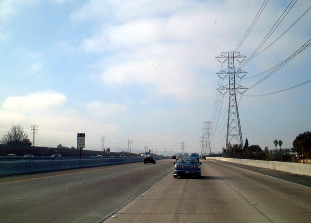
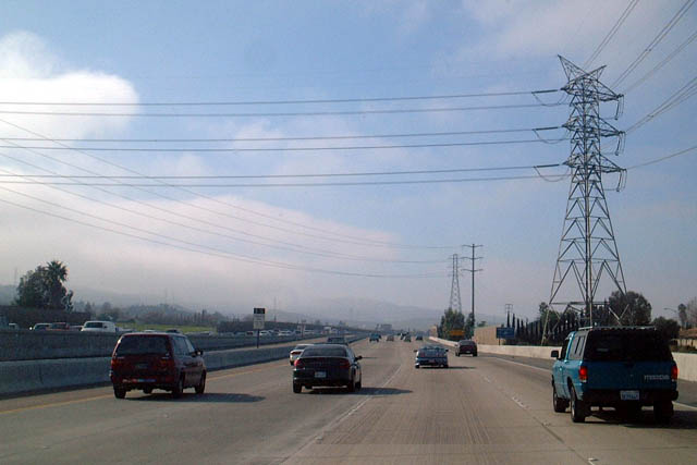
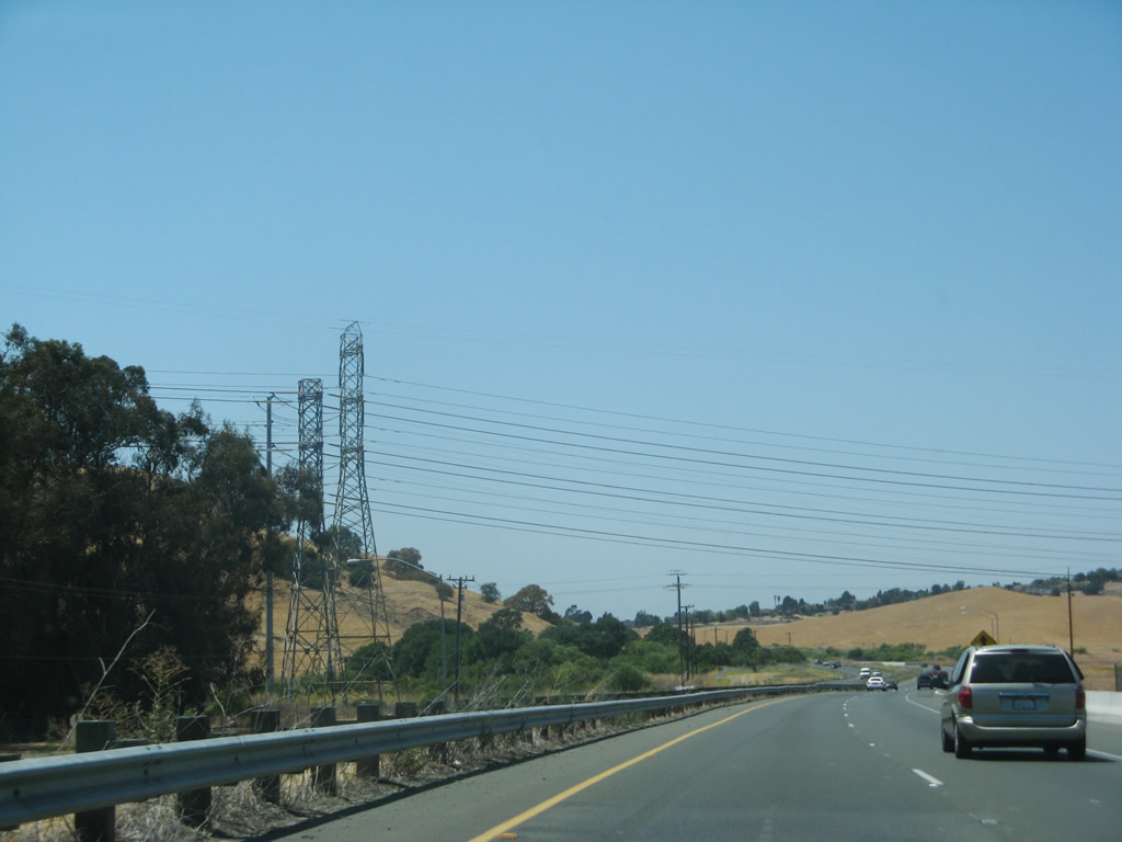
This portion of westbound California 4 parallels a large power transmission line, which takes power from the plants along the Sacramento River west into the Bay Area. The first photo shows the huge quantity of power lines that emanate from this area, transmitting power all over the East Bay. Photo taken 01/18/03. |
 |
|
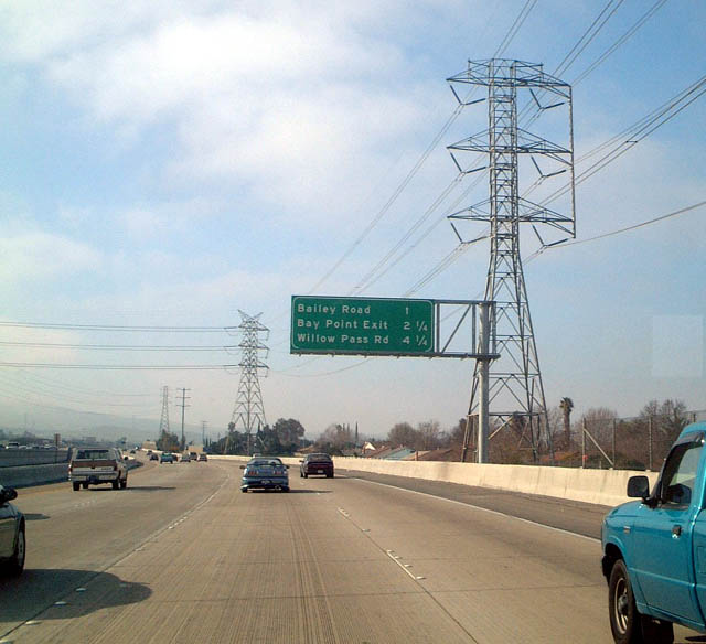 |
The next exit along westbound California 4 is Exits 20A-B, Bailey Avenue, one mile. Surprisingly, much of the land here is undeveloped as the freeway leaves Pittsburg/Bay Point en route to Concord. Photo taken 01/18/03. |
 |
The large transmission power lines that paralleled westbound California 4 turn off as the freeway approaches Exits 20A-B, Bailey Avenue. Photo taken 01/18/03. |
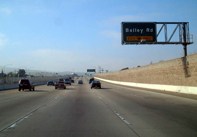 |
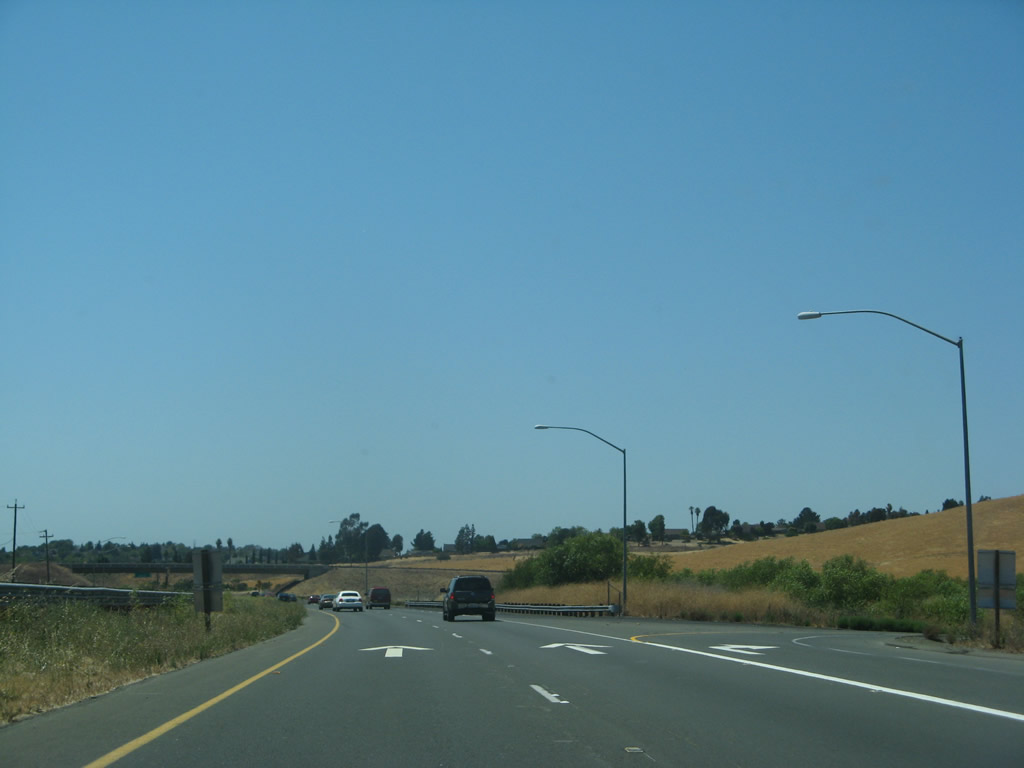
Continuing west, California 4 approaches Exits 20A-B, Bailey Avenue. Photo taken 01/18/03. |
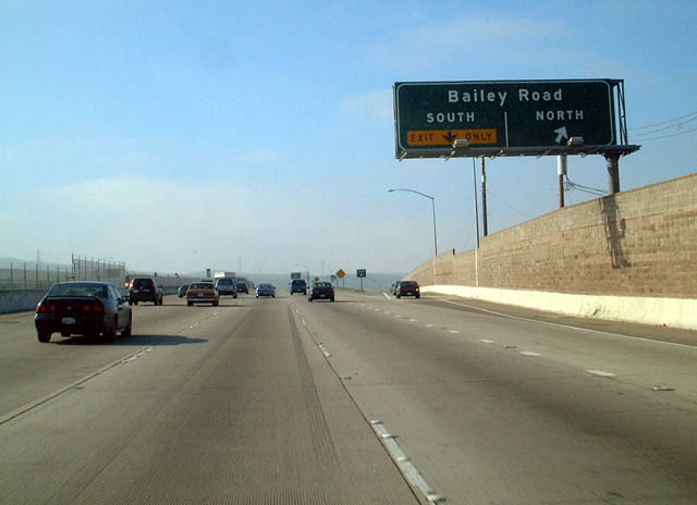 |
Westbound California 4 reaches Exit 20B, Northbound Bailey Avenue. Photo taken 01/18/03. |
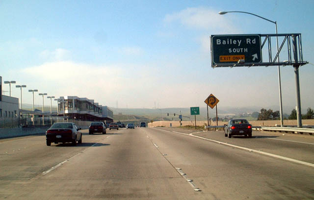 |
Westbound California 4 reaches Exit 20A, Southbound Bailey Avenue. Photo taken 01/18/03. |
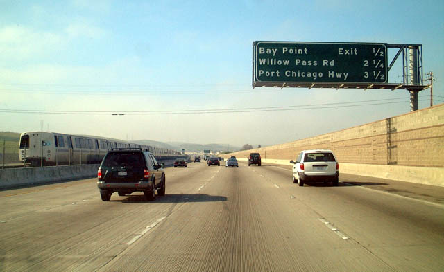 |
The next exit along westbound California 4 is Exit 19, Bay Point, one-half mile. The median of the freeway now accommodates the Bay Area Rapid Transit (BART) train, which leads west from Bay Point to San Francisco via Concord, Walnut Creek, Orinda, and Oakland. Photo taken 01/18/03. |
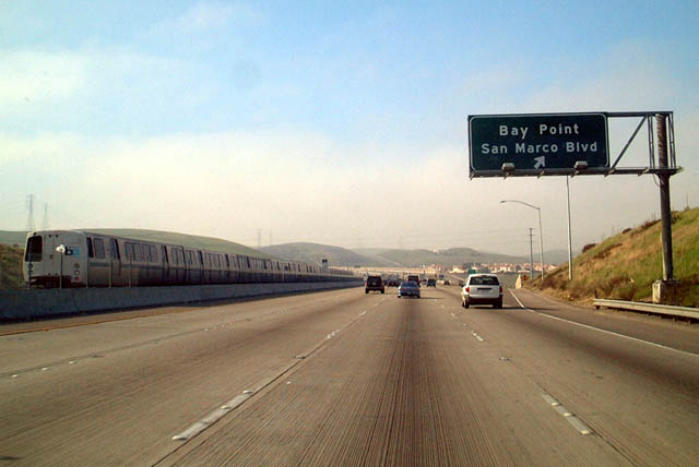 |
Westbound California 4 reaches Exit 19, Bay Point. Check out the BART train in the median. Photo taken 01/18/03. |
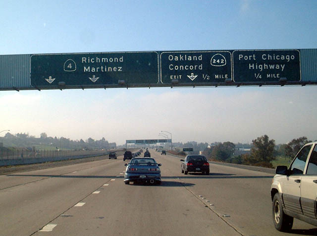 |
The next exit along westbound California 4 is Exit 15B, Port Chicago Highway. Exit 15B is California 242, a freeway connector between California 4 and Interstate 680. Photo taken 01/18/03. |
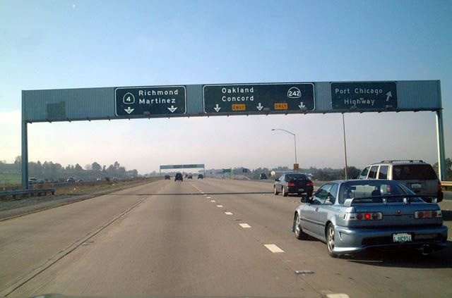 |
Westbound California 4 reaches Exit 15B, Port Chicago Highway. The next exit is California 242, which is a three-lane exit and is the fastest route to westbound California 24 and Oakland. Photo taken 01/18/03. |
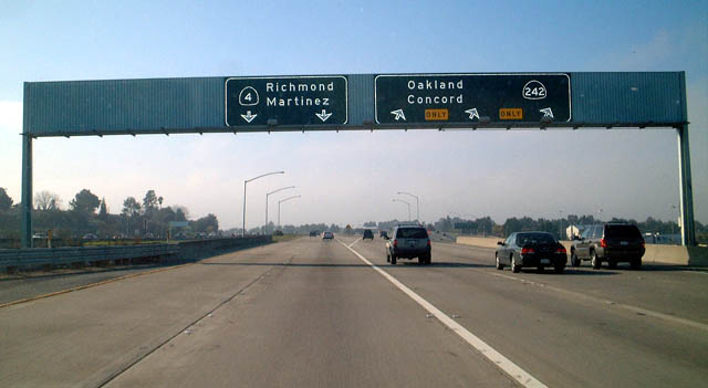 |
Westbound California 4 reaches Exit 15A, westbound California 242 to Concord and Walnut Creek. Historically, this split marked where former California 24 turned southwest toward Oakland via California 242, Interstate 680, and the current California 24 freeway. To reduce route duplication and overlap, California 24 was reduced to its current alignment, and this short stretch was renumbered as California 242. Photo taken 01/18/03. |
 |
The next exit along westbound California 4 is Exits 12C-B, Interstate 680. Even though this interchange connects two major freeways, it is only a cloverleaf, so it faces delays during heavy traffic periods. Photo taken 01/18/03. |
 |
Westbound California 4 reaches Exit 12C, northbound Interstate 680. Note the substandard signage marking this cloverleaf interchange, which is more suitable for a collector distributor ramp or a surface street. Photo taken 01/18/03. |
 |
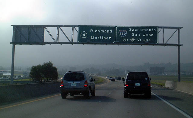
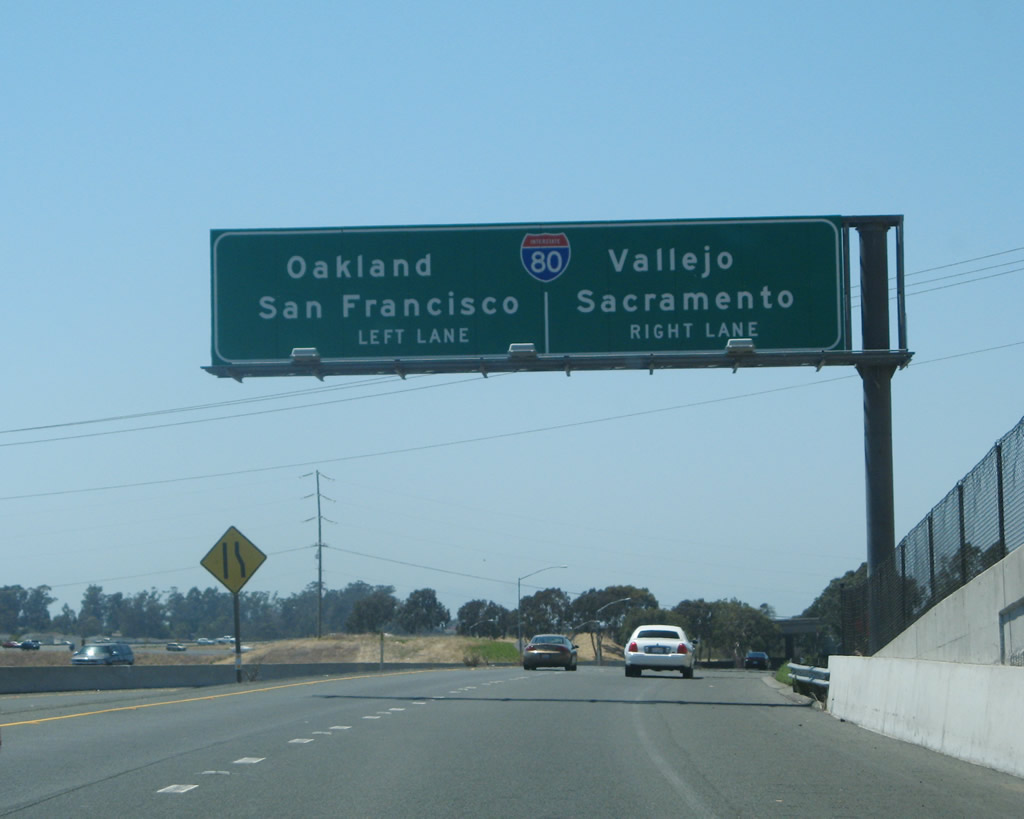
Westbound California 4 reaches Exit 12B, Interstate 680 south to Walnut Creek and San Jose (loop ramp). California 242 acts as the major connector between westbound California 4 and southbound Interstate 680 (rather than Exit 12B). This sign bridge was replaced by 2007 with a sign that includes the exit number. Photo taken 01/18/03. |
 |
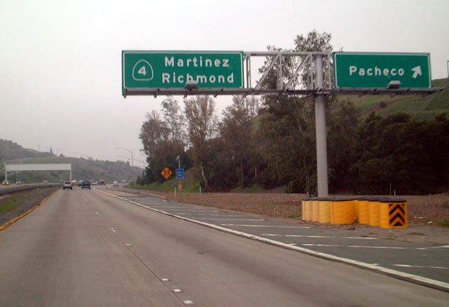 |
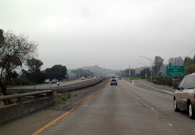
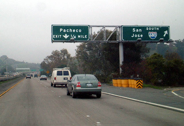
Immediately thereafter, westbound California 4 reaches Exit 12A, Pacheco Boulevard. At this point, California 4 shifts from the California Delta Highway onto the John Muir Parkway. This sign assembly was changed in 2007. Photos taken 07/07/07 and 01/18/03. |
 |
Continuing west, California 4 approaches Exit 11, Morello Avenue, one-half mile. Photo taken 01/18/03. |
|
This mileage sign provides the distance to the next two exits along westbound California 4 (John Muir Parkway): Exit 11, Morello Avenue; and Exit 10, Pine Street and Center Avenue. California 4 enters the city of Martinez, the seat of Contra Costa County and home to 35,866 people as of the 2000 Census. Martinez was founded in 1849 and incorporated on April 1, 1876. The city is situated along the California Delta near several oil refineries. Photo taken 07/07/07. |
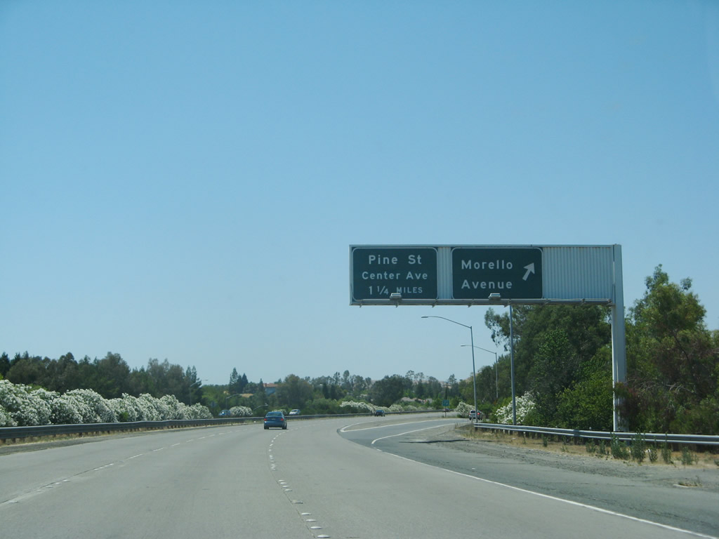 |
Westbound California 4 reaches Exit 11, Morello Avenue. Photo taken 07/07/07. |
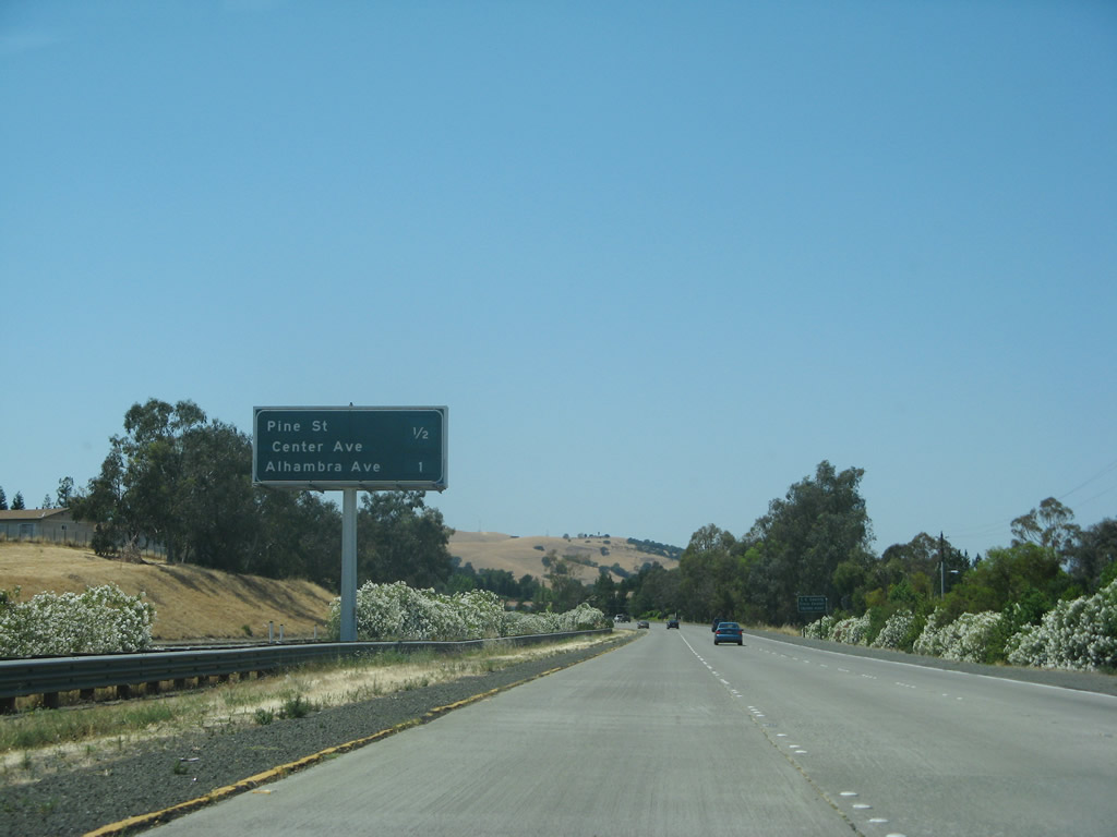 |
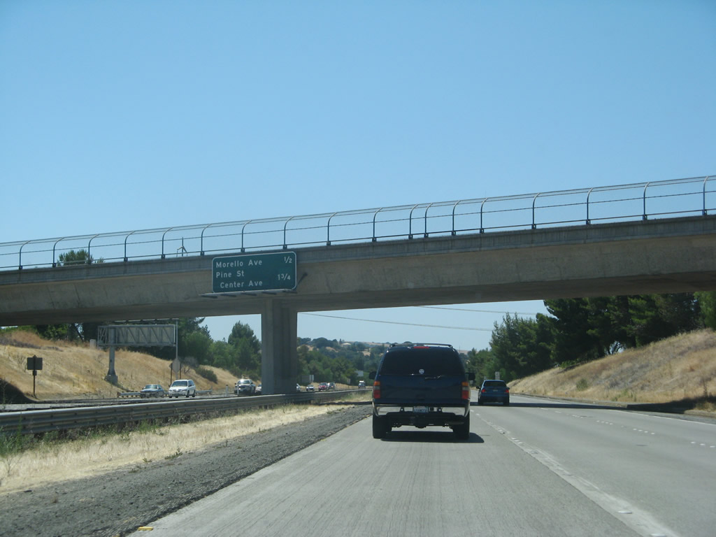
This mileage sign provides the distance to the next two exits along westbound California 4 (John Muir Parkway): Exit 10, Pine Street and Center Avenue; and Exit 9, Alhambra Avenue. Photo taken 07/07/07. |
 |
Westbound California 4 reaches Exit 10, Pine Street/Center Avenue. Photo taken 07/07/07. |
 |
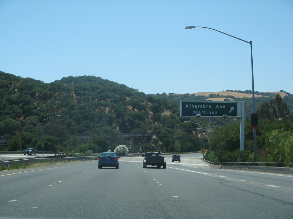
The next exit along westbound California 4 is Exit 9, Alhambra Avenue in Martinez. Photo taken 07/07/07. |
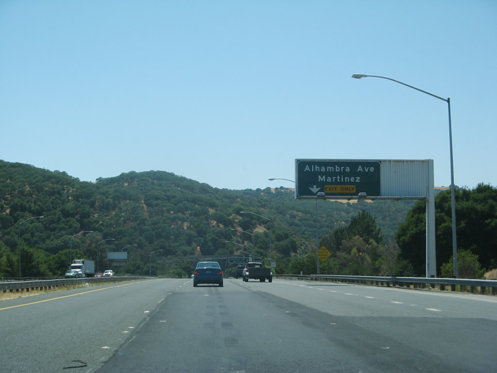 |
The right lane of California 4 (John Muir Parkway) west becomes exit only for Exit 9, Alhambra Avenue. Photo taken 07/07/07. |
 |
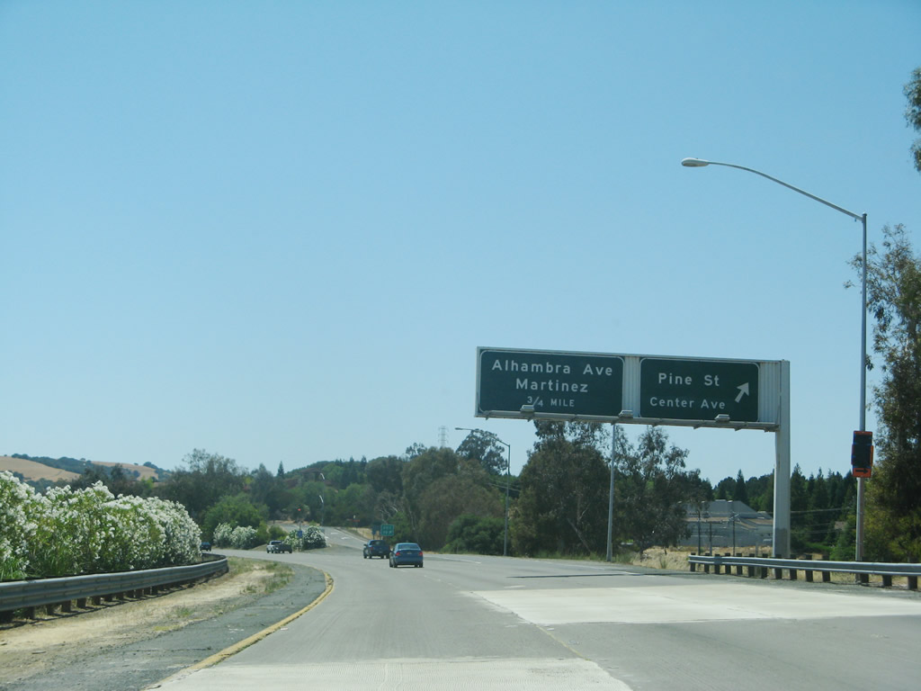
Westbound California 4 reaches Exit 9, Alhambra Avenue in Martinez. Photo taken 07/07/07. |
 |
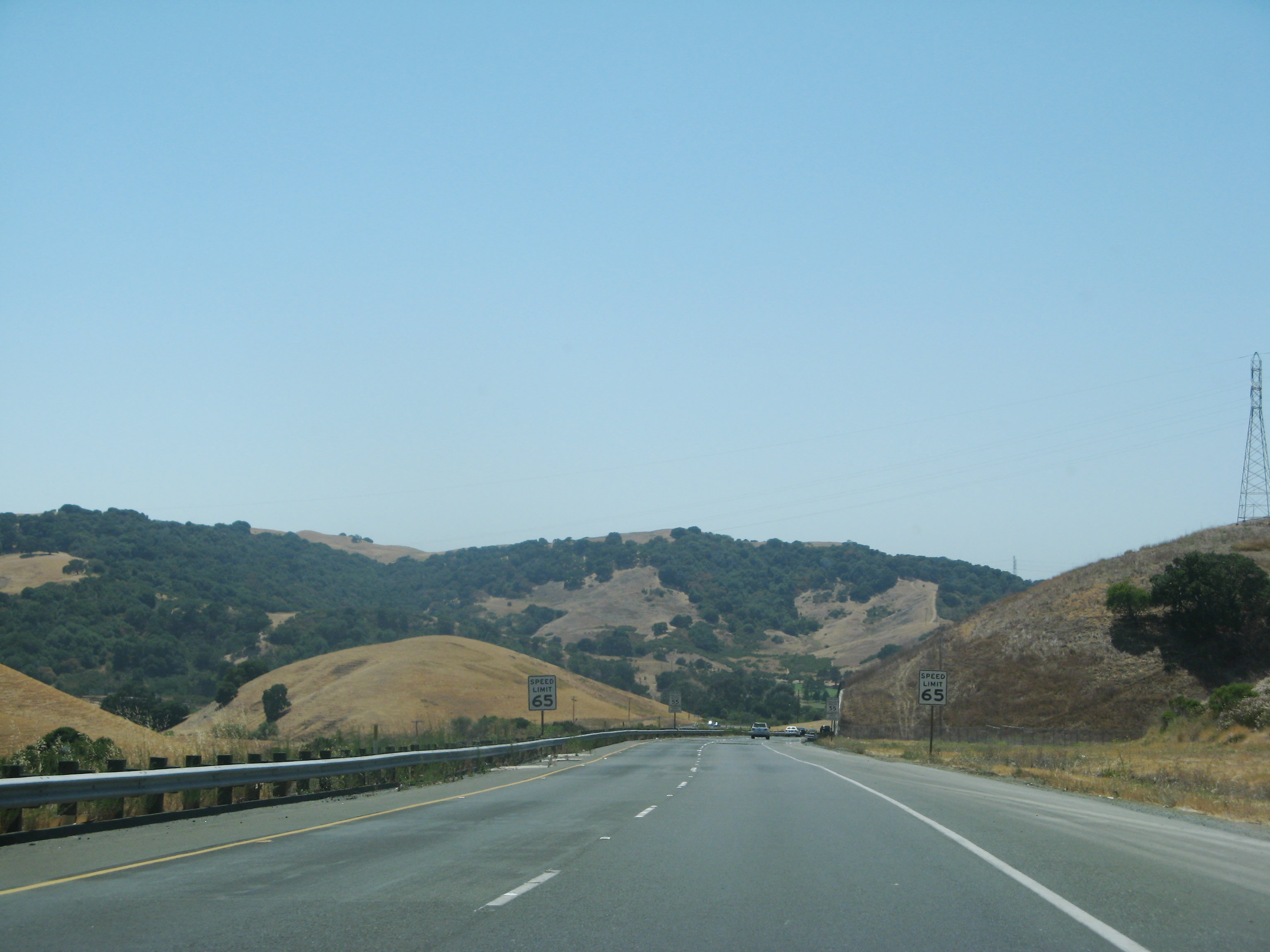
This section of westbound California 4 passes through some rolling hills as it reaches the mouth of the Sacramento River, which flows into San Francisco Bay. On this day, the fog was thick enough to preclude much picture taking until nearly reaching Interstate 80. Even though much of this road is controlled access, there are a couple of minor connecting roads that prevent this segment of California 4 from being a full freeway. Photo taken 07/07/07. |
 |
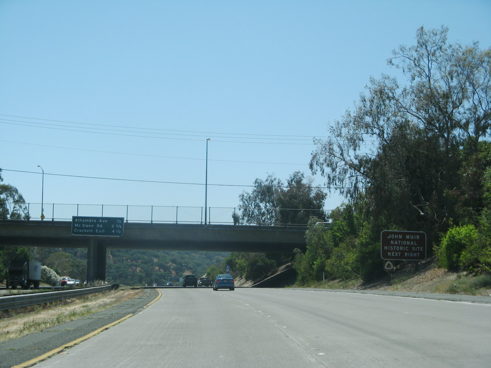
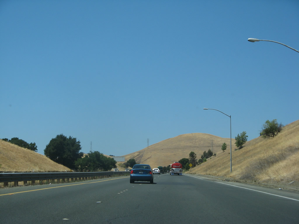
This mileage sign along California 4 (John Muir Parkway) west provides the distance to three of the next five exits: Exit 6, McEwen Road; Exit 5, Cummings Skyway to Crockett and Interstate 80 east; (Exit 3, Franklin Canyon; Exit 2, Sycamore Avenue;) and Exit 1C, Willow Avenue and Bayberry Avenue. Photo taken 07/07/07. |
 |
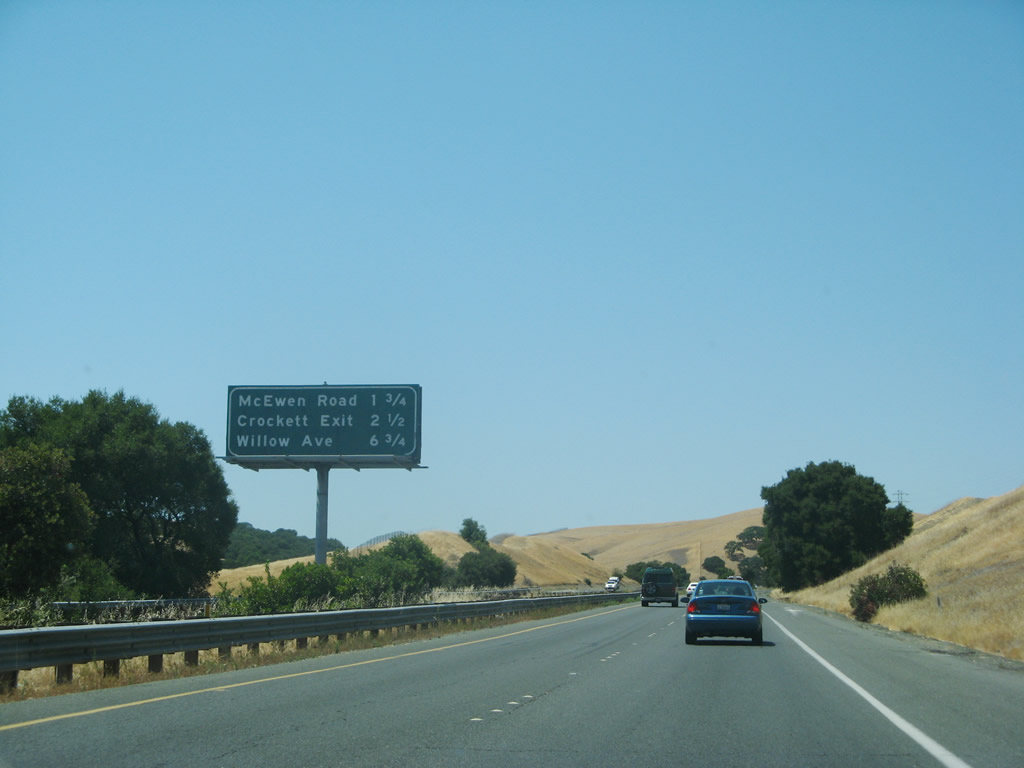
The next exit along California 4 (John Muir Parkway) west is Exit 6, McEwen Road (1.50 miles). Photo taken 07/07/07. |
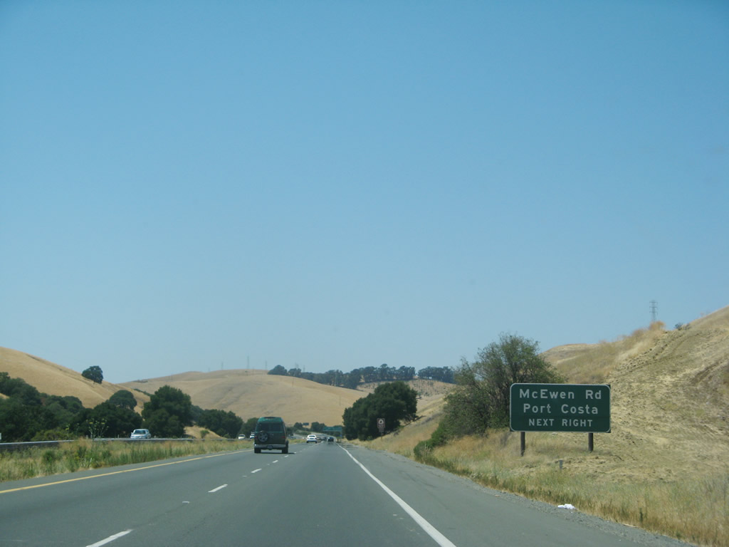 |
Use Exit 6, McEwen Road to Port Costa. Photo taken 07/07/07. |
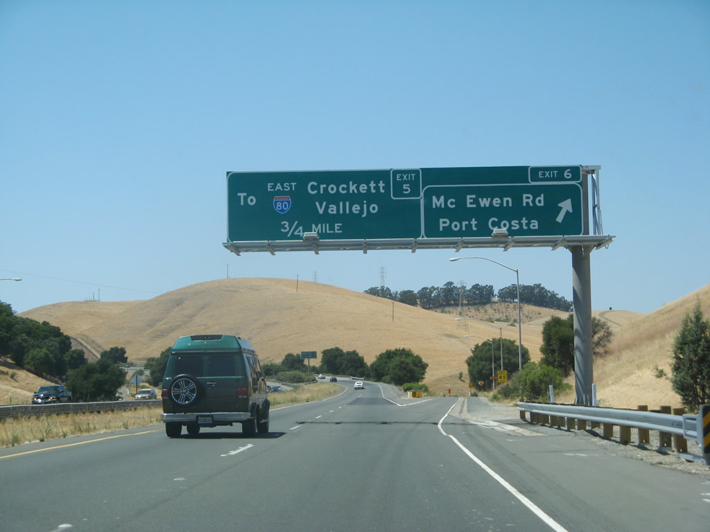 |
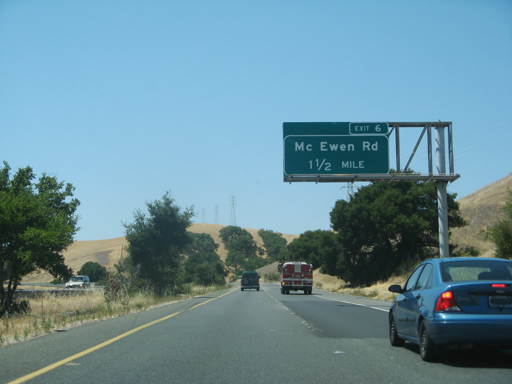
Westbound California 4 (John Muir Parkway) reaches Exit 6, McEwen Road. The next exit is Exit 5, Cummings Skyway to Crockett and Interstate 80 east. Photo taken 07/07/07. |
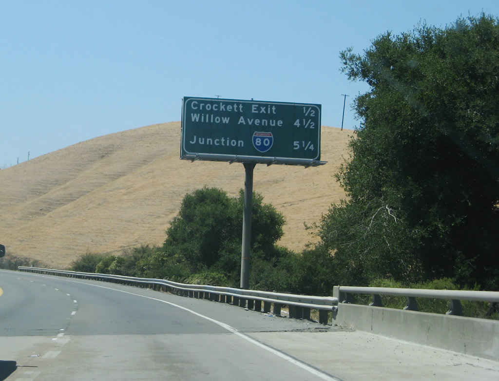 |
This mileage sign along California 4 (John Muir Parkway) west provides the distance to four of the next five exits: Exit 5, Cummings Skyway to Crockett and Interstate 80 east; (Exit 3, Franklin Canyon; Exit 2, Sycamore Avenue;) Exit 1C, Willow Avenue and Bayberry Avenue; and Exit 1B, Interstate 80 (Eastshore Freeway). Photo taken 07/07/07. |
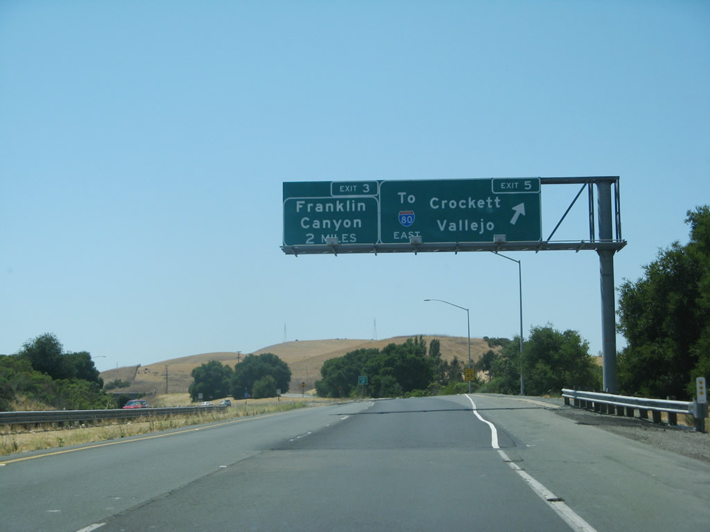 |
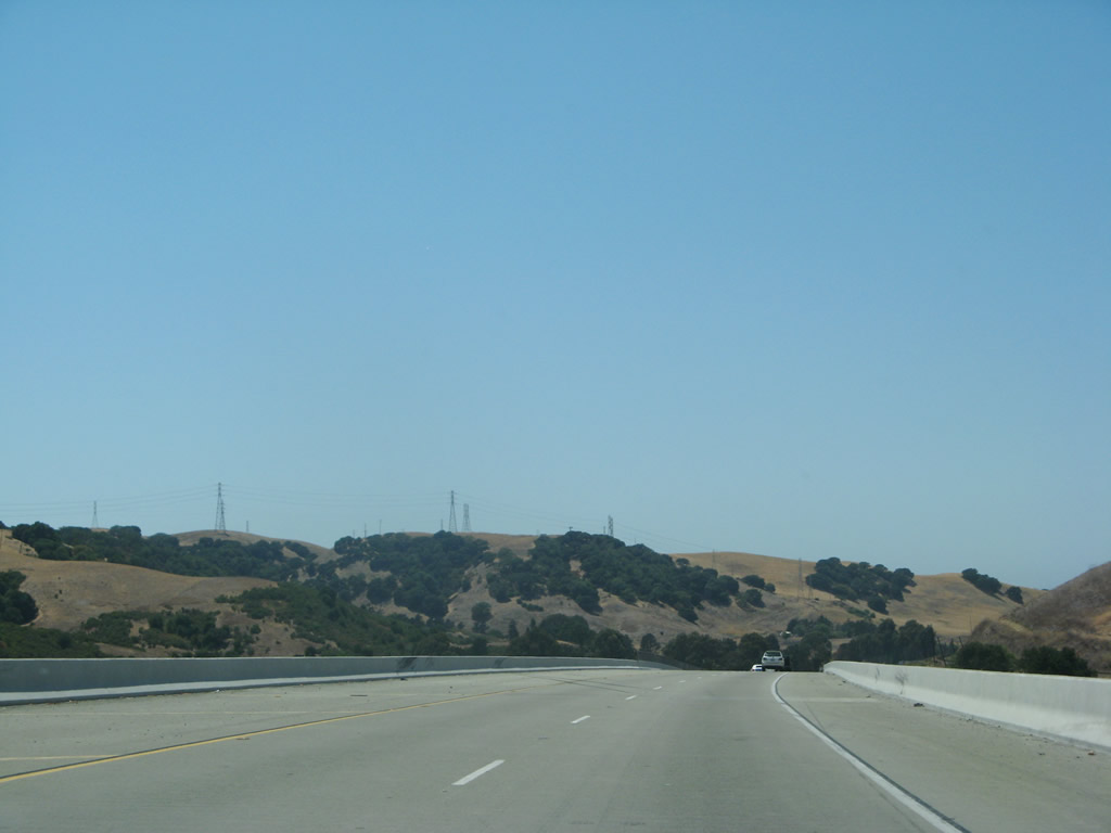
Westbound California 4 (John Muir Parkway) reaches Exit 5, Cummings Skyway to Crockett and Interstate 80 east. The next exit along westbound is Exit 3, Franklin Canyon. Photo taken 07/07/07. |
 |
California 4/John Muir Parkway retains its rural feel between Exit 5 and Exit 3. Photo taken 07/07/07. |
 |
This open space preserve is part of the Carquinez Strait Regional Shoreline Park and north of Briones Regional Park. A railroad parallels California 4 through Franklin Canyon. Photo taken 07/07/07. |
 |
Westbound California 4 (John Muir Parkway) reaches Exit 3, Franklin Canyon. Photo taken 07/07/07. |
 |
A major Pacific Gas & Electric (PG&E) power transmission corridor passes over California 4. These lines travel north to cross over the Carquinez Strait to bring power south to Berkeley and Oakland. Photo taken 07/07/07. |
 |
An unsigned exit leads from California 4 west to Exit 2, Sycamore Avenue (local access only). Photo taken 07/07/07. |
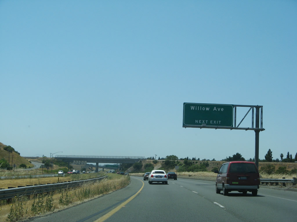 |
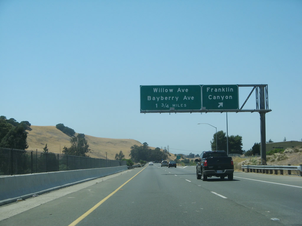
The next exit along westbound California 4 is Exit 1C, Willow Avenue and Bayberry Avenue. Photo taken 07/07/07. |
 |
Westbound California 4 reaches Exit 1C, Willow Avenue and Bayberry Avenue. The next two exits are Exit 1B, Interstate 80 (Eastshore Freeway) and Exit 1A, San Pablo Avenue. Photo taken 07/07/07. |
 |
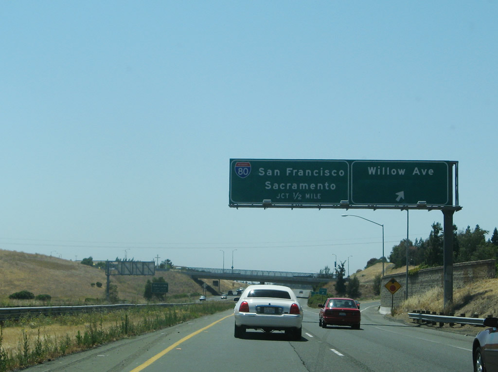
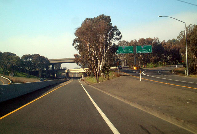
The next exit along westbound California 4 is Exit 1B, Interstate 80. The freeway continues straight ahead to end at San Pablo Avenue (Exit 1A). Photo taken 07/07/07. |
 |
The next exit along westbound California 4 is Exit 1B, Interstate 80. The freeway continues straight ahead to end at U.S. 40/San Pablo Avenue (Exit 1A). Photo taken 01/18/03. |
 |
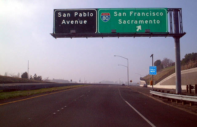
Now on the off-ramp, the left lane connects to Interstate 80 west (south) to Oakland, while the right lane connects to Interstate 80 east (north) to Vallejo and Sacramento. Photo taken 07/07/07. |
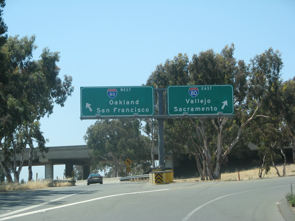 |
A butterfly gantry (overhead sign bridge) serves as the split between Interstate 80 west and east. Photo taken 07/07/07. |
 |
Back on the mainline, California 4 passes under Interstate 80 on this partial, symmetrical stack interchange. Ahead is the city of Hercules, the "Dynamic City on the Bay." With a population of 19,488 as of the 2000 Census, Hercules is a growing city situated on San Pablo Bay near the Carquinez Strait and several large oil refineries. Its location near the freeway, railroad, and water shipping network makes it a prime location for commercial interests. Originally founded as a company town, Hercules incorporated on December 15, 1900. Photo taken 01/18/03. |
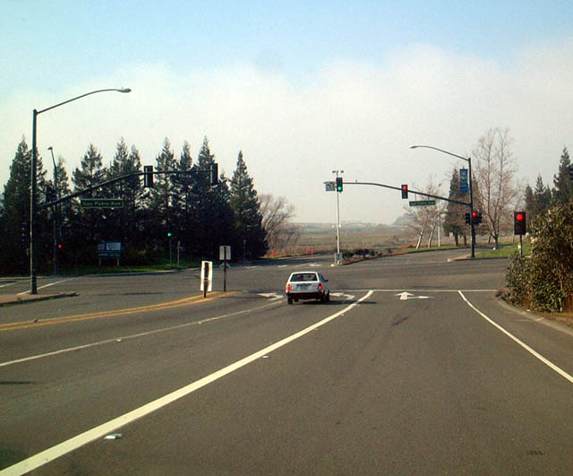 |
Finally, westbound California 4 ends at its junction with Historic U.S. 40/San Pablo Avenue at this traffic signal in Hercules. There is no end shield assembly present at this intersection. Photo taken 01/18/03. |

Page Updated October 21, 2009.
|
About Contact Glossary |
In The News Interstate Guide |
Social Media:
 |
|
© 2000-25 AARoads.com | All Rights Reserved | Privacy Policy / Terms of Use
|
||