| California 24 east |
|
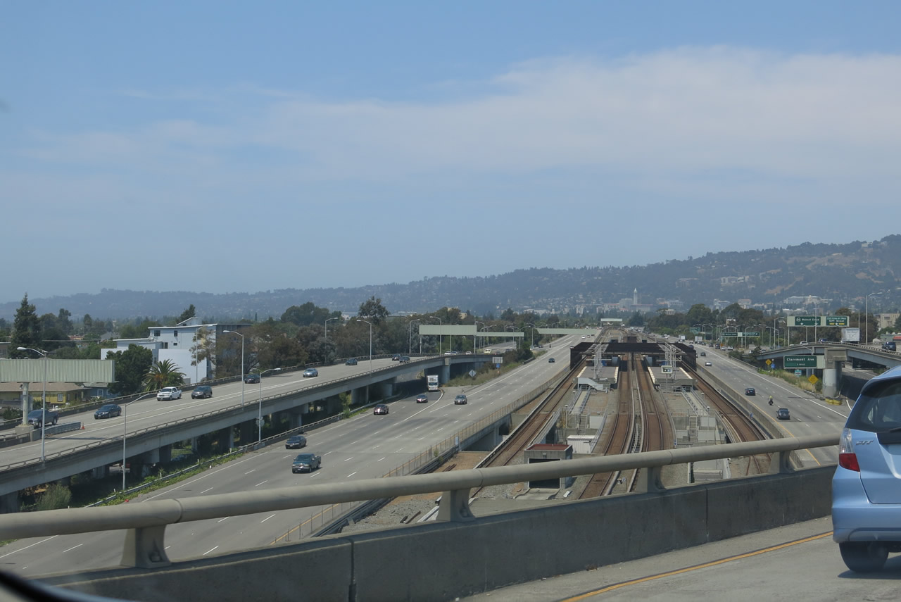
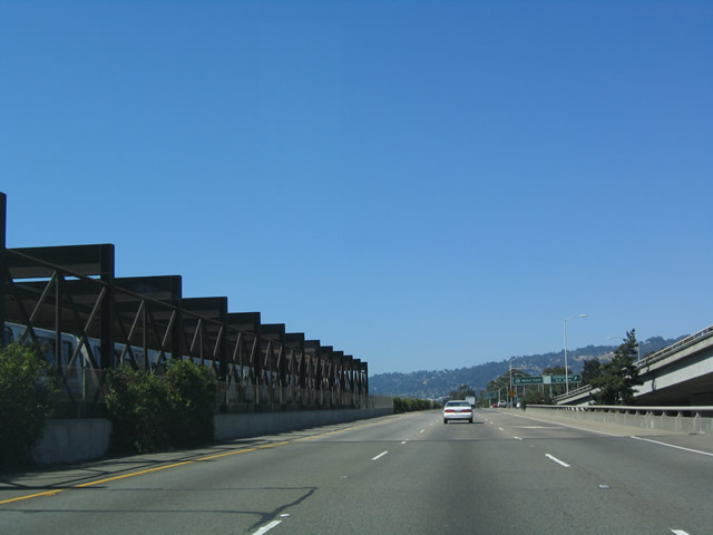
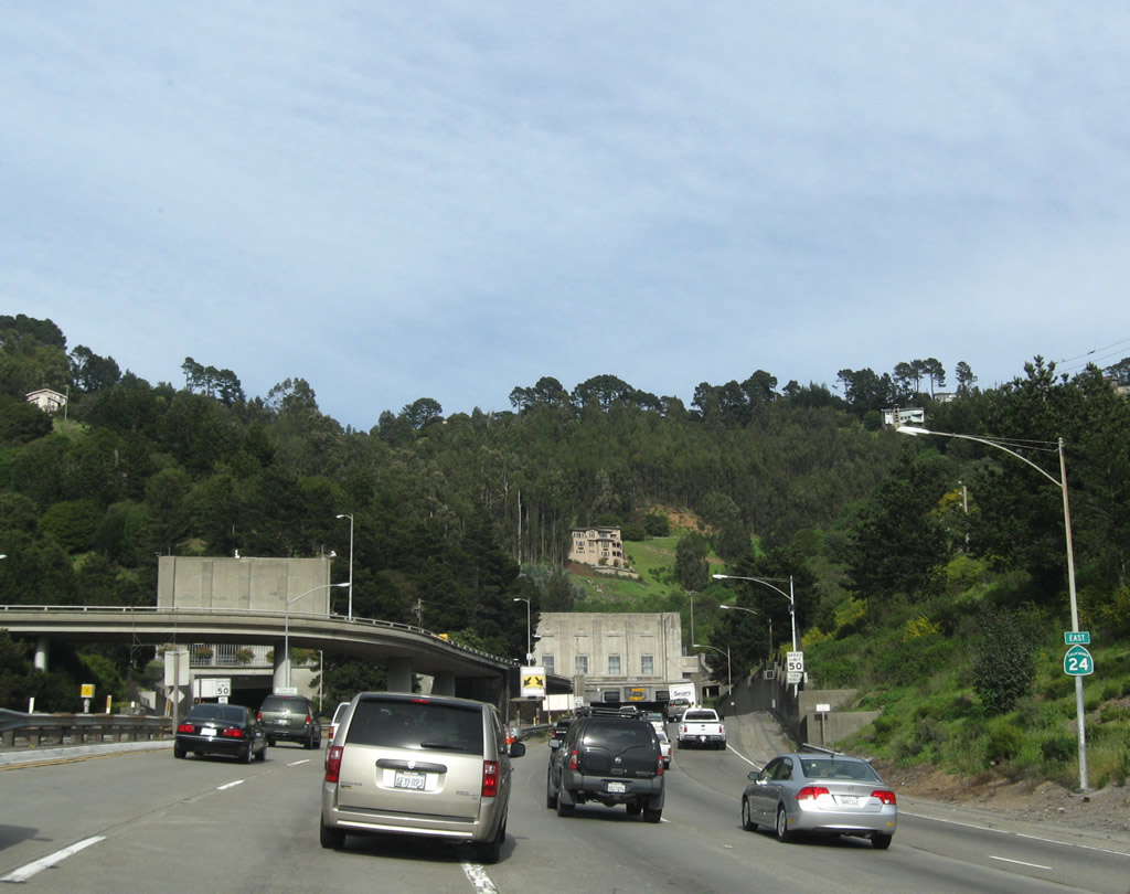
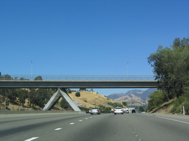
View of California 24 east as seen from the transition ramp from eastbound Interstate 580 to eastbound California 24. Photo taken 07/02/13. |
|
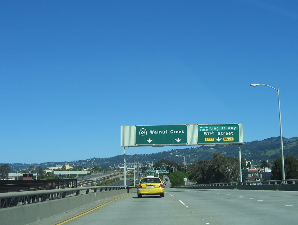
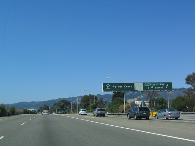
Upon exiting eastbound Interstate 580, the first exit for eastbound California 24 appears even before it merges with traffic from eastbound Interstate 980 from downtown Oakland. That exit is Exit 2, Martin Luther King, Jr. Way and 51st Street. The exit numbering continues the same numbering as Interstate 980, hence why the first exit along eastbound California 24 is Exit 2 and not Exit 1. Photo taken 03/19/06. |
|
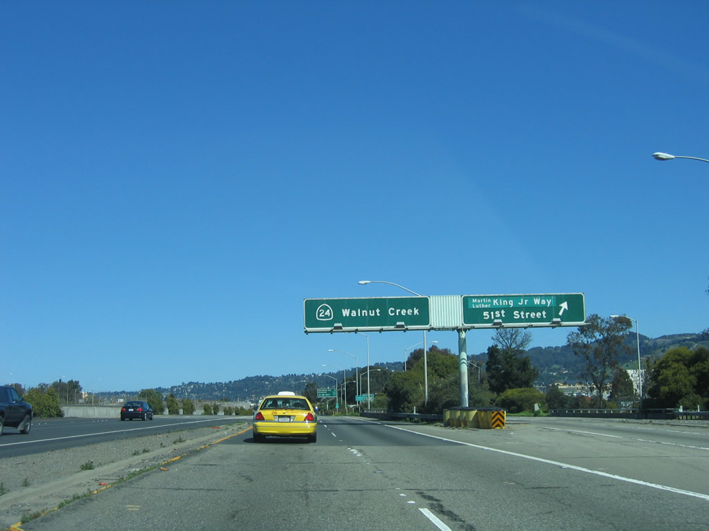
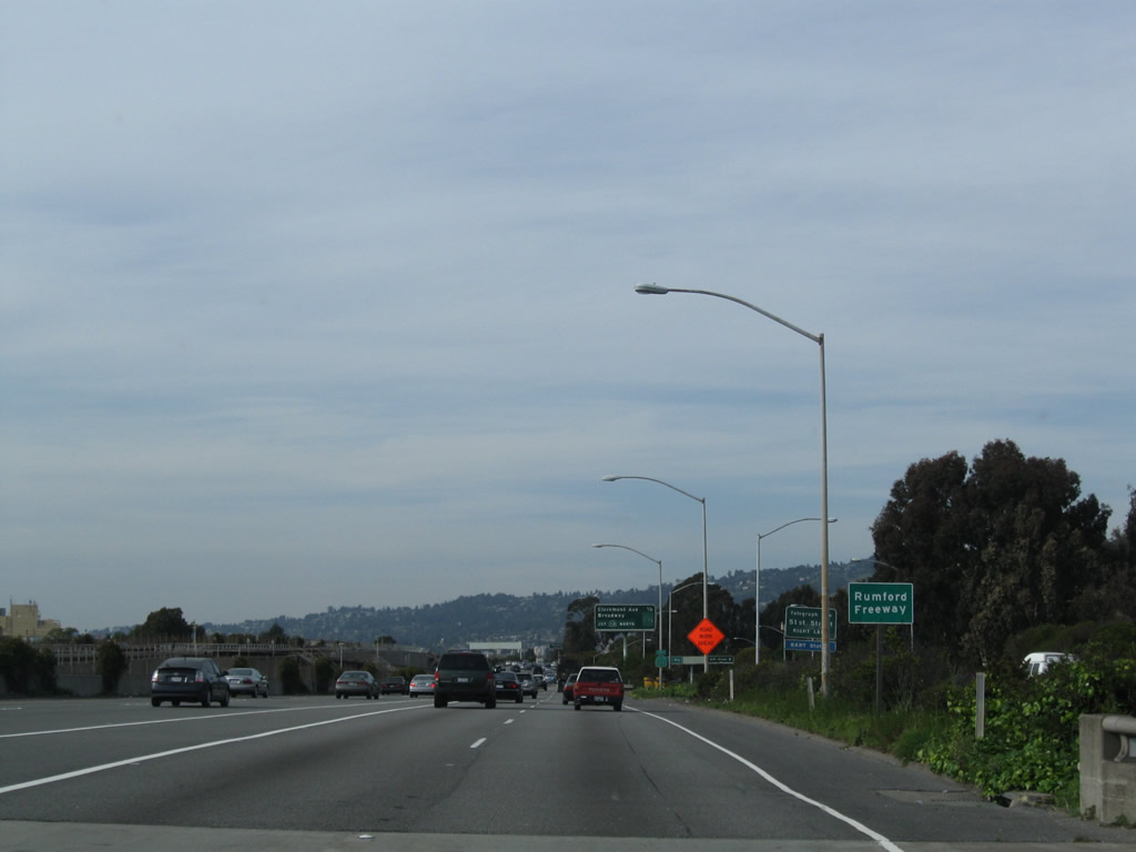
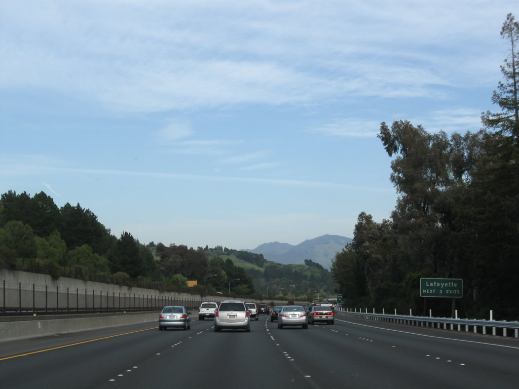
Eastbound California 24 (Rumford Freeway) reaches Exit 2, Martin Luther King, Jr. Way and 51st Street in Oakland. Notice the additional lanes coming in from Interstate 980 . Photo taken 03/19/06. |
|
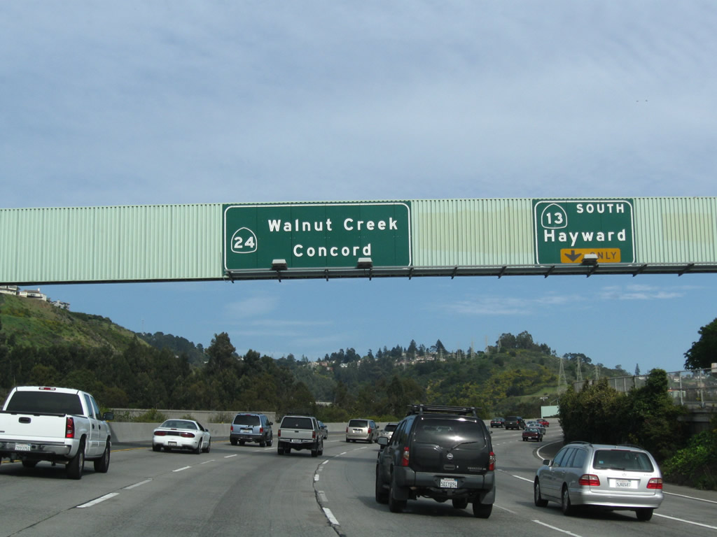
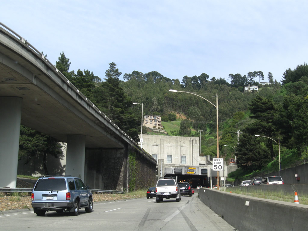
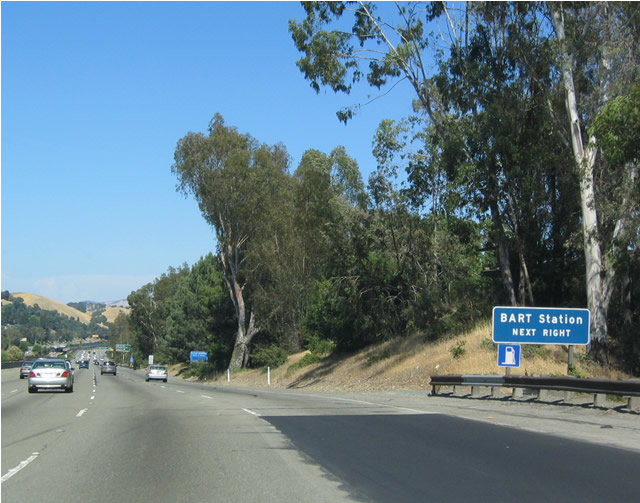
As for mainline Interstate 980, it transforms into California 24 as it approaches the on-ramp in the previous photo. Note the sign bridge and ramp to the right of the mainline. To the left is the first Bay Area Rapid Transit (BART) station to be found in the median of California 24. The balance of California 24 will follow the BART all the way to Walnut Creek. Photo taken 07/05/04. |
|
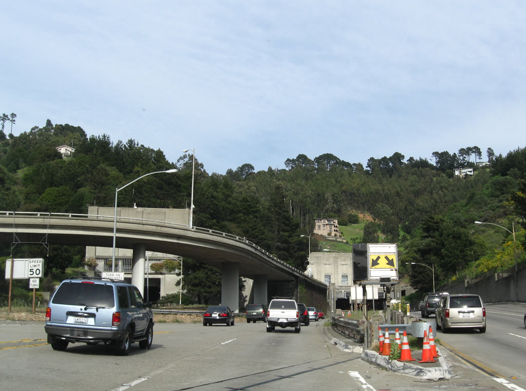
Here is another view of the exit from the transition ramp from Interstate 580 onto eastbound California 24; the signs are the same as those presented in the photo two boxes above. Photo taken 07/05/04. |
|
California 24 is designated as the William Byron Rumford Freeway, named in honor of the first African-American to be elected to office in Northern California. Mr. Rumford lived from 1908 to 1986, and he became representative of the 17th state assembly district in January 1949. Together with Interstate 980, the section of California 24 freeway from Oakland to the Caldecott Tunnel is also known as the Grove Shafter Freeway. Photo taken 04/06/09. |
|
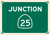
This is the first reassurance shield for eastbound California 24. Photo taken 04/06/09. |
|
|
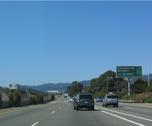
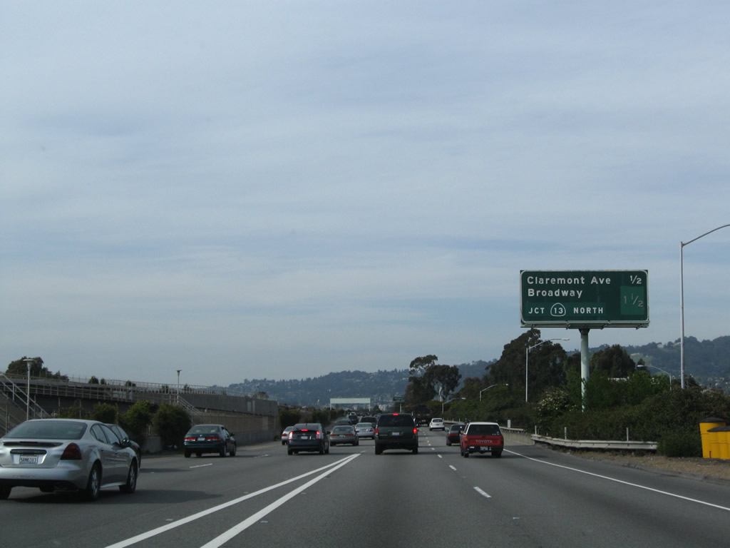
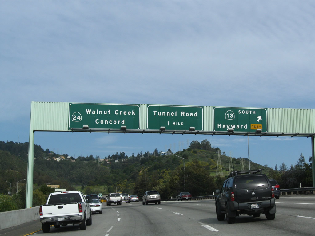
This mileage sign is located along eastbound California 24; it provides the distance to Exit 3, Claremont Avenue and Exit 4, Broadway/California 13 (Warren Freeway). A BART train is visible in the median of the freeway on its elevated tracks. Photos taken 07/05/04 and 04/06/09. |
|
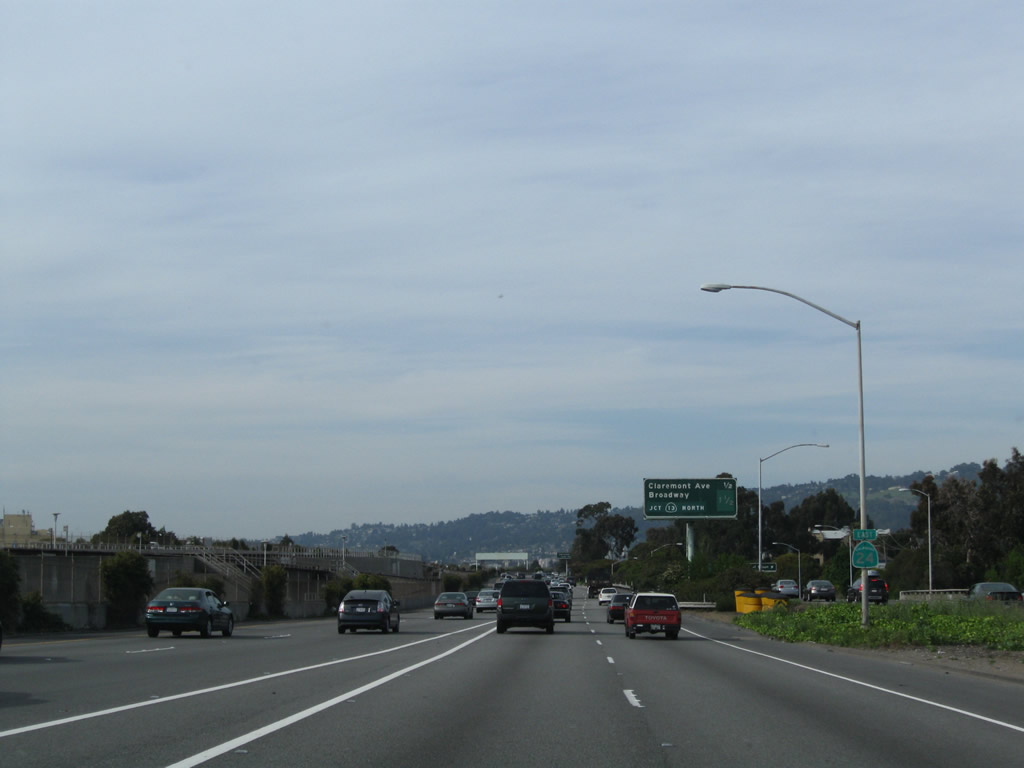
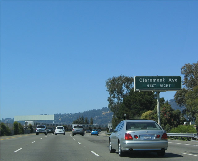
Use Claremont Avenue northeast to reach Berkeley; a left turn at College Avenue leads to the University of California at Berkeley. Photo taken 07/05/04. |
|
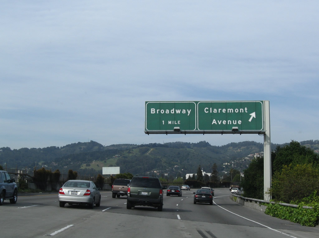
Eastbound California 24 at Exit 3, Claremont Avenue. The next exit is Exit 4, Broadway, one mile. California 24 is still within the city of Oakland, and it will not leave until reaching the midpoint of the Caldecott Tunnel under Grizzly Peak (which is also the county line between Alameda County and Contra Costa County). Photo taken 04/06/09. |
|
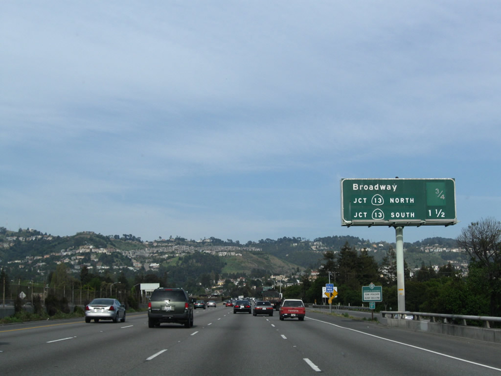
The next exits along eastbound are Exit 4, Broadway to California 13 (Ashby Avenue) north and Exit 5, California 13 (Warren Freeway) south. The first California 13 exit is for northbound, followed by the exit for southbound. Northbound California 13 is Ashby Avenue, which runs east-west through Berkeley; southbound California 13 (Warren Freeway) is a four-lane freeway that connects California 24 with Interstate 580/MacArthur Freeway. Photo taken 04/06/09. |
|
An exit number sign for Exit 4 is posted shortly thereafter. Photo taken 07/02/13. |
|
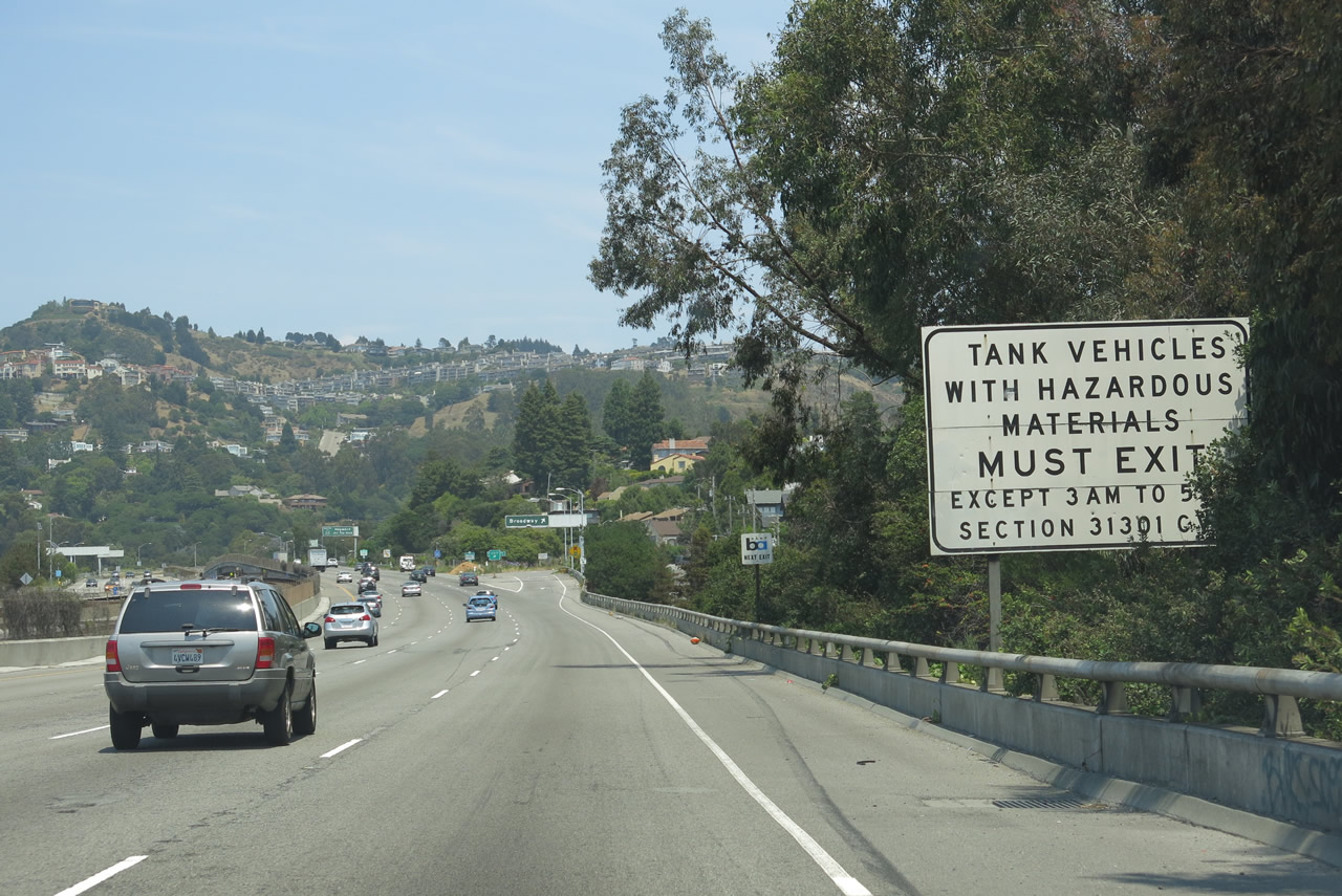
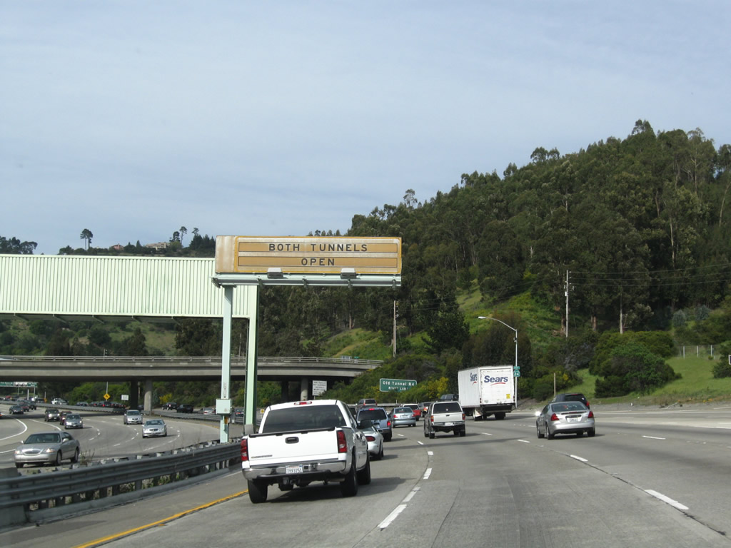
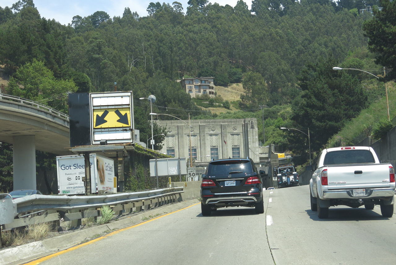
The Caldecott Tunnel will punch through the Oakland Hills (Grizzly Peak) and connect with Contra Costa County. Hazardous materials are not permitted in the tunnel except during designated hours. Photo taken 07/02/13. |
|
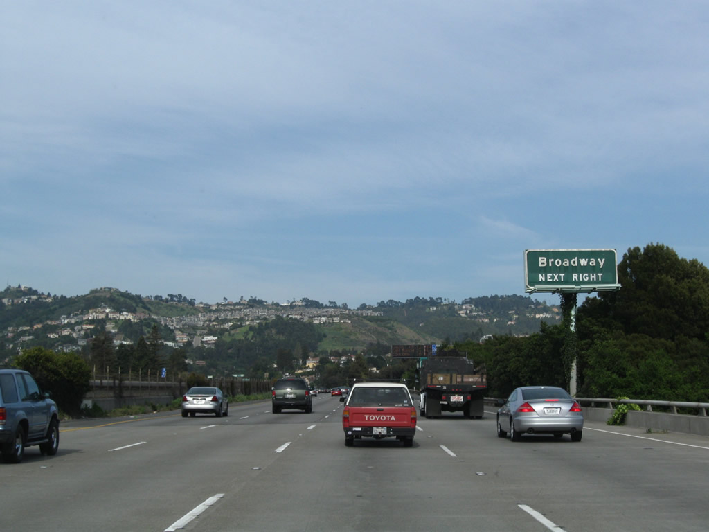
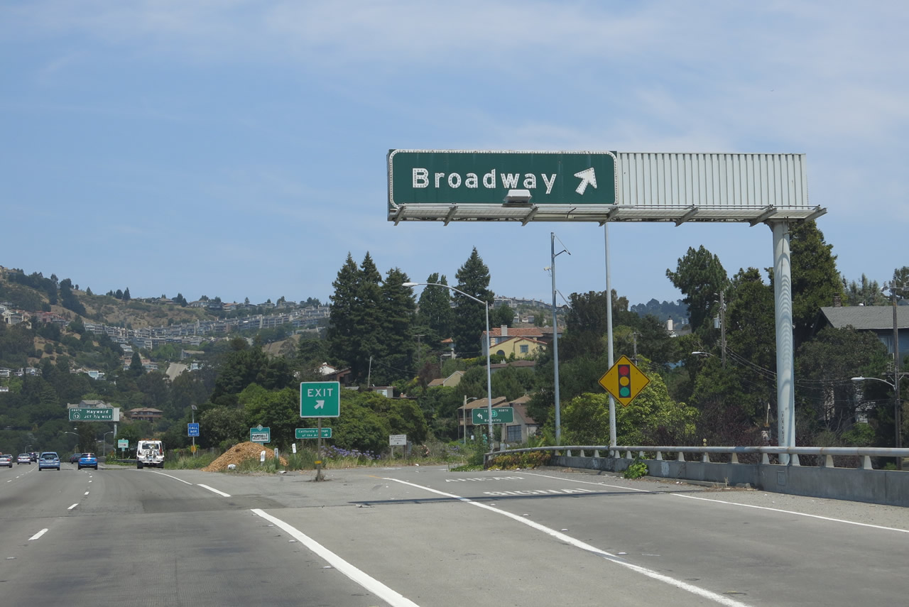
Broadway heads southwest from the Exit 4 interchange back toward downtown Oakland. Note another BART train in the median of the freeway on its elevated tracks. Photo taken 04/06/09. |
|
Eastbound California 24 reaches Exit 4, Broadway, which provides a connection to Northbound California 13 (Ashby Avenue). Broadway has in interesting path through Oakland. Originating at Jack London Square near the Interstate 880/980 interchange, Broadway starts northeast on a fairly straight course until it hits California 24. From this exit east to the Caldecott Tunnels, Broadway closely follows California 24, and it ends when it backtracks into Caldecott Lane and Tunnel Road. However, to complicate matters, just before Broadway intersects California 24, it spawns Broadway Terrace, a separate road that leads into the Oakland Hills. Photo taken 07/02/13. |
|
This view looks at the off-ramp at Exit 4 and signage associated with California 13 north/south. Photo taken 07/02/13. |
|
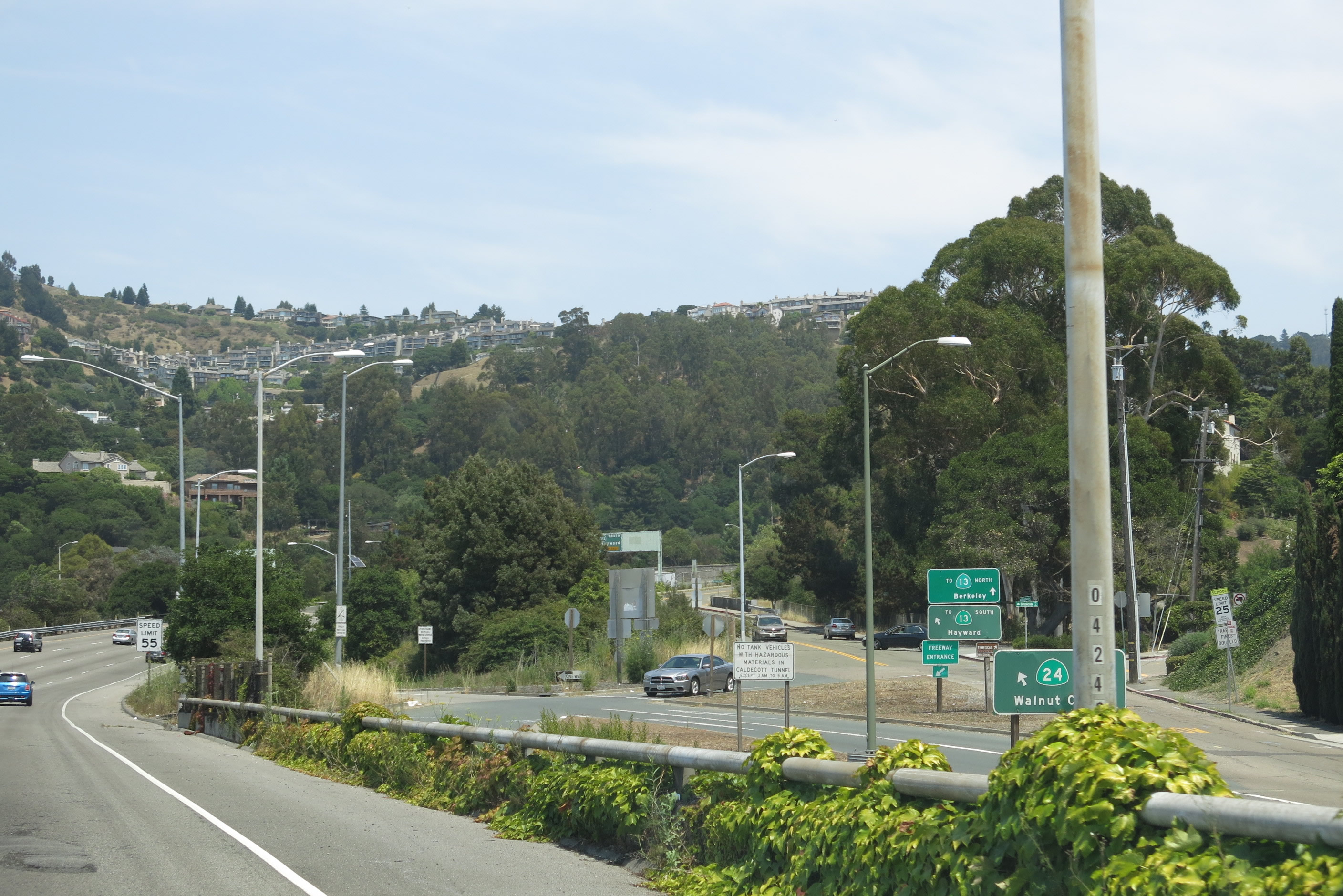
The next exit along eastbound California 24 is Exit 5, California 13 (Warren Freeway) south, three-quarters of a mile. This is a direct transition ramp from California 24 east to California 13 south, unlike the connection to northbound California 13. Photo taken 07/02/13. |
|
A California 24 east reassurance shield is posted soon thereafter. Photo taken 07/02/13. |
|
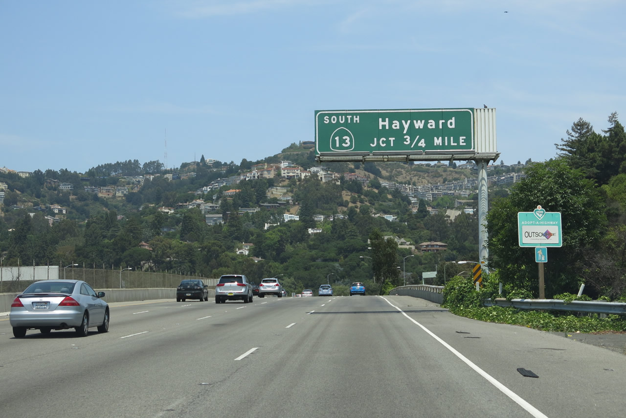
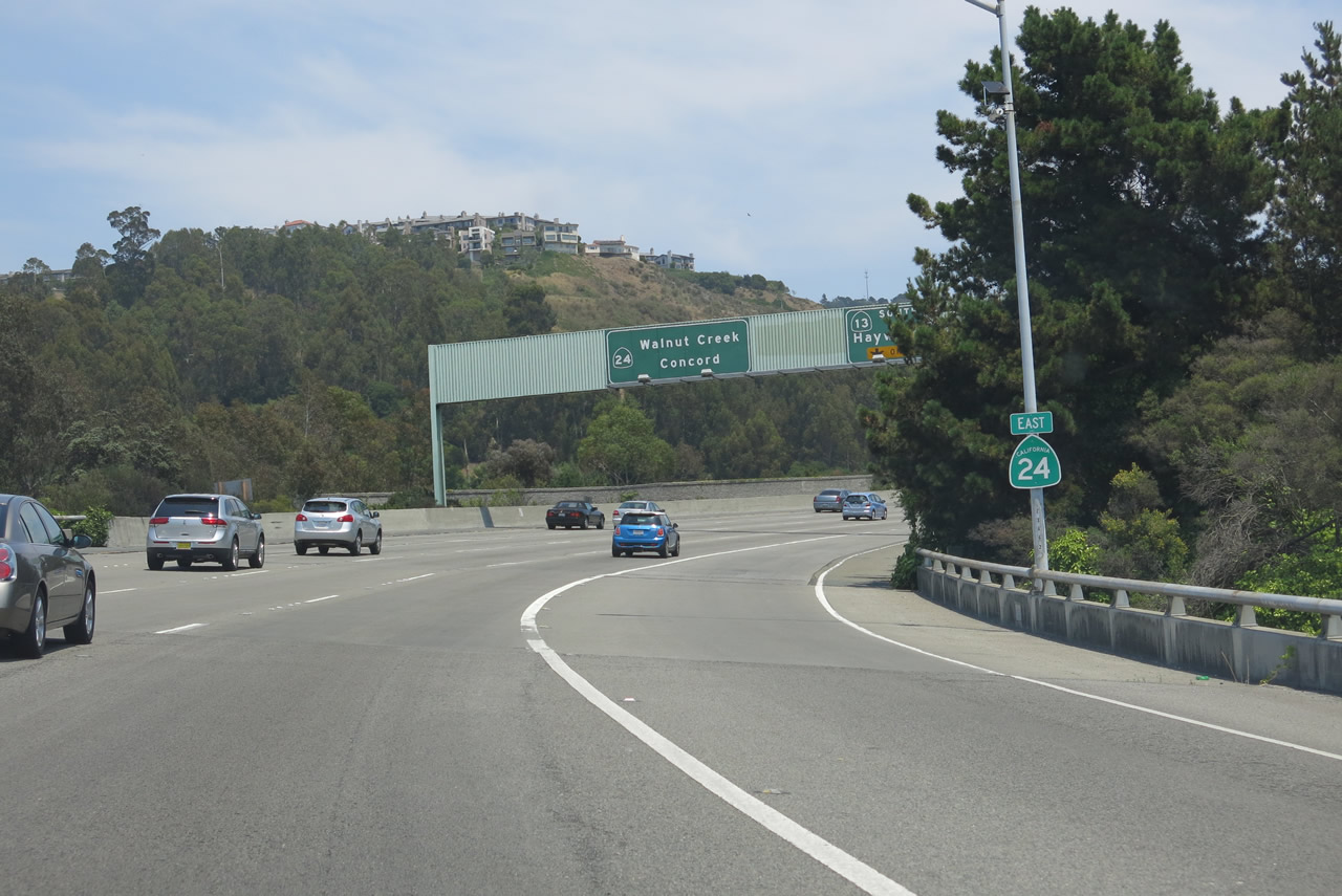
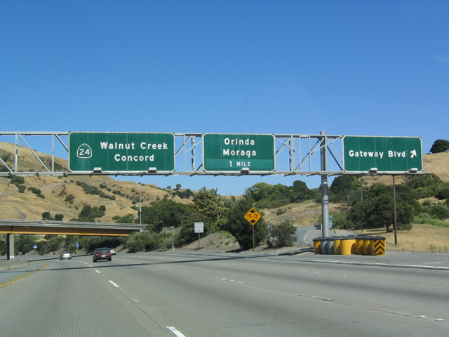
Eastbound California 24 approaches Exit 5 for California 13 (Warren Freeway) south. Note the control cities of Walnut Creek and Concord for California 24. Photo taken 04/06/09. |
|
Exit 5 departs from SR 24 east for SR 13 (Warren Freeway) south to Interstate 580 near Mills College. Photos taken 04/06/09. |
|
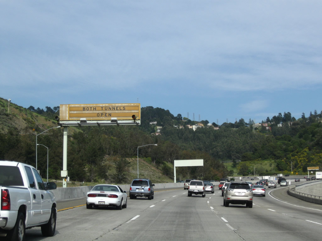
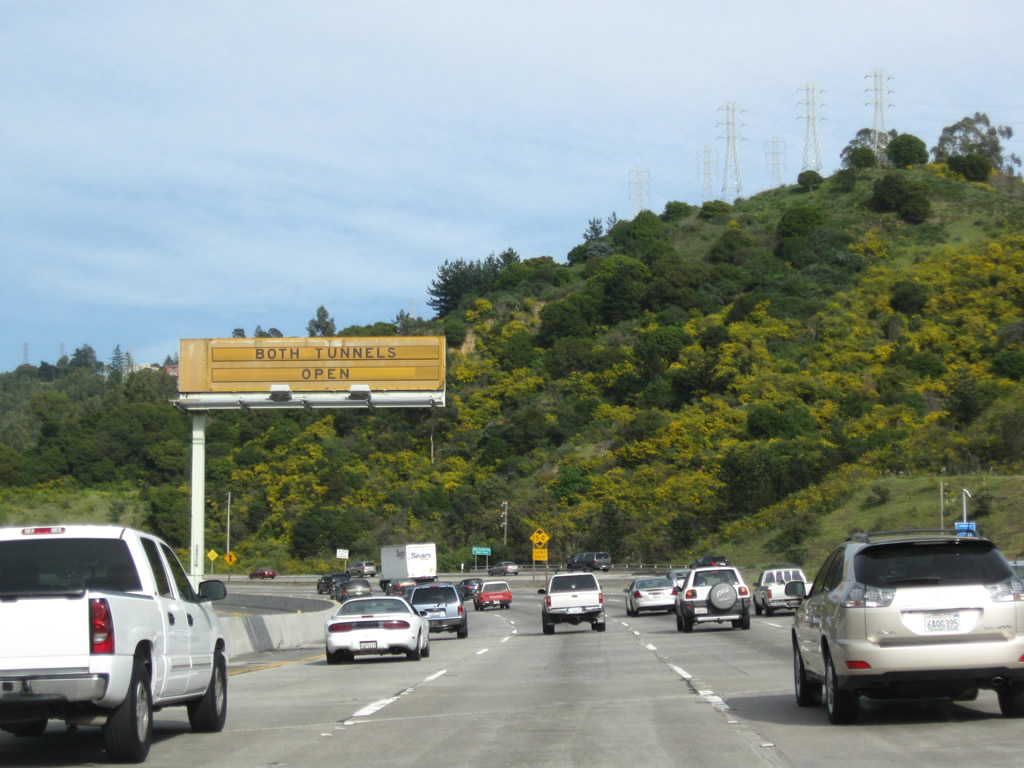
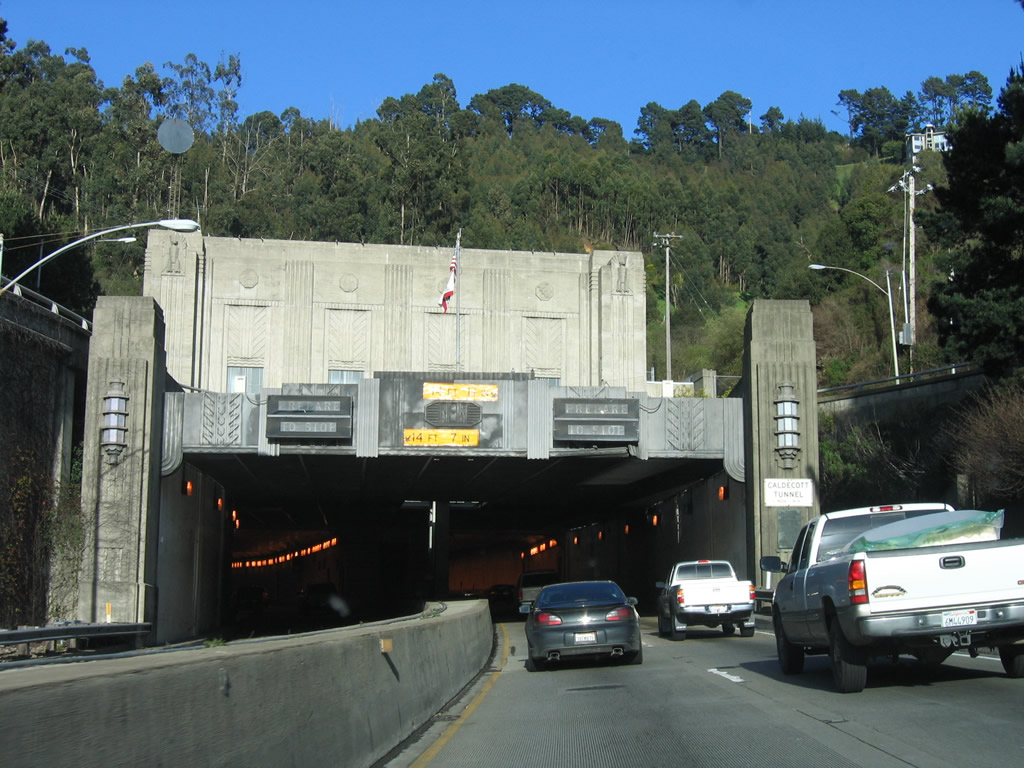
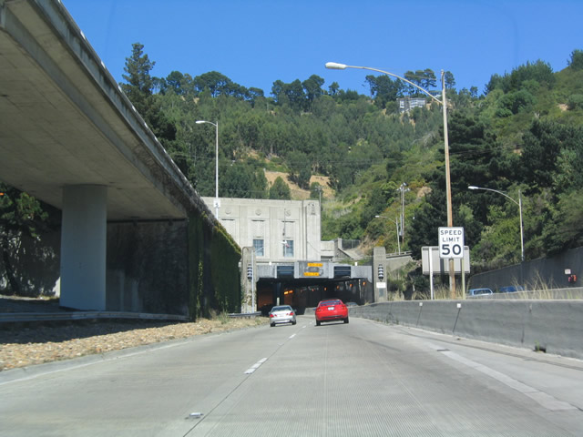
Beyond California 13, California 24 continued to climb toward the Caldecott Tunnel. With the reversible traffic pattern still in place, the first and second bores of the tunnel were open for outbound traffic. Photo taken 04/06/09. |
|
|
Additional changeable signs advised motorists of the second bore status for the Caldecott Tunnel. This traffic pattern was eliminated with the opening of the fourth bore in November 2013. Photos taken 04/06/09. |
|
Slip ramps (Exit 6) precede the SR 24 eastbound partition for the Caldecott Tunnel with Broadway and Caldecott Lane, parallel service roads. Photo taken 04/06/09. |
|
|
Exit 6 leaves SR 24 east for Broadway leading back toward Old Tunnel Road and Caldecott Field. Photos taken 07/02/13 and 04/06/09. |
|
|
|
|
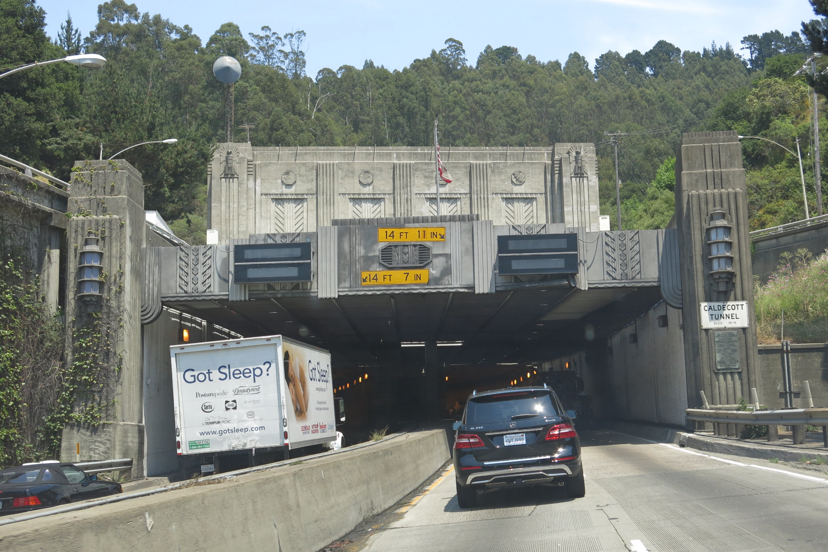
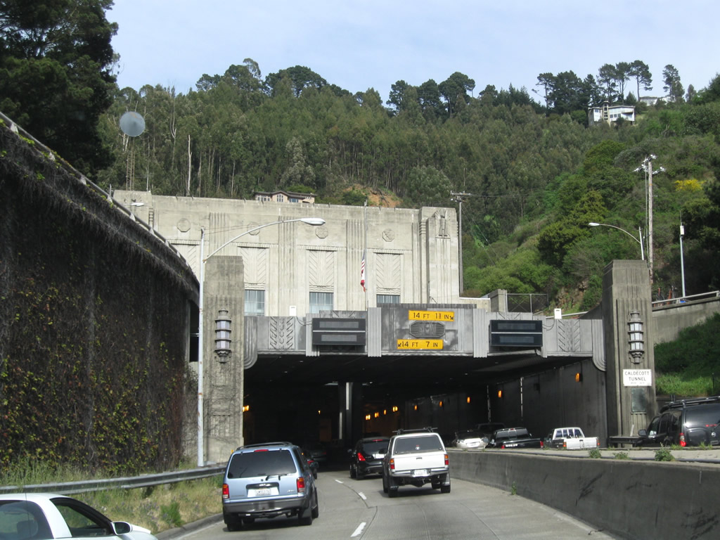
| California 24 partitions with two lanes traveling through both the first and second bores. Both tubes were completed in 1937 and are below Interstate standards. With the November 2013 opening of the fourth bore, the second (then middle) was converted to eastbound only traffic. Photos taken 04/06/09 and 07/02/13. |
|
|
|
SR 24 east approaches the first bore of the Caldecott Tunnel. Photos taken 07/02/13 and 03/18/06. |
|
|
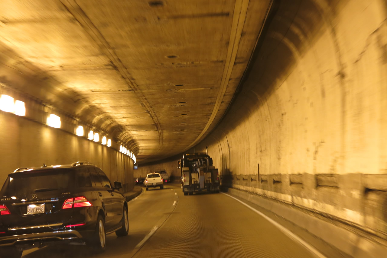
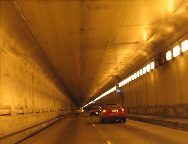
The southern bore of the Caldecott Tunnel is narrow with no shoulders. Passing is however permitted. Photos taken 03/18/06 and 07/02/13. |
|
|
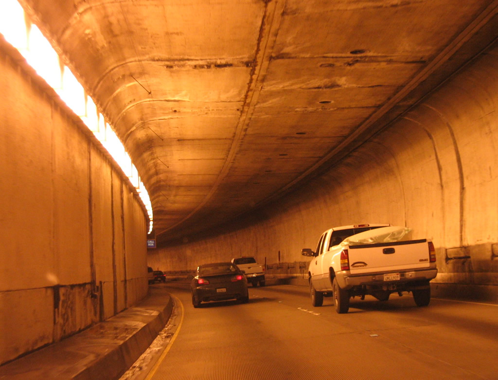
Entering the second bore of the Caldecott Tunnel along SR 24 eastbound. First photo taken 07/05/04; second photo taken 04/06/09. |
|
|
California 24 narrows with no shoulders through the second bore of the Caldecott Tunnel Photos taken 04/06/09 and 07/05/04. |
|
|
|
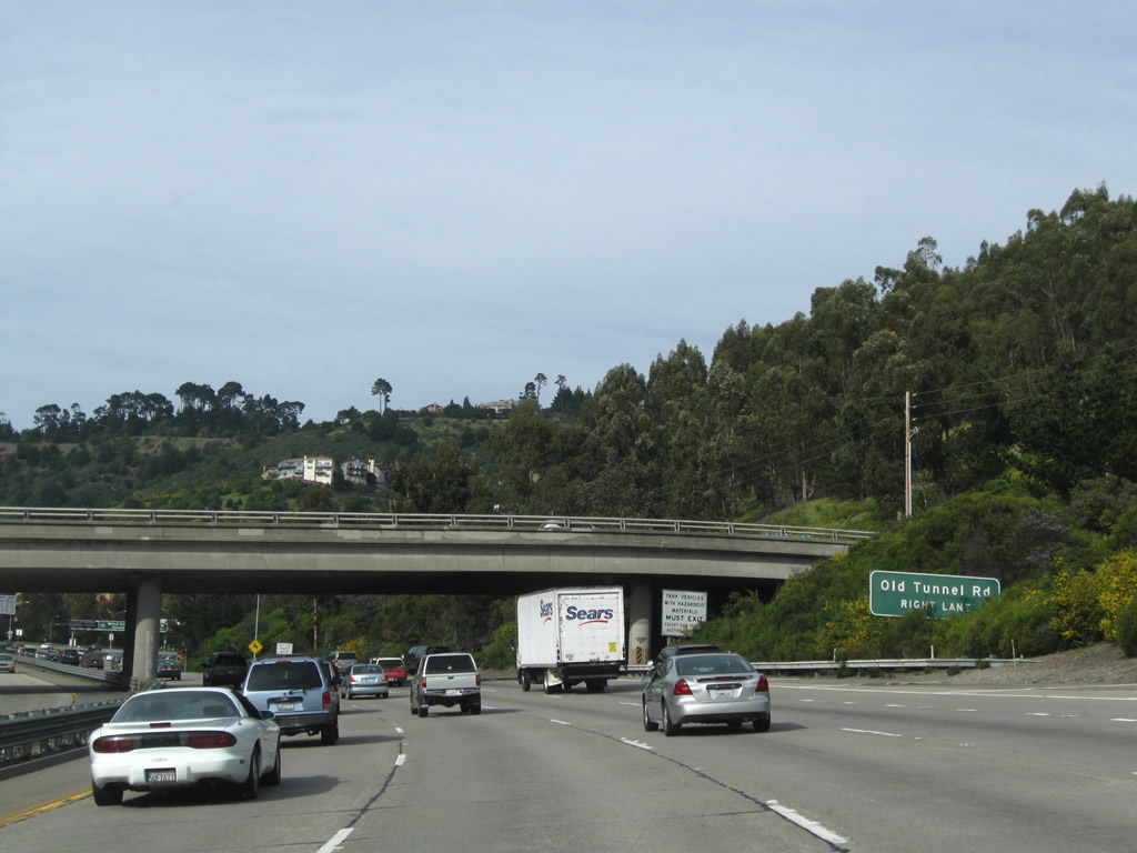
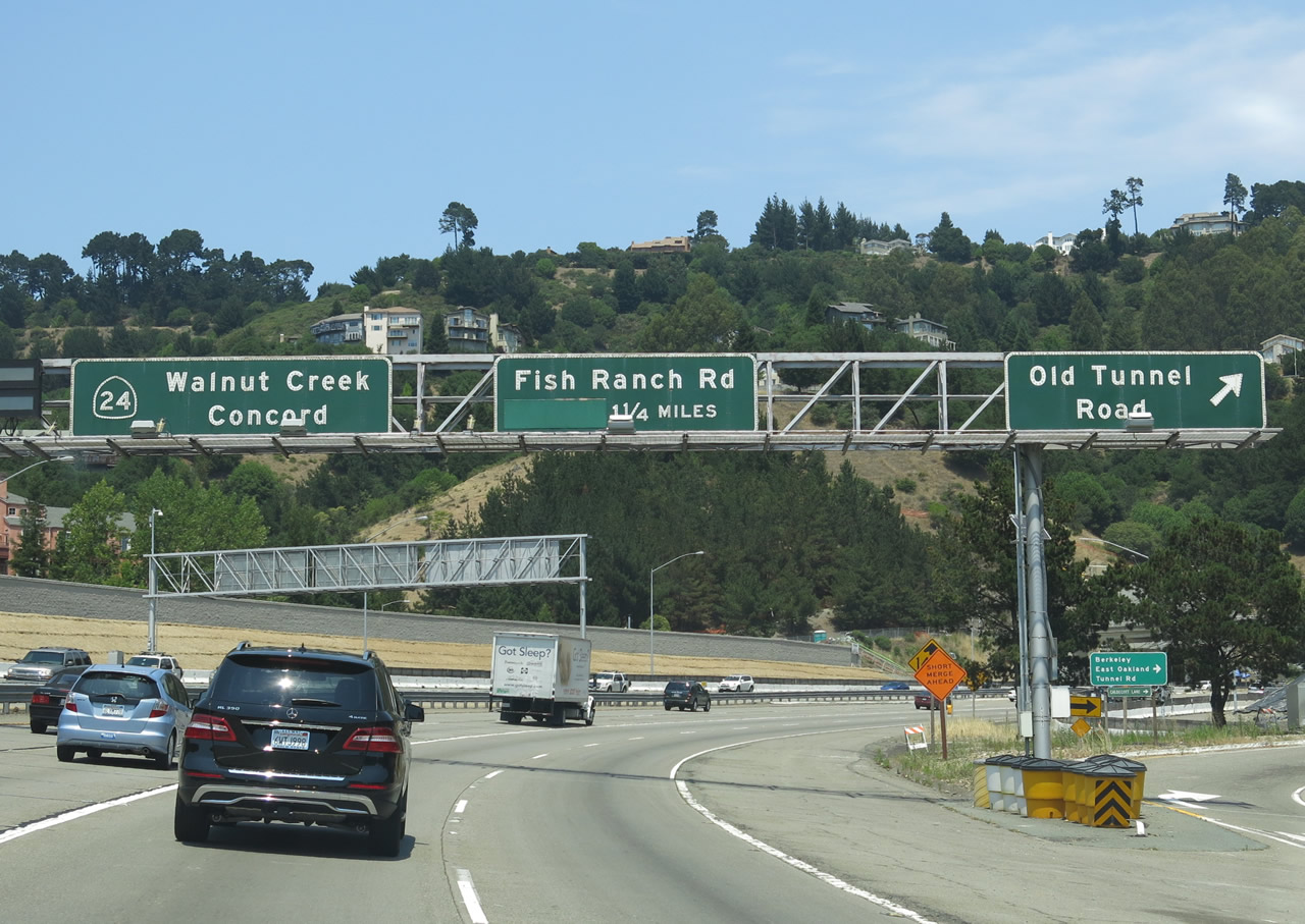
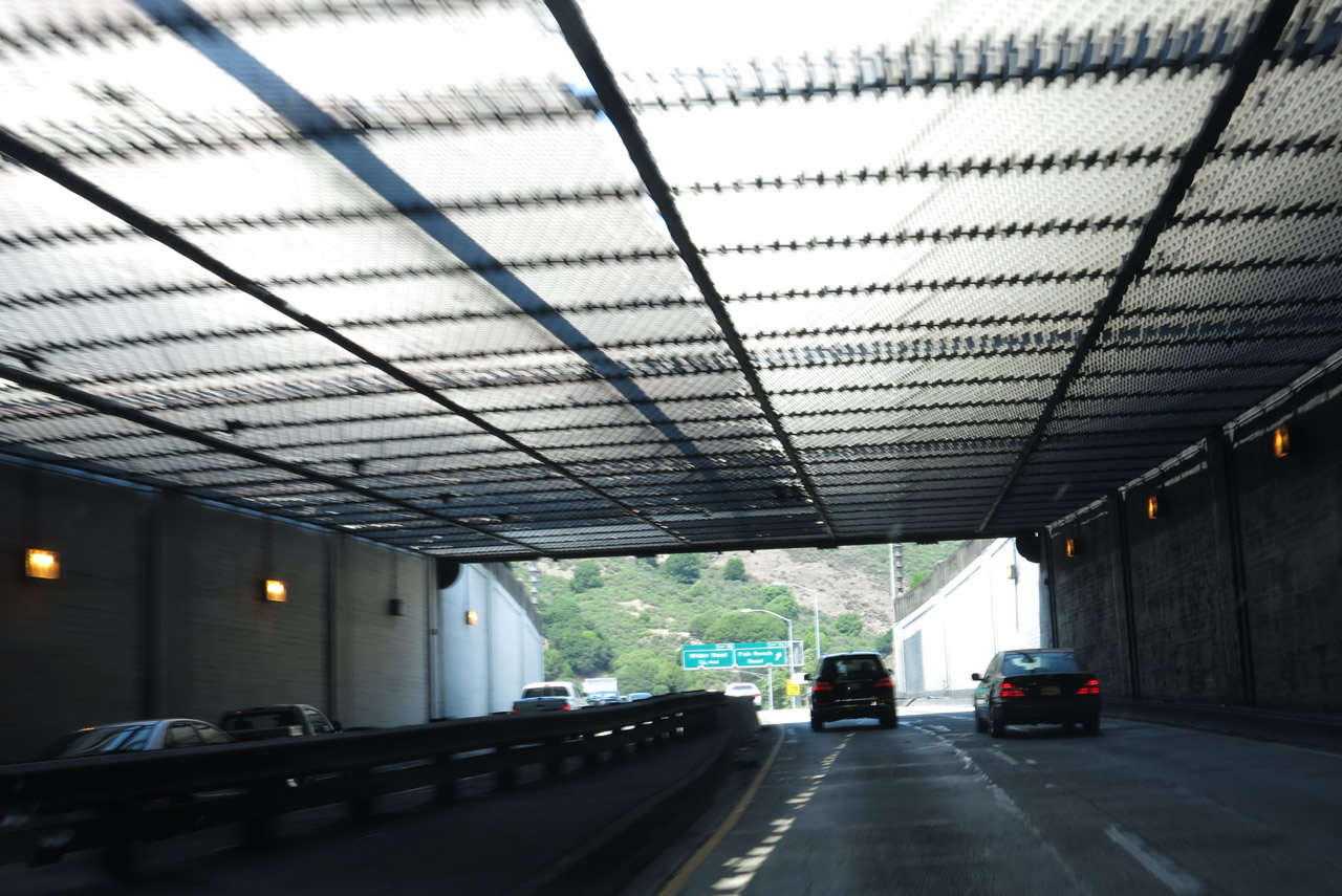
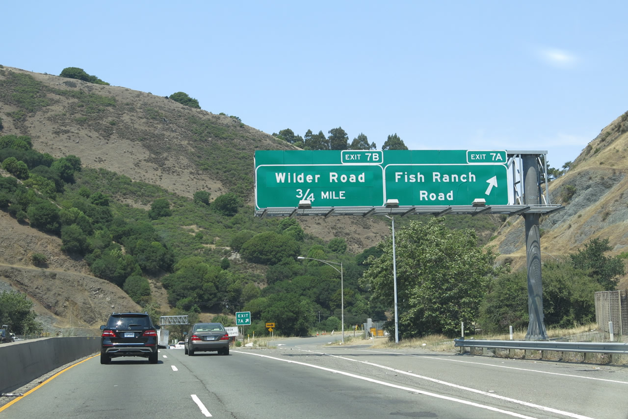
Traffic from the first and second bores combines ahead of the first Contra Costa County exit. The off-ramp (Exit 7A) for Fish Ranch Road can only be accessed from the first bore however. Photos taken 07/02/13, 04/06/09, and 03/18/06. |
|
|
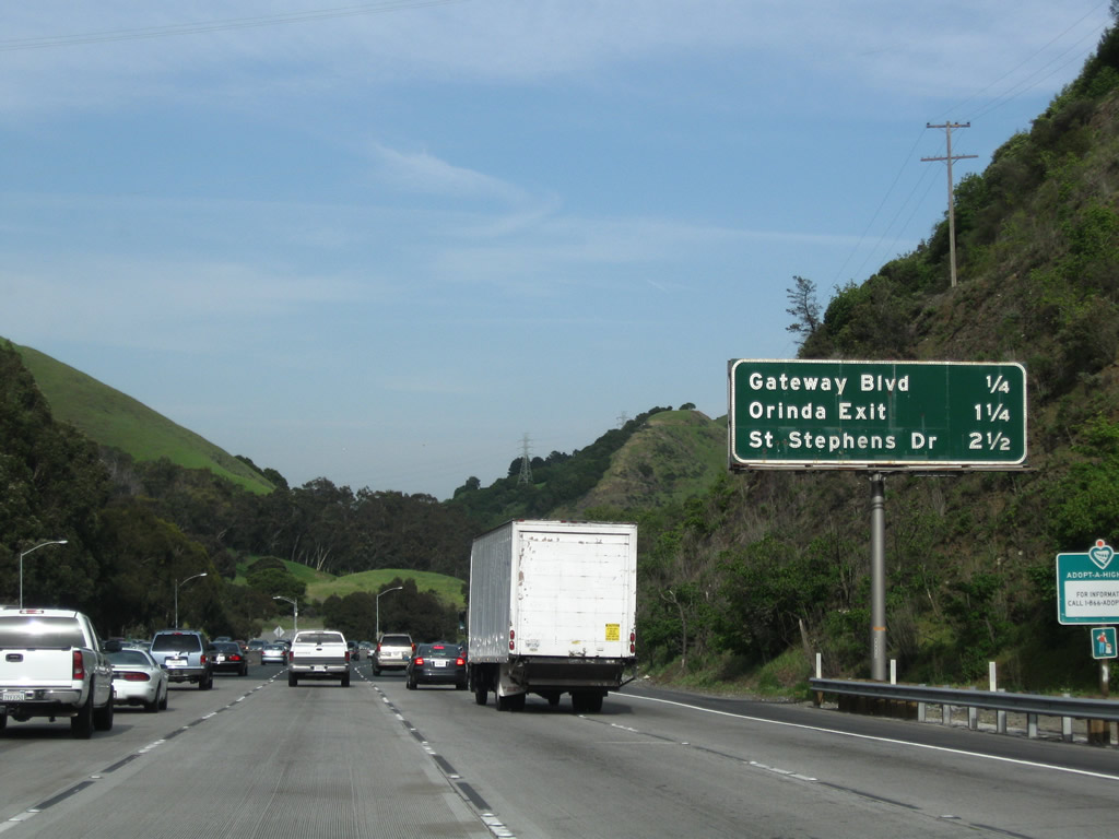
The ensuing exits along SR 24 east are Exit 7B, Wilder Road (formerly Gateway Boulevard); Exit 9, Camino Pablo to Orinda and Moraga; and Exit 10, St. Stephens Drive and Hidden Valley Road. Photo taken 04/06/09. |
|
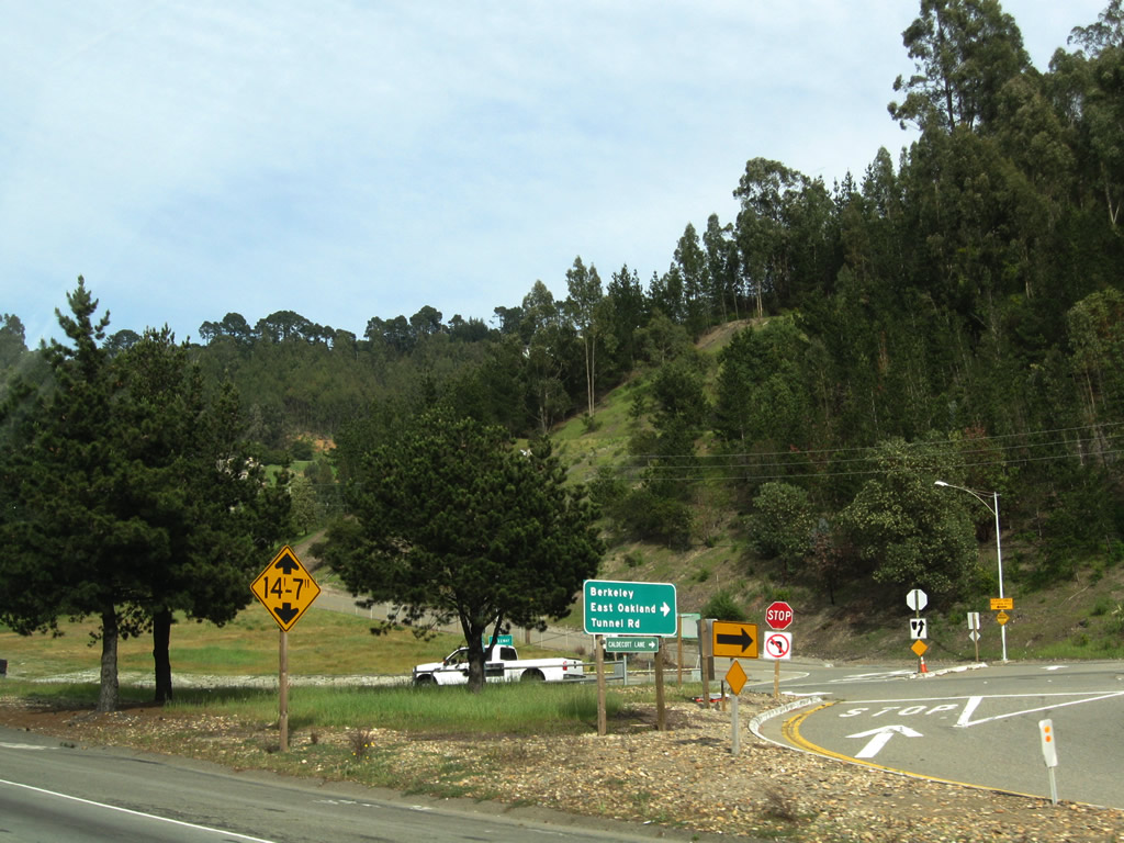
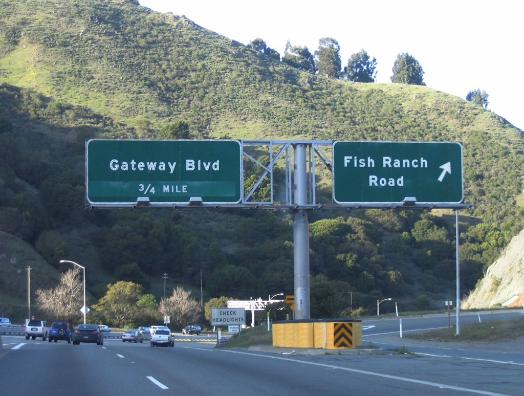
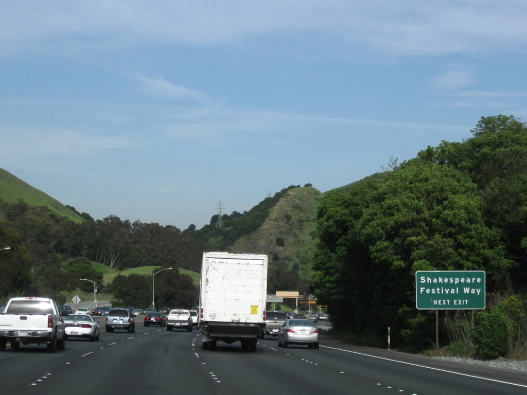
California Shakespeare Festival Way extends north from Exit 7B to an amphitheater. Photo taken 04/06/09. |
|
|
Eastbound California 24 (Rumford Freeway) reaches Exit 7B, Wilder Road (formerly Gateway Boulevard). Photos taken 04/06/09 and 07/05/04. |
|
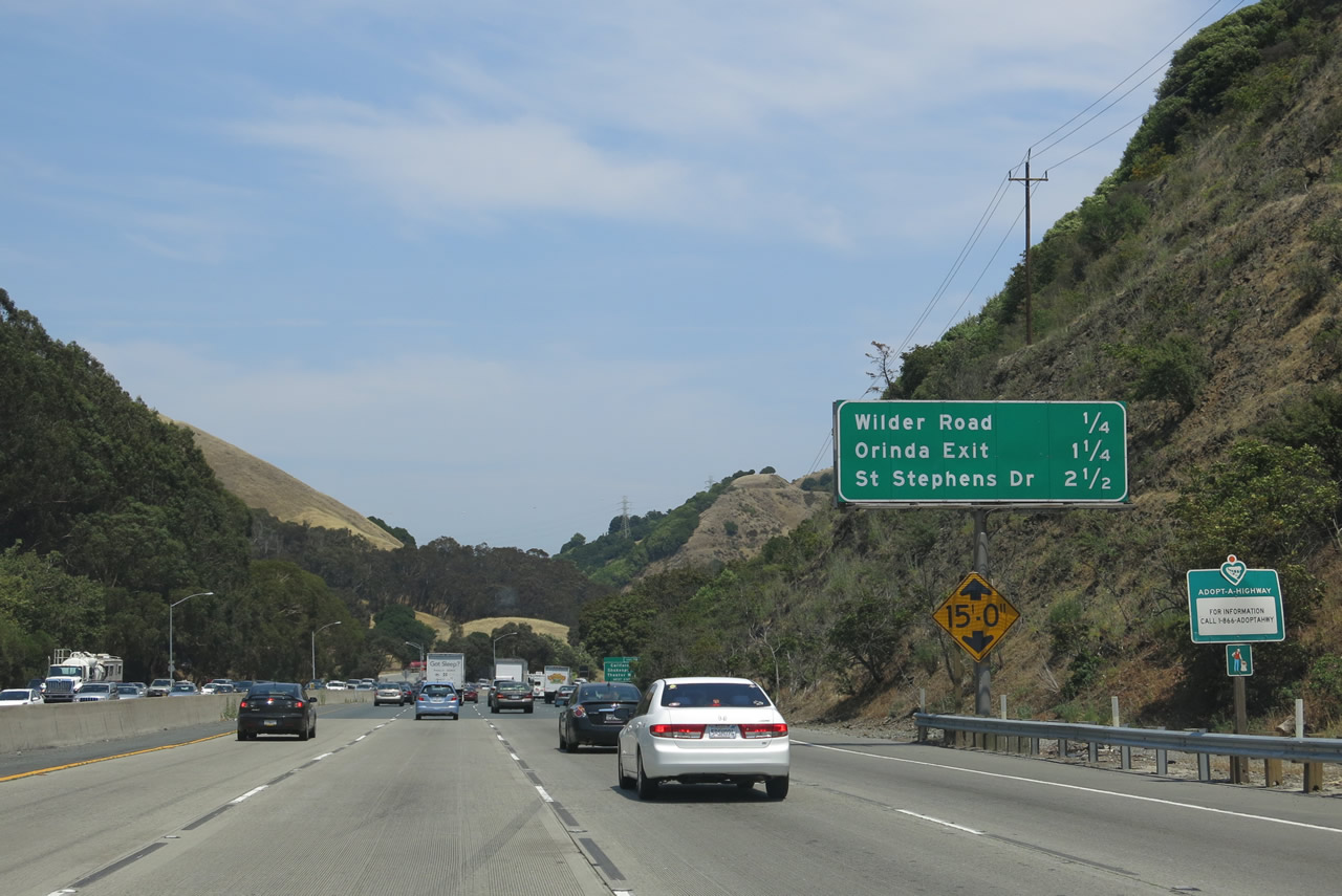
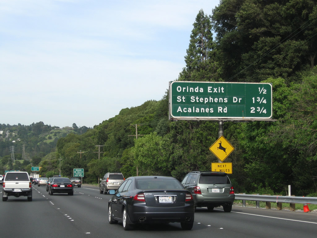
This mileage sign is located along eastbound California 24 as it approaches Exit 9, Camino Pablo to Orinda and Moraga; Exit 10, St. Stephens Road; and Exit 11, Acalanes Road/Mount Diablo Boulevard. At this interchange, California 24 enters Orinda. Photo taken 04/06/09. |
|
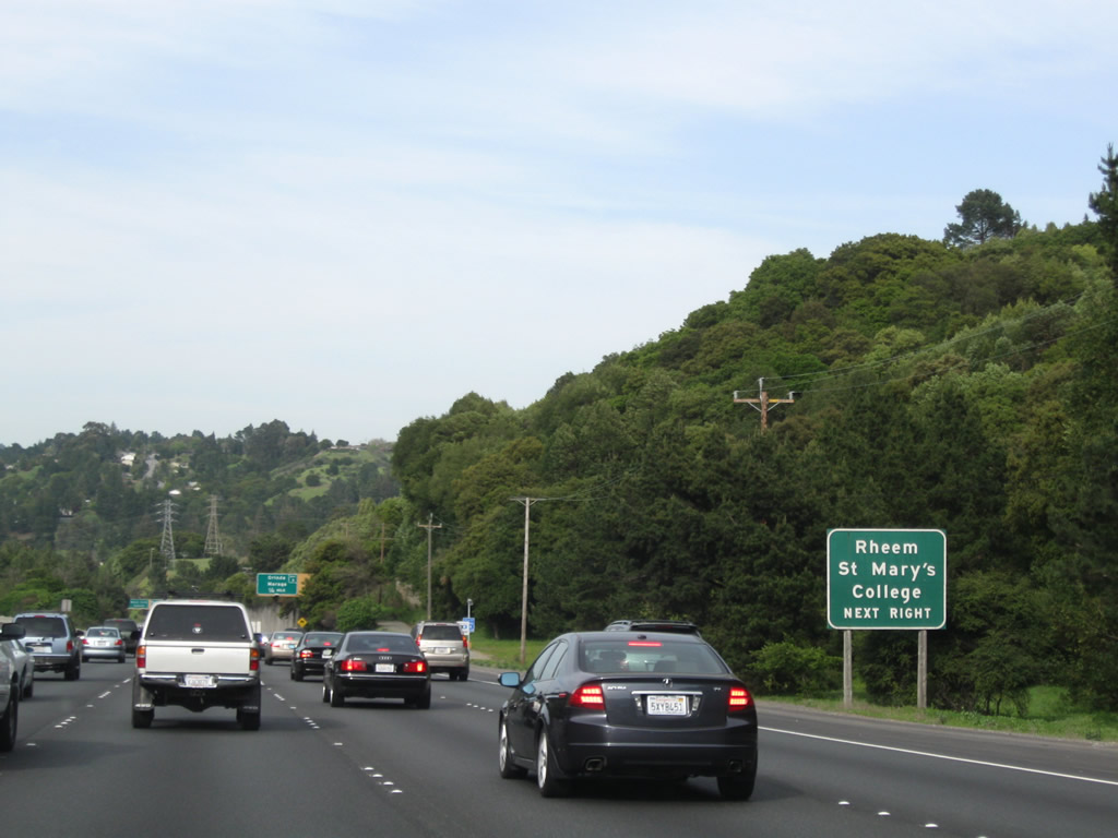
Use Exit 9 to Rheem and St. Mary's College. Photo taken 04/06/09. |
|
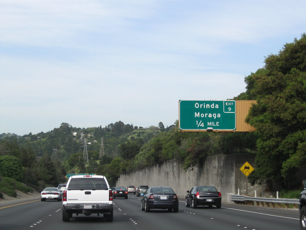
This new exit number sign (erected in 2008) is unusual since it does not provide the street name and only shows the destination cities served by the interchange. This is not common, since most of the newer signs show the street name rather than a city's name. Photo taken 04/06/09. |
|
|
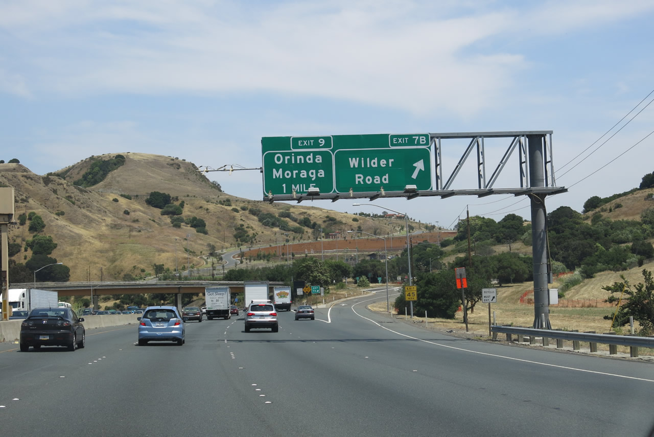
Eastbound California 24 reaches Exit 9, Camino Pablo to Orinda and Moraga. The sign does not indicate the road names and instead indicates the two cities Exit 9 serves, Orinda and Moraga. This is one of the first reflective signs ever installed in the Bay Area. Moraga Way leads south from here through the town of Orinda before entering the town of Moraga. A large park and ride and BART station is located in the expanded median at this interchange. Many East Bay commuters park here and take the BART from here to Oakland, Berkeley, and San Francisco. Photos taken 04/06/09 and 07/05/04. |
|
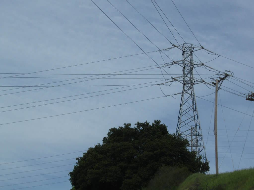
A Pacific Gas and Electric power transmission line tower stands sentinel over the Exit 9 interchange. A BART station is located in the median of this interchange. Photo taken 04/06/09. |
|
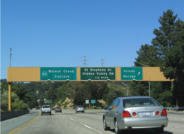
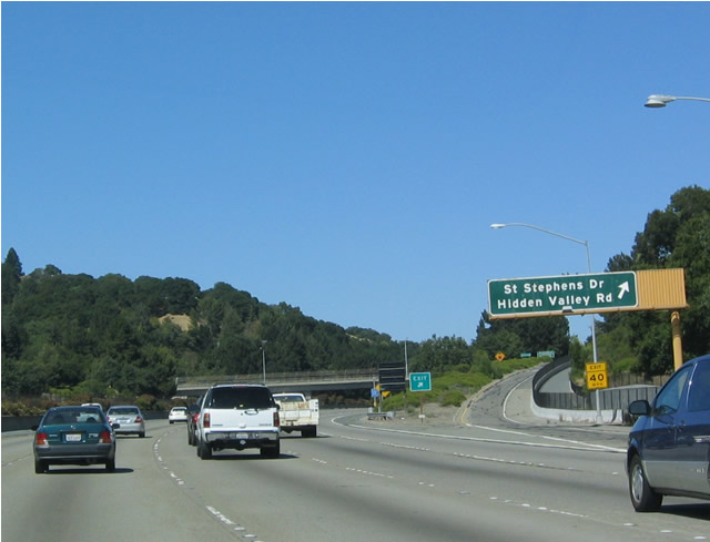
The next mileage sign shows Exit 10, St. Stephens Drive/Hidden Valley Road; Exit 11, Acalanes Road/Mount Diablo Boulevard; and Exit 12, Oak Hill Road. Photo taken 07/05/04. |
|
Exit 10 serves both St. Stephens Drive and Hidden Valley Road. St. Stephens Drive heads north into Orinda, culminating at Las Vegas Road. Hidden Valley Road heads east as a frontage road, then connects to Acalanes Road near Exit 11. South of the interchange, St. Stephens Drive changes into Tahos Road and Wanda Lane into south Orinda. Photo taken 07/05/04. |
|
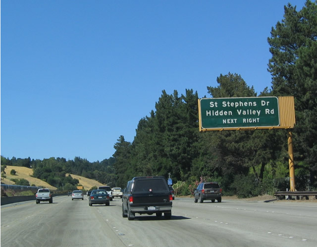
Eastbound California 24 reaches Exit 10, St. Stephens Drive/Hidden Valley Road. This is the last Orinda exit; the freeway enters Lafayette next. Photo taken 08/16/03. |
|
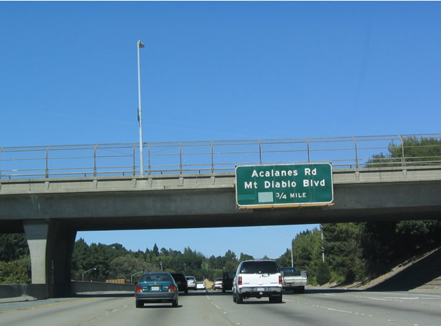
The signage for Exit 11, Acalanes Road/Mount Diablo Boulevard, three-quarters of a mile is mounted on the St. Stephens Drive overpass over California 24. Photo taken 08/16/03. |
|
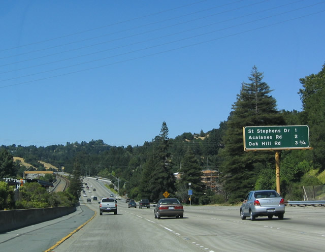
This mileage sign provides the distance to Exit 11, Acalanes Road and Mount Diablo Boulevard and Exit 12, Oak Hill Road. Photo taken 04/06/09. |
|
These California 24 reassurance and scenic route shields are posted after the on-ramp from Exit 10. Photo taken 04/06/09. |
|
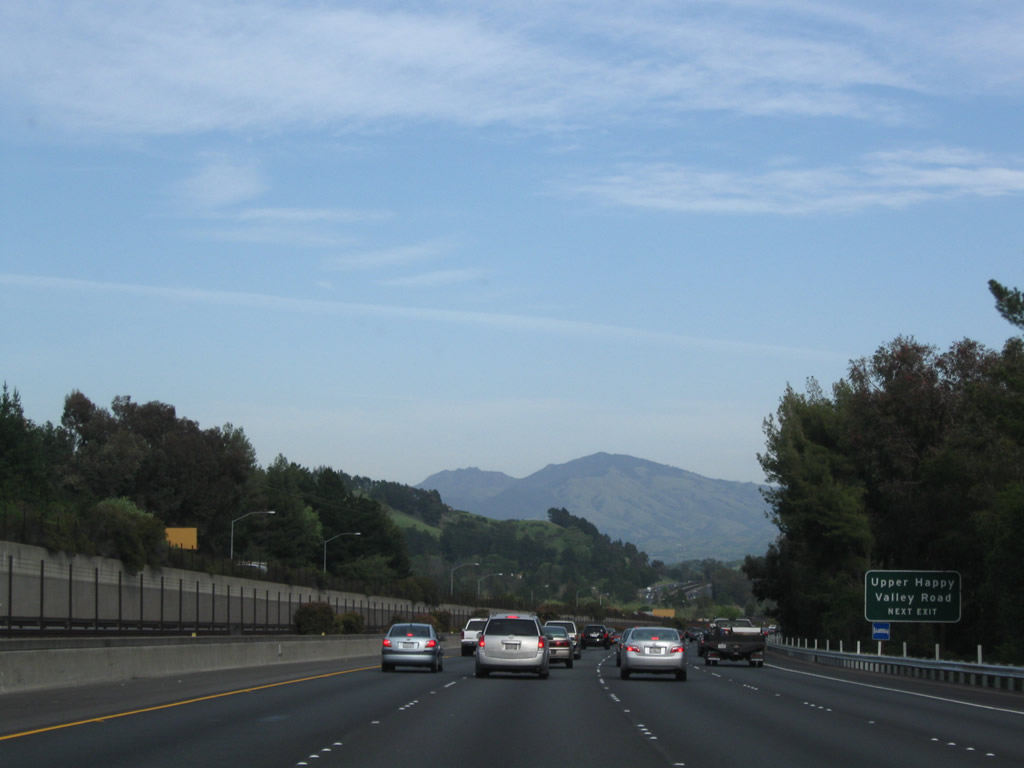
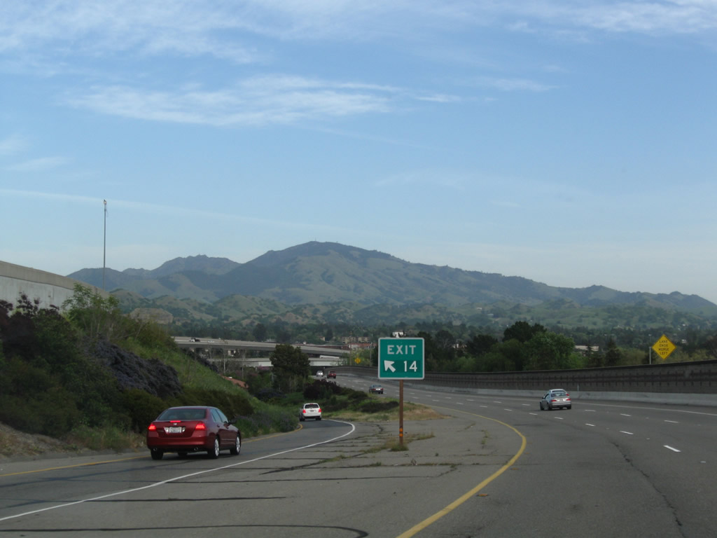
Mount Diablo comes into view as California 24 (Rumford Freeway) rounds a corner. The next three exits all serve the quaint and beautiful city of Lafayette. Photo taken 04/06/09. |
|
Use Exit 11 (Acalanes Road and Mount Diablo Boulevard) to Upper Happy Valley Road. Photo taken 04/06/09. |
|
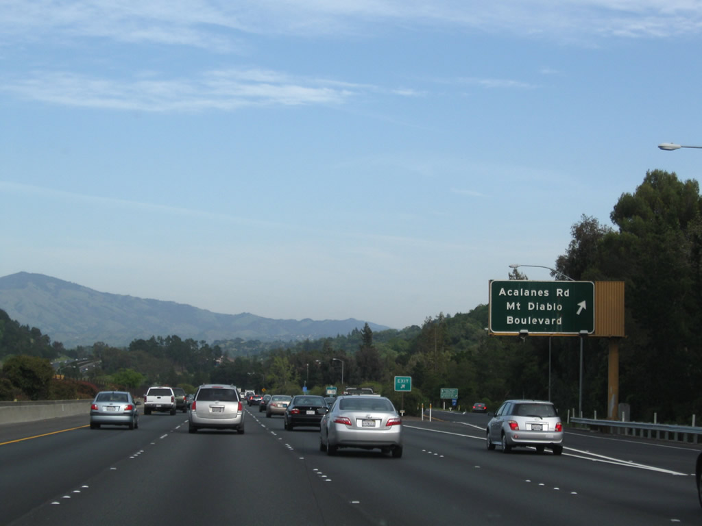
Eastbound California 24 meets Acalanes Road/Mount Diablo Boulevard at Exit 11, a modified partial cloverleaf interchange (it only lacks the direct connection from westbound to preclude it from being a full cloverleaf). California 24 crosses into Lafayette and leaves Orinda midway between Exits 10 and 11. Photo taken 04/06/09. |
|
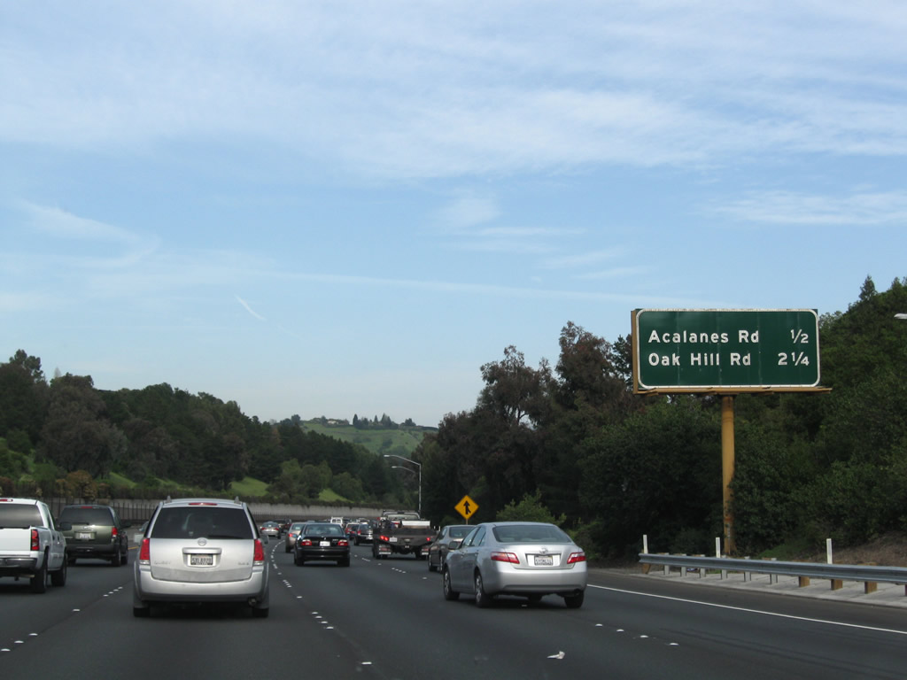
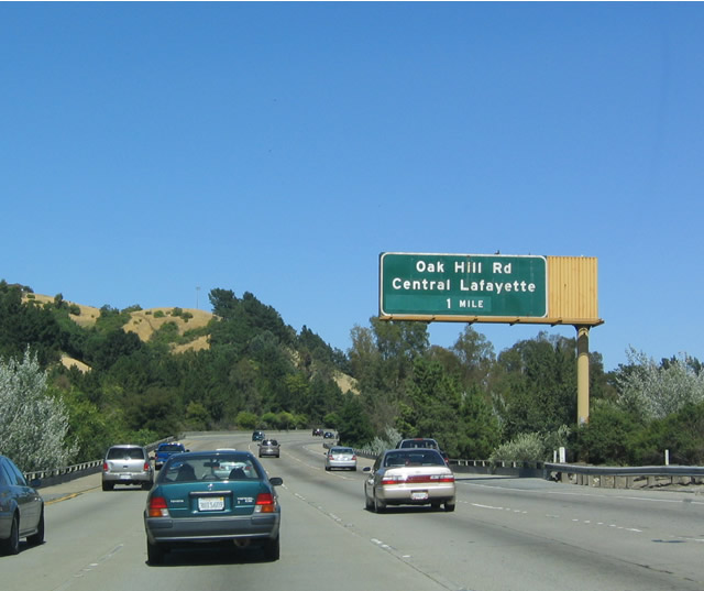
The next exit along eastbound California 24 is Exit 12, Oak Hill Road to Central Lafayette, one mile. Photo taken 07/05/04. |
|
Use Exit 12/Oak Hill Road/Central Lafayette to reach a BART Station, which is located via Mount Diablo Boulevard west to Happy Valley Road north. This is the first station since the major park and ride in the median at Camino Pablo to Orinda and Moraga (which connects to San Pablo Dam Road and Moraga Way). Photo taken 07/05/04. |
|
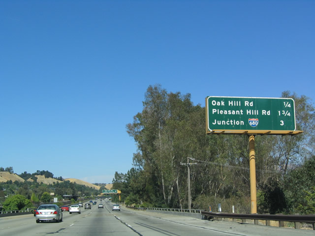
This mileage sign is located along eastbound California 24 as it approaches Exit 12, Oak Hill Road; Exit 14, Pleasant Hill Road, and Exit 15, Interstate 680. Photo taken 07/05/04. |
|
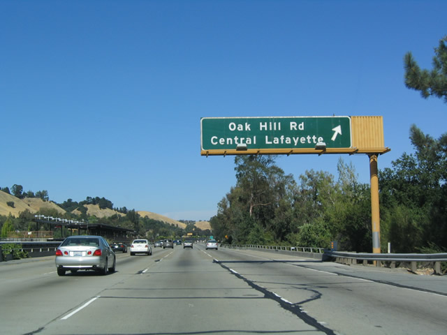
Eastbound California 24 reaches Exit 12, Oak Hill Road. Oak Hill Road heads north to Deer Hill Road and south to Mount Diablo Boulevard and Moraga Road (to Lafayette Reservoir). Photo taken 07/05/04. |
|
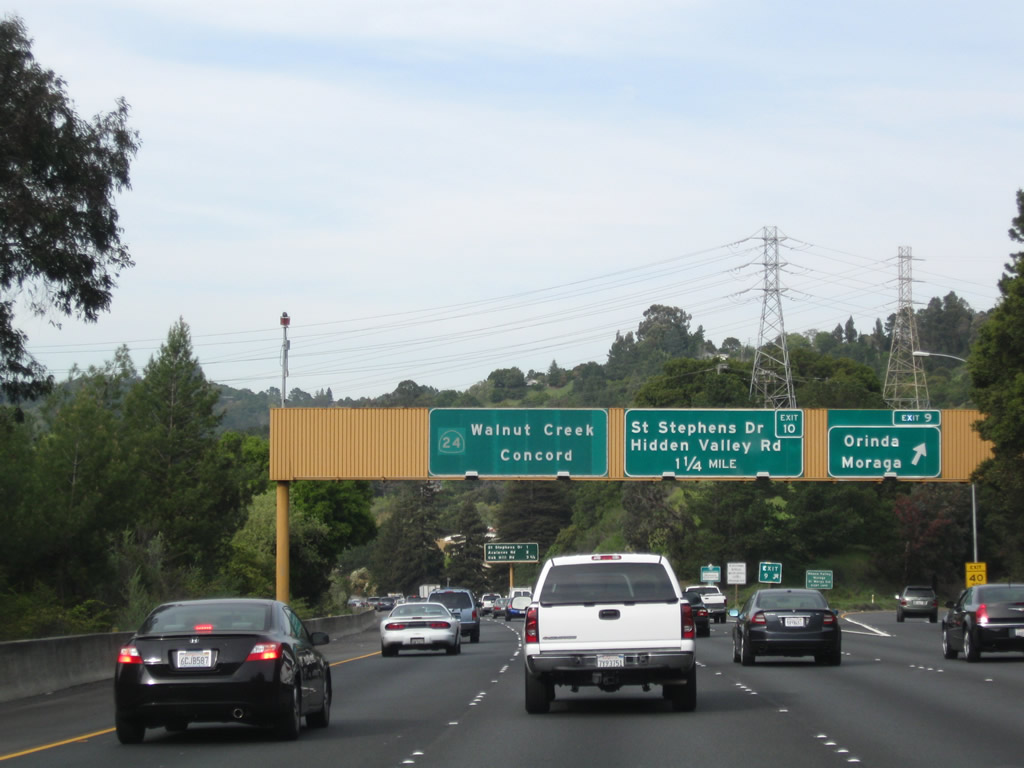
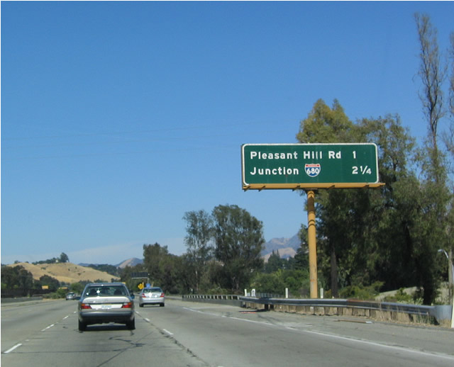
This mileage sign is located along eastbound California 24 approaching Exit 14, Pleasant Hill Road and Exit 15, Interstate 680. The Bay Area Rapid Transit rail line splits off from California 24 at the Interstate 680 interchange to provide rapid transit access to downtown Walnut Creek. It then continues northeast to Concord. Photo taken 07/05/04. |
|
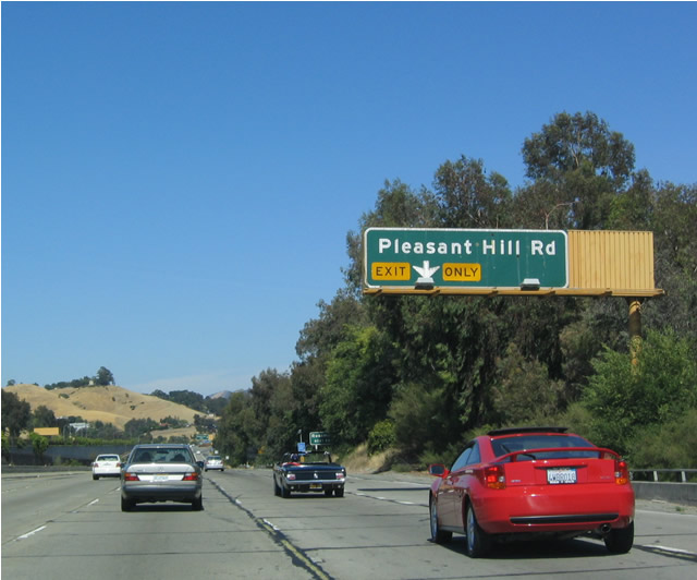
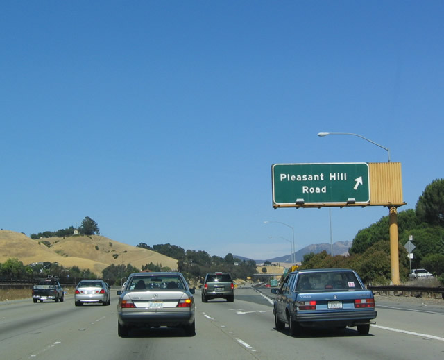
Eastbound California 24 approaches Exit 14, Pleasant Hill Road (next right). Pleasant Hill Road heads north to Briones Regional Park and Taylor Boulevard. Use Pleasant Hill Road south to Olympic Boulevard. Photo taken 07/05/04. |
|
Another cloverleaf interchange, eastbound California 24 reaches Exit 14, Pleasant Hill Road. This is the last exit in Lafayette. Photo taken 07/05/04. |
|
|
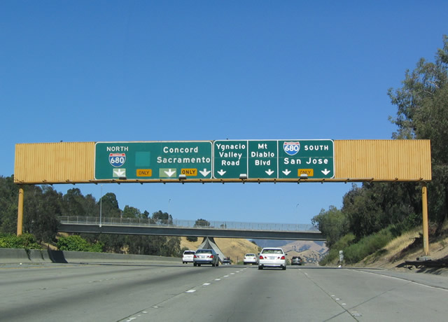
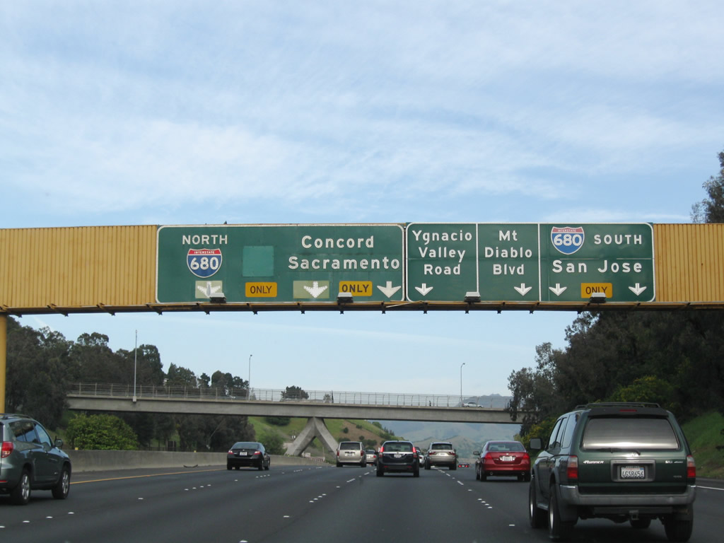
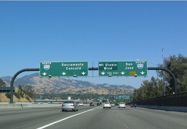
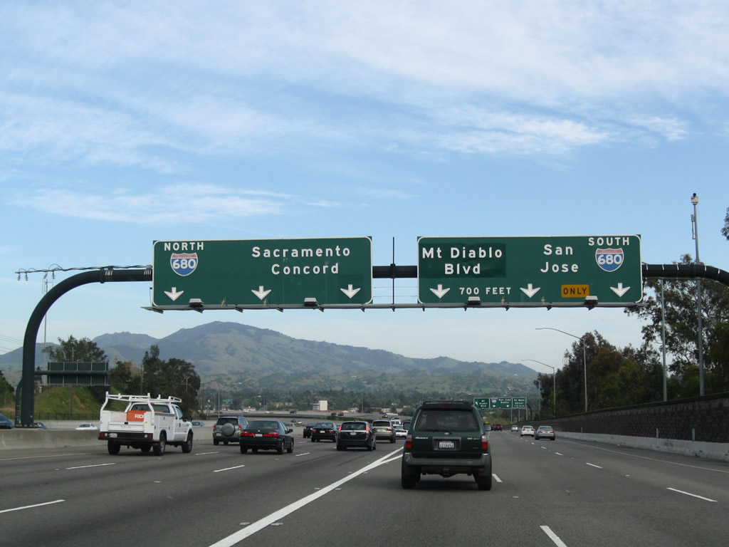
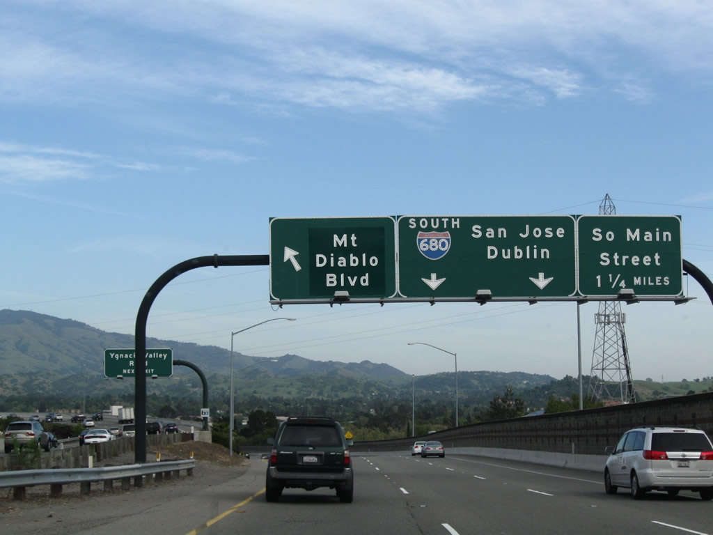
Upon reaching its final interchange, California 24 splits into four separate ramps at Exits 15A-B. From left to right, they are: Northbound Interstate 680 (Exit 15B), Ygnacio Valley Road (downtown Walnut Creek, Exit 15B), Mount Diablo Boulevard (Exit 15A), and Southbound Interstate 680/South Main Street (Exit 15A). Traffic destined for Ygnacio Valley Road and Golden Gate University should use the lanes for northbound Interstate 680. It would be nice to assign Exits 15 A-B-C-D for these four ramps ideally to alleviate confusion. Photos taken 07/05/04 and 04/06/09. |
|
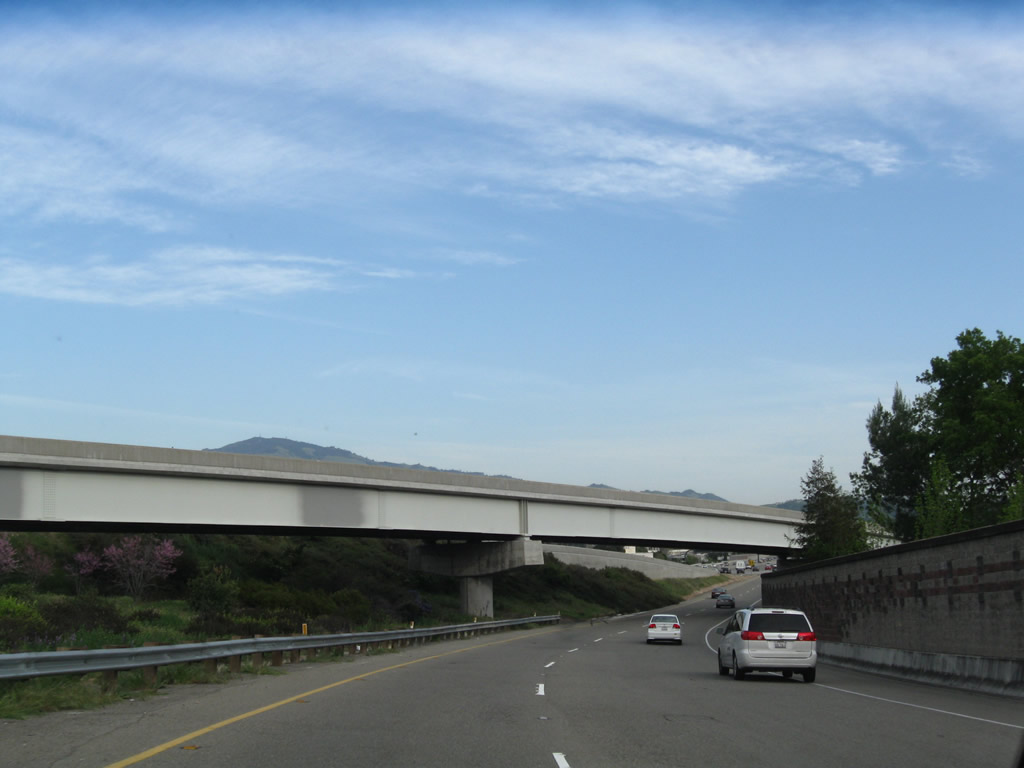
This unique bridge allows the BART to cross under the overpass for Curtola Boulevard. California 24 departs Lafayette and enters the city of Walnut Creek. Photo taken 07/05/04. |
|
|
The next set of signs does not address all four exit ramps and instead focuses on the ramps to northbound and southbound Interstate 680. Use the left three lanes to follow California 24 east to north Interstate 680 en route to Ygnacio Valley Road and Concord. The right two lanes head onto southbound Interstate 680. Photos taken 07/05/04 and 04/06/09. |
|
|
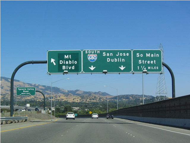
Once on the ramp to Mount Diablo Boulevard, Interstate 680 south, and South Main Street (Exit 15A), the left lane exits to Mount Diablo Boulevard, and the right lanes continue to transition onto Interstate 680 southbound. Photos taken 07/05/04 and 04/06/09. |
|
The left exit to Mount Diablo Boulevard was marked as Exit 14. This could be marked as part of Exit 15A (since the whole ramp including the link to Interstate 680 south is technically Exit 15A). Exit 14 was the off-ramp to Pleasant Hill Road. Photo taken 04/06/09. |
|
Two lanes make the transition from California 24 east to Interstate 680 south (Exit 15A). Photo taken 04/06/09. |
Page Updated May 15, 2015.