| California 24 west |
|
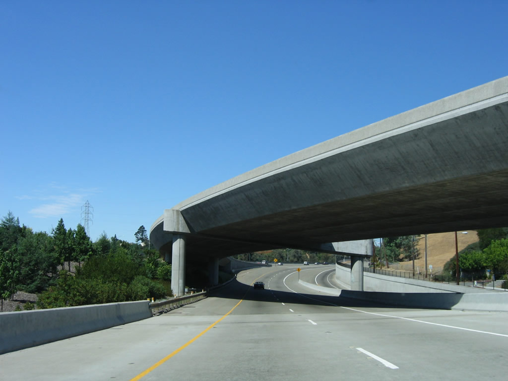
California 24 begins in a major interchange with Interstate 680 in Walnut Creek. A two-lane flyover ramp carries traffic from northbound Interstate 680 to eastbound California 24. This photo shows the ramp as it passes under the connector from Interstate 680 south to California 24 west. Photo taken 08/05/05. |
|
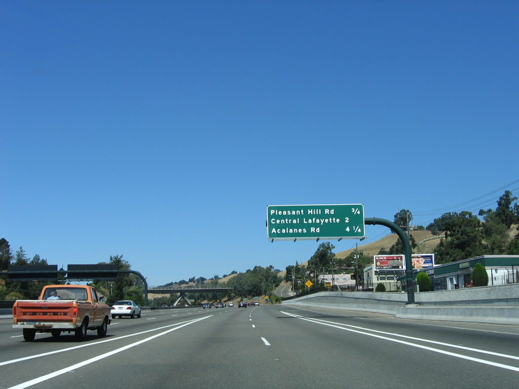
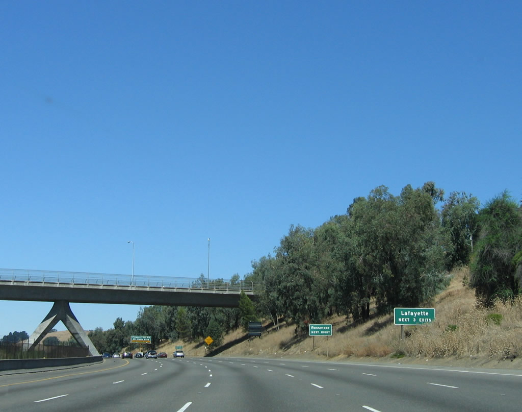
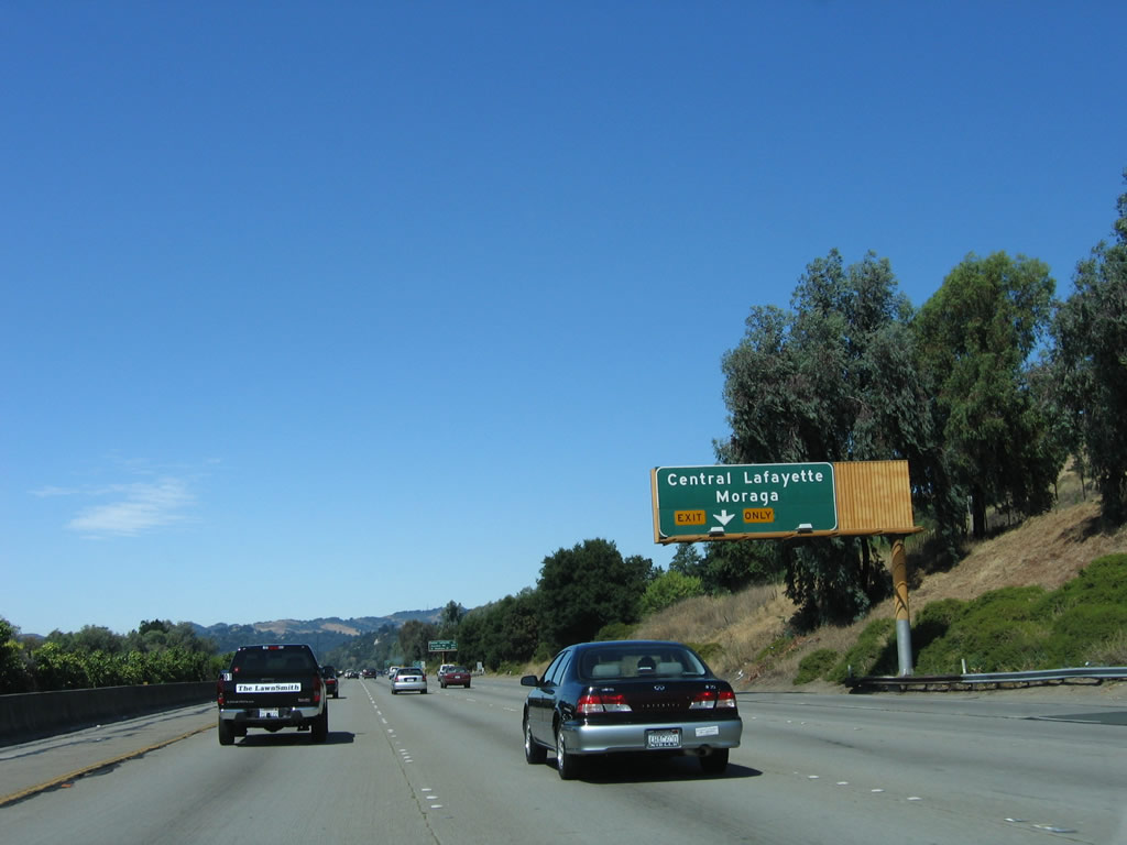
The first three exits on California 24 west are: Exit 14, Pleasant Hill Road/Mount Diablo Road; Exit 13, Central Lafayette/Moraga, and Exit 11, Acalanes Road/Upper Happy Valley Road. All three of these exits serve the city of Lafayette. There aren't any exits from westbound California 24 into Walnut Creek, and it is around this point where California 24 leaves the city of Walnut Creek and enters unincorporated Contra Costa County. Photo taken 08/05/05. |
|
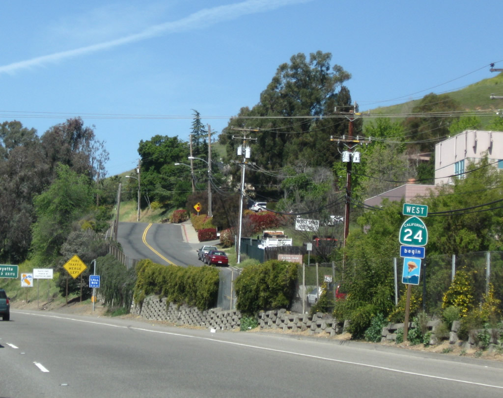
This is the first west California 24 reassurance shield. The freeway is a designated scenic route from Interstate 680 to the entrance to the Caldecott Tunnel as it winds through Lafayette and Orinda. Photo taken 04/06/09. |
|
Between Walnut Creek and the Caldecott Tunnels, the center median serves as the right of way for the Bay Area Rapid Transit (BART) rail line. Commuters use the BART regularly to travel from the East Bay communities of Concord and Walnut Creek west to Oakland and San Francisco. Parking is available at each BART stop, and that allows commuters to leave their cars in the East Bay, and travel via commuter rail to the city, where only limited parking can be found. Photo taken 08/05/05. |
|
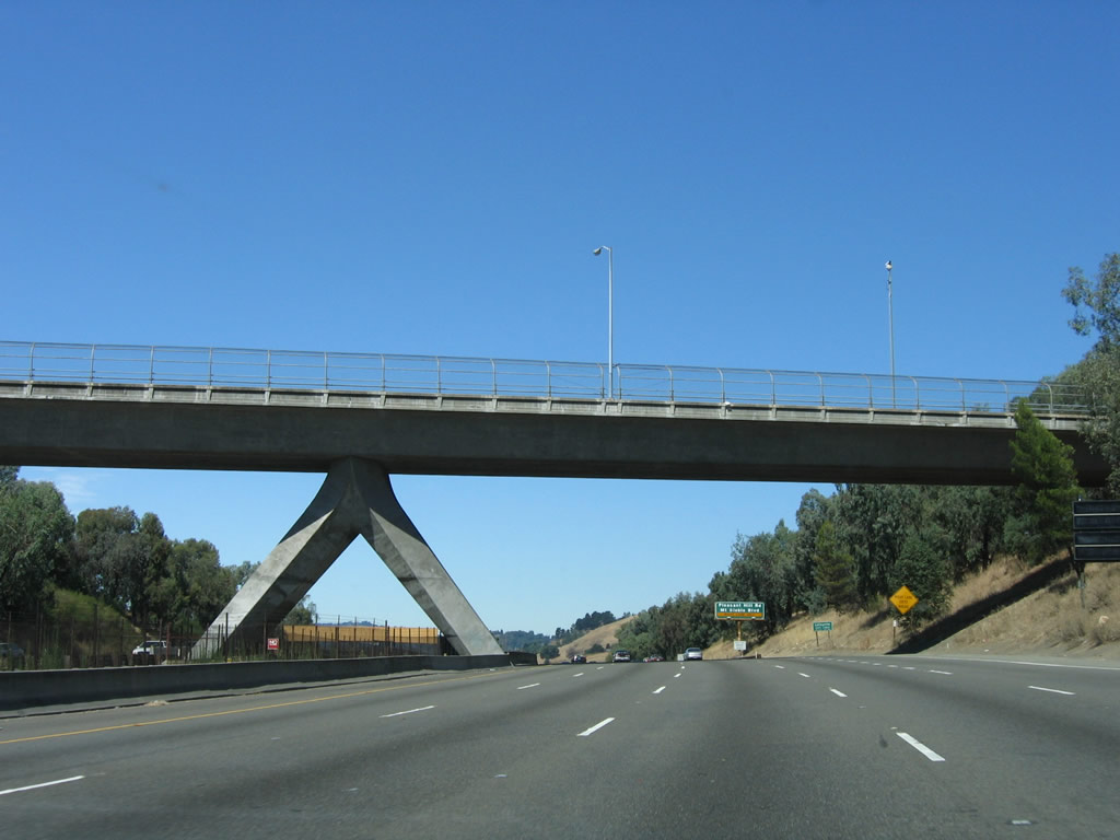
A unique bridge allows Curtola Parkway to cross over California 24 and the BART, and it offers a unique perspective to this scenic corridor. California 24 from Interstate 680 west to the tunnels is considered a scenic corridor especially due to the undeveloped mountains and pristine views afforded along the drive through Lafayette and Moraga. Photo taken 08/05/05. |
|
Leaving Walnut Creek, California 24 enters Lafayette, a beautiful city with a quaint downtown area along nearby Mount Diablo Boulevard. The city of Lafayette was incorporated in 1968 and rests on 15 square miles. Per the 2000 Census, 23,908 people lived in Lafayette, which has its own BART station. Photo taken 04/06/09. |
|
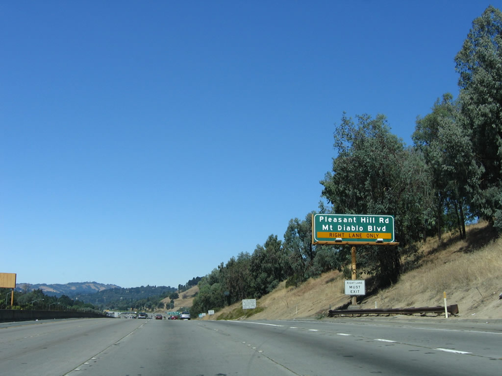
The right lane of California 24 west becomes exit only for Exit 14, Pleasant Hill Road/Mount Diablo Road, and the left four lanes continue west on California 24 (Rumford Freeway). Photo taken 08/05/05. |
|
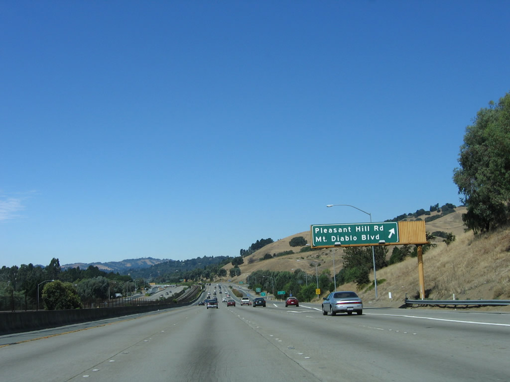
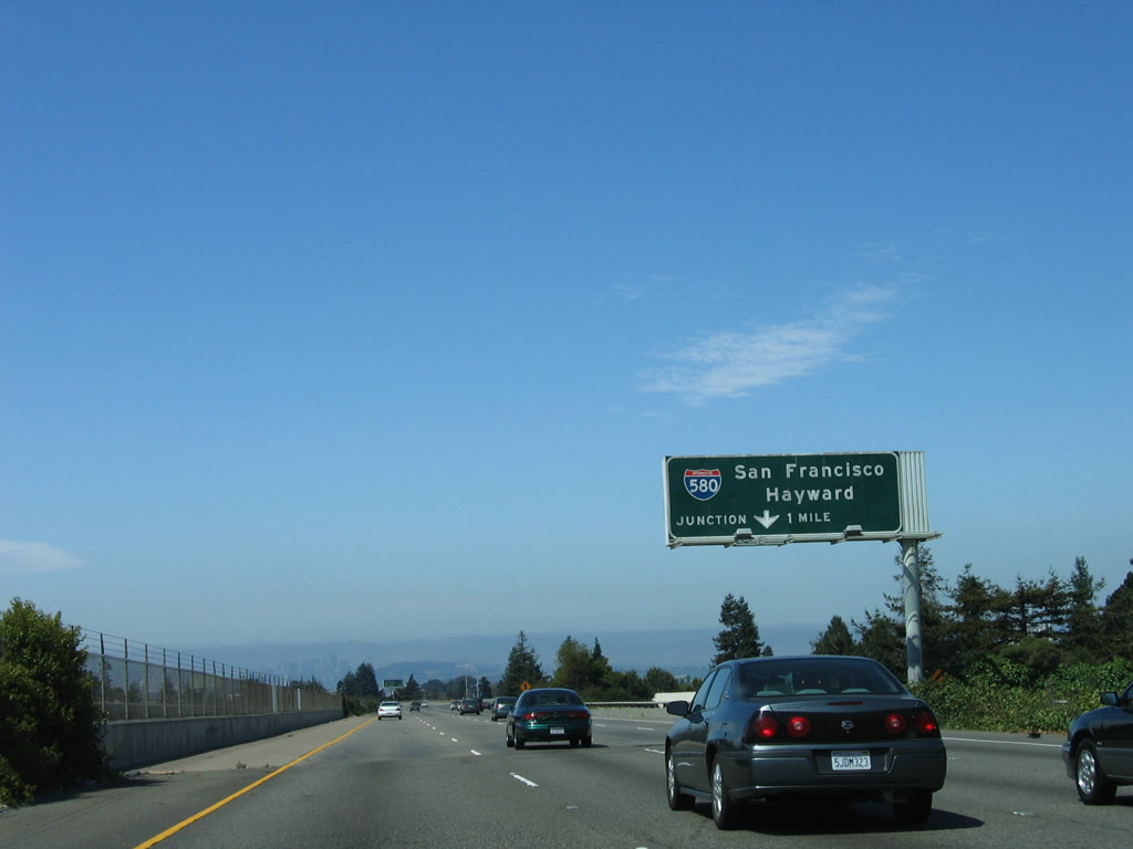
Westbound California 24 (Rumford Freeway) reaches Exit 14, Pleasant Hill Road/Mount Diablo Road. This interchange is a modified cloverleaf, so merging and exiting traffic occurs on the collector distributor lanes. Photo taken 08/05/05. |
|
The next exit on California 24 west is Exit 13, Laurel Drive and Deer Hill Road to Oak Hill Road and Moraga Road south to Moraga. The right lane again becomes exit only, and the left four lanes continue west toward Orinda, Berkeley, and Oakland. Photo taken 08/05/05. |
|
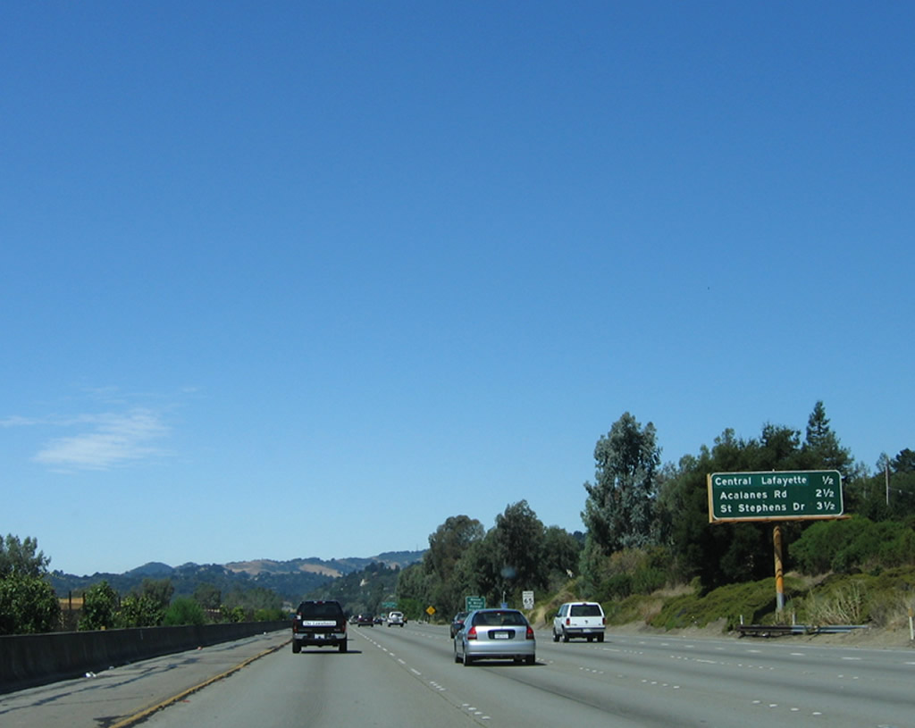
An interchange sequence sign on California 24 west provides the distance to the next three exits: Exit 13, Deer Hill Road to Central Lafayette/Moraga; Exit 11, Acalanes Road/Upper Happy Valley Road; and Exit 10, Saint Stevens Drive/Hidden Valley Road. Photo taken 08/05/05. |
|
Use Exit 13 to Happy Valley Road northwest to the University of California Leuschner Observatory and Briones Regional Park. To the south, use Moraga Road to Rheem Valley and to Saint Mary's College of California. Both of these are located in the city of Moraga, which is served by California 24 but is not on the route of the freeway. Photo taken 04/06/09. |
|
Westbound California 24 (Rumford Freeway) reaches Exit 13, Deer Hill Road to Moraga Road south, Happy Valley Road north, and Mount Diablo Road, which parallels California 24 on the south side of the freeway. Photo taken 08/05/05. |
|
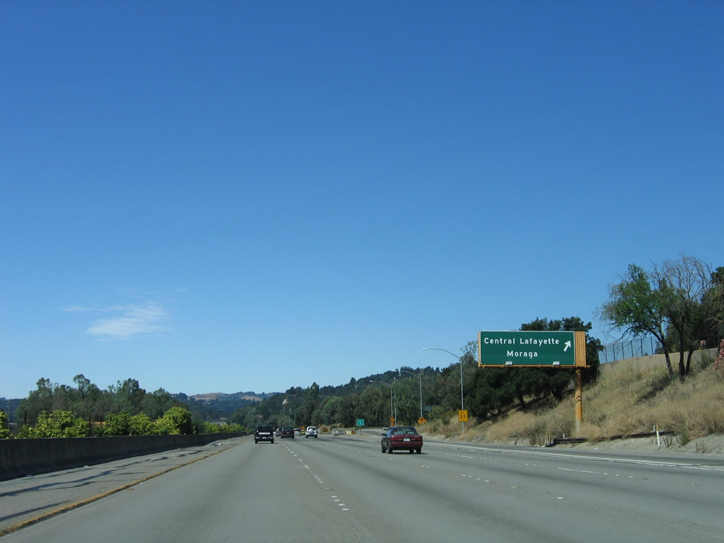
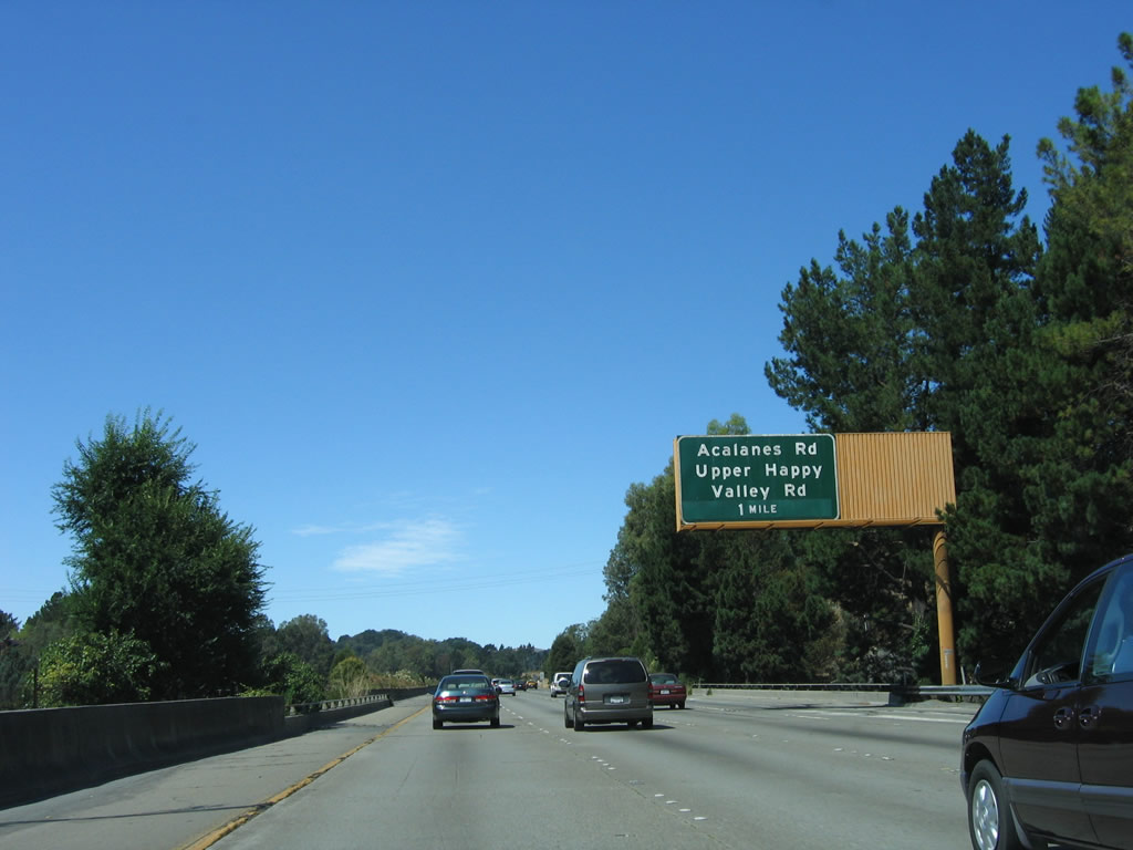
The next exit on California 24 (Rumford Freeway) west is Exit 11, Acalanes Road/Upper Happy Valley Road. This is the final westbound exit to serve the city of Lafayette. Photo taken 08/05/05. |
|
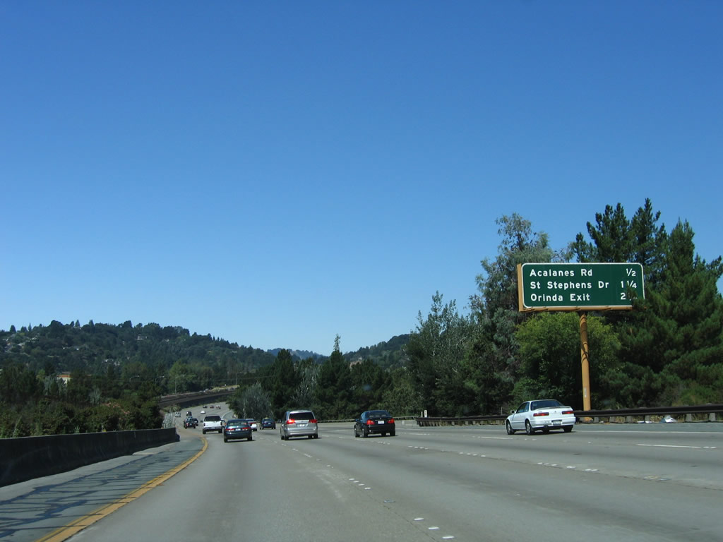
An interchange sequence sign on California 24 west provides the distance to the next three exits: Exit 11, Acalanes Road/Upper Happy Valley Road; Exit 10, Saint Stevens Drive/Hidden Valley Road; and Exit 9, Camino Pablo/Moraga Way. Photo taken 08/05/05. |
|
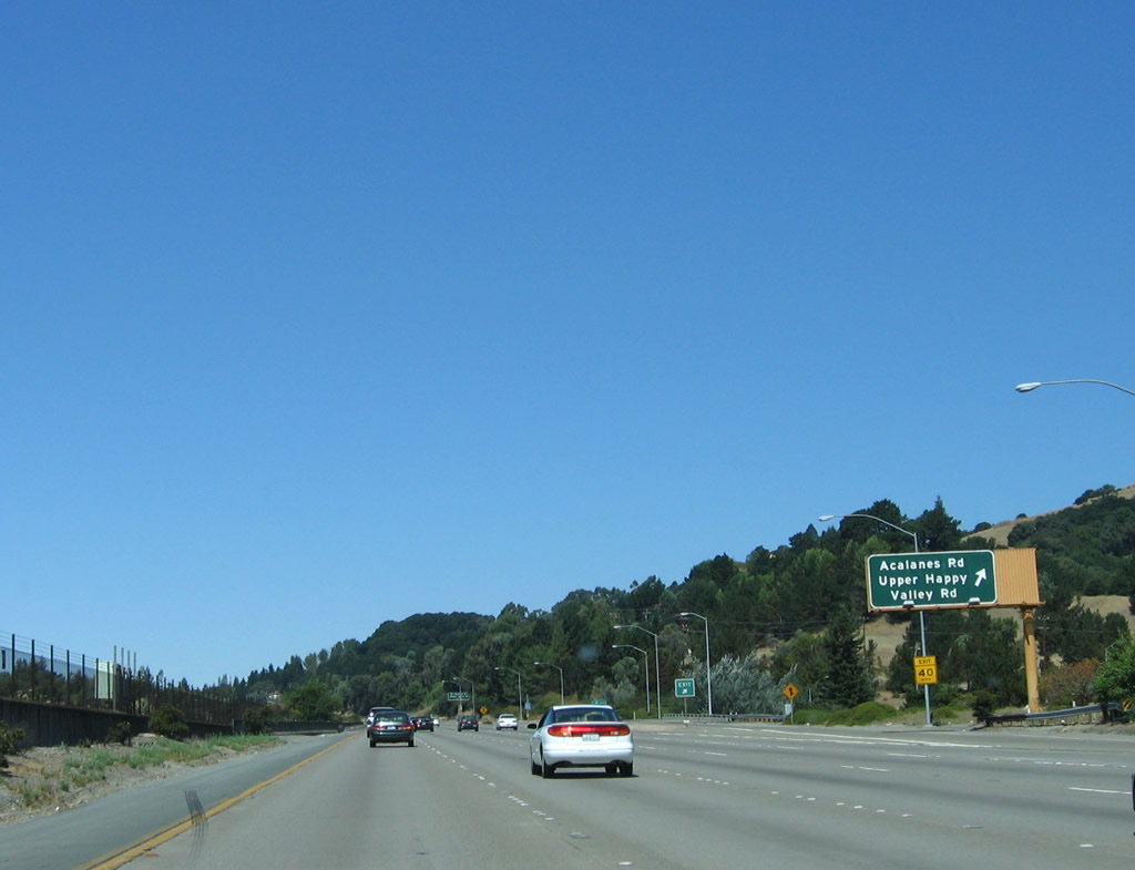
Westbound California 24 (Rumford Freeway) reaches Exit 11, Acalanes Road and Upper Happy Valley Road. This interchange is almost a cloverleaf, except that traffic from the westbound direction must use the loop ramp to make the connection to Nido Road/Upper Happy Valley Road to the north and Acalanes Road/Mount Diablo Boulevard/Hidden Valley Road to the south. Photo taken 08/05/05. |
|
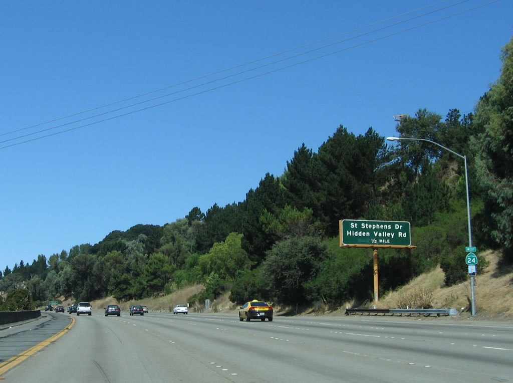
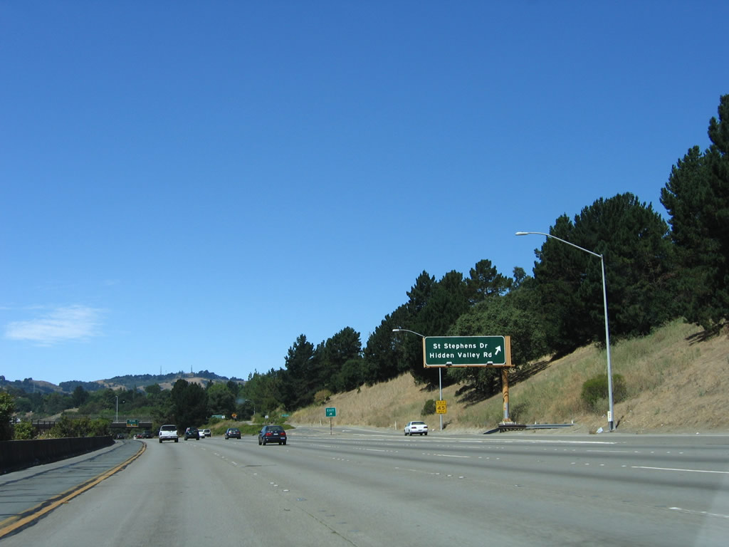
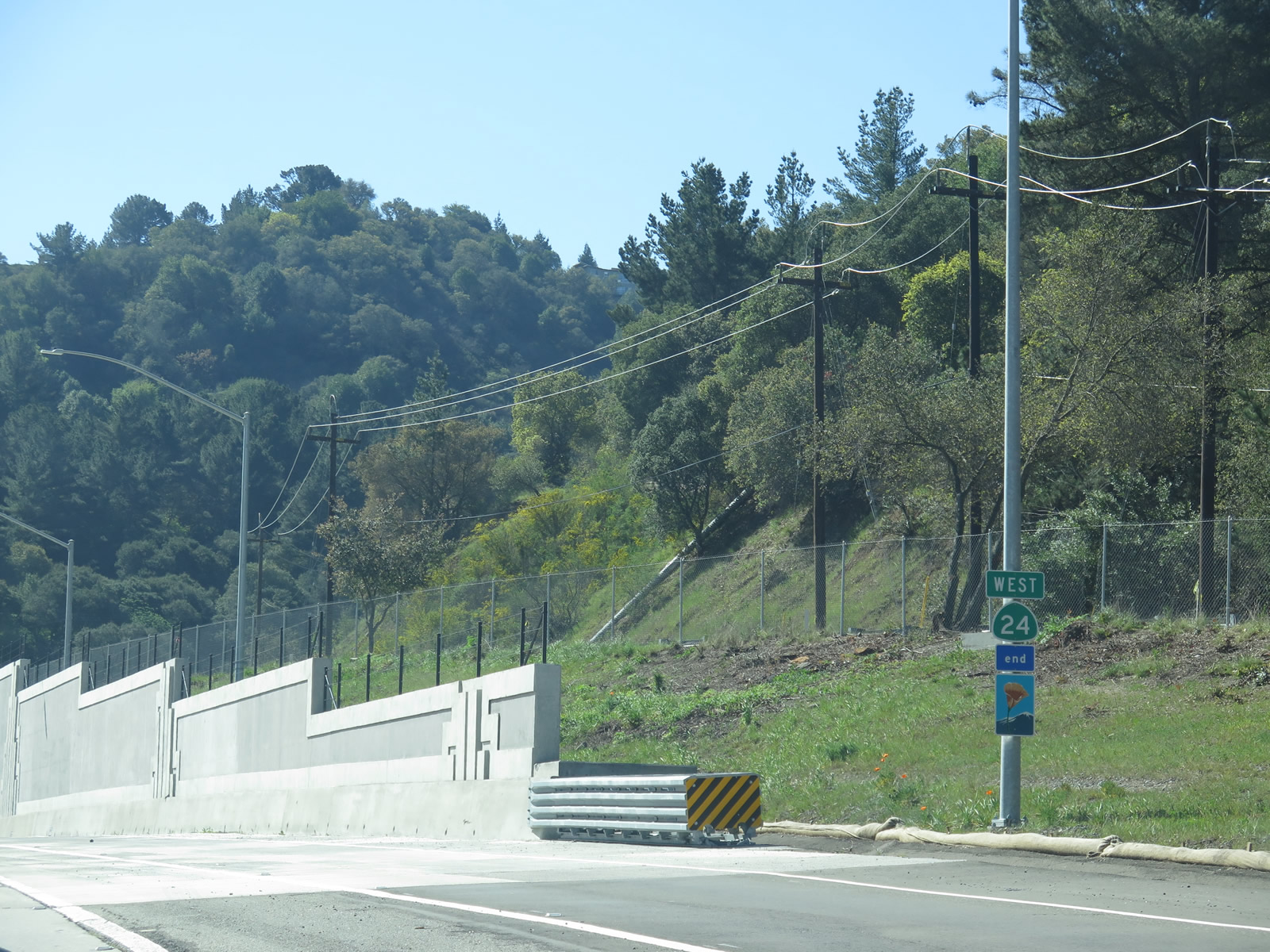
The next exit along westbound California 24 is Exit 10, Saint Stevens Drive and Hidden Valley Road in Orinda. Note the faded scenic route sign posted below the California 24 reassurance shield. Photo taken 08/05/05. |
|
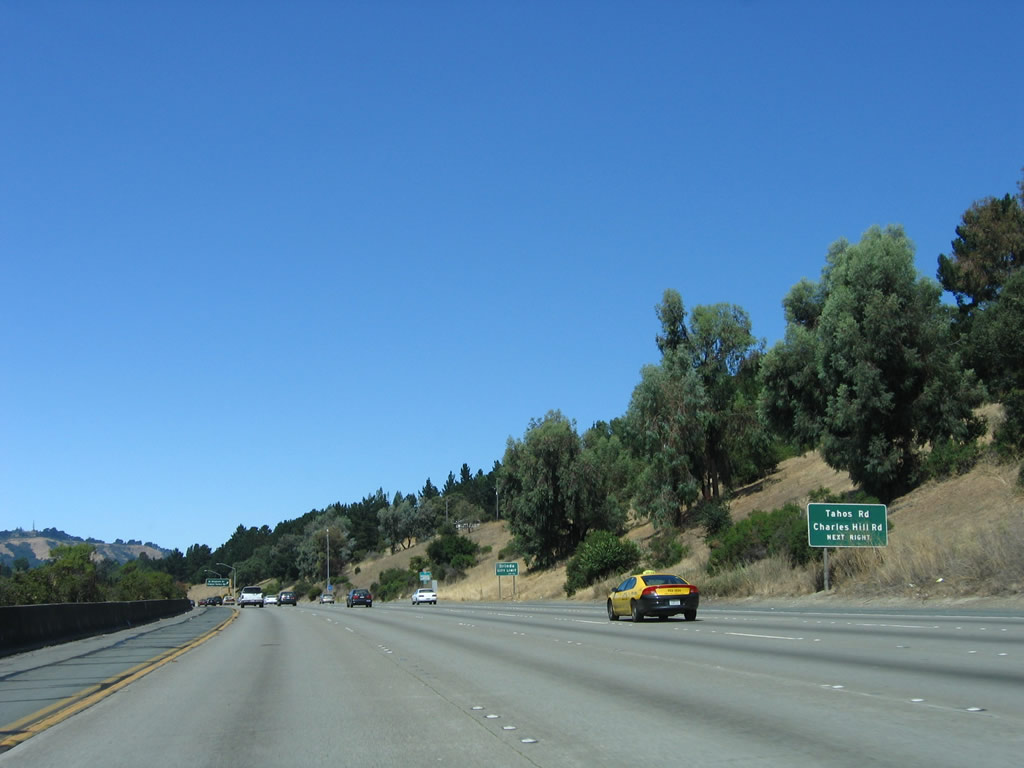
Use Exit 10 to Charles Hill Road north and Tahos Road south. Both roads serve residential Orinda, which is now located on both sides of the freeway. The city of Orinda is located to the west of Lafayette and also has its own BART station. Open space abounds here, with Tilden Regional Park to the west, San Pablo Reservoir to the northwest, Briones Open Space and Reservoir to the north, and Lafayette Reservoir to the east of the city. Photo taken 08/05/05. |
|
Westbound California 24 reaches Exit 10, Saint Stevens Drive and Hidden Valley Road in Orinda. This interchange is a diamond interchange. Photo taken 08/05/05. |
|
The next exit on California 24 (Rumford Freeway) west is Exit 9, Camino Pablo and Moraga Way to Orinda. Photo taken 08/05/05. |
|
The right lane of westbound California 24 becomes exit only for Exit 9, Camino Pablo and Moraga Way. In the westbound direction, this interchange is treated like a cloverleaf, with a collector distributor lane and one ramp to northbound Camino Pablo and another ramp to Moraga Way south. Photo taken 08/05/05. |
|
|
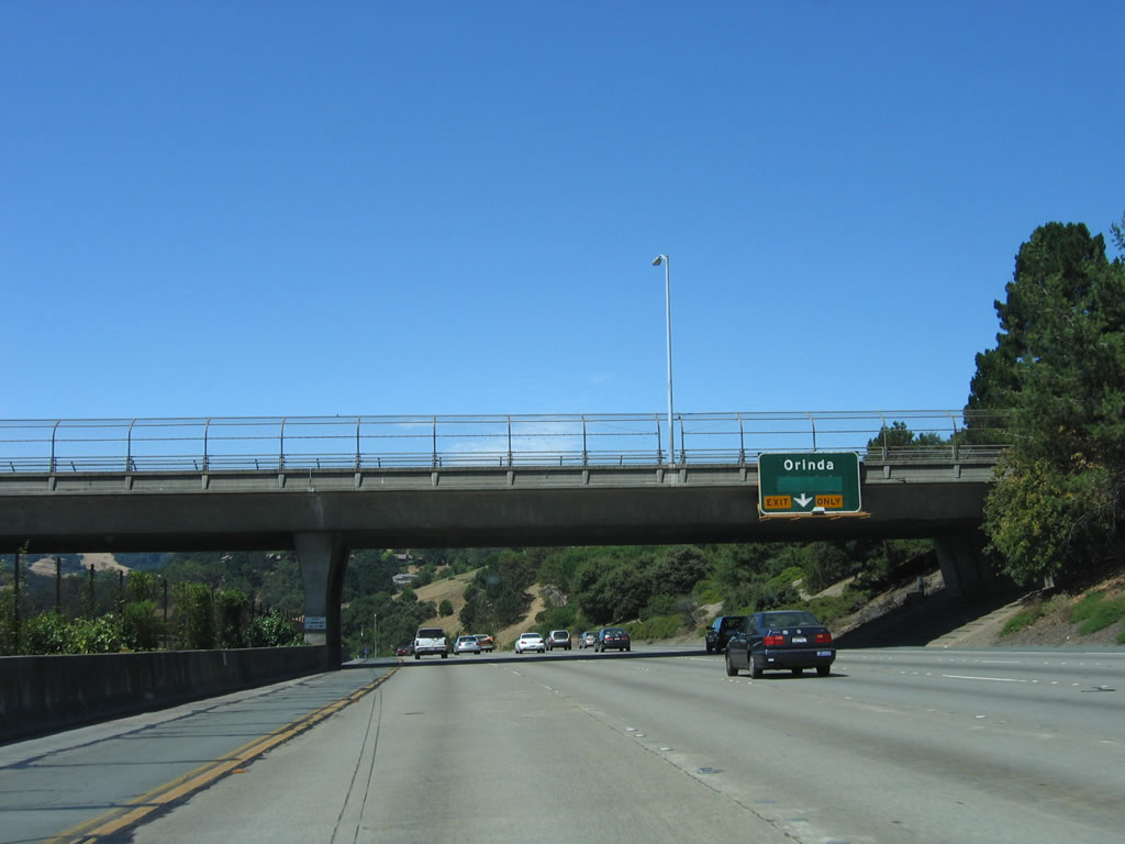
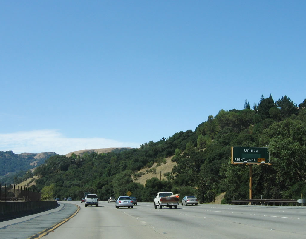
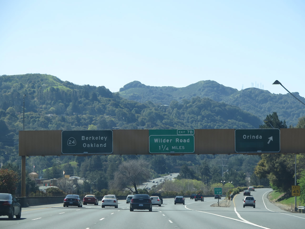
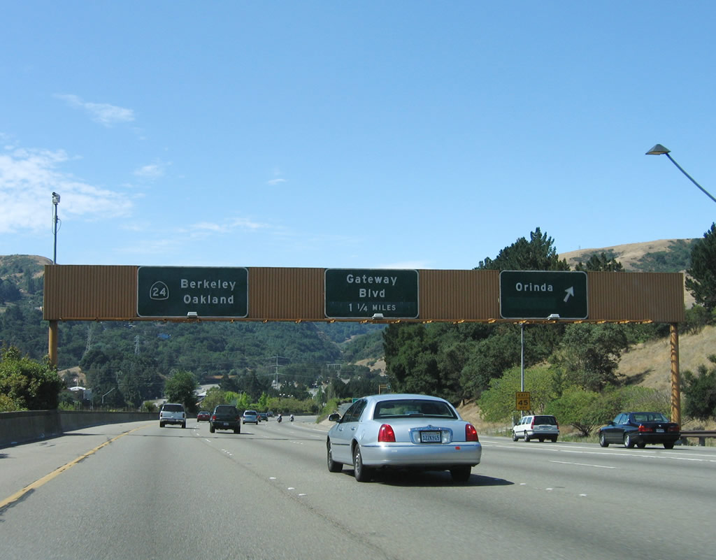
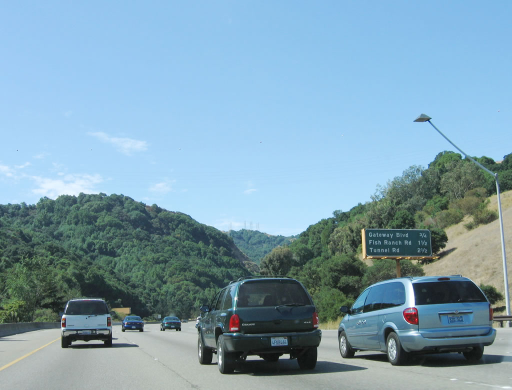
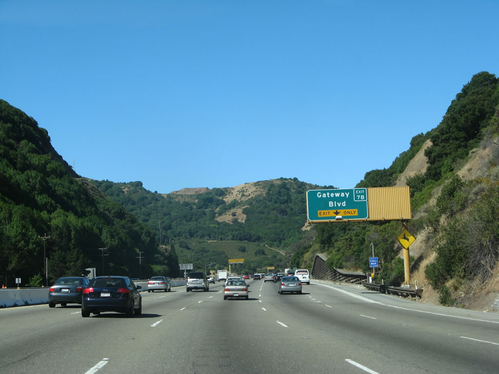
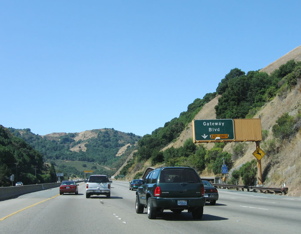
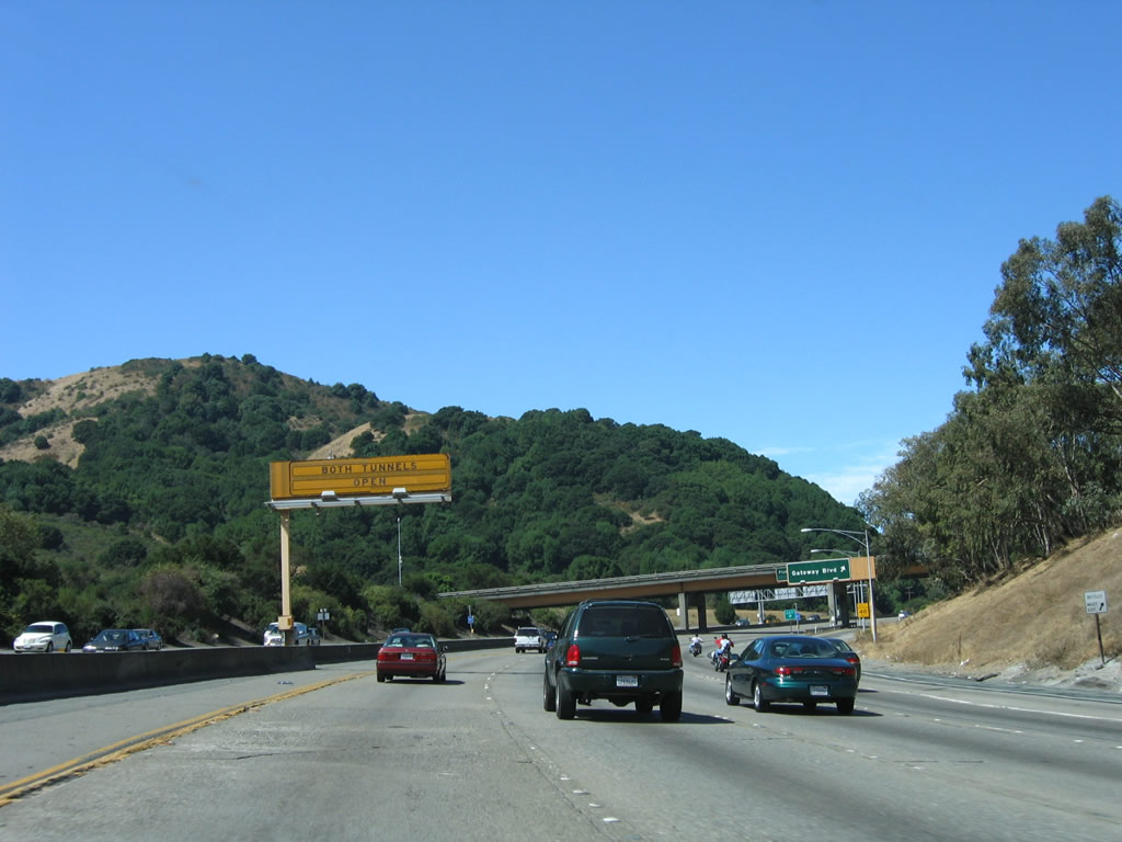
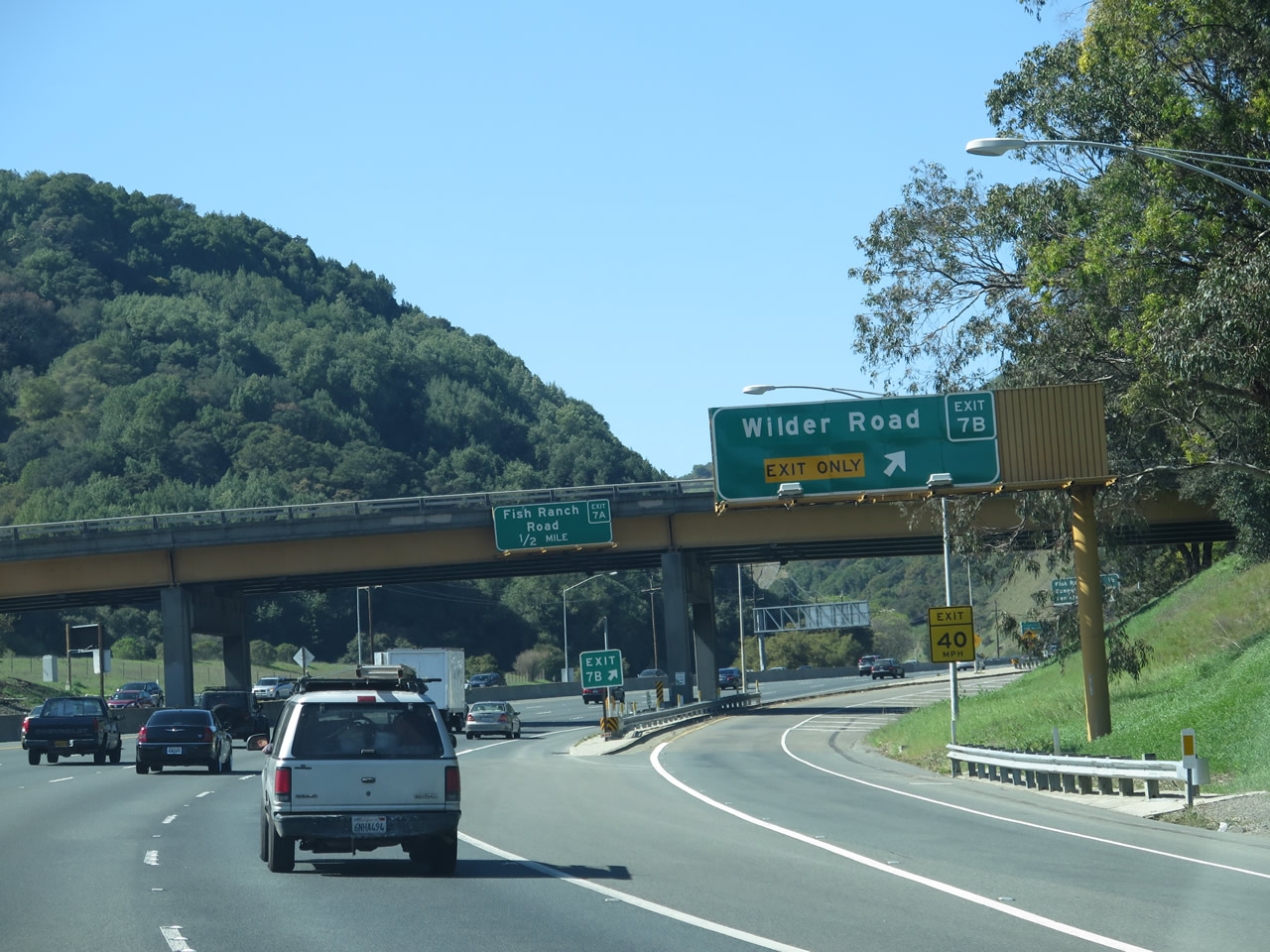
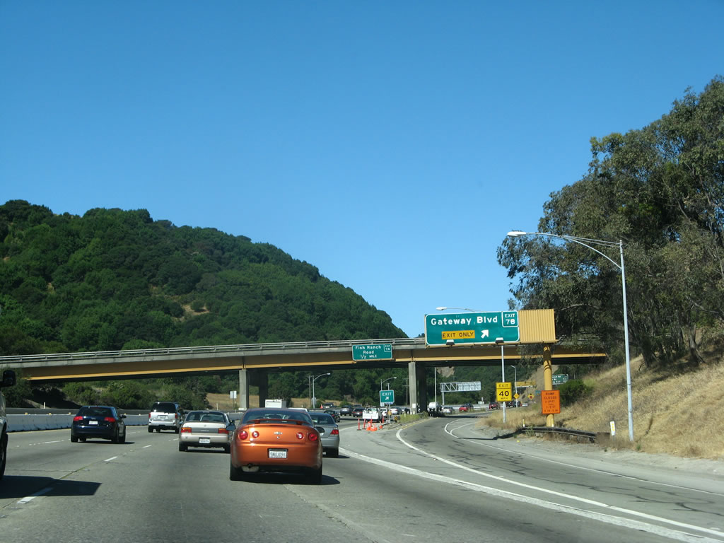
California 24 (Rumford Freeway) briefly turns southwest as it reaches Exit 9, Camino Pablo and Moraga Way to Orinda. To the north, Camino Pablo changes into San Pablo Dam Road upon leaving Orinda. It passes by San Pablo Reservoir, then enters the city of Richmond. The next exit is Exit 7B, Wilder Road (formerly Gateway Boulevard). The 2005 picture shows the original Exit 7B guide sign, while the 2015 picture shows the replacement sign. Photos taken 03/07/15 and 08/05/05. |
|
The ramp to Camino Pablo and Moraga Way is initially elevated. The overhead signs on the exit ramp show that the first exit connects to Camino Pablo north to Richmond, and the second ramp connects to Moraga Way south to Orinda and Moraga. The collector distributor lanes then rejoin California 24 west. Photo taken 08/05/05. |
|
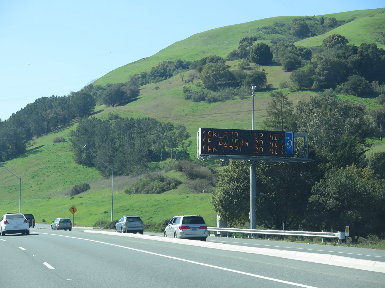
A dybamic message sign advises of the travel times to Oakland (via Interstate 980), San Francisco (via Interstate 580 and Interstate 80), and Oakland Airport (via Interstate 980 and Interstate 880). Photo taken 08/05/05. |
|
|
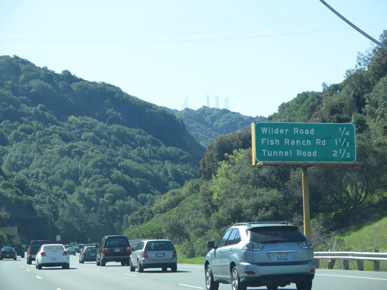
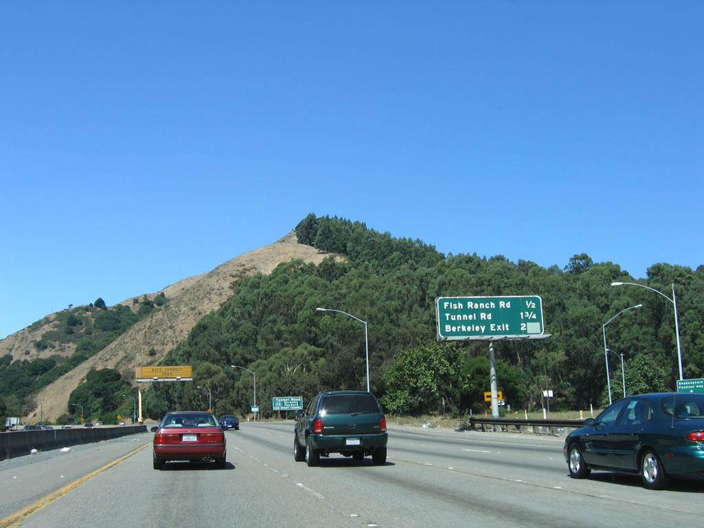
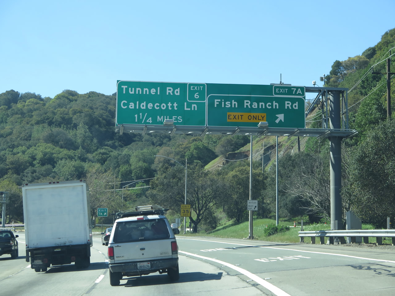
An interchange sequence sign on California 24 west provides the distance to the next three exits: Exit 7B, Wilder Road; Exit 7A, Fish Ranch Road; and Exit 6, Old Tunnel Road in Alameda County. Around this point, the BART leaves the median of California 24 and enters a long tunnel on the north side of California 24 to pass under Grizzly Peak. It does not emerge to daylight again until after passing under both California 13 and Tunnel Road in Berkeley. Photos taken 03/07/15 and 08/05/05. |
|
|
|
Climbing toward the Berkeley Hills, westbound California 24 gains elevation as it approaches the Caldecott Tunnel. The right lane drops at Exit 7B for Wilder Road. Photos taken 03/07/15, 07/06/07, and 08/05/05. |
|
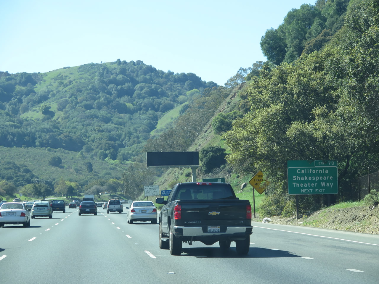
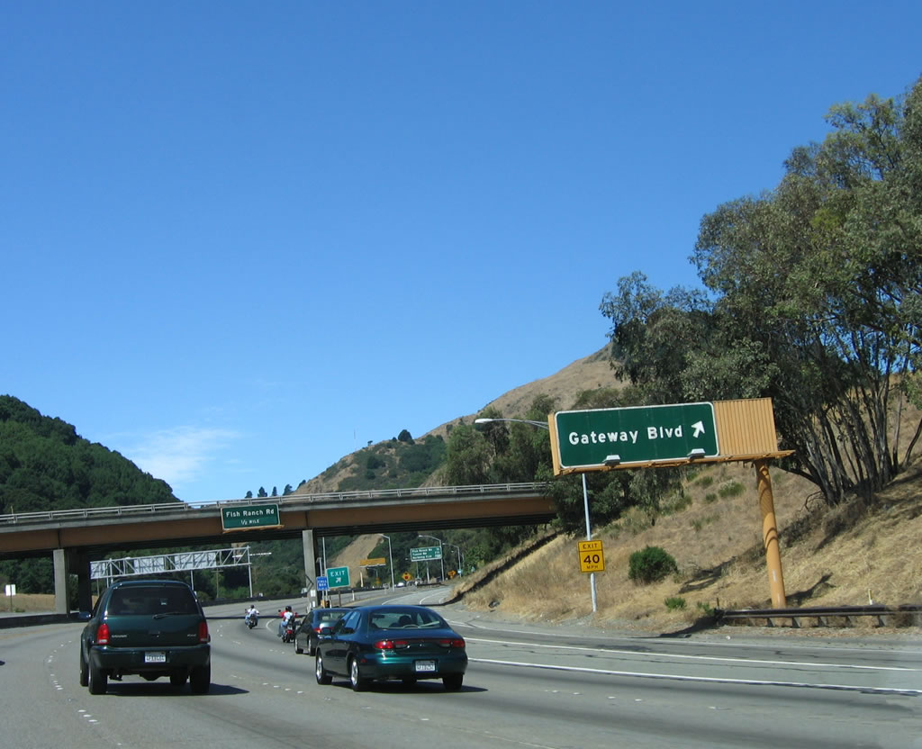
California Shakespeare Theater Way stems north from Exit 7B to an amphitheater by the same name. Photo taken 03/07/15. |
|
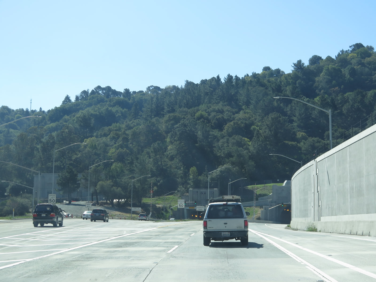
Prior to the addition of the Caldecott Tunnel four bore in 2013, the middle bore, now known as the second bore, was reversible. It flowed westbound during the morning hours and eastbound from noon to midnight. These operating hours also changed depending on traffic needs. With the fourth bore now in place, four continuous lanes of traffic flow in each direction at the Caldecott Tunnel.
As it was no longer needed, this changeable sign for the second bore was removed. Photo taken 08/05/05. |
|
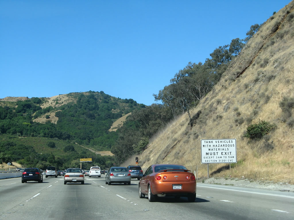
Vehicles carrying hazardous materials must exit at Exit 7B outside the hours of 3:00 a.m. and 5:00 a.m. This prohibition relates to an accident that occurred in the Caldecott Tunnel third bore on April 7, 1982. A crash involving a tanker carrying gasoline took place within the tunnel during early morning hours. The resulting fire and smoke claimed seven lives. The restriction provides a short window for the transport of hazmat based cargo when traffic is minimal. Photo taken 08/05/05. |
|
Changeable signs were positioned ahead of both entrances to the Caldecott Tunnel, indicating the former reversible traffic pattern through the third bore. Photo taken 08/05/05. |
|
|
|
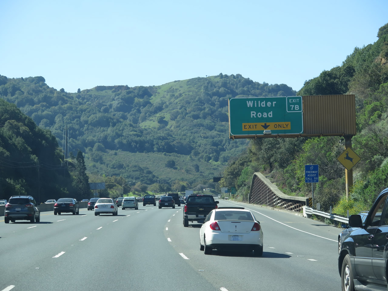
Exit 7B leaves SR 24 (Rumford Freeway) west for Wilder Road. Formerly named Gateway Boulevard, Wilder Road spurs south to the Wilder development. The 245-unit luxury community, where homes were priced to start near $2.1 million, broke ground in 2012.1 Photos taken 03/07/15, 07/06/07, and 08/05/05. |
|
|
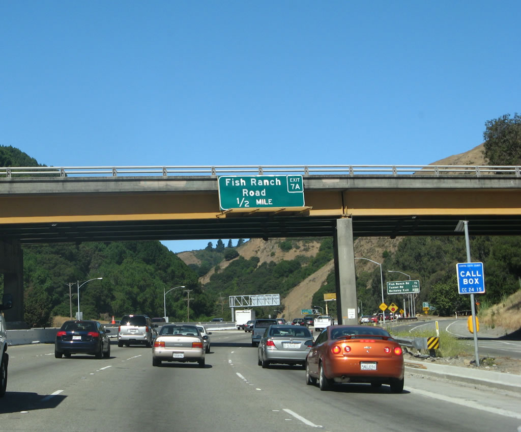
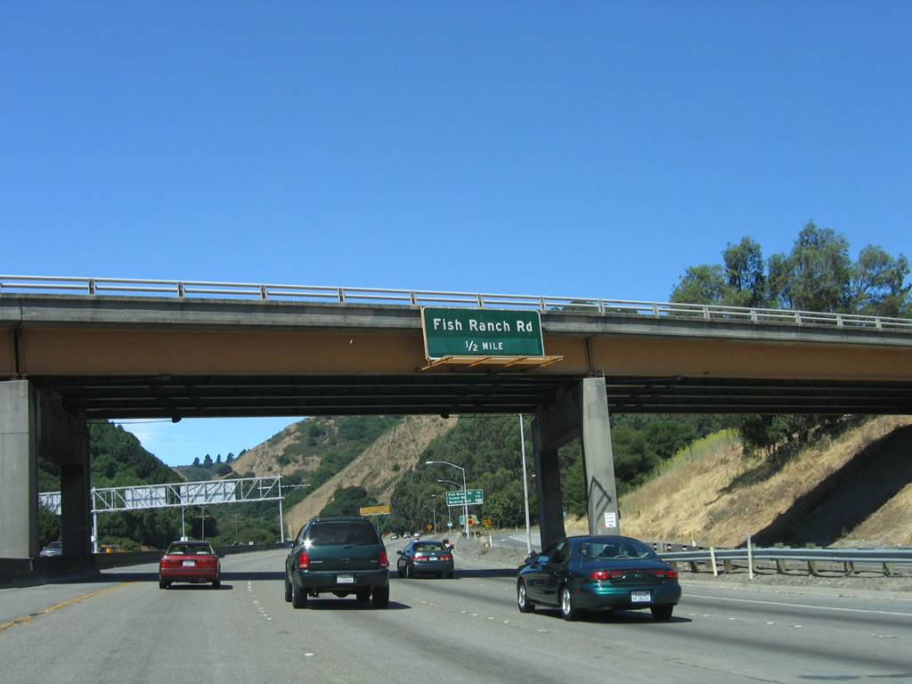
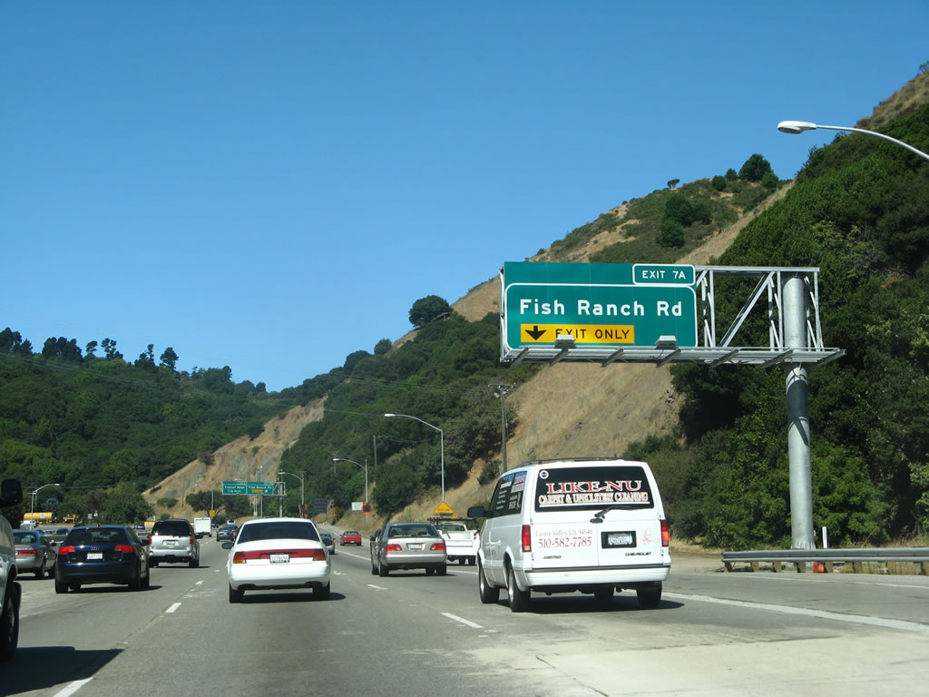
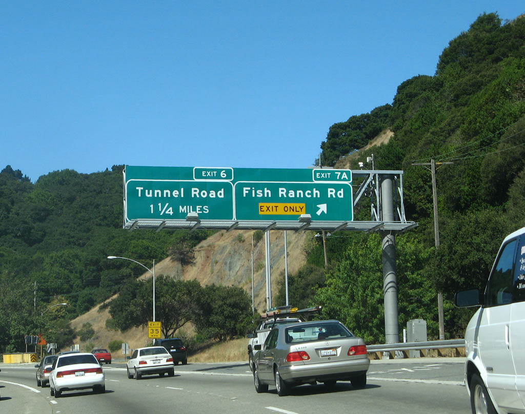
A folded diamond interchange (Exit 7A) follows with Fish Ranch Road, a local road connecting SR 24 with Grizzly Peak Boulevard and Charles Lee Tilden Regional Park. Photos taken 07/06/07 and 08/05/05. |
|
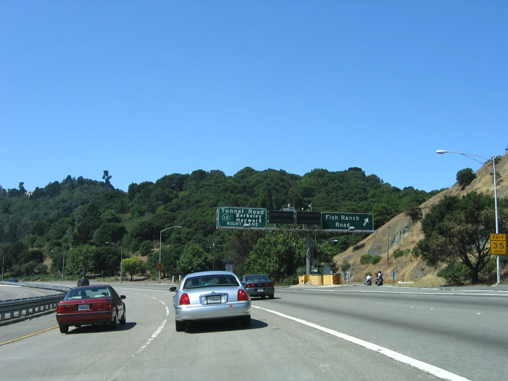
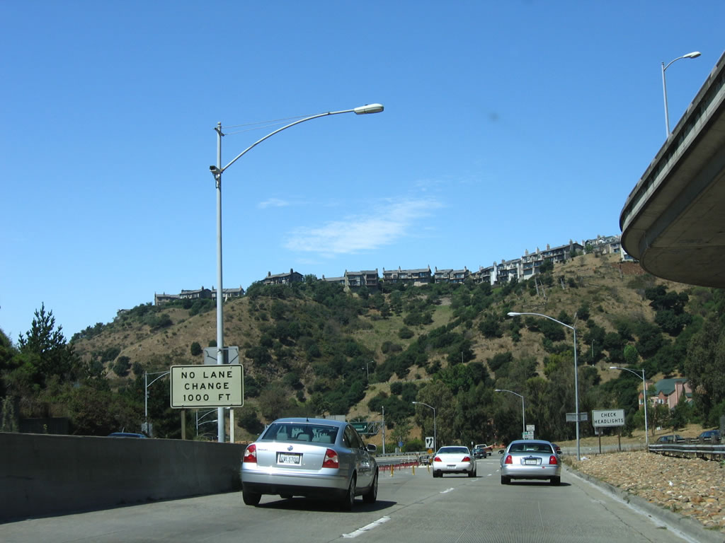
SR 24 shoots through a gap across the Berkeley Hills just beyond Siesta Valley. Beyond the forthcoming Caldecott Tunnel, the freeway separates with Caldecott Lane / Tunnel Road (Exit 6). Photo taken 08/05/05. |
|
Prior to the addition of the Caldecott Tunnel fourth bore, motorists bound for the ensuing exits for Tunnel Road and SR 13 were required to shift into the then-north bore. Photo taken 08/05/05. |
|
A lane drop occurs at the off-ramp (Exit 7A) for Fish Ranch Road. An auxiliary lane from Wilder Road west to Exit 7A was added to SR 24 west around 2006-07. Photo taken 07/06/07. |
|
|
|
Aiming southward to the Caldecott Tunnel, California 24 splits with Exit 7A. Fish Ranch Road winds northwest to Grizzly Peak Boulevard and Claremont Avenue at the Alameda County line. Grizzly Peak (el. 1,759 feet) lies 2.5 miles to the north. Photos taken 03/07/15, 07/06/07, and 08/05/05. |
|
|
A sharp loop ramp merges onto California 24 west from Fish Ranch Road ahead of the fourth (northern) bore of the Caldecott Tunnel. Photos taken 03/07/15. |
|
|
Traffic partitions into two lanes for the 1964-opened third bore and the 2013-opened fourth bore for the Caldecott Tunnel. Photos taken 03/07/15. |
|
Exiting the second bore back when it served as a reversible tunnel with westbound traffic during the morning hours. This bore acted as an express roadway, with no local access to the succeeding off-ramps for Tunnel Road or SR 13 (Warren Freeway). Photo taken 08/05/05. |
|
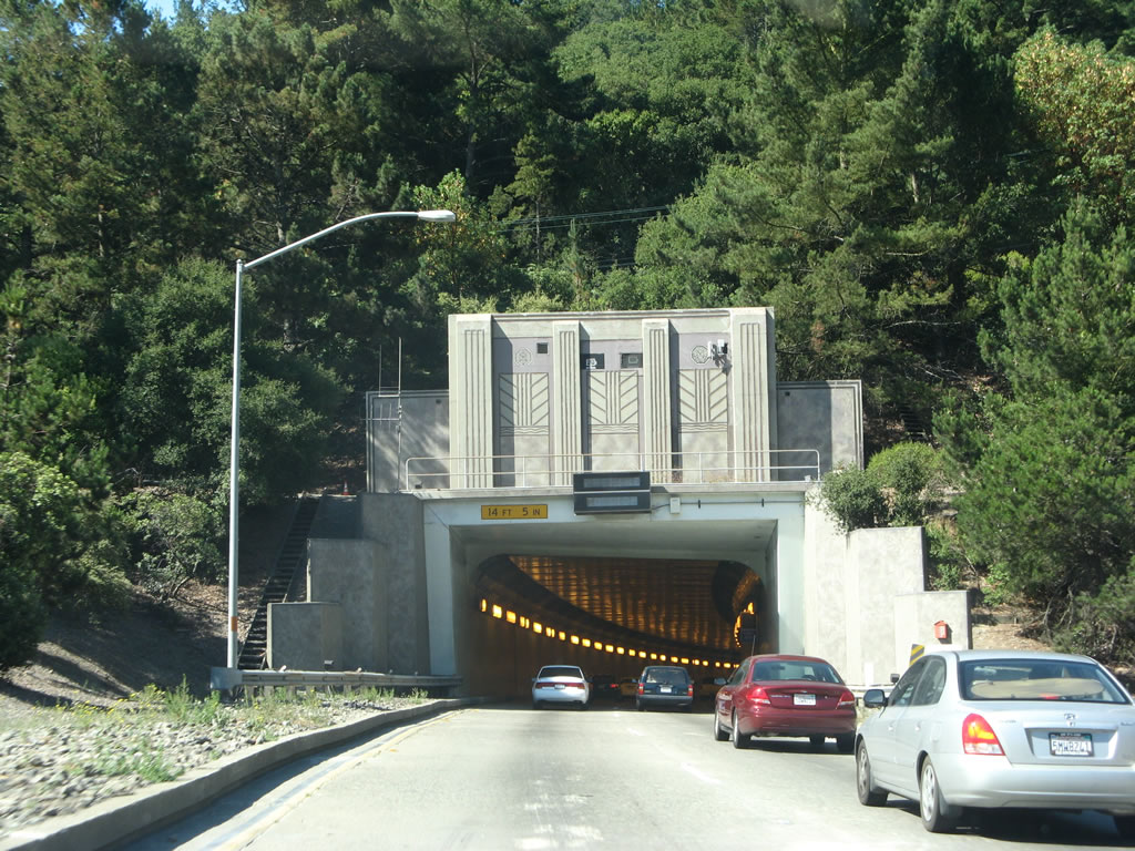
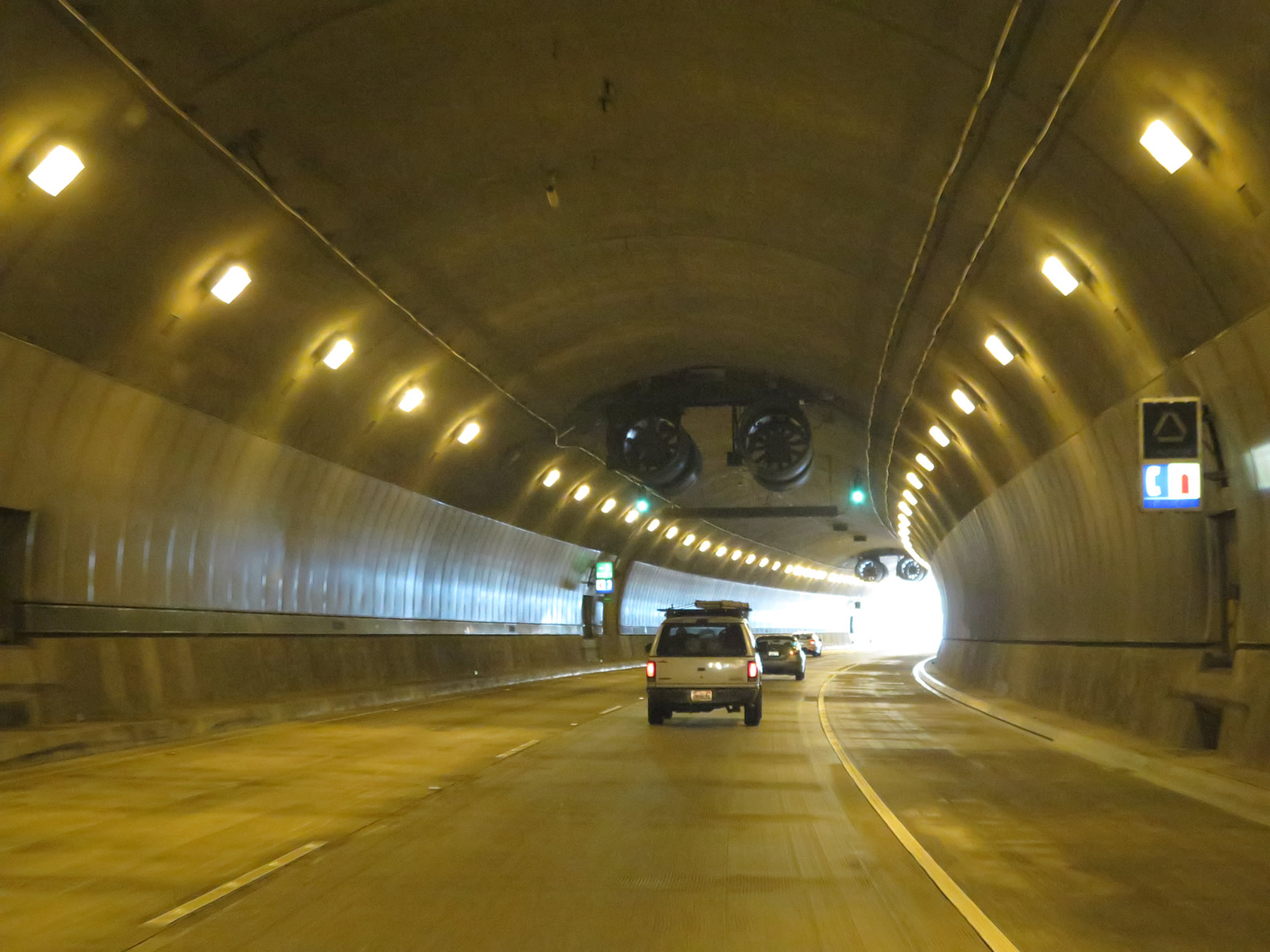
Entering the Caldecott Tunnel third bore on SR 13 (Rumford Freeway) westbound. This narrow tunnel extends 3,771 feet in length without in or outside shoulders. Photo taken 07/06/07. |
|
|
Traveling through the fourth bore of the Caldecott Tunnel along SR 24 west. Motorists cross the Alameda County line midway through the 3,348 feet arch-shaped tunnel. Photos taken 03/07/15. |
|
|
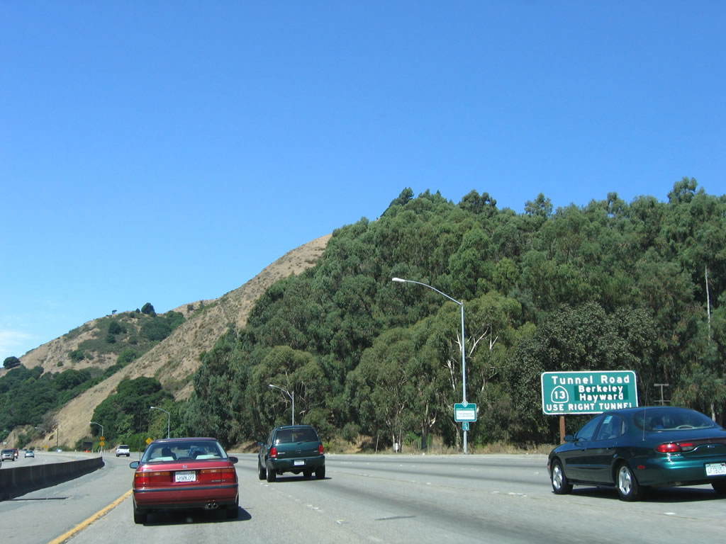
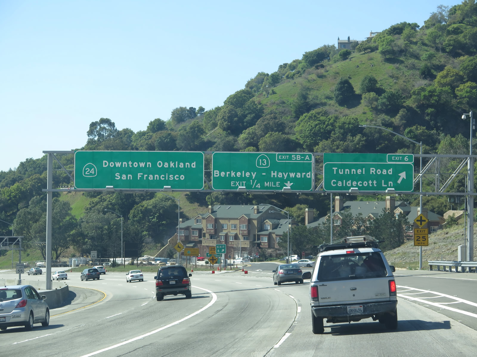
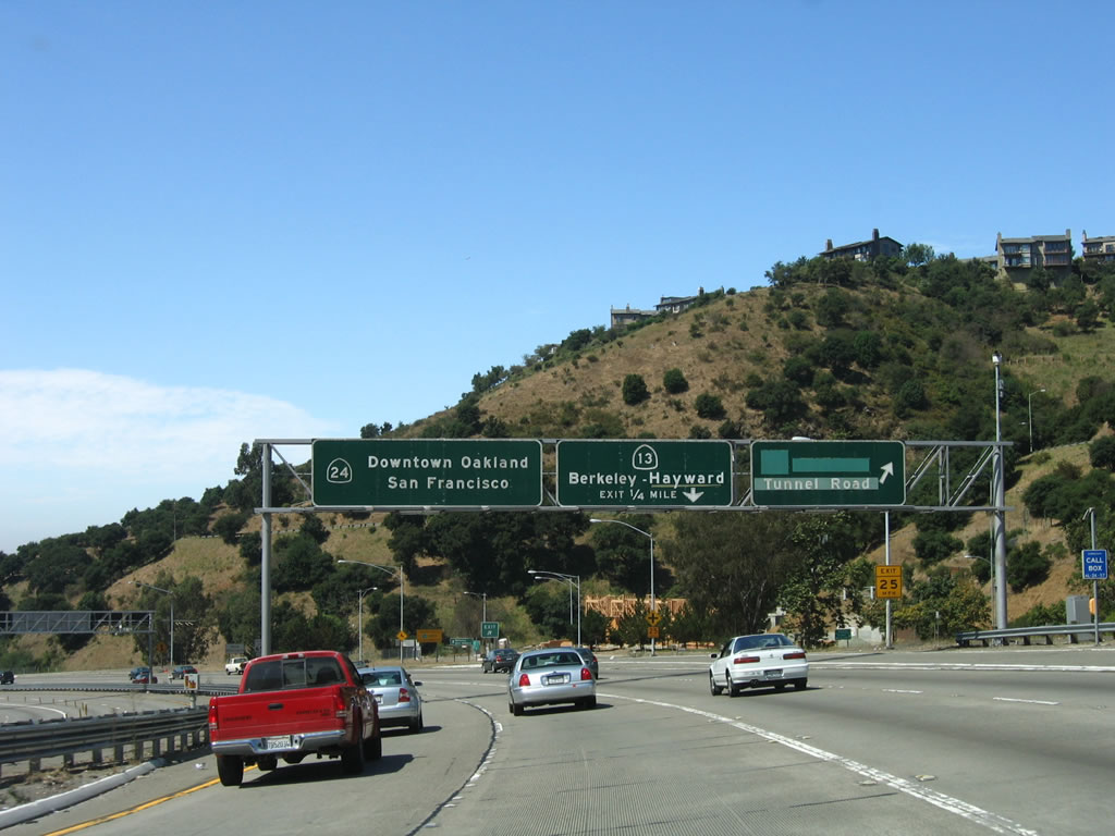
Slip ramps link both sides of SR 24 with the adjacent Caldecott Lane to the west and Broadway to the east. Tunnel Road extends south from nearby to SR 13 north into Berkeley. Exit 5B joins the freeway with SR 13 directly at the subsequent off-ramp.
An older porcelain enamel sign for Tunnel Road included greenouts covering SR 13. First photo taken 03/07/15; second photo taken 08/05/05. |
|
California 24 navigates through a series of S-curves along west to the off-ramps for California 13 (Warren Freeway) and Broadway (Exit 4B). Photo taken 08/05/05. |
|
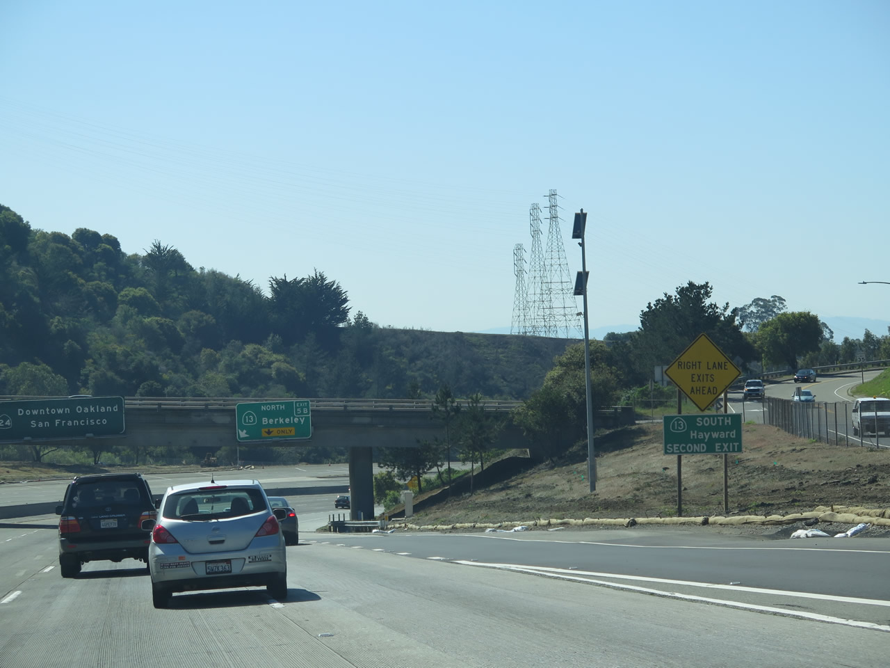
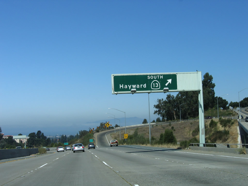
A ground level sign references the forthcoming loop ramp (Exit 5A) for California 13 (Warren Freeway) south to Hayward. Photo taken 03/07/15. |
|
|
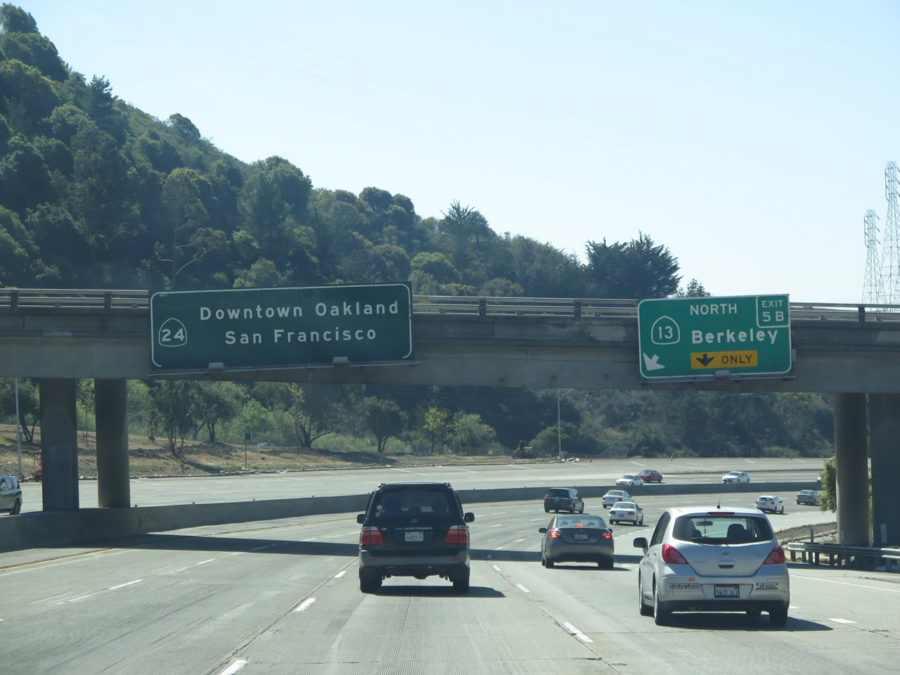
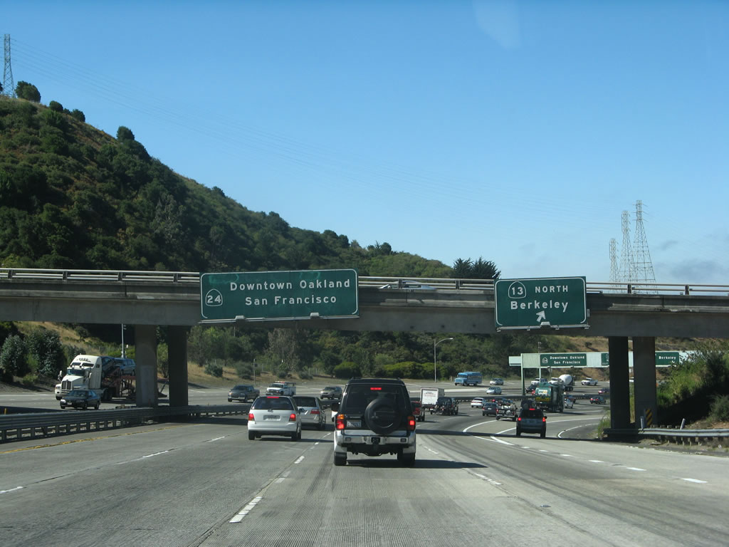
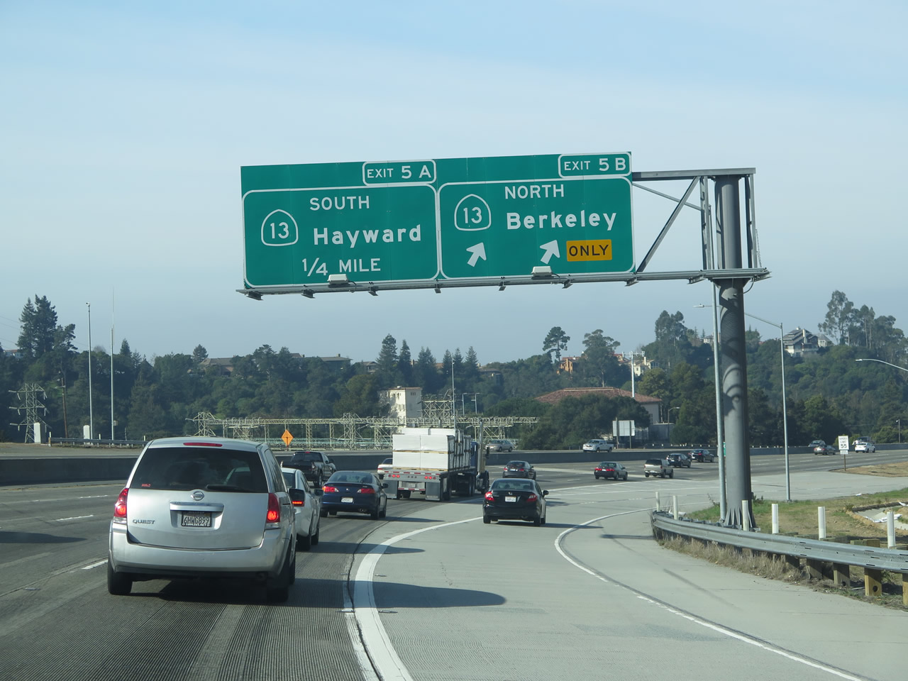
Passing under an overpass, the right lane of California 24 west becomes exit only for Exit 5B, California 13 (Ashby Avenue) north to Berkeley and the University of California at Berkeley (a more direct route to the university is via Exit 4A, College Avenue). California 13 changes from a north-south route into an east-west route upon entering Berkeley. Photos taken 03/07/15 and 07/06/07. |
|
|
Westbound California 24 (Rumford Freeway) reaches Exit 5B, California 13 (Ashby Avenue) north to Berkeley. The next exit is Exit 5A, California 13 (Warren Freeway) south to Hayward. Photos taken 03/07/15 and 07/06/07. |
|
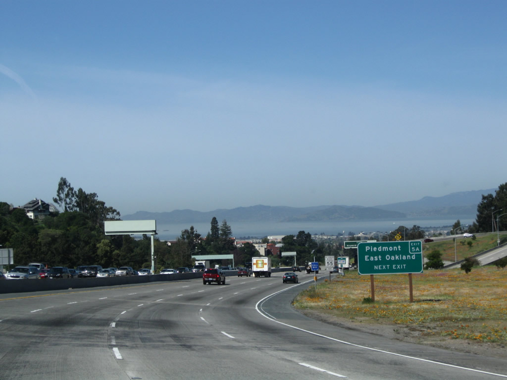
A very small Exit 5A sign is posted for California 13 south to Piedmont and East Oakland. Photo taken 03/07/15. |
|
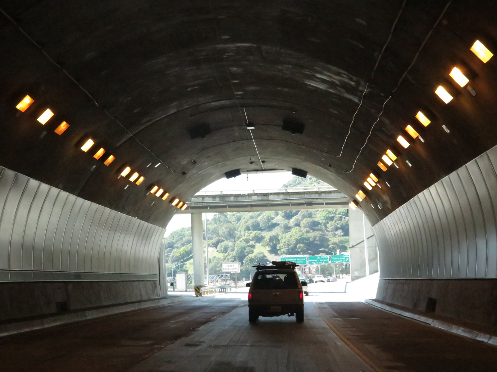
The views upon exiting the Caldecott Tunnel can be exhilarating. Views of the bay, the Bay Bridge, the City of San Francisco, and the Golden Gate Bridge may all be visible in the distance from this vantage point. To indicate how close it all is, the first junction sign for Interstate 580 (Exit 2B) is posted here, just prior to the exit for southbound California 13. The sign was replaced between 2003 and 2007. Photos taken 04/06/09. |
|
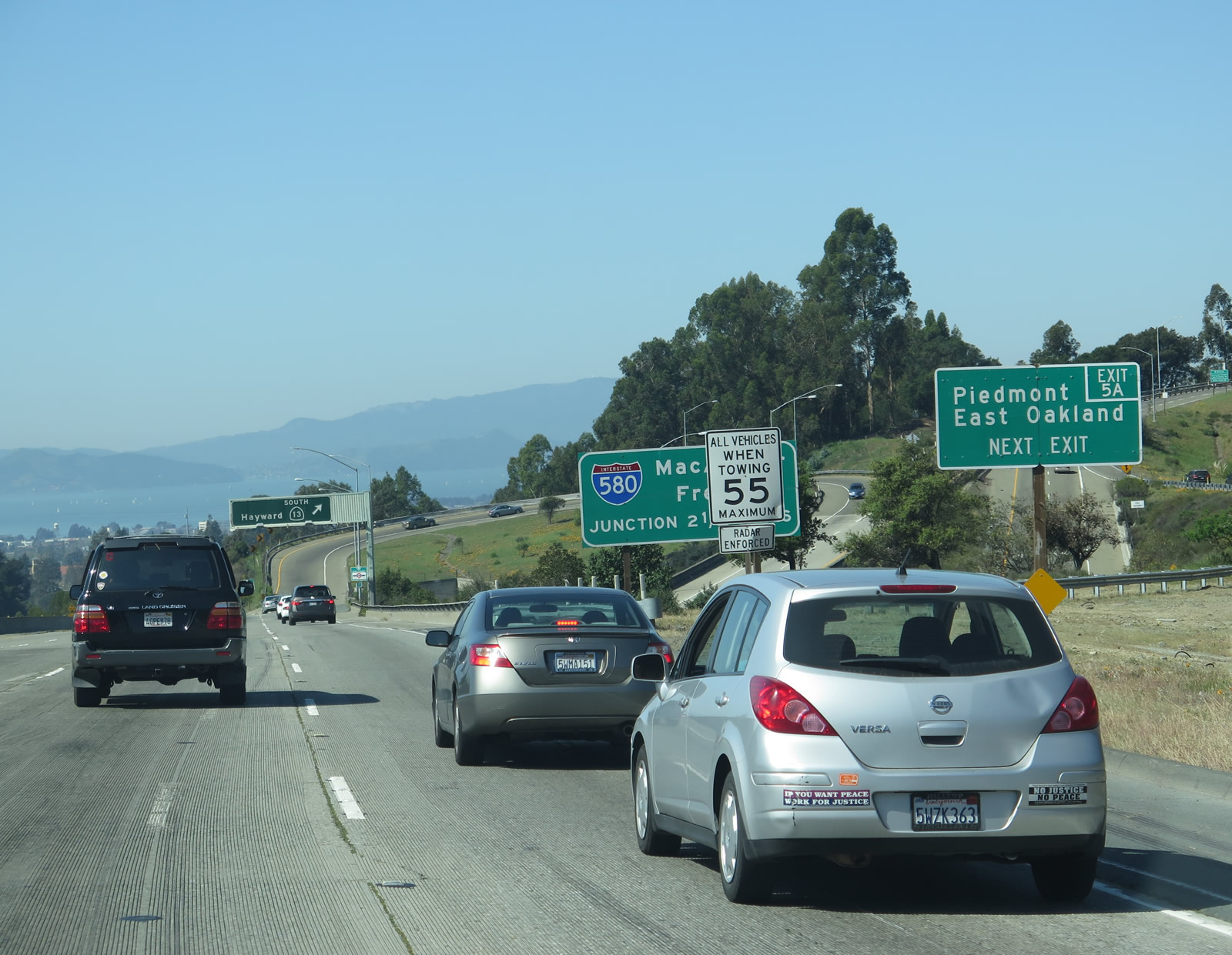
Use Exit 5A to Piedmont and East Oakland. California 13 is generally a four-lane freeway, and it travels in a southerly direction that remains in Oakland for the entire freeway length. The city of Piedmont is bounded on all sides by Oakland, and access to the city can be made via California 13 south to Exit 4, Moraga Avenue. Photo taken 04/06/09. |
|
Westbound California 24 reaches Exit 5A, California 13 (Warren Freeway) south. For travelers en route to the South Bay via Interstate 580 or Interstate 238, this might be a good exit to use. Photo taken 08/05/05. |
|
The next two exits on westbound California 24 are Exit 4B, Broadway and Exit 4A, College Avenue. To the University of California, use Exit 4A, which is the second exit. Photo taken 08/05/05. |
|
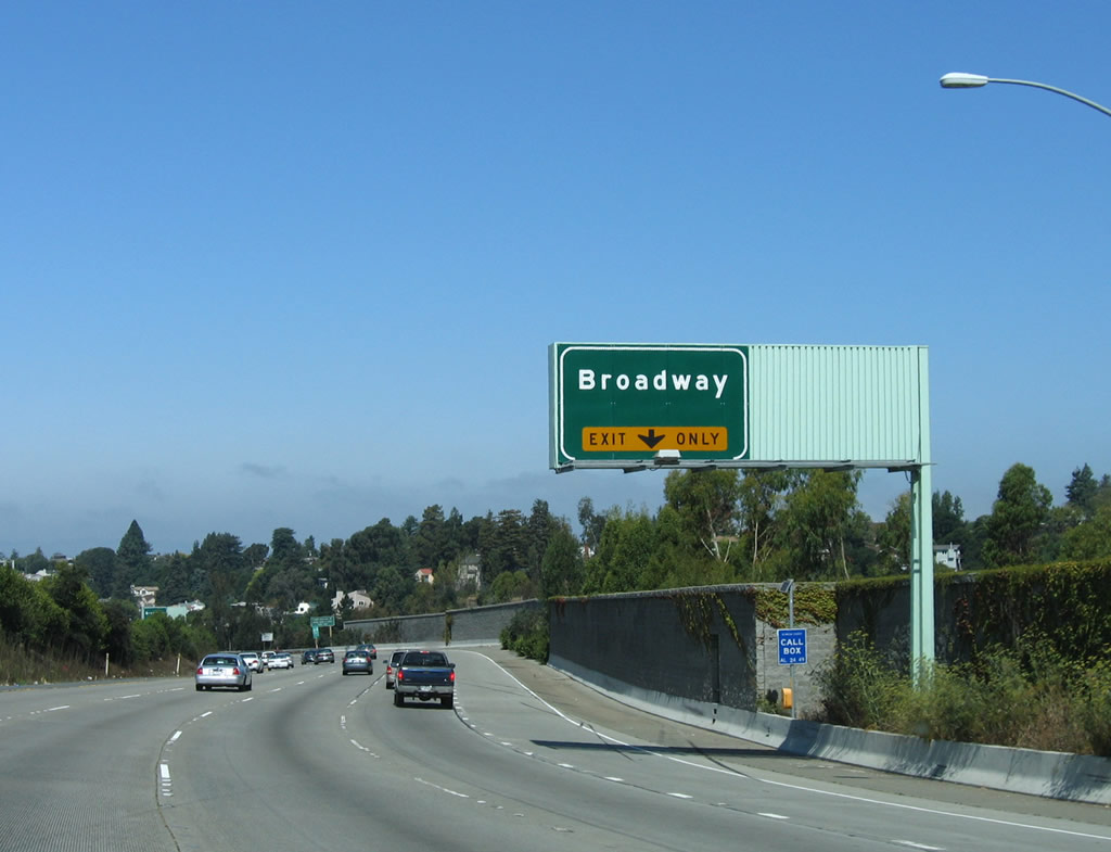
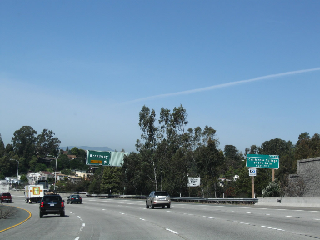
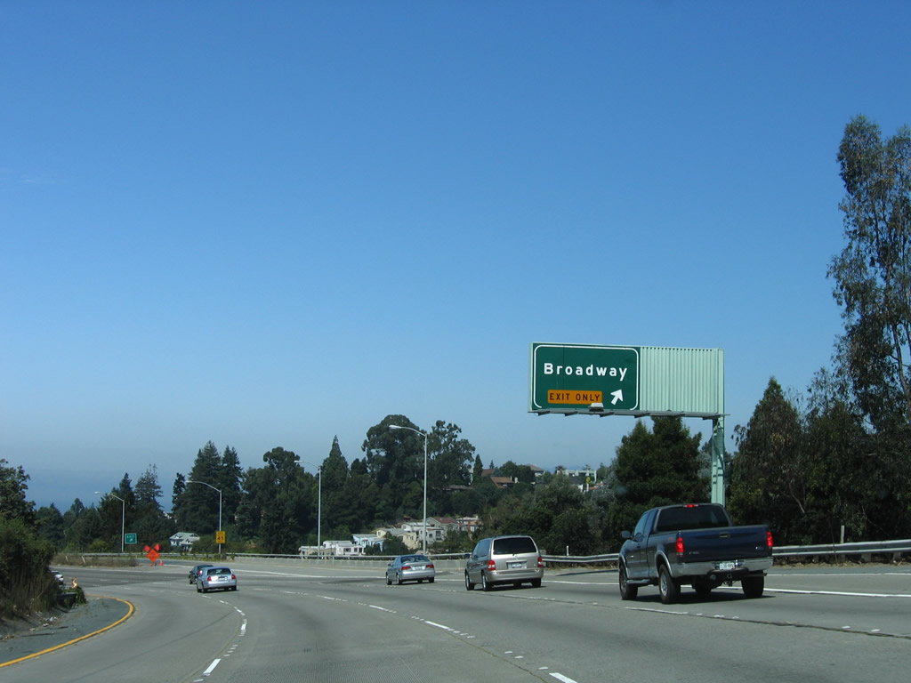
The right lane becomes exit only for Exit 4B, Broadway. The left four lanes continue west on California 24. Use Exit 4B to Rockridge, a community of Oakland. This exit also connects to Miles Avenue (north frontage road) and Keith Avenue (south frontage road). Photo taken 08/05/05. |
|
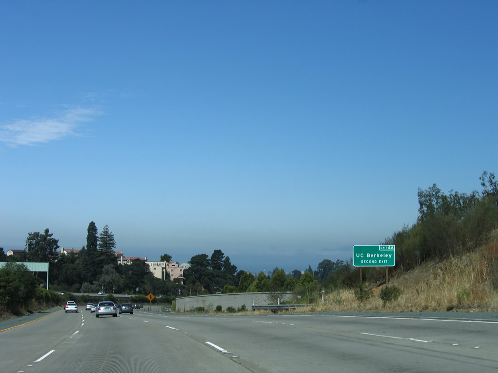
Use Exit 4B (Broadway) to the California College of the Arts and a BART Station. The BART reemerged from Grizzly Peak, then angled southwest to meet California 24 at this interchange. From here, the BART will again follow California 24 in the median of the freeway. The longer tunnel for the BART under Grizzly Peak allows for less of a grade for the commuter trains. Photo taken 04/06/09. |
|
Westbound California 24 reaches Exit 4B, Broadway. The next two off-ramps are for Exit 4A, College Avenue and Exit 3, Telegraph Avenue/Claremont Avenue. Photo taken 08/05/05. |
|
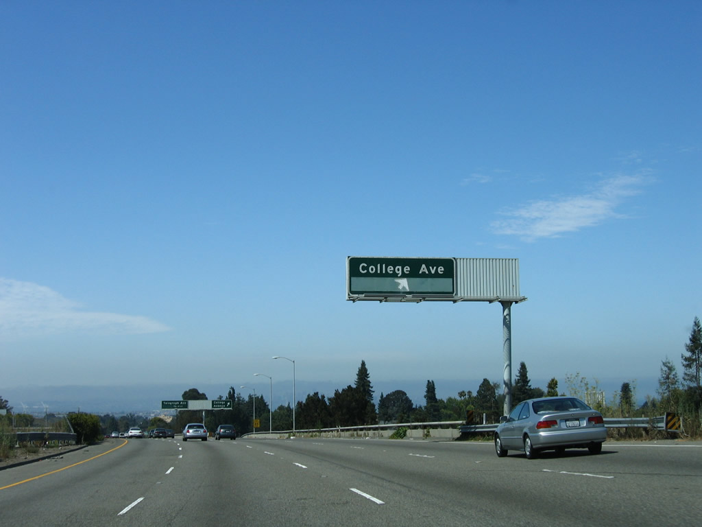
The next exit on westbound California 24 is Exit 4A, College Avenue and the University of California at Berkeley. Through this section, California 24 follows an elevated viaduct. The left four lanes continue west toward downtown Oakland. Photo taken 08/05/05. |
|
Westbound California 24 reaches Exit 4A, College Avenue and the University of California at Berkeley. To College Avenue, motorists must follow Miles Avenue (north frontage road) briefly, then turn right (north) on College Avenue. The university is located in the city of Berkeley. Use College Avenue north to Memorial Stadium, home of the University of California Golden Bears football team. Photo taken 08/05/05. |
|
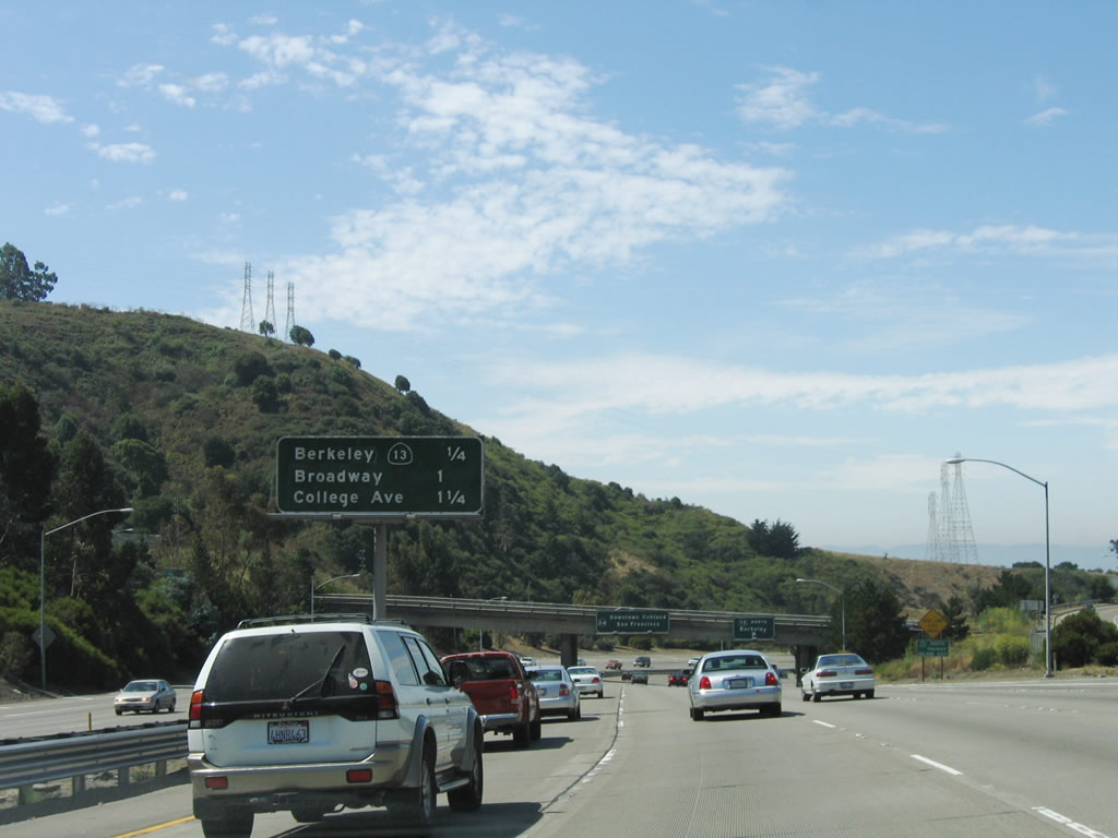
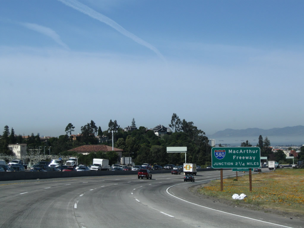
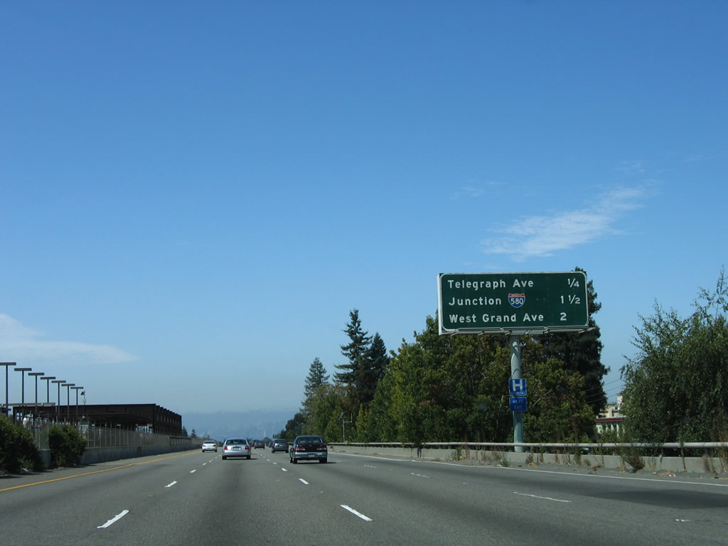
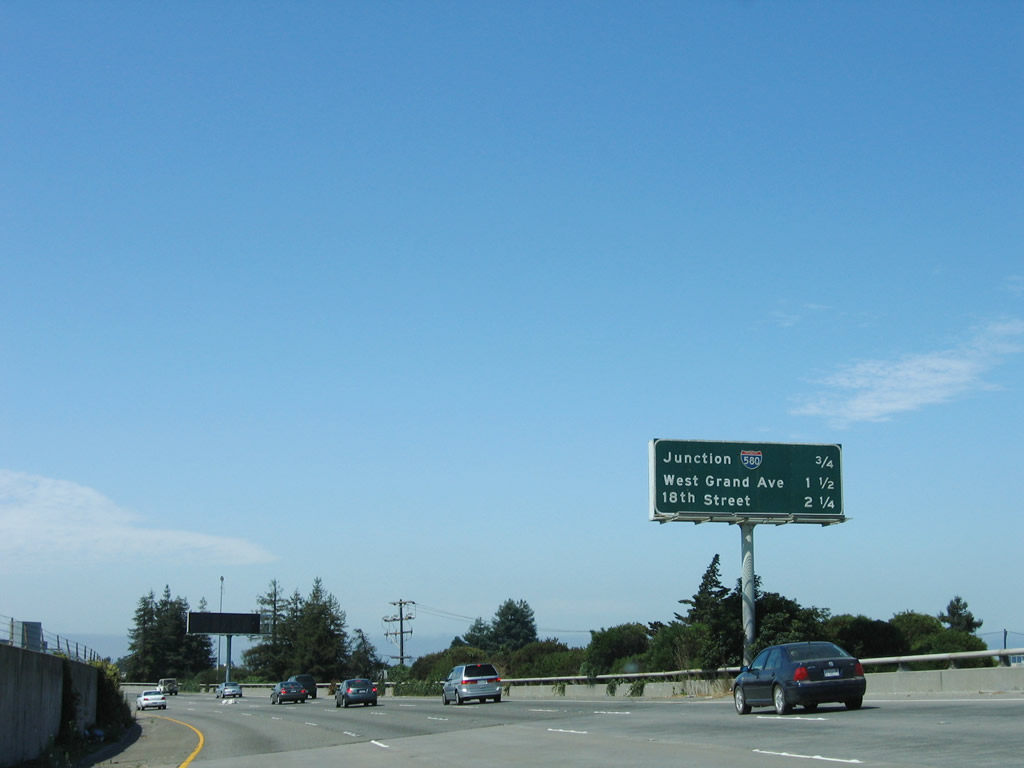
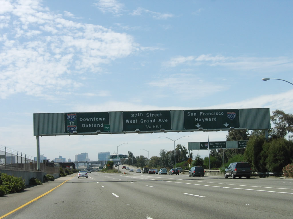
This mileage sign is located along westbound California 24 as it approaches Exit 3, Telegraph Avenue/Claremont Avenue, one-quarter mile. The remaining exits are: Exit 2B, Interstate 580 west to San Francisco and east to Hayward and Exit 2A, Interstate 980 west to downtown Oakland, including connections to 27th Street and West Grand Avenue (Left Exit). The aforementioned Bay Area Rapid Transit (BART) station is located in the median here. Photo taken 08/05/05. |
|
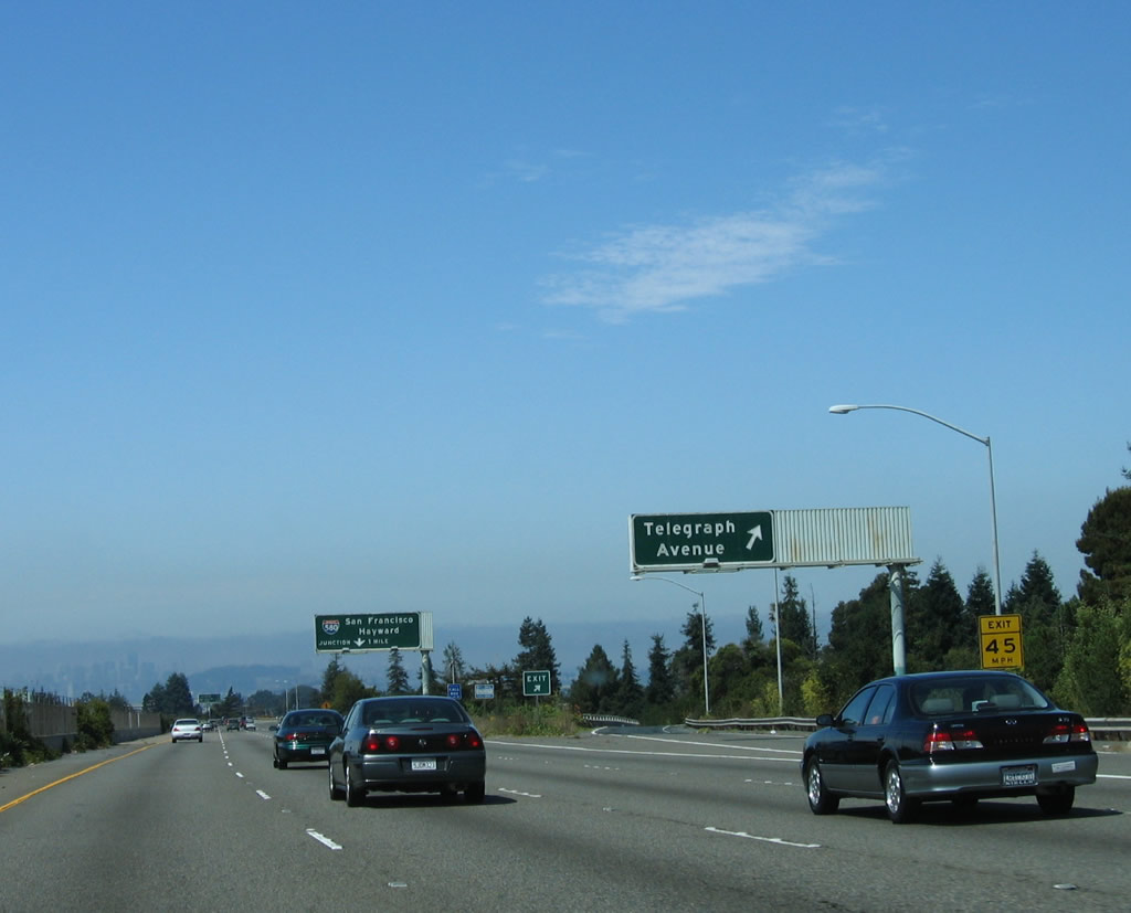
Westbound California 24 reaches Exit 3, Telegraph Avenue. Photo taken 08/05/05. |
|
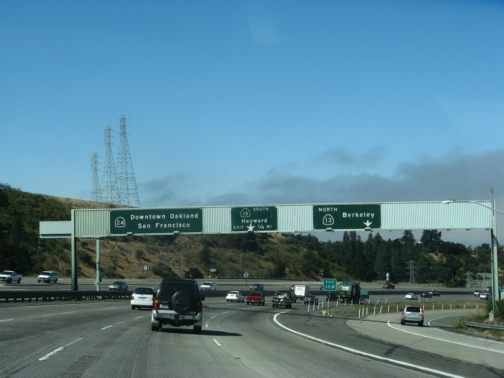
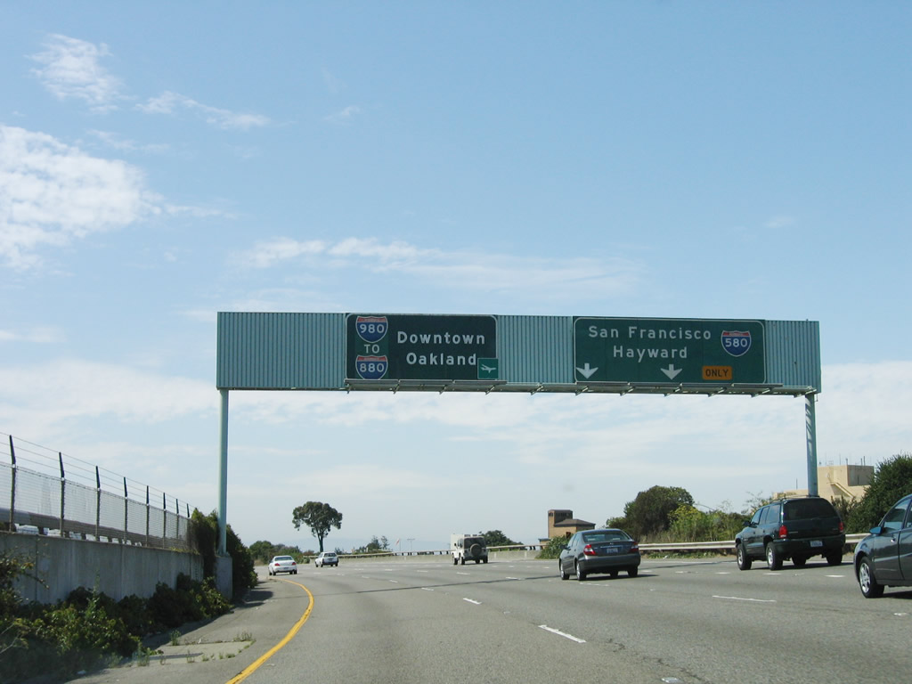
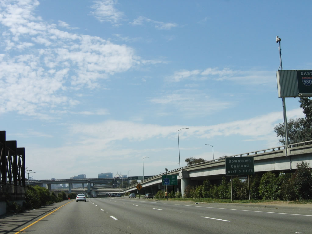
The next exit along California 24 west is the interchange with Interstate 580 and Interstate 980 (Exit 2B) in one mile. Remain right for Interstate 580; the left lanes will default onto westbound Interstate 980 to downtown Oakland. A word of caution: to reach San Francisco, the best route is via Interstate 580. There is no connection between westbound Interstate 980 and northbound Interstate 880. Notorious for its traffic congestion, the infamous Maze interchange (Interstates 80, 580, 880, 980, and California 24) is just ahead. Photo taken 08/05/05. |
|
This is the final interchange sequence sign along westbound California 24. The final exits are Exit 2B, Interstate 580 and Exit 2A, Interstate 980. The West Grand Avenue and 18th Street exits are located on Interstate 980, not California 24. Photo taken 08/05/05. |
|
California 24 approaches its final interchange at Exits 2A-B, Interstate 580 and Interstate 980. California 24 ends at Exits 2B-A; through traffic is directed onto westbound Interstate 980 (Exit 2A), while exiting traffic may take east or west Interstate 580 (Exit 2B). Interstate 980 has the same exit numbering scheme as California 24, since they are contiguous freeways. In fact, a few California 24 reassurance shields have been spotted on Interstate 980 east. Photo taken 08/05/05. |
|
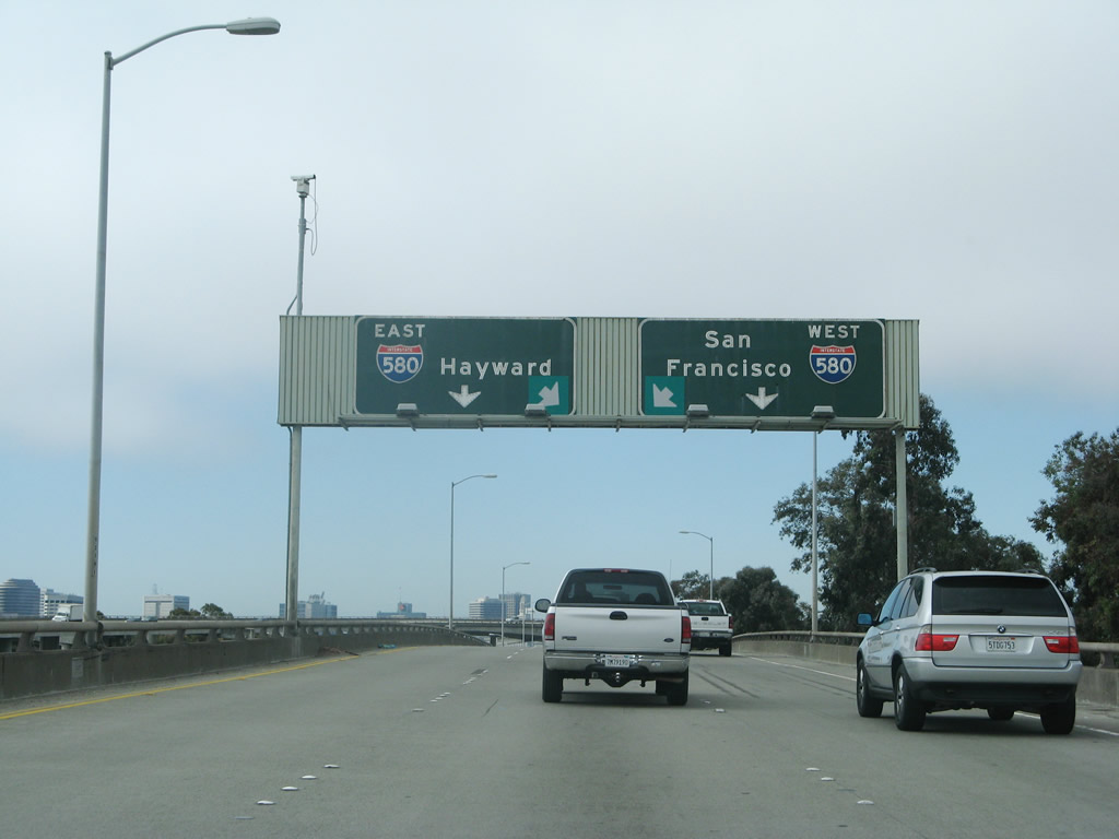
The left three lanes default onto westbound Interstate 980, and the right two lanes connect to Interstate 580 and the Maze Interchange for travelers en route to San Francisco. Photo taken 08/05/05. |
|
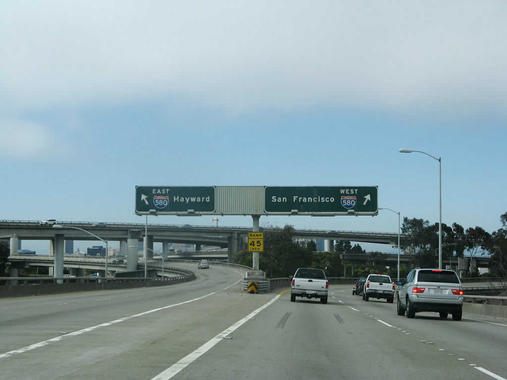
Now on the transition ramp from westbound California 24 (Rumford Freeway) to Interstate 580/MacArthur Freeway, the left two lanes connect to Interstate 580 southeast to Hayward, and the right two lanes connect to Interstate 580 west to San Francisco, Richmond, and San Rafael. Photo taken 07/06/07. |
|
The transition ramp splits. This interchange is a symmetrical stack, with Interstate 980/California 24 forming the lowest level and Interstate 580 forming the second level. The transition ramp from California 24 west to Interstate 580 east is the third level, and the ramp from Interstate 580 east to California 24 east is the top level. Underneath the massive stack interchange is Grove Shafter Park. Photo taken 07/06/07. |
|
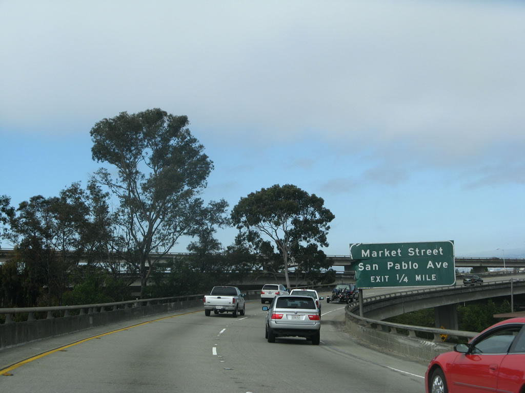
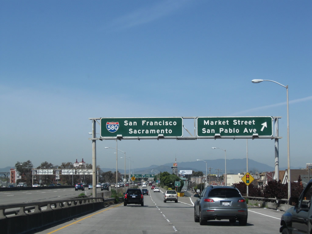
On the transition ramp from California 24 west to Interstate 580 west, an exit connects to 36th Street, which offers a connection to Market Street south, California 123/San Pablo Avenue (former U.S. 40) north, and MacArthur Boulevard (former U.S. 50). Photo taken 07/06/07. |
|
Continuing on the transition ramp to westbound Interstate 580, there is an exit for Market Street and California 123/San Pablo Avenue (former U.S. 40) before merging onto Interstate 580 itself. Photo taken 04/06/09. |
|
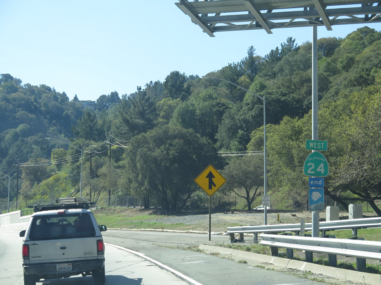
Back on the mainline, there is no end California 24 shield as Interstate 980 takes over west. Photo taken 08/05/05. |
Page Updated May 15, 2015.