| California 33 north |
|
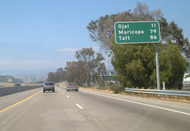
This mileage sign is found on California 33 north after the U.S. 101 interchange. Ojai (California 150) is south of the coastal mountains, while Maricopa and Taft are in the Central Valley. Photo taken 06/02/02. |
|
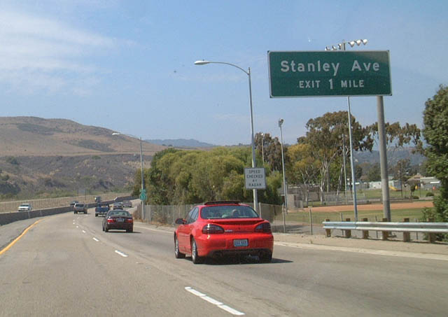
A bit further north, California 33 approaches Exit 2, Stanley Avenue. Photo taken 06/02/02. |
|
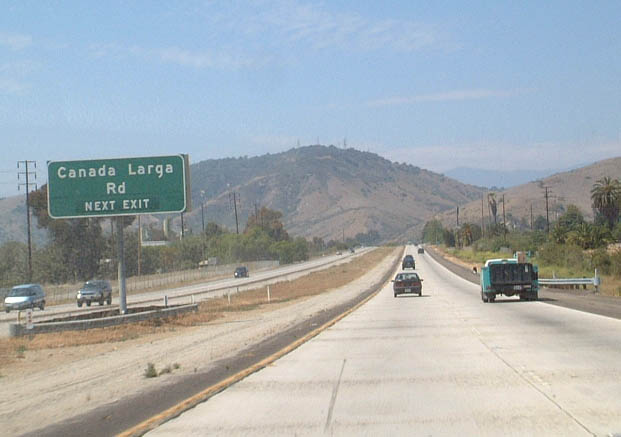
The next exit along northbound California 33 is Exit 3, Canada Larga Road. Photo taken 06/02/02. |
|
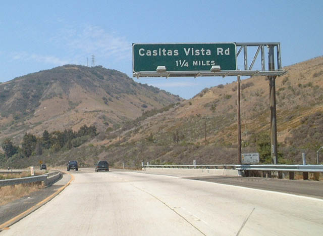
Continuing north, the next exit along California 33 is Exit 4, Casitas Vista Road. Photo taken 06/02/02. |
|
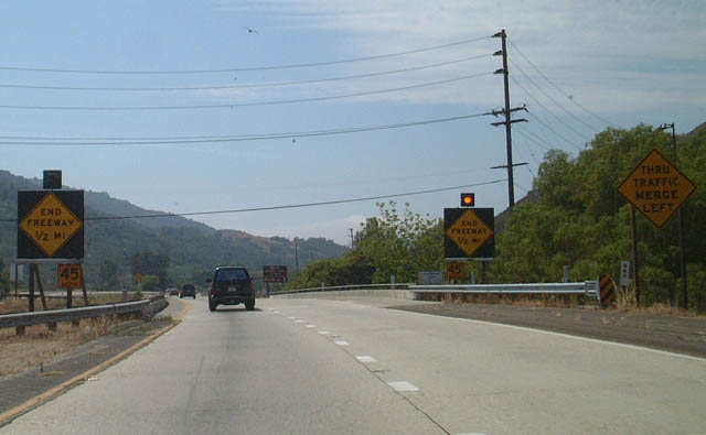
Northbound California 33 approaches the end of its brief freeway segment near Exit 4. After passing through Ojai, the traffic counts will reduce to a point where a continuation of this freeway north through the Los Padres National Forest is impractical (not to mention very costly!). Photo taken 06/02/02. |
|
Northbound California 33 at Pine Mountain Pass in the Los Padres National Forest, elevation 5,080 feet. Photo taken 01/21/04. |
|
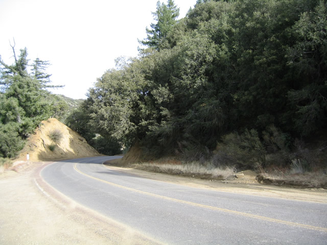
View of the descent from Pine Mountain Pass to Ventucopa. Photo taken 01/21/04. |
|
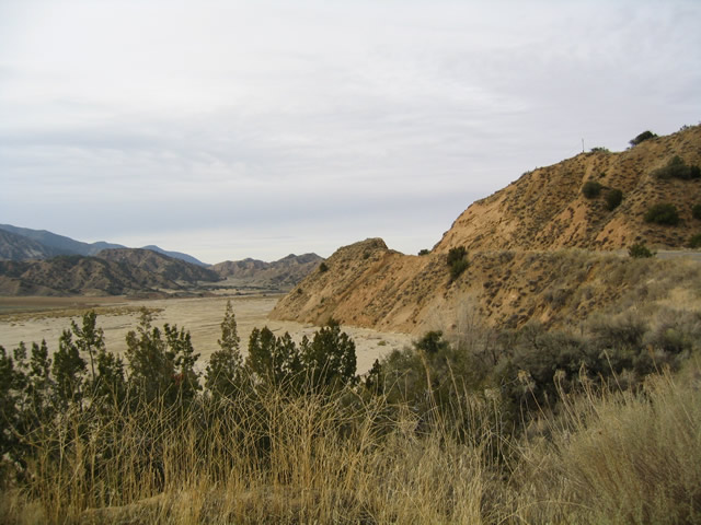
The Cuyama River follows a very wide path alongside California 33, indicating previous floods and largest rain events have widened out this channel to nearly its fullest capacity. At the time this picture was taken, there was not much water in the river. Photo taken 01/21/04. |
|
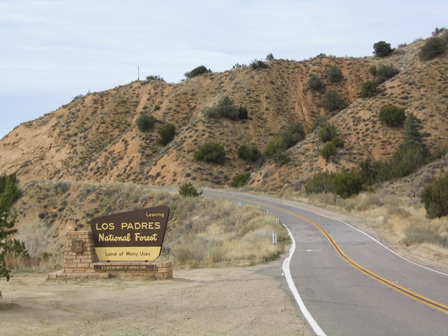
Northbound California 33 exits the Los Padres National Forest. Photo taken 01/21/04. |
|
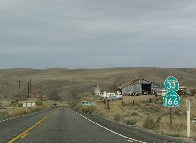
California 33 north at the wye intersection with California 166 in the eastern Cuyama Valley. The two routes overlap 13.7 miles northeast to Maricopa. Photo taken by Joel Windmiller (06/19/01). |
| California 33 north & 166 east |
|
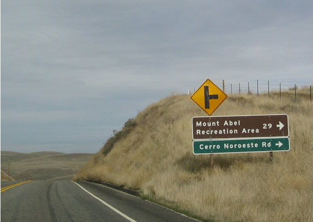
Northbound California 33 and eastbound California 166 meet Cerro Noroeste, which leads southeast into the Bitter Creek National Wildlife Refuge and then east toward Pine Mountain and Frazier Park. Photo taken 01/21/04. |
|
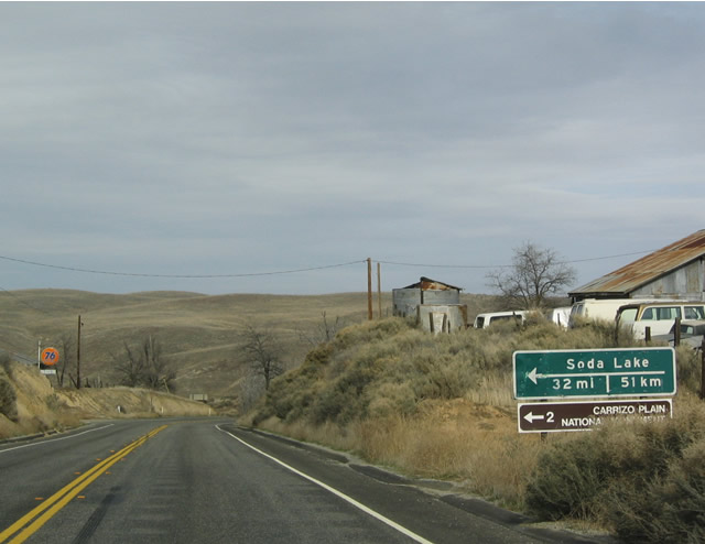
Shields for northbound California 33 and eastbound California 166 as they approach Soda Lake Road and the turn off for Carrizo Plains National Monument. Photo taken 01/21/04. |
|
Northbound California 33 and eastbound California 166 at Soda Lake Road, which leads west into Carrizo Plains National Monument. This monument, which was created by President Clinton's executive order, is an isolated valley formed by the San Andreas Fault. Photo taken 01/21/04. |
|
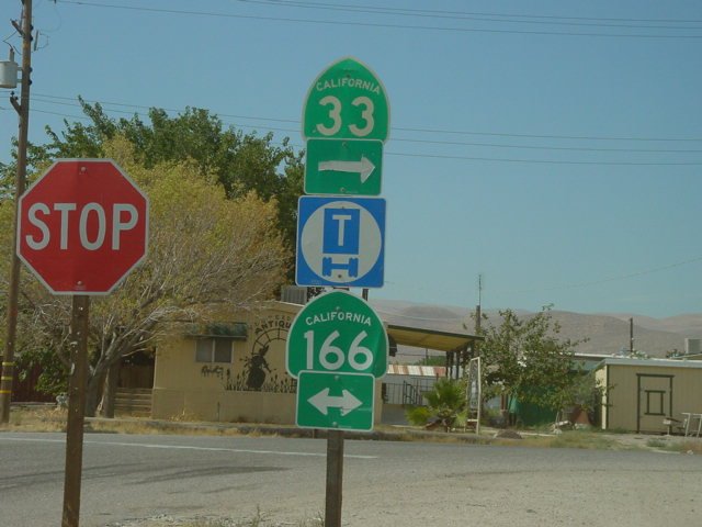
Northbound California 33 meets California 166 in Maricopa. This rugged yet isolated area is a good distance from any major city. Photo taken by Joel Windmiller (07/08/01). |
|
|
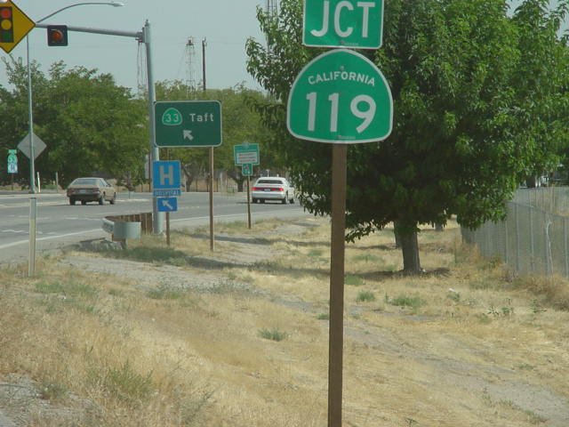
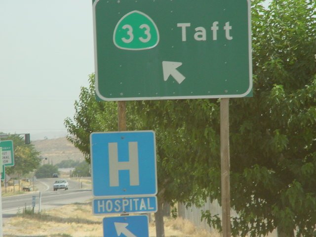
California 33 north meets California 119 east in Taft. At this point, California 33 departs from U.S. 399. California 119 follows Old U.S. 399 northeast toward Pumpkin Center and Maricopa. Photos taken by Joel Windmiller (07/08/01). |
| California 33 north & 198 east |
|
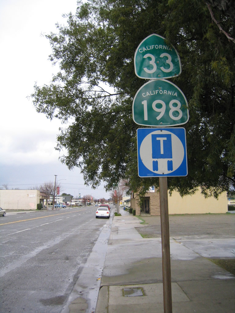
In downtown Coalinga, we find this California 33 north and California 198 east reassurance shield assembly on northbound Elm Avenue at Fifth Street. Photos taken 01/02/05. |
| California 33 north |
|
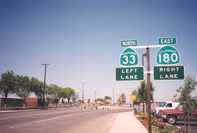
Northbound California 33 approaches the junction with California 180 east in Mendota. These signs are behind the Burger King in relation to the end California 180 shield shown on the California 180 page. This marks the current western terminus of California 180. Photo taken by Trevor Carrier, 04/20/02. |
|
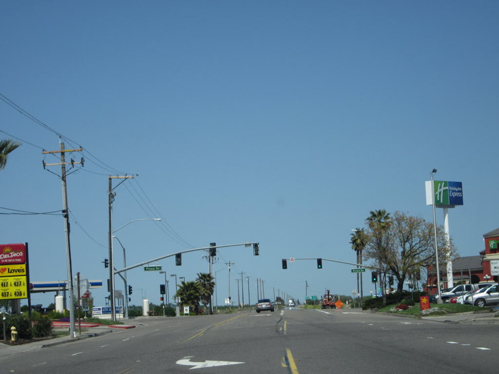
California 33 travels through a series of gas stations, restaurants, and hotels in the vicinity of the Interstate 5 interchange in Santa Nella (Interchange 407). Photo taken 04/06/12. |
|
|
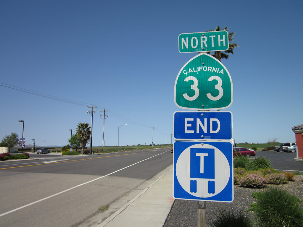
This reassurance shield for California 33 is posted along California 33 north in Santa Nella, just north of the Interstate 5 interchange (Exit 407). An end truck route sign is posted below the green reassurance shield. Photos taken 04/06/12. |
|
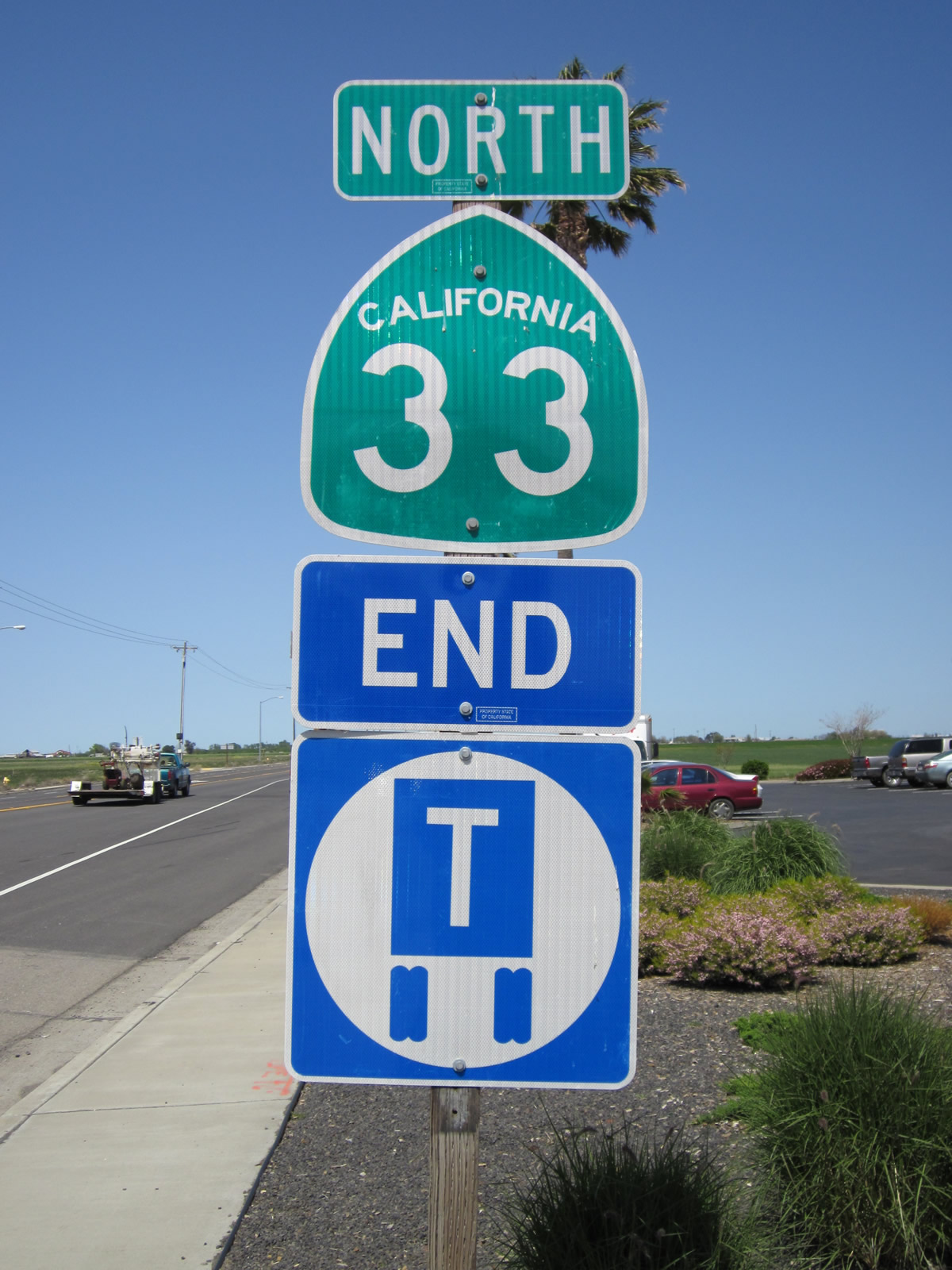
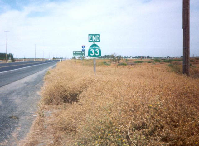
Much further north, this end California 33 shield assembly is found on northbound California 33 at Interstate 5 near Vernalis, just south of Tracy. The interchange marks the northern terminus of one of the longest state routes in California. Photo taken by Trevor Carrier, 10/20/01. |
Page Updated September 16, 2012.