| California 55 - Newport Boulevard north |
|
|
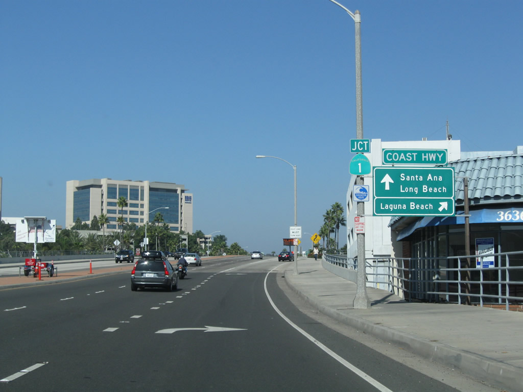
California 55 begins at an interchange with California 1 (Coast Highway) near Downtown Newport Beach. Although this is an interchange (built in 1999), California 55 remains a conventional city street (surface arterial with some near-expressway alignments) until after it enters Costa Mesa. Photos taken 10/29/09 and 05/30/04. |
|
Northbound California 55 reaches Exit 1A, California 1 (Coast Highway) south to San Diego. The history of California 55 in Newport Beach is tied to the original plans for a California 1 freeway. Originally, there were plans to construct a freeway along the California 1 (Pacific Coast Highway) corridor from San Juan Capistrano through the Orange County coastal communities en route to Los Angeles County, but that plan was discarded during the 1960s and 1970s due to environmental concerns, cost, property damage, and the separation of coastal communities by a freeway. Photo taken 10/29/09. |
|
Traffic from California 1 south merges onto California 55 north. Back to the proposed freeway construction for California 1, some scenarios envisioned in constructing California 1 as a freeway even considered building the freeway out over the open water, which would certainly avoid impacting property on land but would likely cause harm on the coastal waters and obstruct views of the ocean. Photo taken 10/29/09. |
|
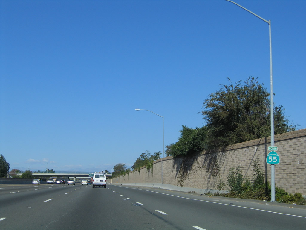
Decorative lighting lines both sides of the widened California 55 bridge over California 1. As part of this freeway construction project, California 55 was planned as a freeway connector to California 1, and both freeways would have met somewhere in Newport Beach. After California 1 was removed from freeway plans, California 55 was removed shortly thereafter. There is ample real estate for a California 55 freeway in some areas, but other rights of way required for the freeway have been developed in Newport Beach and Costa Mesa. As such, the current configuration of California 55 through these two cities is likely to be the final configuration. Photo taken 10/29/09. |
|
|
|
|
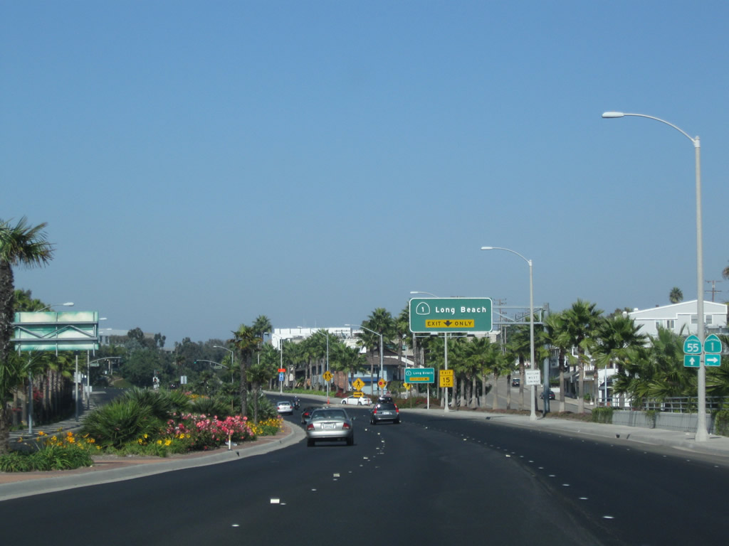
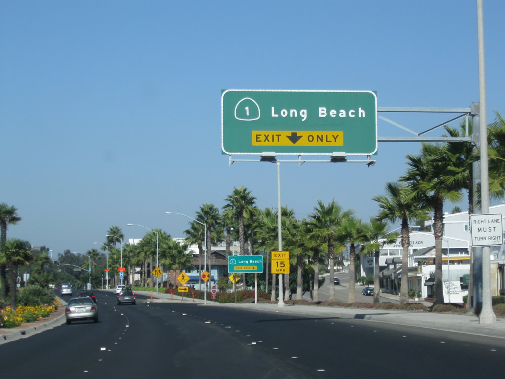
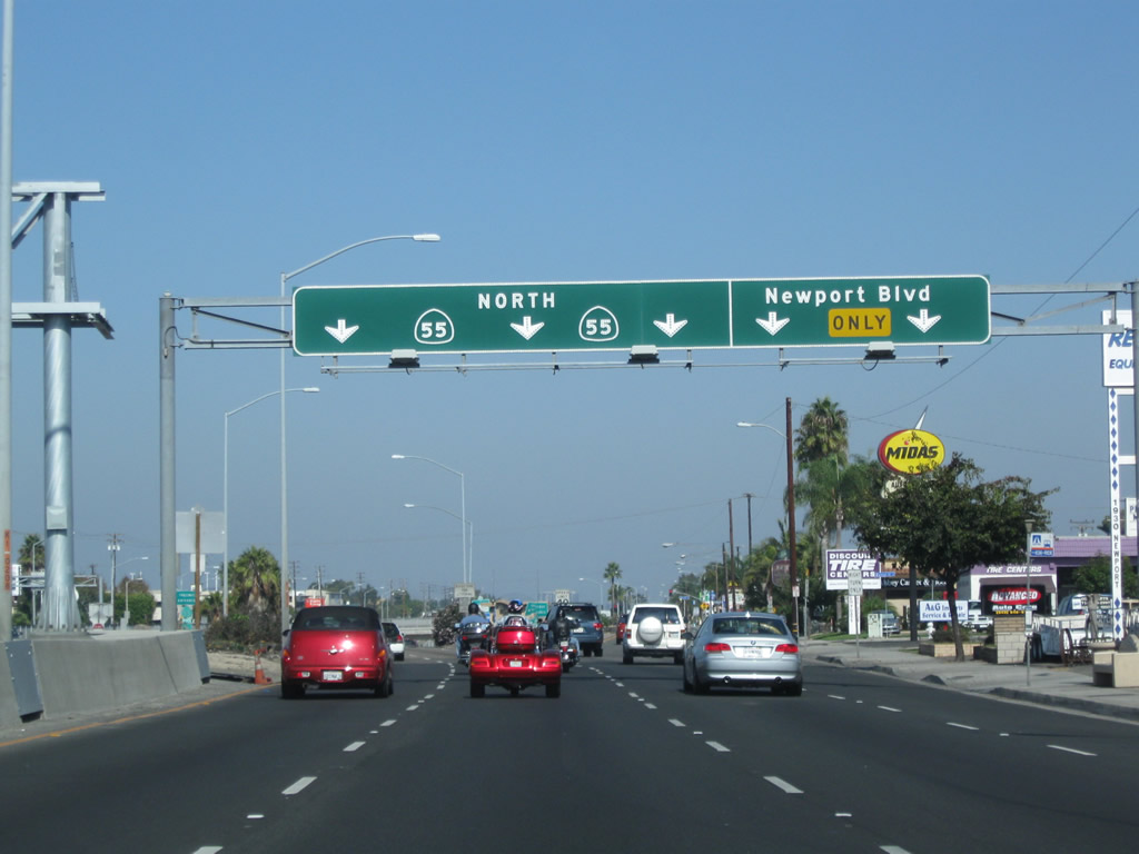
Northbound California 55 (Newport Boulevard) reaches Exit 1B, California 1 (Coast Highway) north to Huntington Beach, Seal Beach, and Long Beach. Photos taken 10/29/09. |
|
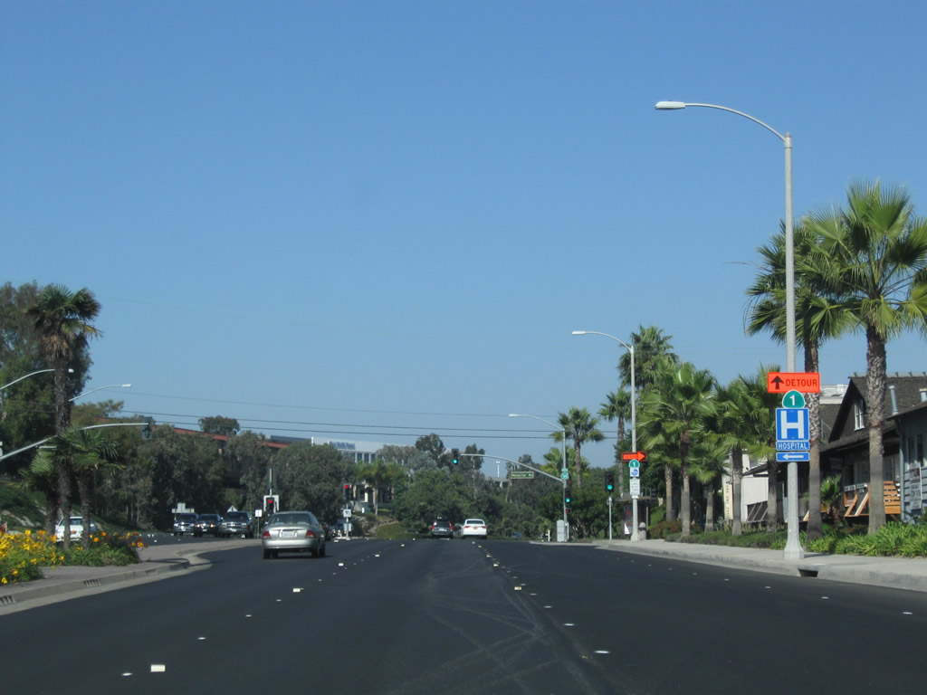
The first traffic signal on California 55 (Newport Boulevard) north is with Hospital Road. A detour sign for California 1 (without state name) is posted prior to this traffic signal. Photo taken 10/29/09. |
|
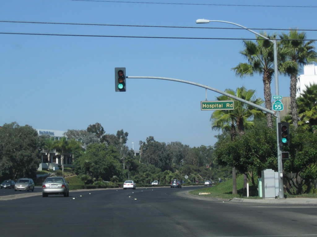
Northbound California 55 meets Hospital Road at this traffic signal. The first California 55 north reassurance shield is posted on the traffic signal mast. Photo taken 10/29/09. |
|
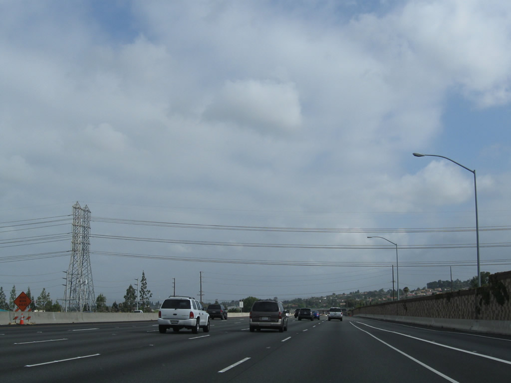
Ample rights of way surround California 55, owing to prior plans to construct this highway into a full freeway. Now the extra area serves as a greenbelt alongside the divided highway. Photo taken 10/29/09. |
|
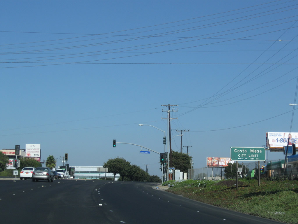
Prior to the Industrial Way traffic signal, California 55 leaves Newport Beach and enters Costa Mesa (population 108,724 as of 2000 Census, elevation 98 feet, and incorporated on June 29, 1953). Photo taken 10/29/09. |
|
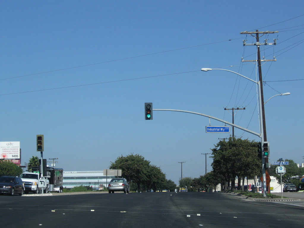
Northbound California 55 meets Industrial Way at this traffic signal in Costa Mesa. Photo taken 10/29/09. |
|
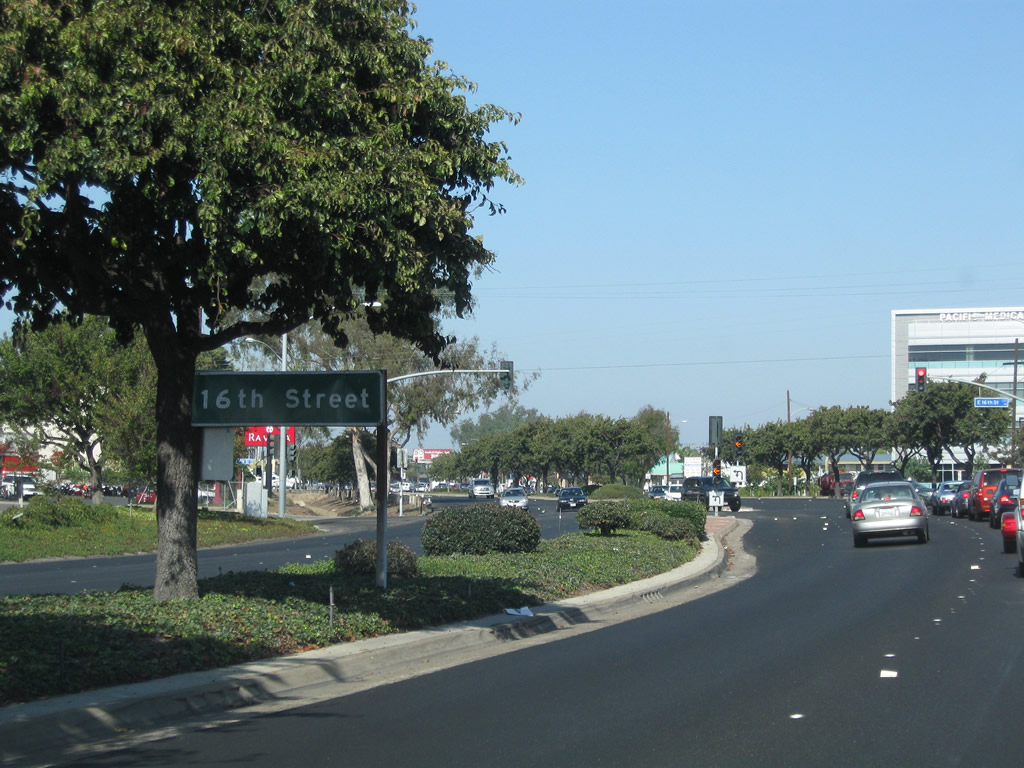
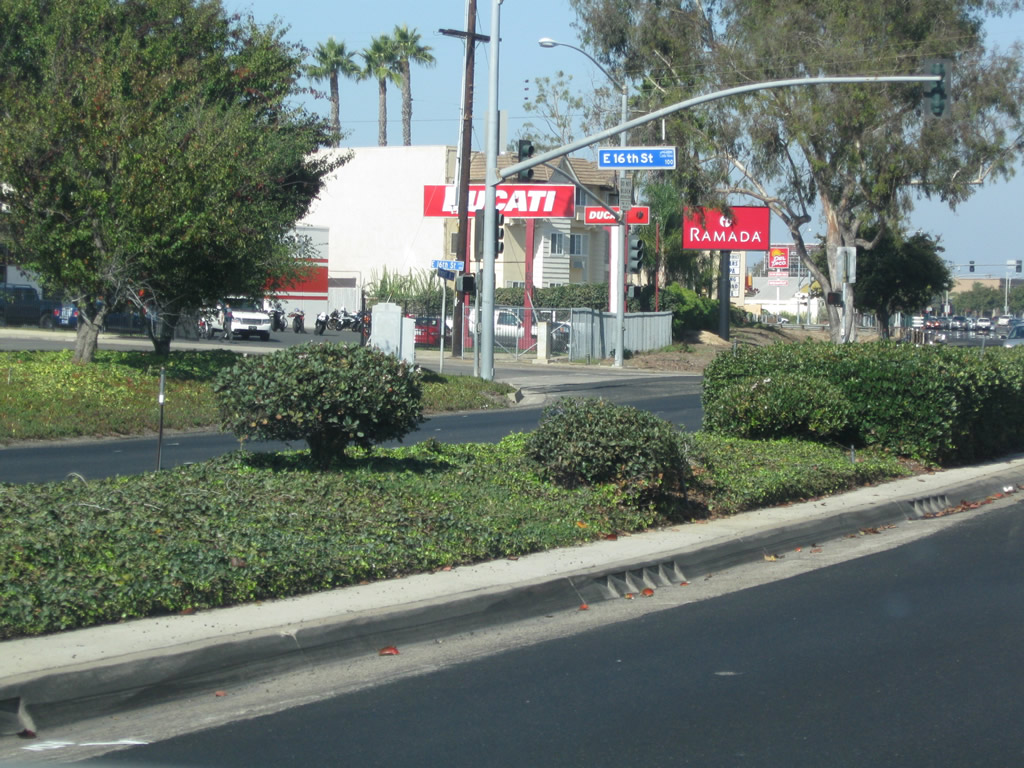
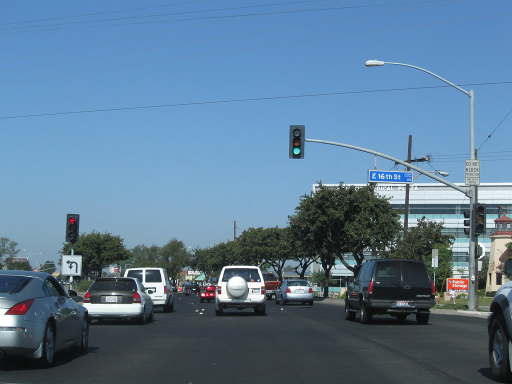
The next traffic signal along California 55 north is with 16th Street. Photo taken 10/29/09. |
|
Divoted curbing lines the median, betraying the age of these original medians. Although the landscaping is comparably new, the concrete curbs date back to the construction of this section of state route. The divots are in groups of five individual divots, and each group of divots is spaced about 15 feet apart. Photo taken 10/29/09. |
|
Northbound California 55 (Newport Boulevard) meets 16th Street at this signalized intersection. Photo taken 10/29/09. |
|
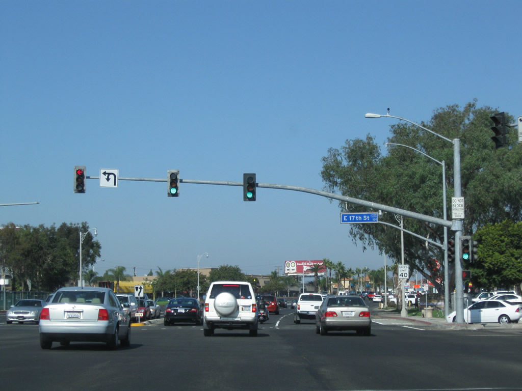
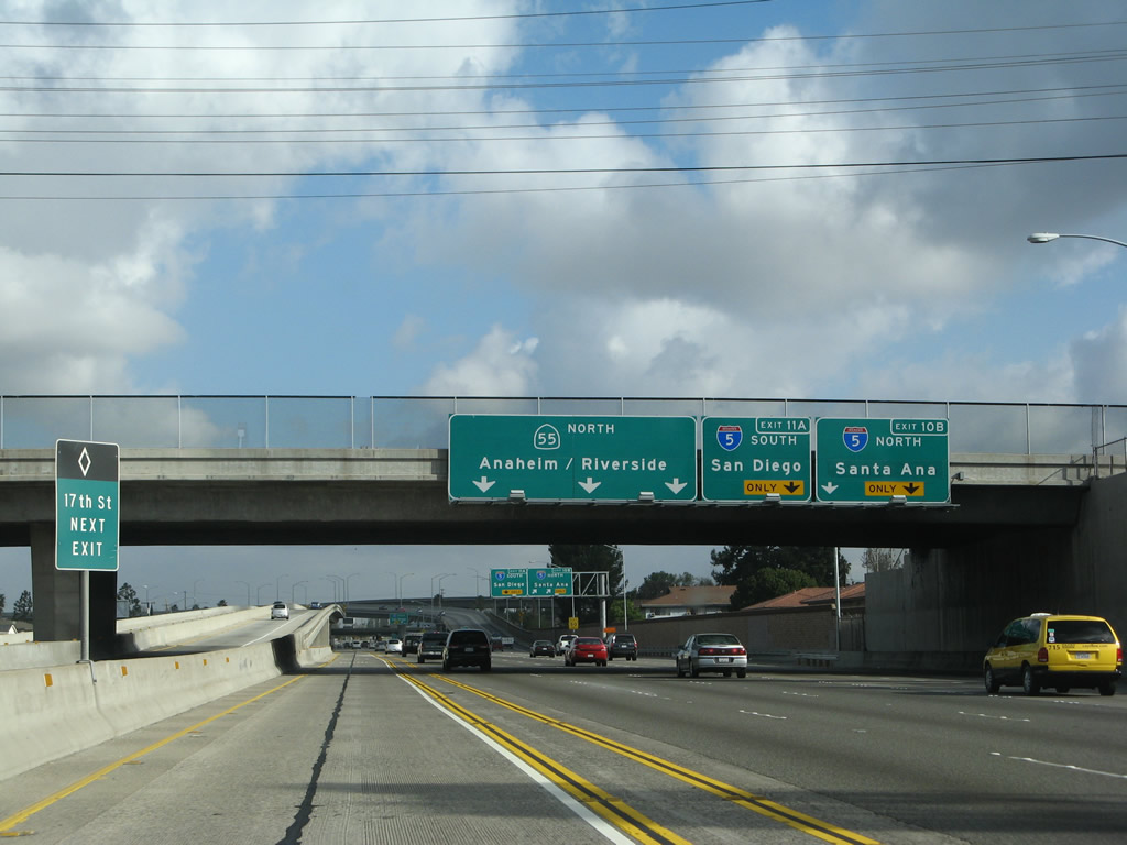
The next signalized intersection along California 55 north is with 17th Street. Photo taken 10/29/09. |
|
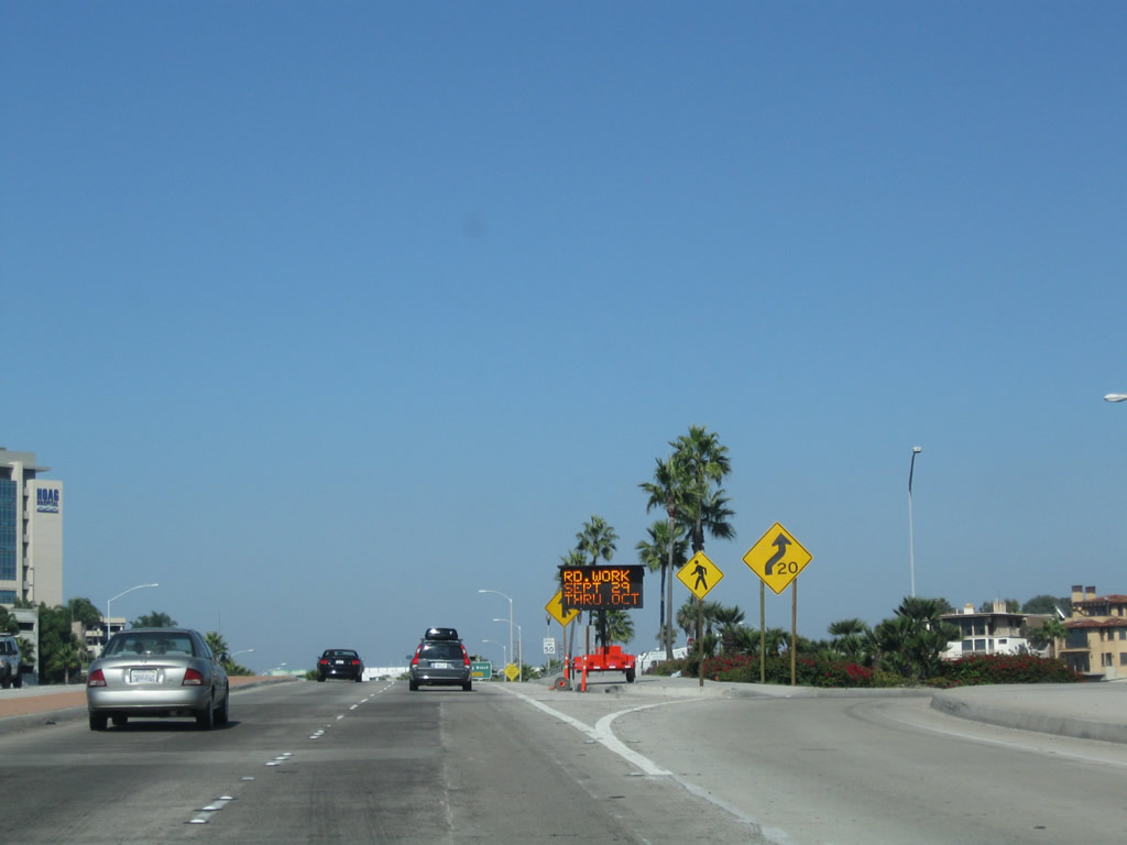
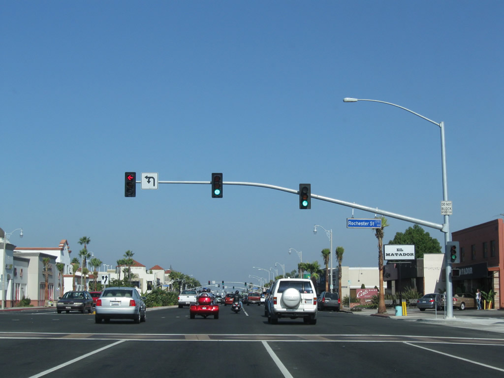
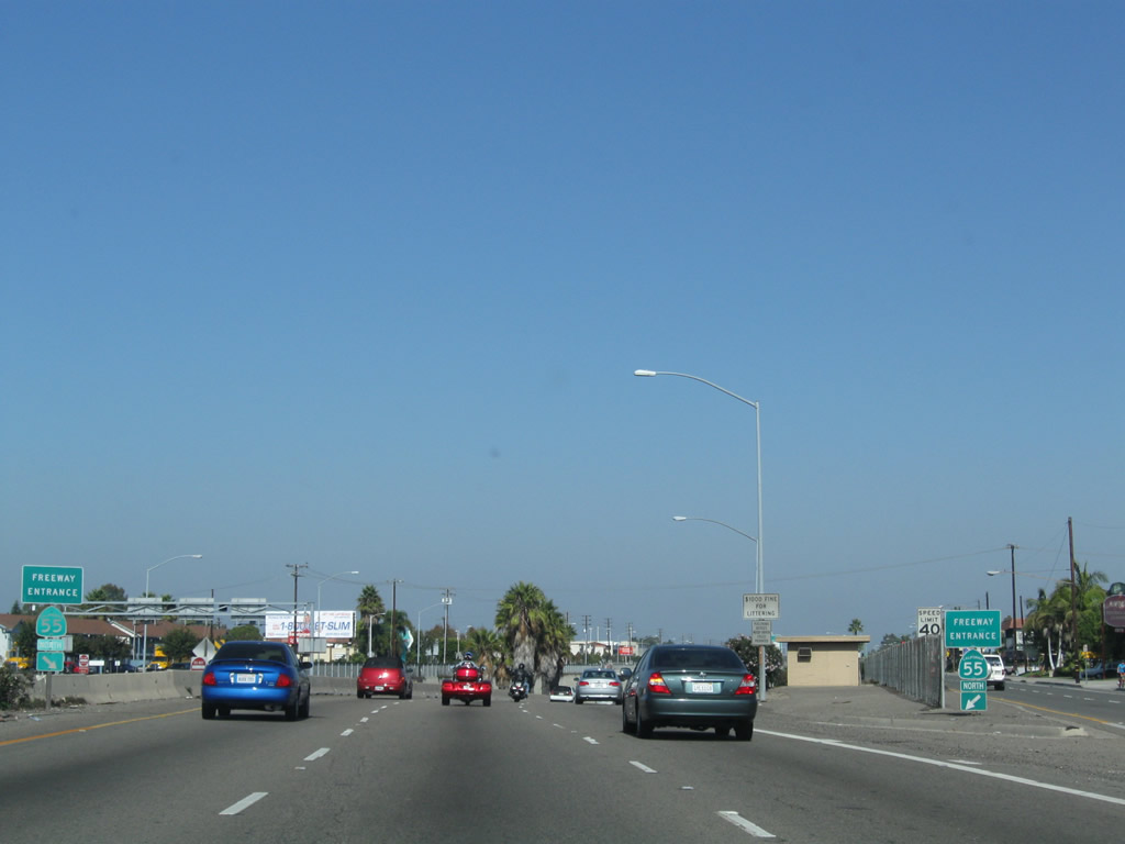
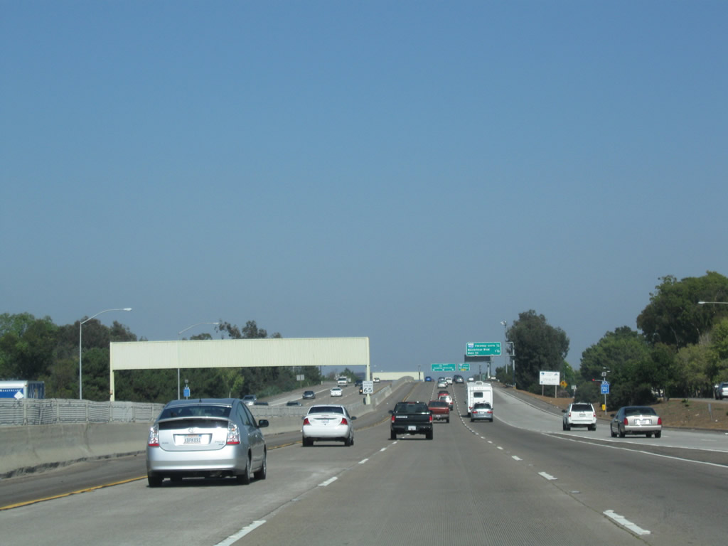
California 55 (Newport Boulevard) carries four northbound lanes after the 17th Street intersection. Businesses and commercial establishments line both sides of Newport Boulevard for several blocks until the freeway entrance after 19th Street. Photo taken 10/29/09. |
|
|
|
|
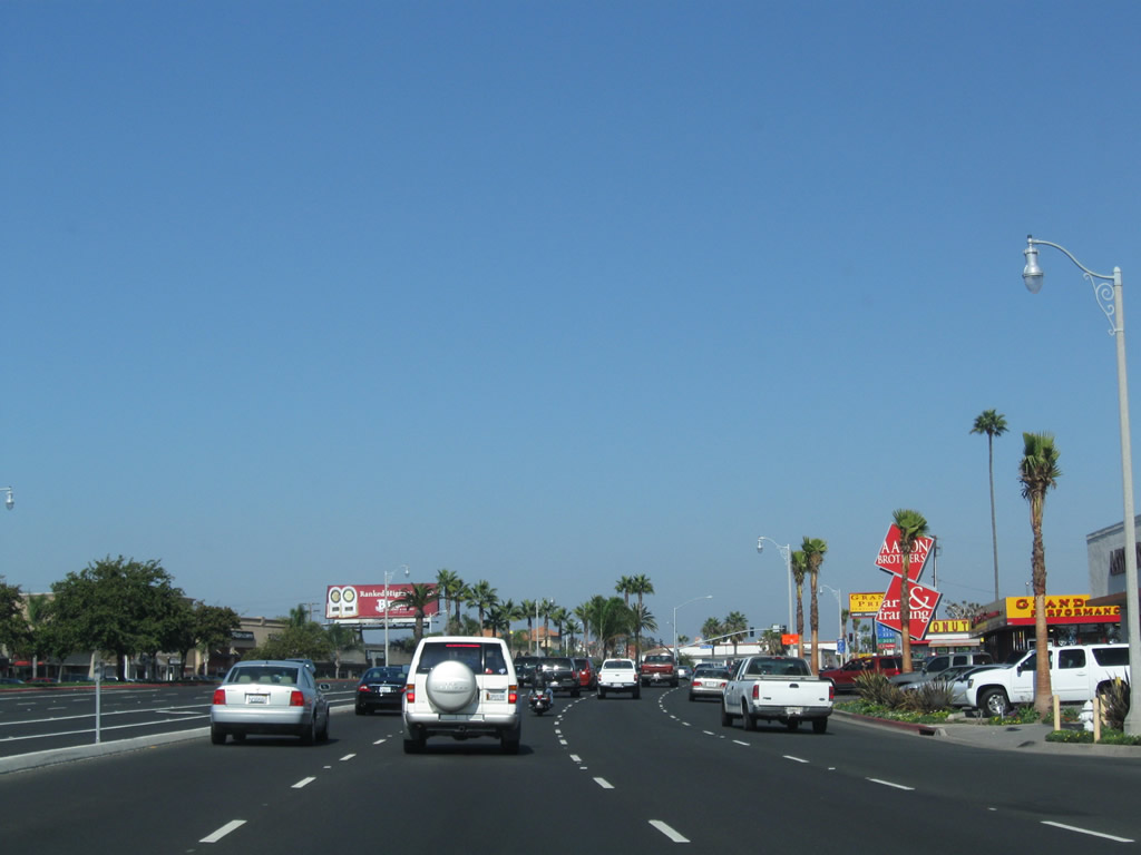
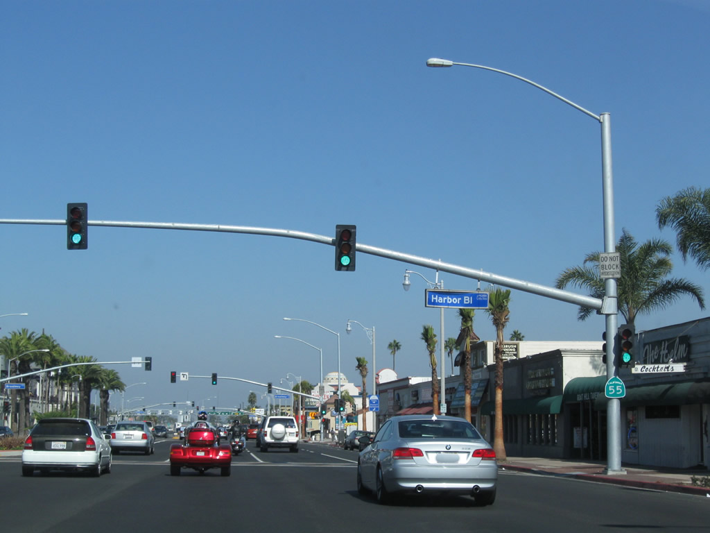
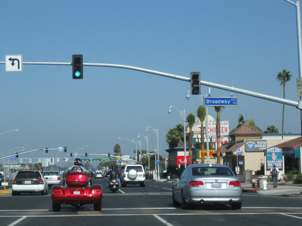
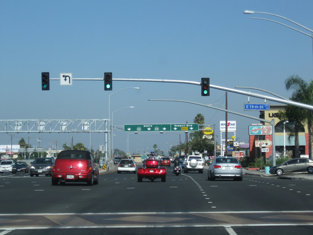
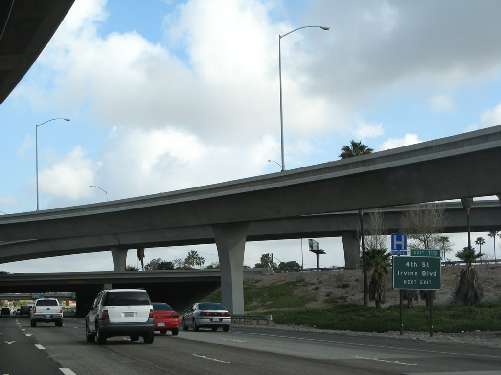
Passing through the shopping districts of Costa Mesa Courtyards and Triangle Square, northbound California 55 (Newport Boulevard) passes Rochester Street, Harbor Boulevard, Broadway, and 19th Street. The traffic signal at 19th Street is the final intersection before California 55 merges onto the Costa Mesa Freeway. Photos taken 10/29/09. |
|
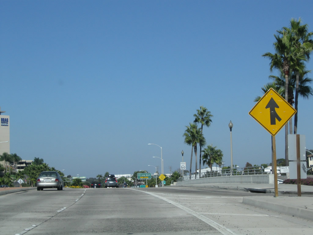
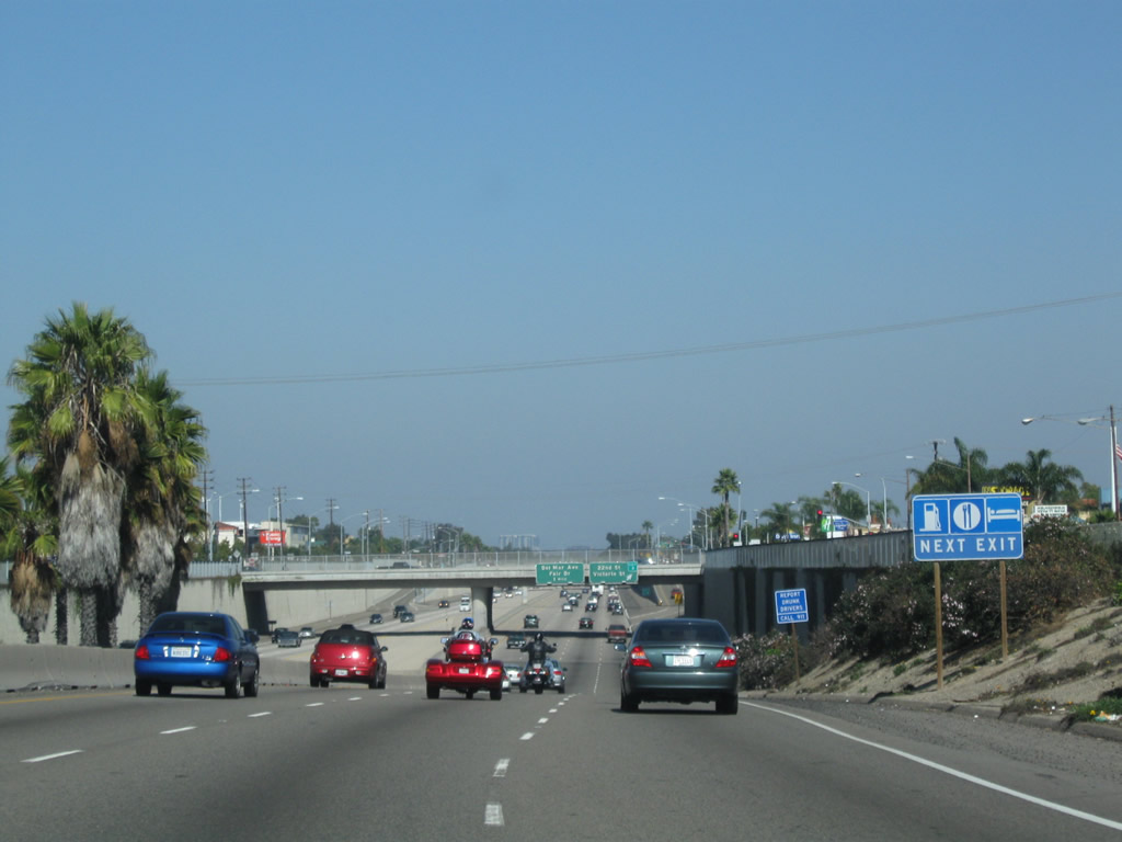
After following a multi-lane divided highway northeast of California 1 through Newport Beach and Costa Mesa, California 55 finally joins its freeway segment after the multiple traffic signals and strip malls seen in the previous pictures. The state route follows the freeway as it branches to the left and goes below grade. The right lanes remain at grade to serve the businesses along Newport Boulevard. Photo taken 10/29/09. |
|
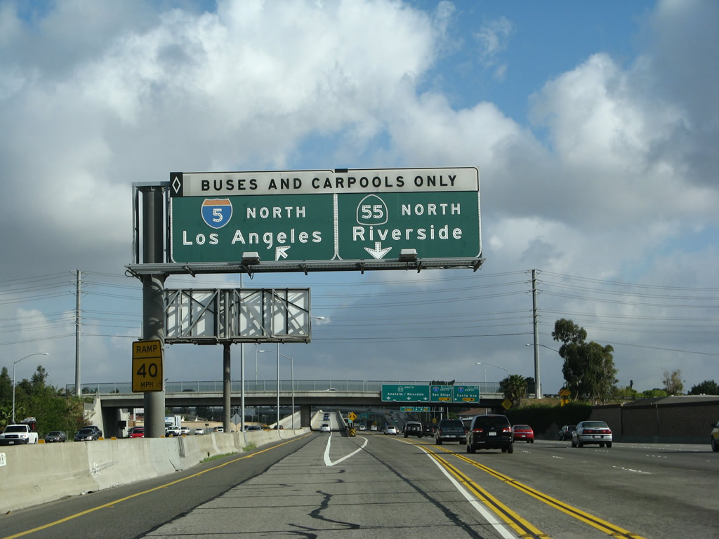
A pair of California 55 north freeway entrance shield assemblies flank the on-ramp from northbound Newport Boulevard onto northbound Costa Mesa Freeway. This split essentially serves as Exit 2, with Newport Boulevard staying right and California 55 (Costa Mesa Freeway) staying left. Photo taken 10/29/09. |
| California 55 - Costa Mesa Freeway north |
|
|
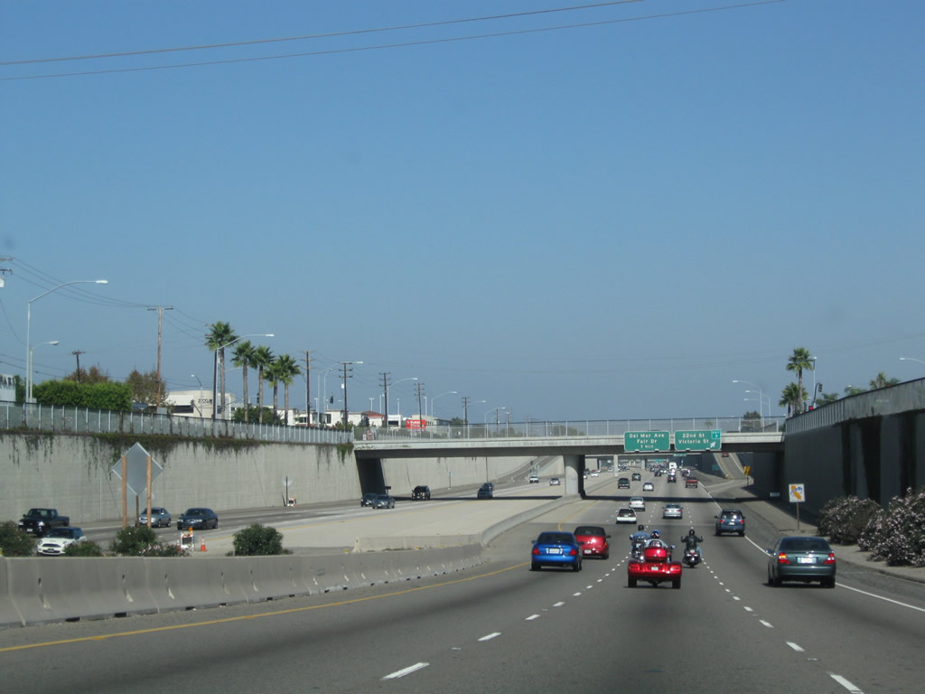
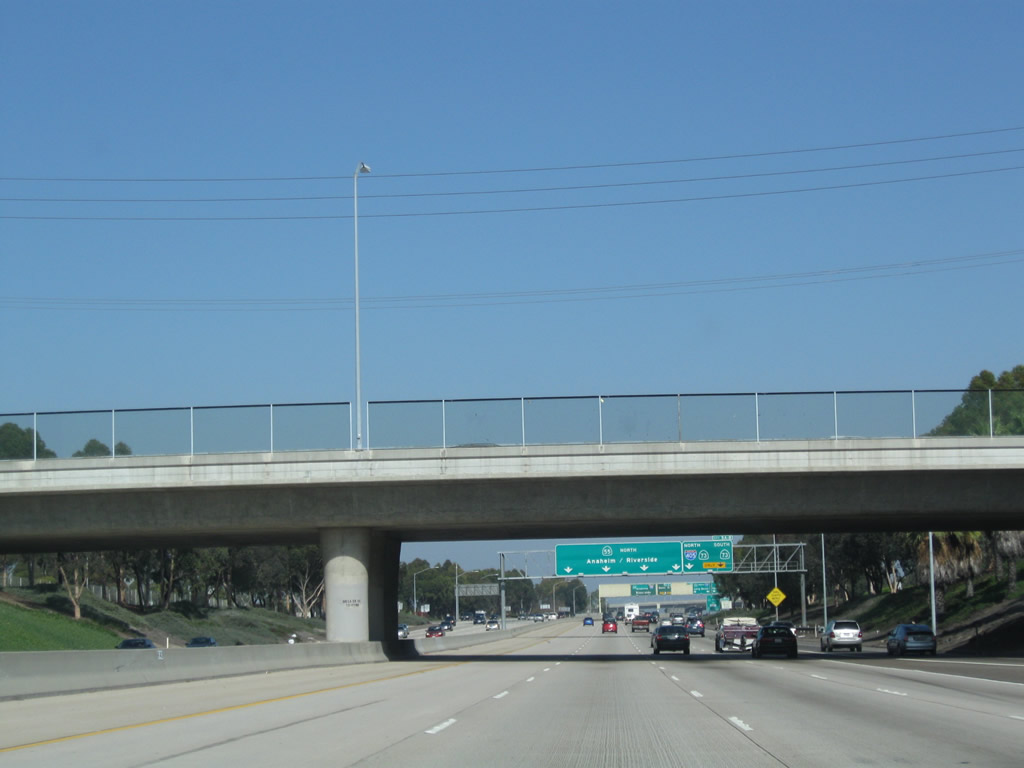
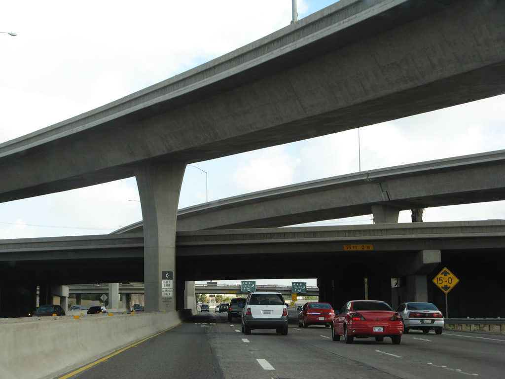
California 55 descends into the below-grade freeway as it leaves Newport Boulevard and joins the Costa Mesa Freeway within the city of Costa Mesa. The first exit will be Exit 3, which offers all motorist services. Had the Costa Mesa Freeway been extended further south, it likely would have featured a similar style of construction as seen here, at the southern end of the freeway. Photos taken 10/29/09. |
|
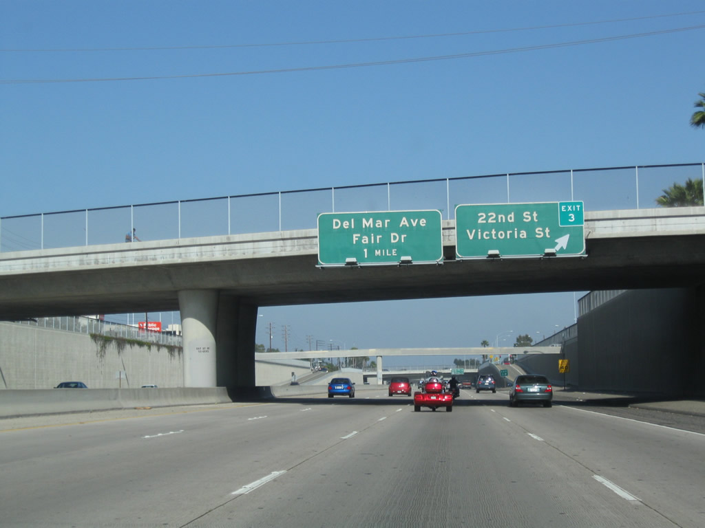
Northbound California 55 (Costa Mesa Freeway) reaches Exit 3, 22nd Street and Victoria Street. The next exit is Exit 4, Del Mar Avenue and Fair Drive. Photo taken 10/29/09. |
|
A utility alignment passes overhead as California 55 north meets the Exit 3 off-ramp. This section of freeway, from 19th Street north to Fairview Road was constructed in 1992. Photo taken 10/29/09. |
|
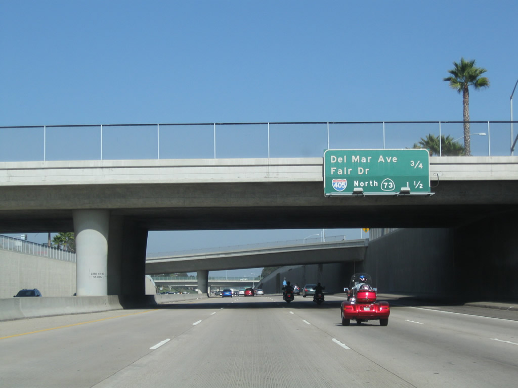
This mileage sign along northbound California 55 (Costa Mesa Freeway) provides the distance to the next two exits: Exit 4, Del Mar Avenue and Fair Drive and Exit 5A, California 73 (Corona del Mar Freeway) north to Interstate 405 (San Diego Freeway) north. Photo taken 10/29/09. |
|
Proceeding north, California 55 (Costa Mesa Freeway) becomes less like a concrete channel as both sides of the freeway become landscaped. The freeway remains below grade. Photo taken 10/29/09. |
|
A dynamic message sign is posted along California 55 north prior to the off-ramp to Exit 4. Photo taken 10/29/09. |
|
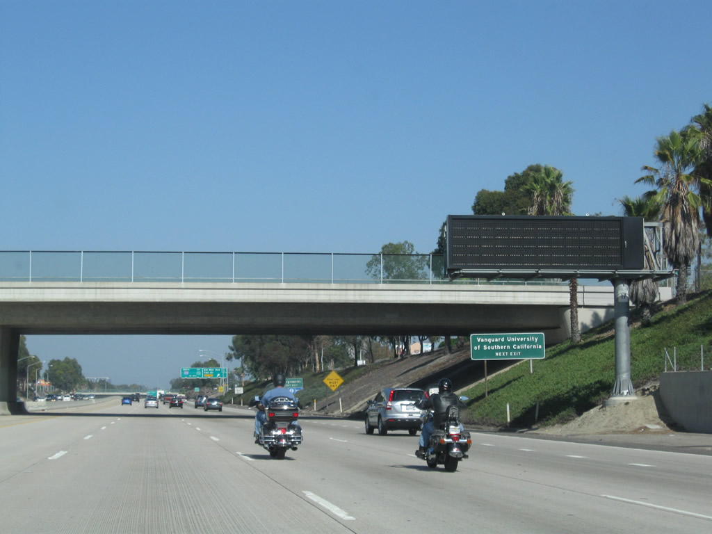
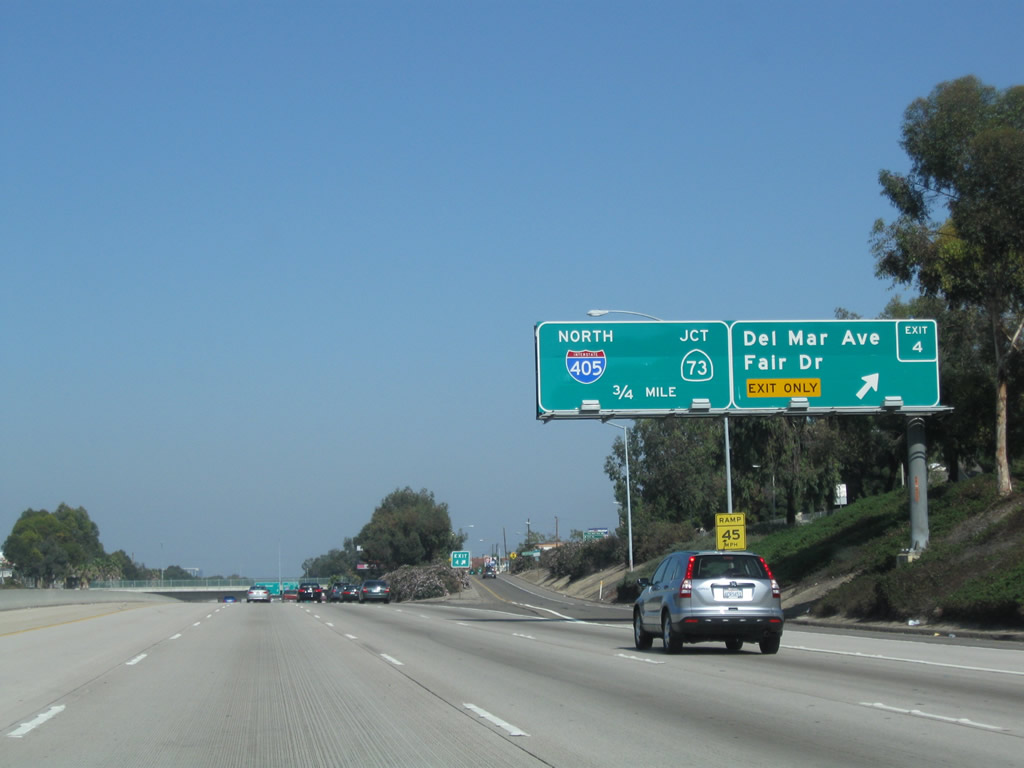
Northbound California 55 (Costa Mesa Freeway) reaches Exit 4, Del Mar Avenue and Fair Drive. Use this exit to reach the annual Orange County fair during the summer. Photo taken 10/29/09. |
|
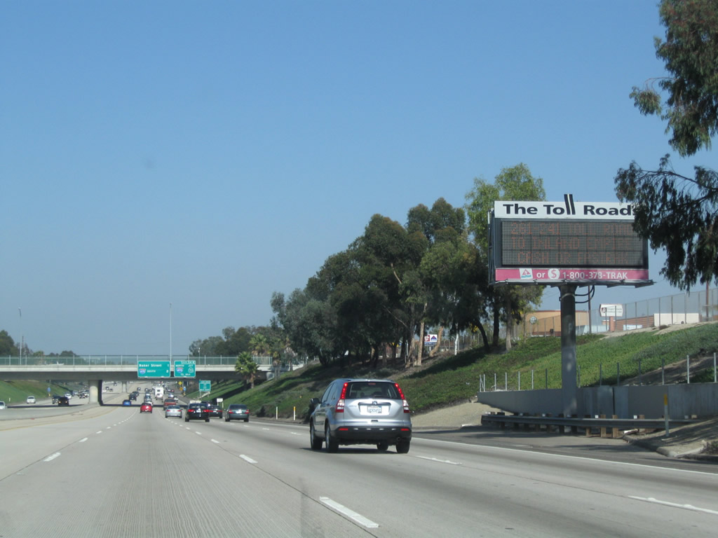
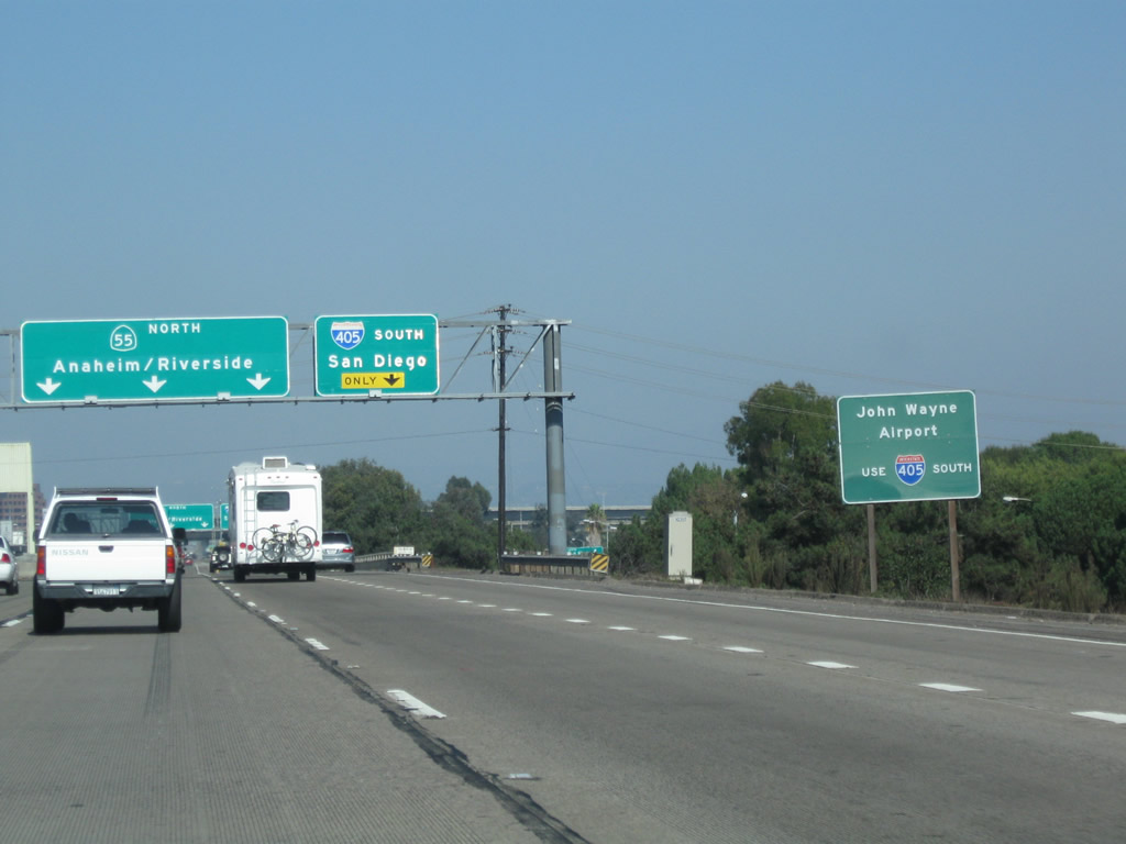
Another dynamic message sign advises of the Orange County Toll Road system. California 55 connects directly to California 73 and indirectly to California 261 and California 241 via Interstate 5 and California 91, respectively. Photo taken 10/29/09. |
|
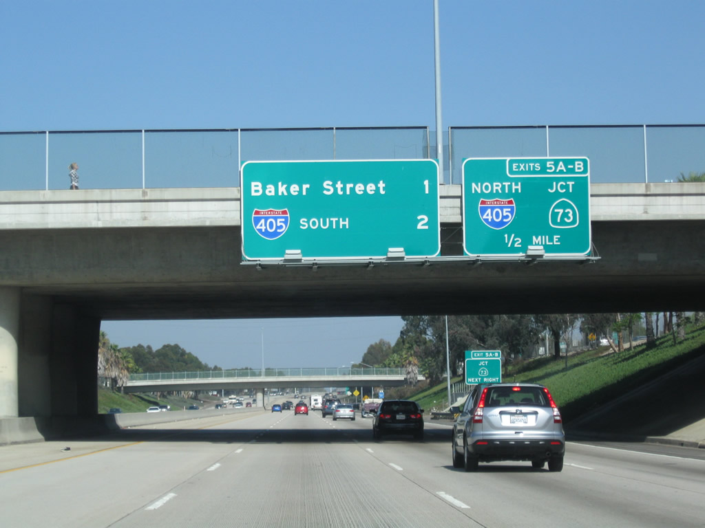
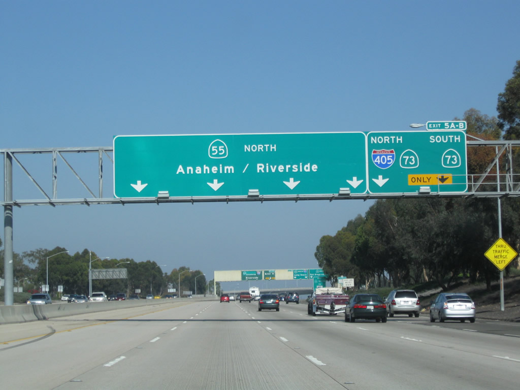
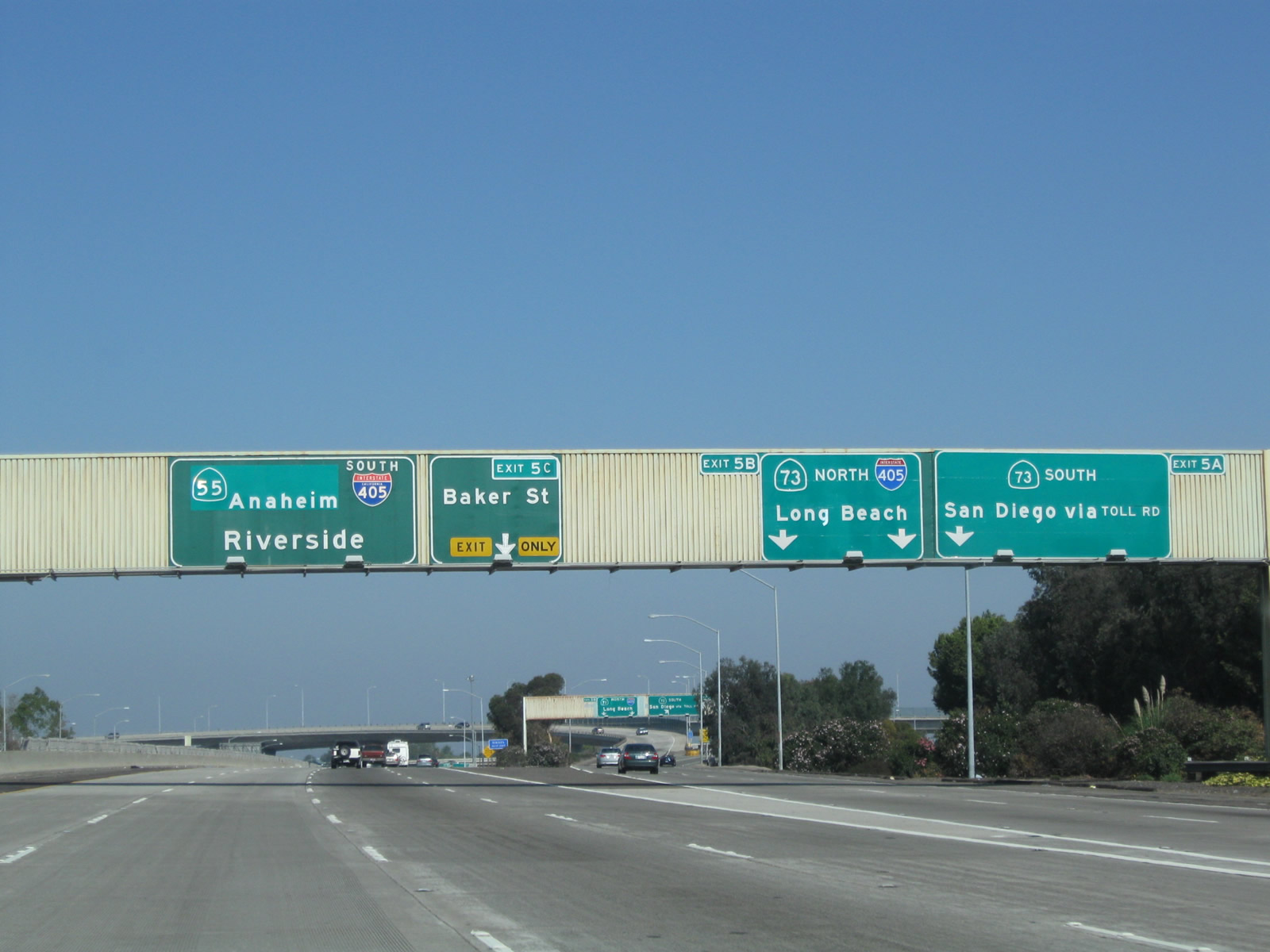
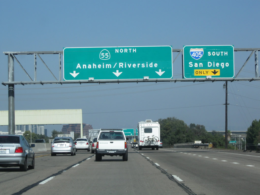
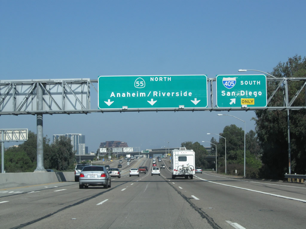
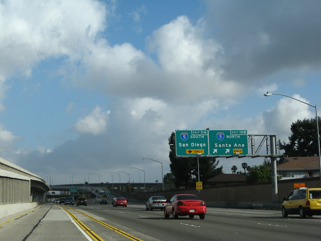
The next four exits along California 55 north are: Exit 5A, California 73 (Corona del Mar Freeway) south to the San Joaquin Hills Transportation Corridor (Toll) to San Diego; Exit 5B, California 73 (Corona del Mar Freeway) north to Interstate 405 (San Diego Freeway) north to Long Beach; Exit 5C, Baker Street; and Exit 6A, Interstate 405 (San Diego Freeway) south to Irvine. The section of California 55 between Fairview Road and Bristol Street was constructed in 1990. Photo taken 10/29/09. |
|
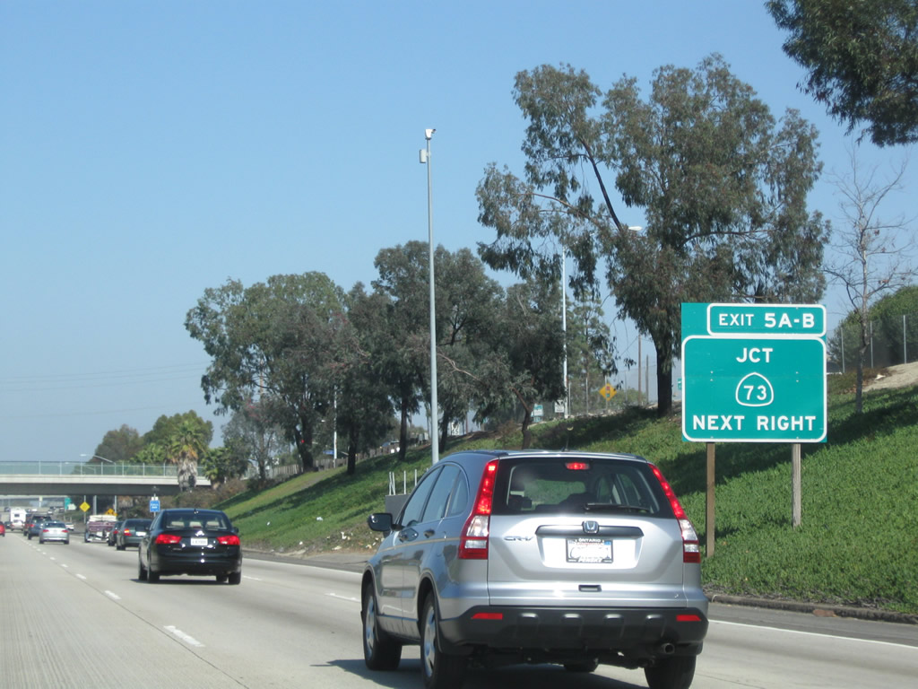
Northbound California 55 approaches Exits 5A-B, California 73 (Corona del Mar Freeway) south and north. Both exits will use the same off-ramp from California 55. California 73 offers an alternative to using Interstate 405 and Interstate 5 through Irvine. Use California 73 north to reach Interstate 405 en route to Long Beach, Los Angeles (via Interstate 710 or Interstate 110), Los Angeles International Airport, Santa Monica, and Interstate 5 north to Sacramento and San Francisco. Photo taken 10/29/09. |
|
California 55 passes under Mesa Drive. Photo taken 10/29/09. |
|
The left four lanes continue north on California 55, while the right two lanes connect to Exits 5A-B, California 73 (Corona del Mar Freeway) south and north. Photo taken 10/29/09. |
|
Northbound California 55 (Costa Mesa Freeway) reaches Exits 5A-B, California 73 south to San Diego (toll) and California 73 north to Interstate 405 north. To Interstate 405 south, continue straight on California 55 north. Photo taken 10/29/09. |
|
Once on the off-ramp to Exits 5A-B, the left two lanes connect to California 73 (Corona del Mar Freeway) north to Interstate 405 (San Diego Freeway) north, while the right lane connects to California 73 (Corona del Mar Freeway / San Joaquin Hills Transportation Corridor) south. Photo taken 10/29/09. |
|
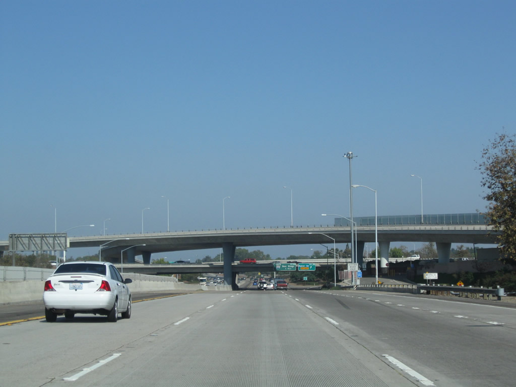
California 55 approaches the stack interchange with California 73. This interchange, along with many of its myriad flyover ramps, was largely constructed in 1976. Ahead is the next off-ramp: Exit 5C, Baker Street. Photo taken 10/29/09. |
|
Within the California 55-73 interchange complex, northbound California 55 reaches Exit 5C, Baker Street. Photo taken 10/29/09. |
|
After passing through the stack interchange, incoming traffic from California 73 soon merges onto northbound California 55. The overhead sign on the transition ramp offers a link from California 73 to Baker Street. Photo taken 10/29/09. |
|
Between California 73 and Interstate 405, northbound California 55 carries three through lanes plus an auxiliary lane. Photo taken 10/29/09. |
|
The next exit along northbound California 55 (Costa Mesa Freeway) is Exit 6A, Interstate 405 (San Diego Freeway) south to Irvine and San Diego. Photo taken 10/29/09. |
|
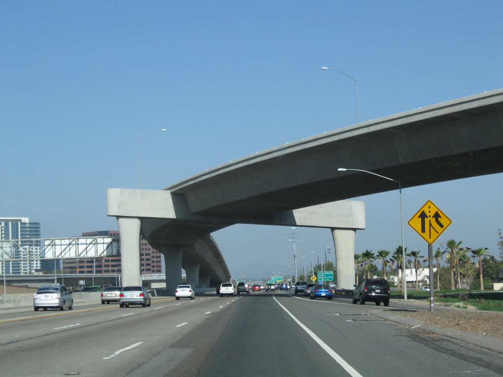
Use Interstate 405 southbound to reach John Wayne (Orange County) Airport. A second chance to access the airport is afforded via Exit 7, MacArthur Boulevard (former California 73). Photo taken 10/29/09. |
|
The left three lanes continue north on California 55, while the right lane prepares to depart to Exit 6A, Interstate 405 south and John Wayne Airport. Photo taken 10/29/09. |
|
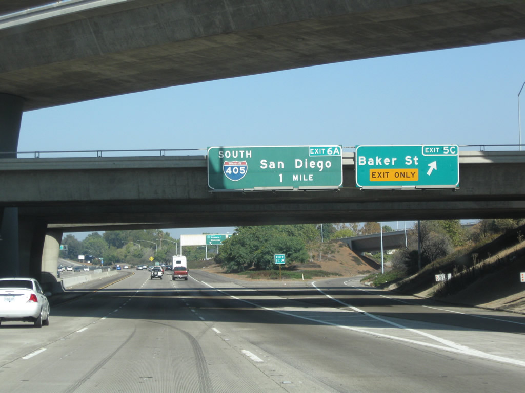
Northbound California 55 (Costa Mesa Freeway) reaches Exit 6A, Interstate 405 (San Diego Freeway) south to Irvine and San Diego. The fact that this off-ramp is designated as Exit 6A implies that there is an Exit 6B for Interstate 405 north, but none currently exists. Calnexus, the official Caltrans Interchange Exit Numbering webpage, indicates that this is actually Exit 6, not Exit 6A. However, signs in the field refer to it as Exit 6A. Photo taken 10/29/09. |
|
A California 55 north reassurance shield is posted after the Interstate 405 south off-ramp (Exit 6A). Ahead, California 55 passes through the Interstate 405 interchange (with its towering ramps linking the carpool lanes) and proceeds north toward Santa Ana. Photo taken 10/29/09. |
|
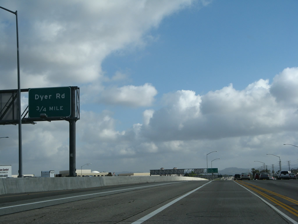
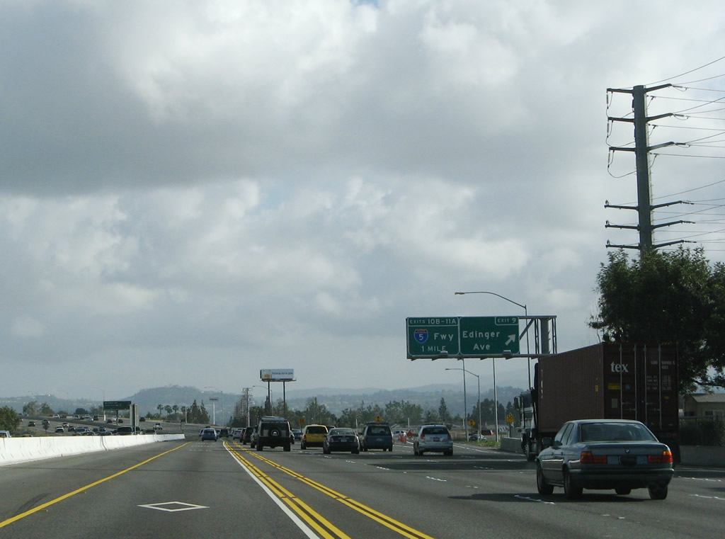
The left lane becomes carpool/high occupancy vehicle (HOV) only. This mileage sign provides the distance to the next three exits on California 55 (Costa Mesa Freeway): Exit 7, MacArthur Boulevard and Main Street to John Wayne Airport; Exit 8, Dyer Road; and Exit 9, Edinger Avenue. Photo taken 10/29/09. |
|
The carpool/high occupancy vehicle (HOV) lanes have direct connections between Interstate 405 and California 55. These ramps fly over the mainline California 55 freeway. Interchange improvements have been gradually implemented at California 55 and Interstate 405 through the 2000s; this interchange has been one the more congested areas on the freeway system in Orange County. Photo taken 10/29/09. |
|
Traffic merges onto California 55 north from Interstate 405 south. Ahead, a second HOV direct connection ramp links Interstate 405 north with California 55 north. While the original interchange between California 55 and Interstate 405 was built between 1966-1968, the HOV connectors were built in the 2000s. Photo taken 10/29/09. |
|
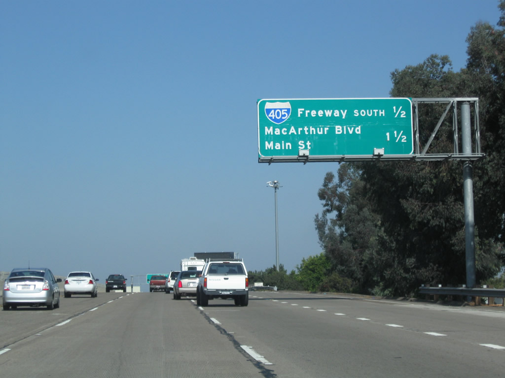
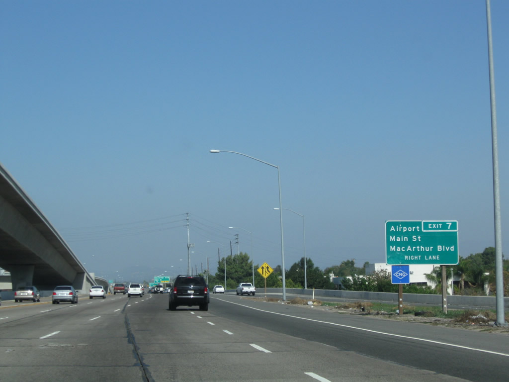
The next exit along California 55 (Costa Mesa Freeway) north is Exit 7, MacArthur Boulevard and Main Street to John Wayne Airport. This interchange was built in 1966. Photo taken 10/29/09. |
|
The right two lanes will connect to Exit 7, MacArthur Boulevard and Main Street to John Wayne Airport. Prior to the completion of the Corona del Mar Freeway in the mid-1970s, California 73 used to see its northern terminus at this interchange and follow MacArthur Boulevard south toward Newport Beach. Photo taken 10/29/09. |
|
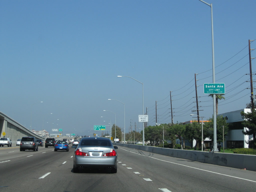
California 55 leaves Costa Mesa and enters the city of Santa Ana, the seat of Orange County. Santa Ana sits at an elevation of 135 feet, consists of 27.2 square miles, and receives an average of nearly 13 inches of rainfall annually. Incorporated in 1886, Santa Ana became the seat of Orange County when Orange County split from Los Angeles County in 1889. As of the 2000 Census, Santa Ana had a population of 337,977 people; that number climbed to a total of 353,428 per a 2007 California Department of Finance Estimate. The city is 76% Latino or Hispanic per the 2000 Census, and Santa Ana therefore has one of the nation's largest urban populations of that ethnic group. Photo taken 10/29/09. |
|
Northbound California 55 reaches Exit 7, MacArthur Boulevard south to Irvine and west to Santa Ana and Fountain Valley and Main Street north into Santa Ana. Since California 55 is angled northeast-southwest, many streets change direction at or near the freeway. MacArthur Boulevard south ultimately turns southwest, leading past the University of California at Irvine, passing California 73 along the way, and it ends at California 1 (Pacific Coast Highway) in Newport Beach. As a result of this jog, MacArthur Boulevard almost looks like the number "7" on a map. Main Street, meanwhile, is the main north-south corridor through Santa Ana. Photo taken 10/29/09. |
|
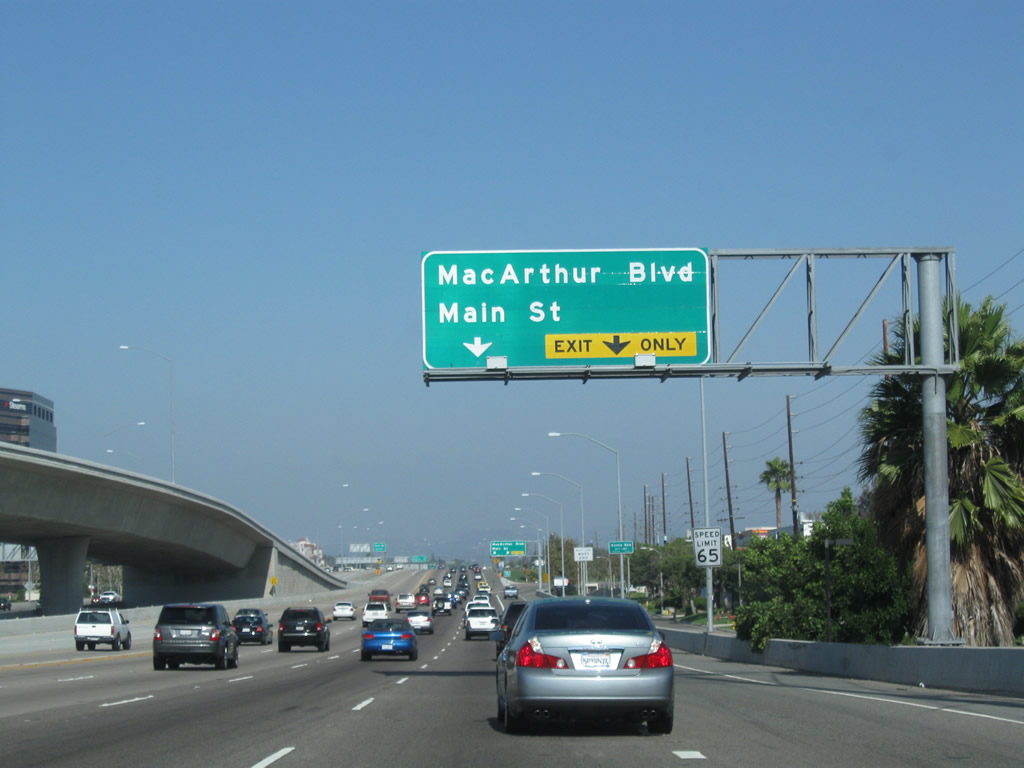
Two lanes depart from California 55 north to MacArthur Boulevard at Exit 7. Photo taken 10/29/09. |
|
To the University of Redlands, turn left onto MacArthur Boulevard. Photo taken 10/29/09. |
|
The left two lanes connect to MacArthur Boulevard west, while the right lane connects to MacArthur Boulevard east (south) to the airport and the city of Irvine. Stay left on the off-ramp to connect to Main Street to Santa Ana. Photo taken 10/29/09. |
|
As traffic from the Interstate 405 HOV (carpool) lanes merge onto California 55 from the left, this sign advises of the next interchange: Exit 8, Dyer Road. Photo taken 03/15/08. |
|
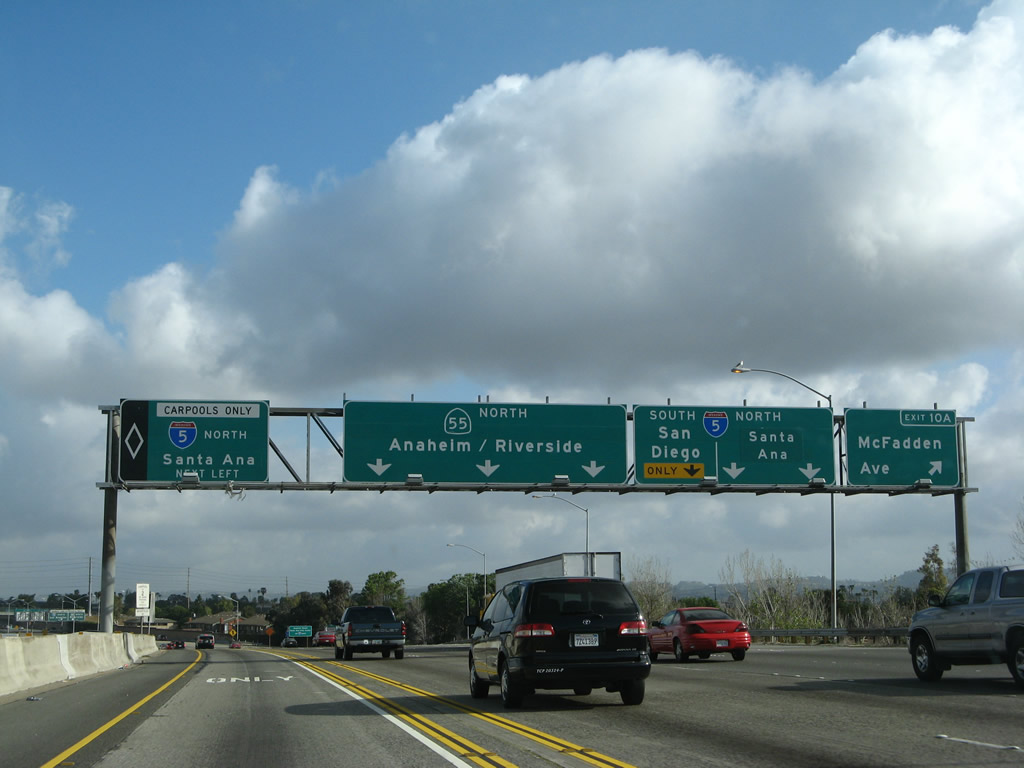
This interchange sequence sign along northbound California 55 provides the distance to the next three exits: Exit 8, Dyer Road; Exit 9, Edinger Avenue and Moulton Parkway; and Exit 10A, McFadden Avenue and Newport Avenue. Photo taken 03/15/08. |
|
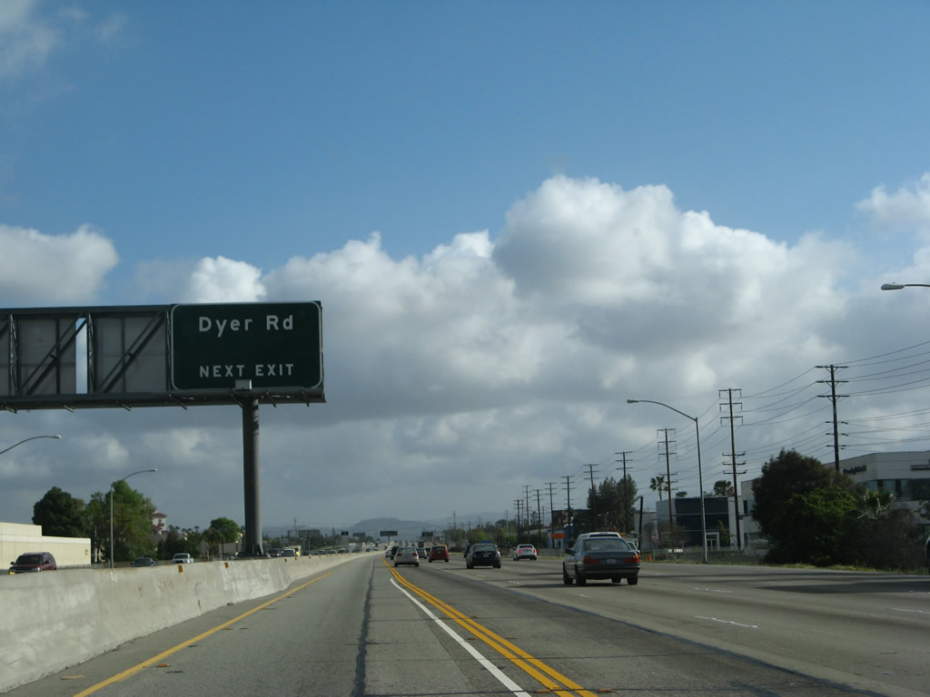
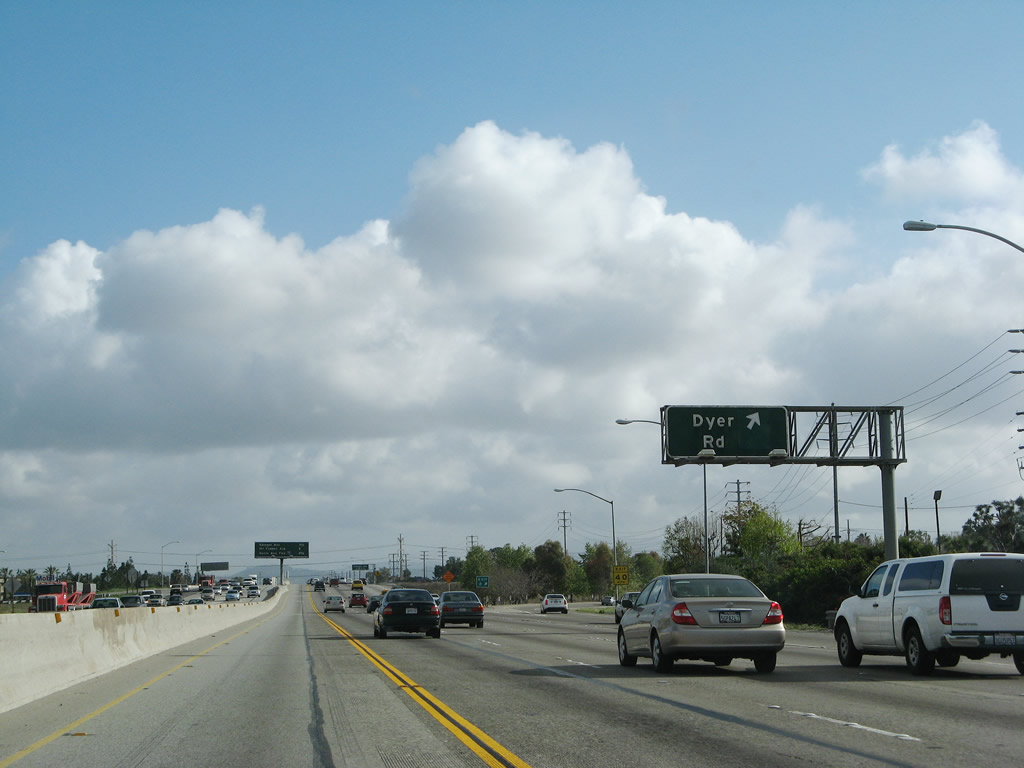
Dyer Road leads southeast into Tustin and west into Santa Ana, becoming Segerstrom Avenue west of Main Street. Photo taken 03/15/08. |
|
Northbound California 55 (Costa Mesa Freeway) reaches Exit 8, Dyer Road. Photo taken 03/15/08. |
|
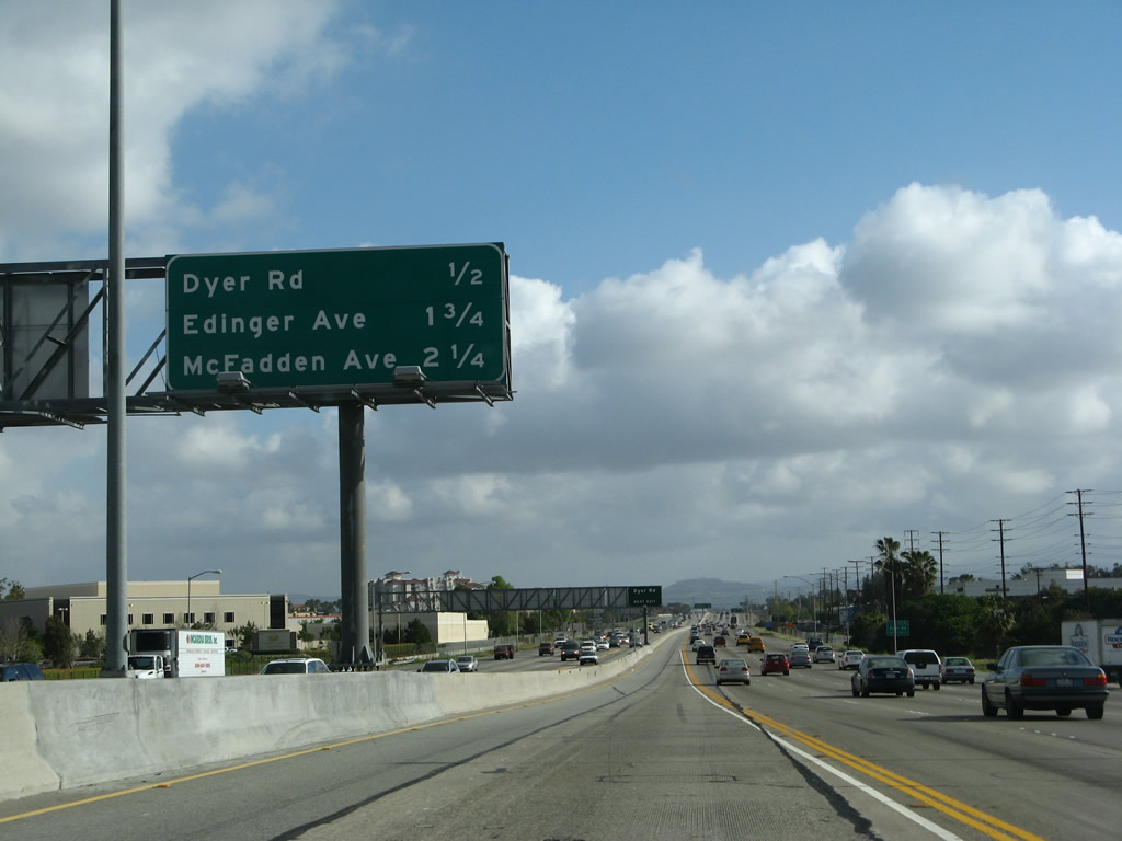
This interchange sequence sign along northbound California 55 provides the distance to the next three exits: Exit 9, Edinger Avenue and Moulton Parkway; Exit 10A, McFadden Avenue and Newport Avenue; and Exit 10B, Interstate 5 (Santa Ana Freeway). Photo taken 03/15/08. |
|
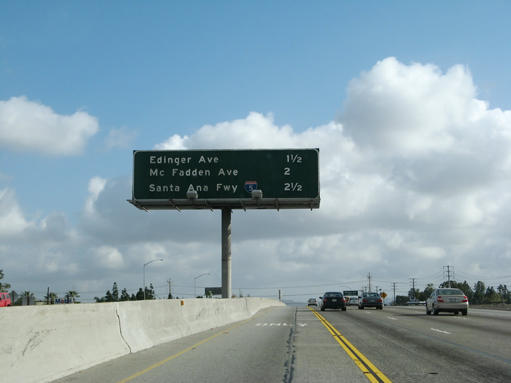
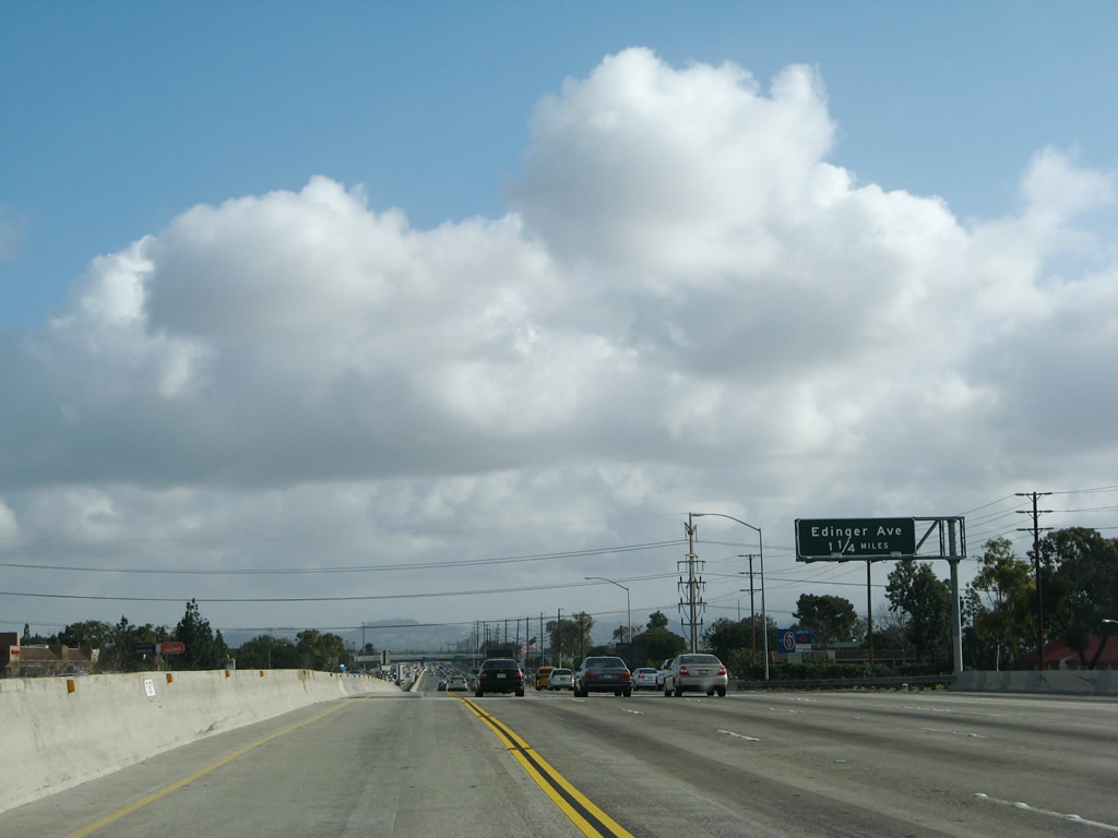
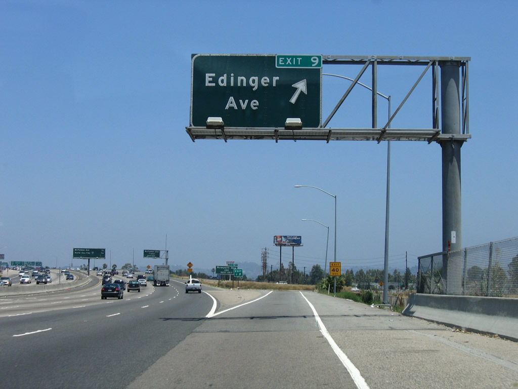
The next exit along California 55 (Costa Mesa Freeway) north is Exit 9, Edinger Avenue and Moulton Parkway. Photo taken 03/15/08. |
|
|
California 55 enters the city of Tustin, and the first exit for that city along northbound is Exit 9, Edinger Avenue and Moulton Parkway. Tustin's motto is "Community Trees History Future." Incorporated on September 21, 1927, Tustin consists of 11.4 square miles and was home to 67,504 people as of the 2000 Census. Photos taken 03/15/08 and 07/03/05. |
|
|
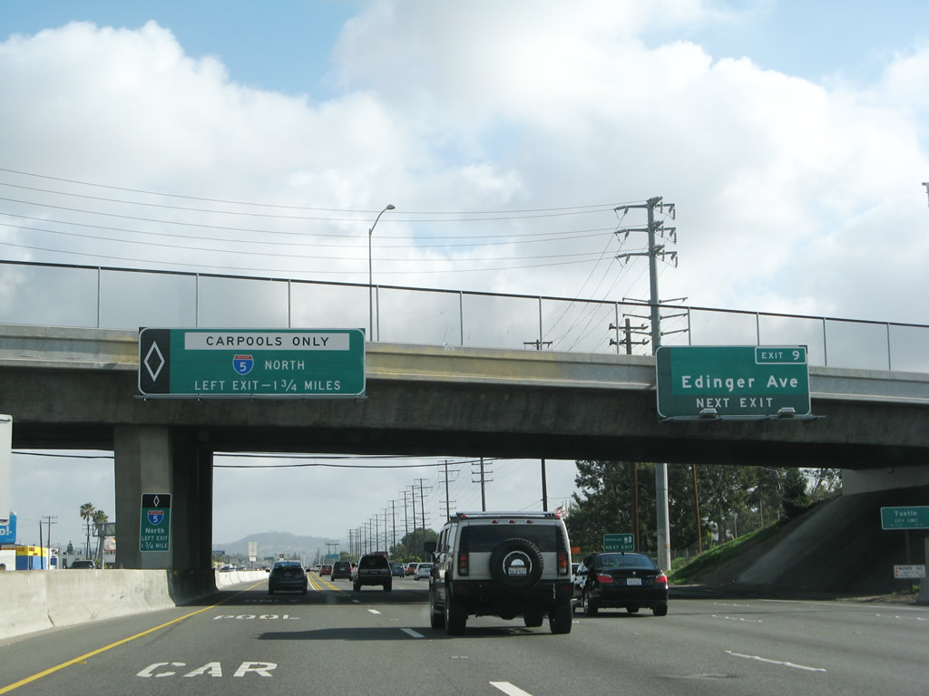
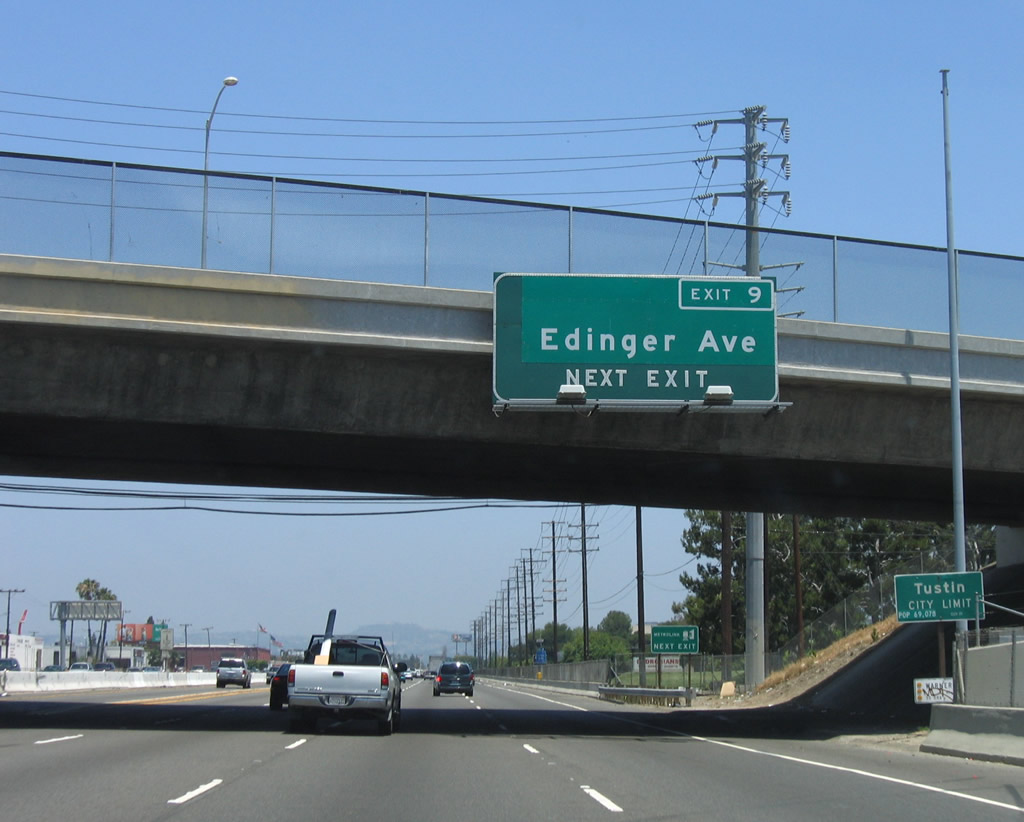
Northbound California 55 (Costa Mesa Freeway) reaches Exit 9, Edinger Avenue and Moulton Parkway. The exit sign was replaced between 2005 and 2008 with a new overhead sign for Exit 9 and a new sign for the Interstate 5 interchange (Exits 10B and 11A). Photos taken 03/15/08 and 07/03/05. |
|
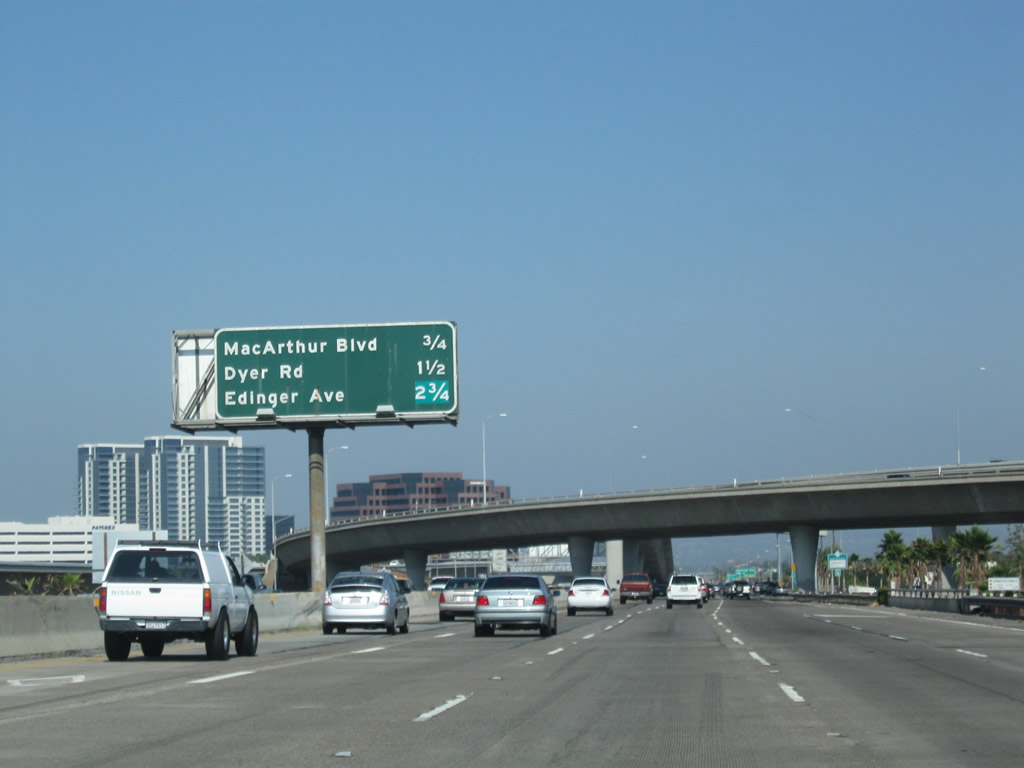
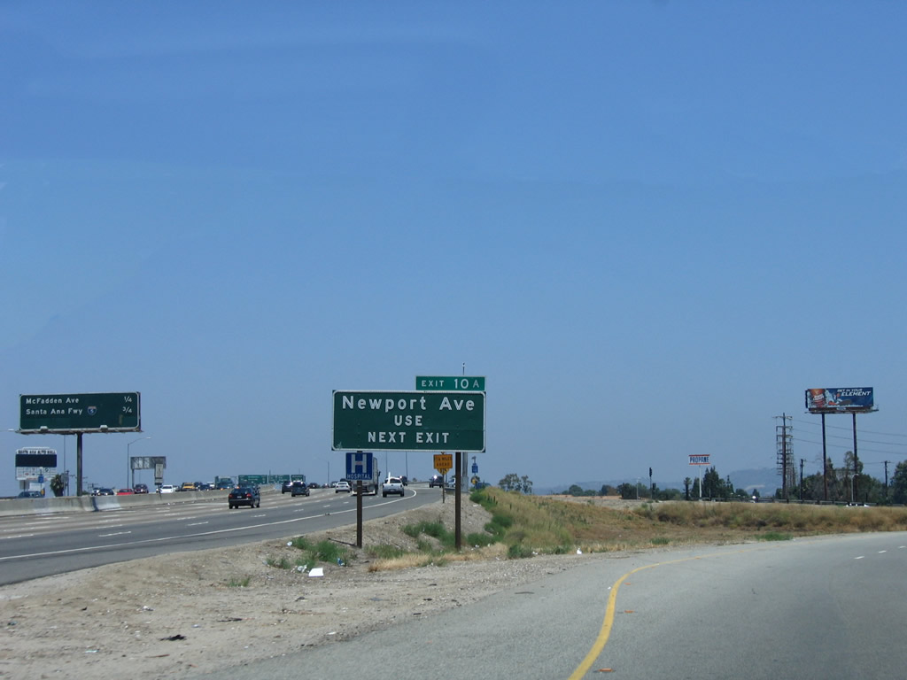
Exiting onto Exit 9, the next exit along California 55 (Costa Mesa Freeway) north will be Exit 10A, Newport Avenue and McFadden Avenue. In typical Caltrans District XII fashion, an exit number plate was attached to the roadside guide sign for Exit 10A, McFadden Avenue. The only trouble is, this sign does not mention McFadden Avenue at all; instead, it implies that the next exit leads to Newport Avenue. This sign would be more effective with an exit number if it mentioned both roads. In addition, since the exit number does not appear on any of the signs that mention McFadden Avenue, it is not as useful. Photo taken 07/03/05. |
|
This interchange sequence sign along northbound California 55 (Costa Mesa Freeway) provides the distance to the next three exits: Exit 10A, McFadden Avenue and Newport Avenue; Exit 10B, Interstate 5 (Santa Ana Freeway) north to Santa Ana and Los Angeles; and Exit 11A, Interstate 5 (Santa Ana Freeway) south to San Diego. Photo taken 03/15/08. |
|
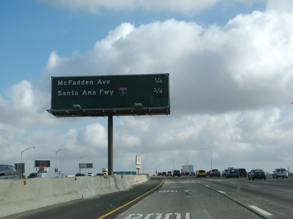
Northbound California 55 reaches Exit 10A, McFadden Avenue and Newport Avenue. This exit serves the city of Tustin. The next exit along northbound is Exit 10B, Interstate 5 (Santa Ana Freeway) north to Santa Ana and Los Angeles. The control city was changed in the mid-2000s to reflect the change of control cities to Santa Ana. Photo taken 03/15/08. |
|
Looking from the carpool (HOV) lane, northbound California 55 next approaches the carpool transition ramp to Interstate 5 north to Santa Ana and Los Angeles (unsigned Exit 10C). Photo taken 03/15/08. |
|
The northbound California 55 carpool lane splits. Exit left for the direct transition ramp onto northbound Interstate 5 for high occupancy vehicles (HOV) in Tustin. This ramp leads onto an elevated center median freeway high above Interstate 5, then comes down to the freeway level a few miles north of the California 55 interchange. Photo taken 03/15/08. |
|
This view shows the transition ramp for high occupancy vehicles as it links from northbound California 55 to northbound Interstate 5. The ramp remains elevated above Interstate 5 for about a half mile north of the interchange. Photo taken 02/15/04. |
|
Looking at the main lanes, northbound California 55 approaches Exit 10B, Interstate 5 north to Santa Ana and Los Angeles and Exit 11A, Interstate 5 south to San Diego. Photo taken 03/15/08. |
|
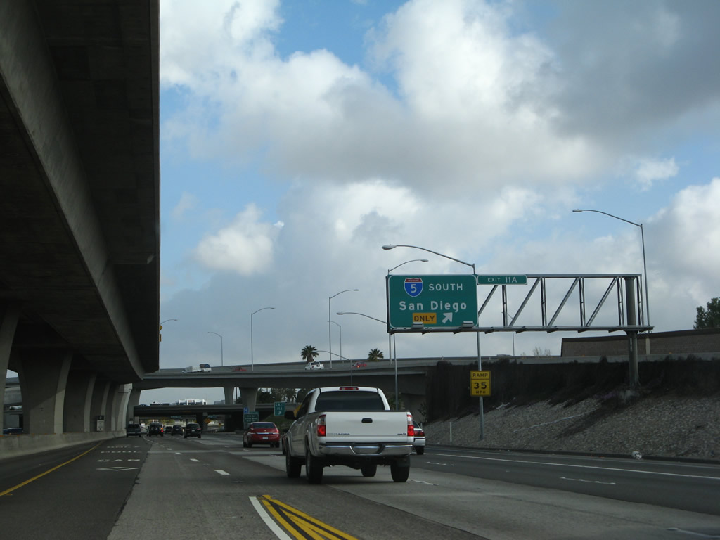
Northbound California 55 reaches Exit 10B, Interstate 5 north to Santa Ana and Los Angeles. The next off-ramp connects to Exit 11A, Interstate 5 south to San Diego. Photo taken 03/15/08. |
|
Shortly thereafter, northbound California 55 reaches Exit 11A, Interstate 5 south to San Diego. Photo taken 03/15/08. |
|
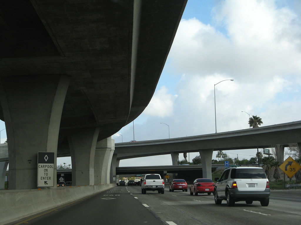
After the off-ramp to Exit 11A, a carpool exit/entrance is available for through traffic on northbound California 55. Above is the towering HOV transition ramp from California 55 north to Interstate 5 north. Photo taken 03/15/08. |
|
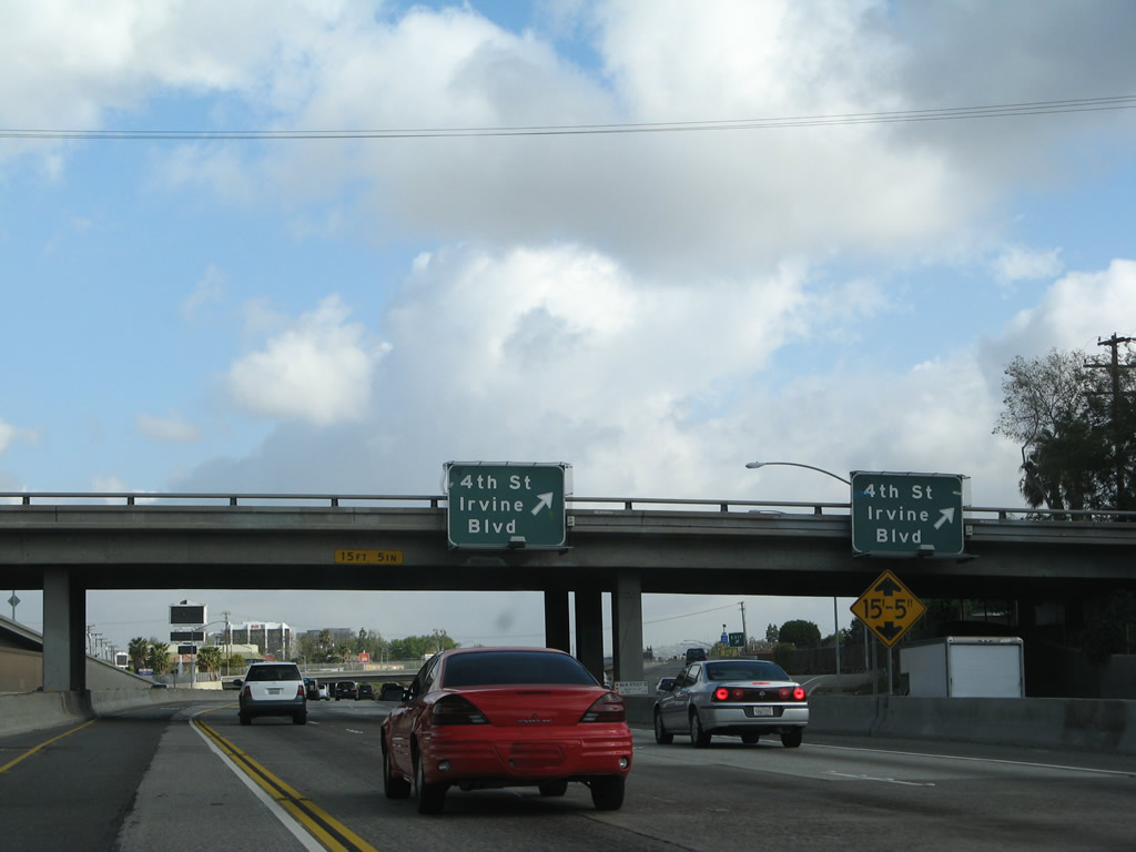
The next exit along California 55 (Costa Mesa Freeway) is Exit 11B, Fourth Street and Irvine Boulevard. Photo taken 03/15/08. |
|
California 55 (Costa Mesa Freeway) passes under the main lanes of Interstate 5. The next off-ramp is Exit 11B, Fourth Street and Irvine Boulevard. Photo taken 03/15/08. |
|
|
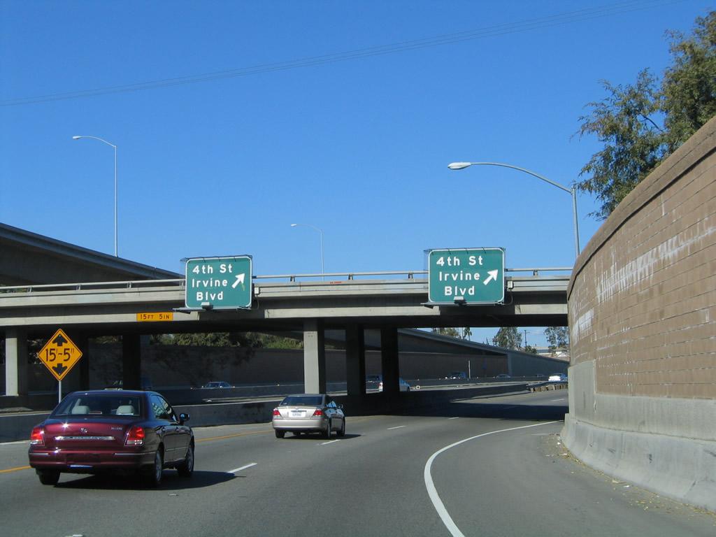
Northbound California 55 (Costa Mesa Freeway) meets Exit 11B, Fourth Street and Irvine Boulevard (see 2008 photo from northbound mainline). A companion exit also departs from the transition ramp from Interstate 5 north to California 55 north (see 2004 photo for view of this exit from transition ramp). Photos taken 03/15/08 and 11/14/04. |
|
|
|
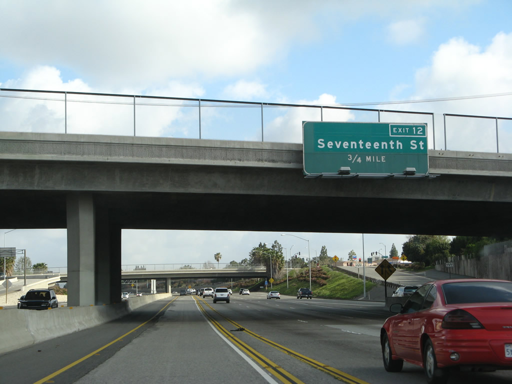
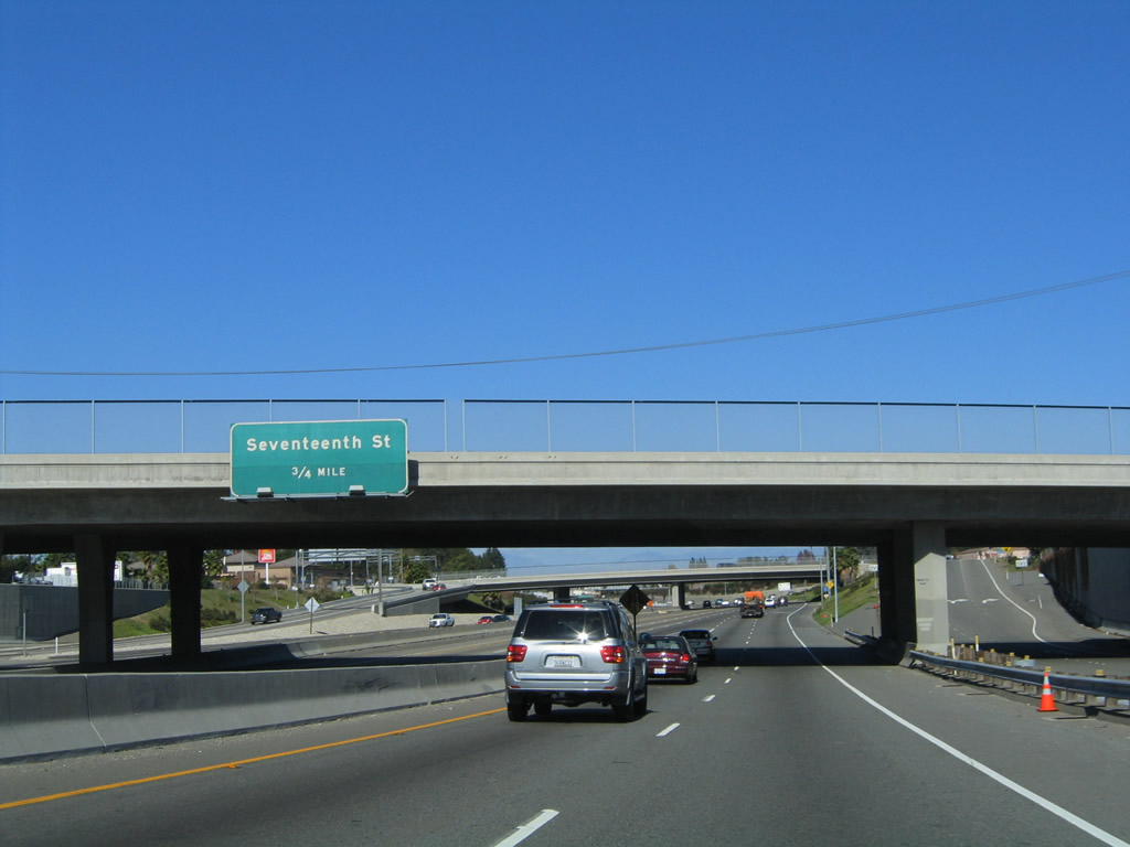
The next exit along California 55 (Costa Mesa Freeway) north is Exit 12, Seventeenth Street. The first photo shows the view from the HOV/main lanes, while the second two photos show the view from the transition ramp lanes. An exit number was added between 2006 and 2008. Photos taken 03/15/08, 11/08/08, and 11/14/04. |
|
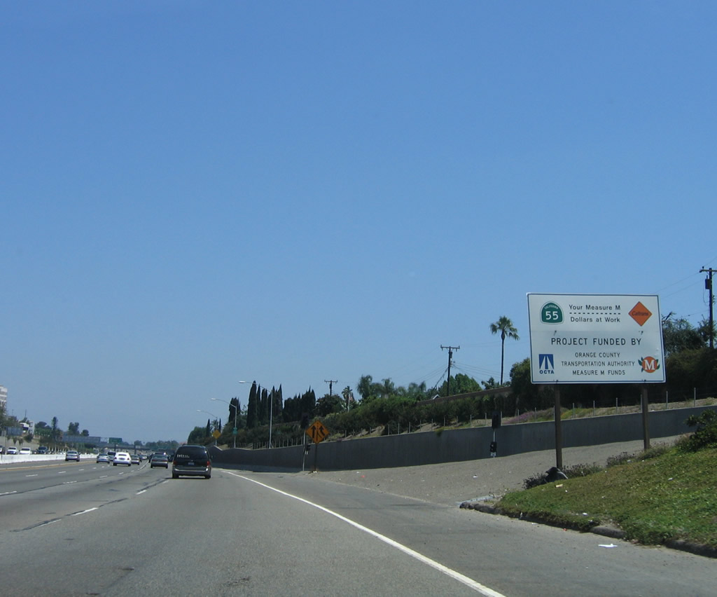
Construction signs such as this one advise that road improvements are a result of Orange County's Measure M. This included a completion reconstruction of California 22 (Garden Grove Freeway). Photo taken 06/17/06. |
|
This California 55 north reassurance shield is posted after the transition ramp from Interstate 5 merges onto the mainline. The next exit is Exit 12, Seventeenth Street. Photo taken 11/14/04. |
|
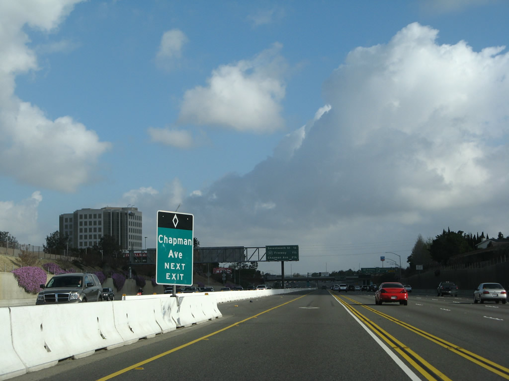
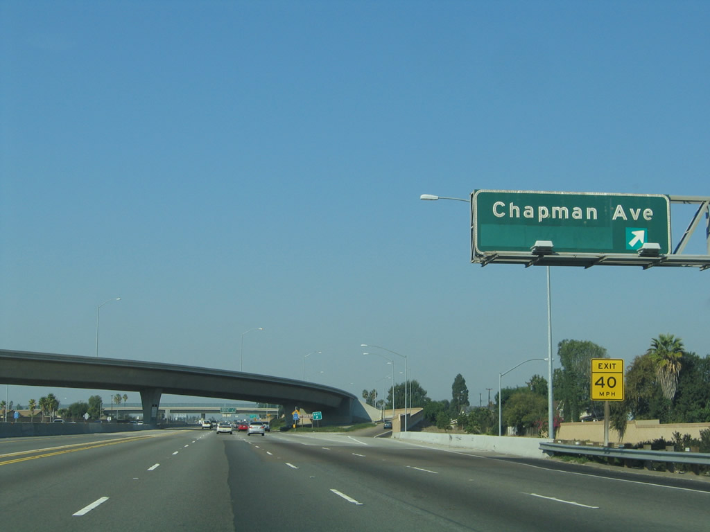
Due to the restricted nature of the carpool lanes, the next entry/exit point will allow HOV traffic to depart for Chapman Avenue. Photo taken 03/15/08. |
|
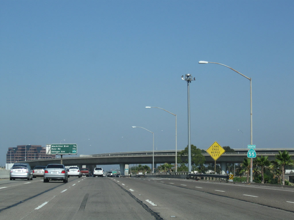
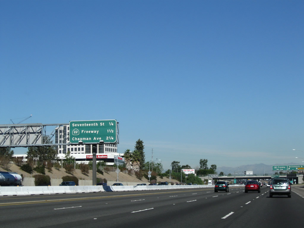
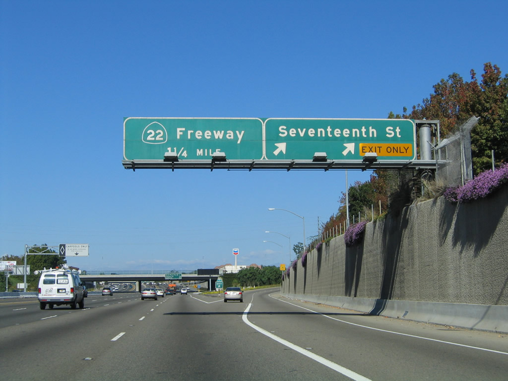
This mileage sign provides the distance to the next four exits along California 55 north: Exit 12, Seventeenth Street; Exit 13, California 22 (Garden Grove Freeway) west; and Exits 14A-B, Orange County S-25 (Chapman Avenue). Exit 12 serves the city of Santa Ana to the west and Tustin to the east. Photo taken 11/08/08. |
|
Northbound California 55 reaches Exit 12, Seventeenth Street. The next exit is Exit 13, California 22 (Garden Grove Freeway) west. Photo taken 11/14/04. |
|
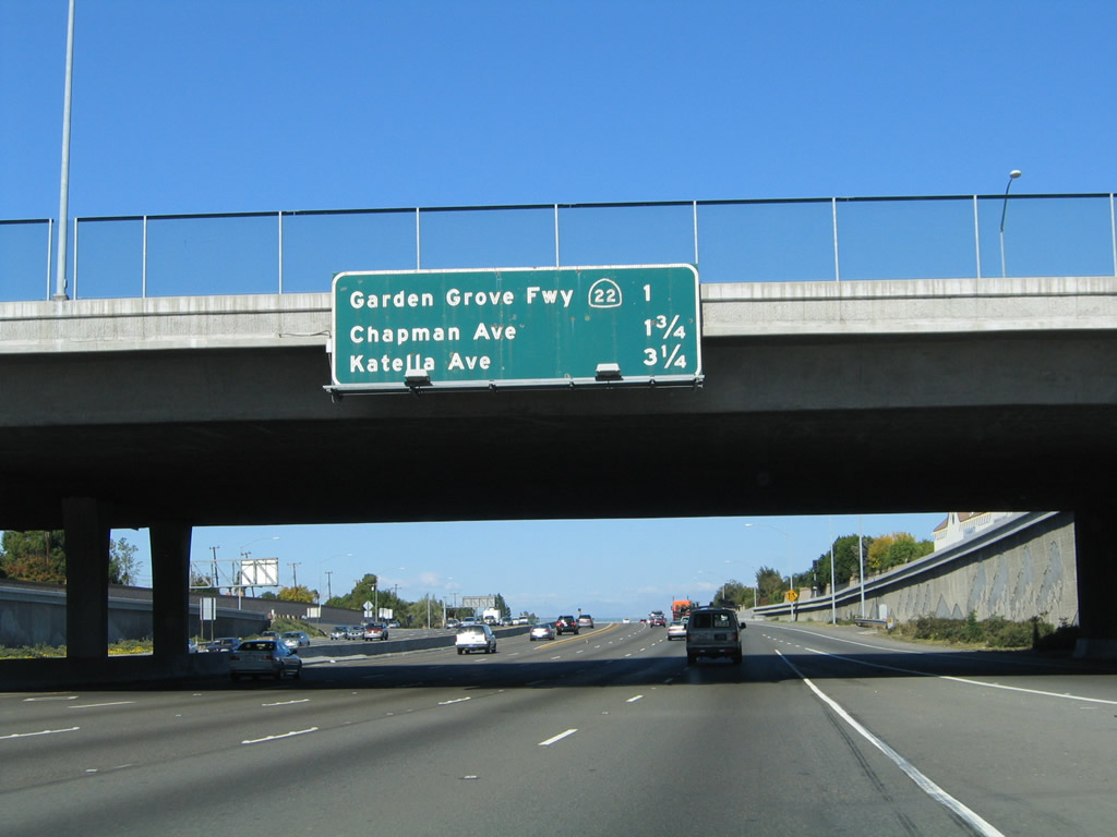
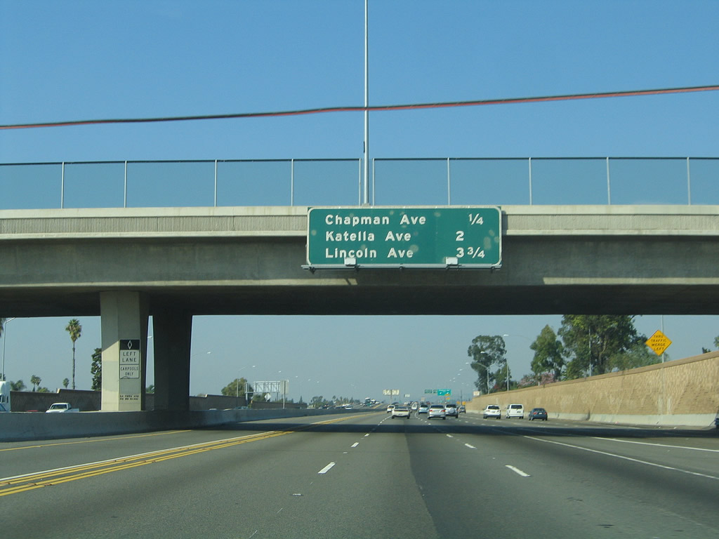
This mileage sign provides the distance to the next several exits along California 55 (Costa Mesa Freeway) north: Exit 13, California 22 (Garden Grove Freeway) west; Exits 14A-B, Orange County S-25 (Chapman Avenue); and Exit 15, Orange County S-18/Katella Avenue. Photo taken 11/14/04. |
|
A California 55 north reassurance shield is posted after the on-ramp from Seventeenth Street. Photo taken 11/14/04. |
|
|
The right two lanes of California 55 north will connect to California 22 west to Long Beach; the left four lanes continue north on California 55. California 22 (Garden Grove Freeway) is a major east-west connector, passing through the heart of Orange County and separating two of the largest cities in the county: Santa Ana and Anaheim. California 22 also serves the cities of Garden Grove and Westminster, then merges with Interstate 405 for the distance to Seal Beach and Long Beach. Photos taken 10/30/05 and 11/14/04. |
|
Northbound California 55 (Costa Mesa Freeway) reaches Exit 13, California 22 (Garden Grove Freeway) west to Garden Grove and Long Beach. Photo taken 11/14/04. |
|
|
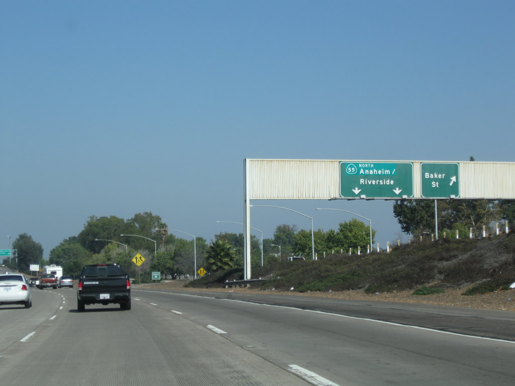
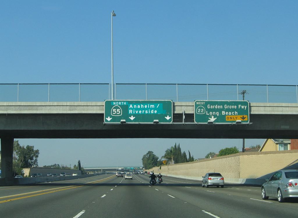
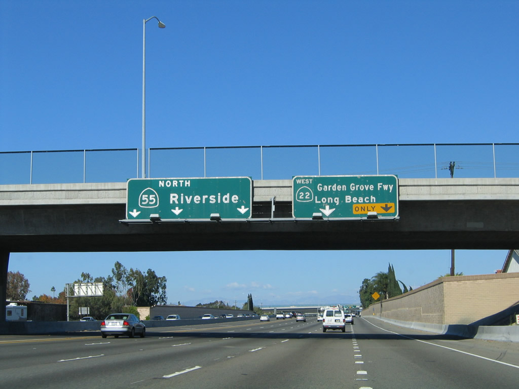
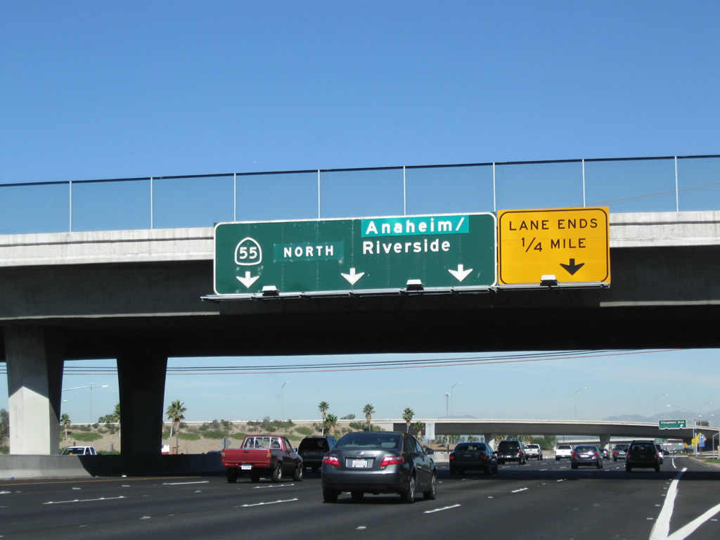
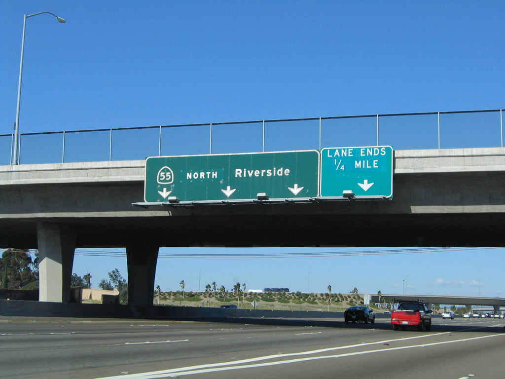
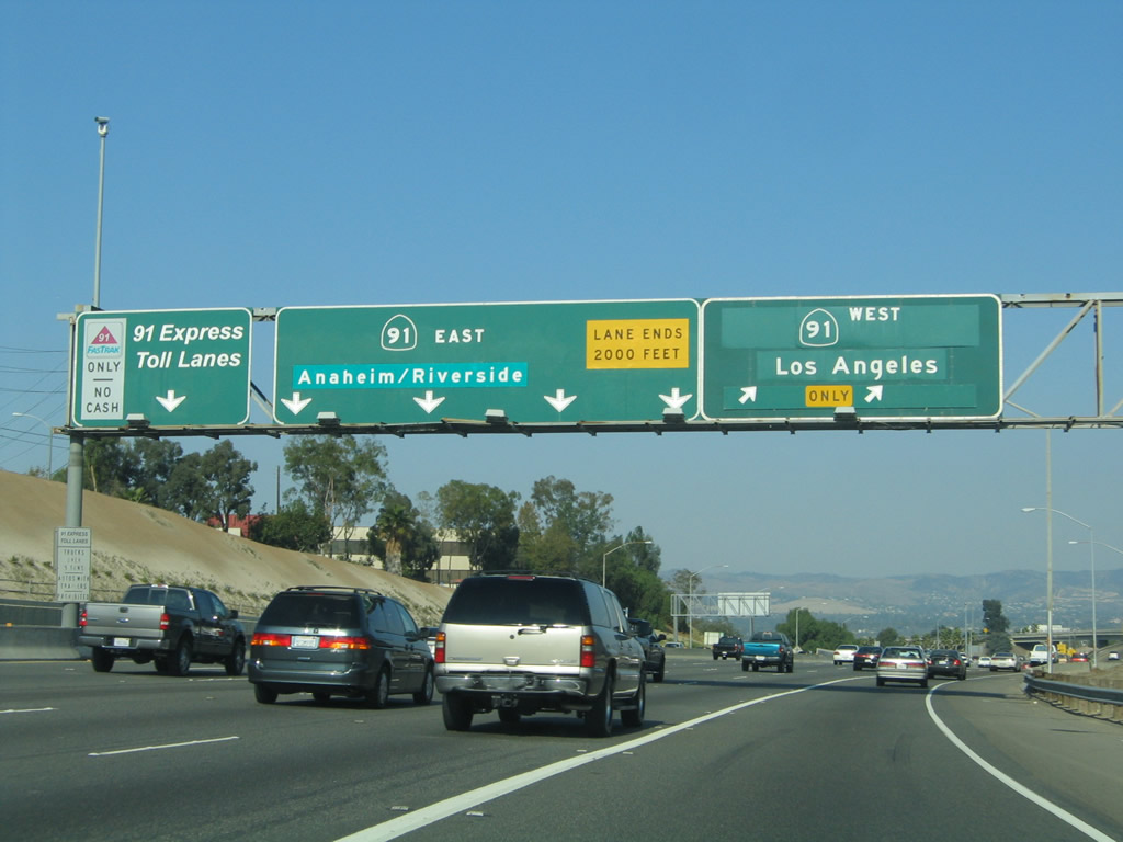
After the California 22 (Garden Grove Freeway) off-ramp, a pull through sign advises of the continuation of California 55 north to Anaheim and Riverside. The right lane ends (note that the "lane ends" sign changed from green to yellow). California 55 continues north into the city of Orange. The city was incorporated on April 6, 1888, Orange had a population of 128,821 as of the 2000 Census. Photos taken 11/08/08 and 11/14/04. |
|
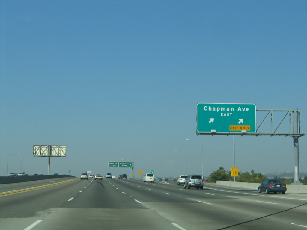
Within the California 22 interchange is a bypass ramp that allows traffic to stay right and avoid merging across entering traffic from California 22 (yes, this bypass ramp looks like an exit ramp). This local bypass carries one lane and allows exiting traffic to stay right. It will merge back onto the mainline as traffic from California 22 also join California 55 north. It is possible to exit this ramp and rejoin California 55 north after the California 22 merge. The next two exits are Exit 14A, Orange County S-25 (Chapman Avenue) east and Exit 14B to Orange County S-25 (Chapman Avenue) west. Chapman Avenue is Orange County S-25 between Interstate 5/California 57 and Orange County S-18 east of here, but no signs are in place for the signed county route on the northbound freeway. Photo taken 10/30/05. |
|
Traffic transitions from California 22 east to California 55 north; the ramp flies overhead here. Use Exit 14B to Old Towne Orange. Photo taken 05/02/10. |
|
This mileage sign provides the distance to the next three exits: Exit 14B, Orange County S-25 (Chapman Avenue) west; Exit 15, Orange County S-18/Katella Avenue; and Exit 16, Nohl Ranch Road and Lincoln Avenue (Old U.S. 91). At this point, traffic from California 22 east merges onto California 55 north. Photo taken 10/30/05. |
|
Northbound California 55 reaches Exit 14A, Orange County S-25 (Chapman Avenue) east. Orange County S-25 passes through the city of Orange, then ends at its junction with Orange County S-18 (Santiago Canyon Road) near Orange Park Acres just northwest of the California 241/261 interchange. Photo taken 10/30/05. |
|
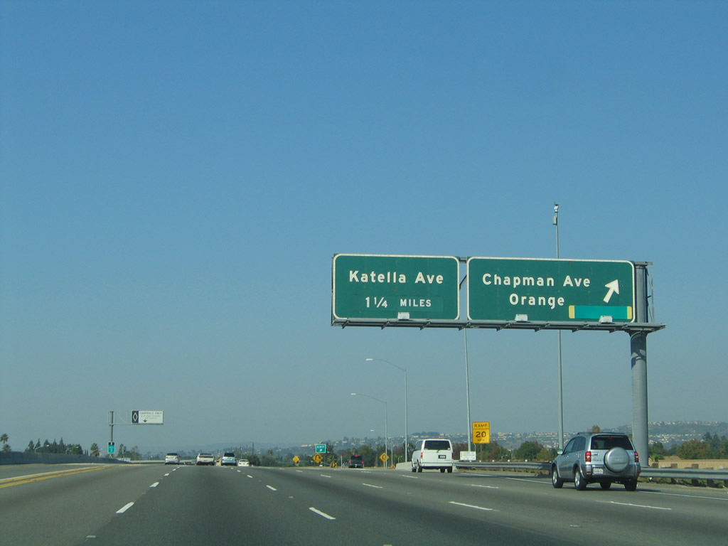
Immediately thereafter, northbound California 55 meets Exit 14B, Orange County S-25 (Chapman Avenue) west. The next exit is Exit 15, Orange County S-18/Katella Avenue. Photo taken 10/30/05. |
|
This mileage sign along California 55 (Costa Mesa Freeway) provides the distance to the next two exits: Exit 15, Orange County S-18/Katella Avenue and Exit 17, Nohl Ranch Road/Lincoln Avenue. Photo taken 10/30/05. |
|
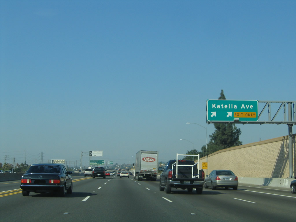
The right two lanes will connect to Exit 15, Katella Avenue. Katella Avenue heads east as Orange County S-18 toward Irvine Lake, changing into Santiago Canyon Road and turning southeast. To the west, Orange County S-18 turns into the city of Orange and meets California 57 near Arrowhead Pond (home of the National Hockey League's Anaheim Ducks) and Angels Field. Photo taken 10/30/05. |
|
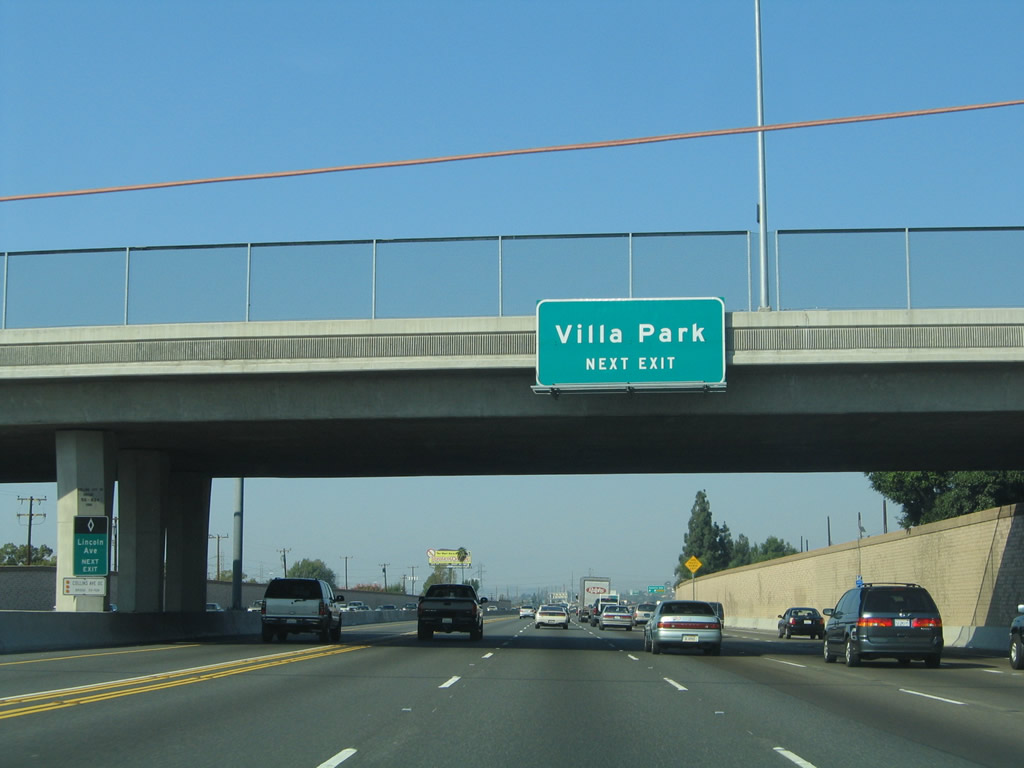
Orange County S-18/Katella Avenue travels east into the city of Villa Park, the "Hidden Jewel." Villa Park had a population of 5,999 as of the 2000 Census, has an elevation of 341 feet, and was incorporated on January 11, 1962. Upon leaving Villa Park, Orange County S-18 turns southeast along Santiago Canyon Road parallel to California 241 until reaching Lake Forest. At Lake Forest, Orange County S-18 turns southwest, meeting Interstate 5 at Exit 91 and ending at California 133 northeast of Laguna Beach. This makes for a rather circuitous route through Orange County. Photo taken 10/30/05. |
|
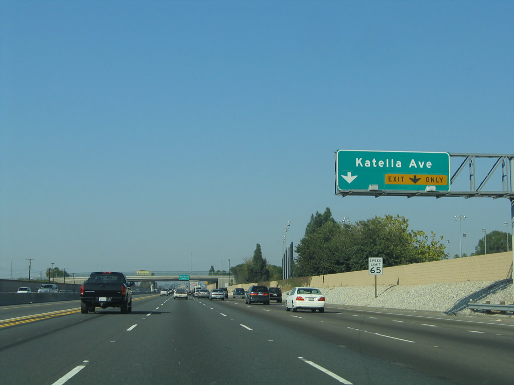
Northbound California 55 meets Exit 15, Orange County S-18/Katella Avenue. Photo taken 10/30/05. |
|
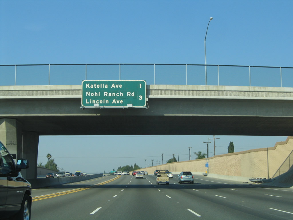
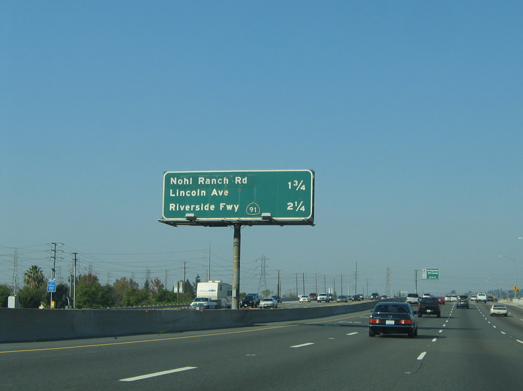
This mileage sign along northbound California 55 provides the distance to the final two exits: Exit 17, Nohl Ranch Road and Lincoln Avenue (Old U.S. 91) and Exit 18, California 91 (Riverside Freeway). Photo taken 10/30/05. |
|
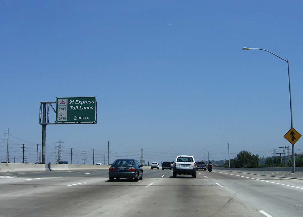
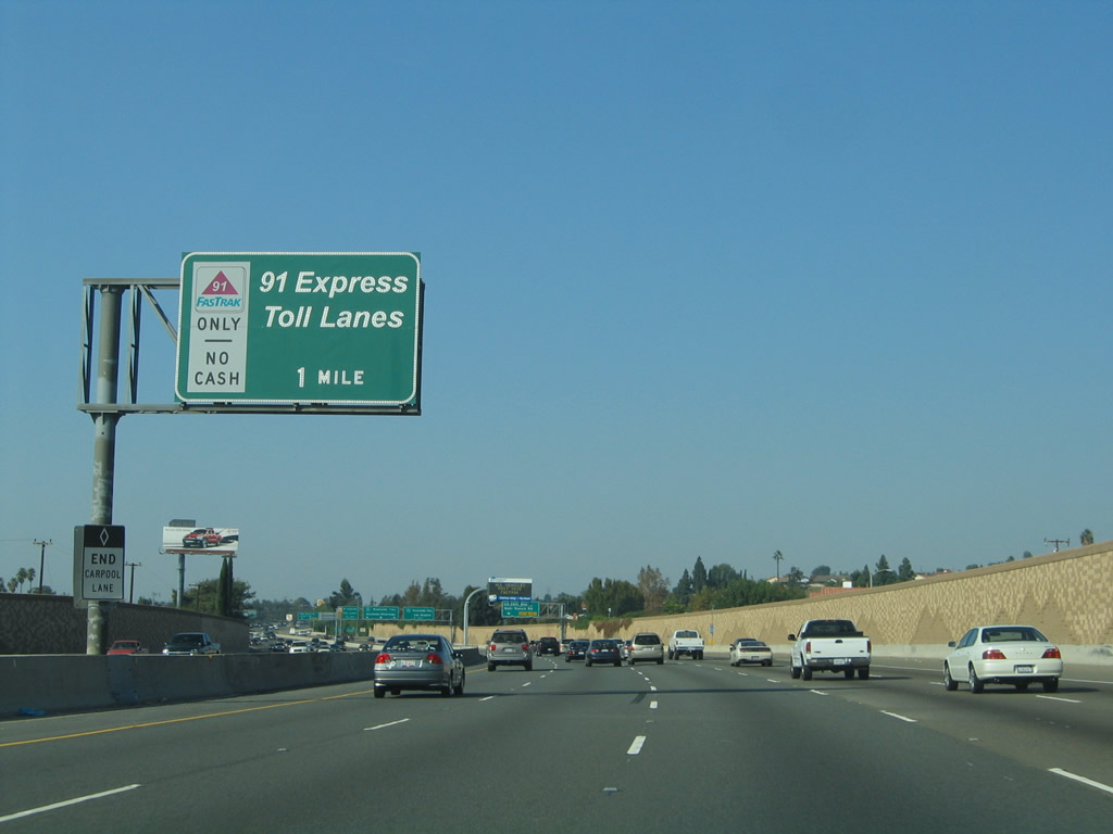
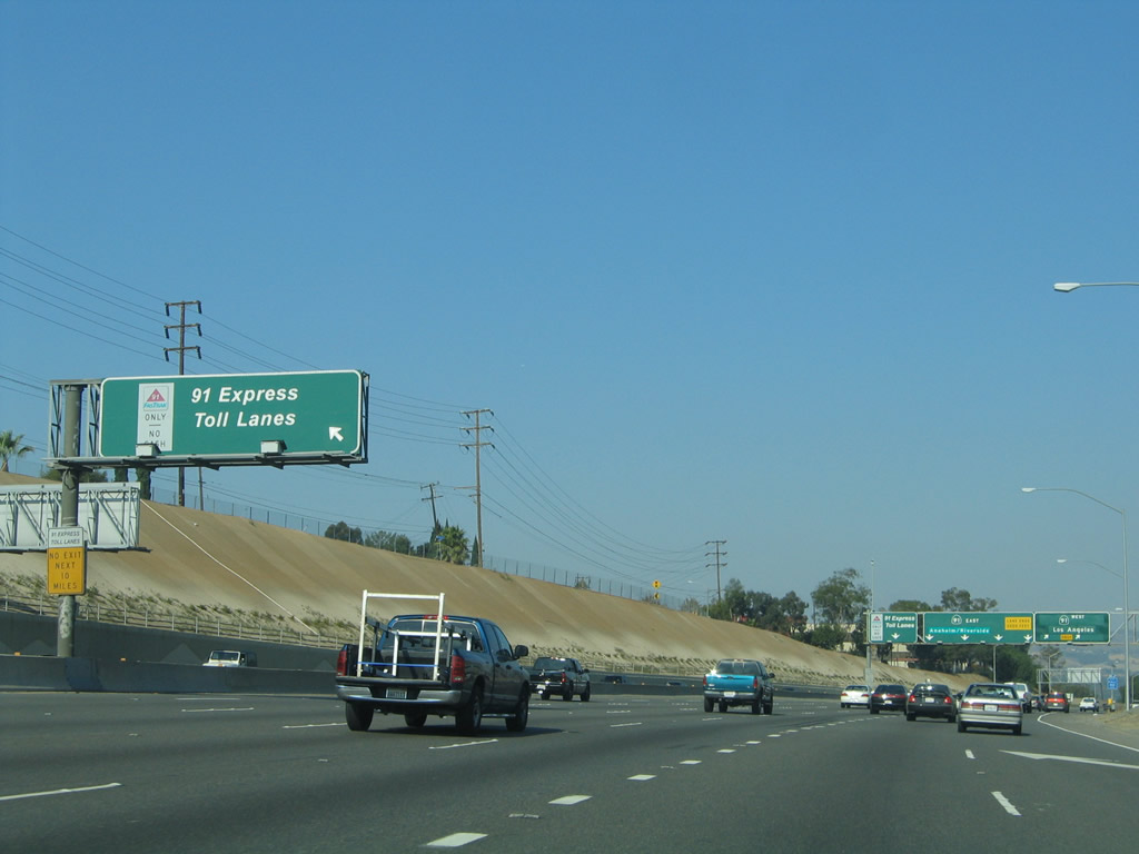
This is the first of many along northbound for the approaching California 91 Express Lanes. These high occupancy/toll (also known as HOT) lanes were constructed in the median of California 91 with private funds, and a toll is charged for all solo drivers and HOV-2 who prepay to use the lanes. In addition, carpools with three or more occupants may use the lanes for free. Photo taken 06/17/06. |
|
A pair of double circuit, 220kV Southern California Edison power lines cross over California 55. Photo taken 05/02/10. |
|
A second mileage sign along northbound California 55 again provides the distance to the final two exits: Exit 17, Nohl Ranch Road/Lincoln Avenue and Exit 18, California 91 (Riverside Freeway). Photo taken 10/30/05. |
|
As California 55 approaches California 91, the traditional Southern California high occupancy lane in the left lane ends, and the left lane defaults onto the eastbound California 91 Express Lanes. High occupancy vehicles as well as single occupancy vehicles that pay a toll may use that lane on California 91. Photo taken 10/30/05. |
|
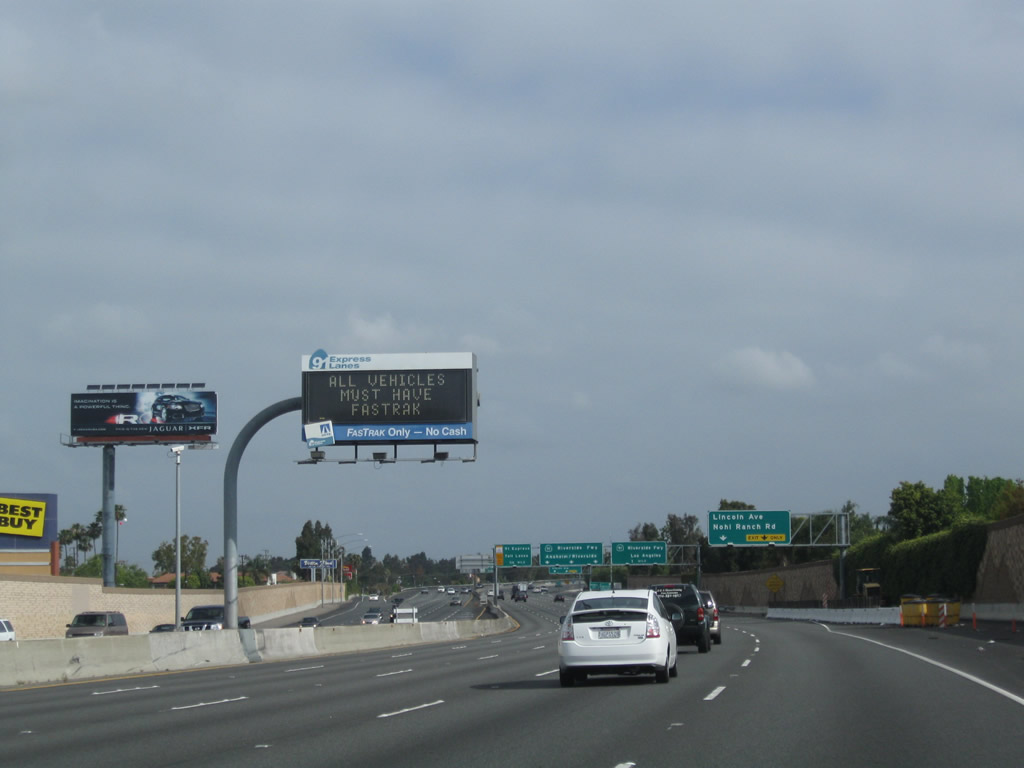
A dynamic message sign is posted for the California 91 Express Lanes. Only those with a transponder (FasTrak) or high occupancy vehicles with three or more passengers may use the Express Lanes. Photo taken 05/02/10. |
|
The right two lanes of California 55 north will connect to Exit 17, Nohl Ranch Road and Lincoln Avenue (Historic U.S. 91). The following exit is the northern terminus of California 55: Exit 18, California 91 (Riverside Freeway). Photo taken 05/02/10. |
|
Stay right for Exit 17, Nohl Ranch Road and Lincoln Avenue and Exit 18A, California 91 (Riverside Freeway) west to Anaheim and Long Beach. Stay left for Exit 18B, California 91 (Riverside Freeway) east to Anaheim Hills and Riverside via the main lanes or Exit 18C, 91 Express Lanes east to Riverside. Photo taken 06/17/06. |
|
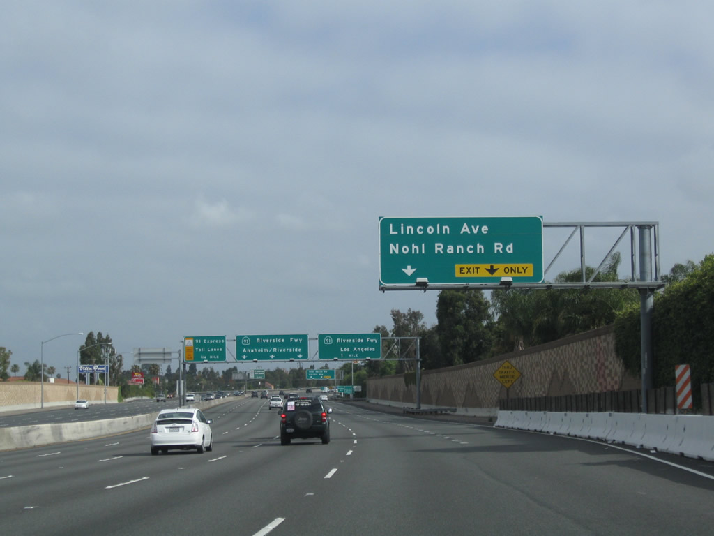
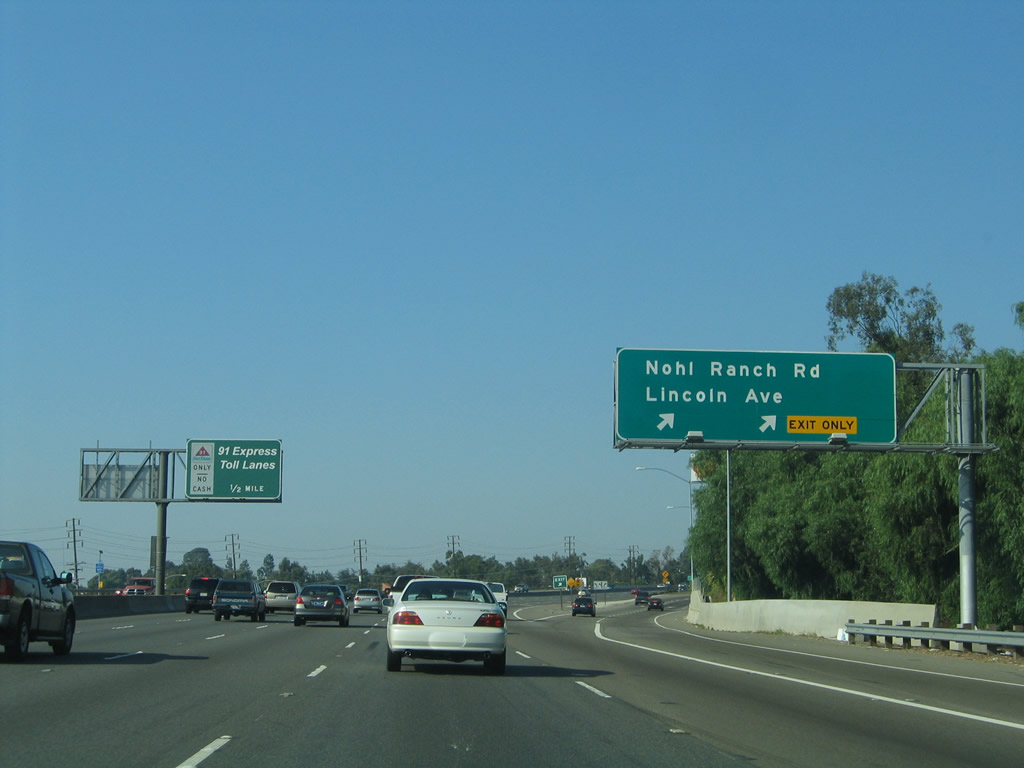
Northbound California 55 (Costa Mesa Freeway) reaches Exit 17, Nohl Ranch Road and Lincoln Avenue. Lincoln Avenue is the original alignment of U.S. 91 and California 18; both routes have since been retracted from this road, and Lincoln Avenue is now a city street. Photo taken 10/30/05. |
|
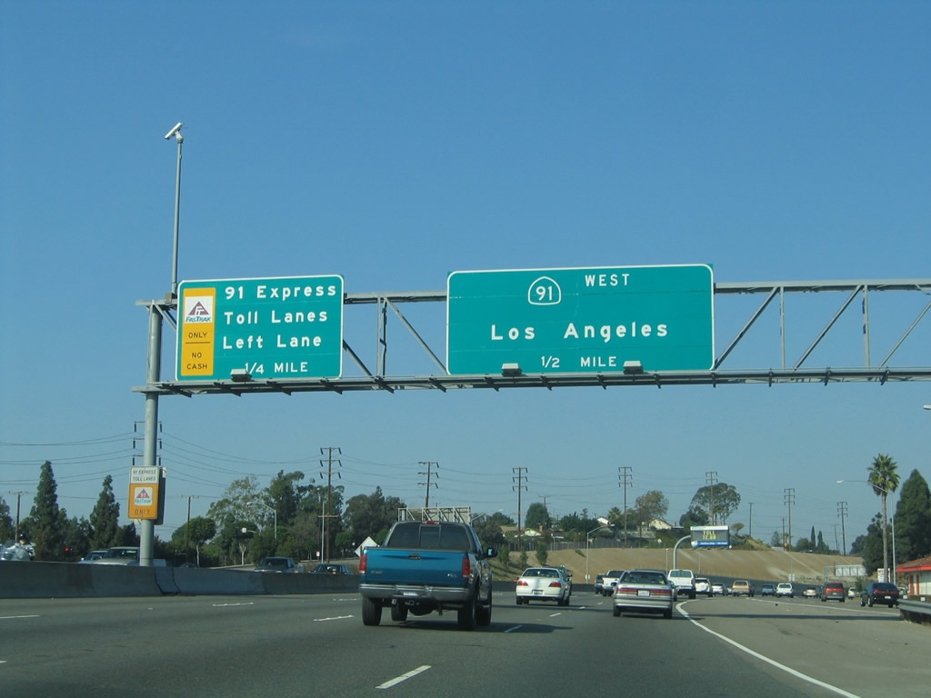
Northbound California 55 approaches Exit 18A, California 91 west to Anaheim, Fullerton, Long Beach, and Manhattan Beach. This section of California 91 replaced former U.S. 91, which used to travel along Lincoln Avenue. Photo taken 10/30/05. |
|
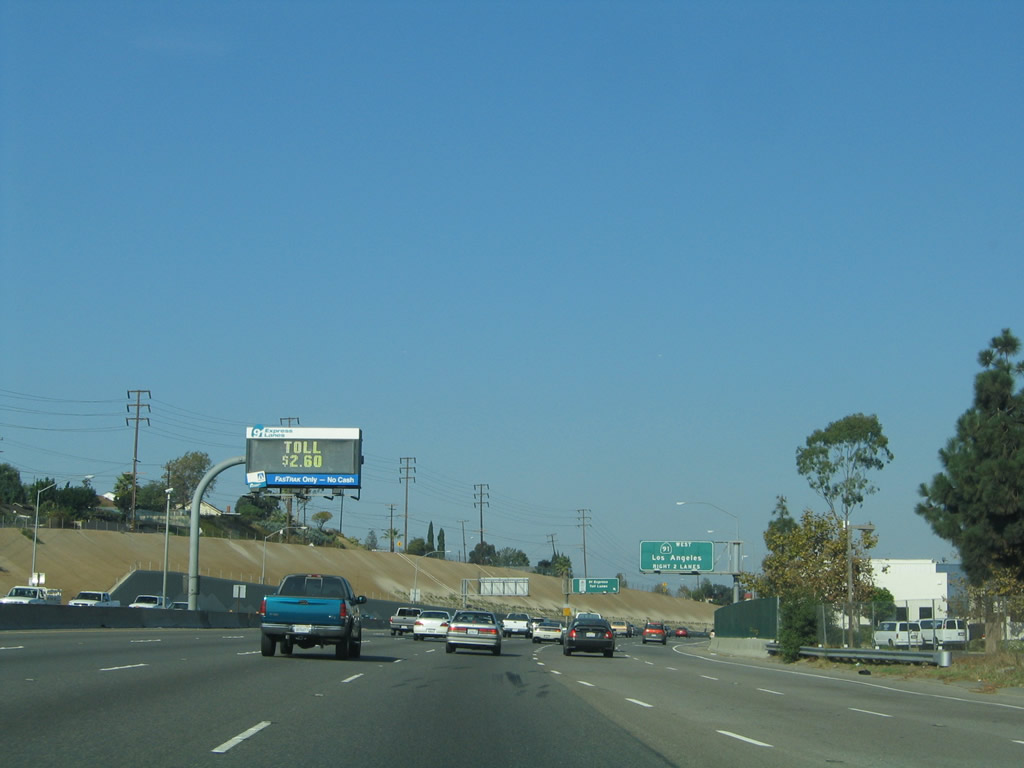
The toll for the 91 Express Lanes was $2.60 on this clear and sunny autumn day. Photo taken 10/30/05. |
|
The right two lanes of California 55 become exit only for California 91 west (Exit 18A). California 91 is a major east-west freeway, originating at the coast in Hermosa Beach just south of Manhattan Beach at California 1 (Pacific Coast Highway). The multi-lane divided expressway becomes a freeway at Interstate 110, and the freeway heads east through Compton, Bellflower, Cerritos, and Buena Park before meeting California 55 in Anaheim. Passing California 55, California 91 continues east through Yorba Linda and into Riverside County, culminating in the city of Riverside at its junction with Interstate 215 and California 60. Photo taken 10/30/05. |
|
This ramp directly connects the California 55 high occupancy vehicle lane with the California 91 high occupancy vehicle lane. California 91 has high occupancy toll lanes in its median that allow for carpools and single drivers who pay a toll to use those lanes. They extend from California 55 east to the Orange-Riverside County Line, a distance of exit-less travel for about ten miles. Photo taken 10/30/05. |
|
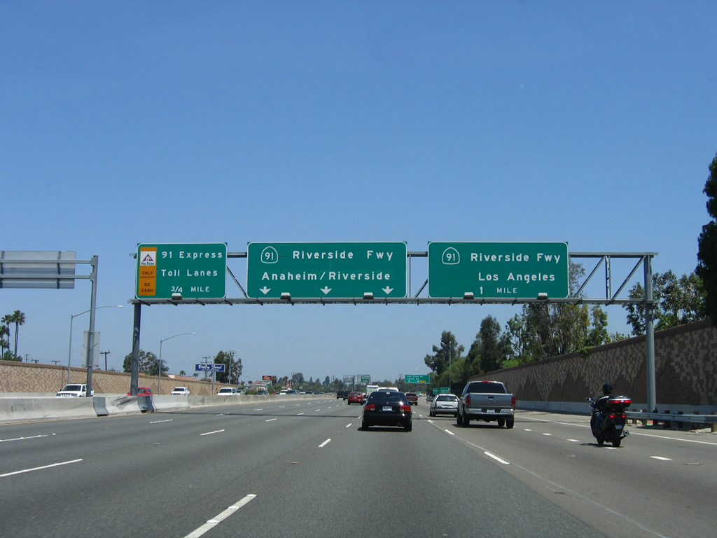
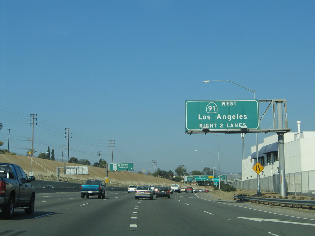
Northbound California 55 ends as the mainline splits. The right two lanes connect to Exit 18A, California 91 (Riverside Freeway) west. The middle four lanes connect to is Exit 18B, California 91 (Riverside Freeway) east, and the left lane links to Exit 18C, 91 Express Lanes east for High Occupancy Vehicle (HOV+3 carpools) and toll payers. Photo taken 10/30/05. |
|
The ramp to westbound California 91 splits off from northbound California 55; the rest of the traffic on northbound California 55 defaults onto eastbound California 91. California 55 reaches its northern terminus; no end shield is present. Photo taken 10/30/05. |
Page Updated September 16, 2010.