
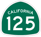
California 125 South - SR 94 to SR 905
| California 125 south | |
|---|---|
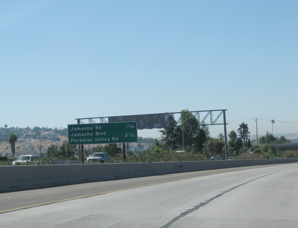 |
The next two exits along California 125 south are Exit 13, Jamacha Road and Exit 12, San Diego County S-17 (Jamacha Boulevard) and Paradise Valley Road. Photo taken 08/23/10. |
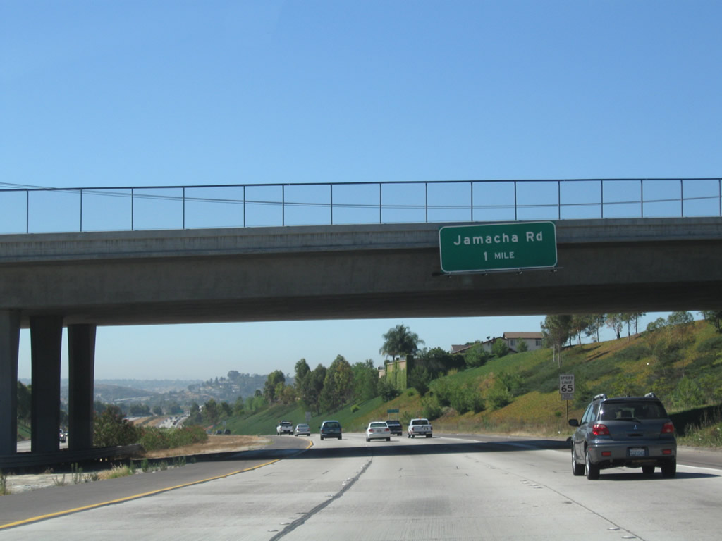 |
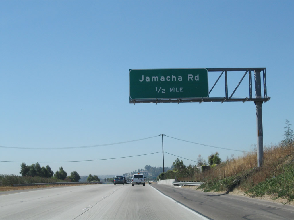
Passing into Spring Valley, southbound California 125 next approaches Exit 13, Jamacha Road (one mile). The freeway passes under Troy Street at this point. Photo taken 08/23/10. |
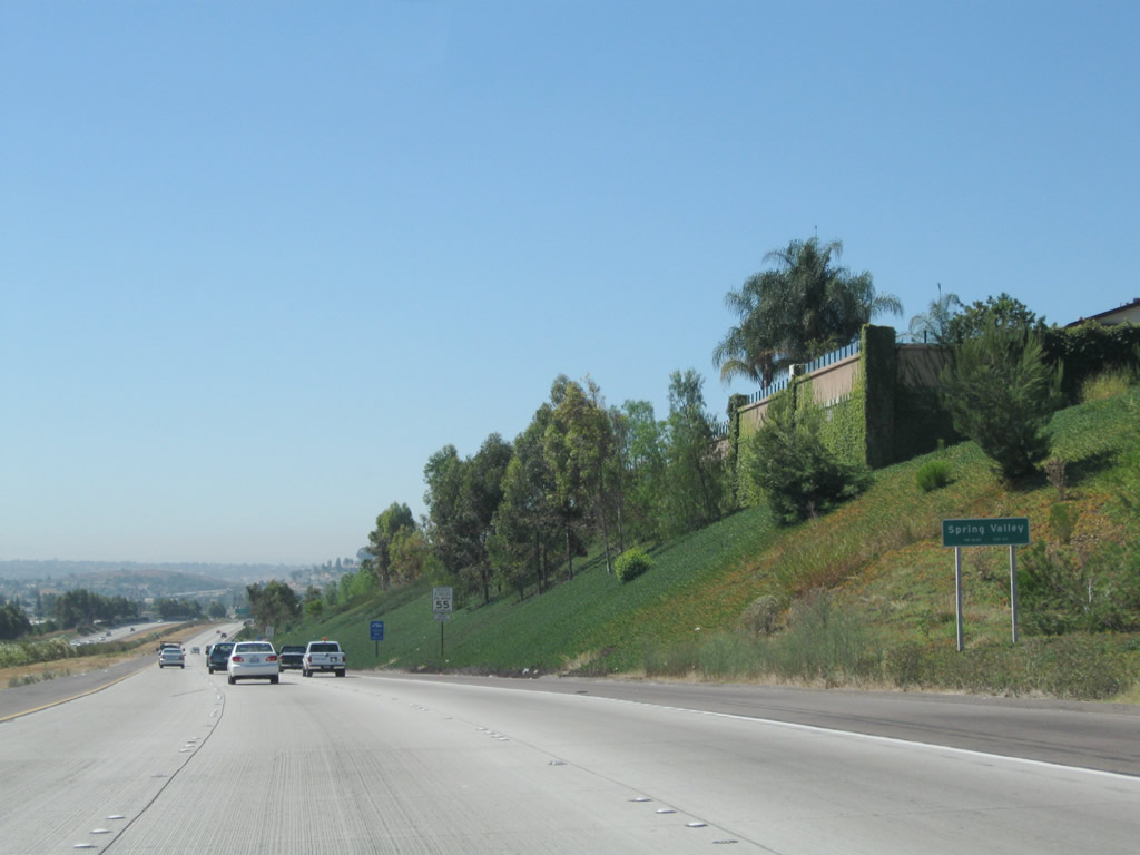 |
Spring Valley in an unincorporated community within San Diego County. A large residential community is located on either side of the freeway as it proceeds south parallel to Sweetwater Road. Photo taken 08/23/10. |
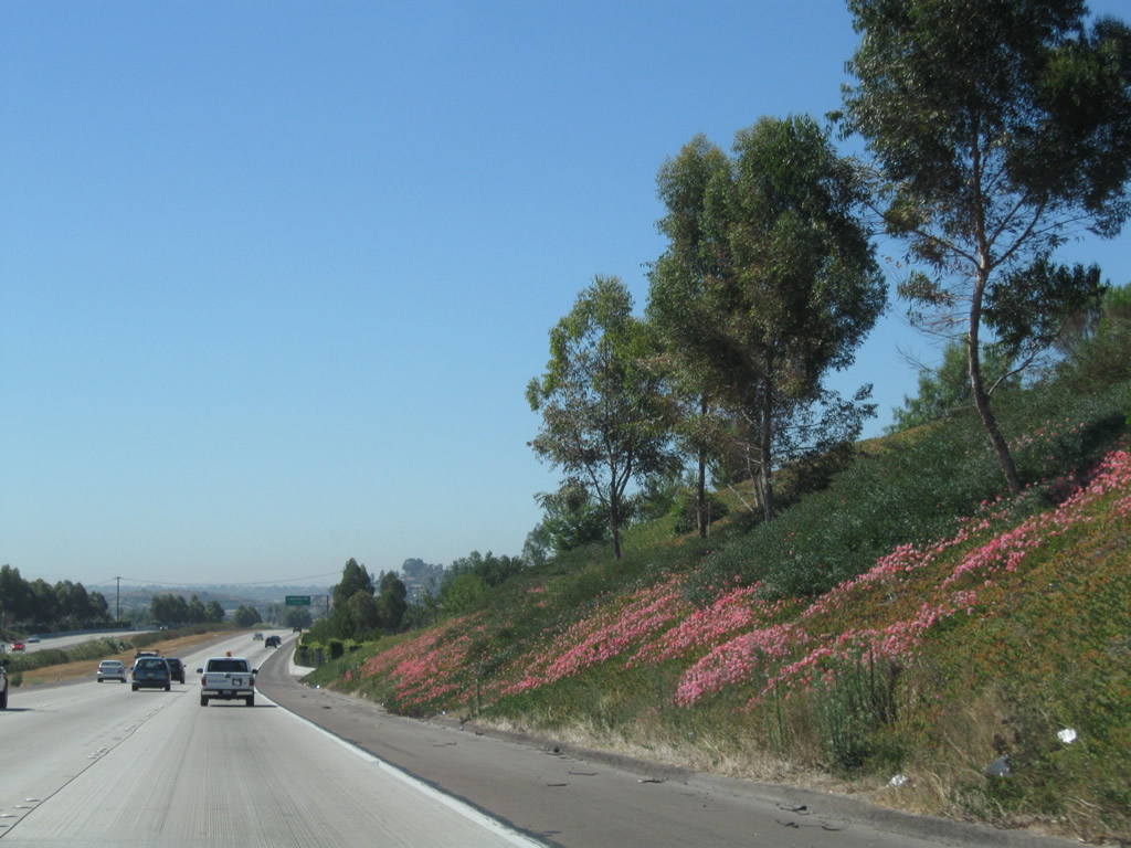 |
A slope covered in pink flowers lies along the west side of the freeway. Photo taken 08/23/10. |
 |
Jamacha Road (not to be confused with Jamacha Boulevard at Exit 12) is an east-west arterial street that serves the community of Spring Valley. Photo taken 08/23/10. |
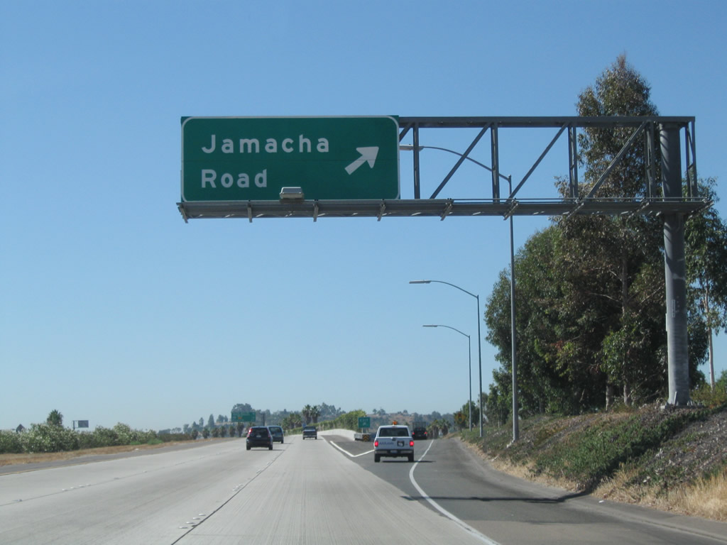 |
Southbound California 125 reaches Exit 13, Jamacha Road. Photo taken 08/23/10. |
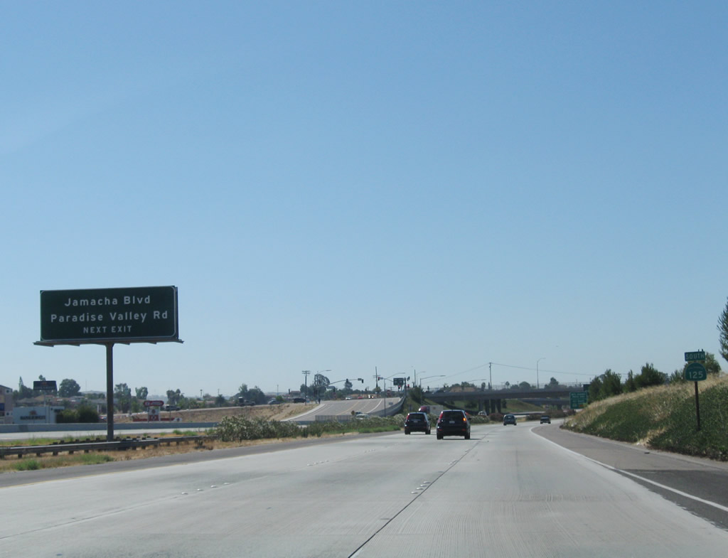 |
The next exit along California 125 south is Exit 12, San Diego County S-17 (Jamacha Boulevard) and Paradise Valley Road. Jamacha Boulevard is a major east-west corridor that parallels the proposed California 54 expressway connector between California 125 and California 94. Designated as San Diego County S-17, Jamacha Boulevard carries a decent amount of traffic and provides the most direct route from here to eastern El Cajon and points east via California 94 or Interstate 8. Future plans call for construction of California 54 between California 125 and California 94, although no timetable is in place for this eventual expressway. Photo taken 08/23/10. |
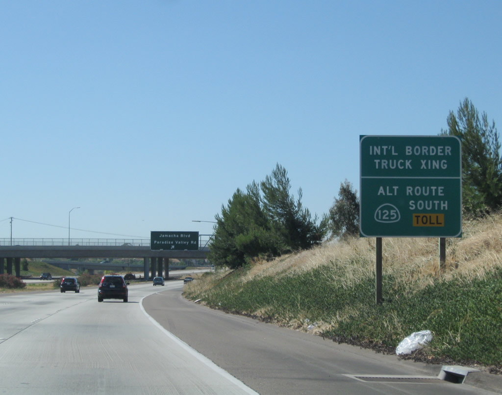 |
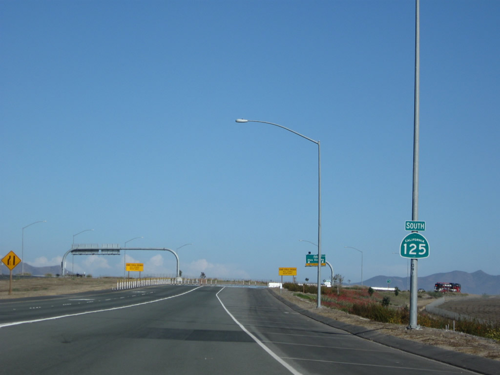
To the International Border Crossing at Otay Mesa, use California 125 (South Bay Expressway) south to California 905. It is a more direct route than using Interstate 805 (although no toll is charged for using Interstate 805). Photo taken 08/23/10. |
 |
Southbound California 125 reaches Exit 12, San Diego County S-17 (Jamacha Boulevard) and Paradise Valley Road. Ahead, California 54 west merges onto California 125 south. Photo taken 08/23/10. |
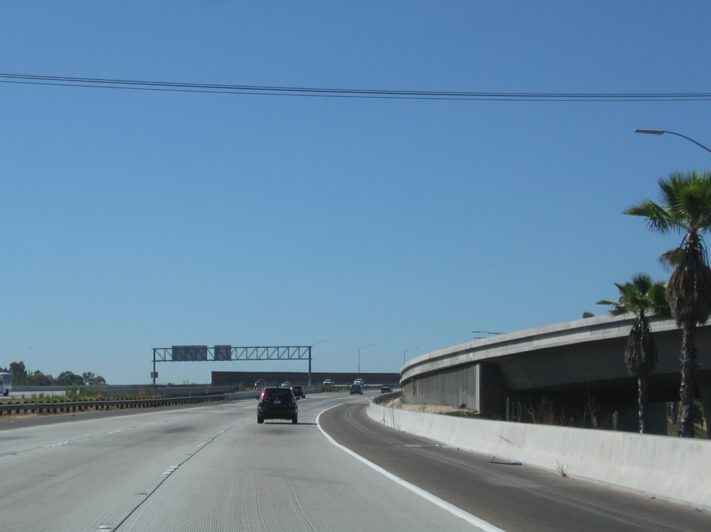 |
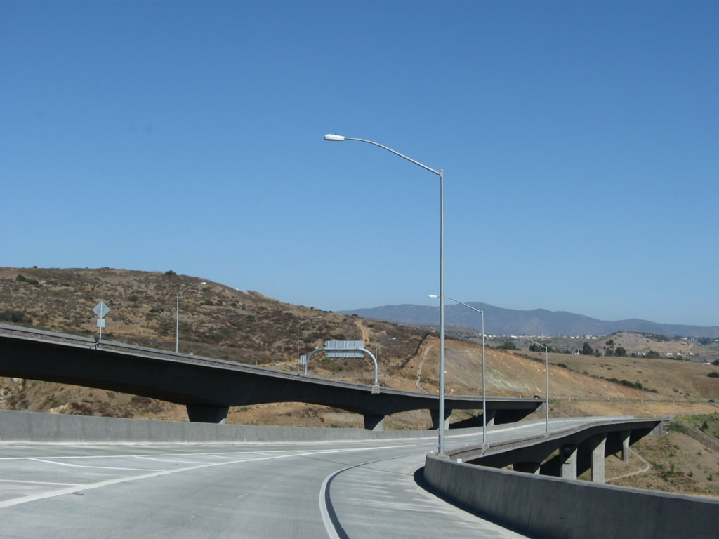
California 125 curves southwest. Traffic from San Diego County S-17 (Jamacha Boulevard) merges onto California 125 south. Although California 54 has not yet been constructed, this on-ramp represents the continuation of westbound California 54 en route to National City. Photo taken 08/23/10. |
| California 54 west & 125 south | |
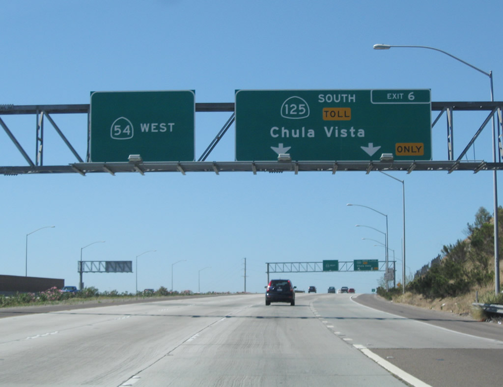 |
Previously signed as Exit 6 from SR 54, this guide sign provides the lane allocation for Exit 11 of SR 54 west & SR 125 south. SR 54 west heads to National City and northern and western Chula Vista. Photo taken 08/23/10. |
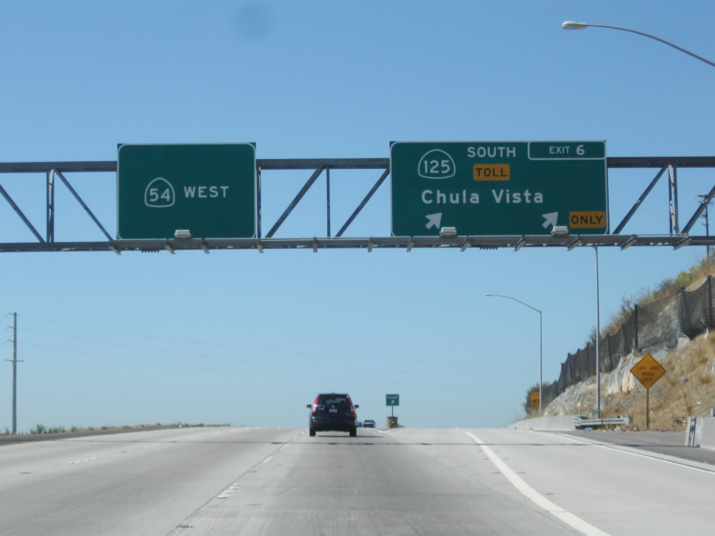 |
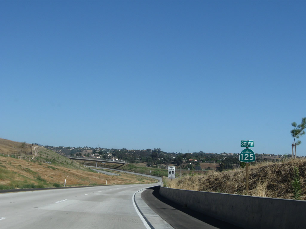
Westbound California 54 and southbound California 125 split at this point. The left three lanes continue west on California 54 (via Exit 11), and the right two lanes continue south on California 125 (South Bay Expressway) south (via Exit 6). Photo taken 08/23/10. |
| California 125 - South Bay Expressway south | |
 |
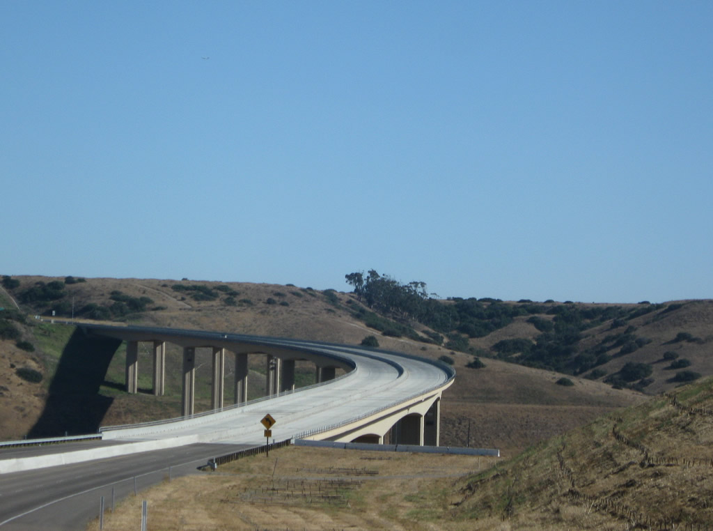
Leaving the California 54 interchange, California 125 flies high above the Sweetwater River. The freeway ramps between California 54 and California 125 include some tall segments above the valley below the bridges. Photo taken 07/12/09. |
 |
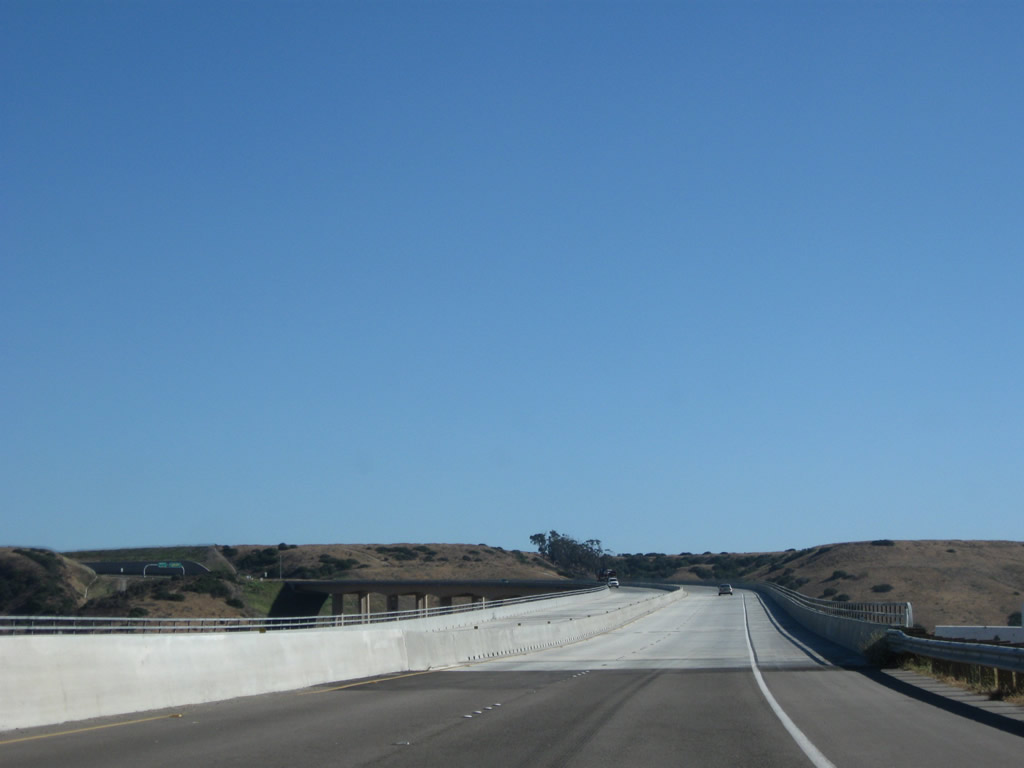
The first California 125 south reassurance shield is posted after crossing the bridge over the Sweetwater River. While not bannered as a toll highway, the remainder of the California 125 freeway is a toll. Photo taken 07/12/09. |
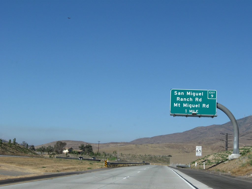 |
The next exit along California 125 (South Bay Expressway) south is Exit 9, San Miguel Ranch Road and Mount Miguel Road (one mile). Photo taken 07/12/09. |
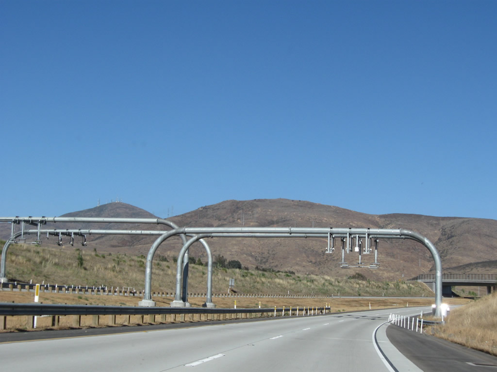 |
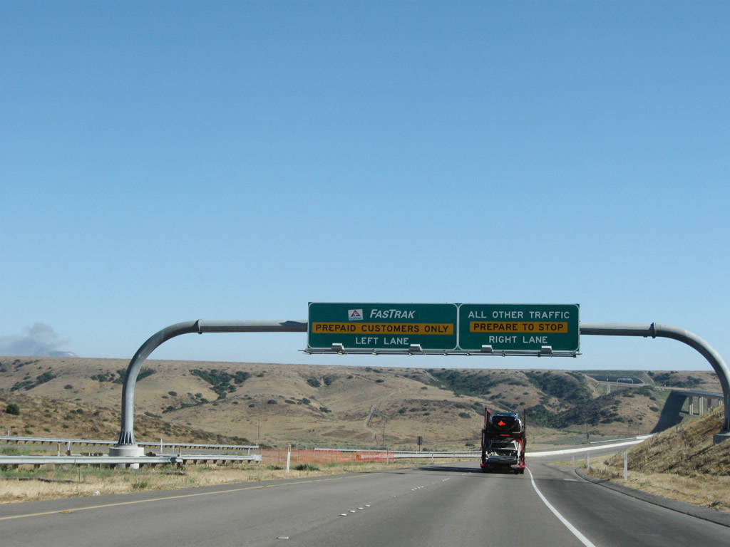
Electronic tolling (Fastrak) is tracked using these towering gantries. Photo taken 07/12/09. |
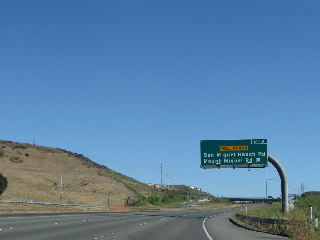 |
Southbound California 125 (South Bay Expressway) reaches Exit 9, San Miguel Ranch Road and Mount Miguel Road. Photo taken 07/12/09. |
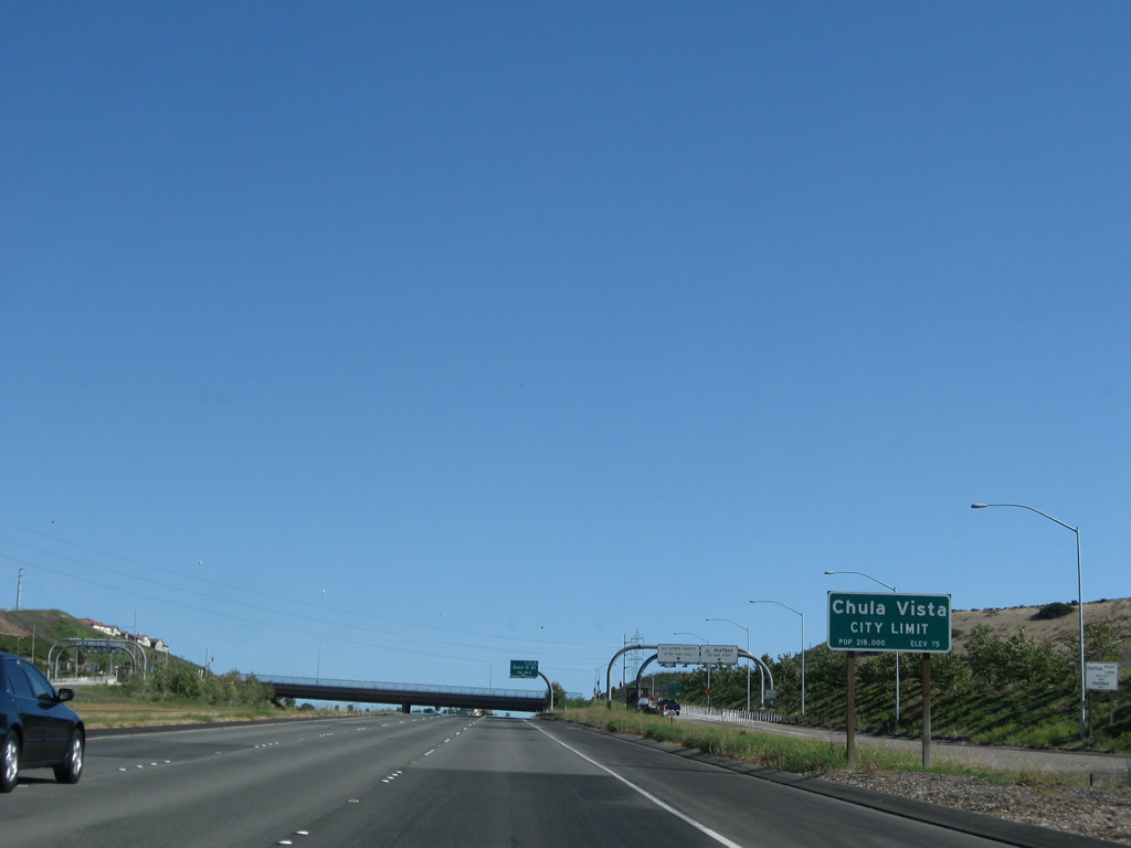 |
California 125 (South Bay Expressway) leaves unincorporated Bonita and enters the city of Chula Vista, the largest suburb of San Diego. Chula Vista is estimated to have 201,210 people (as of 2003), and demographic estimates suggest that it will continue to grow at a high rate, especially as more residential properties are developed in the eastern part of the city (in the Eastlake and Otay Ranch communities). Photo taken 07/12/09. |
 |
The next exit along California 125 (South Bay Expressway) south is Exit 8, East H Street (0.75 mile). Photo taken 07/12/09. |
 |
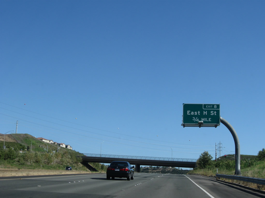
Southbound California 125 (South Bay Expressway) reaches Exit 8, East H Street. Photo taken 07/12/09. |
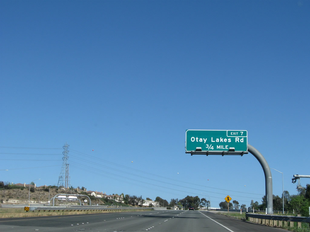 |
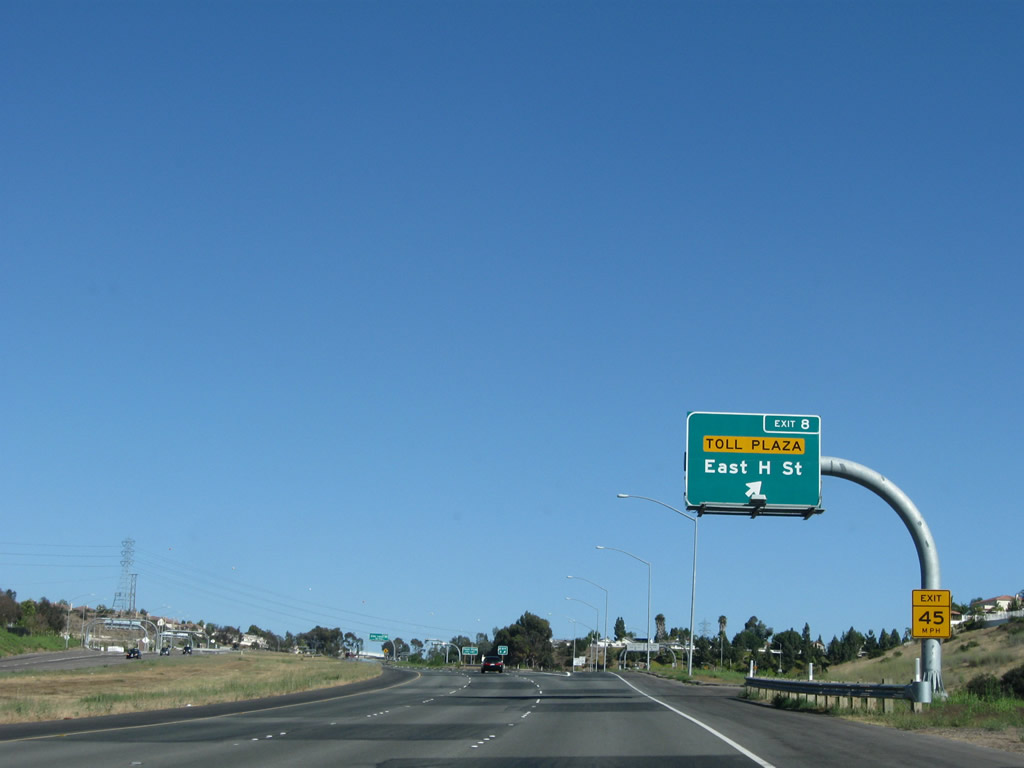
The next exit along California 125 (South Bay Expressway) south is Exit 7, Otay Lakes Road (0.75 mile). Most of these interchanges serve the eastern neighborhoods of Chula Vista, including Eastlake and Otay Ranch. Many of these developments were constructed in the 1990s and 2000s, with the tollway offered an alternate route. Photo taken 07/12/09. |
 |
Southbound California 125 (South Bay Expressway) reaches Exit 7, Otay Lakes Road. Photo taken 07/12/09. |
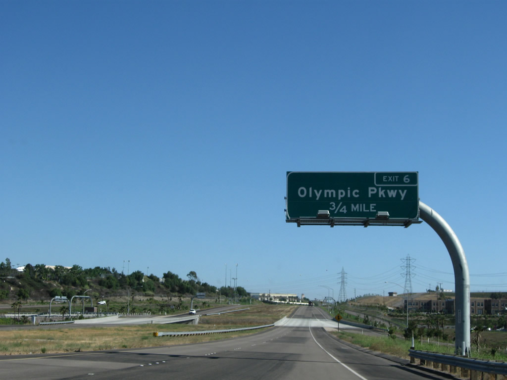 |
The next exit along California 125 (South Bay Expressway) south is Exit 6, Olympic Parkway (0.75 mile). Photo taken 07/12/09. |
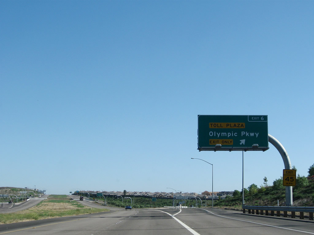 |
Southbound California 125 (South Bay Expressway) reaches Exit 6, Olympic Parkway. Photo taken 07/12/09. |
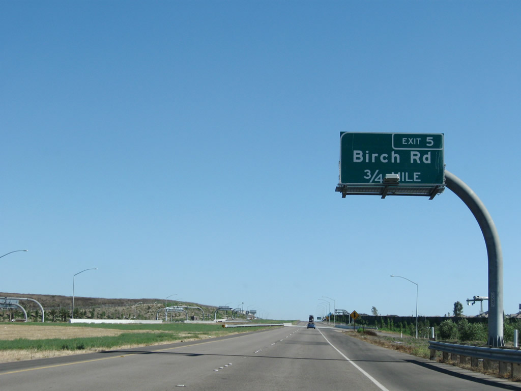 |
The next exit along California 125 (South Bay Expressway) south is Exit 5, Birch Road (0.75 mile). Photo taken 07/12/09. |
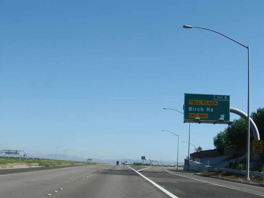 |
Southbound California 125 (South Bay Expressway) reaches Exit 5, Birch Road. Photo taken 07/12/09. |
 |
This California 125 south reassurance shield is posted after the on-ramp from Birch Road. Photo taken 07/12/09. |
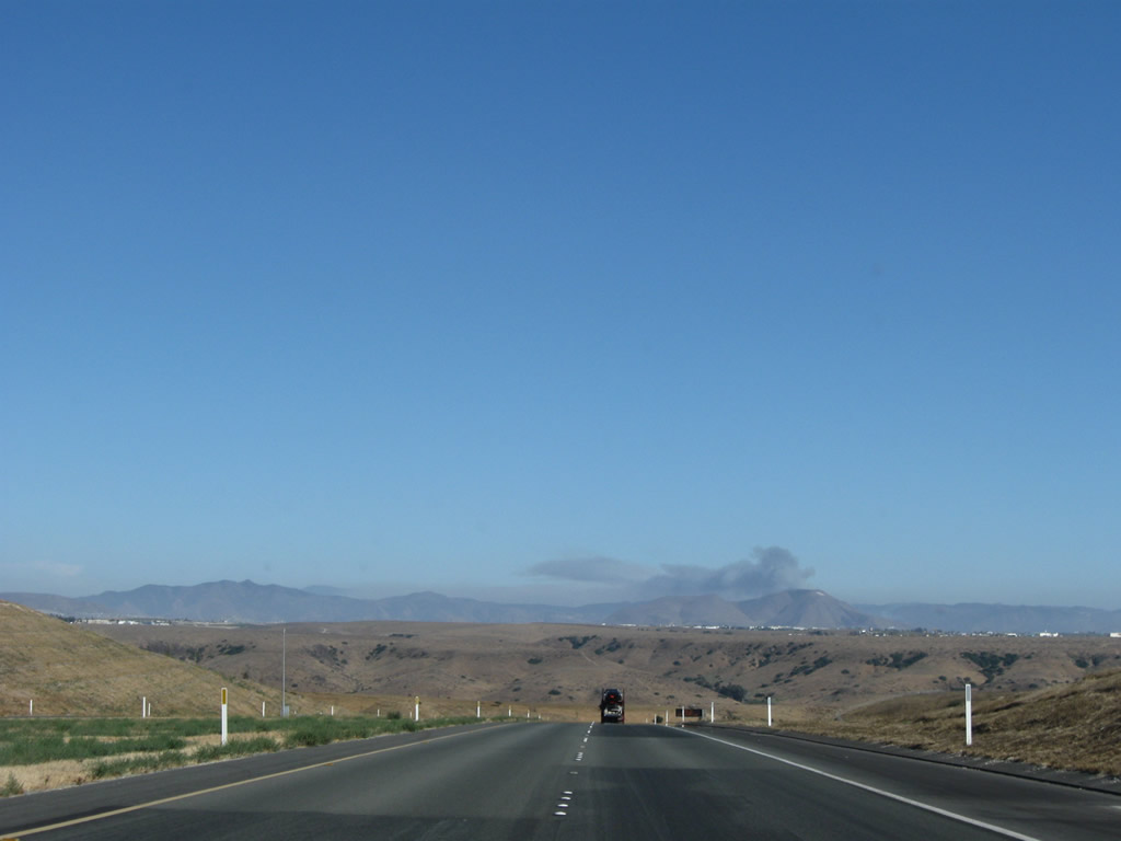 |
A fire was burning in Mexico on the day this photo was taken. Photo taken 07/12/09. |
 |
The toll plaza along California 125 south is located just after the Otay River Valley bridge. Photo taken 07/12/09. |
 |
The massive Otay River Valley bridge carries California 125 over the Otay River Valley. Crossing at a height of 160 feet above the floor of the valley, the bridge is a precast segmental bridge (built using the balanced cantilever method). The bridge has a length of almost 0.75 mile (3,280 feet) with 12 precast segments. Photo taken 07/12/09. |
 |
Along southbound, the bridge is all uphill toward the toll plaza and the Chula Vista-San Diego city limits. Photo taken 07/12/09. |
 |
California 125 leaves Chula Vista and enters the city of San Diego. Photo taken 07/12/09. |
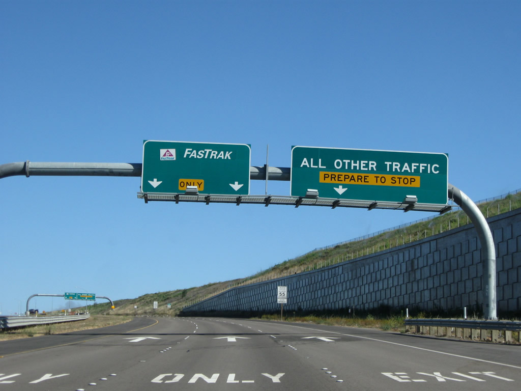 |
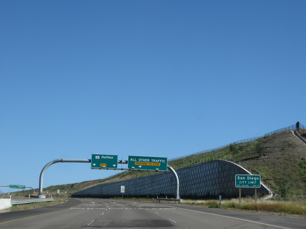
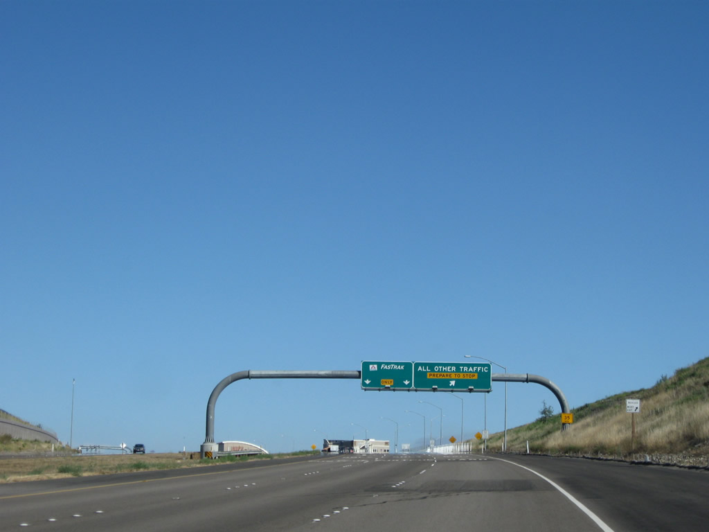
Electronic toll customers may use the left lanes, while cash customers must use the right lanes to use the manual booths. Photo taken 07/12/09. |
 |
The toll plaza comes into view at the top of the hill. A future interchange is planned near here (Exit 2), but it was not built as part of the original toll facility. Photo taken 07/12/09. |
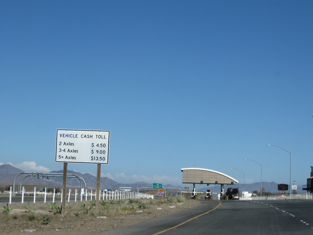 |
At the time this photo was taken, the cost for a car to drive the tollway in one direction was $4.50. Photo taken 07/12/09. |
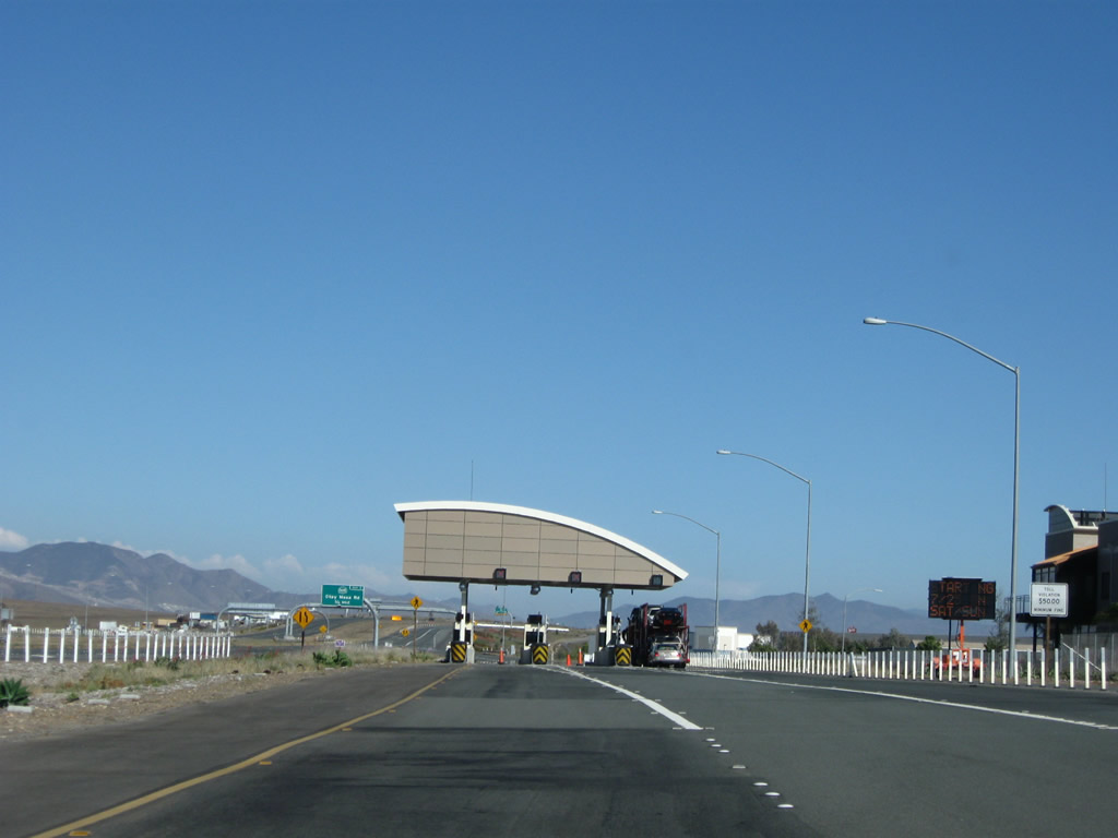 |
The toll booth arrangement is comparable to that seen in other open-road tolling facilities, including those on the Orange County Toll Road network. Photo taken 07/12/09. |
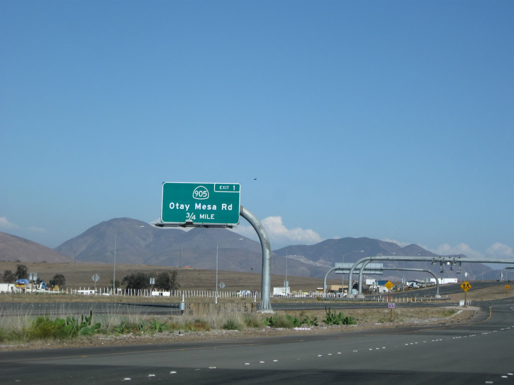 |
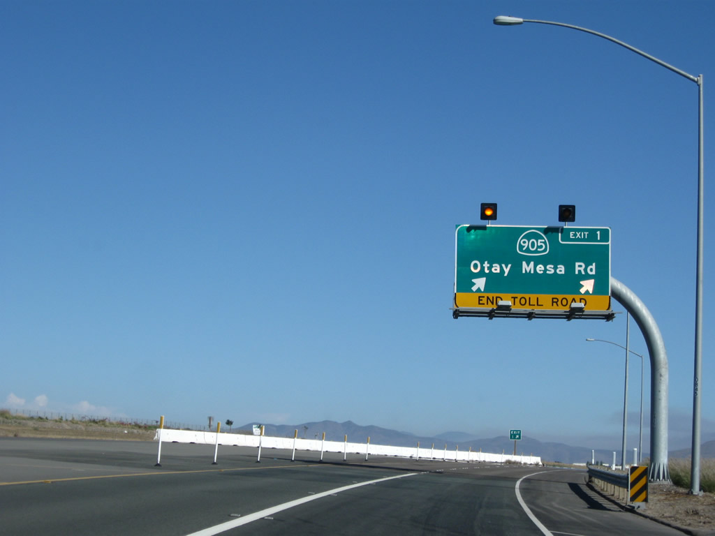
The final exit along California 125 south is Exit 1, California 905/Otay Mesa Road. The southern terminus will be extended to connect to the future Interstate 905 freeway, which was under construction as of Summer 2010. Photo taken 07/12/09. |
 |
The final exit along California 125 south is Exit 1, California 905/Otay Mesa Road. The southern terminus will be extended to connect to the future Interstate 905 freeway, which was under construction as of Summer 2010. Photo taken 07/12/09. |
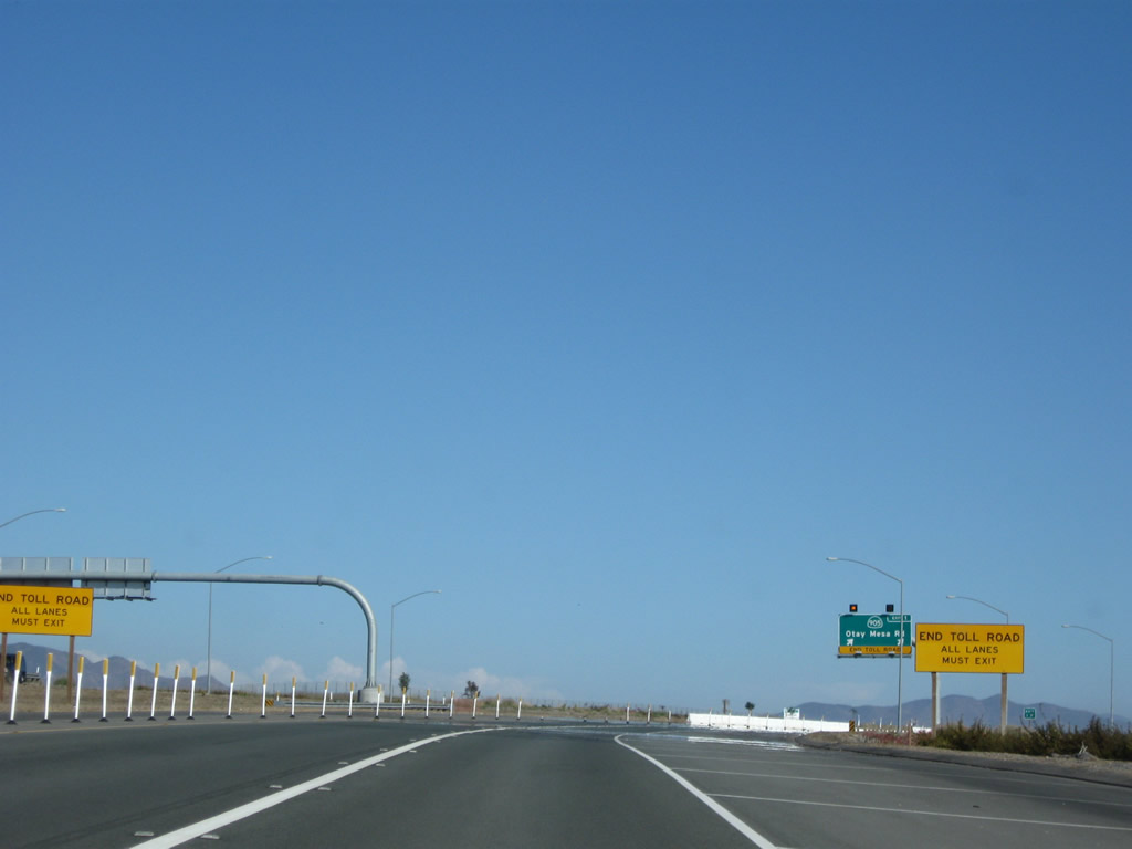 |
Yellow signs mark the southern end of the tollway. For now, all traffic must divert onto Otay Mesa Road until the freeway-to-freeway interchange is completed as part of the California 905 freeway (Future Interstate 905) project. Photo taken 07/12/09. |
 |
Southbound California 125 reaches Exit 1, California 905/Otay Mesa Road. Photo taken 07/12/09. |
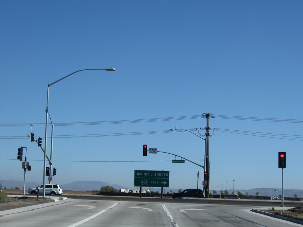 |
A traffic signal governs the flow of traffic between southbound California 125 and California 905/Otay Mesa Road. Photo taken 07/12/09. |


Page Updated August 28, 2010.
|
About Contact Glossary |
In The News Interstate Guide |
Social Media:
 |
|
© 2000-25 AARoads.com | All Rights Reserved | Privacy Policy / Terms of Use
|
||