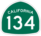
| California 134 east |
|
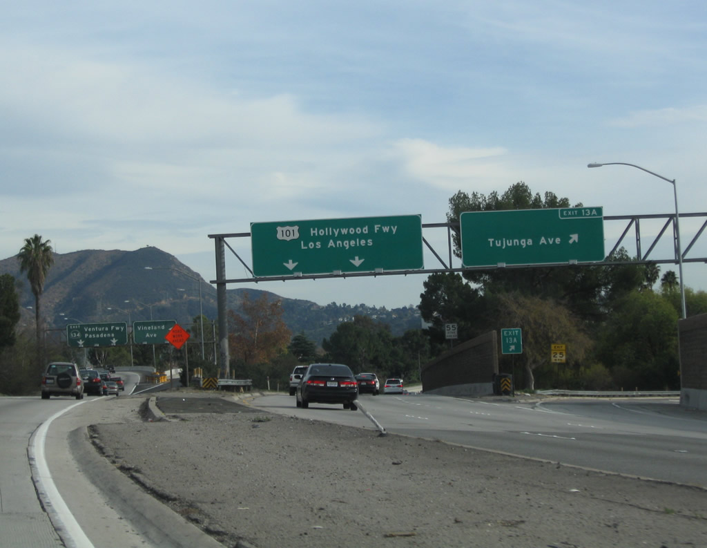
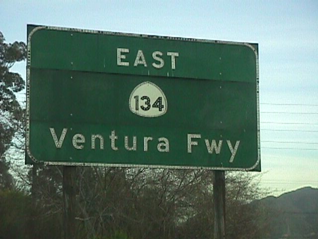
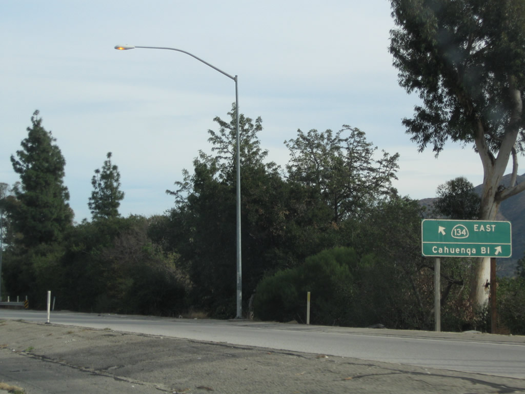
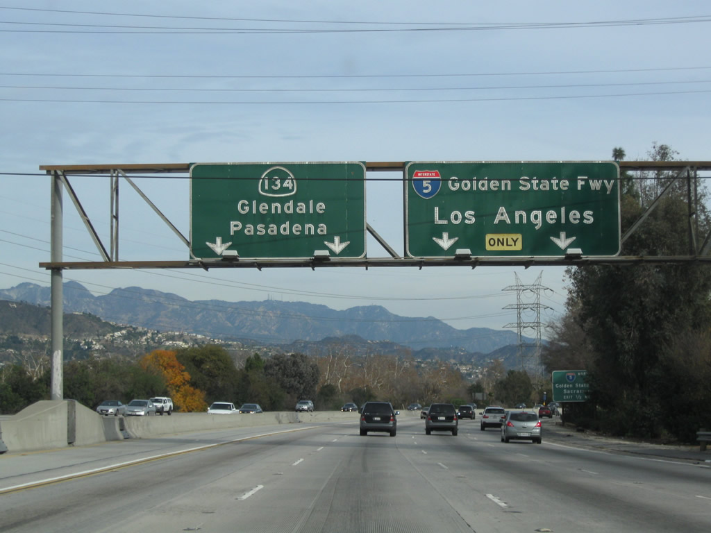
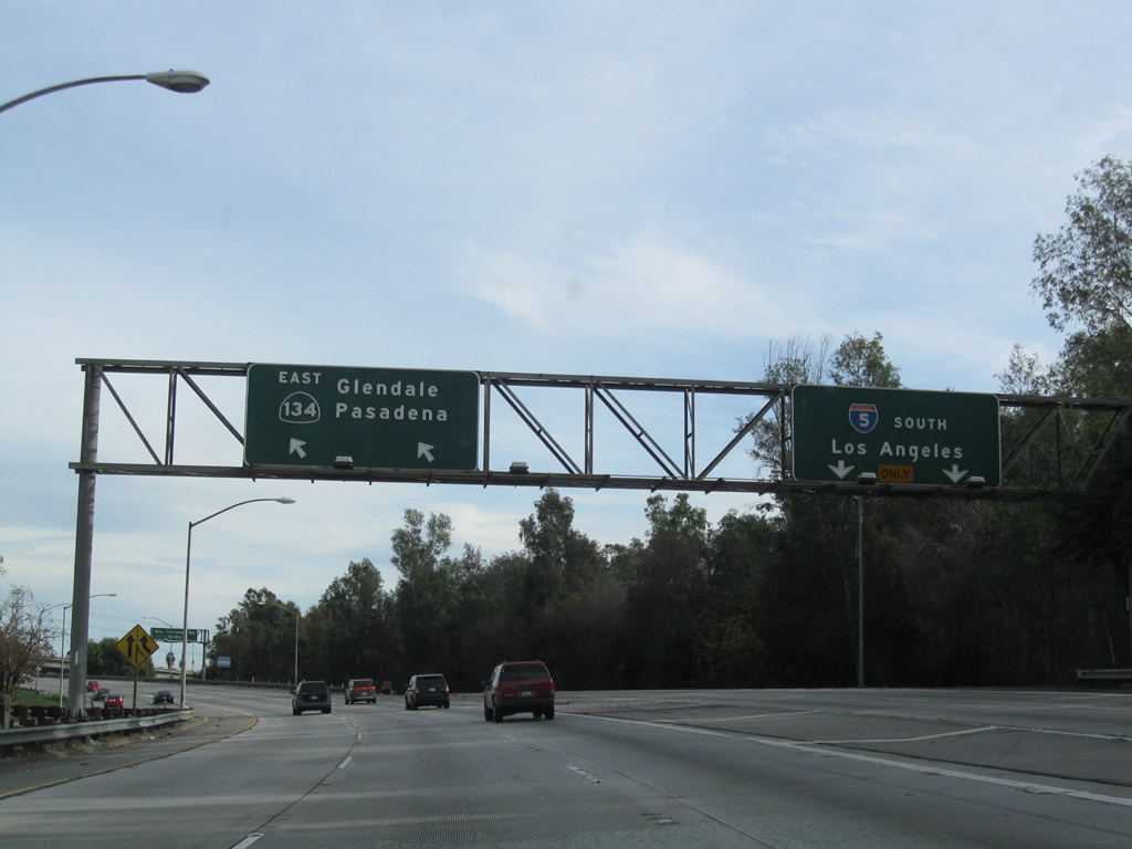
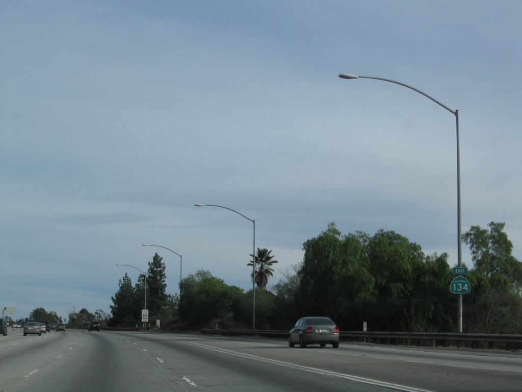
The left two lanes of U.S. 101 south depart onto California 134 (Ventura Freeway) east to Glendale and Pasadena. The sign on the right is porcelain enamel and is older than the sign on the left. Photo taken 12/20/09. |
|
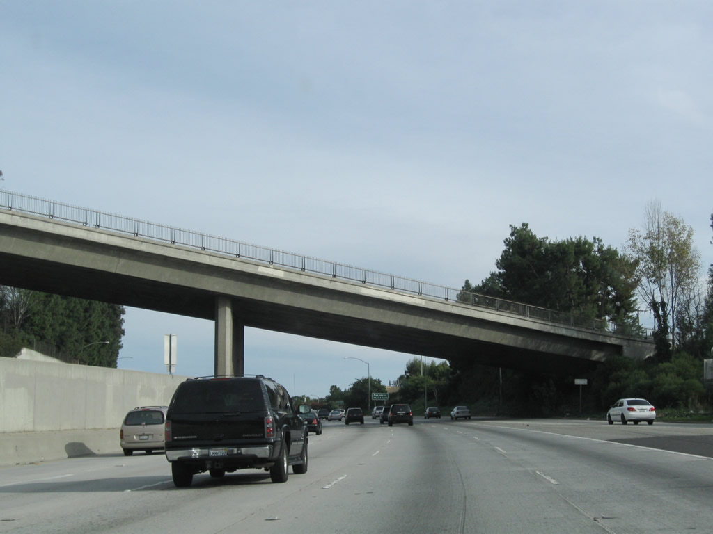
This view looks at the Tujunga Avenue (Exit 13A) off-ramp from U.S. 101 south as seen from the main lanes of California 134 east. The interchange between California 134, California 170, and U.S. 101 was built in stages between 1959 and 1962. The section of California 134 from U.S. 101 to Interstate 5 was mostly built in 1962. Photo taken 12/20/09. |
|
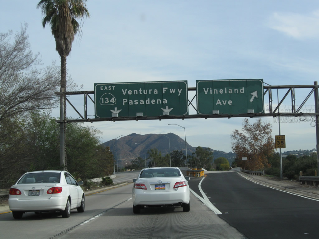
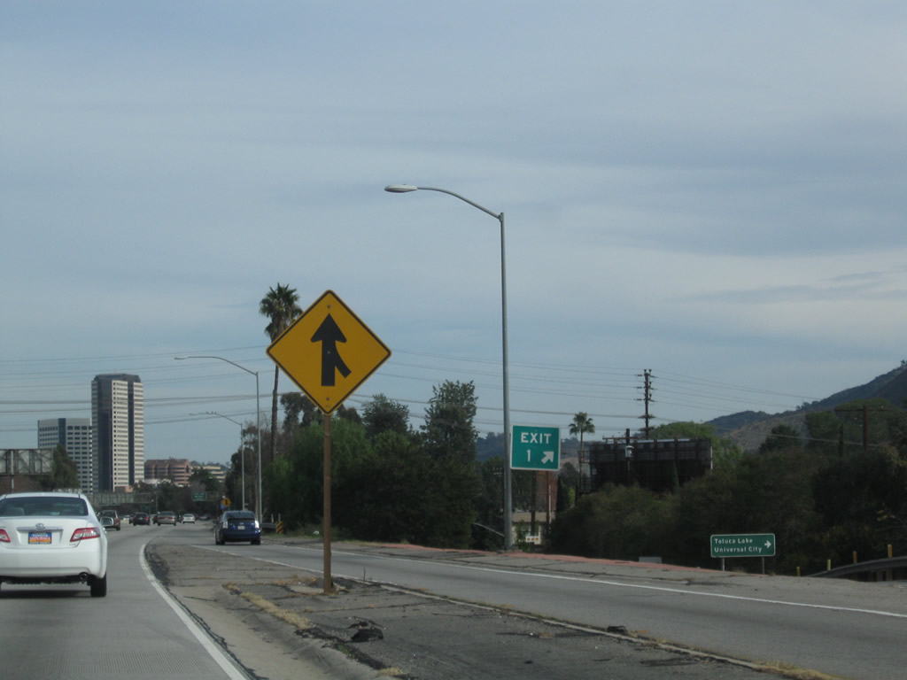
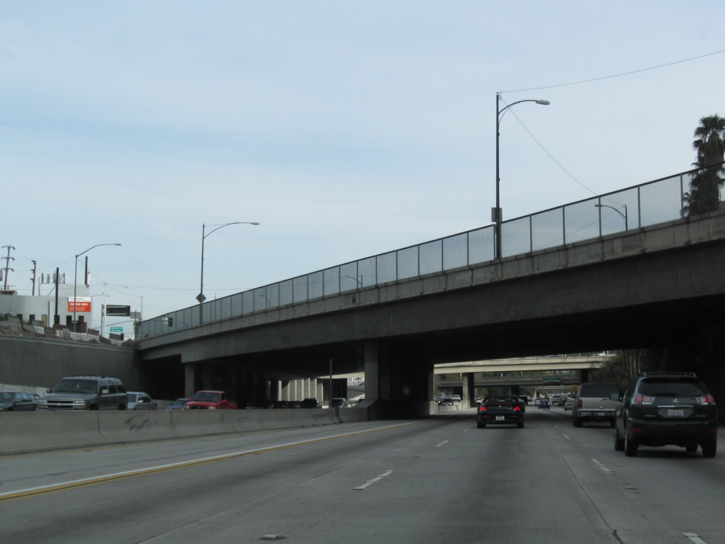
The first exit from California 134 (Ventura Freeway) east is Exit 1A, Vineland Avenue. Traffic from California 170 south merges onto California 134 on the left side of the freeway. Photo taken 12/20/09. |
|
|
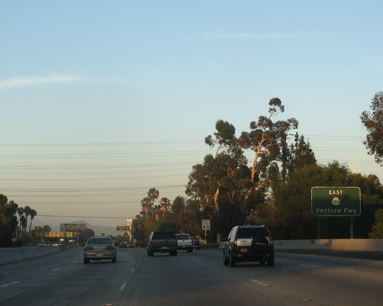
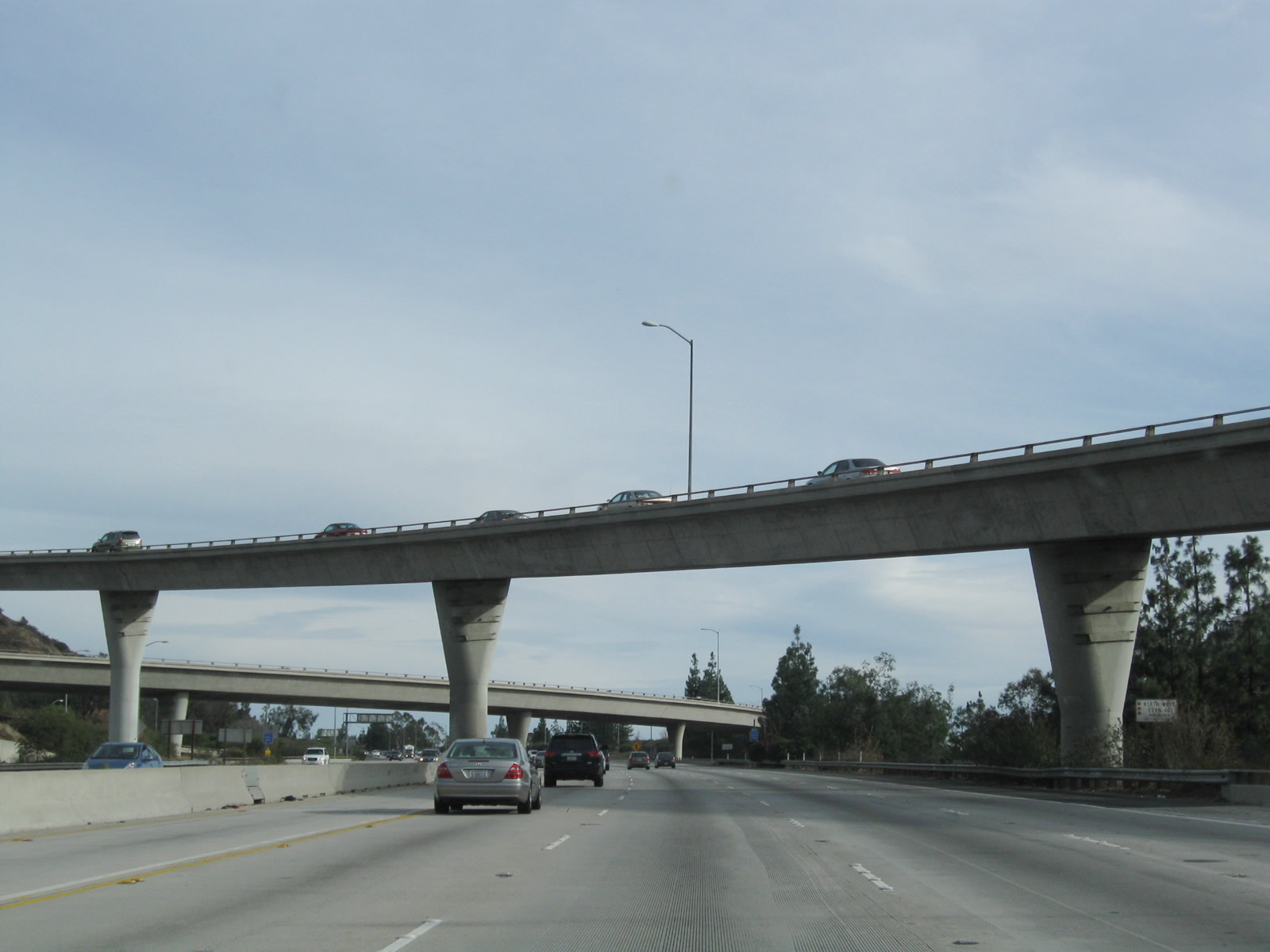
California 134 is the Ventura Freeway between U.S. 101 in the San Fernando Valley of Los Angeles and Interstate 210 in Pasadena. This freeway is at least eight lanes wide for its entire length. This sign was an older-style, button-copy sign that was located along eastbound California 134 until late 2007, when it was removed. Photos taken 07/01/07 and by Mike Ballard (1998). |
|
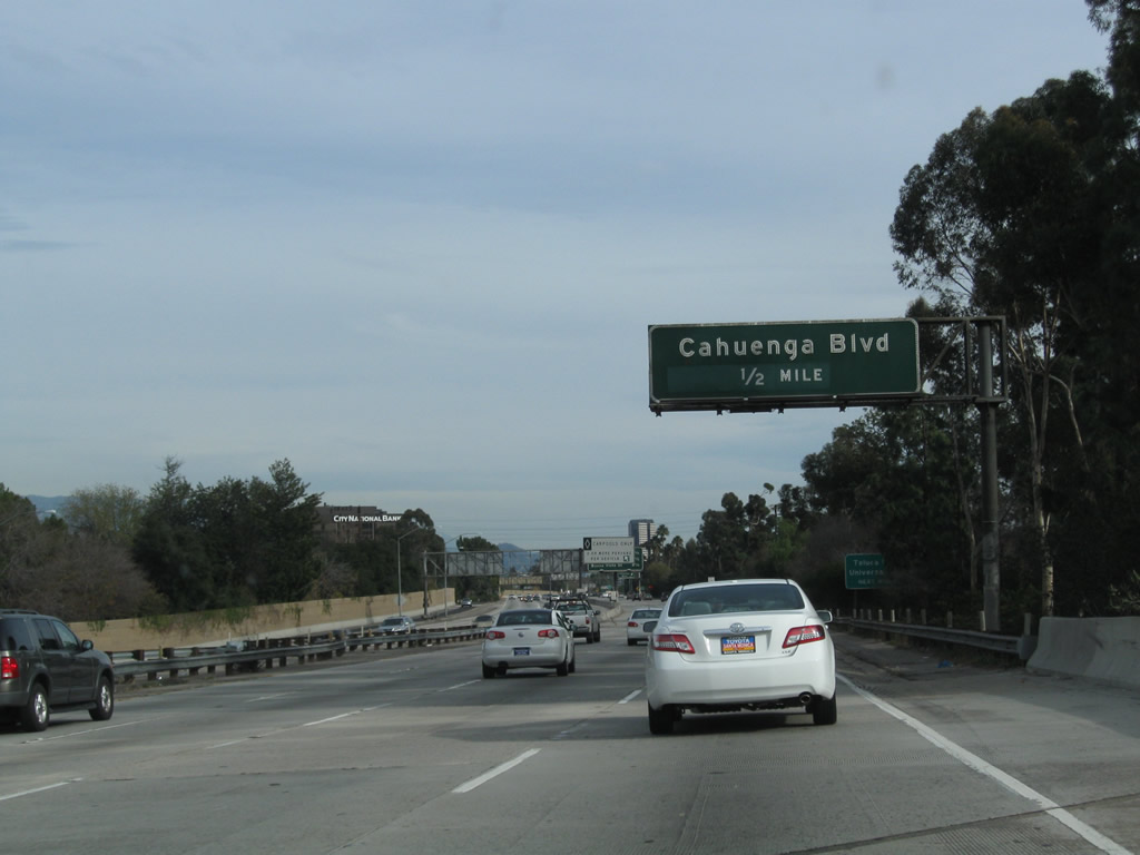
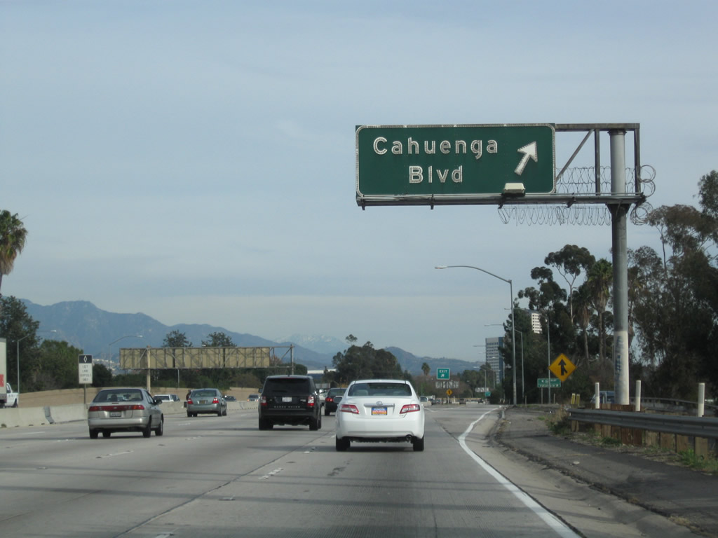
Leaving the Hollywood Split Interchange, eastbound California 134 (Ventura Freeway) next approaches Exit 1B, Cahuenga Boulevard (one-half mile). Photo taken 12/20/09. |
|
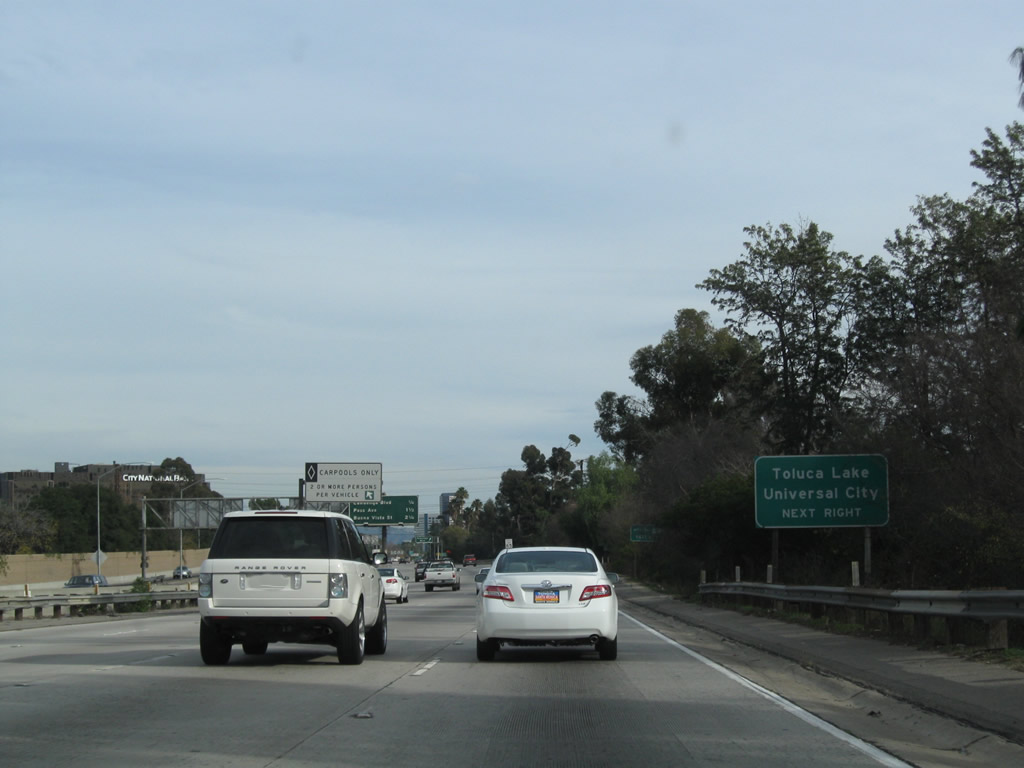
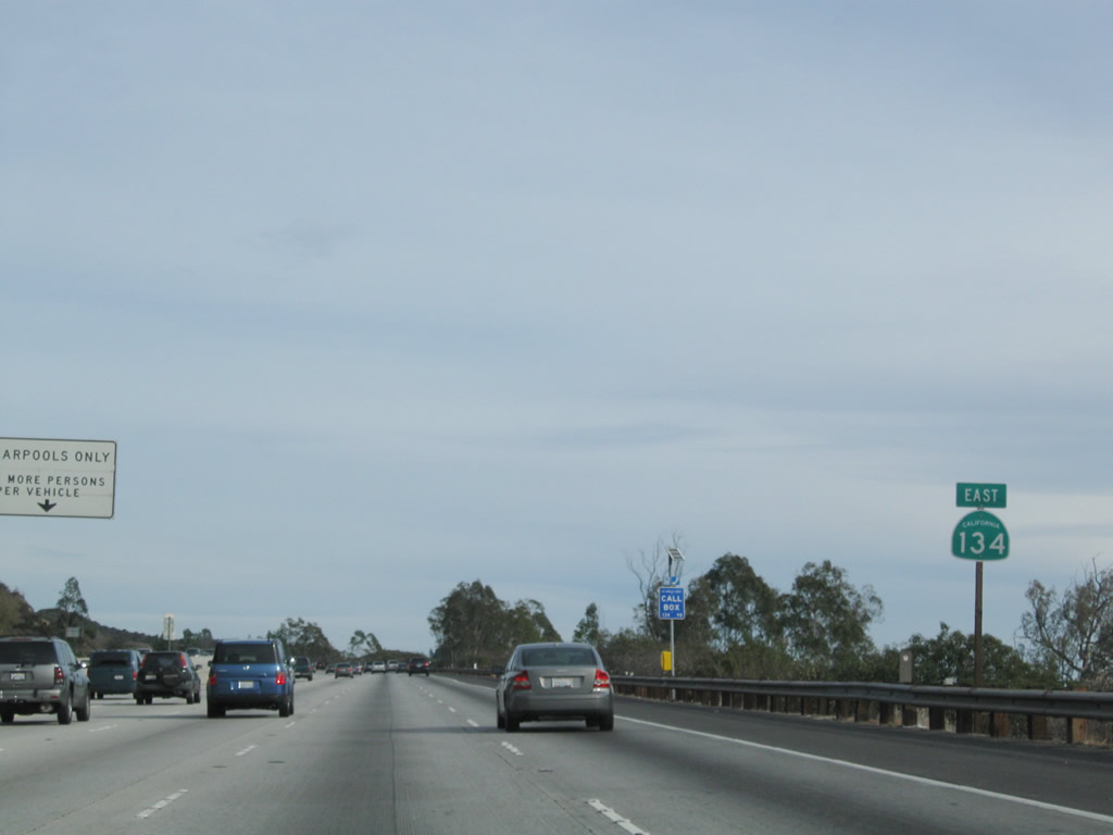
Use Exit 1B to the city of Los Angeles communities of Toluca Lake and Universal City. A carpool (high occupancy vehicle) lane begins on the left side of the freeway at this point. California 134 has the carpool lane for most of its length east to Pasadena. Photo taken 12/20/09. |
|
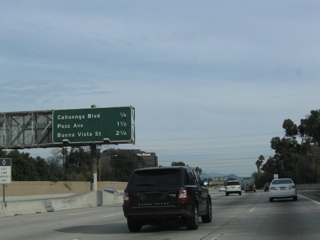
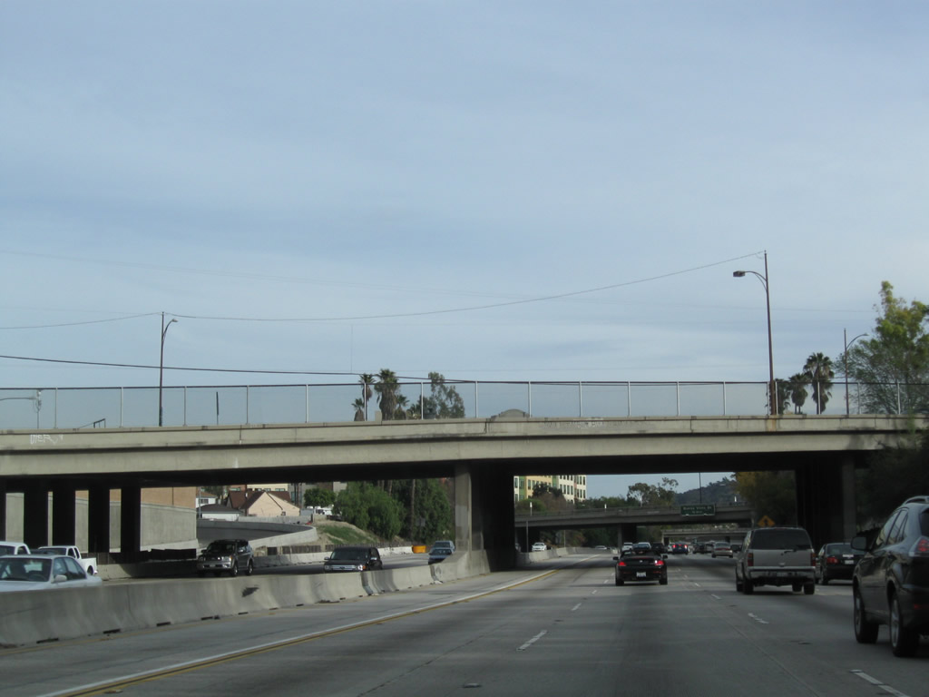
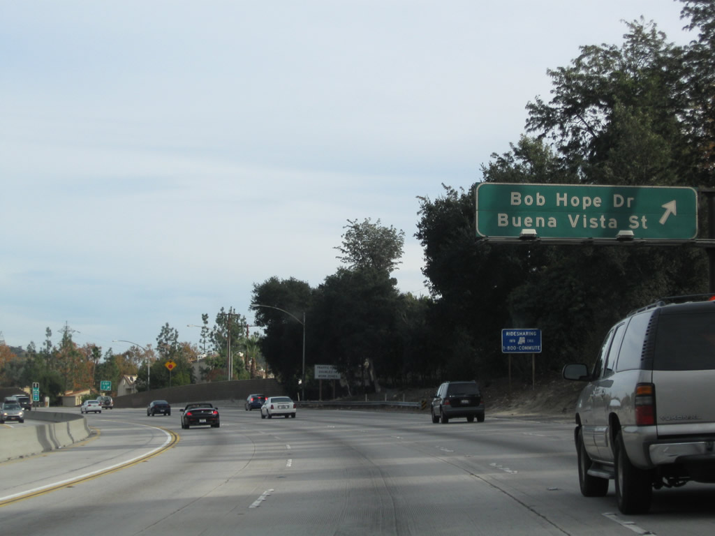
The next three exits along eastbound California 134 (Ventura Freeway) are: Exit 1B, Cahuenga Boulevard; Exit 2, Pass Avenue; and Exit 3, Buena Vista Street. Photo taken 12/20/09. |
|
Eastbound California 134 (Ventura Freeway) reaches Exit 1B, Cahuenga Boulevard. The next exit is Exit 2, Pass Avenue. Photo taken 12/20/09. |
|
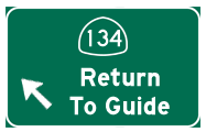
A collector distributor lane for the Cahuenga Boulevard interchange includes an off-ramp to Cahuenga Boulevard and a return to California 134 east to Glendale. Photo taken 12/20/09. |
|
Exit 1 is signed at the gore point for Cahuenga Boulevard in the collector distributor lanes. Photo taken 12/20/09. |
|
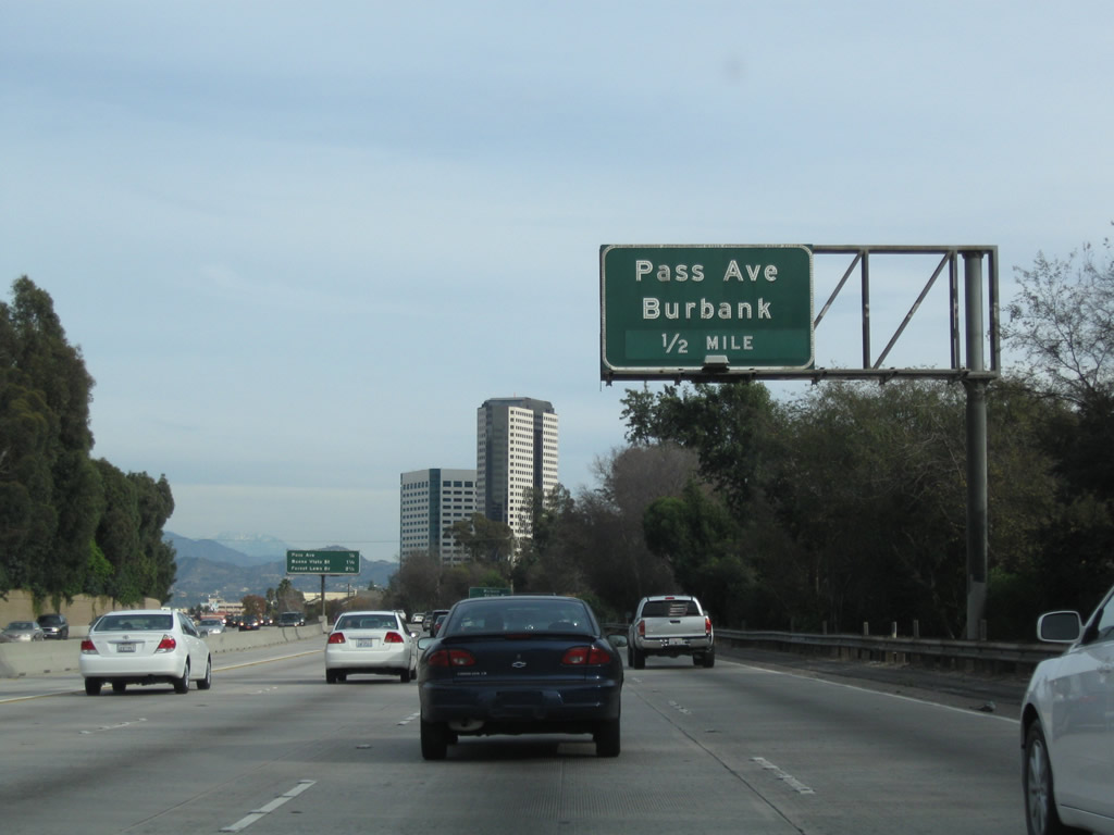
The next exit along California 134 (Ventura Freeway) east is Exit 2, Pass Avenue to Burbank (0.50 mile). Photo taken 12/20/09. |
|
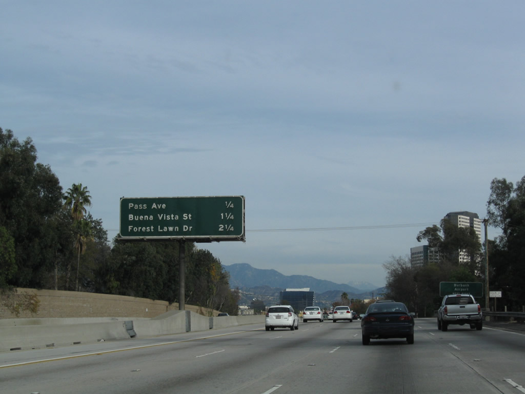
Another mileage sign provides the distance to the next three exits along California 134 (Ventura Freeway) east: Exit 2, Pass Avenue to Burbank; Exit 3, Buena Vista Street and Bob Hope Drive; and Exit 4, Forest Lawn Drive. Photo taken 12/20/09. |
|
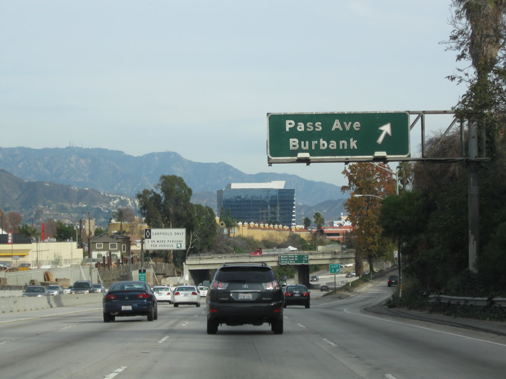
Use Exit 2, Pass Avenue to Burbank Airport. Photo taken 12/20/09. |
|
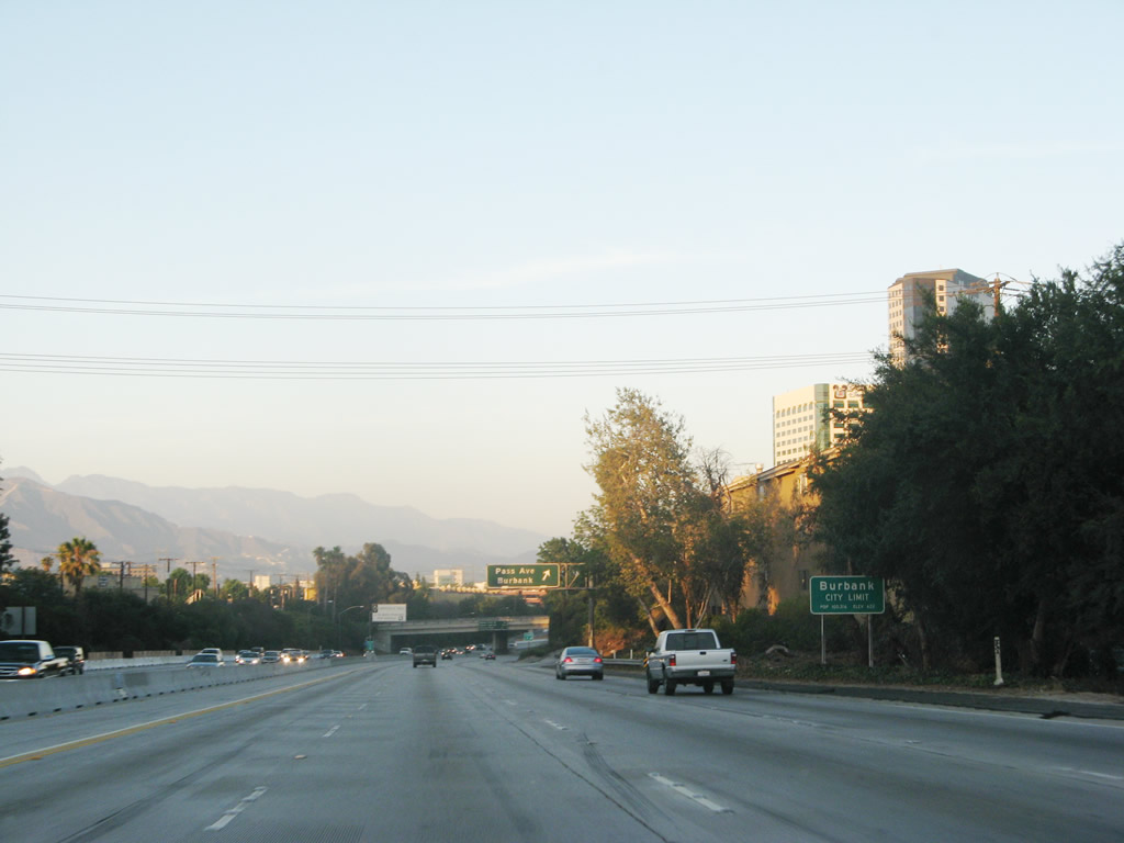
California 134 leaves the city of Los Angeles and enters the city of Burbank (population 100,316 [2000 Census], 17.4 square miles, incorporated on July 8, 1911). Photo taken 07/01/07. |
|
Eastbound California 134 (Ventura Freeway) reaches Exit 2, Pass Avenue. This interchange is located within the city of Burbank. Photo taken 12/20/09. |
|
Another mileage sign provides the distance to the next three exits along California 134 (Ventura Freeway) east: Exit 3, Buena Vista Street and Bob Hope Drive; Exit 4, Forest Lawn Drive; and Exit 5A, Victory Boulevard to Interstate 5 (Golden State Freeway) north. Photo taken 12/20/09. |
|
Through the southwestern corner of Burbank, California 134 drops below grade. Photo taken 12/20/09. |
|
At the time this photo was taken, some construction was underway on roads approaching the crossing over California 134. Photo taken 12/20/09. |
|
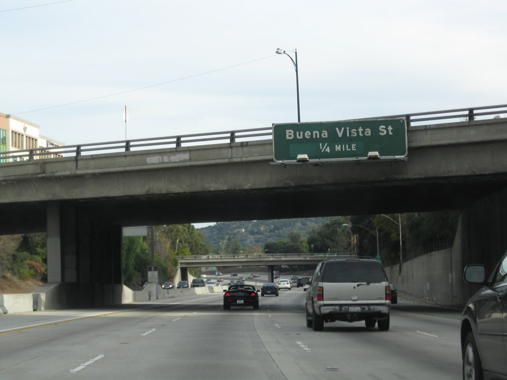
The next exit along California 134 east is Exit 3, Buena Vista Street and Bob Hope Drive (0.25 mile). Photo taken 12/20/09. |
|
This California 134 east reassurance shield is posted shortly thereafter. Photo taken 07/01/07. |
|
Eastbound California 134 (Ventura Freeway) reaches Exit 3, Buena Vista Street and Bob Hope Drive. Photo taken 12/20/09. |
|
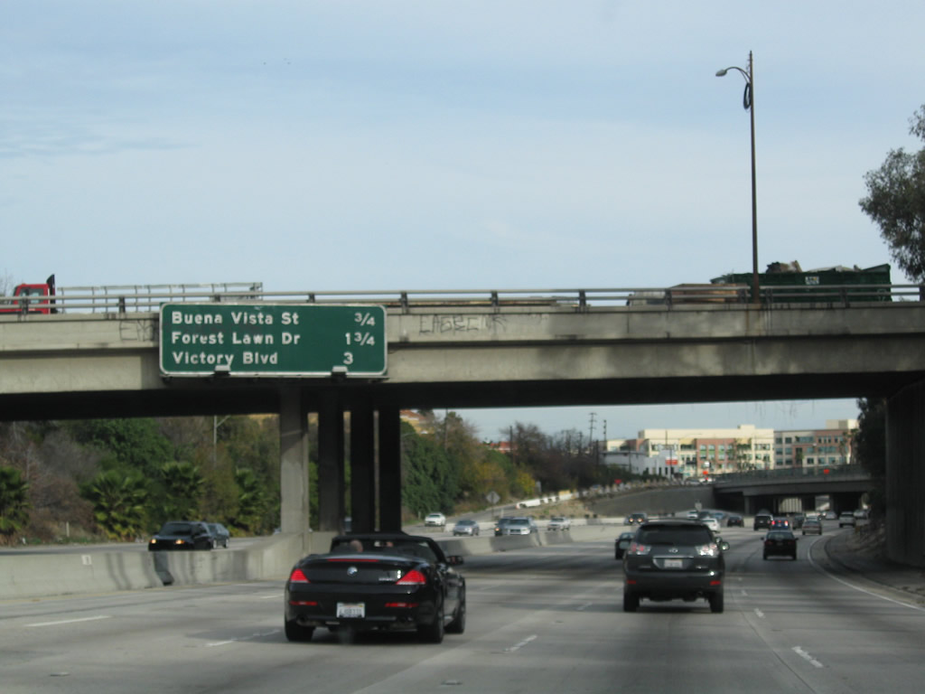
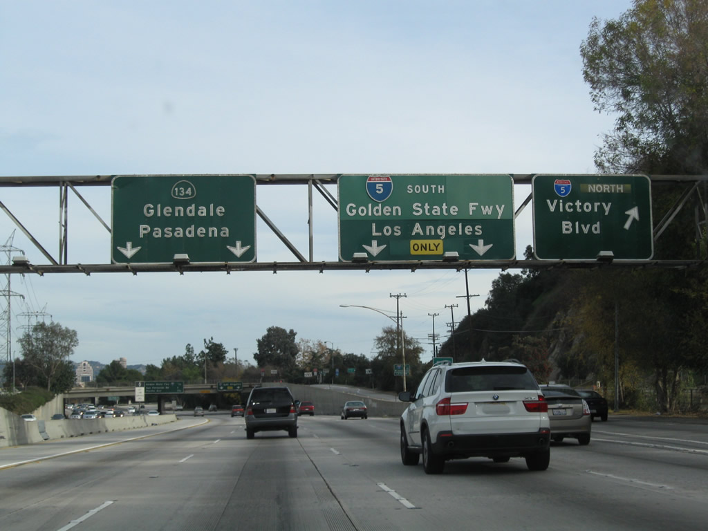
A centerline sign for the HOV lane advises motorists bound for any of the next three exits to depart the HOV lane and use the main lanes for those exits: Exit 4, Forest Lawn Drive; Exit 5A, Victory Boulevard to Interstate 5 (Golden State Freeway) north; and Exit 5B, Interstate 5 (Golden State Freeway) south to downtown Los Angeles. Photo taken 12/20/09. |
|
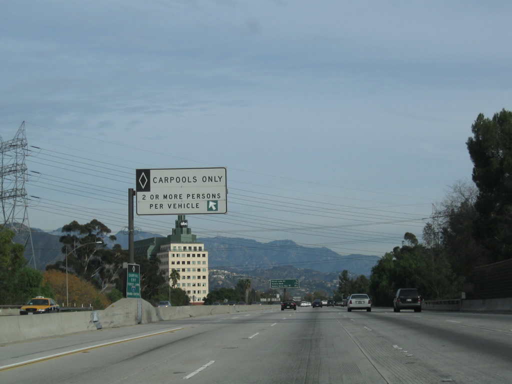
A carpool (HOV) lane entrance sign is posted shortly thereafter. Photo taken 12/20/09. |
|
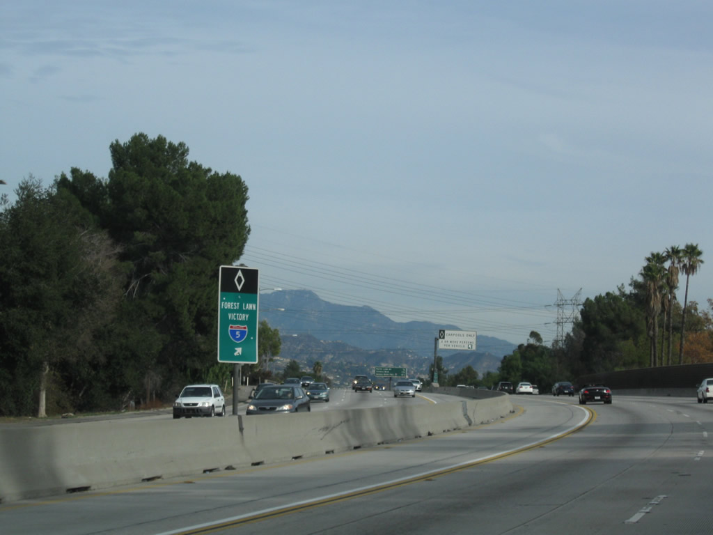
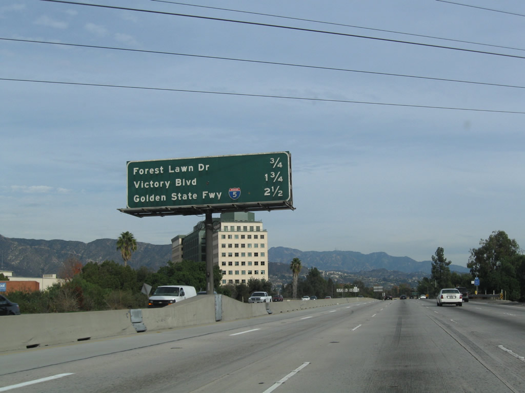
This mileage sign provides the distance to the next three exits from California 134 east: Exit 4, Forest Lawn Drive; Exit 5A, Victory Boulevard to Interstate 5 (Golden State Freeway) north; and Exit 5B, Interstate 5 (Golden State Freeway) south to downtown Los Angeles. Photo taken 12/20/09. |
|
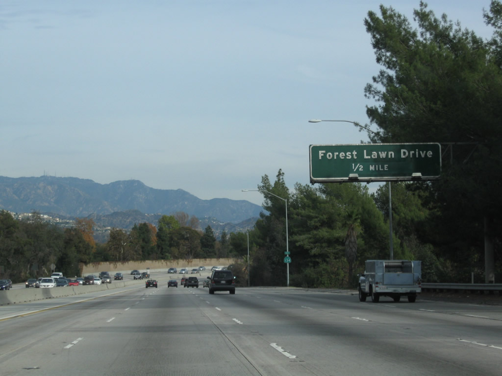
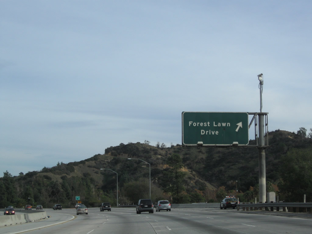
The next exit along California 134 (Ventura Freeway) east is Exit 4, Forest Lawn Drive to Griffith Park. Photo taken 12/20/09. |
|
A California 134 east reassurance shield is posted shortly after the on-ramp from Buena Vista Street. Photo taken 12/20/09. |
|
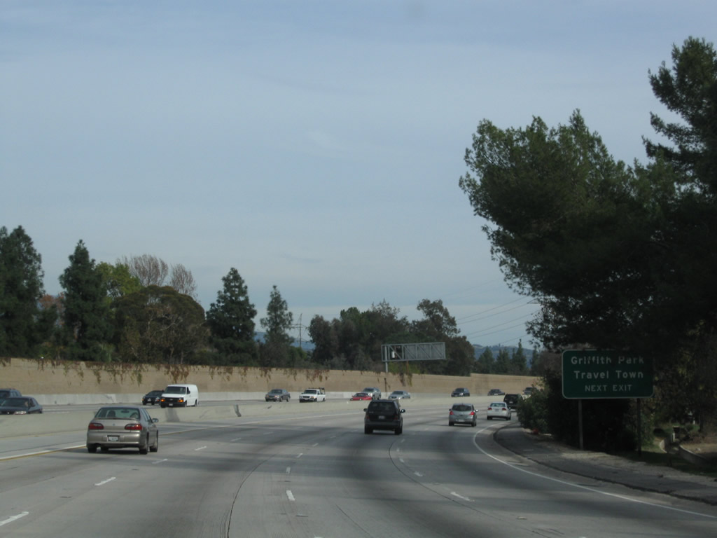
Use Forest Lawn Drive to Griffith Park and Travel Town. Photo taken 12/20/09. |
|
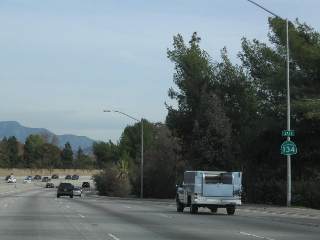
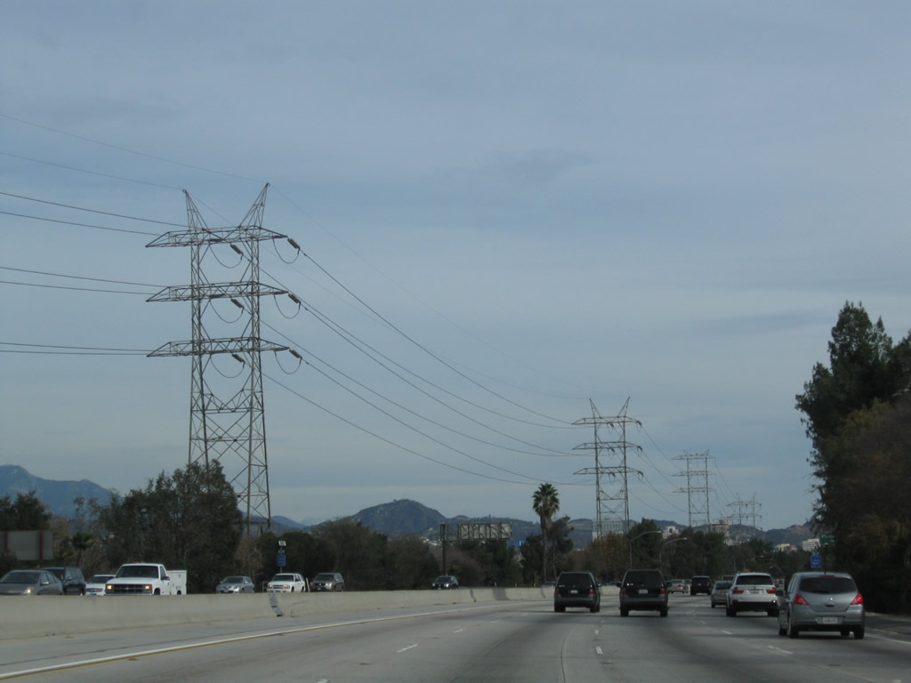
California 134 crosses over the Los Angeles River and passes under a set of tall Los Angeles Department of Water and Power tranmission lines. The river will parallel California 134 until the Interstate 5 interchange, then turn south toward downtown. Photo taken 12/20/09. |
|
Eastbound California 134 (Ventura Freeway) reaches Exit 4, Forest Lawn Drive to Griffith Park in the city of Los Angeles. Photo taken 12/20/09. |
|
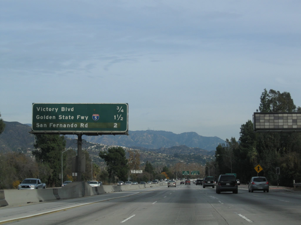
This mileage sign provides the distance to the next three exits from California 134 east: Exit 5A, Victory Boulevard to Interstate 5 (Golden State Freeway) north; Exit 5B, Interstate 5 (Golden State Freeway) south to downtown Los Angeles; and Exit 6, Historic U.S. 99/San Fernando Road. Photo taken 12/20/09. |
|
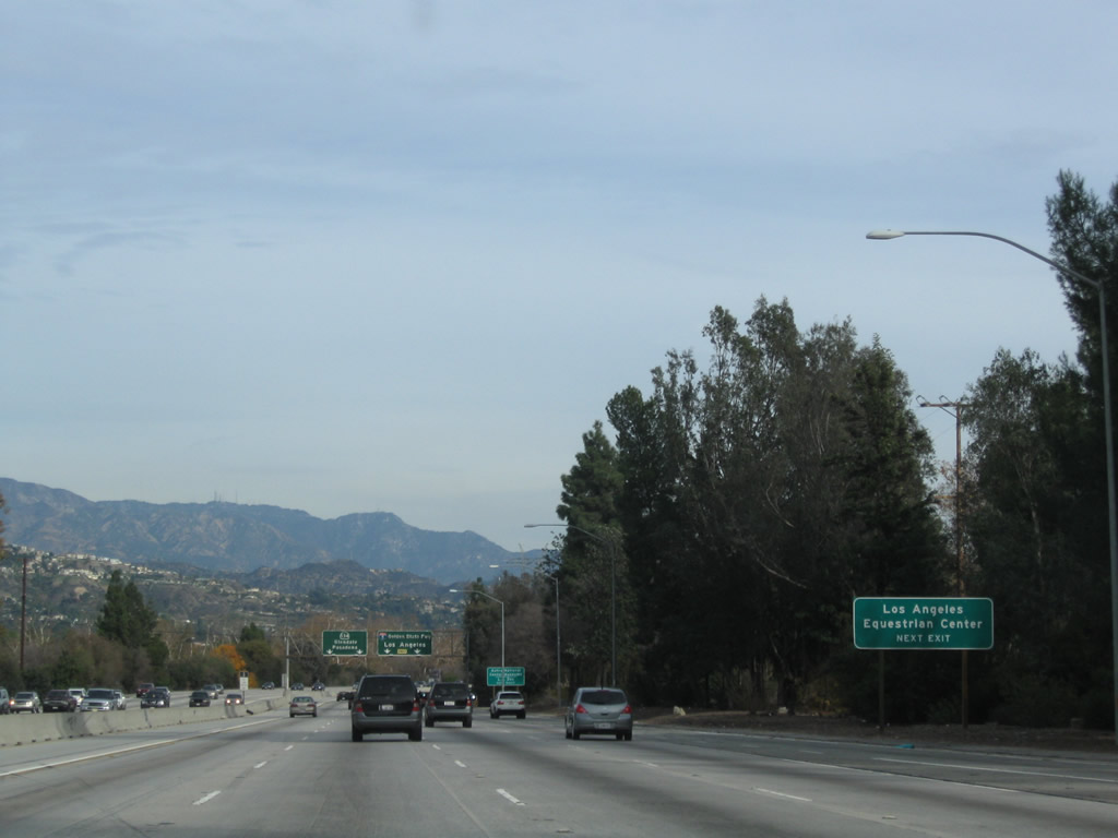
Use Exit 5A, Victory Boulevard to the Los Angeles Equestrian Center. Photo taken 12/20/09. |
|
Exit 5A also serves the Autry National Center Museums and Los Angeles Zoo. Photo taken 12/20/09. |
|
A lane allocation sign along California 134 east indicates that through traffic should merge left, while exiting traffic to either Exit 5A, Victory Boulevard to Interstate 5 (Golden State Freeway) north or Exit 5B, Interstate 5 (Golden State Freeway) south to downtown Los Angeles should merge right. Photo taken 12/20/09. |
|
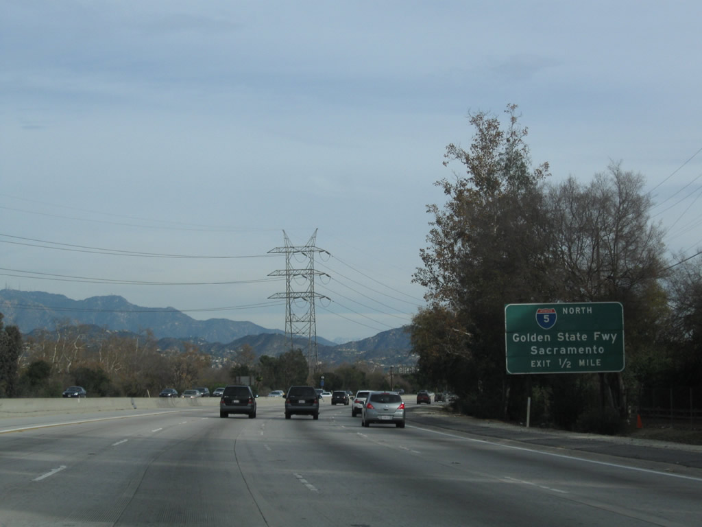
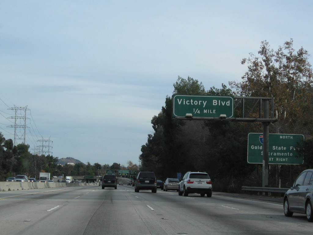
The most direct connection from California 134 east to Interstate 5 (Golden State Freeway) north is via Victory Boulevard (Exit 5A). Photo taken 12/20/09. |
|
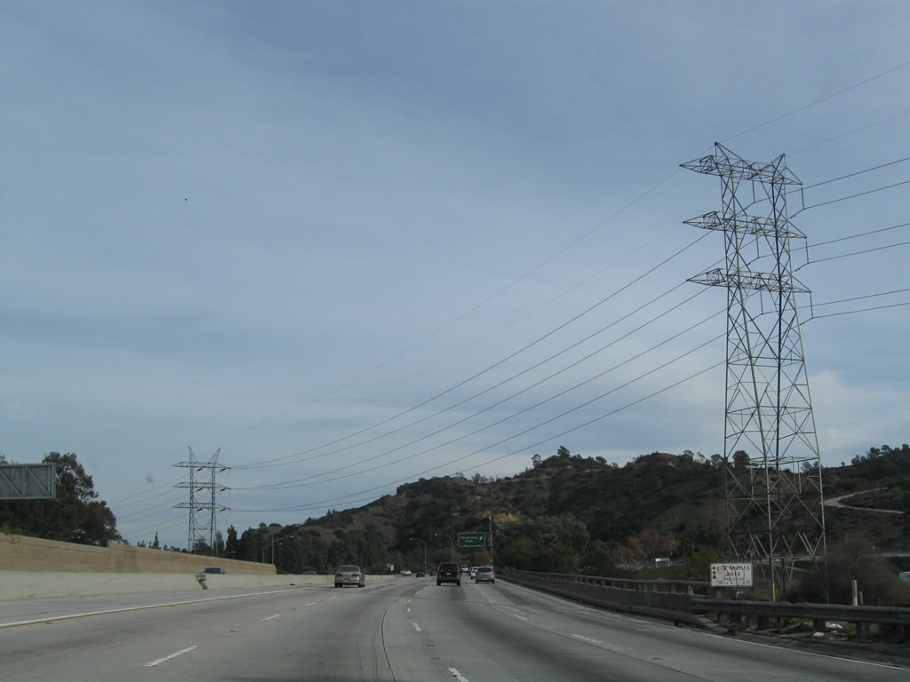
As California 134 parallels the Los Angeles River, the LA DWP power lines also parallel the freeway. California 134 reenters the city of Los Angeles as it nears Griffith Park, which is a huge open space park located just north of downtown Los Angeles west and south of the Los Angeles River. The park includes the Autry National Center, Greek Theater, Griffith Merry-Go-Round, Griffith Observatory, Griffith Park Southern Railroad, L.A. Equestrian Center, L.A. Live Steamers, L.A. Zoo, and Travel Town. Photo taken 12/20/09. |
|
Eastbound California 134 approaches Exit 5A, Victory Boulevard to Interstate 5 (Golden State Freeway) north (note the difficult to read positioning of these two signs). Photo taken 12/20/09. |
|
Soon thereafter, eastbound California 134 (Ventura Freeway) meets Exit 5A, Victory Boulevard to Interstate 5 (Golden State Freeway) north. The next exit is Exit 5B, Interstate 5 (Golden State Freeway) south to downtown Los Angeles. Photo taken 12/20/09. |
|
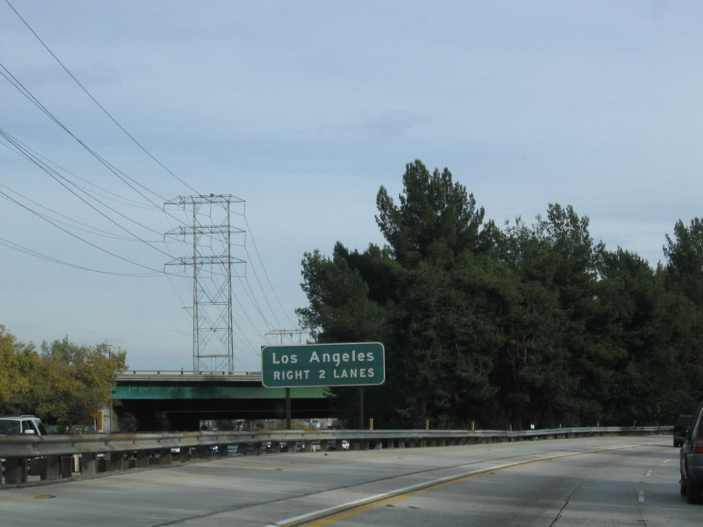
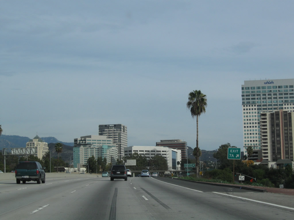
The right two lanes of California 134 east become exit only for Exit 5B, Interstate 5 (Golden State Freeway) south to downtown Los Angeles. The following two exits are Exit 6, Historic U.S. 99/San Fernando Road and Exit 7A, Pacific Avenue. Photo taken 12/20/09. |
|
The carriageways for California 134 east and west split at the interchange with Interstate 5. This view shows the westbound lanes of California 134 as the eastbound lanes veer right (southeast) to briefly parallel Interstate 5. This interchange is named in honor of Gene Autry. Photo taken 12/20/09. |
|
The southbound lanes of Interstate 5 (Golden State Freeway) briefly parallel the eastbound lanes of California 134 (Ventura Freeway). Photo taken 12/20/09. |
|
Eastbound California 134 (Ventura Freeway) reaches Exit 5B, Interstate 5 (Golden State Freeway) south to downtown Los Angeles. After this ramp, California 134 east passes under the main lanes of Interstate 5. Photo taken 12/20/09. |
|
|
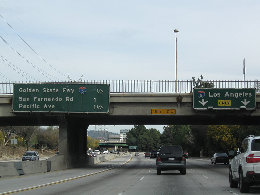
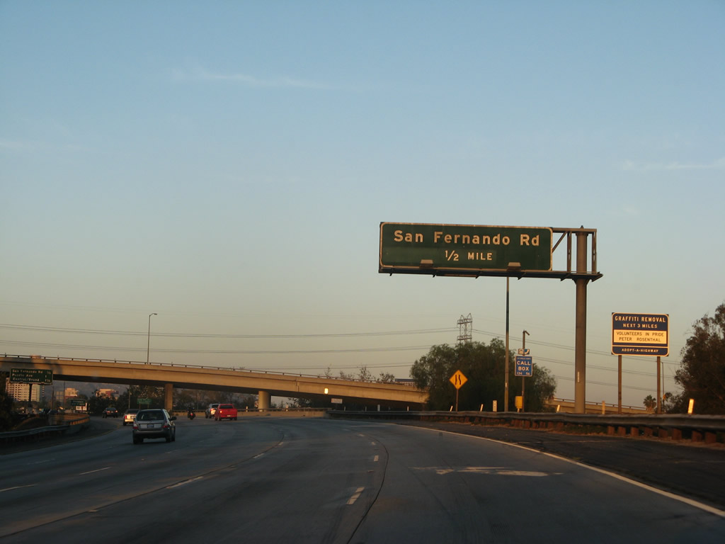
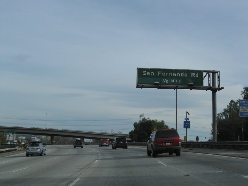
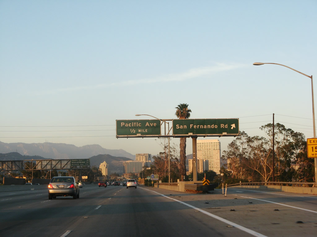
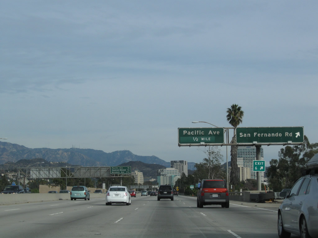
The next exit from California 134 (Ventura Freeway) east is Exit 6, Historic U.S. 99/San Fernando Road. Briefly during the 1970s and 1980s, San Fernando Road was signed as Business Loop I-5. While Rand McNally showed the business route on its Los Angeles city maps within its annual road atlas through the 1980s and 1990s, there were no signs observed for Business Loop I-5 on San Fernando Road when driven in 1991. Within the city of Los Angeles, some signs for Historic U.S. 99 are posted on San Fernando Road. Photos taken 07/01/07 and 12/20/09. |
|
Downtown Glendale comes into view along California 134 (Ventura Freeway) east prior to the San Fernando Road interchange. Soon after the Interstate 5 interchange, California 134 will leave Los Angeles and enter Glendale. Photo taken 12/20/09. |
|
|
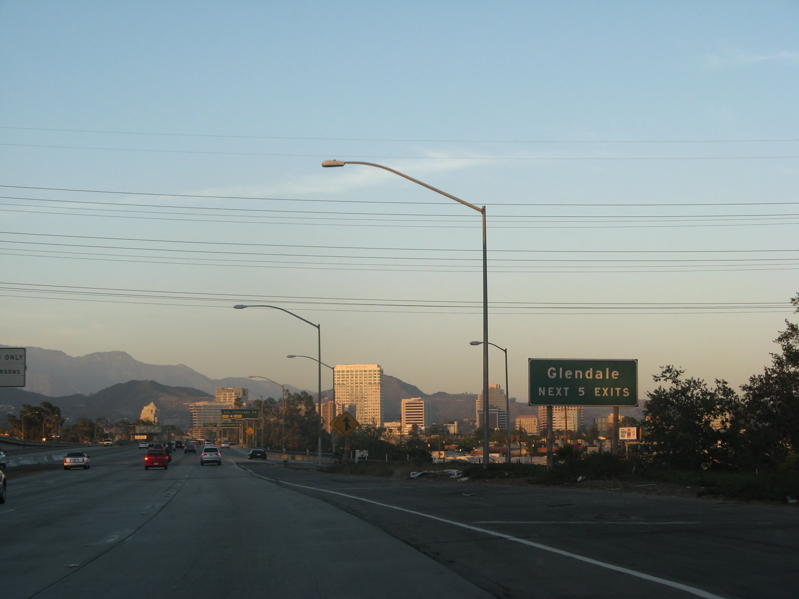
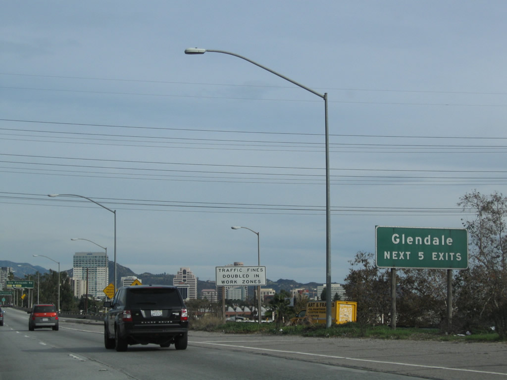
The next five exits from California 134 (Ventura Freeway) east serve the city of Glendale: Exit 6, Historic U.S. 99/San Fernando Road; Exit 7A, Pacific Avenue; Exit 7B, Central Boulevard; Exit 8, Glendale Avenue; and Exit 9A, California 2 (Glendale Freeway). Photos taken 07/01/07 and 12/20/09. |
|
The right lane of California 134 (Ventura Freeway) east becomes exit only for Exit 6, Historic U.S. 99/San Fernando Road (former Business Loop I-5). Photo taken 12/20/09. |
|
|
Eastbound California 134 (Ventura Freeway) reaches Exit 6, Historic U.S. 99/San Fernando Road. The next off-ramp along eastbound is for Exit 7A, Pacific Avenue in Glendale. Photos taken 07/01/07 and 12/20/09. |
|
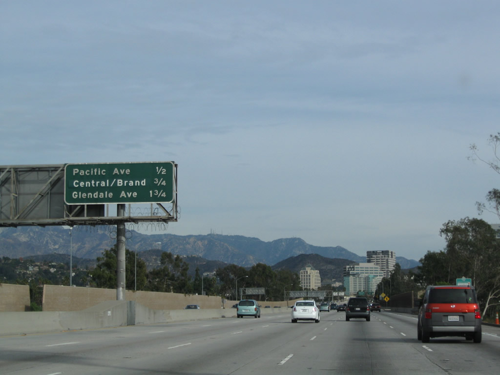
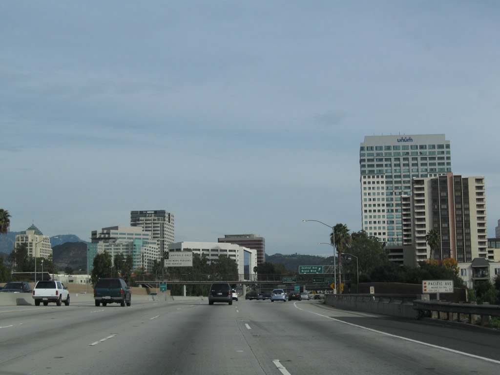
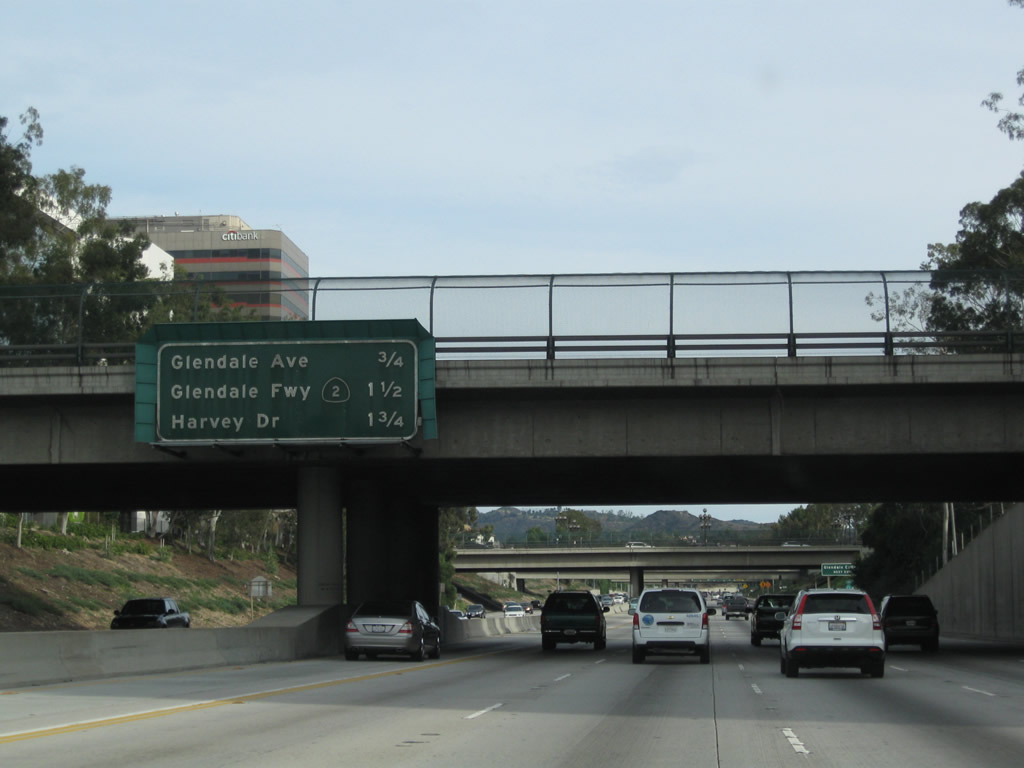
The next three exits along California 134 (Ventura Freeway) east are Exit 7A, Pacific Avenue; Exit 7B, Central Boulevard and Brand Boulevard; and Exit 8, Glendale Avenue. Photo taken 12/20/09. |
|
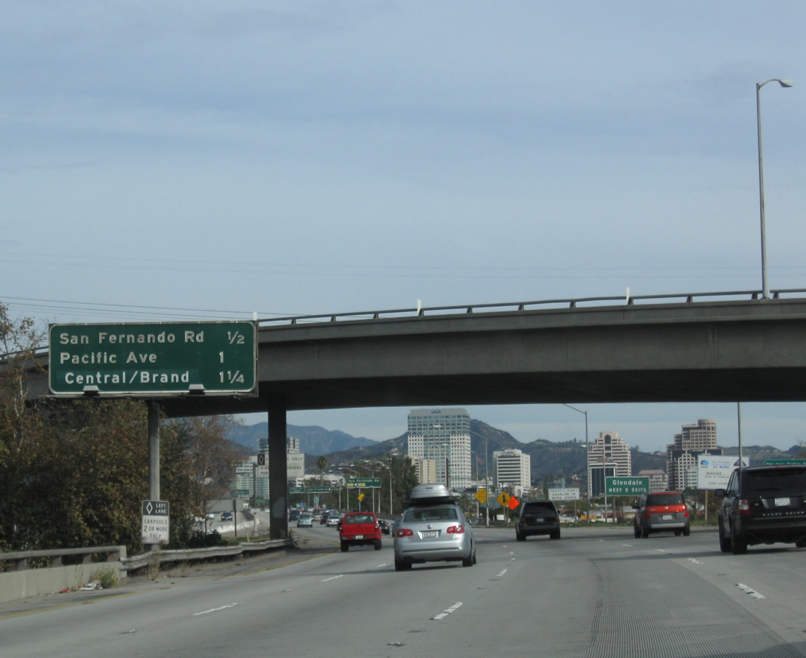
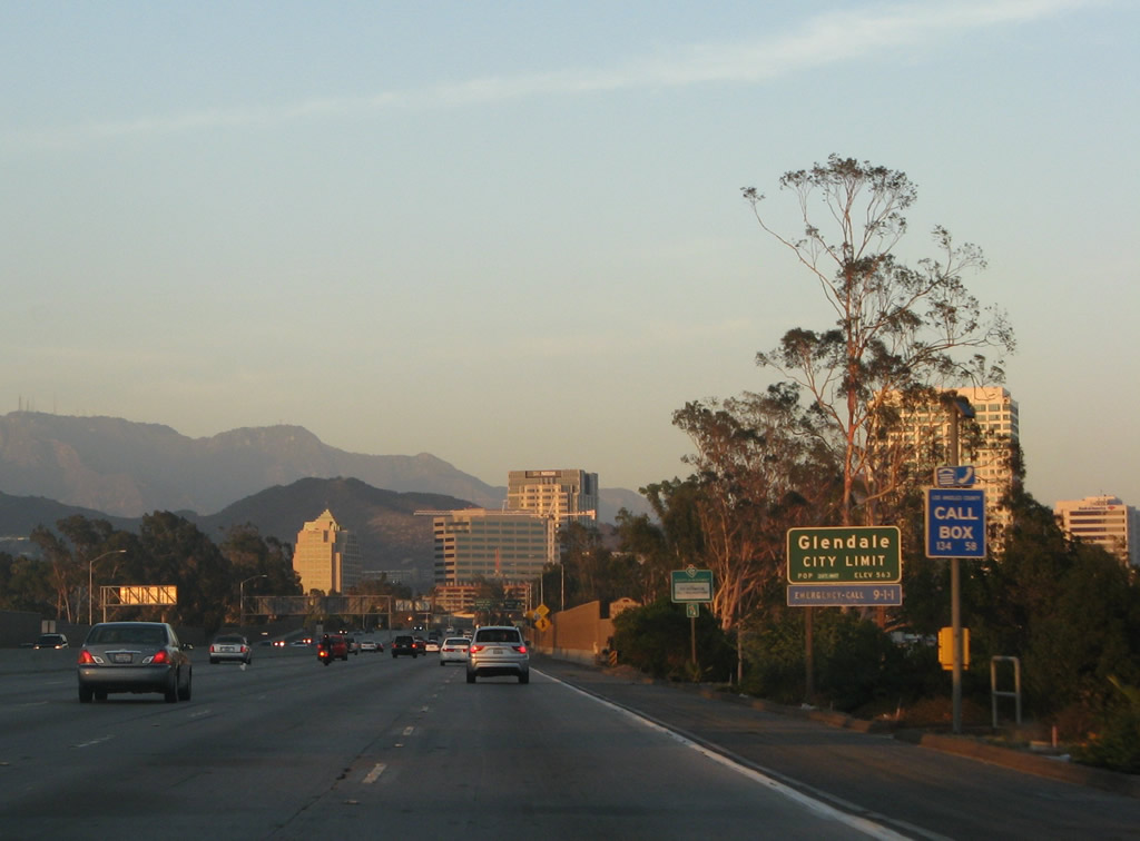
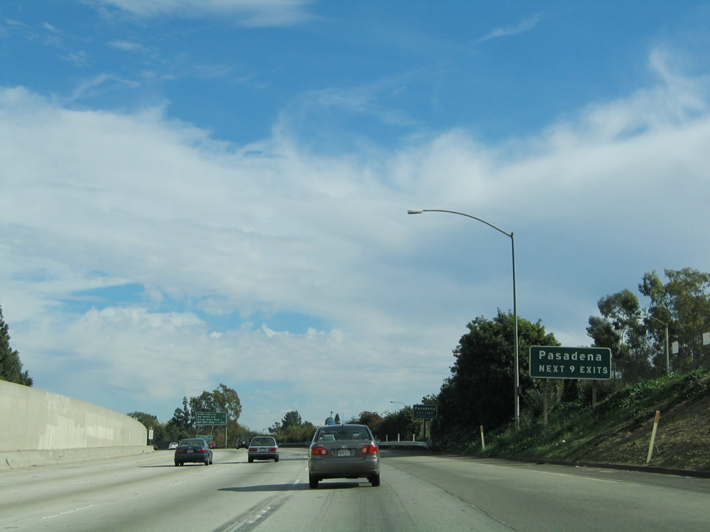
California 134 enters the city of Glendale. Situated at the southeastern end of the San Fernando Valley, Glendale ("The Jewel City") had a population of 194,973 as of the 2000 Census, consists of 30.7 square miles, and was incorporated on February 15, 1906. California 134 was built in 1967 and 1968 through the city of Glendale. Photo taken 07/01/07. |
|
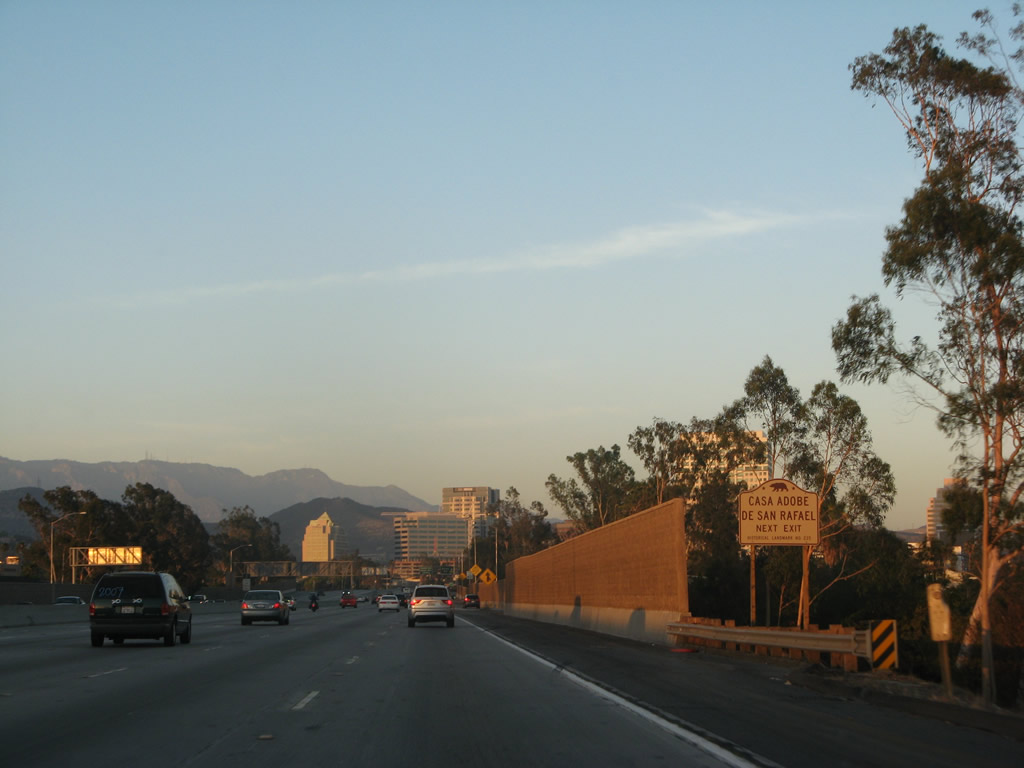
Use Exit 7A to the Casa Adobe de San Rafael. Purportedly built in 1865, the adobe was constructed by Tomas Sanchez and has a New England style of architecture. It is on parkland owned and operated by the city of Glendale. Photo taken 07/01/07. |
|
A new auxiliary right lane comes onto the freeway; it becomes the exit only lane for Exit 7A. Photo taken 07/01/07. |
|
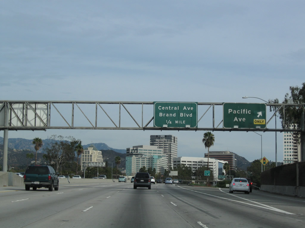
Eastbound California 134 (Ventura Freeway) meets Exit 7A, Pacific Avenue. The next exit is Exit 7B, Central Boulevard and Brand Boulevard. Photo taken 12/20/09. |
|
The gore point is the only acknowledgement of the exit number of Exit 7A for Pacific Avenue as of late 2009. This will change as the guide signs are gradually replaced across Los Angeles with newer, reflective signs. Photo taken 12/20/09. |
|
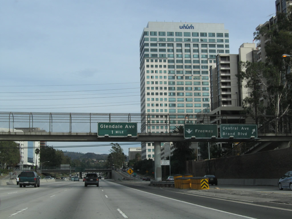
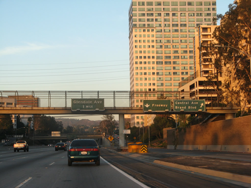
California 134 (Ventura Freeway) crosses over Pacific Avenue as downtown Glendale comes into view. The next exit is Exit 7B, Central Boulevard and Brand Boulevard. Photo taken 12/20/09. |
|
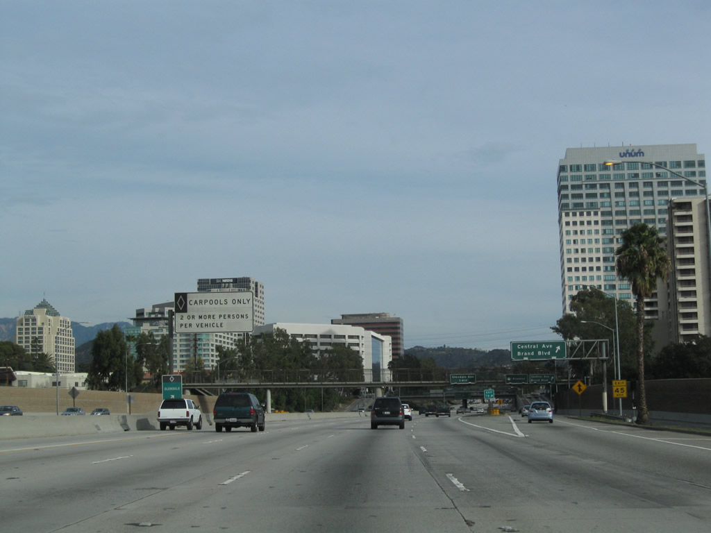
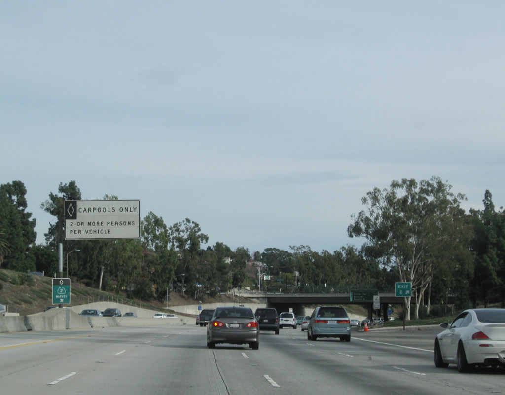
A high occupancy vehicle lane serves through traffic on eastbound California 134 through downtown Glendale. An entrance to the HOV lane (carpool lane) is located prior to the exit to Central Boulevard and Brand Boulevard. Photo taken 12/20/09. |
|
|
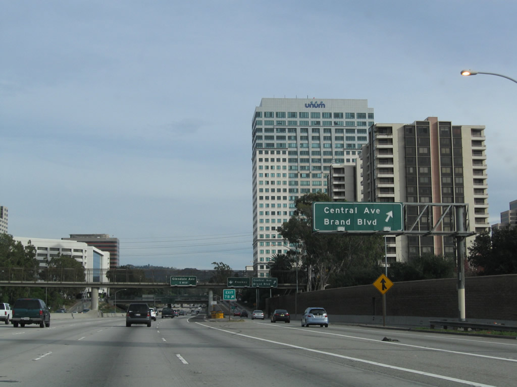
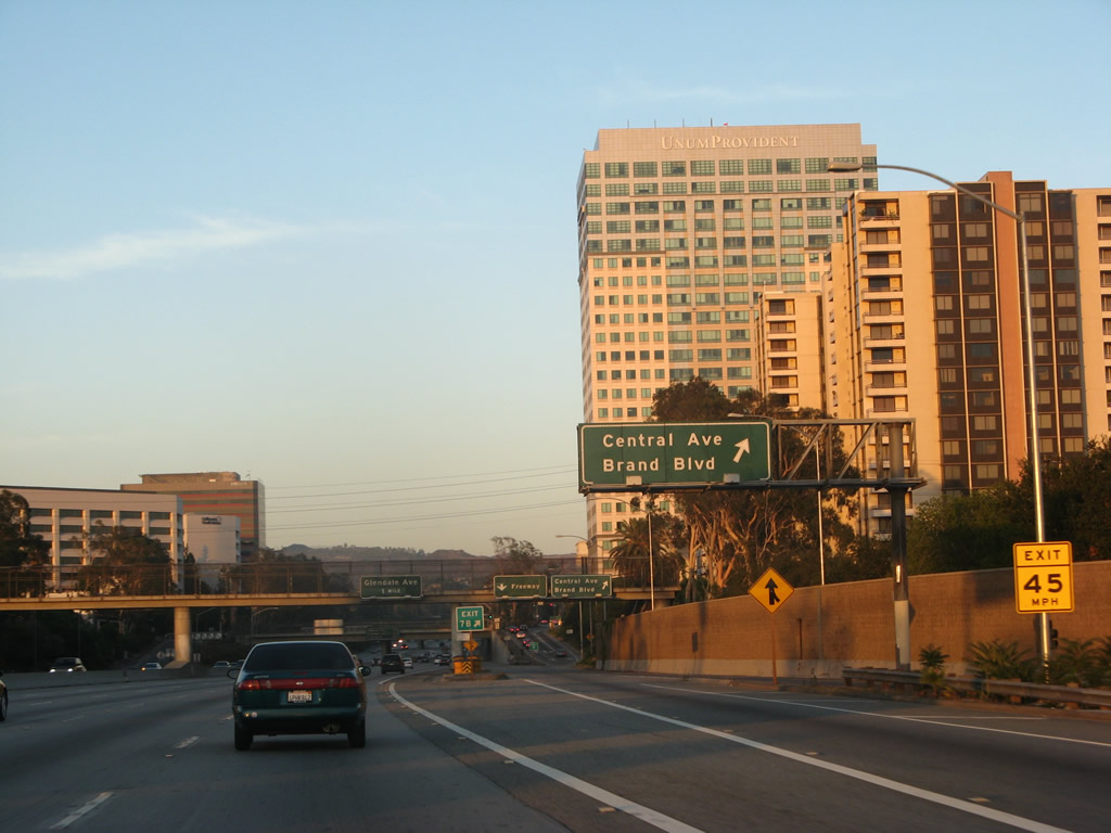
Eastbound California 134 (Ventura Freeway) meets Exit 7B, Central Boulevard and Brand Boulevard. This exit becomes a collector distributor lane that serves the connection to Central Boulevard and Brand Boulevard as well as accept new traffic onto eastbound. Photos taken 12/20/09 and 07/01/07. |
|
|
The ramp to Central Boulevard and Brand Boulevard from the c/d lanes is visible from the main lanes. A connecting ramp brings traffic from Pacific Avenue onto the eastbound freeway. Photos taken 12/20/09 and 07/01/07. |
|
This view looks at the off-ramp from the c/d lane to Central Boulevard and Brand Boulevard as seen from the main lanes of eastbound California 134. Photo taken 12/20/09. |
|
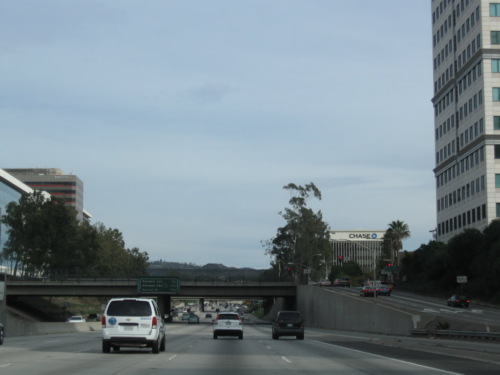
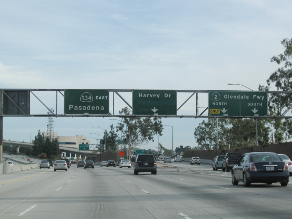
The next three exits along California 134 (Ventura Freeway) east are Exit 8, Glendale Avenue; Exit 9A, California 2 (Glendale Freeway) north to La Canada-Flintridge and south to Los Angeles (Echo Park); and Exit 9B, Harvey Drive. Photo taken 12/20/09. |
|
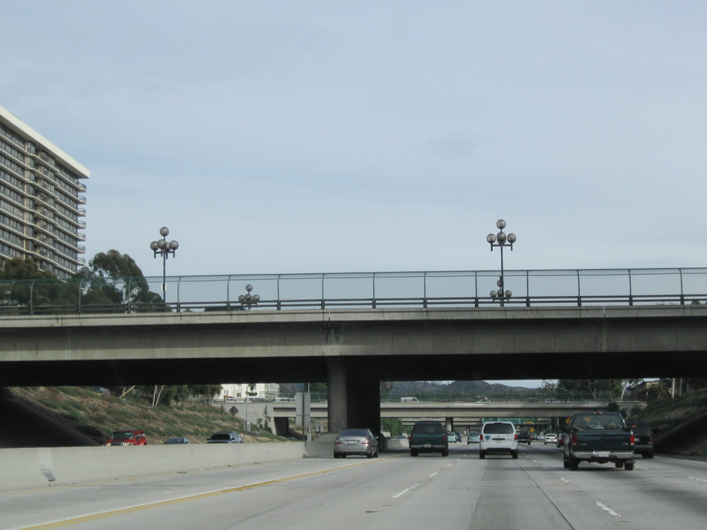
A series of streets pass over the Ventura Freeway as we pass through downtown Glendale. Photo taken 12/20/09. |
|
The right lane of California 134 (Ventura Freeway) east becomes exit only for Exit 8, Glendale Avenue. The second off-ramp serves Exit 9A, California 2 (Glendale Freeway) north to La Canada-Flintridge and south to Los Angeles (Echo Park). Photo taken 12/20/09. |
|
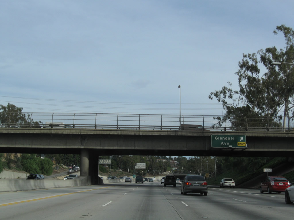
Eastbound California 134 (Ventura Freeway) reaches Exit 8, Glendale Avenue. The next exit along eastbound is Exit 9A, California 2 (Glendale Freeway) north to La Canada-Flintridge and south to Los Angeles (Echo Park). This massive stack interchange (between California 134 and California 2) comes into view shortly. Photo taken 12/20/09. |
|
A carpool lane entrance is located near the gore point for Exit 8, Glendale Avenue. Photo taken 12/20/09. |
|
The next three exits along California 134 (Ventura Freeway) east are Exit 9A, California 2 (Glendale Freeway) north to La Canada-Flintridge and south to Los Angeles (Echo Park); Exit 9B, Harvey Drive; and Exit 11, Figueroa Street south to U.S. 66. Photo taken 12/20/09. |
|
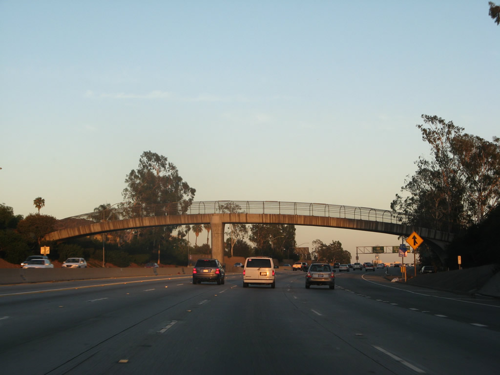
An arched pedestrian bridge crosses the freeway after the Glendale Avenue interchange. Photo taken 07/01/07. |
|
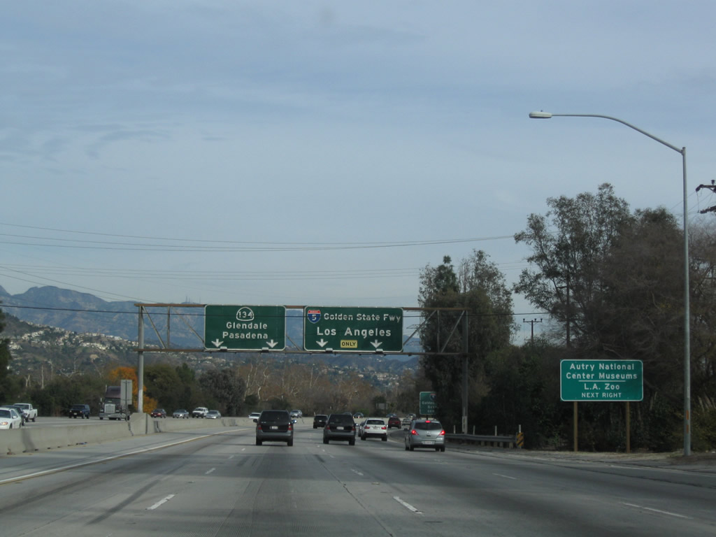
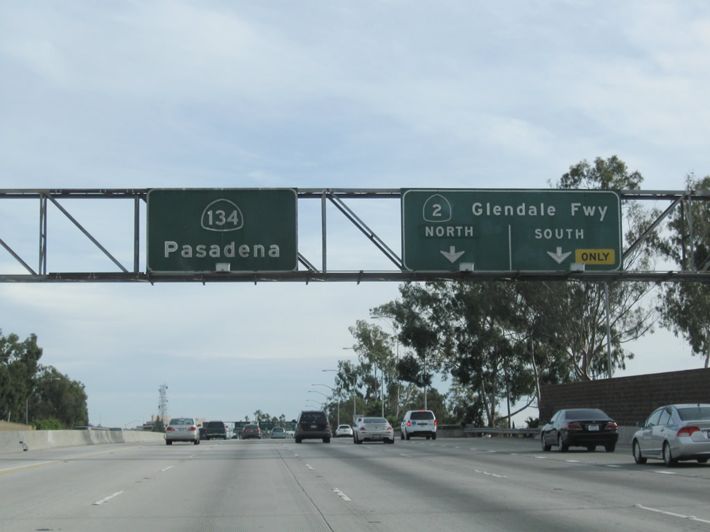
The right two lanes connect to California 2 (Glendale Freeway), while the left five lanes continue east on California 134 (Ventura Freeway) to Pasadena. California 2 travels as a freeway north to meet Interstate 210 in La Canada-Flintridge, then follows the Angeles Crest Highway northeast into national forest lands in the San Gabriel Mountains. To the south, California 2 travels a freeway to meet Interstate 5 in Los Angeles near the community of Echo Park, then becomes a city street to pass through Echo Park to meet with U.S. 101 (Hollywood Freeway) northwest of downtown Los Angeles. California 2 transfers onto Santa Monica Boulevard (Historic U.S. 66) for the rest of the route to West Hollywood, Beverly Hills, West Los Angeles, and ultimately Santa Monica. Photo taken 12/20/09. |
|
Eastbound California 134 (Ventura Freeway) meets Exit 9A, California 2 (Glendale Freeway) north to La Canada-Flintridge and south to Los Angeles (Echo Park). The next off-ramp serves Exit 9B, Harvey Drive. Photo taken 12/20/09. |
|
|
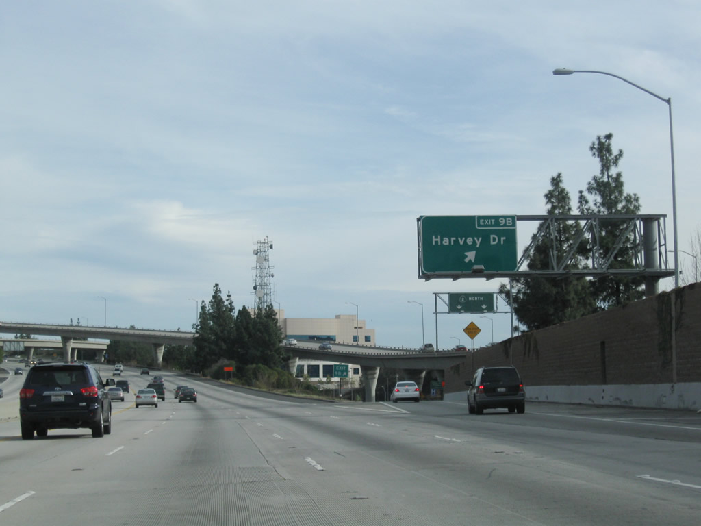
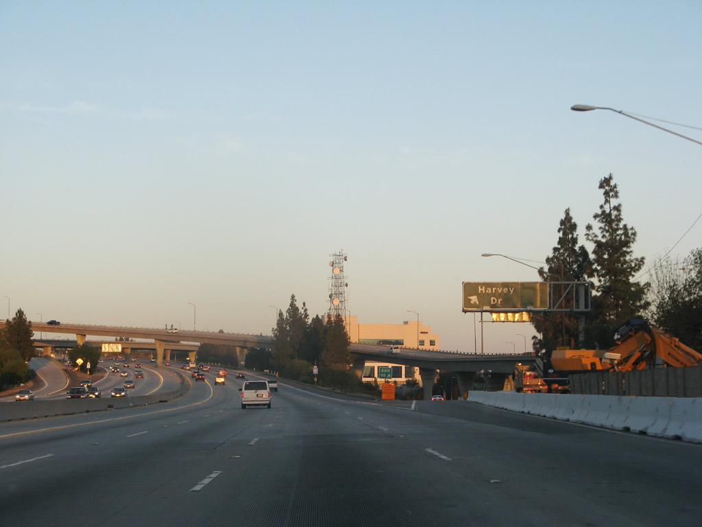
Immediately thereafter, eastbound California 134 (Ventura Freeway) meets Exit 9B, Harvey Drive. This off-ramp was expanded in 2008 to its current configuration, and an exit number sign was added here as part of that project. Photos taken 12/20/09 and 07/01/07. |
|
|
California 134 passes under the flyover ramp from California 134 east to California 2 north. While the California 134 freeway between California 2 and the merge with the Colorado Freeway was built in 1971, the interchange between California 134 and California 2 was largely constructed to its current configuration in 1978. Photos taken 12/20/09 and 07/01/07. |
|
Next, California 134 passes under the flyover ramp from California 2 south to California 134 east. Photo taken 12/20/09. |
|
This California 134 east reassurance shield is posted after the on-ramp from Harvey Drive. Photo taken 07/01/07. |
|
Another California 134 east reassurance shield is posted after the on-ramp from California 2. Photo taken 12/20/09. |
|
At the next high occupancy vehicle transition area, yet another California 134 east reassurance shield is posted. Photo taken 12/20/09. |
|
After the interchange with California 2 (Glendale Freeway), the California 134 freeway passes through some open space in Eagle Rock (part of the city of Los Angeles). Photo taken 12/20/09. |
|
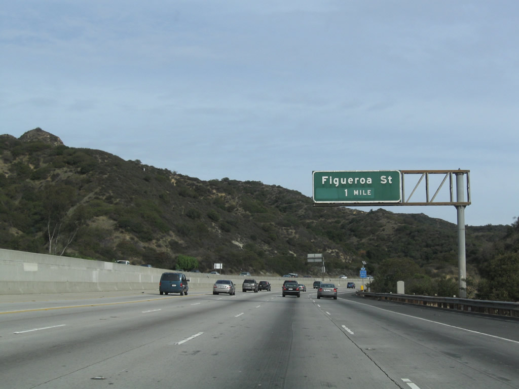
The next exit along eastbound is with Exit 11, Figueroa Street south to U.S. 66/Figueroa Street southwest to downtown L.A. and Historic U.S. 66 (Colorado Boulevard) east to Pasadena. (Figueroa Street and Colorado Boulevard are the first generation of U.S. 66 through this part of Los Angeles. When U.S. 66 was relocated to the Arroyo Seco Parkway [now Pasadena Freeway] in the late 1930s/early 1940s, this route was signed as Alternate U.S. 66 until 1964.) Photo taken 12/20/09. |
|
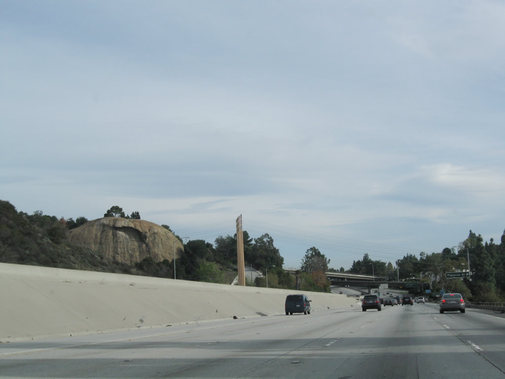
Eagle Rock, a rounded rock formation, rises on the north side of the freeway prior to the Figueroa Street off-ramp. Photo taken 12/20/09. |
|
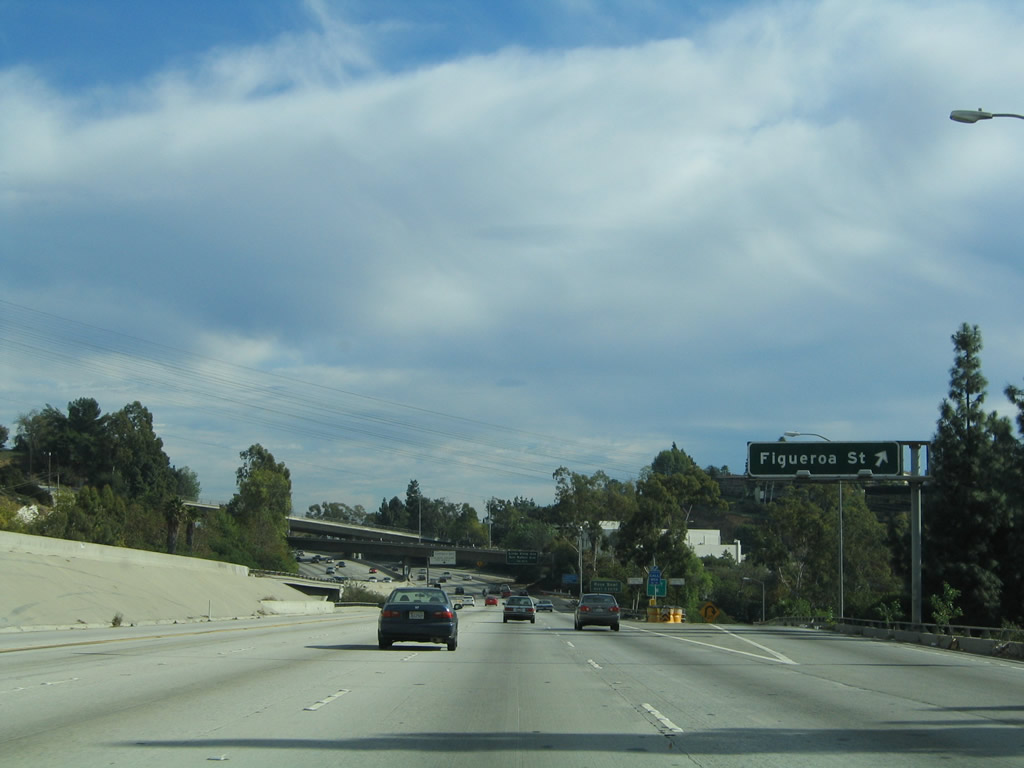
Eastbound California 134 (Ventura Freeway) reaches Exit 11, Figueroa Street south to U.S. 66/Figueroa Street southwest to downtown L.A. and Historic U.S. 66 (Colorado Boulevard) east to Pasadena. Note that there is no access to the Colorado Freeway stub from eastbound California 134; the merge point comes shortly after the Figueroa Street interchange. Photo taken 12/10/05. |
|
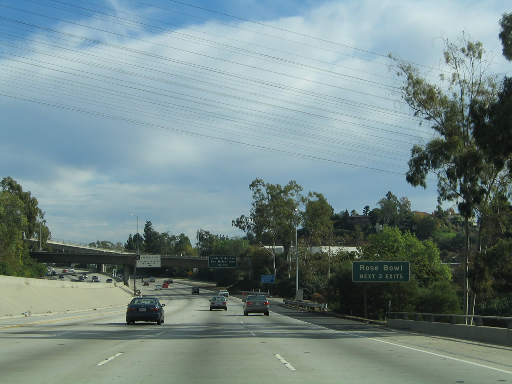
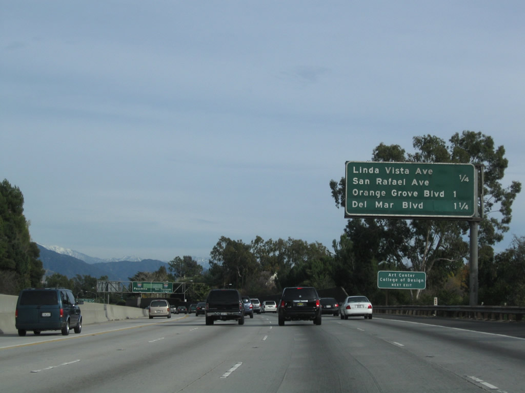
The next exit along eastbound California 134 (Ventura Freeway) is Exit 12, San Rafael Avenue to Linda Vista Avenue (former California 159, before that former California 11). The next three exits all serve the Rose Bowl, including Exit 12, San Rafael Avenue; Exit 13A, Orange Grove Boulevard; and Exit 13B, Interstate 210 (Foothill Freeway) and Interstate 710 (Long Beach Freeway) Stub south. Photo taken 12/10/05. |
|
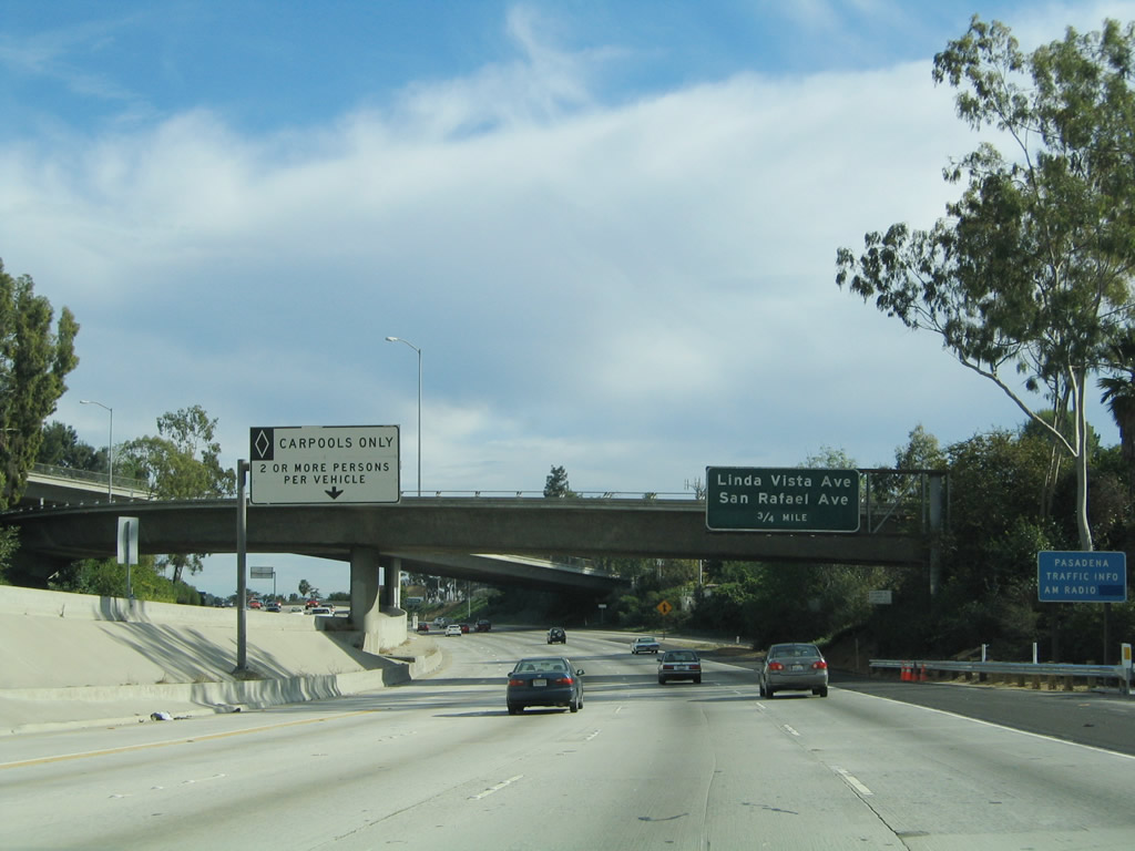
A carpool lane entrance and exit is posted shortly thereafter. The next exit along eastbound California 134 (Ventura Freeway) is Exit 12, San Rafael Avenue to Linda Vista Avenue (former California 159, before that former California 11). Photo taken 12/10/05. |
|
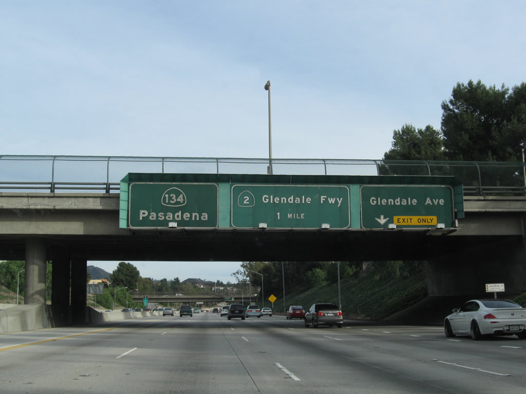
The old Colorado Freeway merges onto eastbound California 134 at this point. Once again, California 134 will travel on some very old alignment. The section of California 134 between the Colorado Freeway merge and Pasadena was originally built in 1953 and expanded to its modern configuration in 1971, including one-half of the massive arch bridge that carries the freeway over the Arroyo Seco. Photo taken 12/20/09. |
|
The next nine exits along eastbound California 134 (Ventura Freeway) and eastbound Interstate 210 (Foothill Freeway) serve the city of Pasadena: Exit 12, San Rafael Avenue and Linda Vista Avenue (former California 11-159); Exit 13A, Orange Grove Boulevard; Exit 13B, Interstate 210 (Foothill Freeway) and Interstate 710 (Long Beach Freeway) Stub south to Del Mar Boulevard and California Boulevard; (begin Interstate 210 east) Exit 26, Lake Avenue; Exit 27, Hill Avenue; Exit 28, Altadena Drive; Exit 29A, San Gabriel Boulevard; Exit 29B, Madre Street; and Exit 30A, California 19 (California 164)/Rosemead Boulevard south. Photo taken 12/10/05. |
|
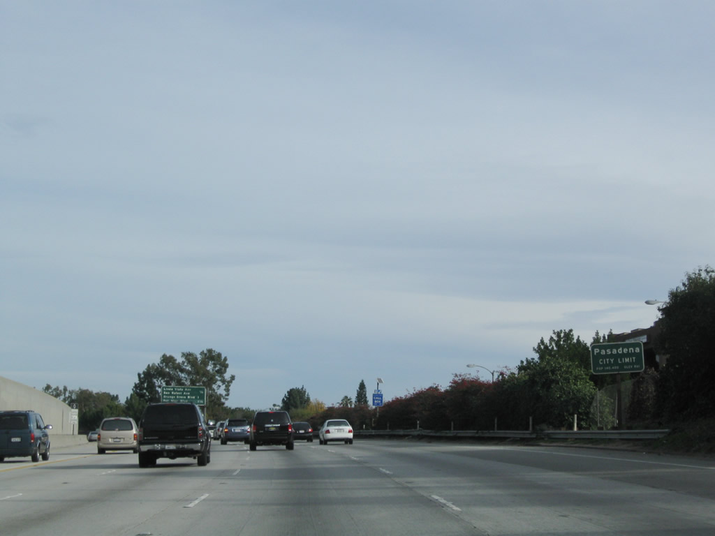
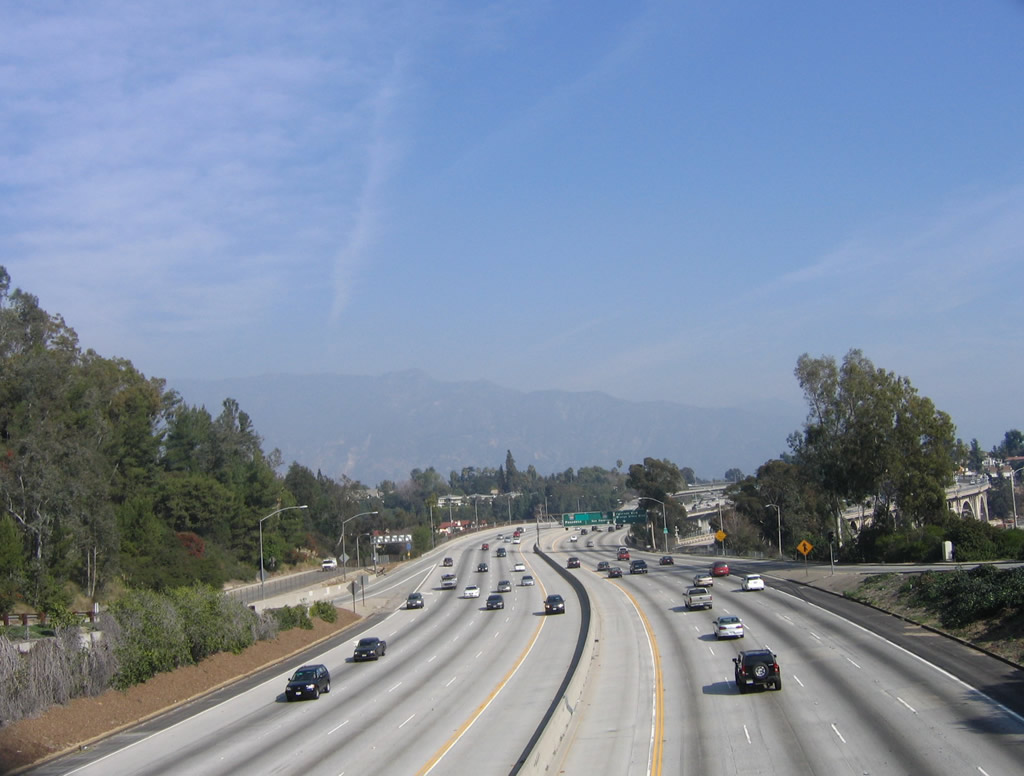
California 134 leaves the city of Los Angeles a final time and enters the city of Pasadena, which had a 2000 Census population of 133,936. The city consisted of 23.2 square miles at that time and was incorporated on June 19, 1886. Pasadena is home to the Rose Bowl, which is a large venue that hosts the annual "Granddaddy of them all": the Tournament of Roses. Each year on New Year's Day, the city hosts the spectacular Tournament of Roses. The annual parade (with floats partially made of rose petals) follows Colorado Boulevard through Old Pasadena (downtown). The festivities culminate with the annual college football game, which often is involved in determining that year's college football champion. During the regular college season, the University of California at Los Angeles (UCLA) uses the Rose Bowl for its home games. Photo taken 12/20/09. |
|
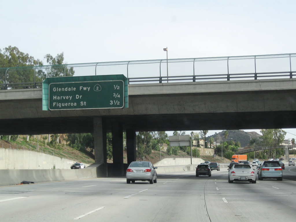
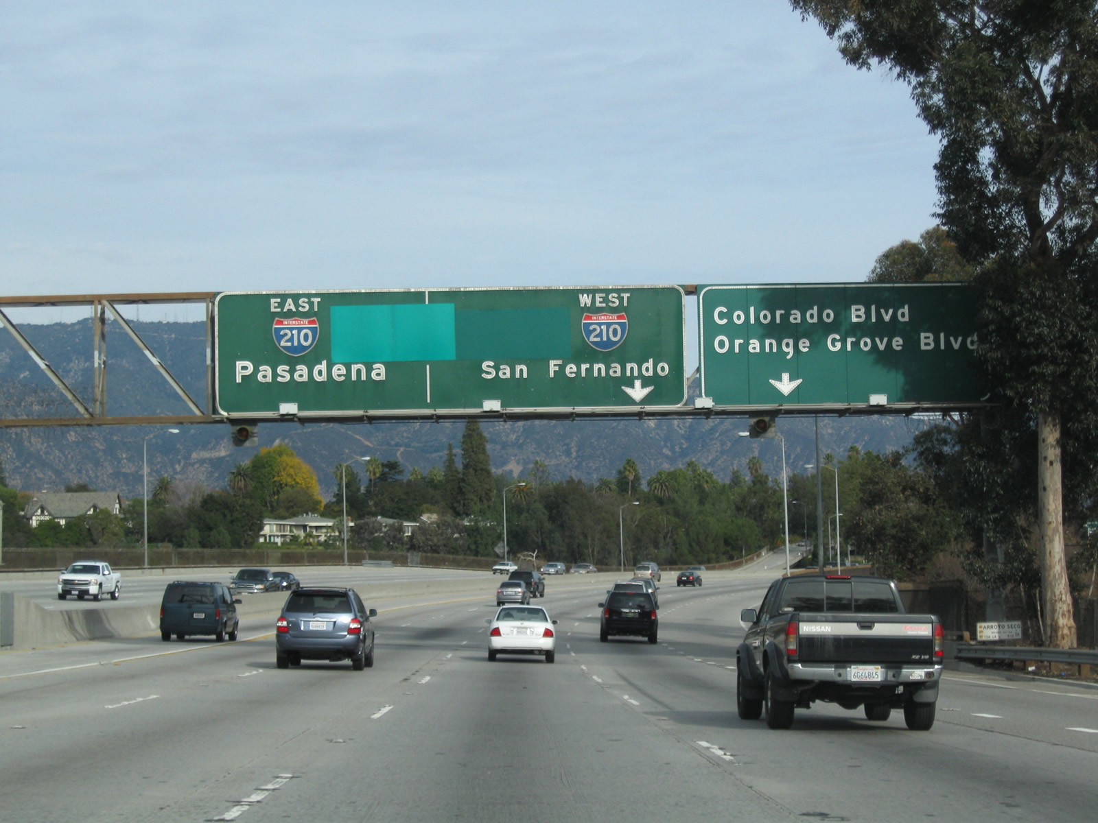
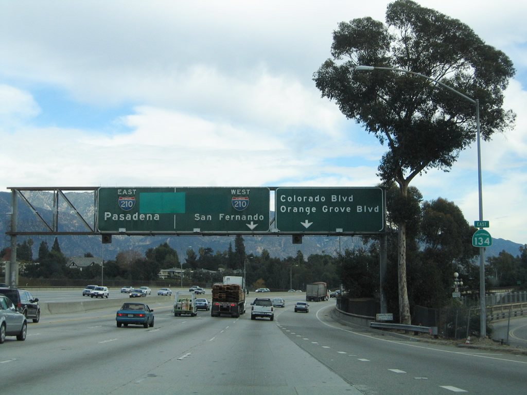
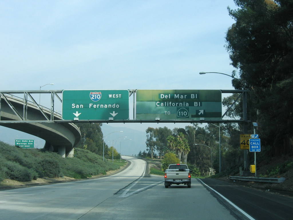
This mileage sign provides the distance to the next three exits along eastbound California 134 (Ventura Freeway): Exit 12, San Rafael Avenue and Linda Vista Avenue (former California 11-159); Exit 13A, Orange Grove Boulevard; and Exit 13B, Interstate 210 (Foothill Freeway) and Interstate 710 (Long Beach Freeway) Stub south to Del Mar Boulevard and California Boulevard. The mileage sign only lists "Del Mar Boulevard" rather than the 710 stub. California 710 is essentially unsigned on its very short freeway stub in Pasadena to avoid motorist confusion, since the link with the existing Long Beach Freeway remains unconstructed. Photo taken 12/20/09. |
|
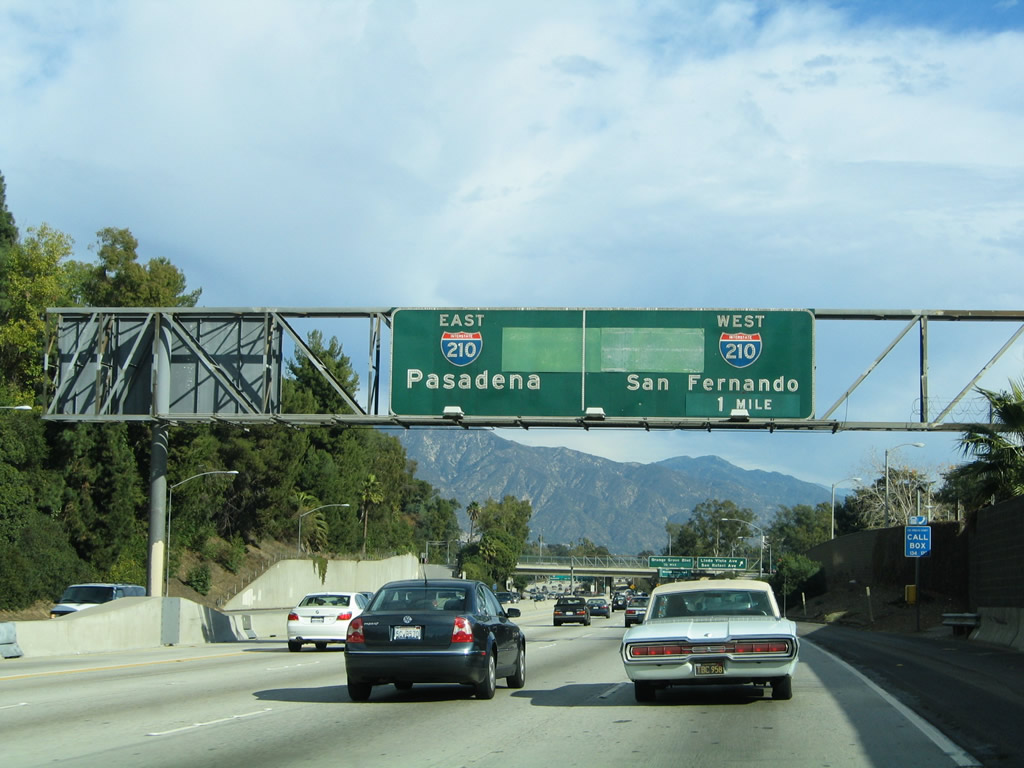
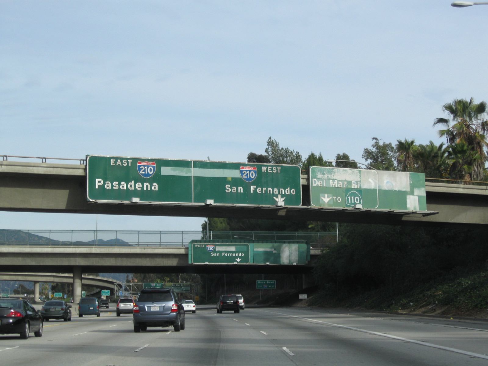
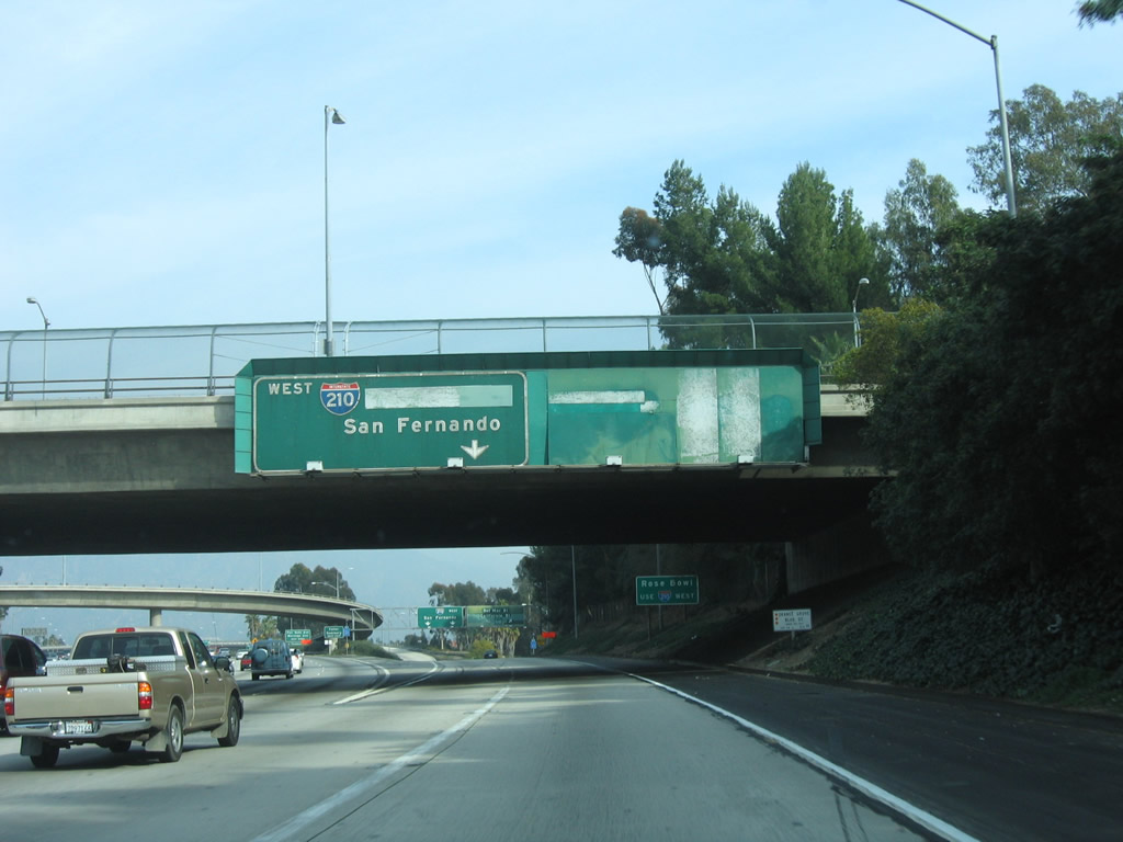
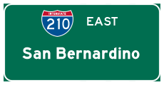
The final interchange along California 134 (Ventura Freeway) east will be Exit 13B, Interstate 210 (Foothill Freeway) east to San Bernardino, Interstate 210 northwest to San Fernando and all points north via Interstate 5, and the Long Beach Freeway (stub freeway pending future construction of 710 tunnel) south to Del Mar Boulevard and California Boulevard. All through traffic will be defaulted onto Interstate 210 (Foothill Freeway) east. The interchange between 210-710-134 marks the end of a very long Ventura Freeway, which originates at the Santa Barbara-Ventura County Line and extends east primarily signed as U.S. 101 and ends at the Interstate 210 interchange in Pasadena. Photo taken 12/10/05. |
|
Eastbound California 134 (Ventura Freeway) reaches Exit 12, San Rafael Avenue and Linda Vista Avenue (former California 11-159); Exit 13A, Orange Grove Boulevard. Photo taken 12/10/05. |
|
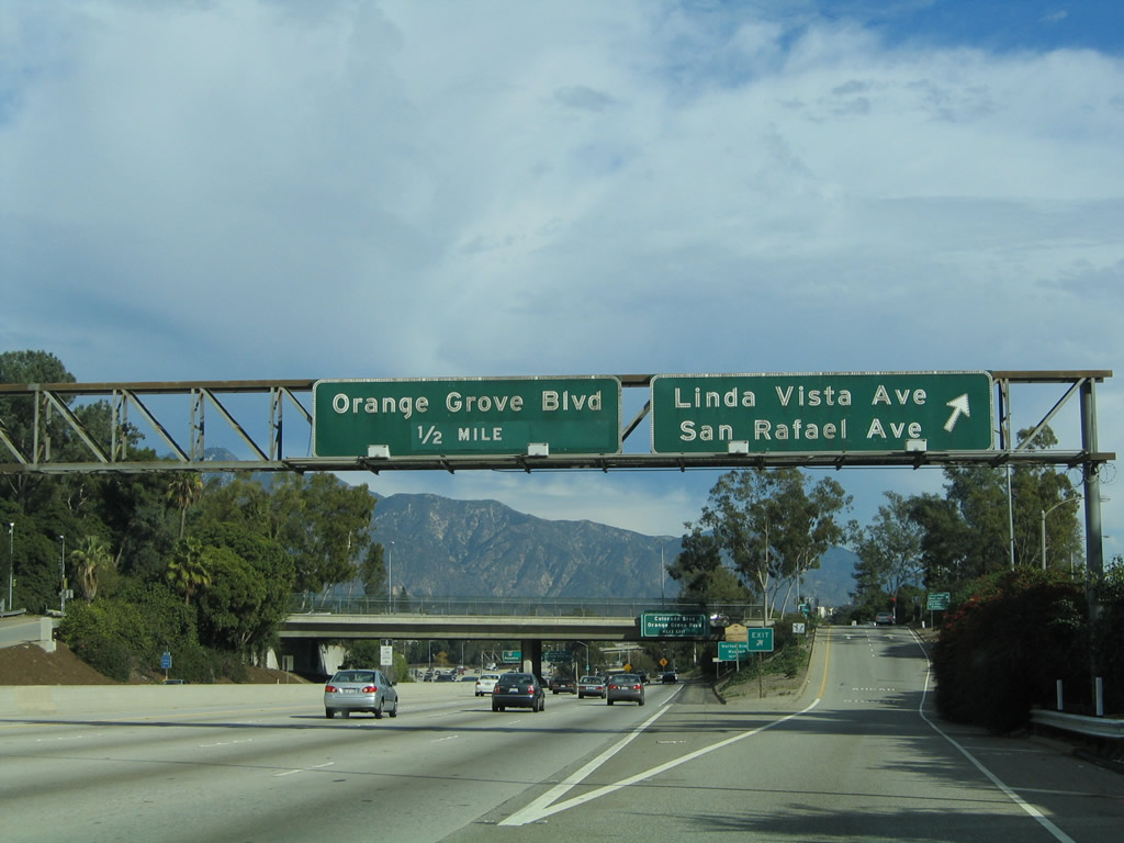
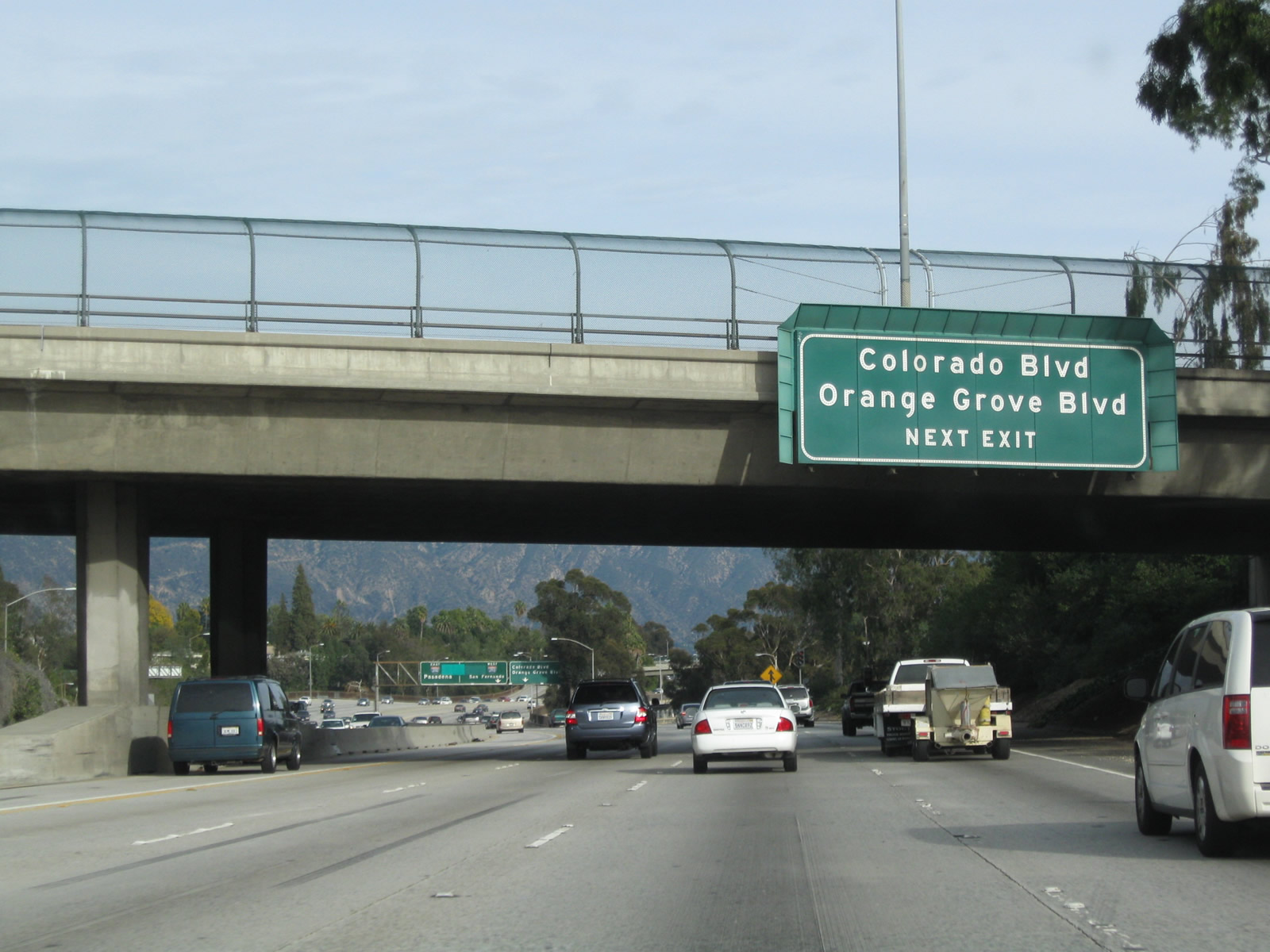
The next exit along eastbound California 134 (Ventura Freeway) is Exit 13A, Orange Grove Boulevard and Historic U.S. 66 (Colorado Boulevard) east. This overhead guide sign is posted on the San Rafael Avenue overpass. Photo taken 12/10/05. |
|
This view looks down on California 134 (Ventura Freeway) east from the San Rafael Avenue (former California 159) overcrossing near the Rose Bowl in Pasadena. Photo taken 01/28/06. |
|
|
The right lane of eastbound California 134 (Ventura Freeway) becomes exit only for Exit 13A, Orange Grove Boulevard and Historic U.S. 66 (Colorado Boulevard) east. The left four lanes (plus HOV lane) will connect to Interstate 210 east/west or California 710 south to Del Mar Avenue. California 134 proceeds across the Arroyo Seco on a wide, long arch bridge. Photos taken 12/20/09 and 12/10/05. |
|
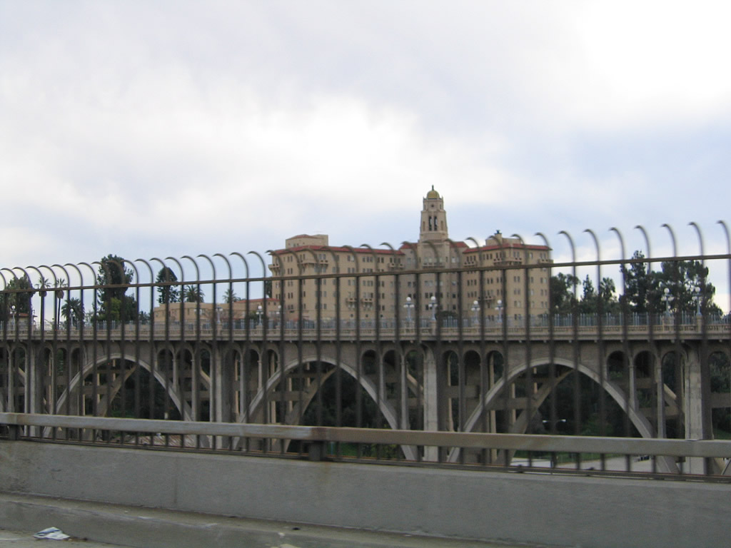
Looking through a "suicide barrier" fence is this view of the 1913 historic Colorado Street Pioneer Bridge, which carries Historic U.S. 66 (Colorado Boulevard) over the Arroyo Seco. Photo taken 12/10/05. |
|
This view looks east along the Ventura Freeway as we cross the Arroyo Seco. The California 134 arch bridge over the Arroyo Seco was constructed in 1953 and expanded to its current width in 1971. The California 134 bridge was built to be similar to the historic 1913 Colorado Street Pioneer arch bridge. It is worthwhile to stop at the San Rafael Avenue interchange, park, and walk across the 1913 Colorado Street bridge to see the huge scale of the California 134 Ventura Freeway bridge as well as the historic 1913 bridge. Photo taken 12/10/05. |
|
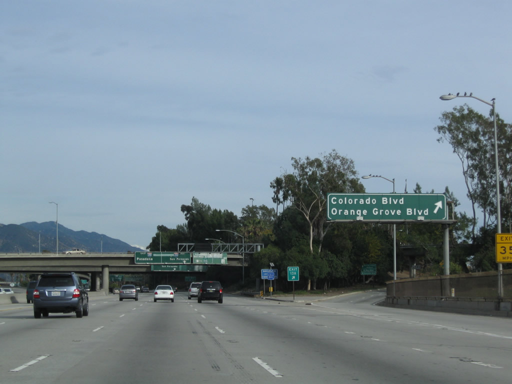
Eastbound California 134 (Ventura Freeway) reaches Exit 13A, Orange Grove Boulevard and Historic U.S. 66 (Colorado Boulevard) east to downtown Pasadena. Photo taken 12/20/09. |
|
|
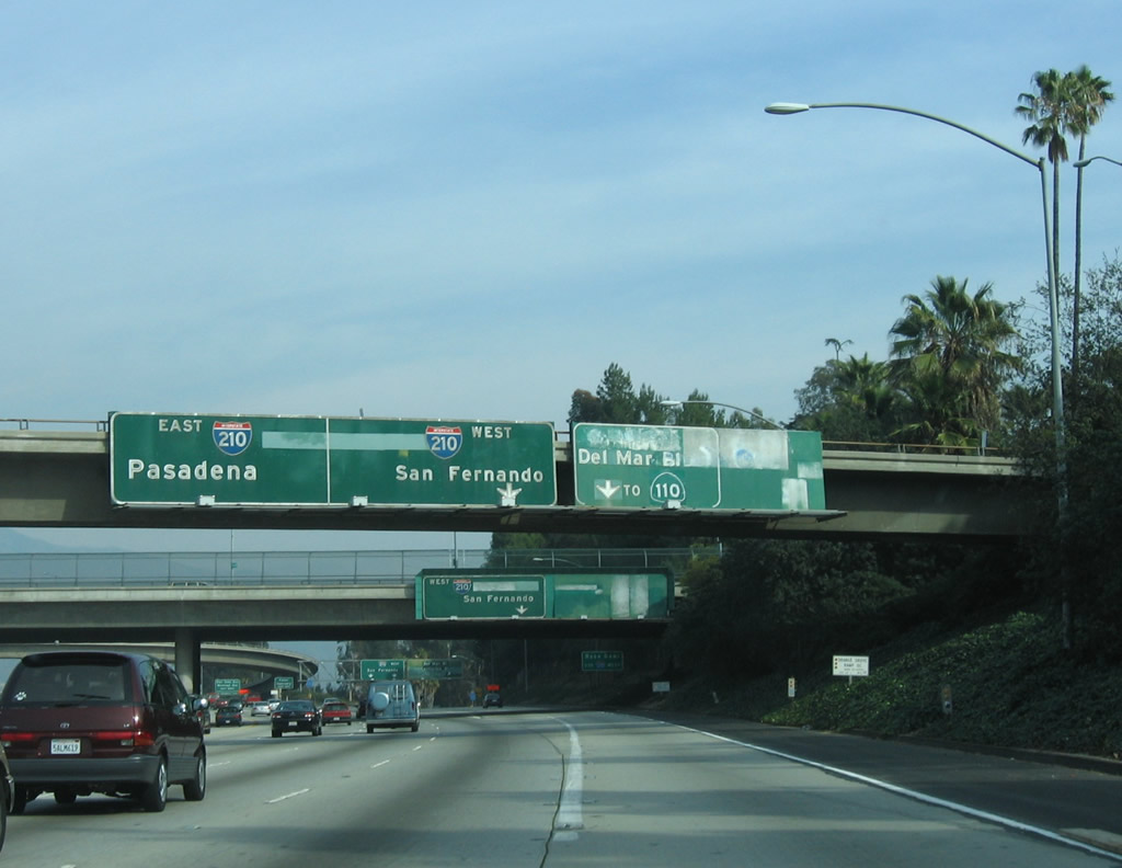
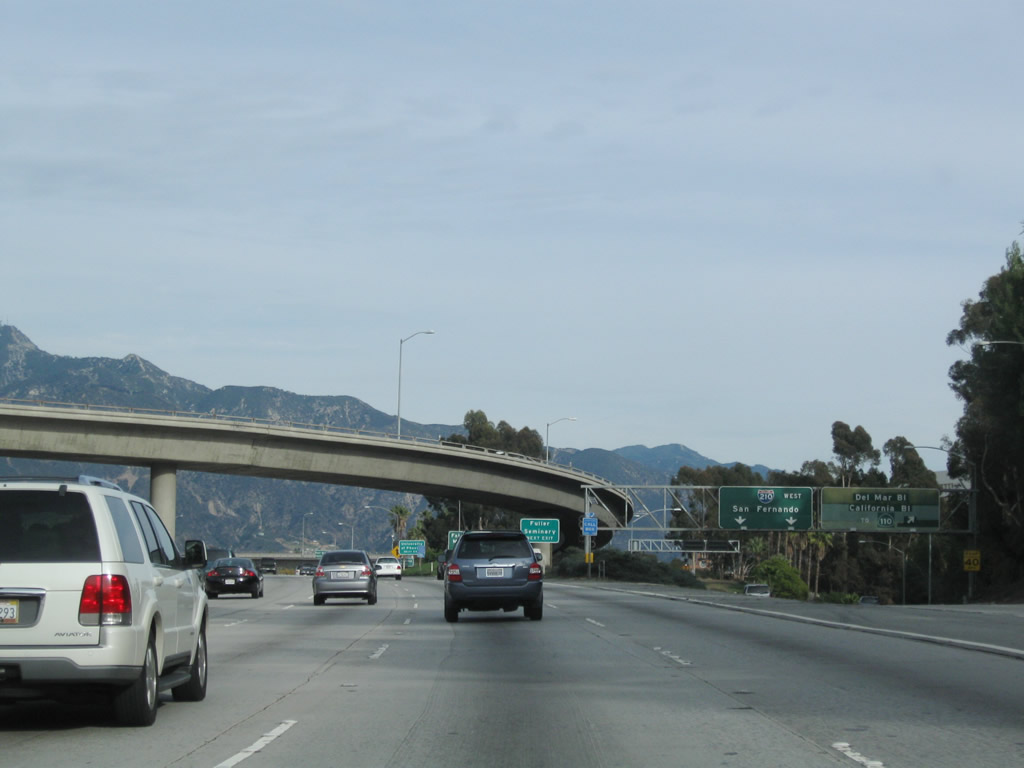
The next exit along eastbound California 134 (Ventura Freeway) is Exit 13B, Interstate 210 (Foothill Freeway) northwest to San Fernando and Interstate 5 and California 710/Long Beach Freeway (Stub) south to Del Mar Boulevard and California Boulevard. The stub freeway does NOT connect to Interstate 710 at this time, pending future construction of the 710 tunnel. Photos taken 12/20/09 and 01/28/06. |
|
|
Eastbound California 134 (Ventura Freeway) reaches Exit 13B, Interstate 210 (Foothill Freeway) northwest to San Fernando and Interstate 5 and California 710/Long Beach Freeway Stub south to Del Mar Boulevard and California Boulevard. Through traffic for Interstate 210 east to San Bernardino and Redlands should stay left. Photos taken 12/20/09 and 01/28/06. |
|
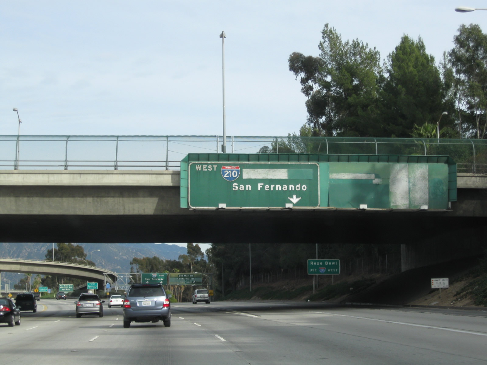
Now on the transition ramp, stay left for Interstate 210 west and right for California 710 south. Since California 710 has not been built between Pasadena and Alhambra, the stub freeway only connects to Del Mar Boulevard and California Boulevard. There is no freeway access currently to the Long Beach Freeway. Photo taken 01/28/06. |
|
|
The transition ramp between eastbound California 134 (Ventura Freeway) and Interstate 210 (Foothill Freeway) northwest is the highest ramp in the 210-710-134 interchange. Photos taken 12/10/05. |
|
Back on the mainline, California 134 carries four main lanes plus one HOV lane east through the Interstate 210 and California 710 interchange. Photo taken 12/20/09. |
|
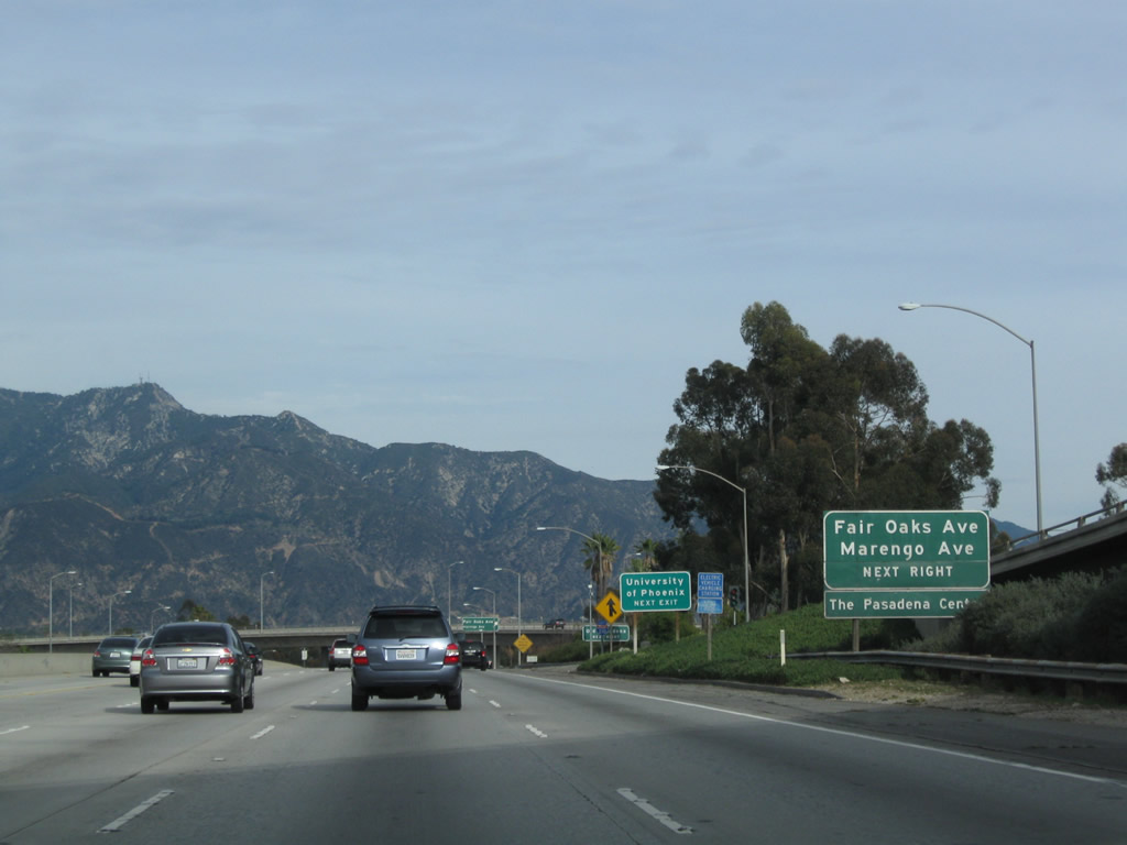
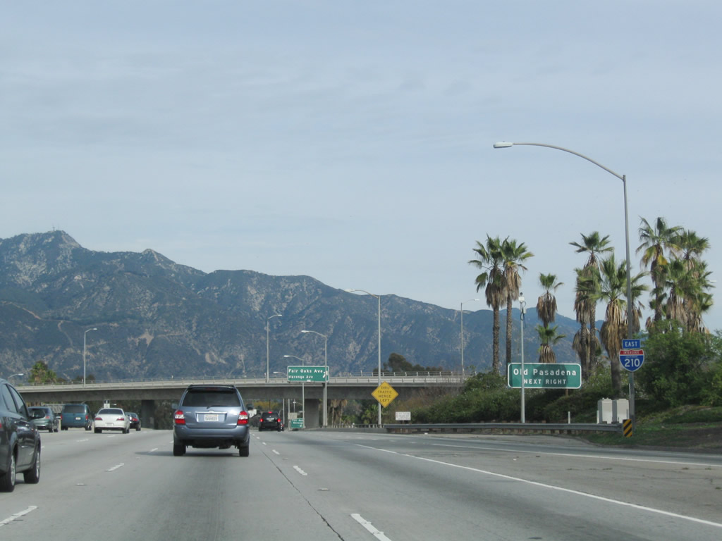
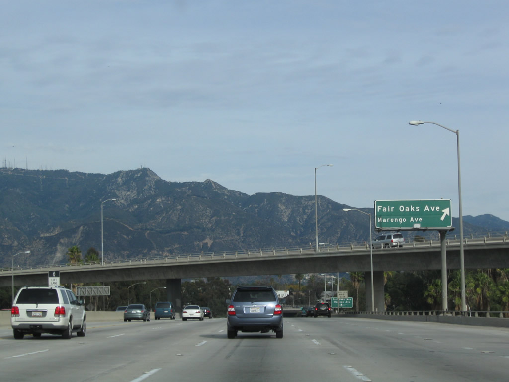
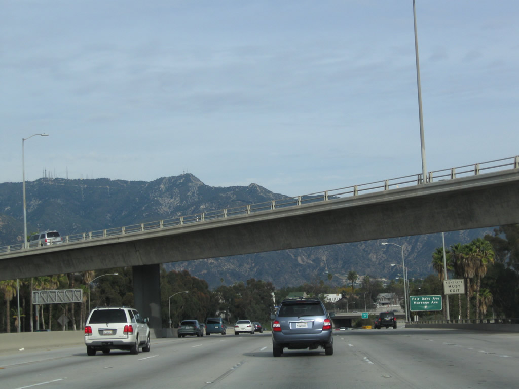
The final exit along California 134 (Ventura Freeway) east is Exit 13C, Fair Oaks Avenue and Marengo Avenue to Historic U.S. 66 (Colorado Boulevard) and downtown Pasadena. Photo taken 12/20/09. |
|
An Interstate 210 east reassurance shield is posted shortly thereafter (at the on-ramp from Orange Grove Boulevard and Holly Street). This should be a California 134 east route marker since traffic from Interstate 210 (Foothill Freeway) east has not yet merged onto the 134 freeway. Photo taken 12/20/09. |
|
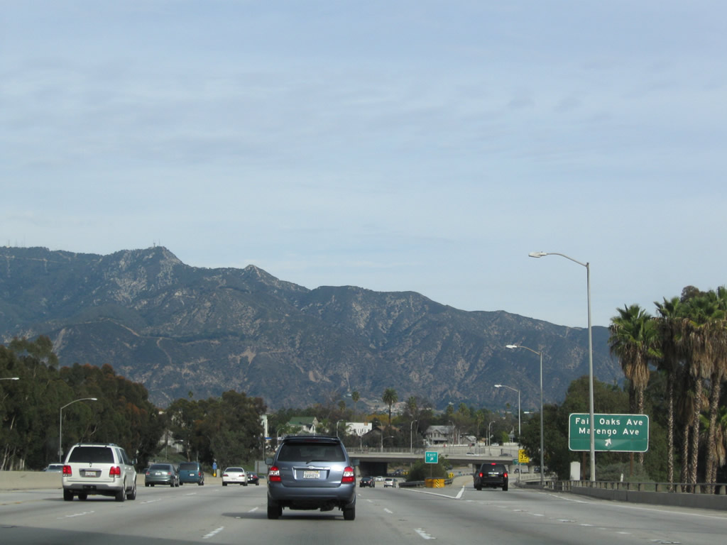
California 134 (Ventura Freeway) approaches Exit 13C, Fair Oaks Avenue and Marengo Avenue to Historic U.S. 66 (Colorado Boulevard) and downtown Pasadena. Upon exiting, the off-ramp connects directly to Corson Street, which intersects with north-south Fair Oaks Avenue at a traffic signal. Turn right (south) to Old Pasadena and Historic U.S. 66 (Colorado Boulevard) (about four or five blocks south of the freeway). Photo taken 12/20/09. |
|
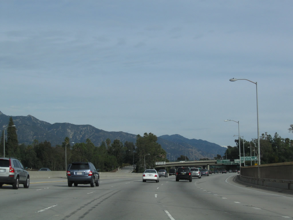
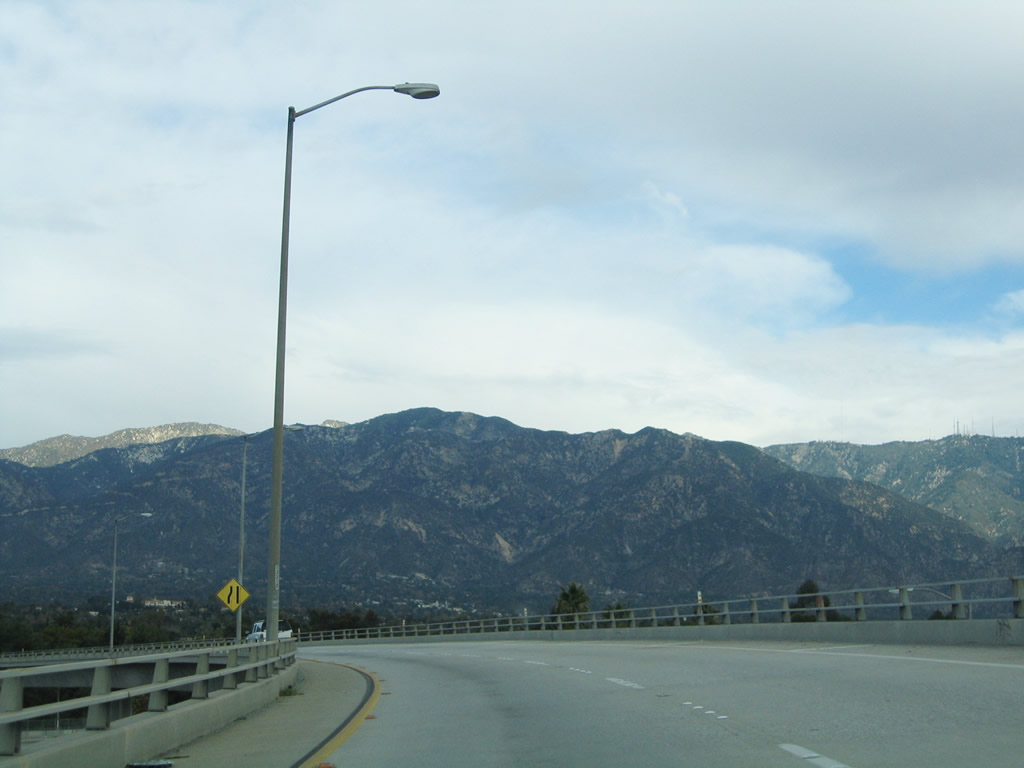
The flyover ramp between California 134 east and Interstate 210 west crosses over the mainline freeway. Mt. Wilson, which is located in the San Gabriel Mountains, can be seen in the tall range behind this massive interchange. Radio and television transmitter towers are mounted on top of the mountain, which rises 5,710 feet and is home to an observatory as well. Access to Mt. Wilson is afforded via California 2 (Angeles Crest Highway). Photo taken 12/20/09. |
|
Eastbound California 134 (Ventura Freeway) reaches Exit 13C, Fair Oaks Avenue and Marengo Avenue to Historic U.S. 66 (Colorado Boulevard) and downtown Pasadena. Photo taken 12/20/09. |
|
After the off-ramp to Fair Oaks Avenue and Marengo Avenue, eastbound California 134 continues just a bit further before reaching Exit 13D, Interstate 210 east. The next off-ramp will be Exit 26 to Lake Avenue, which uses Interstate 210's exit numbering system. Ahead, traffic merges onto California 134 east from California 710 north. Photo taken 12/20/09. |
|
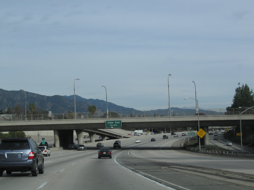
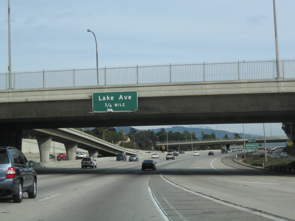
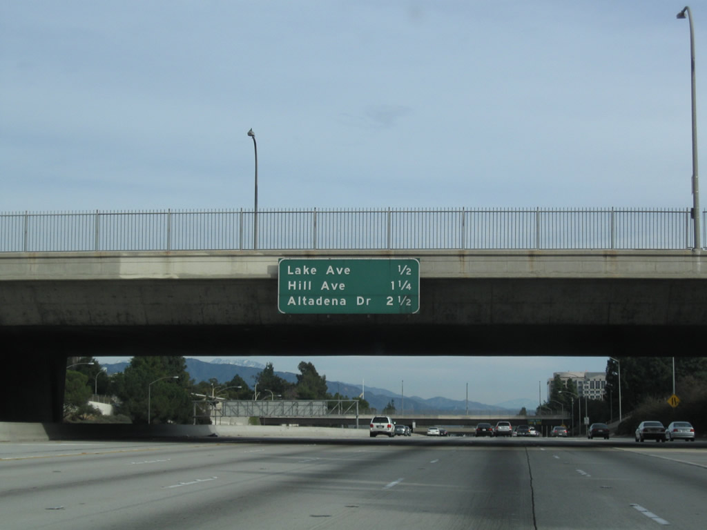
The next two exits along is Exit 13D, Interstate 210 east (all traffic merges onto Interstate 210 (Foothill Freeway) east) and Exit 26, Lake Avenue (0.75 mile). Photo taken 12/20/09. |
|
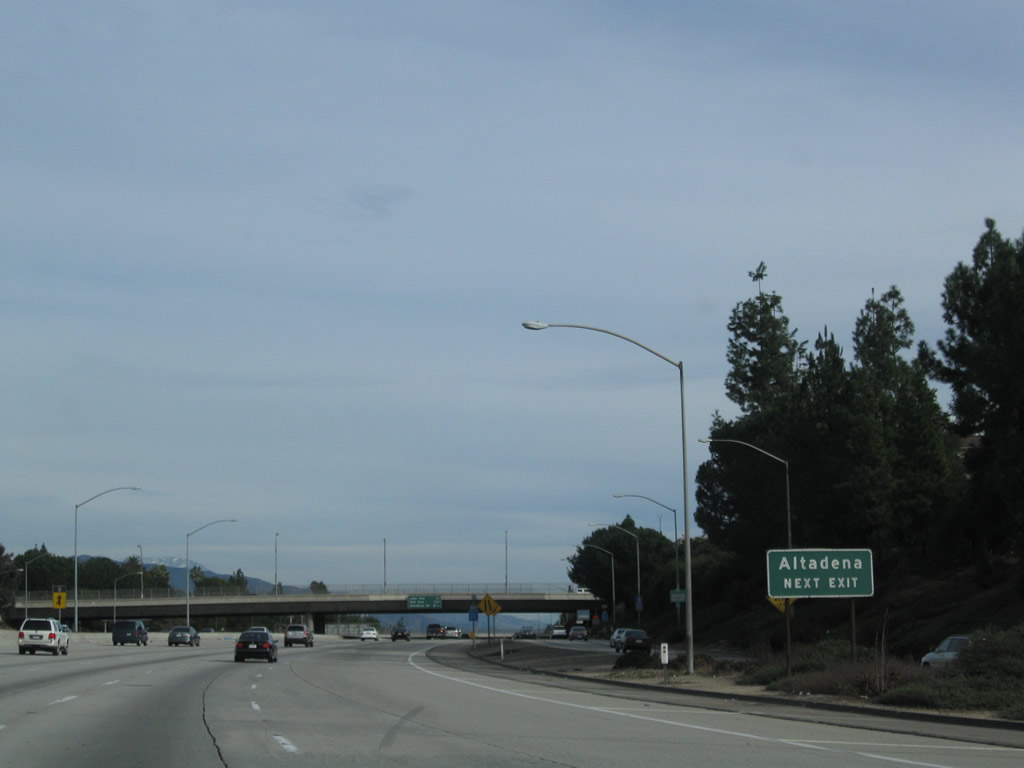
Use Exit 26, Lake Avenue north to the city of Altadena. Photo taken 12/20/09. |
|
California 134 ends at this point, as traffic from Interstate 210 east merges from the right. From here, all lanes proceed east on Interstate 210 (Foothill Freeway) toward San Bernardino. The next three exits on Interstate 210 east are: Exit 26, Lake Avenue; Exit 27, Hill Avenue; and Exit 28, Altadena Drive. There is no end shield present for California 134. Photo taken 12/20/09. |
Page Updated January 3, 2010.