
Interstate 10 East - California 19 to Kellogg Interchange
| Interstate 10 (San Bernardino Freeway) east | |
|---|---|
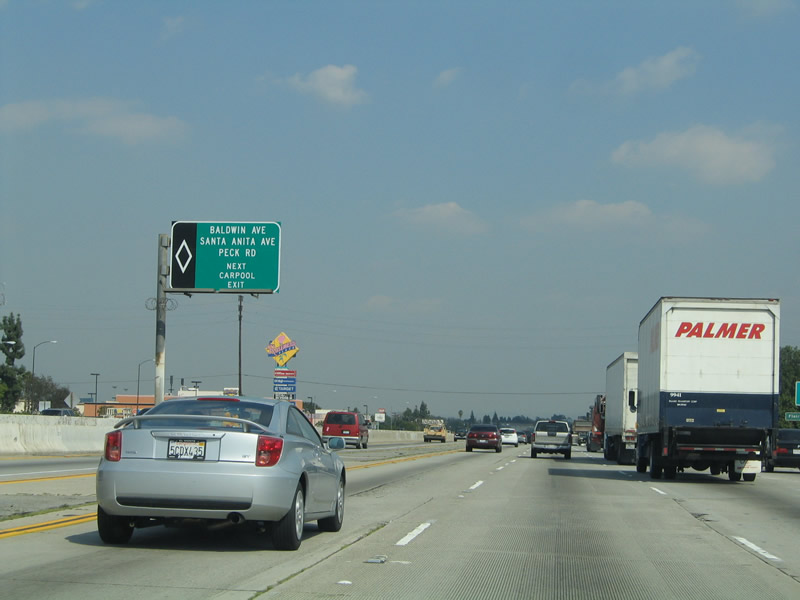 |
After the off-ramp to California 19 (Rosemead Boulevard), an HOV-only exit ramp approaches for a direct connection to Baldwin Avenue and the El Monte Bus Station and Transit Center (including park and ride lots). East of the transit center, El Monte Transitway HOV motorists can easily connect to Santa Anita Avenue, Ramona Boulevard, and Peck Road. Photo taken 03/25/05. |
 |
The next exit along eastbound Interstate 10 (San Bernardino Freeway) is Exit 27, Baldwin Avenue. At this point, Interstate 10 leaves the city of Alhambra and enters the city of El Monte, which had a population of 115,965 as of the 2000 Census, sits at an elevation of 299 feet, consists of 9.7 square miles, and was incorporated on November 18, 1912. Photo taken 03/25/05. |
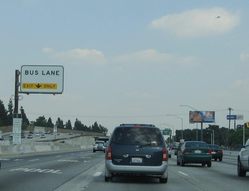 |
A second advance sign for the bus station and park and rides is posted for the HOV lanes. Photo taken 03/25/05. |
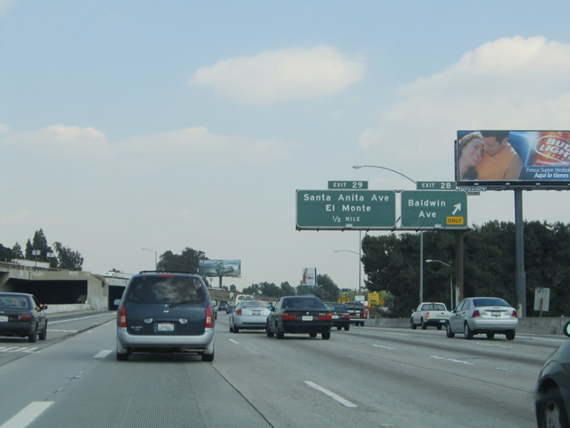 |
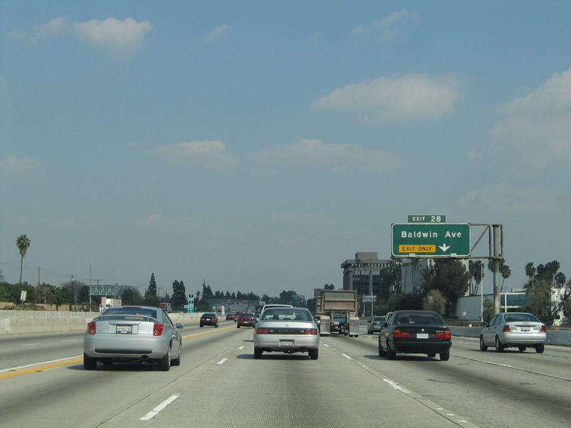
Eastbound Interstate 10 (San Bernardino Freeway) reaches Exit 27, Baldwin Avenue. The exit number shown here (Exit 28) is from the 1971 experiment, and it will eventually be replaced with a new sign showing the correct exit number of Exit 27. Photo taken 03/25/05. |
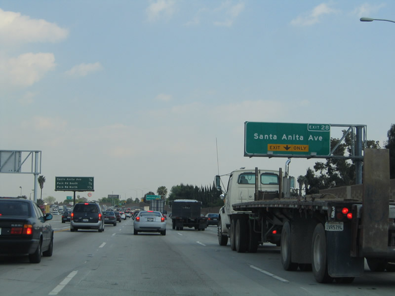 |
The next exit along Interstate 10 (San Bernardino Freeway) east is Exit 28, Santa Anita Avenue. The right lane becomes exit only for Exit 28. Photo taken 03/25/05. |
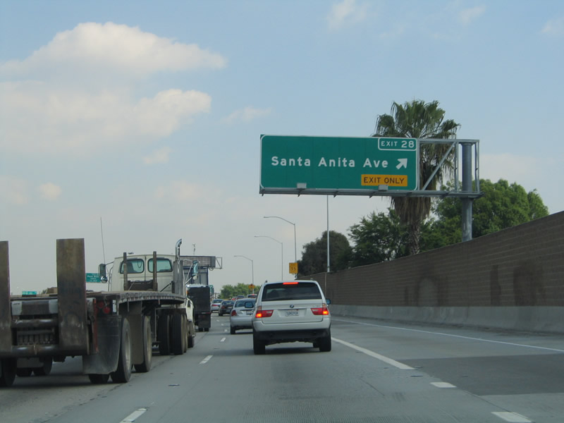 |
Eastbound Interstate 10 (San Bernardino Freeway) reaches Exit 28, Santa Anita Avenue. Photo taken 03/25/05. |
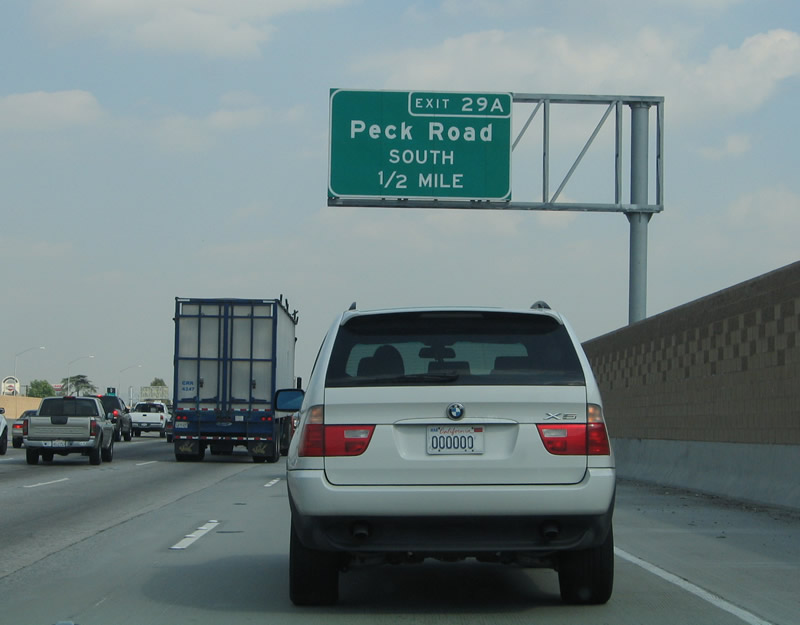 |
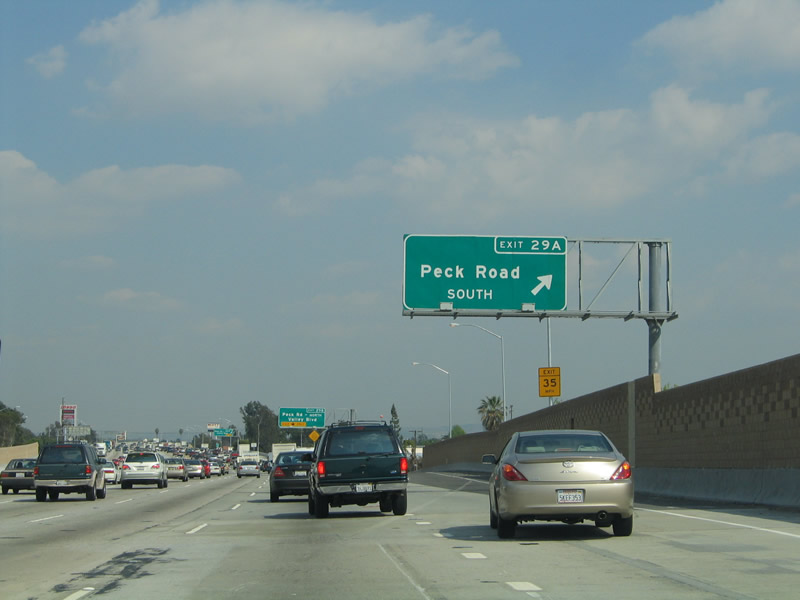
The next exit along Interstate 10 (San Bernardino Freeway) east is Exit 29A, Peck Road south to El Monte and South El Monte. Photo taken 03/25/05. |
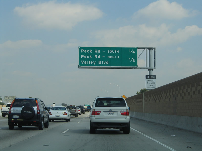 |
This mileage sign provides the distance to the next two exits along Interstate 10 (San Bernardino Freeway) east: Exit 29A, Peck Road south and Exit 29B, Peck Road north and Valley Boulevard. Photo taken 03/25/05. |
 |
A rare FHWA Series E Highway Gothic Interstate 10 reassurance shield is posted after the on-ramp from Santa Anita Avenue. Photo taken 03/25/05. |
 |
Eastbound Interstate 10 (San Bernardino Freeway) reaches Exit 29A, Peck Road south. Photo taken 03/25/05. |
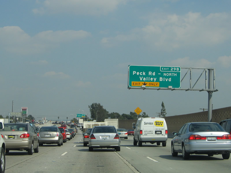 |
The next exit along Interstate 10 east is Exit 29B, Peck Road north and Valley Boulevard. The right lane becomes exit only for Exit 29B. Photo taken 03/25/05. |
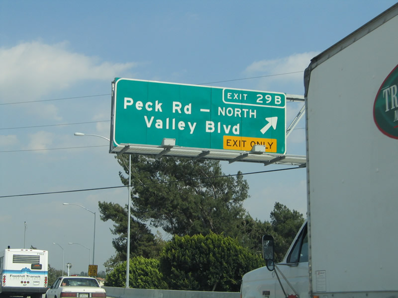 |
Eastbound Interstate 10 (San Bernardino Freeway) reaches Exit 29B, Peck Road north and Valley Boulevard. Photo taken 03/25/05. |
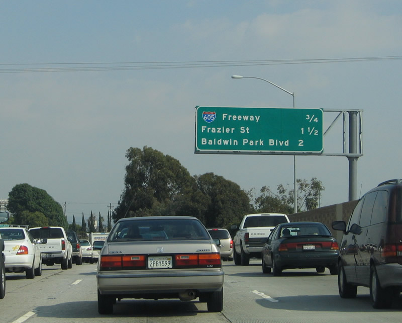 |
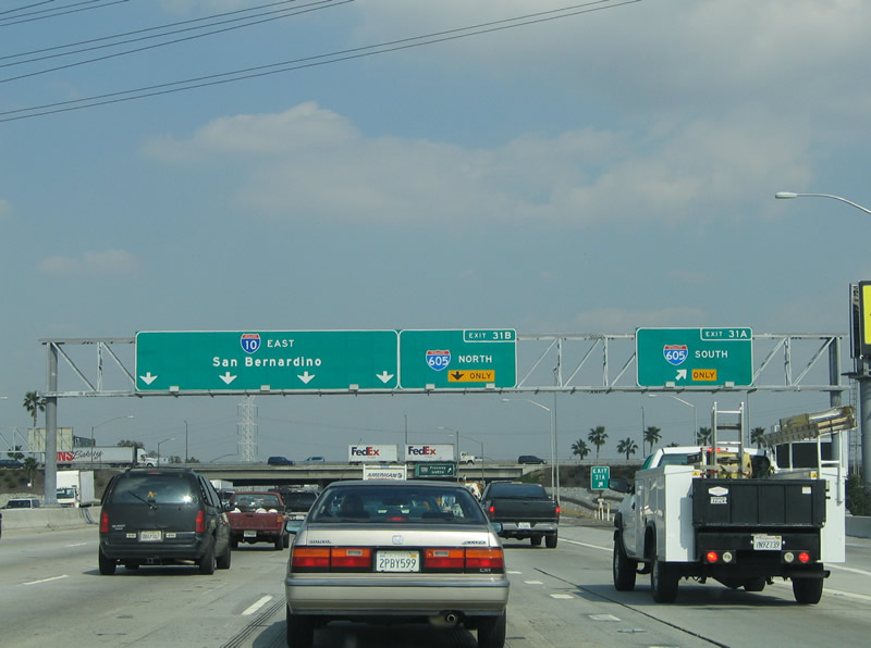
This mileage sign provides the distance to the next four exits along Interstate 10 (San Bernardino Freeway) east: Exits 31A-B, Interstate 605 (San Gabriel River Freeway); Exit 31C, Frazier Street; and Exit 32A, Baldwin Park Boulevard. Photo taken 03/25/05. |
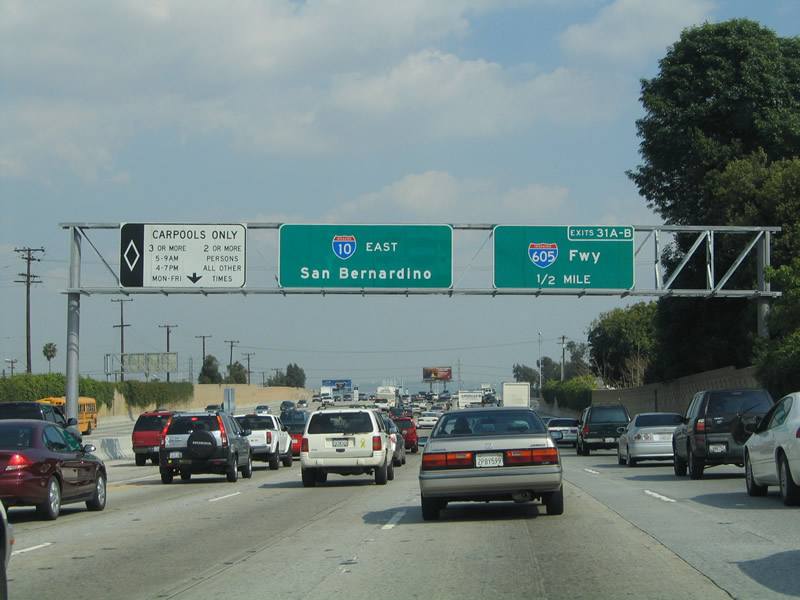 |
Interstate 605 is a major freeway corridor that travels along the path of the San Gabriel River from Seal Beach north to Duarte. It is also a good route north to Interstate 210 and south to California 60 and Interstate 5. These newer reflective signs with exit numbers were installed in 2005. An entrance to the HOV lanes is allowed at this point. Photo taken 03/25/05. |
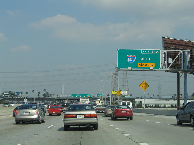 |
The right lane becomes exit only for Exit 31A, Interstate 605 (San Gabriel River Freeway) south to Seal Beach. At the Interstate 605 interchange, the HOV lanes temporarily end (although a 2008 project plans to extend the lanes east to Puente Avenue). Photo taken 03/25/05. |
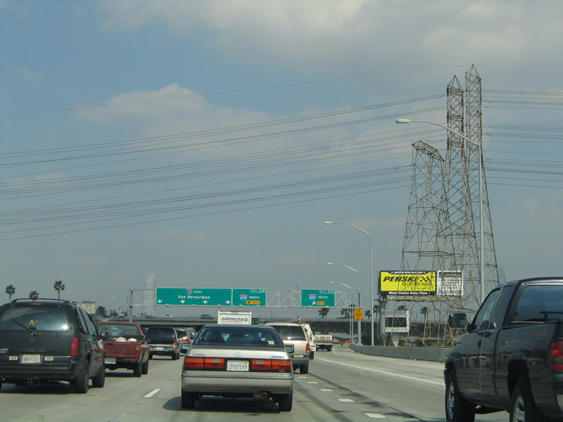 |
A set of Southern California Edison (SCE) power lines cross over Interstate 10; these lines generally parallel Interstate 605 south toward the Whittier Narrows. Interstate 10 now crosses the San Gabriel River, leaves El Monte, and enters the city of Baldwin Park. Photo taken 03/25/05. |
 |
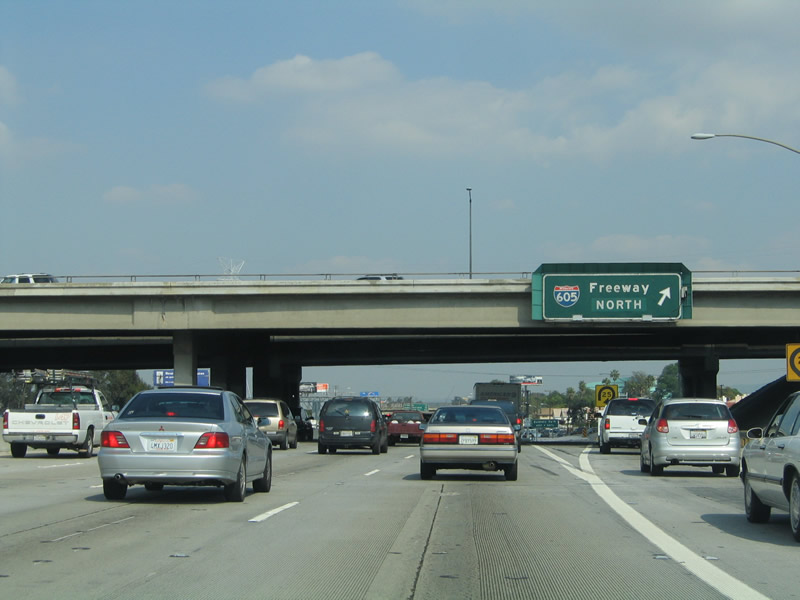
Eastbound Interstate 10 (San Bernardino Freeway) reaches Exit 31A, Interstate 605 south. The next exit is Exit 31B, Interstate 605 north to Irwindale and Duarte. Photo taken 03/25/05. |
 |
An older porcelain-enamel overhead guide sign is posted at the exit from Interstate 10 east to Interstate 605 north at Exit 31B. Photo taken 03/25/05. |
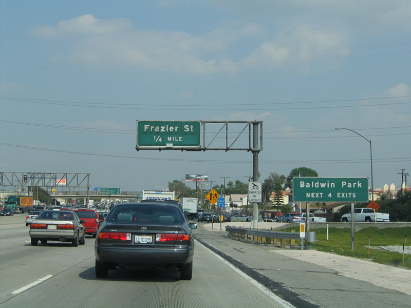 |
The next four exits serve the city of Baldwin Park. Baldwin Park had a population of 75,837 as of the 2000 Census. The city was incorporated on January 25, 1956, and consists of 6.8 square miles. Photo taken 03/25/05. |
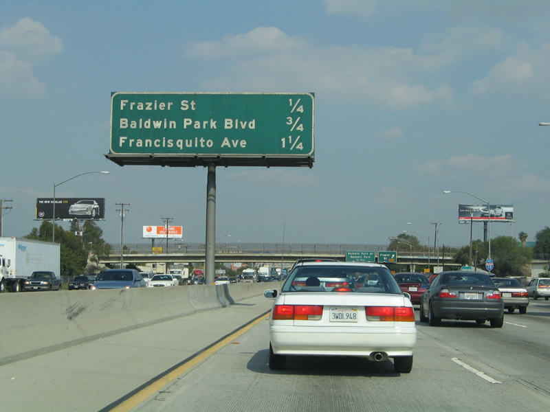 |
This mileage sign provides the distance to the next three exits along Interstate 10 (San Bernardino Freeway) east: Exit 31C, Frazier Street; Exit 32A, Baldwin Park Avenue; and Exit 32B, Francisquito Avenue. Photo taken 03/25/05. |
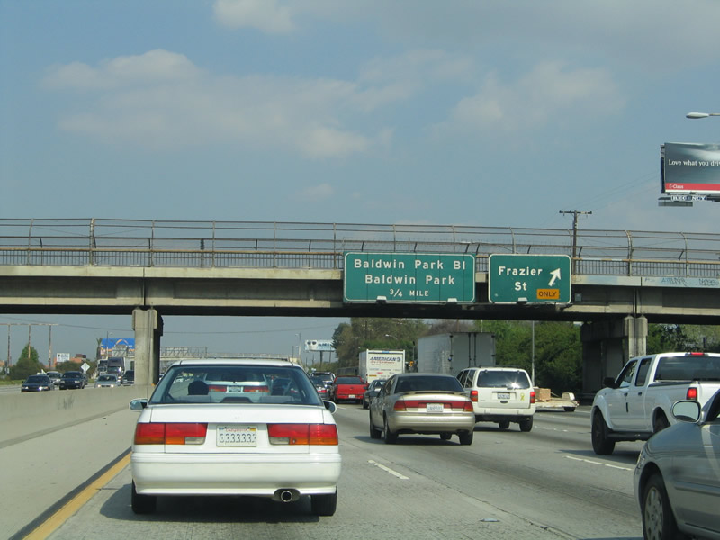 |
Eastbound Interstate 10 reaches Exit 31C, Frazier Street. The next exit along eastbound is Exit 32A, Baldwin Park Avenue. Photo taken 03/25/05. |
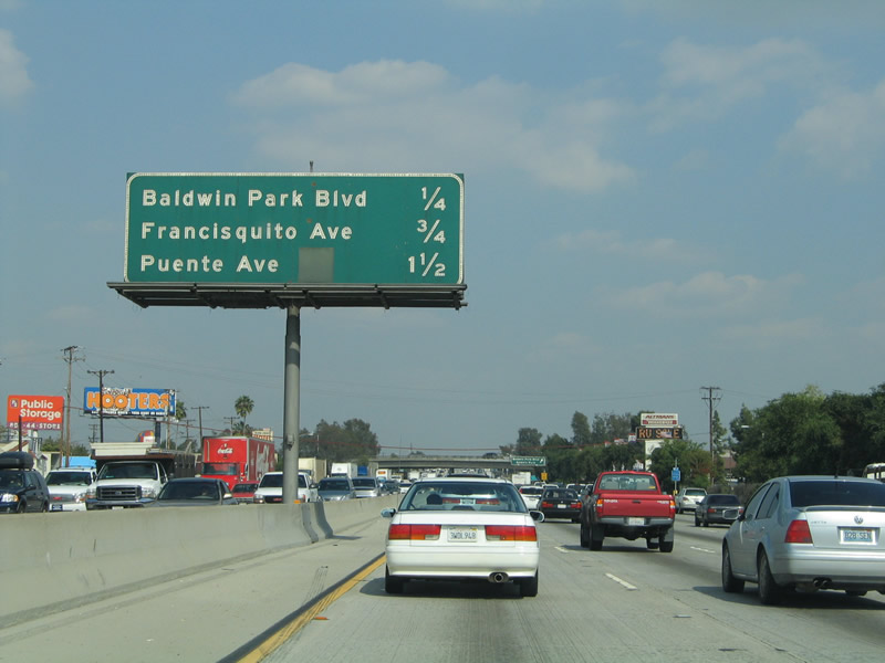 |
This mileage sign provides the distance to the next three exits along Interstate 10 (San Bernardino Freeway) east: Exit 32A, Baldwin Park Avenue; Exit 32B, Francisquito Avenue; and Exit 33, Puente Avenue. The green overlay on this sign covers a California 35 shield; prior to the completion of Interstate 605 (which was originally built as California 35), Puente Avenue served as part of this state route. California 35 used to run from California 22 in Westminster north to U.S. 60-70-99 in Baldwin Park. Interstate 605 replaced the route, and the California 35 designation was transferred in 1964 to the Skyline Boulevard alignment in the San Francisco Bay Area (where it replaced former California 5). Photo taken 03/25/05. |
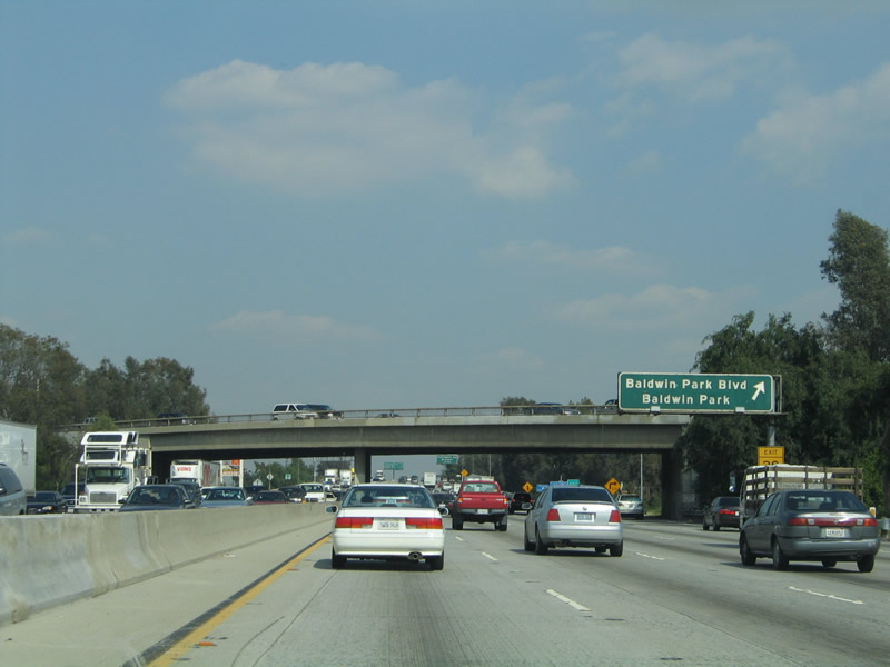 |
Eastbound Interstate 10 (San Bernardino Freeway) reaches Exit 32A, Baldwin Park Avenue. Photo taken 03/25/05. |
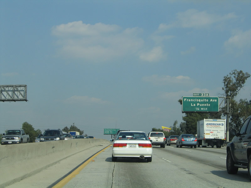 |
The next exit along Interstate 10 east is Exit 32B, Francisquito Avenue to La Puente (signed here as Exit 33A based on the old exit numbering system). Use Francisquito Avenue southeast to Hacienda Boulevard south into the city of La Puente. Interstate 10 remains in the city of Baldwin Park until after Exit 33. Photo taken 03/25/05. |
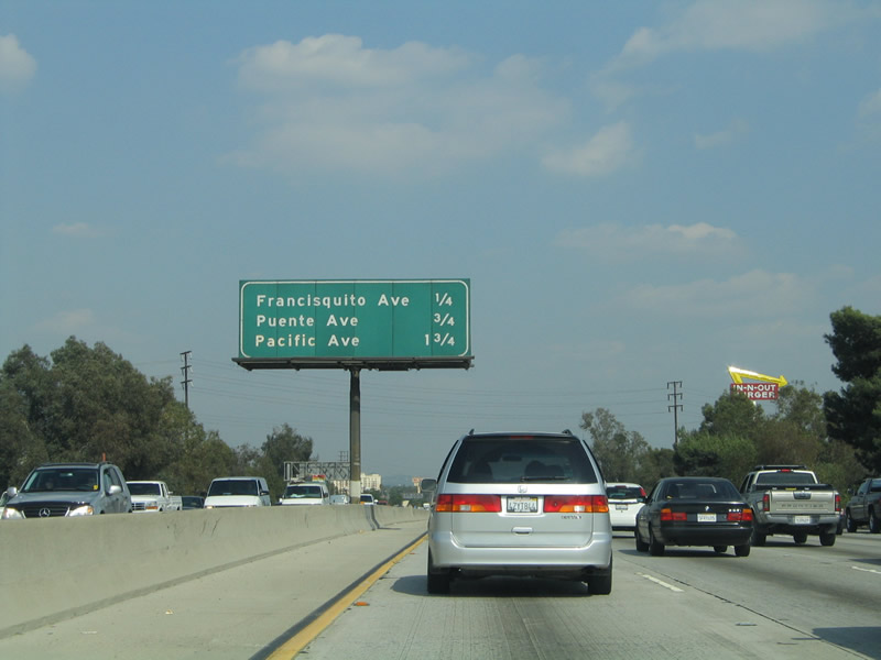 |
This mileage sign provides the distance to the next three exits: Exit 32B, Francisquito Avenue; Exit 33, Puente Avenue; and Exit 34, Pacific Avenue and West Covina Parkway. Photo taken 03/25/05. |
 |
Eastbound Interstate 10 (San Bernardino Freeway) reaches Exit 32B, Francisquito Avenue to La Puente. Photo taken 03/25/05. |
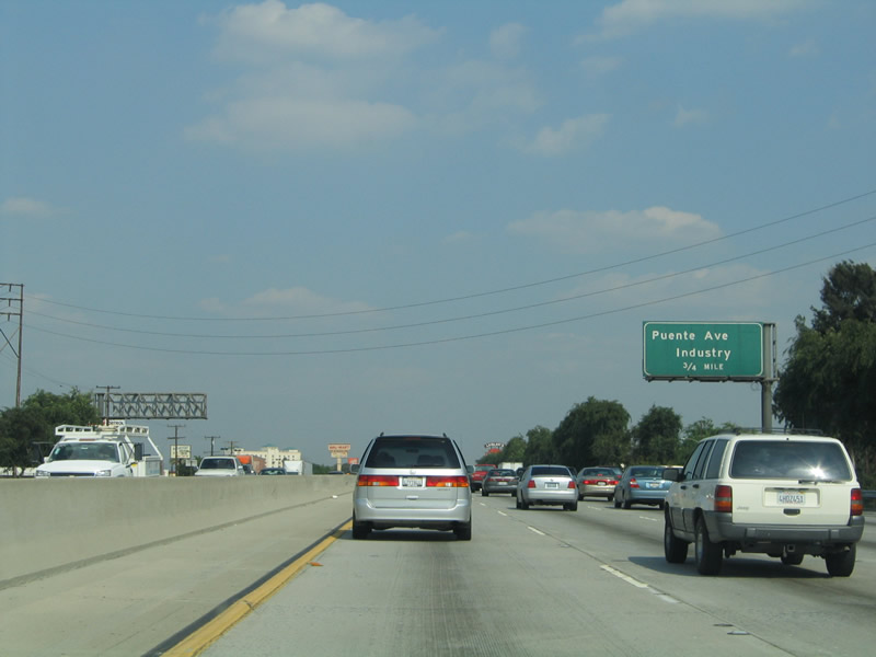 |
The next exit along Interstate 10 east is Exit 33, Puente Avenue. Photo taken 03/25/05. |
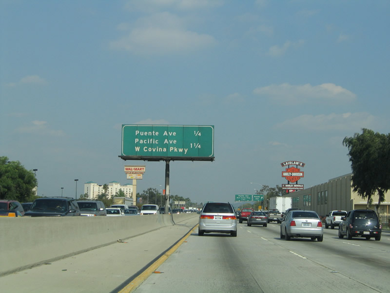 |
This mileage sign provides the distance to the next two exits: Exit 33, Puente Avenue and Exit 34, Pacific Avenue and West Covina Parkway. Photo taken 03/25/05. |
 |
Westbound Interstate 10 reaches Exit 33, Puente Avenue. The next exit along eastbound is Exit 34, Pacific Avenue and West Covina Parkway. Photo taken 03/25/05. |
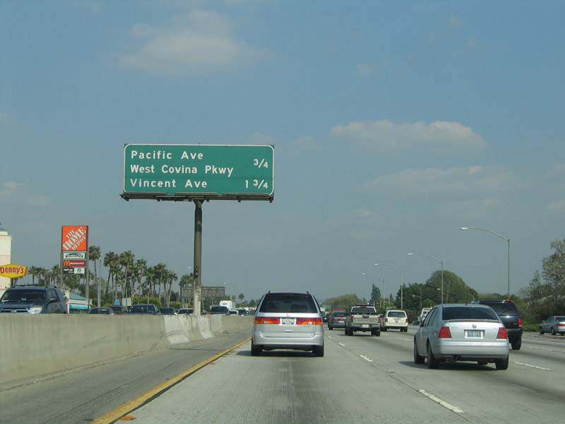 |
This mileage sign provides the distance to the next two exits: Exit 34, Pacific Avenue and West Covina Parkway and Exit 35, Vincent Avenue and Glendora Avenue. Around this point, Interstate 10 leaves the city of Baldwin Park and enters the city of West Covina (population 105,080 as of the 2000 Census). West Covina consists of 16.1 square miles and was incorporated on February 17, 1923. Photo taken 03/25/05. |
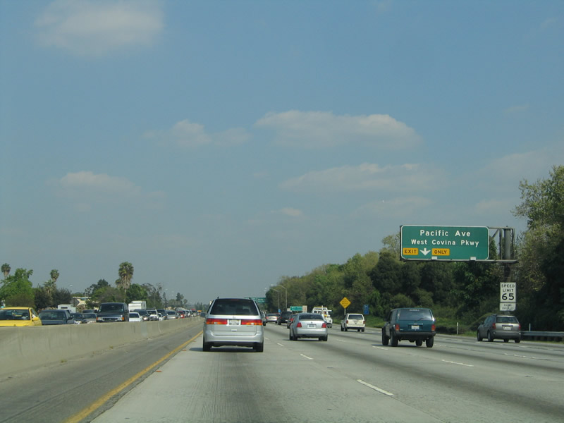 |
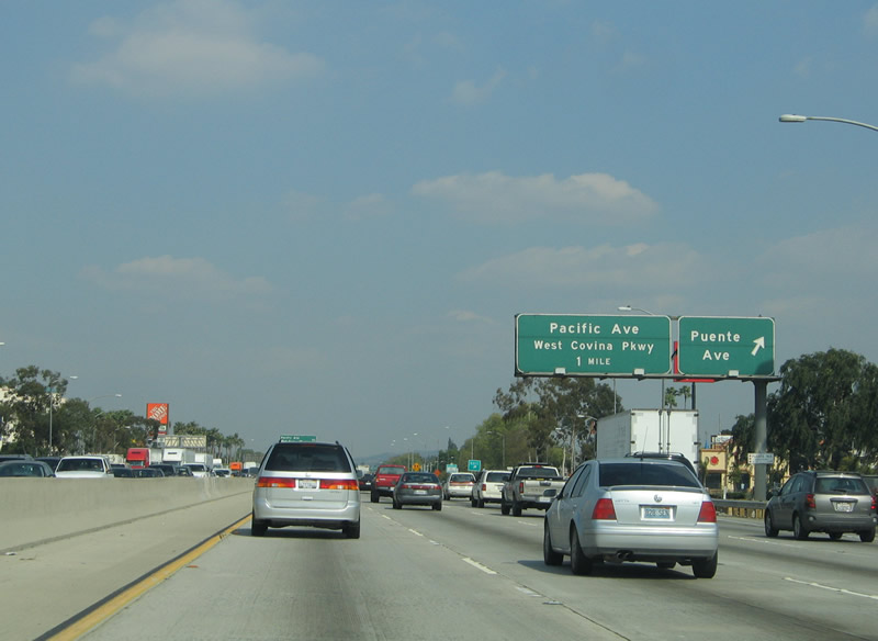
The right lane becomes exit only for Exit 34, Pacific Avenue and West Covina Parkway. Photo taken 03/25/05. |
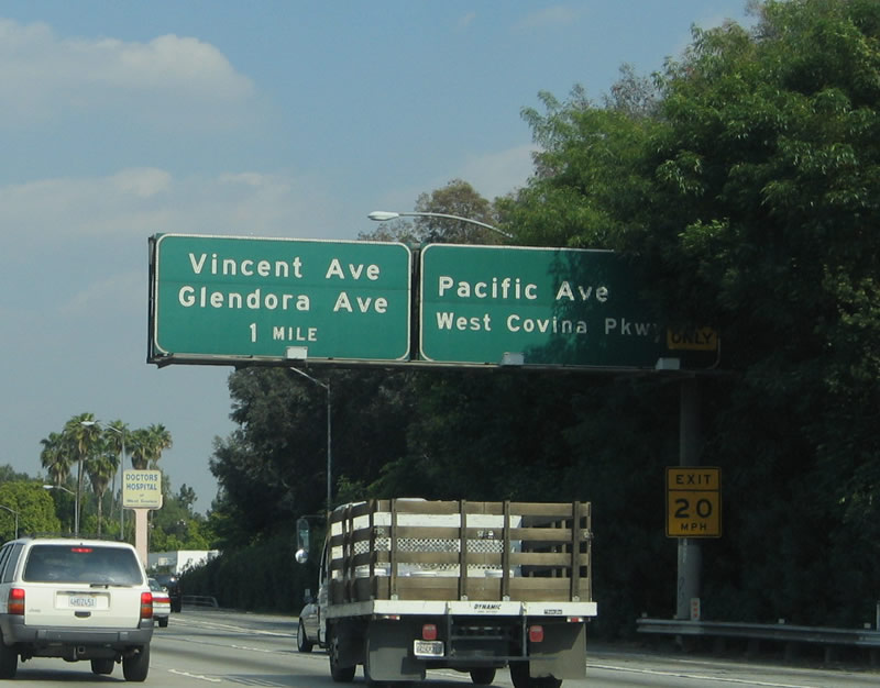 |
Westbound Interstate 10 (San Bernardino Freeway) reaches Exit 34, Pacific Avenue and West Covina Parkway. The next exit along eastbound is Exit 35, Vincent Avenue and Glendora Avenue. Photo taken 03/25/05. |
 |
The right lane again becomes exit only, this time for Exit 35, Vincent Avenue and Glendora Avenue. Photo taken 03/25/05. |
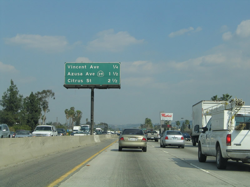 |
This mileage sign provides the distance to the next three exits: Exit 35, Vincent Avenue and Glendora Avenue; Exit 36, California 39/Azusa Avenue; and Exit 37A, Citrus Street. Photo taken 03/25/05. |
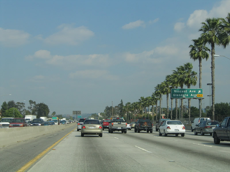 |
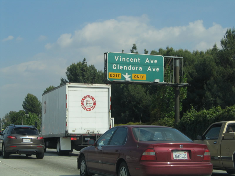
Eastbound Interstate 10 reaches Exit 35, Vincent Avenue and Glendora Avenue. Photo taken 03/25/05. |
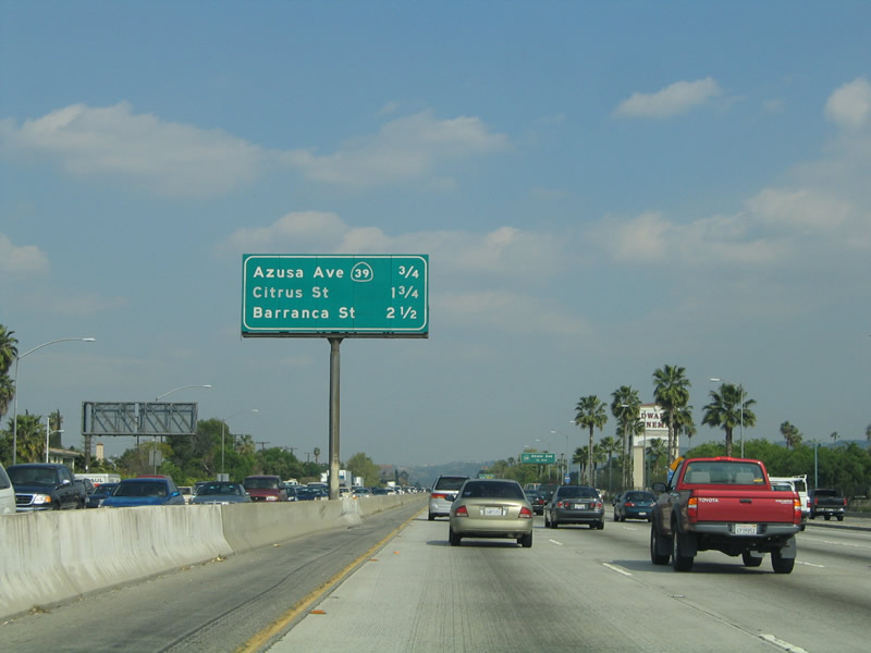 |
This mileage sign provides the distance to the next three exits: Exit 36, California 39/Azusa Avenue north to Azusa and Los Angeles County N-8 (Azusa Avenue) south; Exit 37A, Citrus Street; and Exit 37B, Barranca Street. Photo taken 03/25/05. |
 |
California 39 is a segmented state highway, with a northern segment in Los Angeles County and a southern segment in Orange County. Both segments are surface streets or rural highways; no section of this state route is freeway. The northern segment of California 39 starts at this interchange (Exit 36) and travels north through West Covina and Covina into Azusa. While Azusa Avenue through the city of Azusa is maintained by the city, California 39 resumes as a state highway along San Gabriel Canyon Road north into Angeles National Forest. While California 39 is supposed to connect to California 2 (Angeles Crest Highway), multiple rock slides and other factors have kept that connection closed since the 1970s. Another section of California 39 exists in Orange County along Beach Boulevard south of California 72 (Whittier Boulevard). Photo taken 03/25/05. |
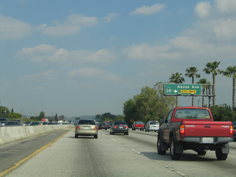 |
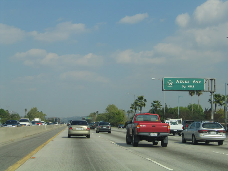
The right lane of Interstate 10 (San Bernardino Freeway) east becomes exit only for Exit 36, Los Angeles County N-8 (Azusa Avenue) south and California 39/Azusa Avenue north. Photo taken 03/25/05. |
 |
Eastbound Interstate 10 (San Bernardino Freeway) reaches Exit 36, California 39/Azusa Avenue north to Azusa and Los Angeles County N-8 (Azusa Avenue) south to La Habra. Photo taken 03/25/05. |
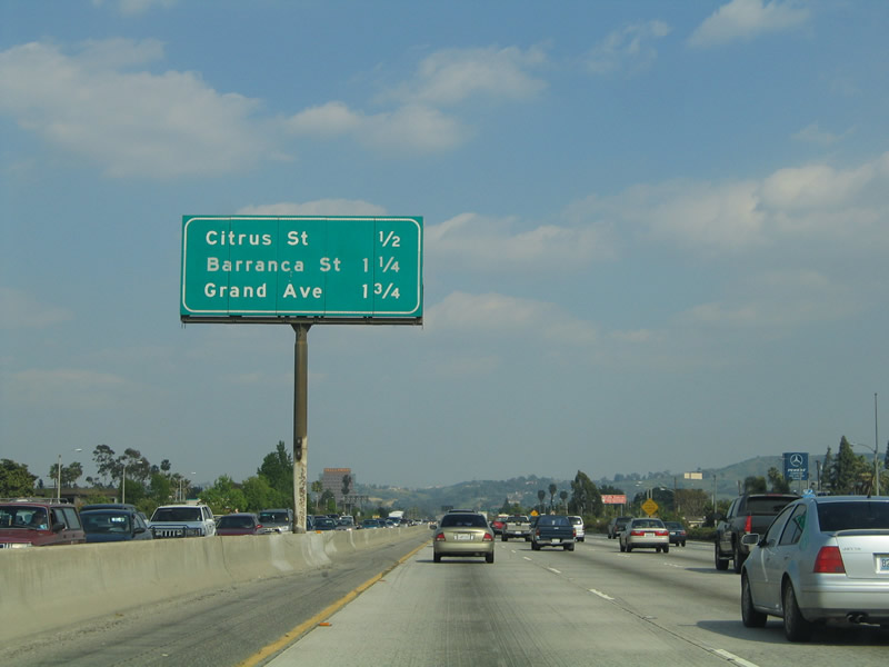 |
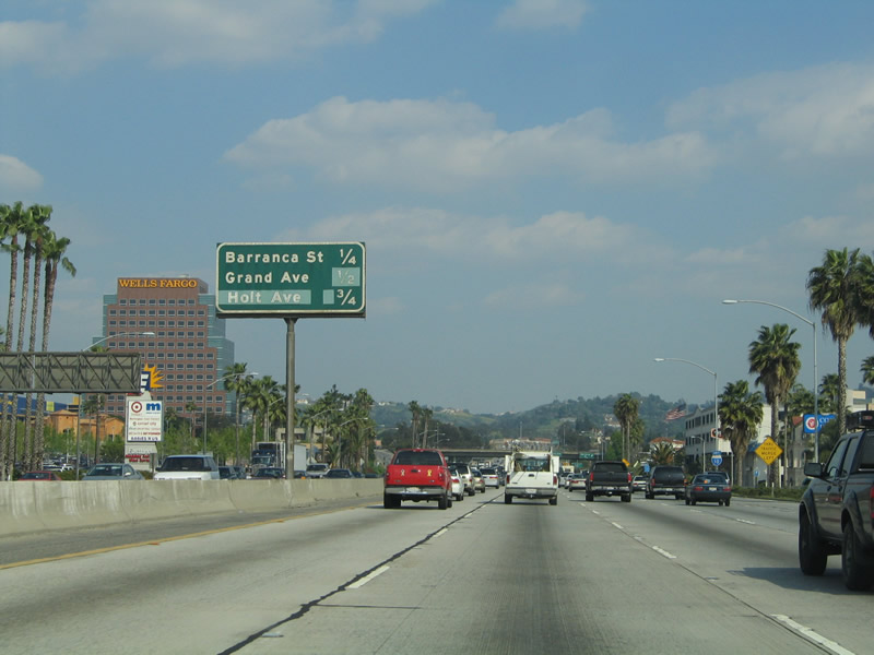
This mileage sign provides the distance to the next three exits: Exit 37A, Citrus Street; Exit 37B, Barranca Street; and Exit 38A, Grand Avenue. Photo taken 03/25/05. |
 |
Eastbound Interstate 10 (San Bernardino Freeway) reaches Exit 37A, Citrus Street north to Covina and south to West Covina. The next exit along eastbound is Exit 37B, Barranca Street. Photo taken 03/25/05. |
 |
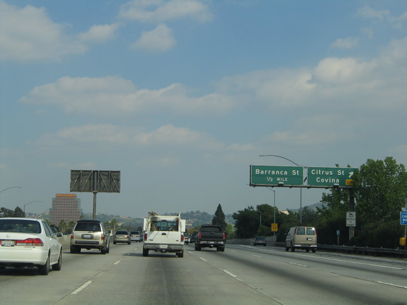
This mileage sign provides the distance to the next three exits: Exit 37B, Barranca Street; Exit 38A, Grand Avenue; and Exit 38B, Holt Avenue. Photo taken 03/25/05. |
 |
Eastbound Interstate 10 (San Bernardino Freeway) reaches Exit 37B, Barranca Street. The next exit is Exit 38A, Grand Avenue. Photo taken 03/25/05. |
 |
Immediately thereafter, Interstate 10 east reaches Exit 38A, Grand Avenue. This is the second to final exit to serve the city of West Covina. Photo taken 03/25/05. |
 |
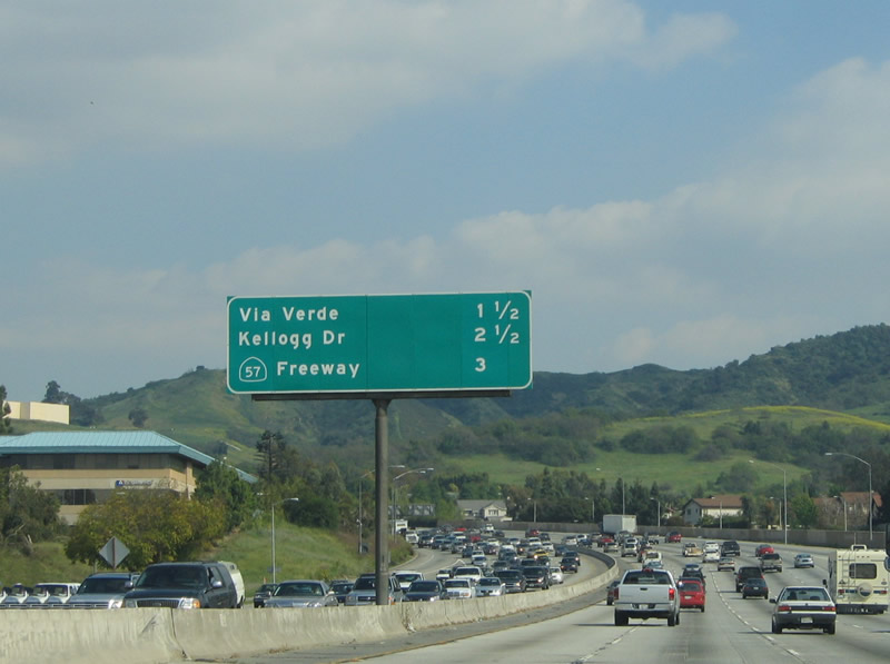
This interchange sequence sign provides the distance to the next three exits along Interstate 10 east: Exit 38B, Holt Avenue; Exit 40, Via Verde; and Exit 41, Kellogg Drive. Photo taken 03/25/05. |
 |
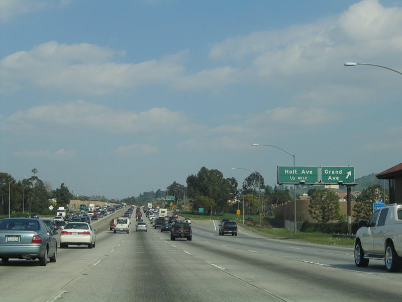
Eastbound Interstate 10 (San Bernardino Freeway) reaches Exit 38B, Holt Avenue. At this point, Interstate 10 leaves the city of West Covina and enters the city of Covina (population 46,837 as of the 2000 Census and incorporated August 14, 1901). Photo taken 03/25/05. |
 |
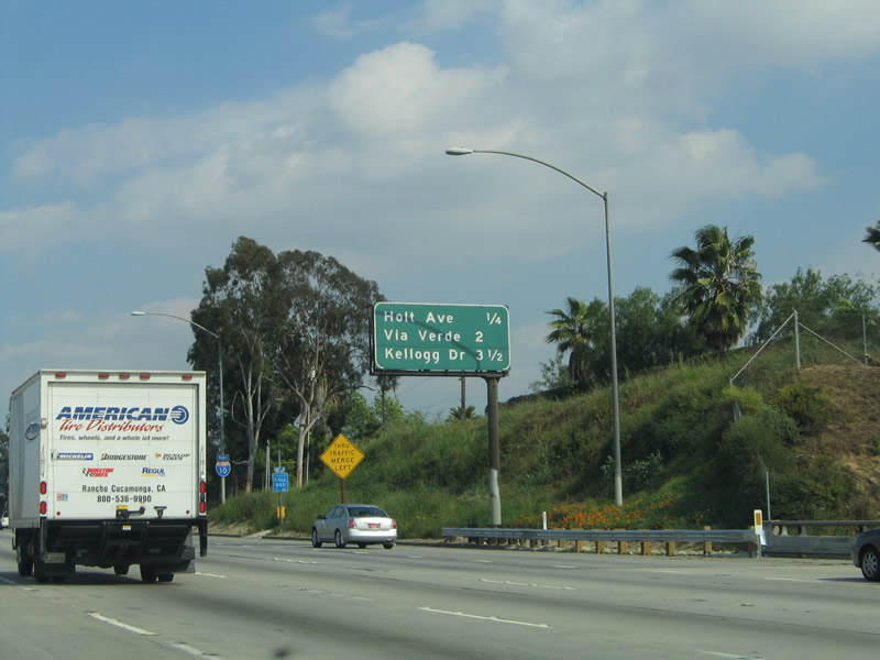
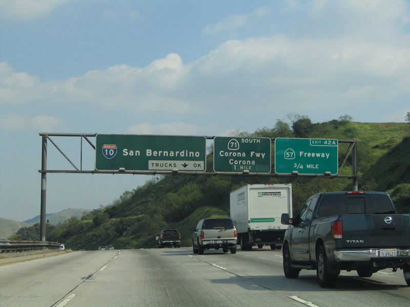
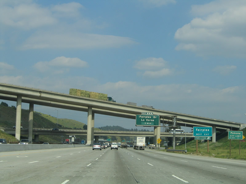
This interchange sequence sign provides the distance to the next three exits along Interstate 10 east: Exit 40, Via Verde; Exit 41, Kellogg Drive; and Exit 42A, California 57 (Orange Freeway) north to San Dimas and south to Anaheim. Photo taken 03/25/05. |
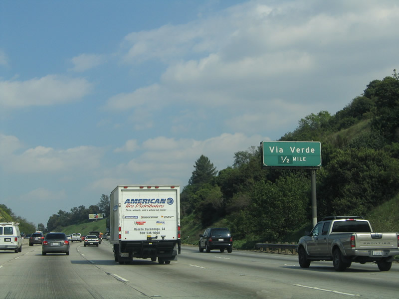 |
Via Verde travels northeast into the city of San Dimas (population 34,980 as of 2000 Census and incorporated on August 4, 1960). Via Verde crosses California 57 then ends at Frank G. Bonelli Regional County Park. Photo taken 03/25/05. |
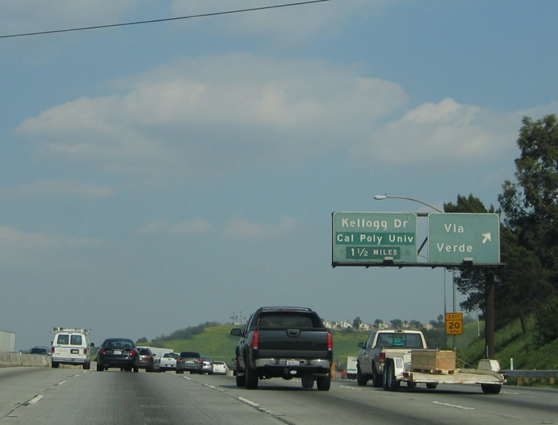 |
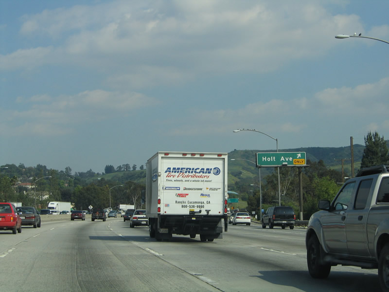
Eastbound Interstate 10 (San Bernardino Freeway) reaches Exit 40, Via Verde. The next exit along eastbound is Exit 41, Kellogg Drive. Photo taken 03/25/05. |
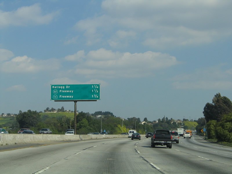 |
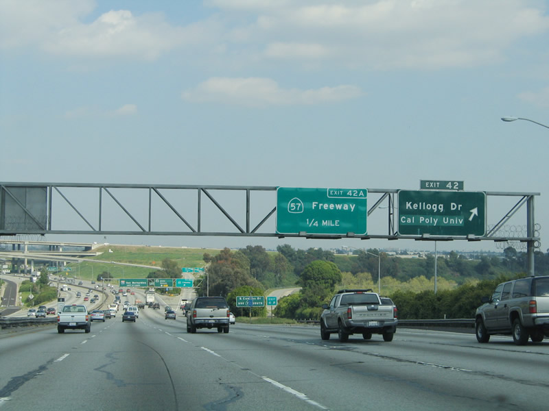
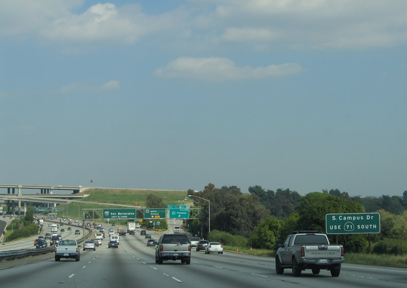
This interchange sequence sign provides the distance to the next three exits along Interstate 10 east: Exit 41, Kellogg Drive; Exit 42A, California 57 (Orange Freeway) north to San Dimas and south to Anaheim; and Exit 42B, California 71 (Chino Valley Freeway). The advance signs prior to Exits 42A-B were replaced when California 57 replaced Interstate 210 at the Kellogg Interchange. Photo taken 03/25/05. |
 |
Porcelain enamel signs dating from the 1960s are posted for Exit 42B and the pull-through sign, but a newer reflective sign for Exit 42A, California 57 (Orange Freeway) replaced a porcelain enamel sign that used to have both Interstate 210 and California 57 on it. Photo taken 03/25/05. |
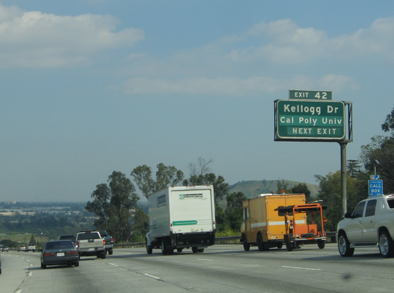 |
Eastbound Interstate 10 approaches Exit 41, Kellogg Drive, next right. Originally, this was assigned Exit 42, but in the new program, this exit will be Exit 41. New signs will be installed to reflect the new numbering. However, this stretch of Interstate 10 was clearly the laboratory for the original attempt to sign exit numbers in California in the 1960s; too bad it was not continued any farther than it was back then. Exit numbers are fairly common on the oldest signs between downtown Los Angeles and Ontario. Photo taken 03/25/05. |
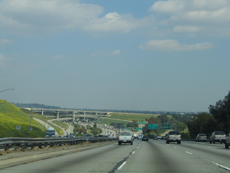 |
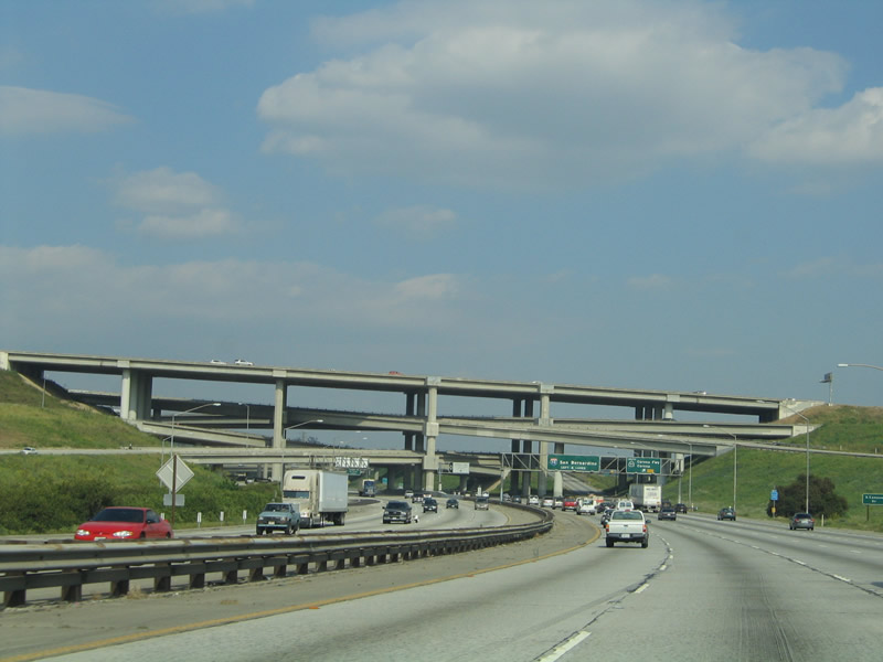
The symmetrical stack Kellogg Interchange comes into view as Interstate 10 continues east toward the California 57 and California 71 interchange. Photo taken 03/25/05. |
 |
Eastbound Interstate 10 reaches Exit 41, Kellogg Drive. Kellogg Drive leads to California Polytechnical University at Pomona. The massive Kellogg Interchange between Interstate 10, former Interstate 210, California 57, and California 71 is visible in the distance. Photo taken 03/25/05. |
 |
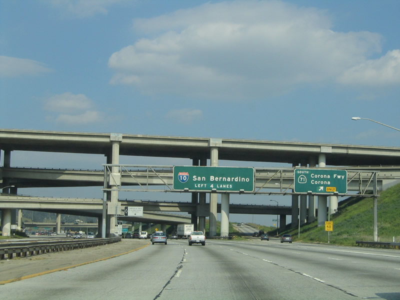
The next two exits along eastbound Interstate 10 are Exits 42A-B, the Kellogg Interchange. At this interchange, Interstate 10 interchanges with California 57 (former Interstate 210) and California 71. Interstate 210 used to end at this interchange, but it has since been rerouted to Redlands and will ultimately connect to the California 30 freeway by 2007. California 57 leads north to meet Interstate/California 210 (Foothill Freeway) leads west and north from this point toward Pasadena and Interstate 5 northbound. California 57 (Orange Freeway) leads south toward Orange County destinations (Anaheim and Santa Ana), and ends at the Orange Crush interchange with California 22 and Interstate 5. A proposed extension may see California 57 continue south to Interstate 405 as a toll road, but it is not clear if or when it might be constructed. Photo taken 03/25/05. |
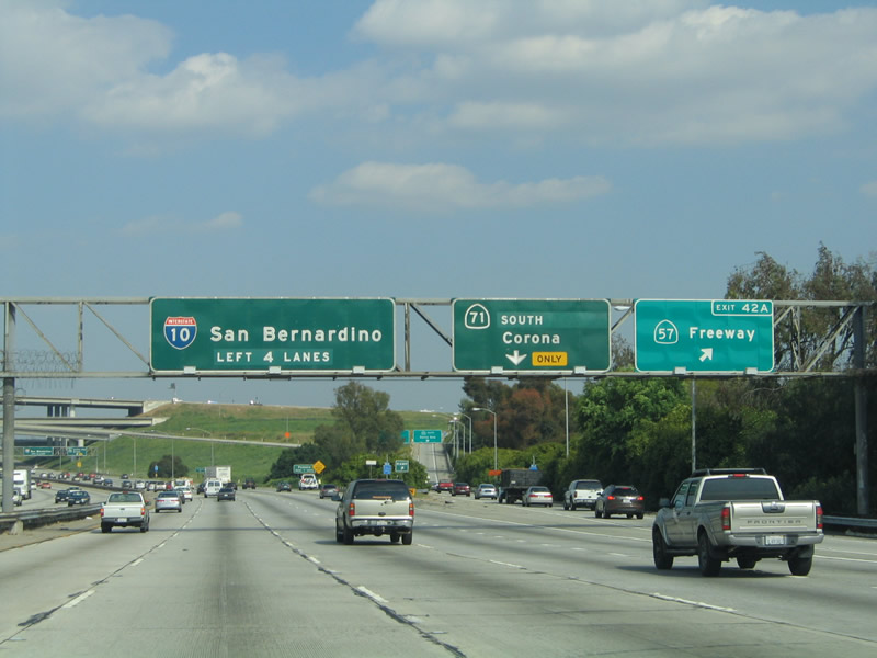 |
This ramp connects eastbound Interstate 10 with Exit 42A, California 57 (Orange Freeway) south to Diamond Bar and California 57 (Orange Freeway) north (formerly Interstate 210 west) to San Dimas. The next ramp is Exit 42B, which connects to California 71 (Chino Valley Freeway) south to Chino Hills. California 71 passes through the city of Pomona as a surface street. Photo taken 03/25/05. |
 |
The Kellogg Interchange is a symmetrical stack interchange between Interstate 10 and California 57 with a set of connecting ramps to California 71. Photo taken 03/25/05. |
 |
Eastbound Interstate 10 (San Bernardino Freeway) reaches Exit 42B, California 71 (Chino Hills Freeway) south. Use California 71 south to Business Loop I-10 (Holt Avenue) east to Pomona. Even though California 71 is called the Chino Hills Freeway, it is not a freeway through Pomona yet. An interchange at Mission Boulevard was slated for completion in 2010.1 However, the long-range Metro transportation planning document suggesting that funding may not be available for the completion of the California 71 freeway gap until 2029 due to limited funding availability. It has an expressway section through Pomona, but the rest of the route southeast to California 91 (Riverside Freeway) near Corona is up to freeway standards. Use California 71 south to Business Loop I-10 (Holt Avenue) (former U.S. 70-99) east into downtown Pomona. Photo taken 03/25/05. |
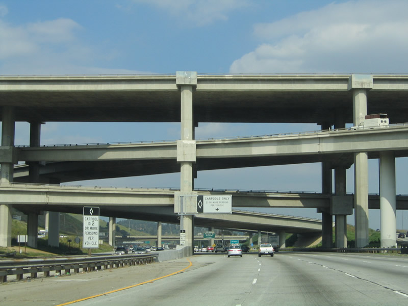 |
Interstate 10 passes under the Kellogg Interchange. Interstate 10 remains at the bottom, while California 57 passes over the top. The two mid-level ramps are for connections between these two roadways. The next ramp (after the four-level stack interchange) is angled toward Interstate 210, and it carries California 71 to its northern terminus as a part of this interchange. Photo taken 03/25/05. |
 |
Interstate 10 enters the city of Pomona. Home to 149,473 people as of the 2000 Census, Pomona was incorporated on January 6, 1888. Pomona is served by a sporadically signed business route along Holt Avenue (connecting to Interstate 10 via California 71), but it is not signed from Interstate 10. Photo taken 03/25/05. |
Sources:
- City of Pomona: Street Improvements -Mission Boulevard and SR 71 Grade Separation - "The Mission Boulevard/ SR 71 Grade Separation project will remove the existing at-grade intersection of Mission Boulevard at SR 71 by constructing an overcrossing of Mission Boulevard over the existing SR 71 expressway. Six through lanes and two turning lanes are proposed for the overcrossing, and the design provides a compressed diamond configuration allowing full uncontrolled ingress and egress on SR 71 using standard freeway type on and off-ramps. Completion of the project will improve traffic circulation at this heavily used intersection. The project schedule anticipates advertising for construction bids in early 2007 with estimated construction starting in Fall 2008. Construction is anticipated to take 24 months to complete. Motorists are advised to seek alternative routes during the construction period to avoid excessive delays." Information retrieved on 09/15/08.
- Los Angeles Metropolitan Transportation Authority (Metro): Draft 2008 Long Range Transportation Plan - Information retrieved on 09/15/08.

Page Updated October 12, 2008.
|
About Contact Glossary |
In The News Interstate Guide |
Social Media:
 |
|
© 2000-25 AARoads.com | All Rights Reserved | Privacy Policy / Terms of Use
|
||