|
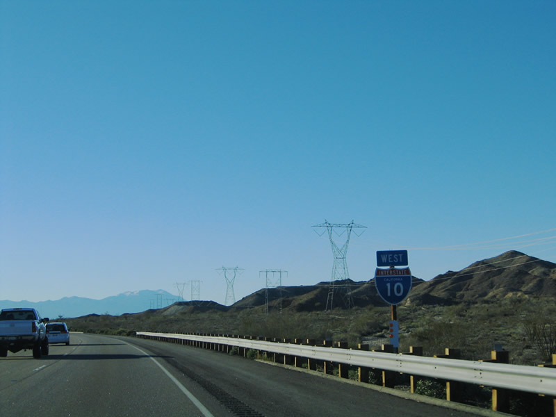
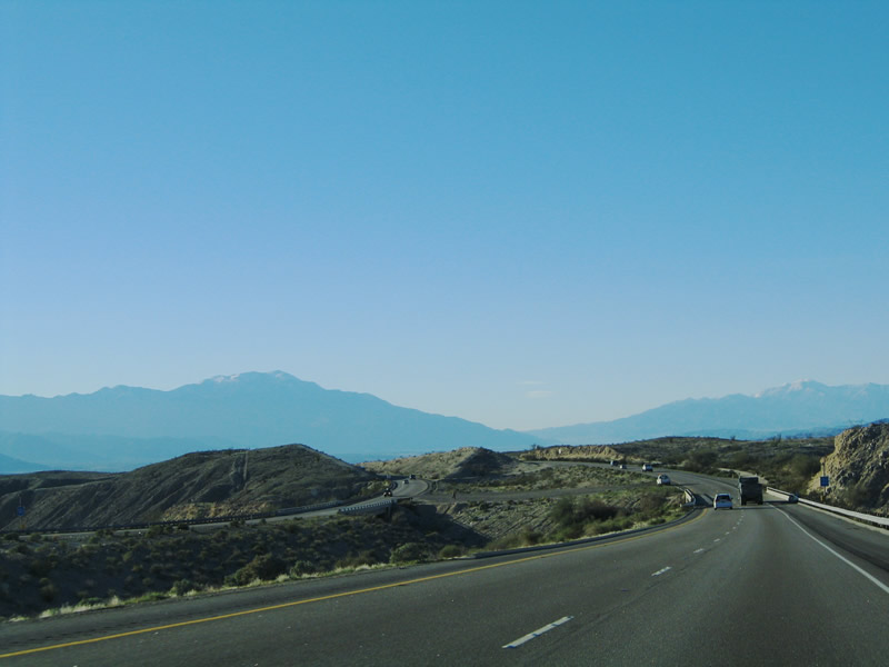
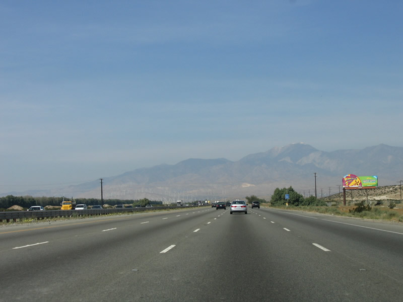
The next set of powerlines cross Interstate 10 about two miles east of the Dillon Road interchange. These lines carry electricity generated from geothermal facilities located along the Salton Sea corridor. This particular line begins just north of Interstate 8 near the California 115/Holtville interchange in the Imperial Valley. Most of this geothermal energy is made possible due to the prevalence of fault energy permeating this region. The San Andreas Fault, which angles southeast through California from San Francisco, comes to its southern end near the Salton Sea. However, many faults cross through this area, making it very geologically active. Photo taken 01/17/05. |
|
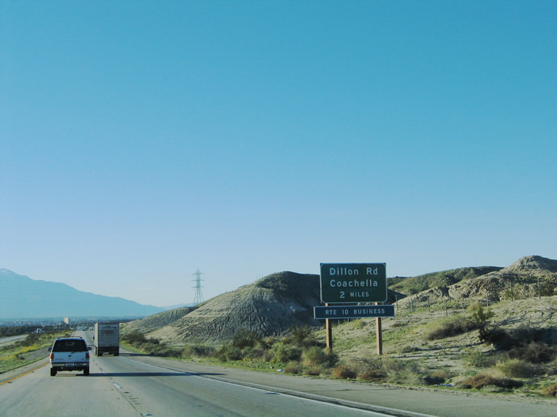
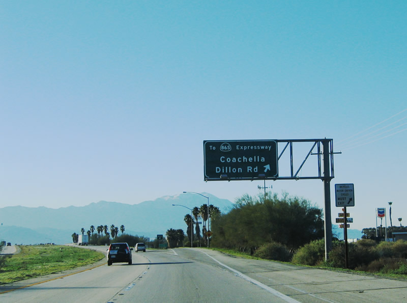
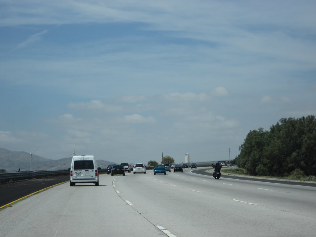
The next exit along westbound Interstate 10 is Exit 146, Business Loop I-10, Dillon Road. Use this exit to Indio and the California 86S Expressway. The business loop follows old U.S. 60-70 and California 86/old U.S. 60-70-99 into Indio. While it is technically true that the Dillon Road interchange is located within the city of Coachella, most of that city lies southwest of Interstate 10 on California 86 and Avenue 52. Coachella had 22,724 people as of the 2000 Census and has an estimated 30,764 residents as of a 2005 estimate. The city's area consists of 32 square miles. Photo taken 01/17/05. |
|
Exit 146 serves as the only connection from westbound Interstate 10 to southbound California 86S. While there are plans to someday provide a full freeway-to-freeway interchange between Interstate 10 and California 86S, currently travelers making the westbound to southbound connection must use Business Loop I-10 (Dillon Road). Photo taken 01/17/05. |
|
For the first time since leaving Blythe, Interstate 10 enters an incorporated city. With this junction, Interstate 10 leaves behind its rural characteristics and becomes a suburban and even urban freeway from here forward. Photo taken 01/17/05. |
|
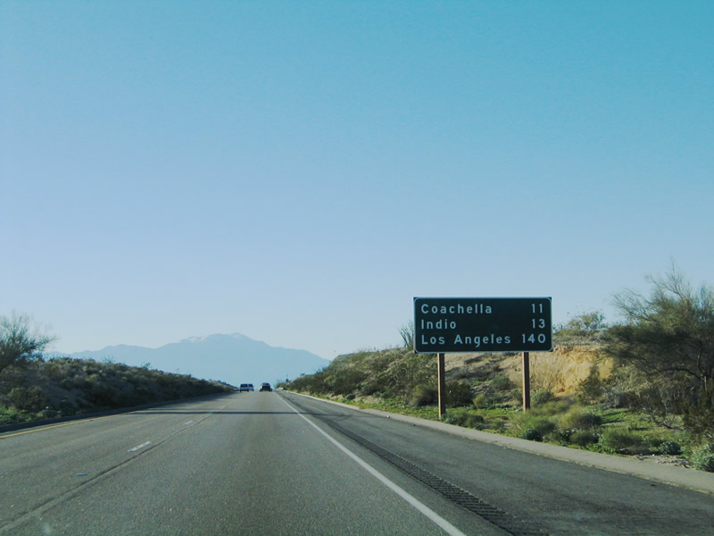
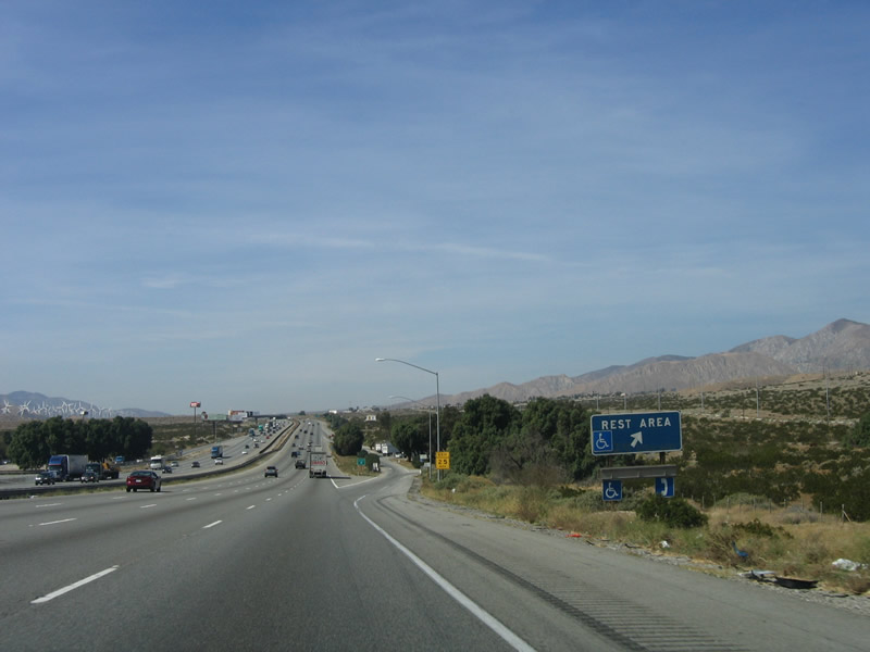
By taking the California 86S expressway southbound, travelers may reach several Salton Sea destinations, including the Salton Sea State Recreation Area located on the east shore of the salty lake. Follow California 86S south to California 111 south to the Salton Sea State Recreation Area. Photo taken 01/17/05. |
|
Westbound Interstate 10 at Exit 146, Business Loop I-10 (Dillon Road) to Indio, to Southbound California 86-S, California 86, California 111, and the Salton Sea resorts. This exit also leads to Historic U.S. 60-70. Photo taken 01/17/05. |
|
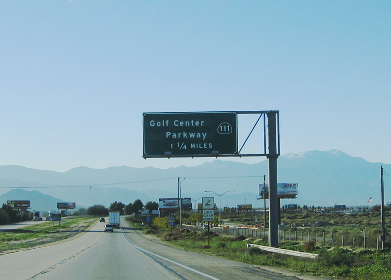
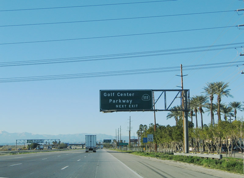
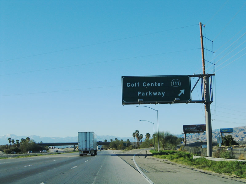
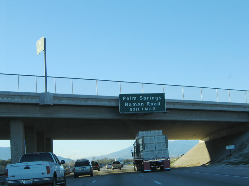
The next exit along westbound Interstate 10 is Exit 144, Golf Center Parkway south to California 111. Use this exit to connect to northbound California 111, which parallels Interstate 10 between Indio and just west of Palm Springs. Contrary to the signage, California 111 does not intersect Interstate 10 at this interchange. Use this exit to follow California 111 northwest through the Coachella Valley's most densely populated communities: Indio, La Quinta, Indian Wells, Palm Desert, Rancho Mirage, Cathedral City, and Palm Springs. Photo taken 01/17/05. |
|
Leaving the city of Coachella, Interstate 10 now enters the city of Indio. As of the 2000 Census, 49,800 people lived in Indio, and a 2004 estimate had the population at 59,100 people. Looking forward, projections indicate that Indio's population would increase to 116,884 people by 2020! Photo taken 01/17/05. |
|
Golf Center Parkway connects Interstate 10 with downtown Indio, California 111, California 86, and Business Loop I-10. While this connection is part of the state highway system, it is signed in one direction as "To California 111" and as "To Interstate 10" in the other direction. A viaduct carries Golf Center Parkway over the railroad, and it intersects California 111 at Avenue 46. Turn west to follow California 111 northwest through the Coachella Valley; turn right to follow California 111 southeast to Indio Boulevard. The intersection of Indio Boulevard and Avenue 46 is the northern terminus of California 86; Business Loop I-10 follows Old U.S. 99 northwest back to Interstate 10. Photo taken 01/17/05. |
|
Westbound Interstate 10 reaches Exit 144, Golf Center Parkway to California 111 (and California 86 and Business Loop I-10) in downtown Indio. The freeway continues with four lanes in each direction to serve the rest of the Coachella Valley. Photo taken 01/17/05. |
|
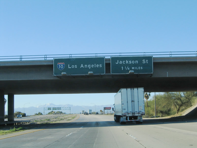
After the Golf Center Parkway interchange, westbound Interstate 10 narrows from four lanes to three lanes (the right lane ends). The next exit along westbound is Exit 143, Jackson Street. This north-south road is a primary arterial corridor in Indio, and it connects Interstate 10 with downtown. Photo taken 01/17/05. |
|
Use Jackson Street (Exit 143) to enter the downtown area of the city of Indio. Mapped out as part of San Diego County in 1888, Indio became one of 12 townships within newly formed Riverside County in 1893. Settlers came to the Coachella Valley and grew slowly through the early 20th Century. In 1930, Indio incorporated with 1,875 residents; it was the first city formed in the Coachella Valley. Agriculture grew in the 1960s with the construction of the Coachella branch of the All-American Canal system, which conveys water from the Colorado River. Population continued to grow with the advent of air conditioning and as "snowbirds" and others relocated to this region. The population of Indio was 49,116 as the 2000 Census, and the city sits at an average elevation of -13 feet (or 13 feet below sea level). Photo taken 01/17/05. |
|
Westbound Interstate 10 reaches Exit 143, Jackson Street. Now that Interstate 10 has descended from the high desert, it crosses the San Andreas Fault. This fault line begins near the Salton Sea to the south, travels northwest through the Coachella Valley, slices its way into the high desert (passing Mt. San Gorgonio to the north), and generally follows California 138 to the northwest. Photo taken 01/17/05. |
|
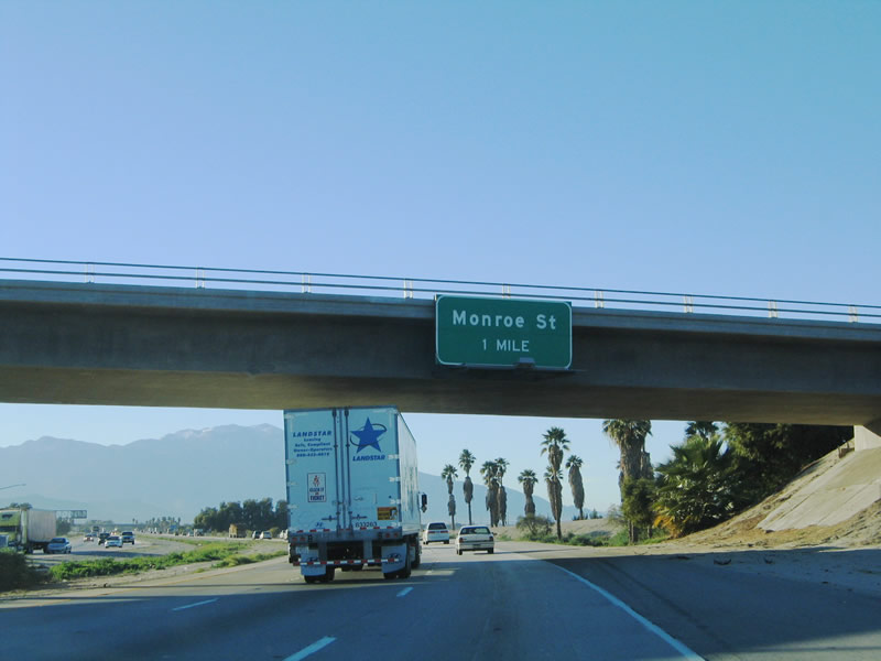
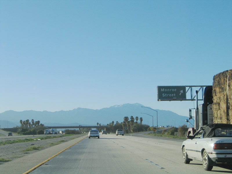
The next exit along westbound is Exit 142, Monroe Street, which continues the trend of naming certain city streets after U.S. Presidents (Jackson and Monroe). Interstate 10 continues west through Indio. Photo taken 01/17/05. |
|
Westbound Interstate 10 reaches Exit 142, Monroe Street. This diamond interchange is typical of the interchanges found in the Coachella Valley. Photo taken 01/17/05. |
|
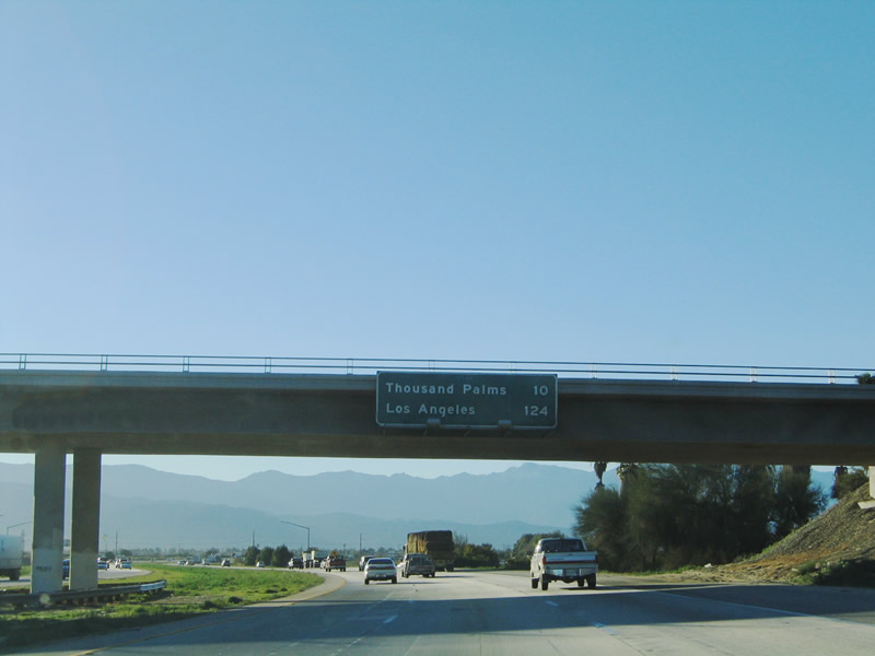
This mileage sign (mounted onto the Monroe Street overpass) provides the distance to unincorporated Thousand Palms and the control city of Los Angeles. It is still quite a way to get to the city of angels. Photo taken 01/17/05. |
|
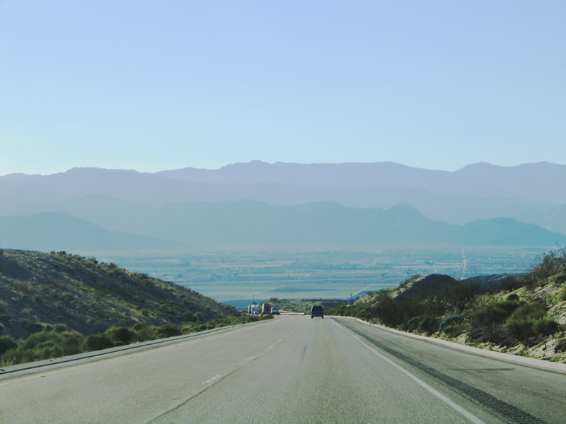
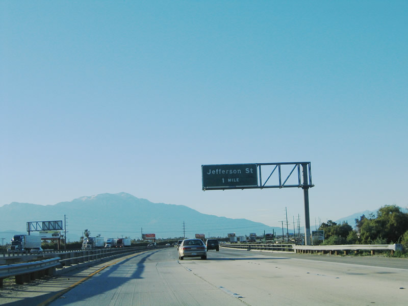
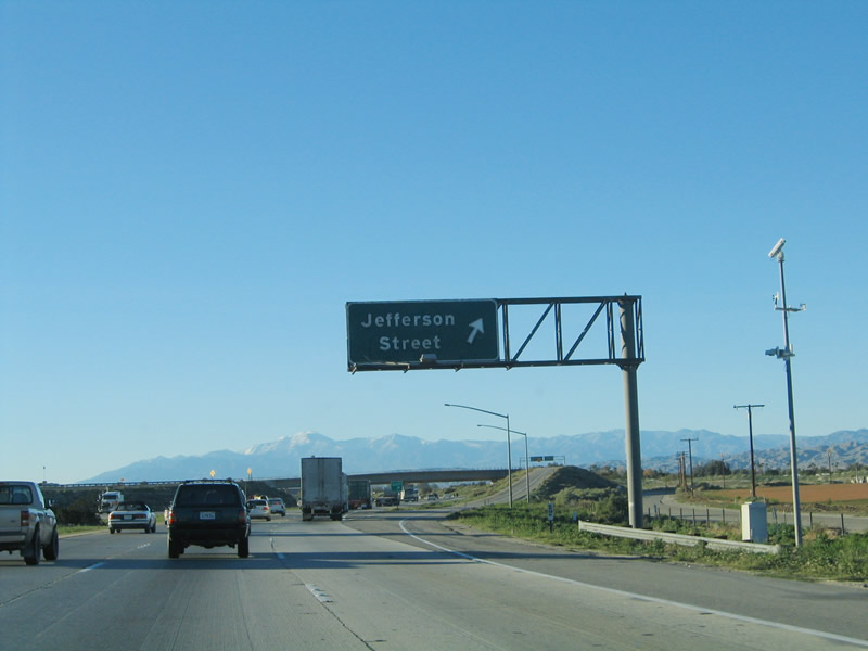
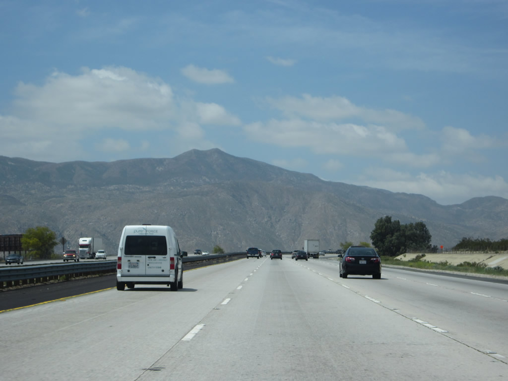
Mount San Jacinto continues to rise above the Coachella Valley as westbound Interstate 10 approaches Exit 139, Jefferson Street. To the north of Interstate 10 and running parallel to the freeway is the San Andreas Fault. This major north-south fault comes ashore in San Francisco, then cuts a diagonal swatch toward southeastern California. It comes to an end in the Salton Sea, where it subdivides into several smaller faults. The section of San Andreas faultline within the Coachella Valley is considered to be one poised for a major earthquake (magnitude 8.0 on the Richter Scale or more). Photo taken 01/17/05. |
|
The next two exits serve the city of La Quinta. Incorporated in 1982, La Quinta has an estimated population of 30,450 in 2005, but it is growing rapidly. Photo taken 01/17/05. |
|
Westbound Interstate 10 reaches Exit 139, Jefferson Street to La Quinta. Mt. San Jacinto, which dominates the western end of the Coachella Valley near Palm Springs, comes into view as Interstate 10 travels northwest toward Banning. Despite Interstate 10 being the main route through the Coachella Valley, it avoids entering most of the urban areas of the various cities along its route, thus providing a bypass. California 111 offers the direct route through the various cities in the valley. Photo taken 01/17/05. |
|
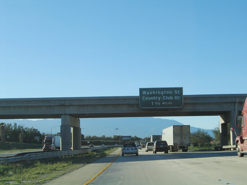
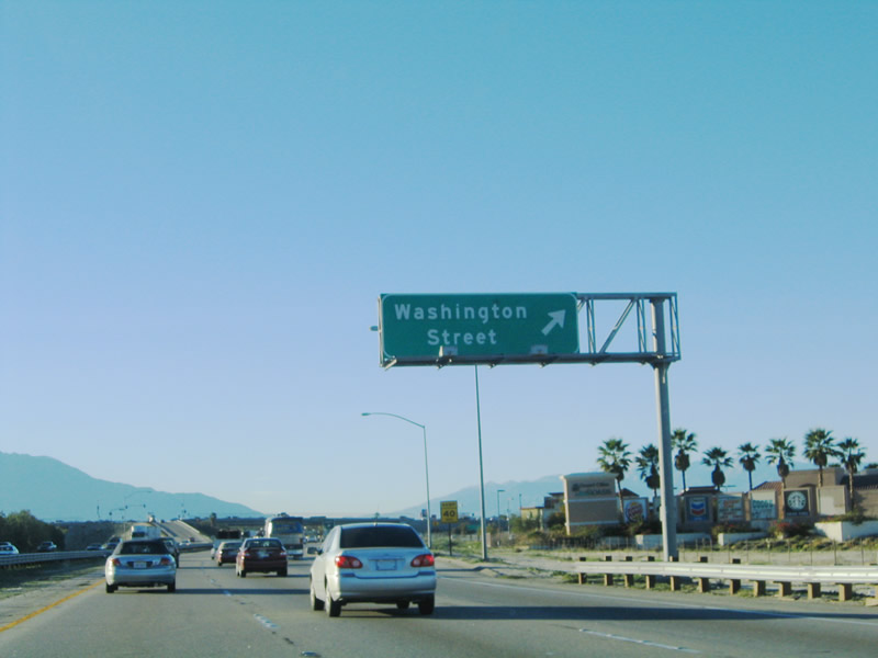
The next exit along westbound Interstate 10 is Exit 137, Washington Street and Country Club Drive. This interchange also serves the city of La Quinta. Photo taken 01/17/05. |
|
The design of this section of Interstate 10 normally has one or two exit signs in the median, which is unusual compared to other freeways in Southern California. However, Interstate 10 is a rare rural freeway that has six to eight lanes of traffic. Overhead signs are limited to the first sign on an overpass and the last sign at the gore point on an overhead sign. This is the one-mile advance sign for Exit 137, Washington Street/Country Club Drive. Photo taken 01/17/05. |
|
This interchange serves the valley cities of Palm Desert, La Quinta, and Indian Wells. It also provides a connection to California 74 west to Sun City (Interstate 215). Several incorporated cities share the Coachella Valley, and they primarily follow the path of California 111 between Indio and Palm Springs. However, Interstate 10 (and old U.S. 60-70-99) skirts the edges of each city along its path. Photo taken 01/17/05. |
|
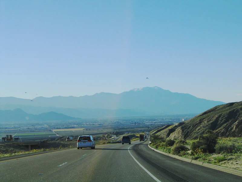
Westbound Interstate 10 reaches Exit 137, Washington Street and Country Club Drive. Palm Desert sits between Indian Wells and Rancho Mirage along California 111; it is home to 41,155 people per the 2000 Census. An additional 30,000 or so populate the region during the moderate winter months by those escaping colder regions to the north. Photo taken 01/17/05. |
|
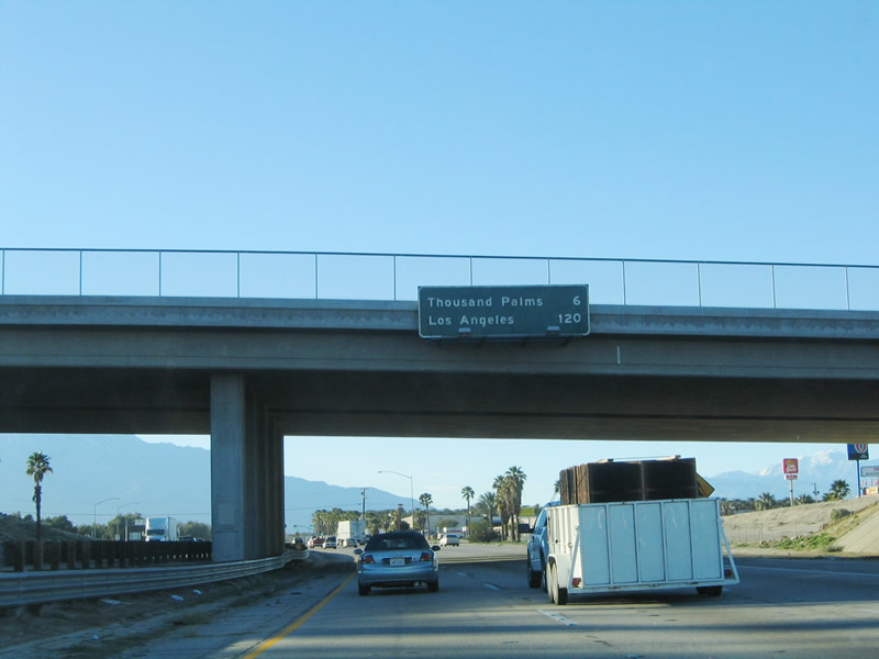
This mileage sign (mounted onto the Washington Street overpass) provides the distance to unincorporated Thousand Palms (6 miles) and the control city of Los Angeles (120 miles). Photo taken 01/17/05. |
|
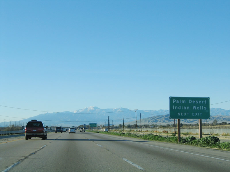
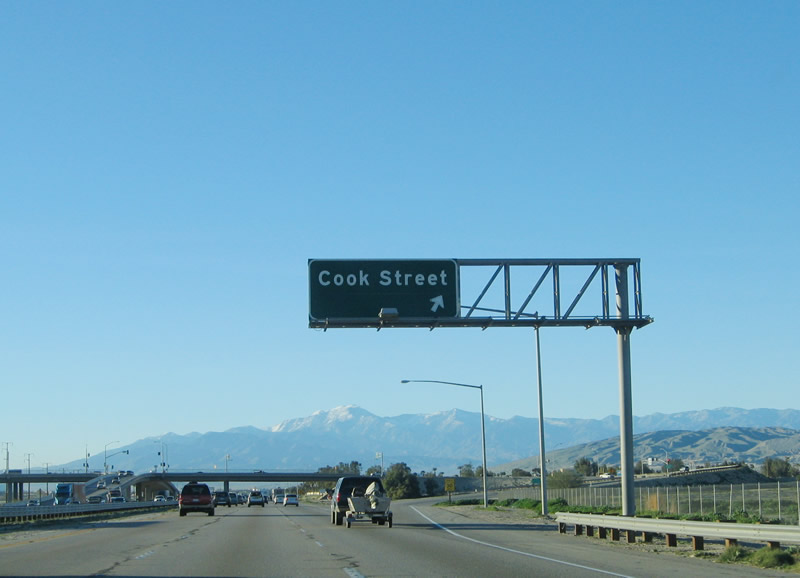
Use Exit 134 (Cook Street, which is the next exit) to the cities of Palm Desert and Indian Wells. Photo taken 01/17/05. |
|
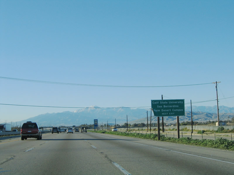
The next exit also serves the California State University at San Bernardino's Palm Desert Campus. Photo taken 01/17/05. |
|
Westbound Interstate reaches Exit 134, Cook Street. Photo taken 01/17/05. |
|
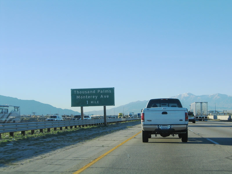
The next exit is Exit 131, Monterey Avenue to Thousand Palms. Monterey Avenue is the proposed alignment of an extended California 74, should the state highway be extended north from California 111 in Palm Desert to Interstate 10 at Exit 131. Photo taken 01/17/05. |
|
Westbound Interstate 10 reaches Exit 131, Monterey Avenue south to California 74 en route to San Bernardino National Forest, Idyllwild, Hemet, and Sun City. In addition, Monterey Avenue travels north to serve unincorporated Thousand Palms. Photo taken 01/17/05. |
|
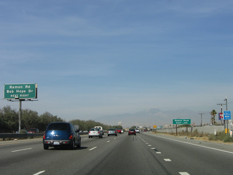
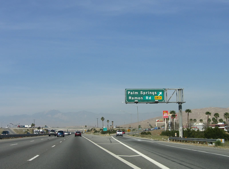
The next exit is Exit 130, Ramon Road/Bob Hope Drive to Palm Springs. Photo taken 01/17/05. |
|
A standard reassurance shield is posted after the Monterey Avenue interchange. Photo taken 02/25/06. |
|
Ramon Road travels east to Thousand Palms and west to Agua Caliente Indian Reservation and the Palm Springs International Airport. Bob Hope Drive travels south to Rancho Mirage and Palm Desert. Photo taken 02/25/06. |
|
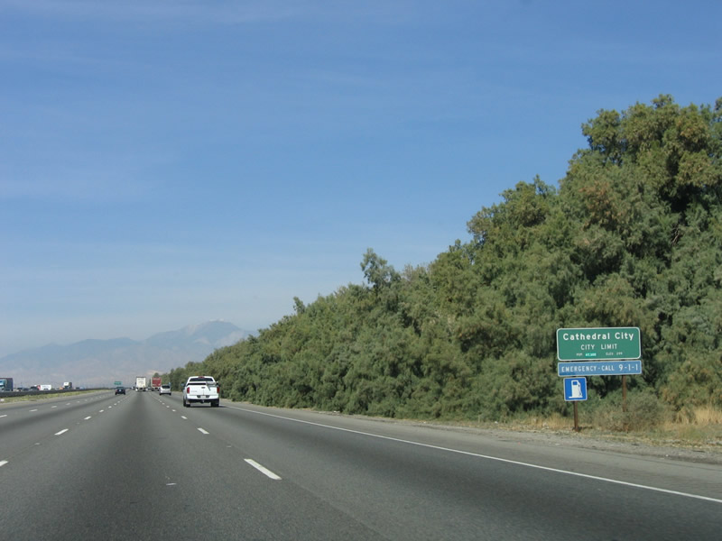
" The next two exits along westbound Interstate 10 serve Cathedral City. Incorporated in 1981, Cathedral City is home to 42,647 people. Photo taken 02/25/06. |
|
Westbound Interstate 10 reaches Exit 130, Ramon Road and Bob Hope Drive. Photo taken 02/25/06. |
|
The Ramon Road/Bob Hope Drive overpass was built in 1961, dating from the U.S. 60-70-99 expressway. Photo taken 02/25/06. |
|
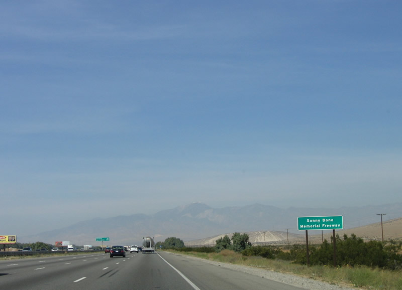
Interstate 10 through Cathedral City and Palm Springs is known as the Sonny Bono Freeway. Sonny Bono (1935-1998) was a popular signer from the 1970s (part of the duo Sonny and Cher) and later served as U.S. Representative for the 44th District in California. Sonny Bono died in January 1998 at Heavenly Ski Resort during a skiing accident. One of his areas of interest was the Salton Sea, and the Sonny Bono Salton Sea National Wildlife Refuge on the southeastern shore of the lake is named in his honor. Photo taken 02/25/06. |
|
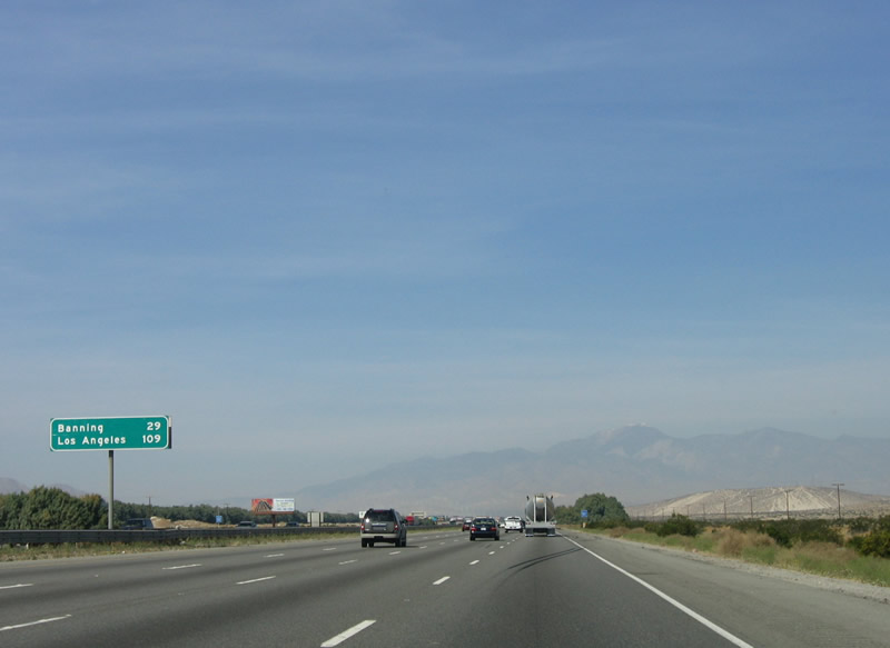
This mileage sign provides the distance to Banning (29 miles) and Los Angeles (109 miles). Photo taken 02/25/06. |
|
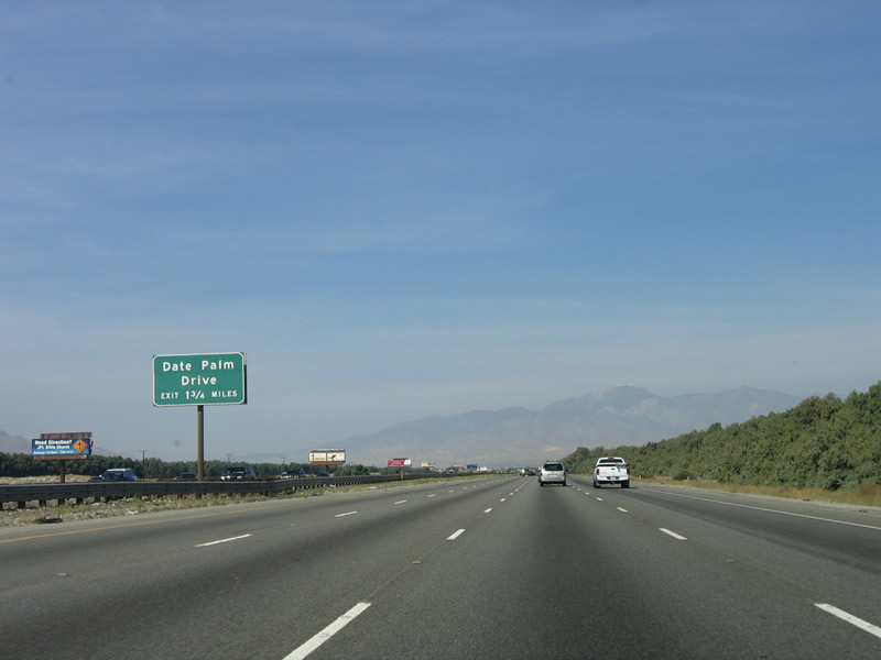
The next exit along westbound Interstate 10 is Exit 126, Date Palm Drive/Vista Chino Road (1.75 miles). Photo taken 02/25/06. |
|
Interstate 10 enters Cathedral City. Photo taken 02/25/06. |
|
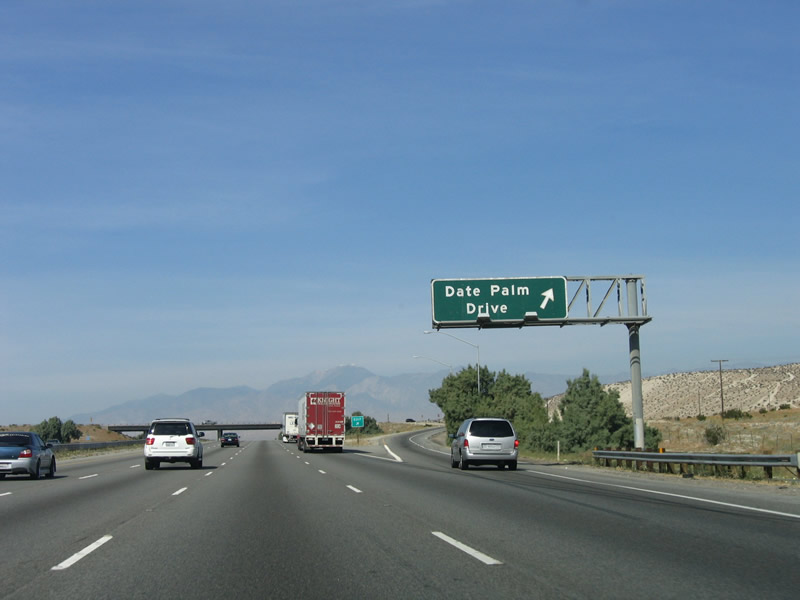
Westbound Interstate 10 approaches Exit 126, Date Palm Drive/Vista Chino Road. Follow Date Palm Drive south into downtown Cathedral City, which is being revitalized with a new hotel, theater, and shops. Photo taken 02/25/06. |
|
Westbound Interstate 10 reaches Exit 126, Date Palm Drive/Vista Chino Road. Photo taken 02/25/06. |
|
Mount San Jacinto, which has been visible on westbound Interstate 10 nearly 30 miles, appears clearly in the distance. It is one of the steepest vertical escarpments in the country. Photo taken 02/25/06. |
|
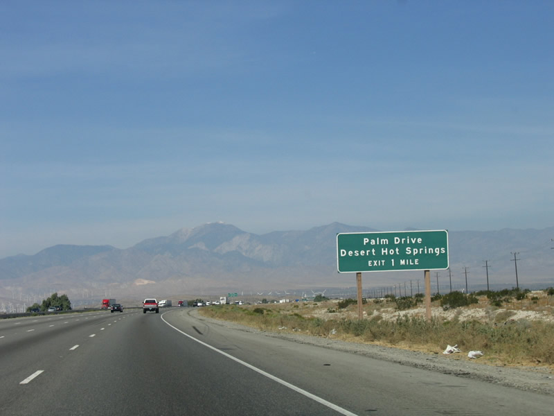
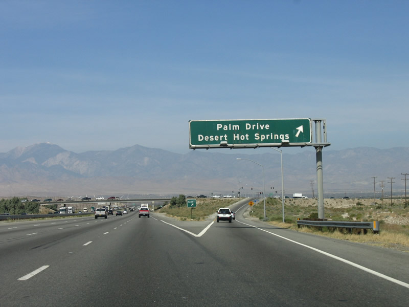
The next exit along westbound Interstate 10 is Exit 123, Palm Drive to Desert Hot Springs. Photo taken 02/25/06. |
|
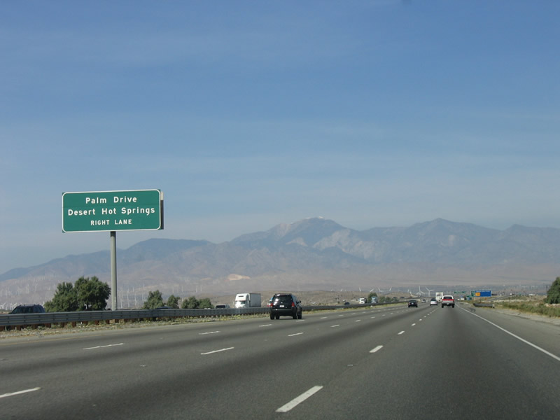
Use the right lane for the exit from westbound Interstate 10 to Exit 123, Palm Drive north to Desert Hot Springs and Gene Autry Trail south to Palm Springs. Photo taken 02/25/06. |
|
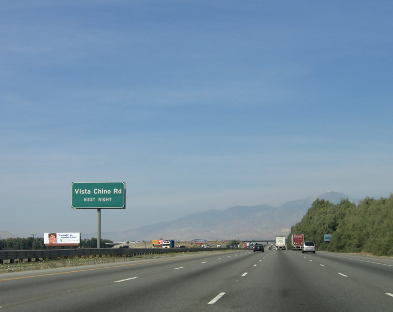
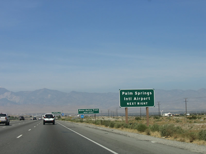
Use Exit 123/Gene Autry Trail south to Palm Springs International Airport and California 111/Vista Chino west. California 111 east joins Gene Autry Trail southbound until the state highway reconnects with East Palm Canyon Drive. Photo taken 02/25/06. |
|
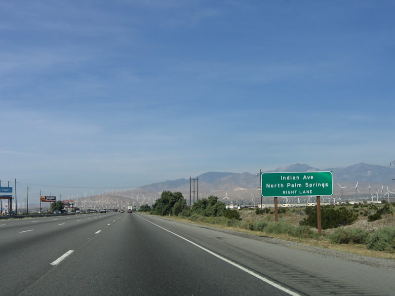
Westbound Interstate 10 reaches Exit 123, Palm Drive north/Gene Autry Trail south. Interstate 10 generally follows the city limits of Palm Springs from here northwest to Exit 120 (Indian Avenue). Photo taken 02/25/06. |
|
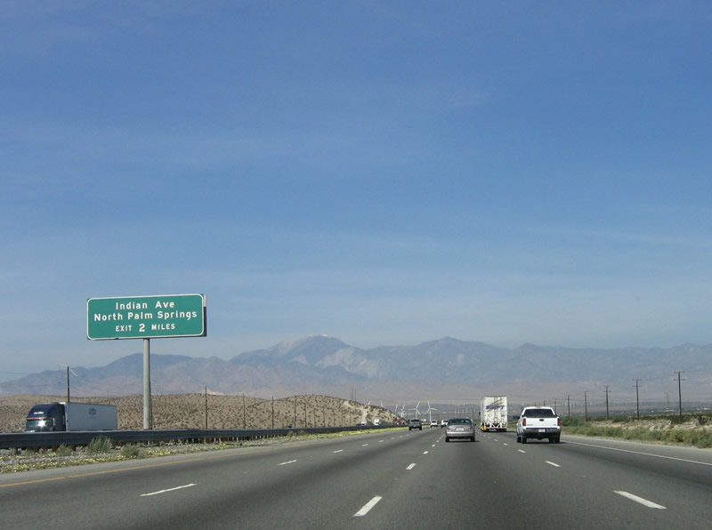
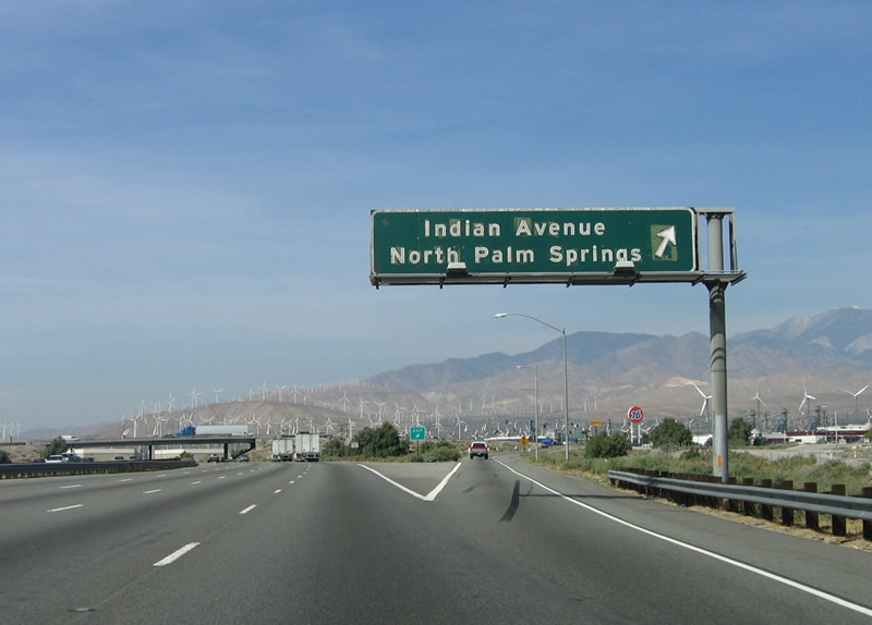
The next exit along westbound Interstate 10 is Exit 120, Indian Avenue/Indian Canyon Drive. Indian Avenue travels north to North Palm Springs (unincorporated), and Indian Canyon Drive travels south into Palm Springs, connecting with California 111 Business in downtown Palm Springs. Photo taken 02/25/06. |
|
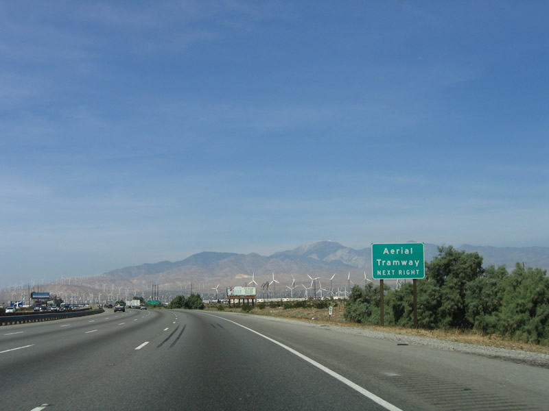
Use Exit 120 to the Palm Springs Aerial Tramway. Follow Indian Canyon Drive south to San Rafael Road west. San Rafael Road transitions onto Tramway Road after crossing California 111/North Palm Canyon Drive. The tram carries passengers from the valley floor to the top of Mt. San Jacinto, which dominates the view to the southwest of Interstate 10. It is well worth a half-day visit to see the incredible views of the desert and hike an alpine area. The tram culminates within Mount San Jacinto State Park. Photo taken 02/25/06. |
|
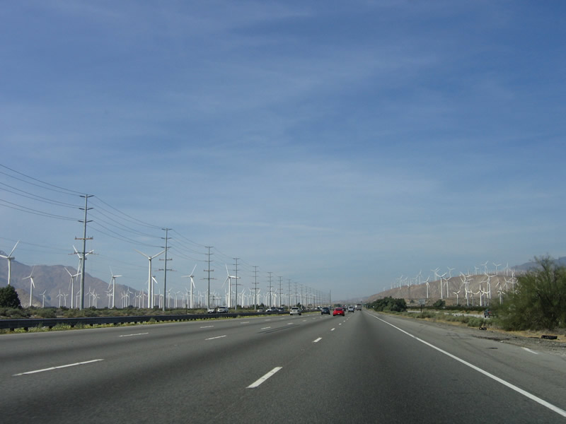
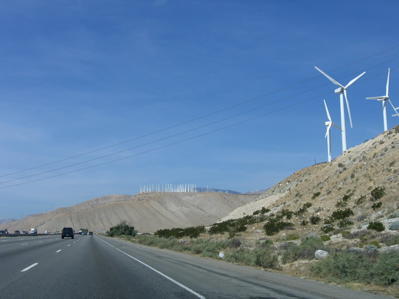
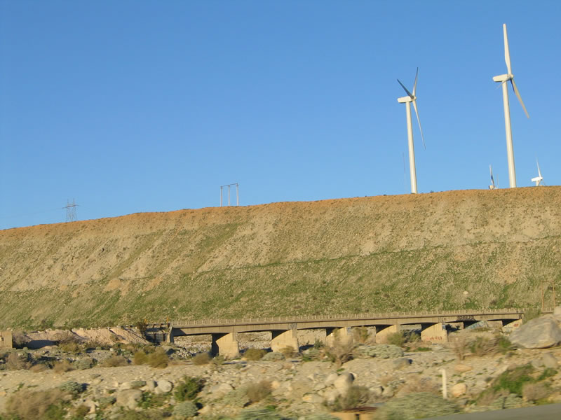
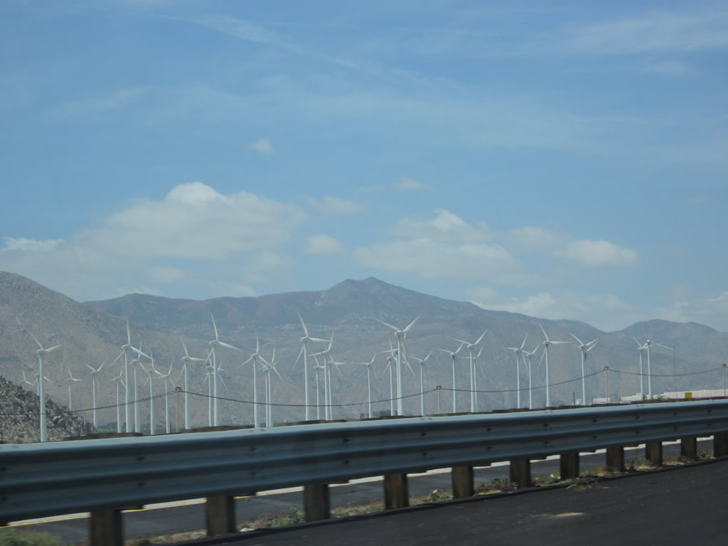
San Gorgonio Pass is well known for its wind power generation. Wind turbines are located throughout the pass area due to the constant wind. Photo taken 02/25/06. |
|
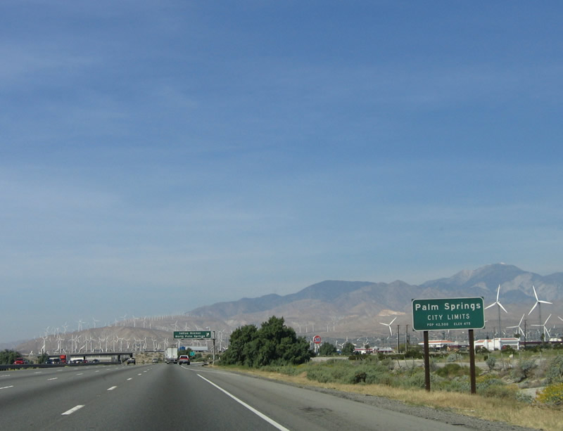
For the past three miles, Interstate 10 has been straddling the city limits of Palm Springs. For the first time, Interstate 10 enters Palm Springs, the most well-known city within the Coachella Valley. Founded in 1884 and incorporated as a city in 1938, Palm Springs is home to 42,807 people as of the 2000 Census and 47,082 people as of 2005 (estimate). Photo taken 02/25/06. |
|
Westbound Interstate 10 reaches Exit 120, Indian Drive north to North Palm Springs/Desert Hot Springs and Indian Canyon Drive south to downtown Palm Springs. This porcelain enamel sign dates back to the original construction of the U.S. 60-70-99 freeway (now Interstate 10) from the 1960s. Photo taken 02/25/06. |
|
This overpass carries Indian Drive/Indian Canyon Drive over Interstate 10, and it features older style, concrete guardrail on a steel deck girder bridge. Photo taken 02/25/06. |
|
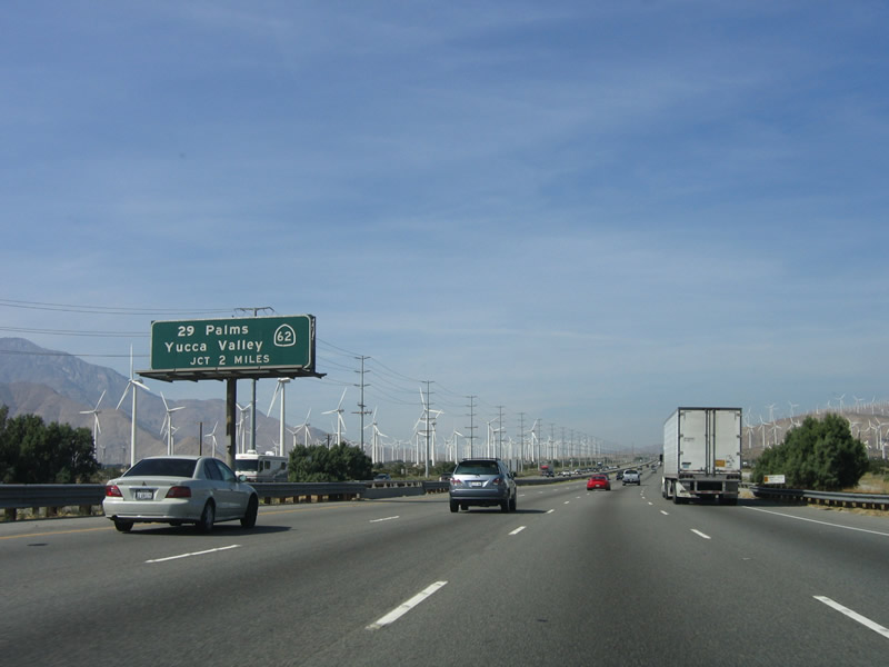
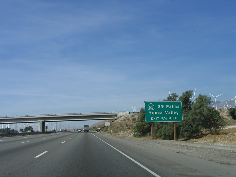
The next exit along westbound Interstate 10 is Exit 117, California 62 east to Yucca Valley, Joshua Tree National Park, and Twenty-Nine Palms (two miles). Photo taken 02/25/06. |
|
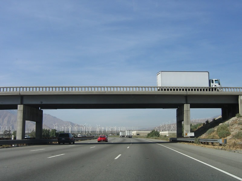
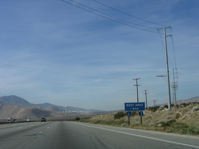
Continuing to ascend San Gorgonio Pass on a gradual slope, wind turbines surround the freeway on both signs, along with a variety of power lines and related infrastructure. There are no services along the freeway until Cabazon (Exit 106) and Banning (Exit 102). Photo taken 02/25/06. |
|
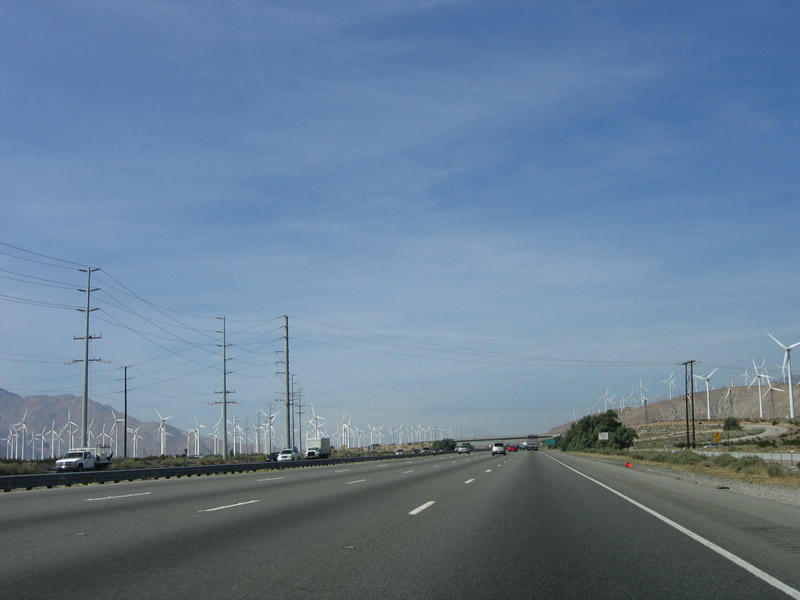
Mount San Gorgonio towers over San Gorgonio Pass (but it does not have as steep of an escarpment as Mount San Jacinto). Additional wind turbines dominate the landscape looking toward the north-northwest. Photo taken 02/25/06. |
|
More power lines follow along Interstate 10. The freeway passes through some open space lands as it climbs to the summit of San Gorgonio Pass. Photo taken 02/25/06. |
|
California 62 is a major east-west corridor across the desert. Tracing a line that roughly separates the Mojave Desert to the north and the Colorado (Sonora) Desert to the south, California 62 exits the Coachella Valley to the north, crossing into San Bernardino County before connecting to Morongo Valley. From there, California 62 turns northeast and then east to connect to Yucca Valley, Joshua Tree, and Twenty-Nine Palms. The highway generally stays to the north of Joshua Tree National Park, then connects with the Los Angeles Aqueduct near the junction with California 177. From there, California 62 follows the aqueduct east to Rice, Vidal Junction (U.S. 95), Earp, and ultimately the Colorado River crossing into Parker, Arizona, where it connects to Arizona 95. Photo taken 02/25/06. |
|
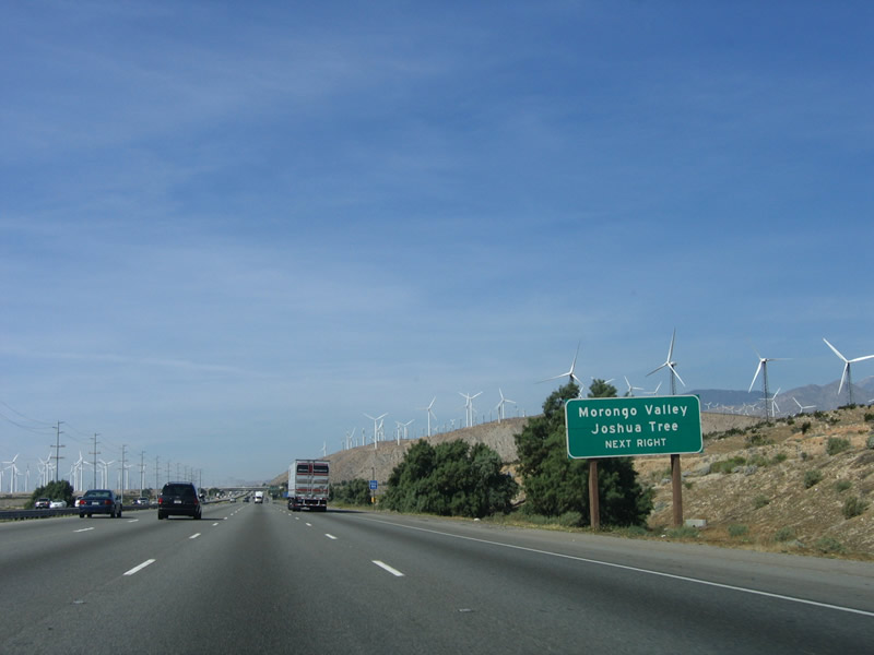
Still climbing up San Gorgonio Pass, a roadside sign advises that California 62 connects to the unincorporated communities of Morongo Valley and Joshua Tree in San Bernardino County. Photo taken 02/25/06. |
|
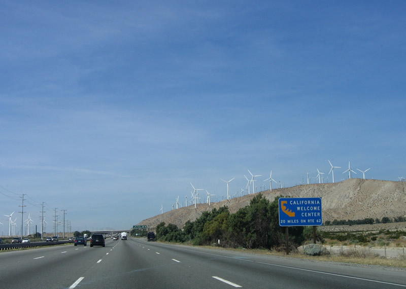
An official State of California welcome center is located on California 62 in Yucca Valley (on the south side of the state highway); it is located about 20 miles northeast of here. Photo taken 02/25/06. |
|
Westbound Interstate 10 reaches Exit 117, California 62 northeast to Yucca Valley, Joshua Tree, and Twenty-Nine Palms. This porcelain enamel sign featured a white California 62 shield underneath the green overlay panel; it was overlaid to make it consistent with newer guide signs that feature the white-on-green state highway marker. Photo taken 02/25/06. |
|
This is the interchange between Interstate 10 and California 62. This bridge carries the transition ramp from eastbound Interstate 10 to northbound California 62. A second bridge carries traffic from southbound California 62 to eastbound Interstate 10 (in the distance). Because of this second looping bridge, this interchange defies typical categorization, and it is not like most others in California. Photo taken 02/25/06. |
|
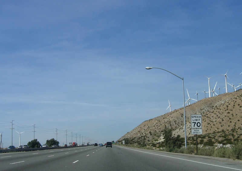
A speed limit of 70 miles per hour continues as westbound Interstate 10 travels up San Gorgonio Pass. Photo taken 02/25/06. |
|
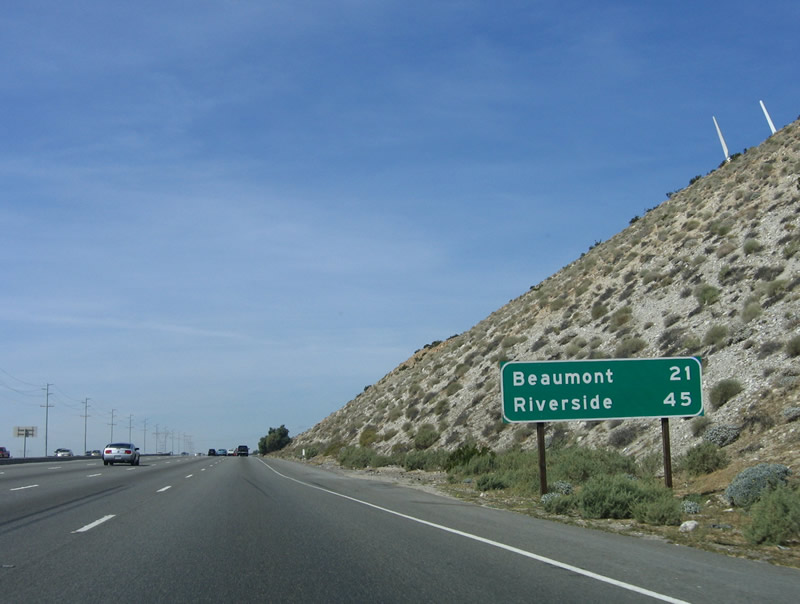
This mileage sign provides the distance to Beaumont (21 miles) and Riverside (45 miles). Photo taken 02/25/06. |
|
|
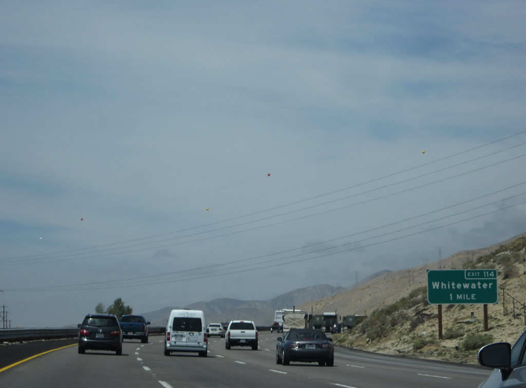
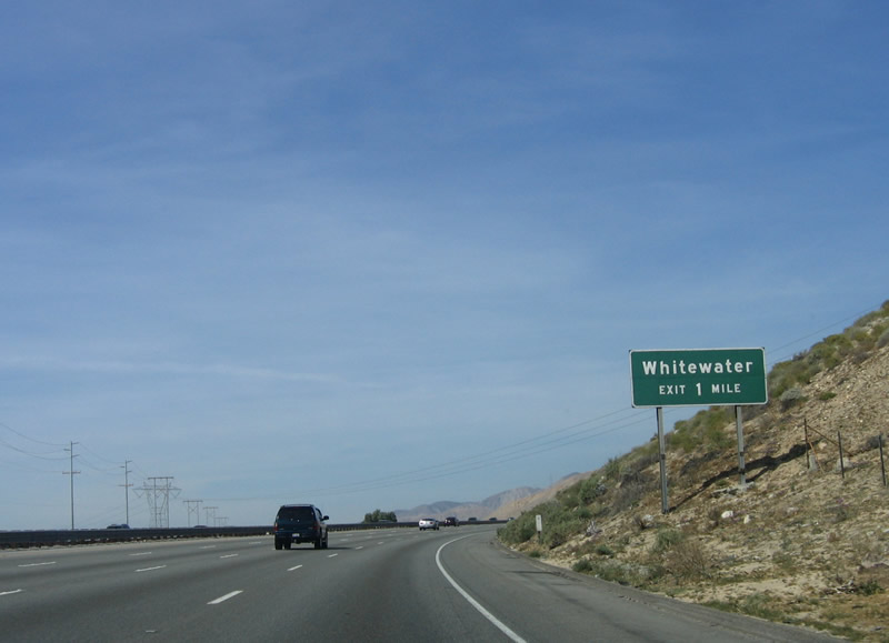
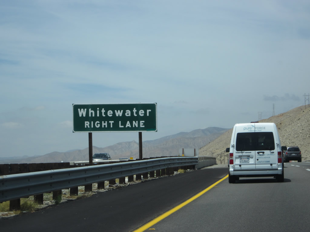
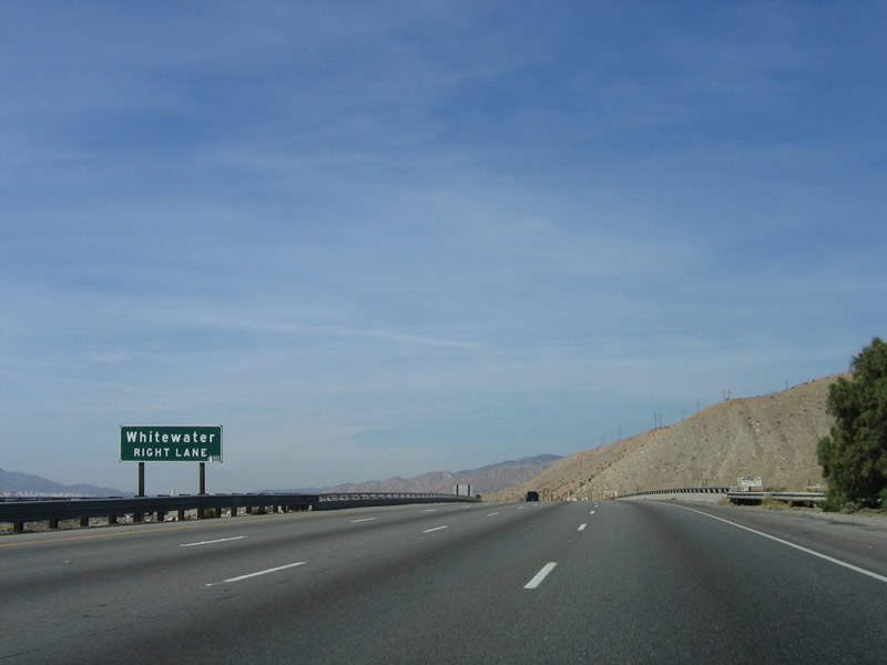
The next exit along westbound Interstate 10 is Exit 114, Whitewater. An extant section of old U.S. 60-70-99 expressway and bridge over the Whitewater River is located at this interchange on the north side of the freeway. The old bridge can be seen from the freeway. The sign was replaced at some point between 2006 and 2014 to include the exit number. Photos taken 04/27/14 and 02/25/06. |
|
|
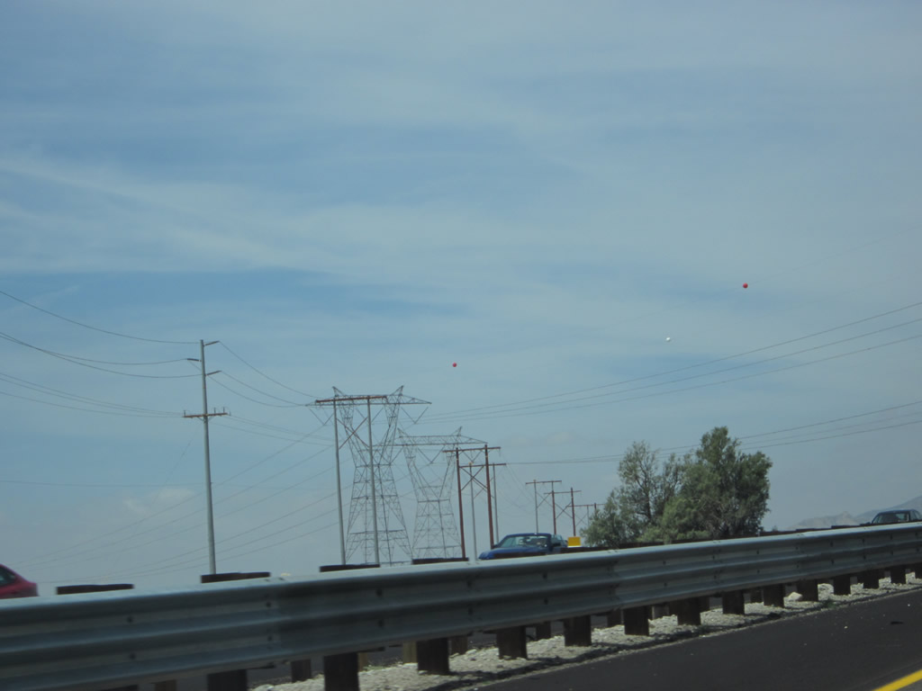
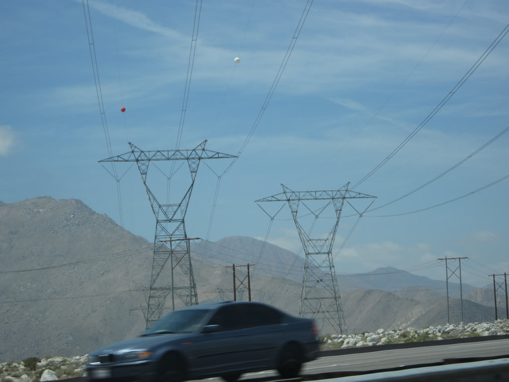
A pair of 500kV Southern California Edison power lines (part of Path 42) crosses over Interstate 10 near Whitewater. Back in 2006, only one 500kV power line crossed here; a second line was added in 2012 (with construction evident in Google Maps Street View imagery by March 2012). The newer of the two lines crosses Interstate 10 first when traveling westbound. The two lines travel east to the Devers substation in Desert Hot Springs; the substation is visible from California 62. From there, the two lines cross the Colorado Desert en route to Palo Verde, a nuclear generating station and power line hub located in Arizona. To the southeast, the two lines aim toward the Valley Substation located near Romoland and Perris in Riverside County. Photos taken 04/27/14. |
|
|
The Whitewater River passes through the canyon visible ahead. It drains from Mt. San Gorgonio southeast through Coachella Valley to the Salton Sea. During winter months, it carries water, but in summer months, it can become dry. Additional wind turbines line the hills that surround the river valley. Photos taken 04/27/14 and 02/25/06. |
|
|
The small community of Whitewater is located on the north side of the freeway. A few homes and businesses are located there, but there are no motorist services. Use Whitewater Road east to Whitewater Canyon Road to follow the river northward. Photos taken 04/27/14 and 02/25/06. |
|
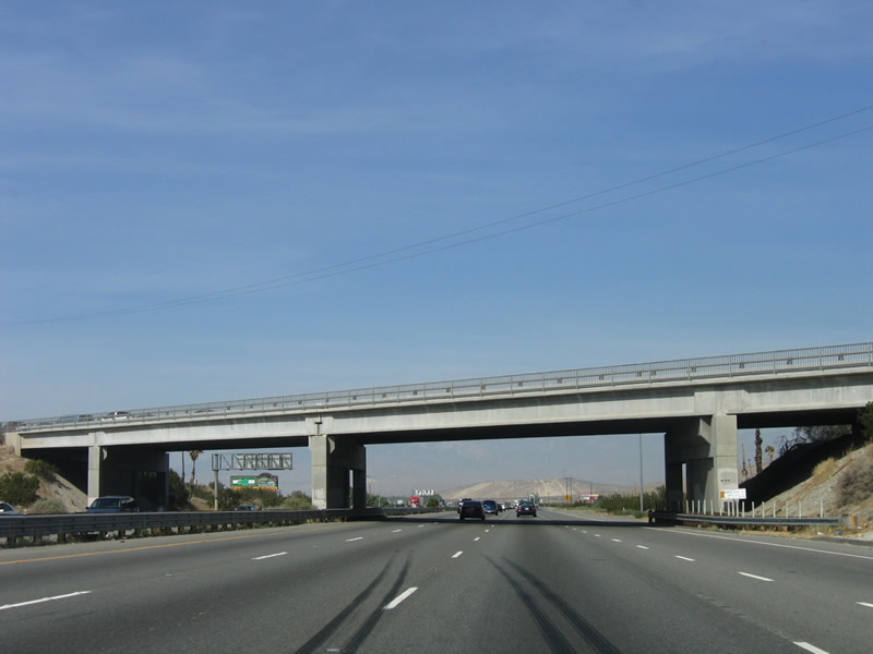
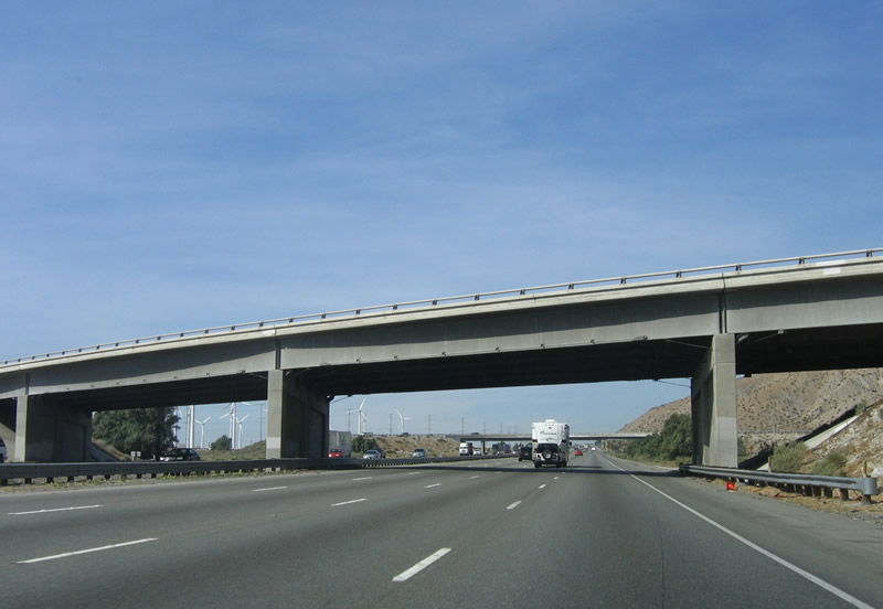
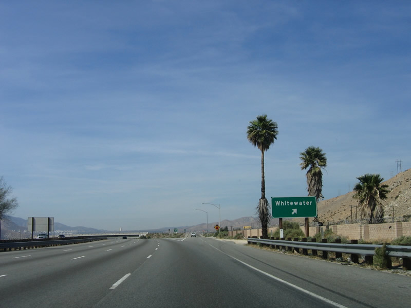
This bridge ahead carries California 111 northwest traffic onto Interstate 10 west. There is no access from westbound Interstate 10 to southeastbound California 111. This marks the northern terminus of California 111. Most of the route from here to the urbanized limits of Palm Springs is an expressway, but it rapidly changes into a city route from there southeast through the Coachella Valley communities. Photo taken 02/25/06. |
|
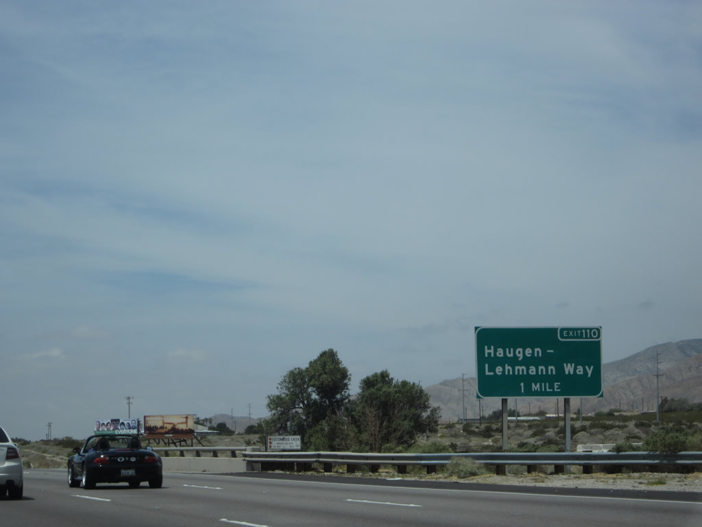
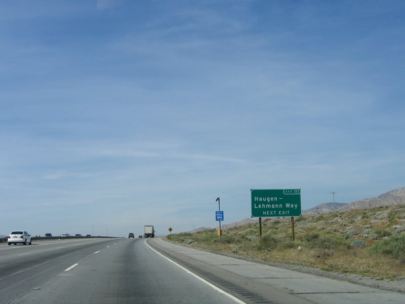
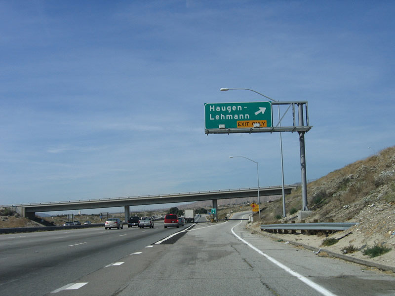
After passing under the California 111 transition ramp, another sign is posted for Exit 110, Haugen Lehmann Way (former Exit 111). Photo taken 02/25/06. |
|
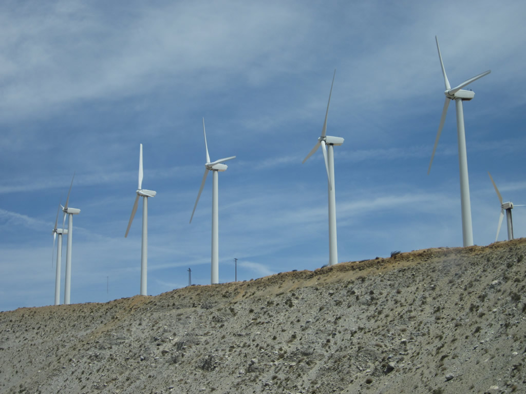
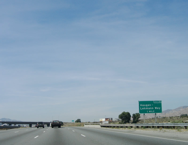
Westbound Interstate 10 reaches Exit 110, Haugen Lehmann Way to San Gorgonio. San Gorgonio Pass is one of the most productive wind farms in California. Photo taken 02/25/06. |
|
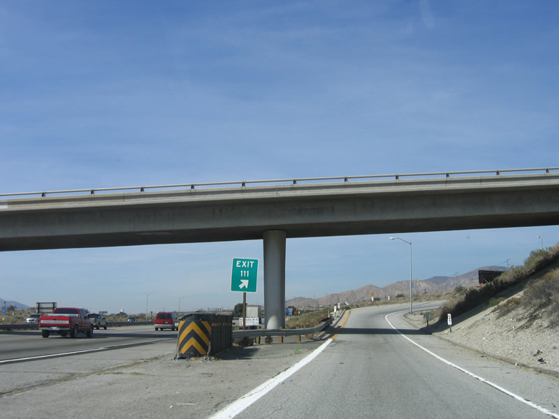
The exit number is again noted at the off-ramp to Exit 110; now it is signed as Exit 110 rather than Exit 111. Photo taken 02/25/06. |
|
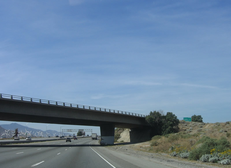
This view of eight-lane Interstate 10 as it ascends to San Gorgonio Pass is afforded from the Haugen Leman Way (Exit 110). Photo taken 02/26/06. |
|
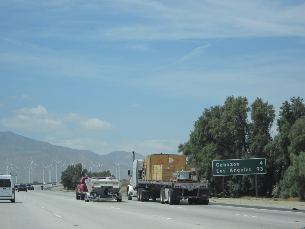
This mileage sign along Interstate 10 west provides the distance to Cabazon (four miles to Exit 106) and Los Angeles (93 miles). Photo taken 04/27/14. |
|
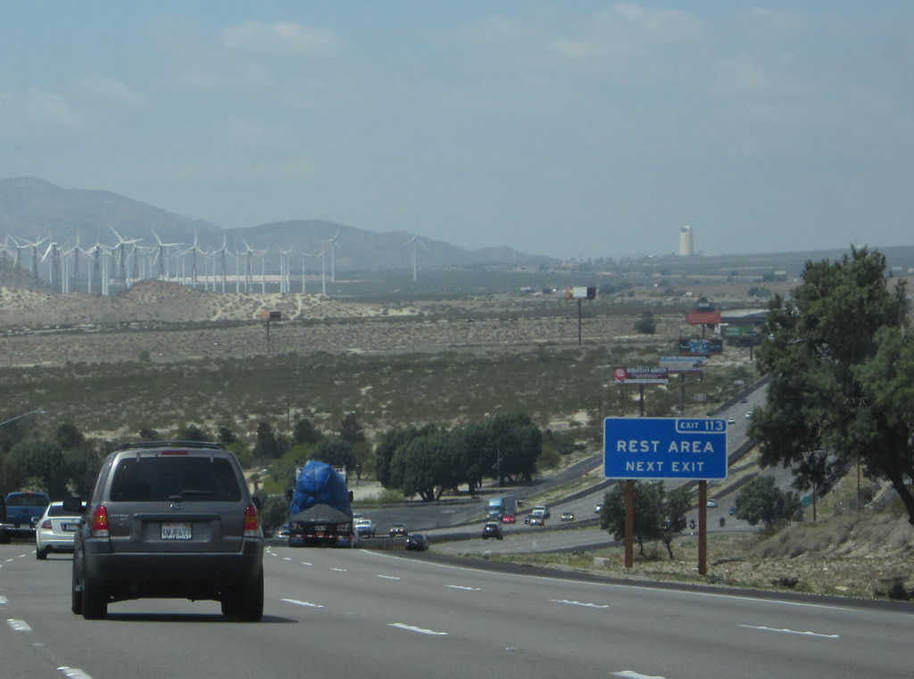
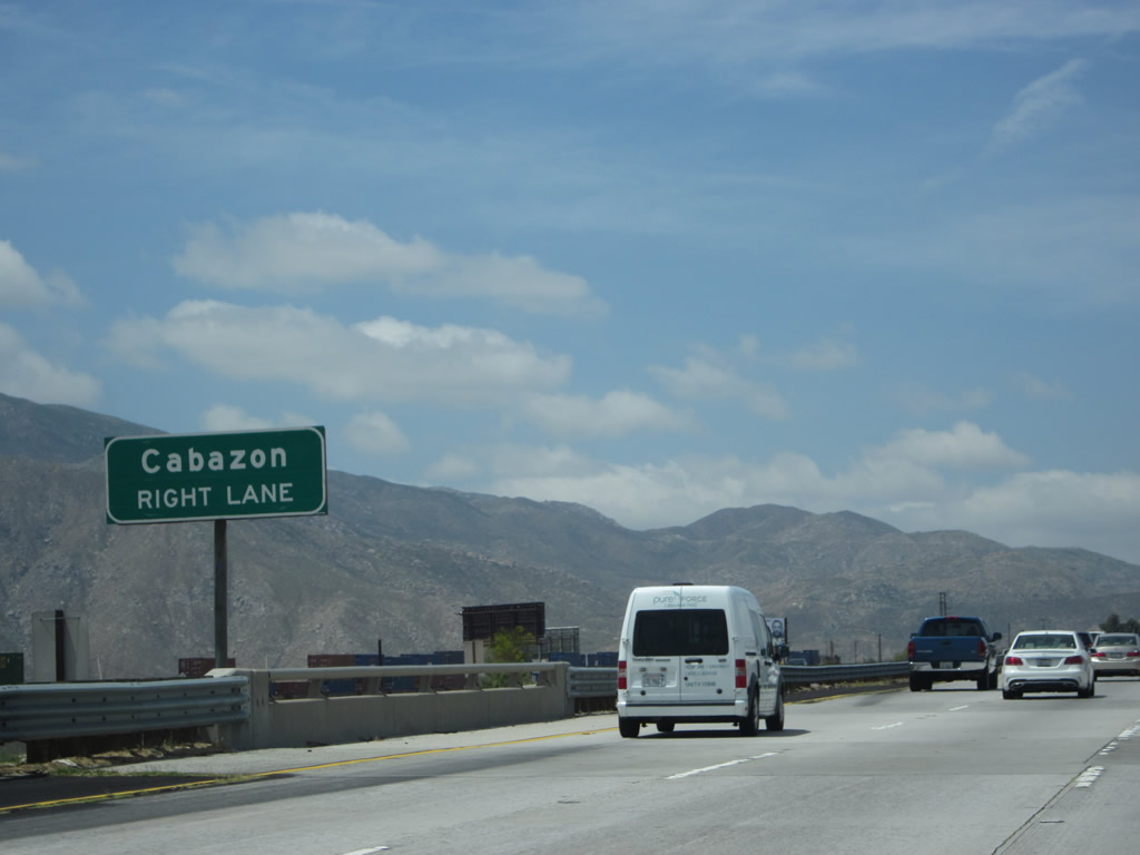
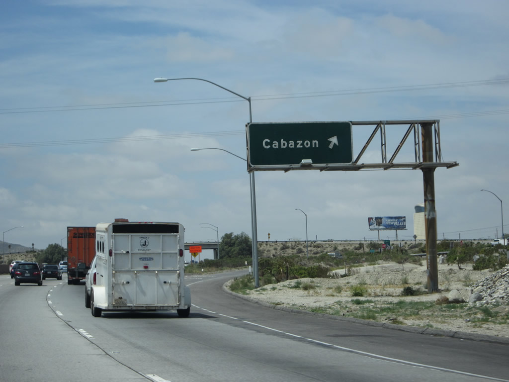
Continuing through San Gorgonio Pass, Interstate 10 continues west toward Cabazon, an unincorporated community of Riverside County. The next exit along westbound Interstate 10 is Exit 106, Main Street in Cabazon. Main Street follows Old U.S. 60-70-99 through downtown Cabazon. Motorist services (gas and food) are available at this exit. This sign was replaced to include the exit number between 2006 and 2014. Photo taken 04/27/14. |
|
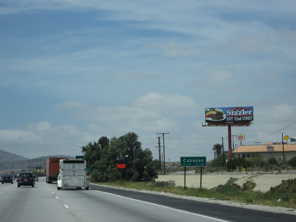
A median overhead sign points the way to Exit 106, Cabazon (U.S. 60-70-99/Main Street west). Cabazon is also known for Desert Hills Premium Outlets, Cabazon Outlets, and Claude Bell's dinosaurs, which are large scale dinosaur replicas on the north side of Interstate 10. A Brontosaurus and a Tyrannosaurus Rex are included among the dinosaurs. To reach the dinosaurs, locate the Wheel Inn Diner on Seminole Drive. The dinosaurs have been prominently featured in Cabazon since the mid-1960s at the diner, and they were designed by Knott's Berry Farm designer Claude K. Bell. The two largest dinosaurs are hollow and habitable inside. Photo taken 04/27/14. |
|
Cabazon is an unincorporated community within Riverside County; it had 2,229 people as of the 2000 Census and 2,535 people as of the 2010 Census. This community actually was an incorporated city between 1955 and 1972, when residents voted to unincorporate. This area is notable for the casino owned and operated by the Morongo Band of Mission Indians. A towering 27-story hotel with a large video screen can be seen for miles in either direction on Interstate 10, especially at night. Photo taken 04/27/14. |
|
Westbound Interstate 10 reaches Exit 106, Main Street (Historic U.S. 60-70 west and U.S. 99 north) to Cabazon. The freeway ascends San Gorgonio Pass to a height of 1,500 feet, then descends into Banning. Photo taken 04/27/14. |
|
Westbound Interstate 10 reaches Exit 106, Main Street (Historic U.S. 60-70 west and U.S. 99 north) to Cabazon. The freeway ascends San Gorgonio Pass to a height of 1,500 feet, then descends into Banning. Photo taken 01/17/05. |
Page Updated May 3, 2014.