| Interstate 15 north |
|
|
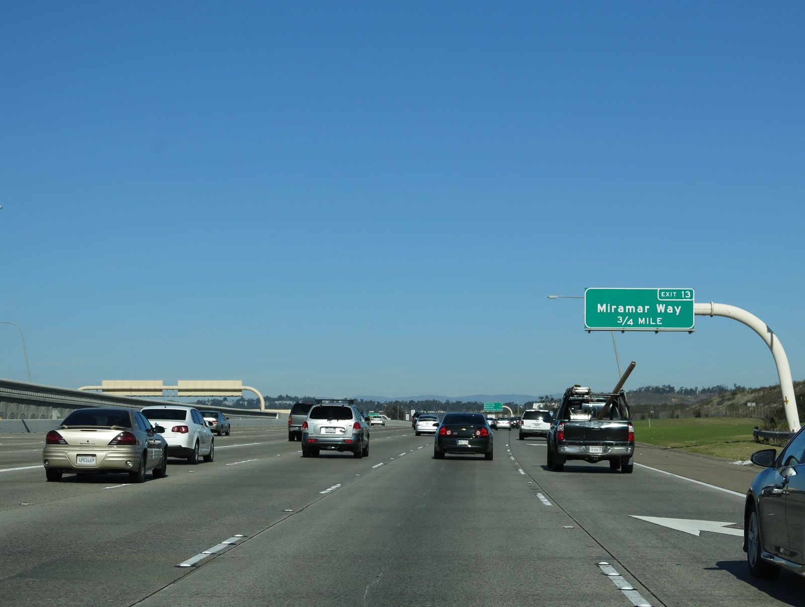
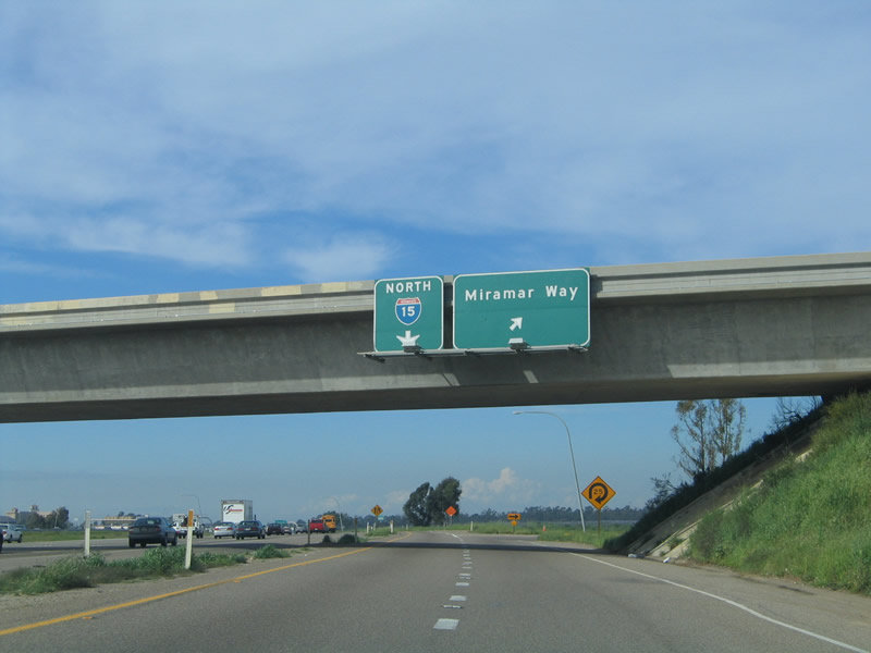
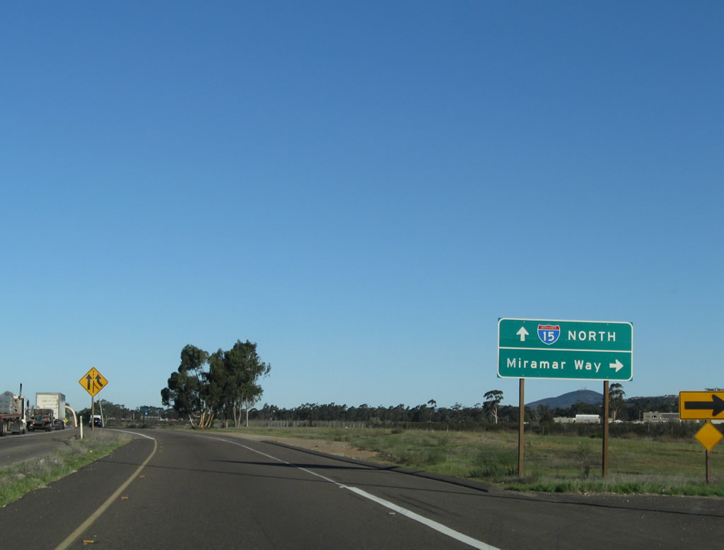
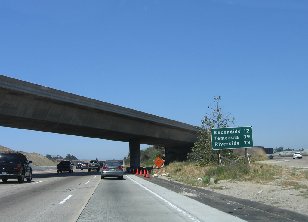
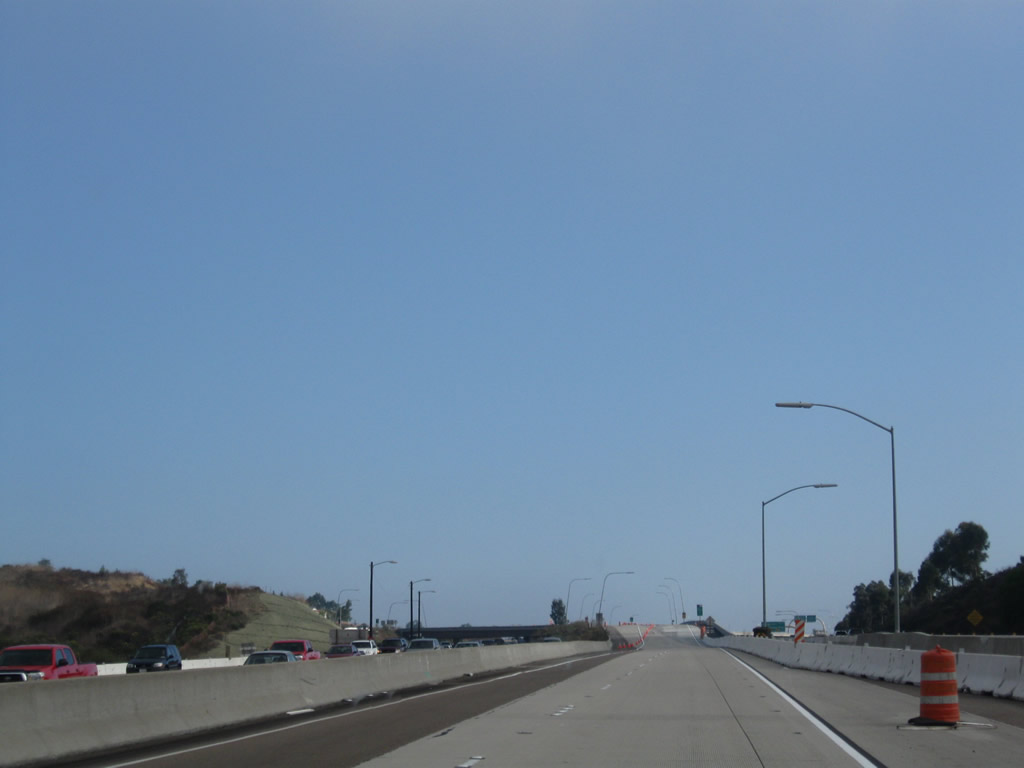
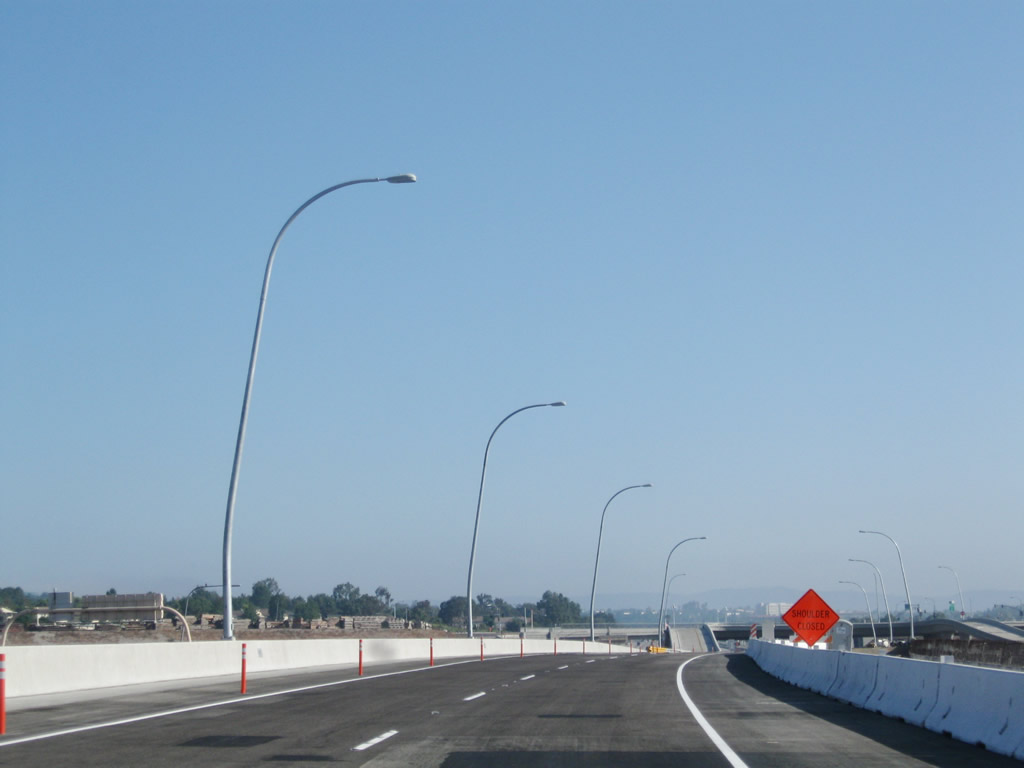
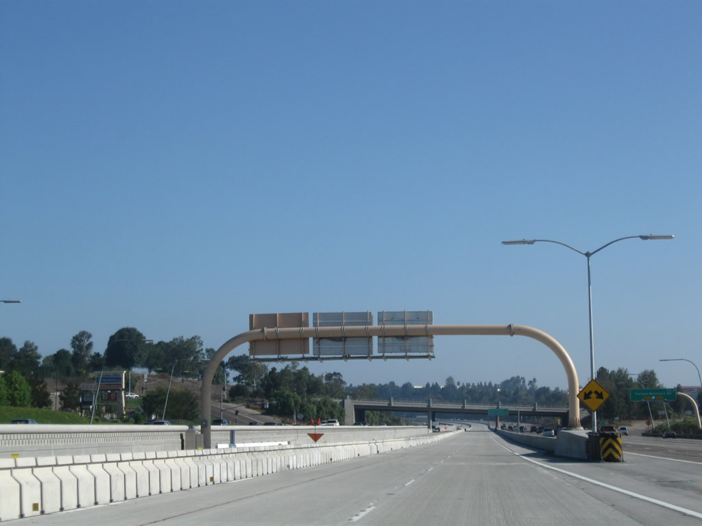
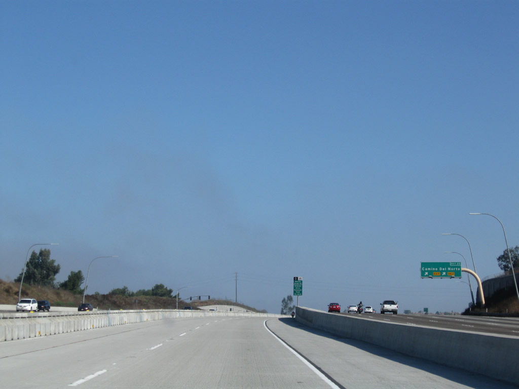
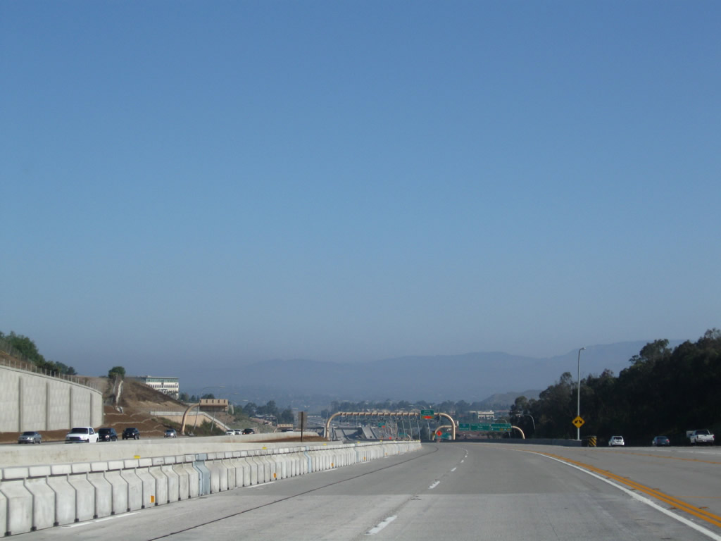
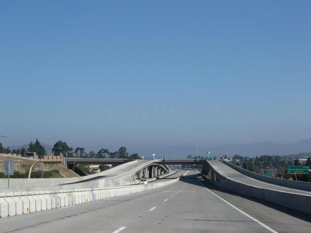
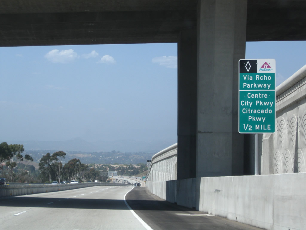
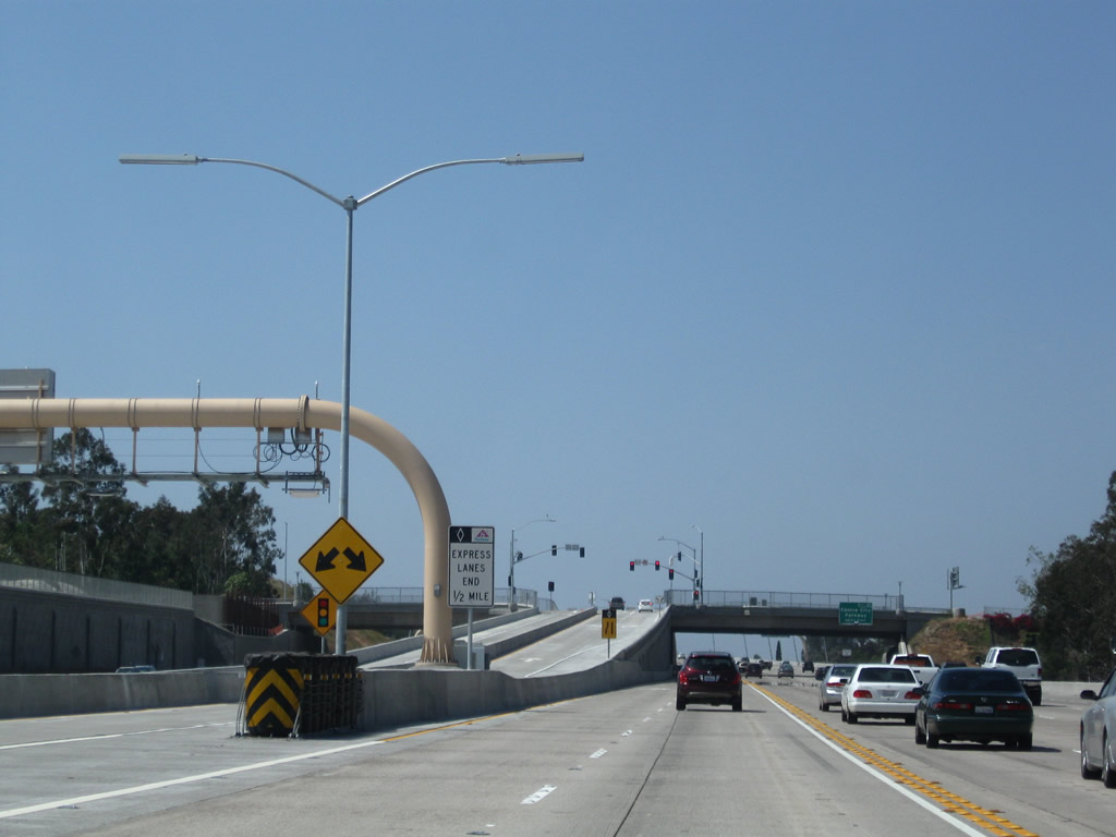
After the California 163 merge, the next exit along northbound Interstate 15 is Exit 13, Miramar Way, 0.75 mile. The entire length of Interstate 15 between California 163 and Rancho Bernardo is served with express lanes. The express lanes between these points opened in phases, with the segment between California 163 and California 56 opening in 2011, the segment between California 56 and Via Rancho Parkway opening in 2008, and the segment between Via Rancho Parkway and California 78 opening in 2012. An exit number was added at this position in 2010. Photos taken 01/05/13 and 02/16/05. |
|
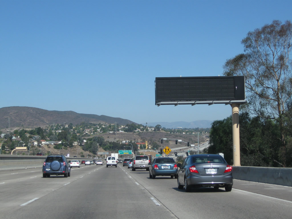
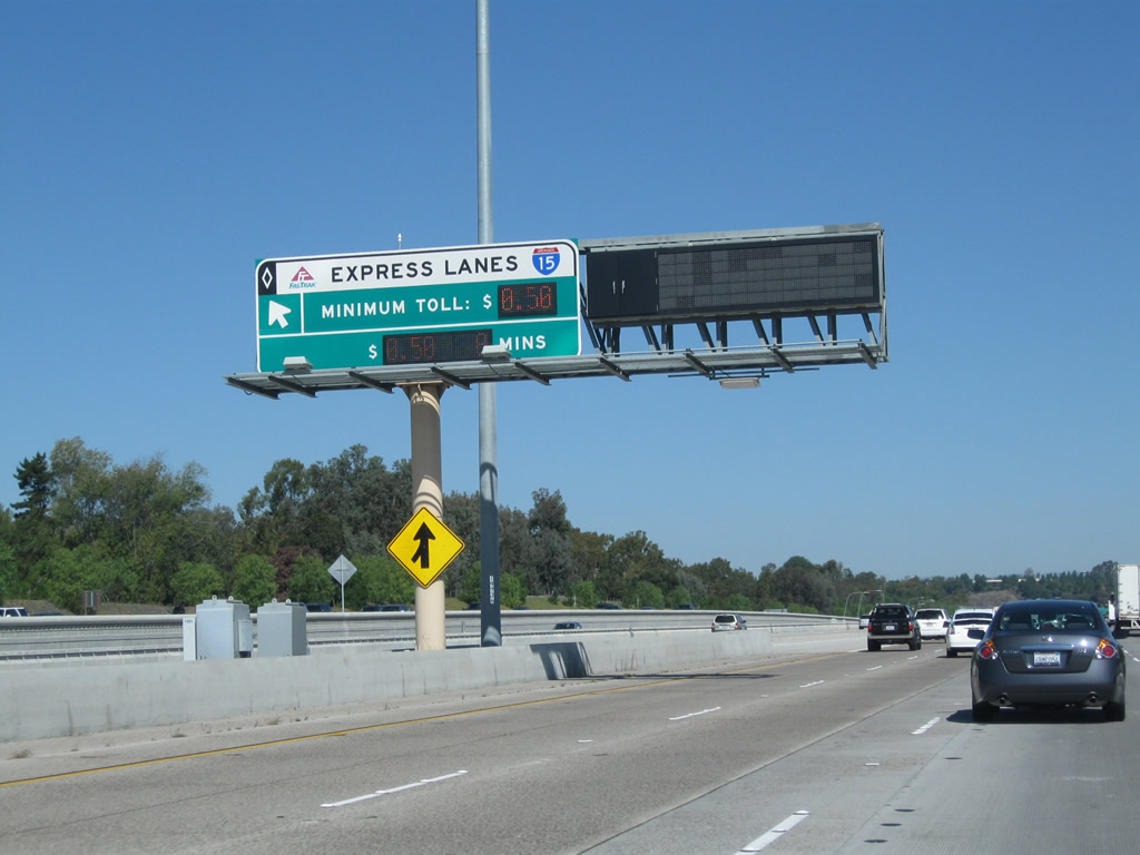
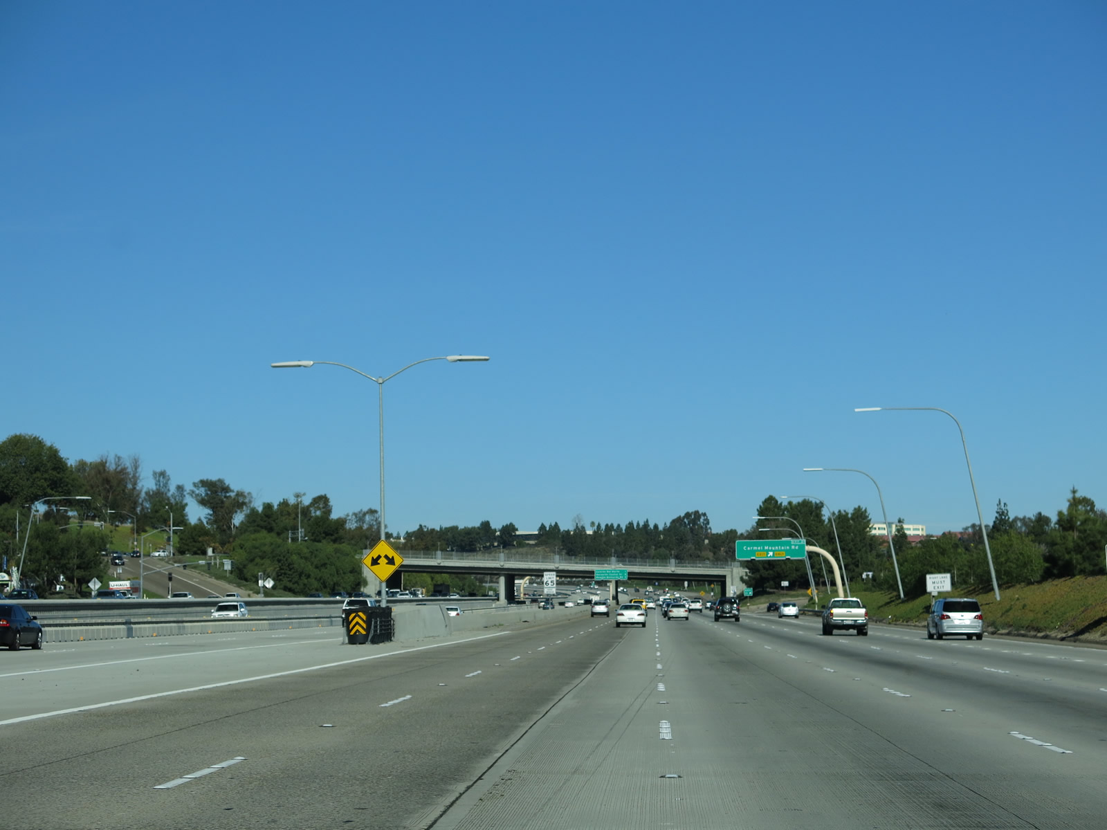
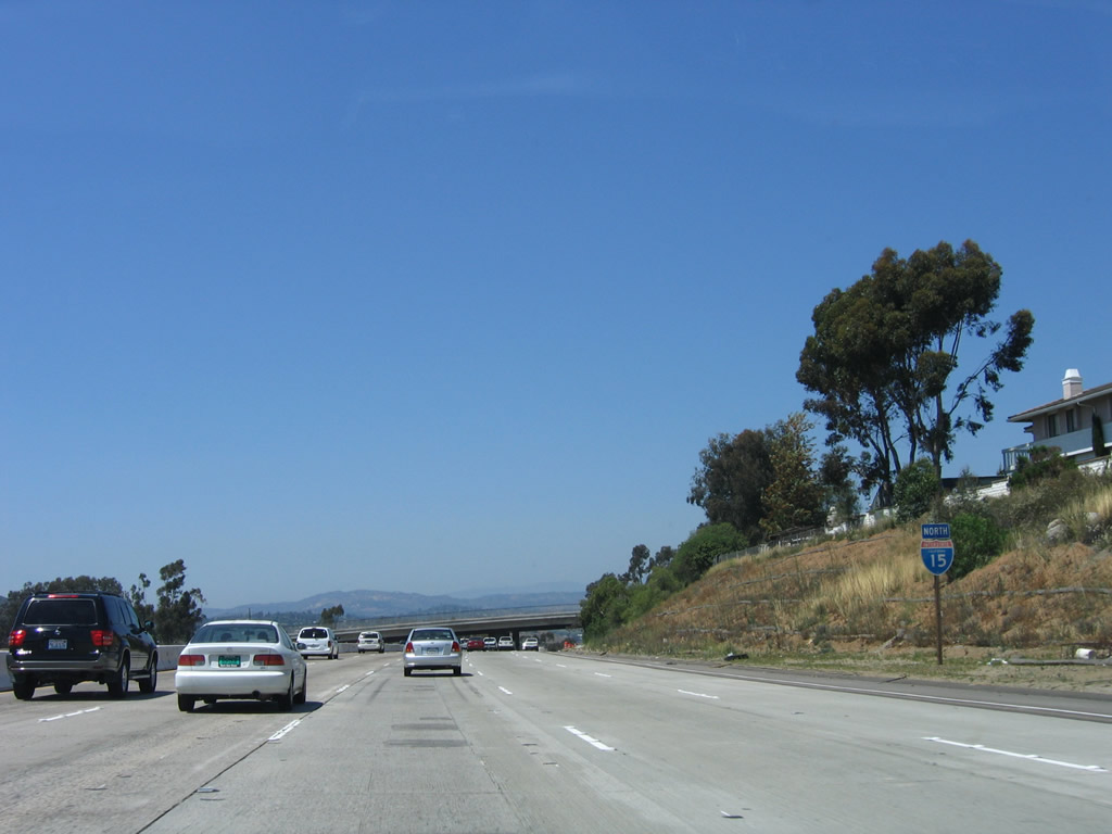
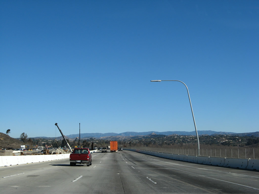
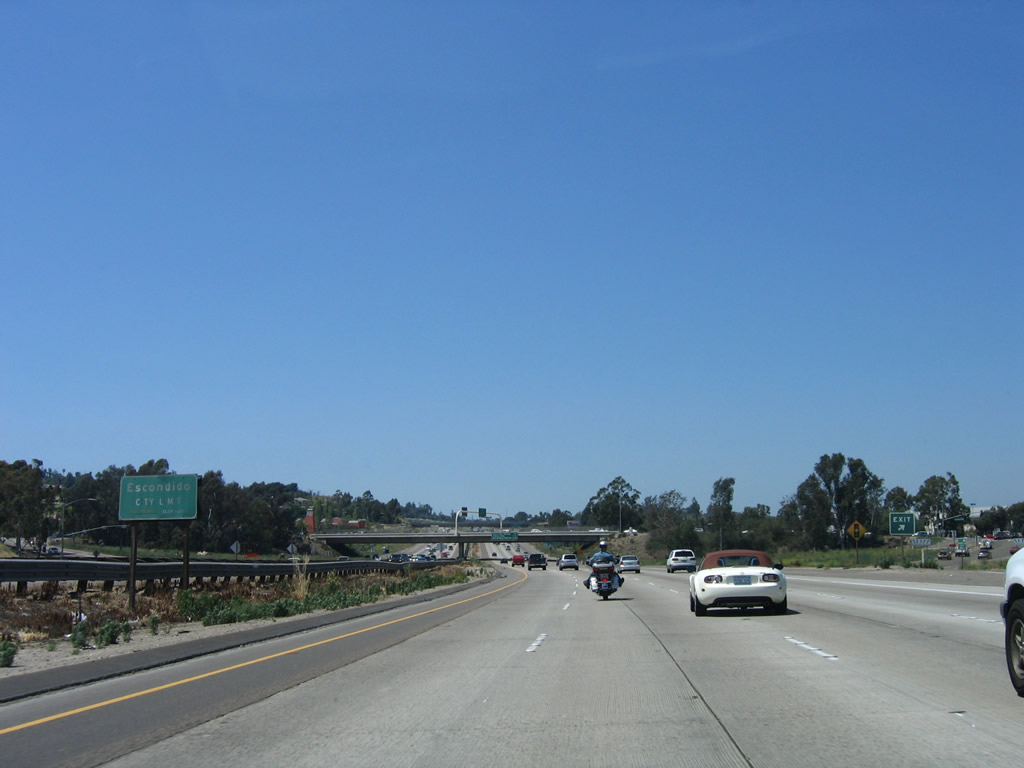
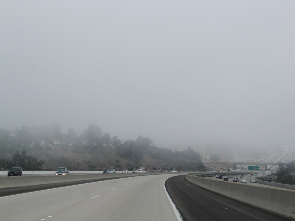
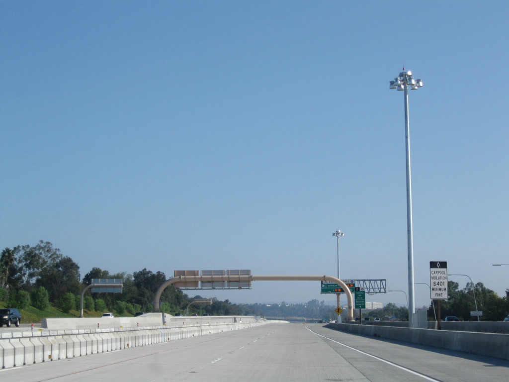
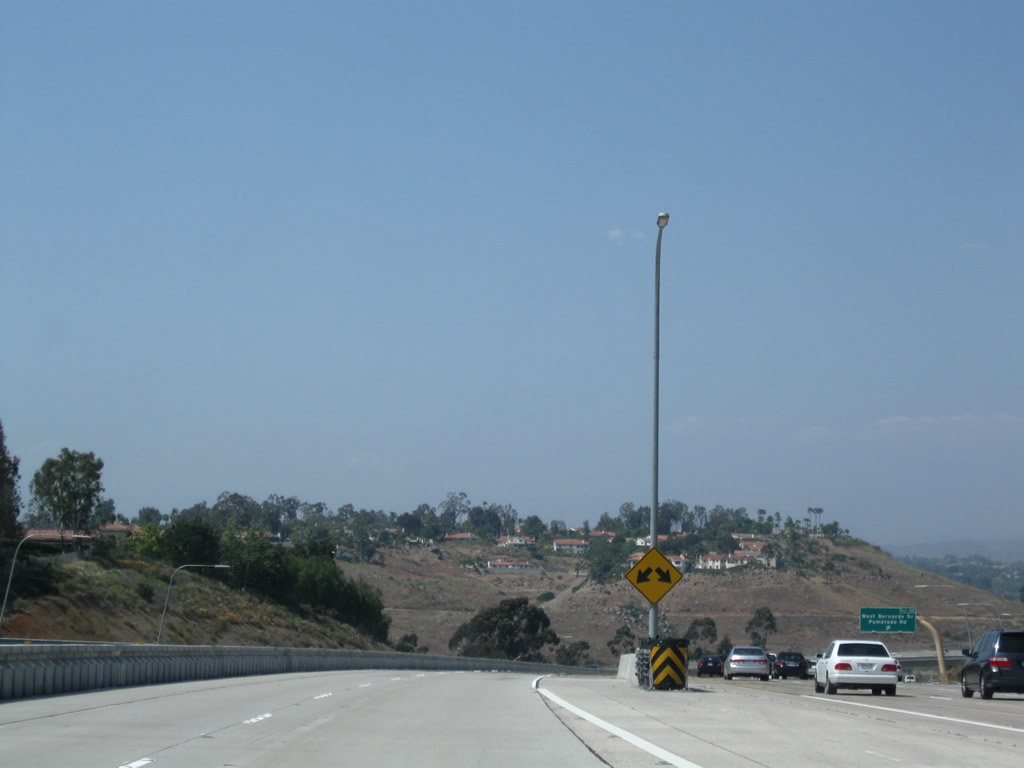
With the introduction of traffic from California 163, Interstate 15 carries six northbound lanes at this point, along with (generally) two northbound express lanes. Photo taken 10/29/11. |
|
|
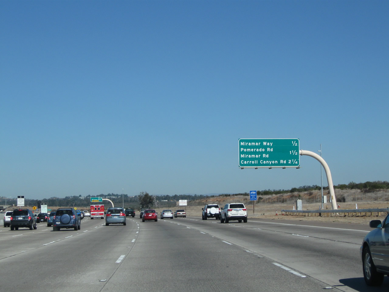
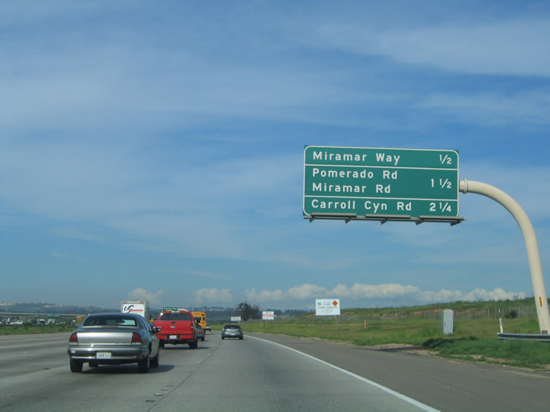
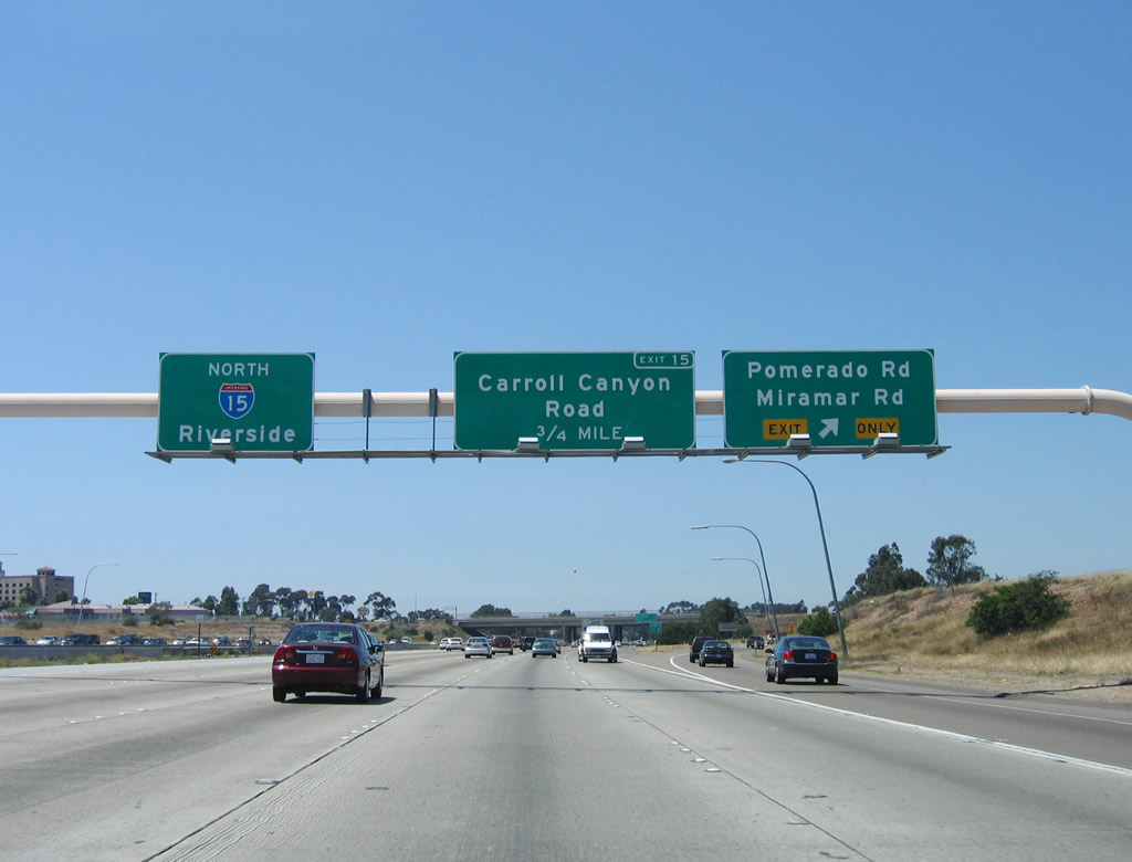
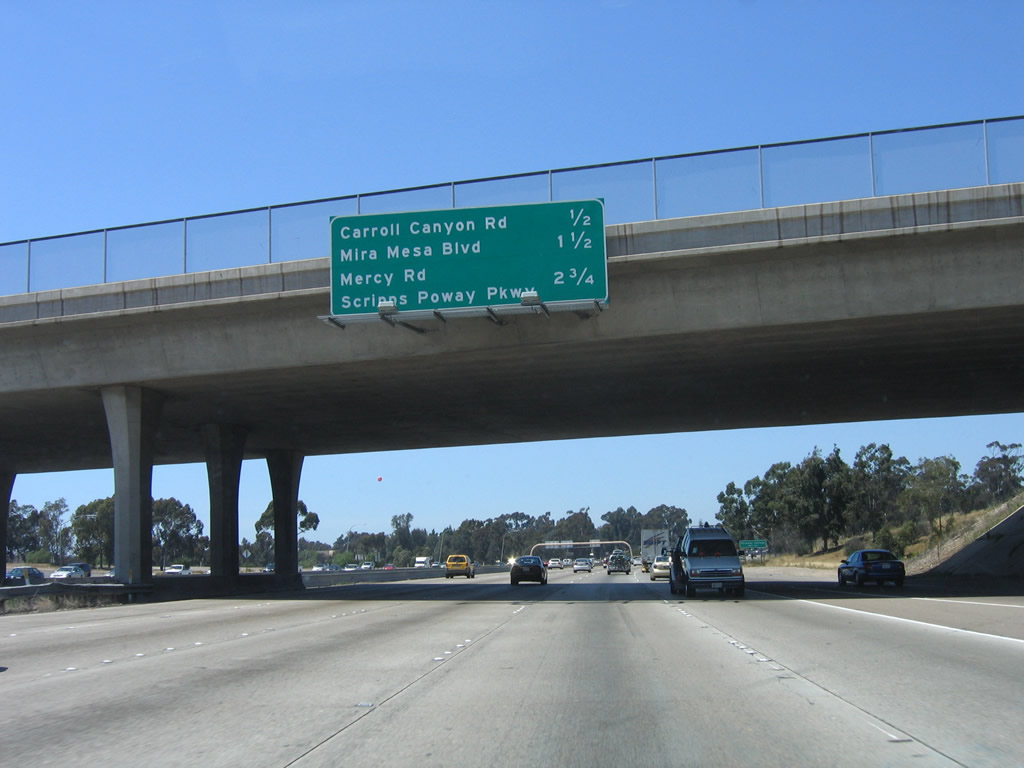
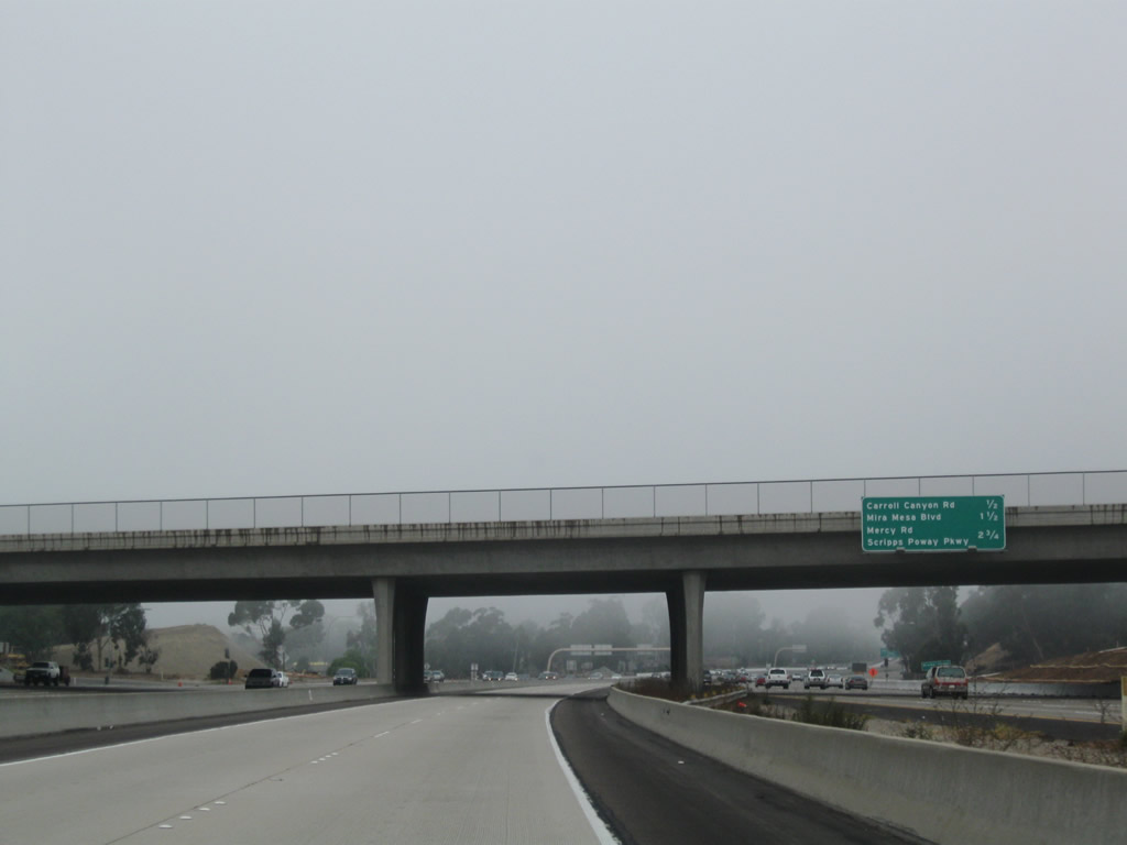
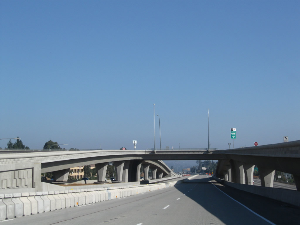
This mileage sign provides the distance to the next three exits: Exit 13, Miramar Way; Exit 14, Pomerado Road/Miramar Road; and Exit 15, Carroll Canyon Road. Photos taken 10/29/11 and 02/16/05. |
|
|
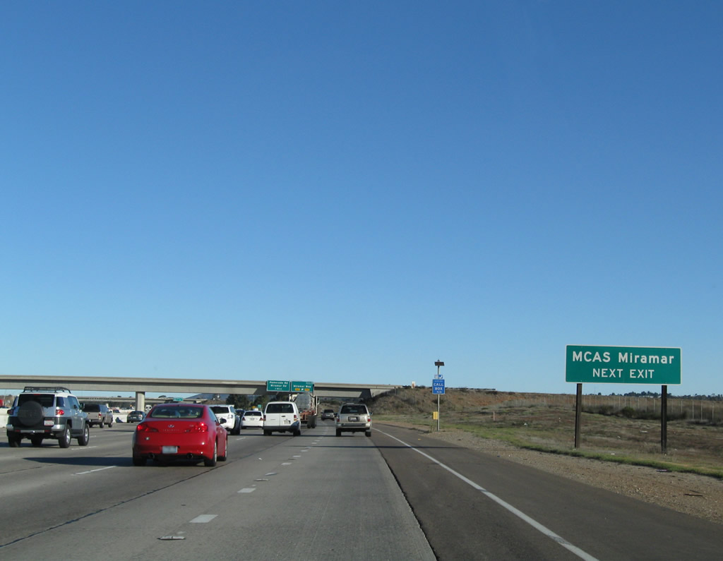
Miramar Way is a short spur into the Marine Corps Air Station at Miramar. An interchange between Miramar Way and Kearny Villa Road (Old U.S. 395) is afforded prior to the entrance gate. Photos taken 12/28/10 and 02/16/05. |
|
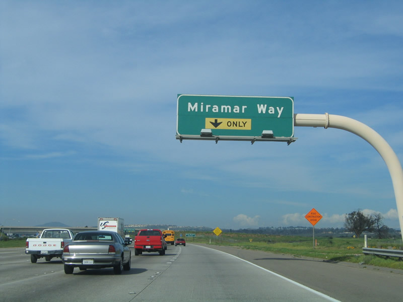
Use Miramar Way west to Marine Corps Air Station (MCAS) Miramar. Photo taken 12/28/10. |
|
An Express Lanes entrance for northbound traffic is located just prior to the Miramar Way off-ramp. Photo taken 10/28/11. |
|
|
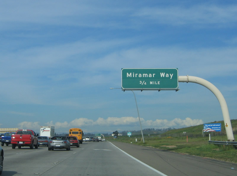
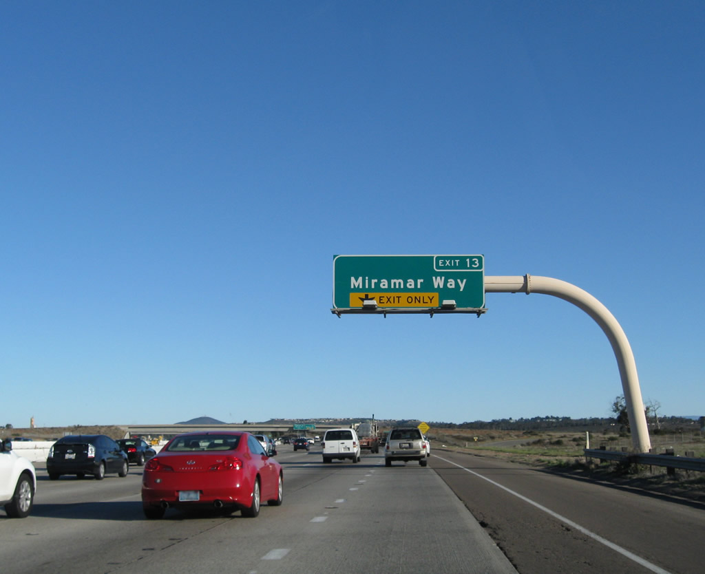
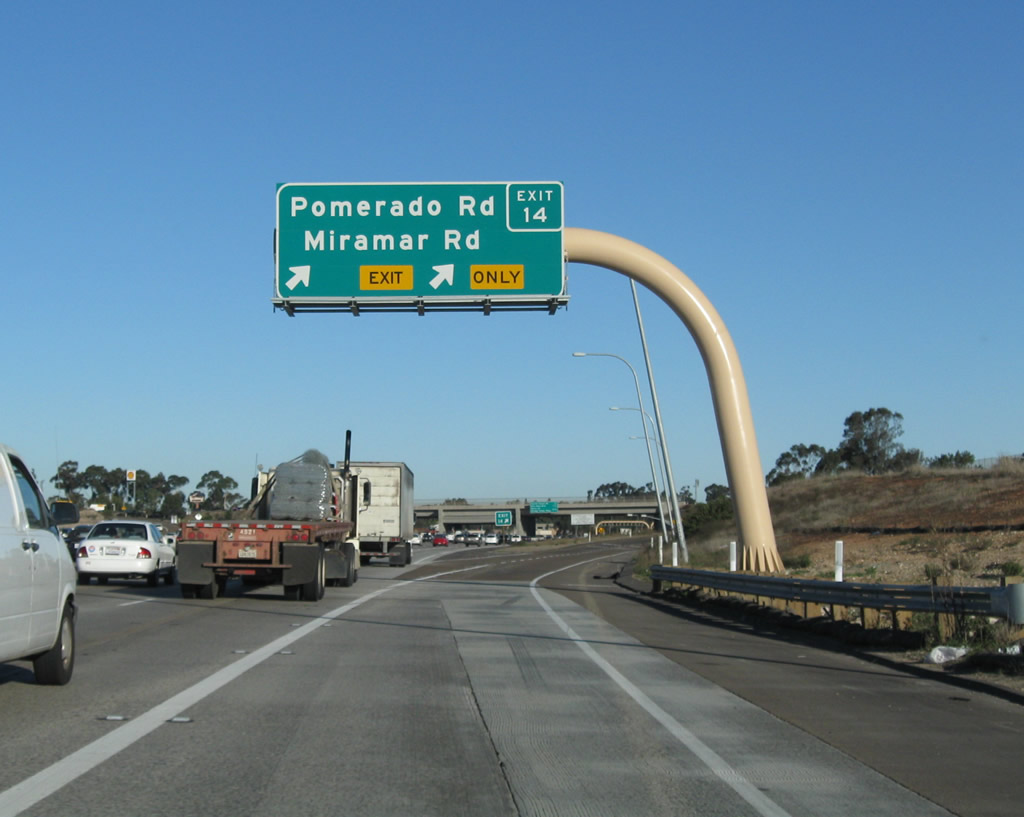
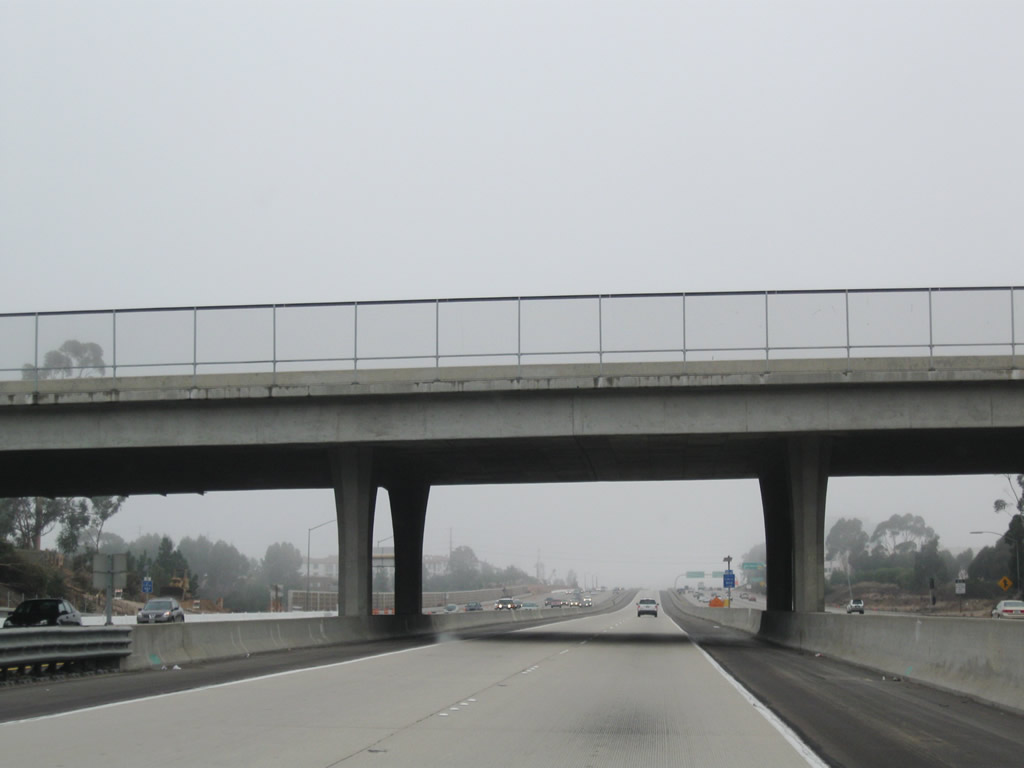
Northbound Interstate 15 reaches Exit 13, Miramar Way. Miramar Way leads west into the Miramar Marine Corps Air Station (MCAS). Note that Interstate 15 is still seven lanes wide here, as traffic is still merging from the California 163 junction. The next exit is for Pomerado Road (Former U.S. 395) northbound and Miramar Road westbound. Photos taken 12/28/10 and 06/03/06. |
|
|
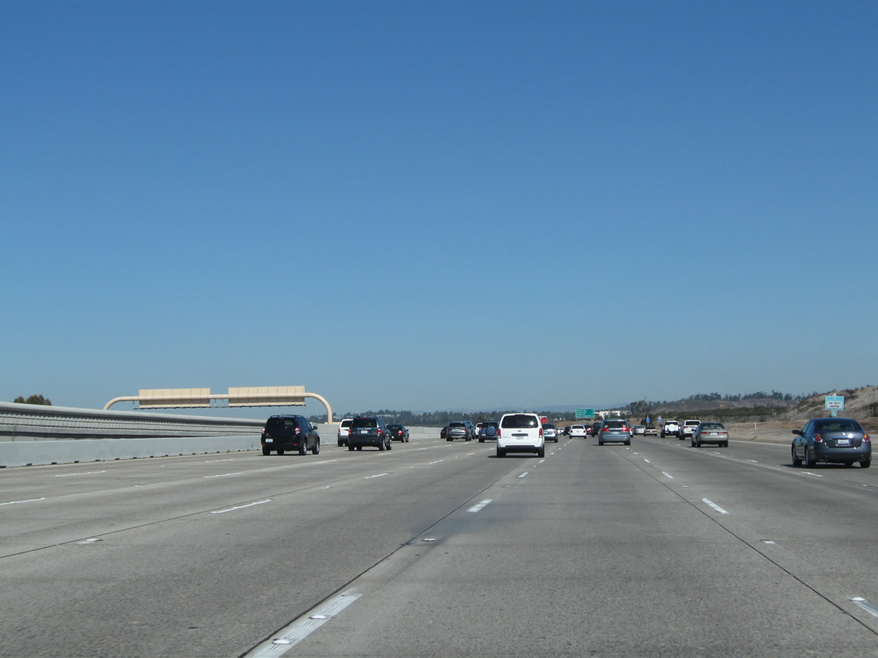
Now on the collector distributor lanes, the on-ramp from Miramar Way joins the ramp before the off-ramp to westbound Miramar Way. The freeway is passing through the Miramar Marine Corps Air Station at this point, thus why the area is not very developed. In October 2003, much of this grassland and eucalyptus tree area burned as part of the massive, 200,000-acre Cedar Fire. This fire spread from Cuyamaca west to Scripps Ranch, and the flames crossed this fourteen-lane freeway to burn part of the Miramar Marine Base before stopping at the Miramar Landfill near the intersection of California 52 and Convoy Street. Photos taken 12/28/10 and 02/16/05. |
|
This sign is posted at the gore point on the collector distributor lanes. Photo taken 12/28/10. |
| Interstate 15 (Escondido Freeway) north |
|
|
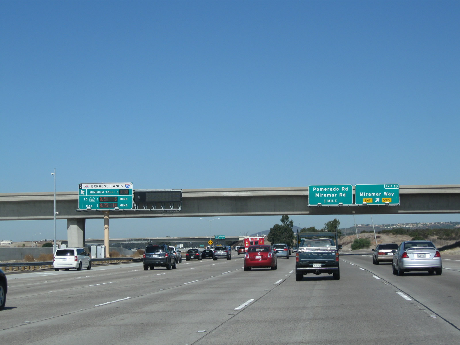
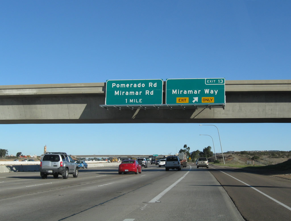
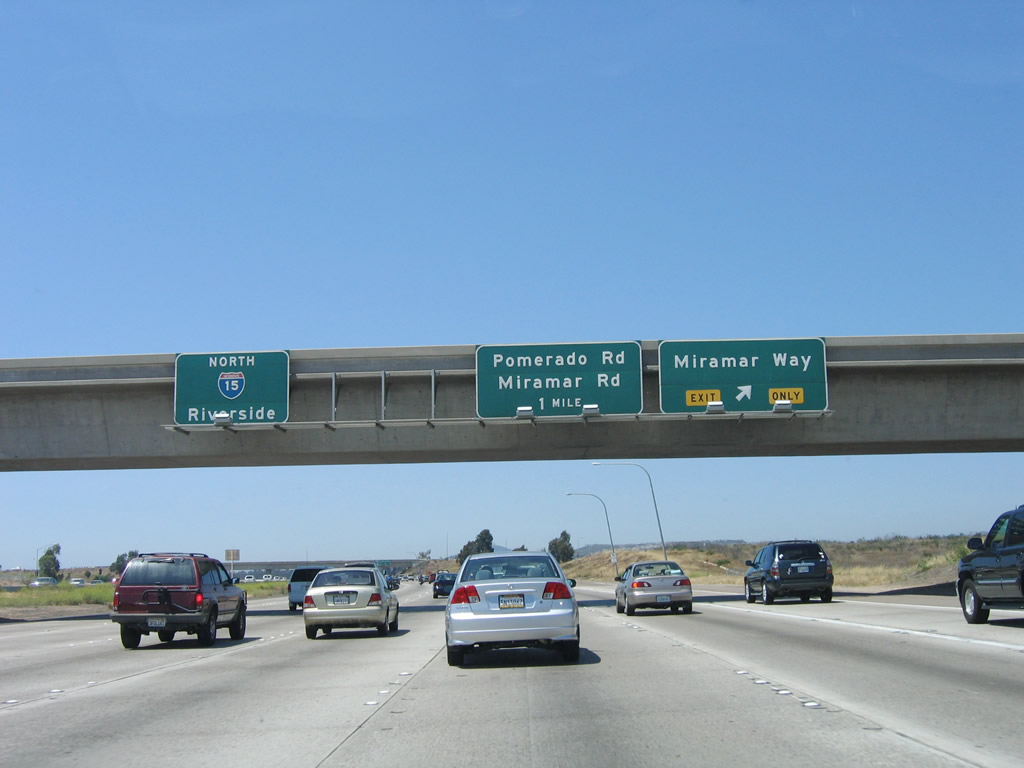
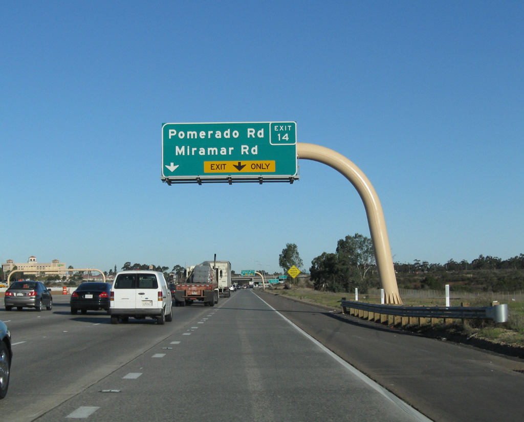
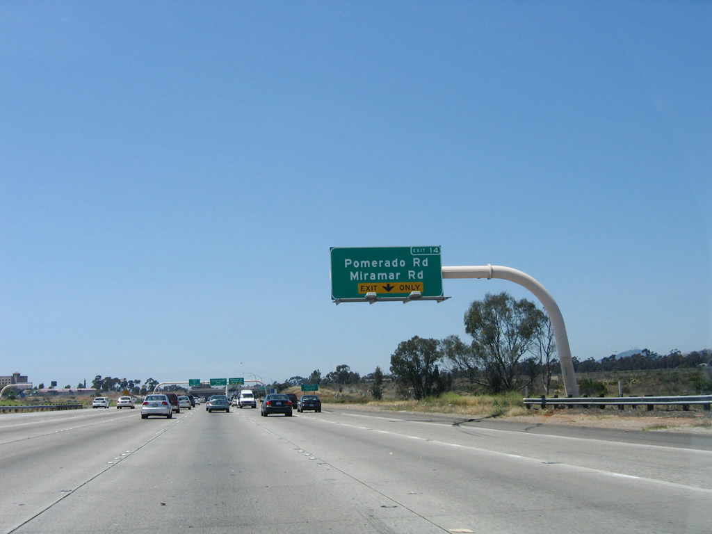
The next exit along Interstate 15 (Escondido Freeway) is Exit 14, Pomerado Road and Miramar Road. This is a major interchange. Miramar Road leads west from this interchange along the northern boundary of the Marine Corps Air Station Miramar through the southern tier of the enormous Mira Mesa community of San Diego. Miramar Road passes through a variety of commercial and industrial areas, eventually meeting with Interstate 805 near the city of San Diego reclaimed water plant. At Interstate 805, Miramar Road transitions directly onto La Jolla Village Drive, which in turn serves the University City community of San Diego and eventually ties into Torrey Pines Road with access to Del Mar and the University of California at San Diego (UCSD). Much of this route is four to eight lanes wide and is very busy. Photos taken 12/28/10 and 06/03/06. |
|
|
Northbound Interstate 15 next reaches Exit 14, Pomerado Road and Miramar Road. Pomerado Road turns northeast from this interchange, passing through the upscale community of Scripps Ranch (part of the city of San Diego) before turning north. The two-lane road through Scripps Ranch is well-traveled, but is much more leisurely as it winds through eucalyptus forests and only has a few intersections along its path. Most of the housing developments are obscured by the eucalyptus forest from the roadway. Pomerado Road turns north, passes through the city of Poway, and then roughly parallels Interstate 15 at a distance. Pomerado Road eventually travels a bit to the west, connecting with San Diego County S-5. Reentering the city of San Diego, Pomerado Road rendezvous with Rancho Bernardo near Lake Hodges near the north end of the city of San Diego. Pomerado Road is the original alignment for historic U.S. 395. Most vestiges of the old sections of U.S. 395/Pomerado Road are now gone, especially with the completion of major development projects along its corridor. However, the city of Poway has signed its section of U.S. 395 as a historic route. Photos taken 12/28/10 and 06/03/06. |
|
Upon exiting, turn left to Miramar Road west or right for Historic U.S. 395/Pomerado Road northeast. Photo taken 12/28/10. |
|
|
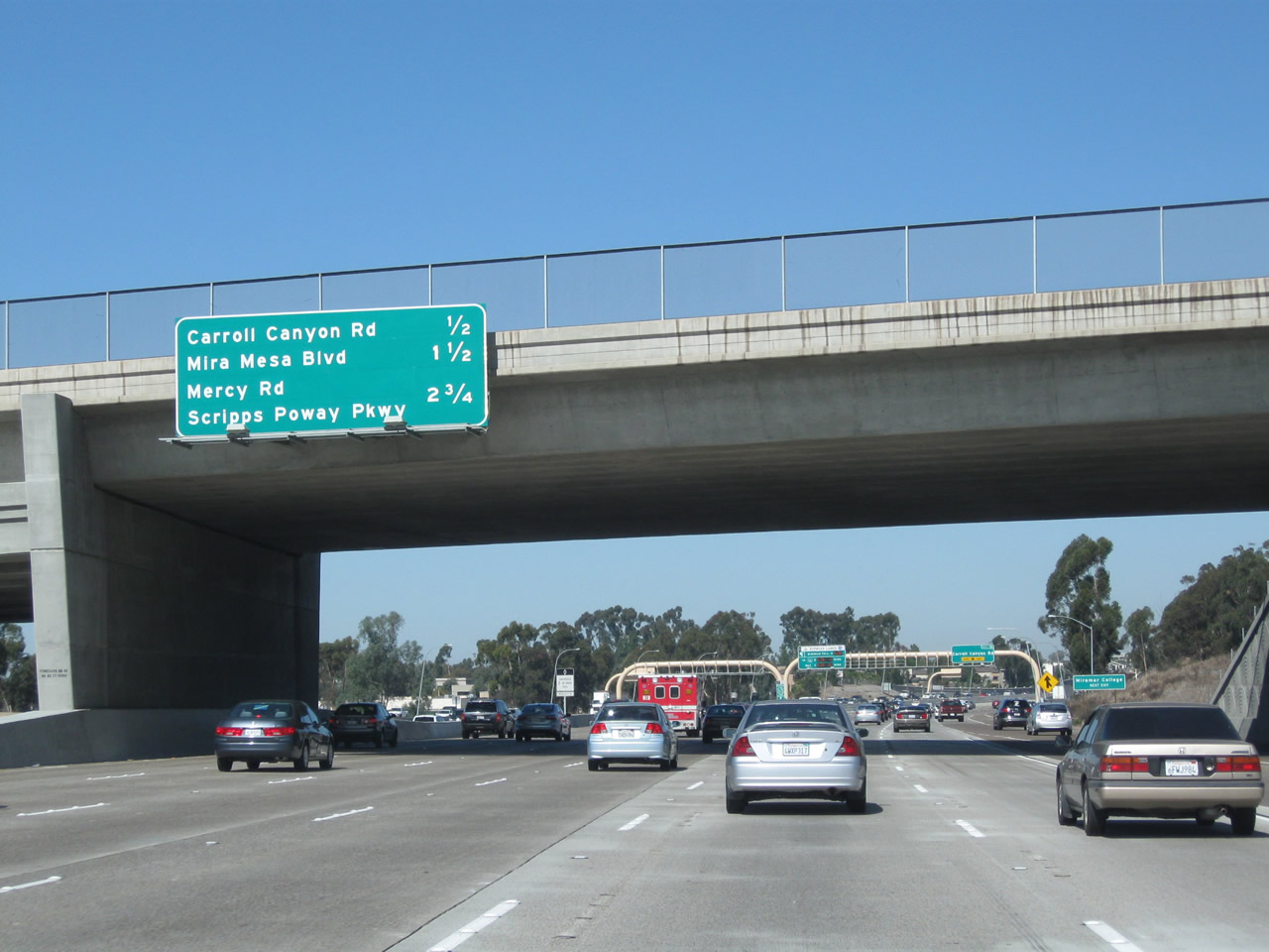
This mileage sign provides the distance to the next three exits along northbound: Exit 15, Carroll Canyon Road; Exit 16, Mira Mesa Boulevard; and Exit 17, Mercy Road west and Scripps-Poway Parkway east. This overpass was widened during the Express Lanes (Managed Lanes) project. Photo taken 06/03/06. |
|
|
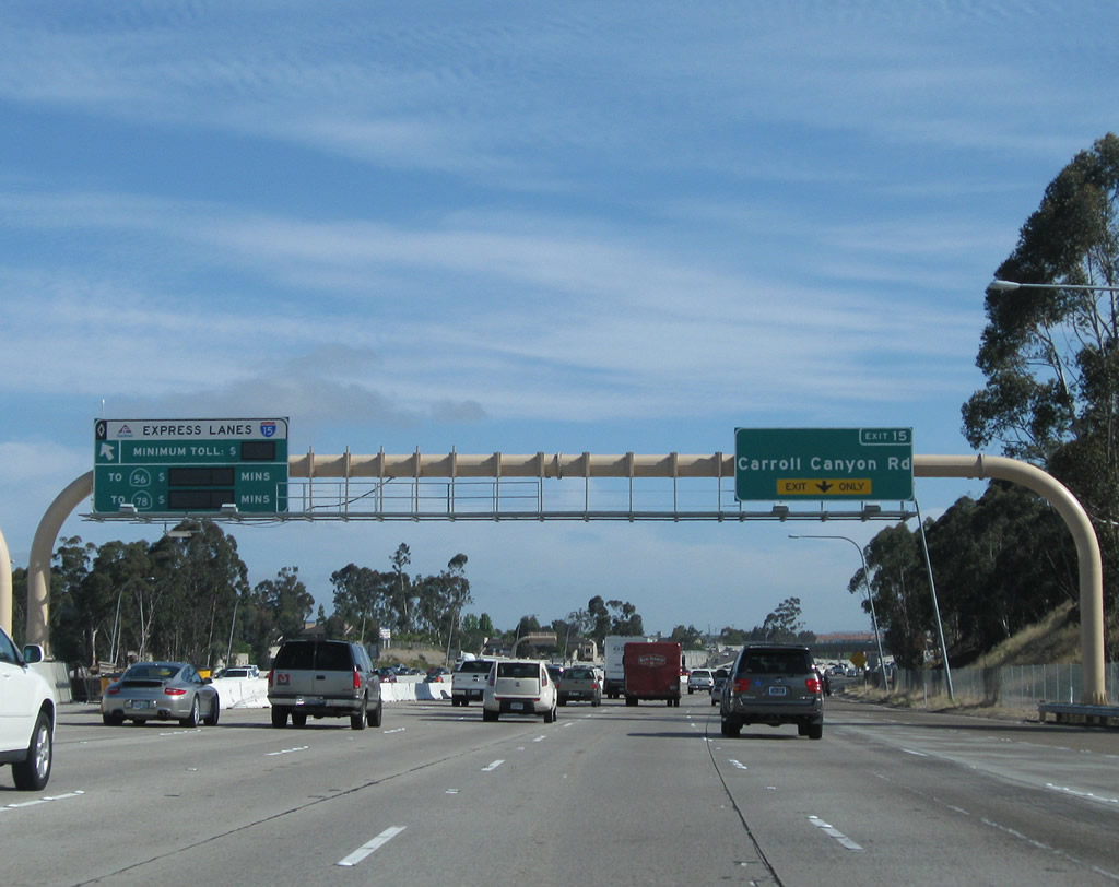
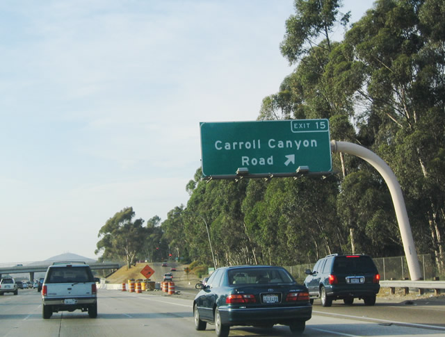
The next exit along northbound Interstate 15 is Exit 15, Carroll Canyon Road. The Cedar Fire of 2003 did not extend much farther north than here. With the construction of the express managed lanes in the center of the freeway, a slip ramp connects the mainline freeway to the high occupancy vehicle/toll lanes just prior to the Carroll Canyon Road interchange. Photos taken 10/29/11 and 06/03/06. |
|
|
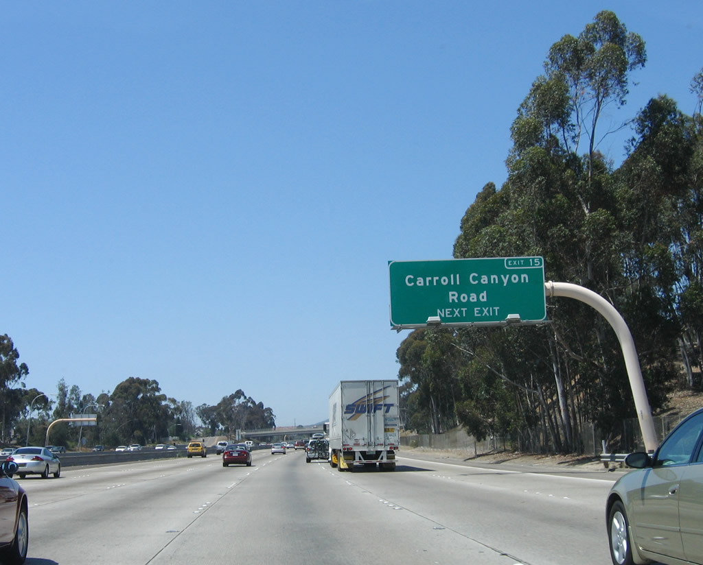
Northbound Interstate 15 (Escondido Freeway) meets Exit 15, Carroll Canyon Road, which leads into the communities of Scripps Ranch (eastbound) and Mira Mesa (westbound). The new exit number sign was installed in Summer 2004. Use this exit east to Miramar College, which is located along Black Mountain Road. Photos taken 01/05/13 and 07/14/04. |
|
|
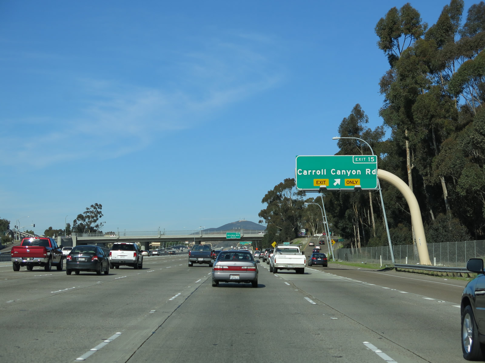
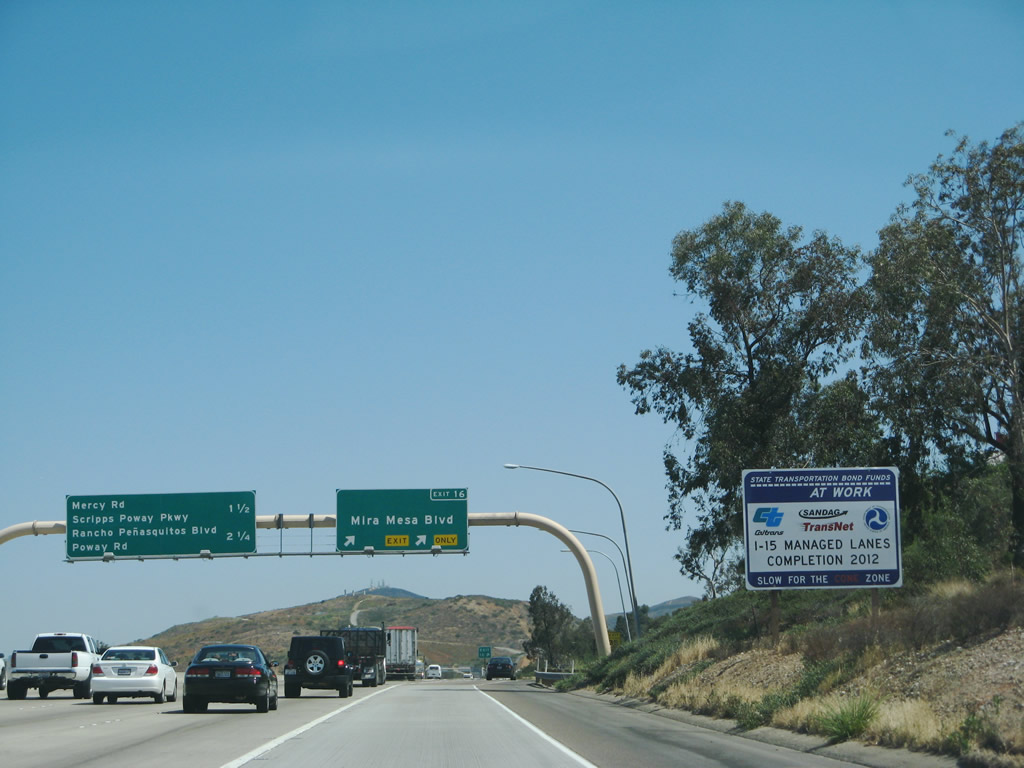
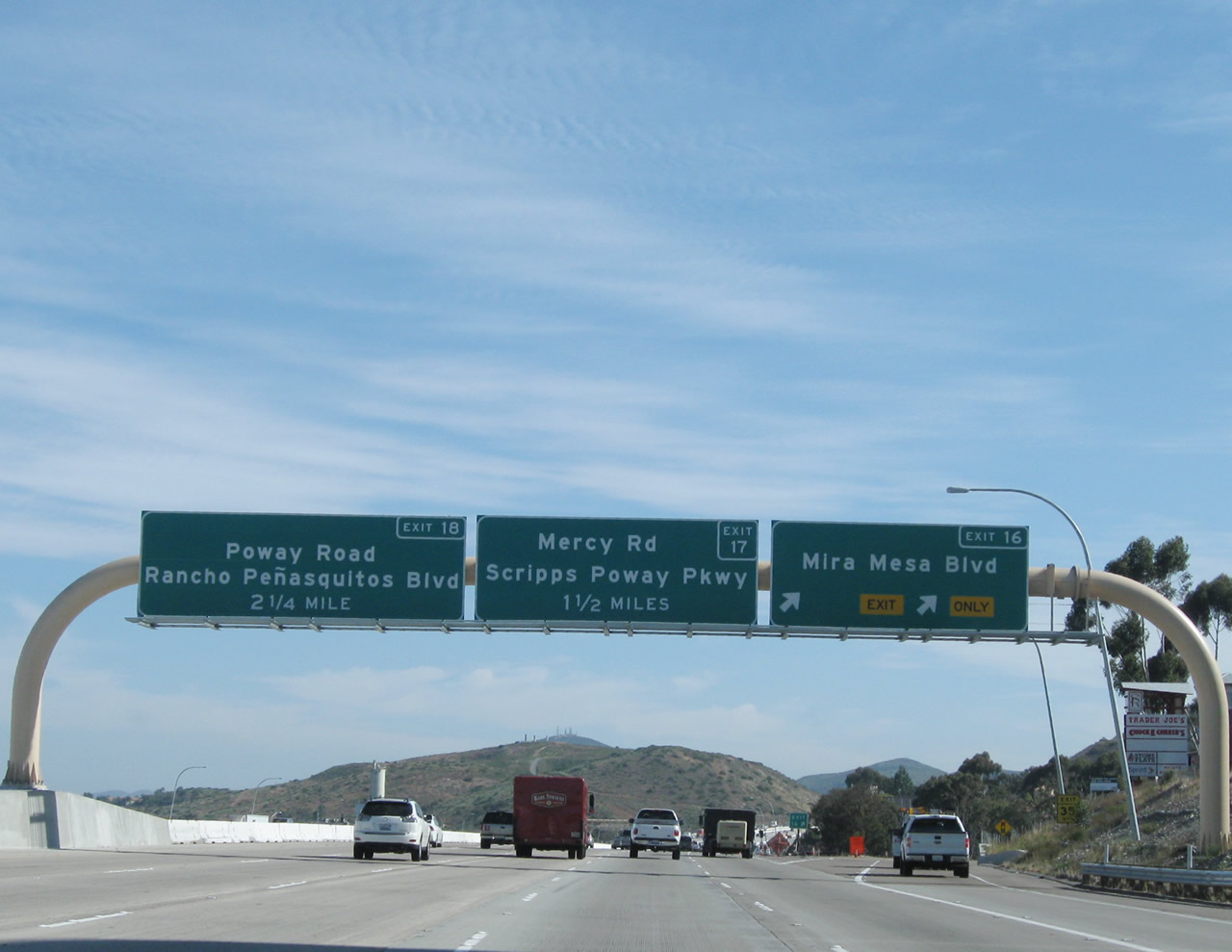
The Carroll Canyon Road bridge over Interstate 15 was also widened and renovated as part of the Managed Lanes project, including the decorative lighting fixtures seen from the freeway. Prior to the completion of the Express Lanes, a mileage sign provided the distance to the next three exits along northbound Interstate 15 (Escondido Freeway): Exit 16, Mira Mesa Boulevard; Exit 17, Scripps Poway Parkway east and Mercy Road east; and Exit 18, San Diego County S-4 (Poway Road) east and Peñasquitos Boulevard west. Photos taken 10/29/11 and 06/03/06. |
|
|
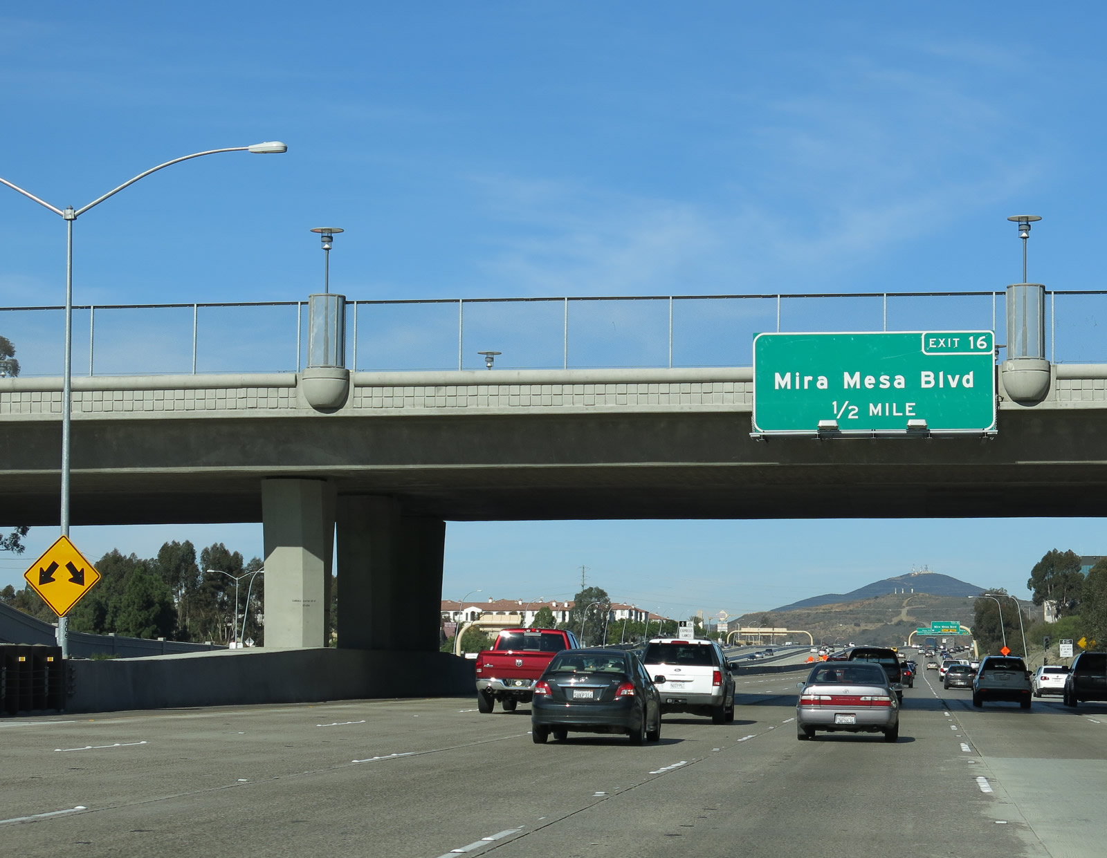
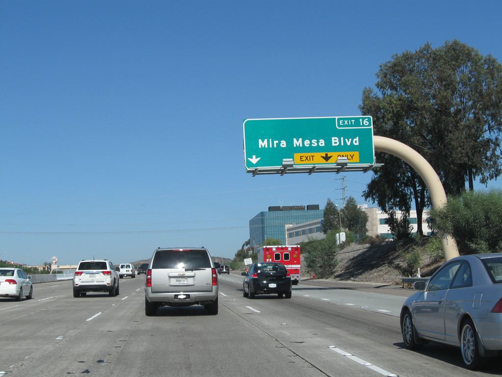
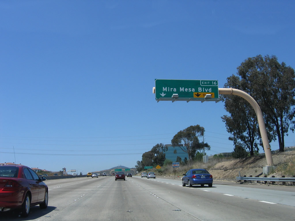
The next exit along northbound Interstate 15 is Exit 16, Mira Mesa Boulevard. Mira Mesa Boulevard extends west through the community of Mira Mesa before ending at Interstate 805 in Sorrento Valley. Heading east, Mira Mesa Boulevard ends at Scripps Ranch Boulevard. This sign was replaced between 2008 and 2011. Photos taken 10/29/11 and 06/03/06. |
|
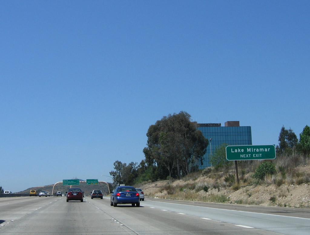
The city of San Diego has a network of reservoirs located throughout San Diego County, but only one is wholly located within the city limits of San Diego: Miramar Reservoir. This reservoir, which is located along the San Diego Aqueduct system, is a storage facility for drinking water. While most of the local drinking water is imported from either the state water project (California Aqueduct) or from the Colorado River (via the Los Angeles Aqueduct and other canals from the east), locally generated water is also stored in the reservoir system. Some recreational activities are permitted here, including hiking, fishing, and some boating. No swimming is permitted in the reservoir system. Photo taken 06/03/06. |
|
The managed lanes project transformed Interstate 15 between California 56 and Escondido between 2003 and 2012. These Express Lanes allow for high occupancy vehicles and toll paying vehicles to use the center express lanes in both directions rather than the reversible lanes that were formerly in use between California 163 and California 56. Photo taken 05/29/08. |
|
|
Northbound Interstate 15 (Escondido Freeway) meets Exit 16, Mira Mesa Boulevard. This major six-lane thoroughfare leads west into Mira Mesa. All services, including food, gas, and lodging, are located here. In addition, several major shopping centers and retail outlets are located here. The managed lanes project resulted in changes to the signs posted at this interchange. Photos taken 10/29/11 and 06/03/06. |
|
A separate mileage sign was in place separate from the one seen at the Exit 16 gore point until around 2005; it is now gone. The next interchange along northbound Interstate 15 is Exit 17, Mercy Road and Scripps Poway Parkway. From the former location of this mileage sign, Mercy Road/Scripps Poway Parkway is one mile ahead; the next exit after that is for Rancho Peñasquitos Boulevard and Poway Road (San Diego County S-4). Photo taken 07/27/02. |
|
|
An Express Lanes entrance, complete with toll information for single occupancy vehicles, is located just after the Mira Mesa Road interchange. At the time this picture was taken, the California 78 shield was temporarily covered with the word "MAX" since the extension of the Express Lanes north to California 78 had not yet been completed at that time. Photos taken 01/05/13 and 10/29/11. |
|
|
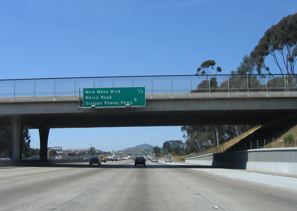
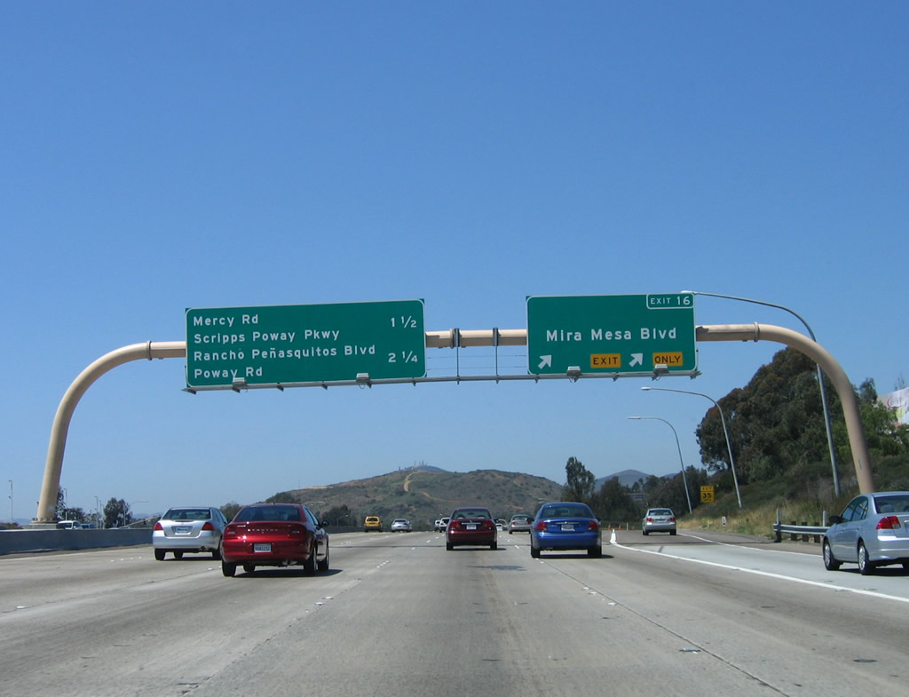
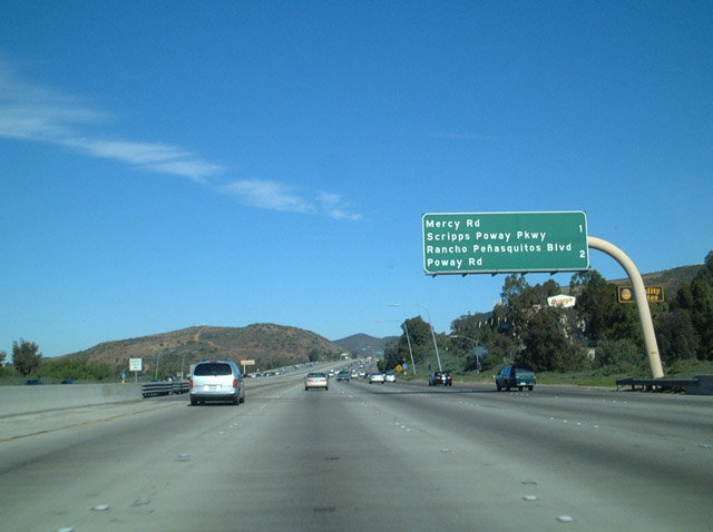
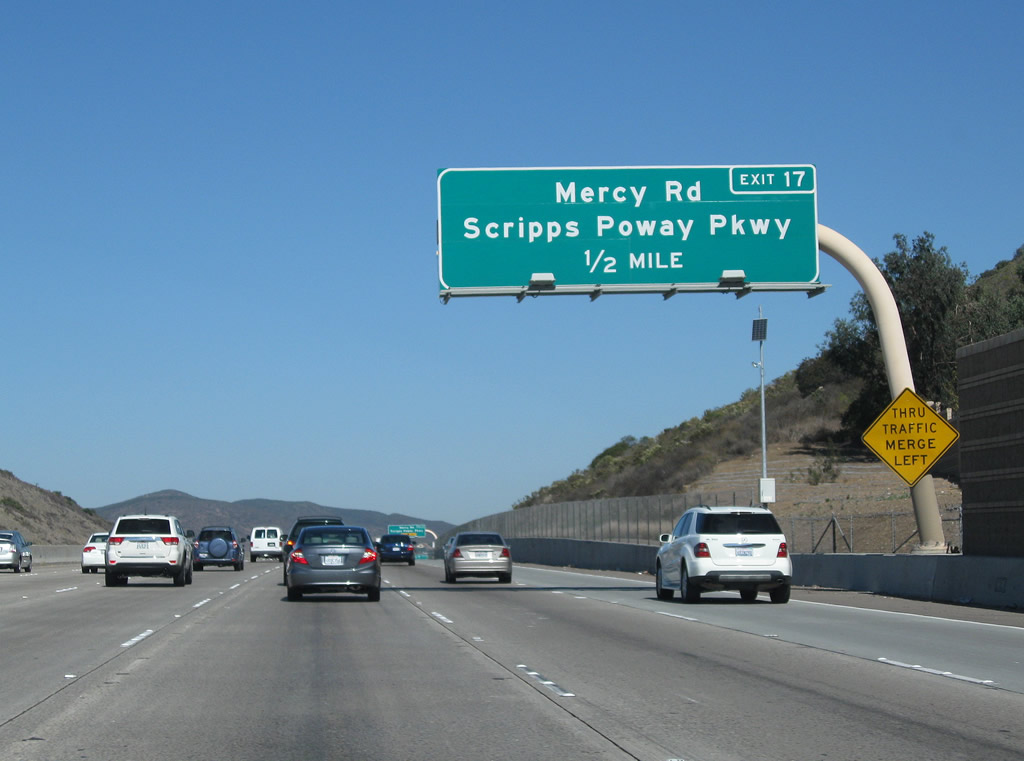
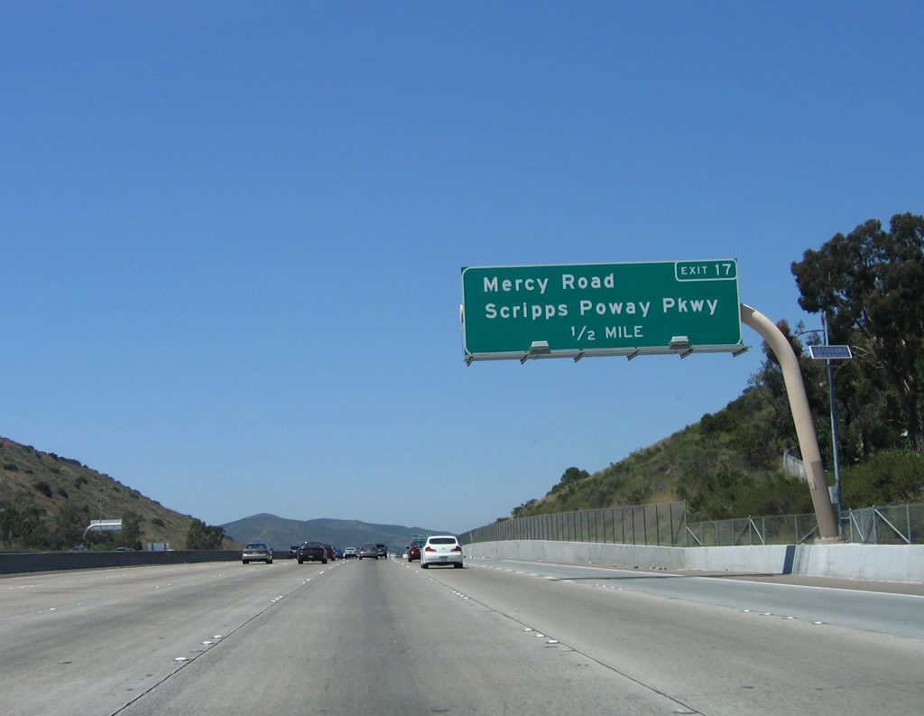
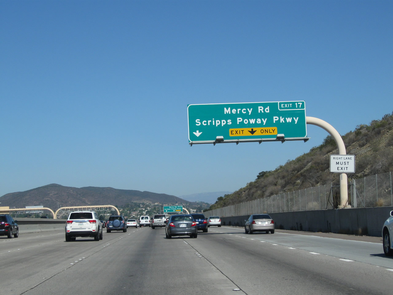
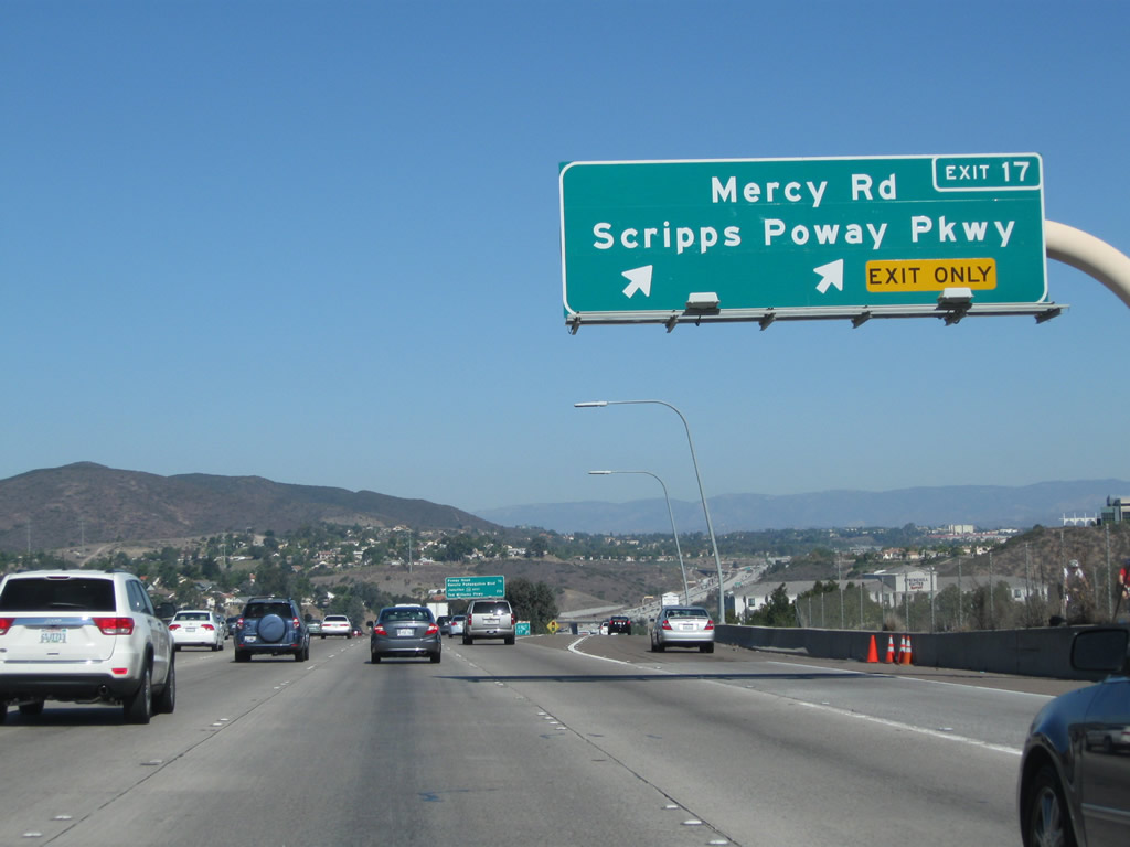
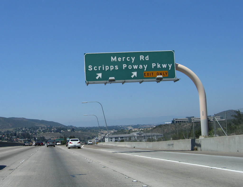
The next exit along Interstate 15 north is Exit 17, Mercy Road and Scripps Poway Parkway. Mercy Road leads west to Black Mountain Road, which connects to California 56 and the community of Rancho Peñasquitos to the north and Mira Mesa to the south. Scripps Poway Parkway is a major east-west expressway that leads east from here to connect to Rancho Encantada and ultimately California 67 in Poway. Only minor changes were made to this sign, which was replaced in 2010-2011. Photos taken 10/29/11 and 06/03/06. |
|
|
Use Mercy Road west to reach Rancho Peñasquitos. and Northeast Mira Mesa; Scripps Poway Parkway heads east through the Miramar Ranch North community of the city of San Diego, then enters the city of Poway. Scripps Poway Parkway becomes an expressway while in Poway, and it provides a four-lane fast connection to California 67/Ramona Highway in eastern Poway just southwest of Iron Mountain. The most significant change to this sign was to add an exit number and make it reflective; it was replaced in 2010-2011. Photos taken 10/29/11 and 06/03/06. |
|
|
Northbound Interstate 15 (Escondido Freeway) meets Exit 17, Mercy Road and Scripps Poway Parkway. After this interchange, Interstate 15 will cross over Peñasquitos Creek (via the Cara Knott Bridge) and the eastern edge of the Los Peñasquitos Canyon Preserve. The bridge over Peñasquitos Creek overshadows an old, two-lane arch bridge that carried a later iteration of U.S. 395 after it was realigned from Pomerado Road onto the modern Interstate 15 corridor. This older bridge cannot be seen from Interstate 15 but is accessible by a roadway leading north from Scripps Poway Road. Beyond the interchange, in the foreground is Black Mountain, and on the horizon is Palomar Mountain. Photos taken 10/29/11 and 06/03/06. |
|
|
This mileage sign (posted on the Mercy Road/Scripps Poway Parkway overpass) provides the distance to the next two exits along northbound: Exit 18, Rancho Peñasquitos. Boulevard northwest and San Diego County S-4 (Poway Road) east and Exit 19, California 56 (Ted Williams Freeway). Black Mountain, a local landmark, can be seen in the distance. Interstate 15 will pass southeast of Black Mountain near the California 56 interchange (Exit 19). Photos taken 10/29/11 and 06/03/06. |
|
A dynamic message sign is posted as we pass over Scripps Poway Parkway. Photo taken 06/03/06. |
|
|
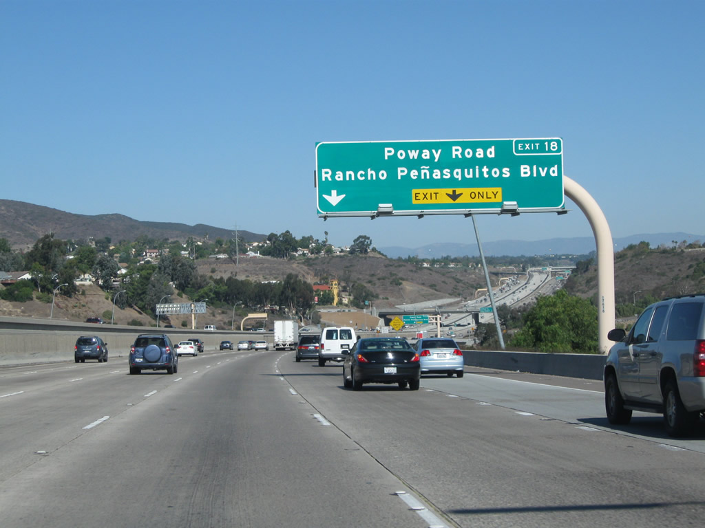
Use San Diego County S-4 (Poway Road) east to reach the city of Poway. Interstate 15 does not enter the city of Poway; in fact, the only state highway to enter Poway is California 67, and it chooses to remain well to the east of downtown Poway. Early proposals called for California 56 and California 125 to be extended east and north of their current termini into Poway, but those plans were scuttled in the 1980s. Photos taken 10/29/11 and 06/03/06. |
|
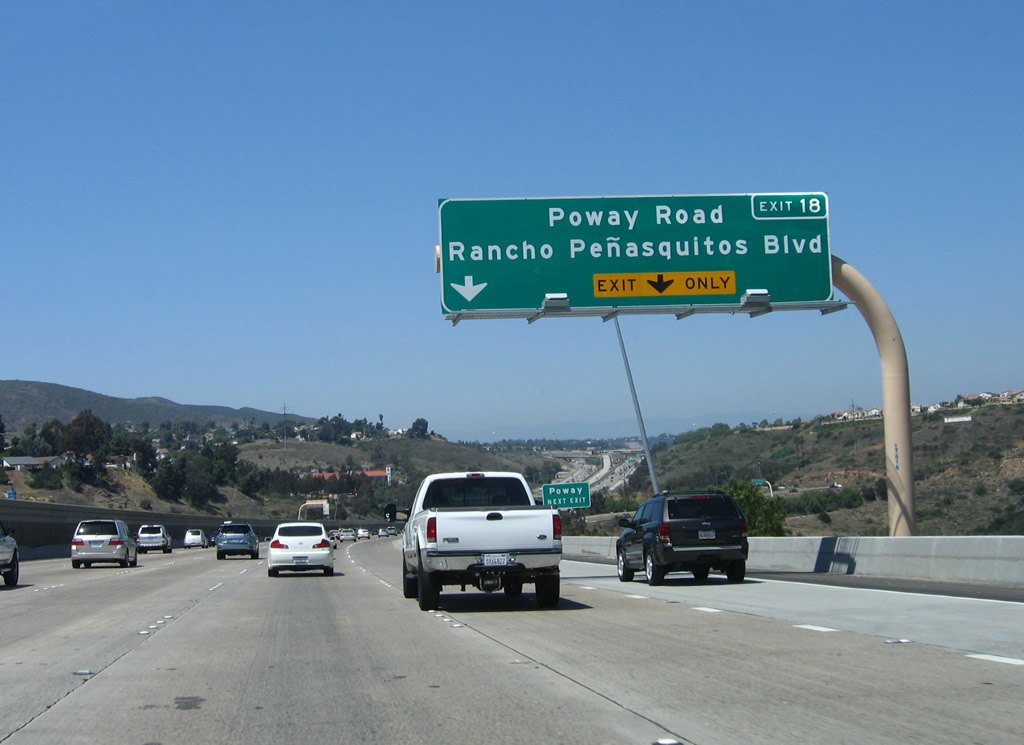
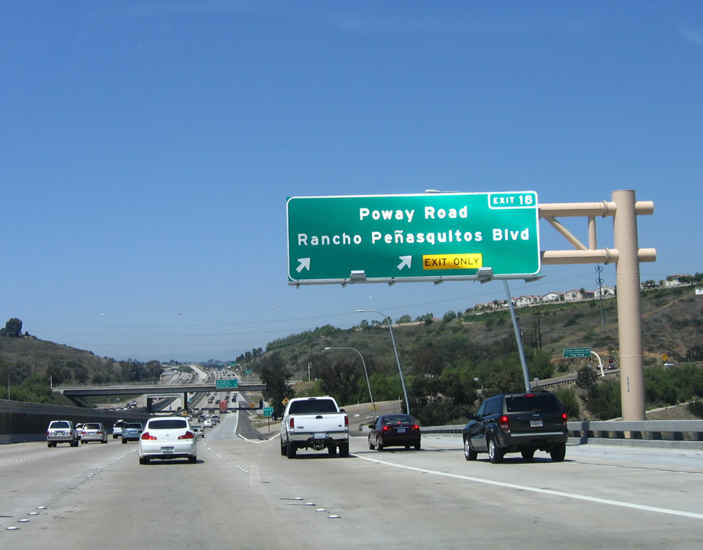
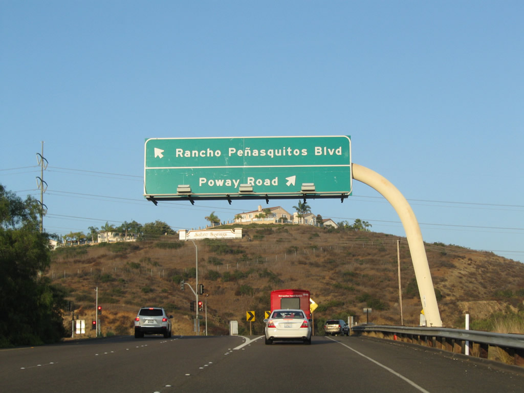
Northbound Interstate 15 meets Exit 18, Rancho Peñasquitos Boulevard and San Diego County S-4, Poway Road. The signed county begins at this interchange, extends west through the Sabre Springs community of San Diego, passes through the city of Poway, and ends at California 67 at the trailhead to Iron Mountain. This sign was not replaced during the Express Lanes construction between 2006 and 2012, but the Poway Road bridge ahead was dramatically reconstructed. Photo taken 10/29/11. |
|
Upon exiting the freeway, turn left for Rancho Peñasquitos Boulevard west or turn right for San Diego County S-4 (Poway Road) east. Photo taken 10/29/11. |
|
|
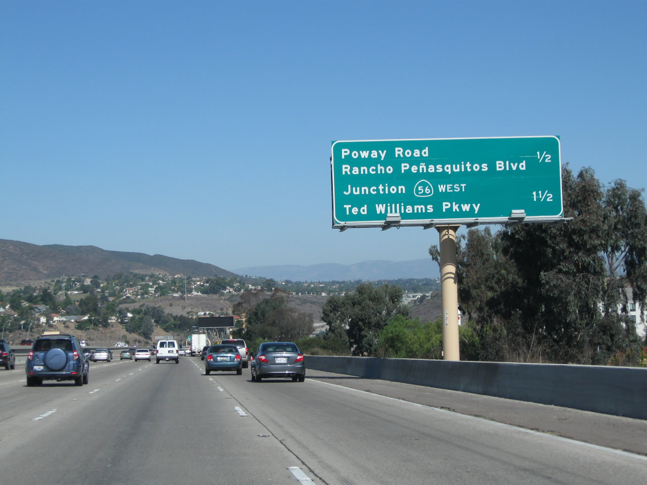
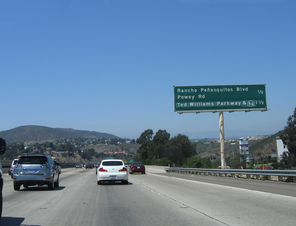
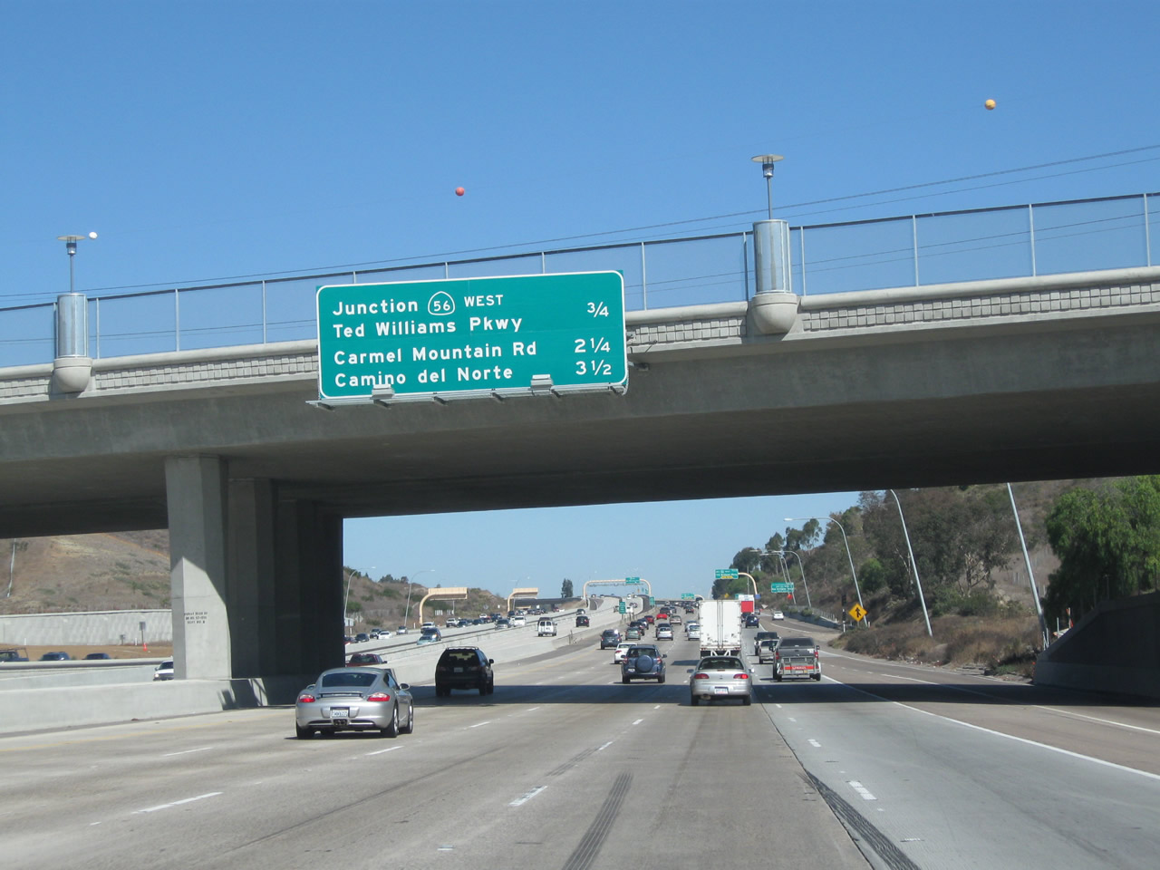
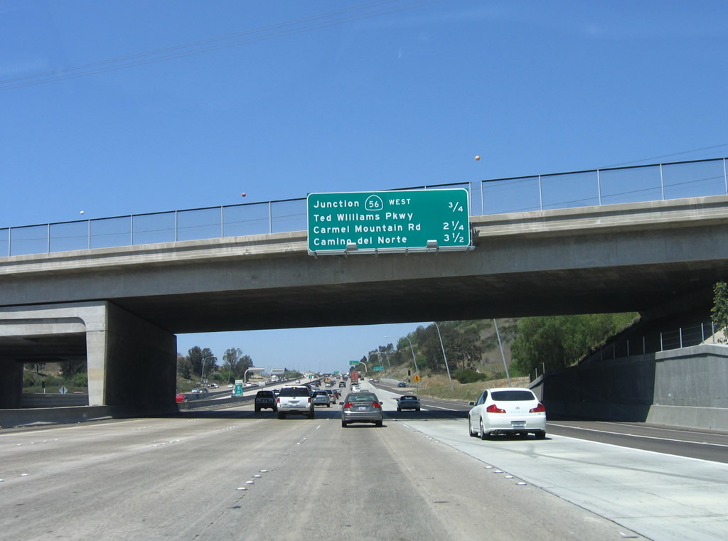
This mileage sign provides the distance to the next three exits along northbound Interstate 15: Exit 19, California 56 (Ted Williams Freeway); Exit 21, Carmel Mountain Road; and Exit 22, Camino del Norte. As a result of the aforementioned reconstruction of this bridge, the mileage sign was replaced in 2010-2011. Photos taken 10/29/11 and 06/03/06. |
|
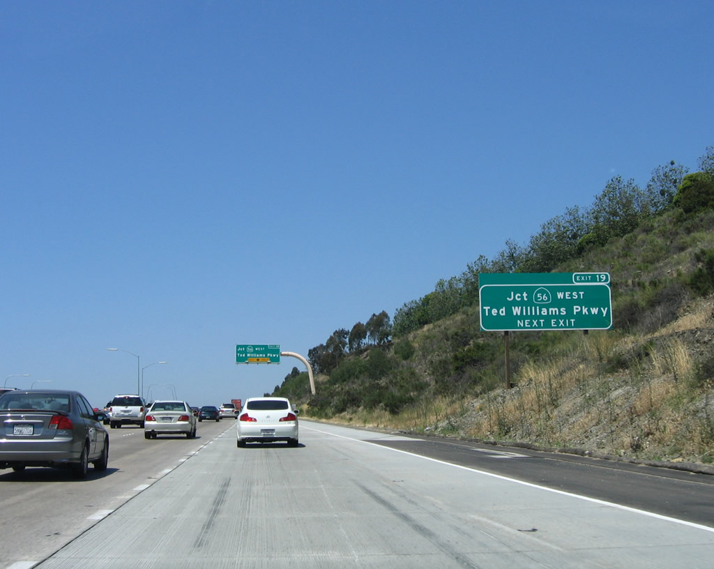
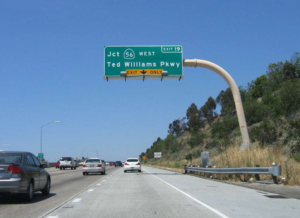
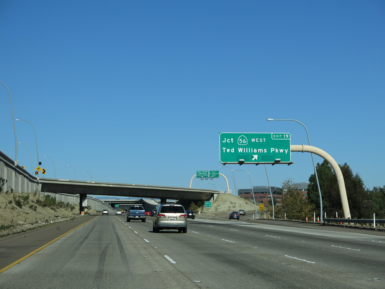
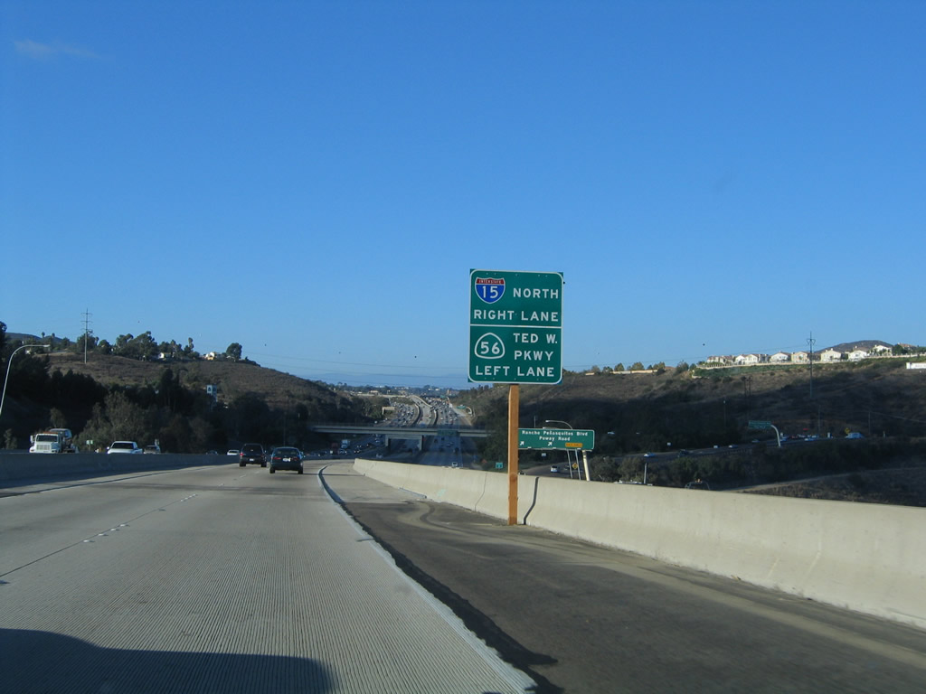
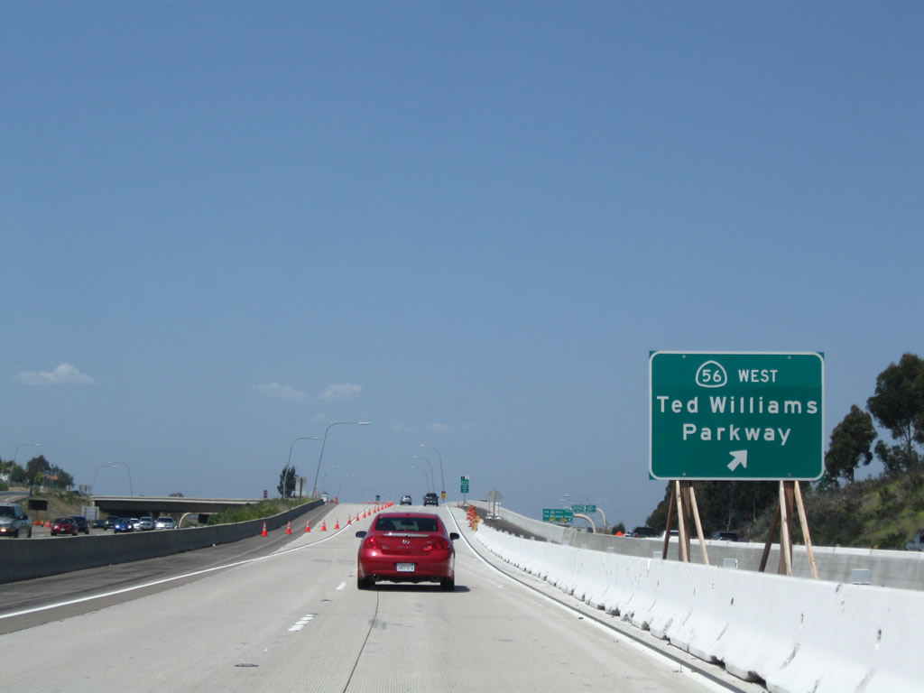
A roadside exit number sign for Exit 19, California 56 (westbound) and Ted Williams Parkway (eastbound) is posted one-half mile prior to the off-ramp. This area has changed as a result of the project to extend the high occupancy/toll lanes further north. Ted Williams Parkway leads east from this interchange into the community of Sabre Springs (part of San Diego) and then into the city of Poway. Most of the route is a six-lane expressway, but it is not part of California 56. California 56 comes to its eastern terminus at the approaching interchange. Photo taken 07/14/04. |
|
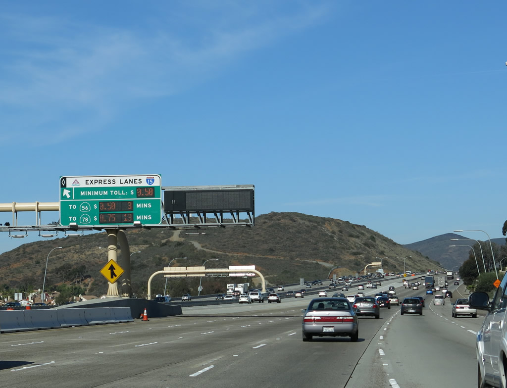
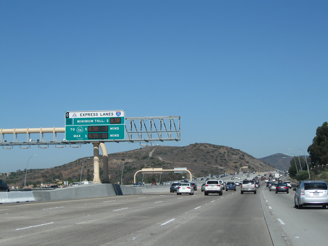
The express lanes have its own signing system, including this median sign for Exit 21 (Carmel Mountain Road) via the California 56 exit from the Express Lanes. Photo taken 01/05/13. |
|
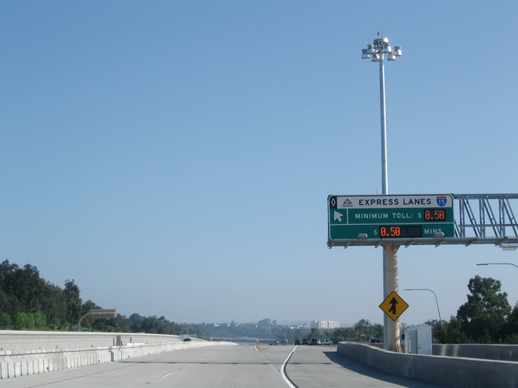
Back in 2006, the right lane became exit only for the connection to California 56 (Ted Williams Freeway) west and Ted Williams Parkway east; this changed by 2012. California 56 is an east-west freeway that serves the newest communities of San Diego. Originating in the Rancho Peñasquitos and Carmel Mountain Ranch area, California 56 extends west to the newer communities of Torrey Highlands and Pacific Highlands Ranch before ending in the Carmel Valley community at the interchange with Interstate 5. Through the 1990s, California 56 existed in two segments: one spur from Interstate 5 into Carmel Valley, and the other spur from Interstate 15 to Black Mountain Road. The two segments were linked permanently in July 2004. Photo taken 06/03/06. |
|
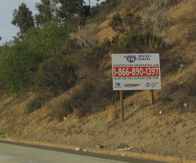
Interstate 15 (Escondido Freeway) was expanded to incorporate Express Lanes (which include additional high occupancy vehicle lanes and a northerly extension of the reversible express lanes all the way to Escondido). This sign was posted around 2004 for information about the construction project. The Interstate 15 Express Lanes project does not include direct, high-speed connectors between Interstate 15 and California 56. Currently, this connection is served by traffic signals even though this interchange connects two freeways. Photo taken 07/14/04. |
|
A dedicated ramp leaves the Express Lanes to California 56 and Ted Williams Parkway (Exit 19). Photo taken 01/05/13. |
|
|
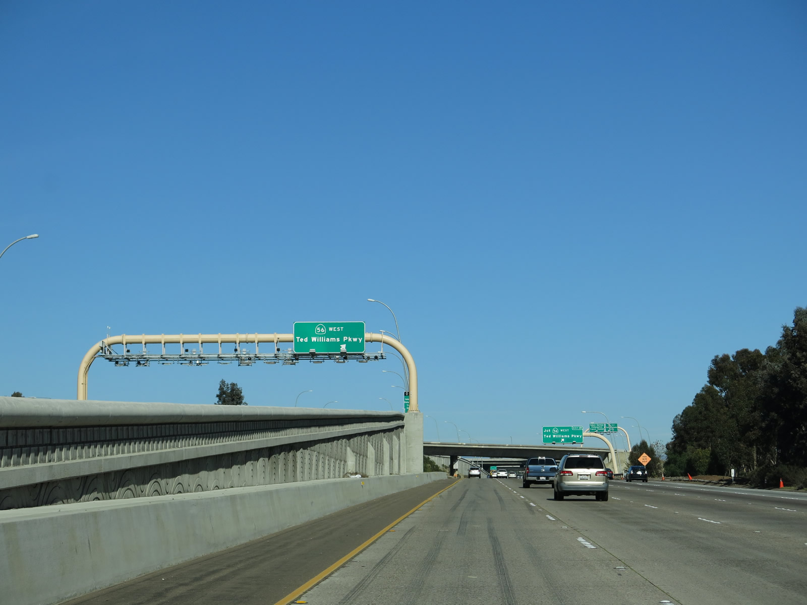
Northbound Interstate 15 reaches Exit 19, California 56 (Ted Williams Freeway) west and Ted Williams Parkway east. Westbound California 56 is the recently completed freeway that heads southwest from this interchange to Interstate 5 in Carmel Valley, near the Interstate 5/805 Merge. The California 56 freeway was fully opened to traffic in July 2004 when the final link between Camino del Sur and Carmel Valley Road opened to traffic. Photos taken 01/05/13 and 06/03/06. |
|
Now on the transition ramp from Interstate 15 north to California 56, the connecting ramps between the high occupancy vehicle/toll lanes to California 56 and Ted Williams Parkway was nearing completion in 2008. Photo taken 05/29/08. |
|
|
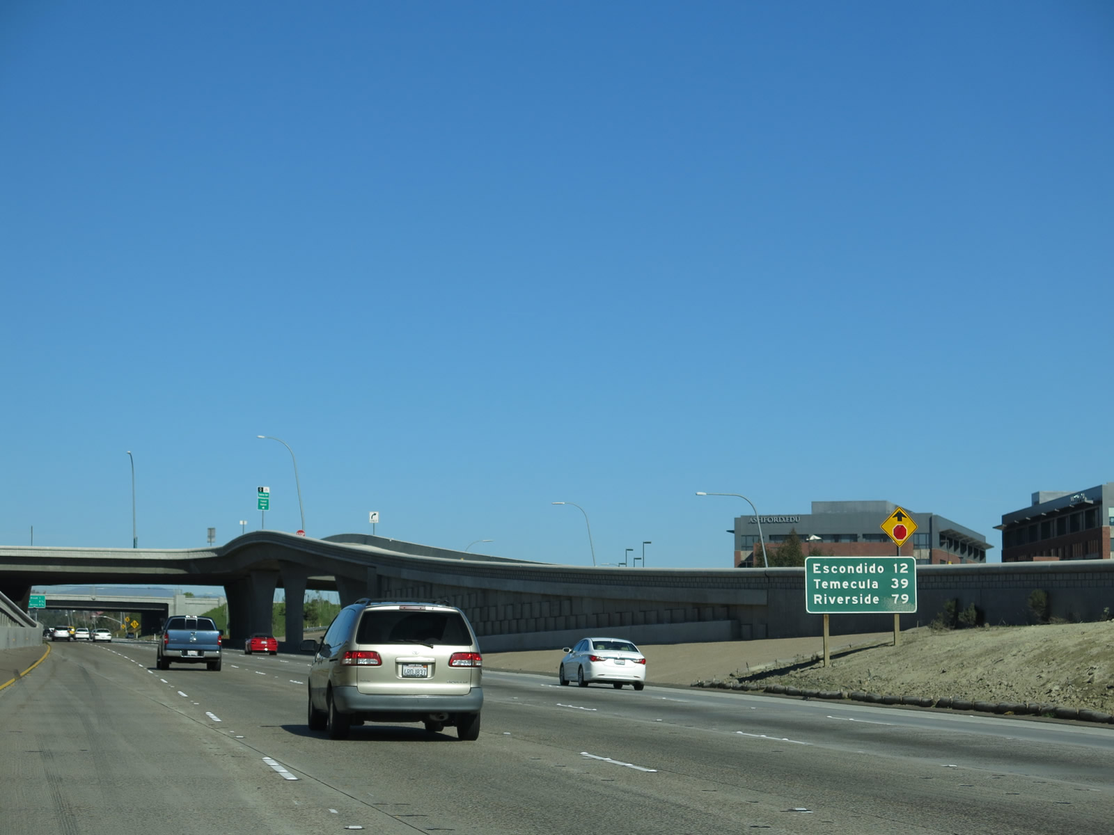
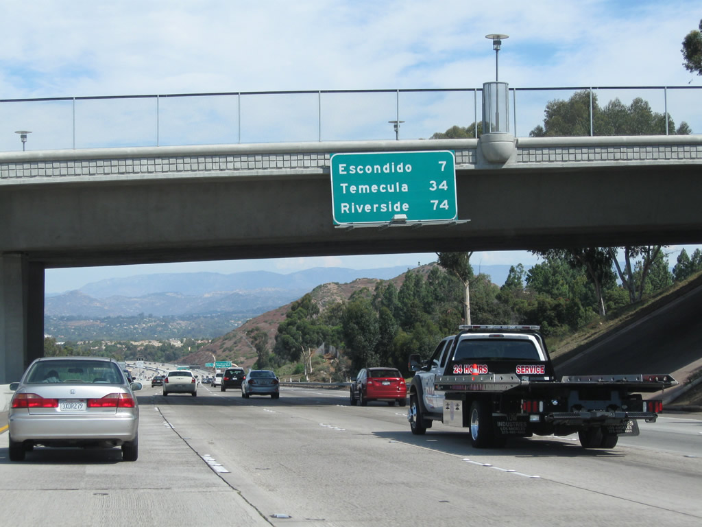
Back on the mainline, this mileage sign provides the distance to Escondido and Temecula via Interstate 15 north and Riverside via Interstate 215 north. This sign is still around, but it has been placed on a temporary structure and has been moved around a bit during construction of the Express Lanes project. It is not clear if a replacement sign will be incorporated somewhere near this point. Photos taken 01/05/13 and 06/03/06. |
|
Construction of the high occupancy vehicle/toll lanes connection to California 56 was visible in 2006; most of this work was complete by 2008. Photo taken 06/03/06. |
|
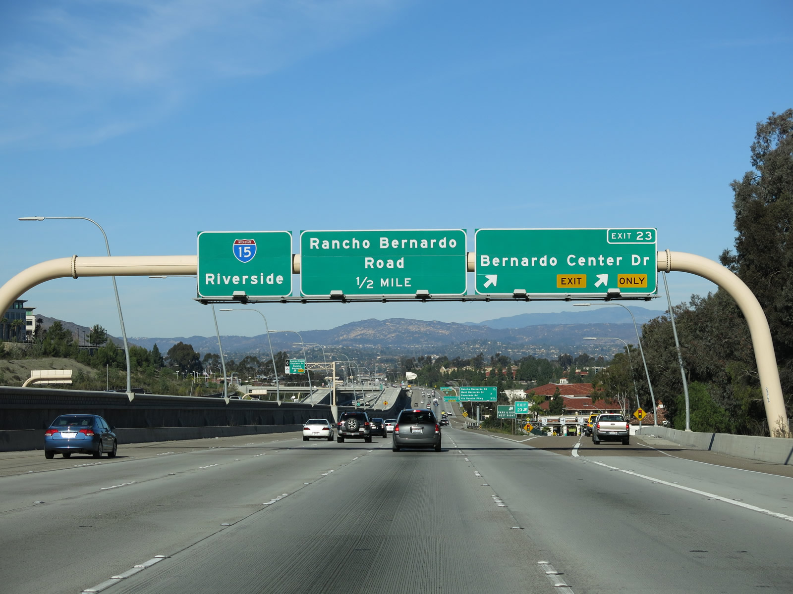
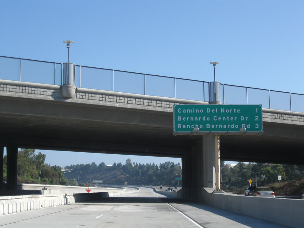
Passing under the California 56 mainline, this mileage sign along Interstate 15 north provides the distance to the next three exits: Exit 21, Carmel Mountain Road; Exit 22, Camino del Norte; and Exit 23, Bernardo Center Drive. Photo taken 10/29/11. |
|
|
An Express Lanes entrance ramp (from the left lanes) is found after passing under the California 56 bridge, near where an on-ramp from California 56 joins Interstate 15 north. Photos taken 07/17/11 and 10/29/11. |
|
A tiny Interstate 15 reassurance shield is posted after the California 56 interchange. A new left lane is temporarily reserved for high occupancy vehicles (carpools) until the new managed lanes are opened in 2008. Photo taken 06/03/06. |
|
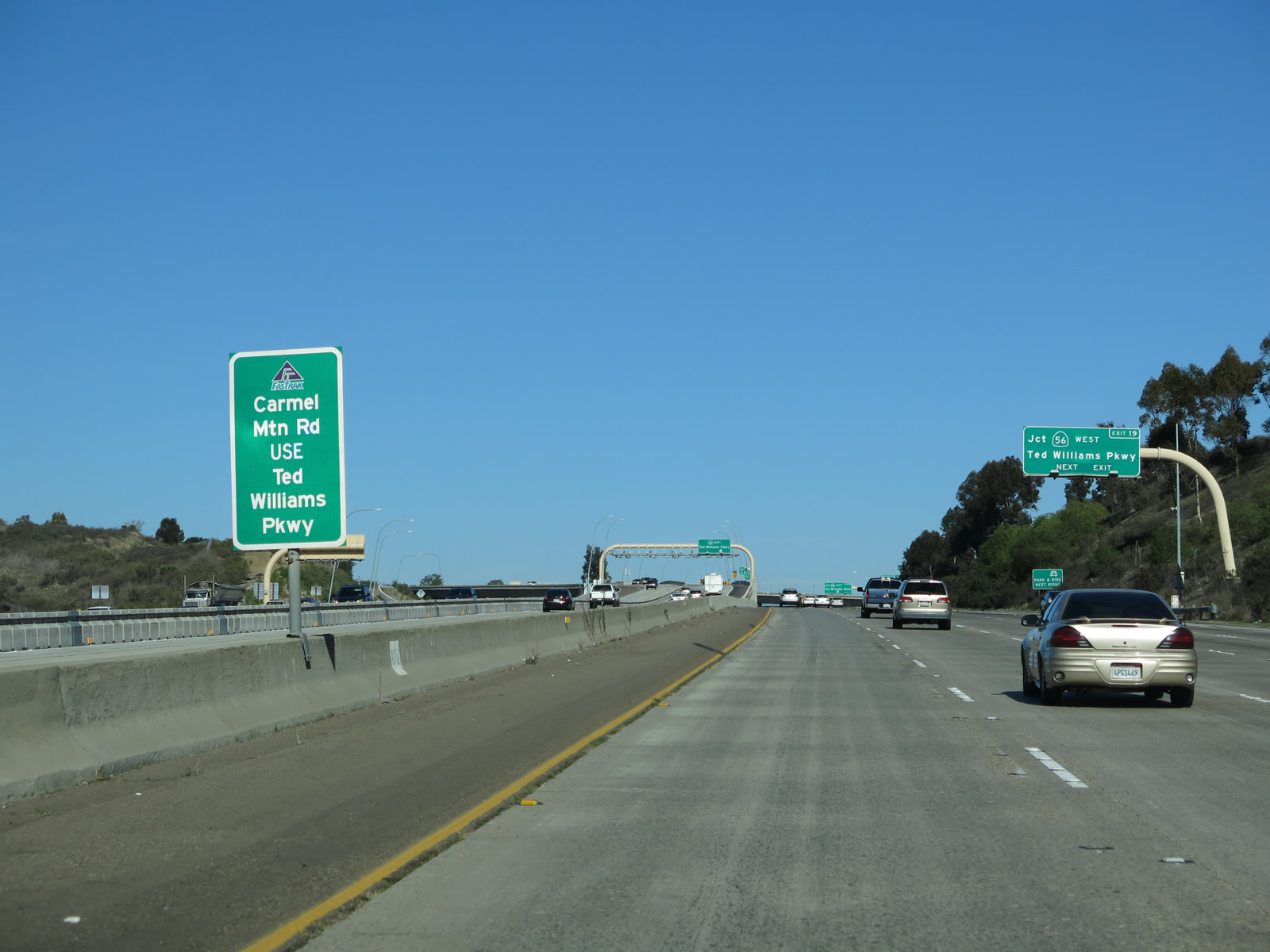
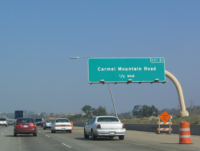
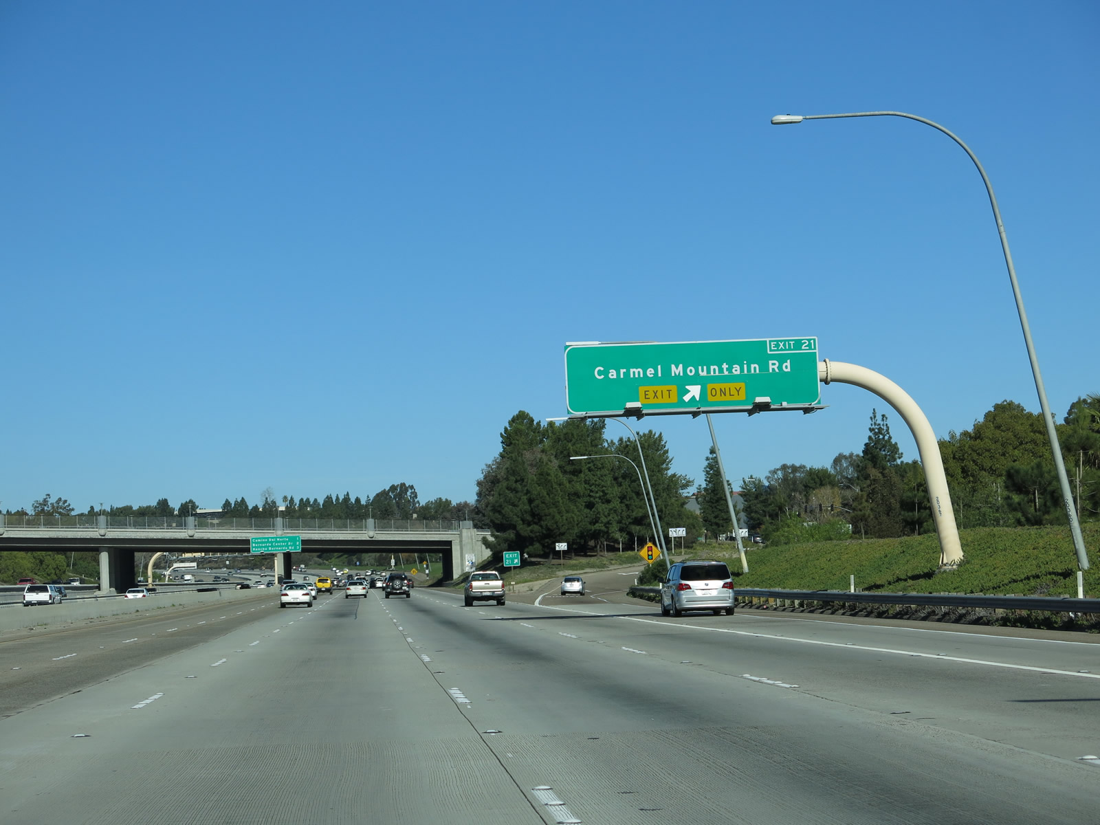
The next exit along northbound Interstate 15 is Exit 21, Carmel Mountain Road. This overhead sign was removed during construction in 2005, and it has not yet been replaced. Photo taken 01/20/04. |
|
|
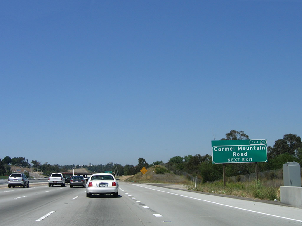
A roadside sign for Exit 21 (Carmel Mountain Road) is posted shortly thereafter. Carmel Mountain Road travels east into the Carmel Mountain Ranch community of the city of San Diego. To the west, Carmel Mountain Road serves the Rancho Peñasquitos community of the city of San Diego, skirting the southern edge of Black Mountain. On the left side of the freeway is another entrance into the Express Lanes (see 2013 picture). Photos taken 06/03/06 and 01/05/13. |
|
|
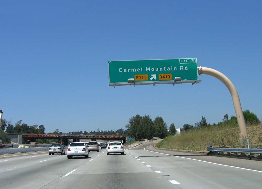
Northbound Interstate 15 (Escondido Freeway) reaches Exit 21, Carmel Mountain Road. The Carmel Mountain Road overpass, visible ahead, was rebuilt between 2006 and 2011. Photos taken 01/05/13 and 06/03/06. |
|
|
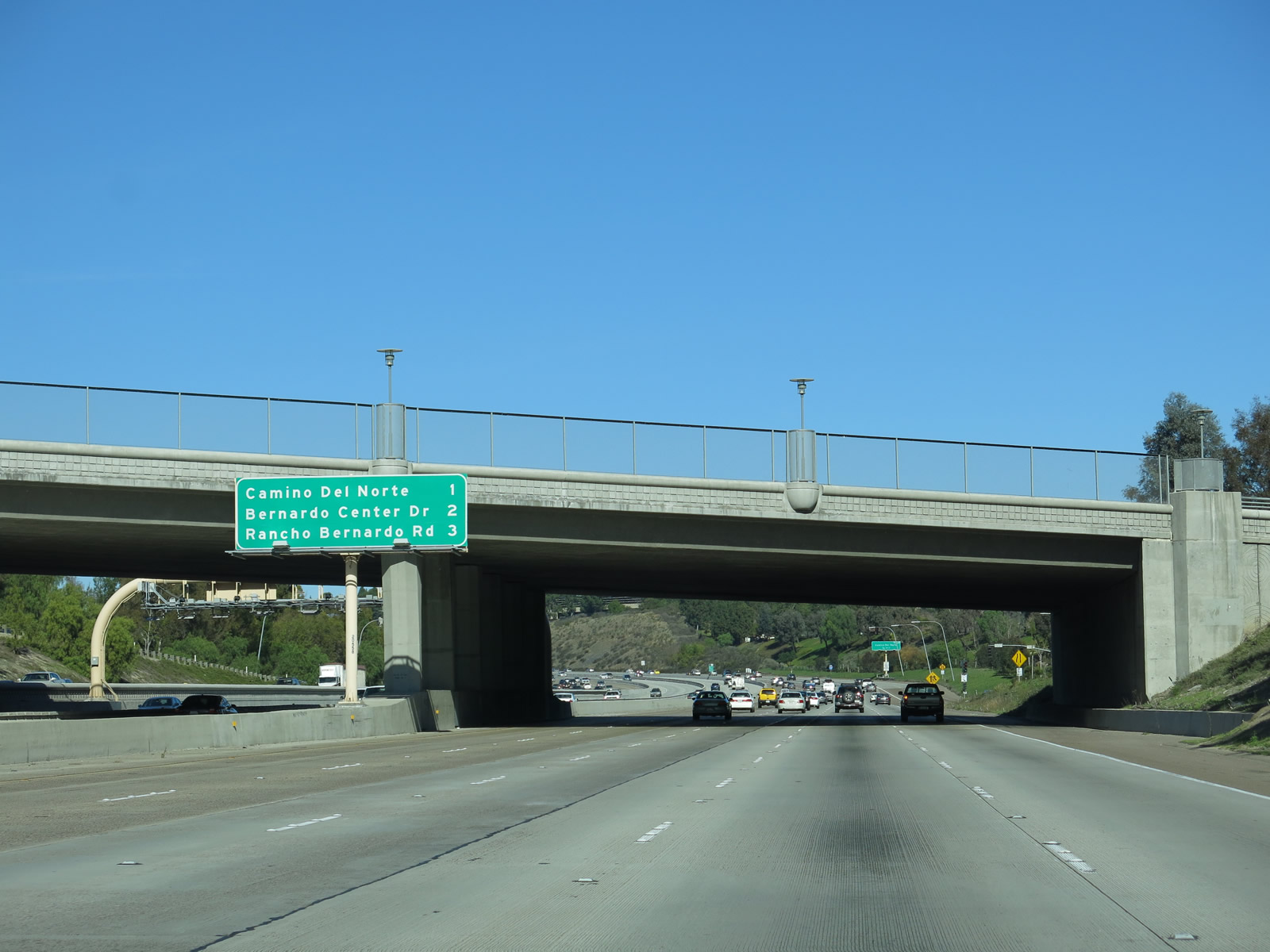
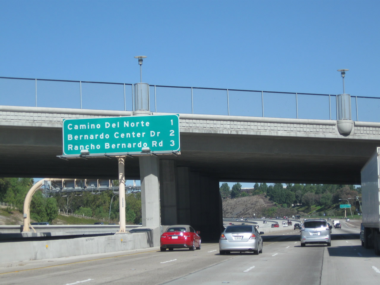
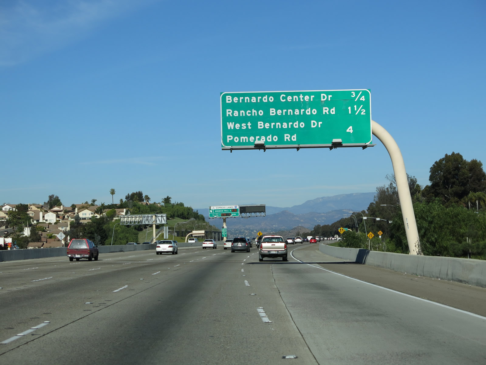
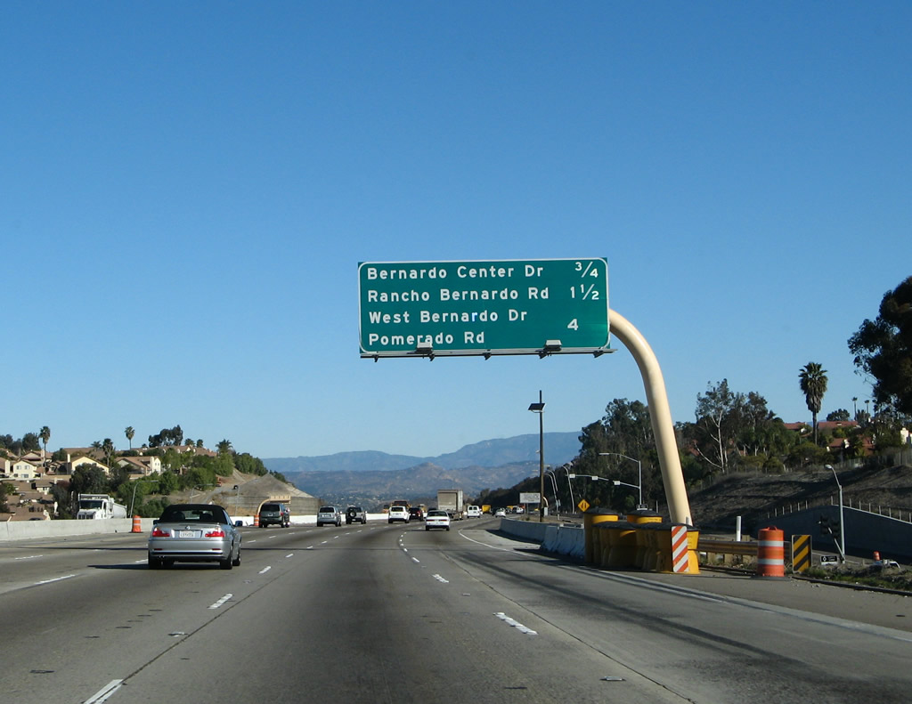
Passing under Carmel Mountain Road, this mileage sign provides the distance to the next three exits along Interstate 15 (Escondido Freeway) north: Exit 22, Camino del Norte; Exit 23, Bernardo Center Drive; and Exit 24, Rancho Bernardo Road. Photos taken 01/05/13 and 10/29/11. |
|
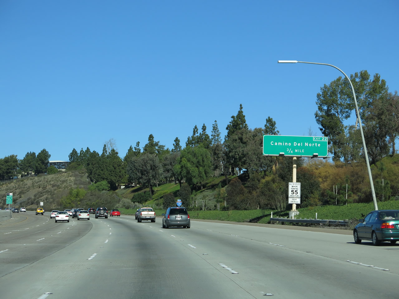
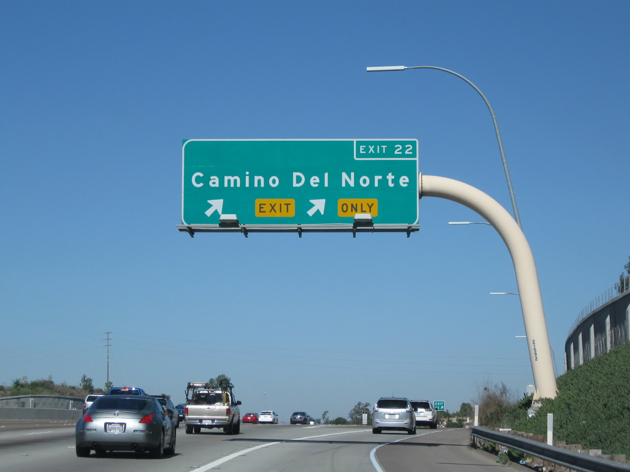
The next exit along northbound is for Exit 22, Camino del Norte, three-quarters of a mile. This exit is signed with an exit number. Camino del Norte serves the Rancho Bernardo and Carmel Mountain Ranch communities of the city of San Diego. Photo taken 01/05/13. |
|
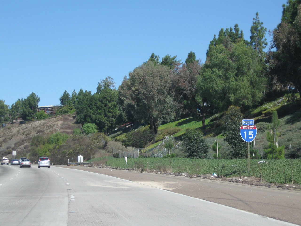
This Interstate 15 route marker is posted after the first advance sign for Camino del Norte (Exit 22) and after the on-ramp from Carmel Mountain Road. As part of a trend along this corridor, a neutered Interstate 15 shield (with no state name) was placed in 2010. Photo taken 10/29/11. |
|
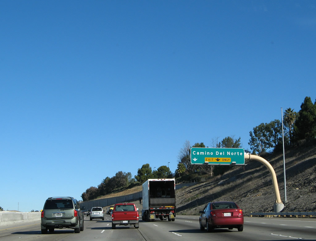
The right two lanes prepare to exit to Camino del Norte. This is another major interchange that could have been much more. During the 1980s, Exit 22 was considered the location for a proposed northern extension of California 125 to meet Interstate 15. Additionally, Camino del Norte (then referred to as Select Arterial 680) would have followed an expressway or even freeway alignment west across north San Diego into the city of Encinitas. Both projects were killed: California 125 is not welcome in the city of Poway, so no northern extension is likely, and Select Arterial 680 was denied due to opposition from Encinitas. Photo taken 10/29/11. |
|
|
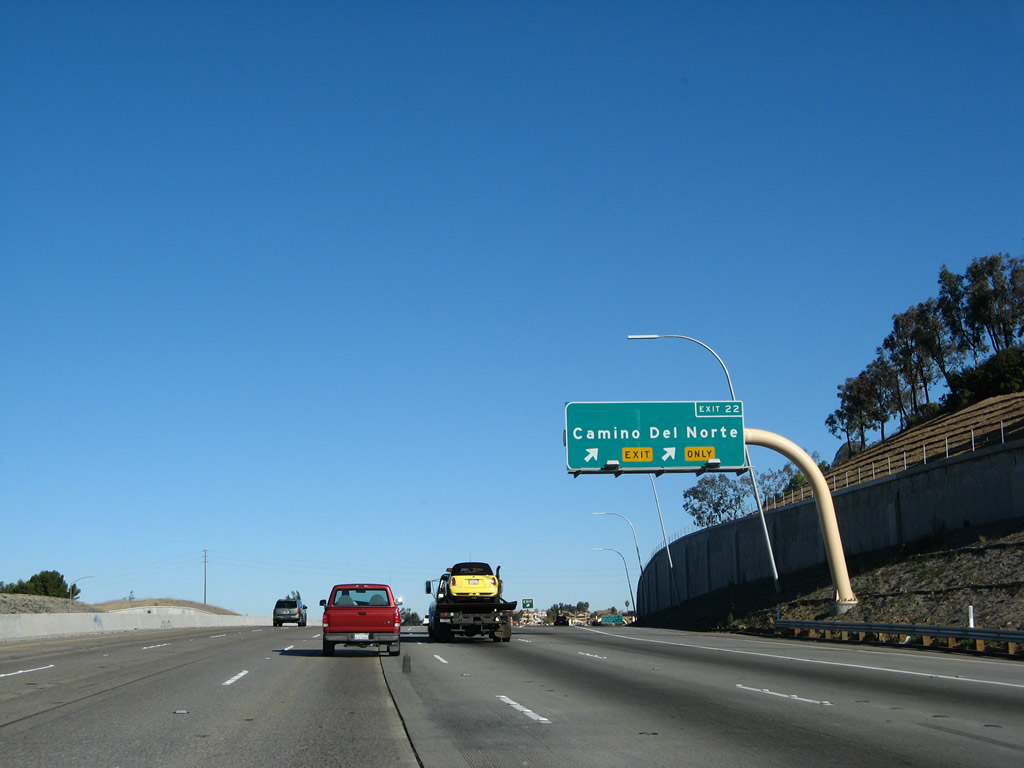
Northbound Interstate 15 reaches Exit 22, Camino del Norte. Despite the fact that Select Arterial 680 was not constructed as originally planned, Camino del Norte is still a major corridor that connects Interstate 15 with several housing developments in northern San Diego city (including Del Sur in Black Mountain Ranch community) and the sprawling 4S Ranch development in the unincorporated county. To achieve access to the west, residents must use either California 56 or congested San Dieguito Road. Photos taken 10/29/11 and 01/25/07. |
|
|
Departing the freeway, this view follows the off-ramp from Interstate 15 north to Camino del Norte. The interchange is a standard diamond with traffic signals. To Rancho Bernardo High School, turn right on Camino del Norte to Paseo Lucido north. Photos taken 10/29/11. |
|
|
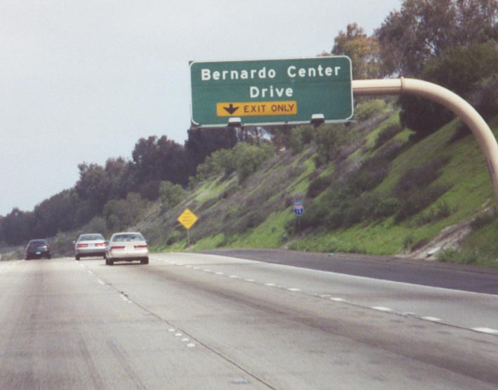
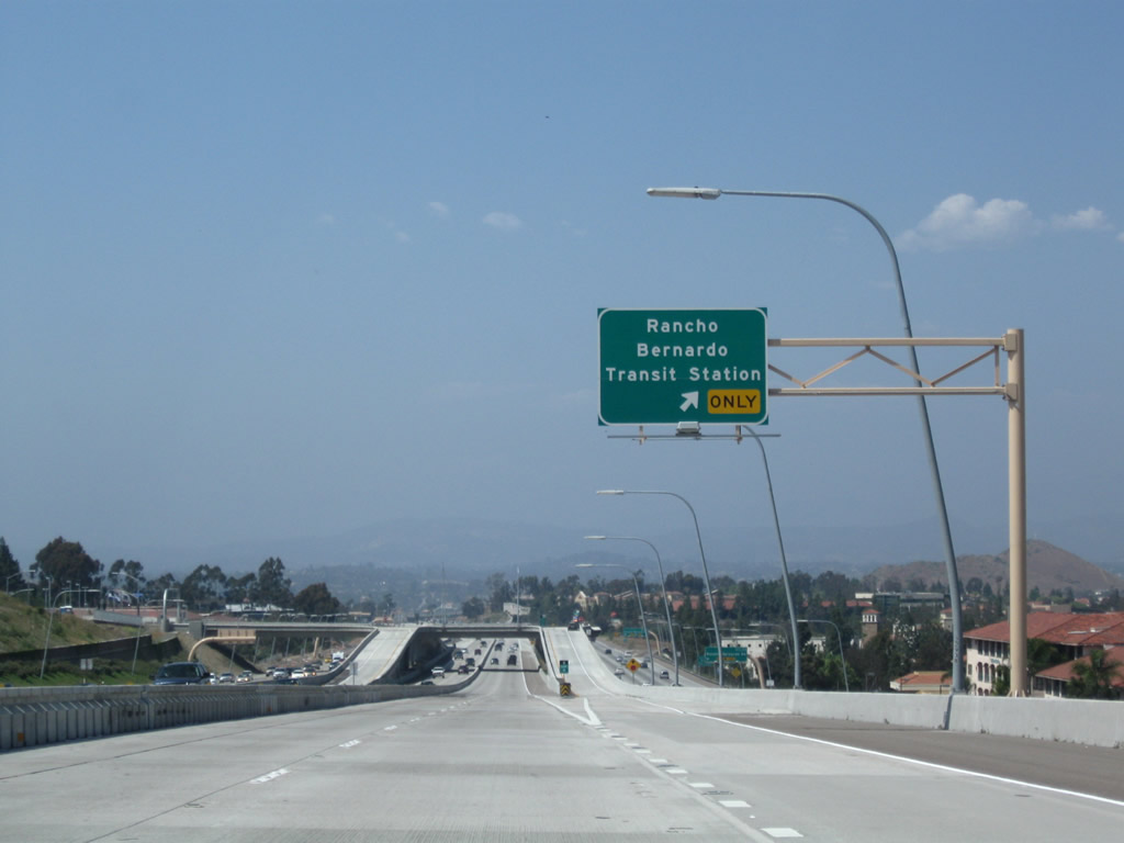
The connection to Exit 23 (Bernardo Center Road) changed as a result of construction of the managed lanes project. The new overhead sign is reflective but lacks exit numbers. In the 2001 photo, note the 18-inch Interstate 15 shield located on its own post beneath the overhead exit signage. Photos taken 01/25/07 and 03/15/01. |
|
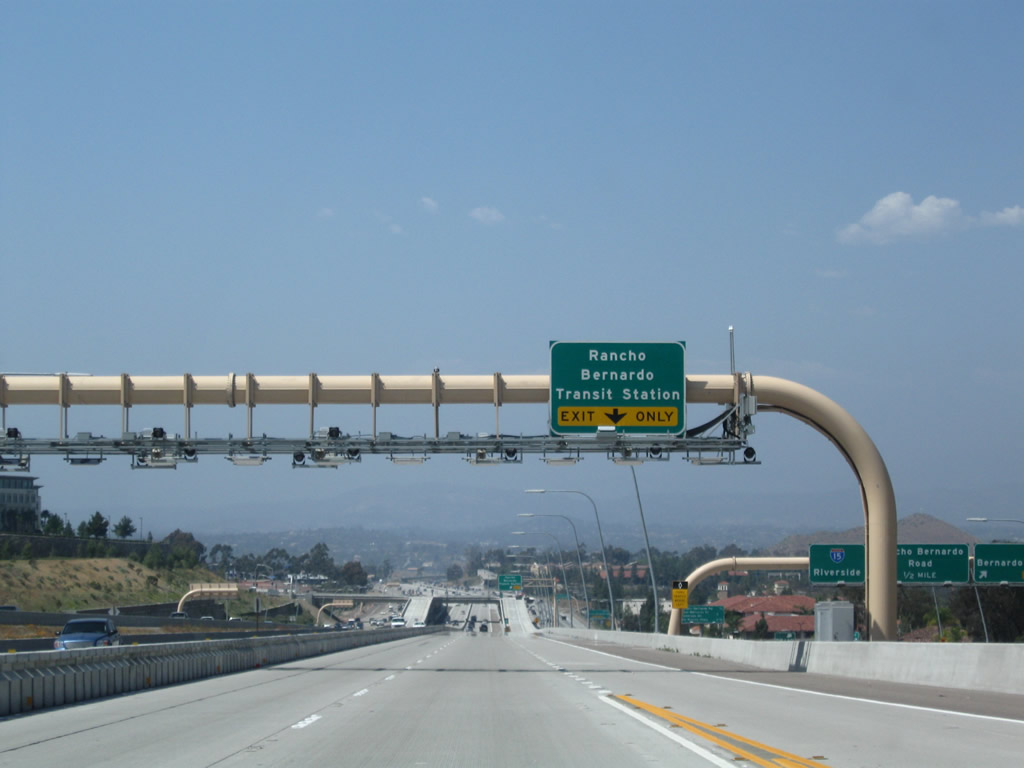
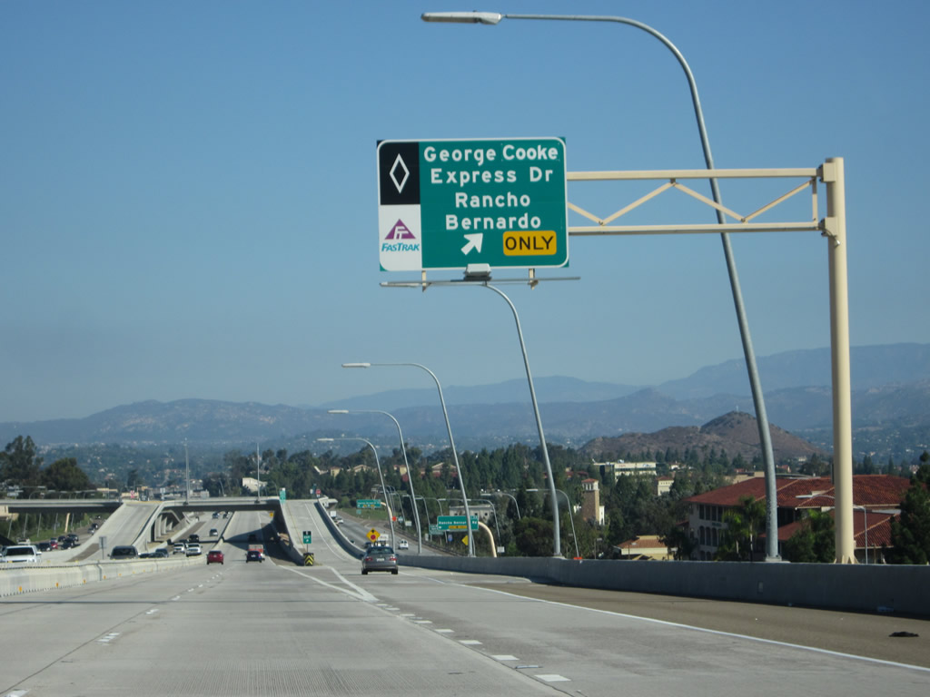
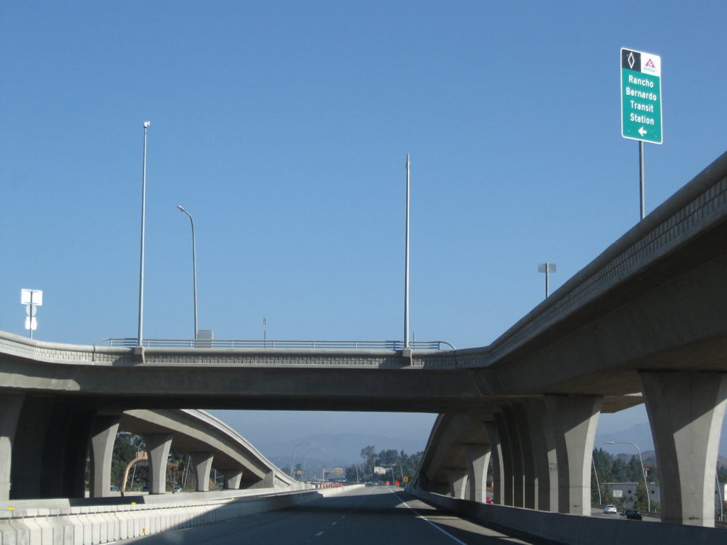
A dedicated ramp from the Express Lanes connects to George Cooke Express Drive, a transit station. Photo taken 01/05/13. |
|
|
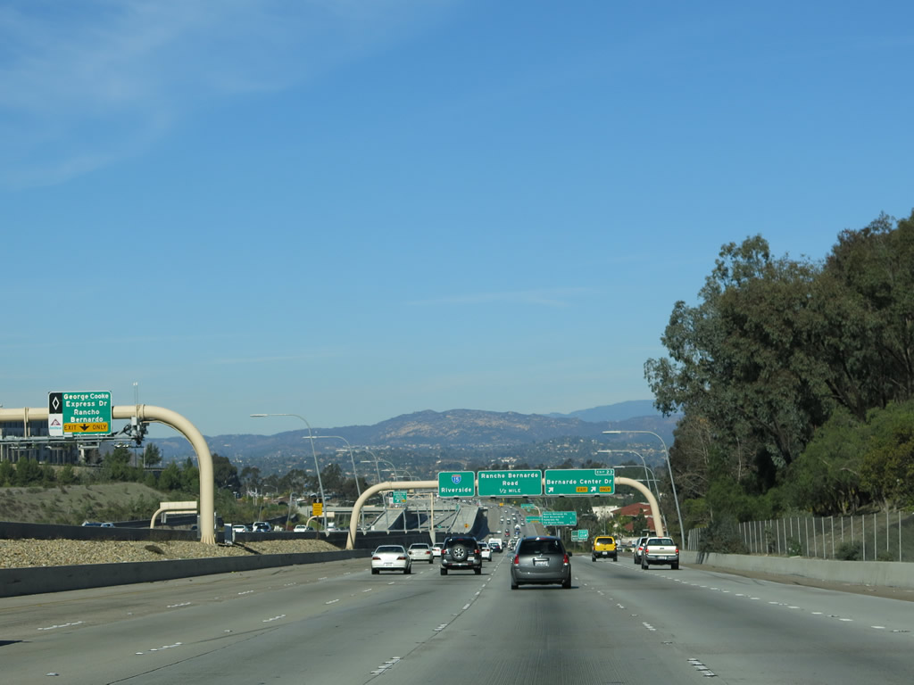
Northbound Interstate 15 meets Exit 23, Bernardo Center Road. Again note the changes in signs between 2004 and 2007. Photos taken 01/05/13 and 03/20/04. |
|
|
The Express Lanes have a direct access ramp to George Cooke Express Drive, which links to the Rancho Bernardo Transit Station. The exit can only be accessed from the middle Express Lanes yet is visible from the northbound lanes. Photos taken 10/02/11. |
|
|
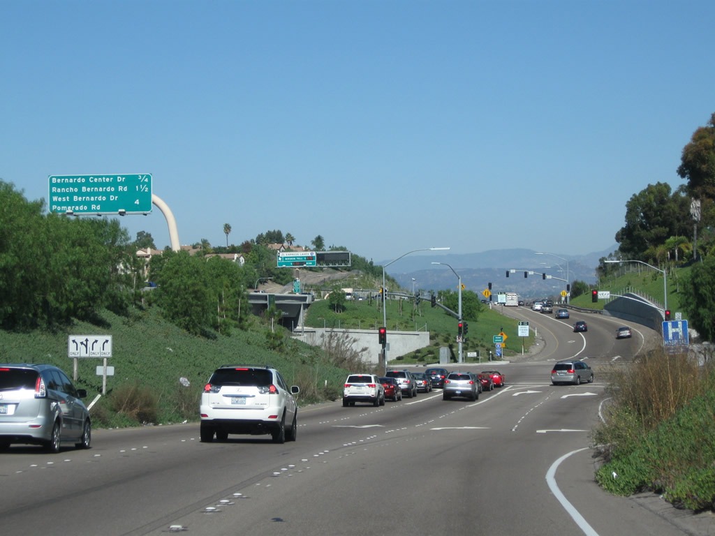
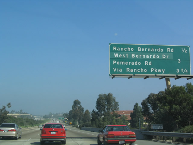
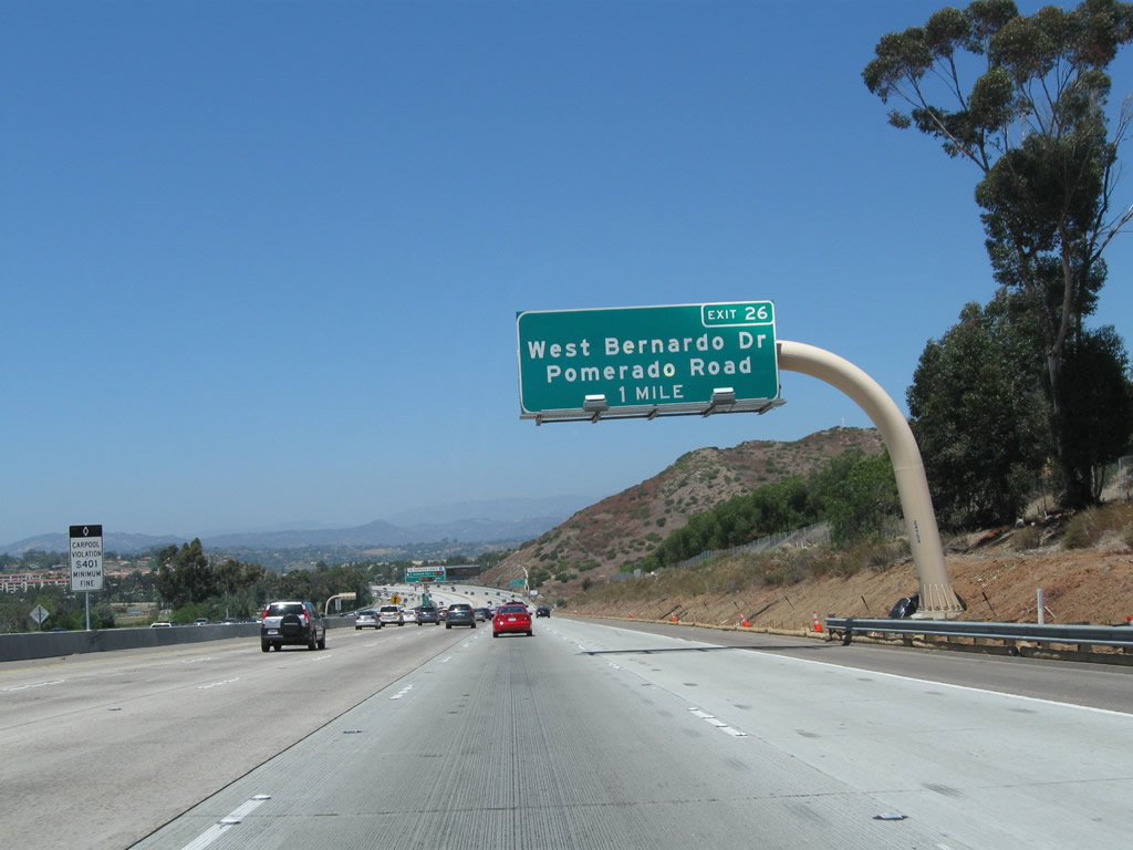
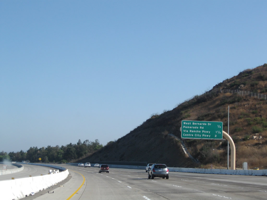
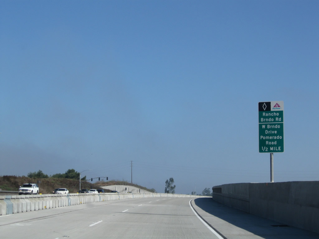
This mileage sign along northbound Interstate 15 provides the distance for the next three exits: Exit 24, Rancho Bernardo Road; Exit 26, San Diego County S-5 South/Pomerado Road and West Bernardo Drive; and Exit 27, Via Rancho Parkway. Photo taken 01/05/13 and 03/20/04. |
|
The new managed lanes (high occupancy vehicle and toll lanes in center of freeway) will have direct access to the Rancho Bernardo community for express buses, carpools, and other transit options. A park and ride connects directly to the managed lanes via George Cooke Express Drive. Photo taken 01/25/07. |
|
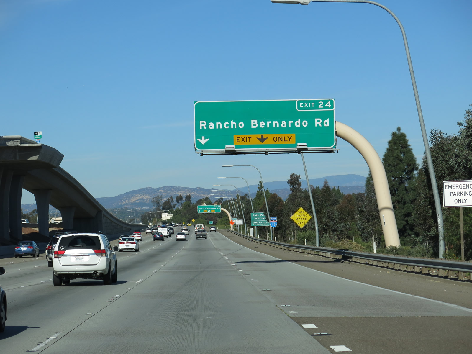
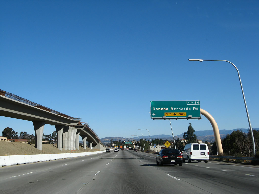
An Interstate 15 north route marker is posted between the on-ramp from Bernardo Center Drive and off-ramp to Rancho Bernardo Road. Photo taken 01/05/13. |
|
|
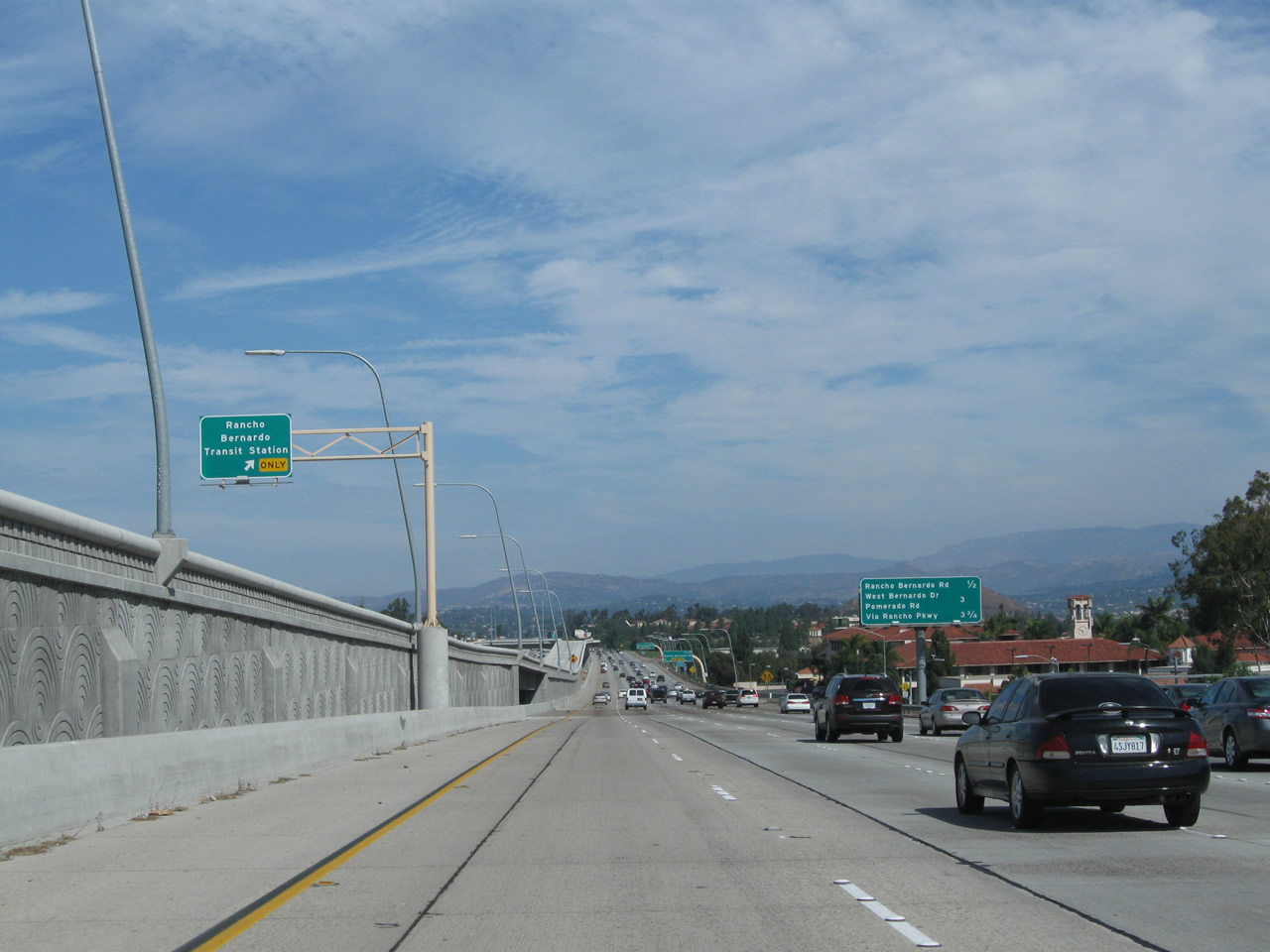
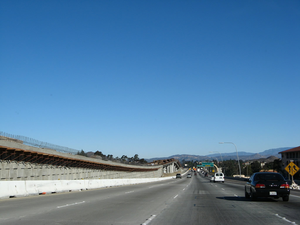
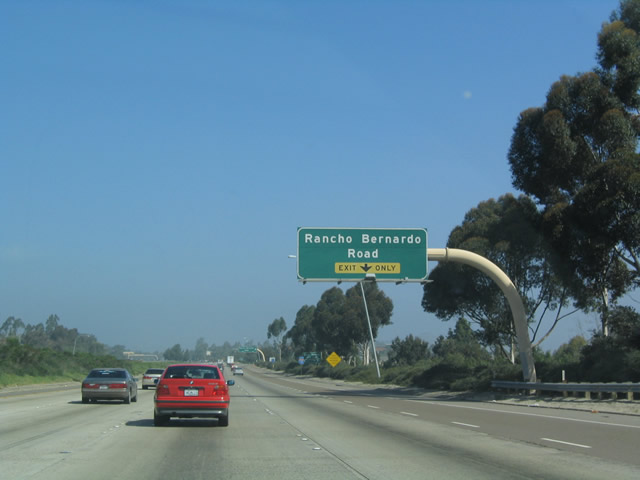
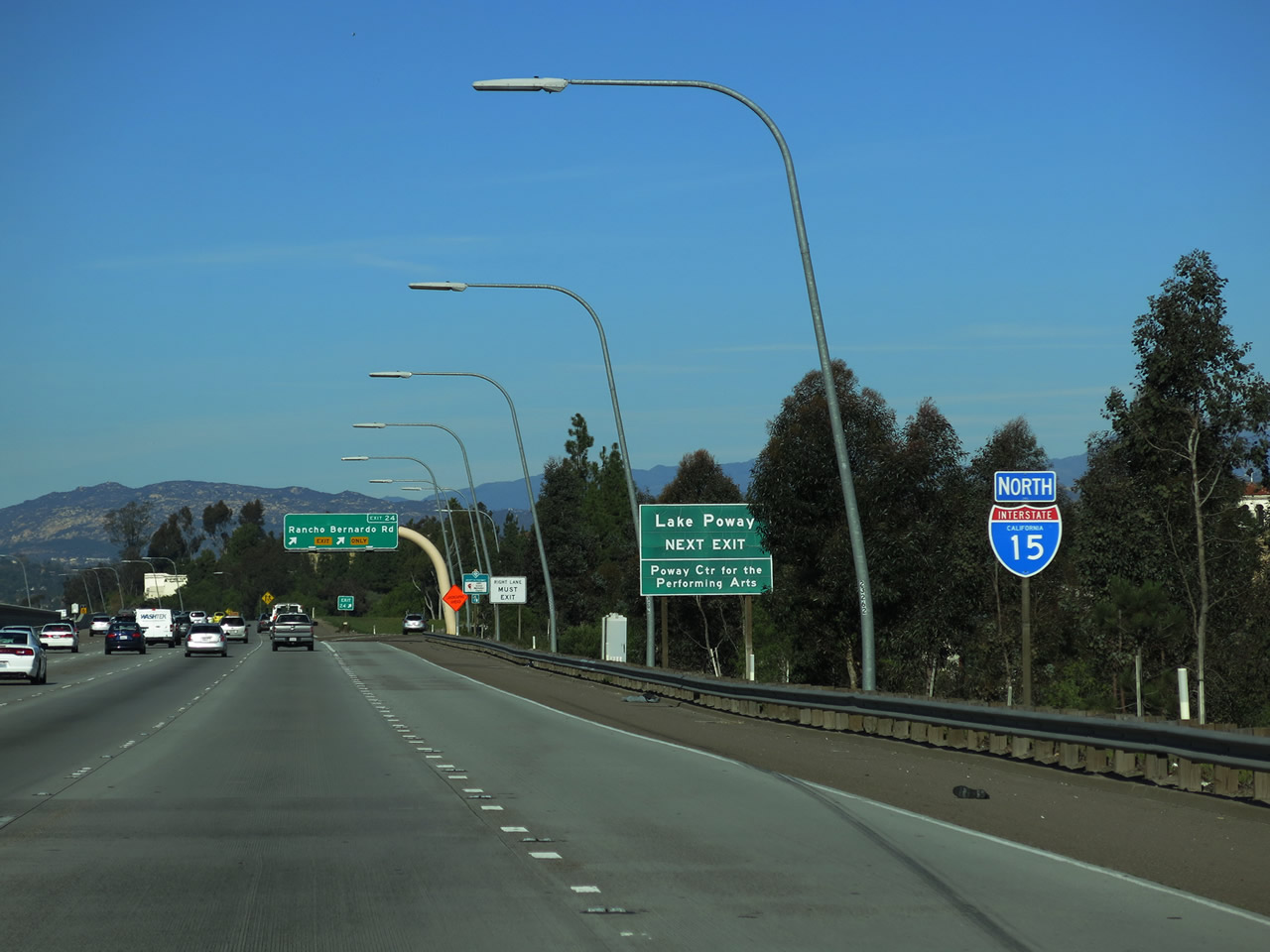
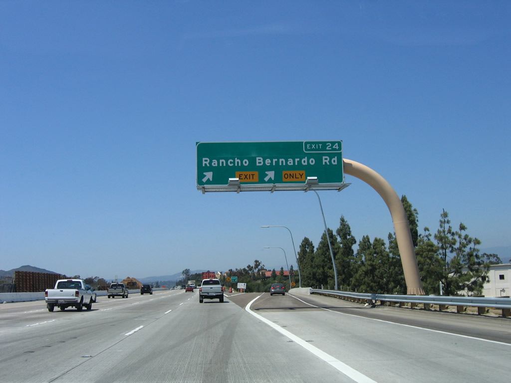
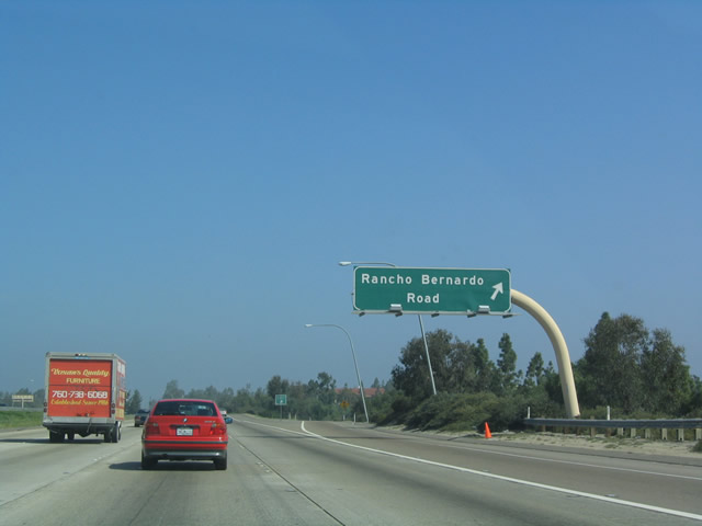
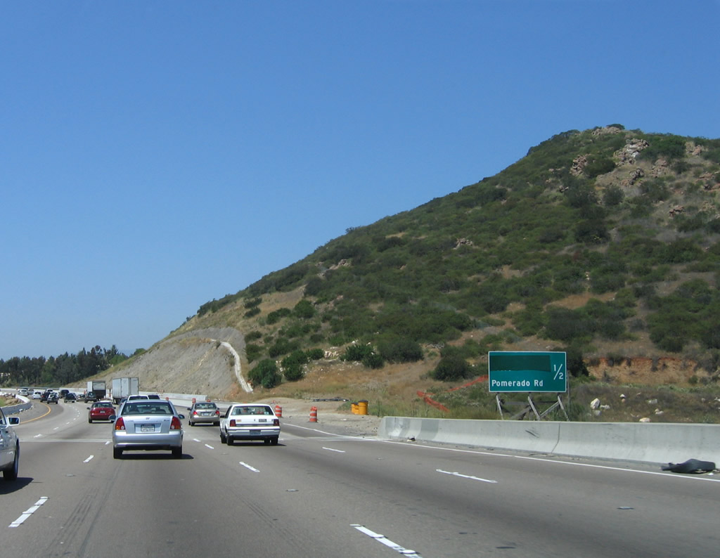
Northbound Interstate 15 reaches Exit 24, Rancho Bernardo Road. The next exit is for San Diego County S-5, Pomerado Road and West Bernardo Drive (Exit 26), which is the last exit along northbound within the city of San Diego. Photos taken 06/03/06 and 03/20/04. |
|
This Interstate 15 reassurance shield is posted shortly after the on-ramp from Rancho Bernardo Road. This section of freeway was widened dramatically to accommodate the new managed lanes. Photo taken 06/03/06. |
|
|
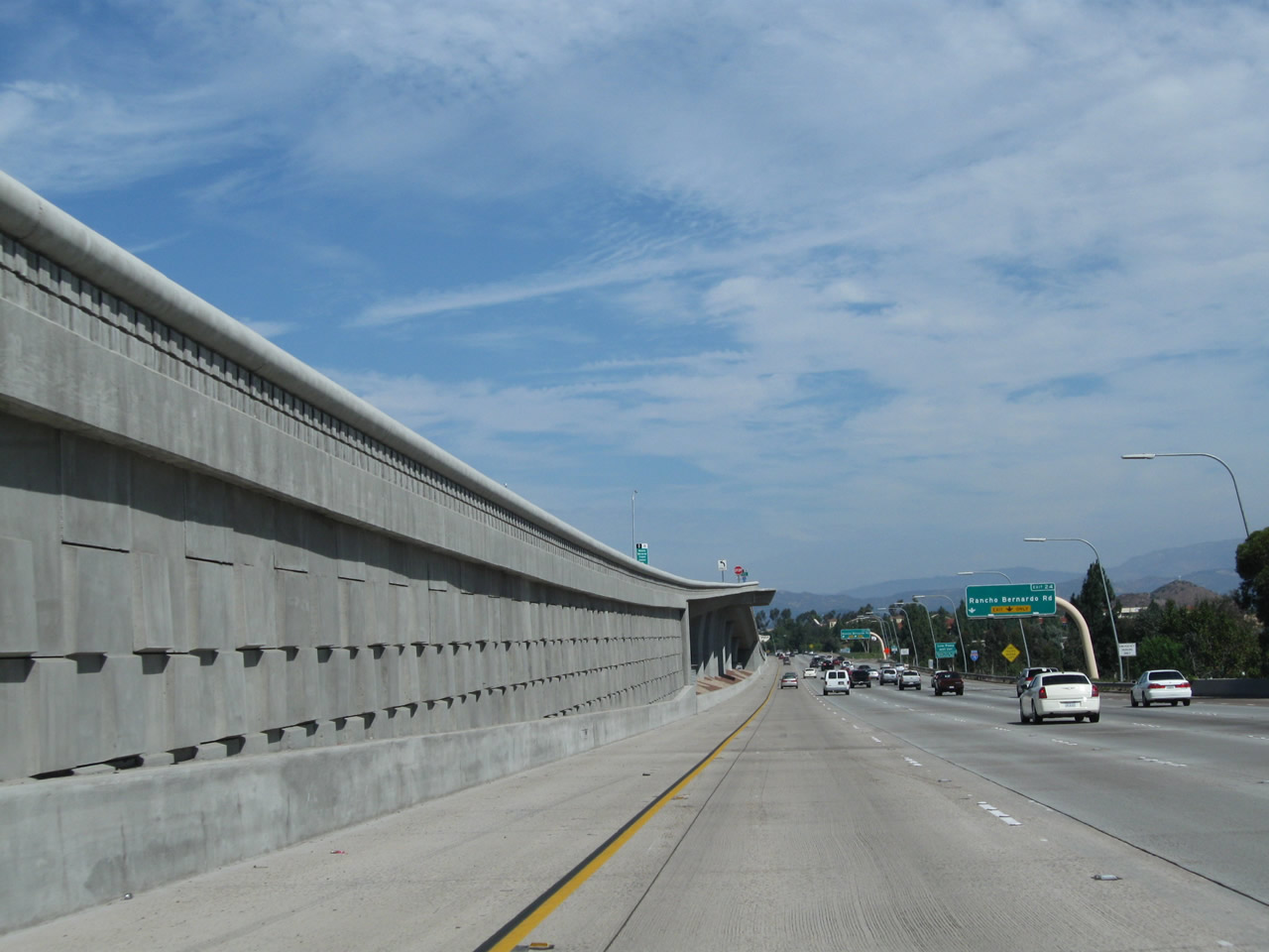
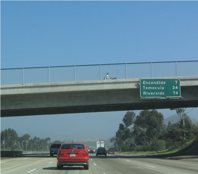
This mileage sign provides the distance to Escondido, Temecula, and Riverside. Note the changes in the bridge overpass. Photos taken 10/02/11 and 03/20/04. |
|
|
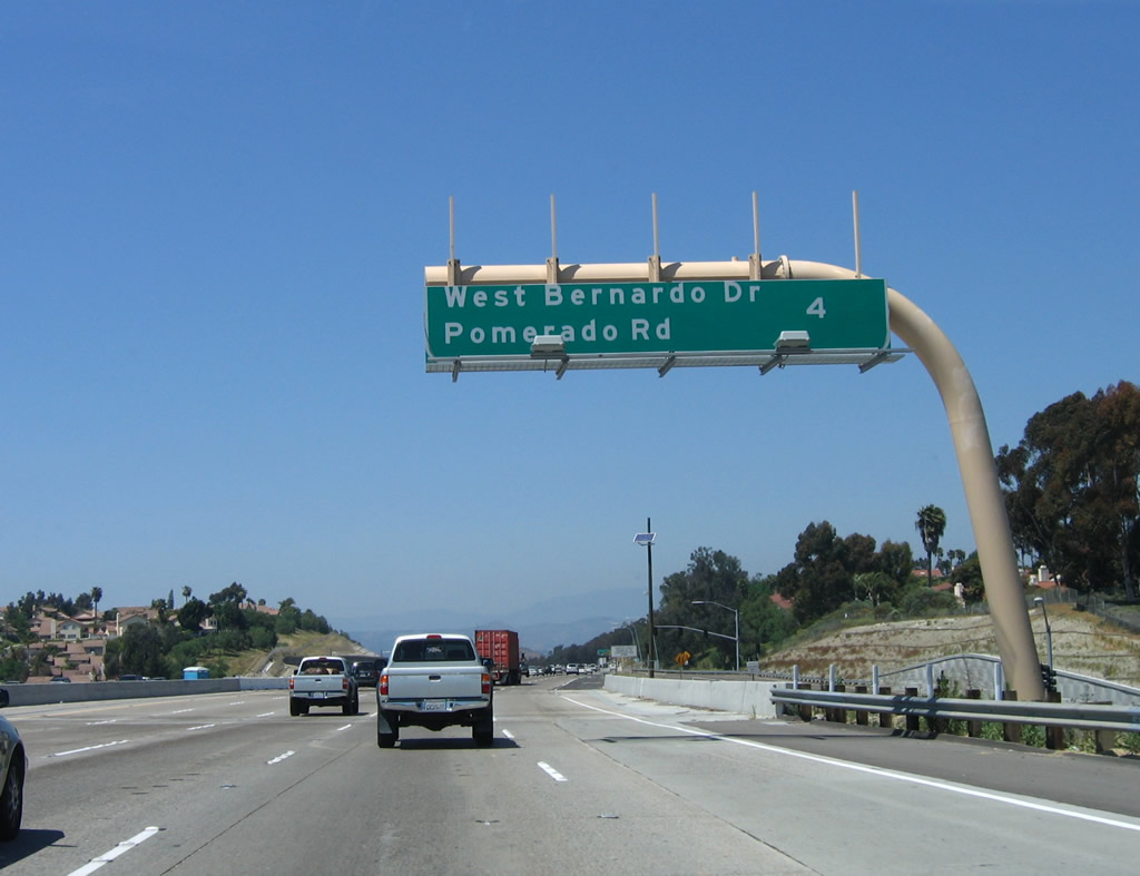
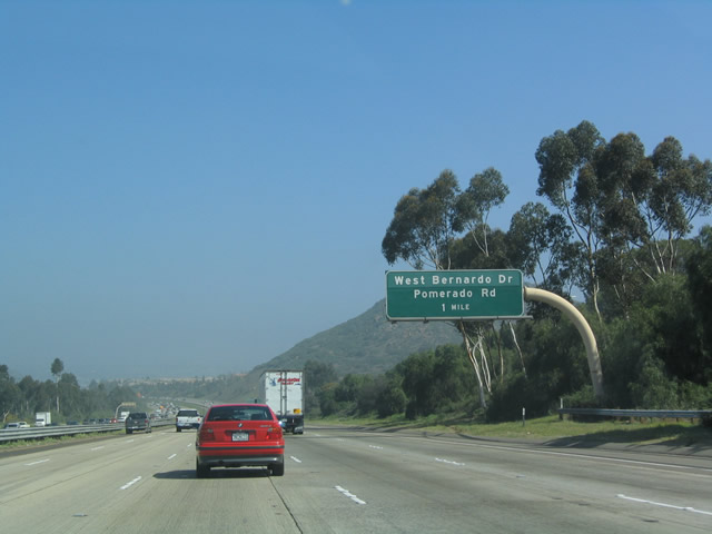
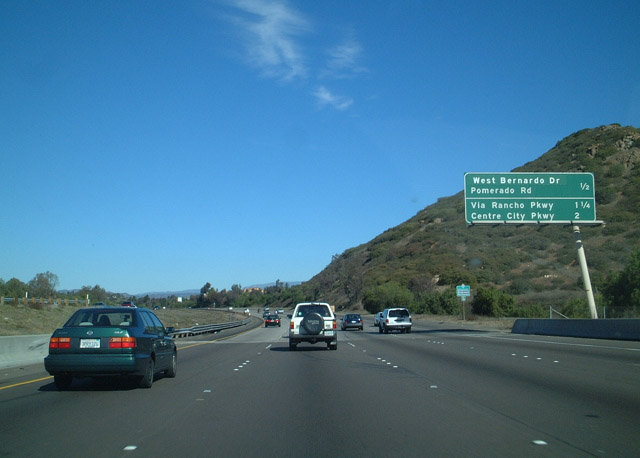
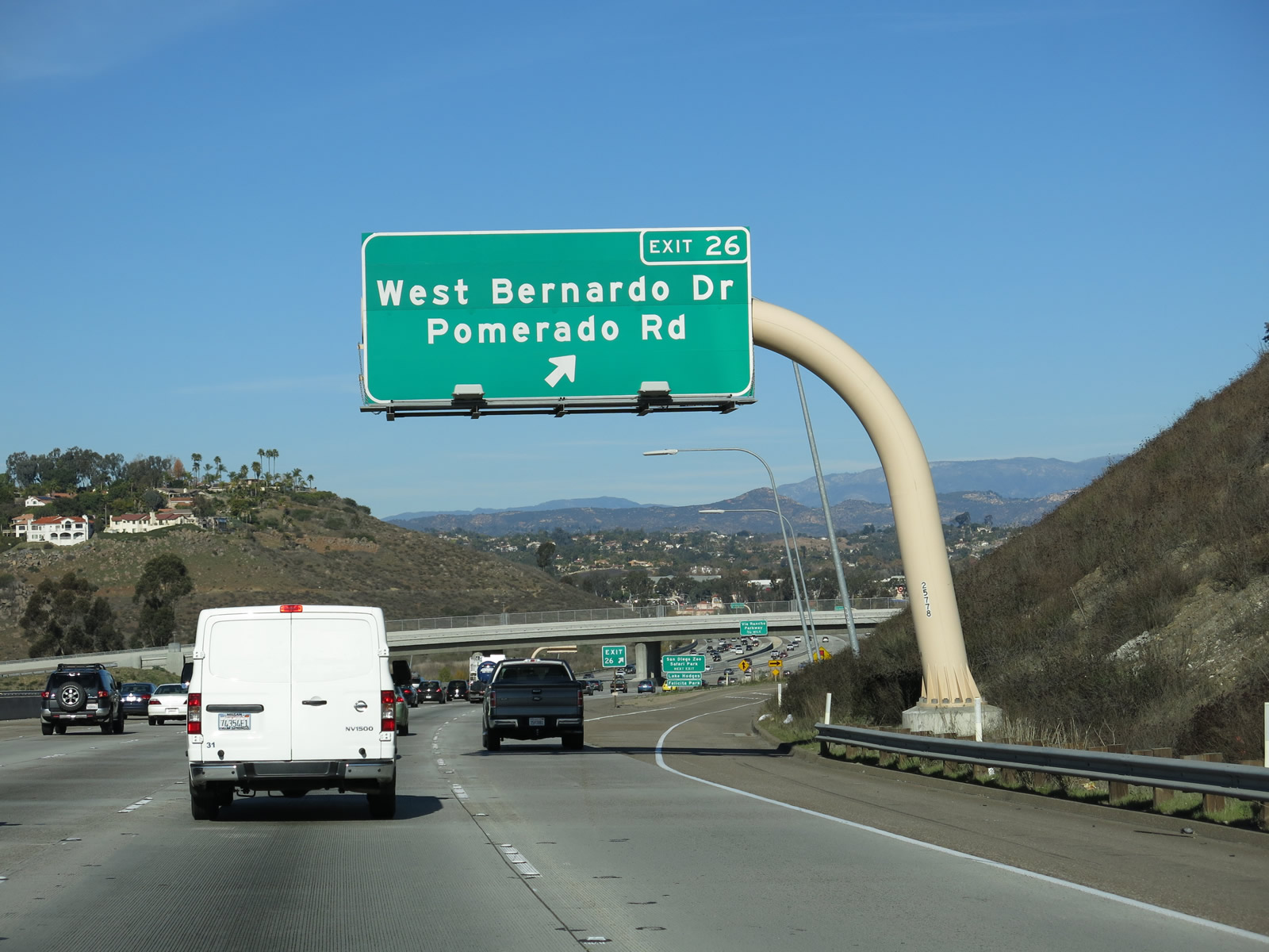
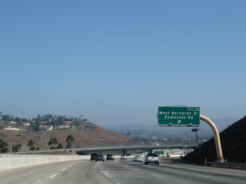
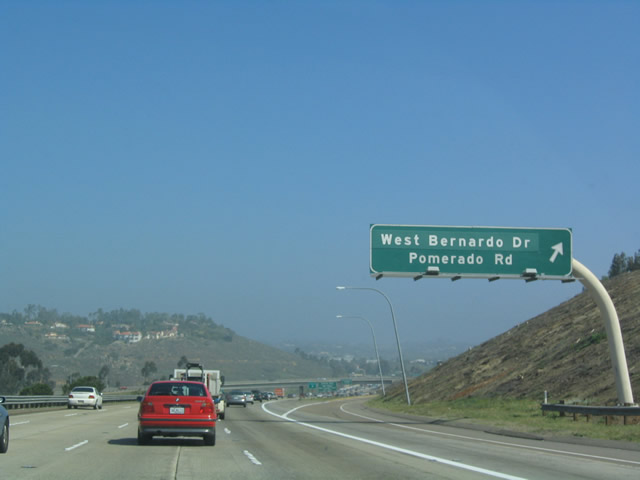
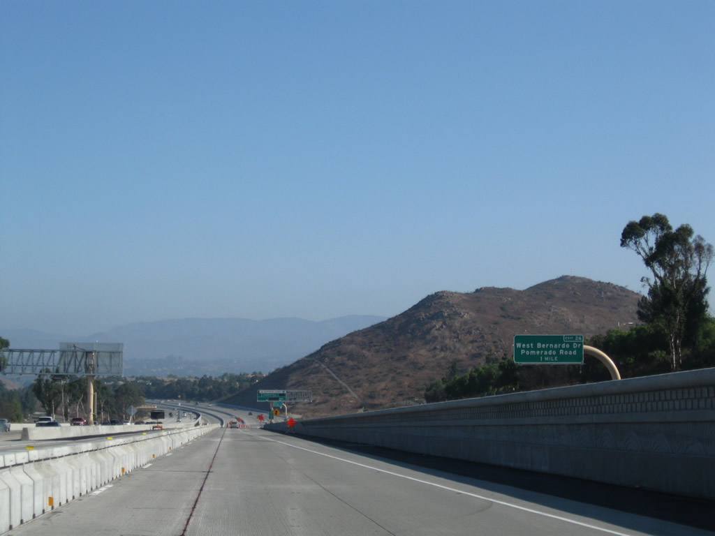
The white cross on top of Battle Mountain comes into view on the east side of Interstate 15 as the freeway descends toward Lake Hodges and the San Dieguito River Valley. During the wildfires of October 2007, most of Battle Mountain burned, along with dozens of homes and buildings in the Rancho Bernardo community. The next interchange along Interstate 15 north is Exit 26, San Diego County S-5 and Historic U.S. 395/Pomerado Road south and West Bernardo Drive south. Photos taken 07/17/11 and 03/20/04. |
|
An entry point to the Express Lanes is located between Exits 23 and 26 near Battle Mountain. Photo taken 07/17/11. |
|
|
As Interstate 15 passes under West Bernardo Drive and Pomerado Road, signage for the next exit appears. Use Via Rancho Parkway east as a bypass to eastbound California 78 and the Wild Animal Park. California 78 heads east to Ramona, Julian, and Borrego Springs. Photos taken 01/05/13 and 03/20/04. |
|
|
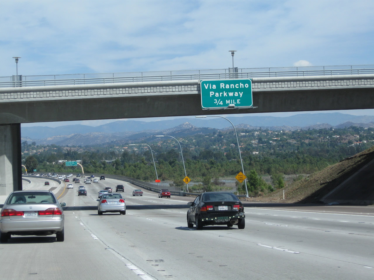
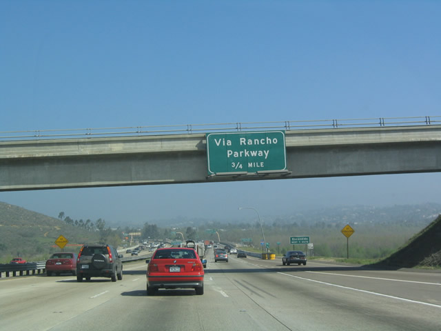
The next exit along northbound Interstate 15 is Exit 27, Via Rancho Parkway, 0.75 mile. This advance sign was removed during construction and was replaced in Fall 2008 with the opening of the first segment of the Managed Lanes. Interstate 15 will next cross the Lake Hodges reservoir (which is located along the San Dieguito River). Wildfire in October 2007 swept through the San Dieguito River valley, destroying structures visible on hillsides on both sides of the freeway. Reconstruction and rebuilding of these homes continues in 2008. Photos taken 10/02/11 and 03/20/04. |
|
|
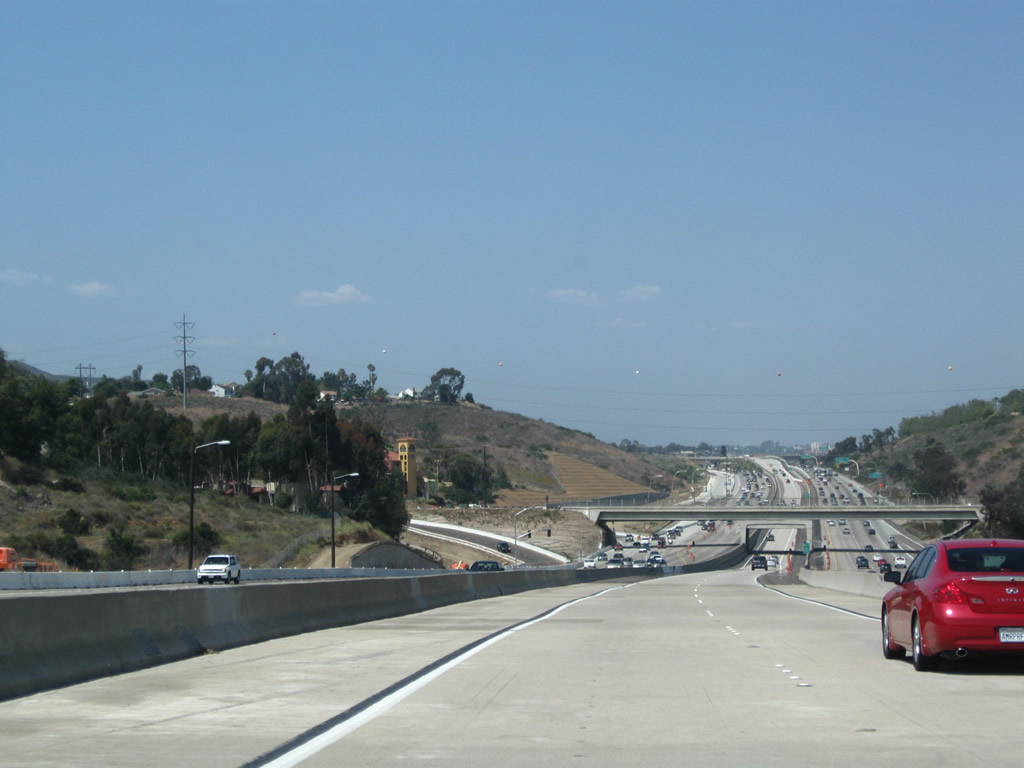
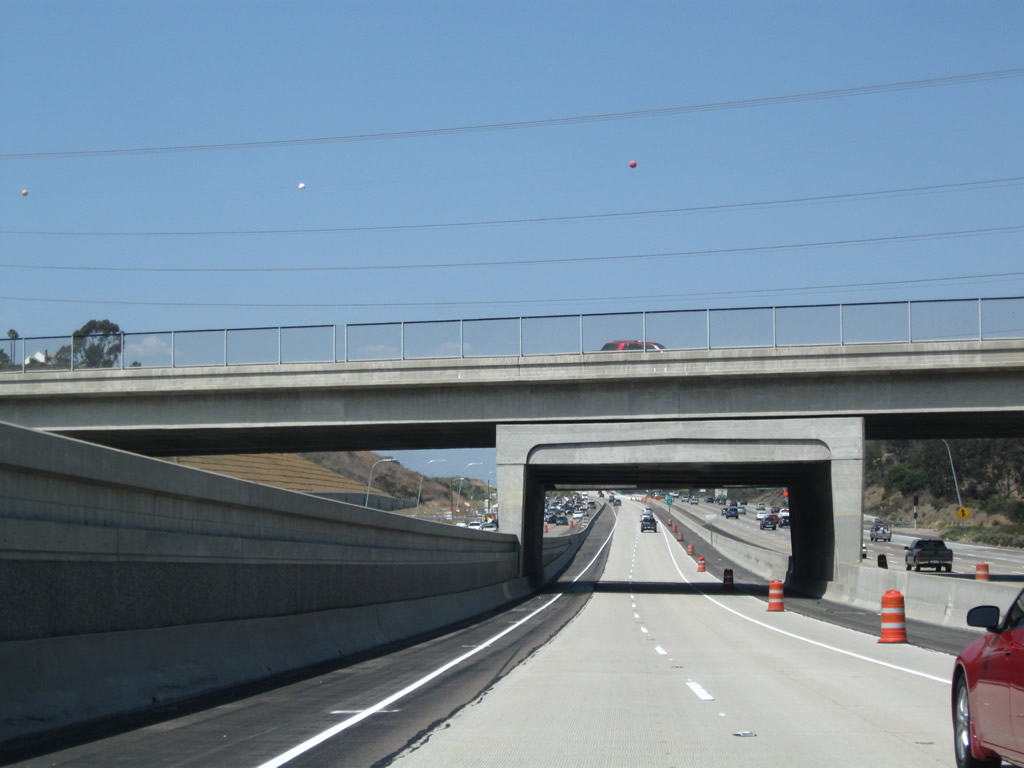
Interstate 15 crosses over Lake Hodges and the San Dieguito River. The 2007 photo shows the new bridge that now carries northbound lanes. The 2006 photo shows the original bridge, which is now part of the managed lanes. Photos taken 01/25/07 and 06/03/06. |
|
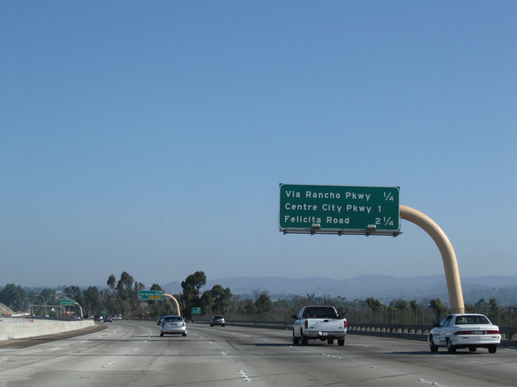
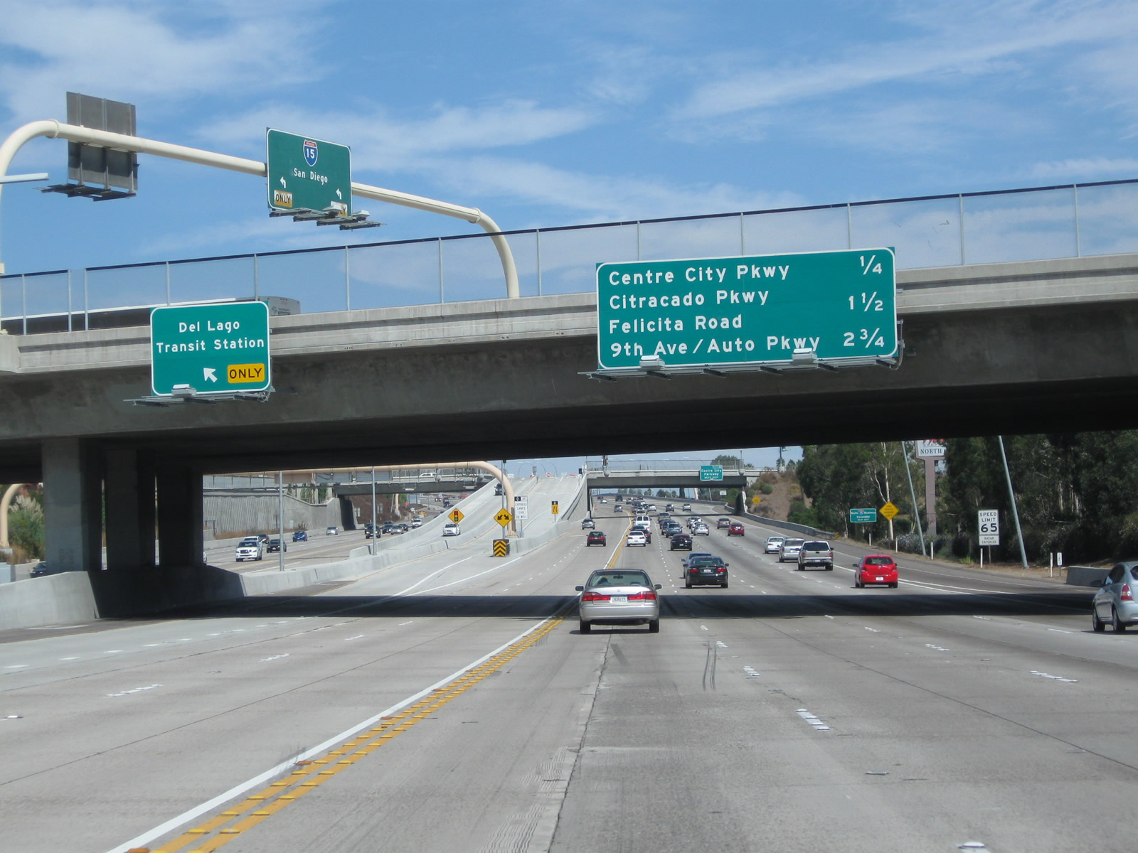
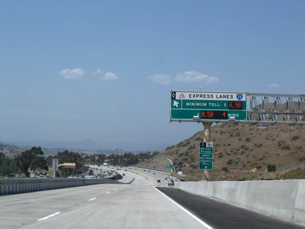
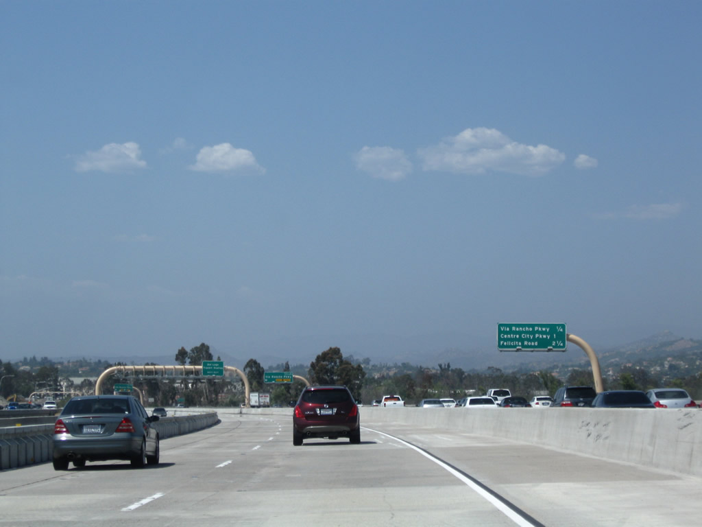
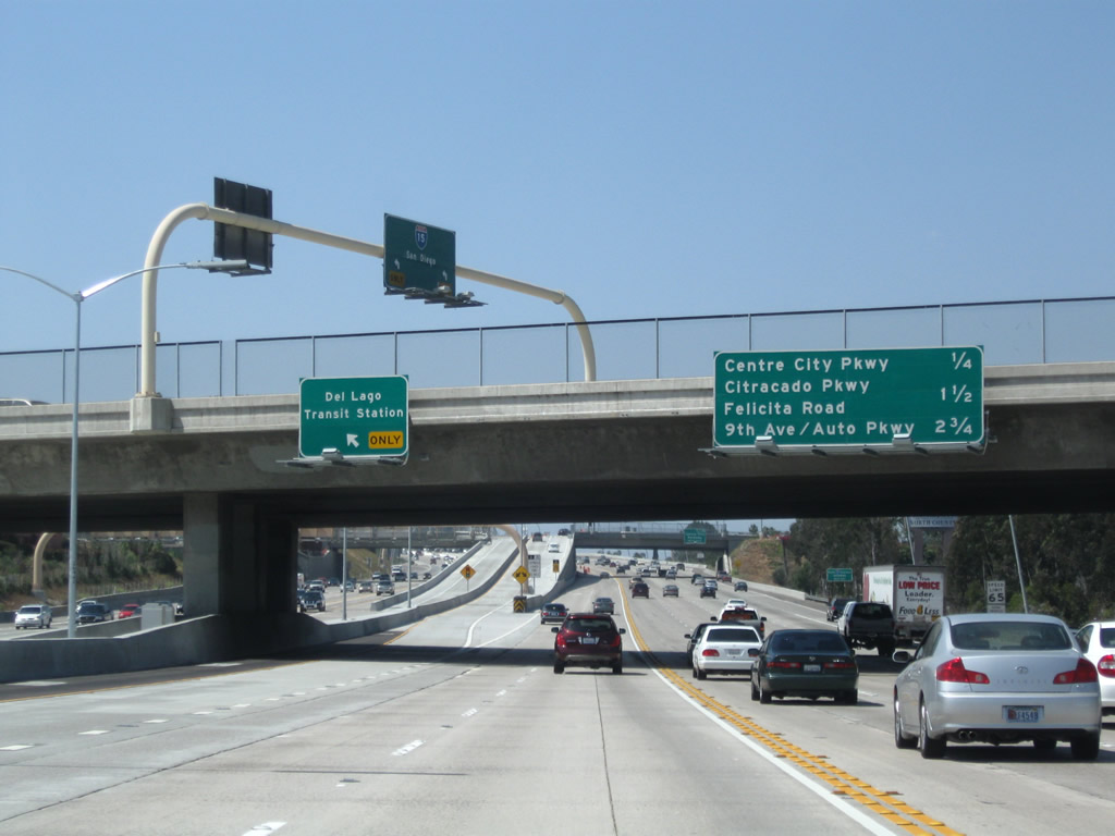
This mileage sign provides the distance to the next three exits along Interstate 15 (Escondido Freeway) north: Exit 27, Via Rancho Parkway; Exit 28, Business Loop I-15 (Centre City Parkway); and Exit 29, Felicita Road. Photo taken 09/28/08. |
|
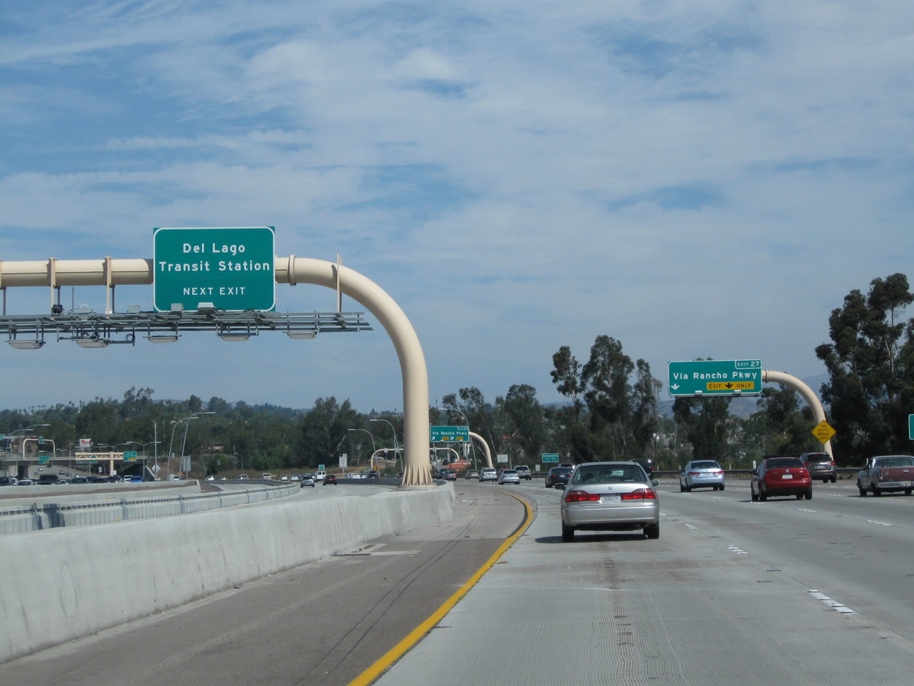
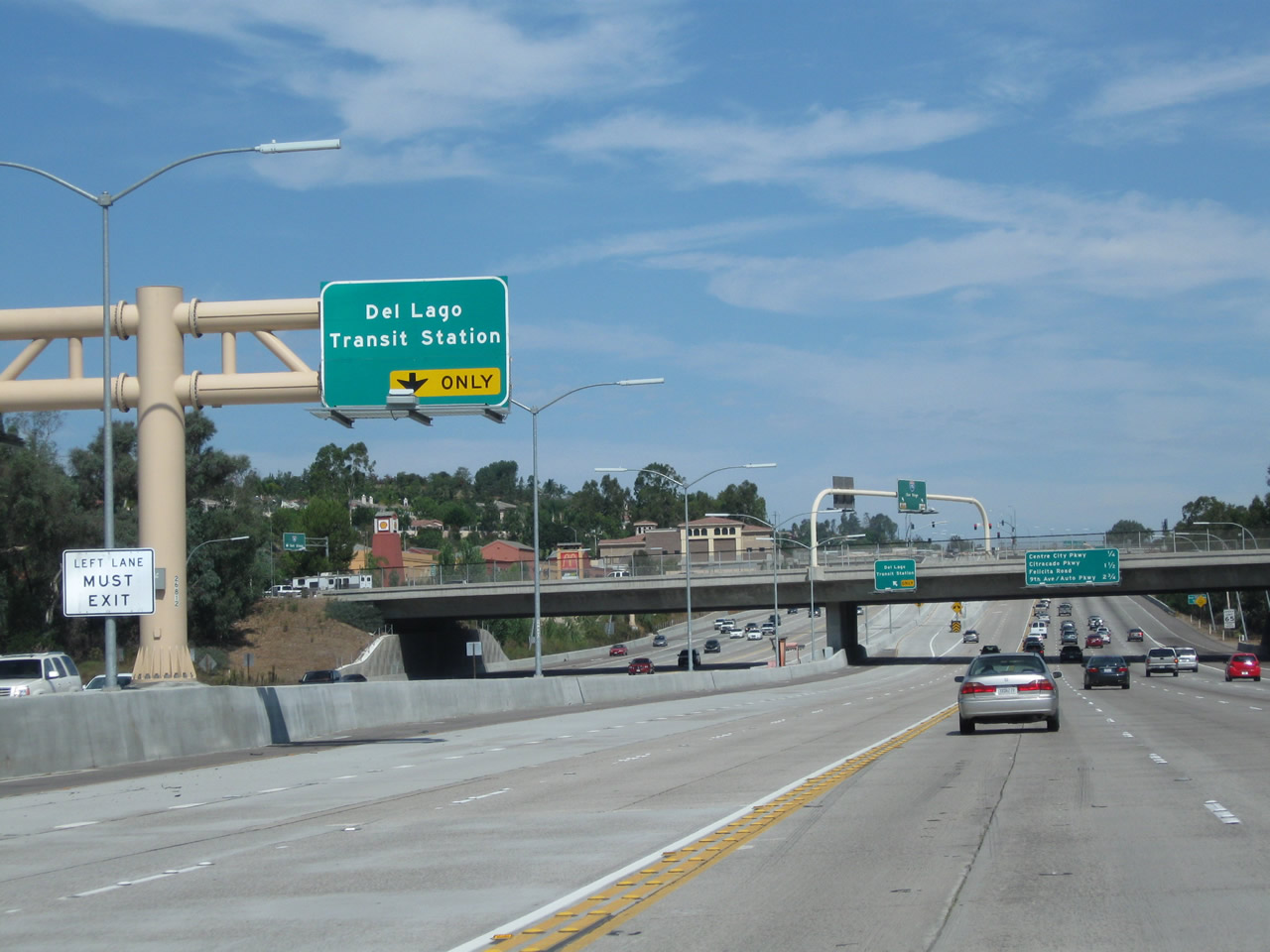
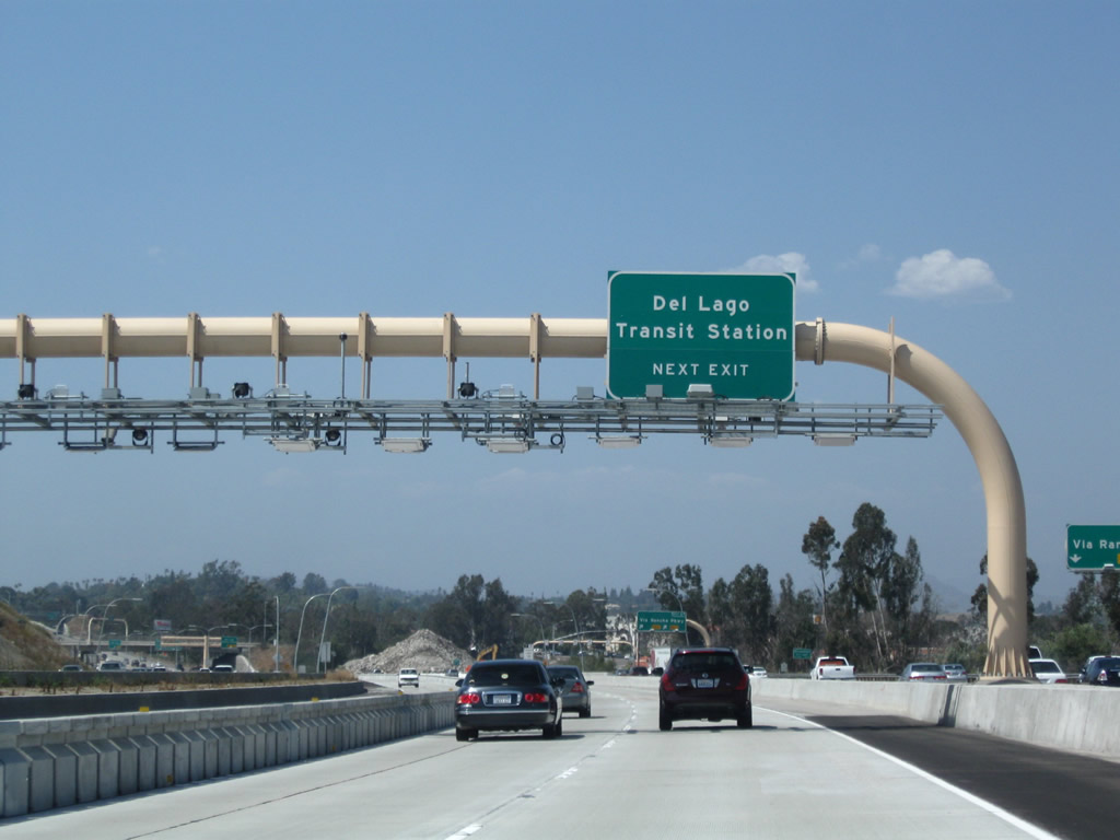
Another direct access ramp from the Express Lanes is located in southern Escondido, just past the Lake Hodges bridge. This ramp connects to the Del Lago Transit Center. Photo taken 10/02/11. |
|
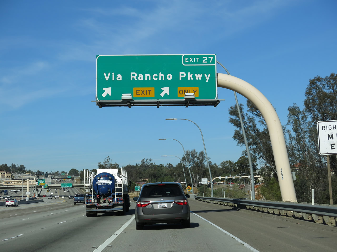
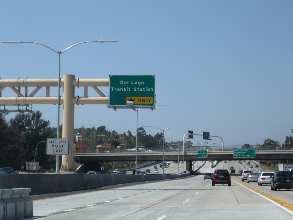
The right two lanes of Interstate 15 (Escondido Freeway) north connect to Exit 27, Via Rancho Parkway. Photo taken 09/28/08. |
|
|
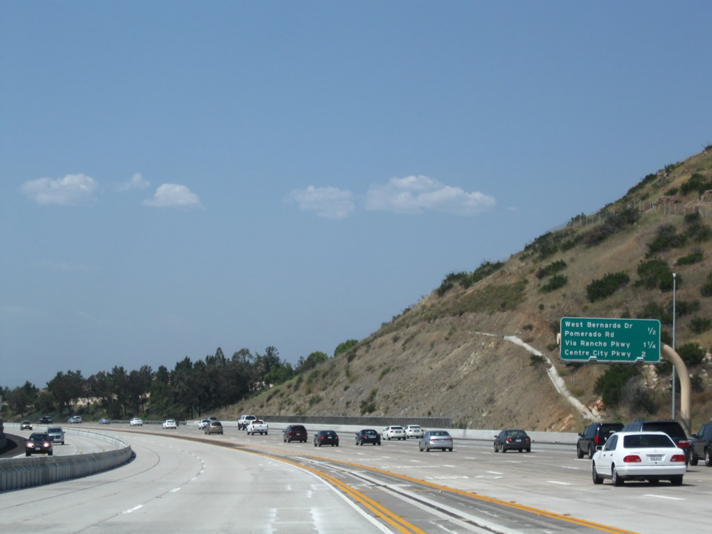
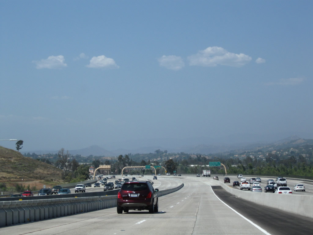
A city limits sign for the city of Escondido was originally located in the median (see 2006 photo), but it was moved to prior to the Exit 27 gore point as a result of the construction of managed lanes north of Lake Hodges (see 2008 photo). Known as the "Heart of San Diego North," Escondido means "hidden" in Spanish. Founded in 1888, Escondido was home to 133,559 people as of the 2000 Census. This increased to 143,911 by the 2010 Census. The city sits at an elevation of 646 feet and features a historic downtown district along Grand Avenue. Photos taken 01/05/13 and 06/03/06. |
|
|
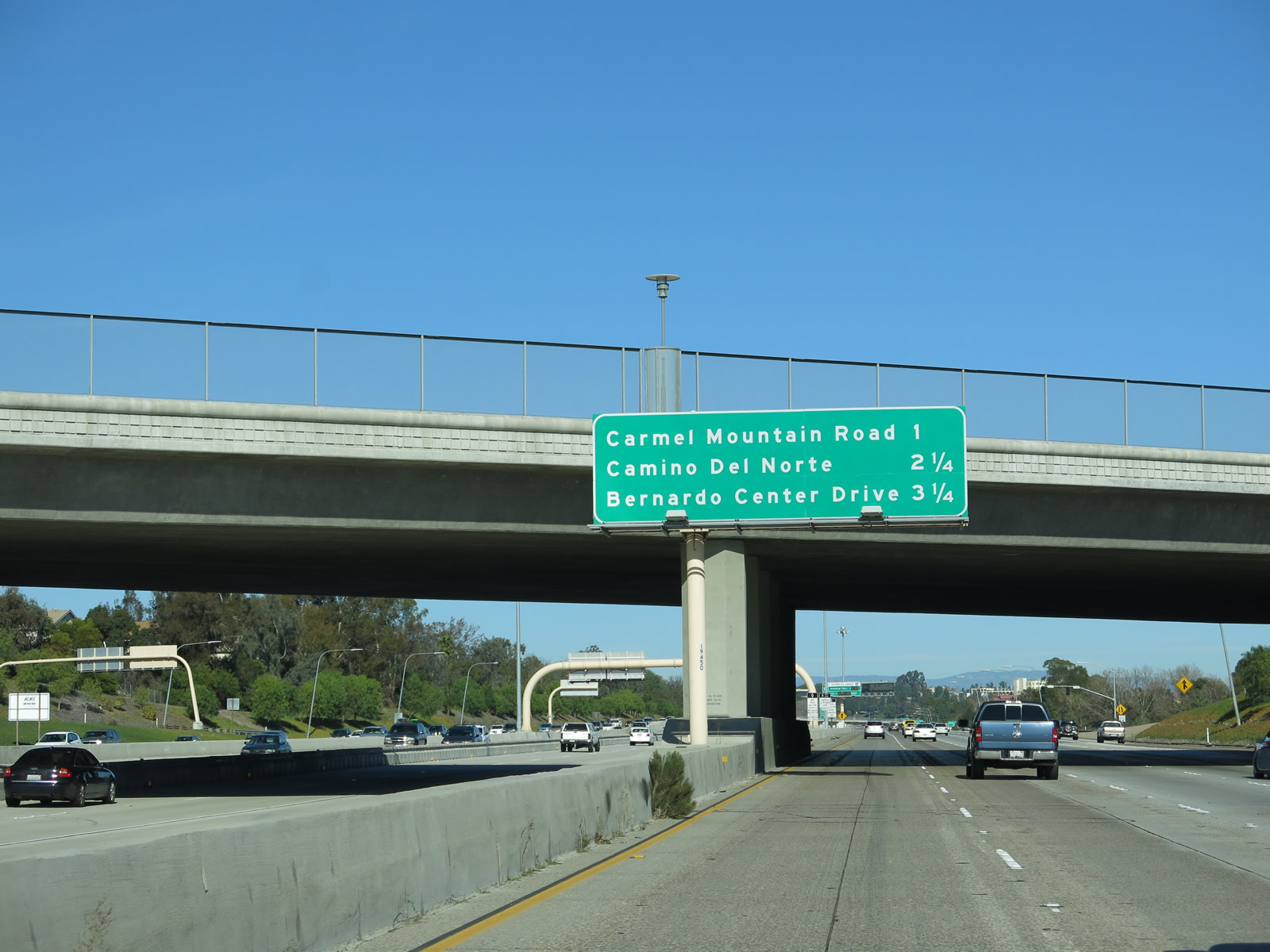
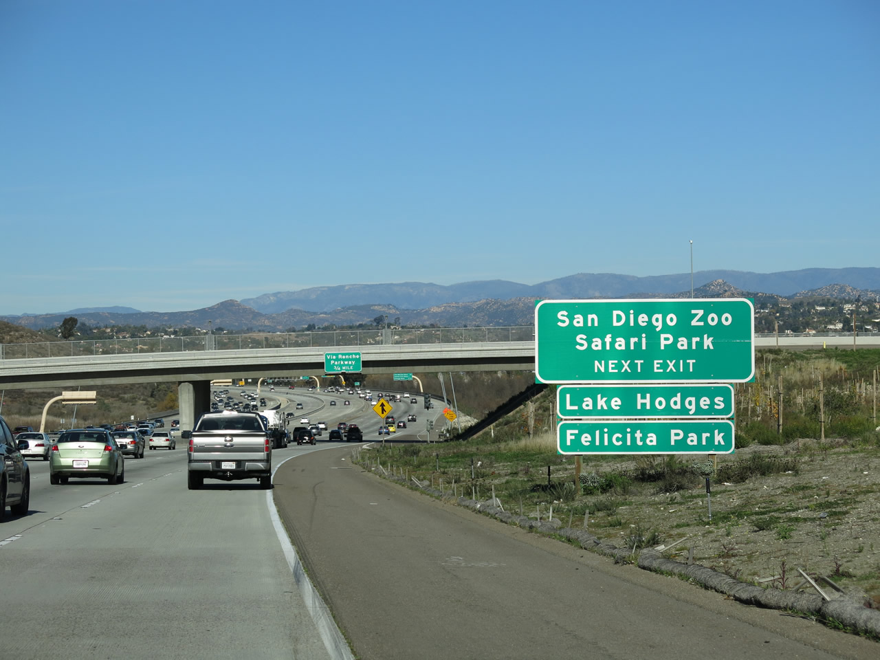
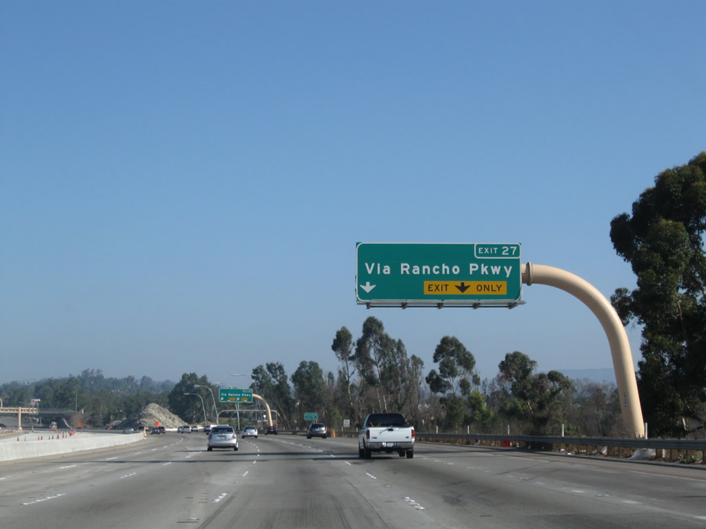
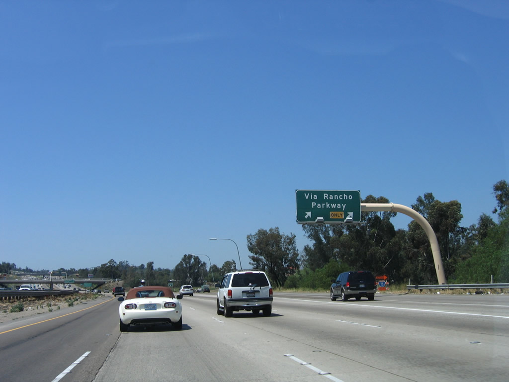
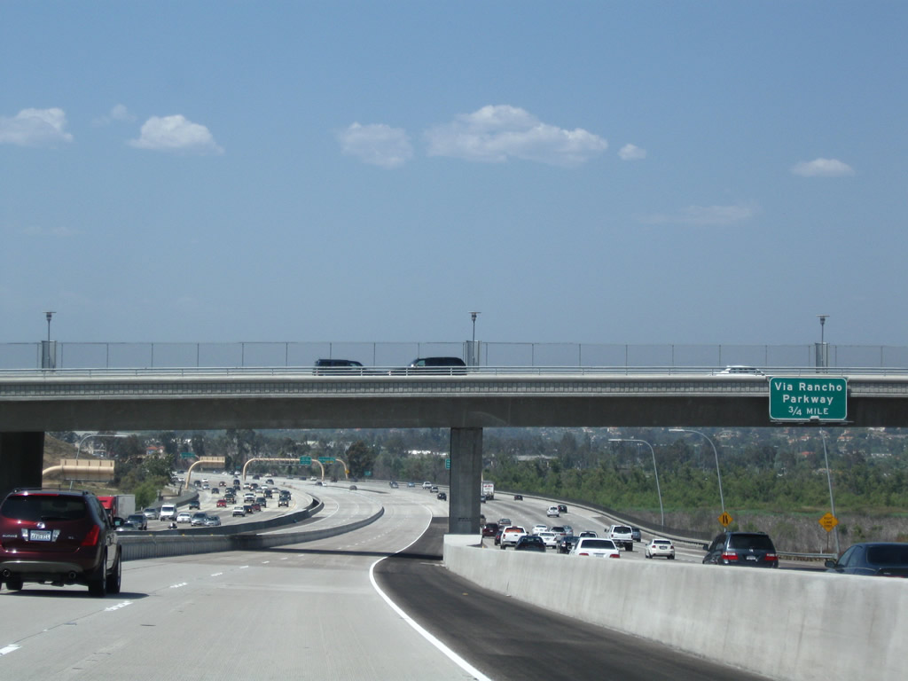
Northbound Interstate 15 (Escondido Freeway) reaches Exit 27, Via Rancho Parkway. This exit serves North County Fair, one of the largest shopping malls in northern San Diego County. In addition, Via Rancho Parkway eastbound connects to San Pasqual Road, which is an excellent bypass around Escondido; it eventually meets California 78 east of the city near the San Diego Wild Animal Park. San Pasqual Road avoids downtown Escondido and the suburban traffic lights that make California 78 a slow ride between Interstate 15 and the Wild Animal Park. Interstate 15 finally leaves the city of San Diego for the first time in its northbound journey and enters the city of Escondido. The next exit is Exit 28, Business Loop I-15, Centre City Parkway. Photos taken 01/05/13 and 06/03/06. |
|
|
Just before passing under Via Rancho Parkway, the left lane of the express lanes will connect to Vista Lago Transit Center. Photos taken 10/02/11. |
|
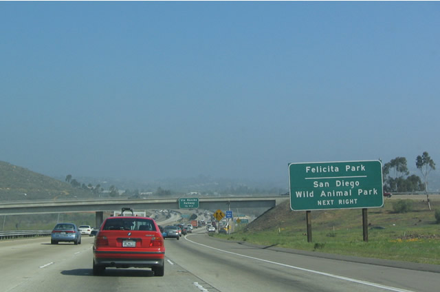
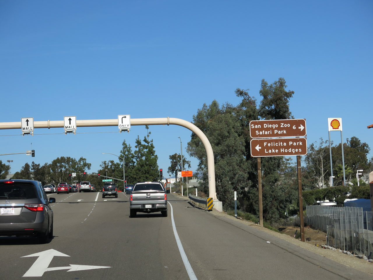
Upon departing the freeway at Exit 27, turn left on Via Rancho Parkway to Lake Hodges and Felicita Park. Turn right on Via Rancho Parkway, which changes into Bear Valley Parkway, to the San Diego Zoo Safari Park (formerly Wild Animal Park) and San Pasqual Battlefield State Historic Park. Photo taken 01/05/13. |
| Interstate 15 (Escondido Freeway) MANAGED LANES north |
|
Returning now to the California 163 merge, the original Express Lanes (built in 1988) begin with two reversible lanes in the middle of the freeway. This configuration changed to the Managed Express Lanes in 2011 (a total of four lanes, with at least one lane in each direction) north of California 56 (Ted Williams Freeway) (Exit 19). The next exit from the express lanes is Exit 19, which also connects to the Sabre Springs-Rancho Peñasquitos Transit Station. Photo taken 08/23/04. |
|
The northbound Express Lanes pass under the Miramar Way overpass (this photo was taken during a weekend, when the Express Lanes only travel north; they vary direction during the week depending on commuting hours). This area will be widened to accommodate two additional middle lanes, and that project will transform the Express Lanes into Managed Lanes, with four lanes that can be altered as needed due to traffic needs. Photo taken 08/23/04. |
|
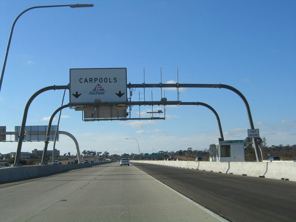
Fastrak transponders register at this station. Photo taken 08/23/04. |
|
There is no access from the Express Lanes to Miramar Road and Pomerado Road. Photo taken 09/28/08. |
|
The northbound Express Lanes pass under the Carroll Canyon Road overpass. In the future, a planned transit facility connecting Interstate 15's Express Lanes to Mira Mesa will be constructed between Carroll Canyon Road (Exit 15) and Mira Mesa Boulevard (Exit 16). Photo taken 09/28/08. |
|
Continuing north, Interstate 15's Express Lanes cross over Mira Mesa Boulevard. As part of the 2012 expansion project, construction continued in 2008 to widen the freeway on either side to allow for two more lanes. Photo taken 09/28/08. |
|
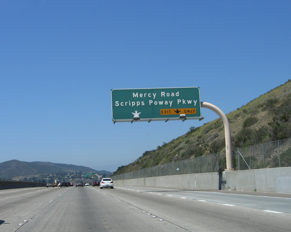
The northbound Express Lanes skip the Mercy Road and Scripps Poway Parkway interchange (Exit 17) as well. Photo taken 09/28/08. |
|
|
|
Crossing Los Peñasquitos Canyon, the Express Lanes remain in the middle of the freeway. The express lanes share the same alignment as the southbound main lanes, while the northbound main lanes take a bridge that is on a lower elevation. The 2004 sign was removed once the managed lanes were extended north, thus negating the utility of that sign. Photos taken 09/28/08, 08/23/04, and 05/16/09. |
|
The northbound Express Lanes passes under Poway Road; this configuration will change once the managed lanes are expanded to four lanes with moveable barrier. Photo taken 05/16/09. |
|
|
|
After passing under the Peñasquitos Drive and Poway Road overpass, the northbound Express Lanes prepare to shift onto the new Managed Lanes. The next exit is to California 52 west and Ted Williams Parkway east. Photos taken 09/28/08, 05/16/09, and 08/23/04. |
|
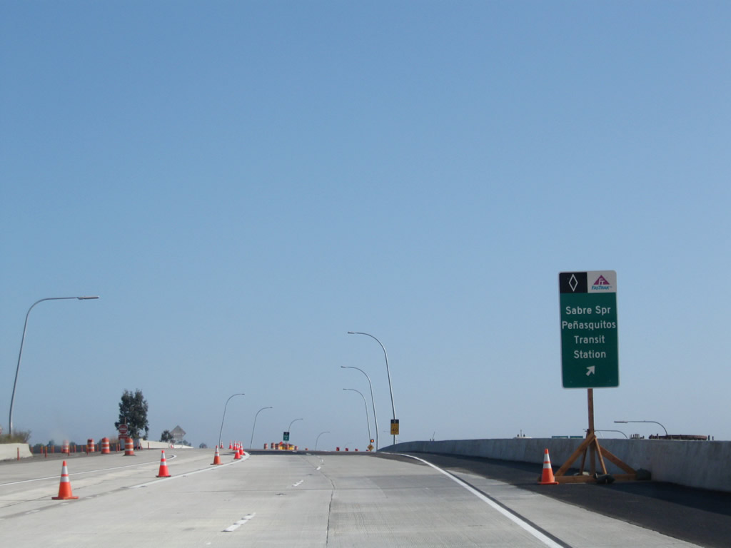
Northbound Interstate 15 Express Lanes has its first and only exit, which connects to California 56 (Ted Williams Freeway) west and Ted Williams Parkway east to Poway (Exit 19, unsigned) and the Sabre Springs and Rancho Peñasquitos Transit Station. Photo taken 09/28/08. |
|
This view shows the signage for the transition ramp from Interstate 15's managed lanes to California 56 and the Sabre Springs and Rancho Peñasquitos Transit Station. Photo taken 05/16/09. |
|
The left two lanes continue north from the reversible Express Lanes onto the four-lane Managed Lanes. On most days, two lanes will continue north from this point. The right lane departs to Sabre Springs and Rancho Peñasquitos Transit Station. Photo taken 09/28/08. |
|
Two lanes gain elevation, then will return to grade in the Managed Lanes. Photo taken 09/28/08. |
|
Northbound Interstate 15 Managed Lanes pass under the connecting ramp to the Sabre Springs and Rancho Peñasquitos Transit Station. Photo taken 09/28/08. |
|
Passing under the Sabre Springs and Rancho Peñasquitos Transit Station connecting ramp, the Managed Lanes will soon connect again with the main lanes of Interstate 15. Traffic for Camino del Norte and Bernardo Center Drive can return to the mainline, while through traffic meeting the criteria to use the Managed Lanes may continue in the two through lanes. Photo taken 09/28/08. |
|
The Managed Lanes receive traffic from the transit station, then pass under California 56 and Ted Williams Parkway. An interchange sequence sign for the main lanes is posted on the overpass. Photo taken 09/28/08. |
|
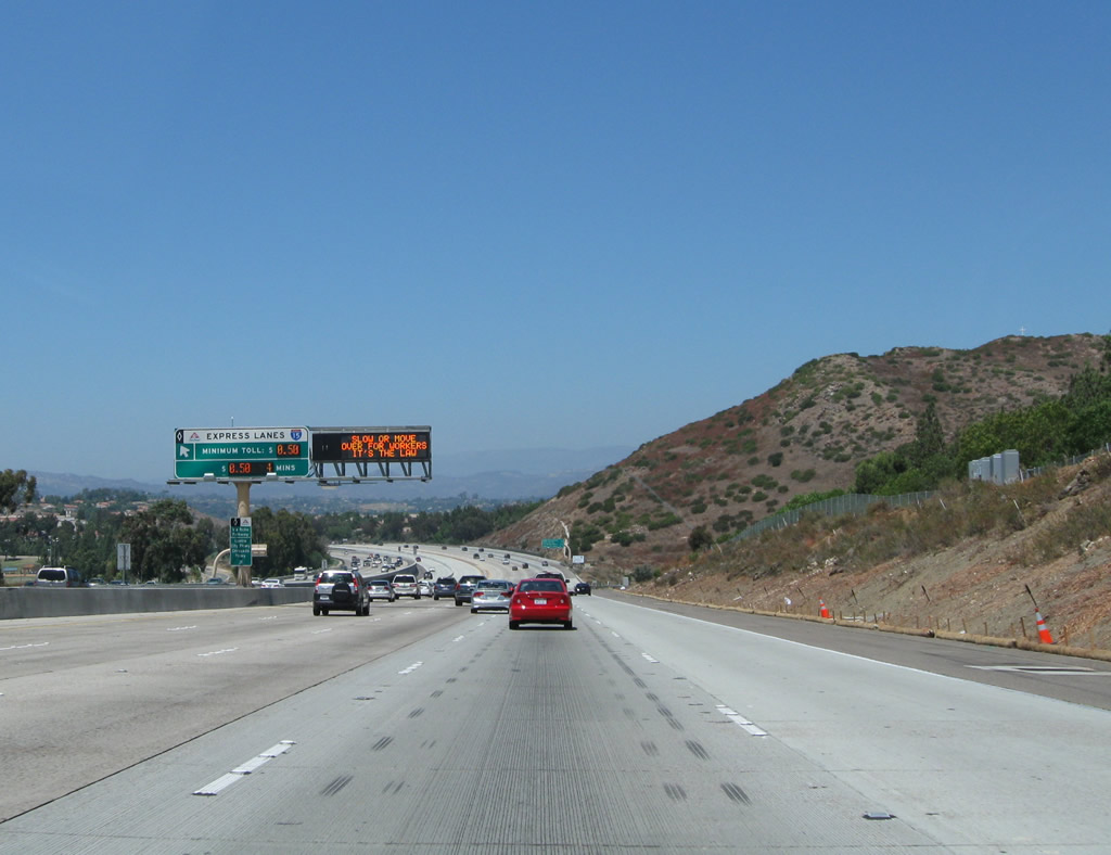
The carpool (high occupancy vehicle) toll violation was $401 as of September 2008. All single-occupancy vehicles must pay a toll via a Fastrack transponder. The overhead transponder apparatus is located after the upcoming connection (ingress/egress) with the main lanes. Photo taken 09/28/08. |
|
Passing under the Carmel Mountain Road overpass (Exit 21), an interchange sequence sign appears for the main lanes, but none of these off-ramps serve the Managed Lanes. Photo taken 09/28/08. |
|
This view shows the full extent of the four-lane Managed Lanes facility, with a movable center barrier. This barrier enables the Managed Lanes to carry three lanes in either direction if traffic conditions warrant. Photo taken 09/28/08. |
|
Cresting to the divide between the Peñasquitos Creek watershed and the San Dieguito River watershed, the Managed Lanes offer no direct access to Exit 22, Camino del Norte. Photo taken 09/28/08. |
|
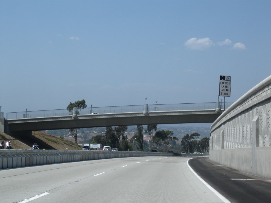
An "Express Lanes Ahead 1 Mile" sign advises of a connection from the Main Lanes to the Managed Lanes. Photo taken 09/28/08. |
|
Northbound Interstate 15 Managed Lanes bypass the off-ramp for Exit 22, Camino del Norte. Photo taken 09/28/08. |
|
Instead, the next ramp will connect northbound Interstate 15 Managed Lanes to the main lanes. Access to Rancho Bernardo Road, West Bernardo Drive, and Pomerado Road/West Bernardo Drive is offered via the main lanes, but not the Managed Lanes. Photo taken 09/28/08. |
|
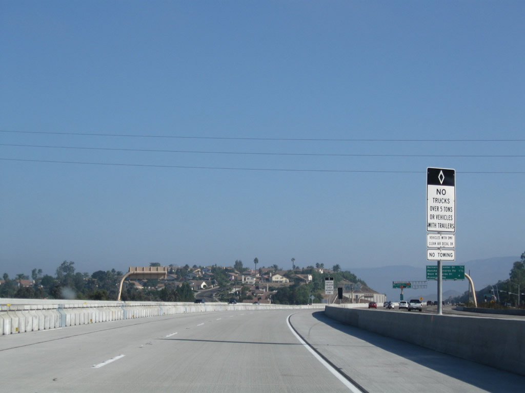
No trucks over five tons are permitted within the Interstate 15 Managed Lanes. Photo taken 09/28/08. |
|
Traffic merges onto northbound Interstate 15 Managed Lanes from the Rancho Bernardo Transit Station. Note the use of a yellow, square merge sign for the on-ramp along with the black HOV diamond. Photo taken 05/16/09. |
|
The northbound lanes of Interstate 15 main lanes are at a higher elevation than the Managed Lanes. Photo taken 05/16/09. |
|
The Managed Lanes temporarily ended between Rancho Bernardo Road and Pomerado Road. The continuation of the lanes north to Business Loop I-15 (Centre City Parkway) is the next section of Managed Lanes opened in early 2009, and the lanes will eventually continue north to California 78 in Escondido. Photo taken 05/16/09. |
|
Battle Mountain comes into view on the east side of Interstate 15. The Managed Lanes will (temporarily) end shortly. Photo taken 09/28/08. |
|
At the next ingress/egress point, traffic may reconnect to Interstate 15's northbound main lanes or remain in the managed lanes to cross Lake Hodges and enter the city of Escondido. Photo taken 05/16/09. |
|
The managed lanes curve around the base of Battle Mountain and will soon pass under Pomerado Road/West Bernardo Drive. Photo taken 05/16/09. |
|
The next segment of managed lanes, which opened in early 2009, continue north toward Escondido. Photo taken 05/16/09. |
|
The next exit along the northbound managed lanes is for the Del Lago transit center in the city of Escondido. This off-ramp is located adjacent to the Via Rancho Parkway exit from the main lanes. Photo taken 05/16/09. |
|
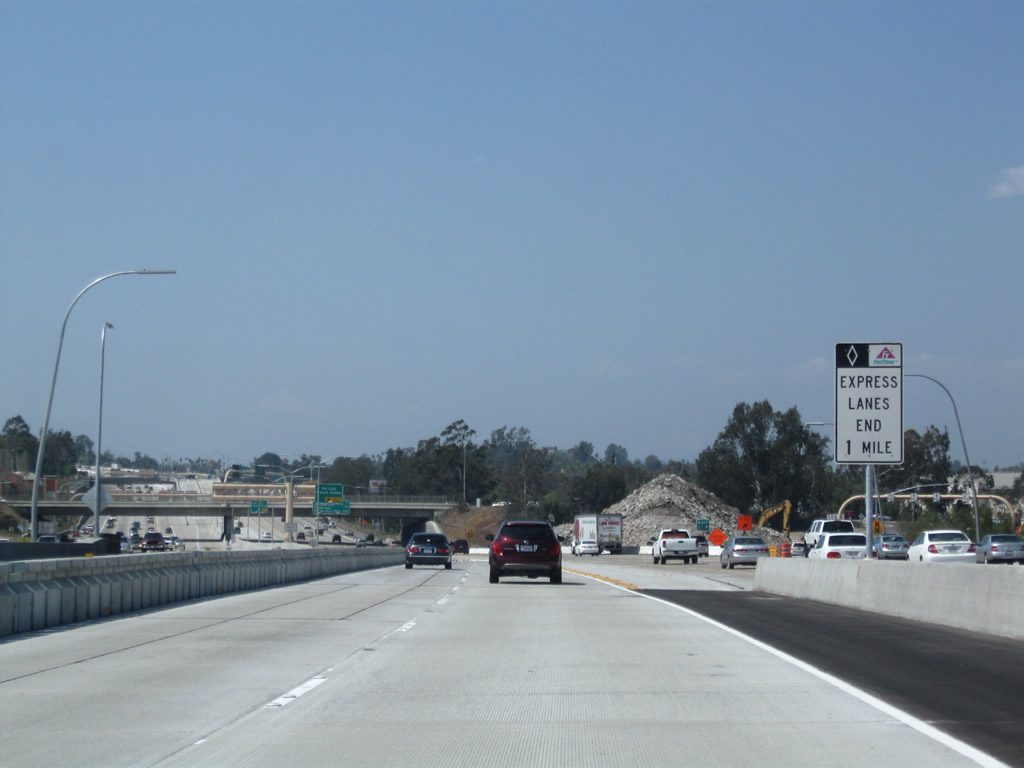
The express lanes will end in one mile (temporarily). Photo taken 05/16/09. |
|
The left lane of the northbound managed lanes becomes exit only for the Del Lago transit center. Photo taken 05/16/09. |
|
Northbound Interstate 15's managed lanes meet the off-ramp for the Del Lago transit center and Via Rancho Parkway in Escondido. Photo taken 05/16/09. |
|
The express (managed) lanes end in one-half mile. Photo taken 05/16/09. |
|
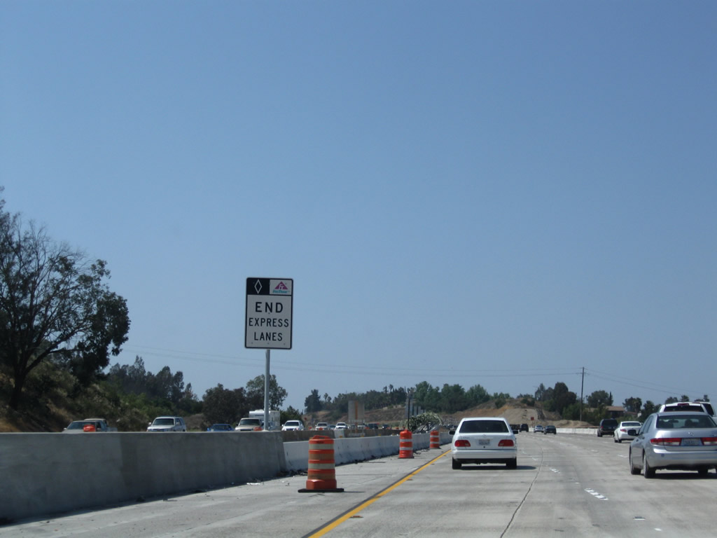
The remaining managed lane transitions back into the main lanes, and the northern end of the express lanes is signed. They are planned to be extended north to California 78 in a future phase. Photo taken 05/16/09. |
Page Updated February 24, 2013.