| Interstate 15/Mojave Freeway north |
|
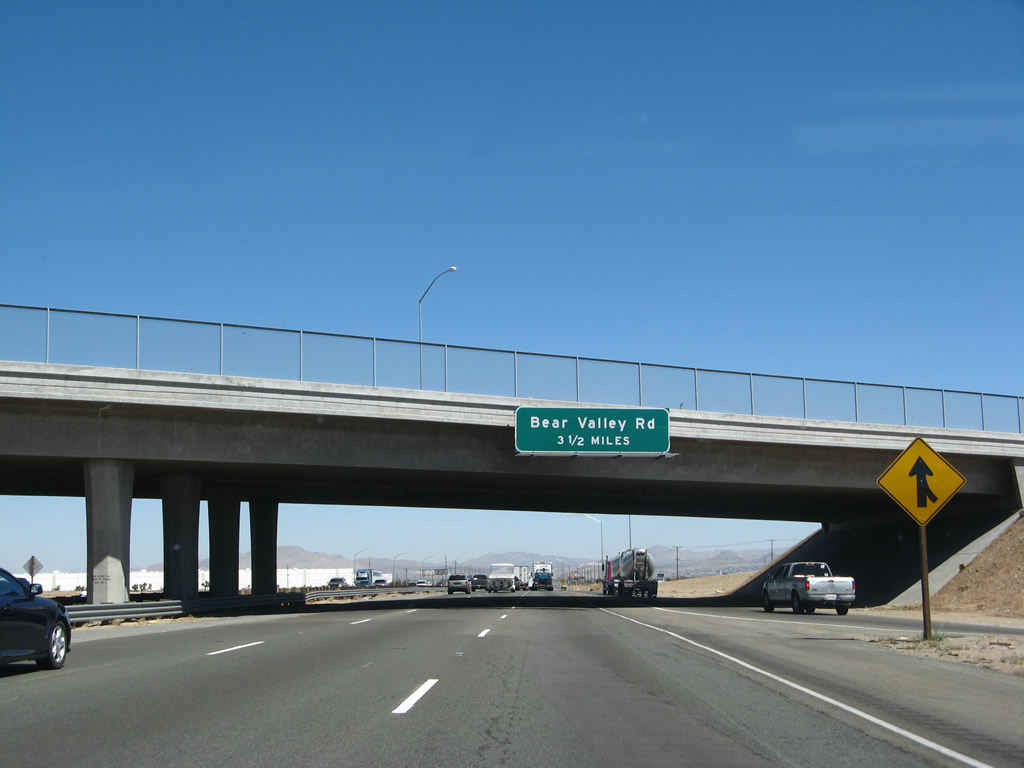
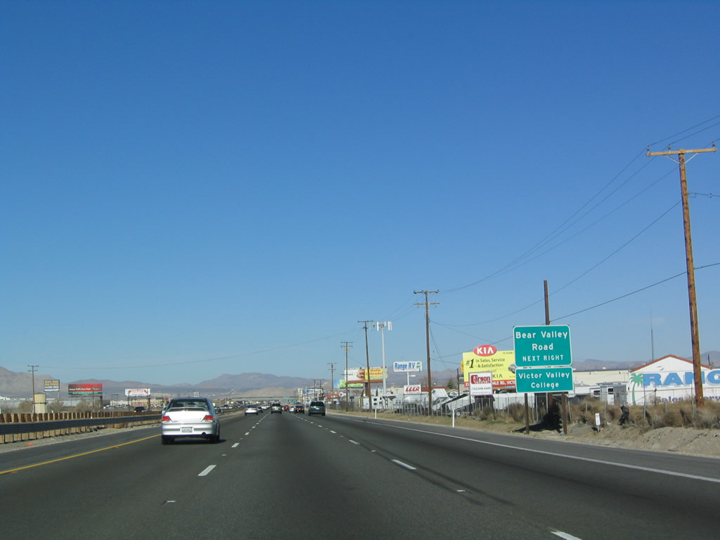
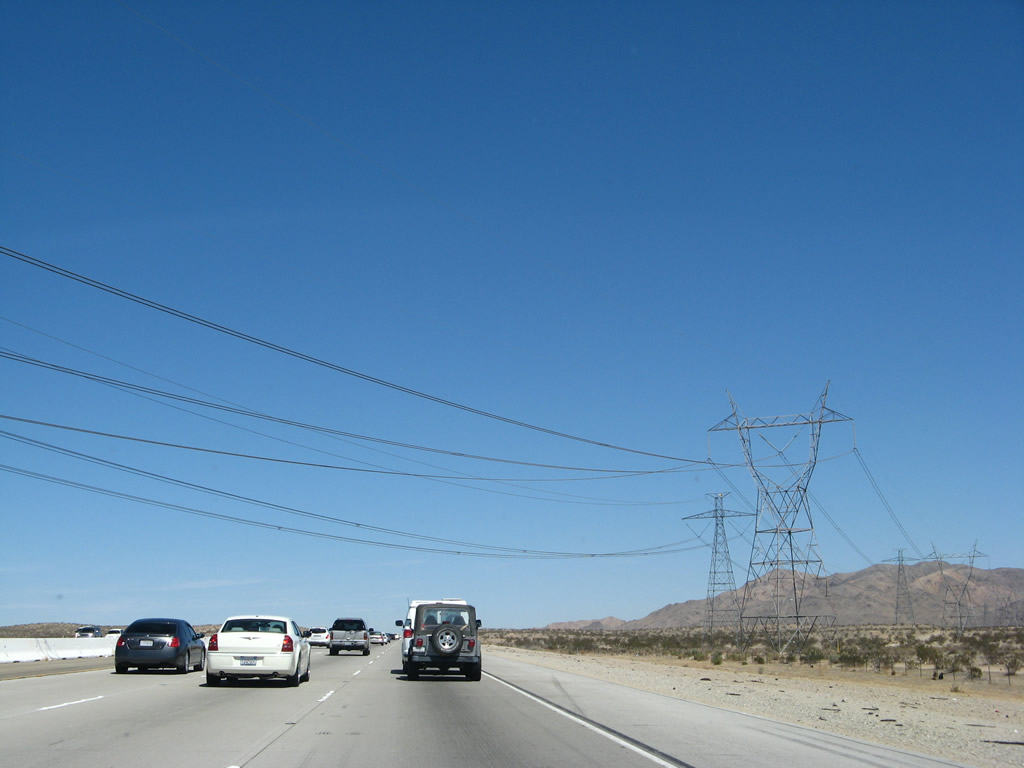
The next exit along Interstate 15/Mojave Freeway north is Exit 147, Bear Valley Road to Lucerne Valley, Apple Valley, and west Victorville. This sign is posted on the Main Street overpass in Hesperia. Photo taken 03/30/07. |
|
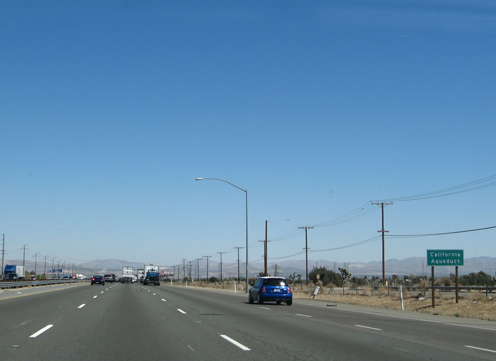
Interstate 15 crosses over the eastern branch of the California Aqueduct (part of the State Water Project). The California Aqueduct is nearing the end of its 444-mile journey from the California Delta to Southern California. This is the eastern branch of the aqueduct, which travels south toward a connection with Lake Perris and the San Gorgonio Pass. The western branch of the aqueduct stays closer to Interstate 5, connecting to Pyramid Lake and Castaic Lake north of Los Angeles. Photo taken 03/30/07. |
|
|
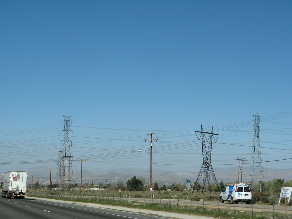
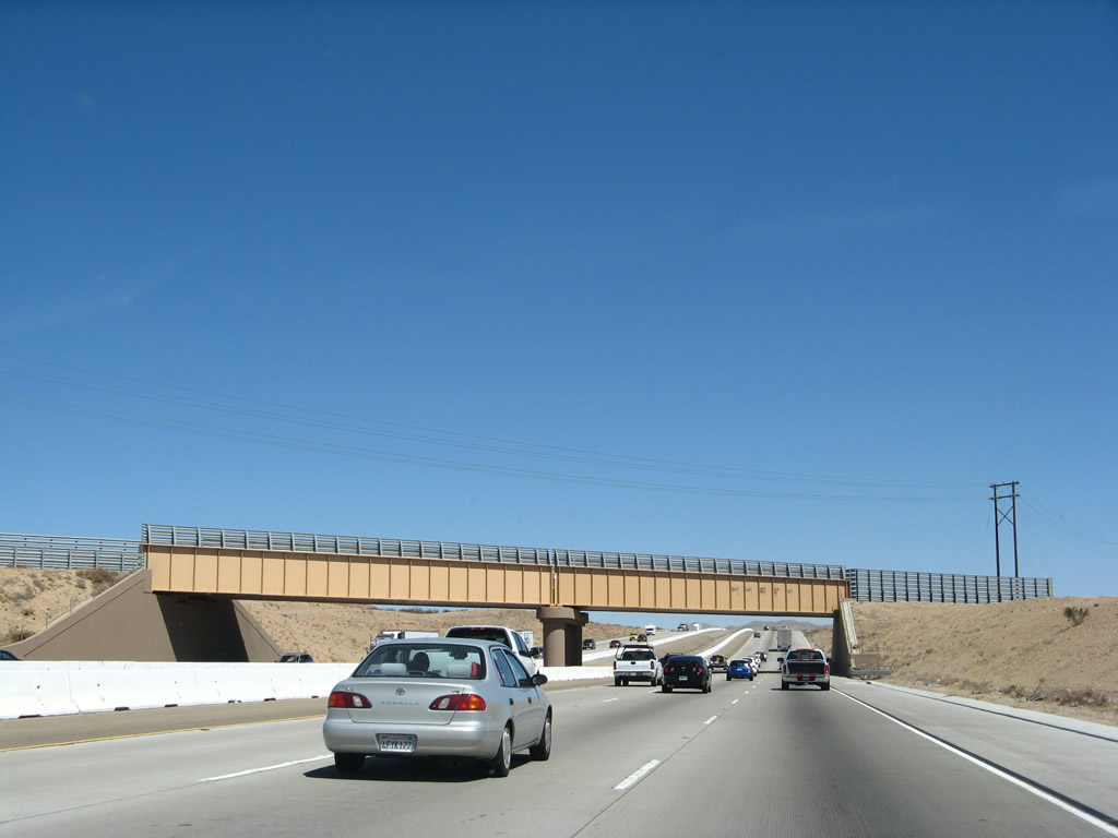
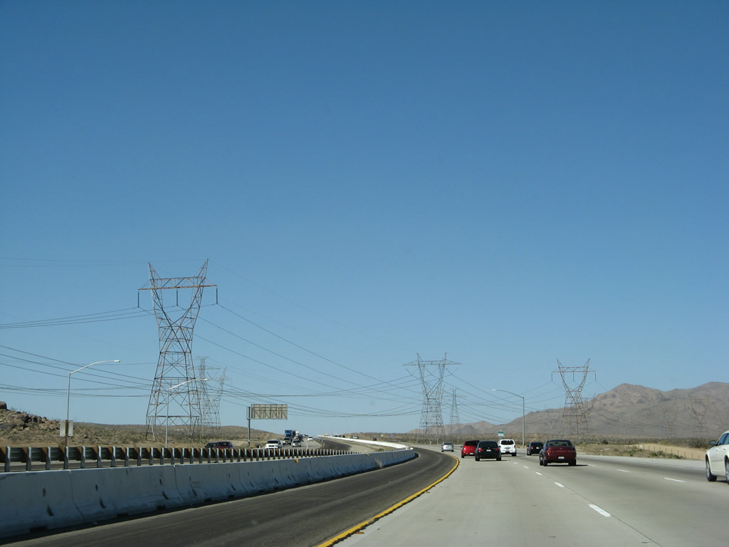
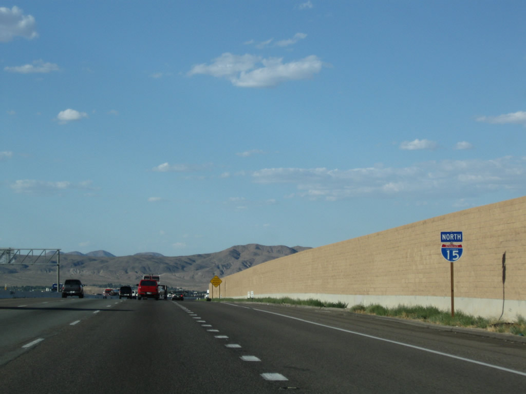
A set of power lines, including one 500kV line and what appears to be two 230kV power lines, crosses over Interstate 15. The 500kV line ties into the Path 46 interconnection by linking the Lugo Substation (Southern California Edison) in Hesperia with the Victorville Substation (Los Angeles Department of Water and Power) in Victorville (off U.S. 66 northwest of downtown). Photos taken 03/28/08. |
|
|
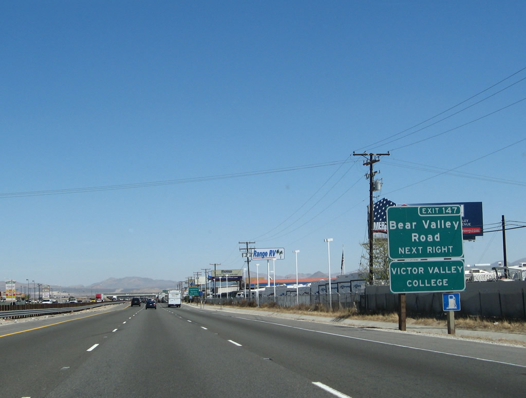
Northbound Interstate 15 approaches Exit 147, Bear Valley Road west to Baldy Mesa and east to the city of Apple Valley. Photos taken 03/30/07 and 01/18/04. |
|
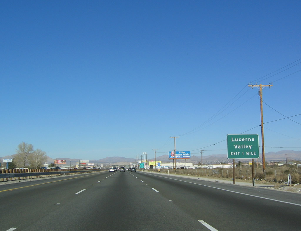
Exit 147 is very confusingly signed along northbound. Depending on the sign, Exit 147 is called one of three different things: Bear Valley Road, Lucerne Valley, and Apple Valley. Exit numbers have improved this situation as of 2010, but the sequence of signs still are a bit confusing. The second sign in sequence showed "Lucerne Valley." The reason for this control point is that Bear Valley Road travels east through the city of Apple Valley, then ends at California 18 northwest of Lucerne Valley. So, Bear Valley Road acts as a cut-off for traffic heading east on California 18 to Lucerne Valley or south on California 247 to Yucca Valley or Twenty-nine Palms. Photo taken 01/18/04. |
|
|
Use Bear Valley Road east to Apple Valley, which is adjacent to Victorville and Hesperia to the east of the Mojave River. After hooking up with California 18/Happy Trails Highway east of Apple Valley, the highway continues as California 18 en route to Lucerne Valley and to California 247 south to Yucca Valley. This roadside sign was replaced with an exit number between 2004 and 2007. Photos taken 03/30/07 and 01/18/04. |
|
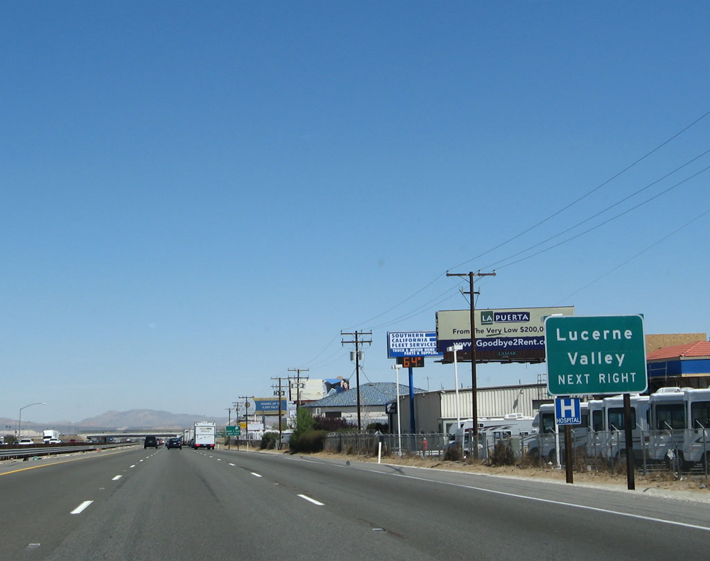
Another roadside sign for Lucerne Valley is posted shortly thereafter. Photo taken 01/18/04. |
|
Northbound Interstate 15 reaches Exit 147, Bear Valley Road. Photo taken 03/28/08. |
|
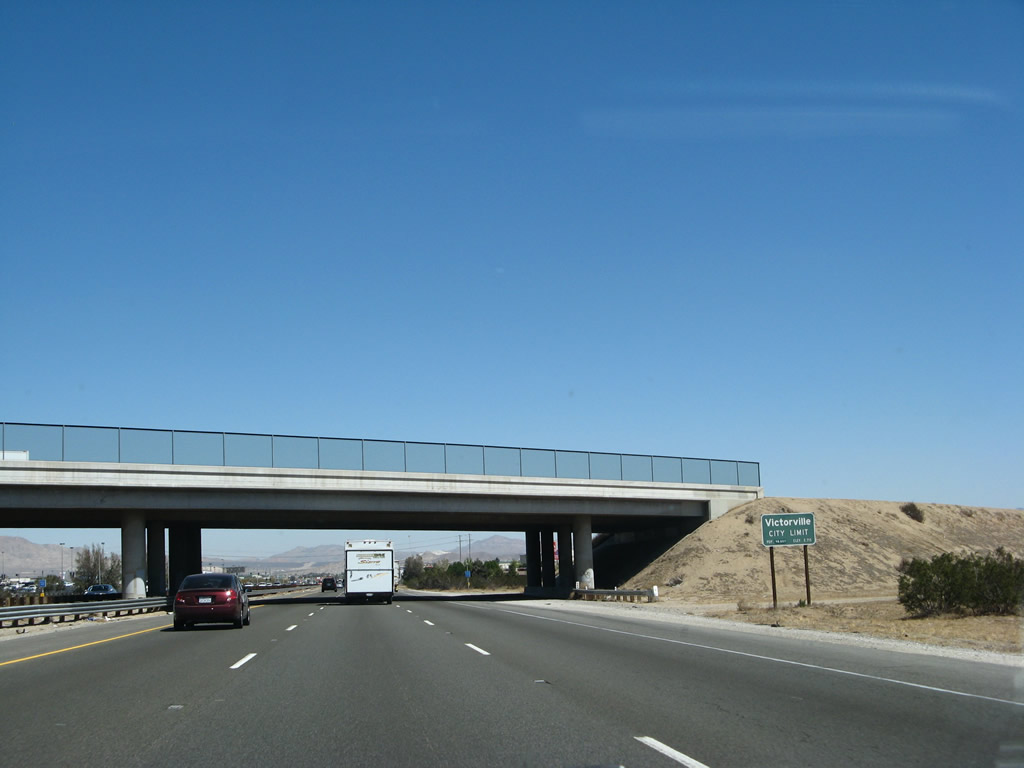
Bear Valley Road serves as the boundary between the city of Hesperia and the city of Victorville east of Interstate 15, and Bear Valley Road leads into southwestern Victorville. The city of Victorville. The city had a population of 64,029 as of the 2000 Census, but that number has increased by over 60% according to more recent population estimates. Incorporated on September 21, 1962, Victorville sits at an elevation of 2,730 feet and consists of 73.30 square miles. Photo taken 01/18/04. |
|
This Interstate 15 north reassurance shield assembly is located just after entering the city limits of Victorville and after the on-ramp from Exit 147 (Bear Valley Road). Photo taken 01/18/04. |
|
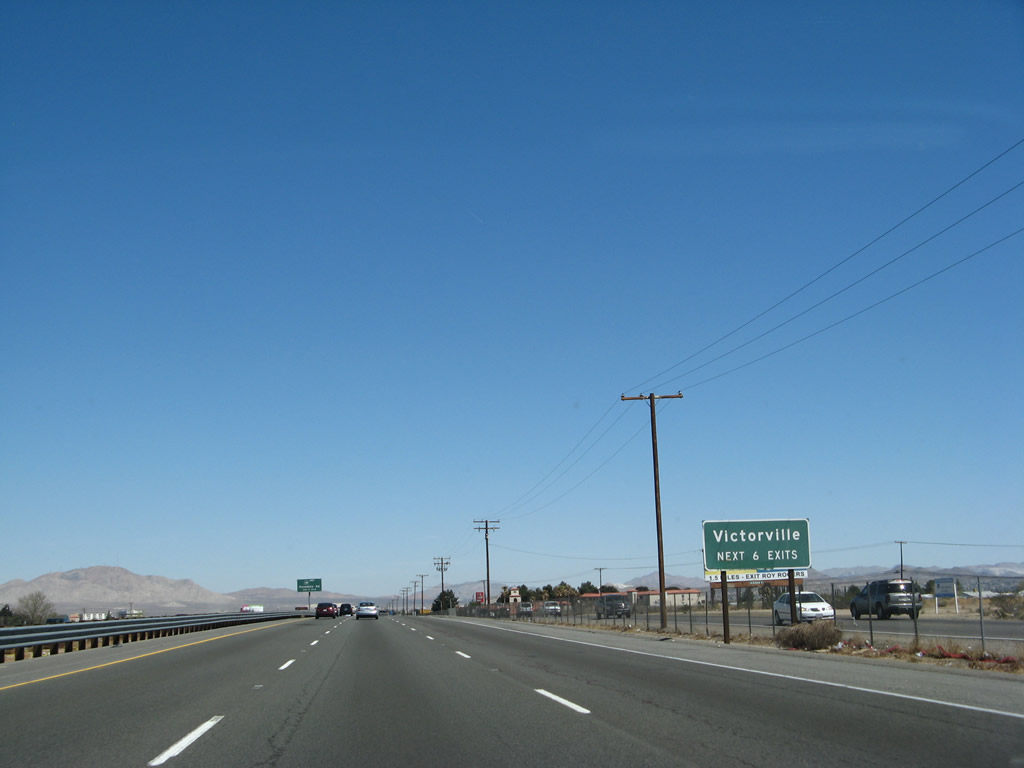
The next six exits along northbound Interstate 15 serve the city of Victorville. Known as the "Key City of the High Desert," Victorville is named after Jacob Nash Victor, a railroad pioneer who helped bring the railroad over the Cajon Pass in 1885. Located in the high desert (2,730 feet), the city only receives 3.9 inches of precipitation per year but has ample sun and plenty of warmth during the summer. Photo taken 03/28/08. |
|
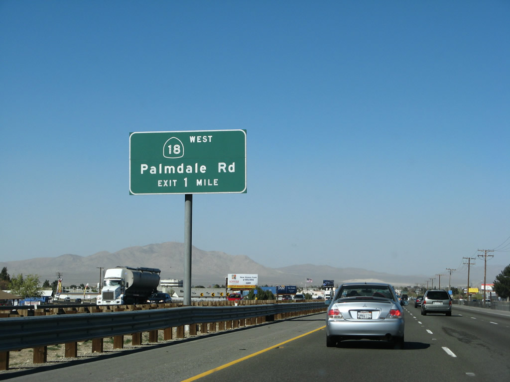
The first Victorville exit is Exit 150, northbound Business Loop I-15/7th Street north and California 18 (Palmdale Road) west. Photo taken 01/18/04. |
|
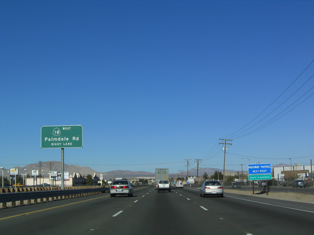
Northbound Interstate 15 approaches Exit 150, Business Loop I-15/7th Street north and California 18 (Palmdale Road) west. Note the "Route 15 Business" designation is written beneath the blue sign for the California Highway Patrol. This auxiliary sign was gone by 2008. Photo taken 01/18/04. |
|
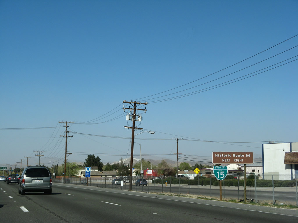
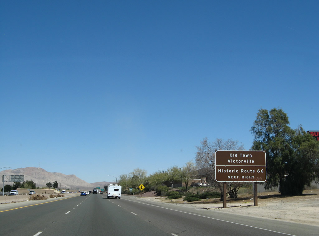
An auxiliary trailblazer for Business Loop I-15 and Historic Route 66 is posted prior to the exit ramp. Old U.S. 66 follows 7th Street into downtown Victorville, and both U.S. 66 and the business route are well-signed through downtown. This is the first significant extant stretch of Old U.S. 66 since ascending Cajon Pass. Photo taken 03/28/08. |
|
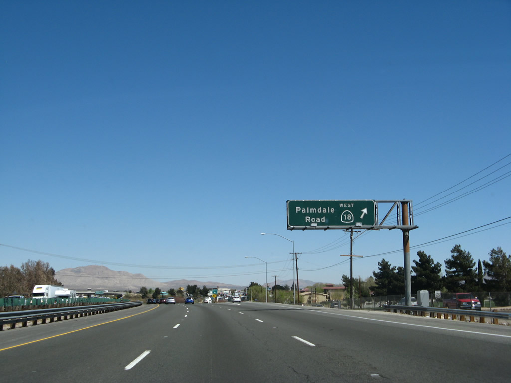
Northbound Interstate 15 reaches Exit 150, Business Loop I-15/7th Street north and California 18 (Palmdale Road) west. California 18 leads west from here to meet California 138. California 18 east merges with Interstate 15 north between Exits 150 and 153A. The business loop follows old U.S. 66 through Victorville. Photo taken 01/18/04. |
| Interstate 15/Mojave Freeway north and California 18 east |
|
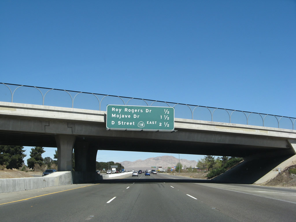
This mileage sign along Interstate 15/Mojave Freeway north provides the distance to the next three exits: Exit 151A, Roy Rogers Drive; Exit 151B, Mojave Drive; and Exit 153A, California 18 East/Business Loop I-15 South/U.S. 66/D Street. Photo taken 03/30/07. |
|
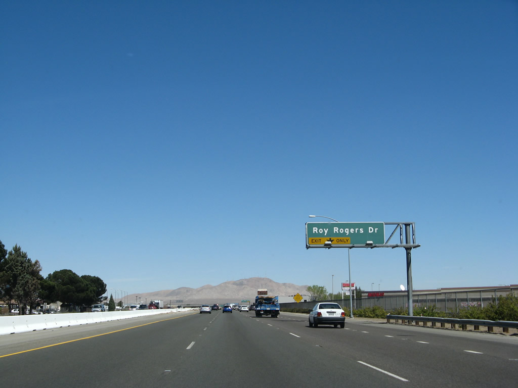
The right lane becomes exit only for the next exit on Interstate 15 north and California 18 east: Exit 151A, Roy Rogers Drive. Roy Rogers was a local fixture in Victorville, and he used to have his museum here in Victorville. It has since been moved to Branson, Missouri. For more on Roy Rogers, the "King of Cowboys," and his wife Dale Evans, visit their official web page. Photo taken 03/30/07. |
|
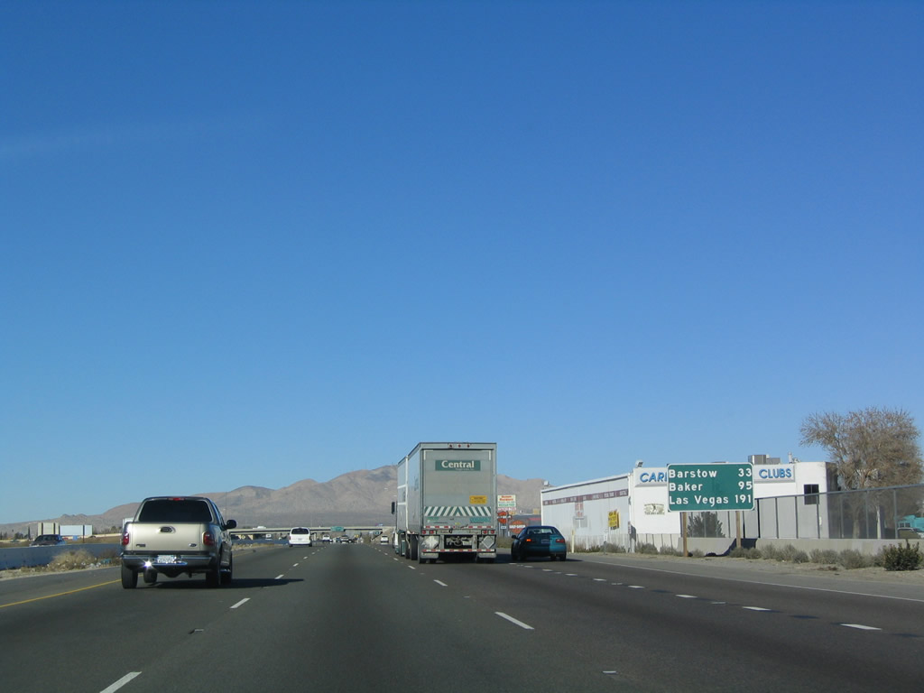
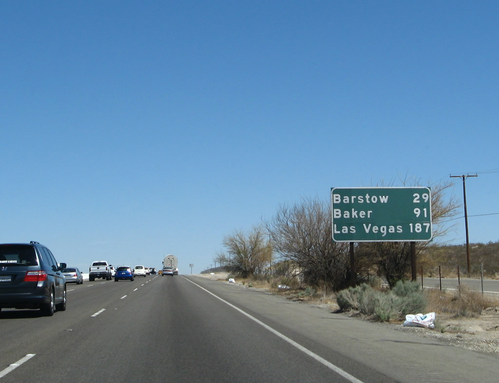
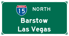
A roadside mileage sign is posted for Barstow, Baker, and the control city of Las Vegas, Nevada. Las Vegas is still 191 miles north of Victorville, so there is still quite a bit of desert between here and there. Photo taken 01/18/04. |
|
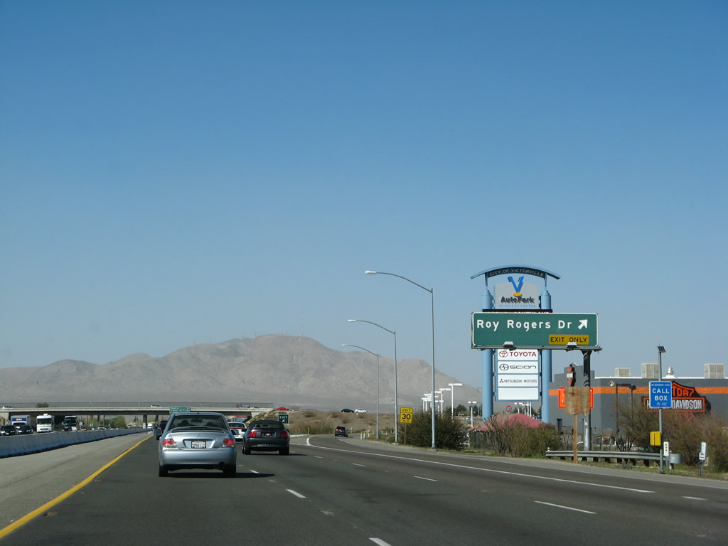
Northbound Interstate 15/Mojave Freeway and eastbound California 18 reach Exit 151A, Roy Rogers Drive. Photo taken 03/28/08. |
|
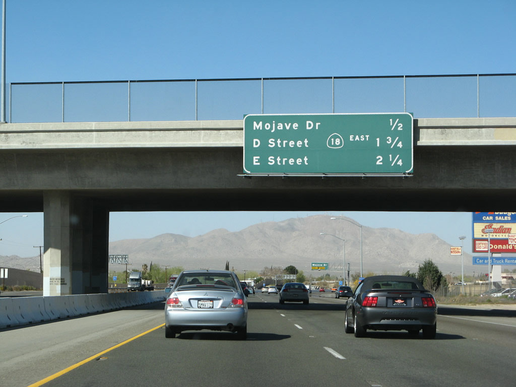
This mileage sign along Interstate 15/Mojave Freeway north provides the distance to the next three exits:: Exit 151B, Mojave Drive; Exit 153A, California 18 East/Business Loop I-15 South/U.S. 66/D Street; and Exit 153B, E Street. Photo taken 03/28/08. |
|
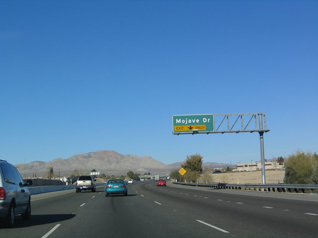
The right lane becomes exit only for Exit 151B, Mojave Drive. Mojave Drive parallels Palmdale Road (California 18), and it connects U.S. 395 in Adelanto with Historic U.S. 66/Business Loop I-15 in downtown Victorville. Photo taken 01/18/04. |
|
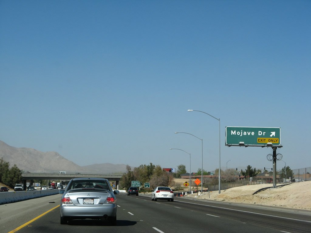
Interstate 15 north and California 18 east reach Exit 151B, Mojave Drive. Photo taken 03/28/08. |
|
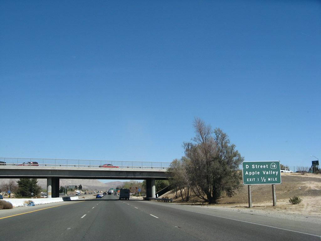
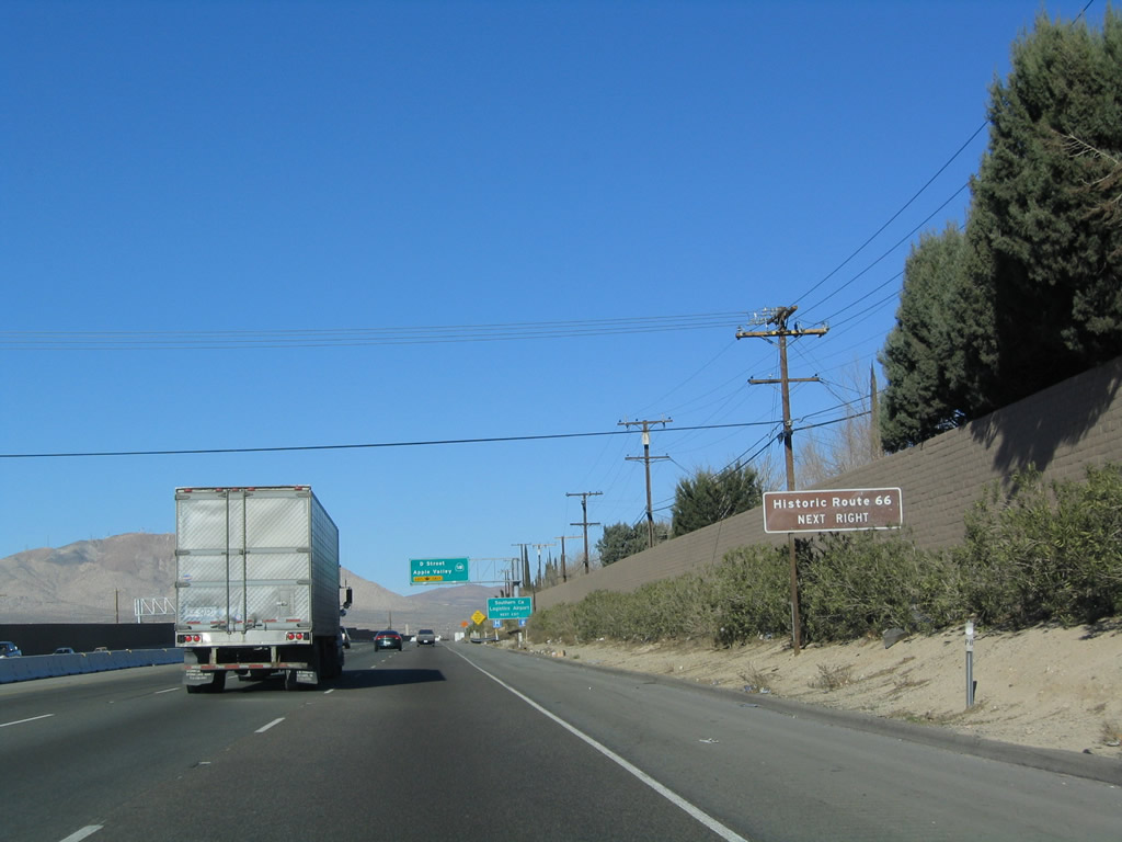
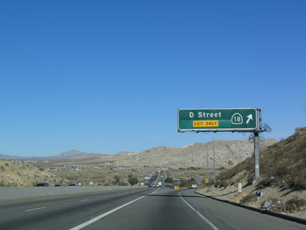
The next exit along Interstate 15 north and California 18 east is Exit 153A, California 18 east, Business Loop I-15 south, and Historic U.S. 66-91. This is the northern end of the business loop that began at Exit 150. U.S. 66-91 travels south via D Street into downtown Victorville and north via National Trails Highway into Oro Grande. Photo taken 03/30/07. |
|
Use Business Loop I-15/D Street south to downtown Victorville and the Route 66 Museum, which is located near the downtown rail station. Photo taken 03/30/07. |
|
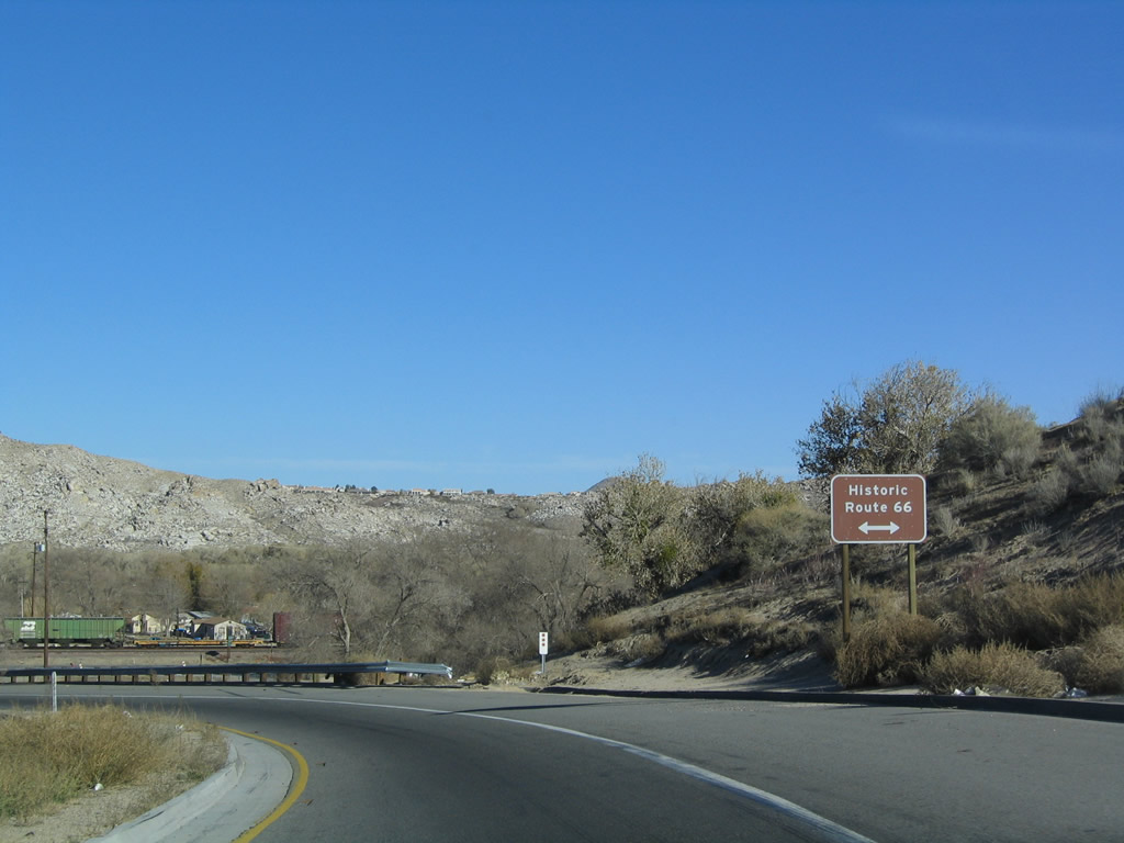
As is commonly seen on Interstate 15 and Interstate 40 where they intersect with an old alignment of Historic U.S. 66, these historic brown signs indicate where to access the old route of U.S. 66. Old U.S. 91 also follows the U.S. 66 alignment through Victorville, and a long extant section travels north through Oro Grande all the way to Barstow. Photo taken 01/18/04. |
|
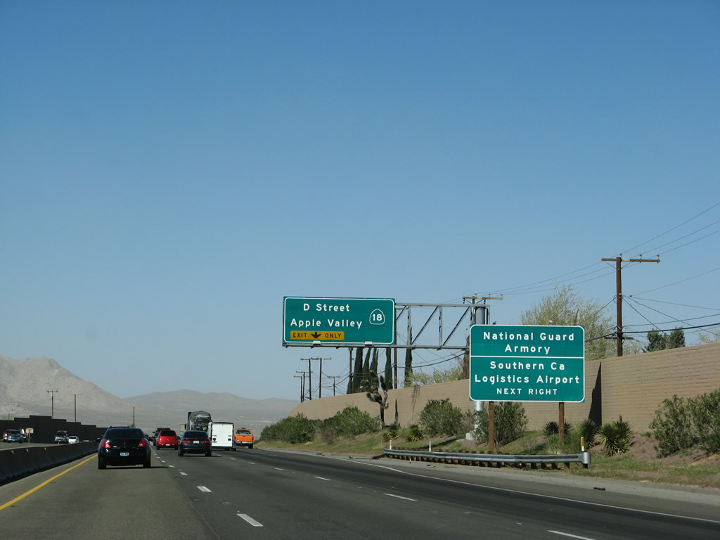
This exit connects to the sprawling Southern California Logistics Airport, where several planes are stored at the location of a former military base. The airport is reached by following old U.S. 66 northeast to the airport turnoff (a left turn). Photo taken 03/28/08. |
|
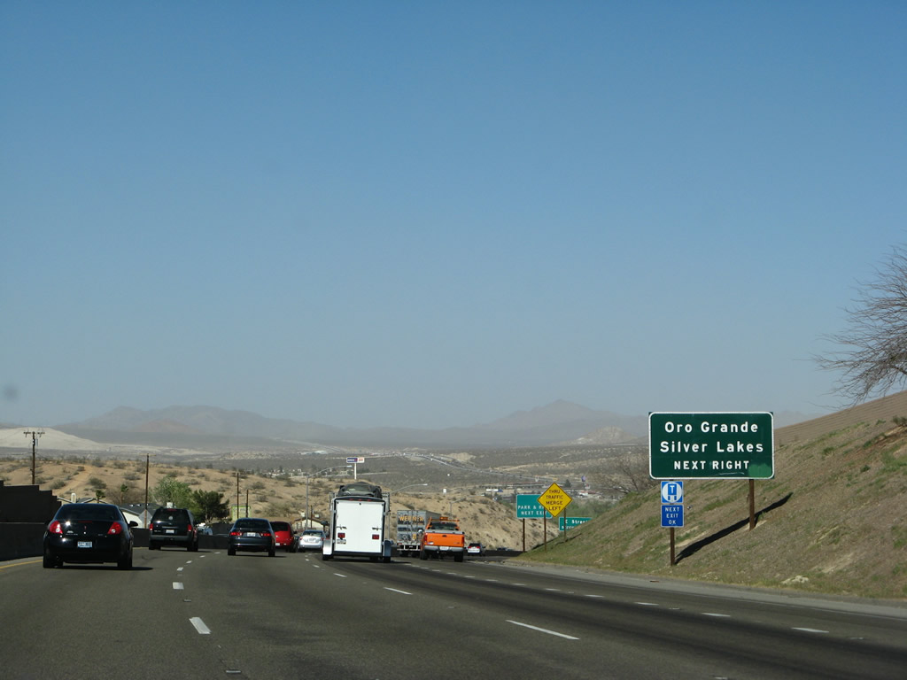
As noted earlier, Exit 153A provides access to historic U.S. 66-91, which follows the National Trails Highway parallel to the Mojave River en route to Oro Grande and Silver Lakes. Photo taken 03/28/08. |
|
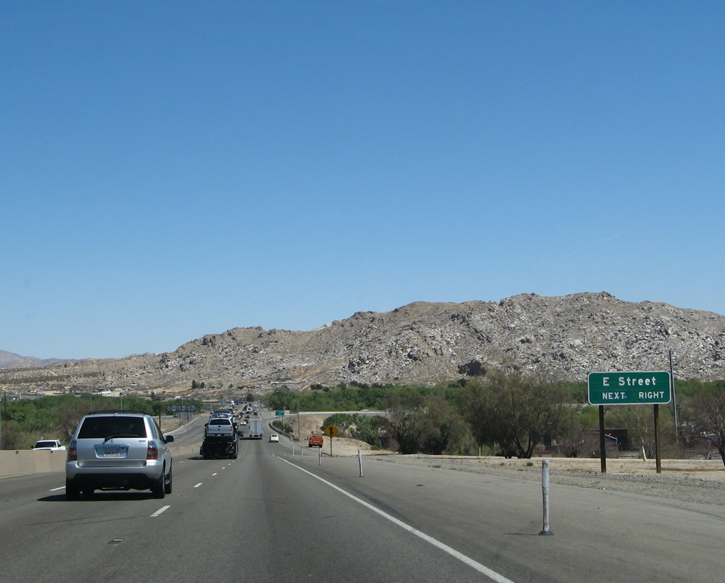
The next two exits are Exit 153A, D Street and Exit 153B, E Street. While all of the advance signs seen in sequence have been for Exit 153A (California 18 east/Business Loop I-15 south and Historic U.S. 66-91) to D Street, this roadside sign advises of the second exit, which is Exit 153B, E Street. Photo taken 01/18/04. |
|
Northbound Interstate 15/Mojave Freeway reaches Exit 153A, California 18 east and Business Loop I-15 south (D Street) as well as old U.S. 66-91. This exit leads east into Victorville, a growing city in the high desert between Cajon Pass and Barstow, and it continues southeast toward Big Bear Lake. Note that a new left lane was added between 2004 and 2007; this allowed for a continuation of the six-lane freeway after the right lane exit only for Exit 153A. Photo taken 03/30/07. |
|
Upon exiting from Interstate 15 north at Exit 153A, this trailblazer advises that Route 66 extends north to Oro Grande and Barstow or south into downtown Victorville. U.S. 91 is not mentioned. Photo taken 01/18/04. |
| Interstate 15/Mojave Freeway north |
|
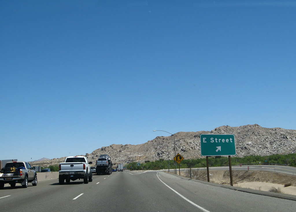
The next exit along northbound Interstate 15/Mojave Freeway is Exit 153B, E Street. Interstate 15 crosses over the Union Pacific (UP)/Burlington Northern Santa Fe (BNSF) Railroad. Photo taken 03/30/07. |
|
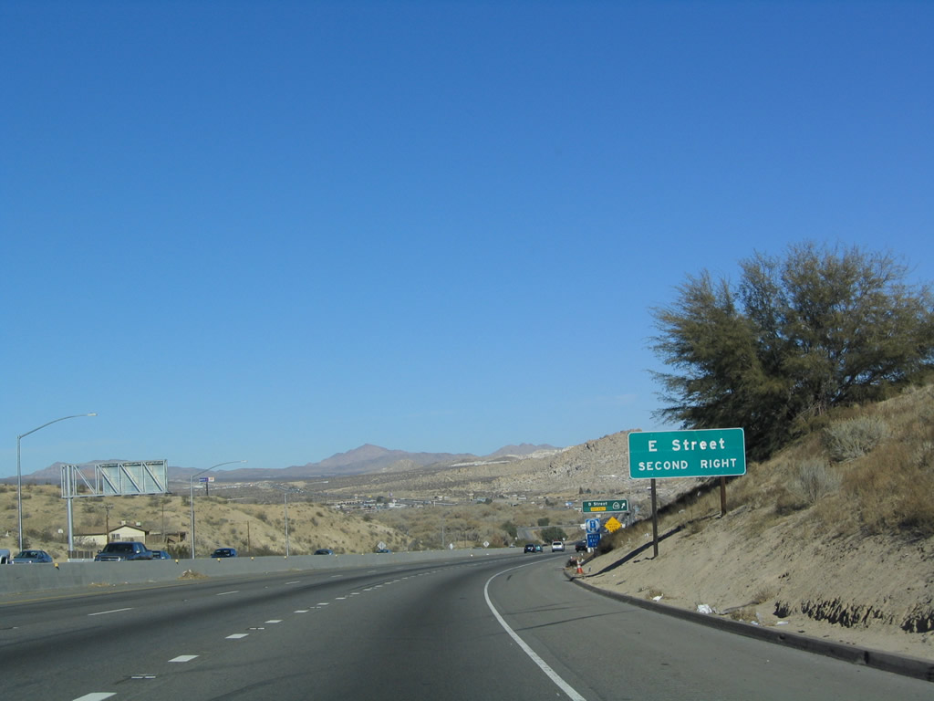
Northbound Interstate 15/Mojave Freeway reaches Exit 153B, E Street. Use E Street south to downtown Victorville. While D Street stays west of the railroad tracks, E Street stays east of the railroad tracks. This enables both sides of the downtown area to have freeway access. Note the sharp angle of this loop ramp exit. Photo taken 03/30/07. |
|
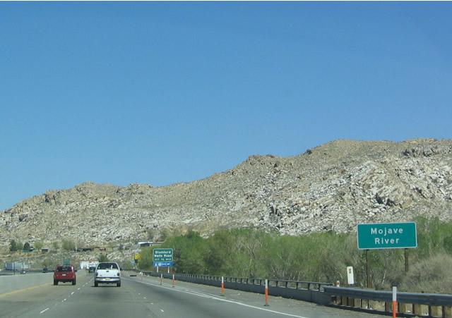
Interstate 15 crosses the Mojave River floodplain between Exits 153B and 154. Although often dry, the Mojave River can flood quickly if there is an abundance of heavy rain that falls in a short duration. The desert does not absorb water quickly, so flooding is often a byproduct of monsoonal rain events in the summer. The Mojave River flows from the hills above Hesperia north through Victorville and Barstow until reaching the area around Soda Lake northeast of Barstow, where the river dries up. Photo taken 03/20/04. |
|
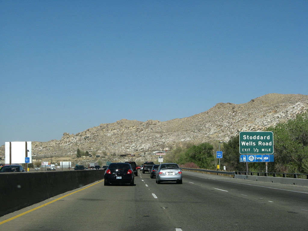
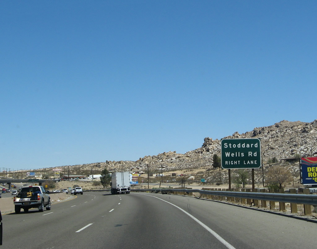
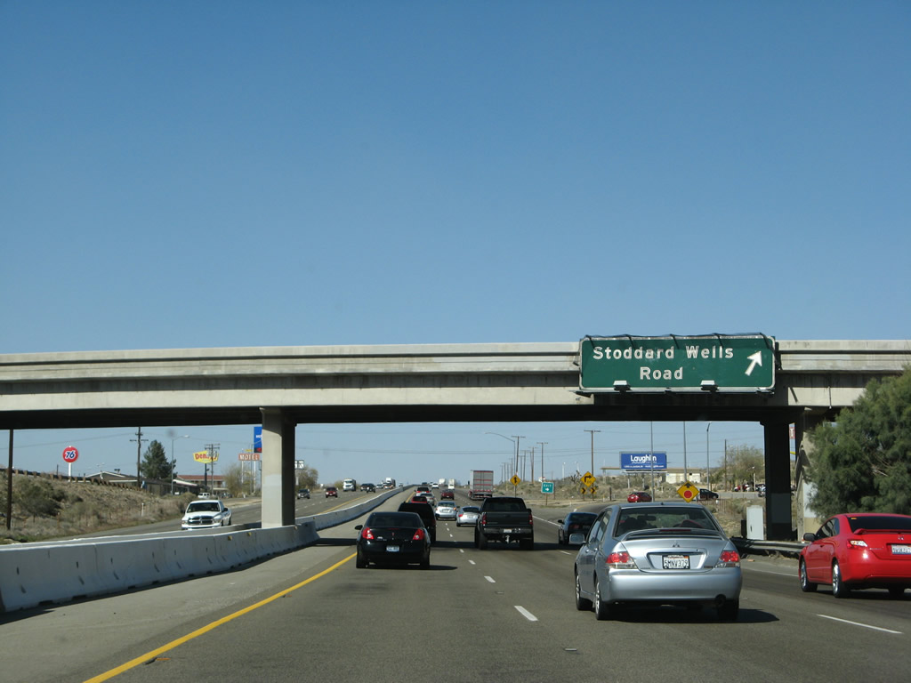
The next exit along Interstate 15 north is Exit 154, Stoddard Wells Road. This is the final exit located in the city of Victorville. Photo taken 03/28/08. |
|
Stoddard Wells Road exits from Interstate 15 at Exit 154 and meets the freeway again at Exit 157. Photo taken 03/20/04. |
|
Northbound Interstate 15 reaches Exit 154, Stoddard Wells Road. Interstate 15 between the California 18 interchange and Barstow was widened from four to six lanes between 2004 and 2007. Between Exit 154 and California 58, all of the signs are new. Photo taken 03/30/07. |
|
A reassurance shield for Interstate 15 north is posted after the on-ramp from Exit 154. Photo taken 03/30/07. |
|
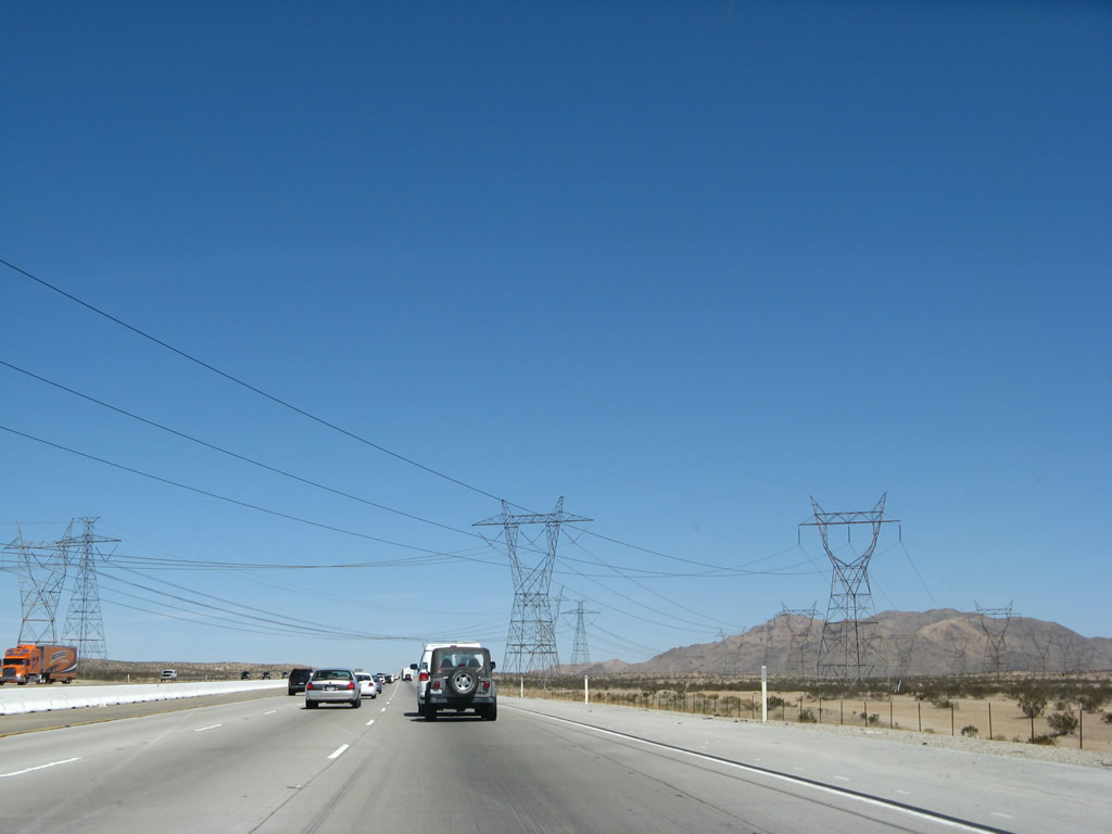
There is not much development along Interstate 15 between Victorville and Barstow; however, Interstate 15 skirts the northwestern edge of the city of Apple Valley. The next city along northbound is Barstow, followed by a few small towns including Baker. Las Vegas is the next major metropolitan area along northbound Interstate 15, with a couple of smaller gambling meccas (Primm and Jean) located north of the Nevada state line. Photo taken 03/30/07. |
|
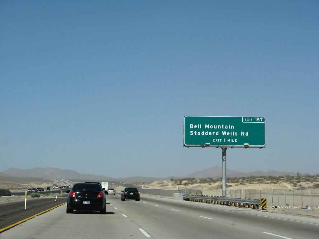
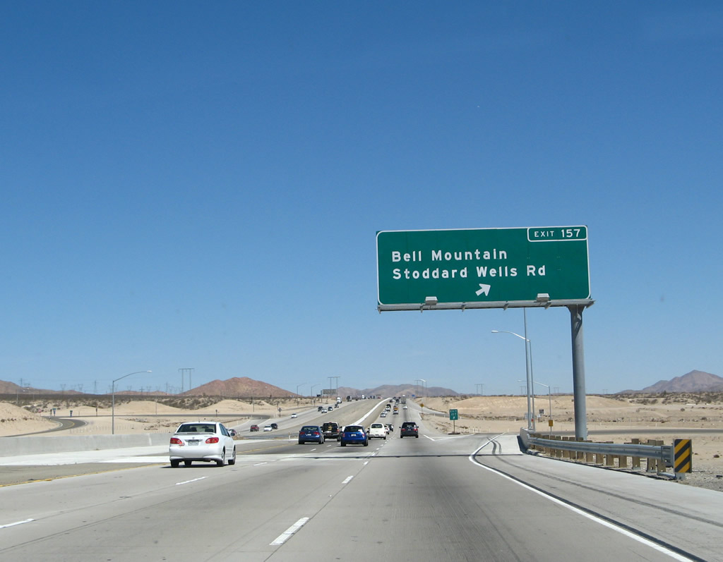
The next exit along Interstate 15 north is Exit 157, Stoddard Wells Road to Bell Mountain. Photo taken 03/28/08. |
|
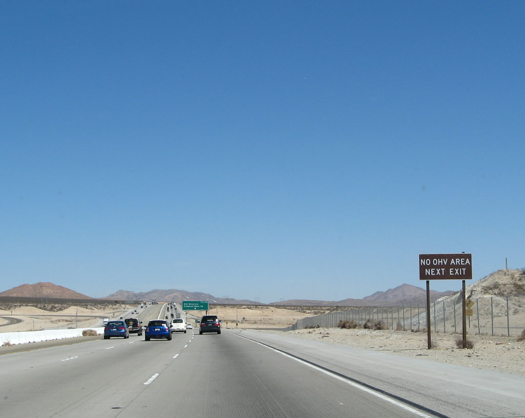
There are no off-road vehicle areas accessed via Exit 157, Stoddard Wells Road/Bell Mountain. Photo taken 03/30/07. |
|
Northbound Interstate 15/Mojave Freeway reaches Exit 157, Stoddard Wells Road/Bell Mountain. Photo taken 03/30/07. |
|
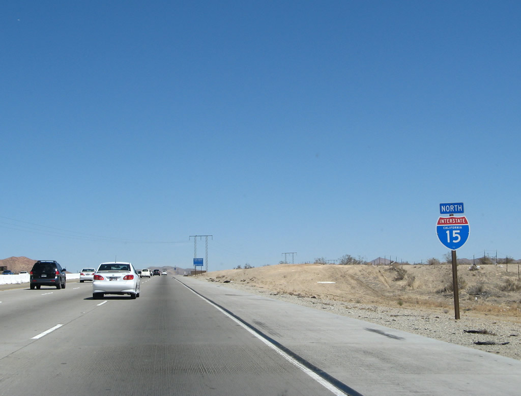
Another reassurance shield for Interstate 15 north is posted after the on-ramp from Exit 157. Photo taken 03/30/07. |
|
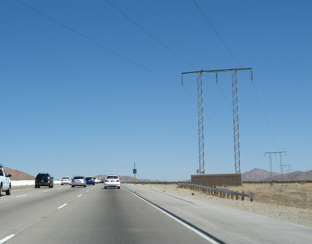
A power line crosses Interstate 15 shortly thereafter. This particular line will extend northeast along the Interstate 15 corridor all the way to Baker and Primm. Photo taken 03/30/07. |
|
The Mojave Northern Mining Railroad passes over Interstate 15 on this bridge that was reconstructed along with the overall freeway widening between 2004-2007. Photo taken 03/30/07. |
|
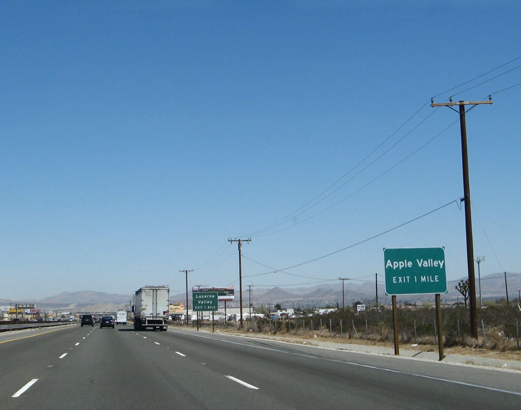
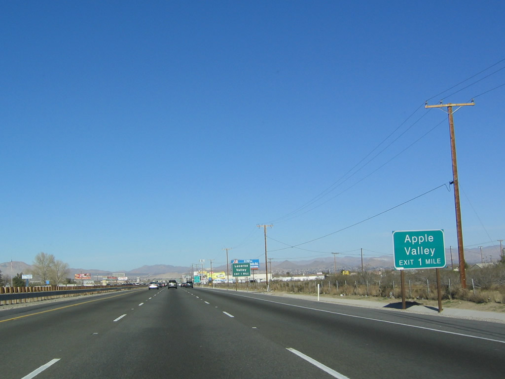
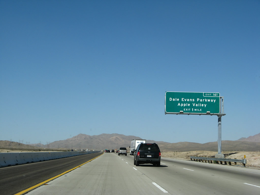
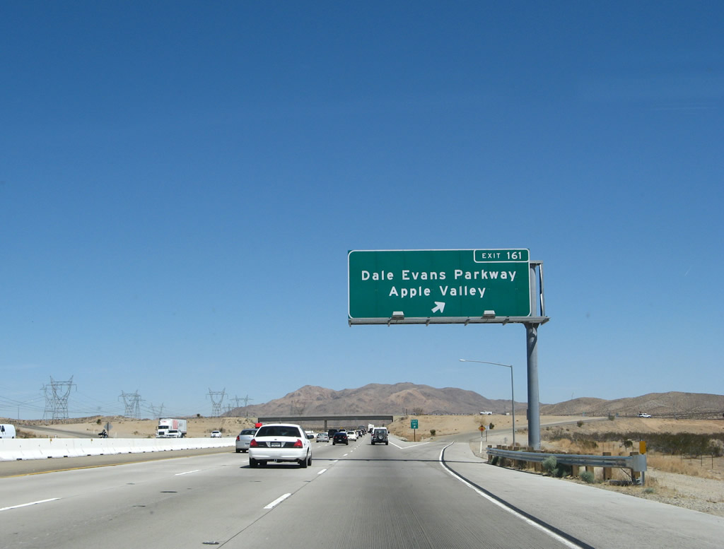
The next exit along Interstate 15/Mojave Freeway north is Exit 161, Dale Evans Parkway south to Apple Valley. Dale Evans, the wife of Roy Rogers, is as much a part of the local celebrity folklore as her husband. The city of Apple Valley, which contains land adjacent to Interstate 15 on the east side near the Exit 161 interchange, owns plenty of open space east of the freeway. Most of the developed parts of the city are south of here, closer to Victorville and Hesperia. Photo taken 03/28/08. |
|
This brown sign advises of the off-road vehicle areas accessible from Interstate 15. Photo taken 03/30/07. |
|
Northbound Interstate 15/Mojave Freeway reaches Exit 161, Dale Evans Parkway south to Apple Valley. There are no services at this interchange. Photo taken 03/30/07. |
|
|
|
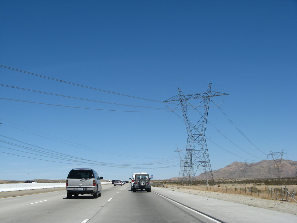
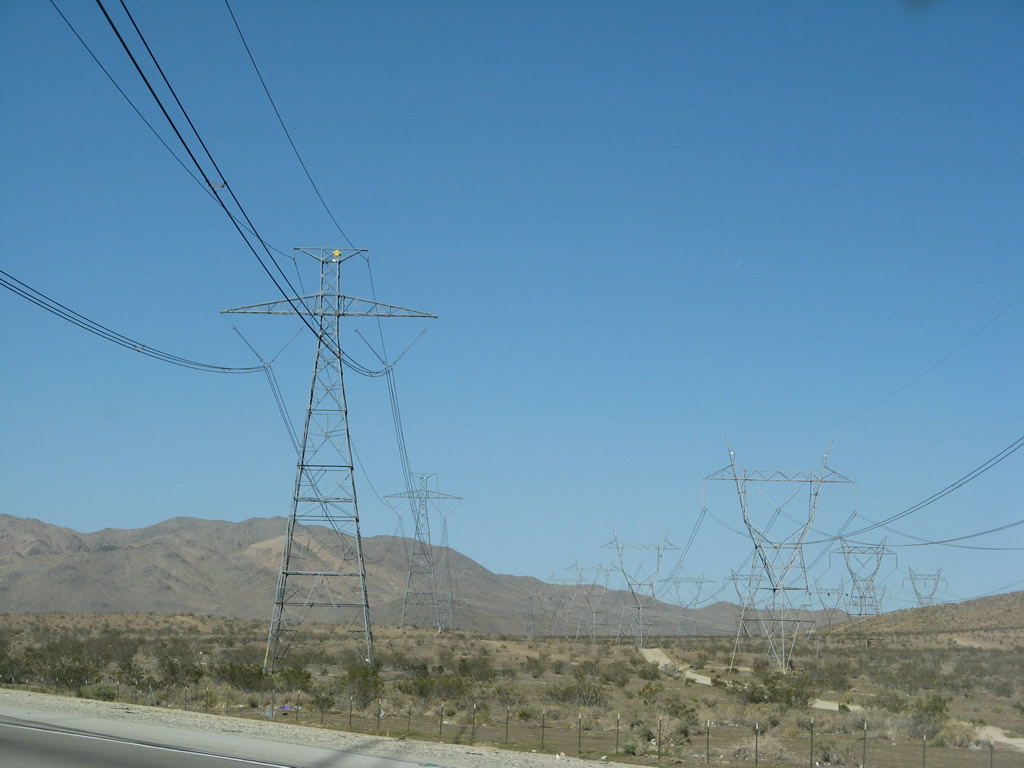
This suite of photos shows the group of 287, 500, and -500kV power lines that cross Interstate 15 north of Exit 161. The first line is part of the Hoover - Victorville 287 kV line. The second two lines are part of Los Angeles Department of Water and Power's McCullough - Victorville transmission line; these two lines are part of the sprawling Path 46 series (500kV). (Path 46 is also referred to as West of Colorado River, Arizona-California West-of-the-River Path [WOR] and includes multiple segments of transmission line. Interstate 15 previously passed under other Path 46 transmission lines when traveling up Cajon Pass and again in Hesperia.)1 The last tower of the four is part of Path 27, a -500kV Intermountain High Voltage Direct Current (HVDC) transmission system. The Intermountain HVDC line is distinct from the other towers for having only two sets of wires rather than the three lines required to transmit alternating current (AC) power; it was built in 1986. Path 27 begins at the Intermountain power plant near Delta, Utah, and travels southwest to the Adelanto static inverter plant.2 This line is also owned by Los Angeles Department of Water and Power. Photos taken 03/30/07 and 03/28/08. |
|
|
|
|
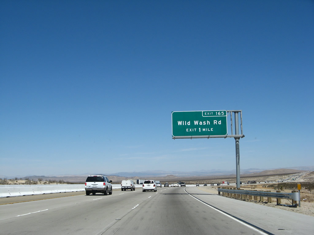
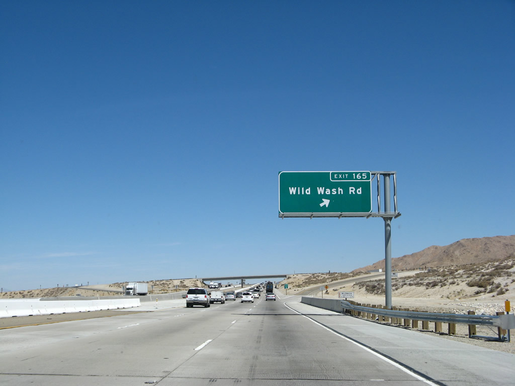
The next exit along Interstate 15/Mojave Freeway north is Exit 165, Wild Wash Road. Photo taken 03/30/07. |
|
Another brown sign advises of the distances to the off-road vehicle areas accessible from Interstate 15. Photo taken 03/28/08. |
|
Northbound Interstate 15/Mojave Freeway reaches Exit 165, Wild Wash Road. Photo taken 03/30/07. |
|
An Interstate 15 reassurance shield is posted after the on-ramp from Exit 165. Photo taken 02/20/05. |
|
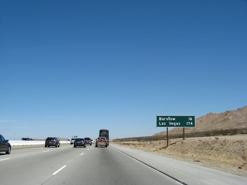
This mileage sign provides the distance to Barstow (16 miles) and Las Vegas (174 miles). Photo taken 03/30/07. |
|
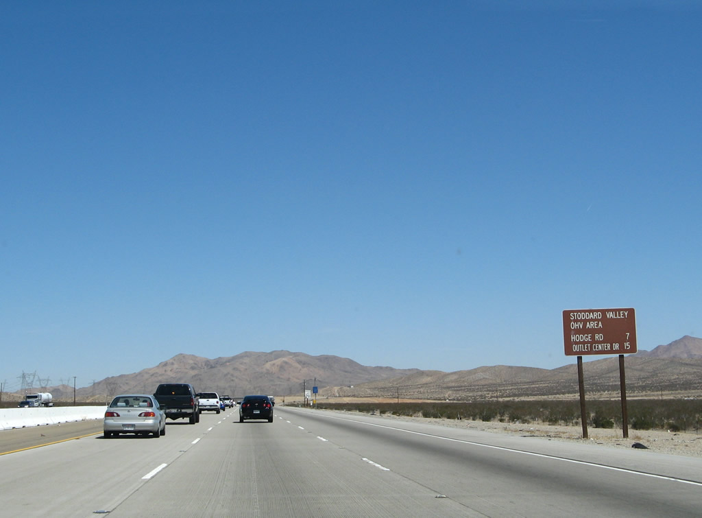
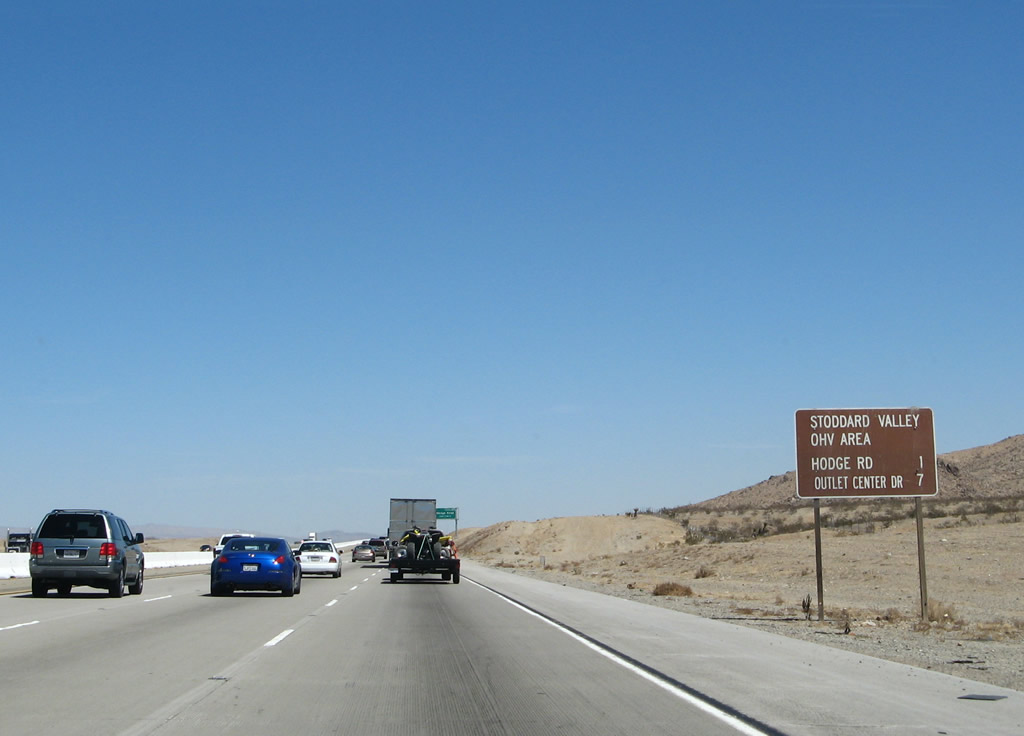
Another brown sign advises of the distances to the off-road vehicle areas accessible from Interstate 15. Photo taken 03/30/07. |
|
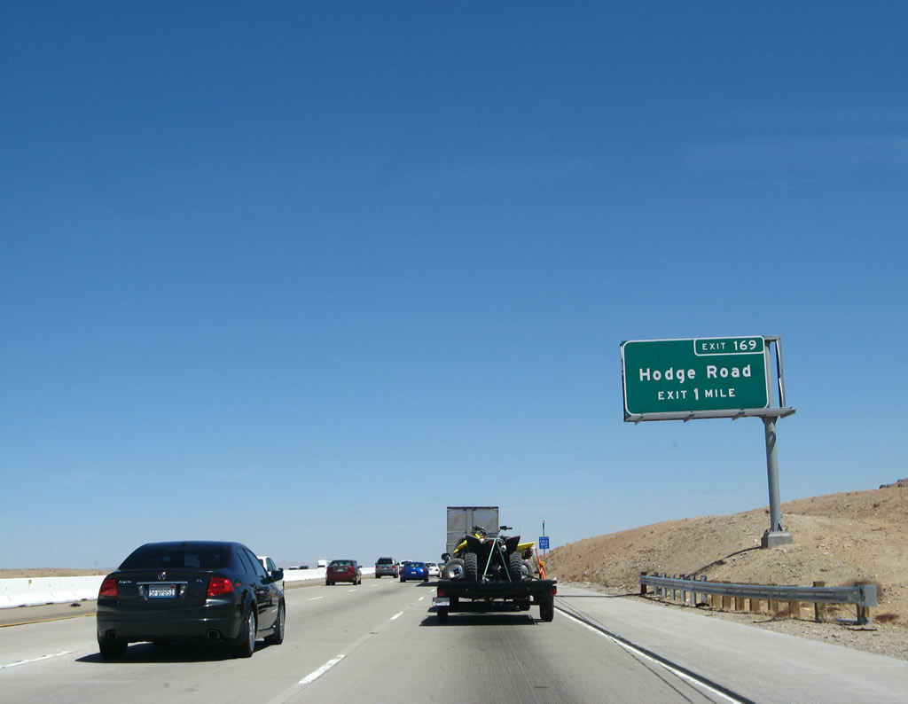
The next exit along Interstate 15/Mojave Freeway north is Exit 169, Hodge Road. Photo taken 03/30/07. |
|
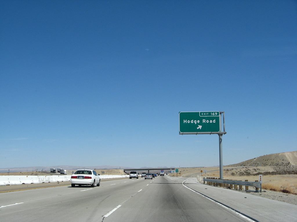
Northbound Interstate 15/Mojave Freeway reaches Exit 169, Hodge Road. Photo taken 03/30/07. |
|
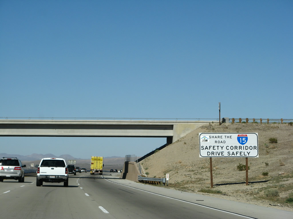
An Interstate 15 Safety Corridor sign is posted next to the Hodge Road overpass. Photo taken 03/28/08. |
|
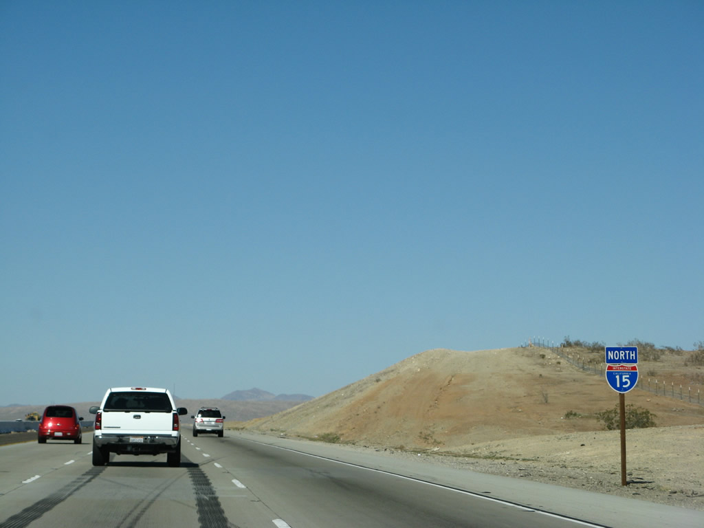
An extra-wide Interstate 15 reassurance shield is posted after the Hodge Road on-ramp. Photo taken 03/28/08. |
|
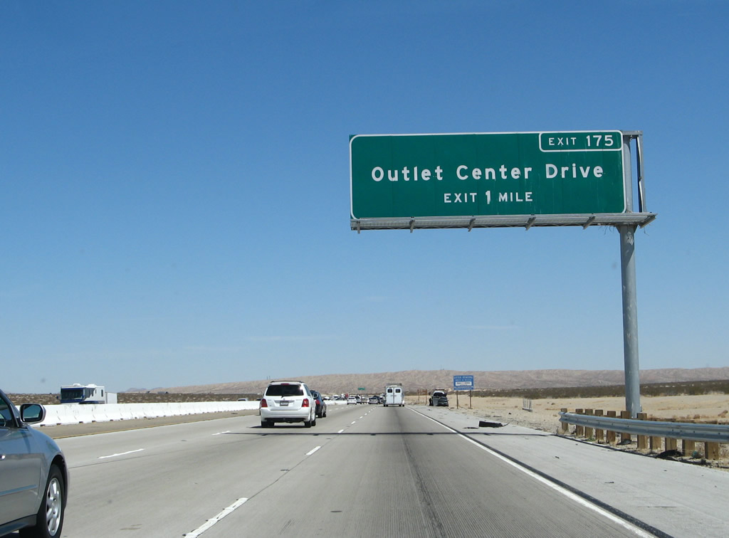
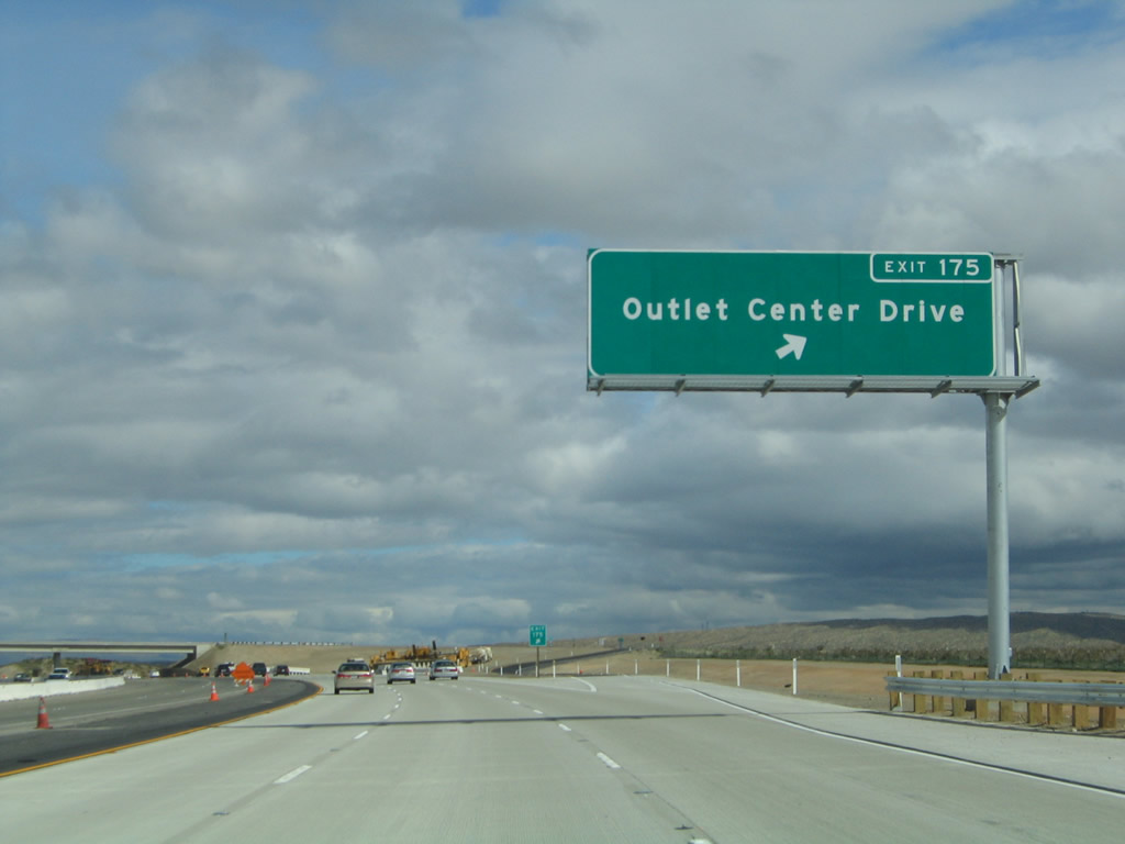
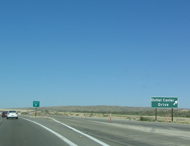
The next exit along Interstate 15/Mojave Freeway north is Exit 175, Outlet Center Drive. Photo taken 03/30/07. |
|
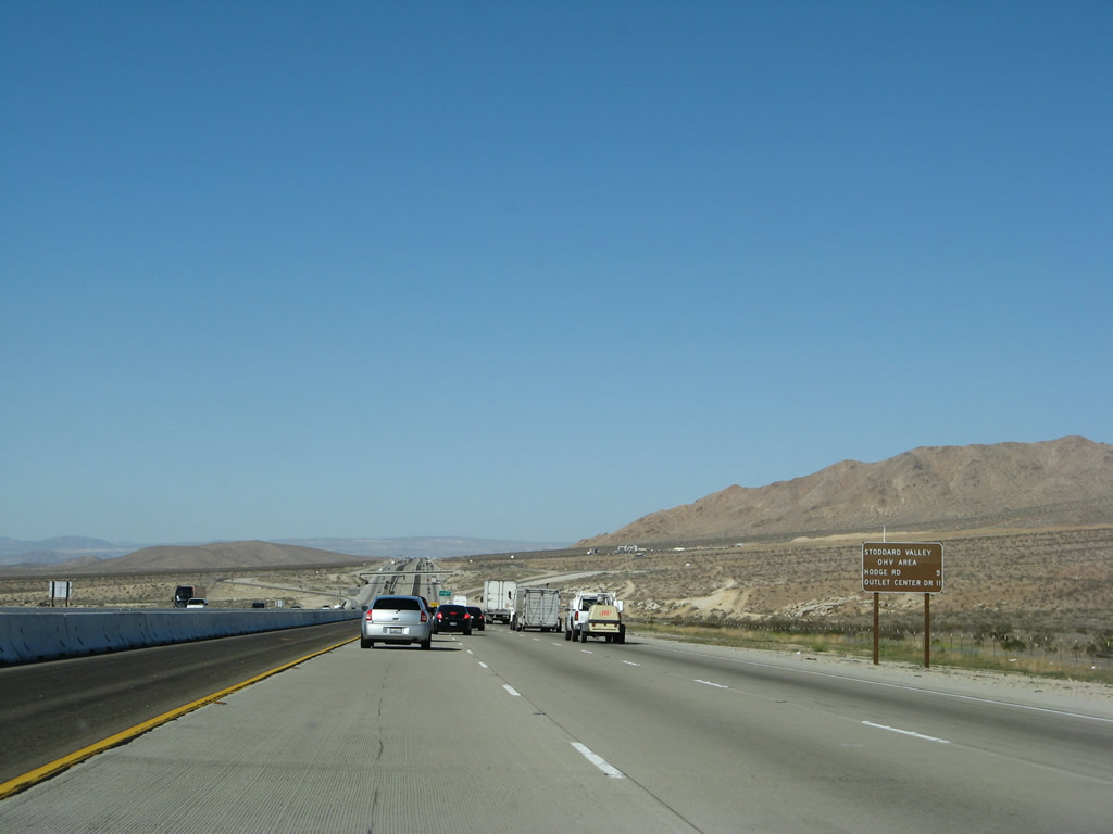
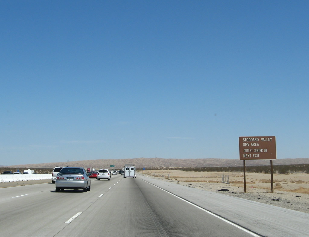
Use Exit 175, Outlet Center Drive, to the OHV area in Stoddard Valley. Photo taken 03/30/07. |
|
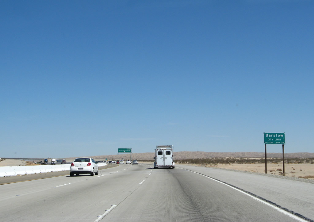
Interstate 15 enters the city of Barstow. With 33.59 square miles of desert, Barstow is huge, but large sections of the city are undeveloped. This includes the initial section of Barstow seen on Interstate 15 north. Barstow had a population of 22,639 as of the 2010 Census, and it was incorporated on September 30, 1947. Sitting at the intersection of Interstates 15 and 40, Barstow was previously at the confluence of U.S. 66, 91, and 466. today's Interstate 40 replaced U.S. 66 east of Barstow, and Interstate 15 replaced U.S. 91-466 northeast of Barstow. West of Barstow, California 58 replaced U.S. 466, and southwest of Barstow, California 58 replaced U.S. 466. Both the Union Pacific (UP) Railroad and the Burlington Northern Santa Fe (BNSF) Railroad enter Barstow, and BNSF has a large railyard in the city. Photo taken 03/30/07. |
|
|
Northbound Interstate 15 reaches Exit 175, Outlet Center Drive. This is the first exit to serve the city of Barstow. Outlet Center Drive provides an alternate route to the Outlet Center shops that are primarily located at Exit 178, Lenwood Road. The 2004 photo shows the original exit sign for Exit 175, Outlet Center Drive, as seen along northbound. Photos taken 02/20/05 and 03/20/04. |
|
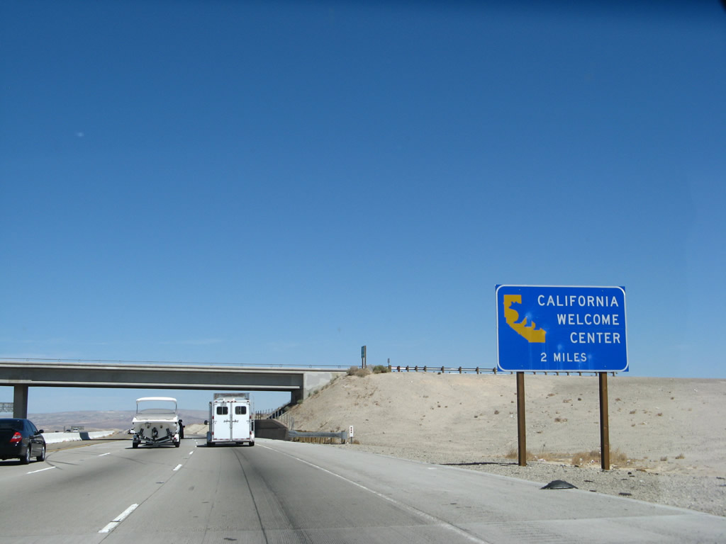
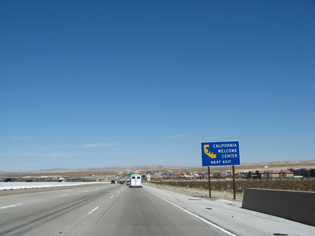
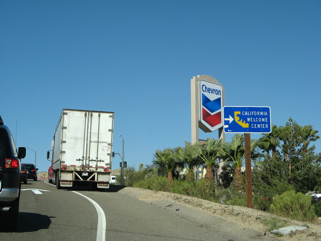
A State of California Welcome Center is located at Exit 178, Lenwood Road. The welcome center is located within the outlet shops; follow the signs to the east side of the freeway. Photo taken 03/30/07. |
|
The outlet shops and related development can be seen approximately two miles ahead in the distance beyond the Interstate 15 north reassurance shield. Photo taken 03/30/07. |
|
During times of heavy traffic, it is wise to check the traffic channel to ensure all routes are clear to popular destinations such as Las Vegas (via Interstate 15) and Laughlin (via Interstate 40). Photo taken 03/28/08. |
|
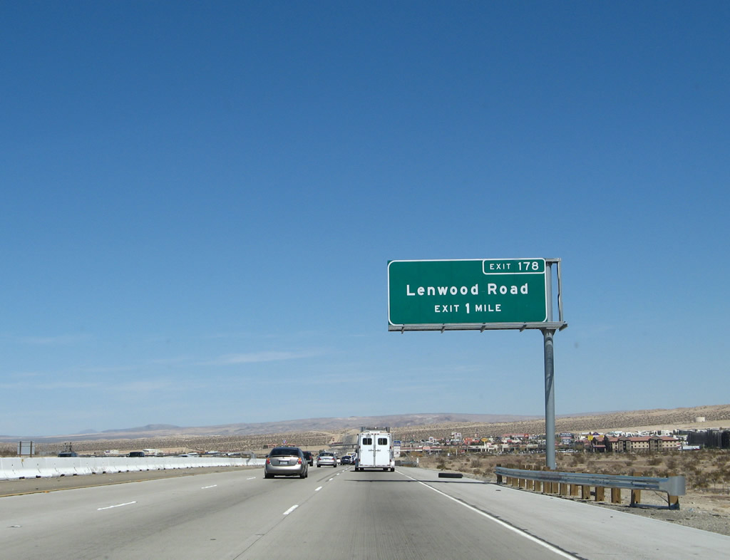
The next exit along Interstate 15/Mojave Freeway north is Exit 178, Lenwood Road. All services are available at this interchange (gas, food, lodging, and shopping). Photo taken 03/30/07. |
|
A second advance sign is posted for the State of California Welcome Center via Exit 178. Photo taken 03/30/07. |
|
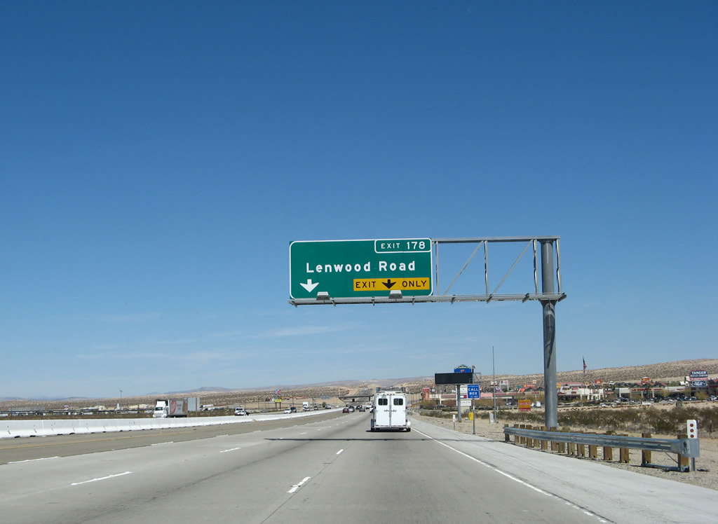
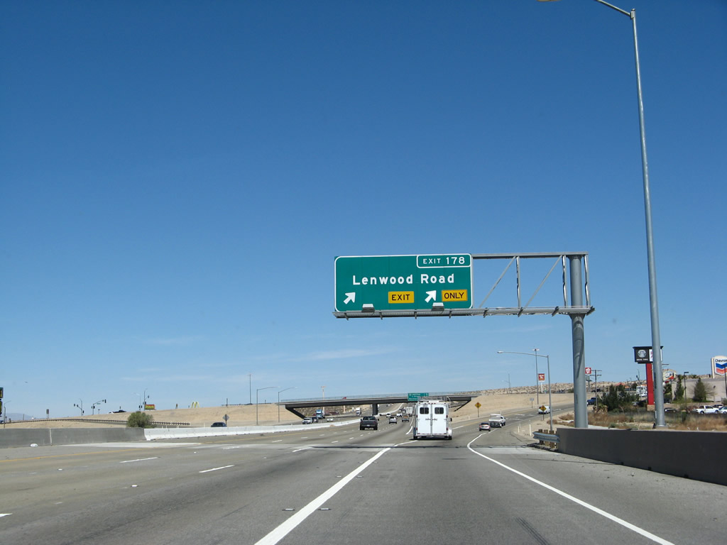
The right lane of northbound Interstate 15/Mojave Freeway becomes exit only for Exit 178, Lenwood Road. Since this is an easy stop for motorist services, it is a busy interchange. Photo taken 03/30/07. |
|
Northbound Interstate 15 reaches Exit 178, Lenwood Road. This is a complete service interchange; it features an outlet mall, nearly every kind of food and beverage imaginable, and several gas stations. Photo taken 03/30/07. |
|
This interchange sequence sign, posted along northbound Interstate 15, provides the distance to Exit 179, California 58 west to Mojave and Bakersfield; Exit 181, Business Loop I-15/L Street north to Old U.S. 66-91/West Main Street; and Exit 183, California 247/Barstow Road south to Lucerne Valley and Barstow Road north to downtown Barstow. Photo taken 02/20/05. |
|
Now on the off-ramp to Lenwood Road, turn right to the State of California Welcome Center. Photo taken 03/28/08. |
|
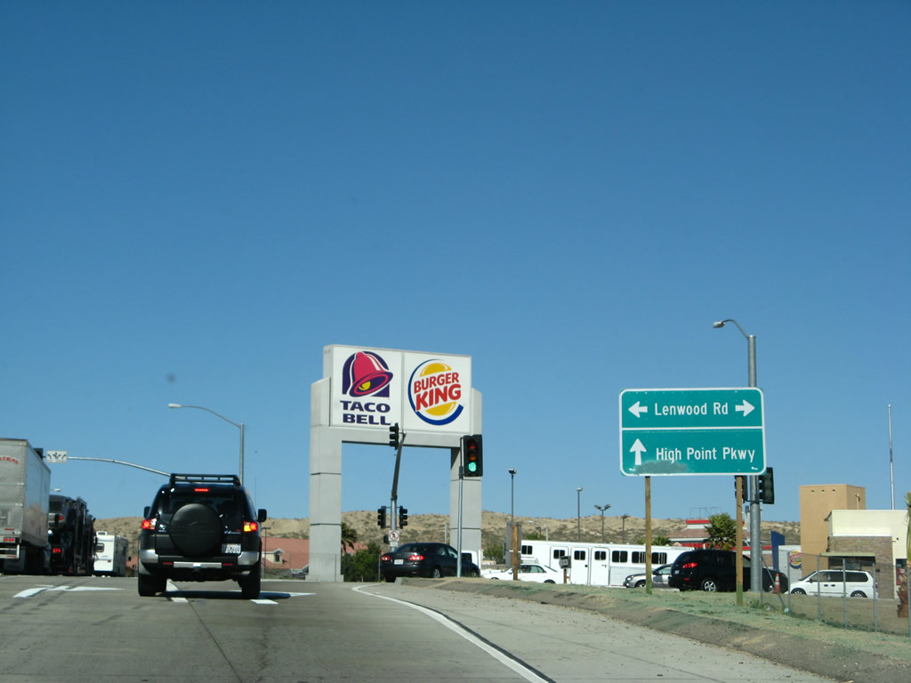
At the top of the off-ramp to Exit 178 is this sign advising of the connection to Lenwood Road and High Point Parkway. Most motorist services are to the right. Photo taken 03/28/08. |
|
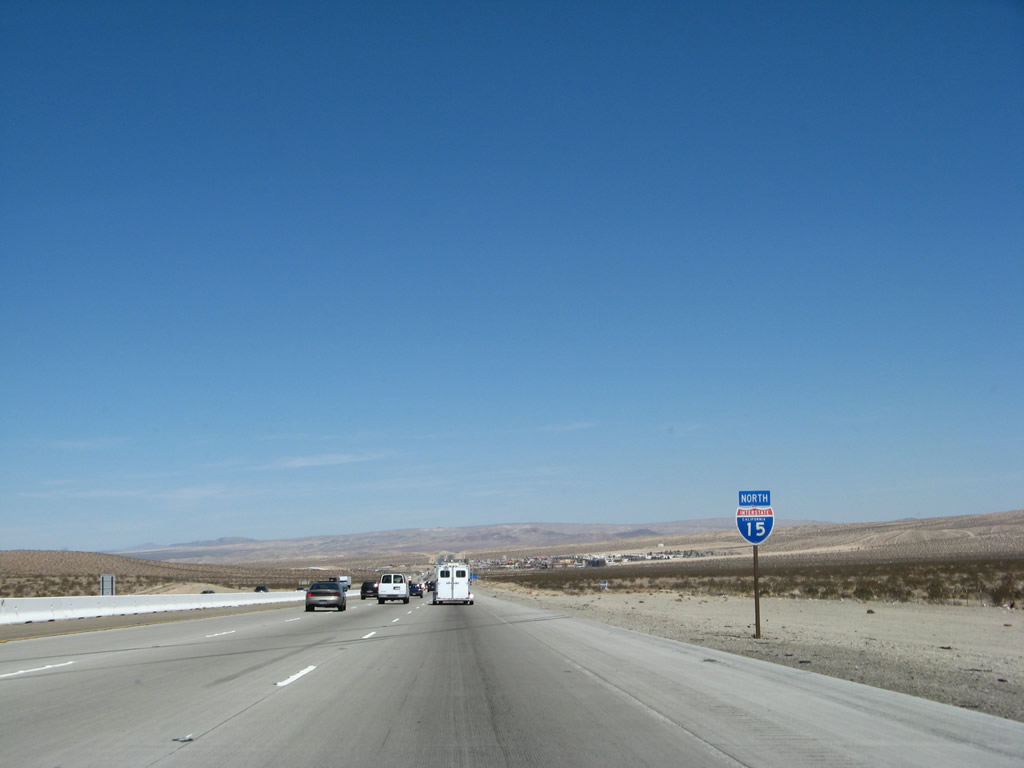
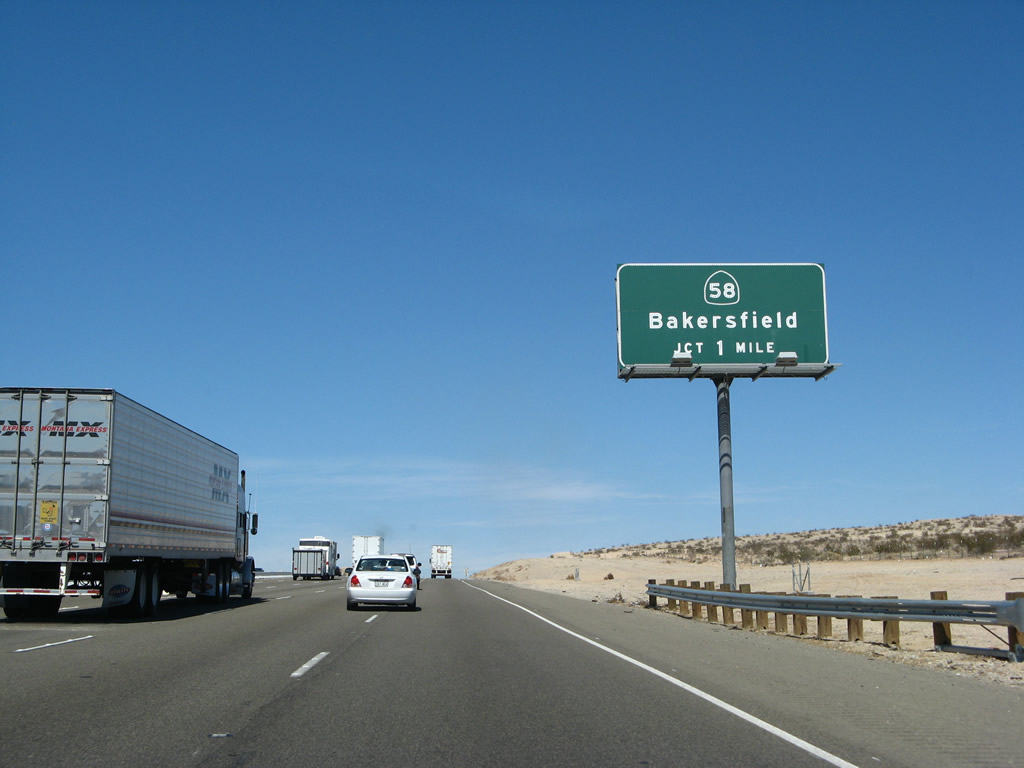
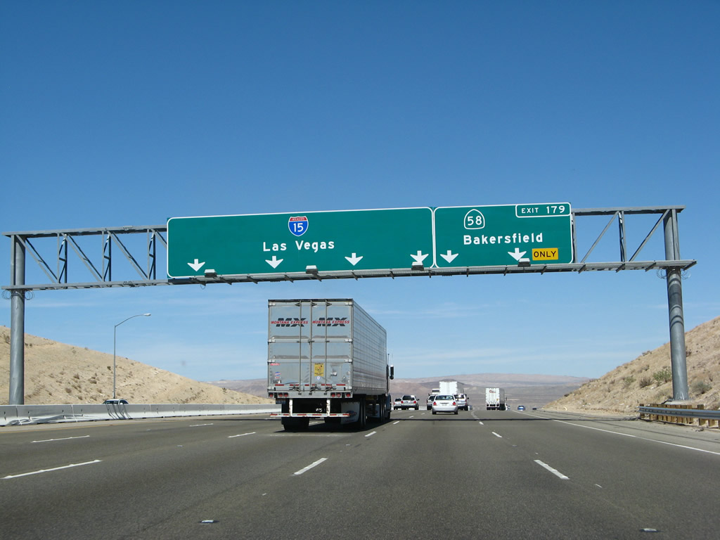
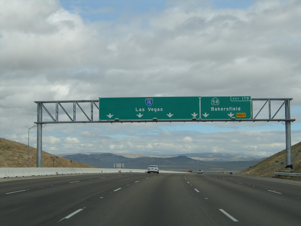
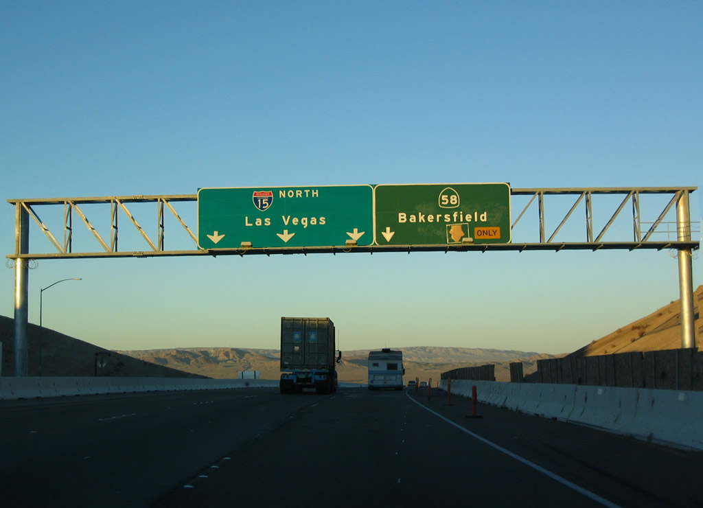
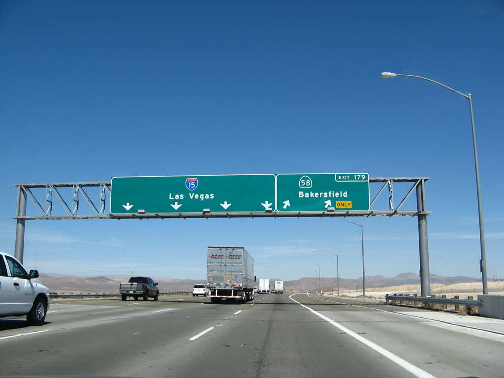
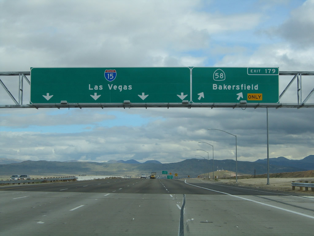
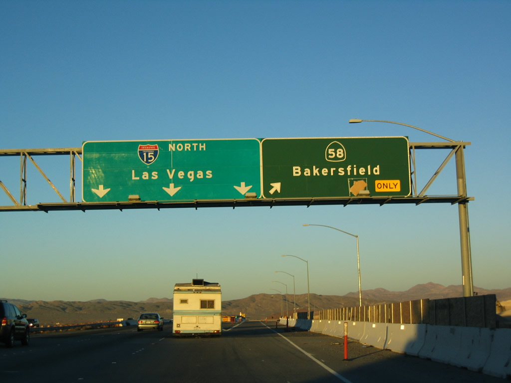
The next exit along northbound after the busy Lenwood Road interchange is Exit 179, California 58. California 58 used to pass to the north of Barstow along the old alignment of U.S. 466, but it was relocated south of Barstow to allow for a bypass that connects more fluidity with Interstate 40 to the east. California 58 is a freeway for a few miles west of here, then reverts to two-lane highway or expressway standards until reaching Kern County. Photo taken 03/30/07. |
|
|
|
California 58 is largely a freeway or expressway between Barstow and Bakersfield. Most of the remaining two-lane sections are in San Bernardino County, and they exist near Hinkley and again in the Four Corners/Kramer Junction area, which is where California 58 meets U.S. 395. Plans call for California 58 to be widened to freeway standards through both areas. In Kern County, nearly the entire route is freeway or expressway, and steps have been taken to make the entire route freeway. Photos taken 03/30/07, 02/20/05, and 01/18/04. |
|
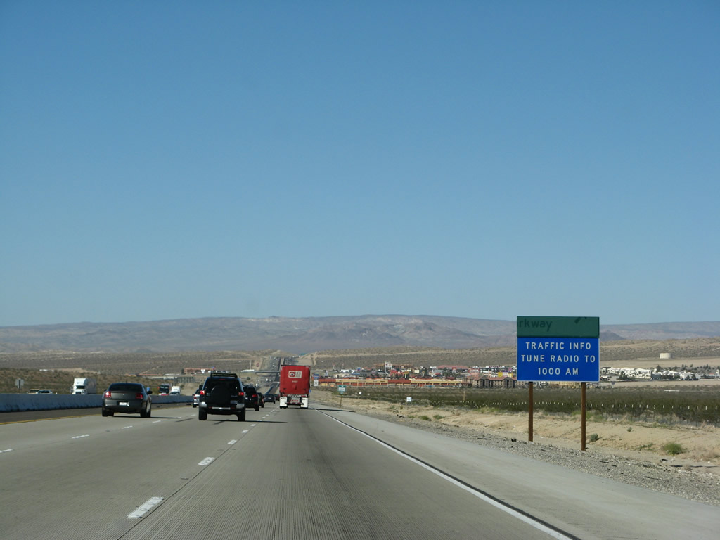
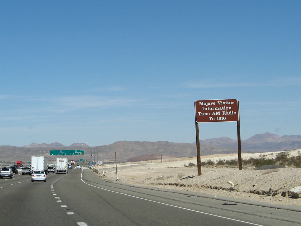
Both Interstate 15 and Interstate 40 provide access to the massive Mojave National Preserve, which constitutes desert valleys, mountains, sand dunes, and abundant wildlife. A radio station broadcasts travel information for those visiting the park. This high-altitude desert region is mostly undeveloped, but it is generally hot and arid during spring, summer, and fall months (April through October). Approximately 3.5 inches of precipitation fall per year in the lower elevations of the national park. Photo taken 03/30/07. |
|
|
|
Northbound Interstate 15/Mojave Freeway reaches Exit 179, California 58 west to Four Corners/Kramer Junction, Mojave, Tehachapi, and Bakersfield. If this highway is completely upgraded to freeway standards, it is likely that this route would be considered for inclusion in the Interstate Highway System, perhaps as an extension of Interstate 40 west to Bakersfield and possibly onward to Interstate 5. Finally, note that the Interstate 15 shield on the new pull-through sign features the state name, which is very rare on overhead signs in the Golden State. Photos taken 03/30/07, 02/20/05, and 01/18/04. |
|
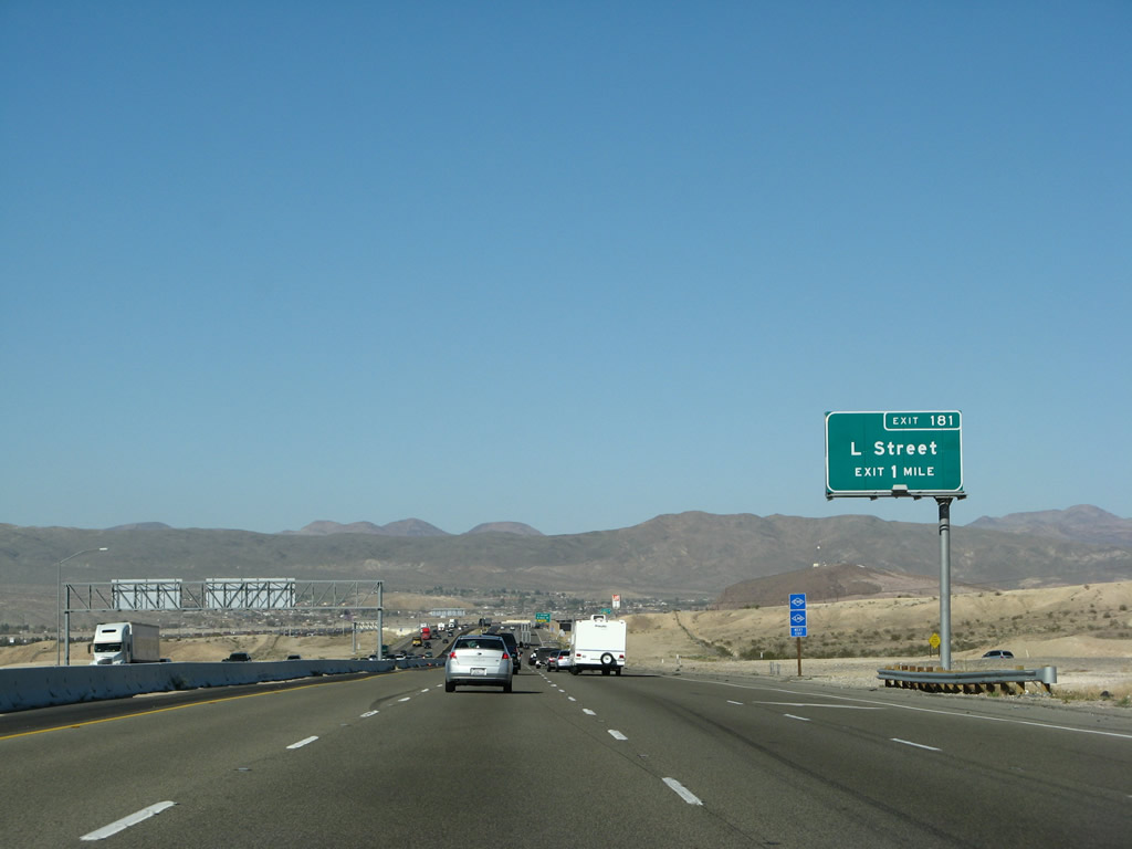
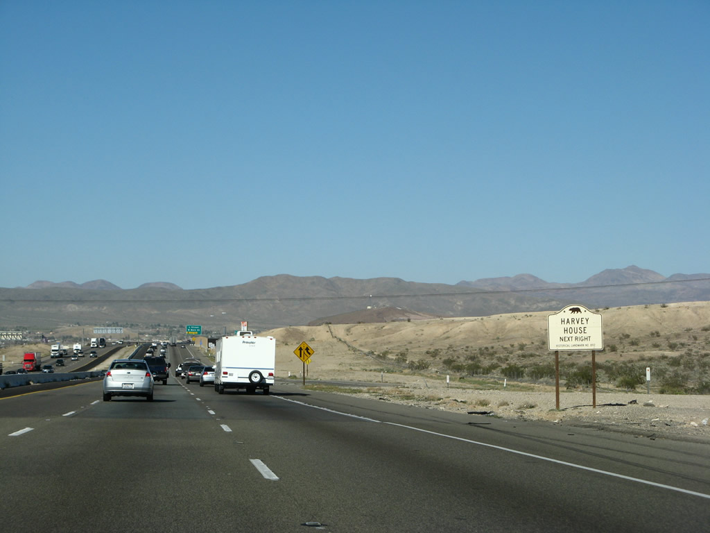
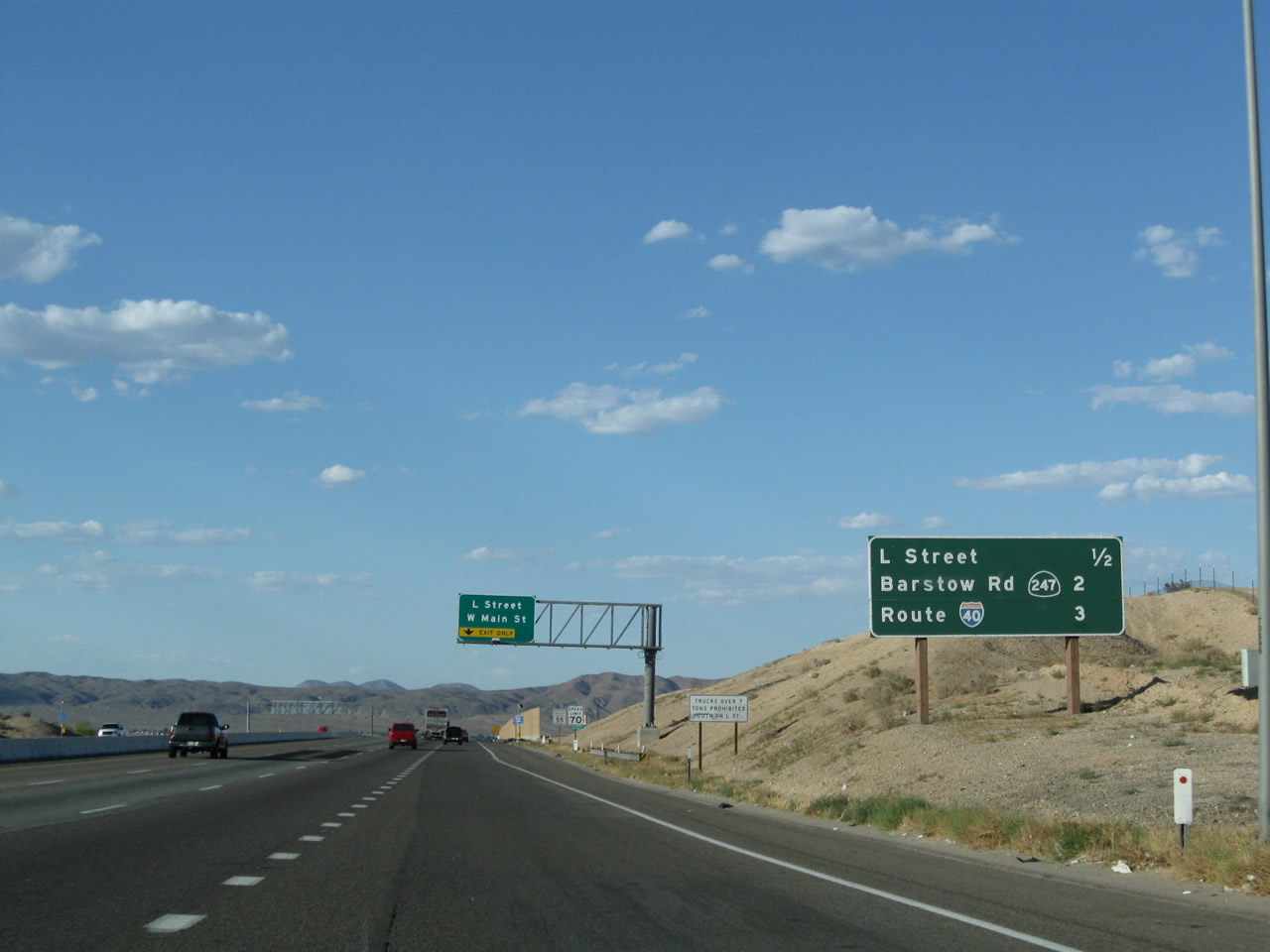
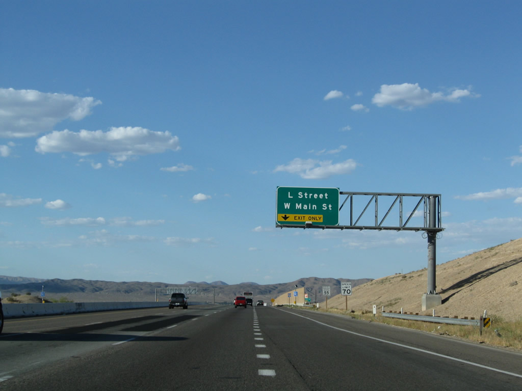
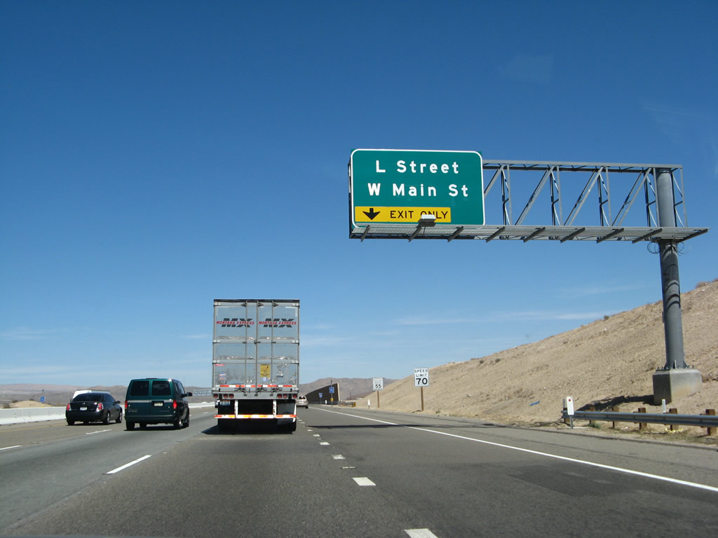
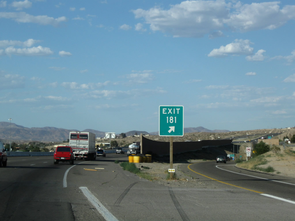
The next exit along Interstate 15/Mojave Freeway north is Exit 181, Business Loop I-15/L Street to U.S. 66-91/Main Street in Barstow. Photo taken 03/28/08. |
|
Use Exit 181 to the Harvey House. Follow Business Loop I-15/L Street north, then turn east on Business Loop I-15 and U.S. 66-91/Main Street to the intersection with North First Avenue. Turn left (north) on North First Avenue, cross the railroad bridge, and look for the Harvey House. Opened on February 22, 1911, as part of the first national restaurant chain, the Harvey House is also known as Casa del Desierto ("House of the Desert"). While the restaurant closed in 1959, the building still stands and is in use. A Route 66 Museum (well worth the visit) is located in the Harvey House. Photo taken 03/28/08. |
|
This mileage sign along Interstate 15/Mojave Freeway north provides the distance to the next three exits: Exit 181, Business Loop I-15/West Main Street/L Street; Exit 183, California 247/Barstow Road; and Exit 184A, Interstate 40 east. Photo taken 06/27/09. |
|
|
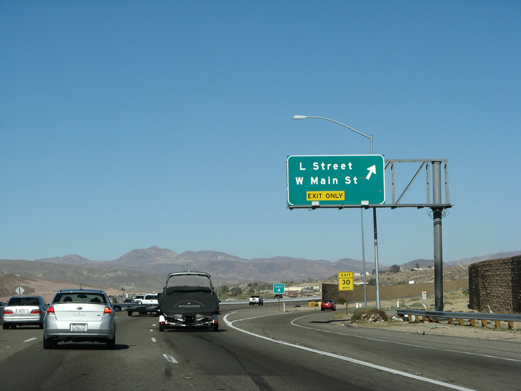
The right lane of Interstate 15 north between California 15 and L Steet becomes exit only for Exit 181, Business Loop I-15/L Street north to U.S. 66-91/West Main Street. L Street travels due north to meet east-west Main Street, which is also designated as San Bernardino County 66 (designated on November 11, 2011). Photos taken 06/27/09 and 03/28/08. |
|
An Interstate 15 north reassurance shield is posted shortly thereafter. Photo taken 06/27/09. |
|
Northbound Interstate 15 reaches Exit 181, Business Loop I-15 North, West Main Street/L Street. This route connects with Old U.S. 66-91 and passes through Barstow's downtown. Business Loop I-15 begins here at Exit 181, and it serves the city of Barstow, which is known as the "Crossroads of Opportunity." It rejoins Interstate 15 reaches Exit 184B. Photo taken 03/28/08. |
|
The gore point for Exit 181 is fully signed with exit number. Photo taken 06/27/09. |
|
|
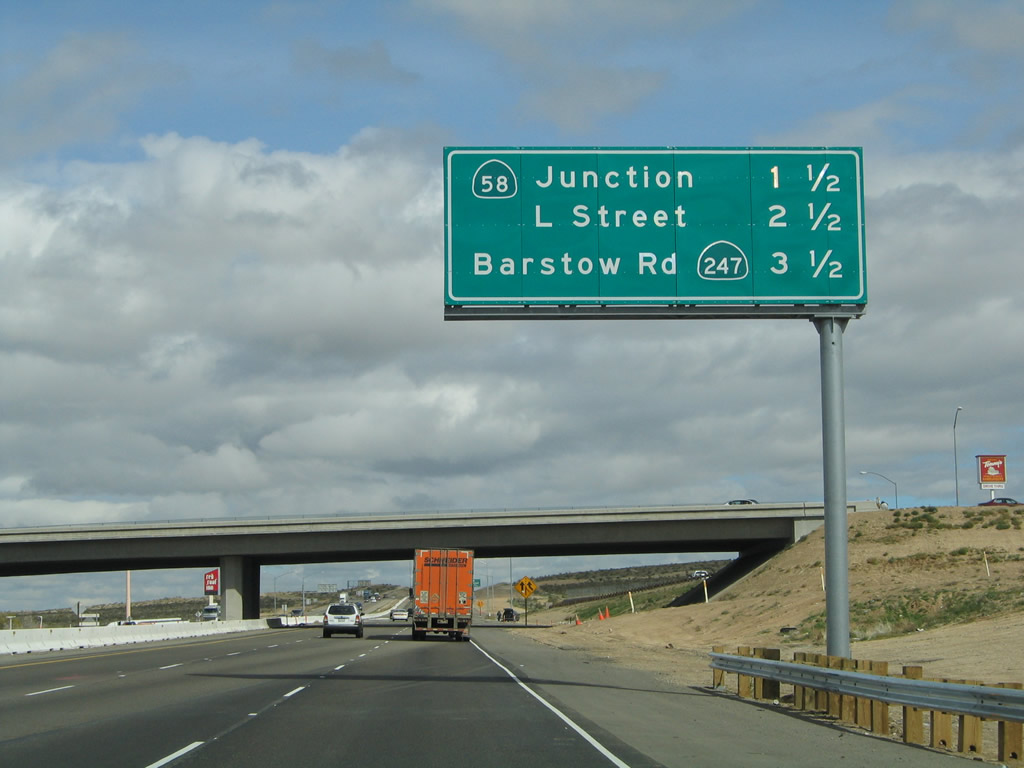
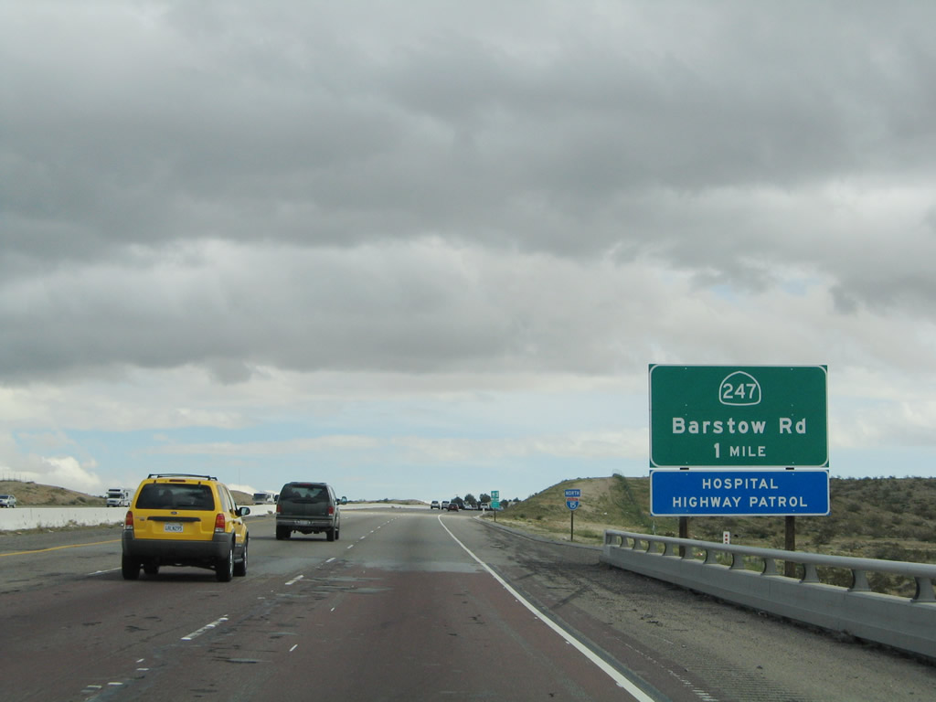
The next exit along Interstate 15/Mojave Freeway north is Exit 183, California 247/Barstow Road south to Lucerne Valley and Yucca Valley and Barstow Road north to downtown Barstow. An exit number was added to this sign in 2009. Photos taken 06/27/09 and 02/20/05. |
|
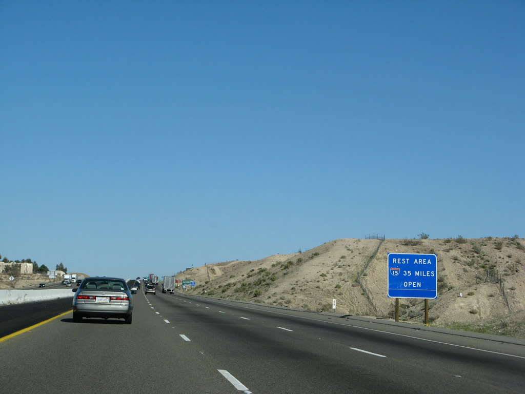
The next rest area along northbound is 35 miles north of Barstow as indicated by this sign, and it is located southwest of the Afton Road interchange. Photo taken 03/28/08. |
|
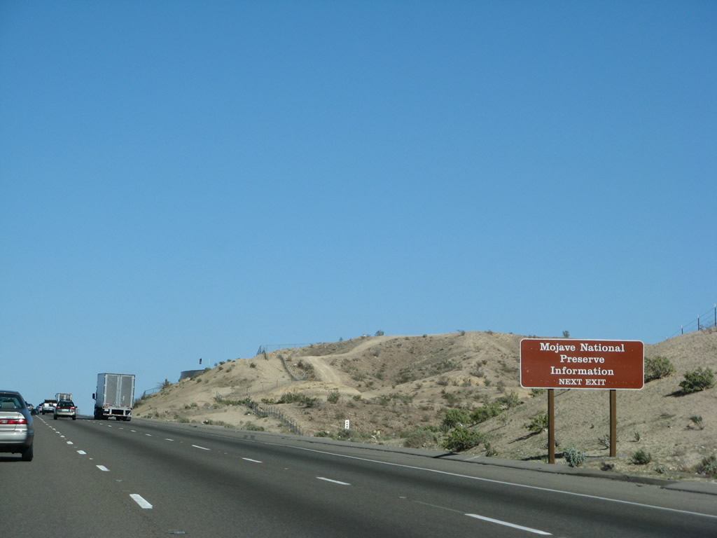
Information about the Mojave National Preserve is available at Exit 183. Photo taken 03/28/08. |
|
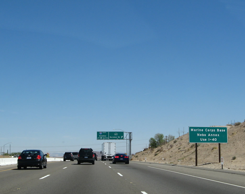
For the Marine Corps Base Nebo Annex, use Interstate 40 east (Exit 184A). Photo taken 03/30/07. |
|
|
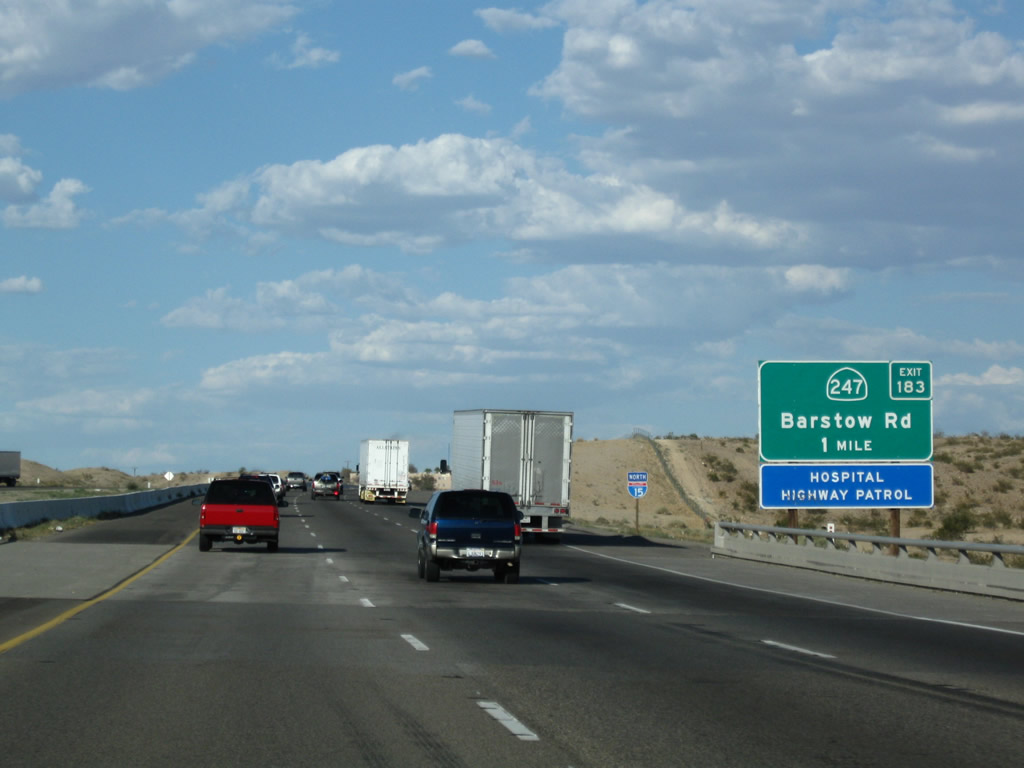
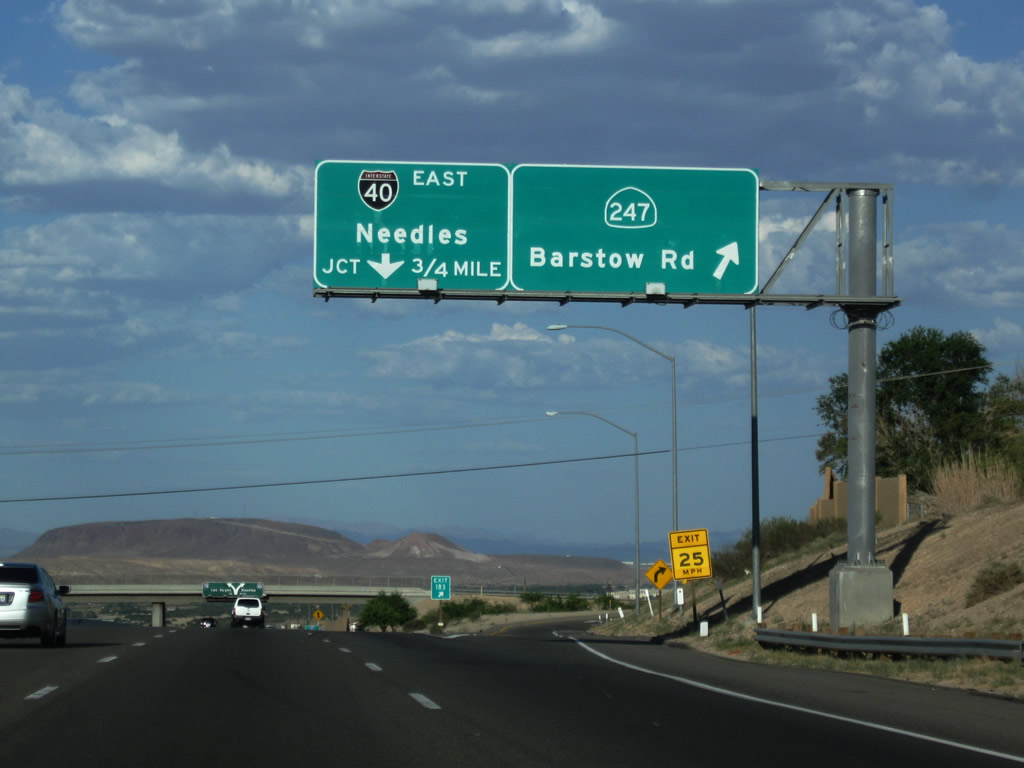
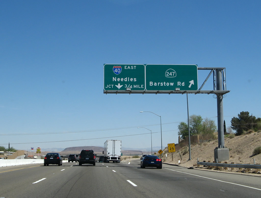
Northbound Interstate 15 reaches Exit 183, California 247/Barstow Road south and Barstow Road north to downtown Barstow. California 247 is a fairly long state highway that travels southeast from here to a near-intersection with California 18 in Lucerne Valley. (The intersection between California 247 and California 18 is actually a "bump" between the two state routes, facilitated by a connecting road.) California 247 then continues south via Landers to end at California 62 in Yucca Valley. The next exit along Interstate 15/Mojave Freeway is Exit 184A, Interstate 40. This sign seems to have weathered poorly, with the red-white-blue colors of the Interstate 40 route marker appearing black-white by 2009. Photos taken 06/27/09 and 03/30/07. |
|
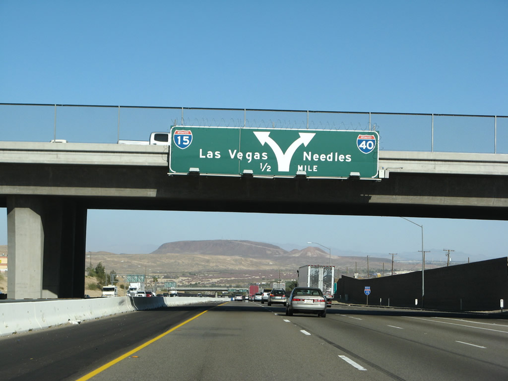
This graphical sign demonstrates the upcoming split between Interstate 15 north and Interstate 40 east. Interstate 15 continues north to Baker and Las Vegas, while Interstate 40 turns east to Needles, Kingman, and Flagstaff. Photo taken 03/28/08. |
|
Soon thereafter, northbound Interstate 15 approaches Exit 184A, Interstate 40 east. This sign was replaced between 2001 and 2003; the major change was the new "triangular" shield shape and the removal of button copy between the original sign and current sign. Photo taken 03/28/08. |
|
|
|
|
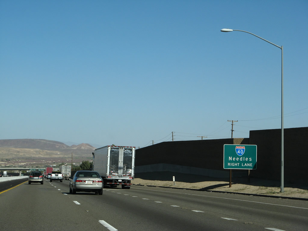
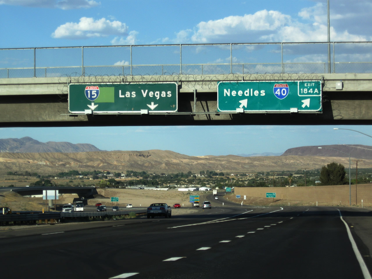
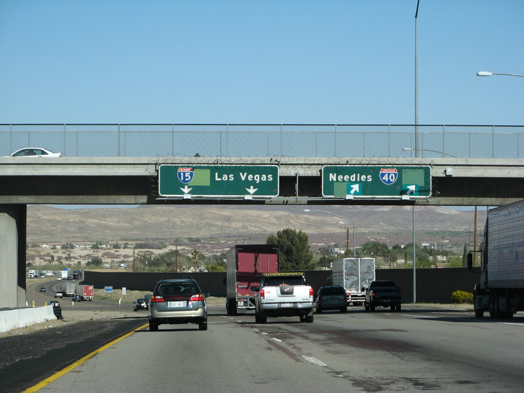
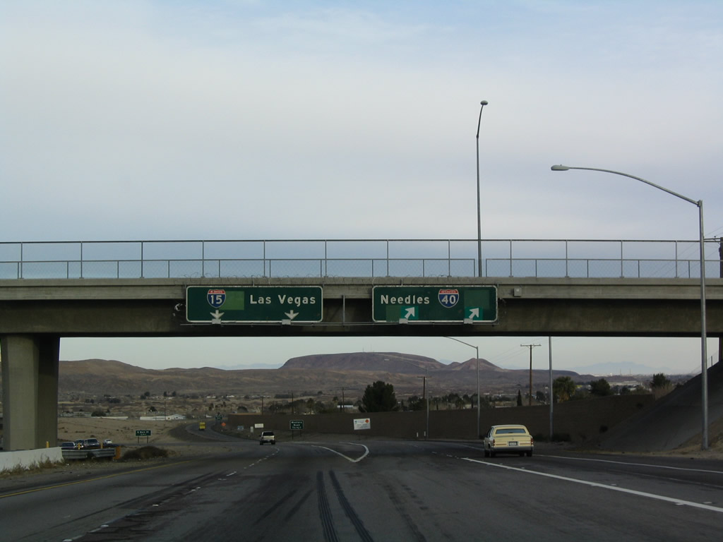
| Northbound Interstate 15 reaches Exit 184A, Interstate 40 east to Needles and Flagstaff. The left lane continues north along Interstate 15, while the right lane exits onto Interstate 40. Motorists have the option of taking either route from the middle lane. These old signs have been present since this road was constructed, and they feature the original U.S. highway designations (U.S. 91 northbound and U.S. 66 eastbound). Of course, overlays now cover these route designations. This interchange marks the western terminus of Interstate 40, which heads east toward Needles, Kingman, Flagstaff, and Wilmington, N.C. Note the sign replacement in 2009 that added an exit number for the Interstate 40 transition ramp. Photos taken 06/27/09, 03/28/08, and 02/15/04. |
Page Updated January 13, 2013.