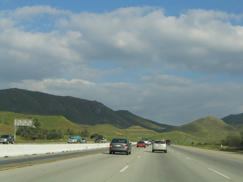
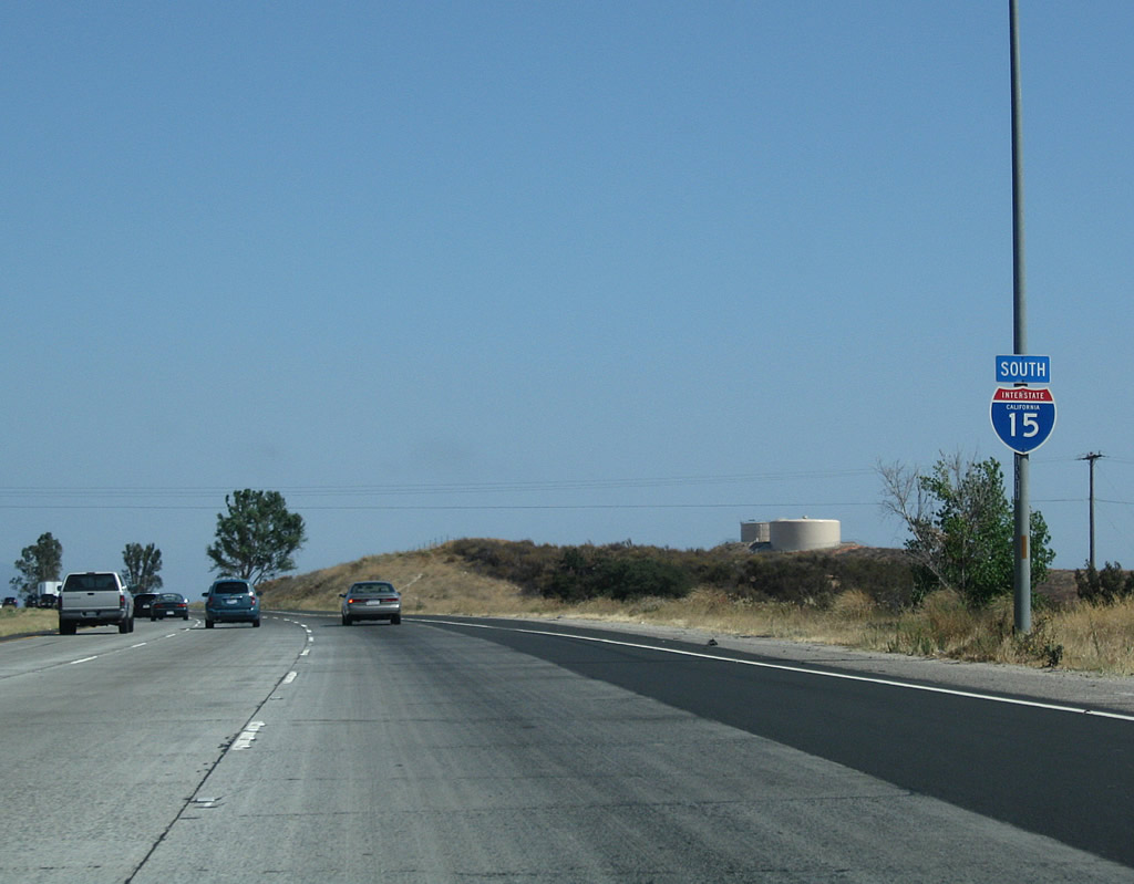
| Interstate 15 (Corona Freeway) south |
|
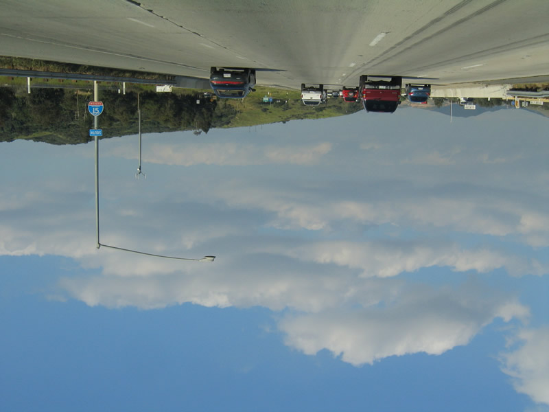
LOL, we turned the entire scene upside down so you could see the Interstate shield rightside up. This shield display was corrected soon after this picture was taken. Photo taken 03/25/05. |
|
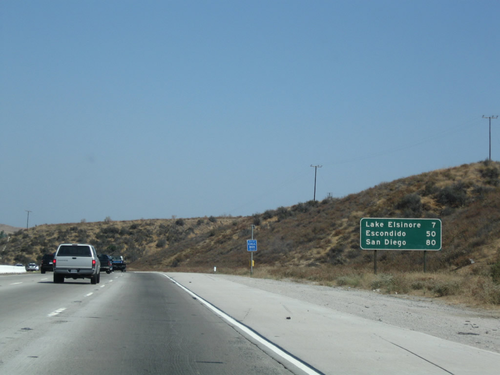
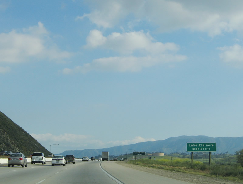
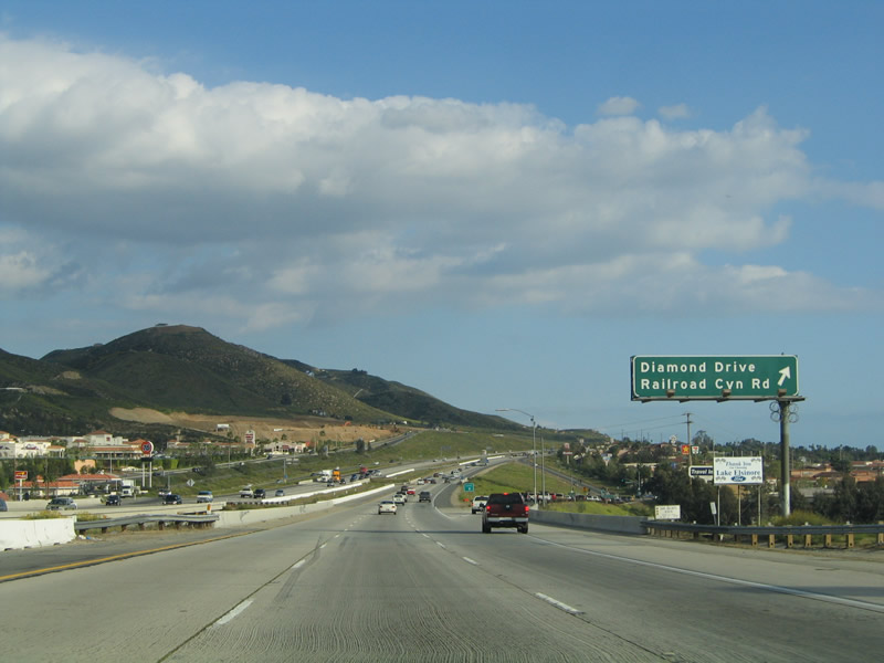
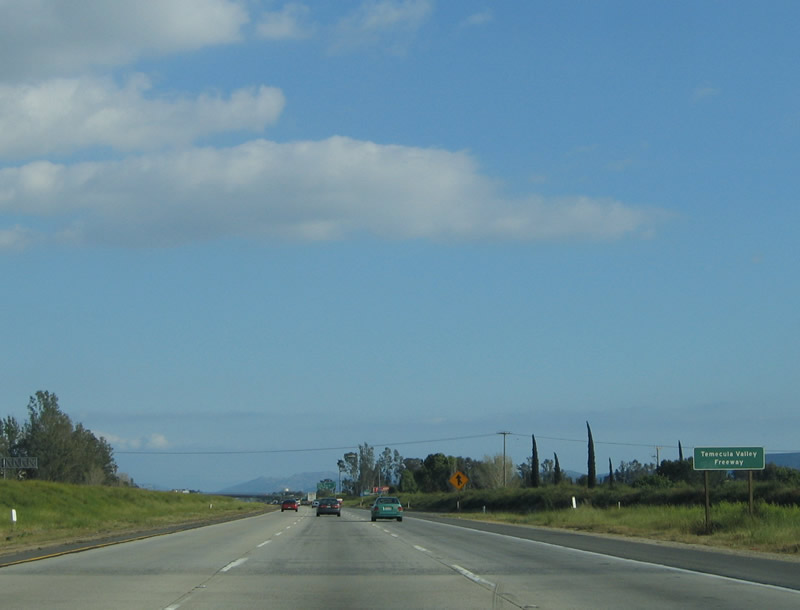
This mileage sign provides the distance to Lake Elsinore, Escondido, and San Diego. Omitted from this list are Murrieta and Temecula near the merge with Interstate 215, just north of the Riverside-San Diego County Line. Photo taken 07/26/09. |
|
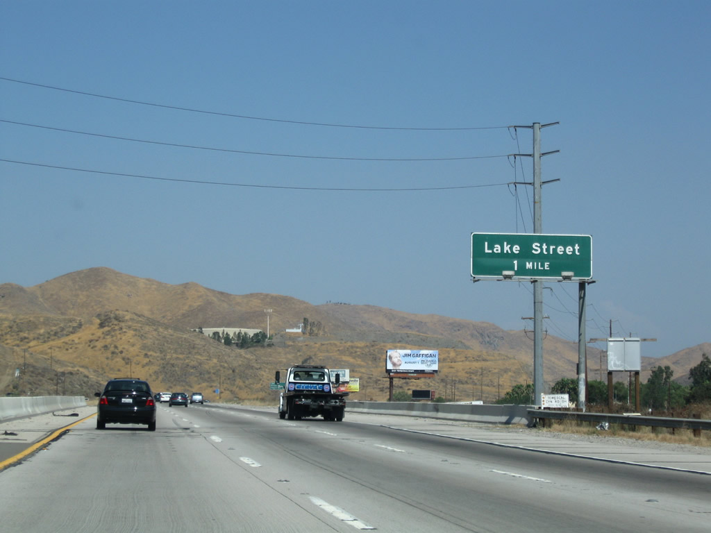
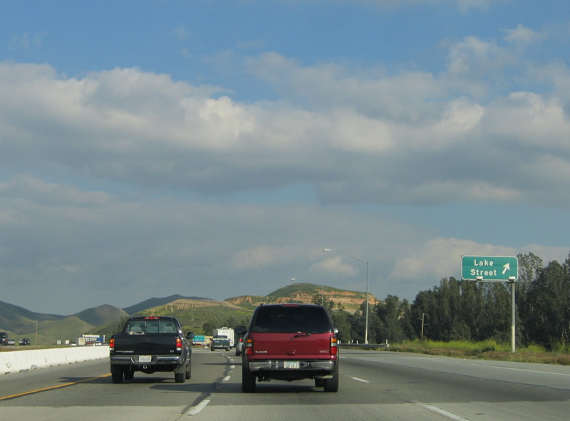
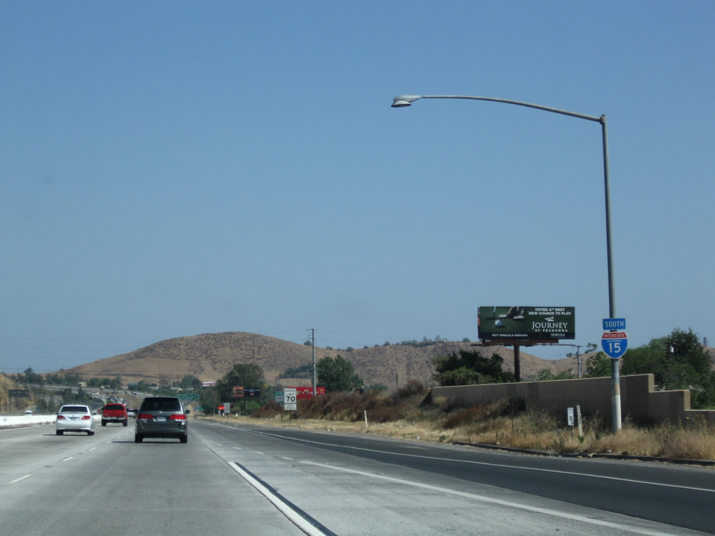
The next exit along Interstate 15 south is Exit 81, Lake Street south to Lake Elsinore. This route connects with Former California 71, Temescal Canyon Road. Photo taken 07/26/09. |
|
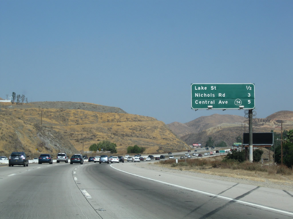
This mileage sign provides the distance to Exit 81, Lake Street; Exit 78, Nichols Road; and Exit 77, California 74 and Business Loop I-15 to Lake Elsinore. Photo taken 07/26/09. |
|
Southbound Interstate 15 (Corona Freeway) reaches Exit 81, Lake Street. Use Lake Street south to Alberhill, a community in the city of Lake Elsinore. Photo taken 03/25/05. |
|
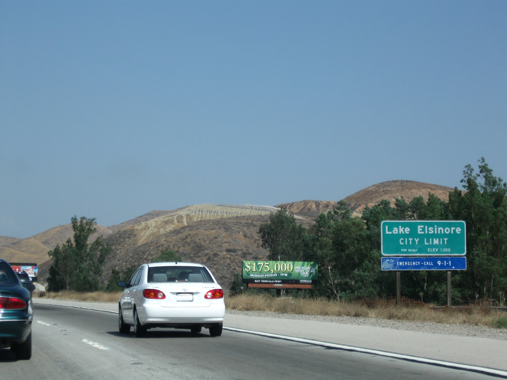
At the Lake Street interchange, Interstate 15 enters the city of Lake Elsinore. The city is home to the Single "A" San Diego Padres baseball farm team, the Lake Elsinore Storm. The Storm play at Diamond Stadium. Lake Elsinore has a population of 28,928 people as of the 2000 Census, and it is also rapidly growing as more housing developments are constructed. The city was incorporated on April 9, 1888, consists of 38.8 square miles, and sits at an elevation of 1,306 feet. Photo taken 07/26/09. |
|
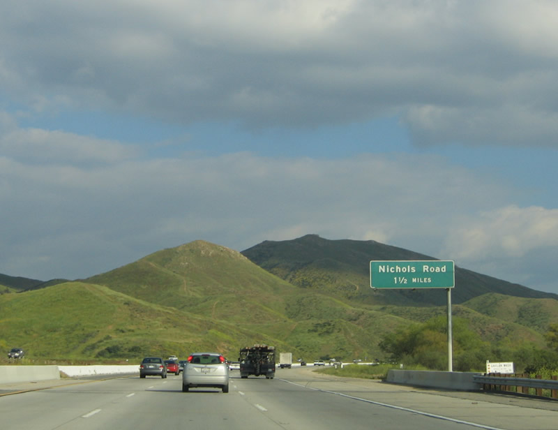
The next exit along Interstate 15 south is Exit 78, Nichols Road. Photo taken 03/25/05. |
|
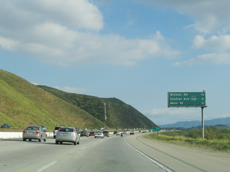
This mileage sign provides the distance to Exit 78, Nichols Road; Exit 77, California 74 and Business Loop 15 to Lake Elsinore; and Exit 75, Business Loop I-15 (Main Street) to downtown Lake Elsinore. Photo taken 03/25/05. |
|
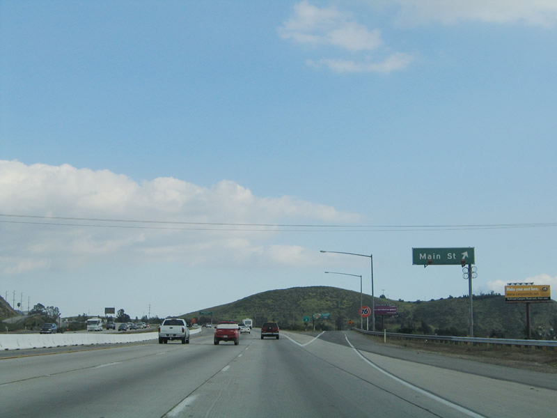
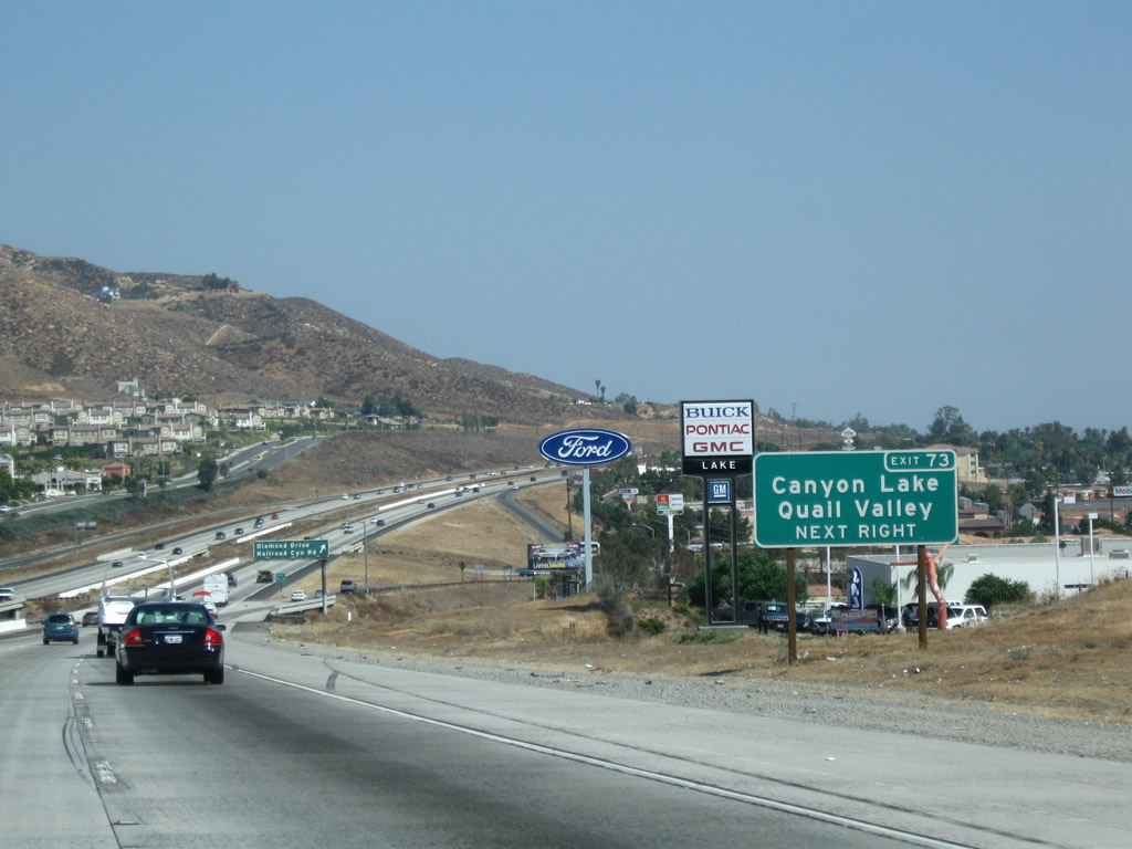
Each of the three exits listed on the prior mileage sign, along with Exit 73, serves the city of Lake Elsinore. Photo taken 03/25/05. |
|
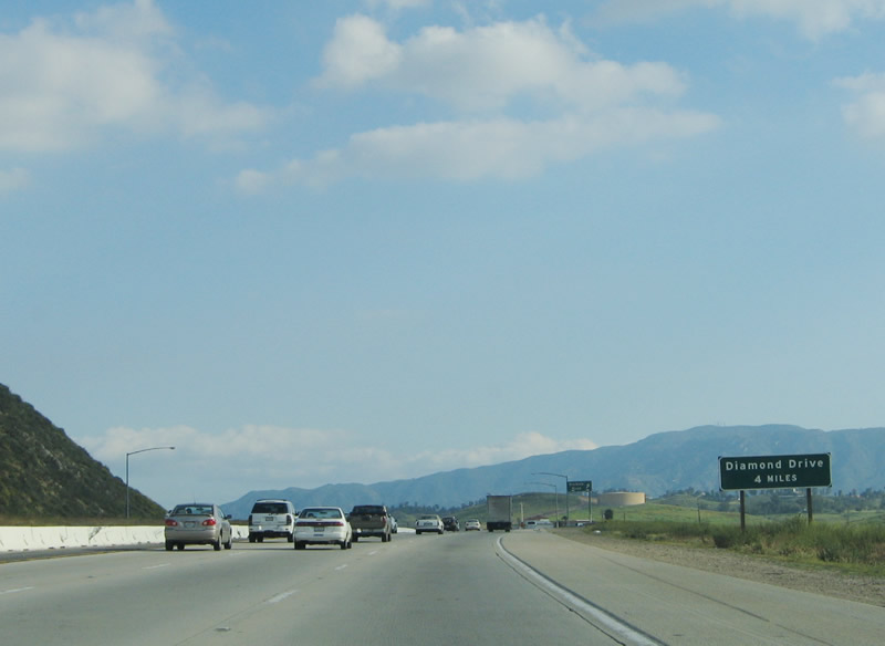
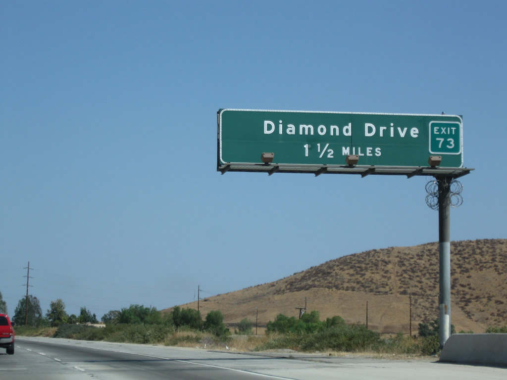
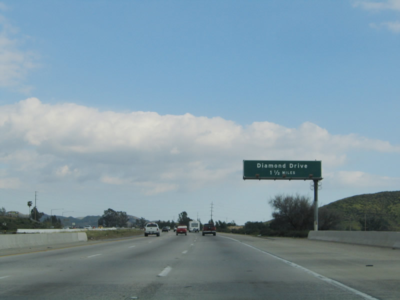
Diamond Drive (Exit 73) is the last interchange of the four to serve the city of Lake Elsinore. Photo taken 03/25/05. |
|
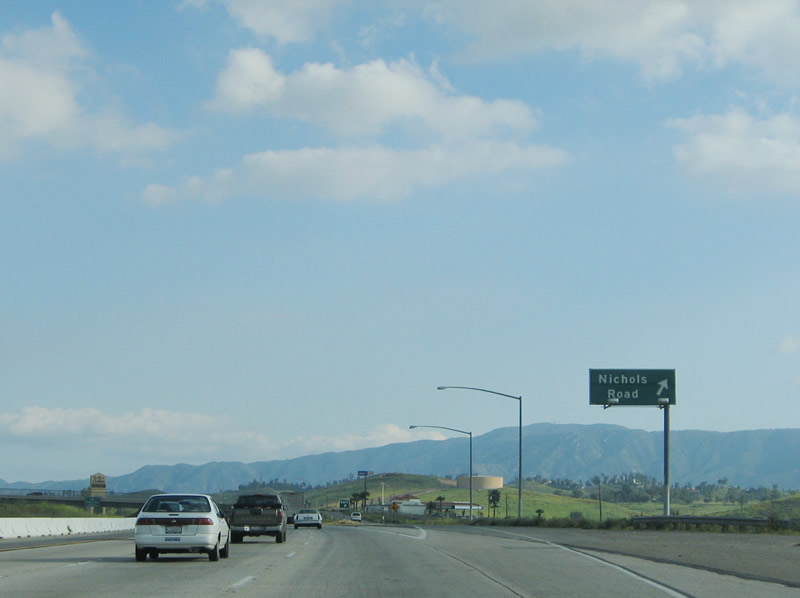
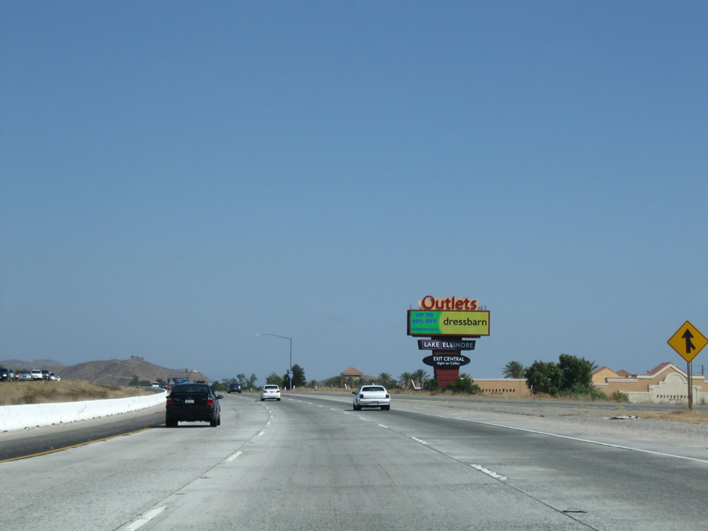
Southbound Interstate 15 reaches Exit 78, Nichols Road in Lake Elsinore. This exit leads to the well-known outlet shops at Lake Elsinore. It is not uncommon for people from throughout the Inland Empire and San Diego County to shop at these outlets in search of deals. Photo taken 03/25/05. |
|
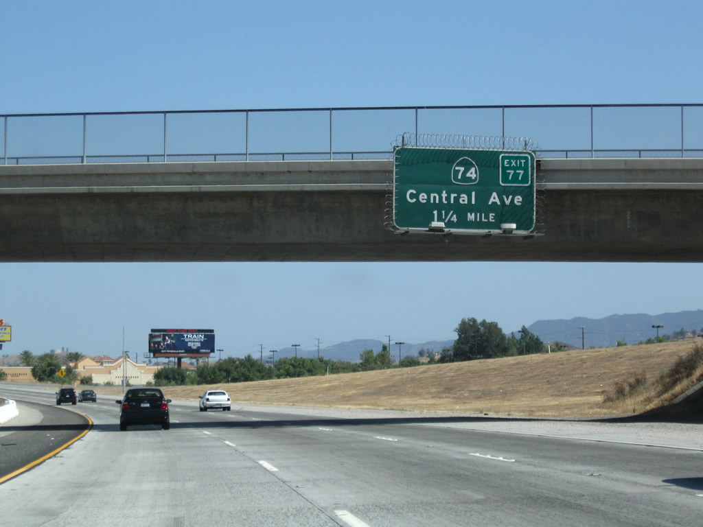
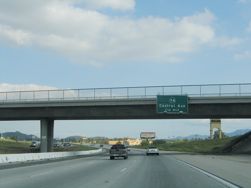
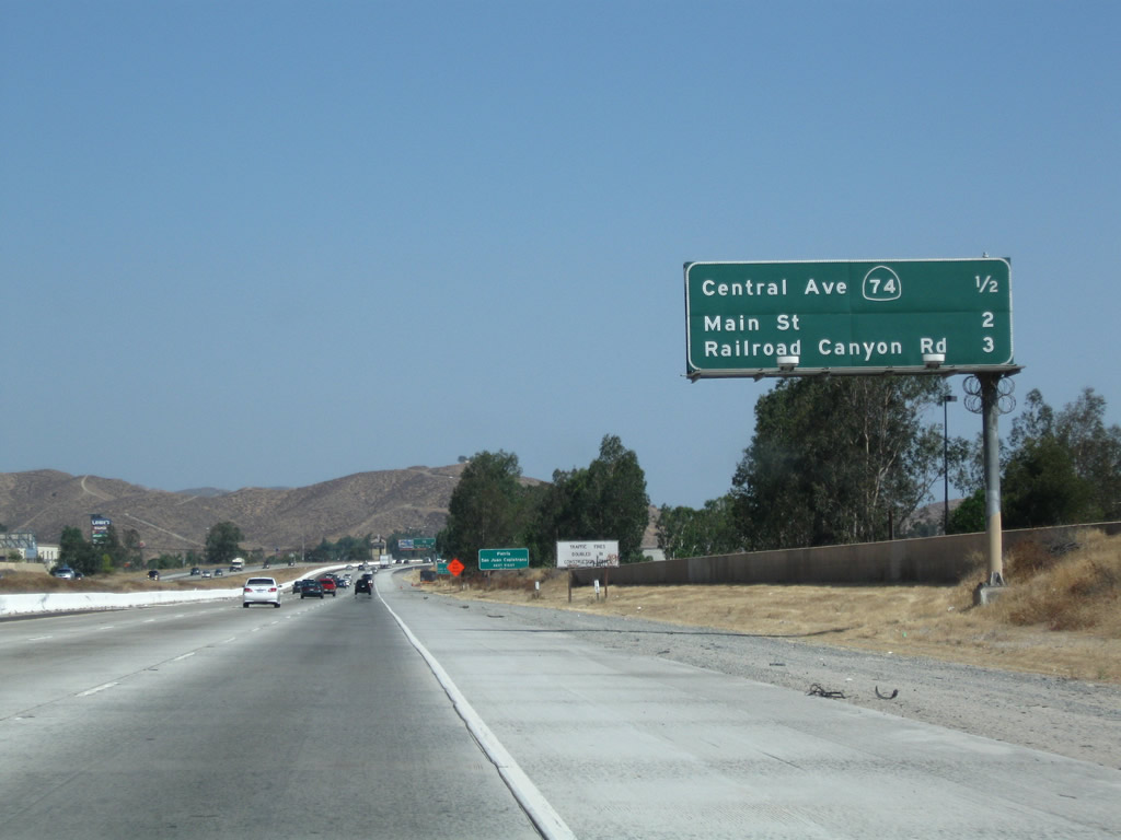
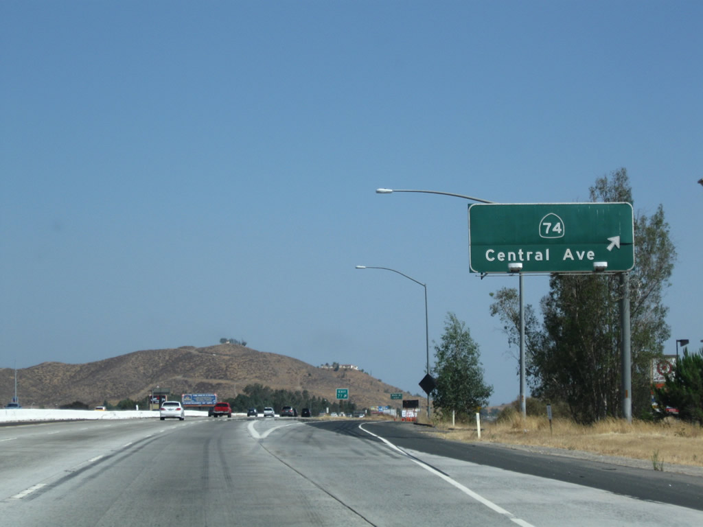
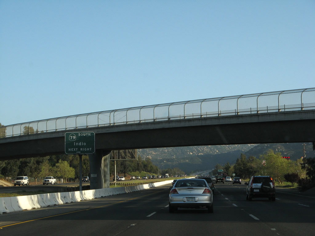
The next exit along Interstate 15 south is Exit 77, California 74/Central Avenue and Business Loop I-15 south. California 74 heads east toward Perris and Hemet, then onward to Idyllwild and Palm Desert via the San Jacinto Mountains. The next two exits along southbound are both in Lake Elsinore (Lake Street and Diamond Drive). The Interstate 15 business route departs Interstate 15 at Exit 77 and will return at Exit 75. In 2009, an exit number tab was affixed to this overhead guide sign. Photos taken 07/26/09 and 03/25/05. |
|
|
A large outlet center is located at the Nichols Road interchange (use Exit 78). Photo taken 07/26/09. |
|
This mileage sign provides the distance to Exit 77, California 74 and Business Loop 15 to Lake Elsinore; Exit 75, Business Loop I-15 (Main Street) to downtown Lake Elsinore; and Exit 73, Railroad Canyon Road and Diamond Drive. Photo taken 07/26/09. |
|
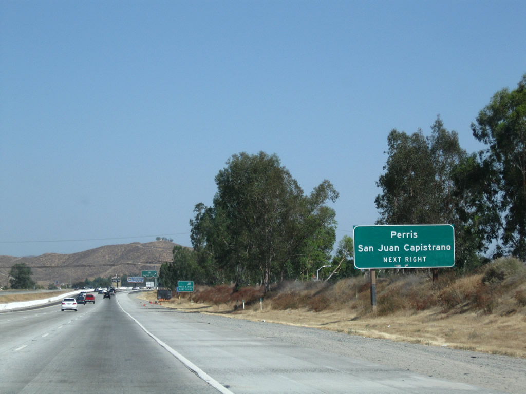
California 74 west travels over the Santa Ana Mountains to reach the Orange County coast at San Juan Capistrano. This corridor was once considered for a freeway alignment, but the highway crosses terrain that is too treacherous and environmentally fragile to accommodate a freeway. However, there is a proposal now to construct a tunnel that would carry traffic under the mountains, and this tunnel would create a second freeway (other than California 91 (Riverside Freeway)) between Orange County and Riverside County. Photo taken 07/26/09. |
|
Southbound Interstate 15 (Corona Freeway) reaches Exit 77, California 74/Central Avenue to Business Loop I-15/Lakeshore Drive in Lake Elsinore. At this interchange, Historic U.S. 395 again joins the Interstate 15 corridor. U.S. 395 left Interstate 15 at the Interstate 215 split, and U.S. 395 followed Interstate 215 south through San Bernardino and Riverside, only to depart from the modern Interstate 215 alignment at Perris. From Perris to Lake Elsinore, Old U.S. 395 followed today's California 74. From Lake Elsinore south to Temecula and onward to Rainbow, U.S. 395 largely follows Interstate 15 rather closely, with intact old alignments to trace. South of Rainbow, old U.S. 395 takes some less direct routings to get to San Diego. Photo taken 07/26/09. |
|
The next exit along southbound is Exit 75, Main Street. At Exit 75, the business loop returns to the freeway. Photo taken 07/26/09. |
|
An Interstate 15 south reassurance shield is posted after the on-ramp from Central Avenue. Photo taken 07/26/09. |
|
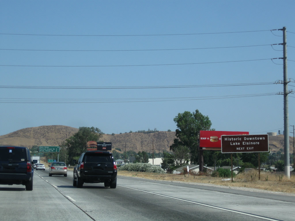
Use Exit 75 to the historic downtown of Lake Elsinore. Photo taken 07/26/09. |
|
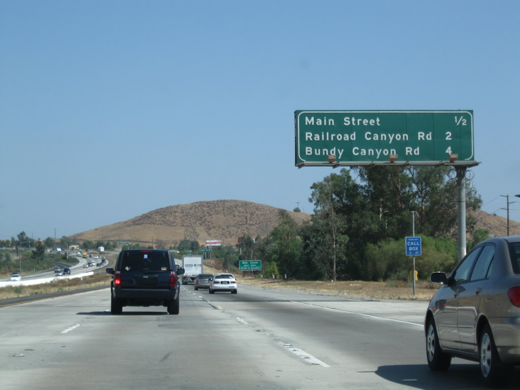
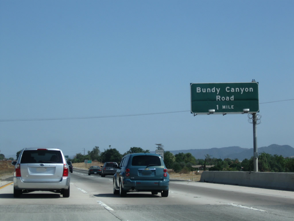
This mileage sign provides the distance to Exit 75, Business Loop I-15 (Main Street) to downtown Lake Elsinore; Exit 73, Railroad Canyon Road and Diamond Drive; and Exit 71, Bundy Canyon Road. Photo taken 07/26/09. |
|
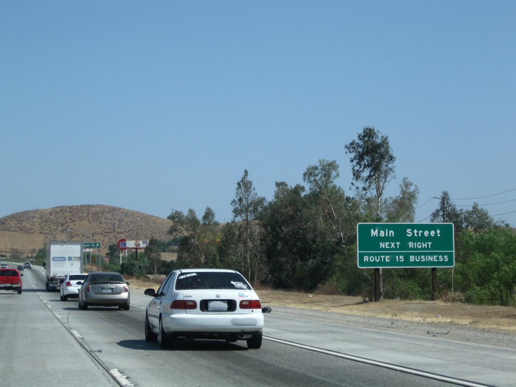
Oddly, the "Route 15 Business" auxiliary sign is posted at Exit 75; it should have been posted at Exit 77. Otherwise, the "business loop" only functions as a business spur into downtown Lake Elsinore. In theory, the business loop follows Main Street through downtown, turns north on Graham Avenue and Lakeshore Drive, then returns to Interstate 15 via California 74/Central Avenue east. Photo taken 07/26/09. |
|
Southbound Interstate 15 reaches Exit 75, Business Loop I-15 (Main Street) in Lake Elsinore. Lake Elsinore is so named because of the large lake situated at the base of the Santa Ana Mountains. It connects to the San Jacinto River watershed. Photo taken 03/25/05. |
|
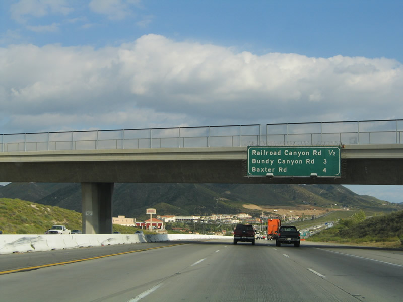
This mileage sign provides the distance to Exit 73, Railroad Canyon Road and Diamond Drive; Exit 71, Bundy Canyon Road; and Exit 69, Baxter Road. Photo taken 03/25/05. |
|
Use Railroad Canyon Road east to the city of Canyon Lake, one of five gated cities in California. This master-planned development was built by the Corona Land Company in 1968 surrounding a reservoir created in 1927 (Canyon Lake Reservoir is owned and operated by the Elsinore Valley Municipal Water District). The city of Canyon Lake was incorporated on December 1, 1990, and it has a population of 9,952 people as of the 2000 Census. No state highway enters the city of Canyon Lake, and Railroad Canyon Road skirts the southern edge of the city. Most of the city is behind a gate. In addition, this exit also serves unincorporated Quail Valley (population 1,639 as of 2000 Census), which is located northeast of Canyon Lake. Photo taken 03/25/05. |
|
Southbound Interstate 15 reaches Exit 73, Railroad Canyon Road and Diamond Drive. Photo taken 03/25/05. |
|
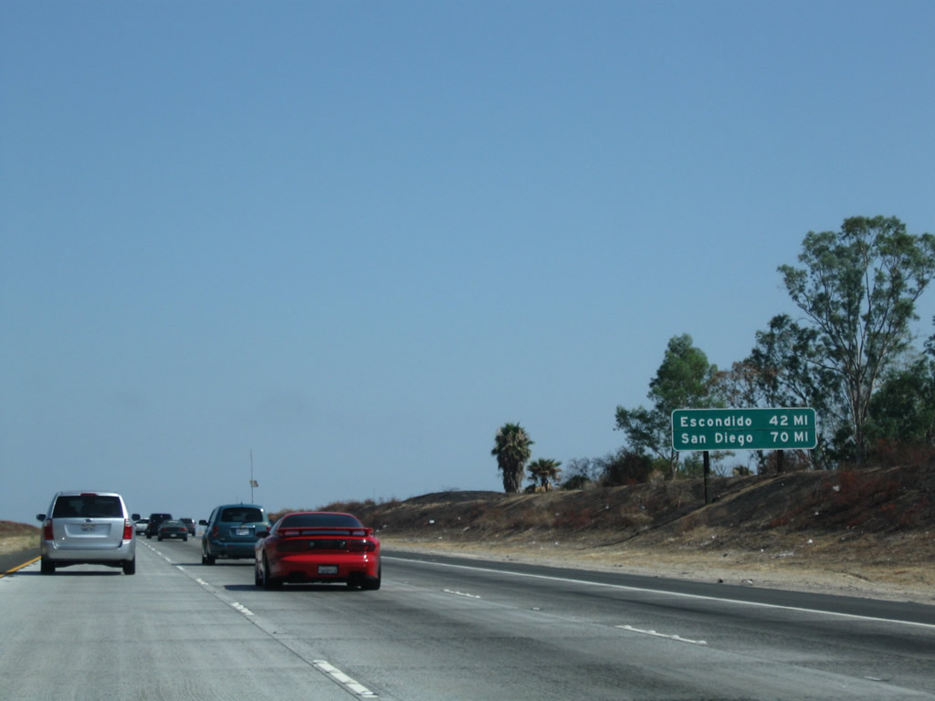
This mileage sign provides the distance to Escondido (42 miles) and San Diego (70 miles). Photo taken 07/26/09. |
|
The next exit along southbound Interstate 15 is Exit 71, Bundy Canyon Road, which changes into Scott Road as it heads east. Heading west, it connects to old U.S. 395 and California 71/Palomar Street in Sedco Hills. Photo taken 07/26/09. |
|
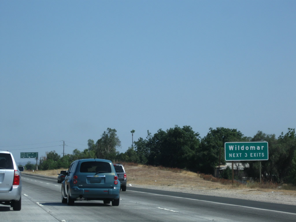
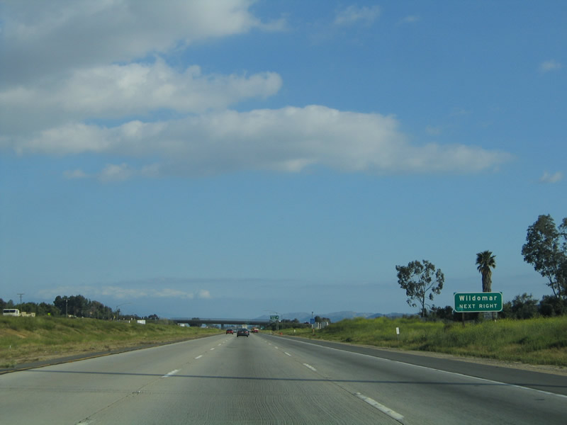
The next three exits along southbound Interstate 15 serve the city of Wildomar. Incorporated on July 1, 2008, Wildomar is one of California's newest cities. The population of the Census-designated place was 14,064 as of the year 2000 Census. This area grew significantly during the 2000s and likely has a population nearly double that figure by 2010. Photo taken 07/26/09. |
|
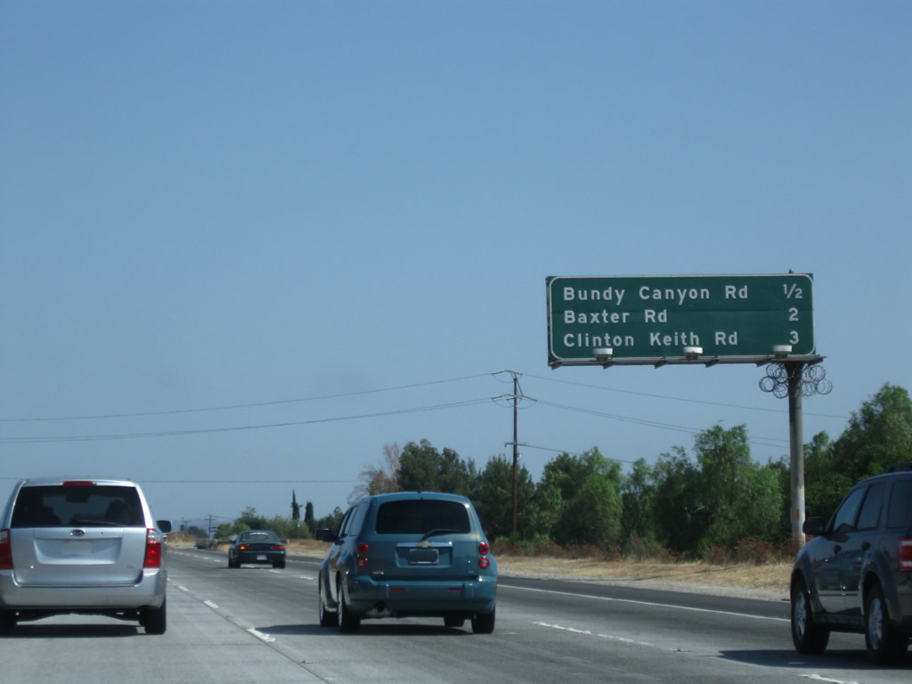
This mileage sign provides the distance to Exit 71, Bundy Canyon Road; Exit 69, Baxter Road; and Exit 68, Clinton Keith Road. Photo taken 03/25/05. |
|
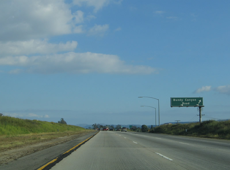
Southbound Interstate 15 reaches Exit 71, Bundy Canyon Road. Photo taken 03/25/05. |
| Interstate 15/Temecula Valley (Corona) Freeway south |
|
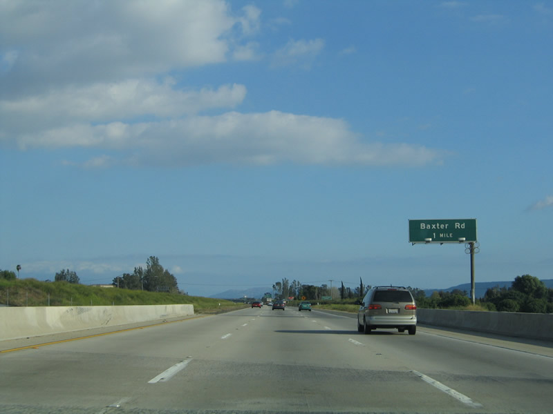
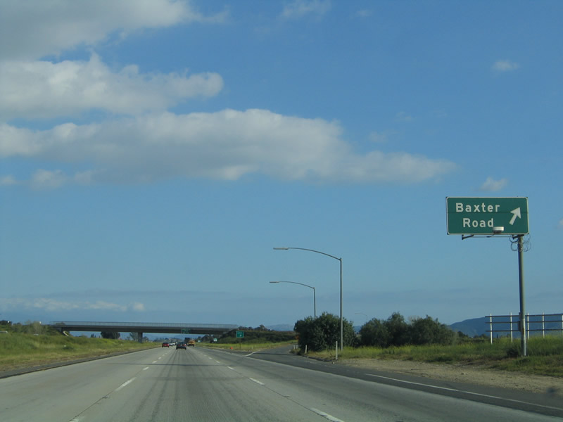
The next exit along Interstate 15 south is Exit 69, Baxter Road. Baxter Road travels southwest to meet Palomar Street in the community of Wildomar. Photo taken 03/25/05. |
|
Interstate 15 becomes the Temecula Valley Freeway after Exit 71, as indicated by this sign. It is also still known as the Corona Freeway. Photo taken 03/25/05. |
|
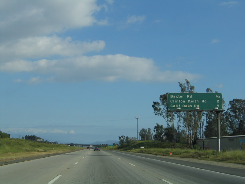
This mileage sign provides the distance to Exit 69, Baxter Road; Exit 68, Clinton Keith Road; and Exit 65, California Oaks Road and Kalmia Street. Photo taken 03/25/05. |
|
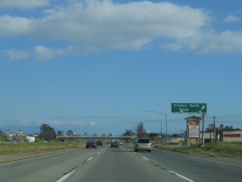
Use Clinton Keith Road west to the city of Wildomar (this sign was posted back when Wildomar was still an unincorporated community). Wildomar was home to 14,064 people as of the 2000 Census and will become a city on July 1, 2008, as a result of the Measure C election held on February 5, 2008. Photo taken 03/25/05. |
|
Southbound Interstate 15 reaches Exit 69, Baxter Road. Photo taken 03/25/05. |
|
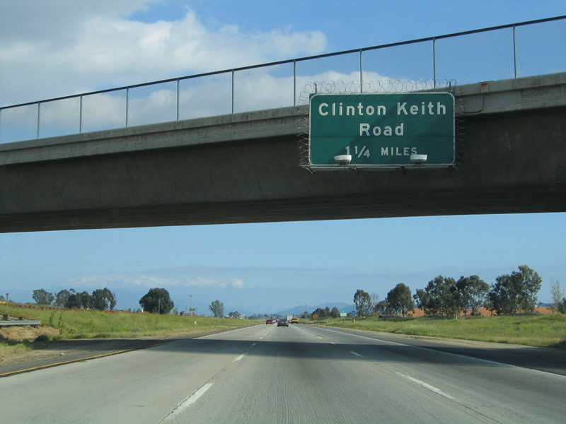
The next exit along Interstate 15 south is Exit 68, Clinton Keith Road (1.25 miles). Clinton Keith Road travels west to meet old California 71 and east to meet Interstate 215 at Exit 4 in Murrieta. Around this point, Interstate 15 leaves the city of Murrieta and enters the city of Wildomar (which incorporates July 1, 2008). Wildomar is now the third city within the Temecula Valley, and it covers the formerly unincorporated area between the cities of Murrieta and Lake Elsinore. Photo taken 03/25/05. |
|
This mileage sign along Interstate 15 south provides the distance for the next three exits: Exit 68, Clinton Keith Road; Exit 65, California Oaks Road and Kalmia Street; and Exit 64, Murrieta Hot Springs Road. Photo taken 03/25/05. |
|
Interstate 15 will leave Wildomar and enter the city of Murrieta; the next three exits will serve that city. Photo taken 07/26/09. |
|
Southbound Interstate 15 reaches Exit 68, Clinton Keith Road. Photo taken 03/25/05. |
|
This Interstate 15 reassurance shield is posted after the on-ramp from Clinton Keith Road. Photo taken 07/26/09. |
|
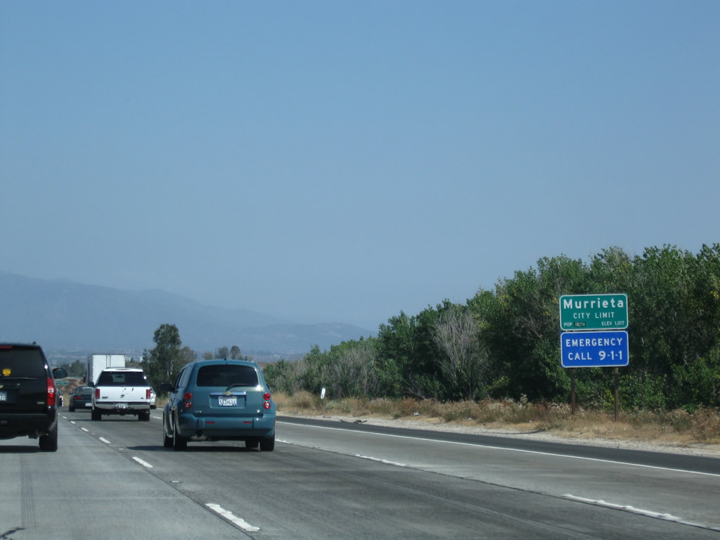
Interstate 15 enters the city of Murrieta, which had a population of 44,282 as of the 2000 Census and probably has grown to a population over two times larger (over 100,000) bu 2008. Rampant development has brought high value to the land around Murrieta and Temecula, and houses and shopping centers now line the valley in large tracts. Photo taken 07/26/09. |
|
The next exit along Interstate 15 south is Exit 65, California Oaks Road and Kalmia Street. California Oaks Road travels northeast through Murrieta to Clinton Keith Road, and Kalmia Street leads southwest toward Washington Avenue. Photo taken 03/25/05. |
|
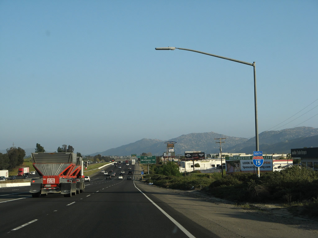
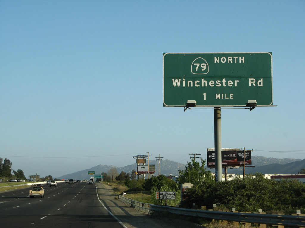
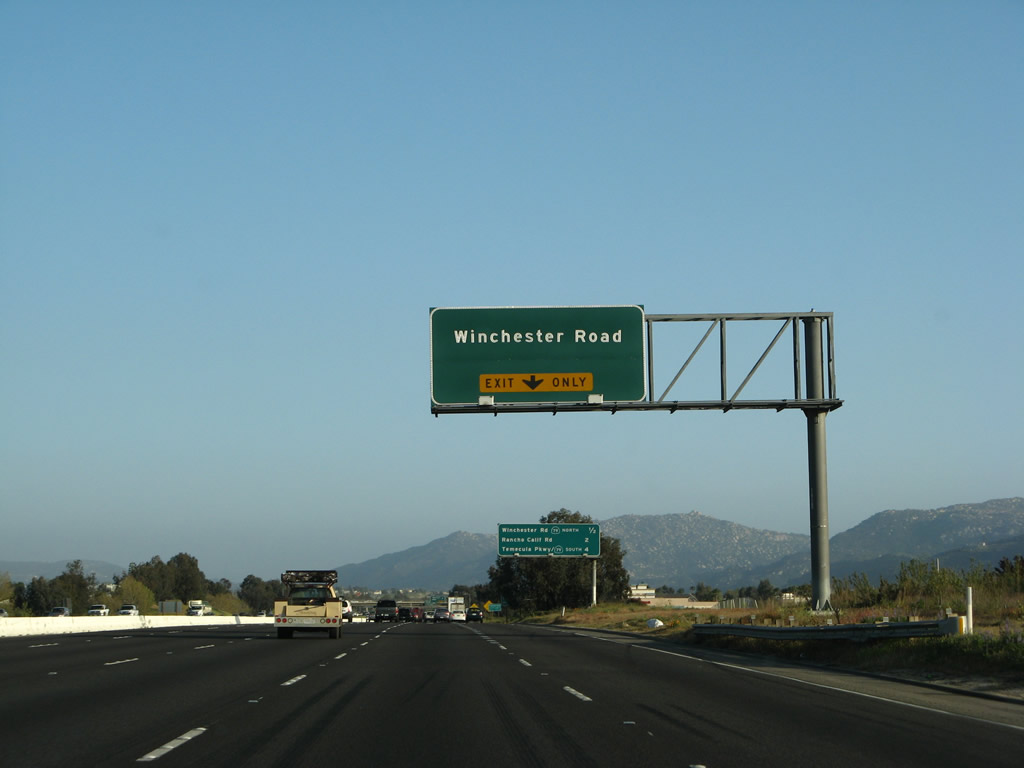
This mileage sign along Interstate 15 south provides the distance for the next three exits: Exit 65, California Oaks Road and Kalmia Street; Exit 64, Murrieta Hot Springs Road; and Exit 61, California 79 (Winchester Road) north to Hemet. Photo taken 03/25/05. |
|
Southbound Interstate 15/Temecula Valley (Corona) Freeway reaches Exit 65, California Oaks Road. This kind of "minimalist" sign bridge is common between California 91 and Interstate 215. Photo taken 03/25/05. |
|
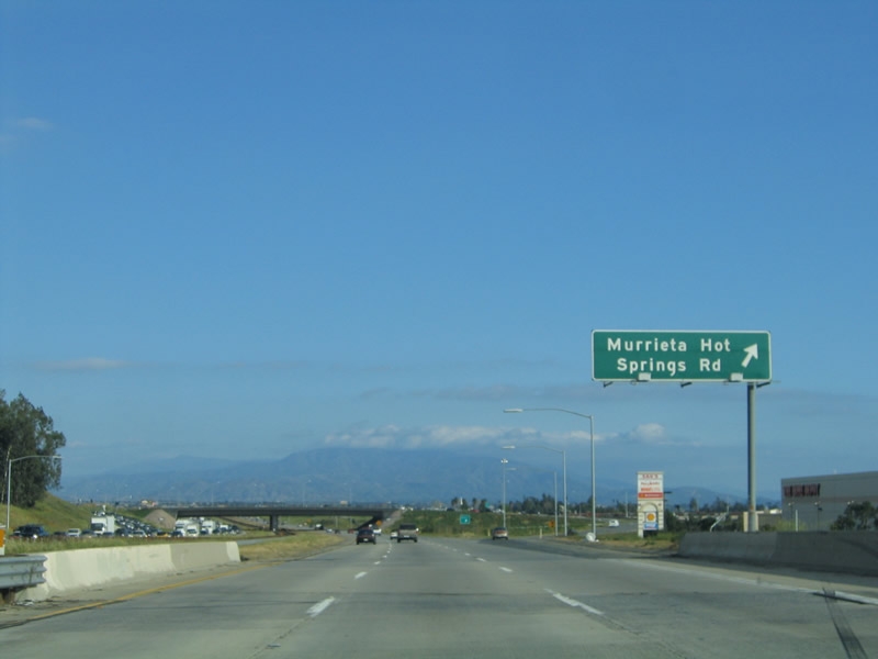
The next exit along Interstate 15 south is Exit 64, Murrieta Hot Springs Road. Photo taken 03/25/05. |
|
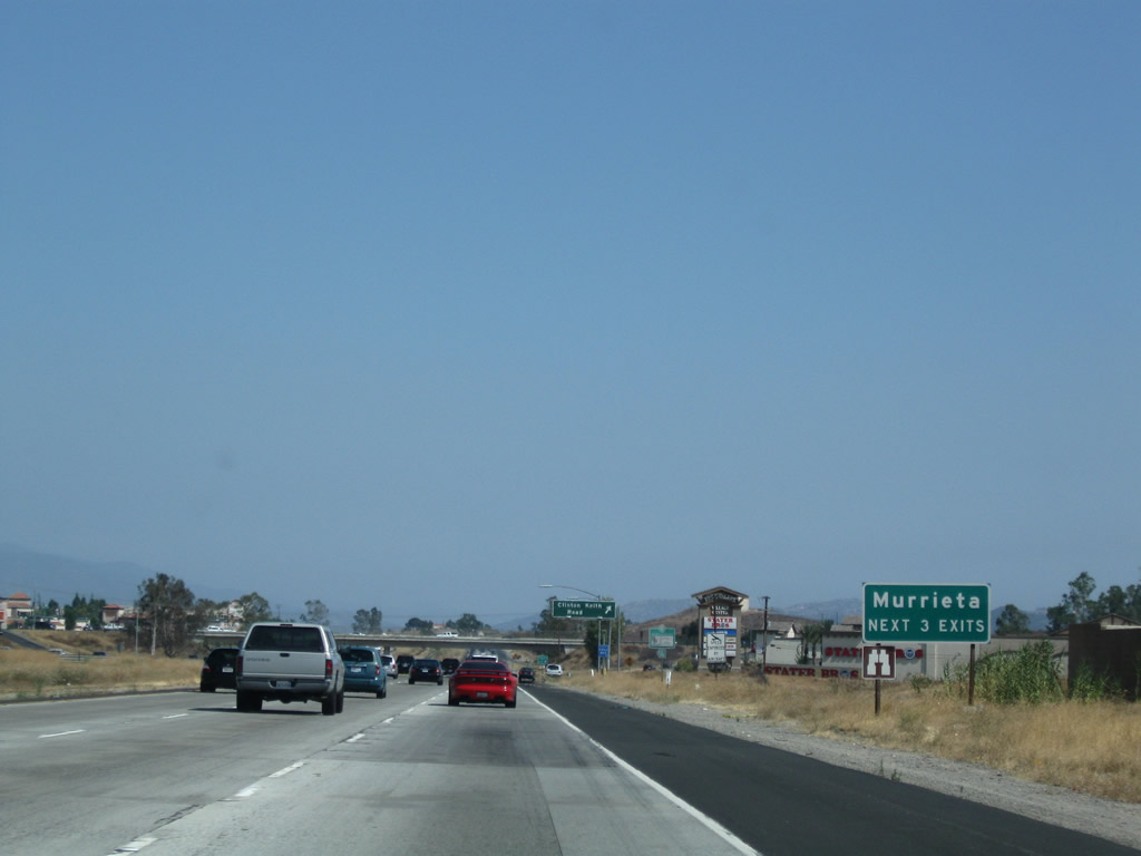
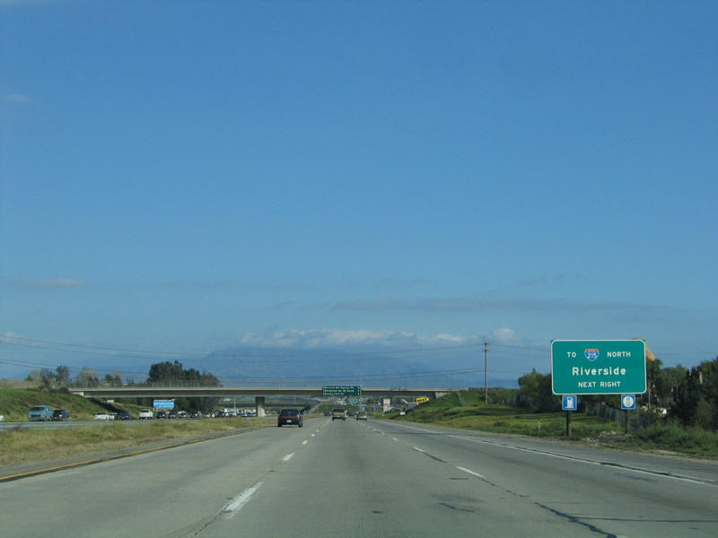
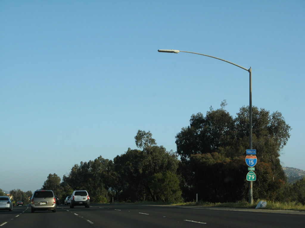
There is no direct connection between Interstate 15 south and Interstate 215 north. The connection must be made via Murrieta Hot Springs Road. Photo taken 03/25/05. |
|
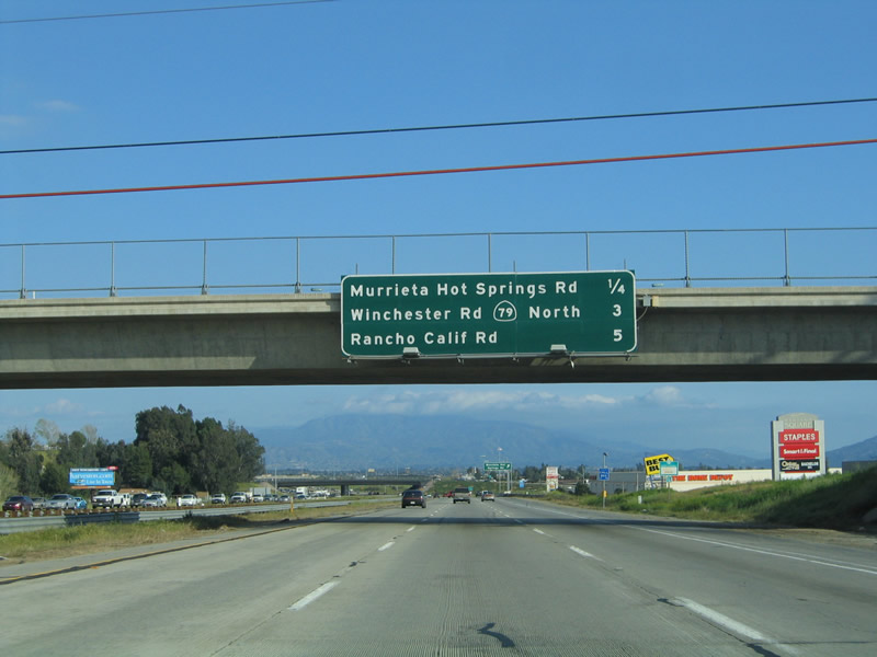
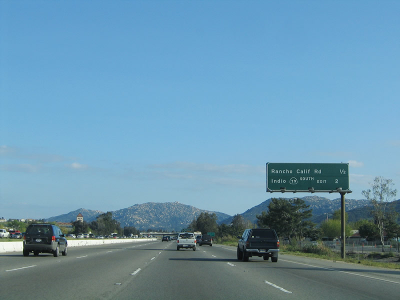
This mileage sign along Interstate 15 south provides the distance for the next three exits: Exit 64, Murrieta Hot Springs Road; Exit 61, California 79 (Winchester Road) north to Hemet; and Exit 59, Rancho California Road and Old Town Front Street. Photo taken 03/25/05. |
|
Southbound Interstate 15 reaches Exit 64, Murrieta Hot Springs Road; this is the last exit to serve the city of Murrieta. The actual Murrieta Hot Springs is located east of Interstate 215 and west of California 79/Winchester Canyon Road just north of Temecula. Photo taken 03/25/05. |
|
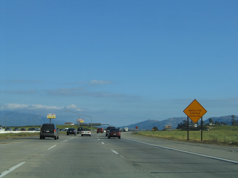
A large warning sign cautions drivers to watch for congestion and slowed vehicles as we approach the merge with Interstate 215 (Escondido Freeway). Photo taken 03/25/05. |
|
Two new lanes join Interstate 15 south as traffic from Interstate 215 (Escondido Freeway) merge onto Interstate 15 south. At this point, the Corona Freeway designation ends, and Interstate 15 now follows the Escondido Freeway (and Temecula Valley Freeway) south toward Temecula. Photo taken 03/25/05. |
| Interstate 15/Temecula Valley (Escondido) Freeway south |
|
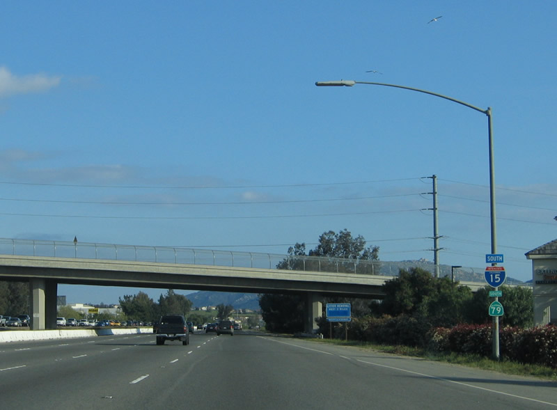
An Interstate 15 south reassurance shield marks the point where Interstate 215 directly transitions onto Interstate 15 south. There is no end shield for Interstate 215. Photo taken 03/31/08. |
|
After the merge with Interstate 215, the next exit along Interstate 15 south is Exit 61, California 79 (Winchester Road) north to Hemet. Prior to to the decommissioning of California 71 in 1974, Exit 61 was the former merge between the two state routes (California 71 and California 79), which had been merged together since Aguanga. At this interchange, Interstate 15 (U.S. 395) and California 71-79 continued straight ahead; California 79 comes into the interchange from the northeast. Today, with the high average daily traffic counts along California 79 north, an expressway or freeway bypass for the California 79 state highway corridor is being considered, including a possible extension of California 67 or California 125 from San Diego County. Such a route could also relieve Interstate 15 and Interstate 215. Photo taken 03/31/08. |
|
A mileage sign provides the distance to Escondido (31 miles) and San Diego (61 miles). Photo taken 03/31/08. |
|
The right lane becomes exit only for Exit 61, Winchester Road (California 79 north). The left four lanes continue south on Interstate 15 to San Diego and California 79 to Warner Springs. Photo taken 03/31/08. |
|
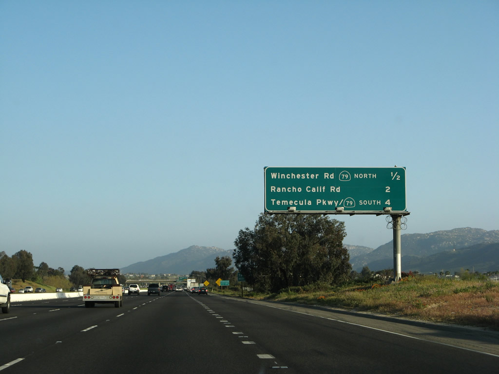
The next three exits on Interstate 15 south are Exit 61, California 79 (Winchester Road); Exit 59, Rancho California Road; and Exit 58, California 79 (Temecula Parkway) south. Photo taken 03/31/08. |
|
Interstate 15 enters the city of Temecula, the last city along Interstate 15 in the Temecula Valley and in Riverside County. As of the 2000 Census, Temecula's population was 57,716 people, but that figure may nearly double by 2010 (due to the annexation of the Redhawk community and increasing housing developments). The city was incorporated on December 1, 1989; prior to that, it was an unincorporated community of Riverside County. The city consists of 26.3 square miles, but that figure may grow as the city expands. Temecula was settled in 1859 and has an old town (use Exit 58, Old Town Front Street north) featuring late 1800s buildings and a variety of art shops, antique stores, and restaurants. Additionally, Temecula is the anchor for the Temecula Valley Wine Country, which is accessed via Exit 59, Rancho California Road east. Most of the wineries are located along Rancho California Road east of the city limits. Photo taken 03/31/08. |
|
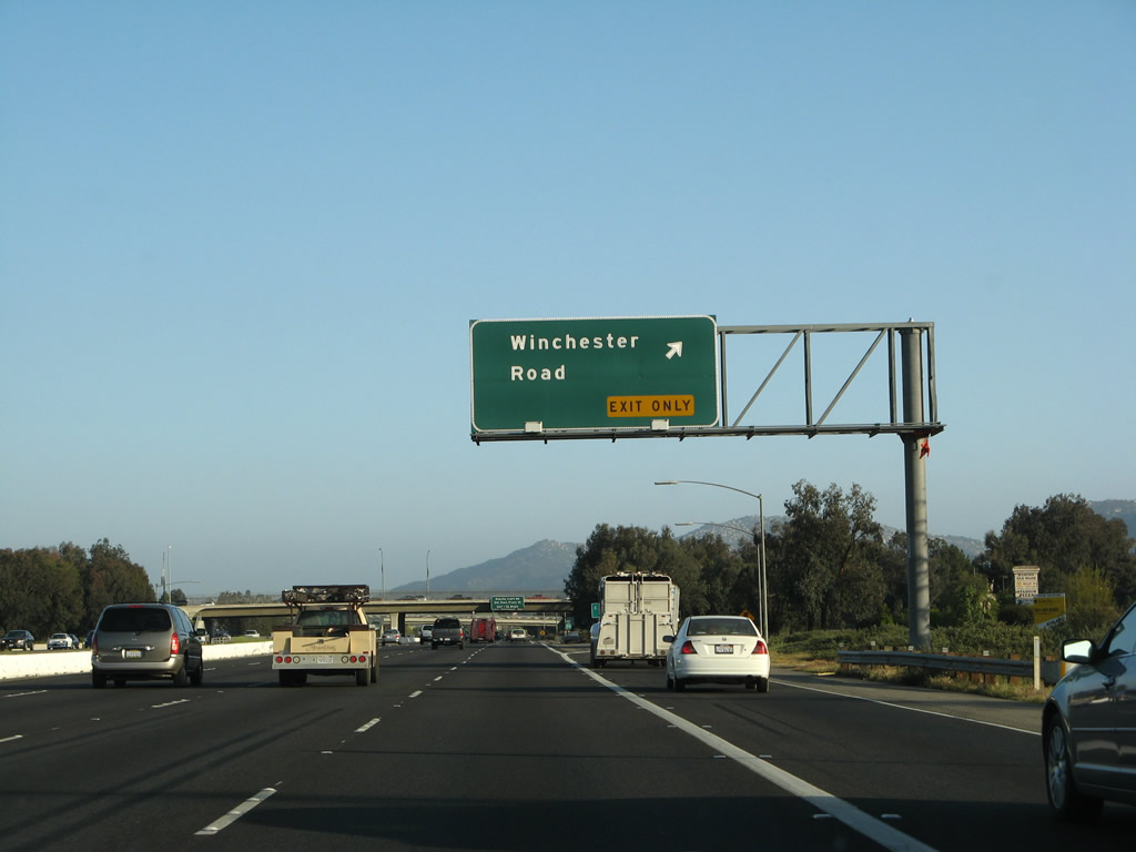
Southbound Interstate 15 reaches Exit 61, California 79 (Winchester Road). This is the first of three exits to serve the city of Temecula. To avoid confusion with Exit 57, the Exit 61 signs deemphasize California 79 north, and California 79 shields don't appear on most approach signs. Photo taken 03/31/08. |
|
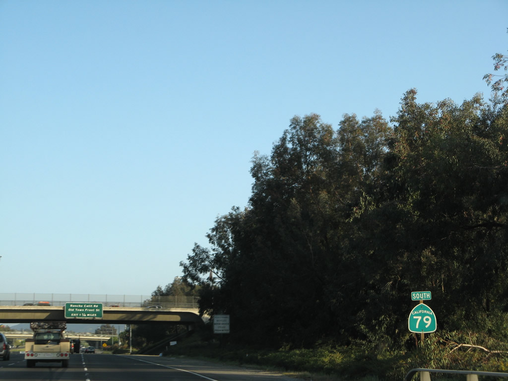
A standard California 79 south reassurance shield is posted after the gore point for Exit 61. Between Exits 61 and 58, Interstate 15 and California 79 share their alignment together. Photo taken 03/31/08. |
| Interstate 15/Temecula Valley (Escondido) Freeway and California 79 south |
|
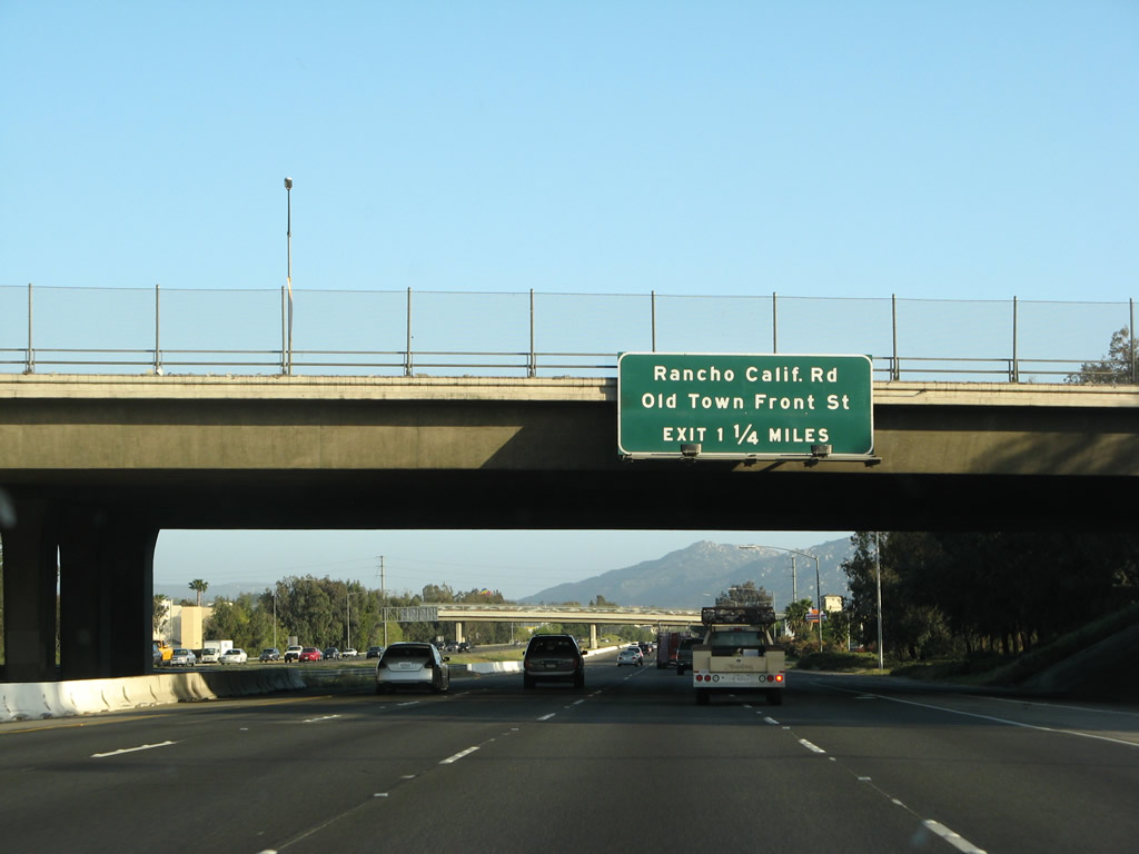
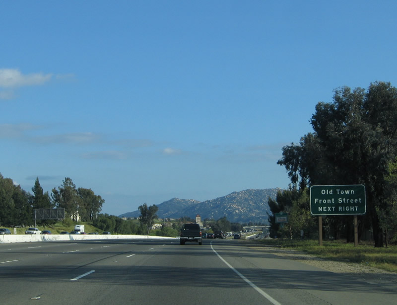
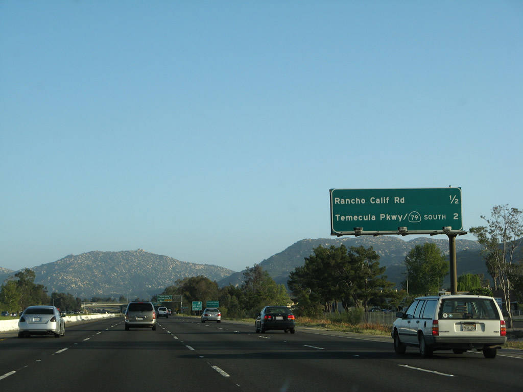
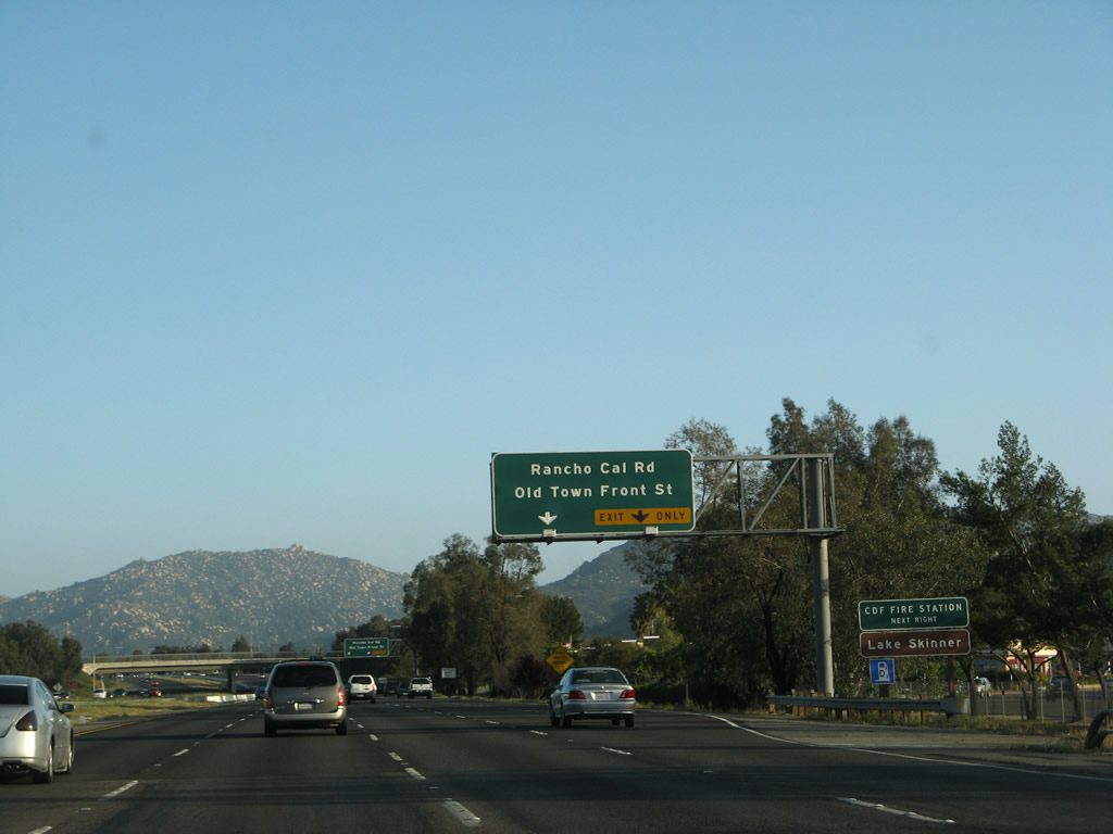
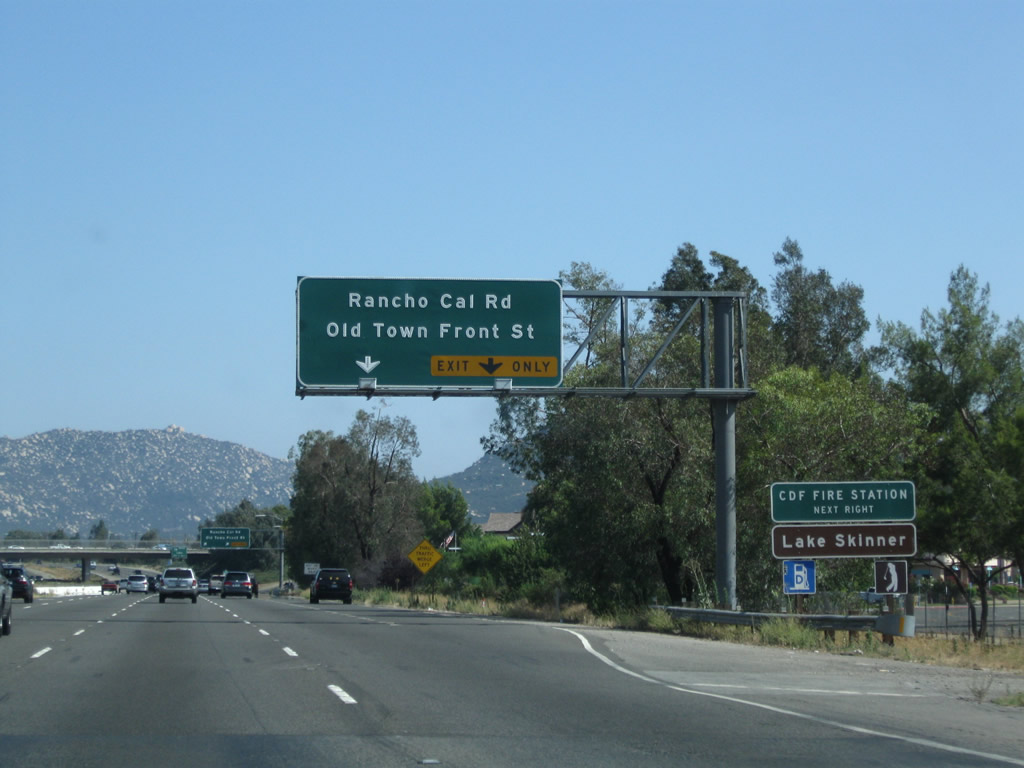
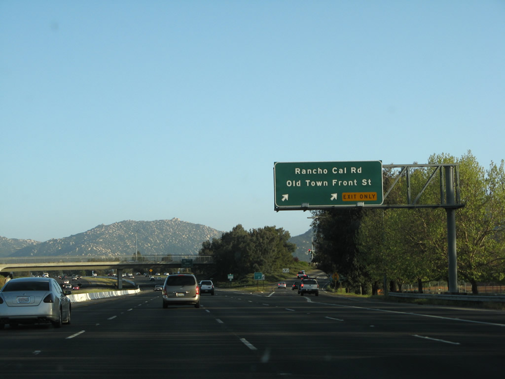
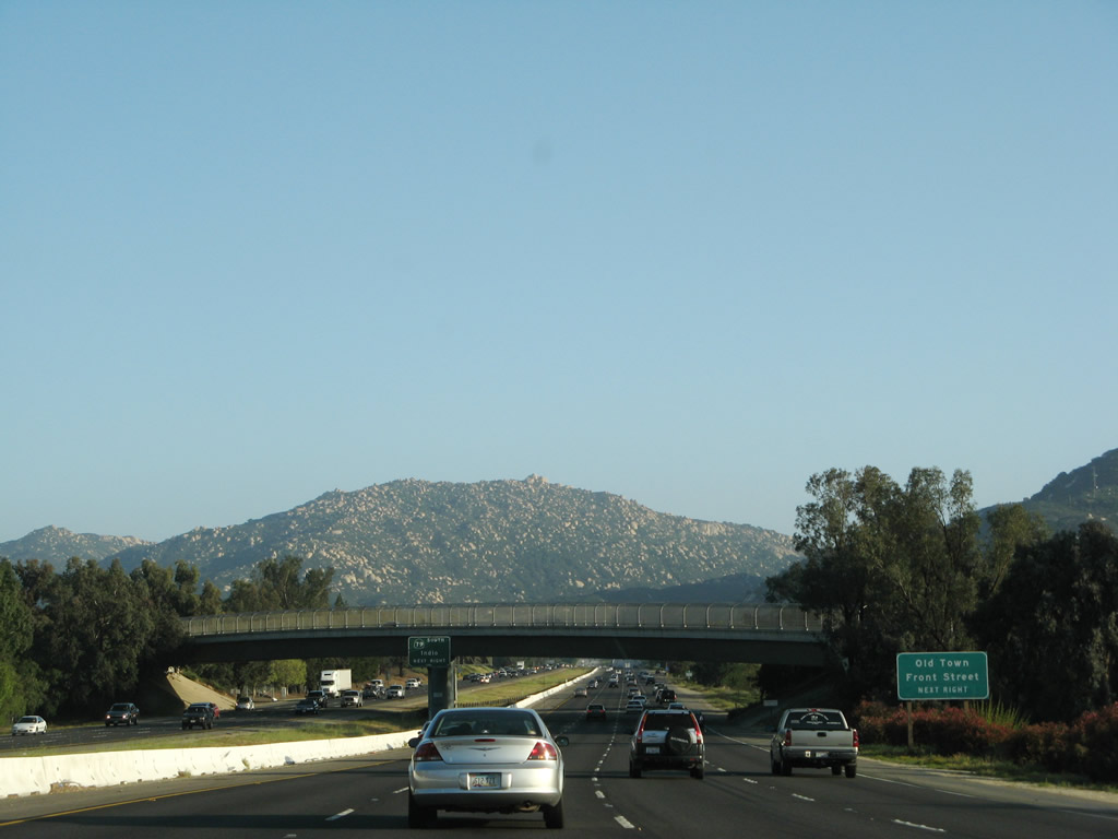
The next exit along Interstate 15/Temecula Valley (Escondido) Freeway south is Exit 59, Rancho California Road and Old Town Front Street. Downtown Temecula is located along Old Town Front Street on the west side of the freeway. Photo taken 03/31/08. |
|
This Interstate 15 and California 79 reassurance shield assembly is posted after the on-ramp from Exit 61. Photo taken 03/25/05. |
|
To Old Town Front Street, follow Rancho California Road west, then turn left on Old Town Front Street. Shops, antique stores, and restaurants line the downtown area of Temecula. Photo taken 03/25/05. |
|
Southbound Interstate 15 and California 79 reach Exit 59, Rancho California Road and Old Town Front Street. Photo taken 03/31/08. |
|
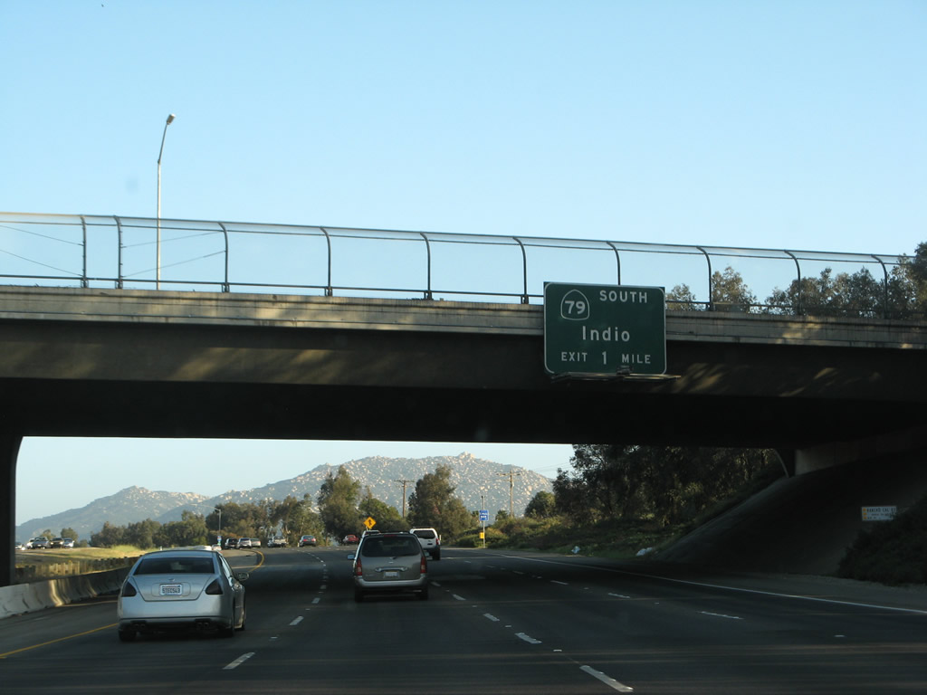
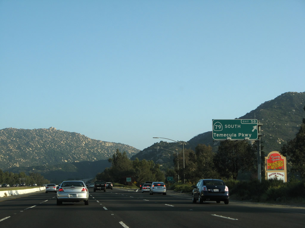
The next exit along Interstate 15 is Exit 58, California 79 (Temecula Parkway) south to Warner Springs, Indio, and Julian. Although signed as "south," California 79 actually travels a good distance east to Aguanga, where California 79 meets California 371. The east-west section of California 79 and all of California 371 were formerly part of an extended California 71, but California 71 was retracted to its currently freeway and expressway alignment north of Corona by legislation in 1974. Signs for the various segments of California 71 cosigned with Interstate 15 and California 79 came down in stages thereafter. The connection of California 79 south, California 371 east, and California 74 east is the most direct route from Interstate 15 to the desert community of Indio and all points east via Interstate 10. Photo taken 03/31/08. |
|
Another set of Interstate 15 and California 79 south reassurance shields is posted after Exit 59. Photo taken 03/31/08. |
|
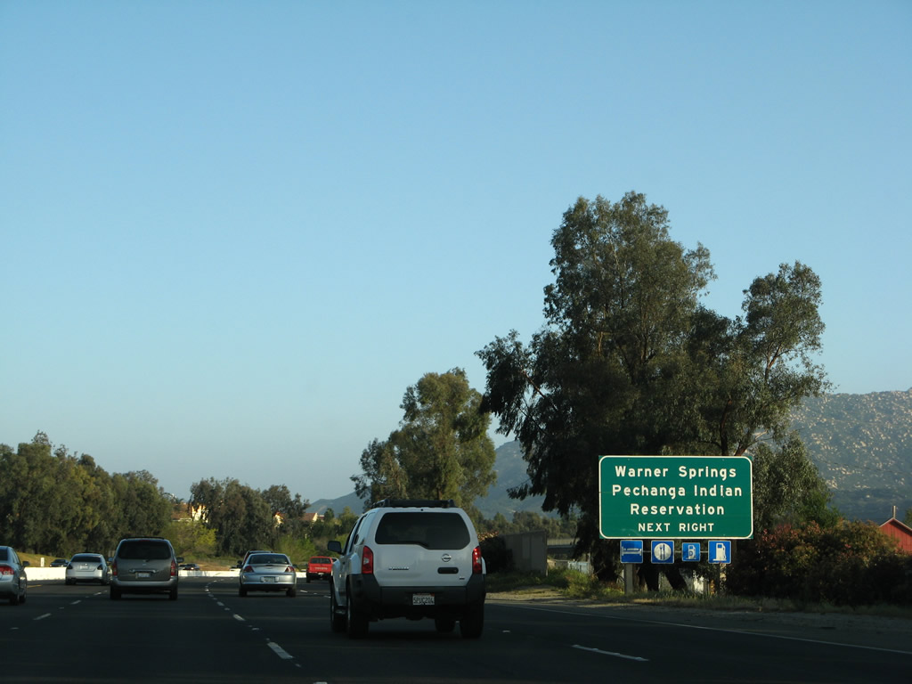
Use Exit 58, California 79 (Temecula Parkway) south to Riverside County S-16 (Pechanga Parkway) south to the Pechanga Indian Reservation, which includes the Pechanga Resort Casino. Pechanga Parkway travels south from the reservation into San Diego County, changing into Pala-Temecula Road. San Diego County S-16/Pala-Temecula Road ends at California 76 in the Pala Indian Reservation, which includes another casino. The small town of Pala is also home to Mission San Antonio de Pala. Photo taken 03/31/08. |
|
Exit 58 also serves as the southern end of Old Town Front Street, so visitors can access downtown Temecula via Exit 58 if they didn't use Rancho California Road. Photo taken 03/31/08. |
|
California 79 travels due east to Aguanga, then turns south toward Warner Springs. This state highway also serves as part of the most direct route to Indio and Palm Springs via California 371 east and California 74 (Pines to Palms Highway) east. After passing through Aguanga, California 79 south connects to Sunshine Summit and Warner Springs, two unincorporated communities in northern San Diego County. Since much of California 79 passes through rugged back country in San Diego County, the most direct route to either of these communities requires significant distance on two-lane highways. California 79 itself turns south after its intersection with California 371 into San Diego County, where it passes through Warner Springs, Santa Ysabel, Julian, and the Cleveland National Forest before terminating at Interstate 8 near Descanso. Photo taken 03/31/08. |
|
Southbound Interstate 15 reaches Exit 58, California 79 (Temecula Parkway) south and Old Town Front Street north to downtown Temecula. A new exit number sign was posted at this off-ramp in 2008. Photo taken 03/31/08. |
| Interstate 15/Temecula Valley Freeway (Avocado Highway/Escondido Freeway) south |
|
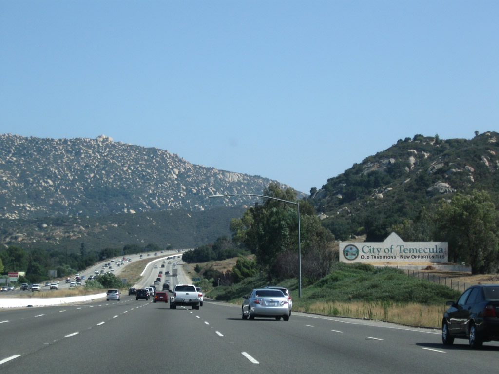
A large sign welcomes visitors to Temecula, "Old Traditions - New Opportunities." Photo taken 07/26/09. |
|
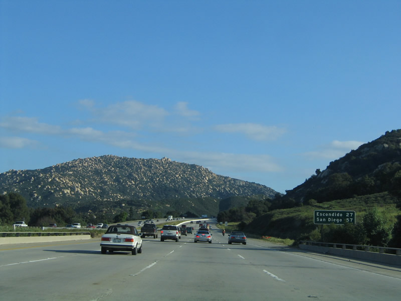
Immediately after the California 79 interchange, a standard mileage sign provides the distance to Escondido (27 miles) and San Diego (57 miles). The freeway, which carries four lanes in each direction, climbs Rainbow Grade toward San Diego County. Photo taken 03/25/05. |
|
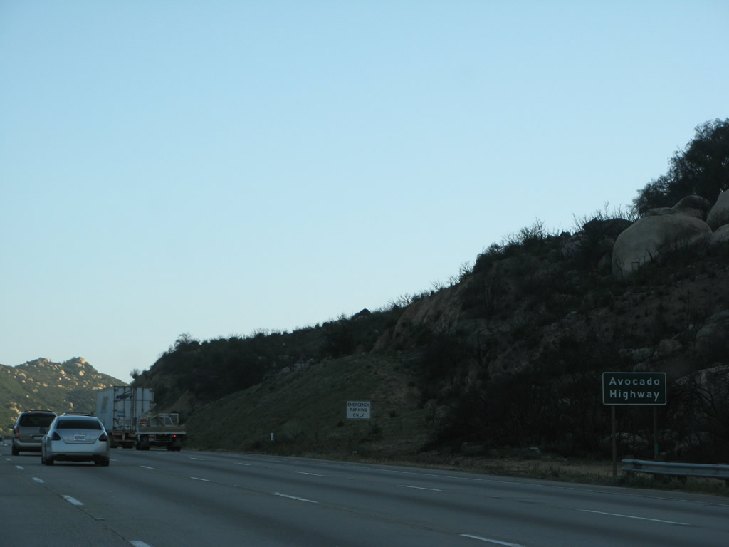
Interstate 15 is designated as the Avocado Highway from the California 79 junction south to Escondido. Interstate 15 is also called Temecula Valley Freeway until the San Diego County line, and the original Escondido Freeway designation will continue along with Interstate 15 all the way to San Diego. Photo taken 03/31/08. |
|
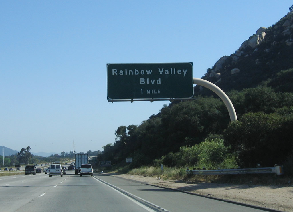
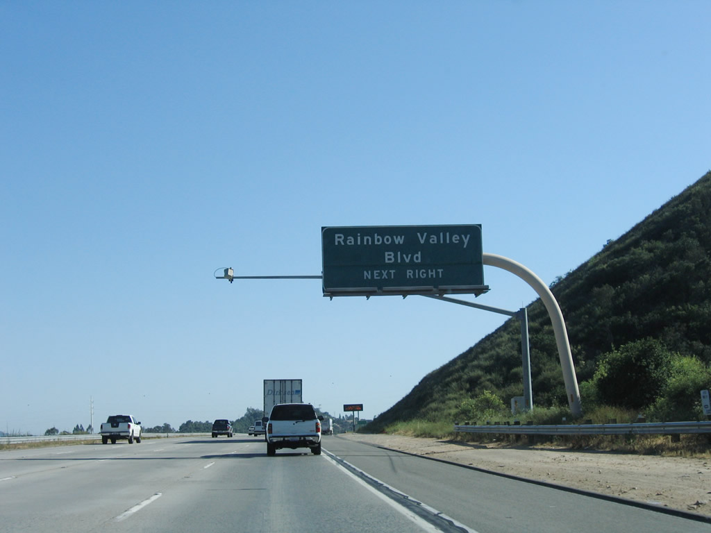
The next exit along Interstate 15 south is Exit 54, Rainbow Valley Boulevard (one mile). Photo taken 06/03/06. |
|
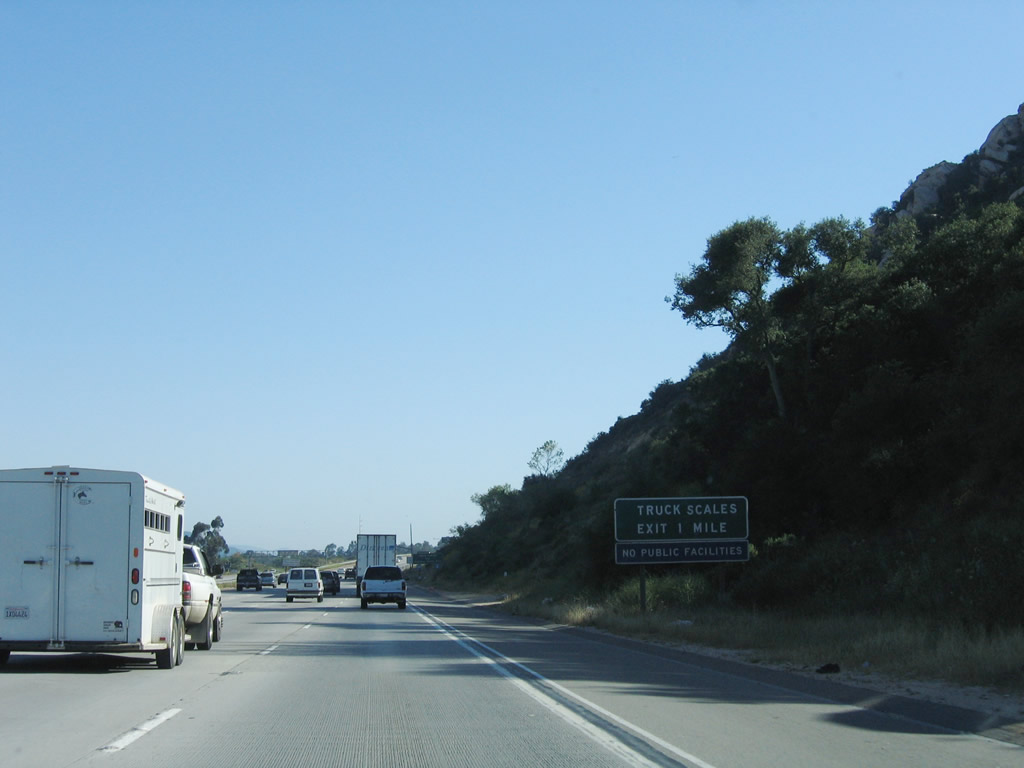
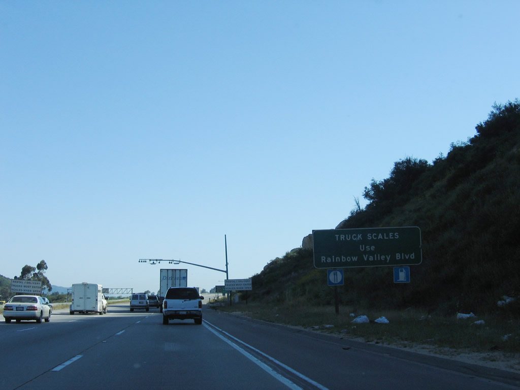
Ascending to the top of Rainbow Grade, a weigh station is incorporated into Exit 54, Rainbow Valley Boulevard. Photo taken 06/03/06. |
|
Food and gas are available at Exit 54, Rainbow Valley Boulevard. Photo taken 06/03/06. |
|
Rainbow Valley Boulevard leads to the unincorporated community of Rainbow. The Rainbow area made the news in the early 2000s with plans to construct a new electrical transmission line. That project would have provided a third corridor of electricity into San Diego County from the rest of California (the other two portals are along the Interstate 5 and Interstate 8 corridors; there are also connections from Mexico). This idea was eliminated due to local opposition, and San Diego Gas and Electric is currently exploring having a new power transmission line (the Sunrise Powerlink) being constructed from the Imperial Valley to Northern San Diego County. Photo taken 06/03/06. |
|
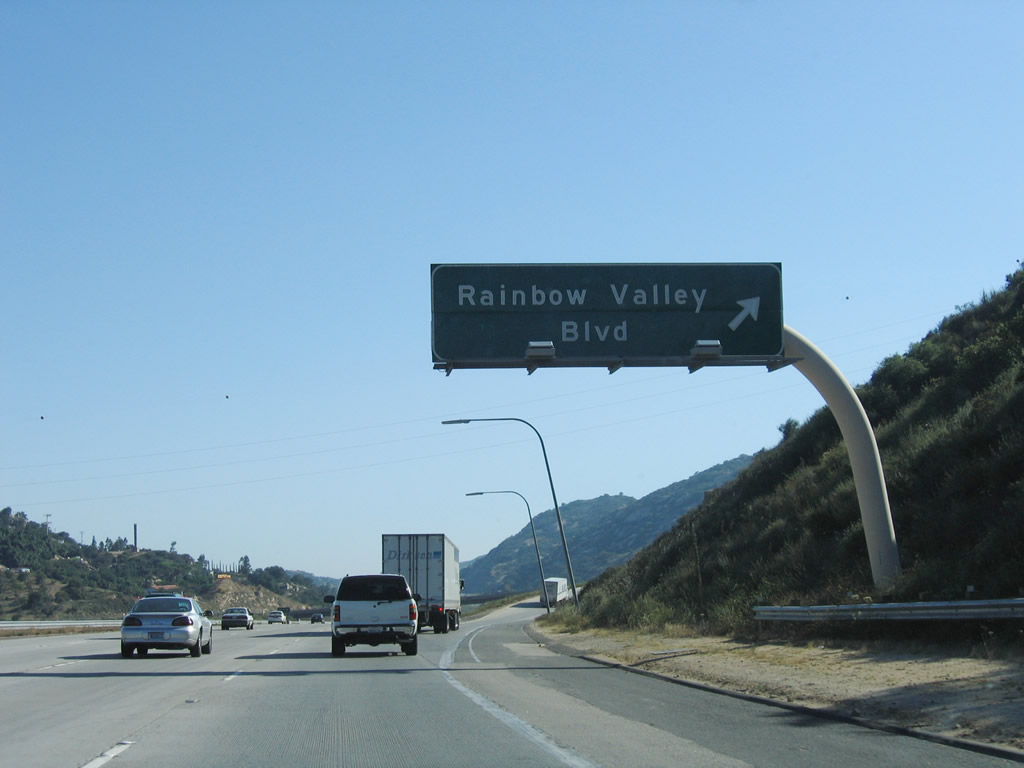
Southbound Interstate 15 reaches Exit 54, Rainbow Valley Boulevard east to Old Rainbow Canyon Road (old U.S. 395) north. Rainbow Canyon Road follows Old U.S. 395 north to meet Riverside County S-16 in Temecula, thus providing an alternate route into Riverside County. Exit 54 is the second interchange to serve the unincorporated community of Rainbow, and it is the first San Diego County exit along southbound Interstate 15. Photo taken 06/03/06. |
|
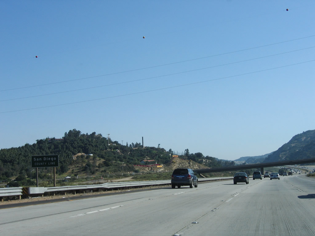
The San Diego County line is posted immediately after the Exit 54 gore point. Interstate 15 leaves Riverside County. At this point, a single circuit 230kV San Diego Gas and Electric Company power line crosses over the freeway and Rainbow Canyon. Photo taken 06/03/06. |
Page Updated May 25, 2010.